


Tree to Sea Loop, Vancouver Island
Distance
647 Mi.
(1,041 KM)Days
15
% Unpaved
90%
% Singletrack
1%
% Rideable (time)
100%
Total Ascent
48,631'
(14,823 M)High Point
2,017'
(615 M)Difficulty (1-10)
7?
- 5Climbing Scale Moderate75 FT/MI (14 M/KM)
- -Technical Difficulty
- -Physical Demand
- -Resupply & Logistics
Contributed By
Miles Arbour
Ride and Report
Slight update to route between Upper Campbell Lake and Gold River as of May 2022—make sure to download the latest route file.
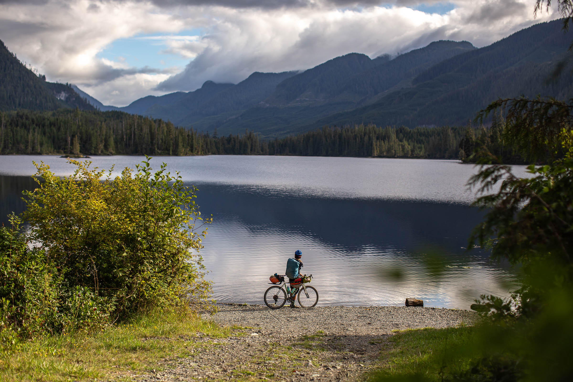
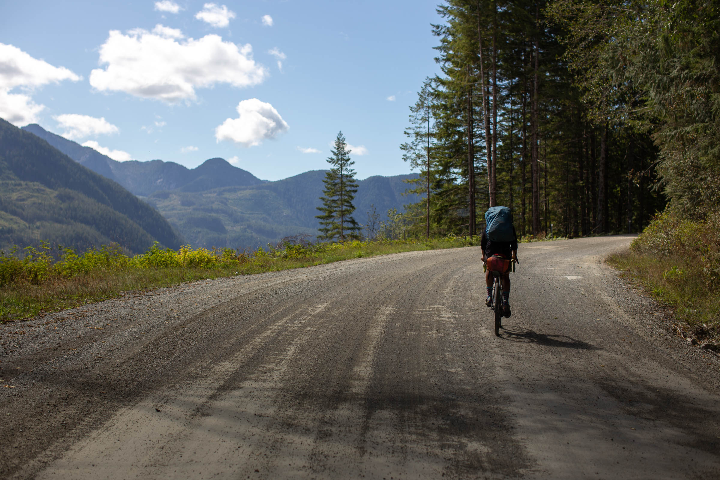
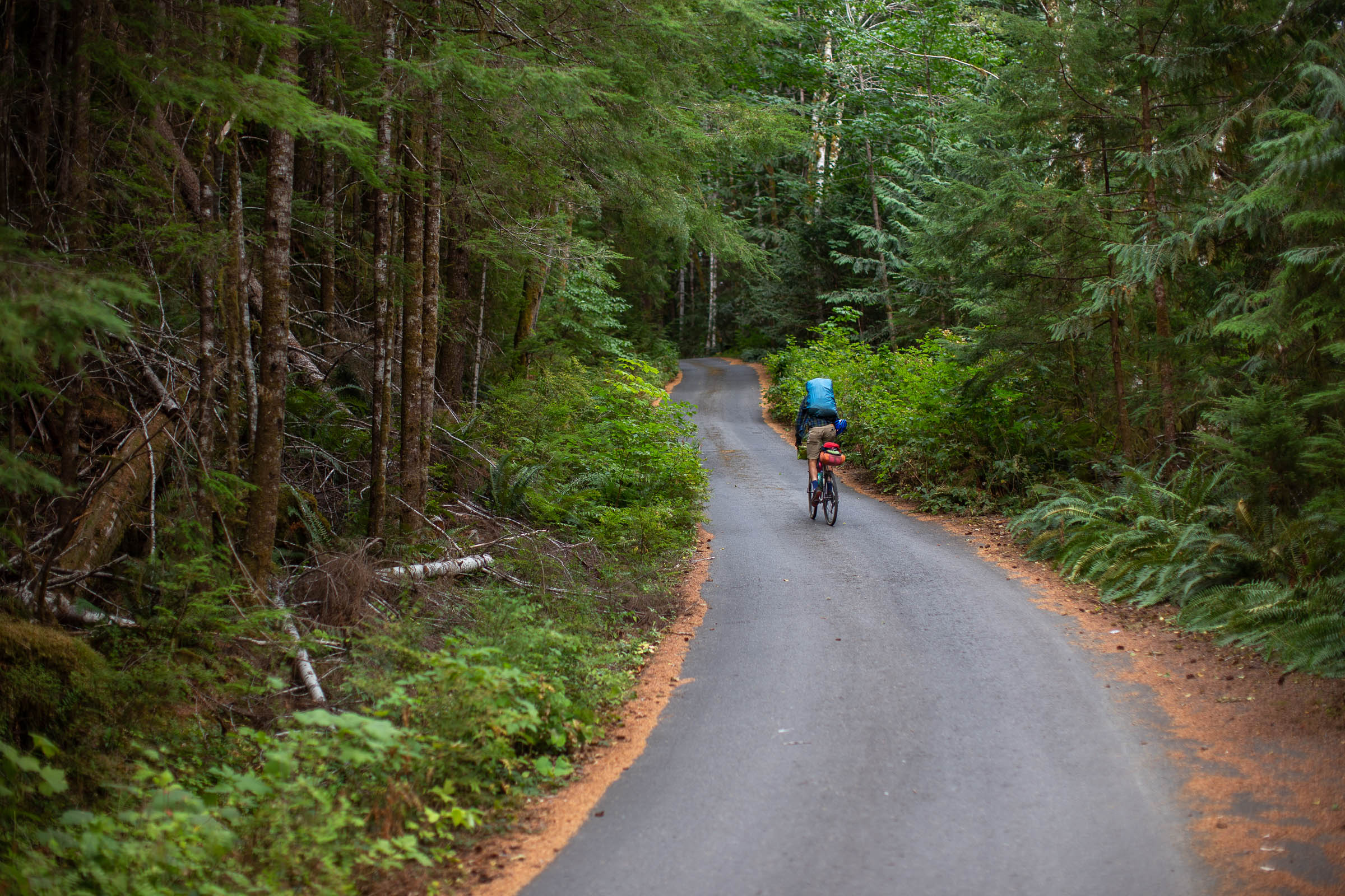
Vancouver Island is a playground for outdoor enthusiasts, boasting year-round access, diverse landscapes, and loads of bikepacking potential. Unfortunately, some outdoor recreation is prohibited due to land access issues stemming from the logging industry, making it challenging to share larger routes that head south from the middle of the island. Thankfully, the north end of Vancouver Island has a fantastic network of publicly accessible forest service roads that can be linked together into a genuinely epic gravel bikepacking route.
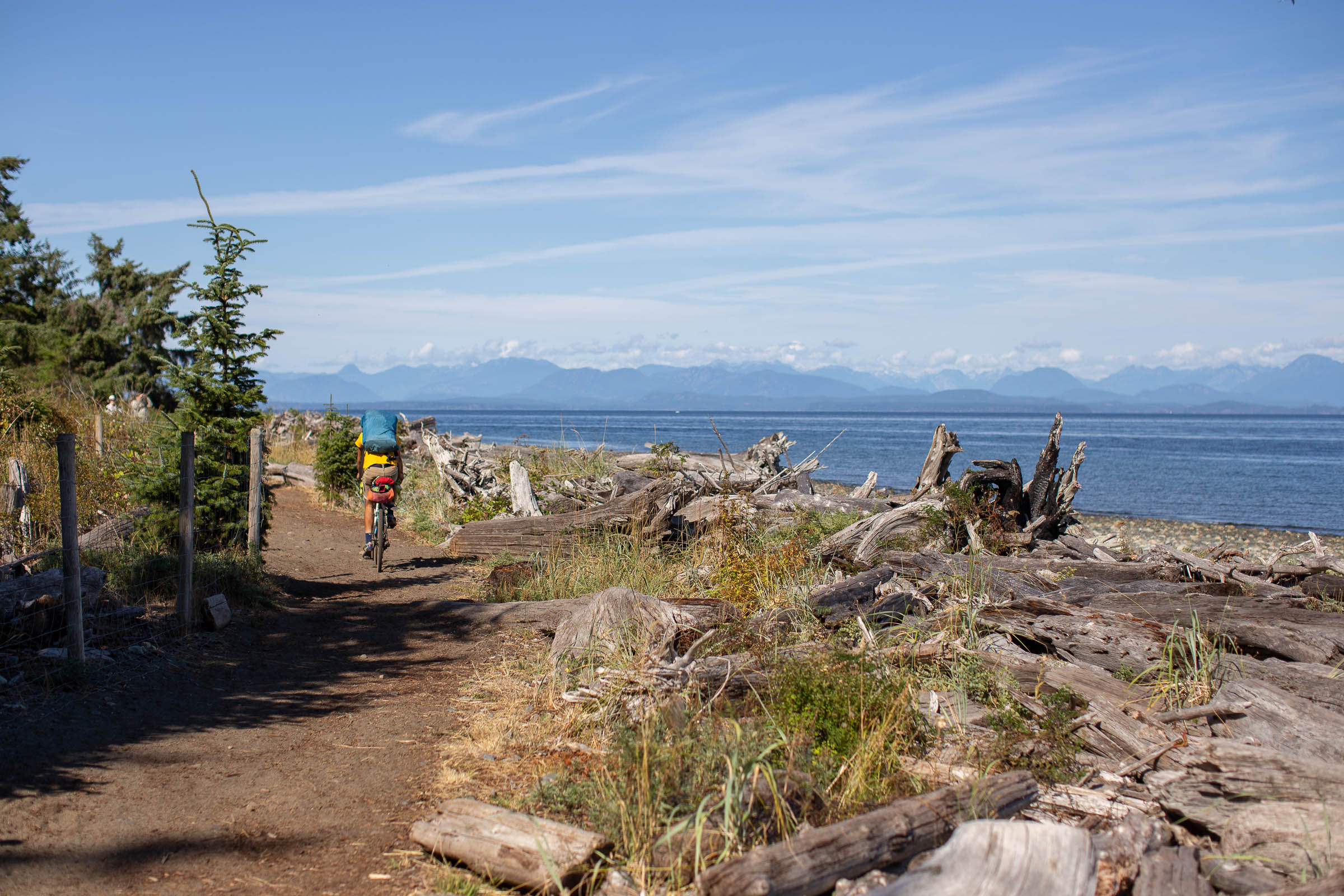
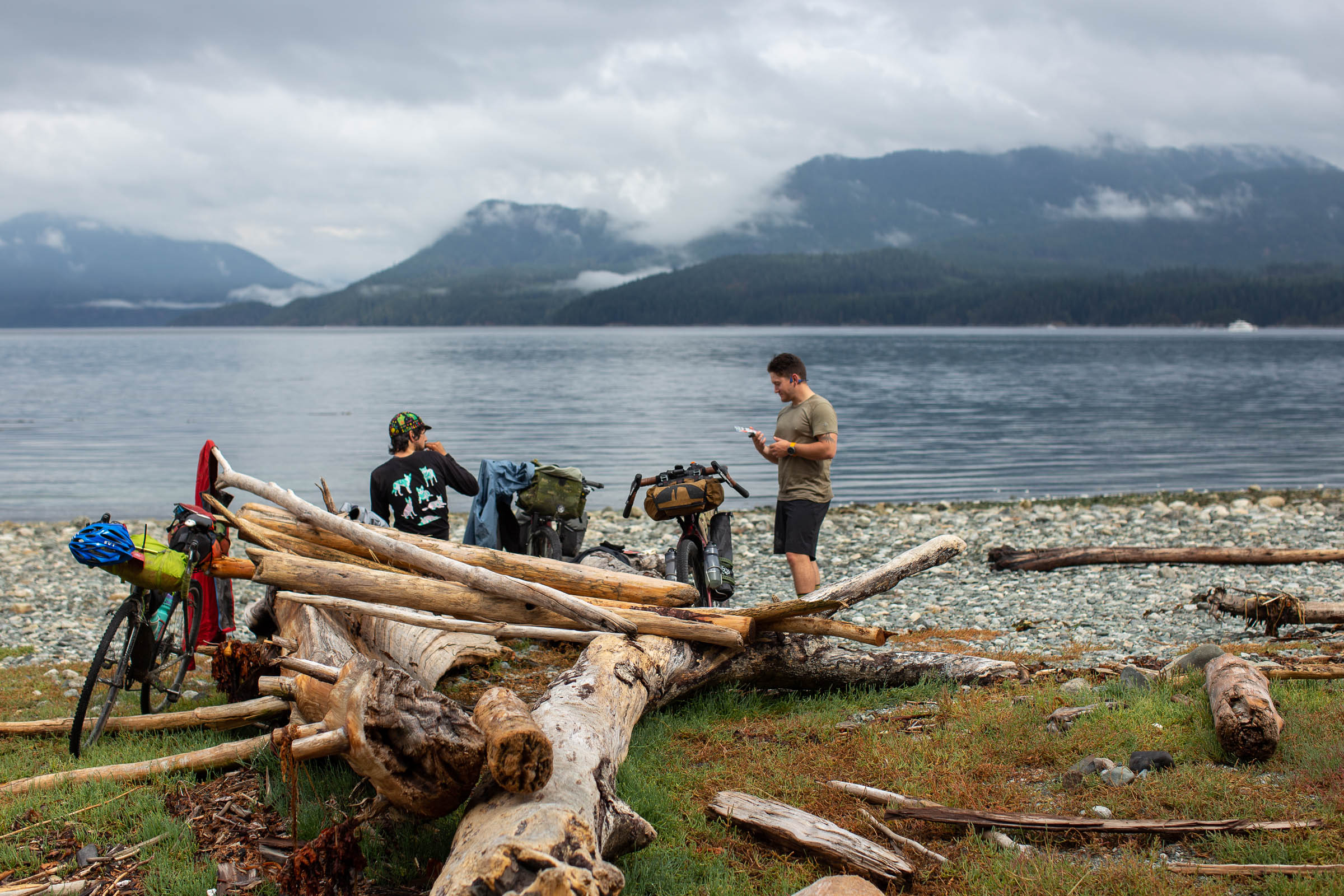
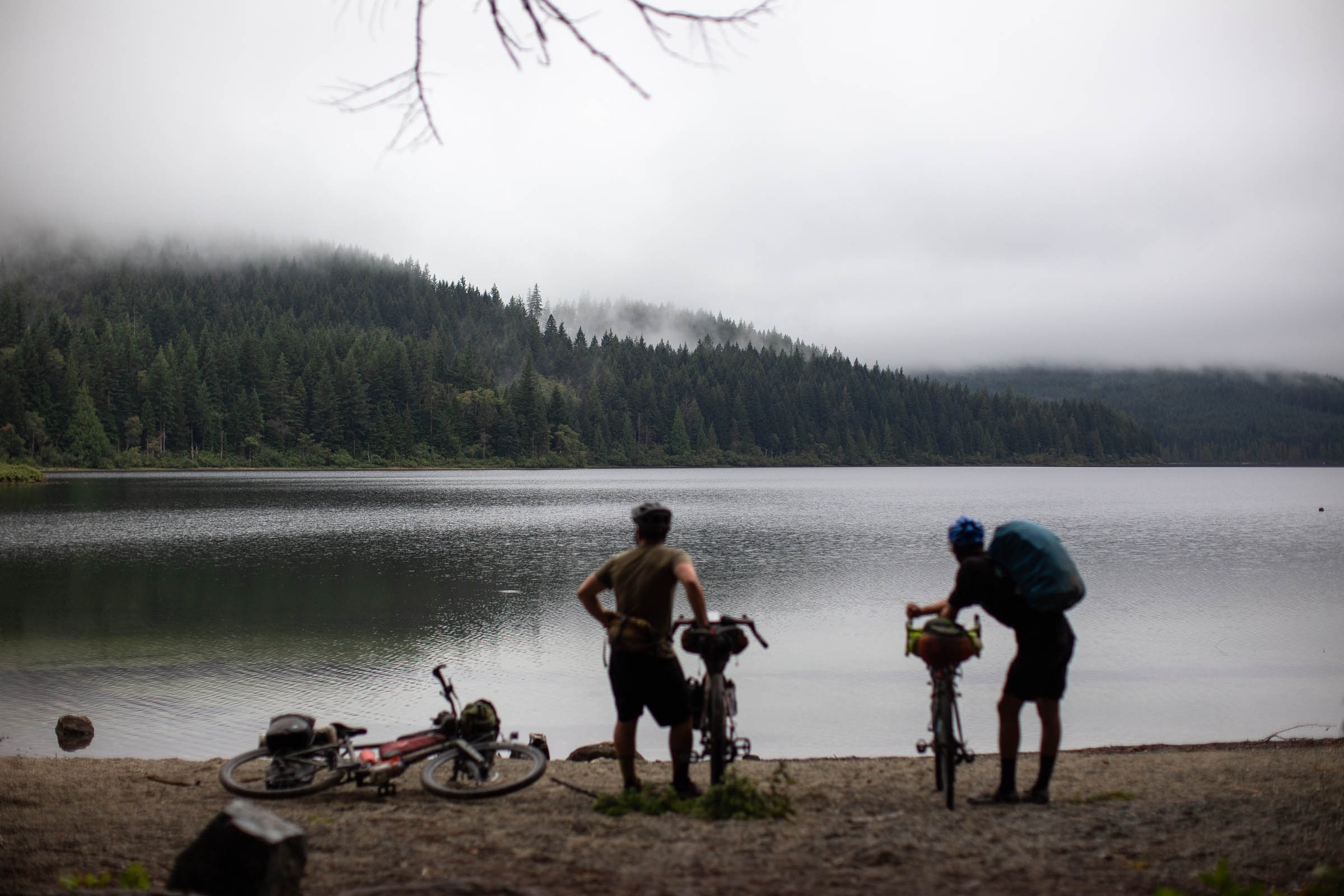
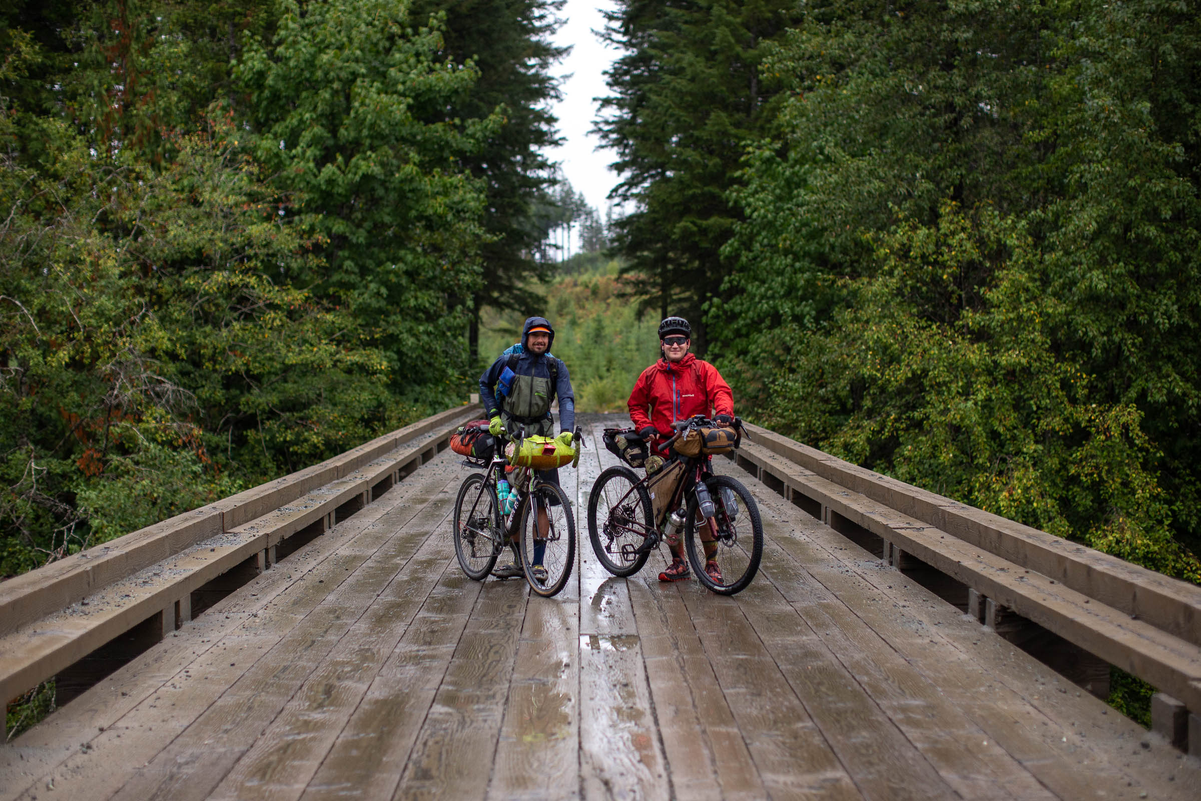
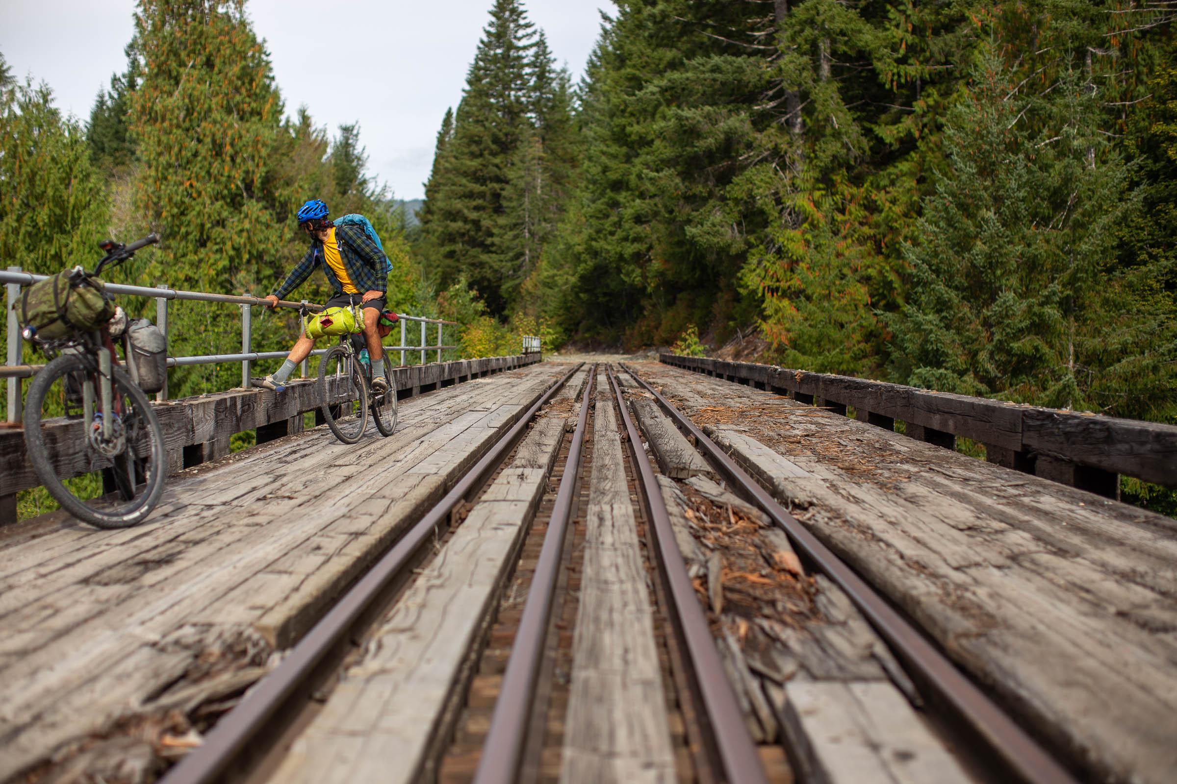
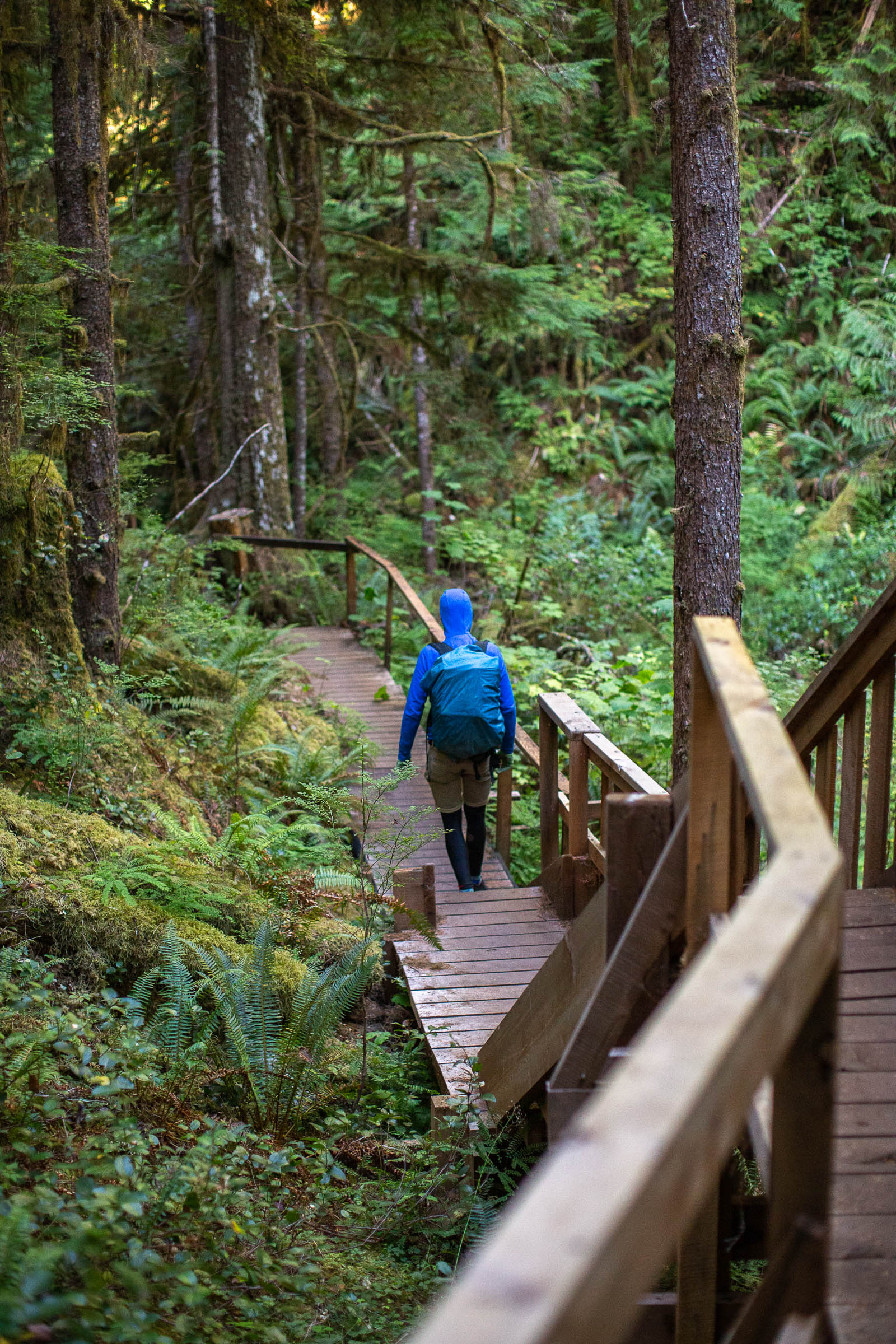
The Tree to Sea Loop takes advantage of the gravel roads north of Campbell River, linking together small coastal villages, incredible landscapes, and impressive granite mountains into a 1,000-kilometre bucket-list bikepacking route. Along the way, riders tackling the route will have the chance to whale watch, explore caves, and unwind at some of the best waterside camp spots in the province. The track bundles much of what the North Island offers into a well-rounded route that can be tackled in two weeks or easily expanded into a 20+ day endeavour with side trips and rest days.


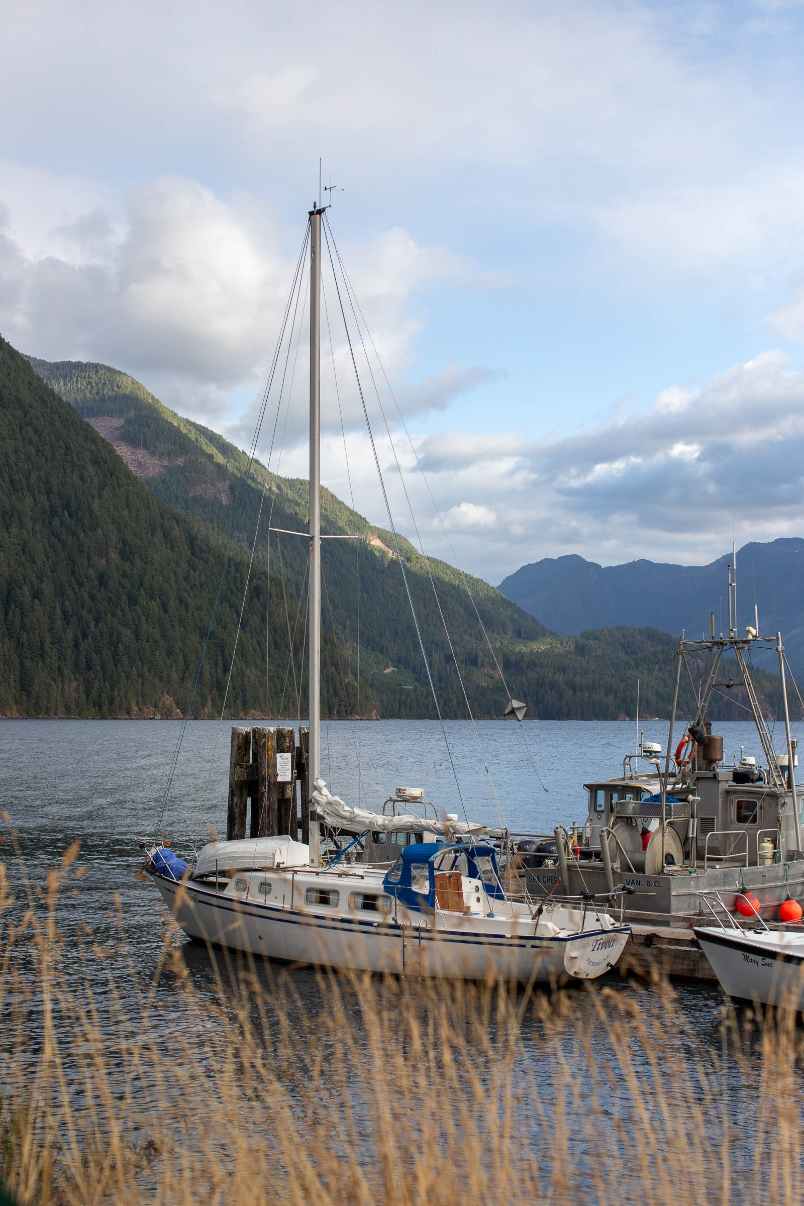
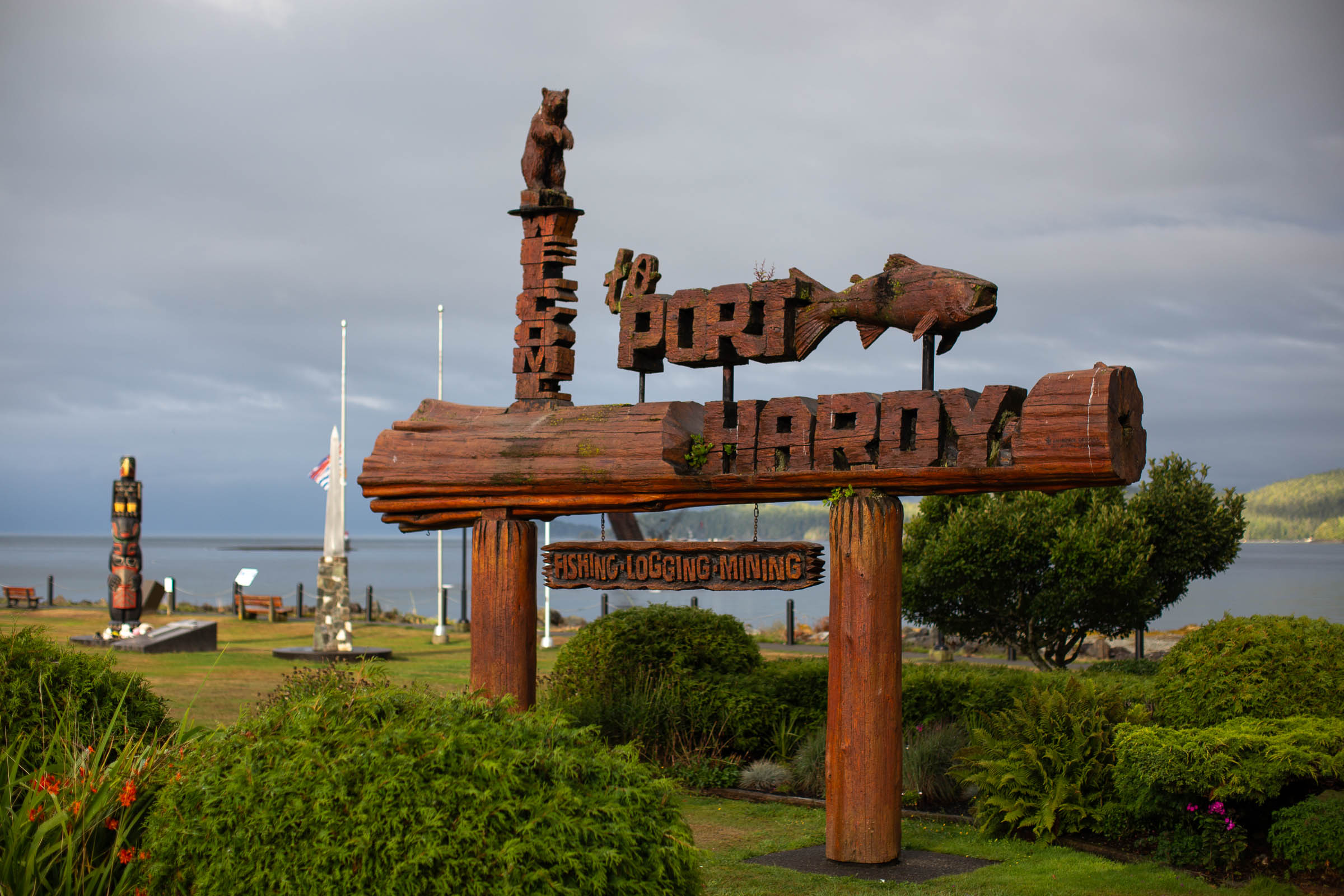
The Tree to Sea Loop starts and ends in Comox on Vancouver Island, providing the perfect starting location for those ferrying in from the Sunshine Coast, flying into the Comox airport, or travelling north from Victoria or the mainland. The route follows a network of side roads and multi-use pathways along the coast towards Campbell River before joining forest service roads for the majority of the loop. After leaving Upper Campbell Lake, the route skirts along the west coast of Vancouver Island, passing through Gold River, Tahsis, Zeballos, and Port Alice, leading to Cape Scott Provincial Park and the most remote pub on Vancouver Island, the Scarlet Ibis in Holberg. Riders head east towards Port Hardy and navigate along the east side of the island (with several chances for beautiful oceanside camping) before eventually heading back into the north end of Campbell River. The route wraps up with an urban rail-trail connection back to the coast and south to Comox.
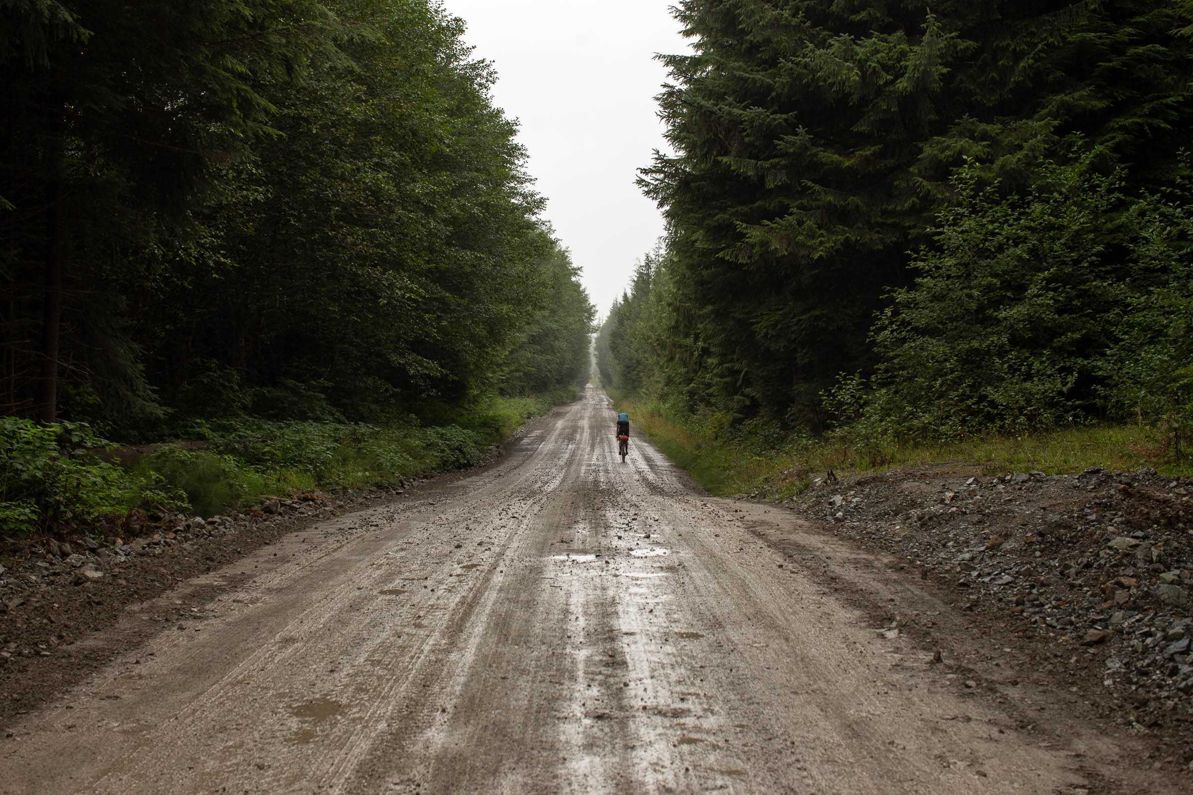
Though beautiful, this route is no walk in the park. Logistics and coastal weather create a sliding difficulty rating that is both hard to predict and manage. As presented, the route requires a water taxi from Tahsis to Zeballos, which will be replaced by the Unity Trail that will eventually connect the two communities. It’s an expensive ride that’s best split between a larger group, but the boat trip is incredibly beautiful and rewarding in its own way. Many of the remote coastal communities have general stores and resupply points that aren’t entirely reliable, especially in the off-season, forcing riders to pack several days of food at a time. On top of all that, the unpredictable weather of northern Vancouver Island makes proper rain gear and multiple layers a necessity, especially during the spring and fall, which are some of the best times to enjoy the route.

First Nations of Vancouver Island
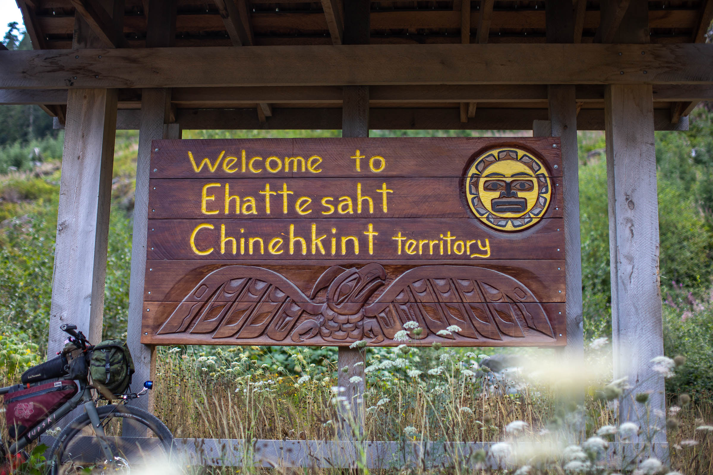
The First Nations of BC refer to those people who can trace their ancestry to the aboriginal people that inhabited the land prior to the arrival of Europeans and Americans in the late 18th century. There are more than 50 different First Nations on Vancouver Island, located in three distinct tribal regions: Coast Salish, Nuu chah nulth, and Kwakwaka’wakw. This route travels in both the Nuu-chah-nulth and Kwakwaka’wakw regions, passing through several First Nation communities along the way. These Nations account for almost 20% of First Nations in all of British Columbia. Before riding the route, we strongly suggest taking some time to learn more about the history of the land and the people where it travels. Head to the British Columbia Assembly of First Nations website to start.
Difficulty
As mentioned above, it’s difficult to predict how challenging the Tree to Sea Loop will be at any given time. Due to its length and changing weather and road conditions, riders should be prepared for long days of rain, cold nights, and hot days. There are lengthy stretches without resupply or shelter, and riders must be self-sufficient in all conditions. Cellular coverage is limited along much of the route, and a mechanical could turn hazardous for the ill-prepared. Do your research and don’t skimp on the right gear. The route follows gravel roads and doubletrack, the majority of which is graded and maintained. Golfball-sized gravel is not uncommon, but rough sections are usually limited to just a few kilometres. While there’s lots of climbing and steep descents on the route, there are only a few shorter ultra-steep climbs that some may need to push up. Otherwise, the route is 100% rideable. Looking for a shorter version of the Tree to Sea Loop? Scroll down to the Trail Notes section below for a map of the “Tree to Sea Mini” – a 380km loop that follows much of the full route but skips the required boat section and takes a more direct paved route between Campbell River and Gold River.
Route Development: The Tree to Sea Loop was inspired by the North Island 1000, which was created the year before we scouted and published this route. They share many of the same roads, but the Tree to Sea includes some bicycle-only trails and is designed specifically for bikepacking. The name pays homage to the scenic Tree to Sea Drive from Gold River to Tahsis, a truly spectacular section of road with many interesting side trips along the way. Peter Buco of Vancouver helped scout the route during the first week of September, and further assistance was provided by Brett Baldwin and Hannah and Madi Friesen, who joined in on some of the fun. Further input was also provided by Bruce Grant, who also tackled a variation of the route with a group of friends. A shoutout to Rob (Salty Beard Bikepacking) who provided input on the route and helped finalize the section between Campbell Lake and Gold River.


Submit Route Alert
As the leading creator and publisher of bikepacking routes, BIKEPACKING.com endeavors to maintain, improve, and advocate for our growing network of bikepacking routes all over the world. As such, our editorial team, route creators, and Route Stewards serve as mediators for route improvements and opportunities for connectivity, conservation, and community growth around these routes. To facilitate these efforts, we rely on our Bikepacking Collective and the greater bikepacking community to call attention to critical issues and opportunities that are discovered while riding these routes. If you have a vital issue or opportunity regarding this route that pertains to one of the subjects below, please let us know:
Highlights
Must Know
Camping
Food/H2O
Trail Notes
Resources
- Charming coastal communities linked together by gravel forest service roads. Take time to chat with the locals and hear their stories. Not only will these communities provide important resupply points, but the people will provide valuable intel that’s often not available online.
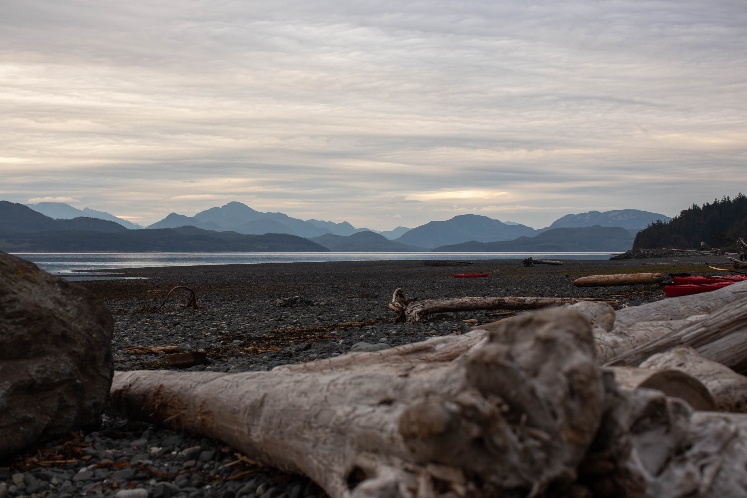
- Opportunities for fantastic marine mammal viewing. There are humpbacks, orcas, and porpoises off the west coast of the island. The Naka Creek BC Rec Site, looking out over the Johnstone Strait, is a great spot to view orcas and huge pods of Pacific white-sided dolphins.
- Numerous BC Recreation campsites are directly on route. Some of our favourites are included on the route map, but there are others. See the Camping and Lodging section for more details.
- The water taxi from Tahsis to Zeballos is an unforgettable experience. There are plans to develop a multi-use trail connecting the two communities, but things are moving slowly. Mention your interest in the Unity Trail while you’re there! We’re looking into how we can help push this project along.
- Long climbs and steep coastal descents with views of massive inlets, the Sunshine Coast, and the Johnstone Strait.
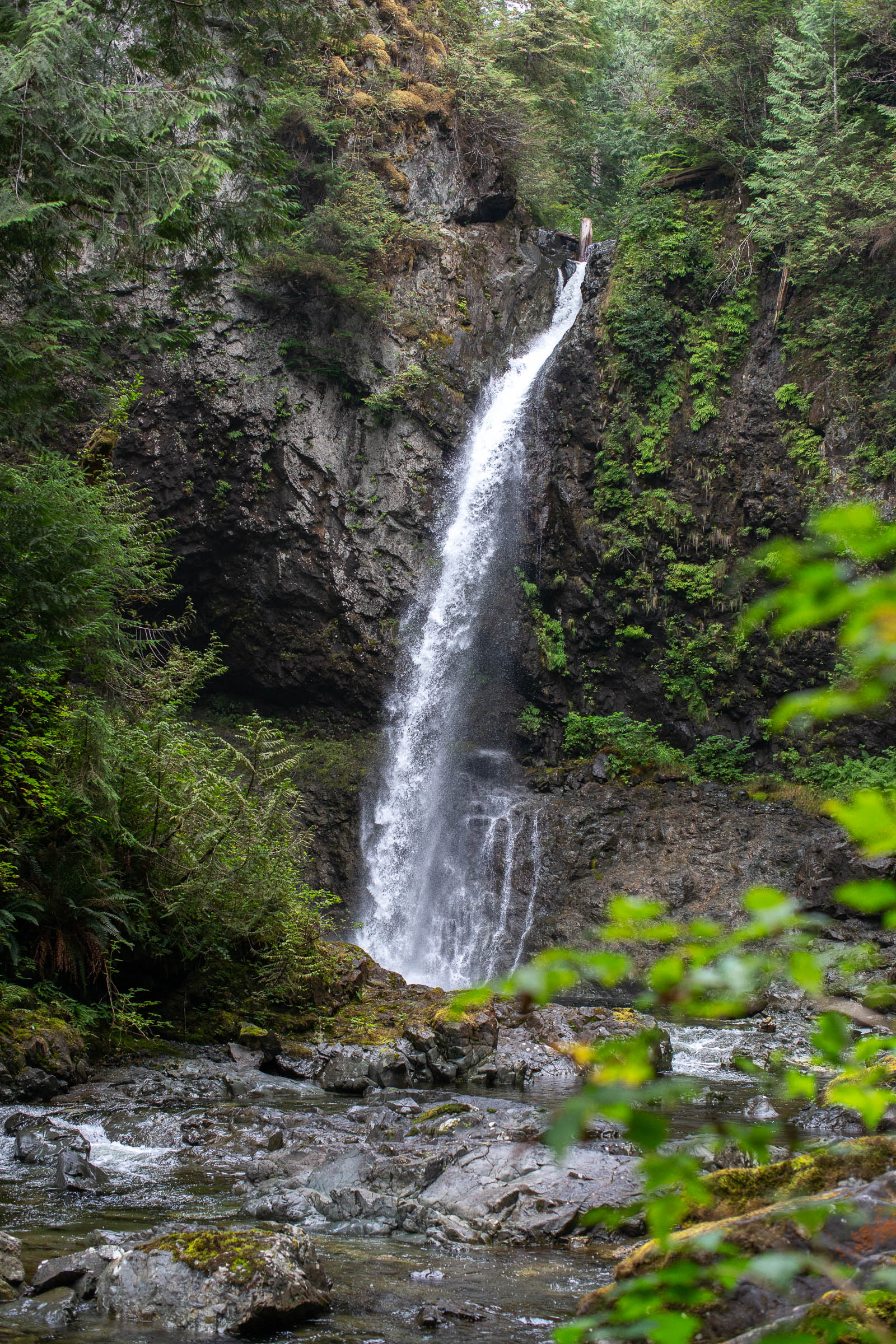
- A number of waterfalls and lakes on route are great for swimming and fishing in the warmer months.
- Follow an easily expandable route that could be 20+ days with optional side trips for the adventurous, or layover days in coastal communities. It can also be shortened for those with less time, riding the top or bottom half of the loop in under a week.
- Take the ferry to Malcolm Island from Port McNeill to visit the charming town of Sointula and camp at Bere Point Regional Park.
- Easy access from the Sunshine Coast, Vancouver, and Victoria using ferries and public transit. Airports are also nearby for those flying in from outside of British Columbia or Canada. See the Must Know section for details.
- Ideal bike: A gravel bike with at least 45mm tires is reccomended, but a rigid mountain bike or hardtail wouldn’t be overkill. A reliable wide-range drivetrain is beneficial for some of the steeper climbs, and durable tires set up tubeless is a good idea. There aren’t many bike shops along the route, besides Port Hardy, Campbell River, and Courtenay, so a reliable setup is crucial. Bring a good repair kit and know how to use it.
- When to ride: The route is best ridden between May and August, as the majority of general stores and resupply points operate during these months. Spring and fall are best for lower daily temperatures, but also bring on higher chances for rain and cold nights. Expect rain and sudden weather changes whenever you decide to ride. Spring has a higher chance for winter blowdown and unfavourable/unrideable road conditions, be prepared to reroute if necessary.
- Route direction: The route is best ridden clockwise, as presented. Mainly to make it easier to plan your water taxi from Tahsis, and due to some steep descents that would be less enjoyable to climb up. However, it can be be ridden in either direction.
- Getting here: Comox can be accessed by water via the Powell River ferry, as well as by air via the Comox Valley Airport. The Vancouver Island Connector bus runs from Victoria to Oyster River or Campbell River and accepts packaged bicycles (box or bag) for a fee. See the Resources tab for details. BC Transit also has routes between Victoria, Fanny Bay, and Courtenay, which don’t require your bike to be boxed. Pacific Coastal has direct flights between Vancouver and Comox, which might be useful for anyone flying in from out of province. Otherwise, the ferry from Vancouver (Horseshoe Bay) to Nanaimo (Departure Bay) is your best bet to link up with public transit to get north to Comox. There is paid long-term parking available at both the Comox Ferry and Comox Airport.
- Long-term access: As with most routes that follow forest service roads, there are sections that are susceptible to public closure without much notice. For continued access, we strongly suggest everyone spread the word of the route during your ride, or better yet, tell the local government, Ministry of Tourism, and Ministry of Forests about the route and the benefits that bikepackers can bring to these small communities.
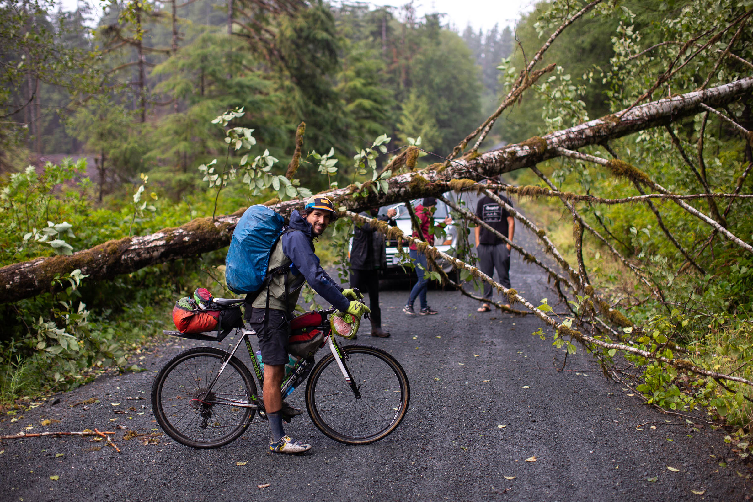
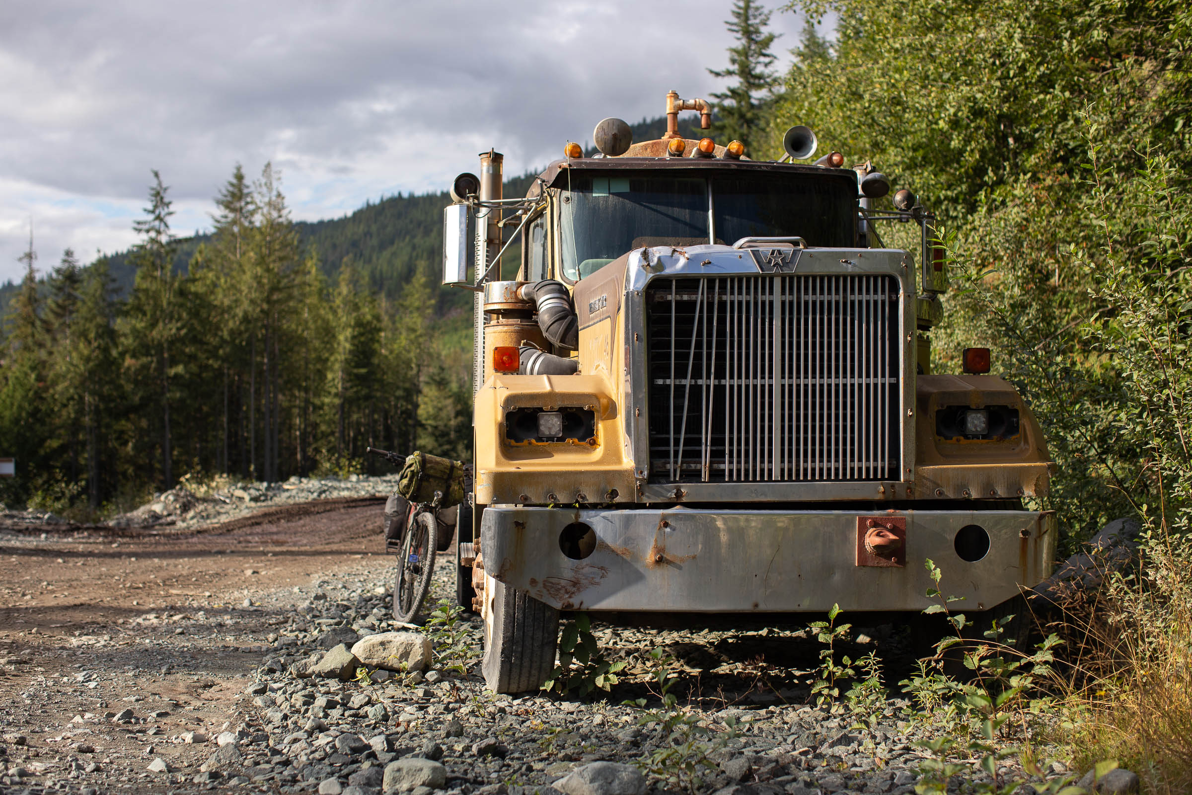
- Large off-road logging trucks use these roads and will not get out of your way. It’s your responsiblity to get off the road to let them pass safely. Don’t wear ear buds and be aware at all times. There is the chance that you’ll pass through active logging areas, so follow all signage and be prepared for potential (though unlikely) detours. Most importantly, be friendly and wave.
- This area contains habitat for many wild animals, including bears, cougars, and wolves. Be bear and cougar aware, always carry bear spray, and hang your food at night. While riding, talk loudly and make noise. It is far too easy to come around a corner and startle a wild animal, and unnecessary interactions should be avoided.
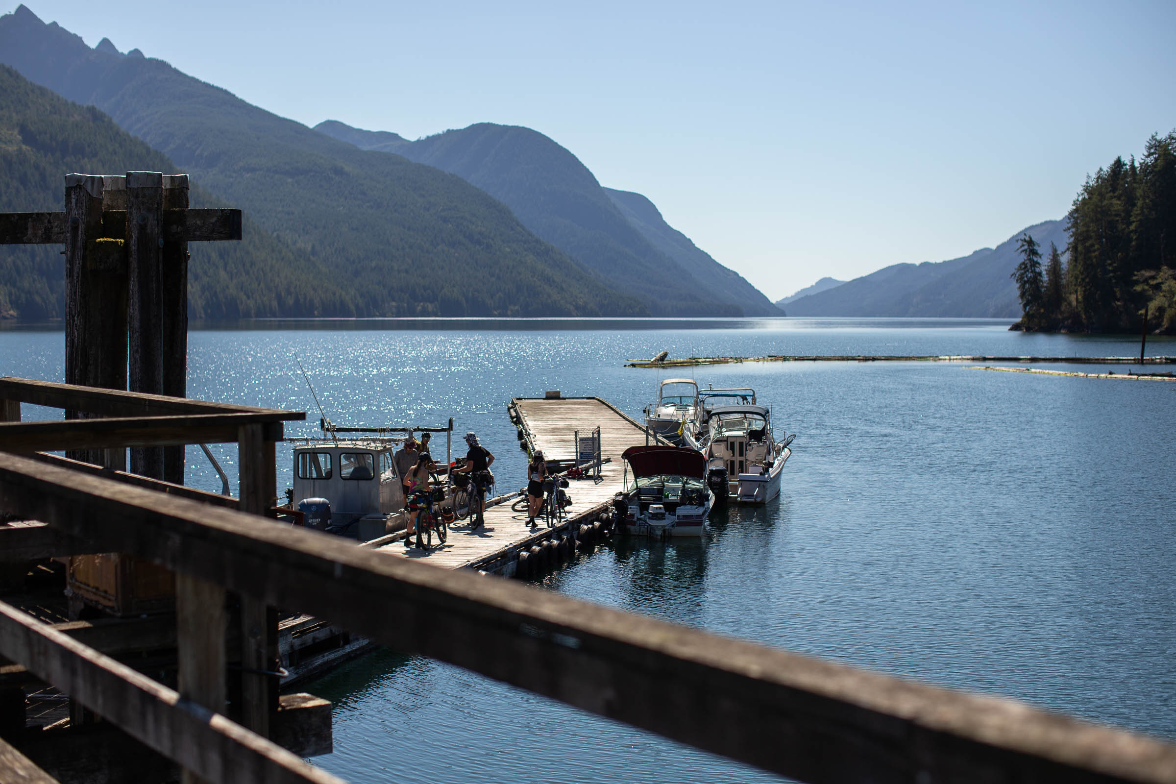
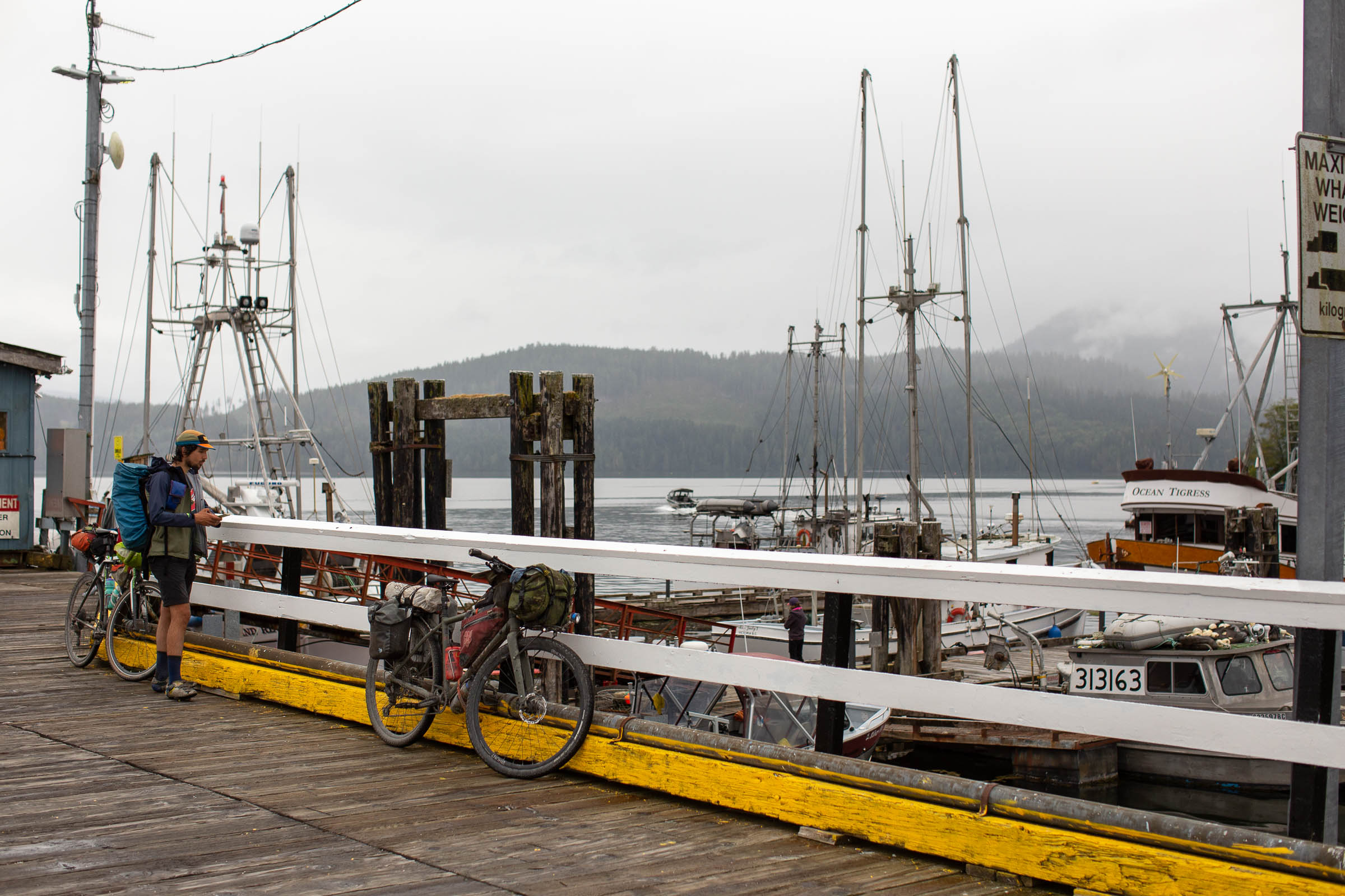
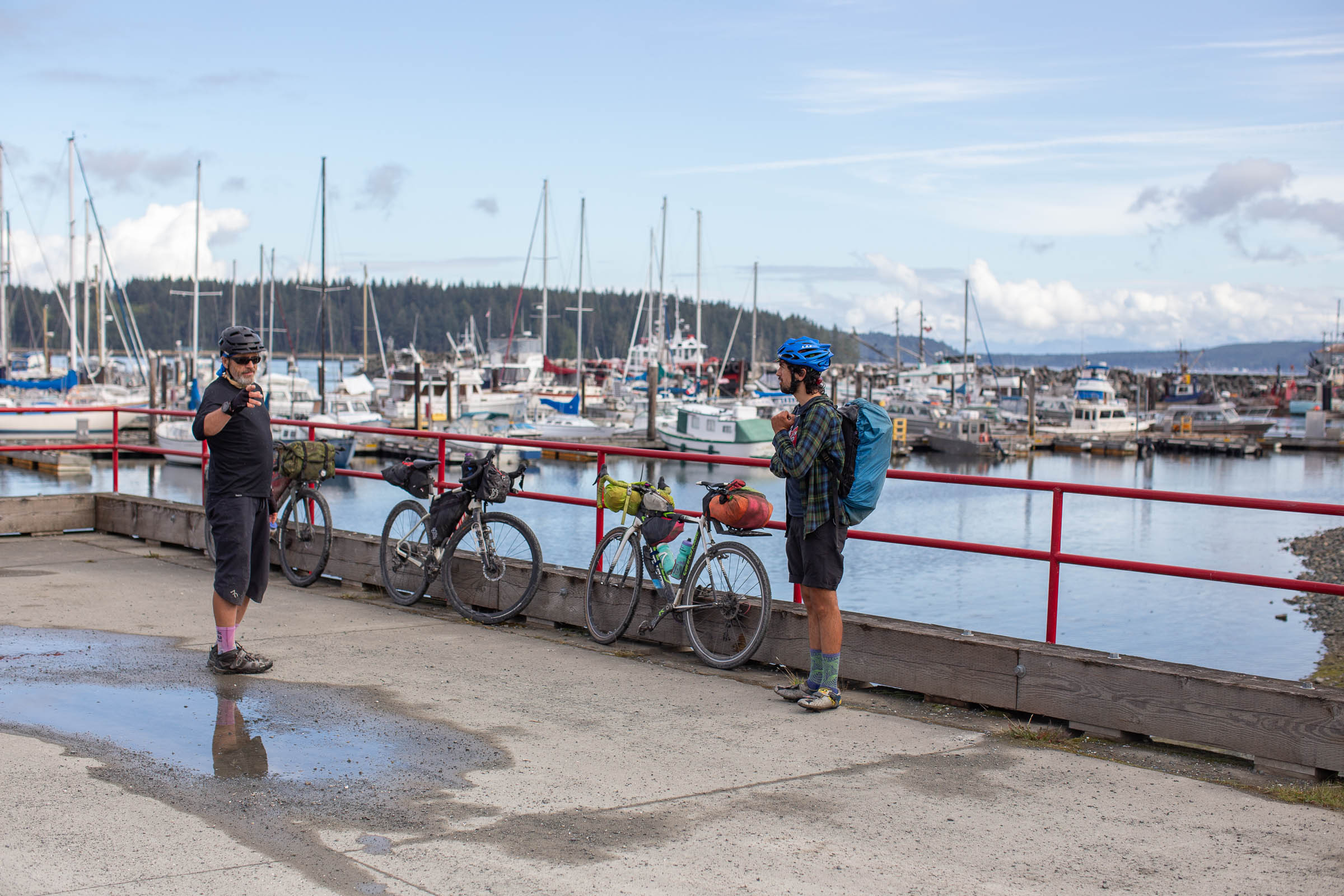
- A water taxi is required to travel from Tahsis to Zeballos and must be booked ahead of time. Try Shorebird Expeditions, Zeballos Expeditions, or Air Nootka. We paid $400 and split it between eight bikepackers. Air Nootka has scheduled flights between Gold River and Zeballos throughout the week that could be useful for smaller groups or solo riders. Join the BC Bikepacking Facebook group and use the hashtag #TreeToSeaBoat to find other groups to split the cost with.
- There are Canada Post offices in most towns that can be used to send resupply packages ahead of time, if attempting in the off-season. Some potential and useful drop locations include Tahsis, Port Alice, Holberg, and Sayward. These post office locations are marked as POIs on the route map above.
- Cell service is spotty along most of the route. Telus seems to offer better coverage. Most libraries and some coffee shops/restaurants will have public wifi. It’s a good idea to bring a satellite communication device like a SPOT or Garmin inReach just in case.
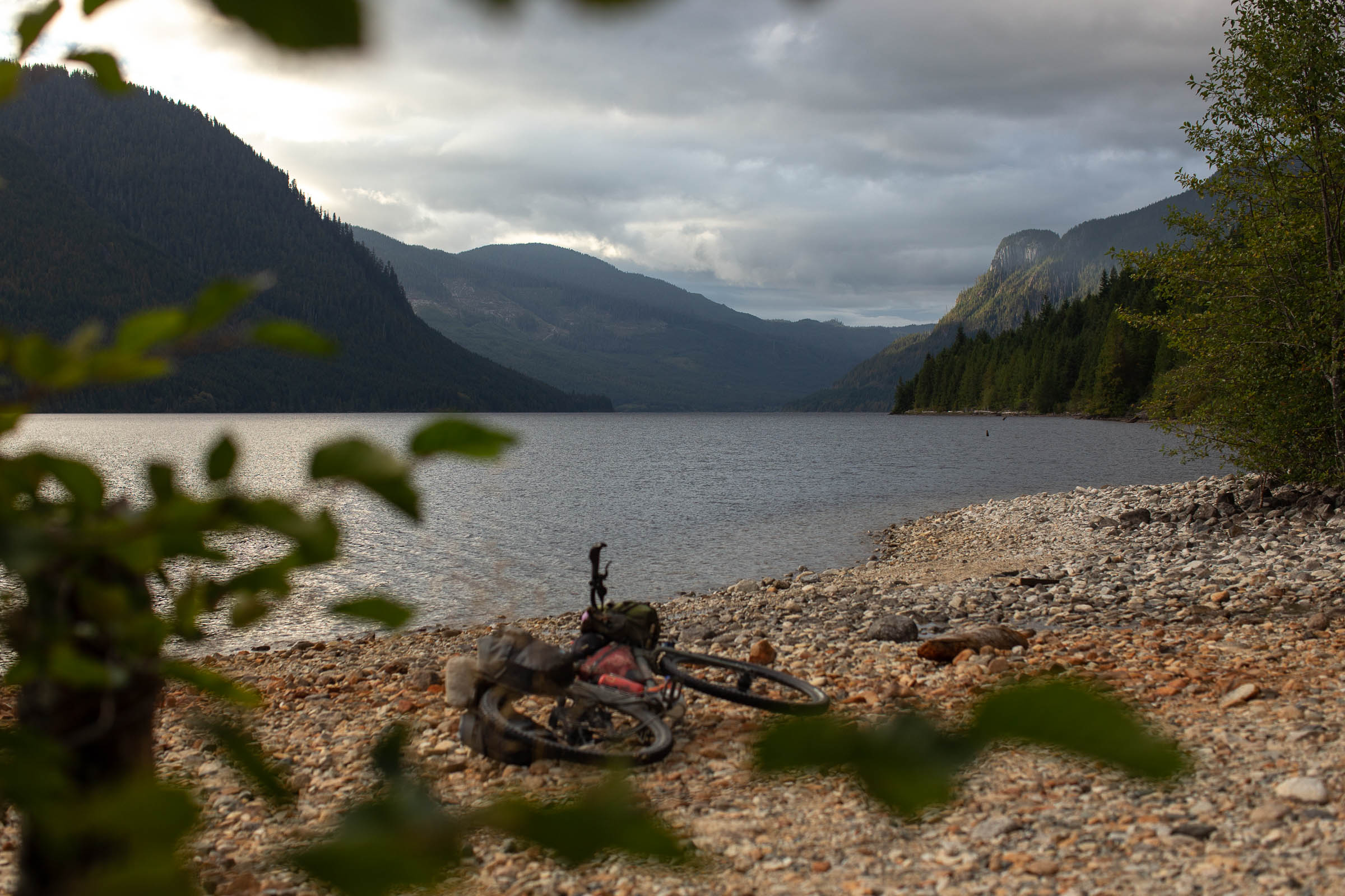
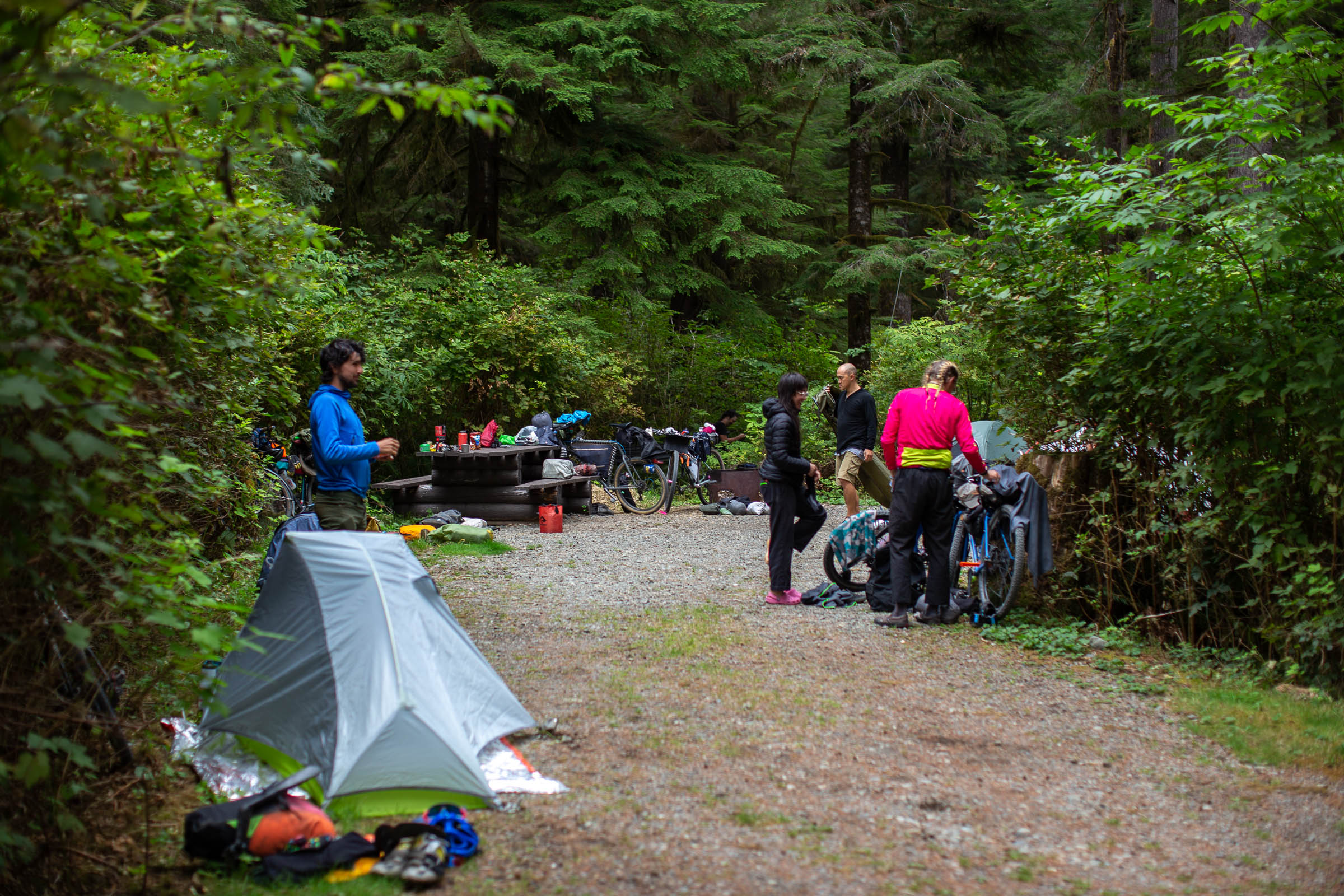
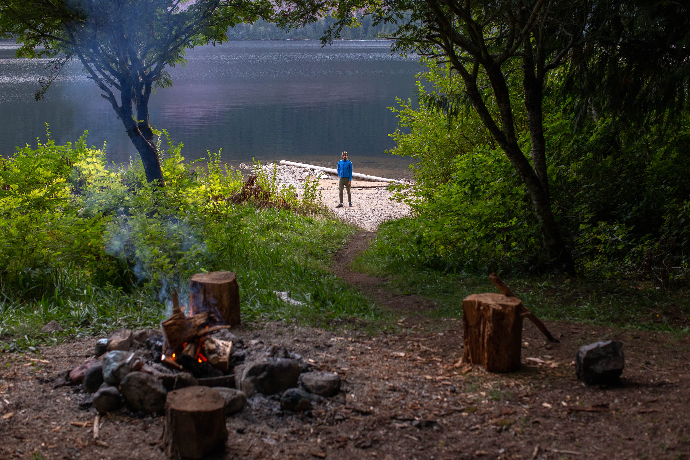
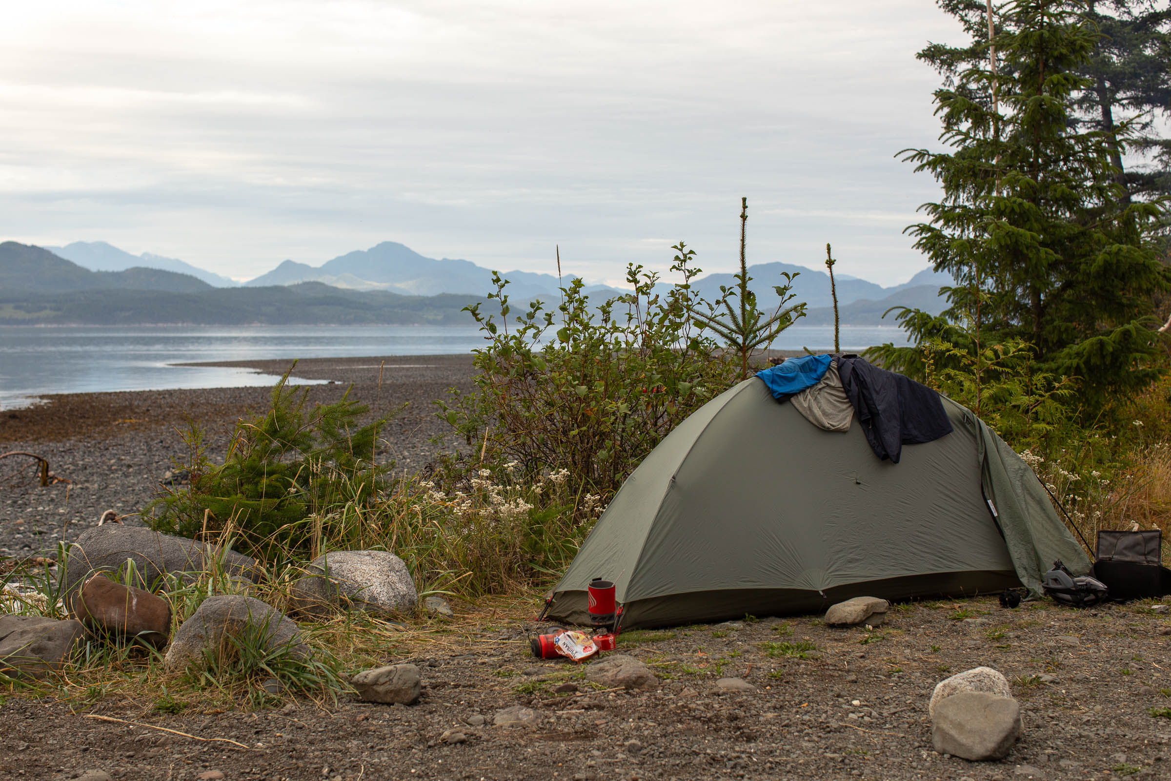
- There are tons of BC Recreation Sites along the route for camping, the majority of which have fire rings, pit toilets, and picnic tables, as well as beautiful lake access for swimming and fishing. Some of our favourites include Leiner River, Atluck Lake, Bonanza South, Naka Creek, and Stella Lake. Some of the best sites are included on the route map, but there are many others.
- While the majority of campsites are free, some require a small cash-only fee of $10 to $20. It’s a good idea to bring some extra cash with you as ATM machines are few and far in between.
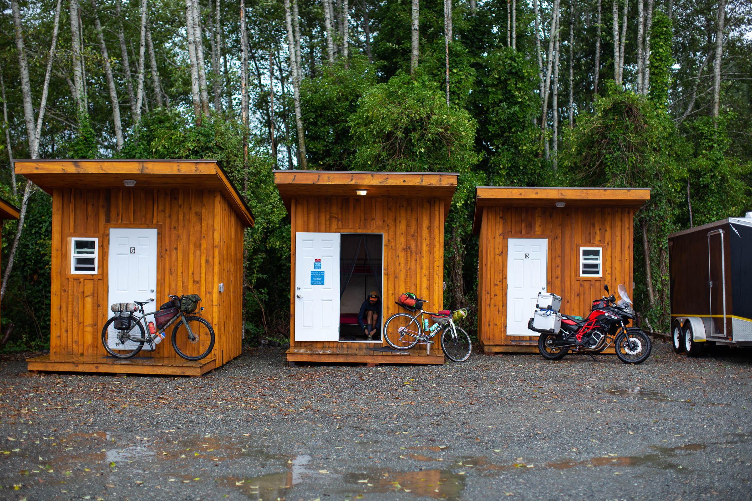
- There are a few resorts and cabin rentals available, as well as motels in Port Hardy and Port McNeil. Moutcha Bay Resort has yurts and the Scarlet Ibis Pub in Holberg has tiny heated Adventure Huts for rent with access to showers.
- There are also several private campgrounds and Provincial Parks on the route that often provide more amenities than the BC Rec Sites. Kitty Coleman Provincial Park just north of Comox is a great spot, as is the Gold River Municipal Campground, Sayward Fisherboy RV/Campground, and Elk Falls Provincial Park in Campbell River.
- A good portion of the route travels on privately owned logging land, and while wild camping is possible, it’s not necessarily legal. Stick to designated campsites if possible.
- There are basic resupply points every two to three days, depending on daily mileage. The more remote communities (Gold River, Tahsis, Zeballos, Holberg, and Sayward) are often limited to smaller general stores selling dry goods and with listed hours that aren’t always reliable. Call ahead or plan accordingly.
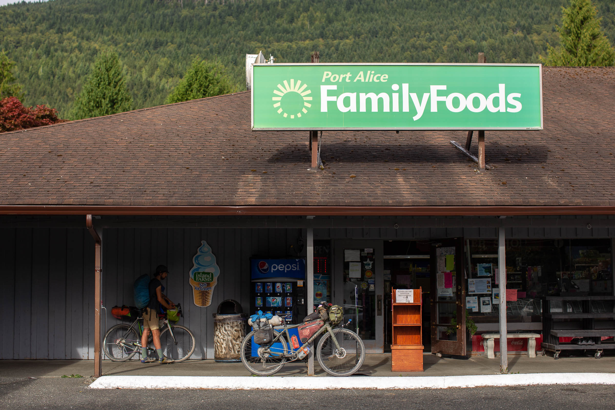
- There are major grocery stores in Courtenay, Campbell River, Port Alice, Port Hardy, and Port McNeill. You’ll find fresh produce, toiletries, and pretty much anything else you might desire there.
- Freshwater lakes, streams, and rivers are abundant. Bring a filter and expect to carry at least two litres at all times, maybe more in the summer. Some coastal campsites won’t have access to fresh water, so bring extra to camp if you’re unsure.
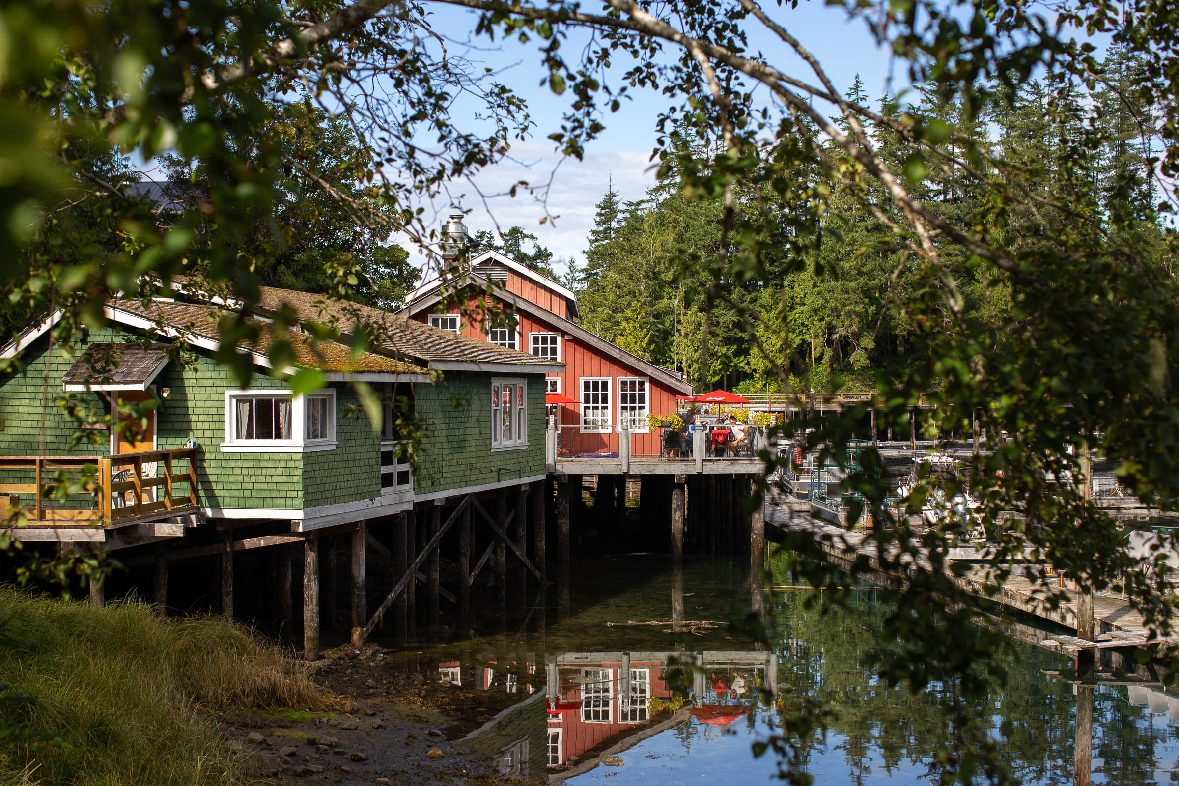
- Some favourite food stops include Sea & Field Bistro in Gold River, Sally’s Grill in Tahsis, Foggy Mountain Coffee Co. in Port Alice, Scarlet Ibis Pub in Holberg, and the Ideal Cafe in Campbell River.
- There is liquid and pressurized stove fuel available at Valhalla Pure Outfitters (Courtenay), Timberland Sports Centre (Port McNeill), and the River Sportsman (Campbell River).
The Tree to Sea Mini
Looking for a shorter route that doesn’t require the boat charter between Tahsis and Zeballos? Try the Tree to Sea Mini. This 380km loop follows most of the southern half of the full route but follows some pavement between Campbell River and Gold River, skips the boat ride, but prioritizes beautiful gravel roads. This is a great option for anyone working up to the full route or for folks with less time.
A Sample 15-Day Itinerary
Here is a sample 15-day itinerary, based on an attainable daily mileage, lazy mornings, and spending lots of time exploring caves, taking photos, and time in towns. Depending on your fitness level, time of year, weather, and preferences, the route is easily rideable in 10 days or under or expanded into a 20+ day trip with rest days and side trips. The distances below are approximate.
- Day 1: Travel + Ferry / Miracle Beach Provincial Park (30km)
- Day 2: Fry Lake / Campbell Lake (60km)
- Day 3: Muchalat Lake (115km)
- Day 4: Leiner River (75km)
- Day 5: Water Taxi + Atluck Lake (50km)
- Day 6: Port Alice / Link River (70km)
- Day 7: Rest Morning + Marble River (30km)
- Day 8: San Josef Bay (90km)
- Day 9: Port Hardy (65km)
- Day 10: Bonanza Lake (100km)
- Day 11: Naka Creek (90km)
- Day 12: Sayward Junction (70km)
- Day 13: Stella Lake (50km)
- Day 14: Elk Falls / Campbell River (40km)
- Day 15: Comox / Kin Beach Provincial Park (60km)
Route Details
Comox to Gold River
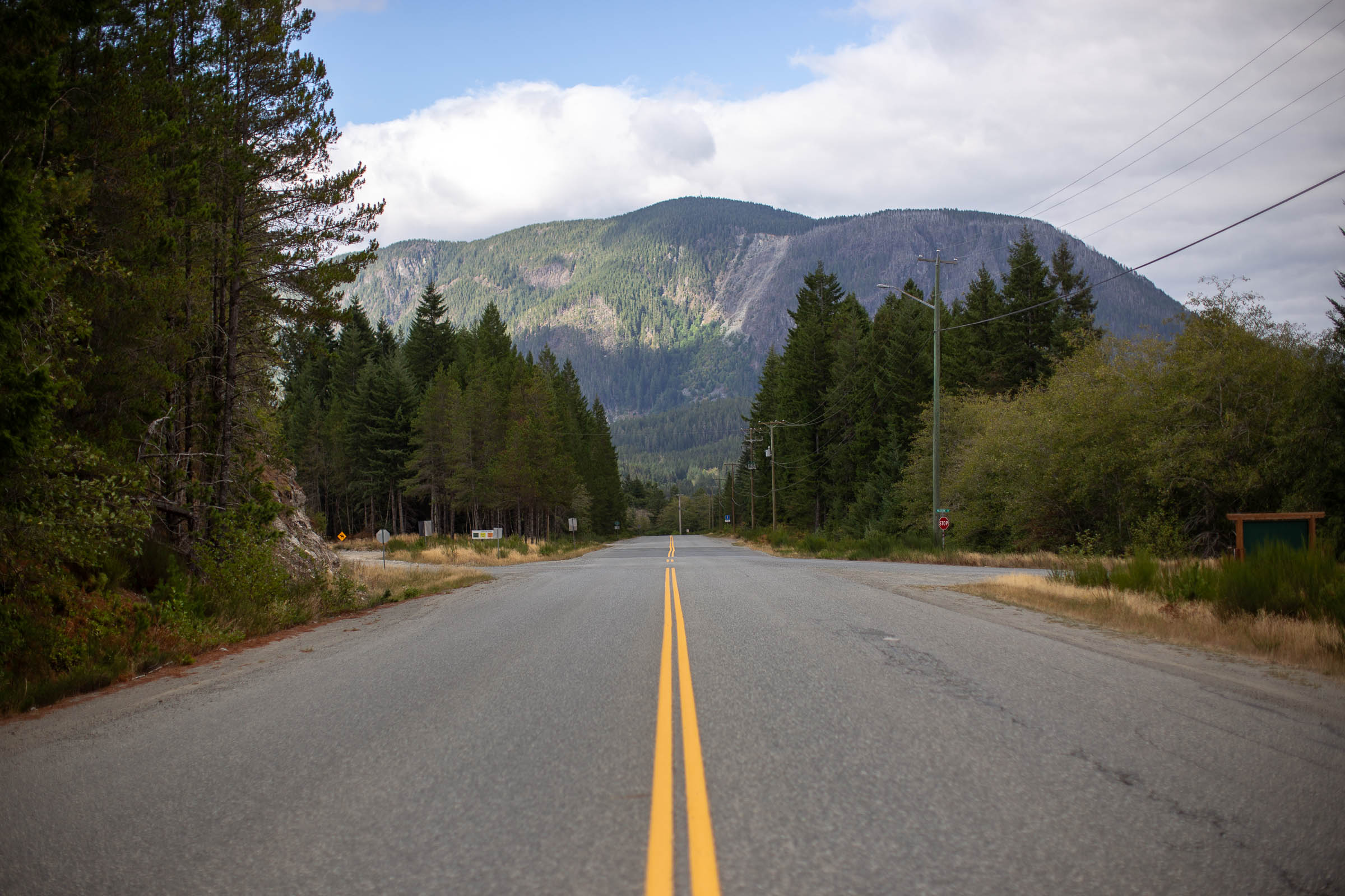
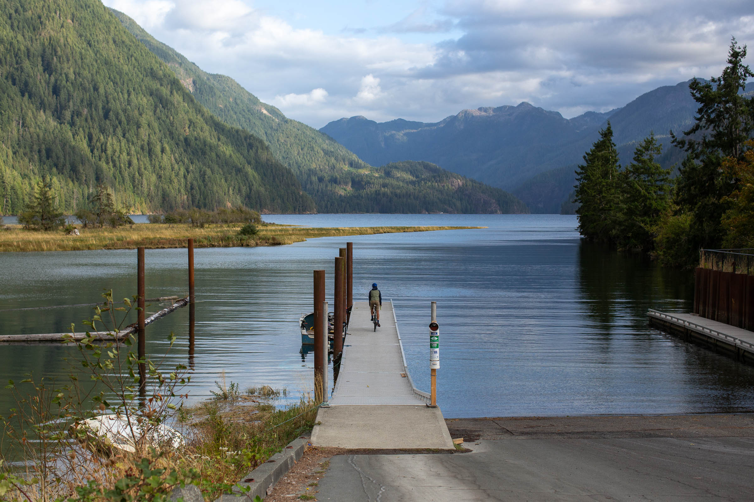
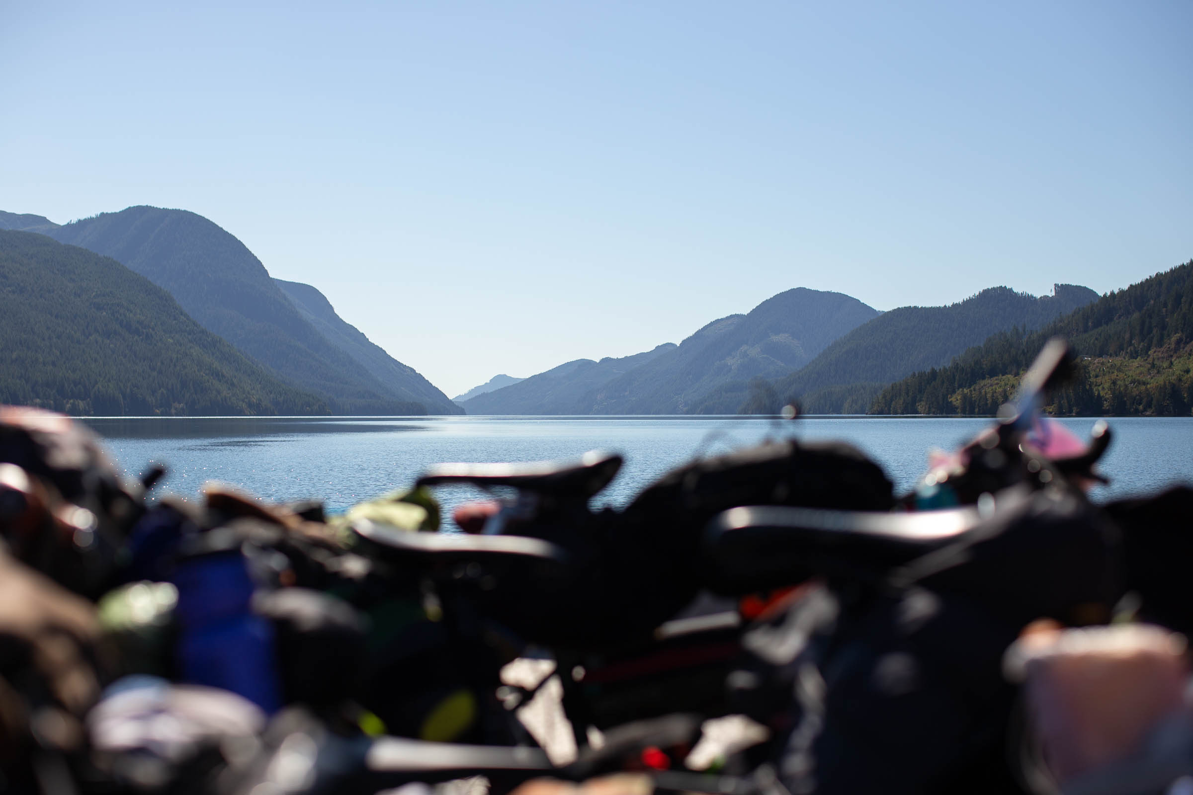
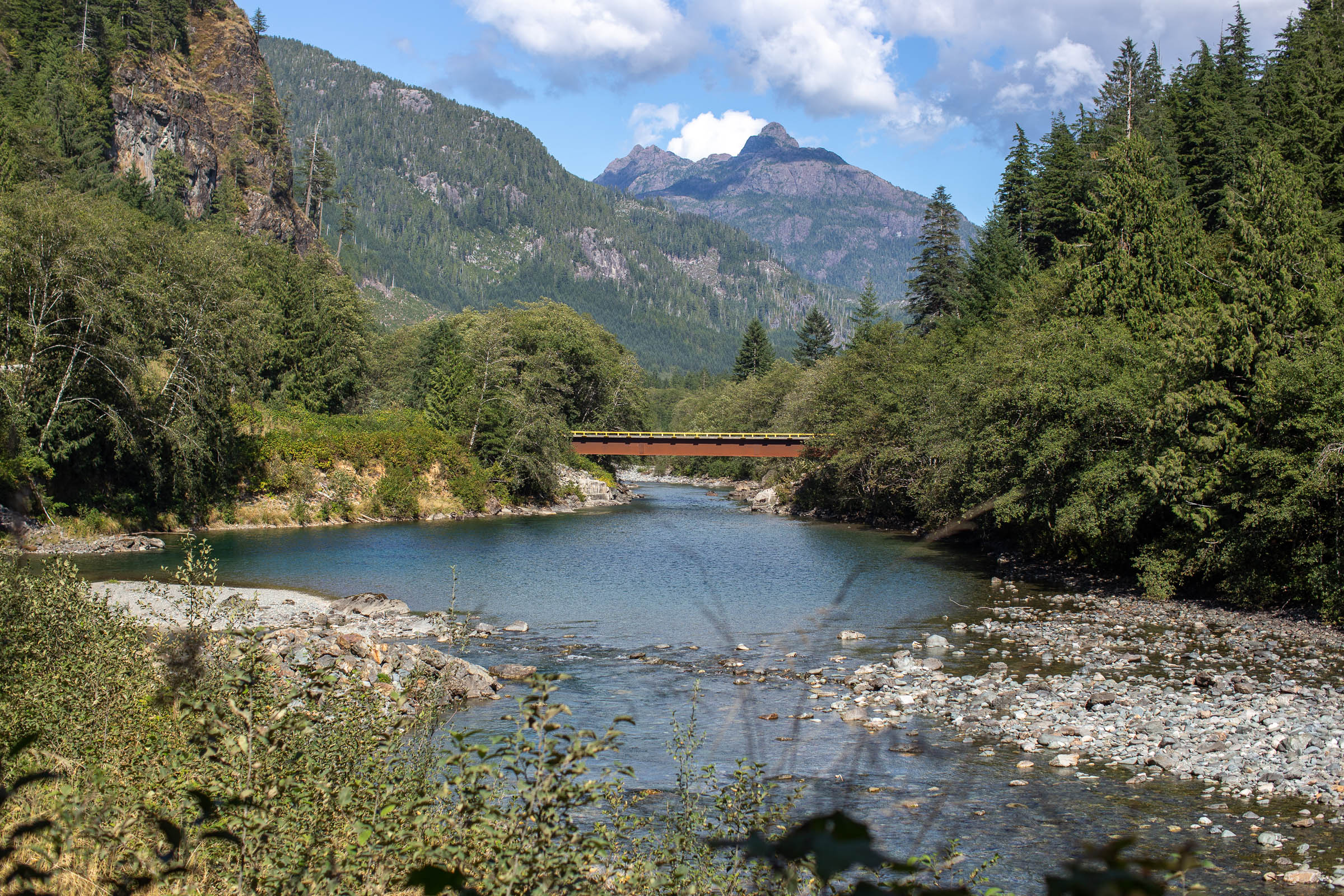
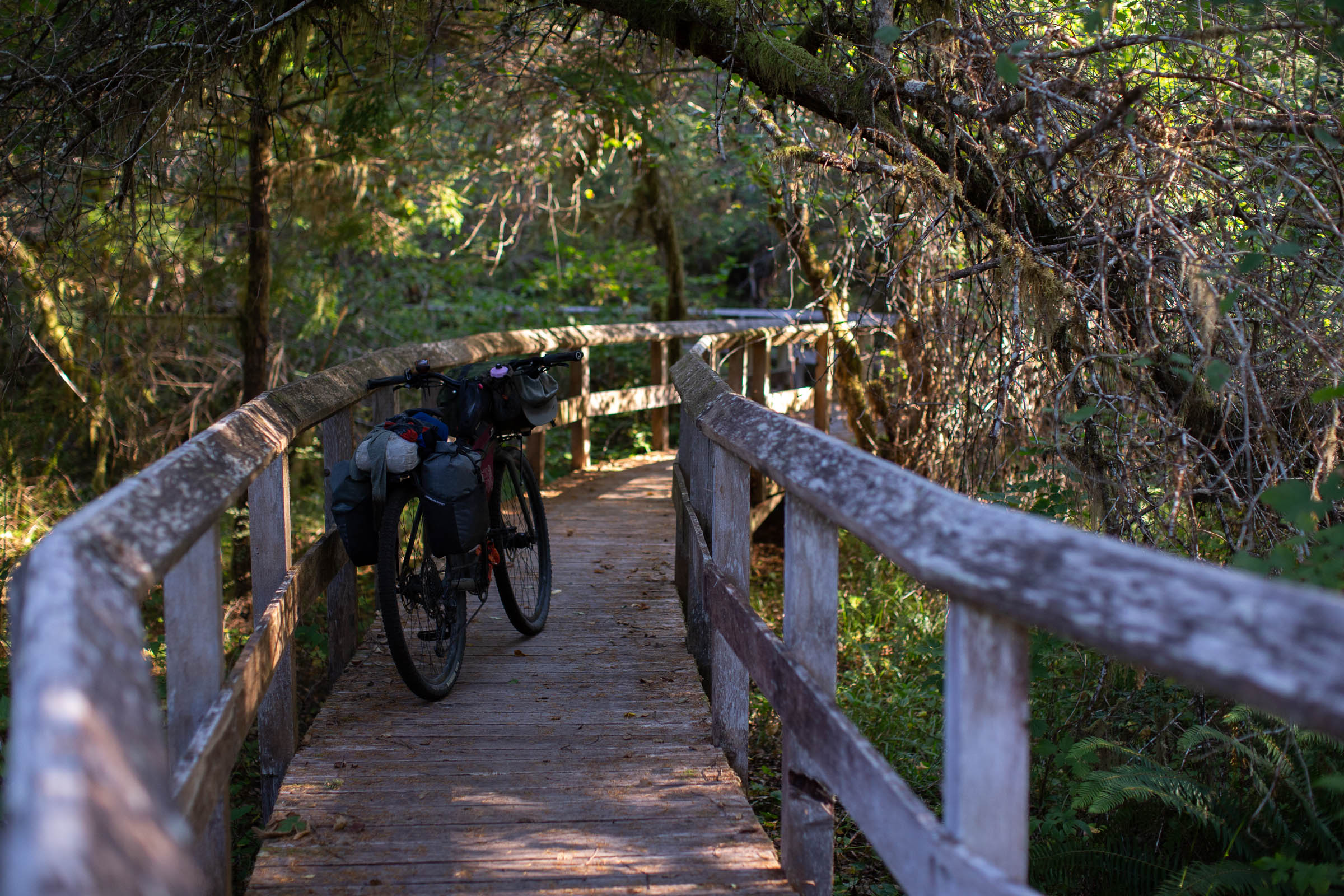
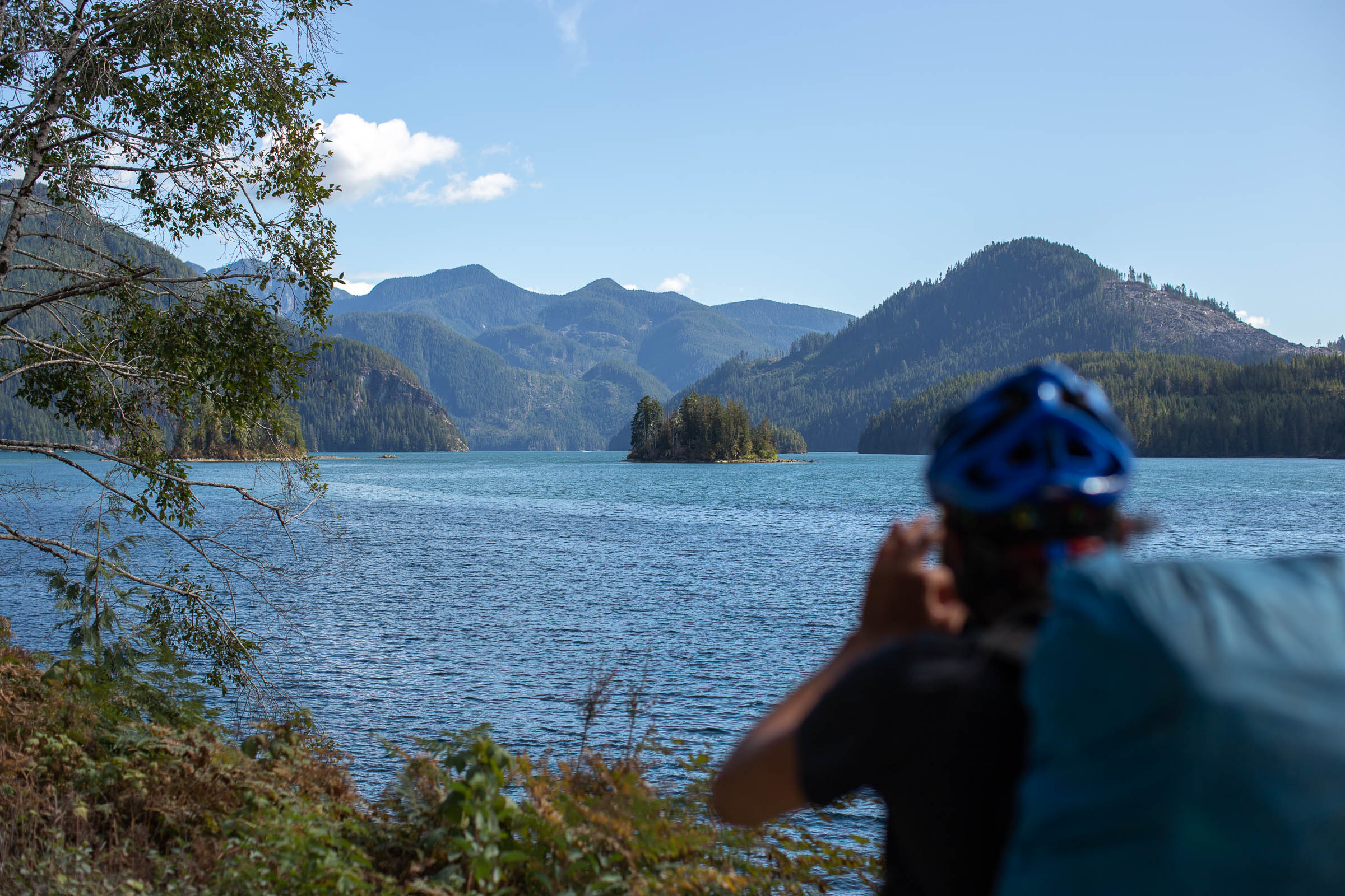
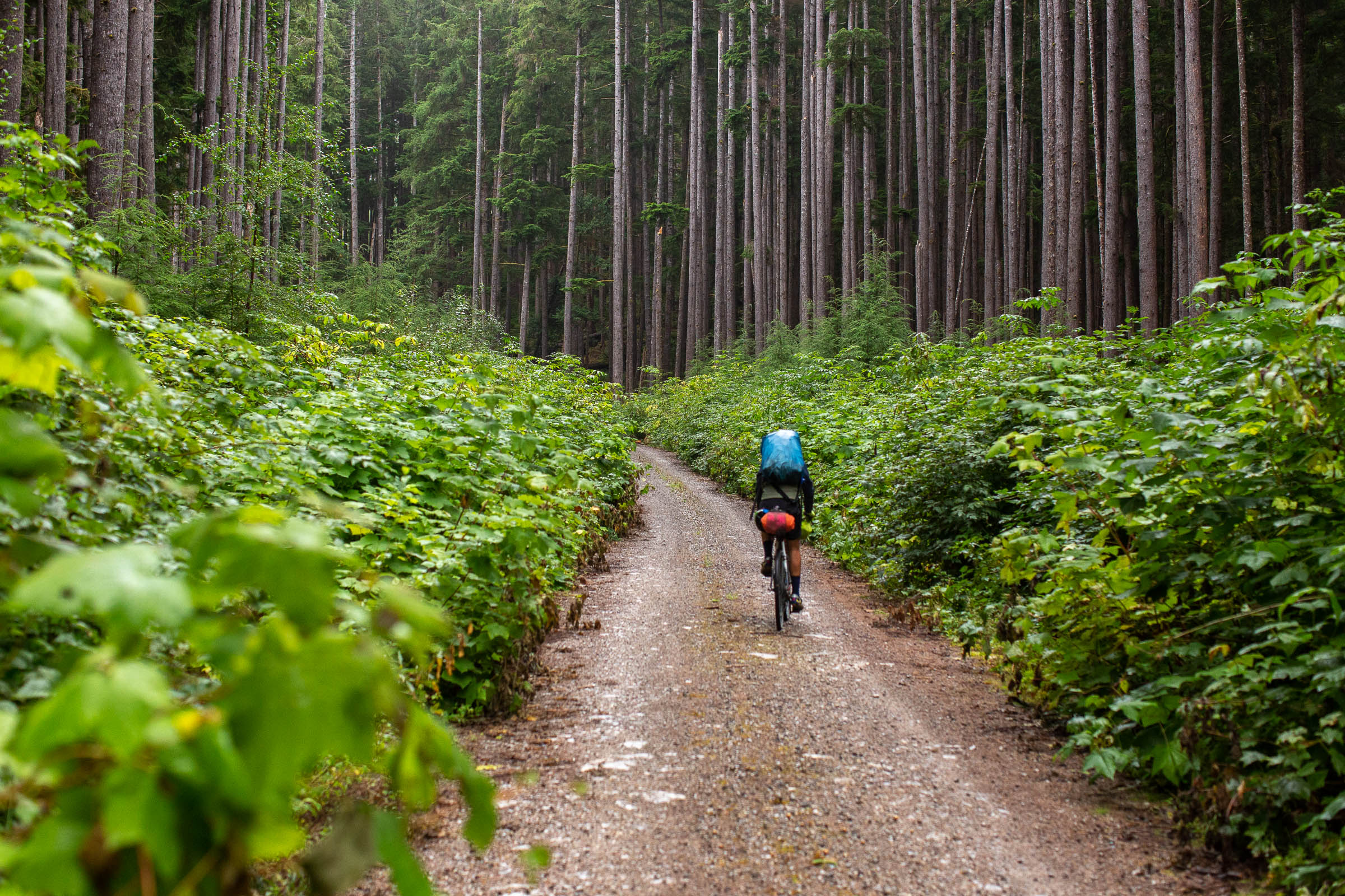
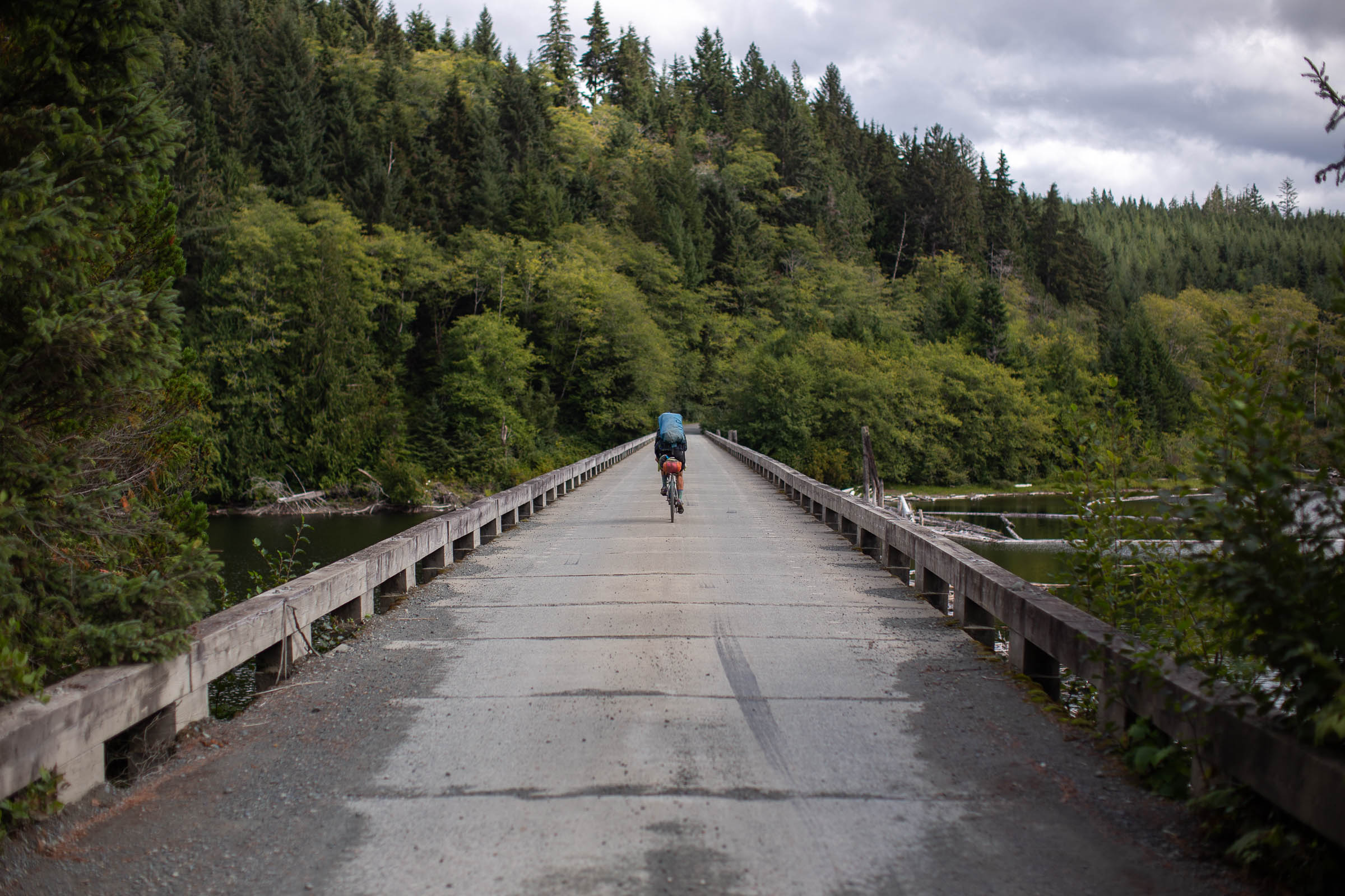
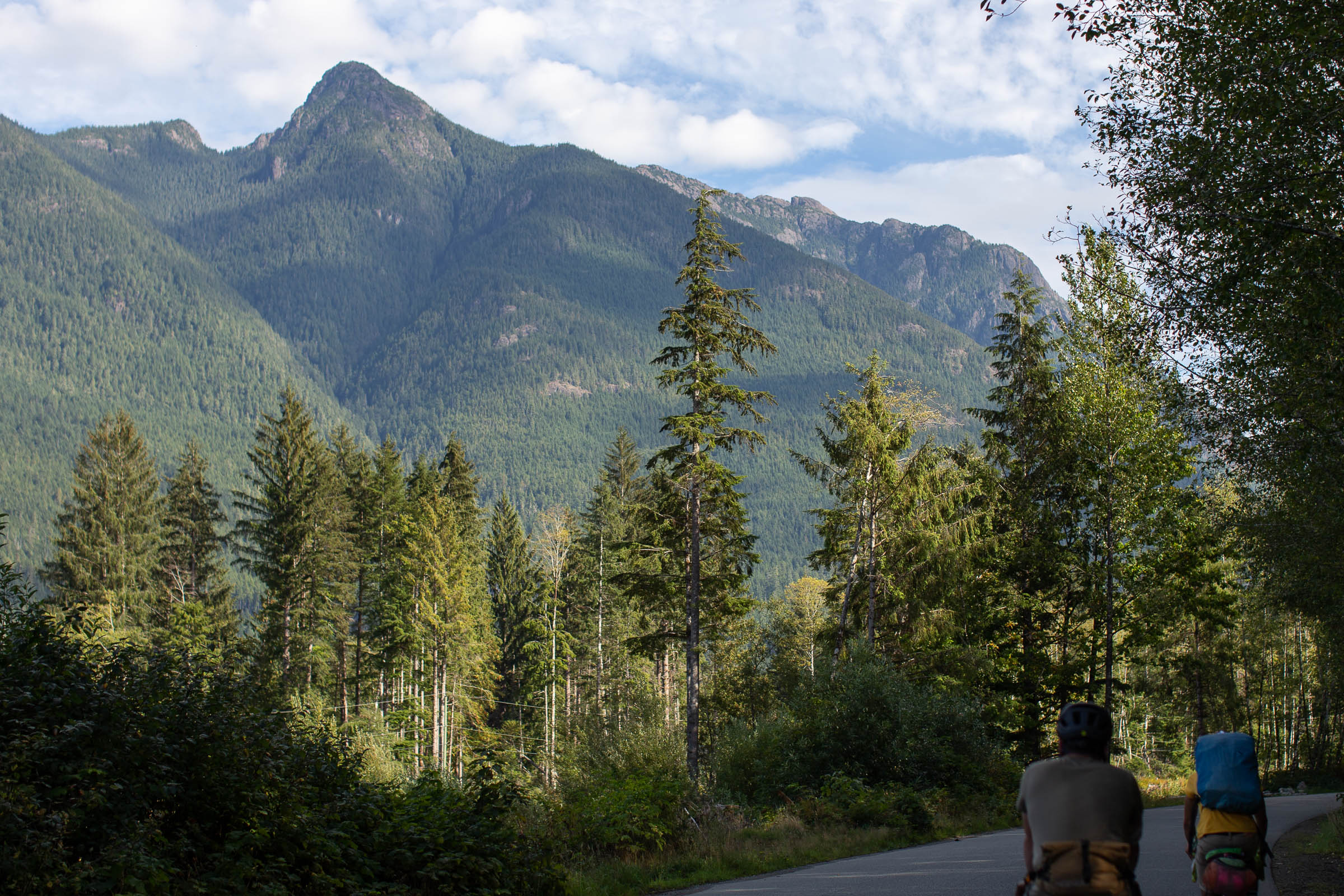
The route starts and ends at the Comox ferry terminal, just south of Campbell River. While the Old Island Highway (19A) could be used to connect the ferry up to Campbell River, we opted to keep things interesting and away from traffic by linking several multi-use paths and side roads together along the coast, eventually skirting inland just north of Oyster River. From there, a short section of chunky gravel roads sneaks behind the Campbell River – Jubilee Airport, joining with the Elk River Mainline which runs parallel to the paved Gold River Highway (Hwy 28), taking riders all the way to Upper Campbell Lake and the Upper Campbell Reservoir Campground. The next 130 kilometers loop up and around Strathcona Provincial Park back down towards Gold River. This section is remote and without services or many established campgrounds. Some may opt to ride the highway to Gold River instead.
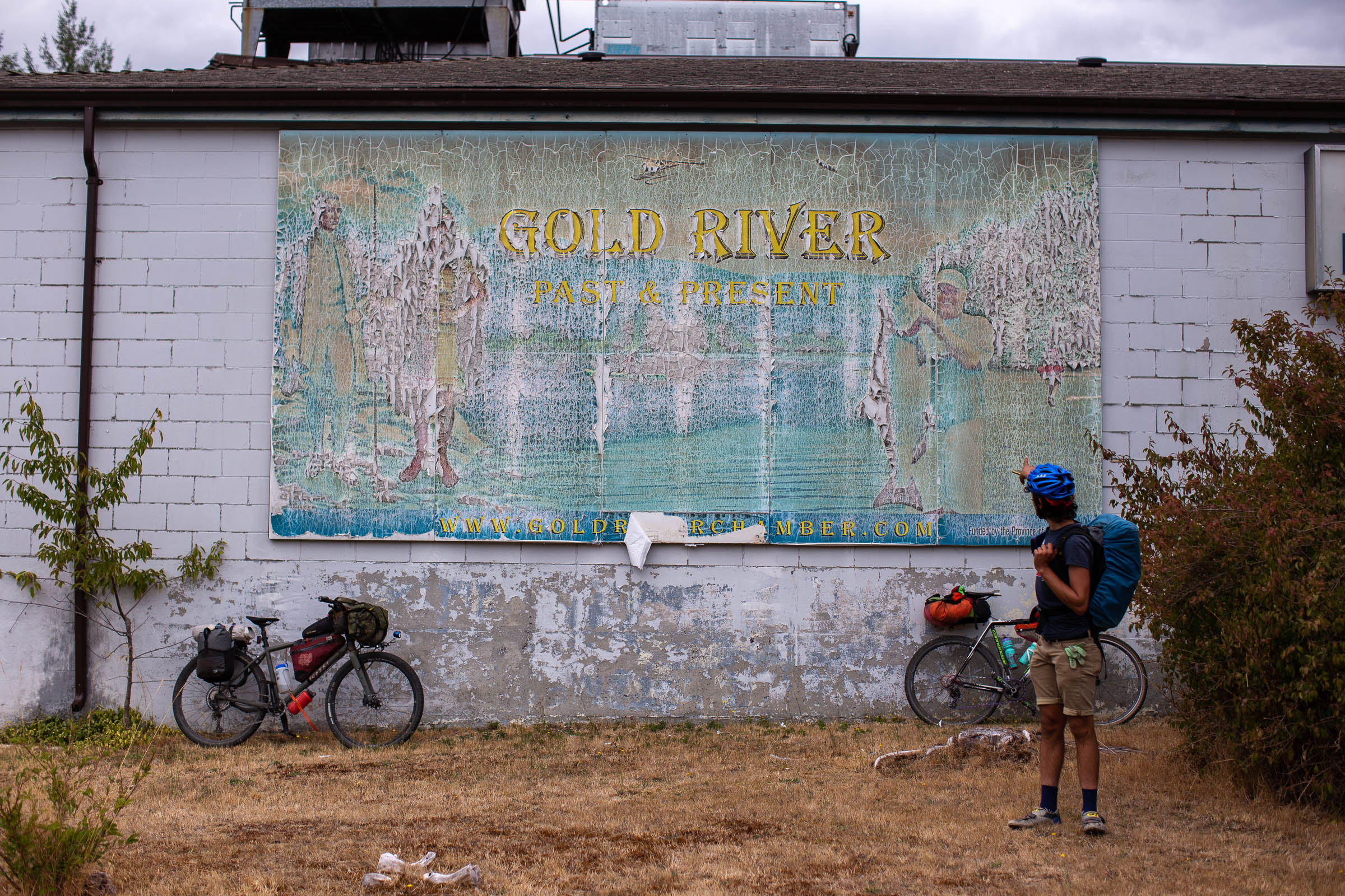
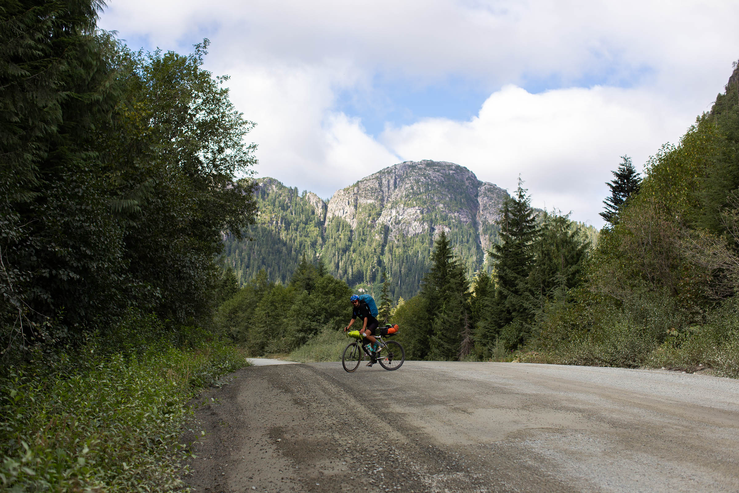
Gold River to Zeballos
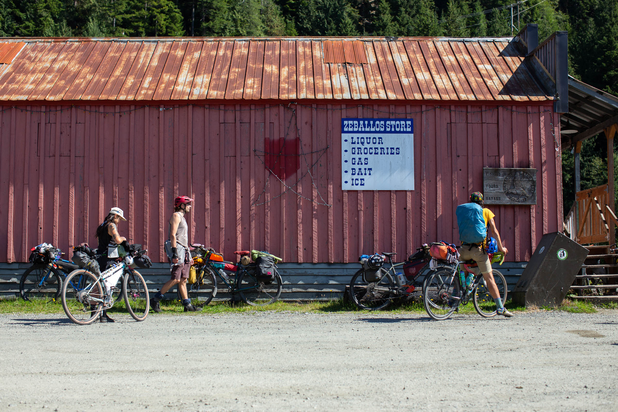
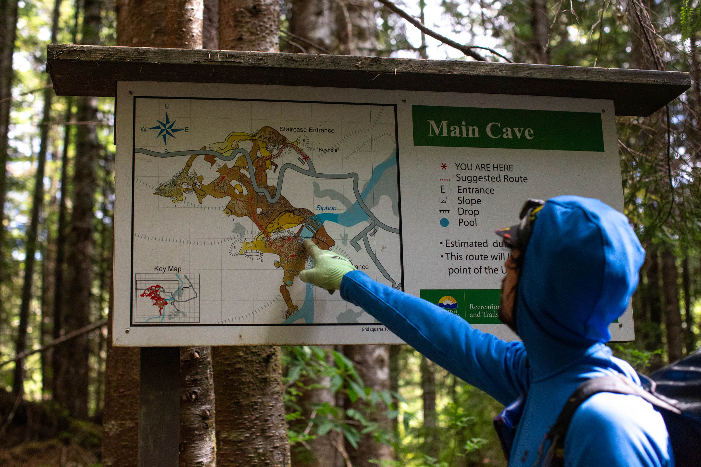
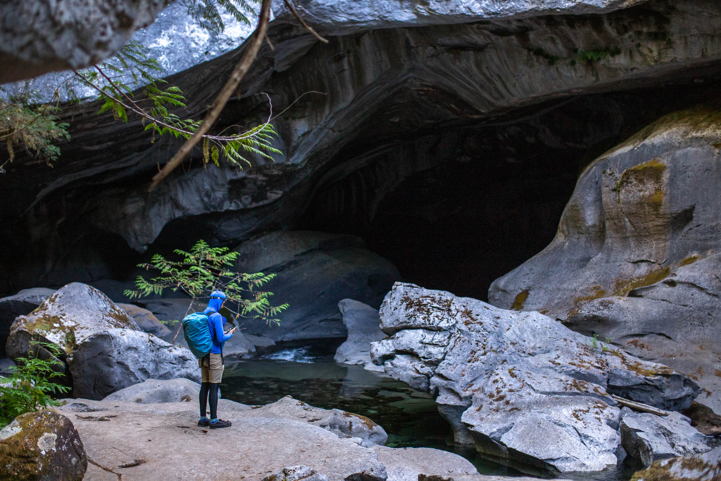
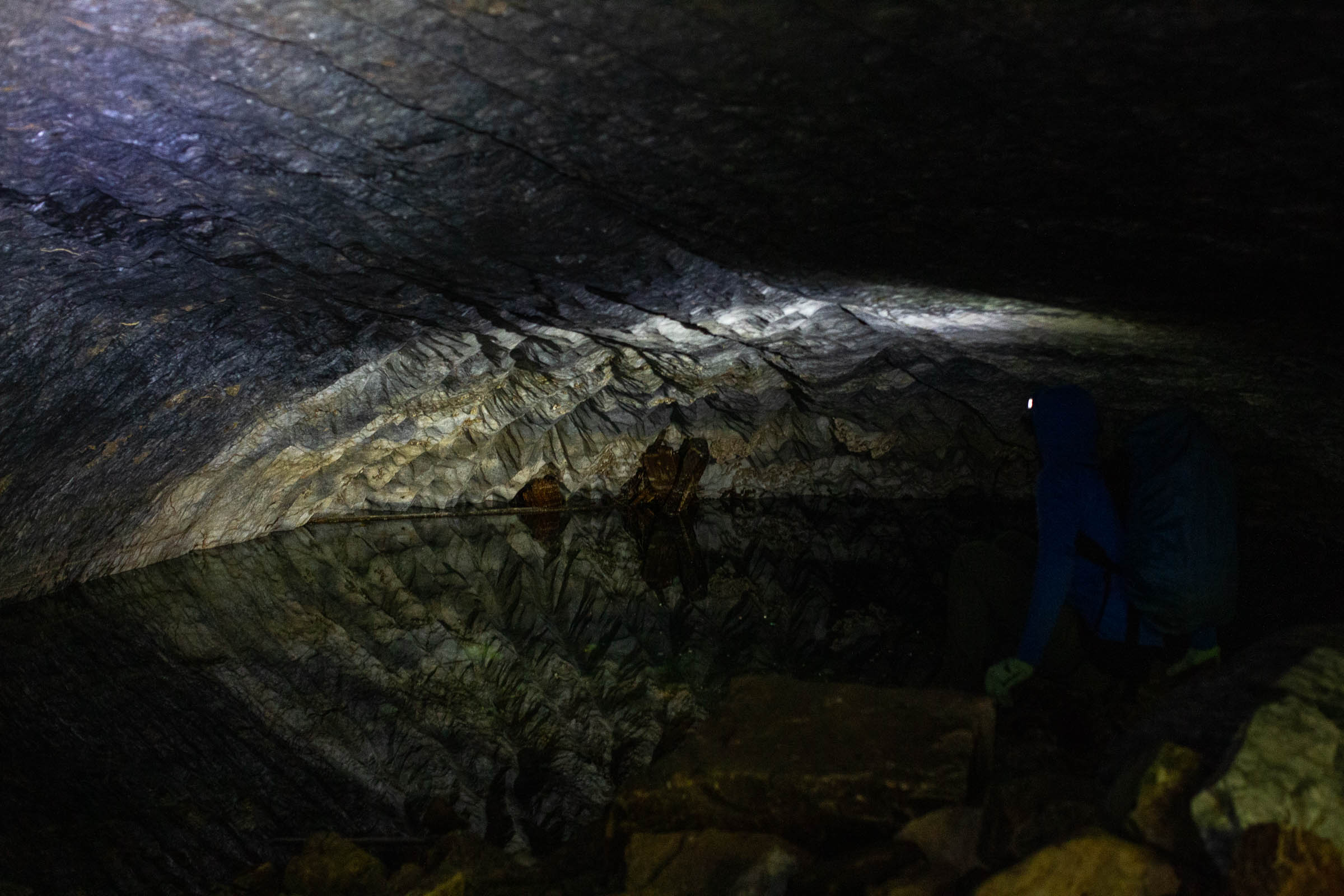
Some of the most beautiful views of the entire route are between Gold River and Zeballos. After a coffee in Gold River, you’ll climb up towards Tlupana Peak, passing by Cala Creek Falls and Upana Caves along the way. It’s easy to spend a few hours exploring the massive underground cave system, and it also serves as a great place to have lunch. After the massive descent down to Moutcha Bay Resort, the route continues northwest to the beautiful Leiner River Rec Site and the town of Tahsis. Until the Unity Trail connecting to Zeballos is complete, a water taxi from Tahsis to Zeballos will need to be pre-booked to continue on the route. Otherwise, another option would be to head north from Gold Muchalat Provincial Park towards Woss, rejoining the route at the south end of Nimpkish Lake. Finding a group to split the cost of a water taxi makes for an amazing experience though, and is well worth it.
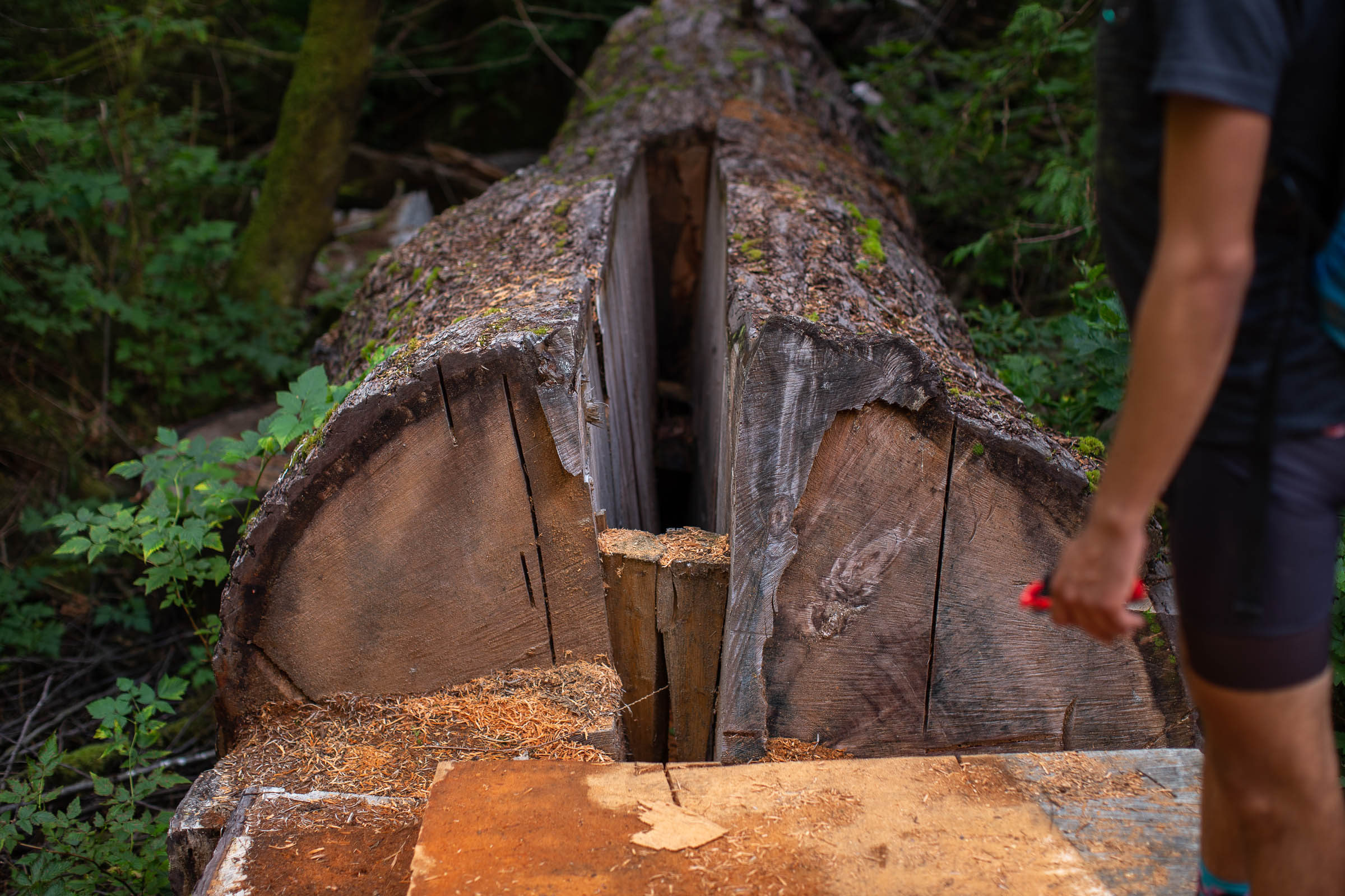
Zeballos to San Josef Bay
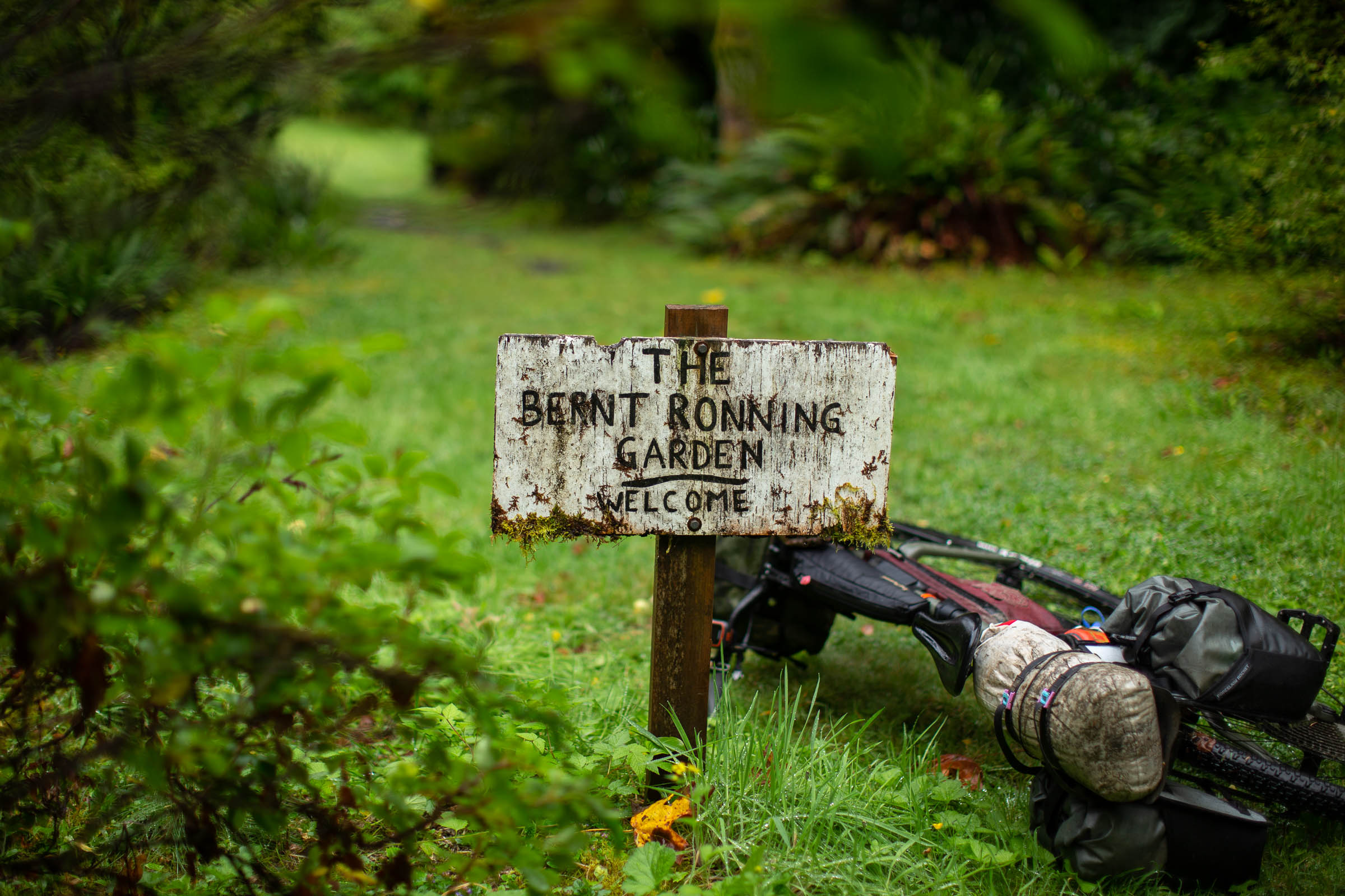
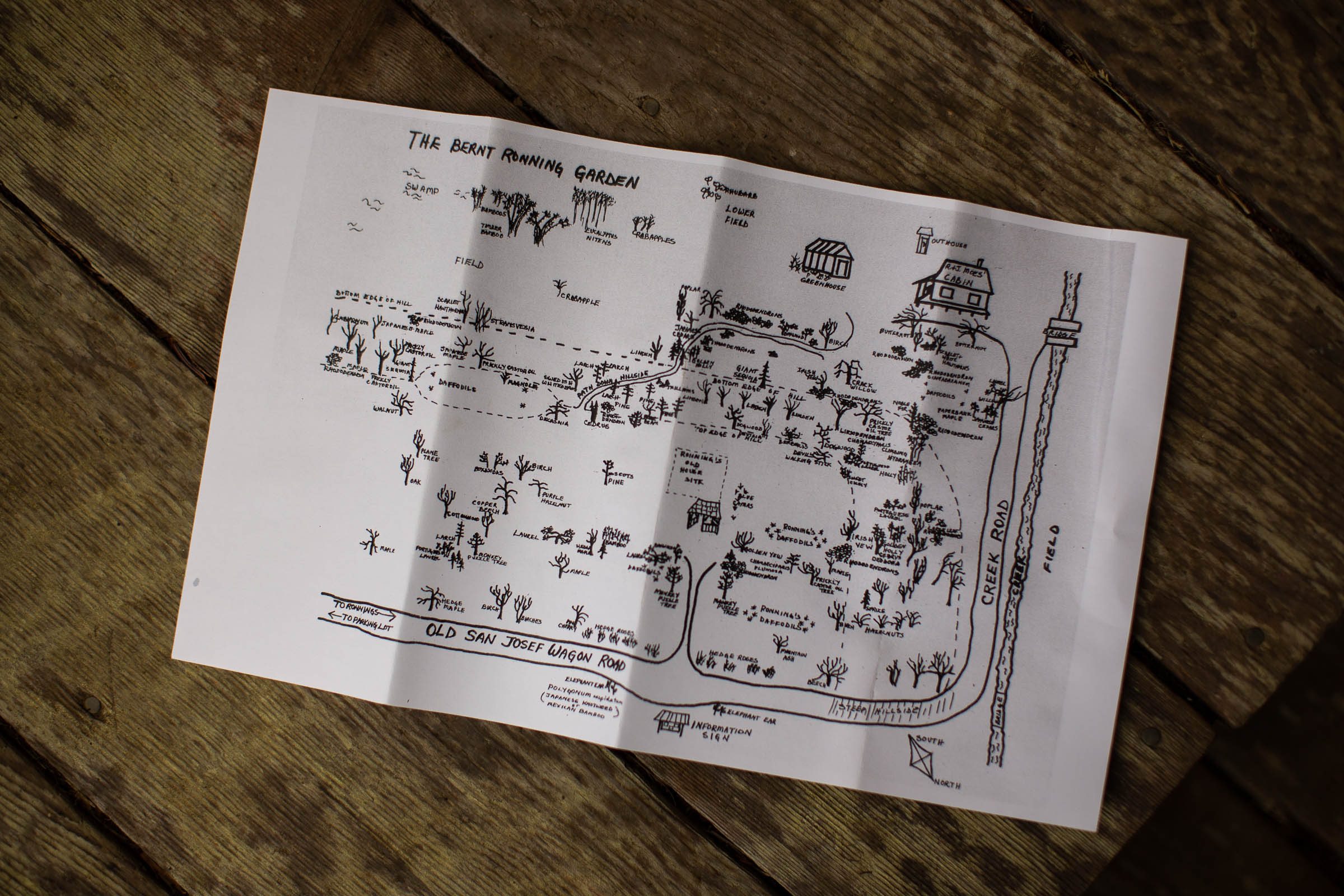
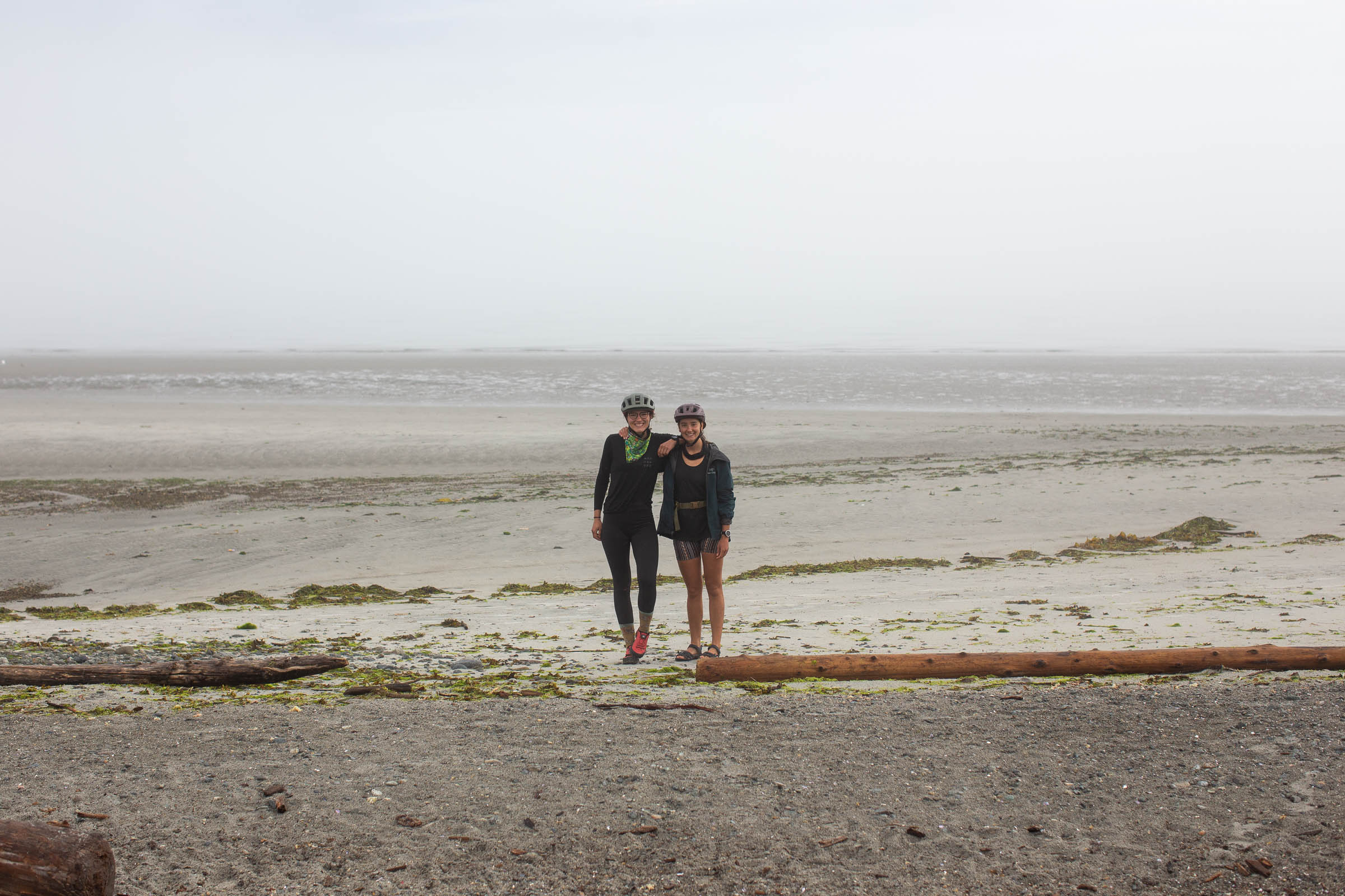
The wide gravel climb north from Zeballos leads to the next spelunking opportunity at Little Huson Caves. These caves are much larger than Upana, some of which are above ground and equally beautiful. From there, the route continues to the town of Port Alice, and the next major resupply point. Don’t forget to stop by Foggy Mountain Coffee Co. while you’re there. One of the more remote sections of the route is from Port Alice to Coal Harbour, looping around Rupert Inlet on forest service roads and sometimes rough doubletrack. Mostly rolling wide gravel roads run north along the long Holberg Inlet before a steep descent down to the town of Holberg and the Scarlet Ibis Pub. From there, it’s an easy ride out to Cape Scott Provincial Park, where some folks will choose to wild camp on the magnificent beaches of San Josef Bay. Don’t forget to stop into Ronning’s Garden on the way back to Holberg.
San Josef Bay to Woss
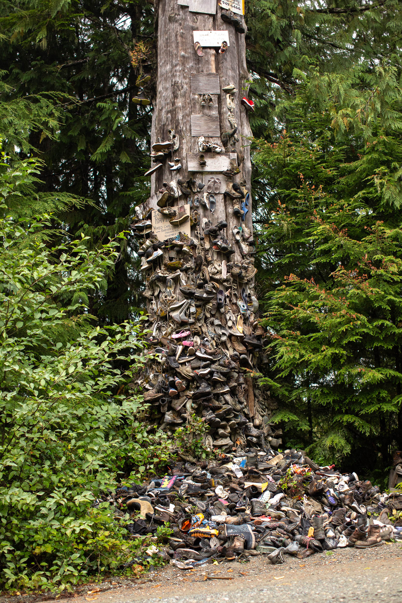
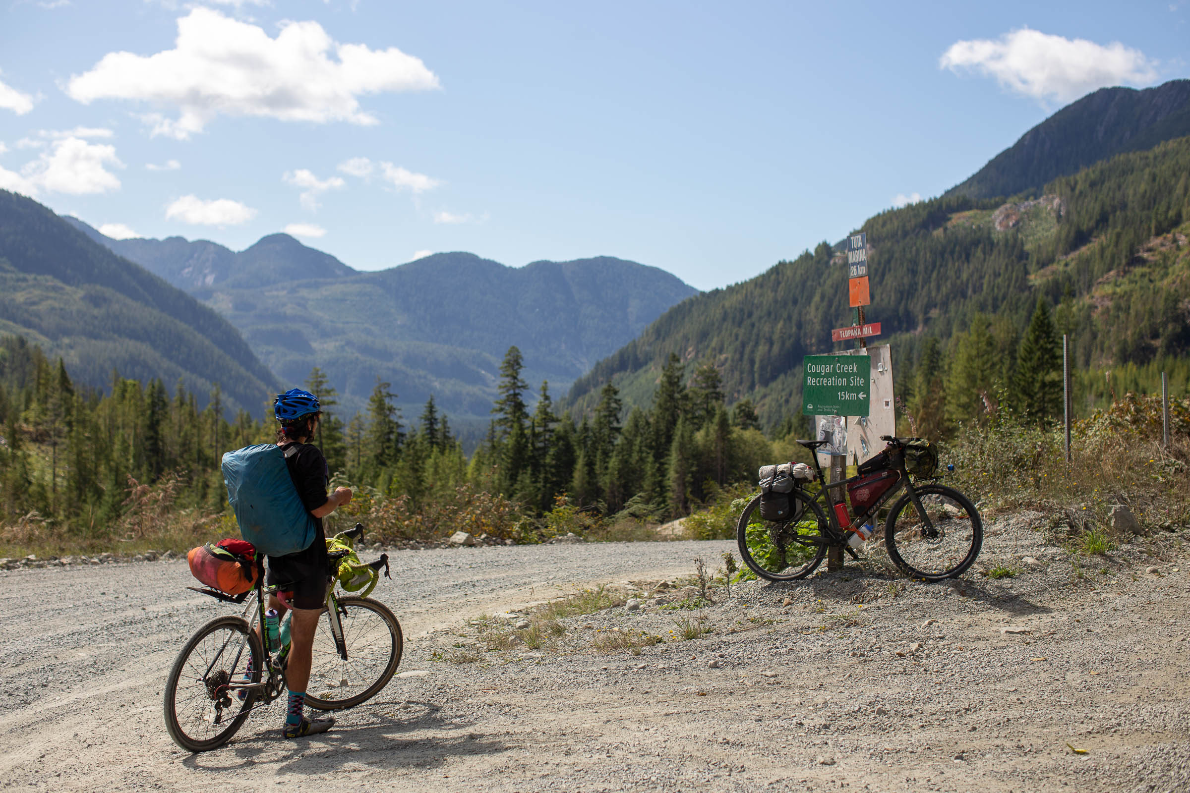
After a quick stop at the general store in Holberg, the route follows Holberg Road east to Port Hardy. Don’t forget to stop at the Holberg Shoe Tree at the eastern end of Kains Lake. Port Hardy is a well-established town with a few different campsites, a well-stocked grocery store, and a good coffee shop. Skirting on and off the highway, the route continues to Port McNeill, where you’ll find grocery stores, campgrounds, and most importantly, the world’s biggest burl. Those with extra time should consider an optional ferry ride to Malcolm Island and the charming town of Sointula, an old Finnish utopian settlement that is definitely worth a visit. Gravel roads lead to the northern tip of Nimpkish Lake, looping back to the coast and eventually Telegraph Cove. This popular tourist destination has options for lodging, camping, and wildlife tours, providing a great layover or lunch spot. Head south along the eastern shores of Ida and Bonanza Lake, two beautiful options for camping and swimming, before arriving in the small town of Woss, just off Highway 19.
Woss to Campbell River
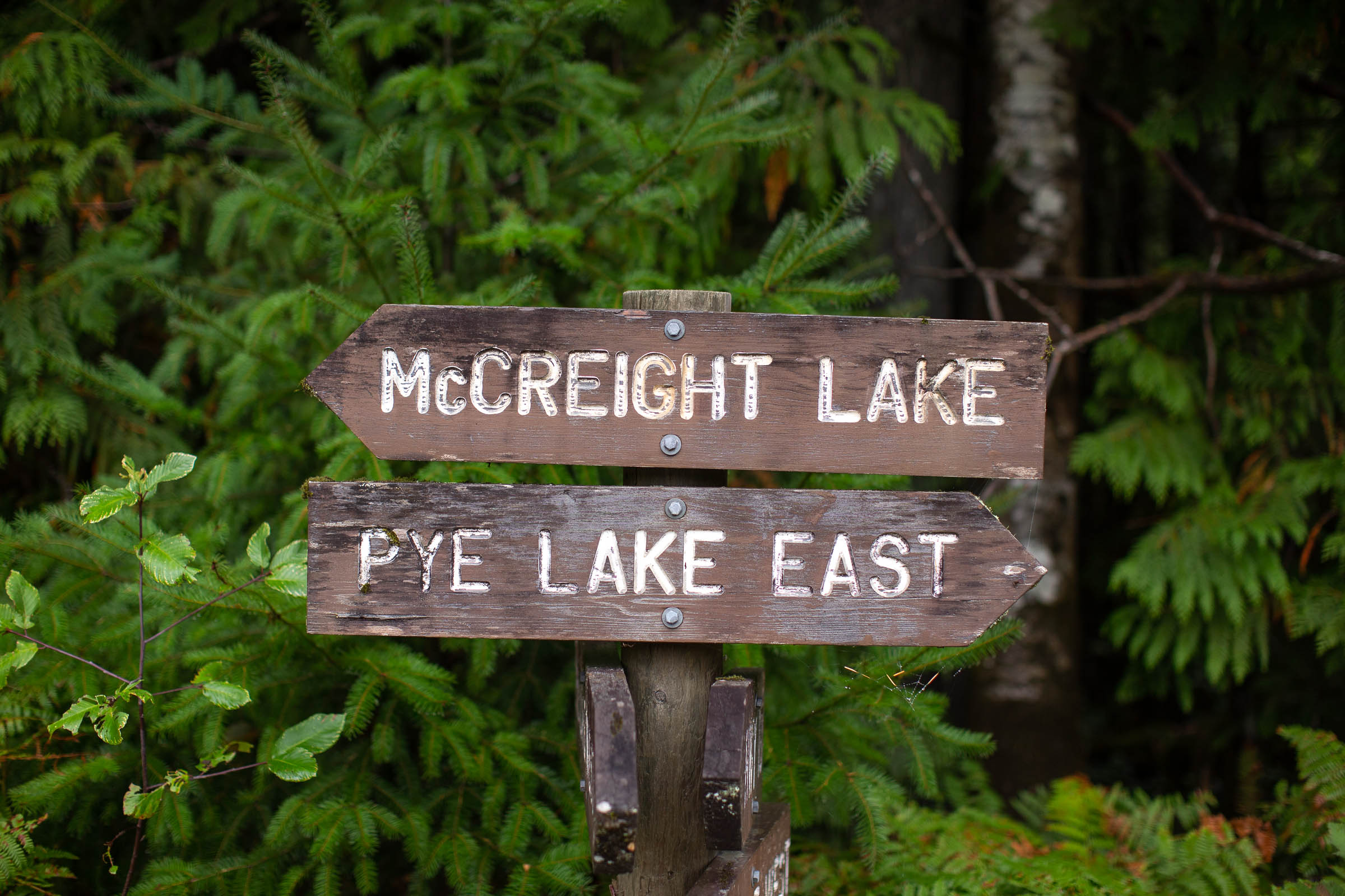
The final stretch from Woss to Campbell River has some of the most scenic oceanside camping opportunities on the entire route. Naka Creek rec site, while popular and often busy, has great whale watching and is worth a visit. A long climb and steep descent lead to the small town of Sayward—head north off route to Kelsey Bay for more great views. Sayward Junction serves as an important resupply point along the route, with several different camping options nearby, as well as a pub (if it’s open). East of the Prince of Whales Range, the route passes by McCreight Lake and Stella Lake, both are great spots for camping. The last big climb of the route heads south from Elk Bay, towards the highway, and the Iron River Main FSR towards Elk Falls Provincial Park and Campbell River. The route rejoins with itself just north of Oyster River, following a multi-use rail trail and a short section of the Island Highway south from Campbell River.


Terms of Use: As with each bikepacking route guide published on BIKEPACKING.com, should you choose to cycle this route, do so at your own risk. Prior to setting out check current local weather, conditions, and land/road closures. While riding, obey all public and private land use restrictions and rules, carry proper safety and navigational equipment, and of course, follow the #leavenotrace guidelines. The information found herein is simply a planning resource to be used as a point of inspiration in conjunction with your own due-diligence. In spite of the fact that this route, associated GPS track (GPX and maps), and all route guidelines were prepared under diligent research by the specified contributor and/or contributors, the accuracy of such and judgement of the author is not guaranteed. BIKEPACKING.com LLC, its partners, associates, and contributors are in no way liable for personal injury, damage to personal property, or any other such situation that might happen to individual riders cycling or following this route.
Please keep the conversation civil, constructive, and inclusive, or your comment will be removed.