


Lower Dolores Canyon Scramble
Distance
79 Mi.
(127 KM)Days
2-3
% Unpaved
100%
% Singletrack
0%
% Rideable (time)
98%
Total Ascent
6,615'
(2,016 M)High Point
8,481'
(2,585 M)Difficulty (1-10)
9?
- 5Climbing Scale Moderate84 FT/MI (16 M/KM)
- 9Technical Difficulty Very Difficult
- 9Physical Demand Very Difficult
- 9Resupply & Logistics Very Strenuous
Contributed By

Sarah Swallow
Contributing Editor
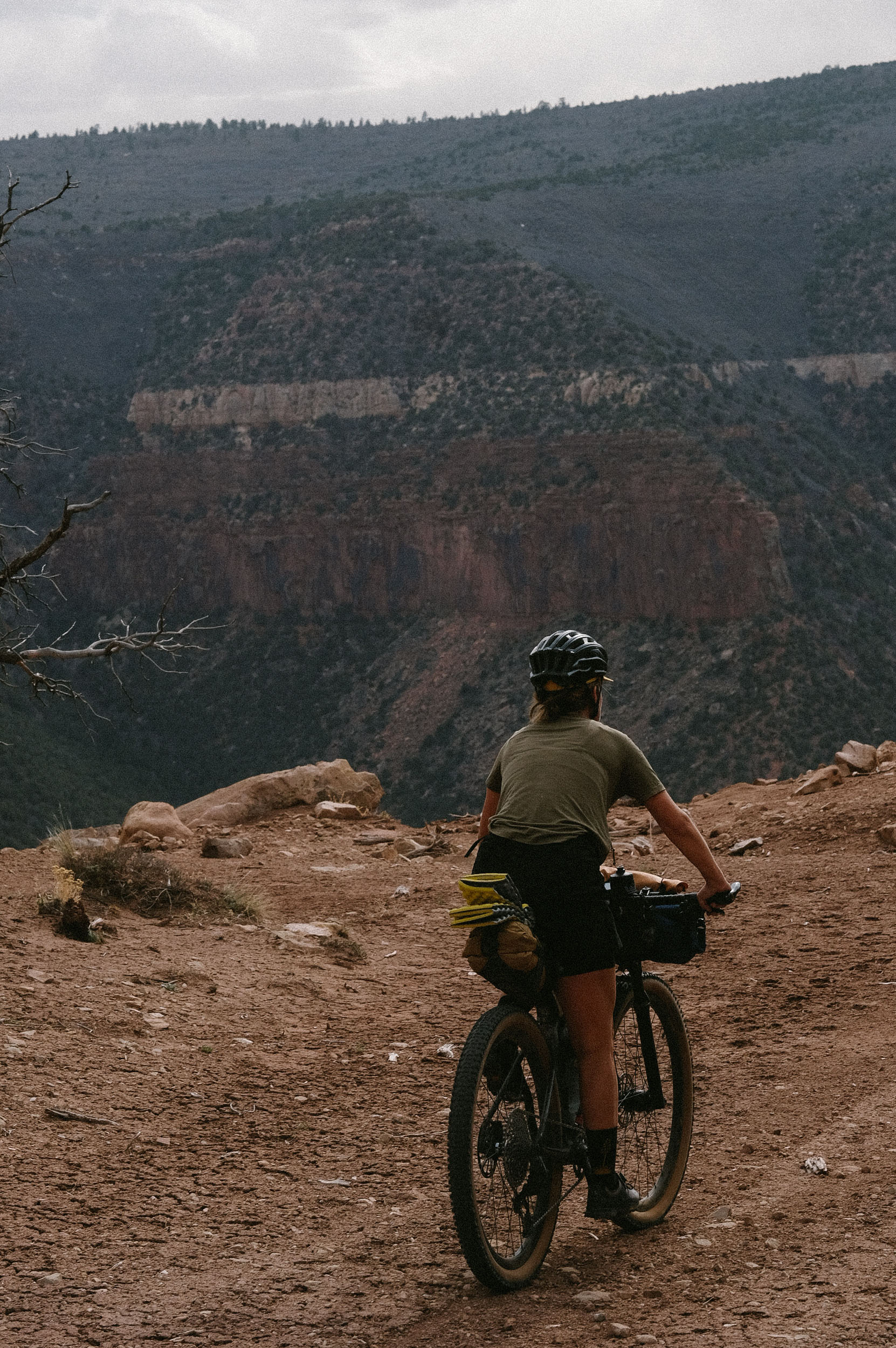
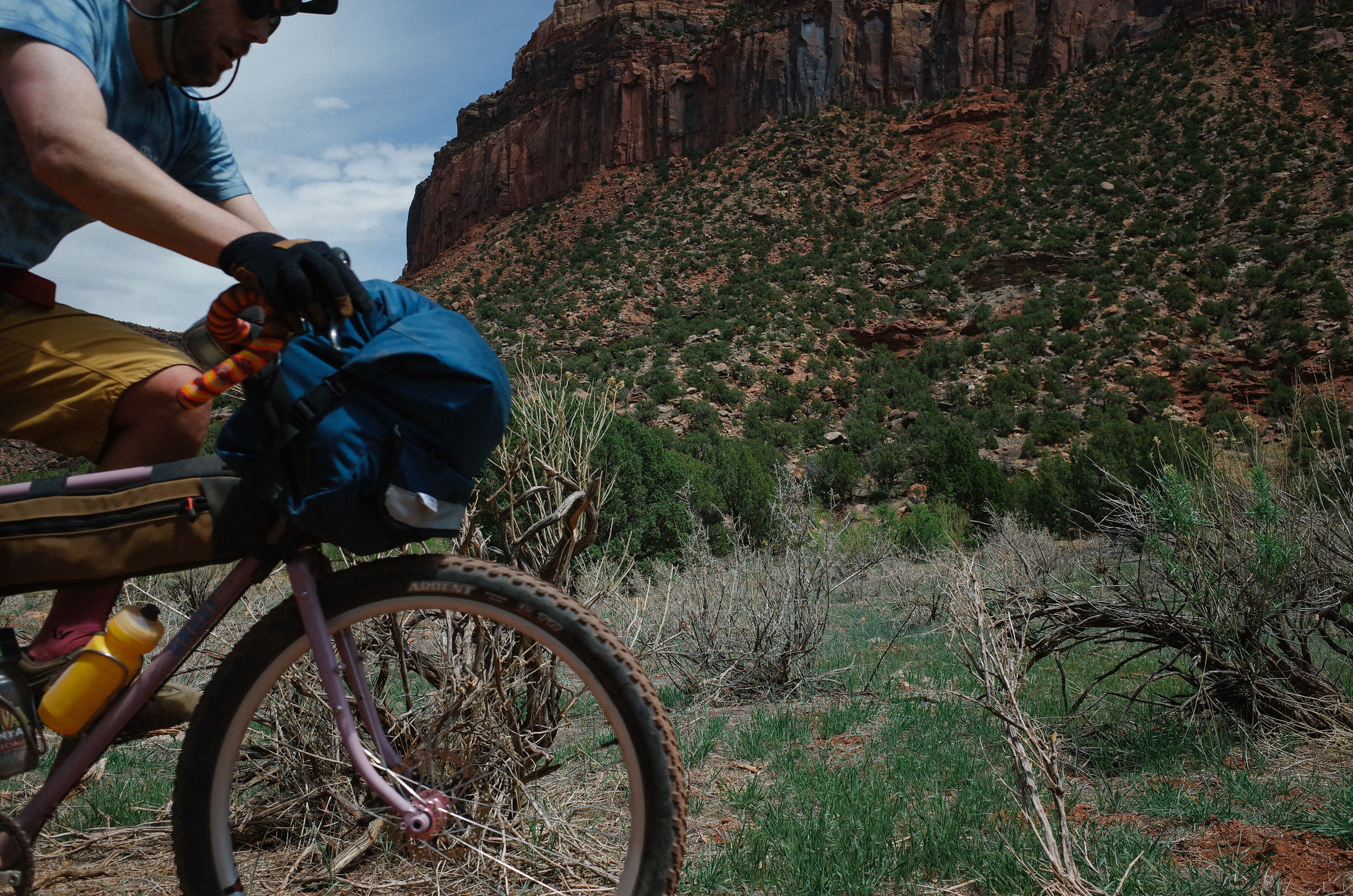
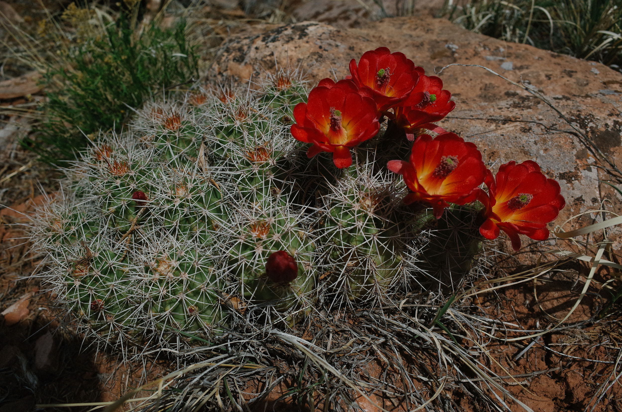
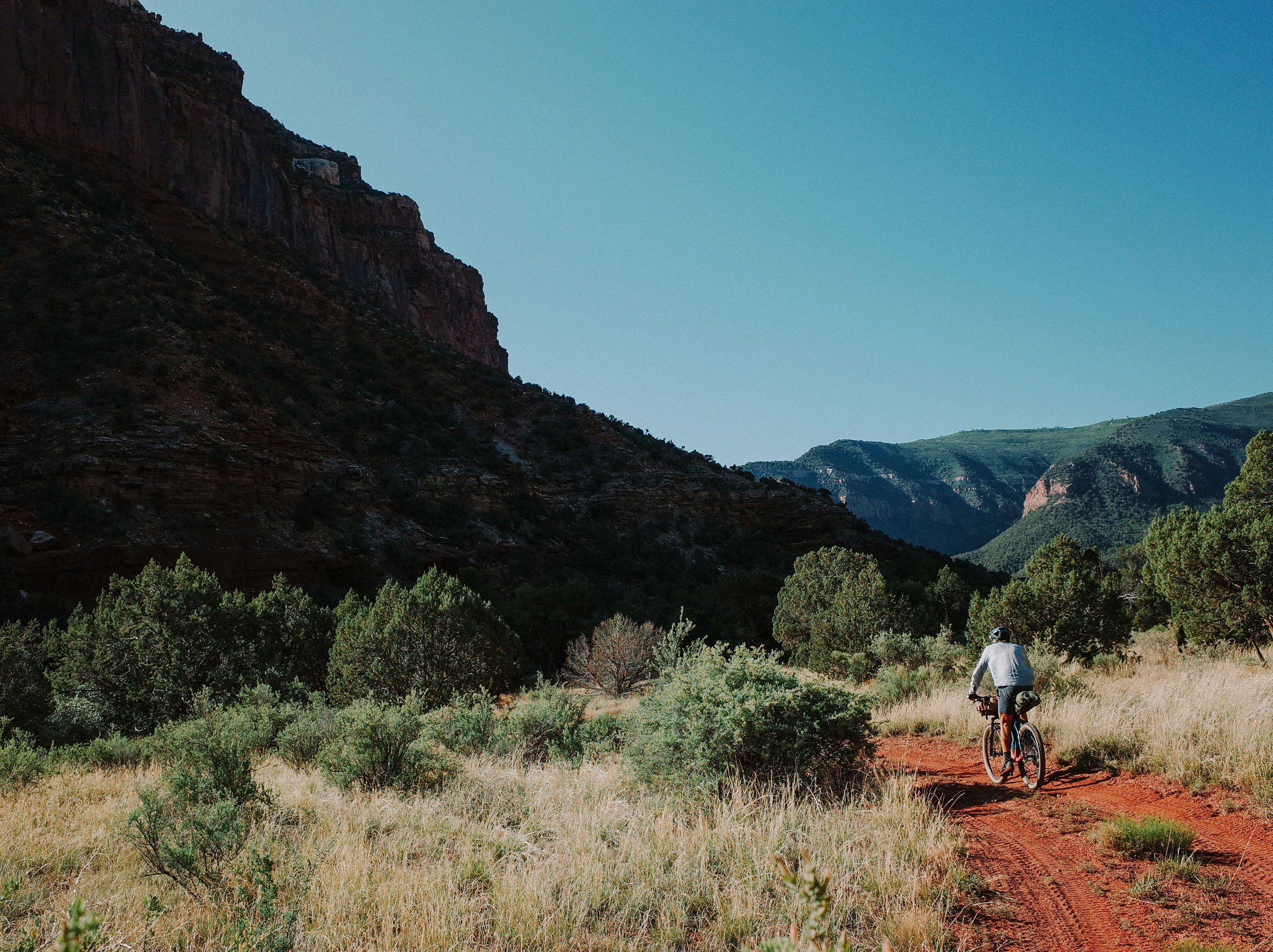
The Lower Dolores Canyon Scramble is a rugged and remote loop that circumnavigates one of Colorado’s most spectacular and least-traveled landscapes: the Lower Dolores River Canyon. Starting and ending at Bradfield Campground, near Dove Creek, CO, the route climbs high onto Lone Mesa (8,500 ft), where smooth gravel gives way to a primitive network of old mining roads that weave through a classic high desert woodland. This upper mesa environment is characterized by grassy meadows, pinyon-juniper forests, scattered ponderosa pines, and open mountain shrublands, all set against sweeping views of the Abajo, La Sal, La Plata, and Wilson mountain ranges. Wildlife sightings (beyond grazing cattle) are common, ranging from herds of elk to black bears, mule deer, and wild turkeys, especially during the shoulder seasons of spring and fall, when conditions are ideal for travel.
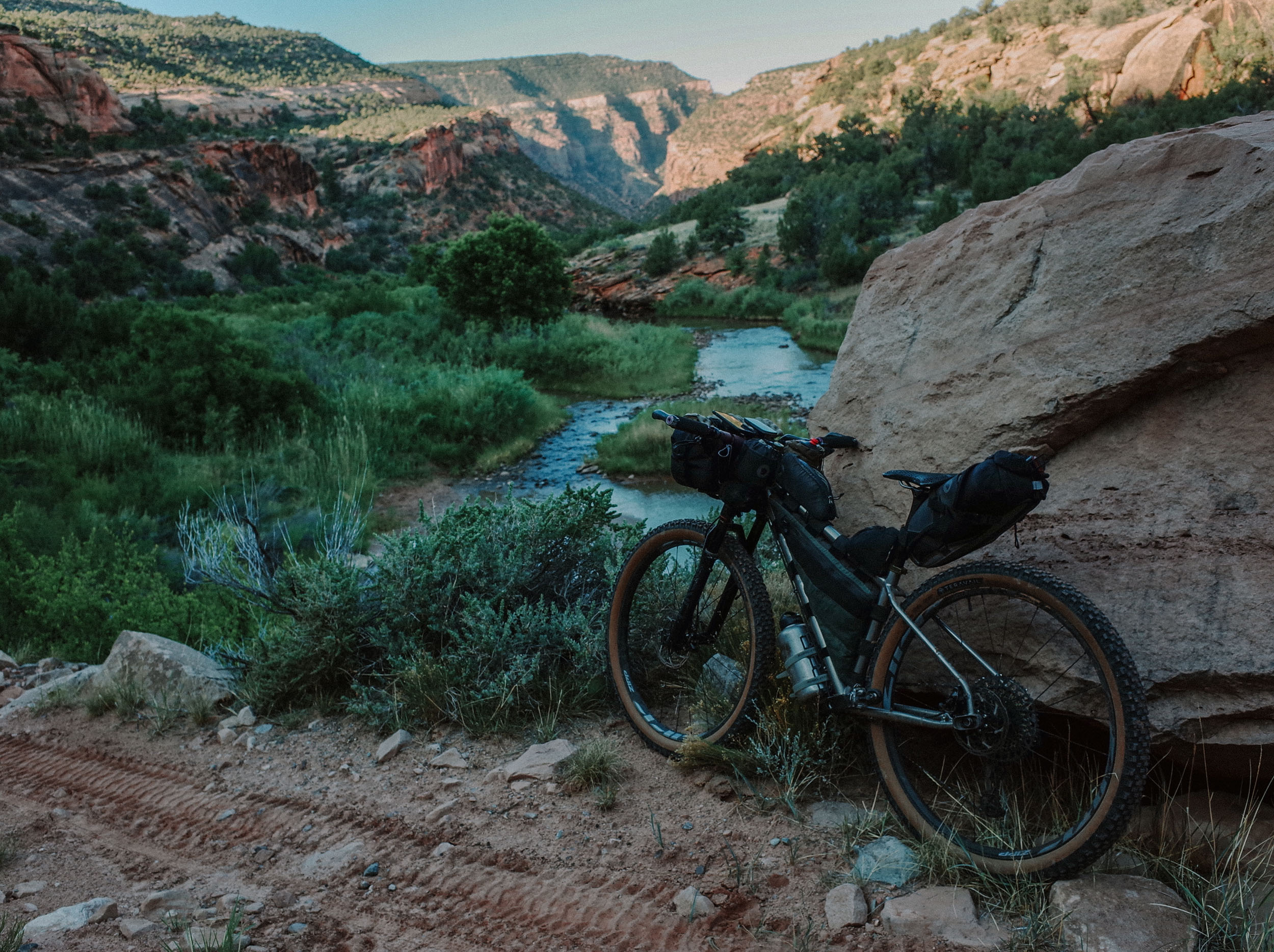
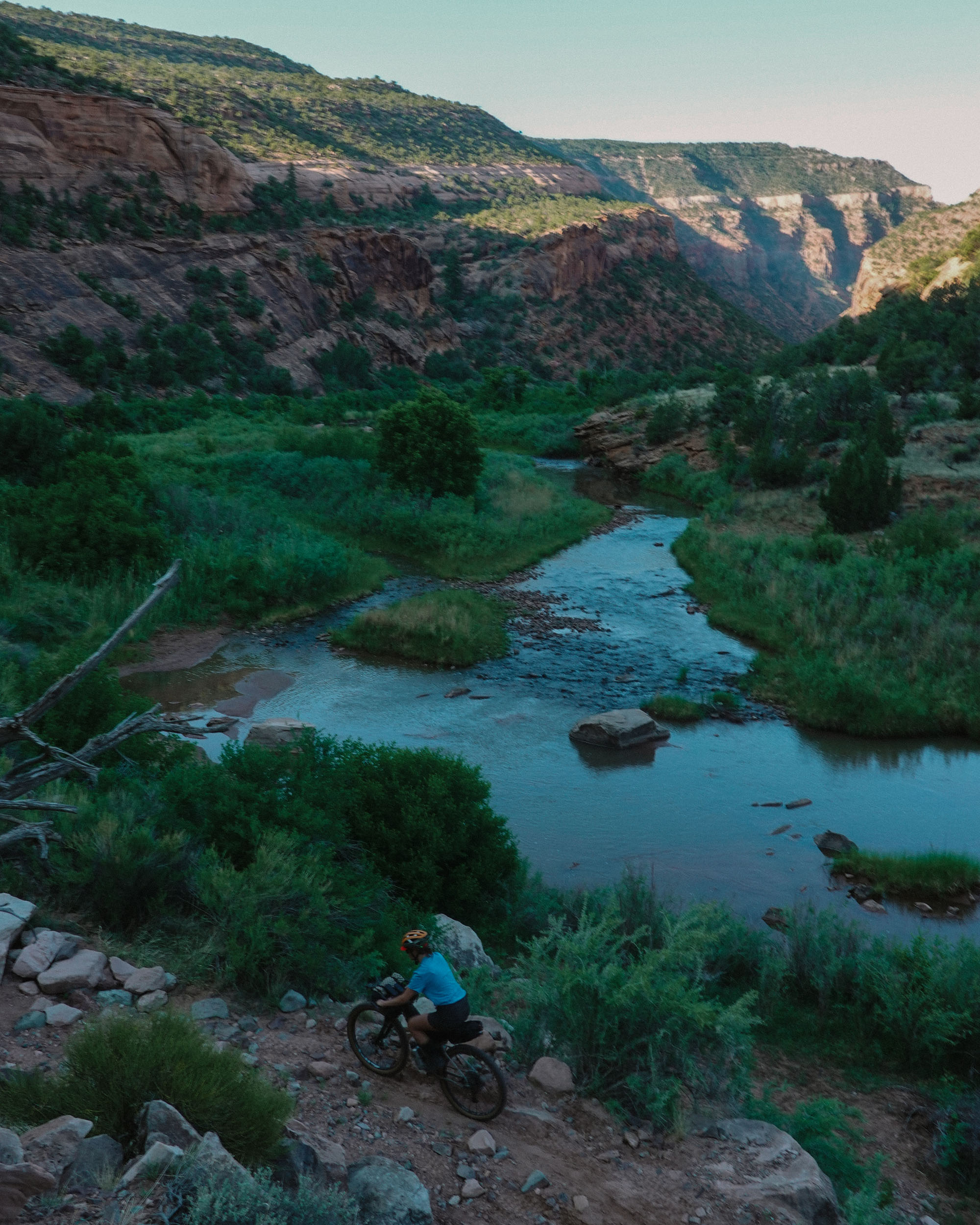
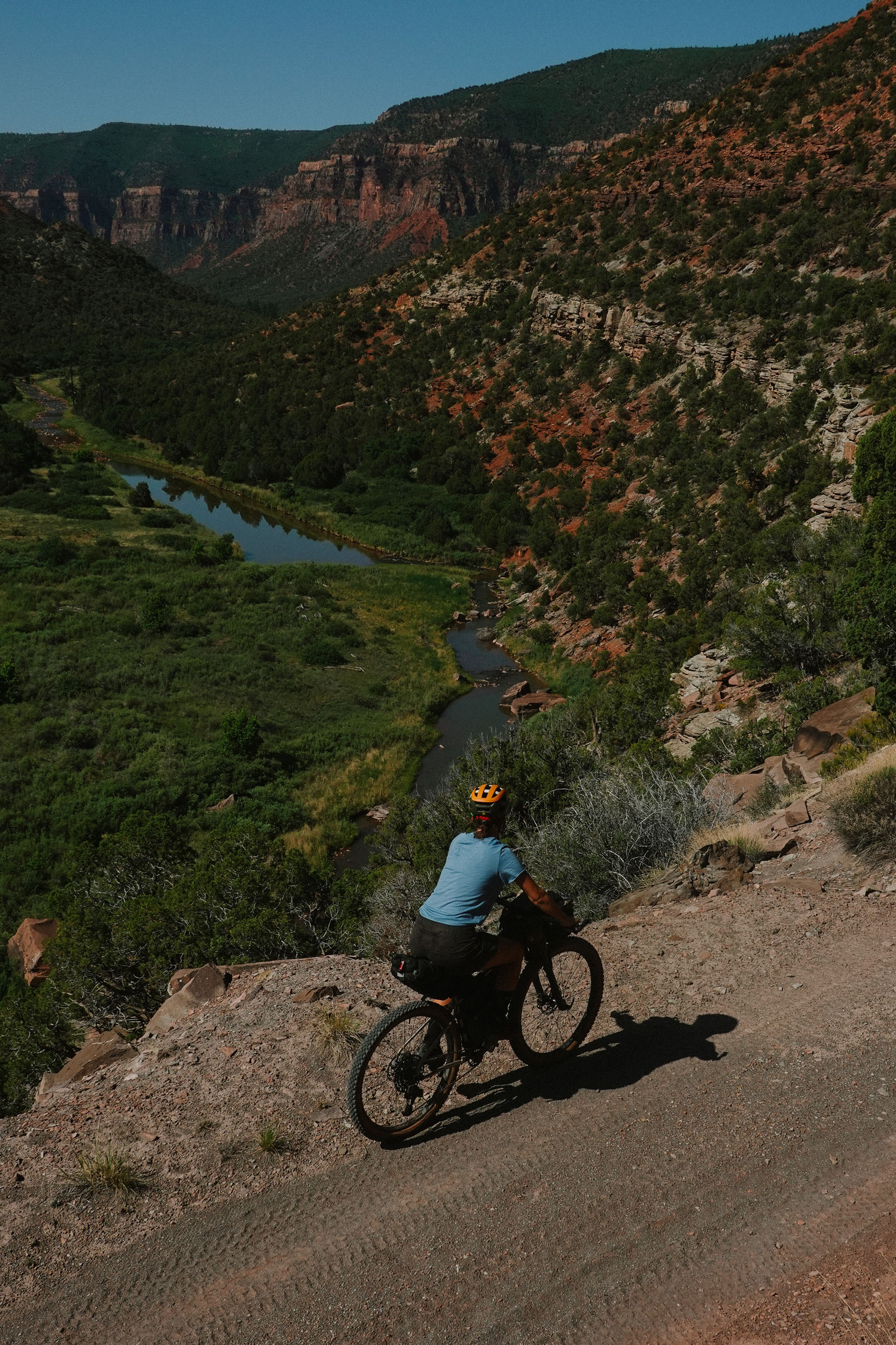
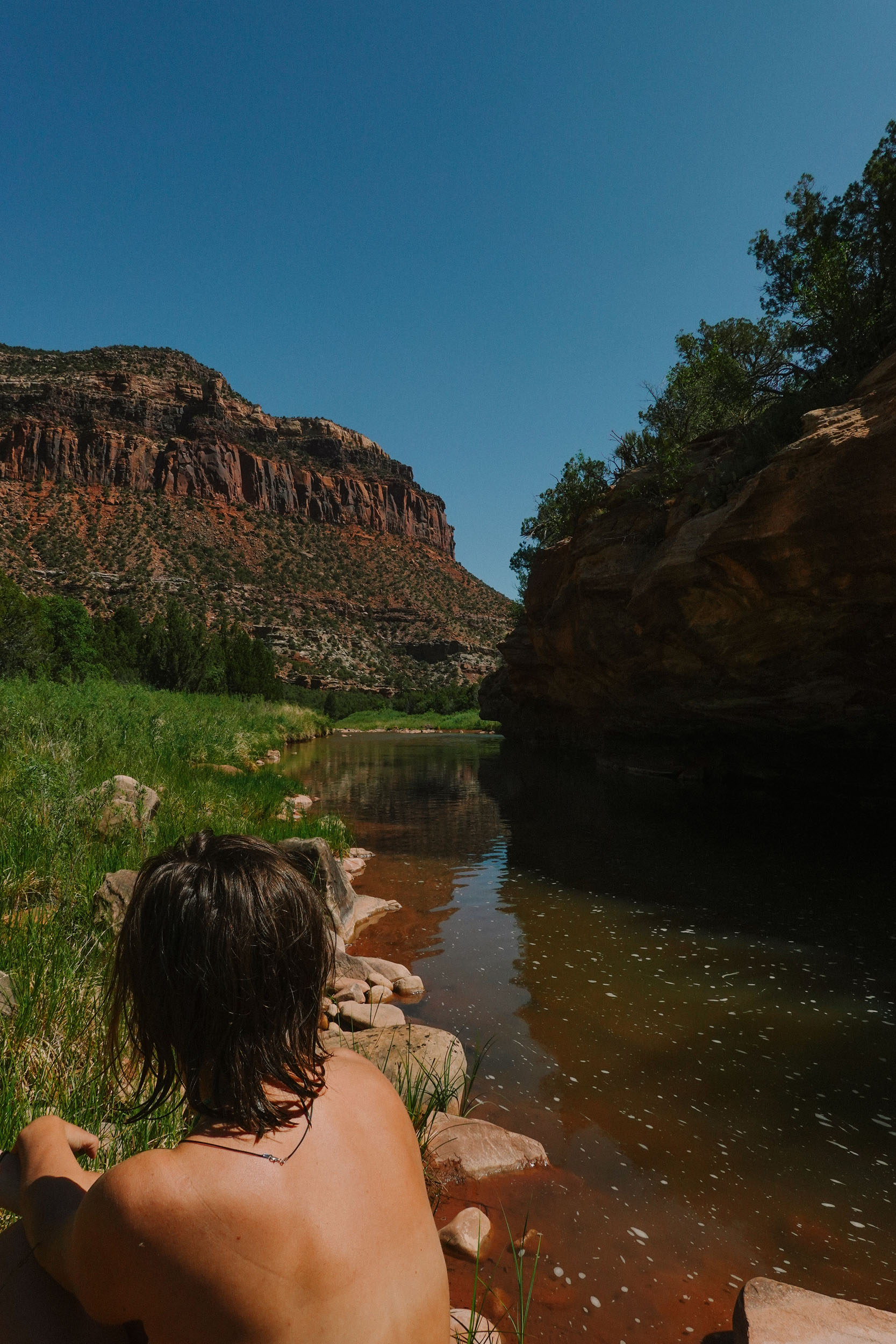
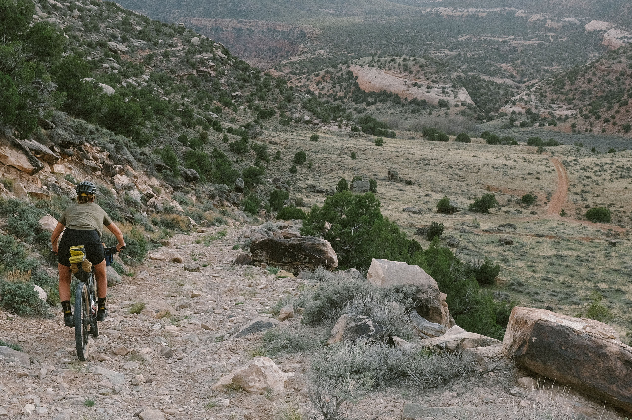
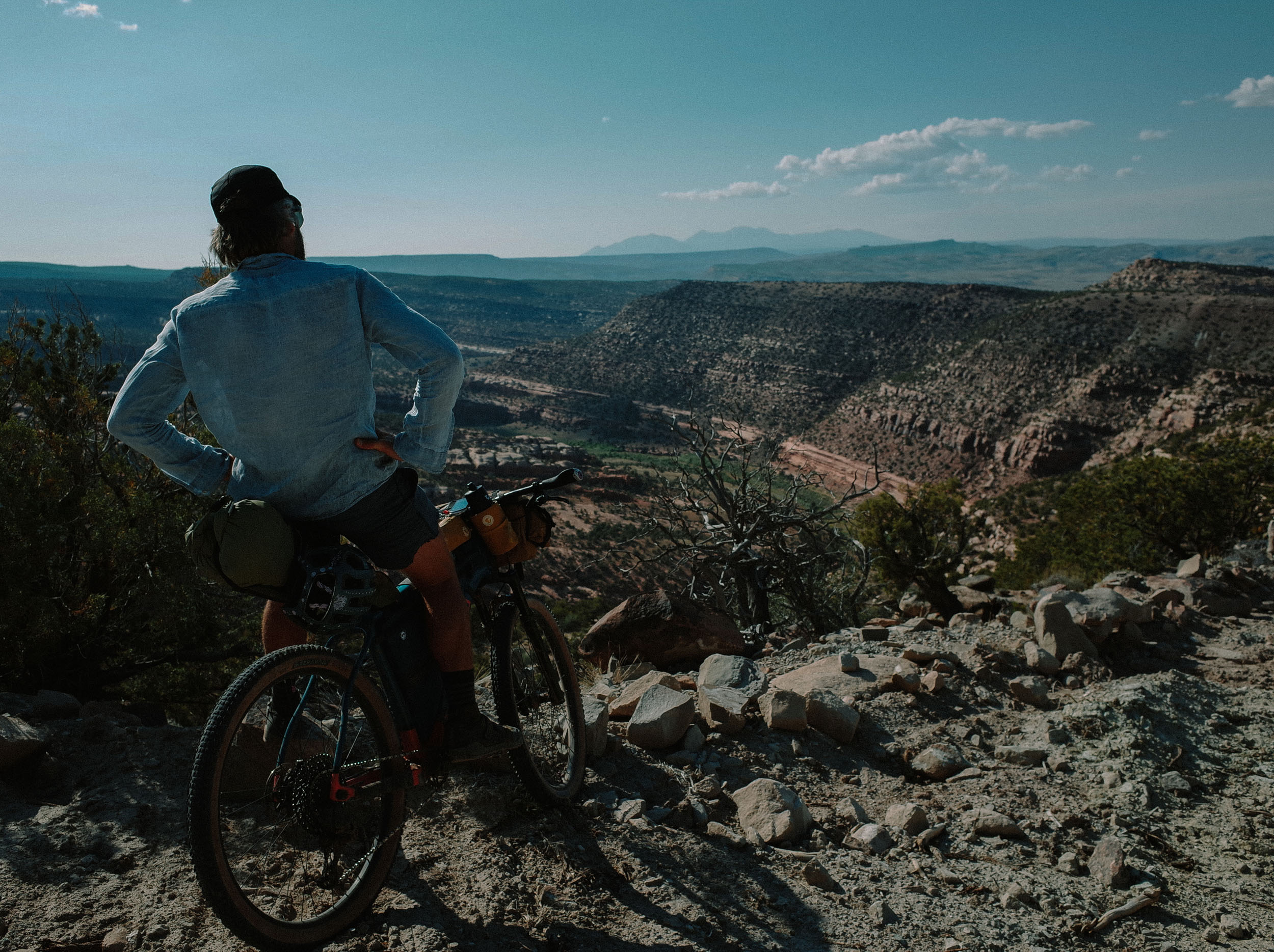
After miles of increasingly technical terrain, riders descend into the Lower Dolores River Canyon, a redrock corridor carved over millions of years into the Colorado Plateau. Towering sandstone walls rise more than a thousand feet above the river, sheltering a surprisingly lush riparian corridor filled with cottonwoods, willows, and the tracks of snakes, bighorn sheep, mountain lion, and black bear. The riding here is slow, rocky, and remote, but profoundly beautiful and engaging. For nearly 20 miles, the route hugs the river’s edge, offering quiet campsites, cool swimming holes, and an immersive experience in one of Colorado’s best-kept secrets. The canyon is also rich in ancestral Puebloan history, with archaeological sites, petroglyphs, and cultural landmarks that reflect centuries of Indigenous presence and connection to this land.


While the Dolores River once flowed freely through this landscape, its volume and vitality are now heavily regulated by the upstream McPhee Dam. In dry years, the canyon can feel still and silent, but in the rare event of a dam release, the river reawakens, restoring ecological function to the corridor and offering opportunities for class III to V whitewater rafting.
The McPhee Reservoir, located near the town of Dolores, is one of Colorado’s largest and most significant water storage projects. Completed in the 1980s as part of the federal Dolores Project, it provides irrigation for over 60,000 acres of farmland, municipal water for nearby towns, and fulfills long-standing water rights for the Ute Mountain Ute Tribe. It also supports hydropower generation and recreational use. While McPhee plays a vital role in supporting agriculture and communities throughout the region, it has drastically altered the natural flow of the Dolores River, with ecological consequences still unfolding.
In recent years, a growing coalition of conservationists, Indigenous leaders, rafters, and residents have come together to support a proposal to designate the Lower Dolores River Canyon as a national monument. The designation would protect its fragile ecosystems, cultural heritage, and watershed health, even if that means future access for bikepacking may become more limited.


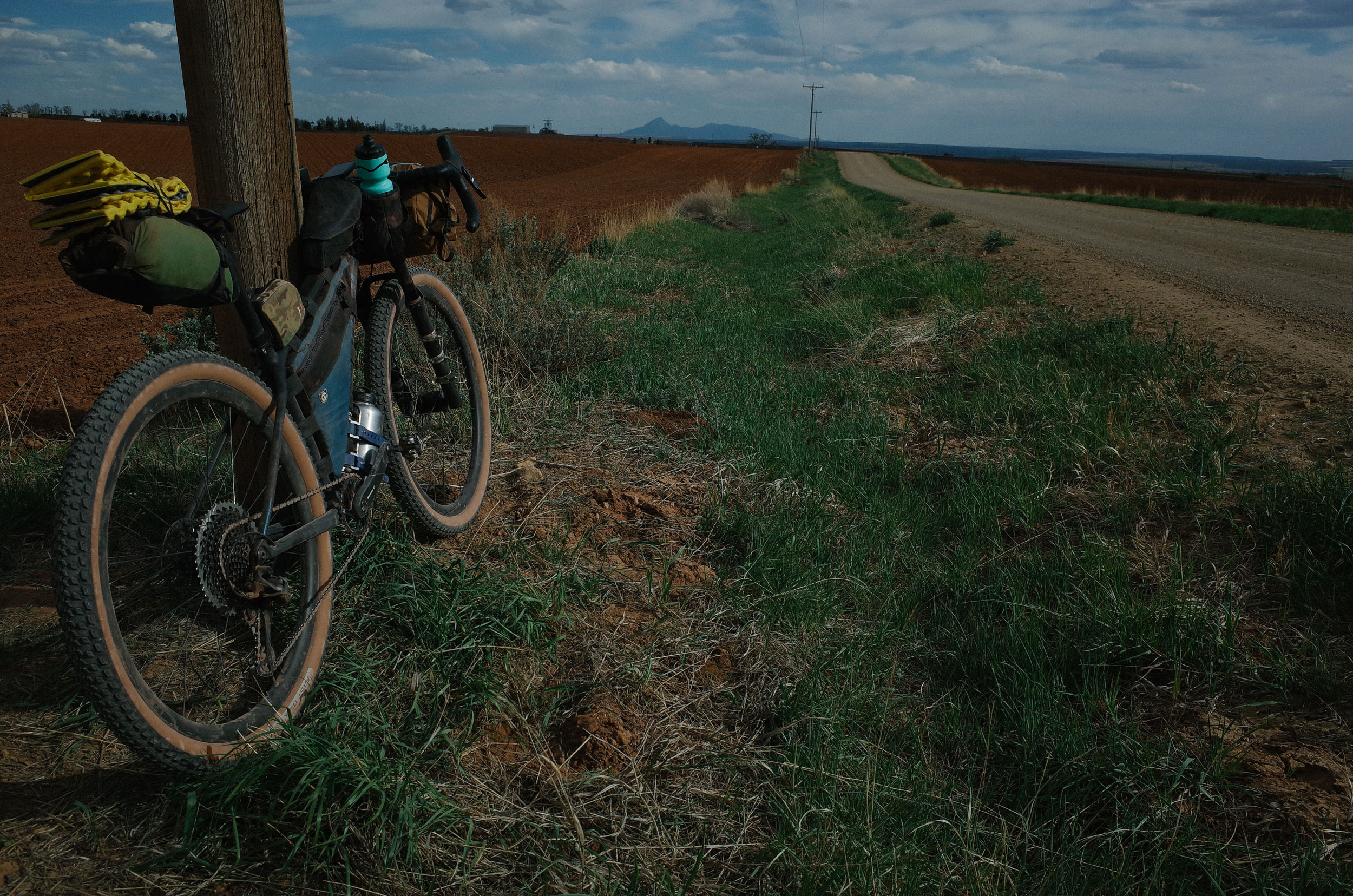
As the route climbs out of the riparian corridor and onto smooth gravel county roads zigzagging through the agricultural lands fed by the Dolores River, the complex relationship between water, land, and people in this region becomes strikingly clear.
As cyclists, we are in a unique position to experience this place while it remains accessible — and to witness firsthand why it deserves protection. This route offers not just a rugged adventure, but a space for reflection on what’s at stake, what wildness still exists, and how we might help preserve it. Enjoy it. Respect it. And if you feel called, advocate for its future.
Route Difficulty
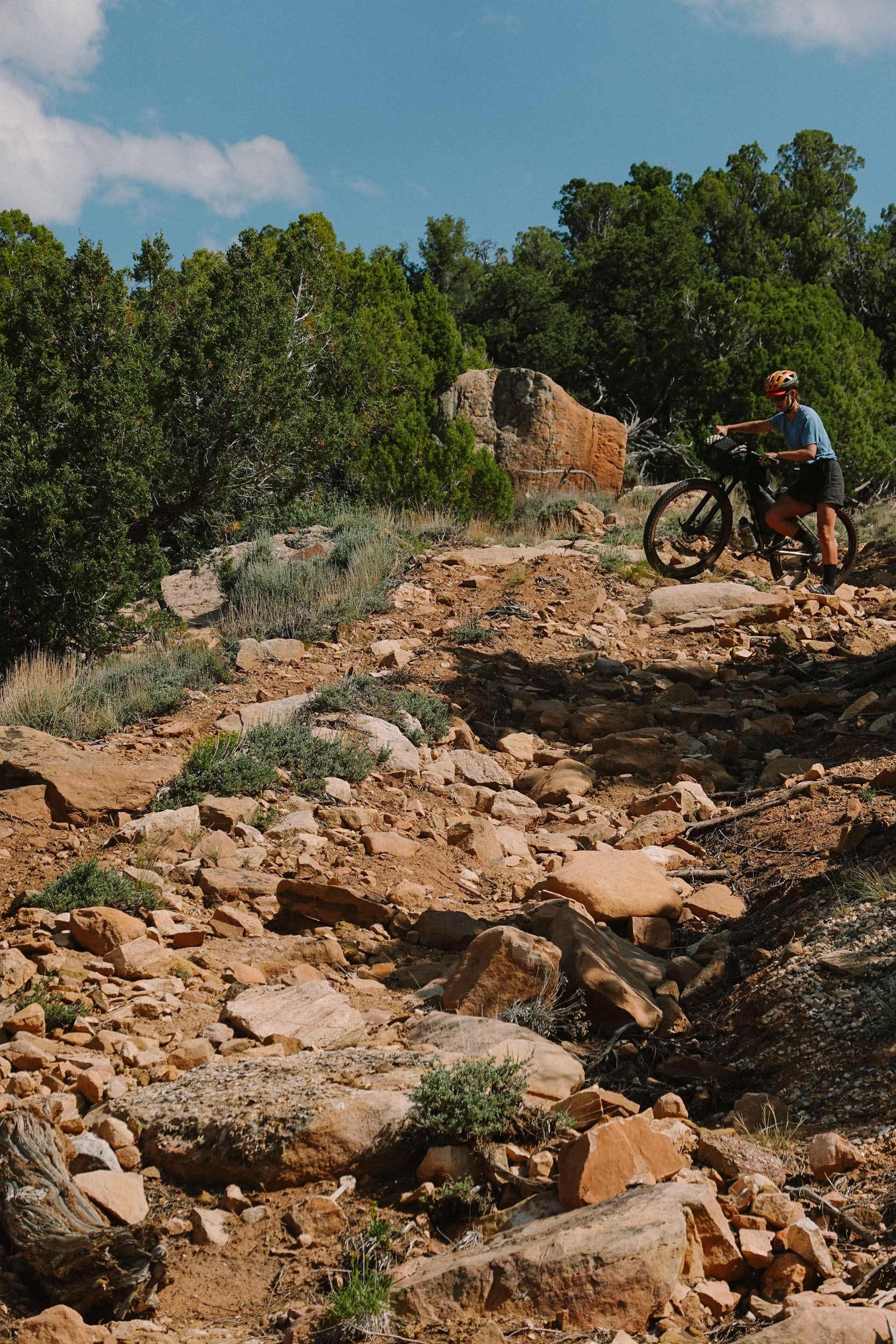
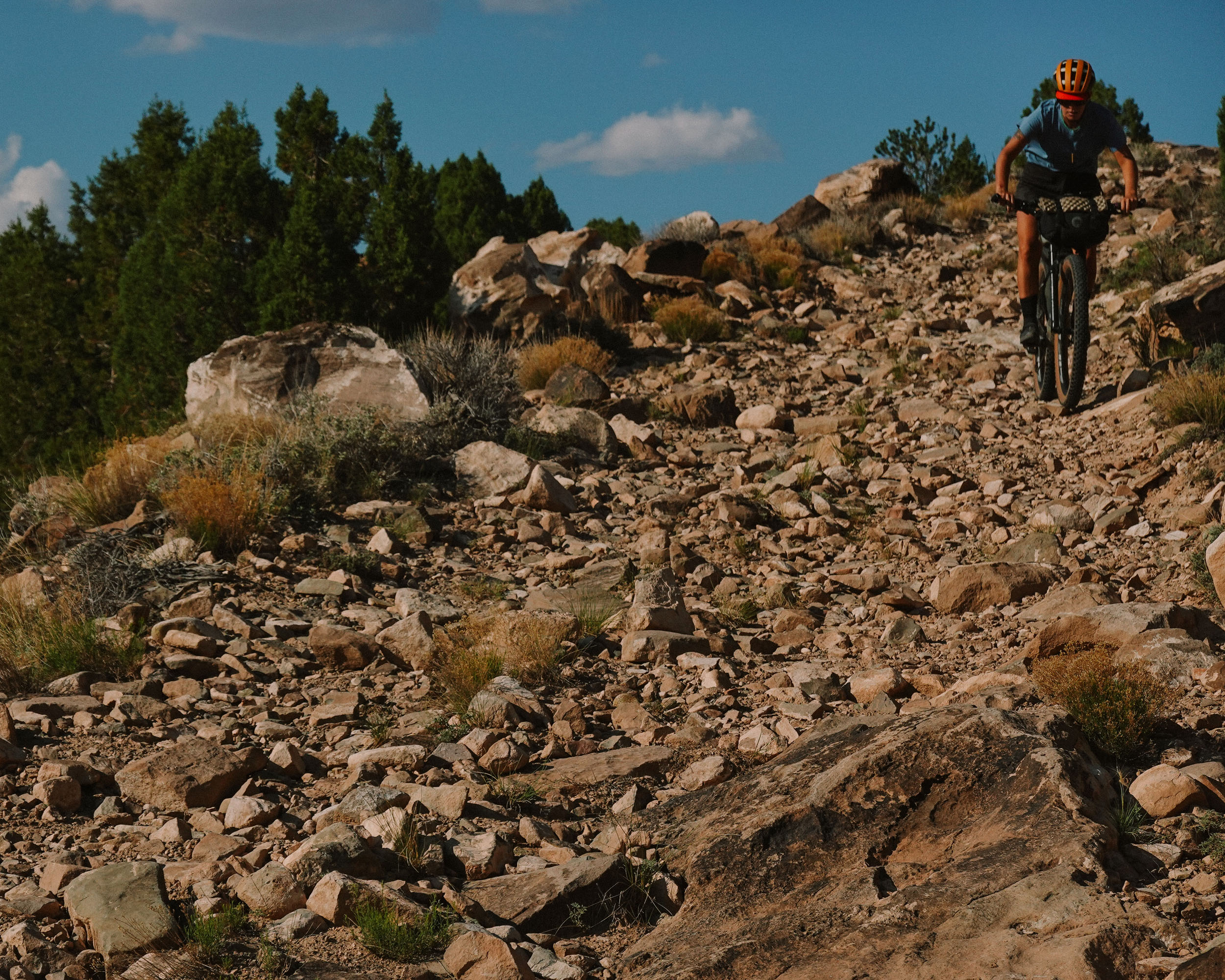
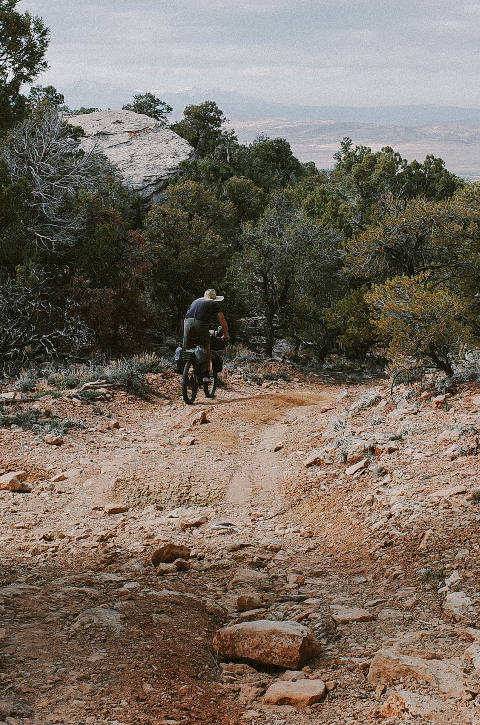
Technical difficulty (9/10): The Lower Dolores Canyon Scramble keeps you on your toes from the start and demands strong bike handling skills. Expect steep, chunky, and loose old mining tracks, along with soft, porous dirt that can swallow your wheels and drain your energy. The route includes plenty of technical descents and punchy climbs that require full focus and control.
Physical demand (9/10): This route dishes out a couple of extended big climbs onto the mesa and out of the canyon, plus slow, technical sections that make the miles feel long. Short hike-a-bikes may add up, and there’s not much “cruise” time. You’ll need endurance, strength, and a good mindset to keep moving when progress feels slow and things get hard.
Resupply and logistics (9/10): Water is only reliably available at the Dolores River, and resupply options are virtually nonexistent. The route passes near Dove Creek late in the loop, but otherwise, you’re fully on your own. The first 40 miles are especially challenging in terms of water, with about 20 of those being slow, technical miles that make carrying enough even more critical.
This is a demanding ride that offers both striking scenery and a serious challenge, with technical terrain, sustained physical effort, and highly remote and isolated areas. It’s not for the faint of heart, but for those who come prepared, it offers a rare kind of adventure that is wild, beautiful, and solitary.
Route Development: I first rode a version of this loop with Todd Gilman, from Rico, and a small crew of cyclists in 2021. At the time, heat maps were non-existent for this area, especially along the canyon rim; roads that appeared on maps often didn’t exist in reality, making the initial ride a challenge in route-finding and on-the-fly adjustments. Coincidentally, on that same day, we crossed paths with fellow Durango locals Colt Fetters and Alec McKeand, who were riding nearly the same loop. Since that exploratory ride in 2021, I returned to the route in the spring of 2022 and 2025 to refine the route’s flow and design. While few riders venture to the canyon’s rim, the Lower Dolores River Canyon road itself has long been cherished by local cyclists aware of its secret beauty. In particular, Durango’s Devo Exploras, a group of 5th–8th grade girls, who ride the length of the canyon, fully loaded, over 3–4 days on a semi-annual basis.


Submit Route Alert
As the leading creator and publisher of bikepacking routes, BIKEPACKING.com endeavors to maintain, improve, and advocate for our growing network of bikepacking routes all over the world. As such, our editorial team, route creators, and Route Stewards serve as mediators for route improvements and opportunities for connectivity, conservation, and community growth around these routes. To facilitate these efforts, we rely on our Bikepacking Collective and the greater bikepacking community to call attention to critical issues and opportunities that are discovered while riding these routes. If you have a vital issue or opportunity regarding this route that pertains to one of the subjects below, please let us know:
Highlights
Must Know
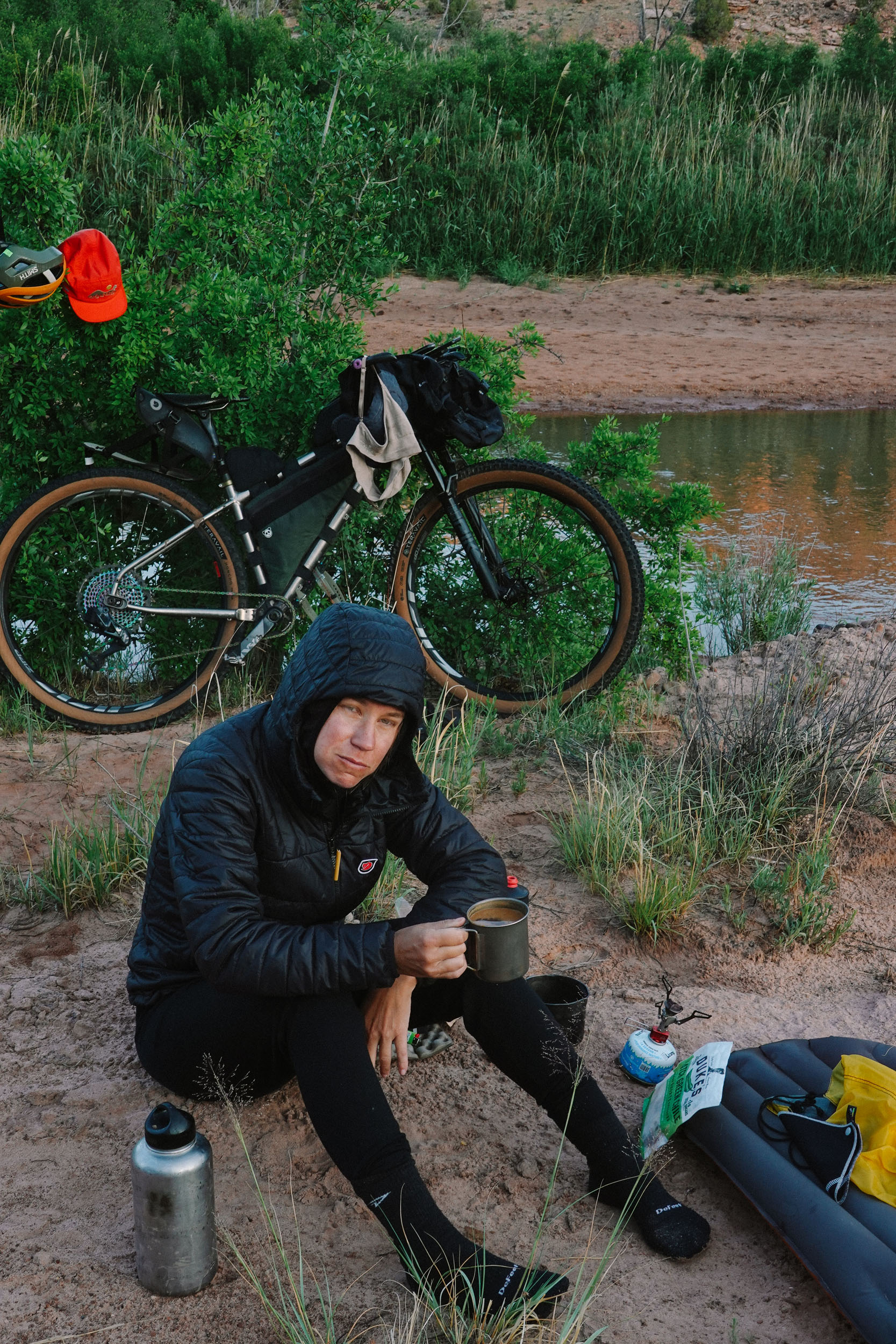
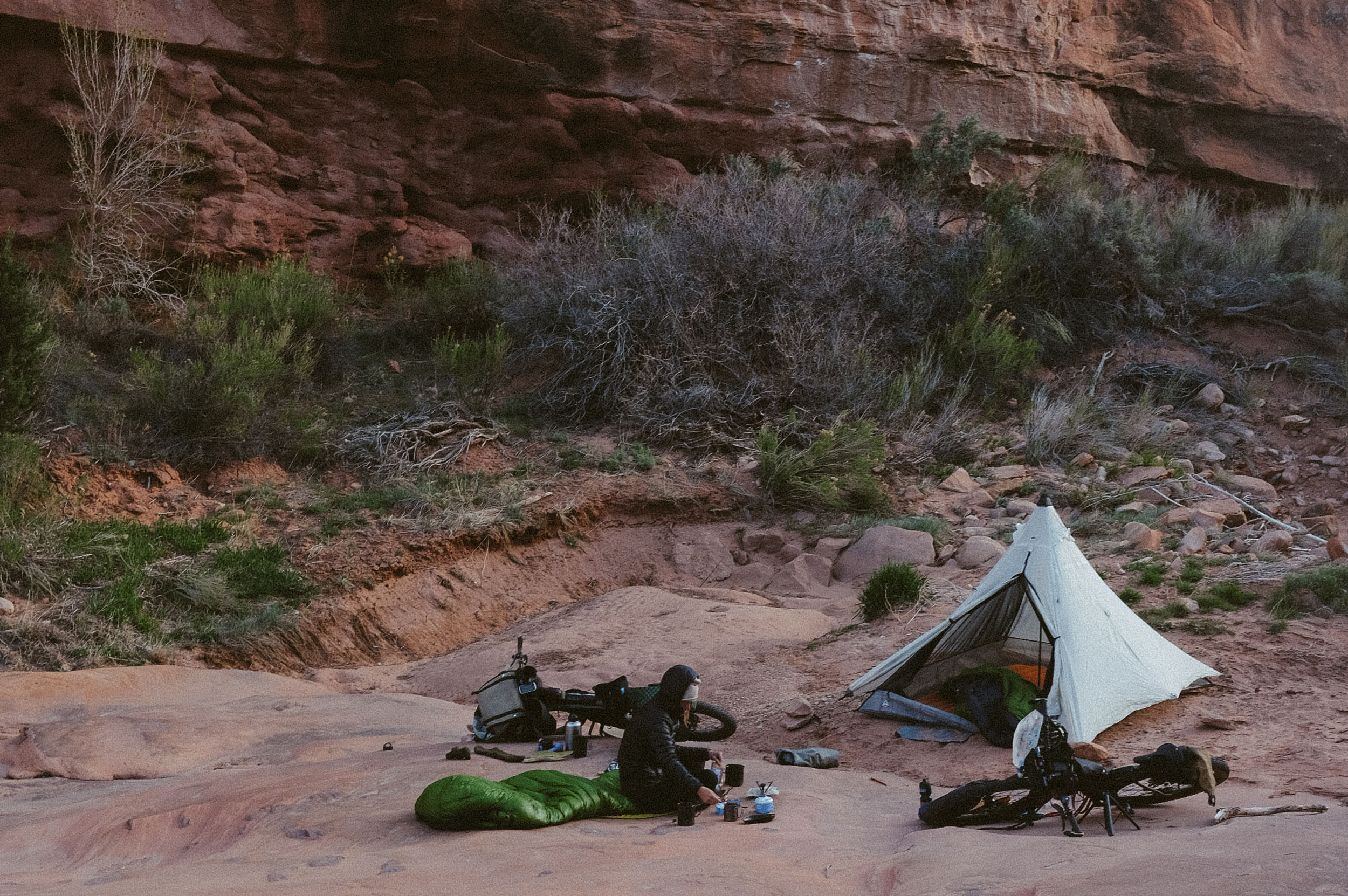
Camping
Food/H2O
Trail Notes
Resources
- Jaw-dropping glimpses of the Lower Dolores River Canyon from the rim’s edge
- Panoramic views of the Abajo, La Sal, La Plata, and Wilson mountain ranges from high mesa roads
- Rugged solitude and true remoteness, a rare sense of being utterly alone in canyon country
- Ancient, massive ponderosa pines in the Mountain Sheep Recreation Area are some of the oldest in the region.
- Striking redrock canyon walls towering over 1,000 feet, creating a cathedral-like atmosphere
- Plenty of swimming holes — perfect for cooling off during long, hot days in the saddle
- The chance to encounter bighorn sheep within the canyon, and black bears or elk atop Lone Mesa
- Excellent birding opportunities for migratory species
- A diverse range of environments — from high-altitude mesa forests to lush canyon bottoms
- Quiet, star-filled nights spent camping deep in the canyon or under open skies on the rim
- When to go: This route can be ridden between late April and late October (depending on snowfall), with the best times to ride in late spring and late fall. Ideally, plan for late April (after snow has melted off Lone Mesa) through early June, before extreme heat sets in. In spring, the Dolores River typically has plenty of water for filtering and swimming. In late fall, water levels are lower, meaning fewer swimming opportunities, but still enough for filtering.
- Altitude: The route’s highest point is 8,440 ft, with the lowest point at 5,500 ft.
- Check river conditions: Always check the current flow rate of the Dolores River before you go. Ensure the McPhee Dam upstream has not been released; a rare release could render the road through the canyon and the single river crossing impassable.
- Potential for packrafting: On the rare occasion of a high flow rate, this route could be creatively adapted into a packrafting adventure.
- Water scarcity: Outside of the Dolores River, access to water is extremely limited or non-existent. Be prepared to carry enough water for the first 40 miles (20 of which are slow, technical miles). You will also need to have enough water for the final 20 miles of fast gravel county roads.
- Avoid wet conditions: Do not attempt this route directly after heavy rain. Many sections turn into sticky, unrideable “peanut butter” mud that can bring progress to a complete halt.
- Recommended pacing: While this route is logistically more straightforward to complete in two days, expect two long and demanding days of riding. A more casual and immersive experience would be to complete it in three days, camping one night on the rim and another night within the canyon (or two nights in the canyon). This allows time to swim, birdwatch, or explore side canyons on foot. If following a three-day itinerary and camping on the rim, be prepared to carry enough water to cover roughly 1.5 days, including the first day, overnight, and part of the next day until reaching the river.
- Logistics: No permits are required. The route starts and finishes at Bradfield Campground and Recreation Site, which requires a small fee and offers parking. There are no official resupply points along the loop, so plan to be fully self-sufficient.
- Dangers and annoyances: The canyon road and river crossing can become hazardous or impassable during rare periods of high water flow. Check the American Whitewater Association for the Dolores River flow rate near Slick Rock. Anything below 200–300 cfs is generally safe for the river crossing; anything above 500 cfs could be dangerous. Use your discretion.
- Always follow the Leave No Trace principles, including camping at least 200 feet away from water sources.
- Route direction: It is recommended to ride the route in a counterclockwise direction. This allows you to descend the most technical sections on the rim and Lone Mesa, avoiding what would otherwise be extended, grueling hike-a-bikes in the opposite direction.
- Miles 26.6 through 40 should not be underestimated. They are very technical and slow going, with no access to water.
- Miles 41 – 49 are closed to motor vehicles from February 1 to May 1
- Recommended Bike: A hardtail or full suspension mountain bike with at least 2.2” tires is best suited for this route, although it has been done on less!
- If you’re traveling from out of town, there is a simple motel option in Dove Creek for the night before or after your ride. Cortez is the next closest town and has more amenities.
- Bradfield Campground, located at the route’s start and finish, is a convenient base with basic amenities (pit toilets and water spigots).
- Dry (no water) dispersed camping is available on public land along Lone Mesa and the rim section (the northeast side and first half of the route).
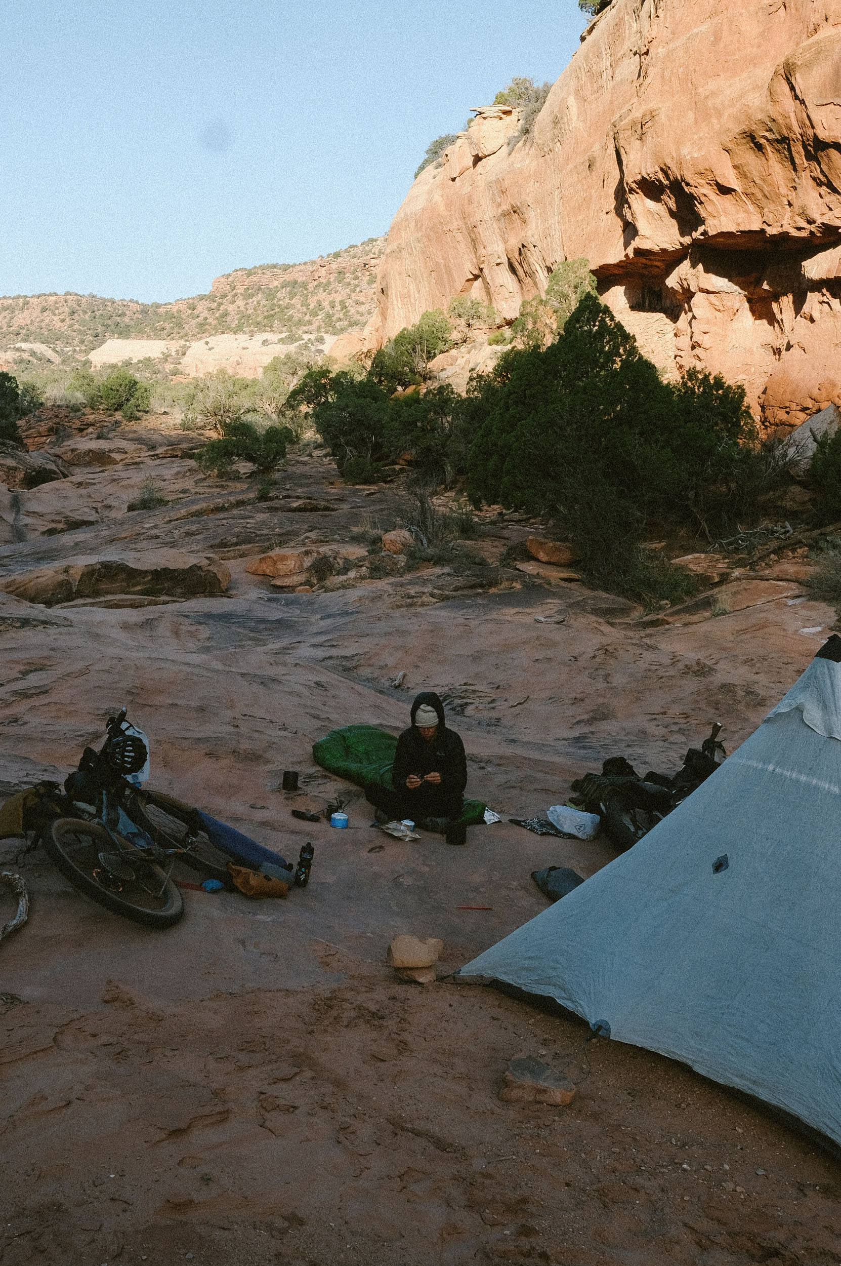
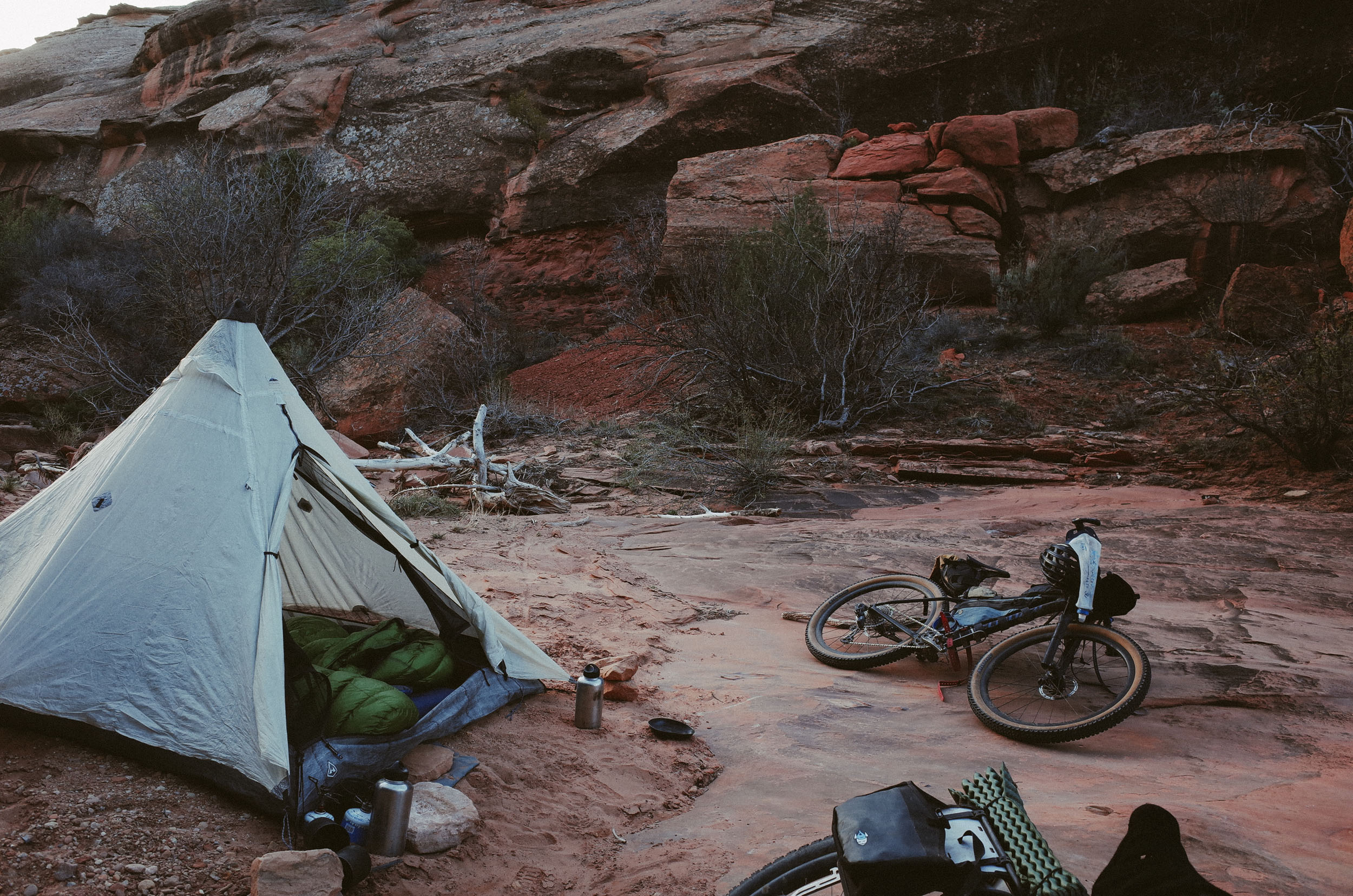
- Beautiful primitive campsites can be found within the canyon at approximately miles 39.8, 41, and 41.3.
- More established campsites are available between miles 49.2 and 51, with actual campgrounds (with pit toilets but no other services) located between miles 57 and 58.
- The only reliable, filterable water source along the route is the Dolores River, which the route closely follows from miles 39 to 58.
- There are no established food or water resupply points on the loop itself — you must bring all the food and snacks you need from the start.
- Dove Creek, located approximately 2.5 miles off the route (a 5-mile round trip), has a convenience store and gas station if you need a resupply before or after your ride.
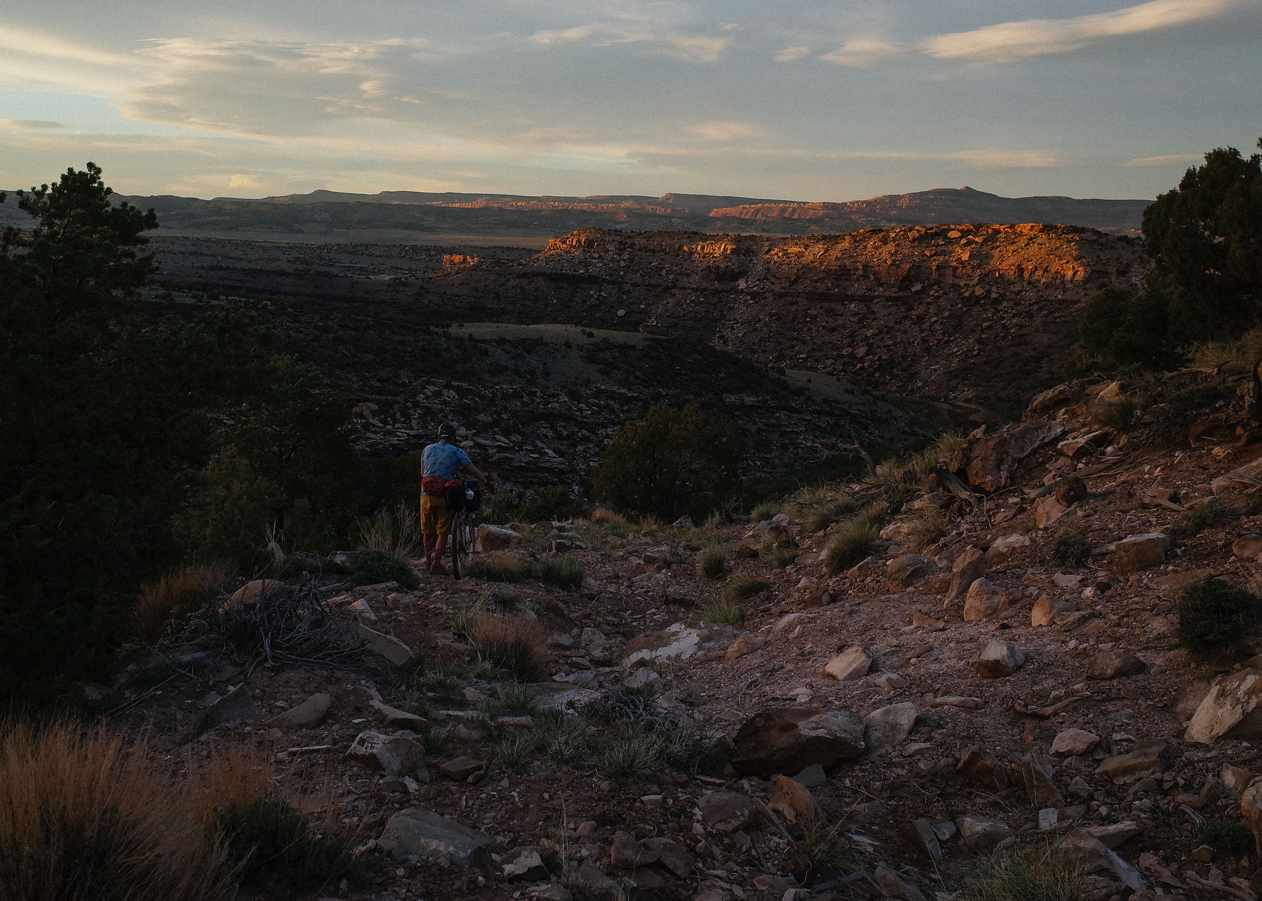
- Start early and park at Bradfield Campground (or in the lot across from the entrance). Ensure you have 5–6 liters of water on hand for the entire day. From Bradfield, you’ll begin by climbing Lone Dome Road for approximately 2,000 feet over 14 miles of smooth gravel into San Juan National Forest. You’ll continue on mellow gravel roads atop Lone Mesa, where you may encounter grazing cows and scattered cow ponds. If riding early in the season, be prepared for possible patches of snow and some flowing drainages, though don’t count on them for water. It’s also possible to see herds of elk atop the mesa.
- At mile 21, the road gradually degrades into dirt with embedded roots and rocks. This section can develop large mud puddles and become very muddy in wet conditions. By mile 26.6, the road deteriorates further. Here, you’ll be rewarded with a stunning vista of the canyon and surrounding mountains — a great spot for lunch or, if following a three-day itinerary, an ideal place to camp for the night.
- Beyond mile 26.6, the route becomes significantly more rugged, with a long, steep, and loose descent over large rocks. Walk your bike if needed, and remember how remote you are. Don’t forget to look up: the views of the Abajo, La Sal, Wilson, and La Plata mountains are spectacular. Miles 26.6 to 40 should not be underestimated — they are steep and technical, with soft, loose, and rocky surfaces along old mining roads that see very little use. These roads bring you ever closer to the rim of the Lower Dolores River Canyon, revealing incredible glimpses into the canyon where you’ll soon be riding. The final descent into the canyon is extremely rocky and loose — descend with caution.
- Once inside the canyon, you’ll immediately find a campsite across the river in a stand of cottonwoods. However, if you continue a bit farther — past the first climb in the canyon — you’ll reach one of the most beautiful campsites on the entire route.
- Miles 41 to 49 are closed to motor vehicles from February 1 to May 1. This section of the road is washed out and highly technical in places. Yet, it offers smooth, luxurious doubletrack in others, all while providing the most stunning and remote canyon views imaginable. There is one essential river crossing at mile 43.4 — usually ankle-deep, but always check the flow rate before you go, especially in rare years when the McPhee Dam is released.
- At mile 49, the road improves and reopens to motor vehicles year-round (though you’re unlikely to see any). At mile 49.3, you’ll find a campsite with a great swimming hole just south of it. From here, the route continues to the Pump Station and Mountain Sheep Lookout Recreation Area before turning back into a smooth gravel climb out of the canyon. Be sure to filter water before leaving the canyon.
- Once out, you’ll follow quiet county roads through agricultural lands that rely on water from McPhee Reservoir and the Dolores River. This stretch offers an alternative perspective on the ongoing efforts to protect the Lower Dolores River Canyon as a National Monument. The country roads eventually bring you back into the national forest for a brief section near the south rim of the canyon.
- If you have time (and energy), consider riding the 14-mile round-trip detour to the Dolores Canyon Overlook for an unforgettable view. Otherwise, you’ll descend past a controversial new solar farm and finally roll back down to Bradfield Campground.
- Disappointment Valley and Jones Creek Route Alternative: cuts out some of the most technical riding on the canyon rim, as well as some of the more spectacular views, in favor of easier gravel roads and entry into the canyon. This route has not been tested.
- Emergency Bailout Option A at mile 26.6 to Disappointment Valley and State Highway 141 in Slick Rock. There are no services available here, but in the event of an emergency, you can flag down a passing vehicle.
- Emergency Bailout Option B at mile 40 to State Highway 141 in Slick Rock. Again, there will be no services available here.
Additional Resources
- RWGPS Collection for the Lower Dolores Canyon Scramble, including the most up-to-date route file, as well as bailout options, detours, and route alternatives.
- Dolores River Special Recreation Management Area (SRMA), Bureau of Land Management
- Dolores River Special Recreation Area Map, Bureau of Land Management
- Protect the Dolores – Conservation-focused website with updates on cultural sites, recreational access, wildlife habitat, and advocacy efforts.
- The River of Sorrows – a short film where two packrafters examine how a large trans-basin diversion devastated downstream ecosystems, cultures, and recreational economies over a two-week journey down the Dolores River.
- American Whitewater Association – Information on flow rate for the Dolores River between Pump Station and Slick Rock
- Dolores Project, Bureau of Reclamation – Covers the creation of McPhee Reservoir, including its uses: irrigation, municipal supply, tribal water rights, hydropower, and recreation.
- San Juan Citizens Alliance: Dolores River
- “How the Dolores Project changed lives in the Colorado Ute Tribe”, Rocky Mountain PBS – Explores how McPhee Reservoir fulfills water treaty obligations for the Ute Mountain Ute Tribe and transformed reservation life.
- “Dolores River conservation efforts surge with record flows”, Colorado Sun – Discusses current proposals and public support for national monument protections across the Lower Dolores corridor.
- Marc Reisner’s Cadillac Desert – A seminal book on Western water policy that provides essential context for McPhee Reservoir’s regional impact
- Jeep Trails to Colorado Ghost Towns (Robert L. Brown) – Offers history and backcountry context for the mining roads and ghost towns along Lone Mesa
- RiverMaps’ Guide to the Dolores River of Colorado & Utah – A waterproof, detailed guidebook with maps, campsite guides, and river rapids descriptions. Great for planning packrafting sections.
- Dolores River Guide (Ralph DeVries, Stephen G. Maurer): A guide to the Dolores River, from McPhee Dam (in the San Juan Mountains, Colorado) to its confluence with the Colorado River northeast of Moab, Utah, including natural and human history. Printed on waterproof, tearproof paper.


Terms of Use: As with each bikepacking route guide published on BIKEPACKING.com, should you choose to cycle this route, do so at your own risk. Prior to setting out check current local weather, conditions, and land/road closures. While riding, obey all public and private land use restrictions and rules, carry proper safety and navigational equipment, and of course, follow the #leavenotrace guidelines. The information found herein is simply a planning resource to be used as a point of inspiration in conjunction with your own due-diligence. In spite of the fact that this route, associated GPS track (GPX and maps), and all route guidelines were prepared under diligent research by the specified contributor and/or contributors, the accuracy of such and judgement of the author is not guaranteed. BIKEPACKING.com LLC, its partners, associates, and contributors are in no way liable for personal injury, damage to personal property, or any other such situation that might happen to individual riders cycling or following this route.
Please keep the conversation civil, constructive, and inclusive, or your comment will be removed.