


Idaho Smoke ‘n’ Fire 400
Distance
418 Mi.
(673 KM)Days
5
% Unpaved
90%
% Singletrack
15%
% Rideable (time)
95%
Total Ascent
35,661'
(10,869 M)High Point
9,000'
(2,743 M)Difficulty (1-10)
6?
- 6Climbing Scale Moderate85 FT/MI (16 M/KM)
- -Technical Difficulty
- -Physical Demand
- -Resupply & Logistics
Contributed By
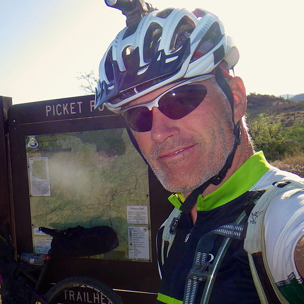
Norb DeKerchove
Guest Contributor
Norb has a love of all things two-wheeled and a passion for big spaces, remote landscapes, and overnights under the stars. Adventures by bicycle and motorcycle have been a part of his life since he was old enough to straddle the saddle. Norb is a Tour Divide, Colorado Trail Race and two-time Arizona Trail Race 300 finisher as well as the race director for the annual Smoke ‘n’ Fire 400.
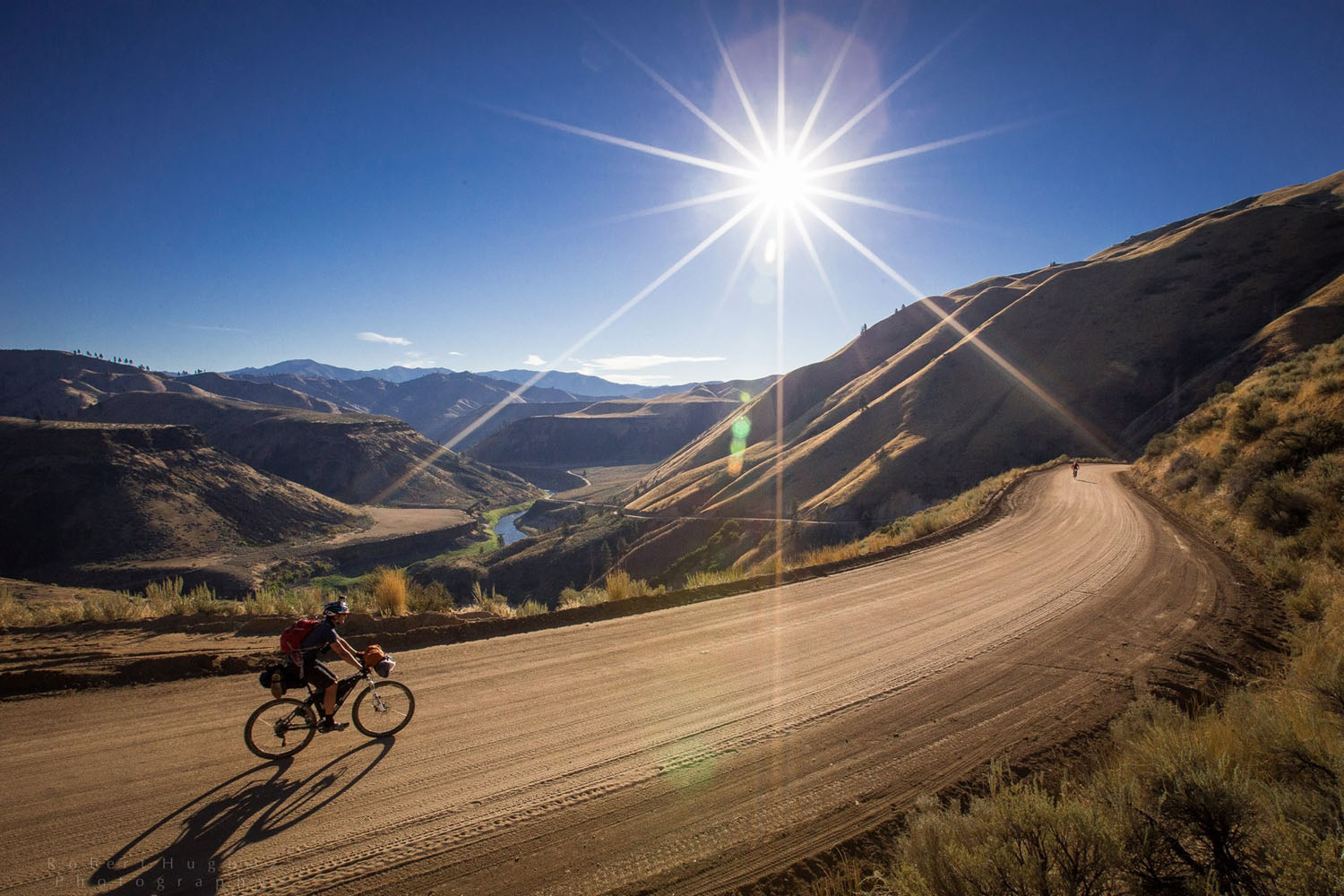
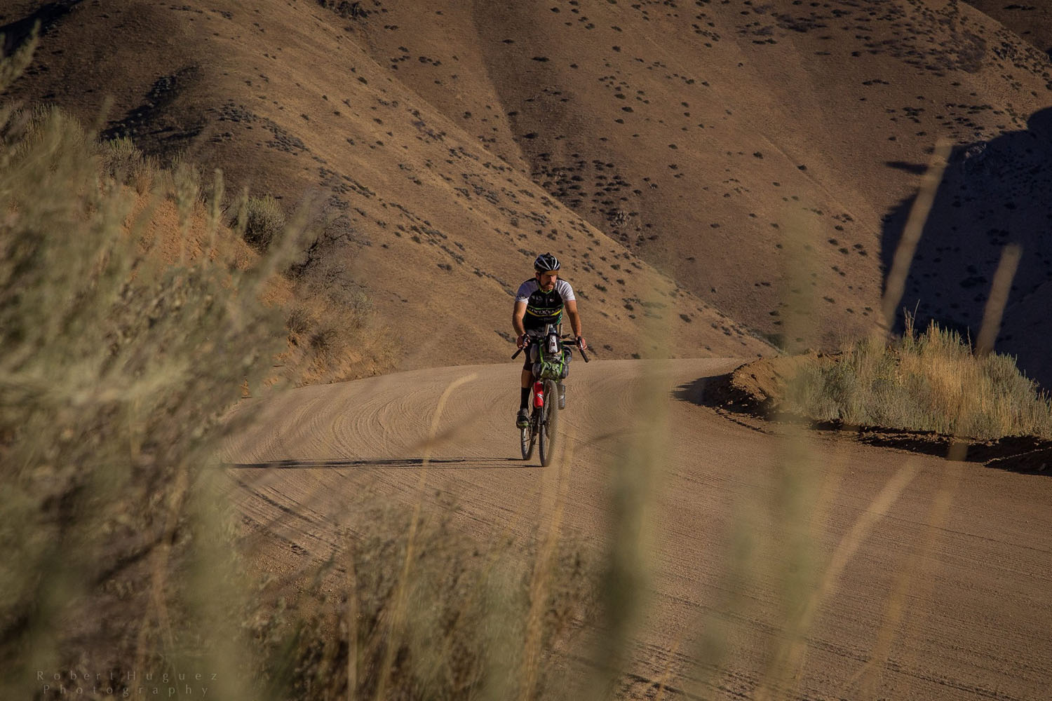
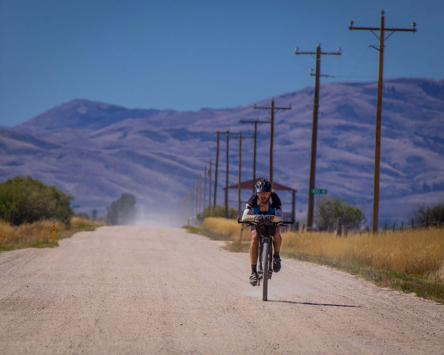
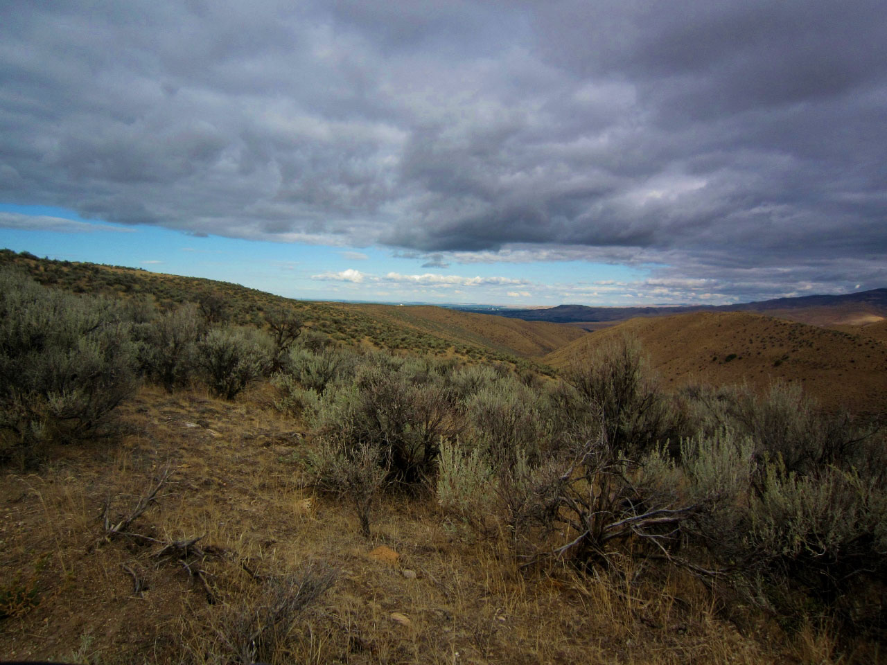
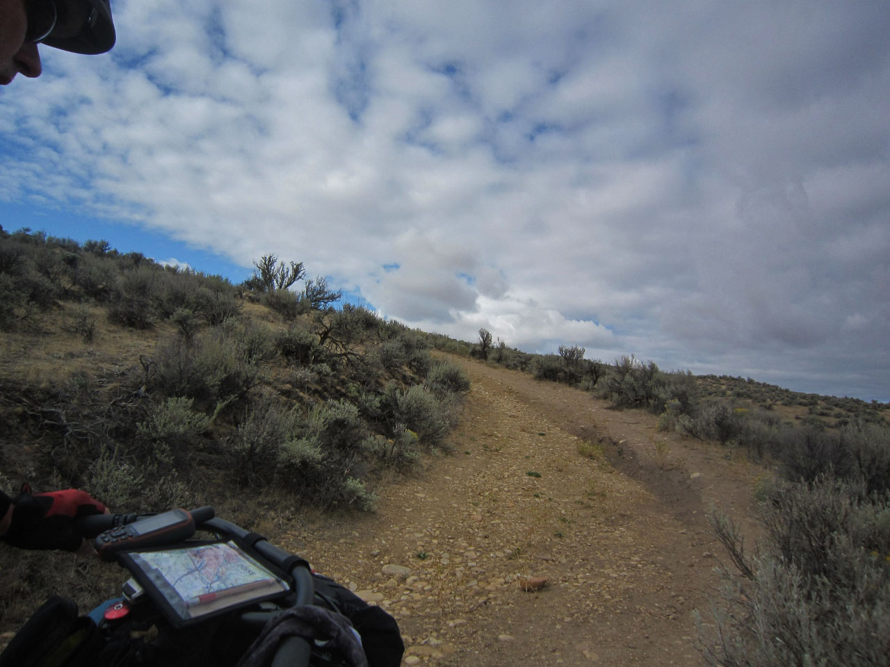
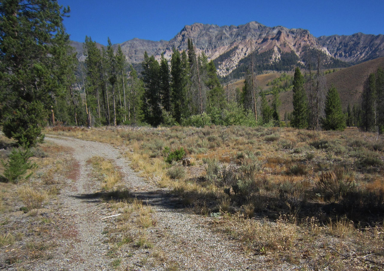
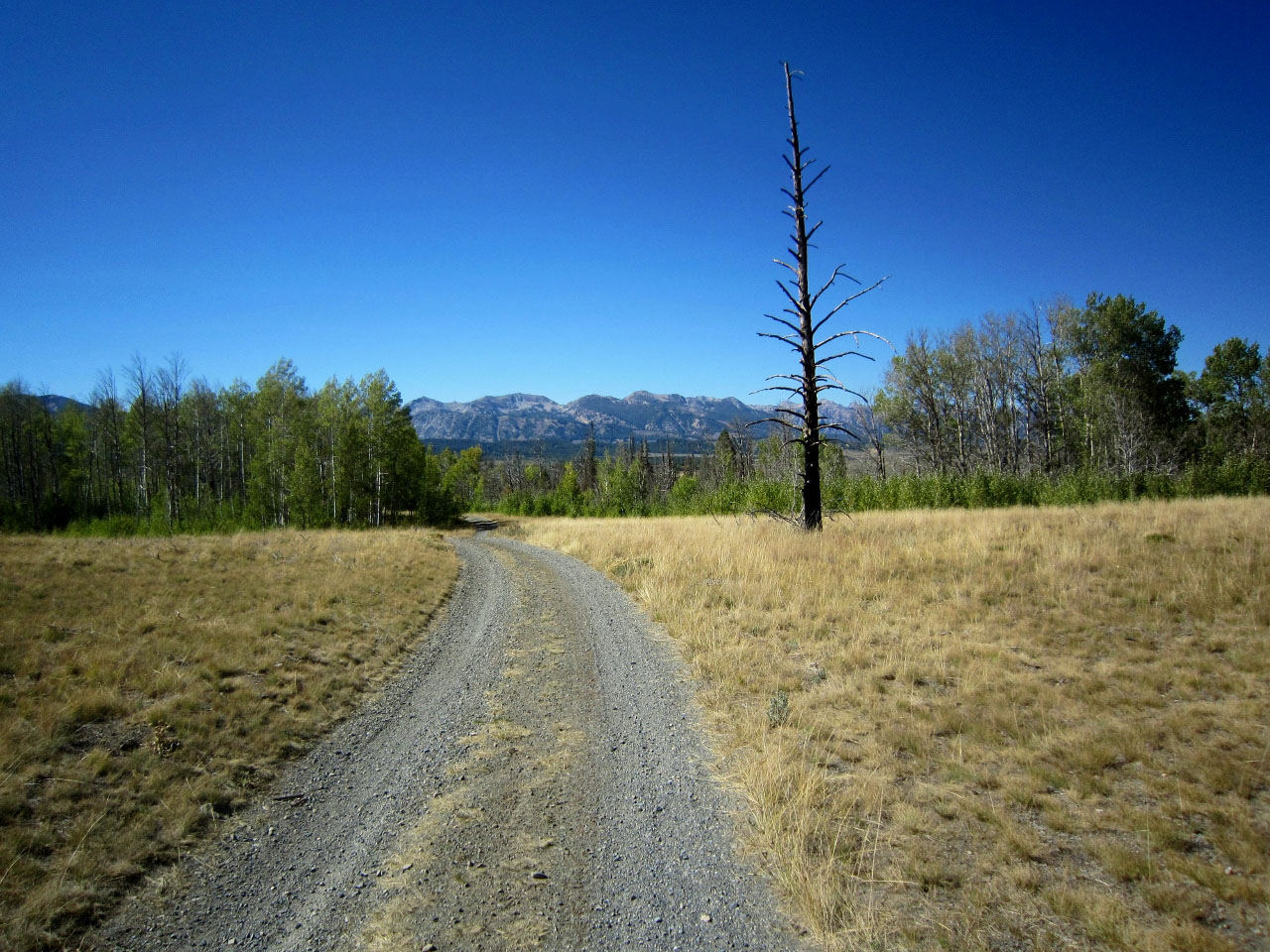
The Idaho Smoke ‘n’ Fire is a 400ish mile bikepacking loop traversing a slice of Idaho’s diverse geography on two-track, gravel, dirt Forest Service roads, singletrack and some paved roads. This loop starts and ends in Boise and features nearly 41,000 feet of climbing over backcountry forest roads, great single-track — including the Centennial and the Harriman Trail — the occasional stretch of pavement, and a touch of hike-a-bike. Terrain and technical level is more akin to Tour Divide in general, as opposed to the Colorado Trail or Arizona Trail.
The Smoke ‘n’ Fire route travels through remote areas, however, there are sufficient resupply opportunities available (see Food and H2O below for details). Besides the physical challenge there are mental challenges to this route and it is also a great test of your bikepacking kit and gear. We recommend a mountain bike with 2.1 or greater tires for the ride.


Submit Route Alert
As the leading creator and publisher of bikepacking routes, BIKEPACKING.com endeavors to maintain, improve, and advocate for our growing network of bikepacking routes all over the world. As such, our editorial team, route creators, and Route Stewards serve as mediators for route improvements and opportunities for connectivity, conservation, and community growth around these routes. To facilitate these efforts, we rely on our Bikepacking Collective and the greater bikepacking community to call attention to critical issues and opportunities that are discovered while riding these routes. If you have a vital issue or opportunity regarding this route that pertains to one of the subjects below, please let us know:
Highlights
Must Know
Camping
Food/H2O
Trail Notes
Resources
- Riding along crystal clear rivers, pristine streams and clear lakes.
- Several geothermal hot springs created by the forces of nature that are accessible and soakable.
- The route traverses several scenic mountain ranges and if you’re not climbing you’ll be descending.
- The laid back town of Boise as a start and finish.
- Incredible hospitality from the small towns and out of the way stores, and bars, along the route
- Beautiful alpine singletrack sections offering technical challenges and rewarding views.
- Late summer to fall (July-September) is the ideal time to ride the Smoke ‘n’ Fire 400 route. Given the high elevations, there is often snowfall through June.
- The race runs in early September when the weather is generally great – clear and warm during the day and chilly at night, but it can also be fickle and unpredictable.
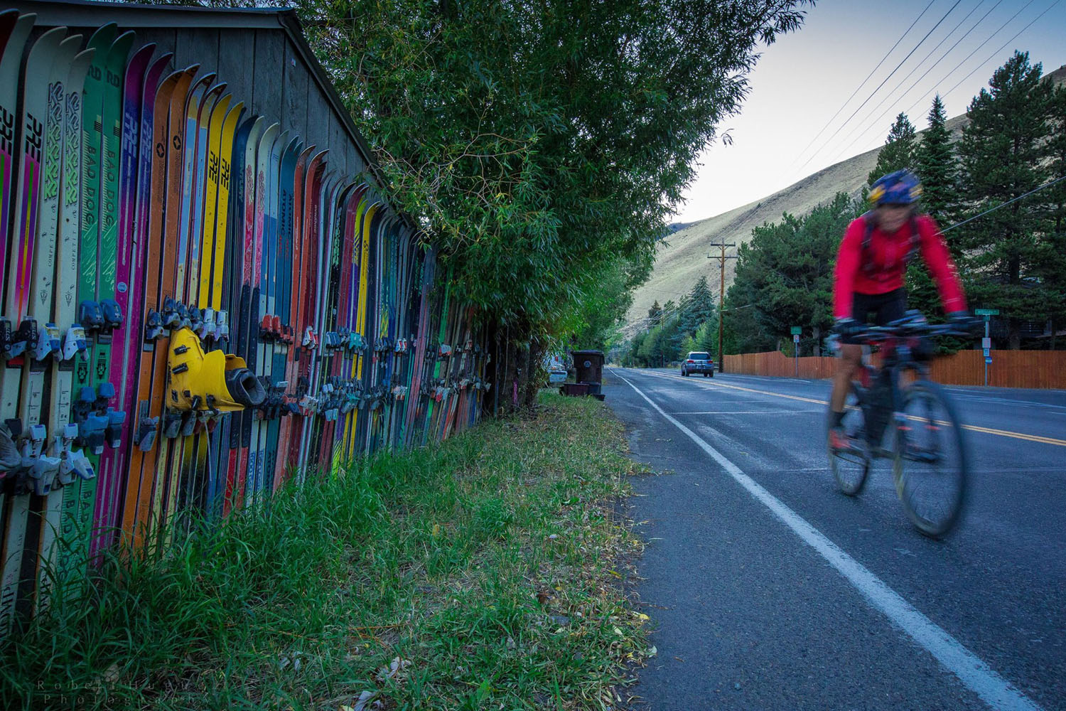
- The route begins and ends in downtown Boise in historic Hyde Park. Boise has many interesting things to do, attractions to see, and a relaxed and inviting vibe. There are numerous restaurants and bars and distinctive local microbrews throughout the city to keep you occupied before and after the race.
- In fall there are fewer people in the backcountry which leads to more wildlife roaming around.
- Idaho is bear country. Make noise to avoid an encounter. Carry 14m of 3mm cord in order to hang your food high in a tree at night. Carrying bear spray as a defense weapon is recommended in case of a confrontation. Leave no food scraps. Bears that have discovered human food become dangerous.
- Respect the people you encounter, and the communities along the route
- And please follow the principles of Leave No Trace
- The options to bivy and camp in the backcountry are endless. You will find yourself in a beautiful river or lake setting either primitive camping or in an improved campsite that you will most likely have all to yourself.
- Plus there are many geothermal hot springs created by the forces of nature that are accessible and soakable.
- There are even a couple hotel options in Ketchum and Stanley, if that’s how you roll.
- There are plenty of locations to filter water along the route. Idaho is a water rich state and much of the route winds along crystal clear rivers, pristine streams and clear lakes.
- Resupply options and services are reasonable (see waypoints on GPS map below) but small stores can limit hours or close for no apparent reason.
- The most reliable places for resupply are Featherville, Ketchum, and Stanley.
- Have a post-ride meal, or a cold beer at one of the many establishments in Hyde Park.
Boise to Prairie
The route starts and ends in downtown Boise’s north end in historic Hyde Park at 13th and Eastman. There is a neutral rollout heading south through town and to the Greenbelt, which parallels the Boise River. The Greenbelt is narrow and will have bikers and runners so the pace on this section should be casual as you head east – consider it social hour. It’s a beautiful river and the Greenbelt meanders through several parks as you head toward Lucky Peak Reservoir. At the Lucky Peak reservoir continue east up two track Lydle Gulch to Bonneville Point and on to Blacks Creek.
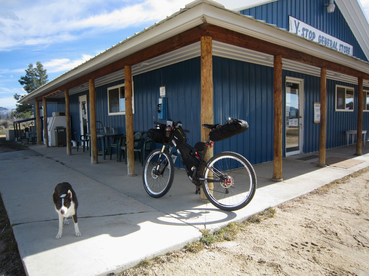
The route continues on Blacks Creek for a few miles on pavement and then transitions to a dirt road with multiple steep climbs and descends along the South Fork of the Boise River. After topping out, look for the Y-Stop General Store to your left, or head a few miles into Prairie on the route to the Mercantile for good grub.
Prairie to Ketchum
From Prairie there are multiple climbs and a fast descent through the woods on Forest Service roads to Anderson Ranch Reservoir and the town of Pine. Pine has a restaurant and a mini mart for resupply. Continue on to Featherville along the S. Fork of the Boise River. Multiple camping and hot spring opportunities are available. Featherville has a saloon, general store and a restaurant – great food, drink and people in this out of the way micro-town.
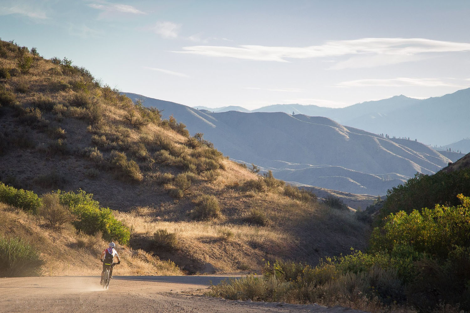
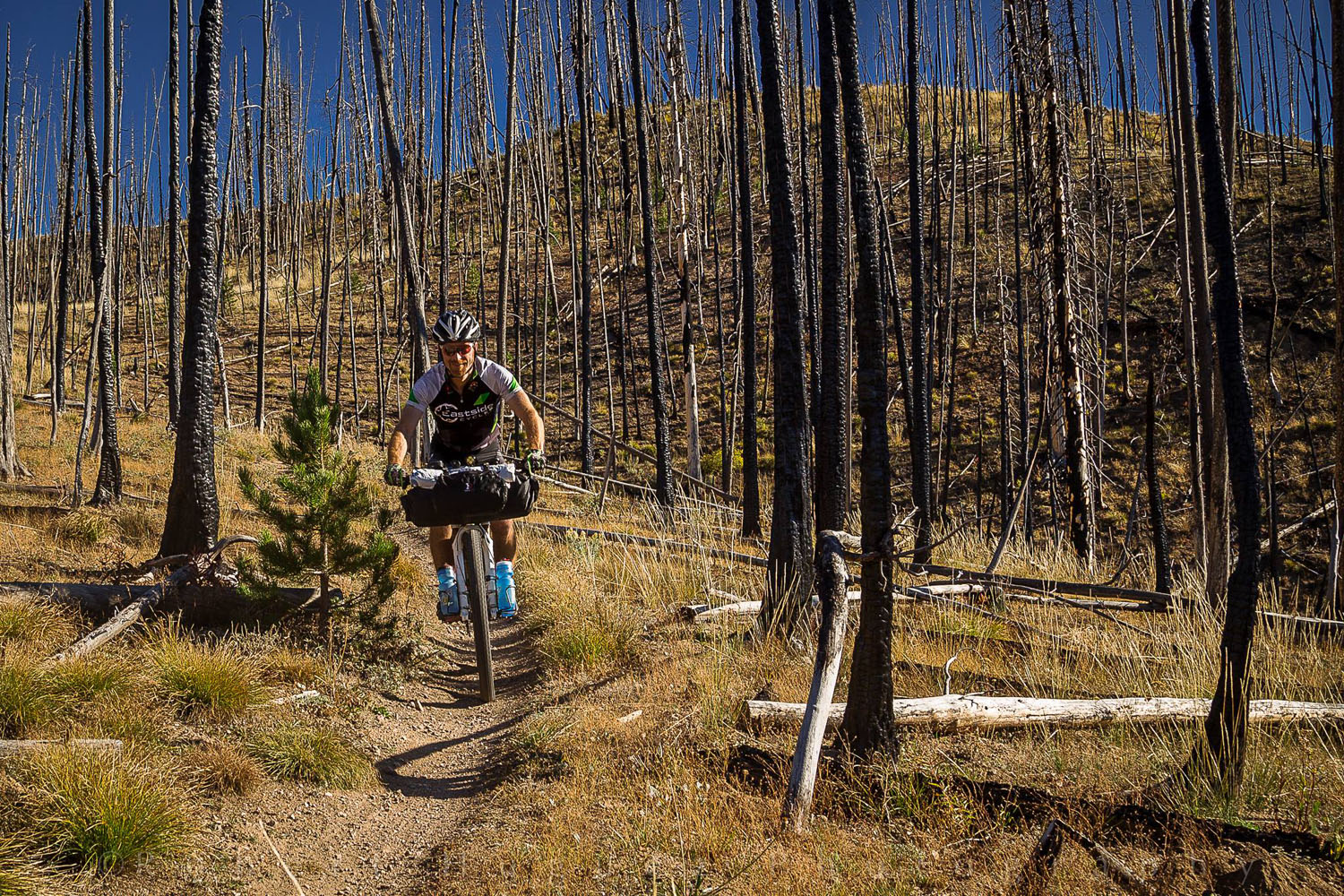
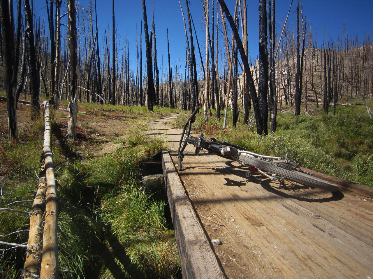
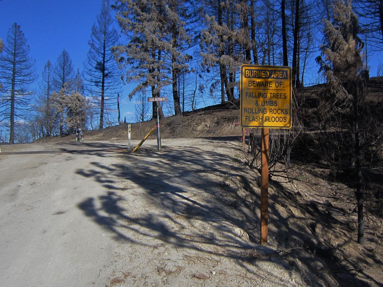
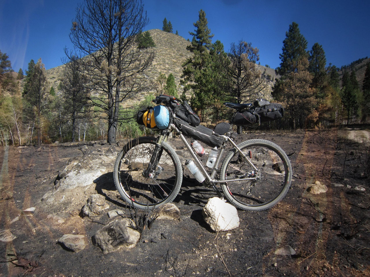
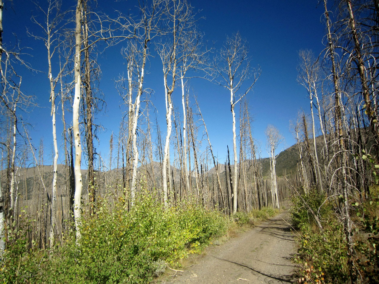
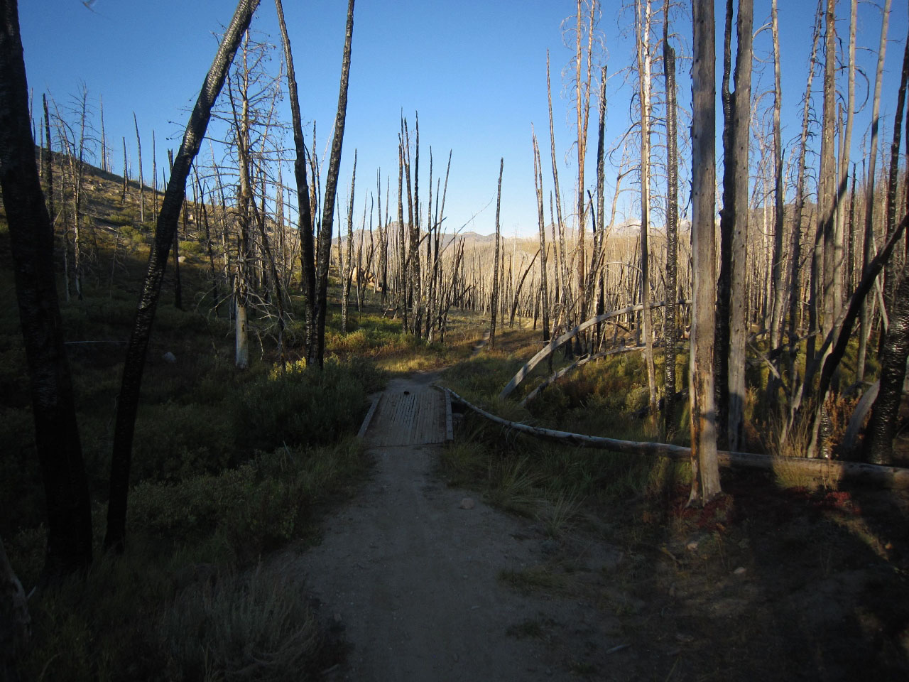
From Featherville the route goes to Ketchum on rolling dirt Forest Service roads paralleling the river for most of the way, with a long climb up to Dollarhide Summit in the central Smoky Mountains with majestic views of the vast Idaho wilderness. A long switchback descent through the recent fire burned forest takes you to the town of Ketchum. Excellent camping on the river and several hot springs are in this area. Wildlife is abundant and black bears forage between the road and the river. Be bear aware!
Ketchum is a great mountain town nestled in the Wood River Valley with all services and a bike shop close to the route. The route goes north on exceptional single track before you access the scenic two-track Harriman Trail, named after Averill Harriman, the man who conceived and built Sun Valley. There’s plenty of camping in this area with imposing views to the east of the Boulder and Pioneer Mountains. The Harriman Trail spits you out at the base of Galena Summit, where you then grind up to the top of this high mountain pass via Titus Lake on single track. Big panoramic views are to the north of the glacially carved Sawtooth Mountains and Sawtooth Valley.
Ketchum to Redfish
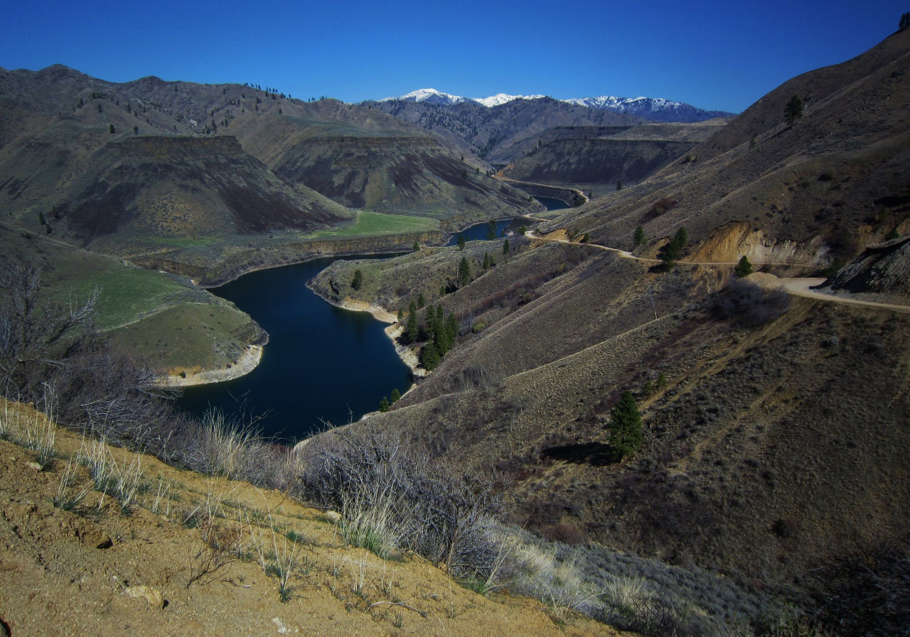
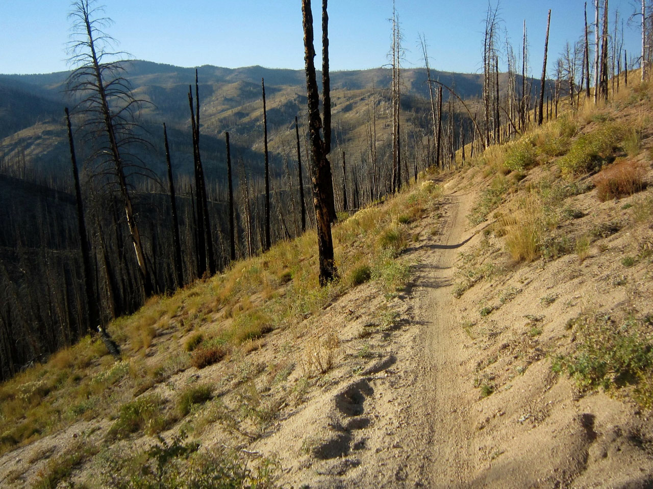
The route descends on the Idaho Centennial Trail (primitive dirt road) to the valley floor where mountain streams come together to form the headwaters of the Salmon River, also known as “The River of No Return”. The route follows the Centennial Trail and the views of the valley are immense. Smiley Creek Lodge is a short distance off route for resupply. The route continues north on the Centennial Trail and transitions to an arduous alpine climb on singletrack to Titus Lake. The route continues on the Centennial Trail and eventually pops out to the highway for a brief paved section and then to Fisher Creek for singletrack through the forest and a burned moonscape. A big uphill is followed by a screaming fast and dangerously smooth downhill and back to the valley, with terrific views of the jagged Sawtooth range to the west. Back on Highway 75 you double-back and ride more Centennial Trail along the edge of the Sawtooth wilderness.
The route takes you to pristine Redfish Lake, named for the brilliant sockeye salmon that once returned from the ocean in such massive quantities that the lake shimmered red during spawning season. These fish are now on the endangered species list. This striking mountain landscape features a chaos of crags and razorback ridges. At Redfish there is a small store, restaurant, rustic lodge, beach and camping available.
Redfish to Frank Church River of No Return Wilderness
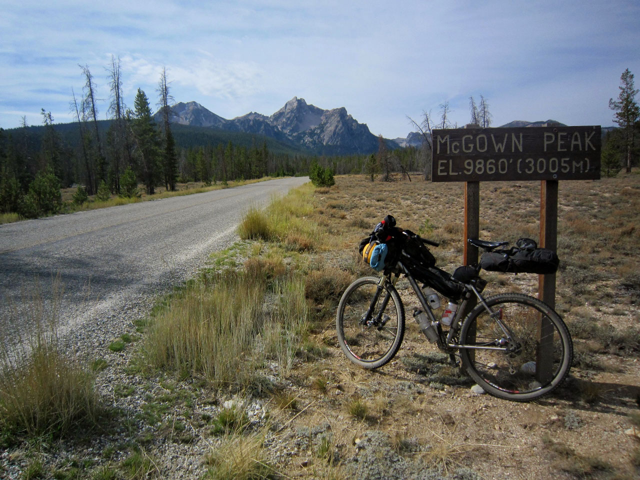
The route takes you back to the highway via sweet Fishhook Creek and on to the mountain town of Stanley where services are available. Stanley is consistently one of the coldest spots in Idaho and frost can occur any time of year. Be prepared for cold night time conditions and unpredictable weather. The route heads north to Lower Stanley and then toward Stanley Lake and the base of McGowen Peak and on to Elk Meadow for some excellent singletrack after a climb up a primitive road. Descend a rocky section through a lodgepole forest and then drop into a massive, boggy meadow. Ride through the evergreens on singletrack and eventually a fire road back to Highway 21.
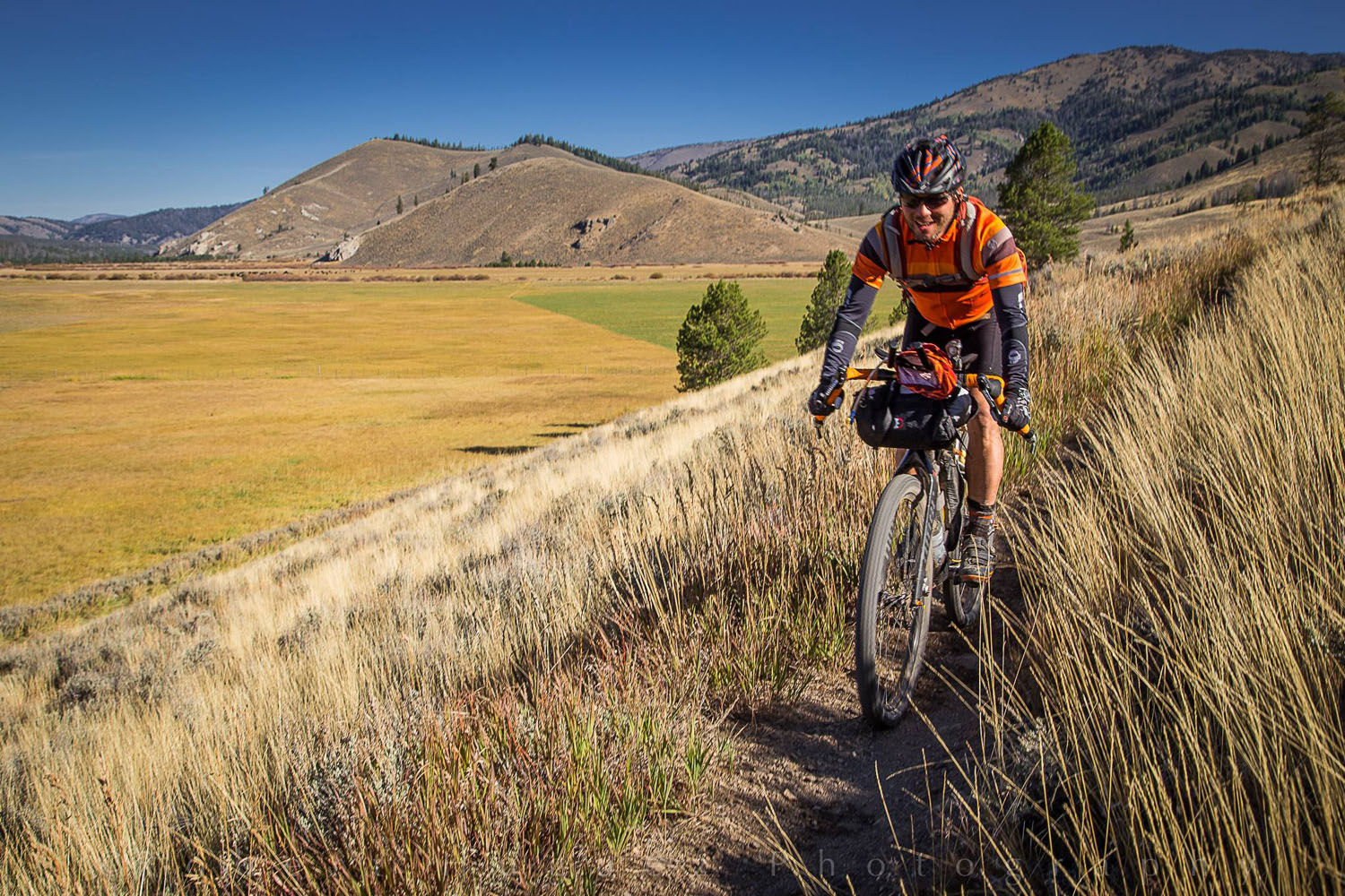
After a short stint on the highway you follow the rolling Centennial Trail along Marsh Creek and the Cape Horn region, featuring a landscape mosaic of riparian, meadow, sagebrush and conifer vegetation. Marsh Creek supports waterbirds and there is a high density of Sandhill Cranes. There is another stint on the highway before grinding up to Cape Horn summit and on to Bear Valley, which is a series of meadows surrounded by timbered mountains. The road skirts the boundary of the Frank Church River of No Return Wilderness. Deer and bear are the most common big game animals here, but one could see elk, moose, and wolves. Many camping opportunities exist through this area.
Deadwood Reservoir to Boise
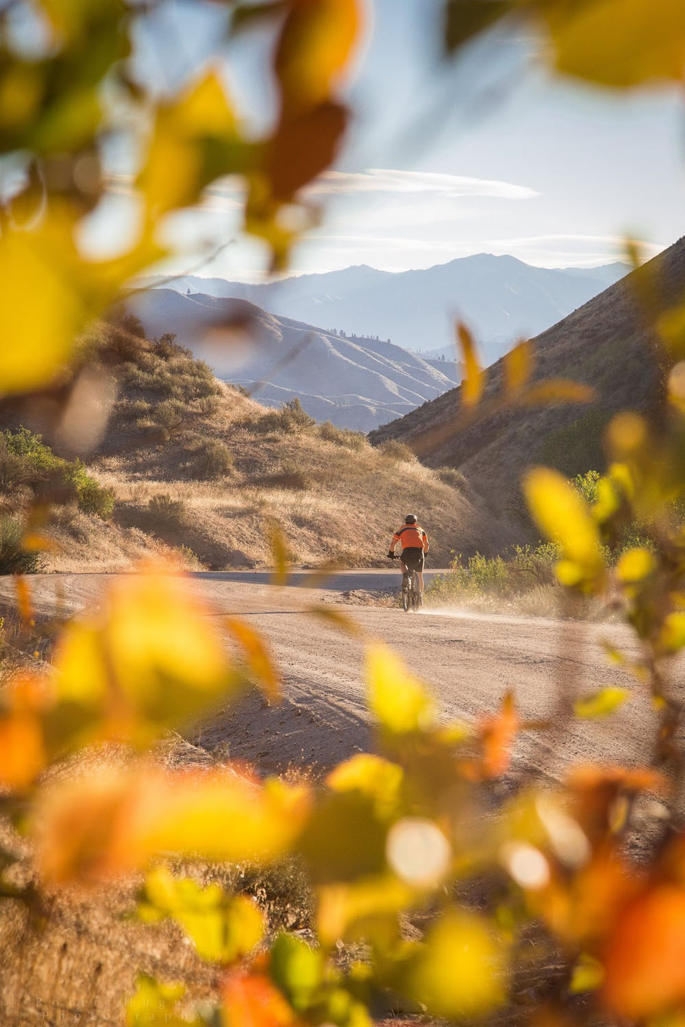
The route continues on forest service roads to Deadwood Reservoir – expect washboard conditions. Ascend from the reservoir up a narrow and steep road to the summit for considerable views of the Sawtooth range to the northeast. Scott Mountain lords over Garden Valley to the south at an elevation of just over 8,000 feet. A long and fast descent takes you to the scenic highway, heading east next to the Payette River toward Garden Valley, which is a mile off route for resupply. Enjoy a few old forgotten roads, affectionately referred to as Mordor, as you head toward the charming semi-ghost town of Placerville, where one tiny convenience store may or may not be open.
Out of Placerville, the road connects to the Harris Creek Road, which is a major connector through these hills. From a high saddle the route goes to Boise Ridge Road, an unassuming backcountry road with crazy steep climbs winding from ridge to ridge. You will see Shafer Butte and Moore’s Mountain off in the distance. These landmarks comprise Bogus Basin and mark the final summit before descending towards Boise. Before topping out, the route skirts around the mountain on single track through old-growth forest and lush meadows, eventually tying into Ridge Road.
Ridge Road is a rolling dirt road that sits above Boise across the top of the foothills with panoramic views of the city and the valley. From Ridge Road begin the flight down singletrack that is long, fast and well groomed to the sagebrush-covered lower foothills. Singletrack punches out a few miles above Boise onto Bogus Basin Road, which is followed back to Hyde Park at 13th and Eastman.
Additional Resources


Terms of Use: As with each bikepacking route guide published on BIKEPACKING.com, should you choose to cycle this route, do so at your own risk. Prior to setting out check current local weather, conditions, and land/road closures. While riding, obey all public and private land use restrictions and rules, carry proper safety and navigational equipment, and of course, follow the #leavenotrace guidelines. The information found herein is simply a planning resource to be used as a point of inspiration in conjunction with your own due-diligence. In spite of the fact that this route, associated GPS track (GPX and maps), and all route guidelines were prepared under diligent research by the specified contributor and/or contributors, the accuracy of such and judgement of the author is not guaranteed. BIKEPACKING.com LLC, its partners, associates, and contributors are in no way liable for personal injury, damage to personal property, or any other such situation that might happen to individual riders cycling or following this route.
Please keep the conversation civil, constructive, and inclusive, or your comment will be removed.