

RideWithGPS just announced its all new mobile and web-compatible heatmap layer, offering yet another helpful map for planning new routes…
In my opinion, Ride with GPS is the best software in its class for planning bikepacking routes. But, there’s always room for improvement—particularly through the addition of new map types that add to its suite of useful layers. Today, the Portland, Oregon-based company added a heatmap to the app’s arsenal. For those unaware, heatmaps use synced ride data from cyclists’ GPS devices to highlight which trails are more ridden and used, so “hot” routes are highlighted with thicker and darker lines. In the past, I’ve regularly flipped over to Strava’s heatmap when planning bikepacking routes. This alternative view provides yet another way of checking which trails and gravel roads are preferred by cyclists, or verifying if questionable tracks are in fact bike-accessible. Essentially, it adds another helpful resource when identifying and choosing tracks prior to on-the-ground recon.
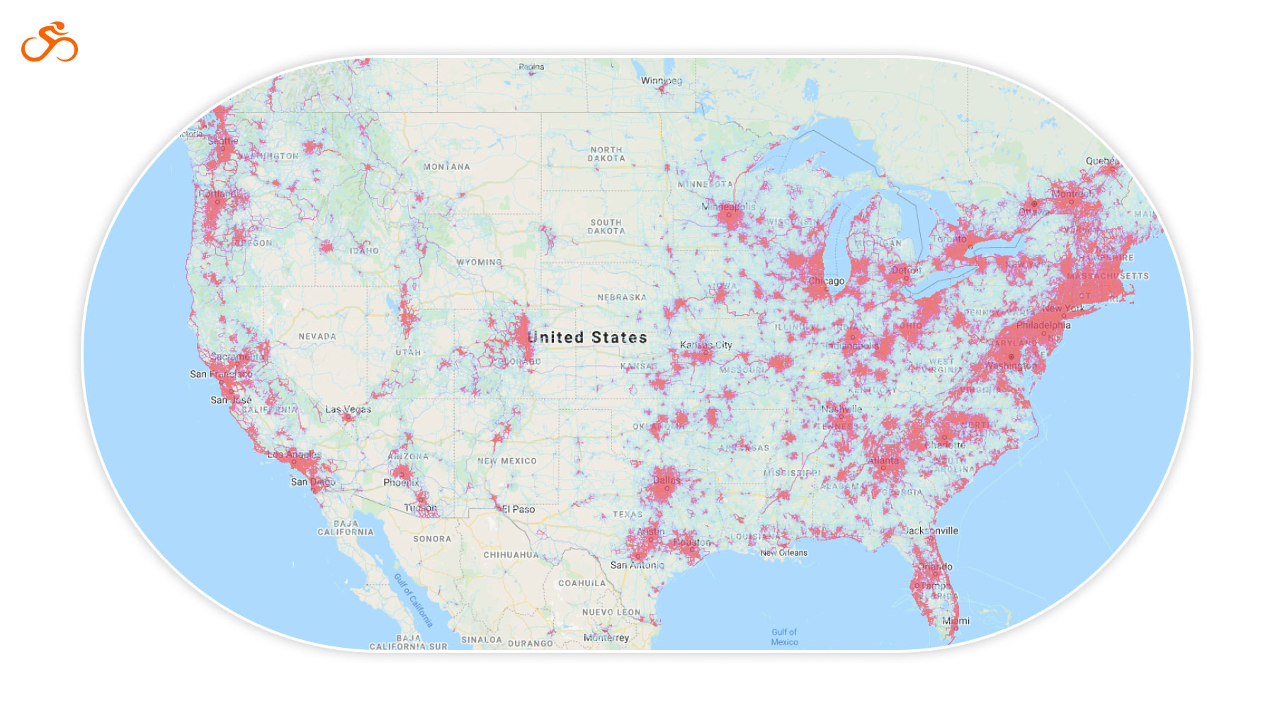
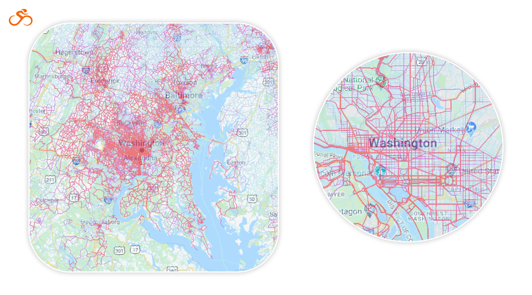
The Ride with GPS Heatmap aggregates data from the past two years of publicly-recorded trips from their global community (over 1,000,000 users), then translates it to highlights on a map so that users can see the “heat” generated from other cyclists via a shaded overlay. The Ride with GPS Heatmap updates weekly, and heatmap data only includes publicly-logged trips from public users, which is nice for those looking to ride privately, for whatever reason.
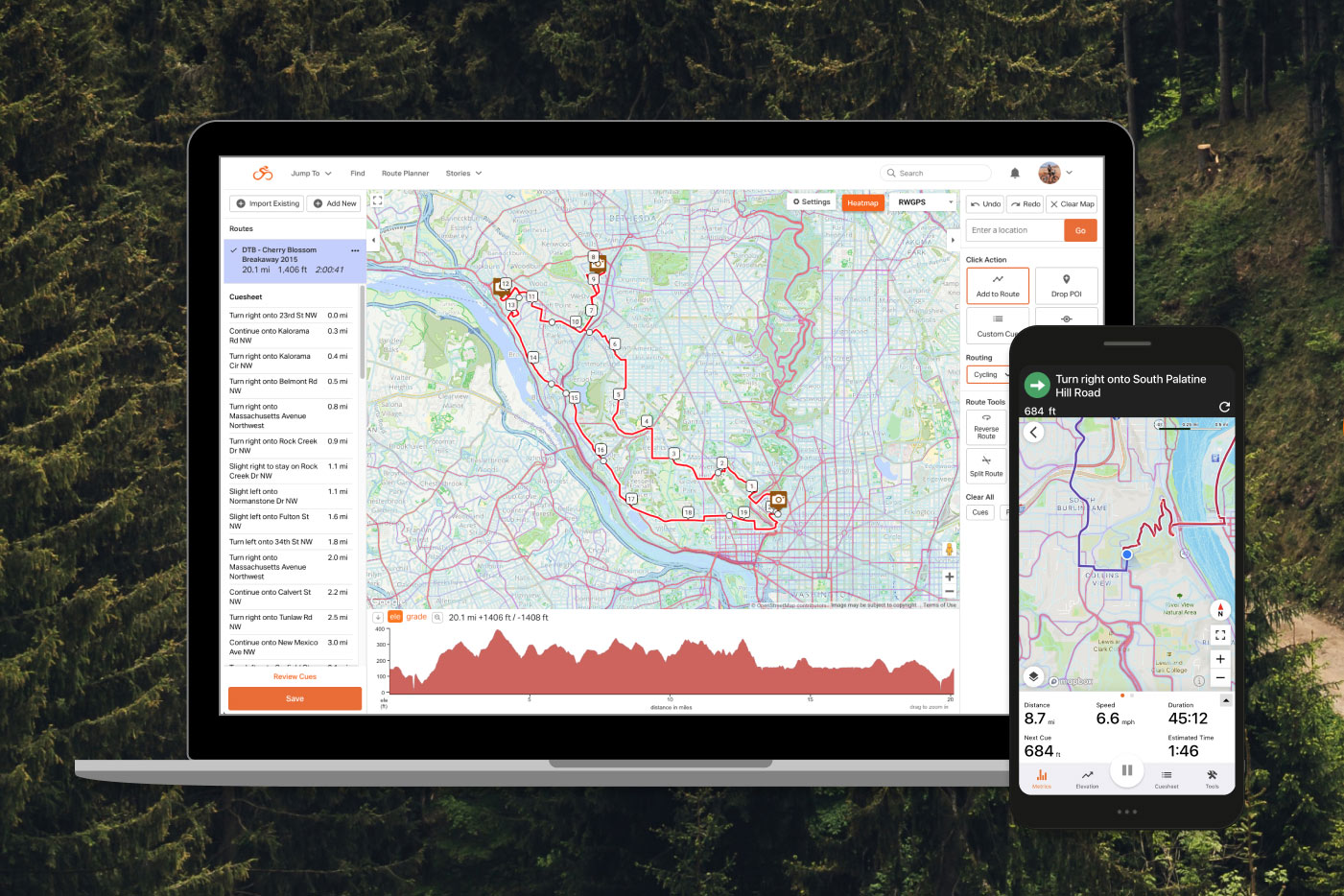
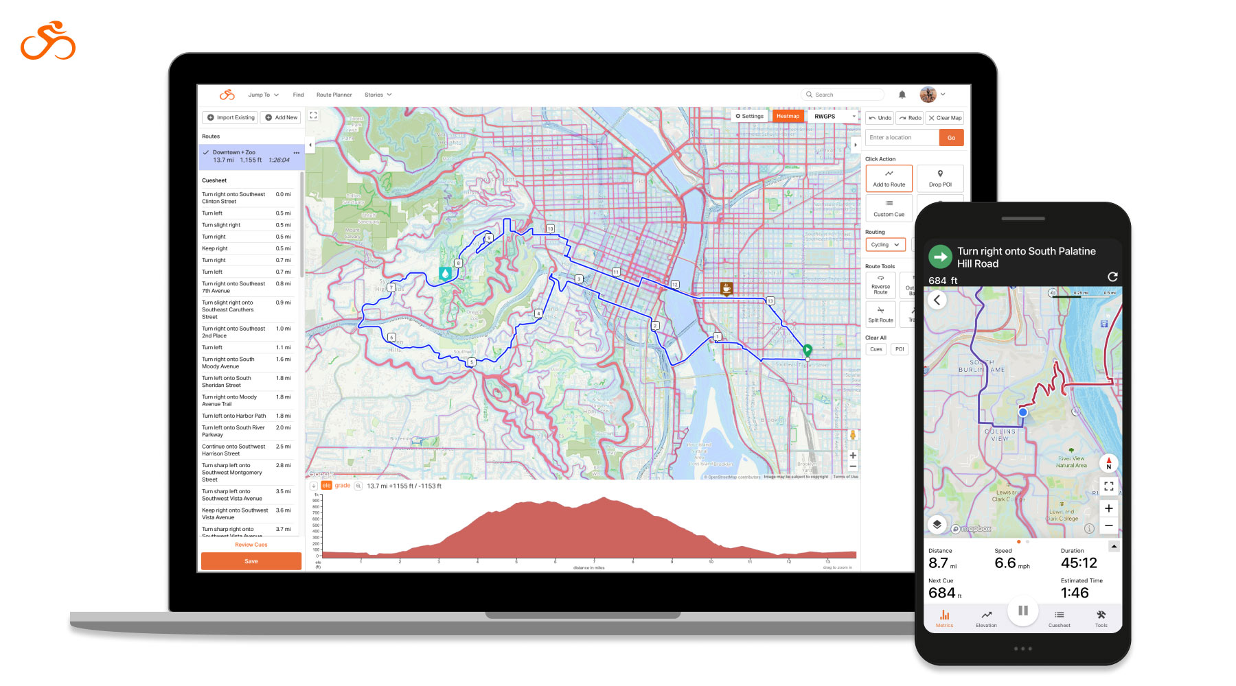
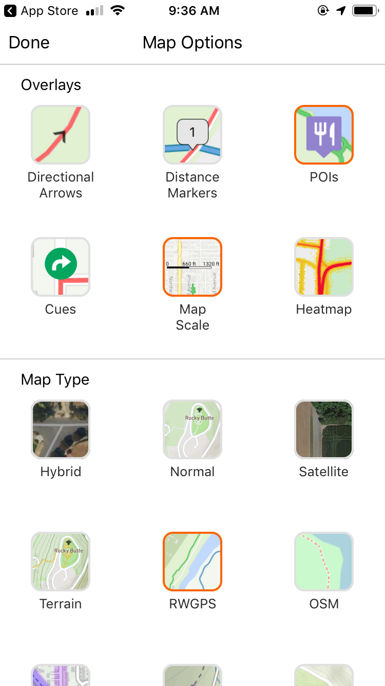
As you can see in the screenshots from my phone below, the heatmap is activated from the layers screen on the mobile app. Similarly, on the web application, there’s a large button at the top of the map when in planning mode. Once it’s activated, the heatmap is overlayed onto the map, and the “heat” is highlighted in shades of purple and pink. The areas most ridden are reddish pink with thicker lines. On first look, I found the Heatmap to be most easily visible atop the standard RWGPS map layer.
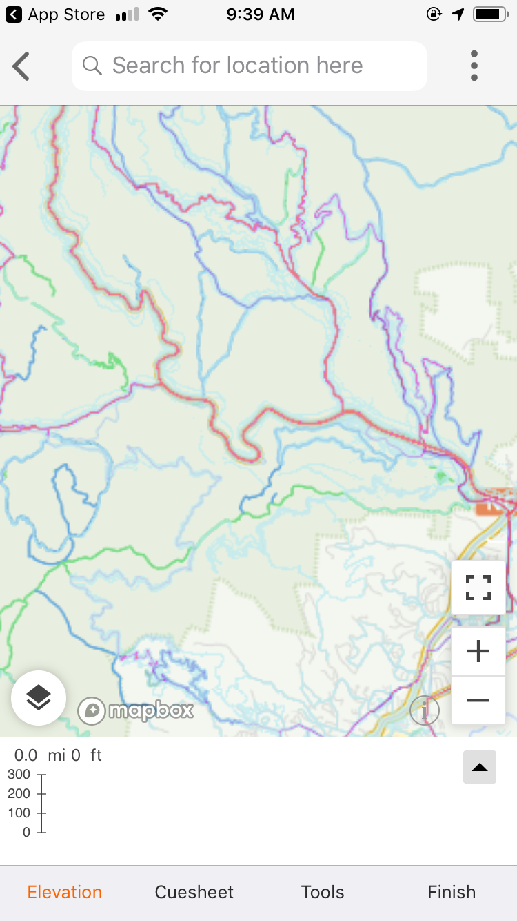
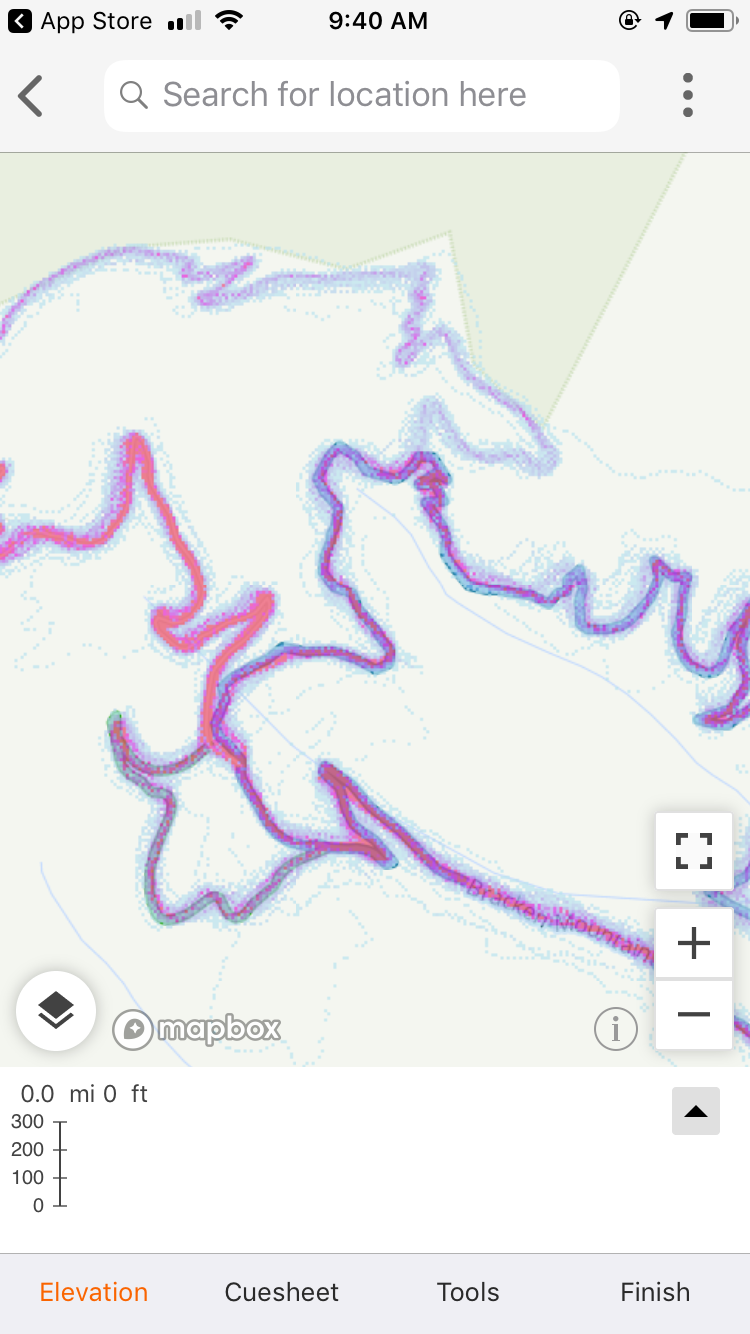
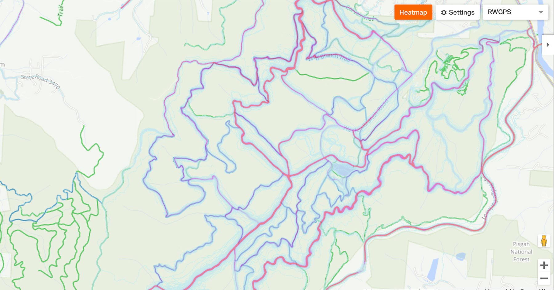
The heatmap overlay is available on both the web and mobile route planner maps with no need to toggle back and forth between maps as users create routes. Technically, you can view the heatmap alongside the elevation profile, while splitting and combining segments, color-coding segments, and performing most other functions. Here are the full specs from RideWithGPS:
- Mobile Access: The heatmap is fully integrated into the Ride with GPS iOS and Android mobile apps, so that it is accessible in the palm of your hand.
- Route Planner Integration: The heatmap was designed with route planning in mind. It overlays in the web and mobile route planners for uninterrupted ease of use.
- Recording Screen Overlay: The heatmap is viewable as an overlay in the ride recording screen of our iOS and Android mobile apps for all Ride with GPS members.
- User Privacy Considerations: Only publicly-logged rides from public users are included. All user-created privacy zones are respected and not included in the ride data, and start & end points of trips are also automatically designated as privacy zones. Users may opt-out at any time through their privacy settings.
- Data-Driven: The heatmap was developed using the two most recent years of data from the publicly-logged trips of our users.
- Weekly Updates: Updates to the heatmap will be made weekly so that the data included is continually growing and accurate.
- Publicly Viewable: The Ride with GPS Heatmap is publicly viewable at ridewithgps.com/heatmap. A Ride with GPS account is not needed to view the heatmap.
- User Availability: The heatmap is viewable to the general public, accessible to all Ride with GPS members in the mobile app recording screen, and available as an overlay in the mobile route planner for Basic members and in the web route planner for Premium members. For more information on plans and features, visit www.ridewithgps.com/plans.
The heatmap is viewable for the general public with no account necessary and available as an overlay in the mobile and web route planners for Basic and Premium members. Bikepacking Colletive Members can save 20% off an annual Ride With GPS Basic or Premium account; find that under Member Benefits in the member login area. Learn more at RideWithGPS.com
Please keep the conversation civil, constructive, and inclusive, or your comment will be removed.