


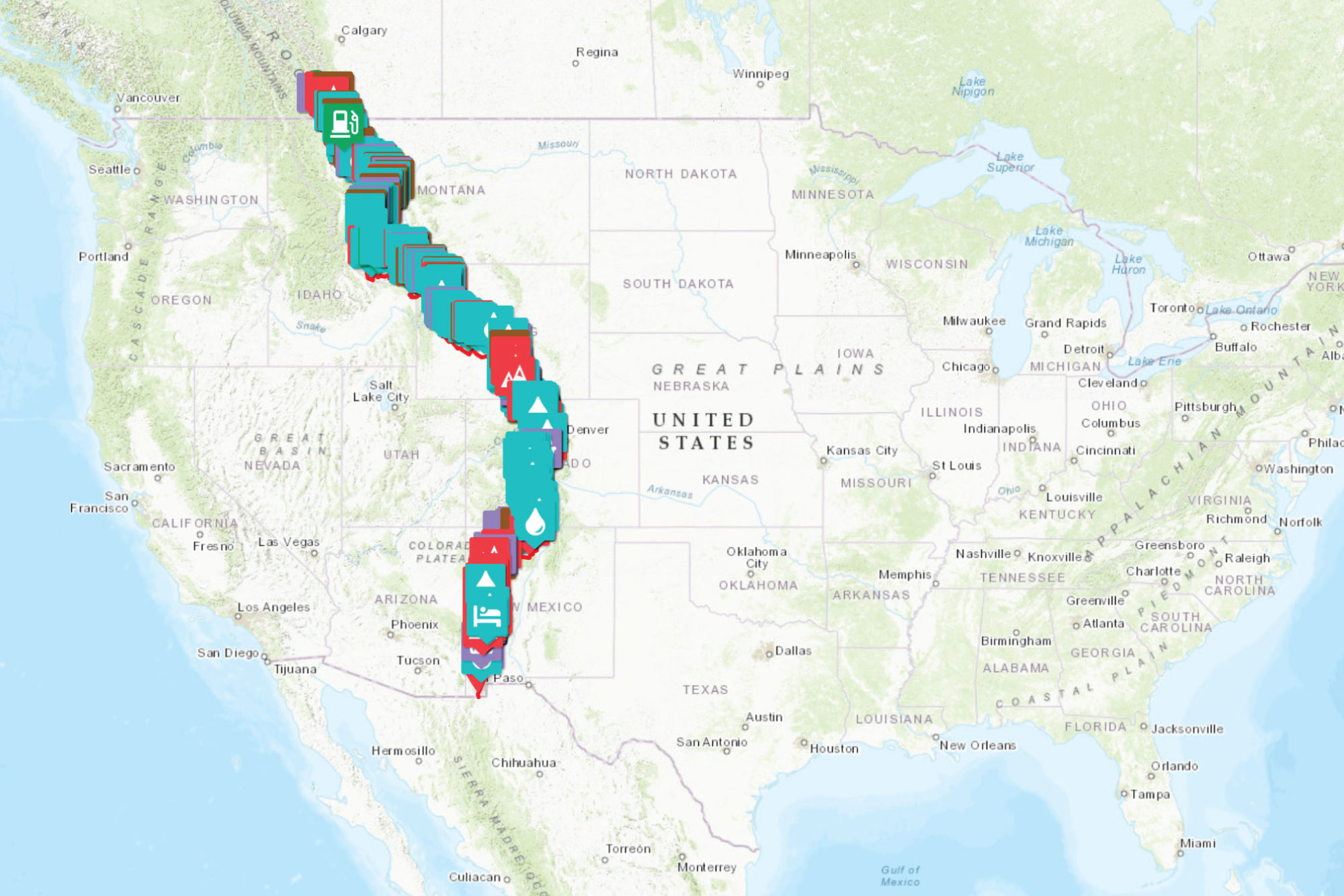


After hours of research, Sarah Swallow created this incredibly detailed POI map for the US portion of the Great Divide Mountain Bike Route. Watch Sarah’s video about the process and find the interactive map here…
Creating bikepacking routes and completing all the documentation that goes into them is a ton of work. One of the most time consuming elements is marking and creating POIs (Points of Interest). Just in scouting the Eastern Divide Trail over the past three years I’ve typed several terms into my mapping app more times than I can count—words such as campsite, spring, begin pavement, and end pavement (hence our new stickers and patches). But I love that about routes, the fact that it’s an open, collaborative, and shareable process. And with a little elbow grease these efforts can help others plan their ride and get out on these incredible routes. In this spirit, our friend Sarah Swallow just released a super-detailed POI map for the 2021 Tour Divide route that she made to help plan her ride. Watch the video below with Sarah walking through this resource, then scroll down for the embedded Tour Divide POI map.
After hours of research, pooling together countless sources, Sarah Swallow created this incredibly detailed POI map for the US portion of the Great Divide Mountain Bike Route—more specifically, the US-only Great Divide Classic route that was adjusted to reflect the border closure with Canada this year. The map features water stops, campsites, resupply services, and much more for use as a reference for riders tackling the route.
Related Content
Make sure to dig into these related articles for more info...


Please keep the conversation civil, constructive, and inclusive, or your comment will be removed.


