


The Great Divide Mountain Bike Route (GDMBR) Planning Guide
Distance
2,696 Mi.
(4,339 KM)Days
37
% Unpaved
90%
% Singletrack
3%
% Rideable (time)
100%
Total Ascent
149,664'
(45,618 M)High Point
11,913'
(3,631 M)Difficulty (1-10)
5.5?
- 4Climbing Scale Fair56 FT/MI (11 M/KM)
- -Technical Difficulty
- -Physical Demand
- -Resupply & Logistics
Contributed By
Matt and Brett
A View From Two Wheels
*We acknowledge that the majority of this route travels through the unceded traditional territory of the First Nations and Indigenous peoples who first occupied it. Learn more at Native-Land.ca.
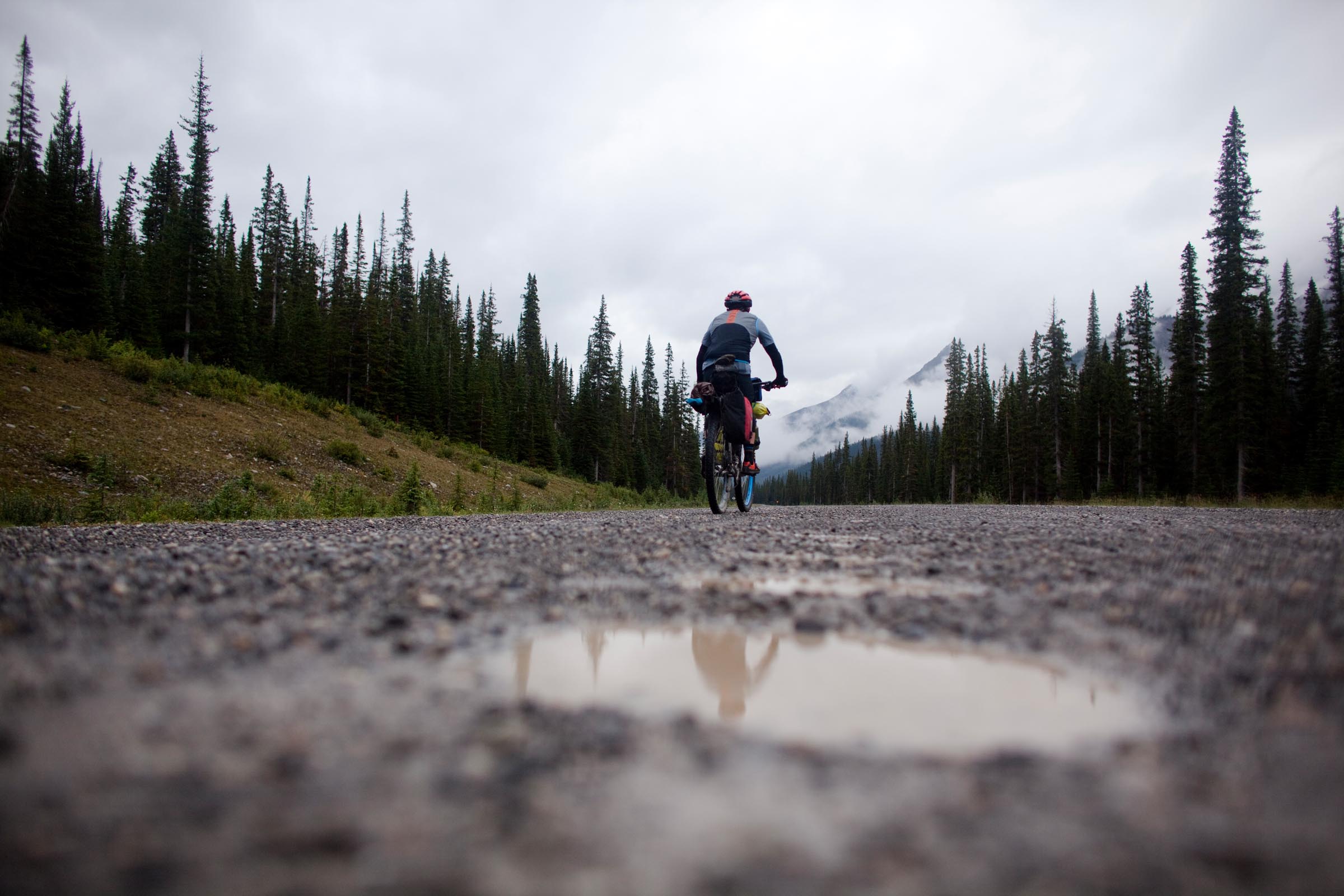
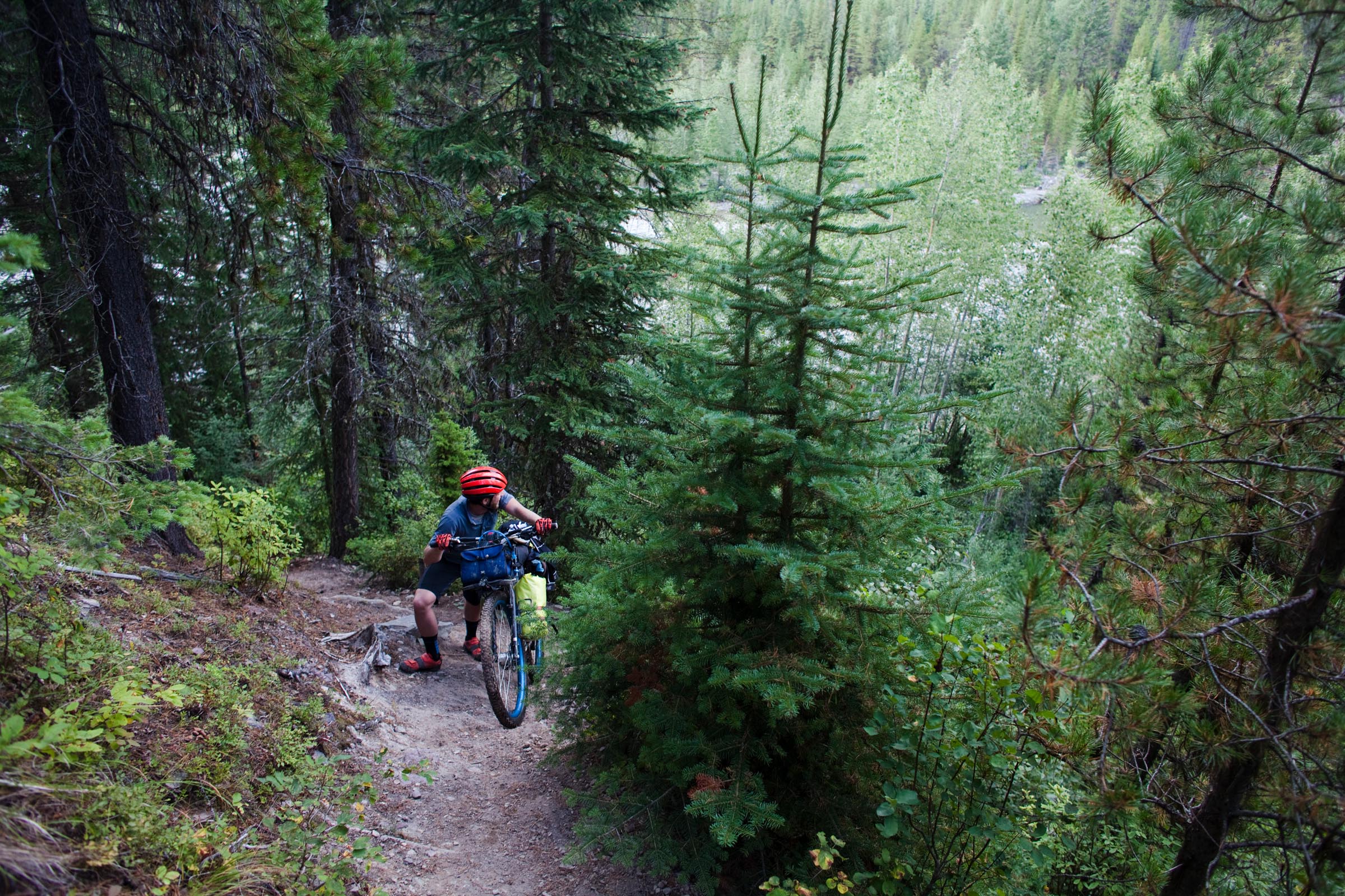
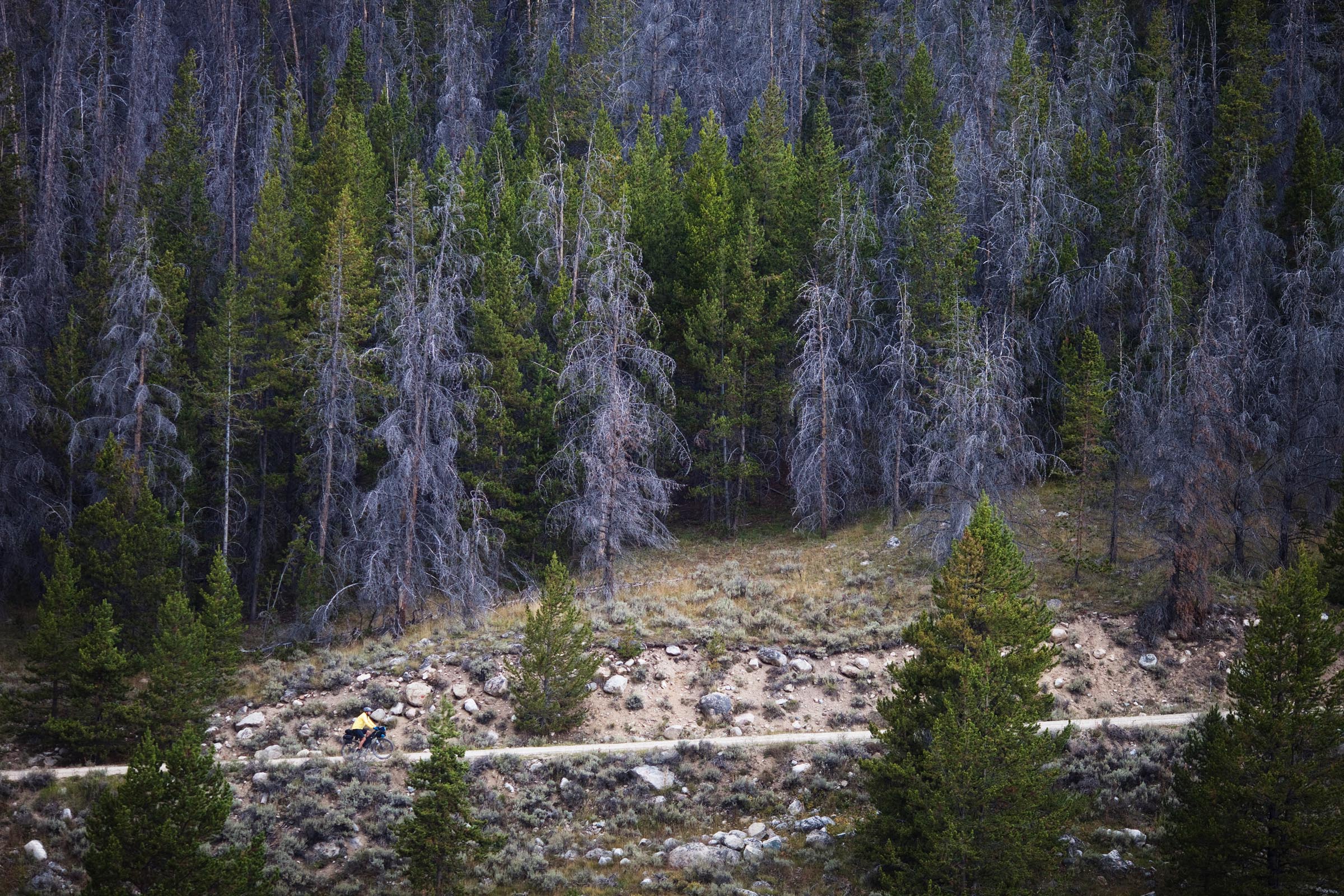
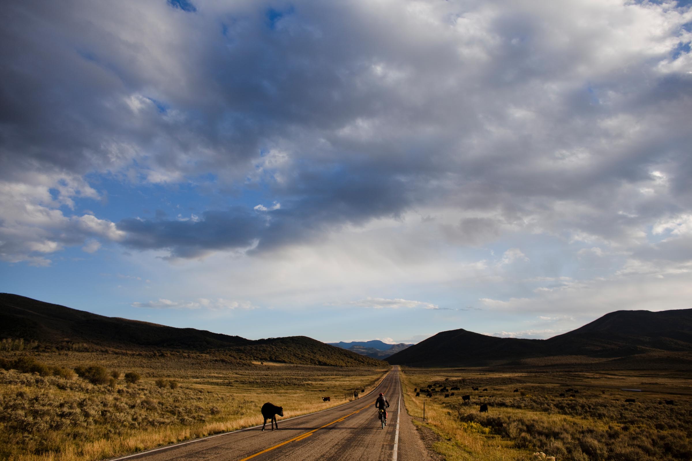
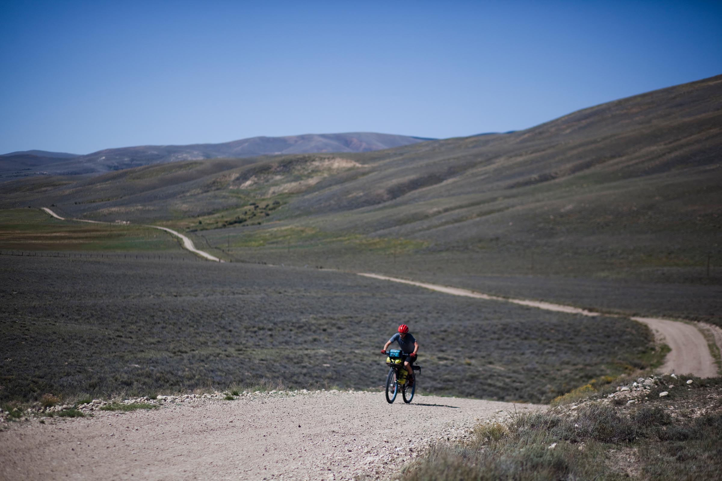
The Great Divide Mountain Bike Route (GDMBR), developed and mapped in 1997 by the Adventure Cycling Association, is approximately 2,700 miles long and is considered by many to be the birthplace of bikepacking as a sport. The route follows the Continental Divide and is 90% off-pavement using high-quality dirt roads, gravel roads, trails, and a few short sections of unmaintained tracks. Bikepacking the GDMBR requires only intermediate off-road mountain biking skills, but it is a painstaking test of endurance based on the sheer scale of the route, with over 200,000 feet (60,960 meters) of elevation gain and loss.
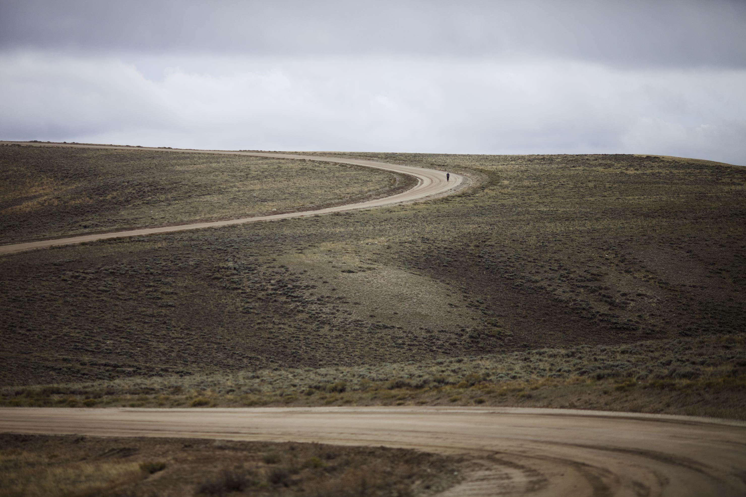
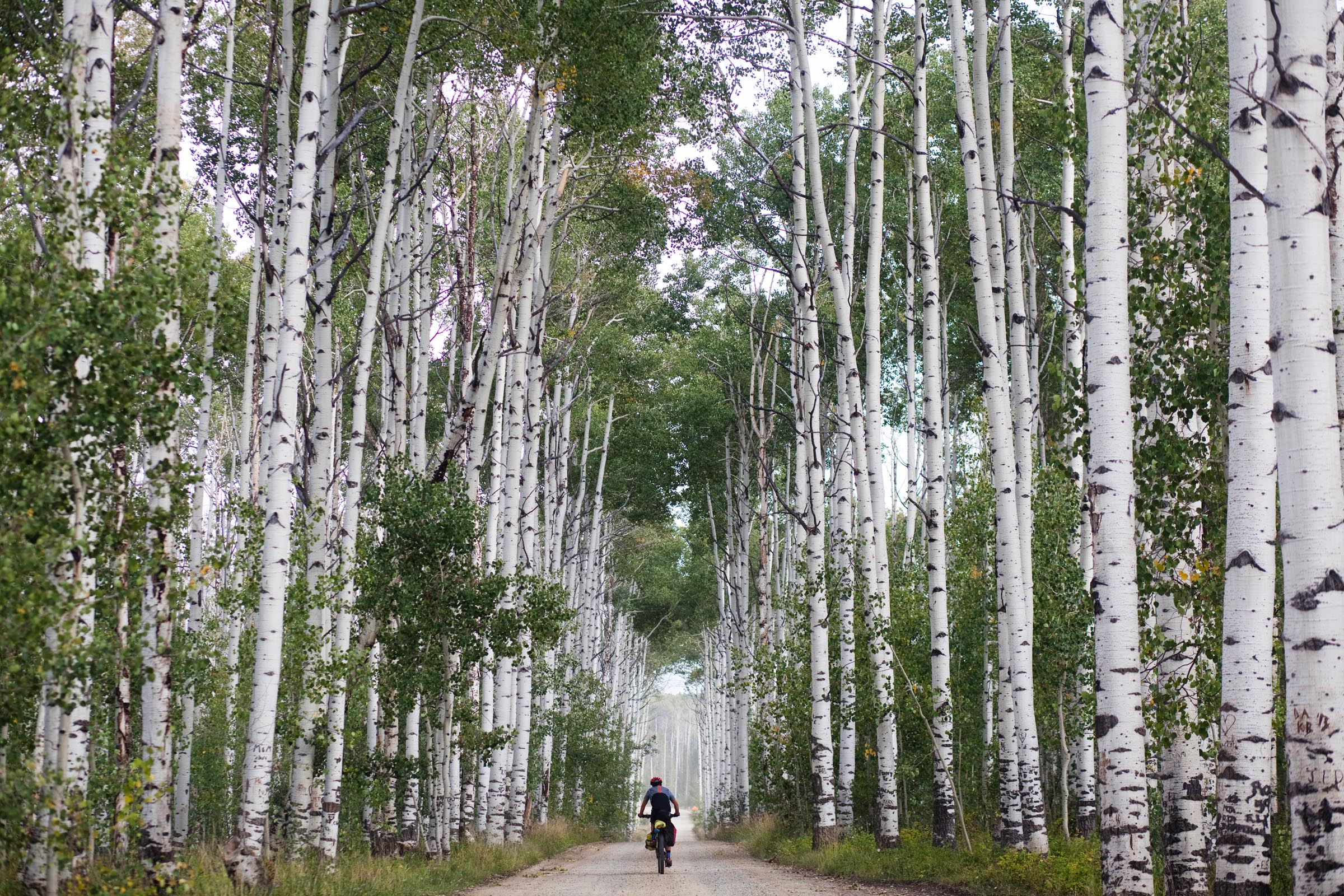
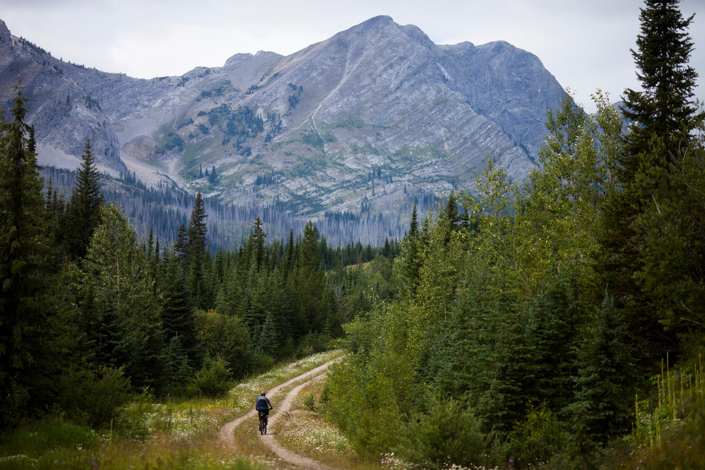
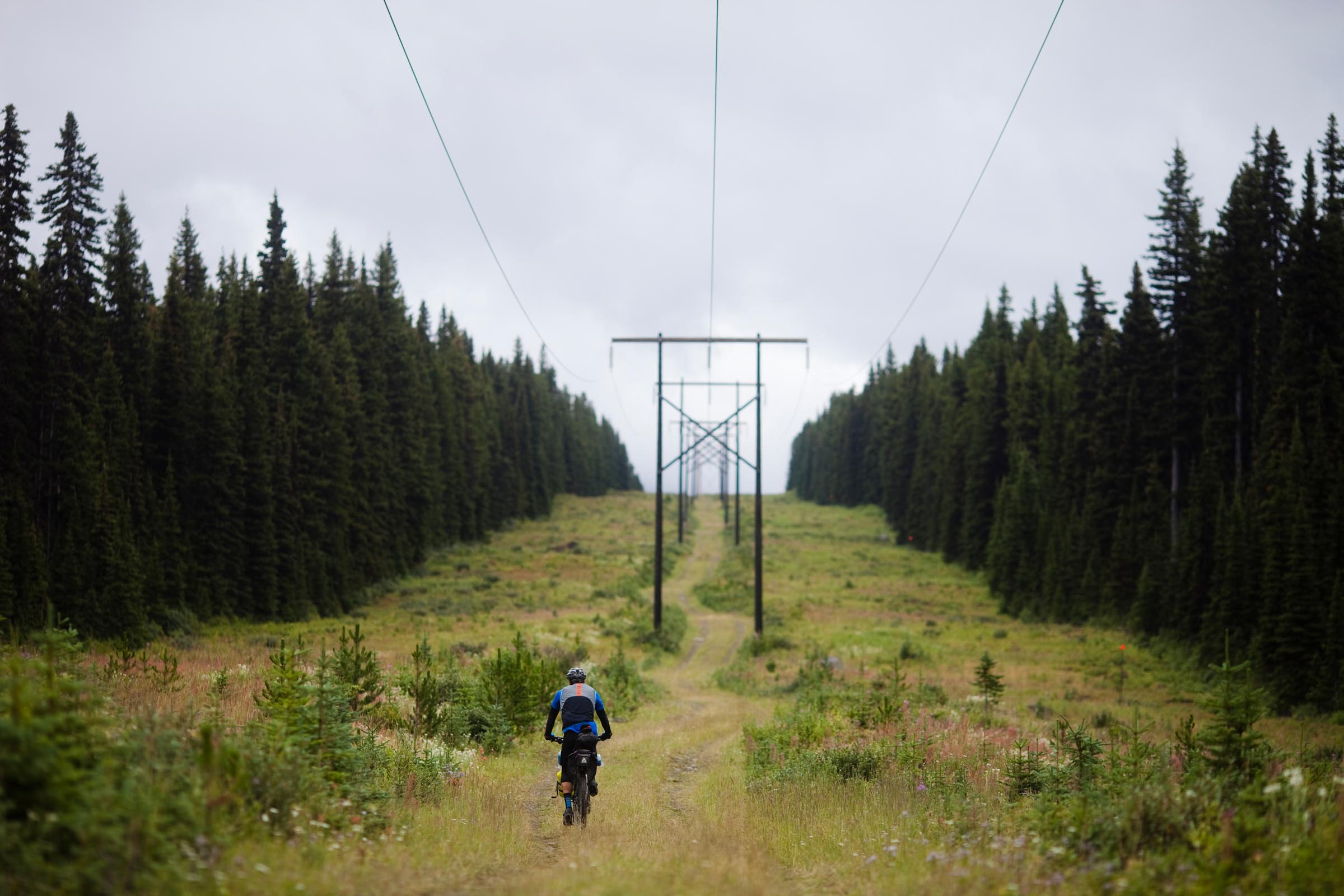
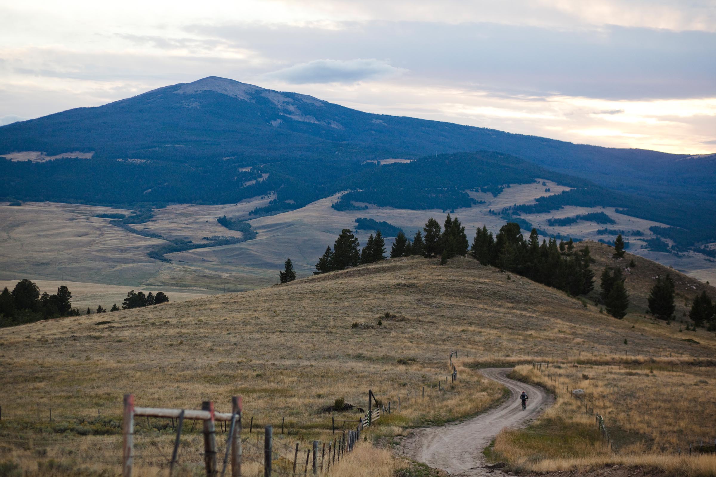
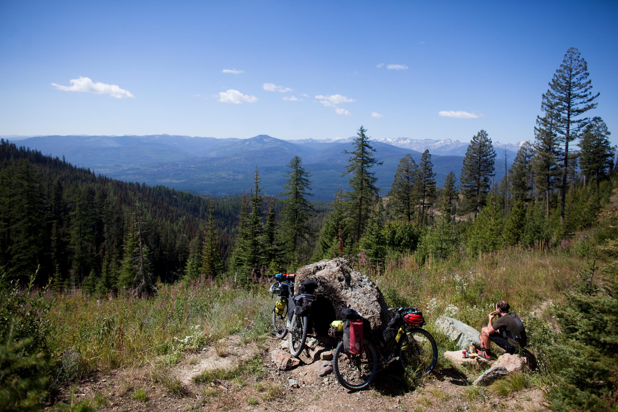
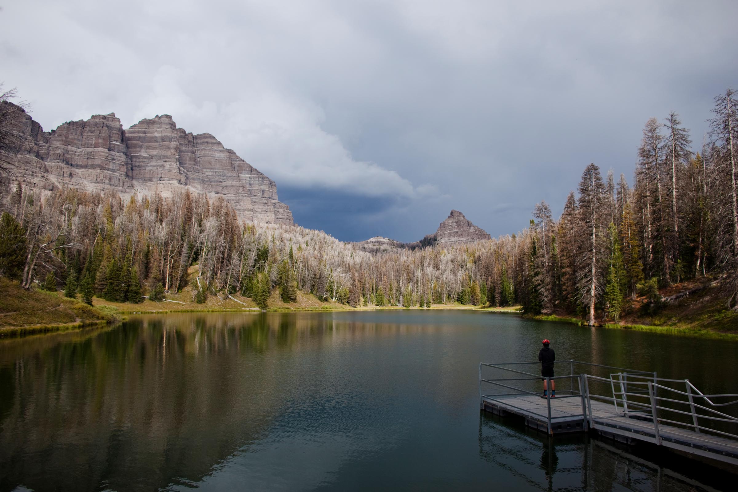
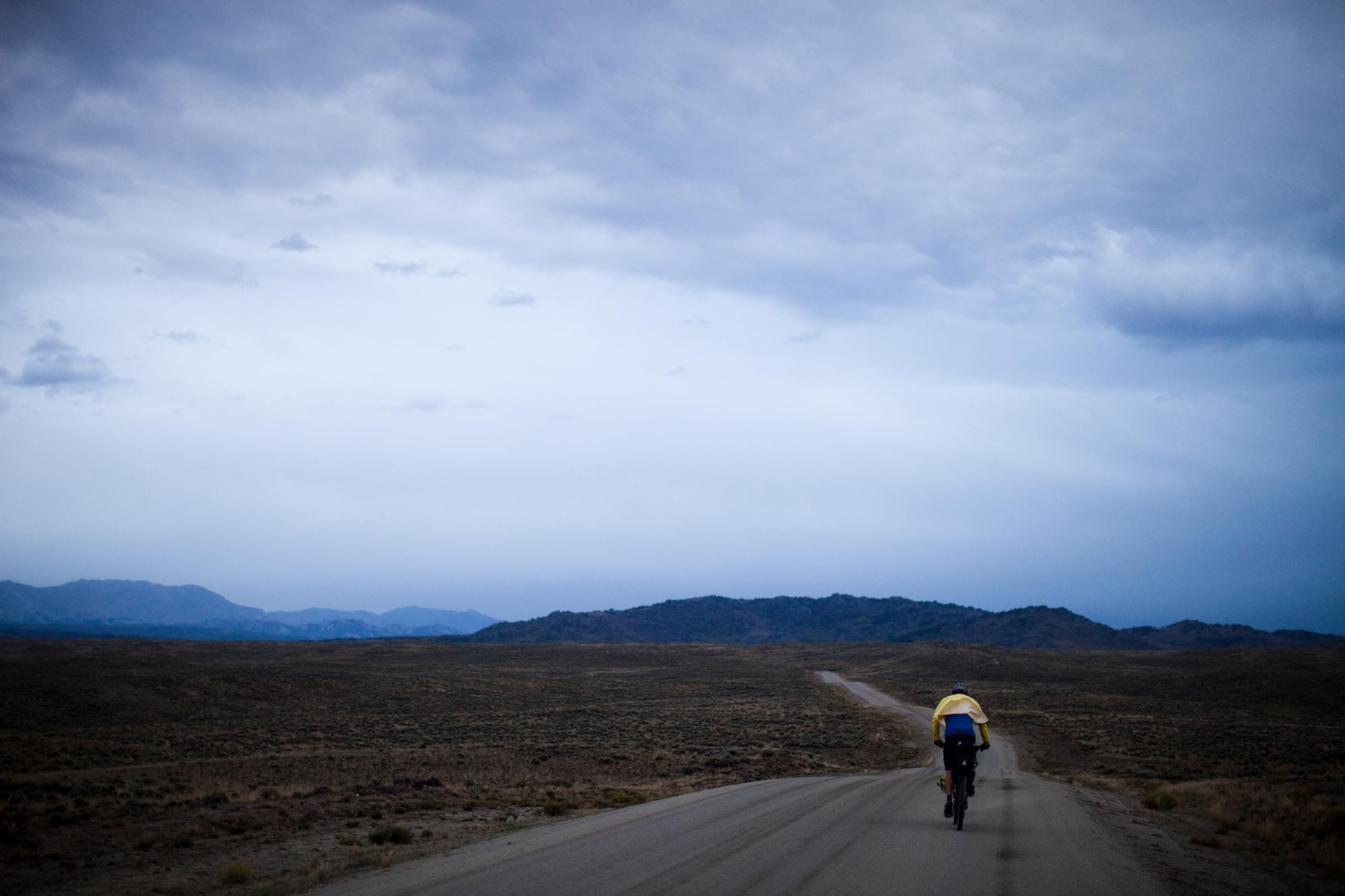
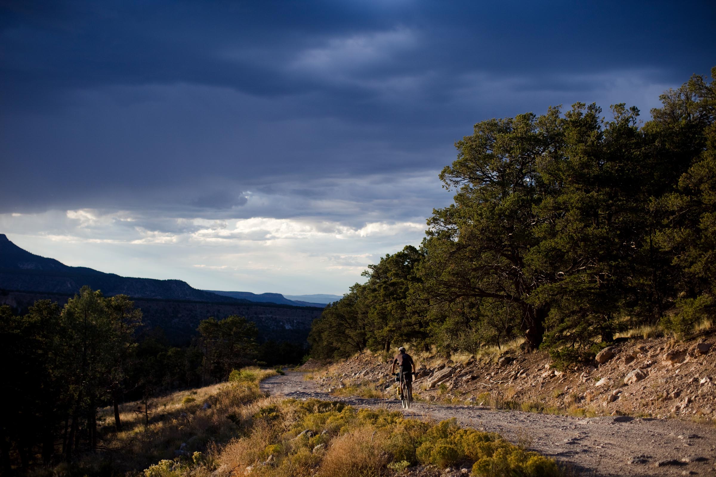
The GDMBR is routed through a cross-section of the American West defined by spectacular scenery, a variety of landscapes, historic mountain towns, and boundless remote wilderness. Highlights include the Flathead Valley in Alberta, Grand Teton National Park, the Great Divide Basin in Wyoming, South Park, Boreas Pass in Colorado, Polvadera Mesa, and the Gila Wilderness in New Mexico. Colorado’s Indiana Pass, at 11,910 feet (3630 meters), is the highest point on the route. Throughout the route riders encounter wild river valleys, remote mountain wilderness, open grasslands, high desert, and towards the southern end of the route, an amazing span through the Chihuahuan Desert.
The route is best known for the Tour Divide, an annual self-supported race. In this event, the race clock runs 24 hours a day and riders are allowed no outside support other than access to public facilities such as stores, motels, and bike shops. The record time to complete the Tour Divide is 13 days, 22 hours and 51 minutes and was set in 2016 by Mike Hall (see Trail Notes for a full list of records). The Tour Divide has been raced and completed on both single speed bicycles and tandem bicycles. The race, which has neither entry fees nor prizes, usually starts in the second weekend of June.
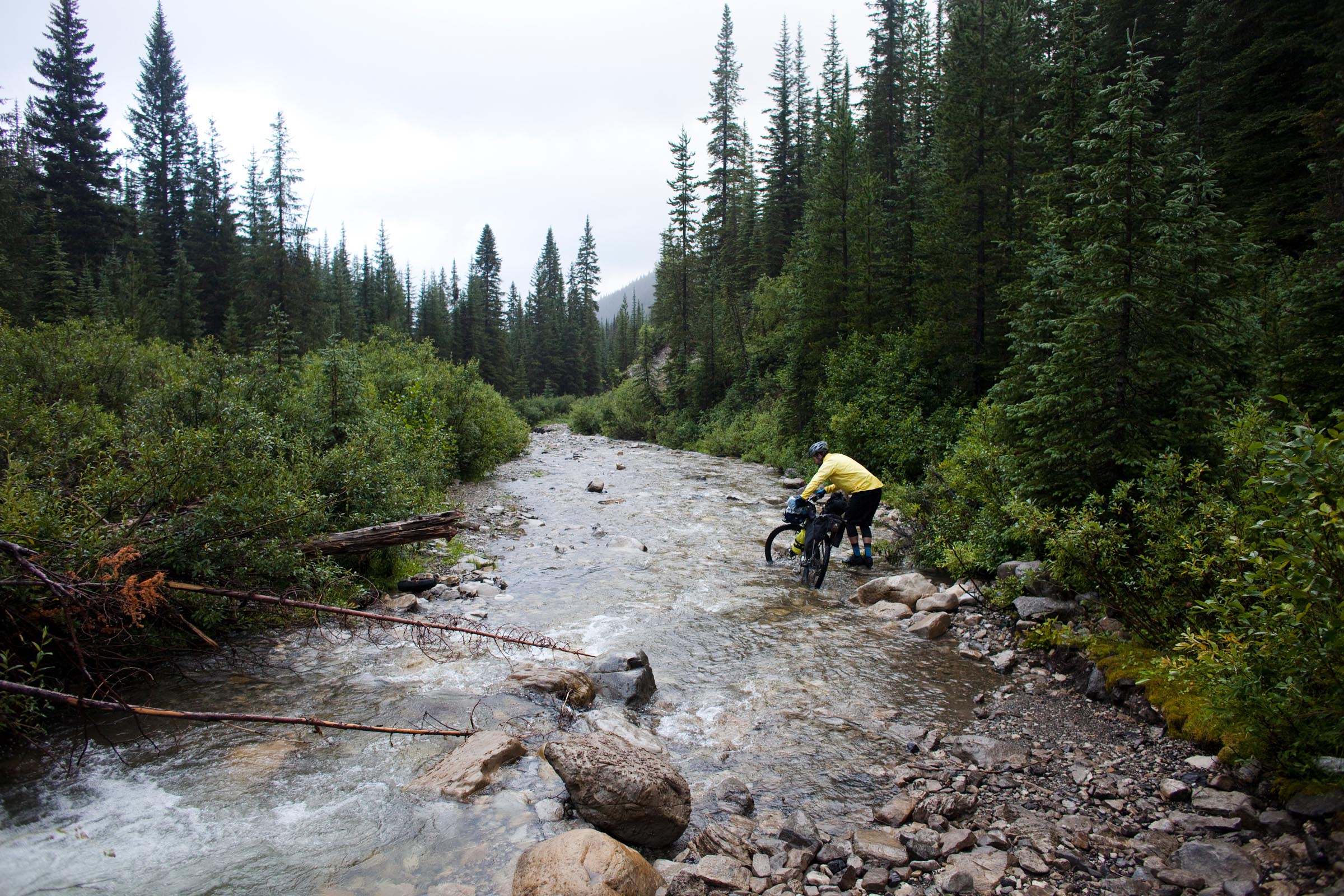


Before you set off, it is crucial to check Adventure Cycling Association’s updated Addenda. Throughout the season, riders contact ACA about current route conditions and offer helpful reroutes for impassable sections. We forgot to do this early on and ran into a deadend created by a massive washout. To avoid significant backtracking, we twice forded a massive river. Also, check the Temporary ACA Route Road Closures forum thread for more up to date issues. Also, see Trail Notes tab for more information on GPX and navigation.
Submit Route Alert
As the leading creator and publisher of bikepacking routes, BIKEPACKING.com endeavors to maintain, improve, and advocate for our growing network of bikepacking routes all over the world. As such, our editorial team, route creators, and Route Stewards serve as mediators for route improvements and opportunities for connectivity, conservation, and community growth around these routes. To facilitate these efforts, we rely on our Bikepacking Collective and the greater bikepacking community to call attention to critical issues and opportunities that are discovered while riding these routes. If you have a vital issue or opportunity regarding this route that pertains to one of the subjects below, please let us know:
Highlights
Must Know
Camping
Food/H2O
Trail Notes
Resources
- Riding through a cross-section of the American West defined by spectacular scenery
- A variety of landscapes, historic mountain towns, and boundless remote wilderness.
- The Flathead Valley in Alberta
- Grand Teton National Park
- The Great Divide Basin in Wyoming
- South Park
- Boreas Pass in Colorado,
- Polvadera Mesa
- Gila Wilderness in New Mexico
- Colorado’s Indiana Pass, at 11,910 feet (3630 meters), is the highest point on the route
- Wild river valleys and remote mountain wilderness, open grasslands, high desert
- An amazing span through the Chihuahuan Desert.
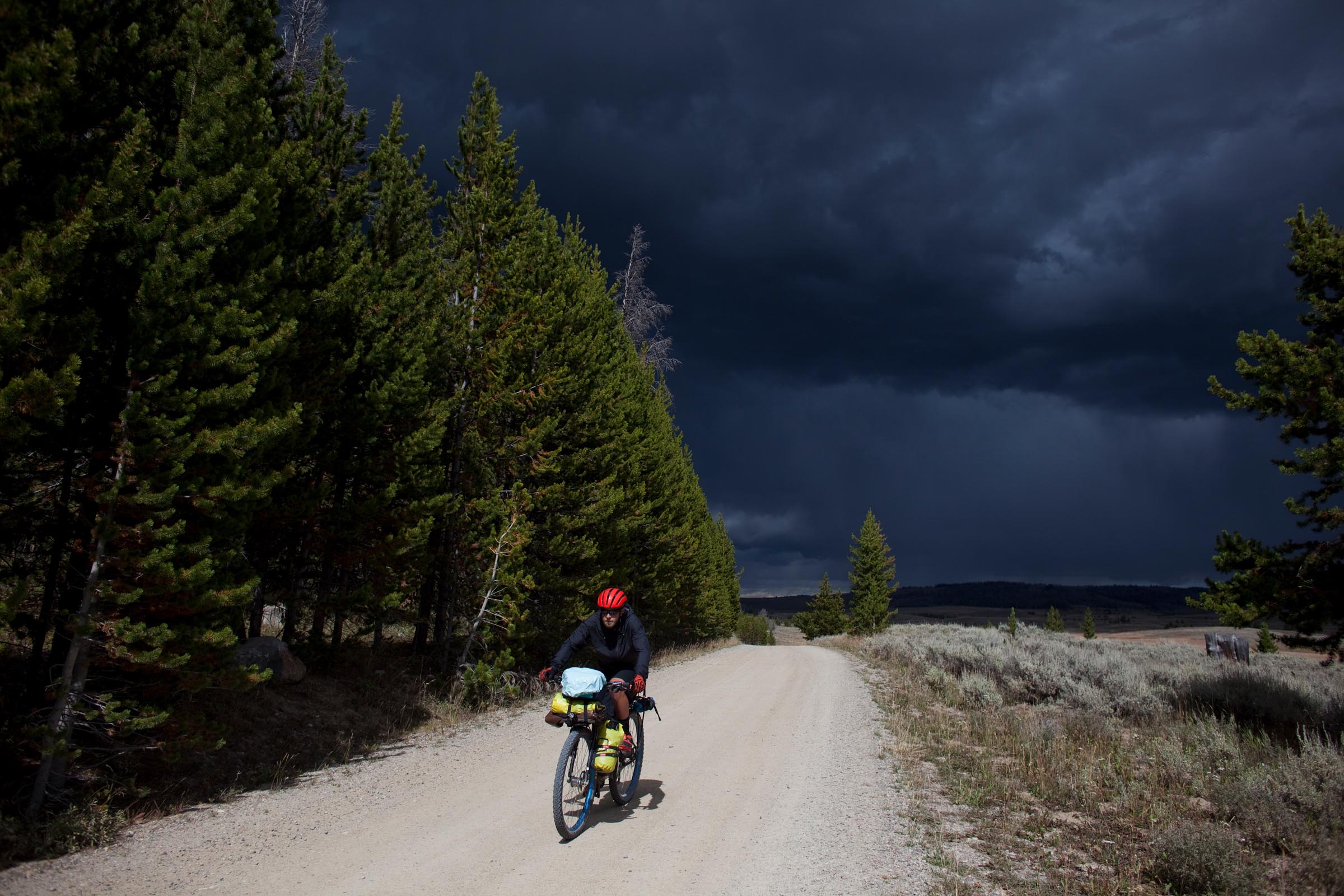
Weather and When to Go
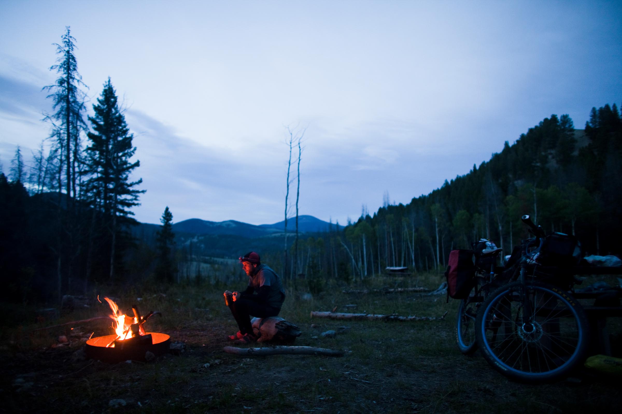
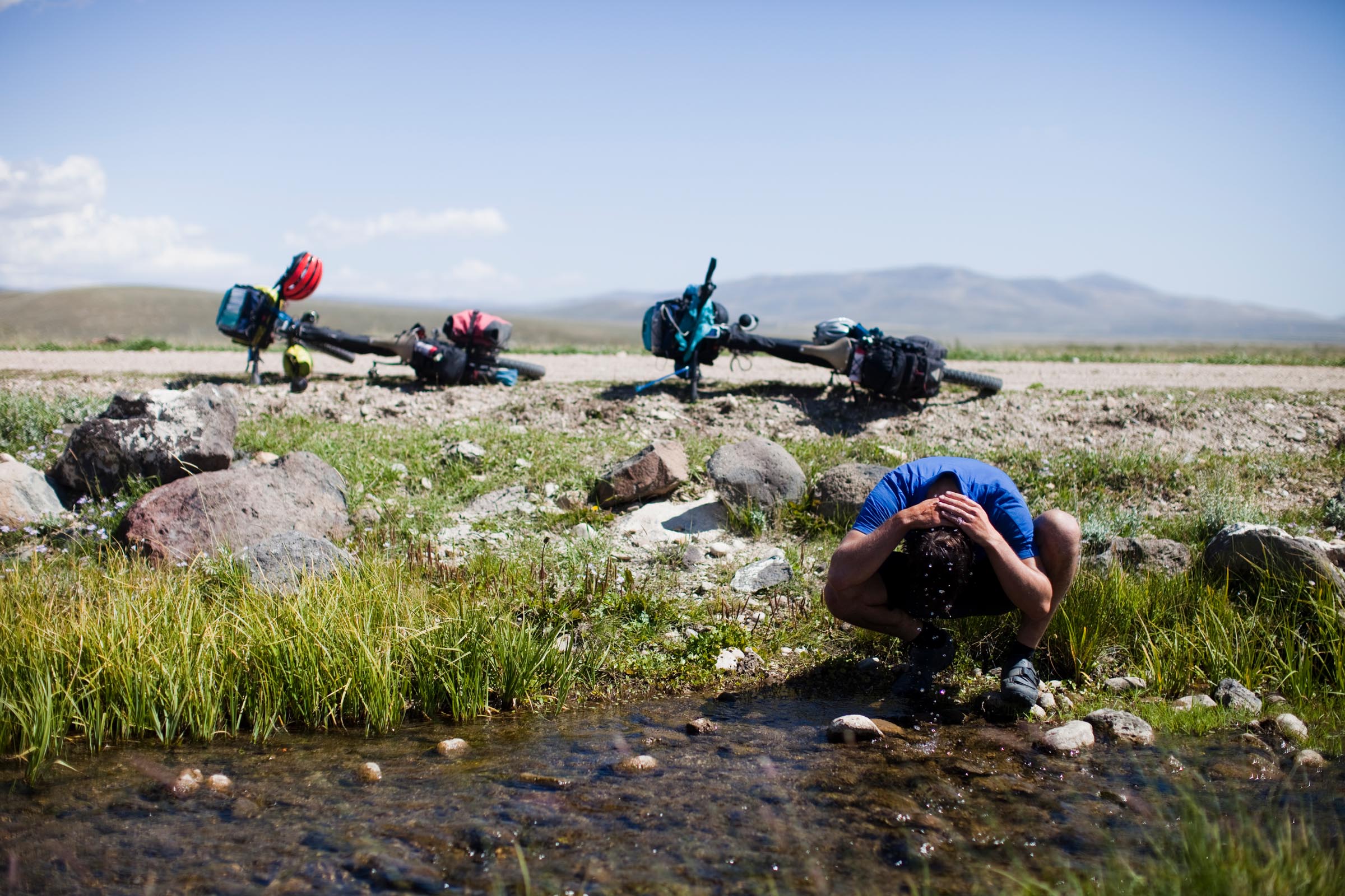
Weather on the GDMBR is always changing. At elevation, the weather can switch in the blink of an eye. In general, the route is mostly passable during late June through mid-October, but be aware that it can snow at elevation any time of the year. After much research, we decided that a mid August departure date would be close to ideal. The weather in Canada and northern Montana would be relatively warm and we would beat the snow in Colorado while escaping the heat of New Mexico. We were pretty spot on with our assessment but overlooked the monsoon season in New Mexico.
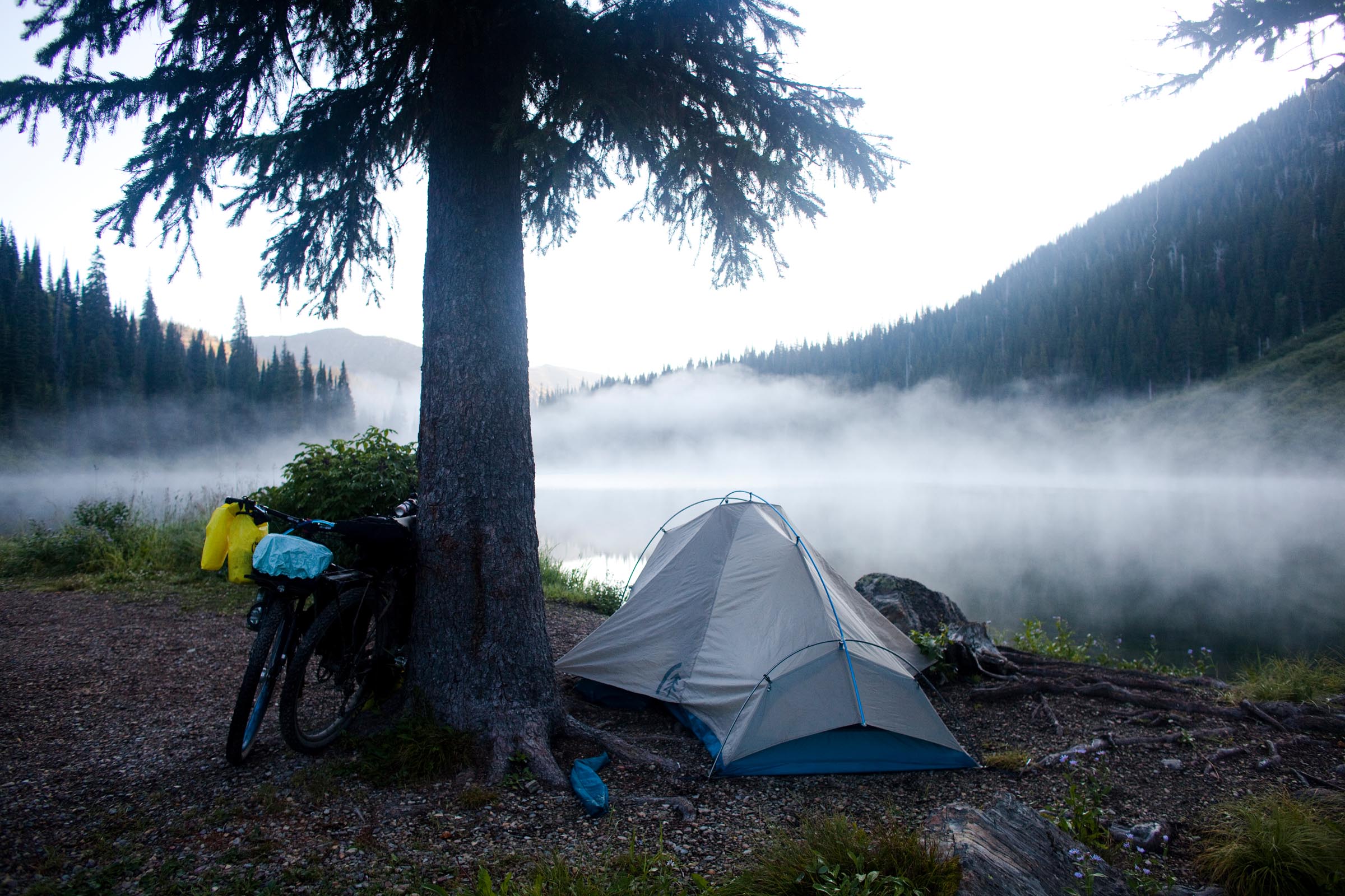
During our travels we woke up with frost on our tent a few times. But, with sleeping bags rated to 20 degrees we were fine. Layering is a necessity, and if you are packing ultralight, consider a sleeping bag liner for higher elevations.
If you decide to travel during June or early July, be aware that you will most likely experience snow in the high mountain passes. Also, if places along the route experienced heavy snow that season, the rivers and streams may be much higher than normal.
Getting there and Getting Started
The best way to get to Banff is to fly into the Calgary International Airport (YYC). Banff is approximately 80 miles (125 km) west of Calgary. From the airport there are a few options to get to Banff. You can rent a car, hire a shuttle, or ride. We decided that it would be easiest to rent a car and split the cost between two people. This allowed us the freedom to choose a starting point own and travel at our leisure.
Once in Banff, a small, posh mountain resort town, we found a parking structure and set about assembling the bikes and kits. There are a few bike shops in town, and if you need any help or last minute supplies, we highly recommend visiting the friendly people at Snowtips-Bactrax. We encourage you to allow yourself more time than you think for last minute errands. We found ourselves running out of daylight after grocery shopping and bike building delays. It may be helpful to book a room at one of the many hostels in town. If you go this route, reserve in advance, because the lodging in town is not cheap! We ended up riding a little out of town to Tunnel Mountain Campgrounds, which was also a touch expensive.
Getting Back from Antelope Wells
Once you arrive in Antelope Wells, instead of a grand finish line, you’ll be met with an anticlimactic border fence. No crowds around the finish, just the Chihuahuan desert and border patrol agents. To avoid an extra 200 mile ride to the airport, it is best to secure a pickup from a shuttle service. From there, you have the choice of two airports. Fly from El Paso, TX (ELP) or Tuscon, AZ (TUS). Both are around 3-4 hours drive from Antelope Wells. After much debate, we decided to fly out of El Paso. We also shipped our bikes via Amtrak… cheap and easy to pack.
Much of the route passes through BLM, national parks, and dedicated wilderness. There are plenty of primitive camping sites along the route. The guidebooks and ACA maps will have accurate camping and lodging recommendations, so depending on your daily pace and number of stops throughout the day, you can plan accordingly.
There are quite a few options for lodging through WarmShowers.org along the route. Check them out in advance and download the app to figure out as you are on the ride.
Also, take advantage of the cyclist only lodging listed on the map as much as possible. Some of them are truly magical.
Tip: Be sure to call ahead for the cyclist only lodging after Lincoln and just before Helena. It is HIGHLY recommended to stay the night there. Brush Mountain Lodge is also a must. Very affordable and the crew there is incredible, very knowledgable and supportive of the GDMBR. Also, a jaccuzzi.
During the Divide you’ll be faced with plenty of long stretches where there are limited to no supplies. Reliable food and water sources on some portions of the route are over 100 miles (160 km) apart. If you follow the ACA mapset, you will get a good idea of where you need to pack extra supplies. Packing a water filter is highly recommended. There are only a few days on the trip when you will not be passing through a town with at least a gas station. But always pack more food and water than you think you’ll need. Better safe than sorry. A couple notable stretches void of supplies include the Flathead Valley, Great Basin, and Polvadera Mesa.
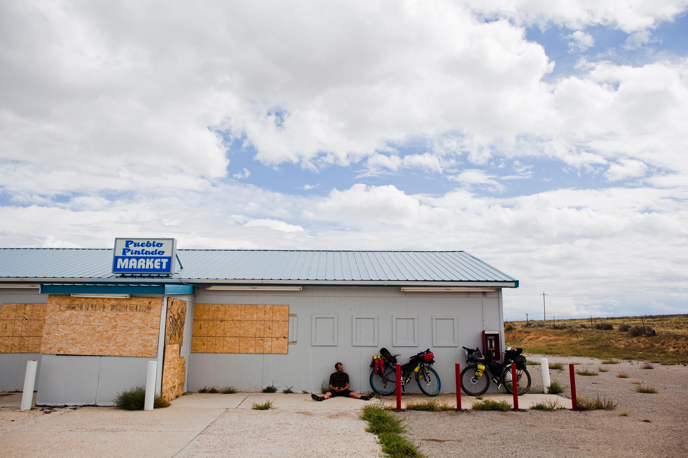
The GDMBR passes through some larger towns, including Helena and Butte, Montana, Pinedale and Rawlins, Wyoming, Steamboat Springs, Breckenridge, Salida, and Del Norte, Colorado, and Grants and Silver City, New Mexico. Otherwise, it’s the occasional small town, with a limited variety of goods and services available to riders.
Tip: Before the Great Basin, stock up properly in Pinedale… Atlantic city was completely closed when we passed through.
Tip: The Diagnus well in the GB is really easy to miss. Really pay close attention to your milage. It could have changed by now, but look for piled up rocks and a stick with a bright colored tip.
Tip: Hopewell Lake campground has very delicious water, great place to fill up and listen to coyotes at night.
Tip: Toaster House in Pie Town
The Route GPX
We used the Tour Divide GPX here. It is NOT the official GDMBR ACA route, as described on the ACA maps. It includes several alternate sections not sanctioned by ACA but required by the TD event, including a route that skips Rawlins, WY, instead using the town of Wamsutter for resupply. Some of these alternates are described below per TopoFusion.
- Added new TD-specific Fernie Alt. This alt is not recommended for a BoB trailer!
- Added High Rockies Trail-North, west side of the Spray River
- Added new route through Butte including singletrack on “Big Butte”
- Changes to Kanasakis Lakes Provincial Park Road instead of bike path through park.
- Adds new two re-routes in Wyoming, scouted by Matthew Lee. 1) Union Pass / Fish Lake. 2) Great Basin/Wamsutter (skipping Rawlins and the heavy construction south of town).
- Added new ACA alternate into Butte, avoiding freeway riding.
- Added FR 212 detour near Kremmling, CO and the Gold Dust trail near Breckenridge.
For detailed annual GPX files for the Tour Divide, see this page on TopoFusion.com.
POI (Points of Interest)
There are several great resources for pooling POIs for the Tour Divide and GDMBR. One is ACA’s maps and there is also this detailed PDF list. Additionally, Sarah Swallow created this detailed POI set with the 2026 Tour Divide route broken into seven sections:
Plus, she provided access to her custom resupply cheat sheet, which details exact mile marker locations and distances between all services within each of the seven sections along the entire Tour Divide 2023 route. Find that here.
Additional Navigation Materials and Tips
You may want to check out Michael McCoy’s Cycling the Great Divide guidebook. This book can be instrumental to your daily planning. Although the book and maps have the same cue sheet, they are slightly off in the actual mileage, so take each with a grain of salt. The book is broken down into 70 riding days with elevation details and local history. We would read ahead to get a good idea of what was in store for us. Typically, we rode one day to each of the book’s two days. Both the guidebook and map offer a couple of route alternates. We usually rode the original route but a few times we had to either make up time and take a paved alternate or create our own alternate to avoid impassible sections that resulted from monsoon rains.
Tip: Take the map and guide book with a bit of skepticism and prepare for the worst. Towns might be closed (Atlantic City and Pie Town were both closed down for us), important creeks for water might be dry, and you will be climbing a lot, even if it doesnt say it.
Tip: The roads in New Mexico are the most primitive and washboarded of the whole route. Use caution. We rode on fully rigid rigs and were wished we had front suspension or a thud buster seatpost most of the ride… especially in New Mexico. A 29+ bike may be ideal, although some sections the extra fat could definitely slow you down.
Timing and Records
It’s a small and select group of athletes. Here are your Grand Depart winners since the inception of the race in 2008.
2008
Men: Matthew Lee – 19:12:00
Women: Mary Collier – 29:17:37
2009
Men: Matthew Lee – 17:23:45
Women: Jill Homer – 24:07:24
2010
Men: Matthew Lee – 17:16:10
Women: Cricket Butler – 26:09:36
2011*
Men: Kurt Refsnider – 15:20:51
Women: Caroline Soong – 22:09:59
2012
Men: Ollie Whalley (R) – 16:02:54
Women: Eszter Horanyi – 19:03:35
2013*
Men: Mike Hall – 14:11:55
Women: Sara Dallman – 22:19:05
2014
Men: Jefe Branham – 16:02:39
Women: Alice Drobna (SS) – 22:06:36
2015
Men: Josh Kato – 14:11:37
Women: Bethany Dunne – 19:02:37
2016
Men: Mike Hall – 13:22:51
Woman: Jackie Bernardi – 19:21:41
2017*
Men: Brian Lucido – 14:22:50
Women: Marketa Peggy Marvanova – 22:18:04
2018
Men: Lewis Ciddor – 15:02:08
Women: Alexandera Houchin – 23:03:51
2019
Men: Christopher Seistrup – 15:11:24
Women: Alexandera Houchin – 18:20:26
2020
CANCELED (COVID-19)
2021**
Men: Jay Petervary – 14:19:15
Women: Lauren Brownlee – 20:05:43
Notable ITT’s
Jay Petervary – 2011 – 17:09:01
Jay Petervary – 2012 – 15:16:04
Billy Rice – 2013 – Yo-Yo (NoBo & SoBo) 44:42:00
Lael Wilcox – 2015 – 15:10:59
Current Records
Men: Mike Hall – 2016 – 13:22:51
Women: Lael Wilcox – 2015/ITT – 15:10:59
(*) Year with a re-route, race records could not be made; (R) Rookie; (SS) Single Speed.
(**) Tour Divide Classic (abbreviated from Canada border to Antelope Wells)
Route Details and Resources
- Adventure Cycling Association (GDMBR)
- Paula and Scott’s Divide route (plus updated GPX files)
- Temporary ACA Route Road Closures (forum thread)
- ACA GDMBR Shuttles
- Elevations and Distances
- Gradient Chart
- Profile Map
- PDF of POIs
Helpful links
- QA With Lael Wilcox (Women’s Route Record Holder)
- Adventure Cycling Association (GDMBR)
- 2015 Winner Josh Kato’s Tour Divide Gear List & Salsa Fargo
- Ride the Divide, the web site about the film
- TourDivide.org a web site about the annual race
- Wikipedia (GDMBR)
- Matt and Brett’s photo book about riding the GDMBR on their site
Gear Planning
Researching and procuring gear is a long and important process in preparing for the GDMBR. Weight and consideration for food provision space are paramount details when building your kit. There are many ways to approach a gear kit for the Tour Divide. Matt and Brett both rode nearly identical Surly Ogres, equipped with XT/SLX drivetrain and hydraulic disc brakes. Their bikes featured Velocity Blunt 35 rims laced to Alfine dynamo hubs up front and XT in the rear. Their tires of choice were Maxis Ardents 2.3” set up tubeless.
Fortunately neither experienced mechanical issues during the route. The only things that broke were the racks, which is a pretty good case for using a soft bag setup on such a route. Packlists will vary by riding style, goal completion time, and skill level, but, for what it’s worth, this is their complete list:
Clothing from Kitsbow
- 2 X Jersey – one Polo, one ventilated riding jersey
- 2x overshorts
- 1x ventilated undershorts
- Arm/knee warmers
- Wind Vest
- Racing bibs
- Giro Merino base layer
- Giro Insulated vest
- Giro Terraduro Shoes
- Giro Full fingered Gloves
- t shirt
- boxers
- 3 socks
- Icebreaker merino long underwear/top
- Rain Jacket
- Rain Shorts
Equipment
- Tent: Sierra Designs lightning 2
- Sleeping Bag: Enlightened Equipment Revelation Pro 850 Drydown Quilt
- Sleeping Pad: Thermarest prolight.
- Cooking: Solo Stove x 2
- 8 inch cook pan
- Knife
- Spork
- Headlamp from Black Diamond
- Katadyn Hiker Pro Water Pump Filter
- Battery bank for charging devices
- Garmin 500
- Sinewaves Revolution USB Dynamo Charging Device
- Kindle – with Cycling the Great Divide Guidebook by Michael McCoy
- Iphone
- ACA Mapset
Bike
- Frame: Surly Ogre Medium
- Fork: Surly Ogre
- Headset: Cane Creek 40
- Stem: Thomson Elite X4</li>
- Handlebar: Salsa Bend
- Shifter: Shimano SLX
- Grips: Ergon GC1
- Seatpost: Thomson Elite
- Saddle: Brooks Cambium
- Seat Clamp: Blue Salsa
- Front Hub: Shimano Alfine DH-S501 32h
- Rear hub: Shimano XT 32h
- Rims: Blue Velocity Blunt 35
- Tires: Maxxis Ardent 2.25
- Cranks: Shimano SLX 36/28
- Pedals: Shimano spd
- Bottom Bracket: Shimano
- Cassette: Shimano 11-36
- Chain: Shimano HG54
- Brakes & Levers: Shimano XT hydraulic
- Light: Supernova E3 Triple
Luggage
- Racks: I’d highly recommend Tubus or Racktime
- Frame Bag: Surly branded Revelate
- Seat Bag: Revelate Pika
- Handlebar Bag: Swift Industries Paloma
- Cage: Salsa Anything Cage
- Panniers: Ortlieb Front Roller
- Additional: 2 Seal Line Nimbus Stuff Sacks


Terms of Use: As with each bikepacking route guide published on BIKEPACKING.com, should you choose to cycle this route, do so at your own risk. Prior to setting out check current local weather, conditions, and land/road closures. While riding, obey all public and private land use restrictions and rules, carry proper safety and navigational equipment, and of course, follow the #leavenotrace guidelines. The information found herein is simply a planning resource to be used as a point of inspiration in conjunction with your own due-diligence. In spite of the fact that this route, associated GPS track (GPX and maps), and all route guidelines were prepared under diligent research by the specified contributor and/or contributors, the accuracy of such and judgement of the author is not guaranteed. BIKEPACKING.com LLC, its partners, associates, and contributors are in no way liable for personal injury, damage to personal property, or any other such situation that might happen to individual riders cycling or following this route.
Please keep the conversation civil, constructive, and inclusive, or your comment will be removed.