

 Singletrack/MTB
 Gravel/All-road
 Dirt-road Touring
 Fat-bike



Are Wildfires Changing Bikepacking?




With the onset of hotter, drier, more unstable conditions across the globe, Neil’s latest video explores how wildfires are affecting bikepacking. Drawing on his experience from a recent trip on the Colorado Trail, Neil shares tips and resources to help you stay better informed in an emergency. Dive into his latest insight-packed piece below…
PUBLISHED Jul 30, 2026
Feature photo by Ali Jones
On the first day of my recent Colorado Trail trip, we watched smoke build throughout the afternoon. It wasn’t until I regained cell service that I learned a new wildfire had started outside Leadville, near a section of trail that would eventually close because of that very fire. These days, planning a summer bikepacking trip involves more than just checking snowpack, water sources, and weather. Increasingly, it also means watching wildfire maps, smoke forecasts, and land closures. Sometimes, right up until the moment you start riding.
In my latest video, I look at how wildfires are affecting bikepacking routes and the broader trends we’re seeing across the globe. I also share the tools I use to decide whether to ride, reroute, postpone, or stay home. Check out the full video below, followed by a written version.
Wildfire Isn’t New
Wildfire is nothing new. It’s a natural and necessary part of many ecosystems. For thousands of years, Indigenous communities have used carefully planned cultural burns to shape and care for the land. Depending on the place and community, these burns have been used to clear hazardous vegetation, improve wildlife habitat, encourage the growth of food and medicinal plants, control pests, and reduce the likelihood of larger, more destructive fires.
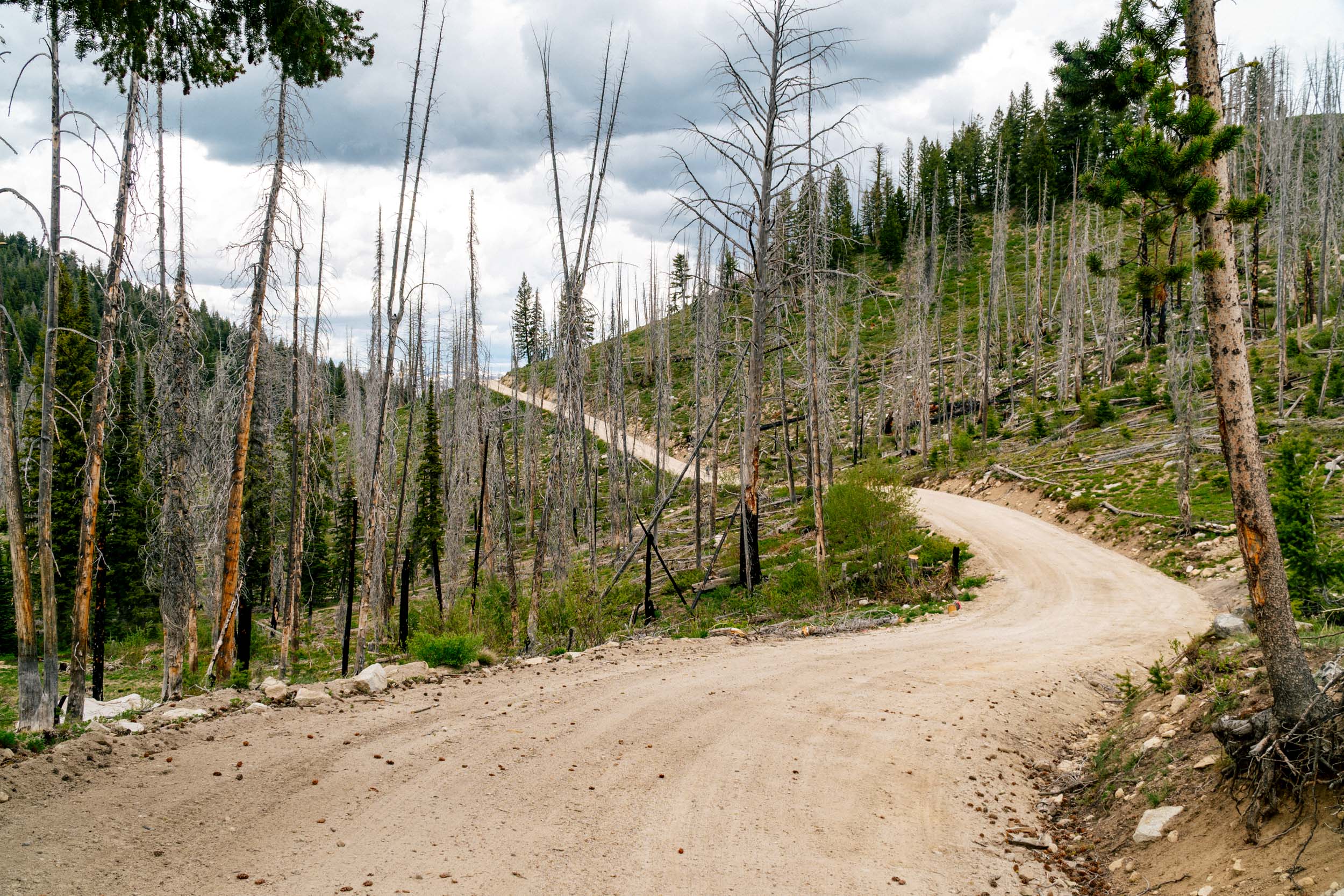
Today, land-management agencies use prescribed fire, mechanical thinning, and naturally ignited wildfires to restore ecosystems and reduce hazardous fuels. However, this work is limited by narrow weather windows, smoke concerns, cost, staffing, terrain, and the risk of prescribed fires escaping their intended zones.
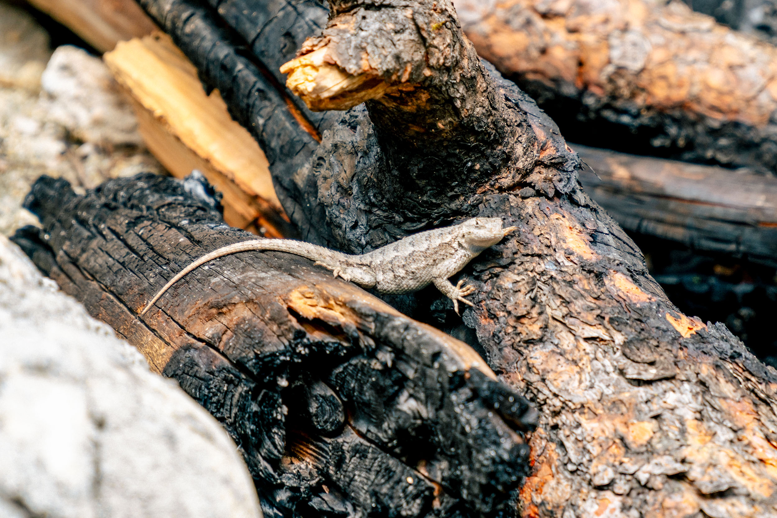
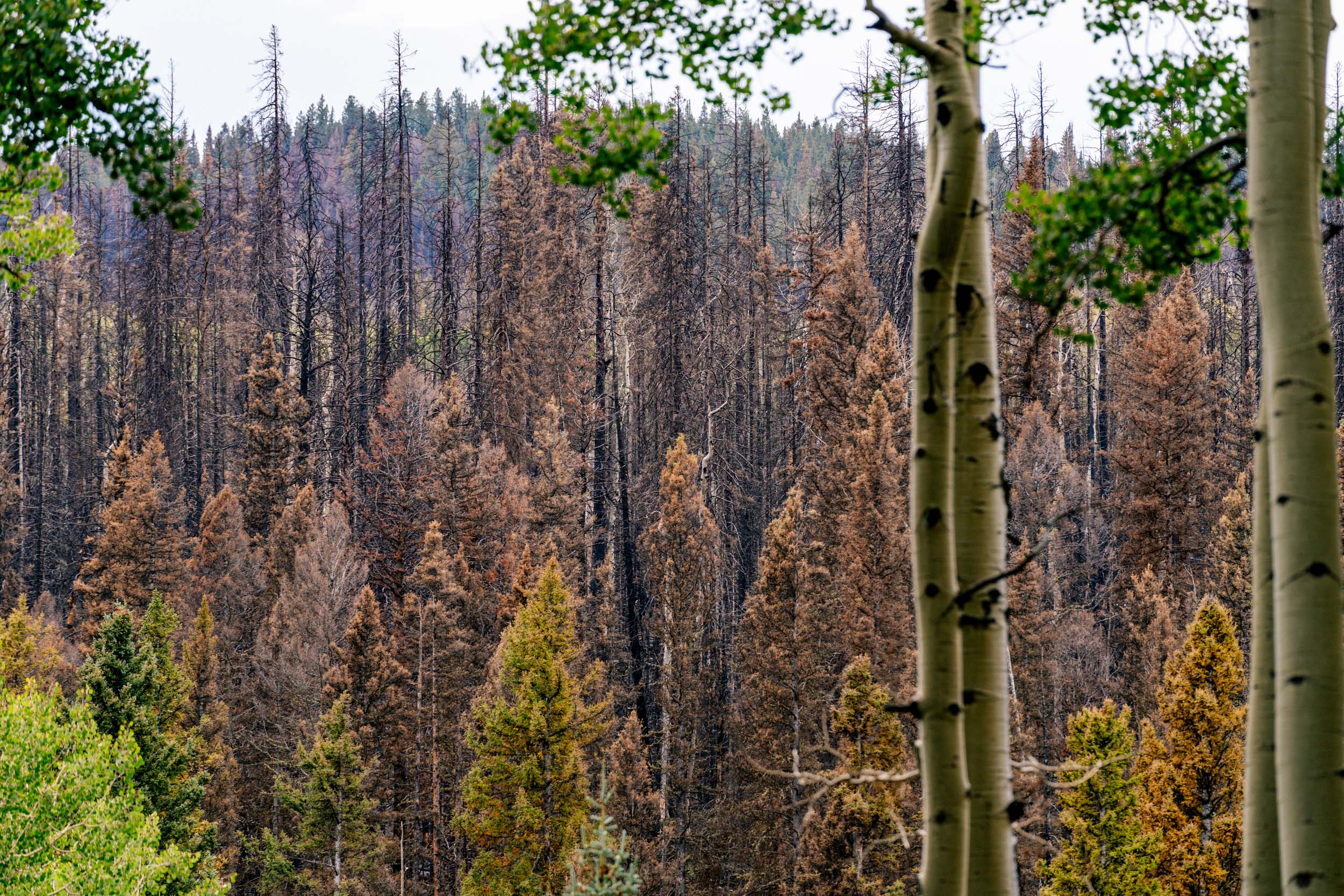
For much of the last century, the prevailing response was to suppress wildfires, especially when they threatened people, property, infrastructure, and other important resources. In some forests, that suppression—combined with logging and other land-use changes—allowed trees and combustible vegetation to accumulate. In addition to increased fuel, hotter, drier conditions have become the norm, along with drought, strong winds, and declining forest health. With both human and lightning-caused ignitions, you have the ingredients for larger and more destructive fires. Wildfire season has always existed, but across much of the Western United States, it has become an increasingly disruptive part of summer and fall.
What Are the Broader Wildfire Trends?
The number of fires and the acreage burned vary considerably from year to year. According to the National Interagency Fire Center, only about 2.7 million acres burned across the United States in 2023. You have to go back to 1998 to find a year with fewer acres burned. But 2023 appears to have been an outlier compared to recent years. From 2015 through 2025, the United States averaged roughly 64,000 wildfires and 7.3 million acres burned annually, and three of those years exceeded 10 million acres.

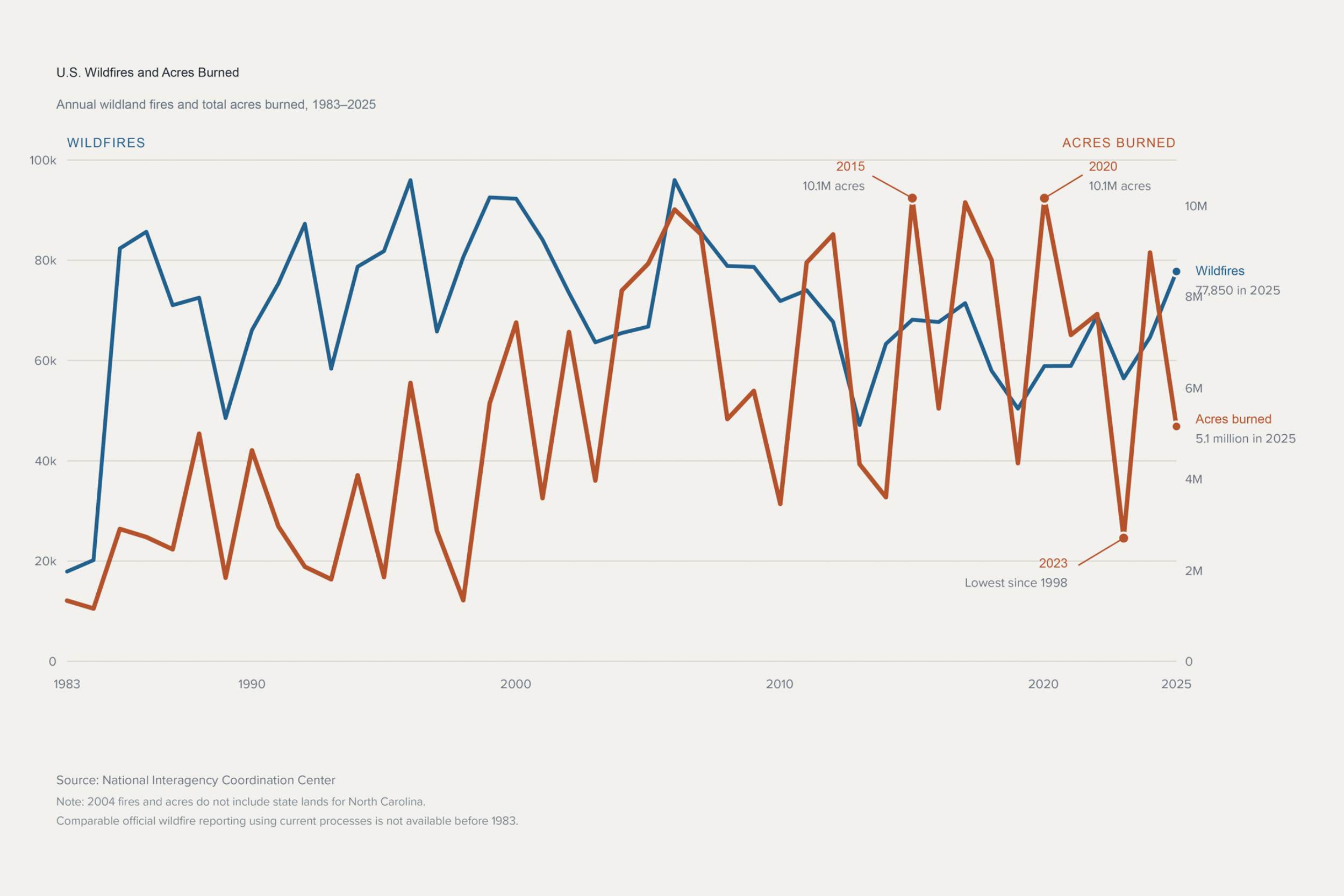
Of course, those annual totals include everything from small fires that are quickly contained to massive incidents that burn for weeks or months. Large fires represent only a small portion of all wildfire incidents, but they can account for a disproportionate amount of the total acreage burned. That brings us to the most telling part of the data: we aren’t seeing more fires. From 1983 through 1999, the United States averaged roughly 76,500 fires and 3.2 million acres burned annually. From 2000 through 2025, the average number of fires was actually lower, at roughly 69,700 per year, while the average acreage burned more than doubled to approximately 6.9 million acres annually. In other words, while we aren’t seeing more fires, we’re seeing far more land burn. The trend isn’t a steady annual increase, but rather a broader shift toward fire seasons that can produce much larger, more disruptive fires.
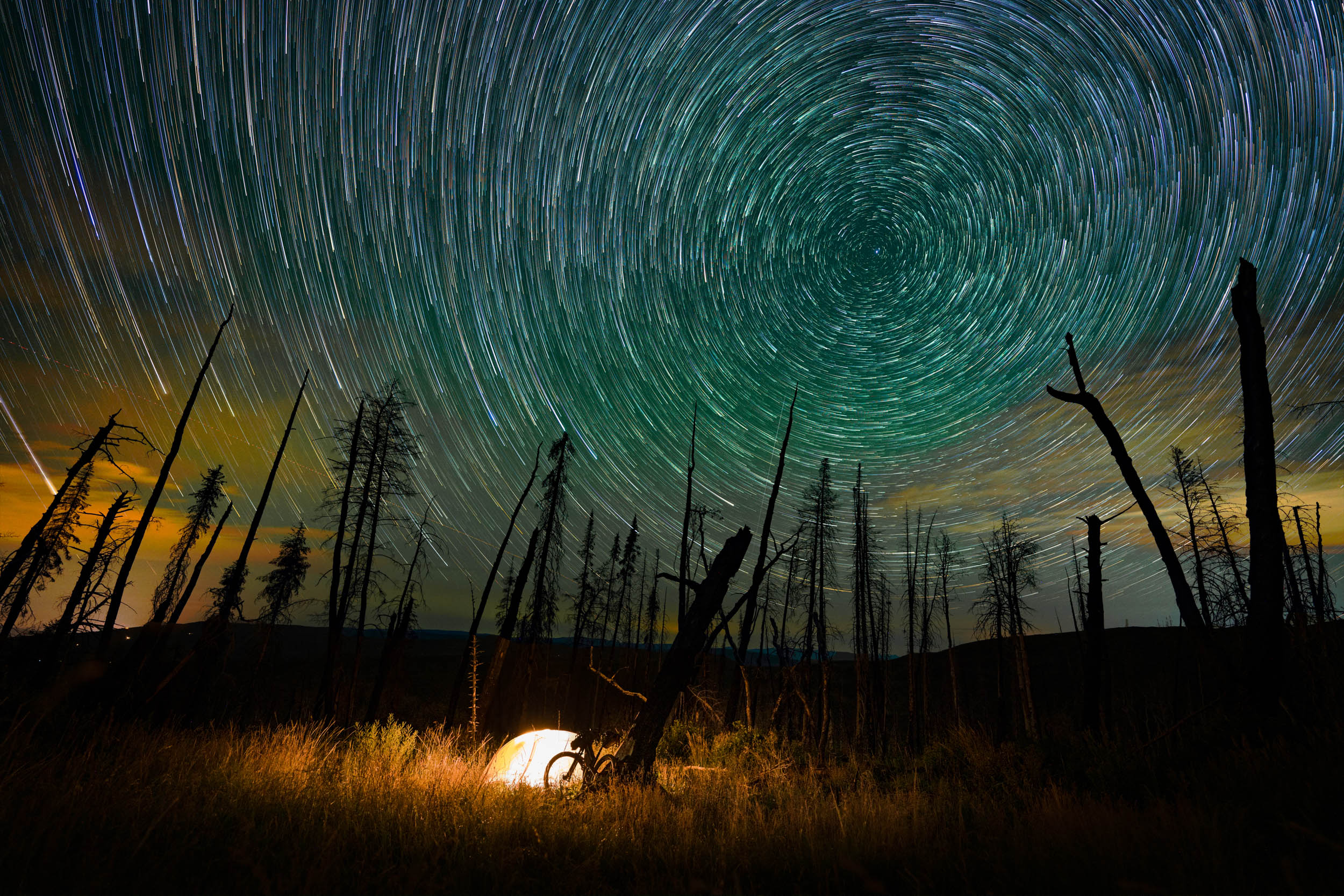
Why Bikepacking Routes Are Especially Vulnerable
Those trends create an obvious challenge for the activities we love. Wildfires affect nearly every form of outdoor recreation, from families visiting national parks to people traveling through remote areas for days at a time. Bikepacking can leave us especially vulnerable. We often traverse backcountry areas with limited communication, few escape options, and itineraries lasting several days or weeks. We also move slowly through places where conditions can change much faster than we can respond.

A recent trip on the Colorado Trail underlined that grim reality. As we finished our first day, we learned that a new fire had started outside Leadville. We had watched the smoke increase throughout the day, but that was our only warning. It wasn’t until I regained cell service that I received more information from friends and family.
What if I had already been on the section of trail that would eventually close because of that fire? How would I have responded? These are questions we should consider before leaving because our decisions can affect not only us, but also firefighters, nearby communities, and the people waiting for us at home.
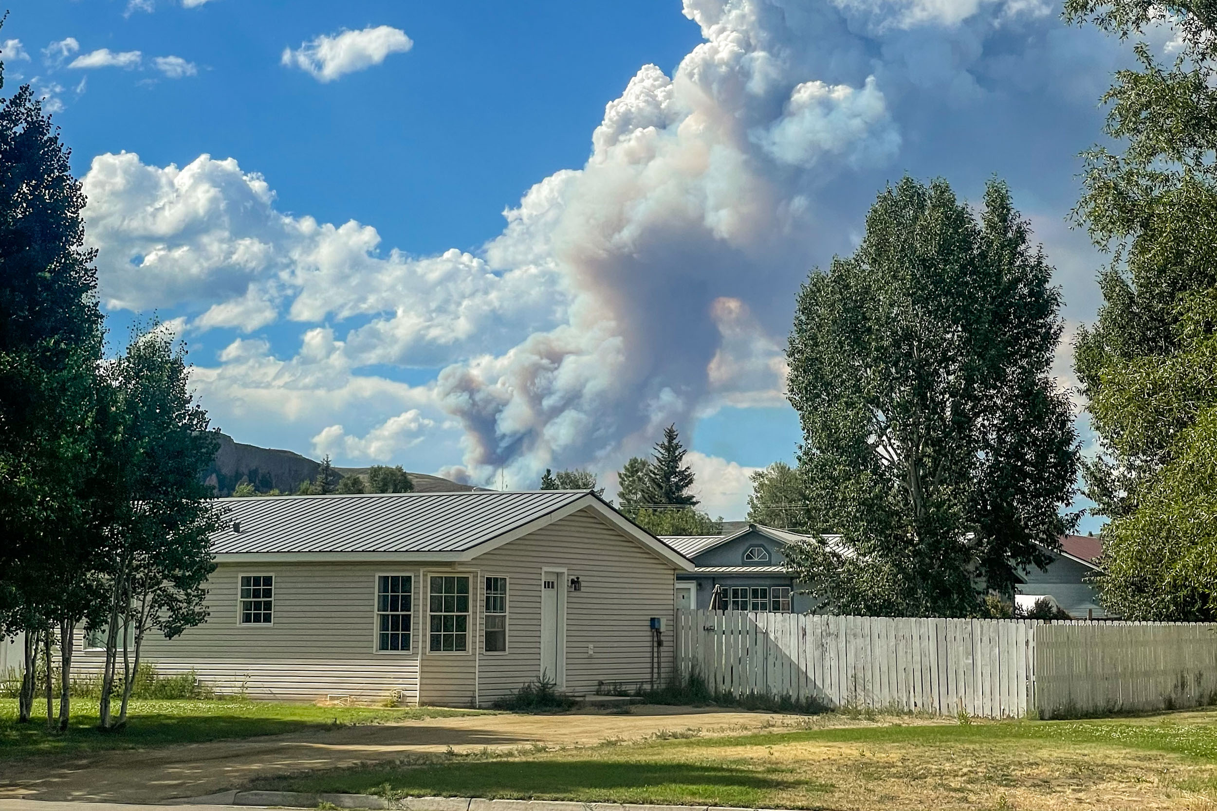

The most obvious concern is direct fire danger. A fire can approach or cross a route, and gusty or shifting winds can quickly change its direction and speed. Lightning may start additional fires, and windblown embers can create spot fires beyond the main fire. Evacuation zones can expand with little warning, while firefighting crews may need the same roads and corridors we’re traveling through.
Then there are the closures. Trails, campgrounds, roads, and sometimes large areas of public land or even towns may be closed or evacuated to protect visitors and preserve access for firefighters. These closures can extend well beyond the visible fire and change as the incident develops. A fire map shows where a fire is burning, but it doesn’t necessarily show where you are legally allowed to travel. As of writing, that’s currently the case along part of the Colorado Trail, and the closure could remain in place well beyond the active fire.
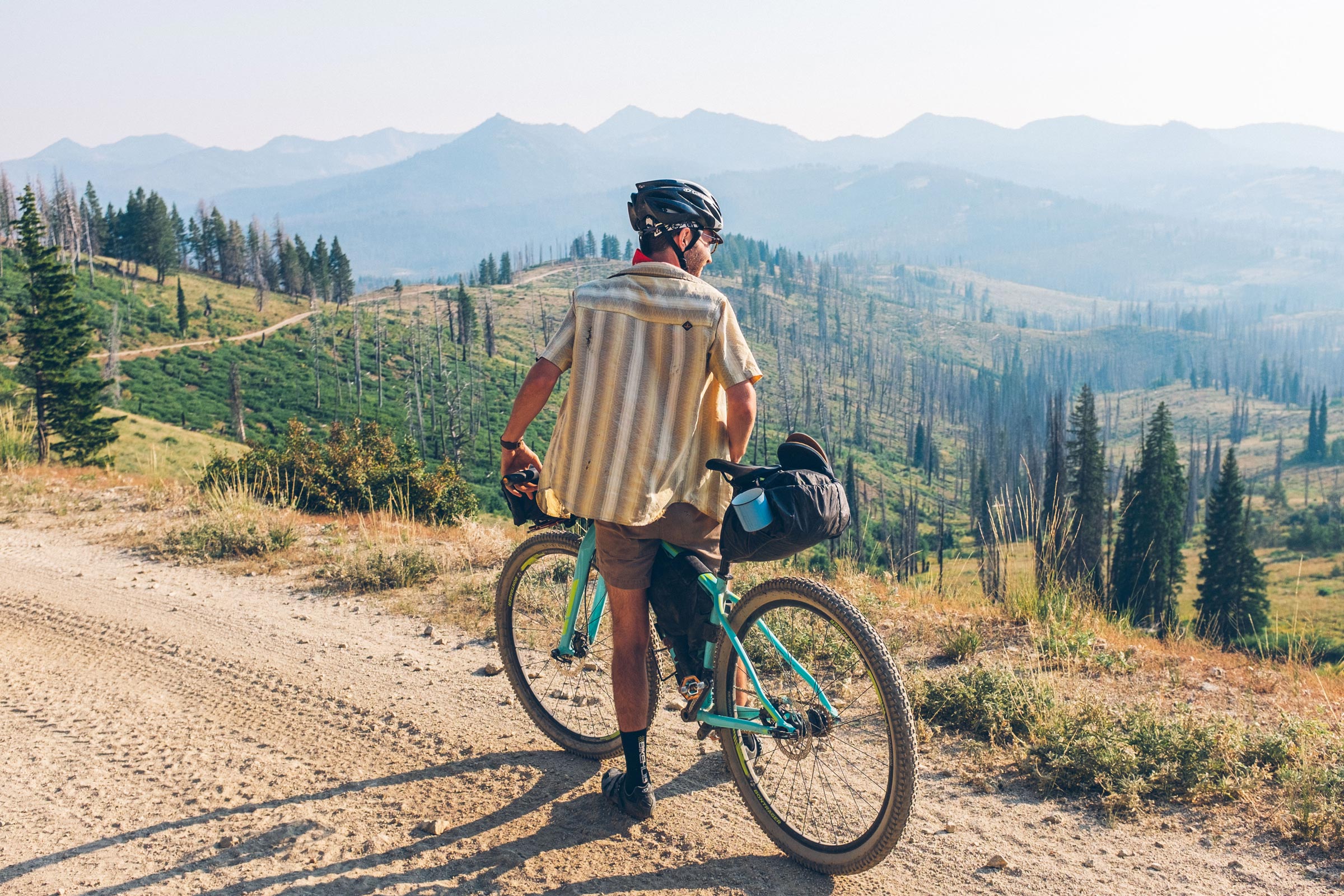
Smoke presents a different danger. It can travel hundreds or even thousands of miles, so a distant fire may affect your ride more than one burning closer to the route. During our trip, smoke settled into the valleys overnight, while the higher elevations occasionally provided cleaner air in the morning. Smoke patterns depend on the terrain, wind, and atmospheric conditions, so that won’t be the case on every route. Air quality can change quickly, and that matters when we’re riding hard and breathing far more air than we would at rest.
Finally, we need to consider the communities along the route. Resupply towns may be preparing for evacuation, businesses may close, and roads may be needed by firefighters and evacuees. Local food, fuel, lodging, and medical resources may already be strained. A route can technically remain open, but traveling through the area could be a bad idea. “Open” and “appropriate” are not always the same thing—you have to read the room.
Planning Around Wildfire Season
So, how can you plan a trip during wildfire season? Just like navigation and route building, wildfire planning requires research before you leave. Look at current drought, snowpack, weather, and fuel conditions, then check the National Significant Wildland Fire Potential Outlook for a broader look at the months ahead. Historical fire maps can also identify previous burn areas where you may encounter deadfall, unstable trees, erosion, or an increased risk of flash floods and debris flows. Remember that every region is different, sometimes even from one side of the Continental Divide to the other. Fire potential can also change quickly, so a seasonal outlook provides context, not a prediction for a specific route or trip.
You should also identify alternate routes and bailout options before leaving. When downloading offline maps, don’t limit them to the immediate route corridor. Download a much larger surrounding area so you can navigate around an unexpected closure without losing access to your maps.
Finally, know which agencies manage the land along your route and where they publish alerts, restrictions, and closure orders. A route may cross national forests, BLM land, state property, county roads, and private land, each with different rules and sources of information. Knowing where to find those updates before leaving will make it much easier to respond if conditions change during your trip. That includes checking current fire restrictions, which determine whether campfires, charcoal, or certain types of stoves are permitted. Restrictions can differ between neighboring jurisdictions, so never assume the rules remain the same throughout the route.
Before leaving on a trip with a fire near or on the route, I suggest you answer these three questions if there is a fire:
- Where is the fire, and what is it doing?
- Which trails, roads, and public lands are legally open?
- Where are the smoke and weather headed?
A fire perimeter, a closure boundary, and a smoke plume are three different things. Looking at only one won’t give you the complete picture. A fire may show minimal growth and produce very little smoke while its associated closure remains firmly in place.
The Tools I Use
Weigh all of that information and ask yourself whether you still want to proceed with the trip. To answer those questions, I use a few tools. No single tool provides the complete picture, but a few digital tools stand out.

Route pages and comments
If you’re following an established route, start with its route page and comments. For routes published on BIKEPACKING.com, we do our best to add important updates about closures and reroutes, but because so many people ride these routes, the comments often contain the most useful, up-to-date information. User reports should be verified through official sources, especially when closures or evacuation orders are involved. Additionally, one cool thing about Ride with GPS is that you can toggle on the wildfire maps layer. So, if you want to see wildfires close to a route, I suggest opening the route on their website to check this.
Watch Duty
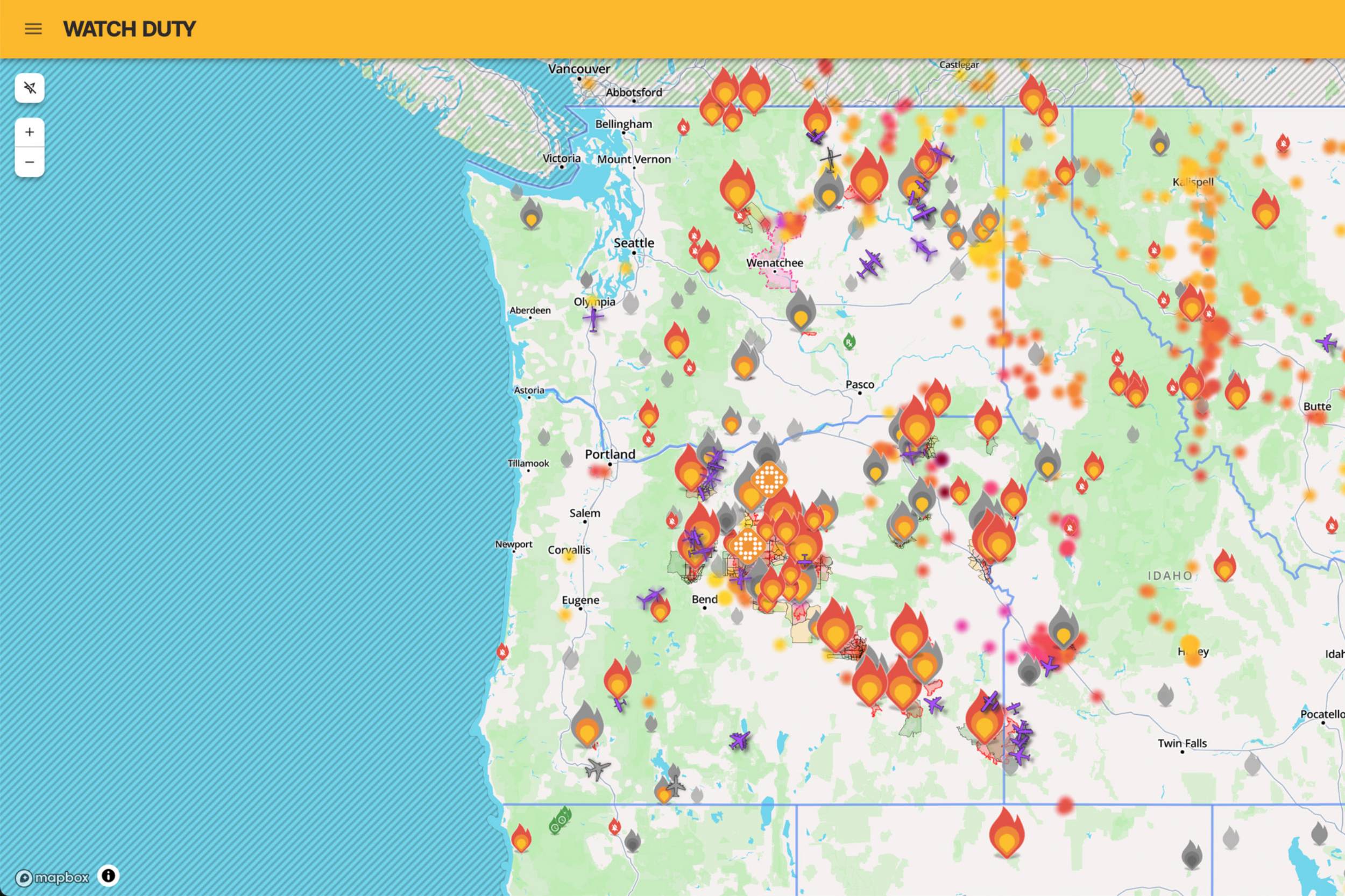
My next stop is usually Watch Duty, an incredible resource for monitoring wildfire activity across the United States. It’s available on the web and as an app for iPhone and Android. Watch Duty provides active incident information, fire perimeters, satellite-detected hotspots, evacuation details, air-quality readings, weather conditions, and incident-specific notifications. It’s one of the easiest ways to discover a new fire and follow its development. The free version provides much of the essential information most people need. Paid memberships unlock additional tools, depending on the level, including firefighting aircraft tracking, unlimited weather and air-quality stations, preplanned evacuation-zone maps, and public and private land information. This is my go-to wildfire app; I check it multiple times a day during trips and even when I’m home.
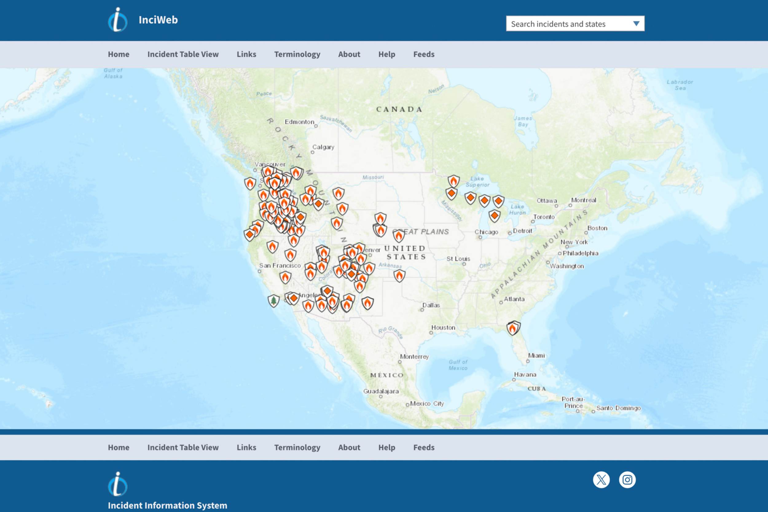
InciWeb
InciWeb is another great resource. Before Watch Duty came along, it was the primary website many people used to find official wildfire information, and it remains extremely valuable. Incident pages may include acreage, containment, daily updates, maps, fire behavior, photographs, public-information contacts, and links to closures or evacuations. Not every small or newly reported fire will immediately have a page, so I use InciWeb alongside Watch Duty.
National Interagency Fire Center
The National Interagency Fire Center is especially useful for understanding the national picture. It provides the National Preparedness Level, current large-fire activity, seasonal fire-potential outlooks, maps, annual reports, and historical statistics. Here, you can dig into the number of fires, total acreage burned, suppression costs, and human- versus lightning-caused ignitions.
OpenSnow
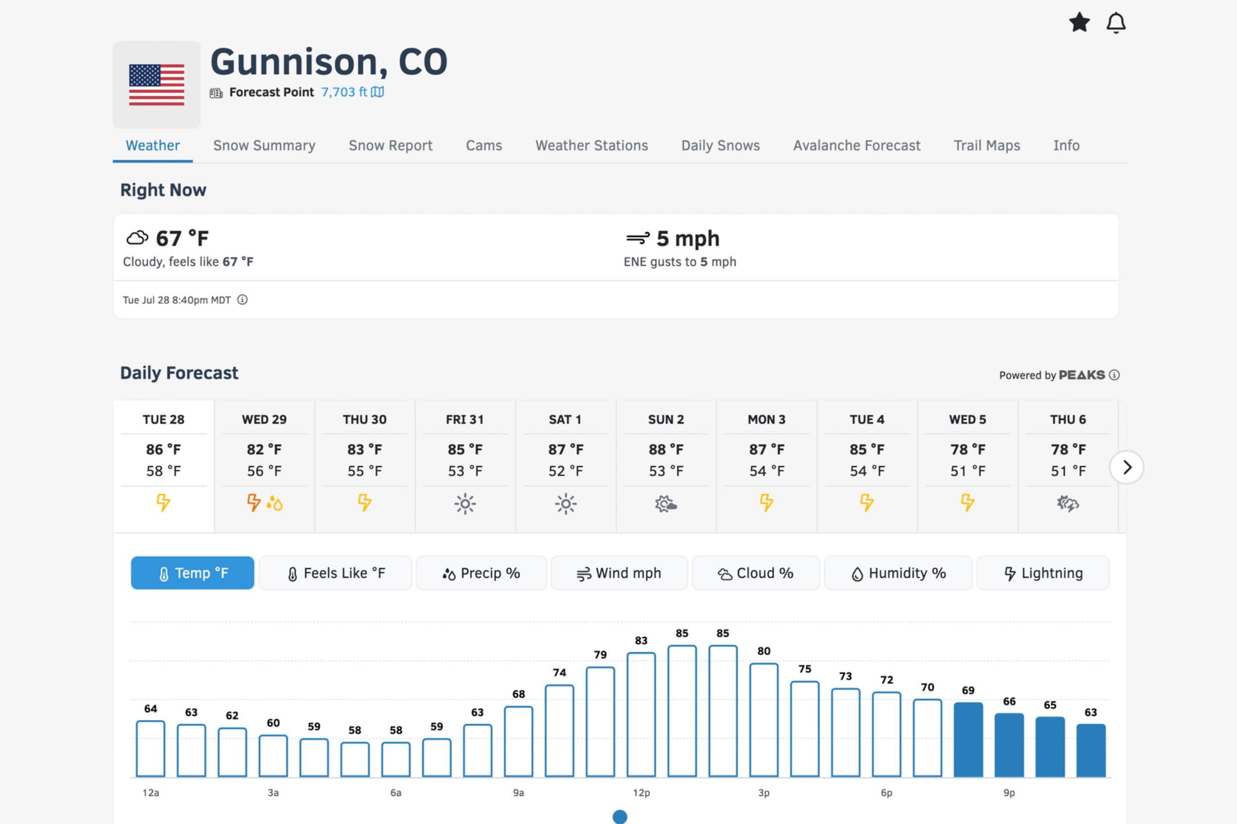
OpenSnow is another app I’ve used for a long time. It was originally built around skiing and snow forecasts, but it has become a useful year-round weather and mapping tool. It provides hourly and extended forecasts, radar, lightning risk, offline satellite maps, land-ownership overlays, active fires, fire perimeters, air-quality readings, and smoke forecasts. It’s useful for bikepackers looking to evaluate weather, smoke exposure, nearby fire activity, and approaching thunderstorms.
Local land-management agencies
You should also check with the agencies managing the land along your route. Take our Sage and Saddles route here in Gunnison, for example. It crosses land managed by several agencies, and knowing those boundaries helps you find official alerts and closures. Depending on the route, that might include the Forest Service, Bureau of Land Management, National Park Service, state agencies, or local governments. County emergency-management offices and sheriff’s departments may also provide evacuation notices and road closures. A wildfire map might show the incident, but the managing agency is usually the definitive source for the actual closure order.
AirNow Fire and Smoke Map
As I mentioned before, I use Watch Duty for quick air-quality readings. However, the AirNow Fire and Smoke Map is another excellent resource. It shows PM2.5 air quality, fire locations, smoke plumes, recent trends, and Smoke Forecast Outlooks where available. PM2.5 refers to airborne particles measuring 2.5 micrometers or smaller. Because they are so small, they can travel deep into the lungs, making them particularly concerning during strenuous outdoor activity.
Weather and Radar
Finally, I always use a reliable weather forecast and radar app. OpenSnow covers much of this for me, but I also use Weather Underground, local National Weather Service forecasts, and NWS forecast discussions, which provide more context about wind shifts, thunderstorms, humidity, and incoming weather systems. A dedicated radar app is also valuable in burned areas, where a short but intense thunderstorm can produce flash flooding or a debris flow. Also, for those in Canada, I referenced the interactive wildfire map on the government’s websites, but I’m not as in tune with other countries, so if you have good information where you live, please let us know in the Conversation below.
Monitoring Conditions During the Trip
Once you’re out on a trip, it’s a good idea to continue checking weather and fire information whenever you have service. Pay attention to active incidents, closure updates, air quality, Red Flag Warnings, wind, and incoming thunderstorms. A Red Flag Warning doesn’t mean there is necessarily a fire nearby, but it does mean that weather and fuel conditions could support rapid fire growth. Knowing what could happen gives you more time to respond, and fewer surprises on a bikepacking trip are always welcome.
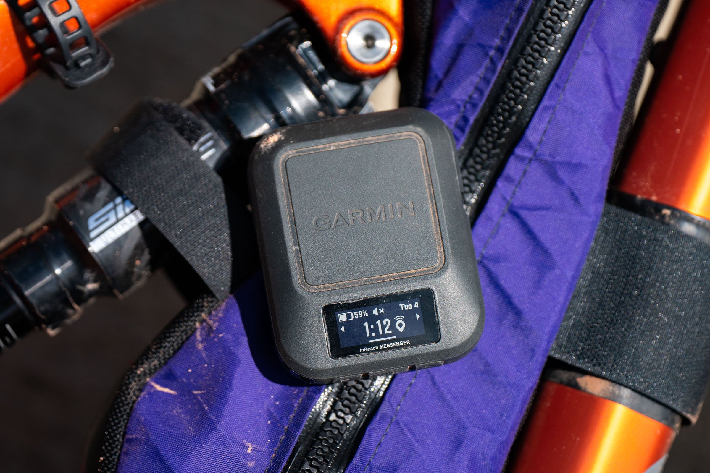
I also like to carry a way to communicate when cell coverage is unavailable, such as a Garmin inReach or another satellite messenger. It allows me to contact someone at home, receive updates, and request help if necessary. That person should have your route, expected schedule, and enough information to alert you if a new fire or closure develops nearby.
It’s also worth considering bringing along or buying a N95 mask. When we passed through Leadville, we briefly pedaled through heavy smoke and falling ash. I folded a Buff over my mouth, which may have helped block some of the larger ash particles, but a Buff or other cloth face covering doesn’t reliably filter the tiny PM2.5 particles found in wildfire smoke. An N95 provides much better protection, although wearing one doesn’t make prolonged or strenuous riding in hazardous air very easy.
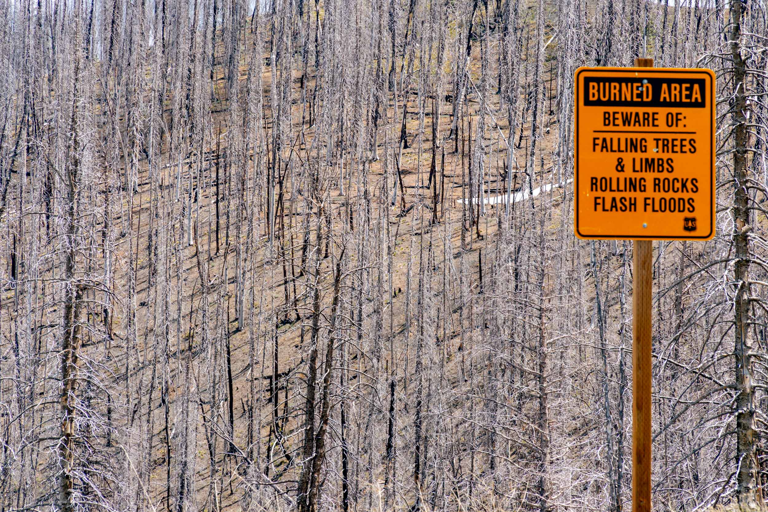
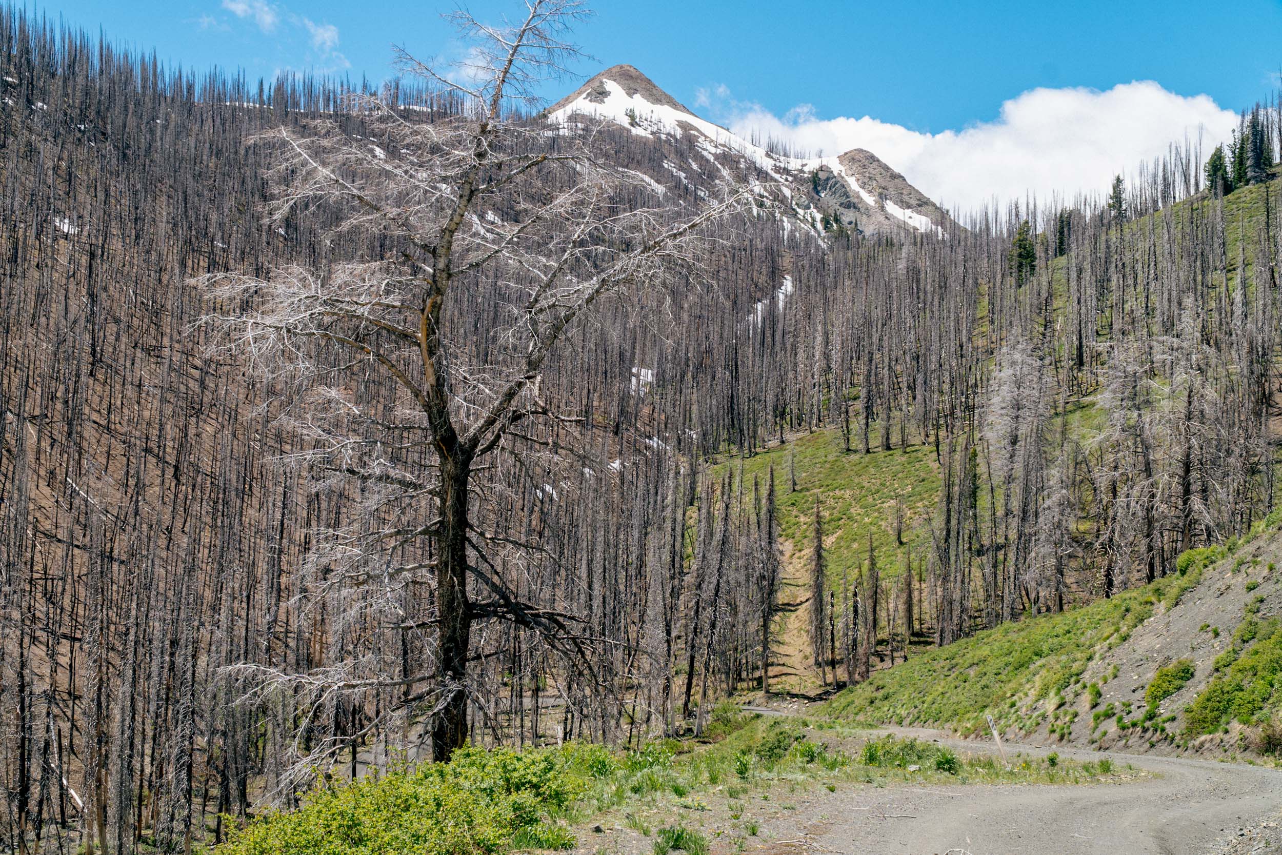
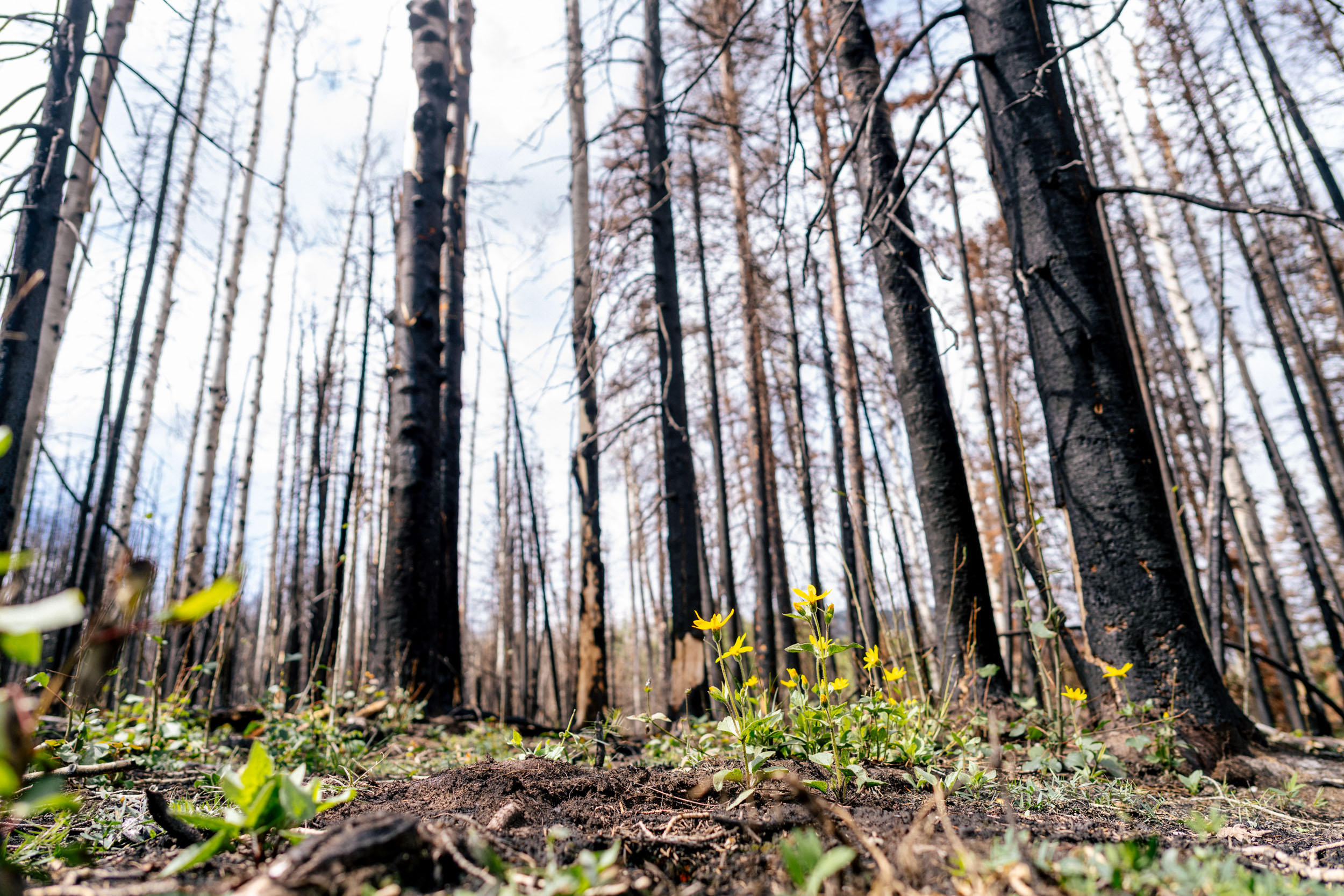
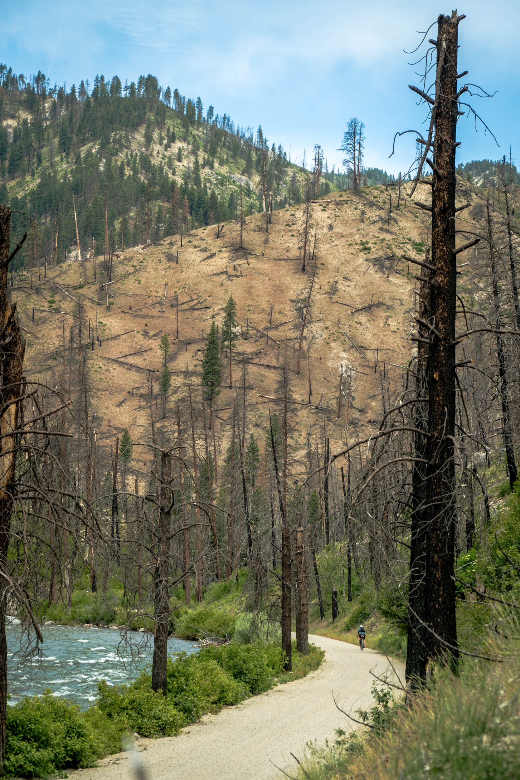
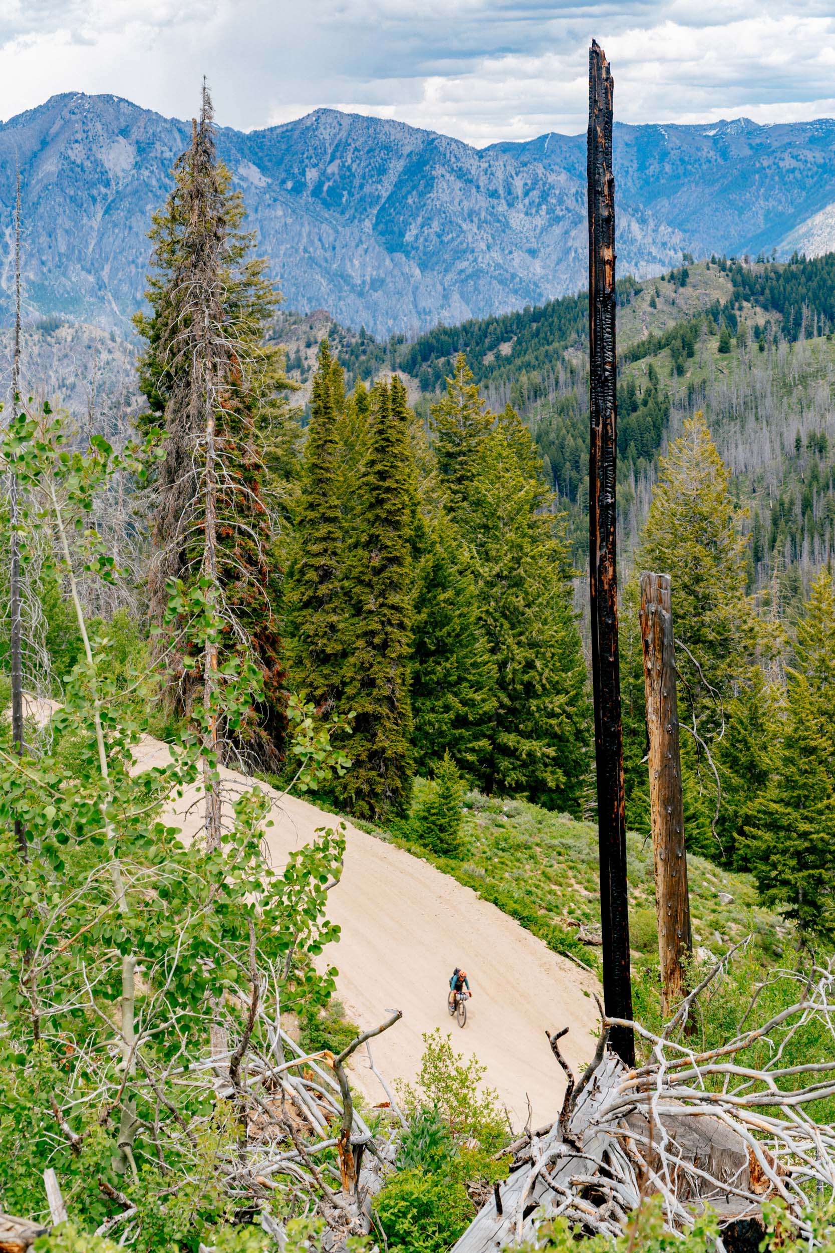
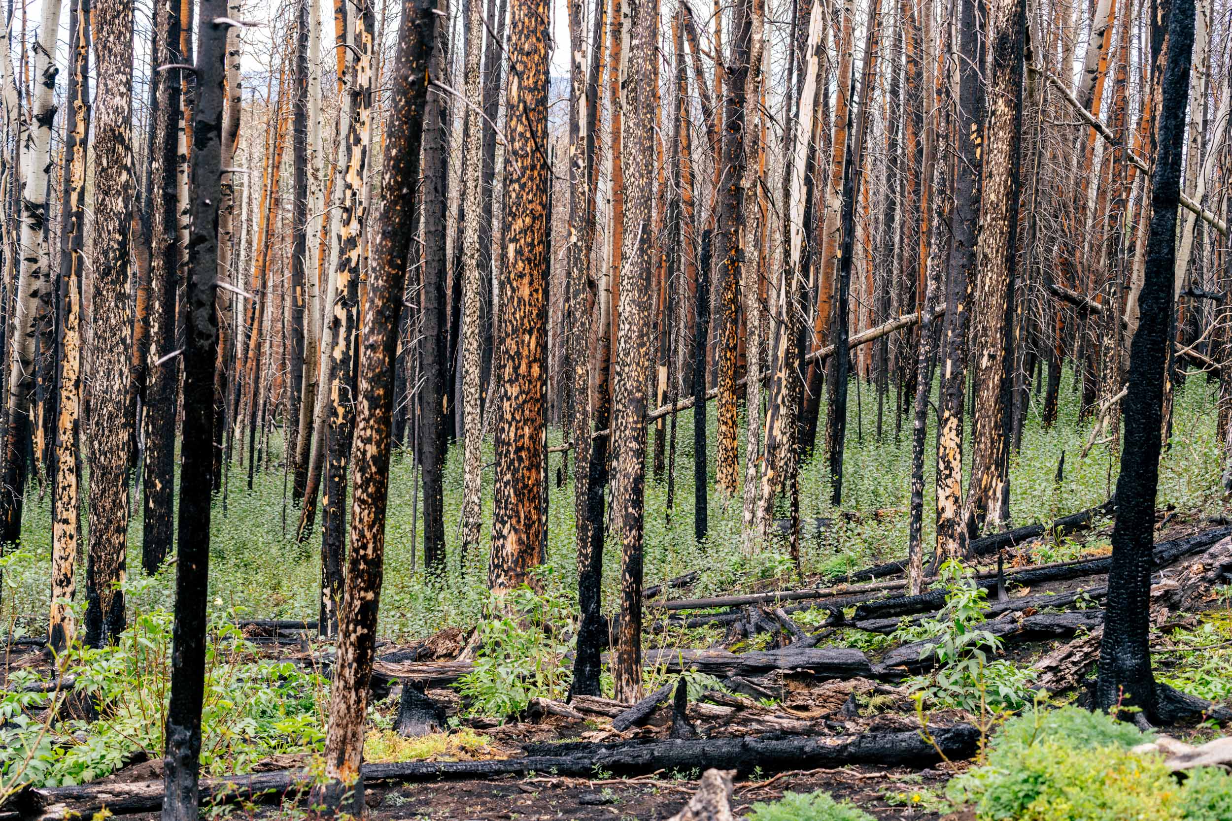
Another major consideration is traveling through old burn scars or forests with extensive beetle kill. Both can contain standing dead or weakened trees that may fall without warning, even when it isn’t especially windy. Before setting up camp, look above and around you for dead branches, leaning trunks, burned trees, damaged roots, and anything else that could reach your sleeping area if it fell. If you can’t find a safe location, keep moving until you reach a clearing or another area without overhead hazards. This is a major hazard on the Colorado Trail right now.
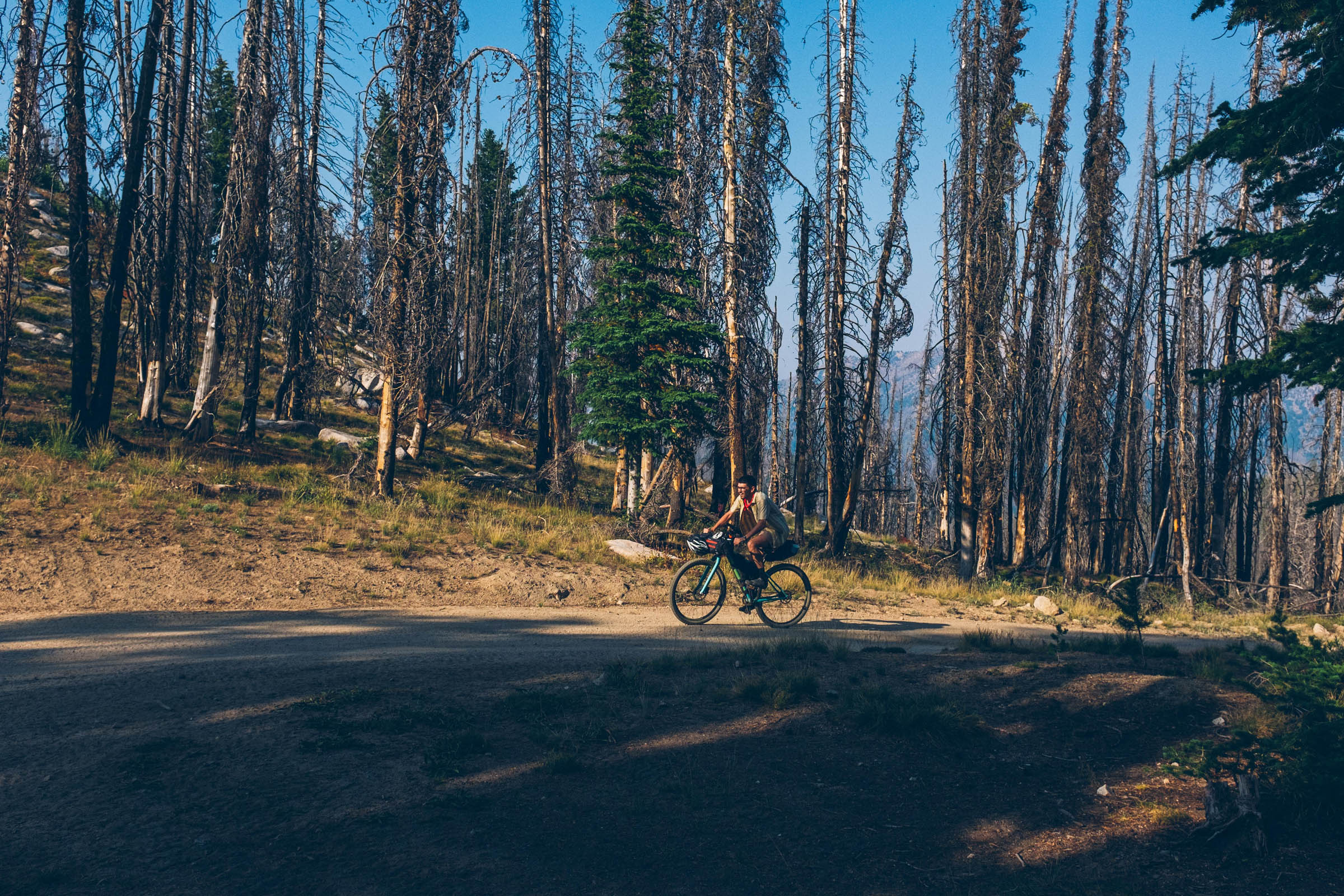
Burn scars can also increase the threat of flash floods and debris flows because the damaged landscape may absorb less water. Avoid camping in washes, gullies, drainage bottoms, narrow canyons, or below steep burned slopes when rain is possible. Remember that the storm doesn’t need to be directly overhead. Heavy rain farther upstream can send water, mud, rocks, and burned logs through a drainage with little warning. A simple rule to remember is this: Look up for dead trees, look uphill for unstable slopes, and look around for drainages. At the same time, burned landscapes shouldn’t automatically be described as destroyed. Fire is part of ecological change and renewal. The priority is respecting closures, giving the land time to recover, and allowing trail crews and land managers to do their work.
Finally, know when to call it quits or find a ride away from the area. I understand how difficult that decision can be. Most of us choose dates, take time off of work, travel to the start, research the route, and spend a lot of time preparing. Changing the plan is the last thing we want to do. Rerouting or getting creative may allow the trip to continue, but only when the alternative is safe, legal, and doesn’t interfere with emergency operations. At some point, finishing the route becomes less important than the risk to you, firefighters, nearby communities, and anyone who may need to rescue you. Sometimes the best decision is to turn around, hitch a ride, and save the route for another time.
Wrap Up
Wildfire doesn’t mean we should stop bikepacking in the West. But it does mean that routes can no longer be treated as fixed lines on a map. Fires grow, smoke moves, closures change, and hazards can remain long after the flames are gone. Sometimes we can safely reroute. Sometimes we need to postpone the trip. And sometimes the only responsible choice is to turn around and come back another year. The route will still be there, even if riding it has to wait. But of course, that’s your decision; I just wanted to share some thoughts on the matter, as it has become a new normal, and one that has affected me year after year.
Further Reading
Make sure to dig into these related articles for more info...
Please keep the conversation civil, constructive, and inclusive, or your comment will be removed.