


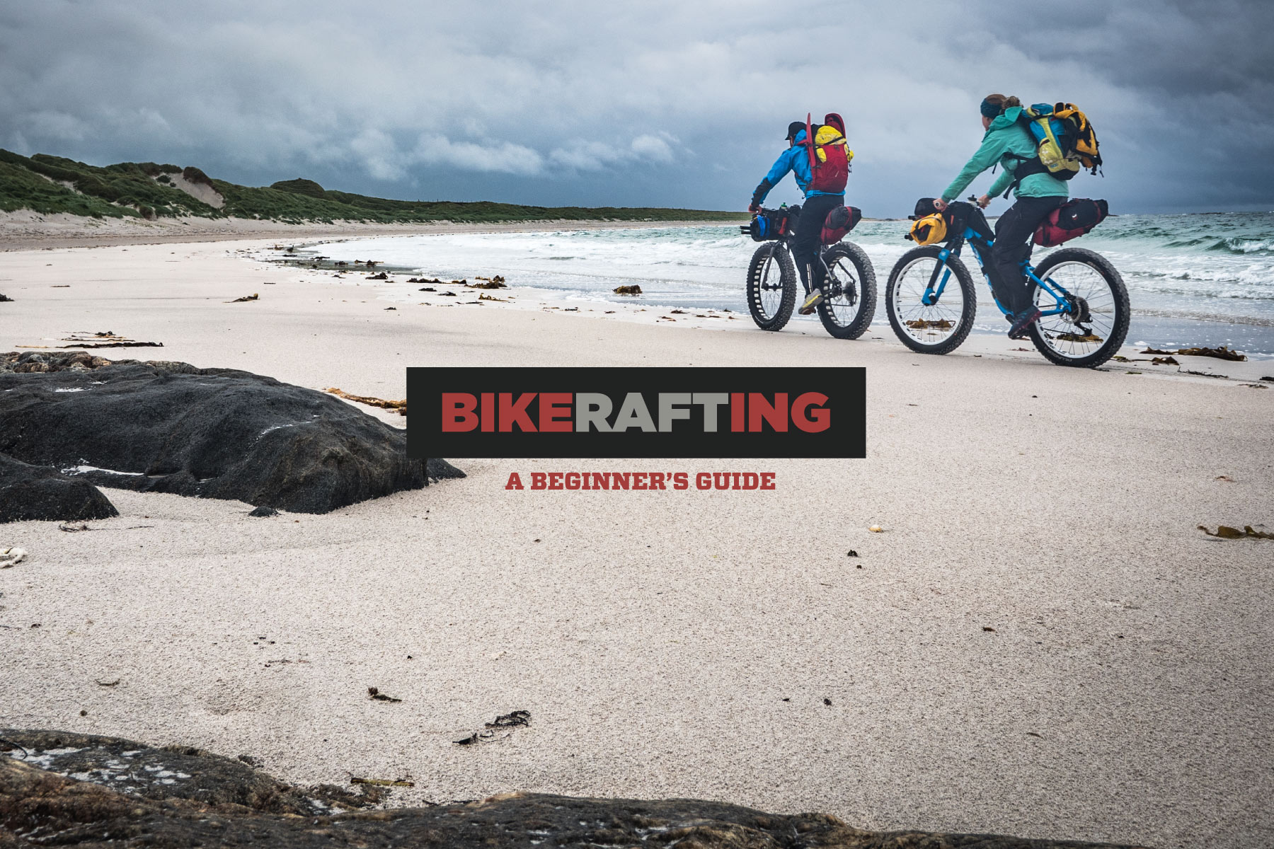
Finding Centre: Bikerafting the Outer Hebrides


Over the summer, Huw Oliver and Annie Le returned to the Outer Hebrides off the west coast of mainland Scotland for a bikepacking and packrafting trip that offered unique access to isolated beaches, remote bothies, and up-close encounters with wildlife. Find their story of combining boats and bikes to find beauty at the edge of the map here…
PUBLISHED Oct 20, 2021
“West is best,” or so the saying goes in the Highlands. It’s not the conclusion you might reach from first glance at a rainfall chart, but I’d defy anyone not to fall in love with the serrated ridgelines, misty glens, and water-streaked land of the western edge of our wee country. The west is a land of contrasts, for sure. For every week of non-stop downpours, there will come a day or two of blue skies and crystal sunlight that helps you to forgive the rain and leaves you willing to endure it all over again for those magical reprieves. Land and water are inextricably entwined, as sea lochs stretch their arms far inland and encroach all the way to the base of our highest mountains. Unlike the east, the west is a land of edges and borderlands, where some settlements are easier reached by boat than land, and names like “the rough bounds” suggest the fact that they’re a destination, an end stop, at least in the minds of some.
They’re wrong, though. Go beyond the edge and across the water, and the Outer Hebrides form the long arc of islands that shield the Scottish mainland from the worst of the winter weather as it rolls in off the Atlantic. Look at an Anglo-centric map and they’re an isolated place that marks the western edge of Europe, and very much a place at the edge of things. We call them the Outer Hebrides, the Western Isles, using toponyms to emphasise their distance from us. To the Vikings who ruled the islands for some 400 years, they were the Suðreyjar, or Southern Isles, and were a different limit of the Norse lands. To outsiders looking in, they’ve always been on the fringes and somewhat mysterious: here be dragons.
Look at them through another lens though, and they’re quite different. The archipelago is at the centre of the modern Gaelic-speaking world, where Scotland’s indigenous language has its stronghold and is still spoken by some 60,000 people. To the people who live there, they are An t-Eilean Fada, The Long Island. They feel like a distinctly different place to the mainland, with their own island culture, history, and traditions. They’re rocky, rain-drenched, wind-scoured, and utterly, inescapably captivating.
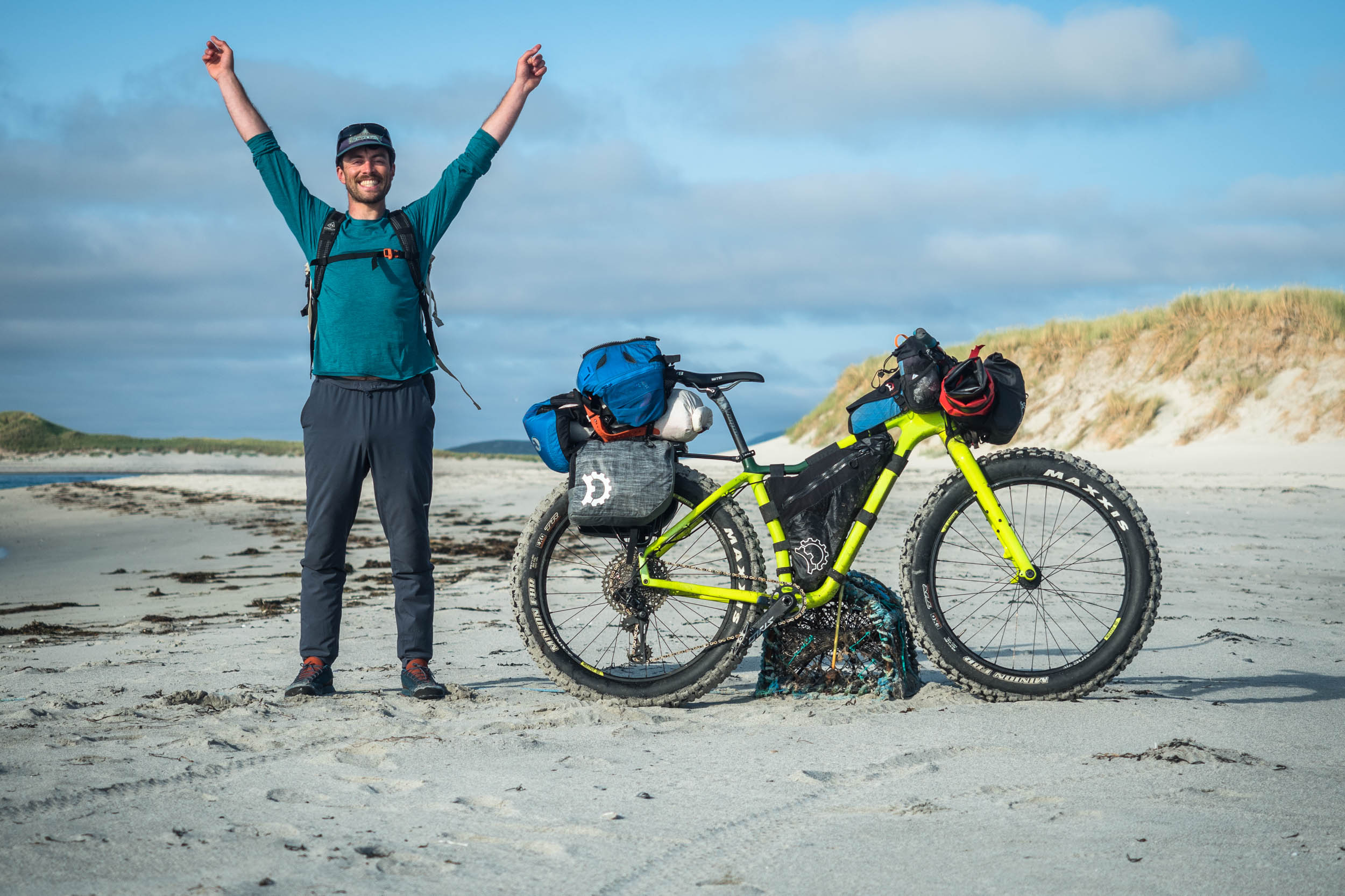
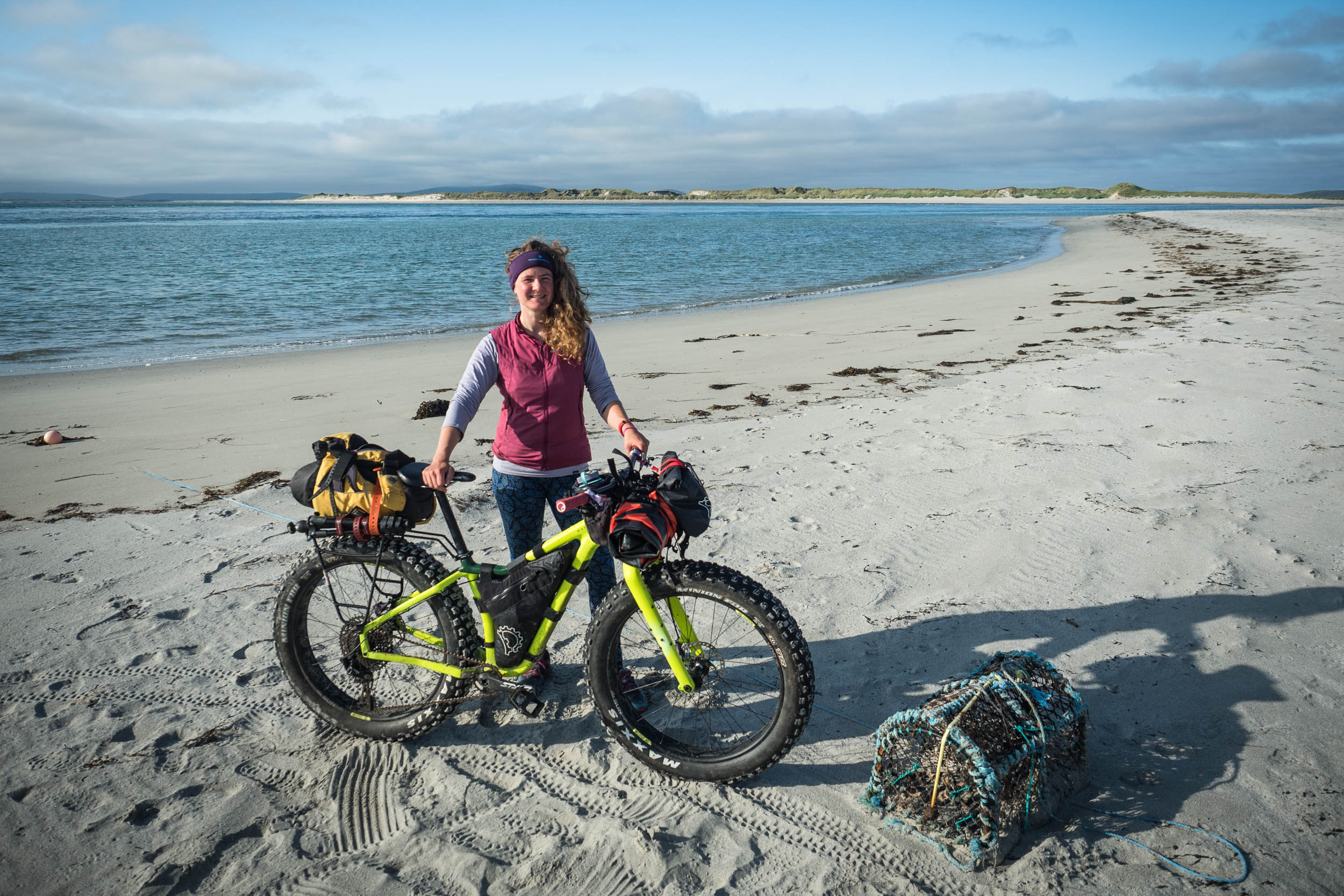
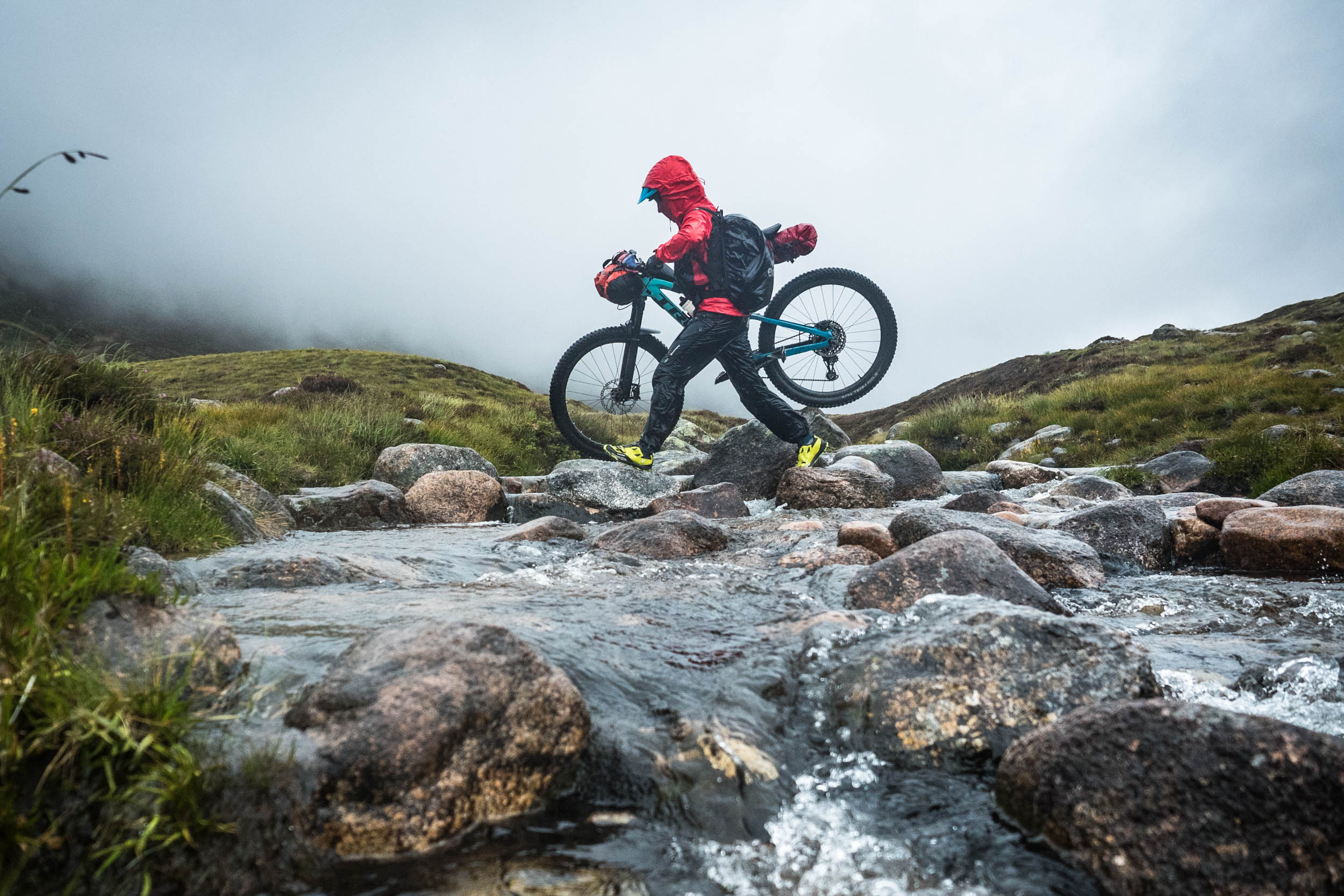
Instead of approaching the islands as if they were the edge, we decided to treat them as the centre of a route that we’d had in mind for some time and explore their circumference, avoiding the road that runs down their spine. With packrafts and fatbikes as our tools, it’s impossible not to want to get creative, to go out on a limb and seek out the route less travelled, driven by the reward of a unique perspective on a place you thought you knew.
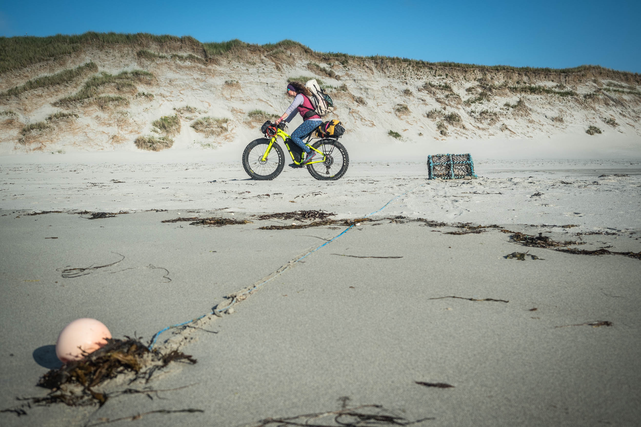
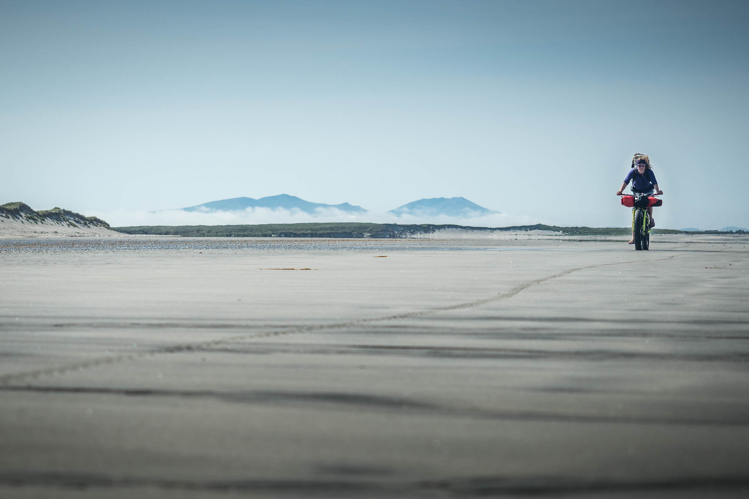
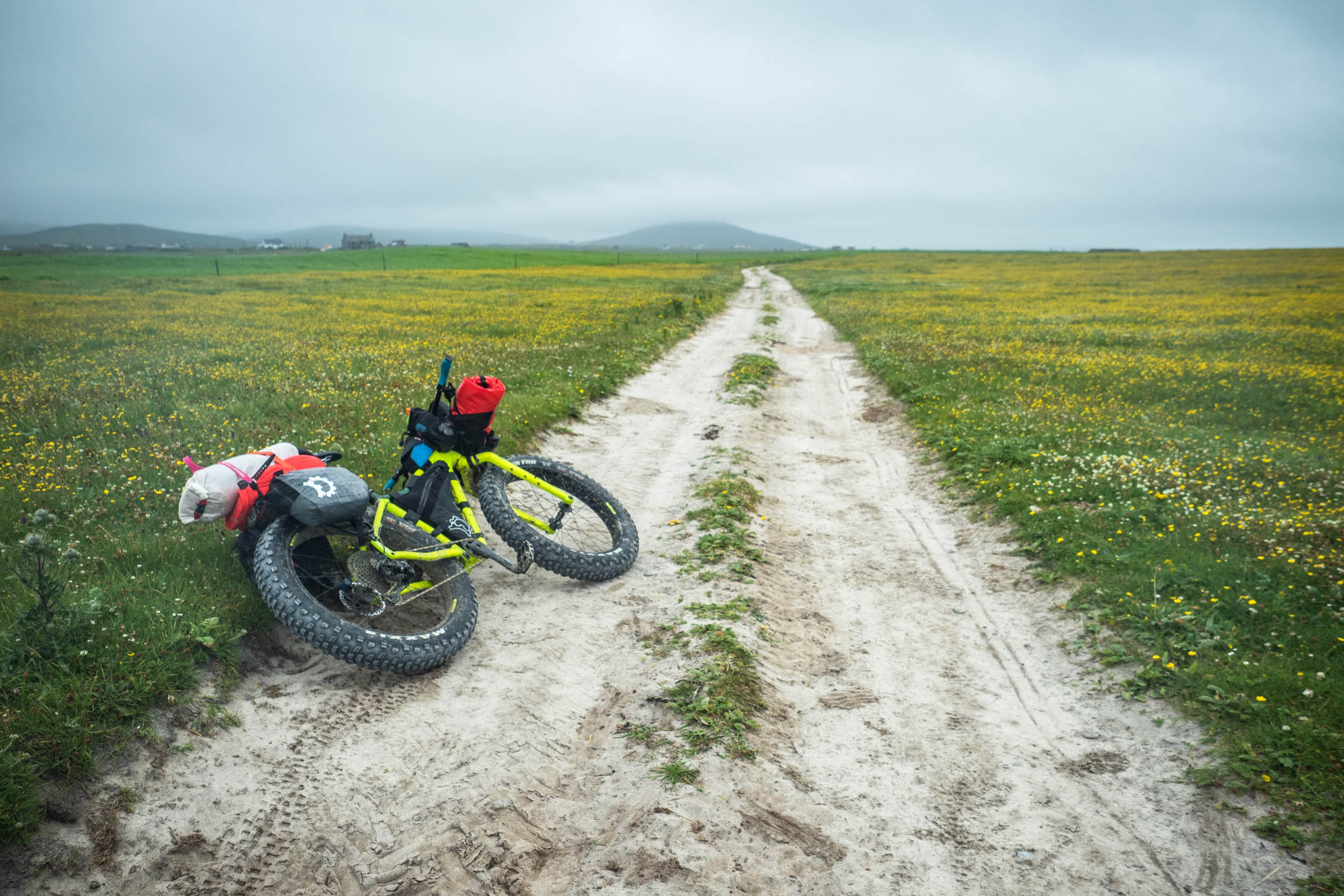
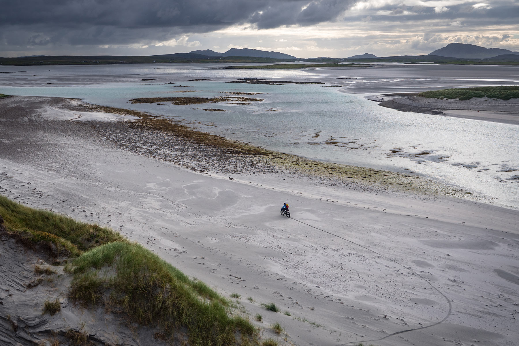
The islands of North Uist, Benbecula, and South Uist almost did the thinking for us anyway, thanks to their geography. Their western, Atlantic-facing coasts are neverending sandy beaches that rise gently to swathes of dune and heath on the landward side: the machair. This fertile grassland of calcium-rich shell sand is found only on those wild Atlantic coasts of Scotland and Ireland, one of the rarest habitats in Europe and home to innumerable wildflowers, birds, and bees in the summer months, as well as the islanders’ sheep and cattle. The eastern coasts are rocky and barely inhabited, shut off from the rest of the islands by a row of mountains with their imposing Norse names: Stulabhal, Hekla, Eabhal. The single road that runs the length of the three islands connects them with causeways. Riding along the road, as we have done before, you see neither the white sand nor the rocky, hidden bays. Back in 2017, we decided to circumnavigate North Uist, using the bikes to pedal the length of the beaches and cross the channels in between them with our packrafts. The boats would then take us up the east coast. This time, it was the turn of Benbecula and South Uist, whose rocky and almost uninhabited east coast had always seemed more intimidating and committing.
We left behind a record-setting heatwave as we departed Skye on the ferry to Lochmaddy. The high-pressure system that sat on top of the British Isles was creating a boundary of its own, as mild, moist air from the Atlantic piled up against it. The divide between the two air masses was right over the archipelago, and since it was unable to go anywhere, all that humid maritime air brought a dense curtain of fog to the islands. The offshore winds were too strong to begin with the exposed paddle down the east, so instead we began on the west, aiming south down the seemingly endless beach that protects South Uist from the sea.
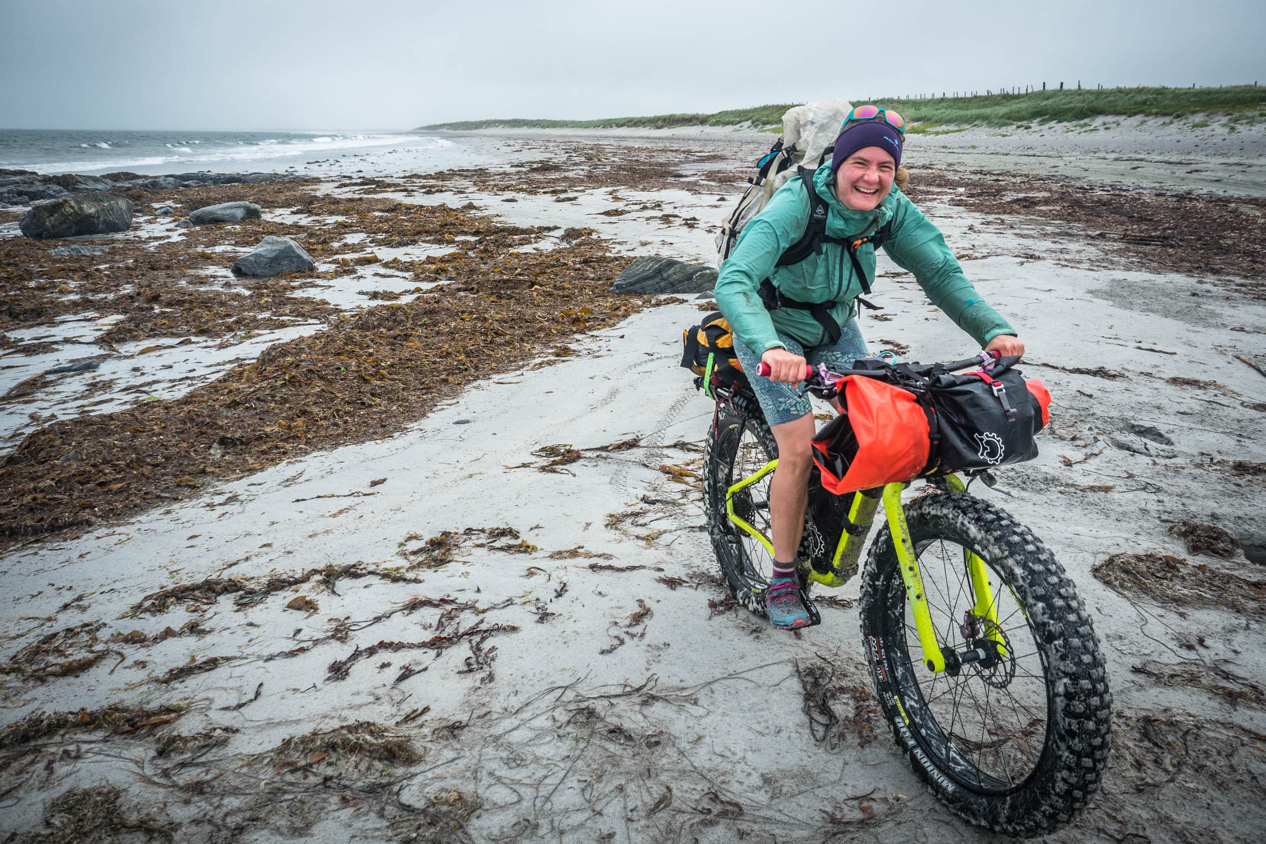
The stiff breeze was laden with fog and sea spray, so much so that we quickly acquired a crust of salt on everything, including ourselves. With the road and the villages lying further inland, the feeling of being isolated and remote was surprising when there were plenty of people living just a few kilometres away. It was only exaggerated by the barrier of the dunes that left us sandwiched on the narrow strip of sand against the Atlantic waves. Sight and sound were obscured in the pulsing waves of soft smirr coming from the sea, so for hours at a time our world was reduced to just a few hundred metres, but in the mild air of a Hebridean summer, it’s never too hard to stay warm, even if getting wet isn’t optional.
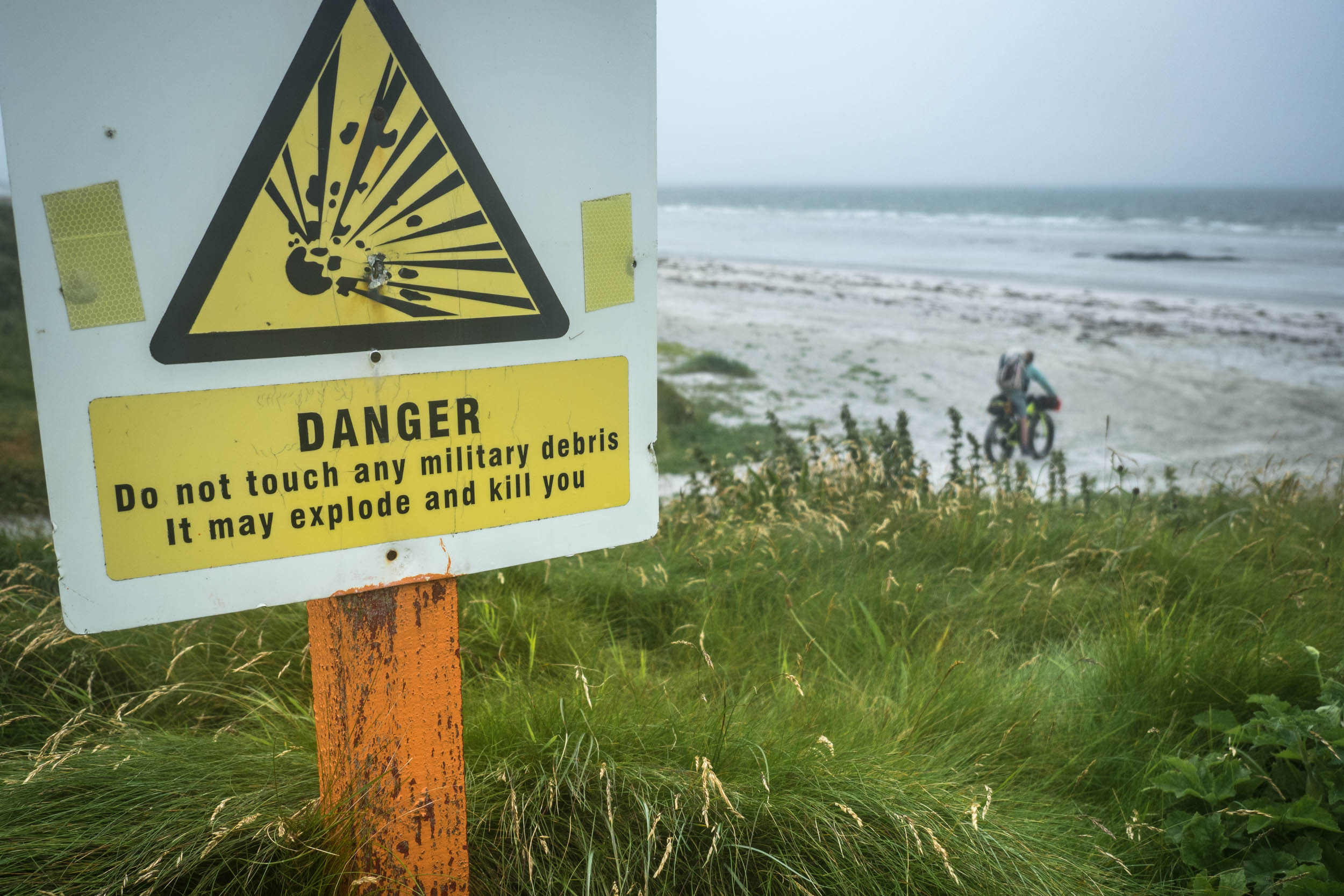
The 35 kilometres of almost continuous beach riding towards the south of the island begin ominously by entering a rocket-testing range, though July was (helpfully) an inactive month. The two days of riding were monotonous though not unpleasant and broken up by the interesting flashes in the sand that like to catch the eye of the beachcomber. Whipped up by the wind and waves, the extensive offshore kelp beds helped to produce mountains of foam that covered the entire beach at times. Hidden among it were the usual fishing detritus: plastic crates from Russia and Norway, buoys of all sizes, and plenty of lobster creels. Higher up the beach, the skeleton of a whale watched the scene forlornly, missing its skull. Small balls of feather and bone blew across our path from time to time, the collateral damage from the gulls, lapwings, and other ground-nesting birds that breed on the machair during summer.
Not everything we saw was dead, and on the second morning, we spotted a couple of tents beside a small stone bridge where a track came west toward the beach and the beach itself forced us inland a little to cross the river. A head popped out the top of the door as we passed, and we chatted for a few minutes with the occupants. The eastern European accents led to the explanation that the three of them were Polish, but living and working in London. Not content with seeing only grimy city spaces, they decided to travel to see the rest of the country they were in, which led them here, on a blustery morning with the sea air still heavy with salty mist, where they were embracing the new day with bacon and sausages cooking in a pan just inside the tent porch. About as far from London as they could be, then!

Lochboisdale is a small village but spread out in the tradition of Hebridean crofting communities, where most houses have their own patch of land to raise livestock or crops. We didn’t see it at its finest, since the flat, grey light did little to beautify the harled grey walls of the buildings, and the locals seemed to be indoors thanks to the persistent drizzle. It was eerily quiet, and the few people we did find were in the bar of the Lochboisdale Hotel, where we also found the most mouth-watering, stomach-filling, artery-choking bowl of chips either of us had ever tasted. The barman seemed confused when we immediately asked for another bowl, disappearing into the depths of the hotel to see if such a thing was actually possible. About halfway through the second helping, I realised they were probably so good because they were fried in beef dripping, but decided to wait a few weeks to tell Annie that she’d unwittingly gone non-veggie for the day.
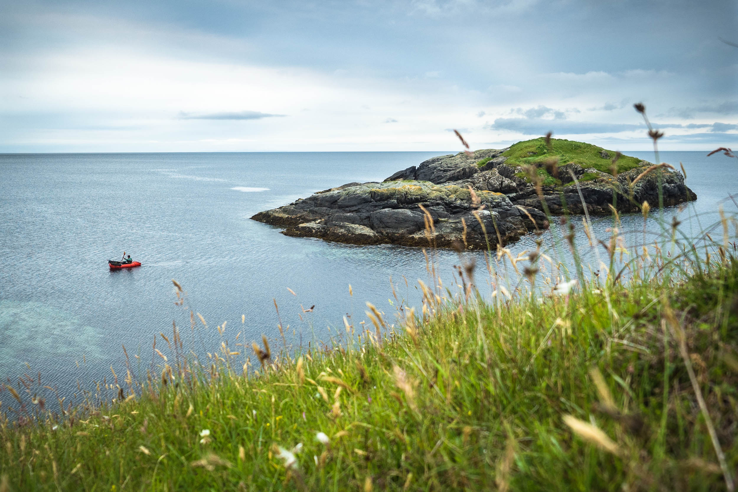
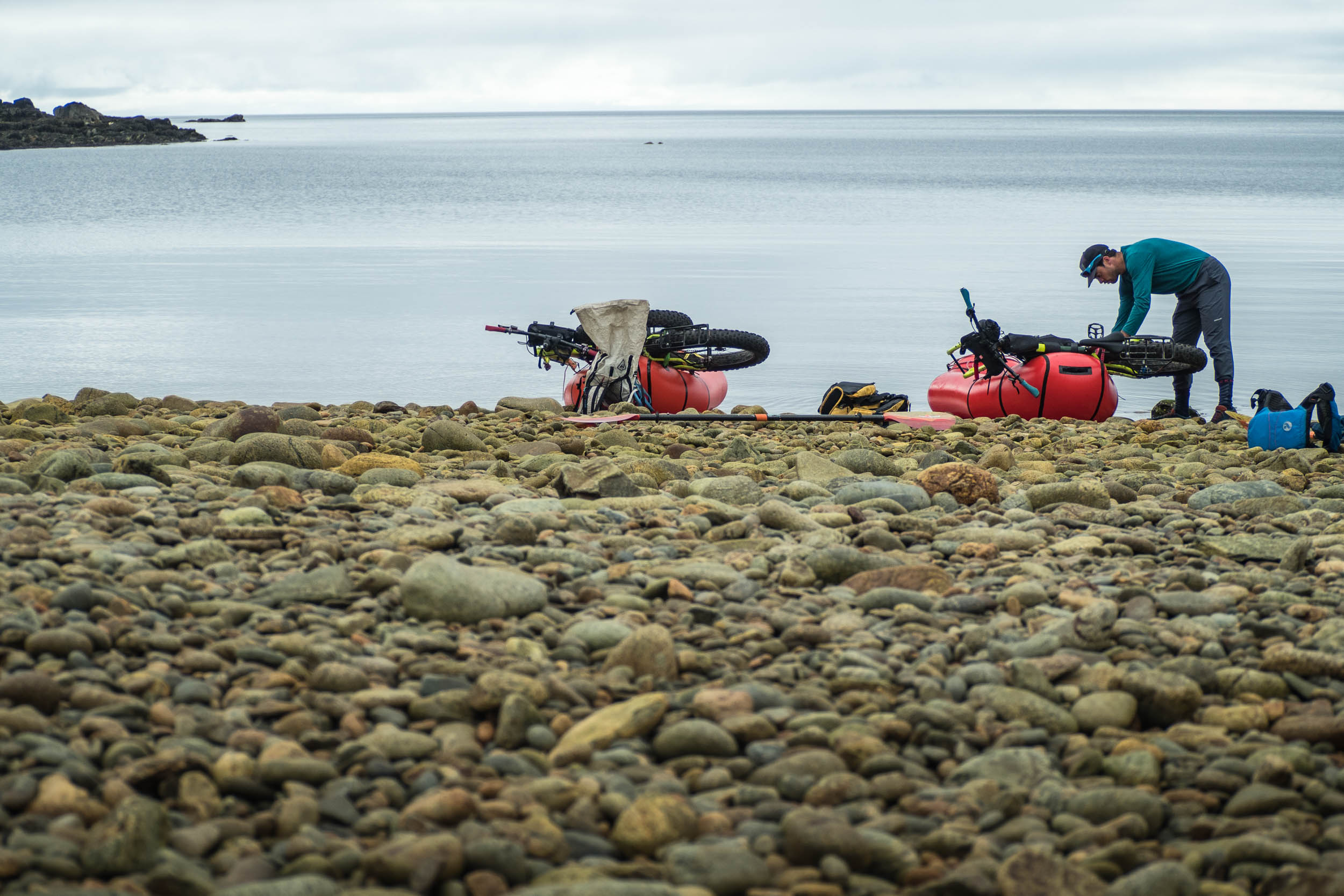
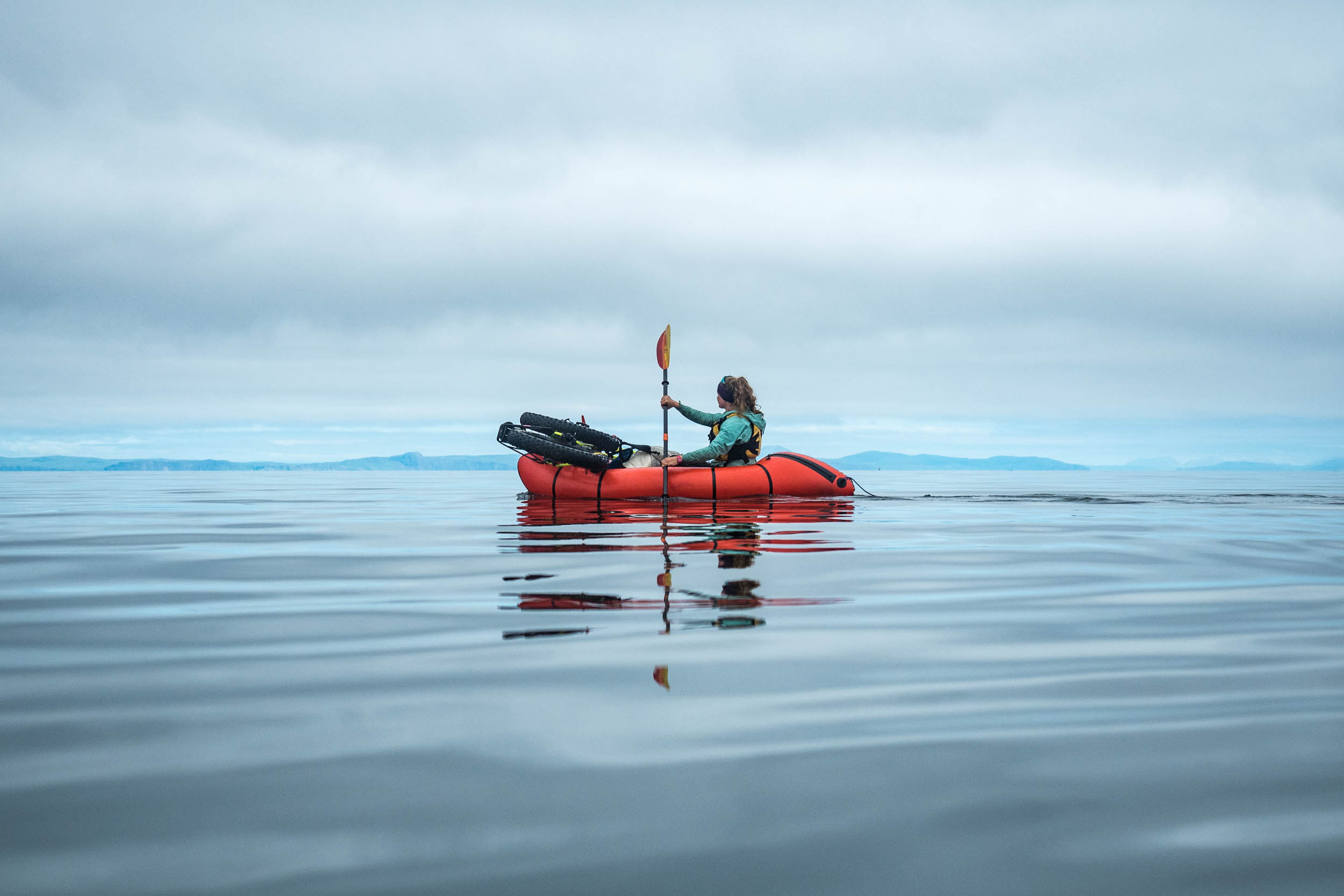
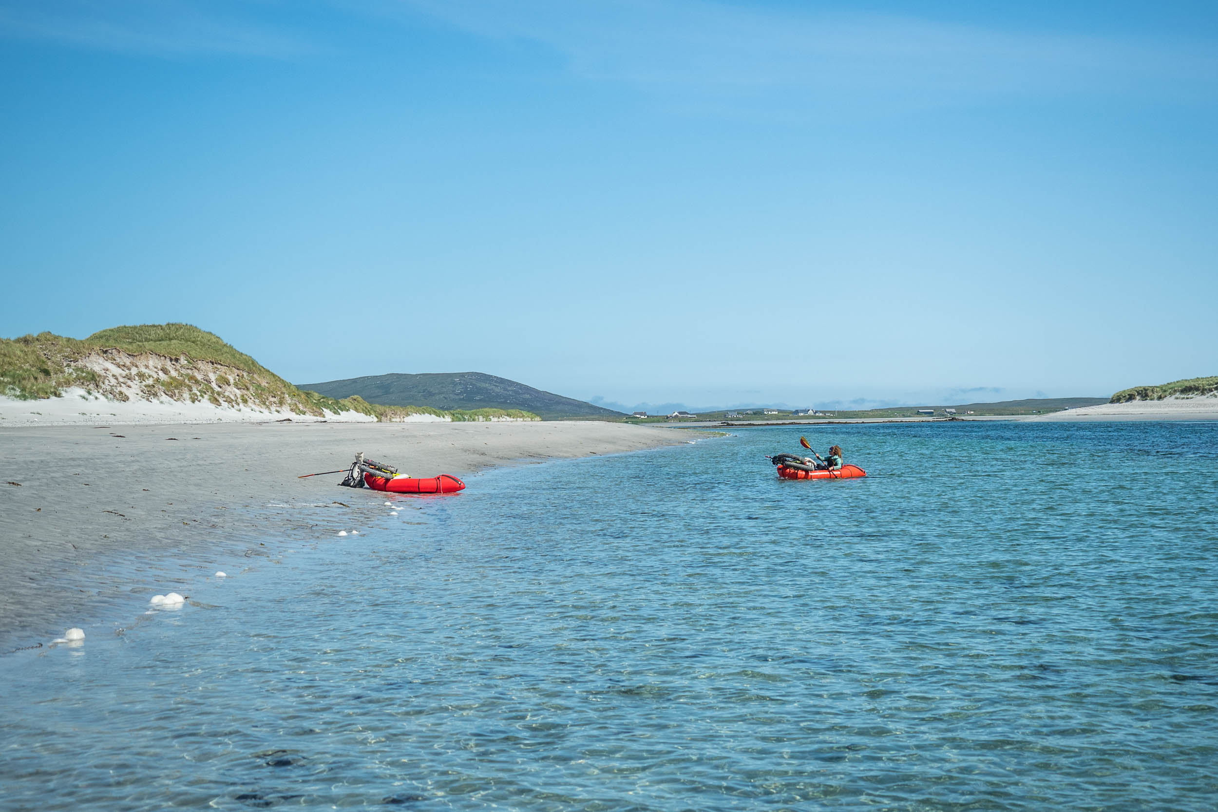
The east coast was the section for which we really relied on the weather playing nicely, so it was with some relief that we felt the westerlies begin to subside as we inflated the packrafts and paddled them east out of the harbour the next morning. It felt a little ridiculous, paddling out of the mouth of Loch Baighasdail with bikes strapped to our bows and little prospect of riding them again anytime soon, but it isn’t the first time I’ve felt that way, and I doubt it will be the last! The bikes had played their part to make the journey down the sands swift and enjoyable, and now it was the packrafts’ turn to do their bit. At first glance, they can both be cumbersome ways to travel, but as we set our sights on the remote bothy at Uisinis, we simply felt grateful that these remarkable bits of gear can take us to these places.
The long day to Uisinis was full of the small, sea-borne scenes that make any day on the water special: curious seals accompanied us for kilometres from their colonies, the confident ones called and splashed while the shy ones simply bobbed from a distance. We even saw one leap clear of the water in a way that neither of us had witnessed seen in Scotland before. The gannets dived, guillemots did their awkward bouncing landings on the water, and a dark patch of sky materialised into thousands of common terns as we skirted near an islet where they nest. The peaks of Skye and Rhum came and went on the horizon as the weather began to lift, but the only human signs we saw all day were the fish farms that are tucked into ever-sheltered sea lochs on the islands, sources of valuable income as well as the additional marine waste that could be visibly traced back to them. The bothy itself came into sight at the end of a long day, just as arms were protesting that they’re not used to being pressed into service.

After camp had been made on a small patch of salt-stunted grass by the shoreline and tea had been drunk, we gave the bothy a quick appraisal. In the summer months, we usually prefer to sleep in our tent and soak in all the long hours of daylight, but Uisinis had captured my imagination years before, and it had become a sight that I sorely wanted to see. Like many Scottish bothies, it began life as a simple crofter’s cottage, but its once unremarkable setting over a sheltered bay on the east coast of South Uist has become remote as the rest of the world left it behind; the walk-in is harder than it seems on the map thanks to the boggy, rough ground of the island, whose highest summits of Beinn Mhor and Hekla guard it from approach from the west. It’s far easier to paddle to than walk to, and so here we were. The inside was familiar to anyone who has visited a Scottish bothy before, but among the usual empty whisky bottles and “bothy book” I found a mouldering copy of Hebridean Memories by Seton Gordon. We were planning a day off the next day anyway, to explore the hills and underground prehistoric dwellings or souterrains nearby, so I thought to borrow it and read while we relaxed in the tent.


I was glad I did. Books about a place take on infinitely more significance if the reader is experiencing that place while reading it. In one of his series of vignettes of island life from 100 years ago, I read about a visit the author made to the crofter who lived in the bothy (then a cottage), describing his wife’s softly spoken Gaelic and the warm hospitality that greeted his arrival in a storm. Looking out of the tent door and across to the proud little structure still sitting squat beneath the mountains, it shook me from seeing it as a remote spot, a place on the edge of things, to the fact that it was once the centre of someone’s world. I read the rest that evening and the next morning.
Seton Gordon’s words stuck with me the next day. The mountaintops were still firmly wrapped in fog, denying us the chance of a view across to St Kilda from their summits, so instead, we hiked into Loch Coradail for a swim. Gordon describes it as “hill-girt and remote,” and in his eyes it’s the likely hiding place of an each uisge, or water horse: a malevolent water spirit that can assume the form of a human and likes to drown anyone who it can tempt into the water. Luckily, it was freezing, so we weren’t tempted to stay in too long. Corodail is also one of the refuges sought by Bonnie Prince Charlie while he fled from the failed uprising in 1745. It was a dreary place to have hidden, alone except for the ravens in the fog.
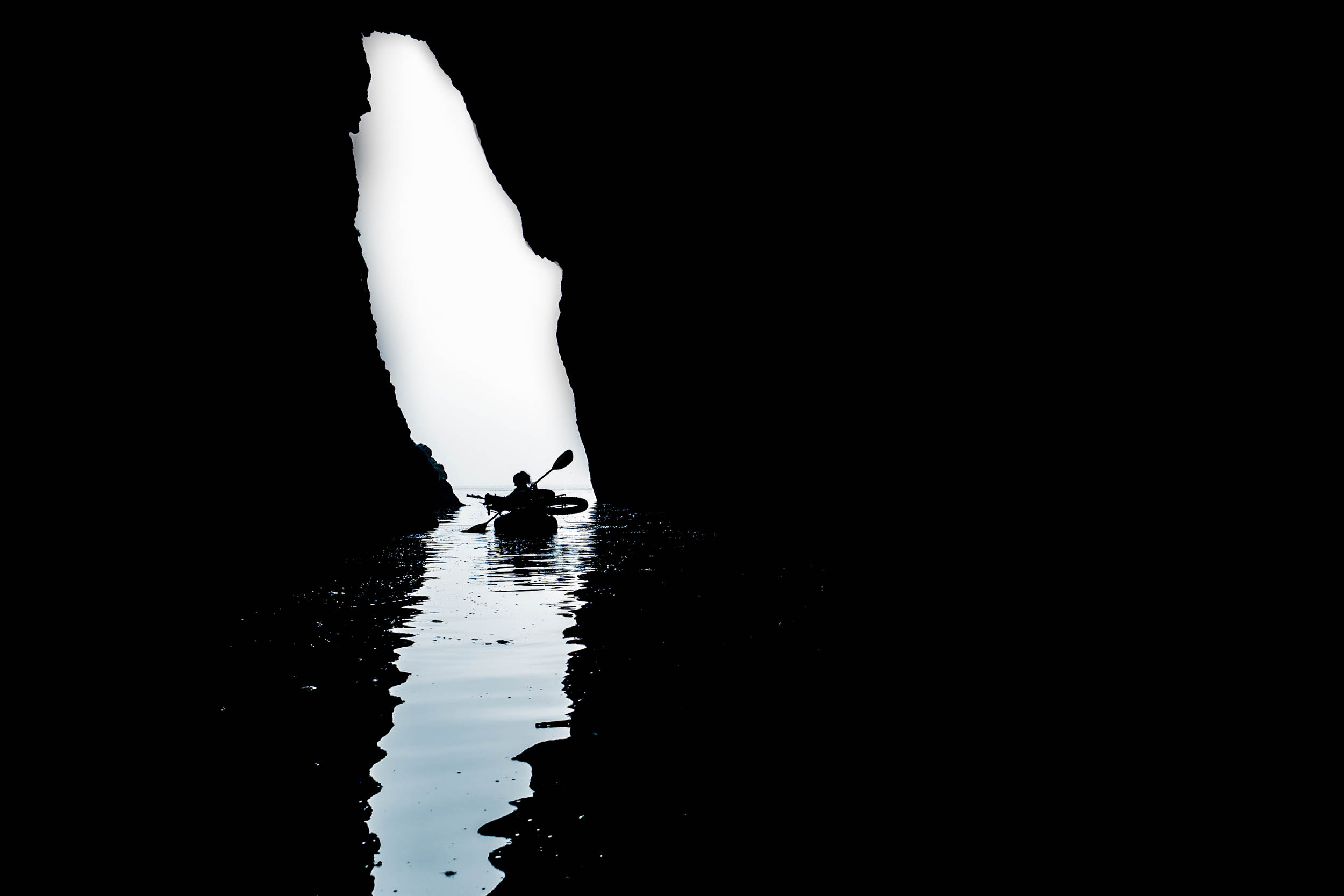
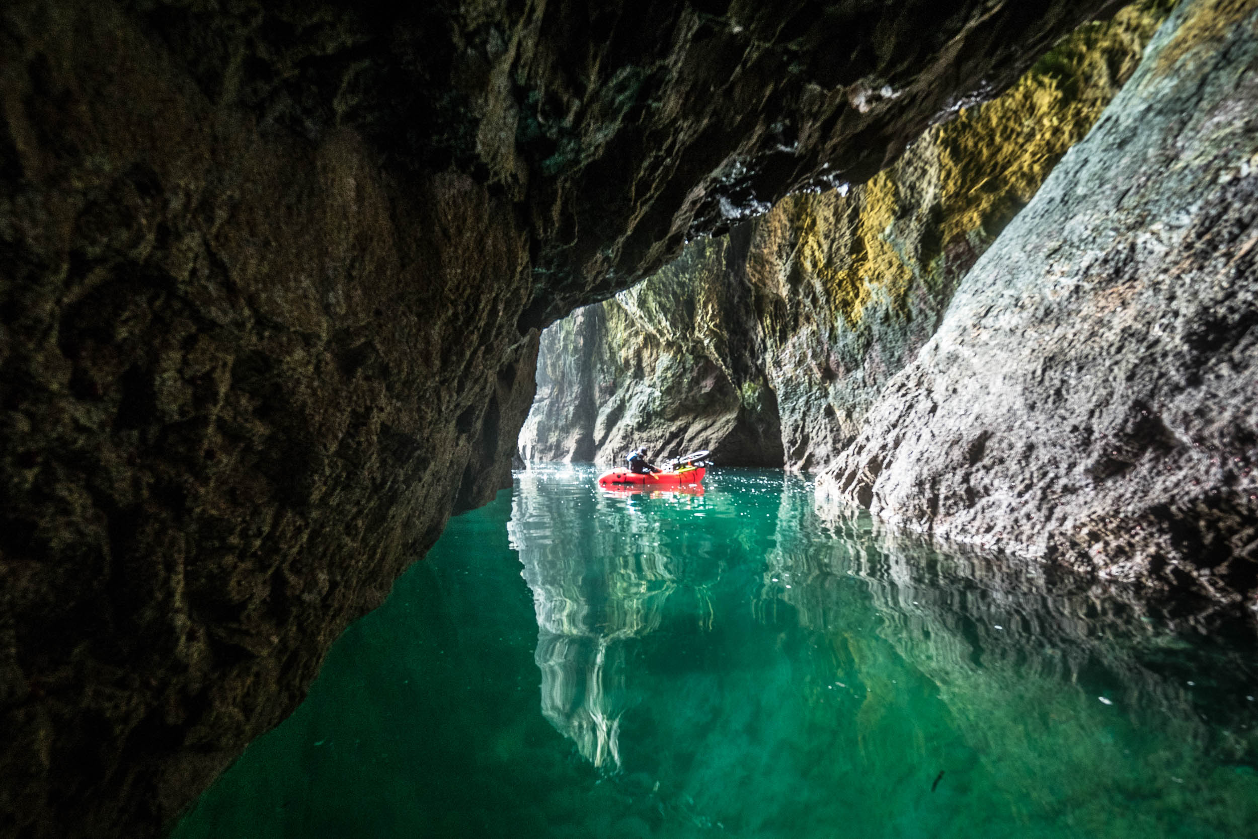
At this point, I’ve diverted from describing a bike ride, but remember that the bikes were still there, faithfully waiting for the marine portion of the journey to finish and a chance to bounce across the sand some more. In fact, the very next day, as we turned on our head torches to paddle deeper into one of the sea caves that riddled the cliffs we were passing beneath, I found myself thinking that this was one of the strangest places I’d ever taken a bike to. That’s the beauty of this sort of trip, though: neither the bike nor the boat ever feels like a burden, since both are essential pieces of the puzzle and without one the whole thing would fall apart. The aim of the journey is the journey itself, after all, since if we had wanted to travel the length of the islands and nothing more we could easily have done it in a day by riding a quicker bike along the road.
That road is the main reason for the several abandoned crofts we saw while we continued up the coast, which once were right on the “highway” of the ferries, trawlers, and innumerable other boats that ran up and down the coast. Now they’re too far from cars, Tesco delivery vans, and buses, and are no longer viable places to live. As we approached the northern tip of South Uist, we joined the dots between skerries, breaking the large tidal crossing to Benbecula into more manageable chunks. The water was almost flat calm, an unusual thing on islands that face the windy western Atlantic, and rather than rushing we could drift along and watch otters scurry down from their holts towards the water’s edge and white-tailed eagles quarter the sky above.
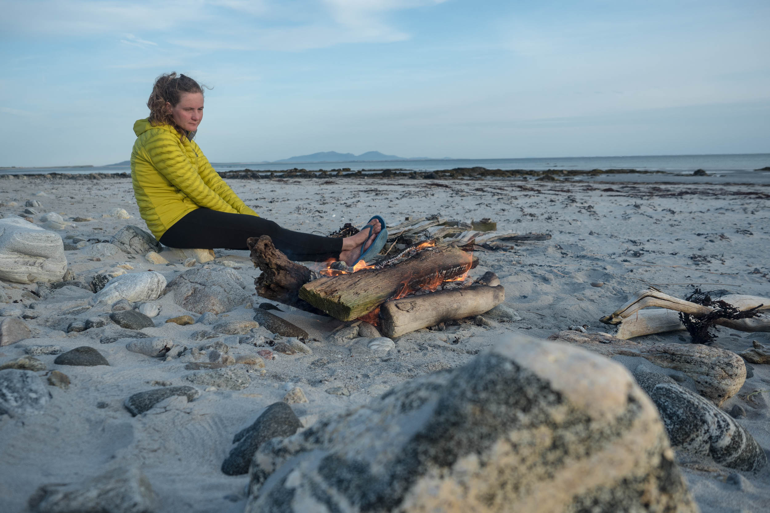
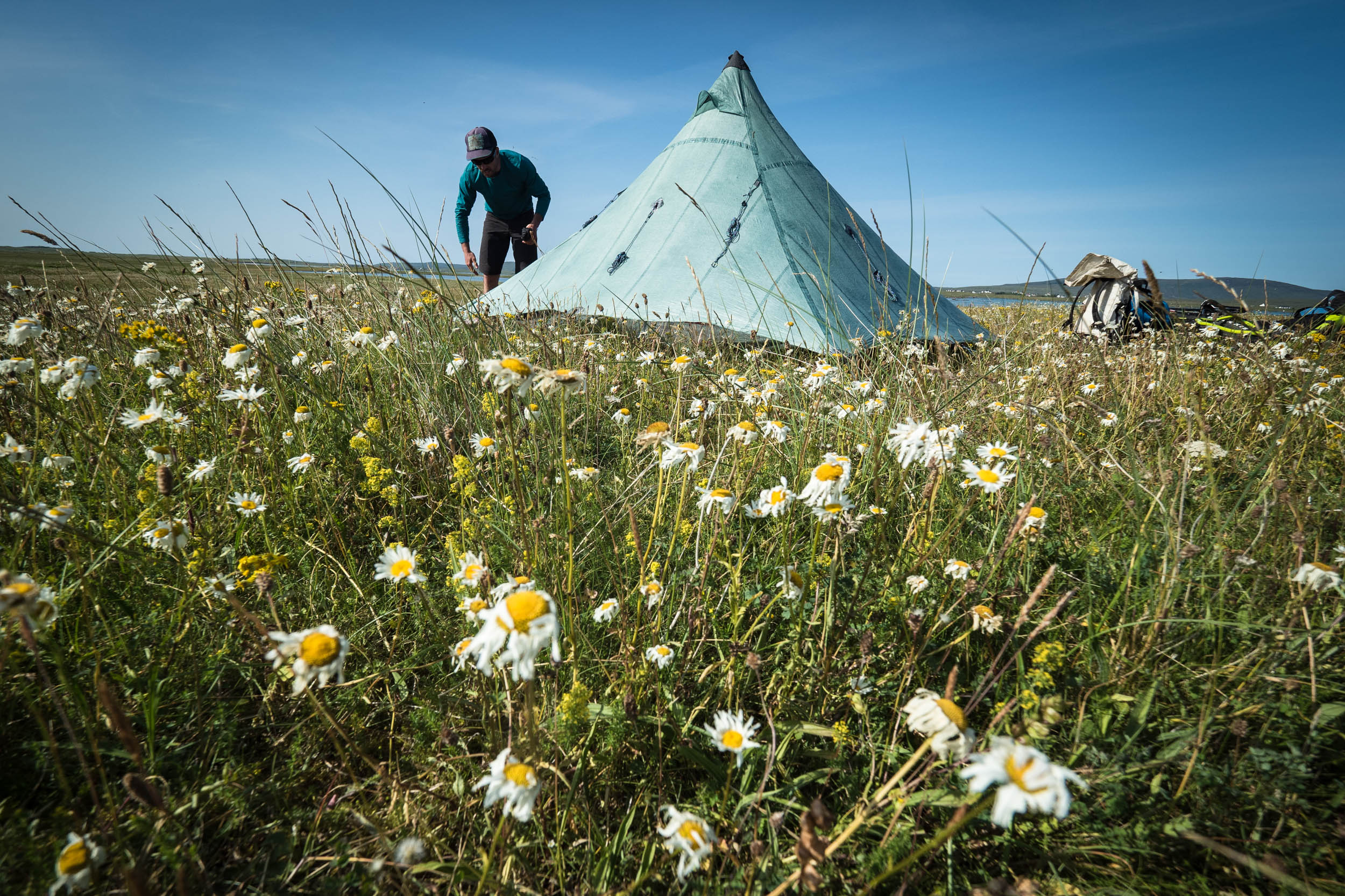
With a little time left before our ferry home, and with nowhere in the world we would rather be, we closed the loop and crossed back on to North Uist, ferrying across the swift tidal channels to an uninhabited machair island on the west. At last, the heatwave that was still baking the rest of the UK made its way across the Minch, and for a couple of days, we rode the huge tidal flats in search of interesting finds, swam in a sun-warmed sea, and lounged in the tent surrounded by wildflowers and humming bumblebees.
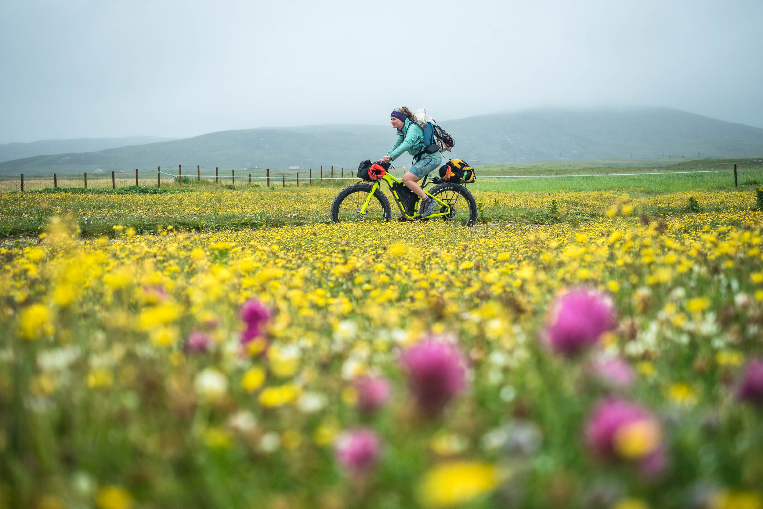
The contrasting scales of our surroundings made it difficult to focus: on one horizon, were the jagged gabbro peaks of the Skye Cuillin, and on the opposite skyline, the huge cliffs of the St Kilda archipelago were visible out beyond the dunes and lighthouse of the Monach Isles. At our feet, the purple of blooming clover was mixed in among a dense carpet containing buttercups, ox-eye daisies, orchids, and gentian. A thousand tiny lives played out in front of us, from the rare Great Yellow Bumblebee to the mice and young birds in the process of leaving their nests. As I sat in yet another spot I would never have visited if it weren’t for that unlikely combination of bike and boat, surrounded on all sides by life, sea, and distant shorelines, I thought again about edges. Even once you get to a place, it’s all too easy to take the easy road through the middle, which in his case would have meant missing so much without ever realising it. At the speed of big tyres and a blow-up boat, the islands had ballooned in size: every nook and cranny worth exploring and investigating, around every corner a new centre to gaze out from. So, don’t disregard the edges of the map, because that’s where the dragons are…
Related Content
Make sure to dig into these related articles for more info...
Please keep the conversation civil, constructive, and inclusive, or your comment will be removed.