


Nine Days on the Northwestern Ontario Rambler


After years of scouting trips, Theo Kelsey-Verdecchia and Glen Quinn recently made their first attempt at riding Glen’s entire 800-kilometer Northwestern Ontario Rambler bikepacking route. Find their report and a gallery of images from a stunning swath of Canadian backcountry packed with geological wonders, lakes, and vistas here…
PUBLISHED Nov 29, 2021
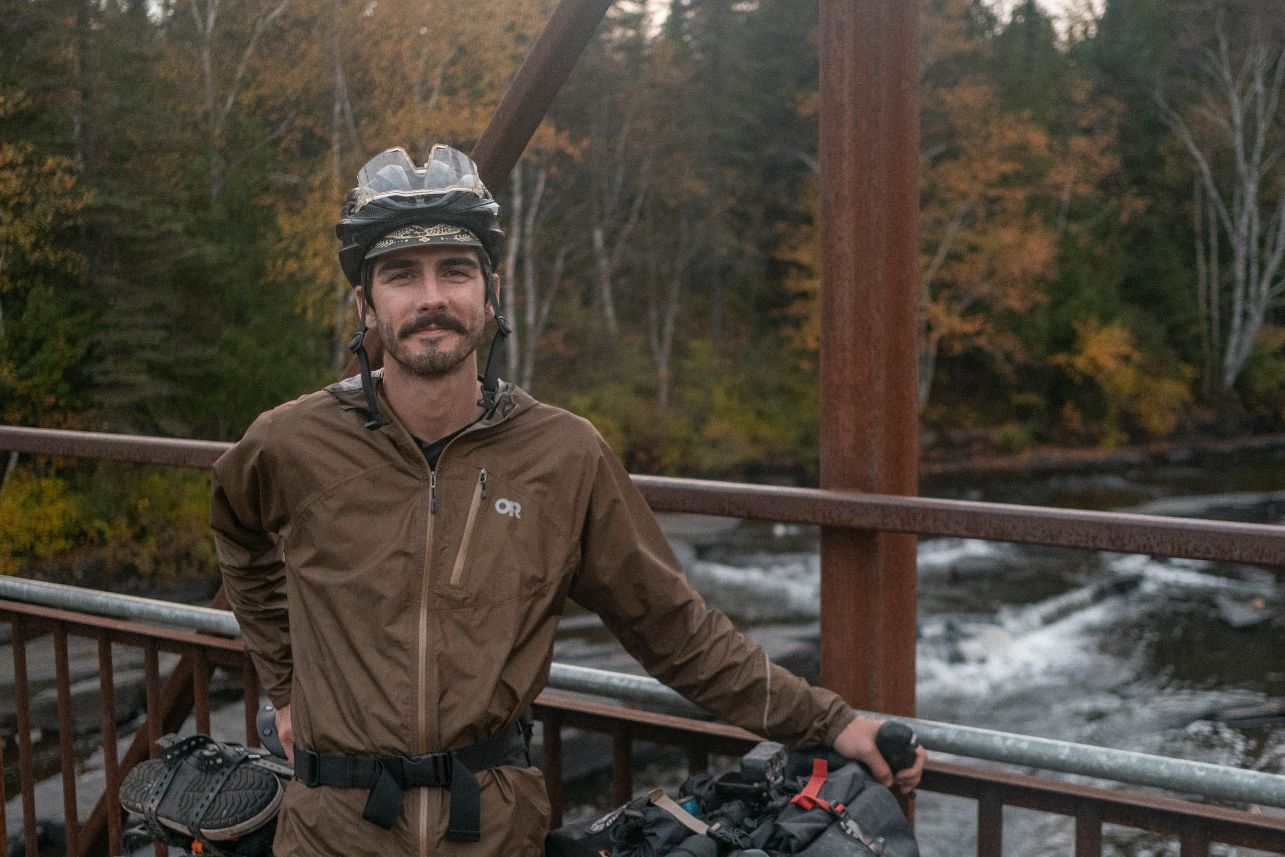
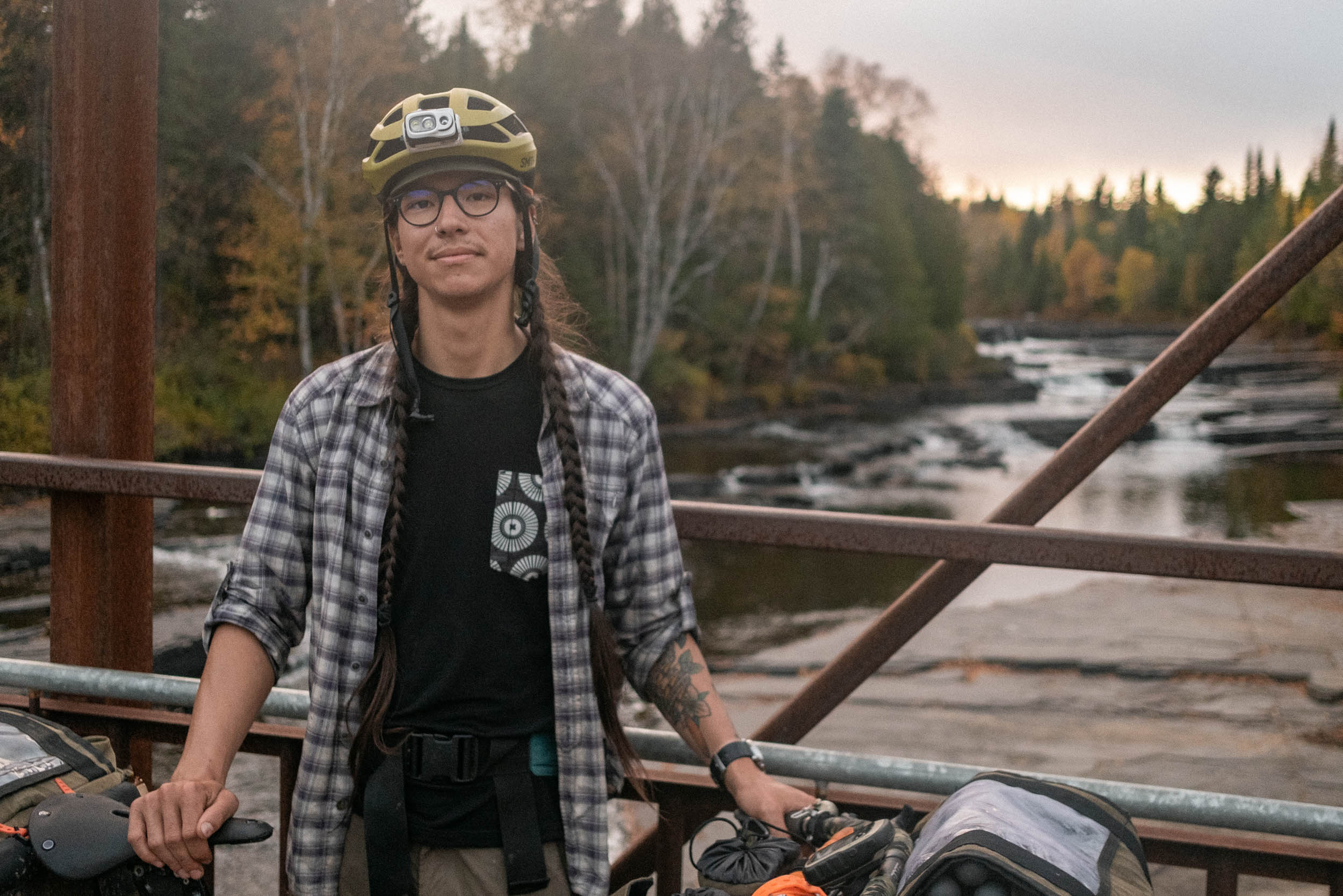
Words by Theo Kelsey-Verdecchia and Glen Quinn, Photos by Glen Quinn
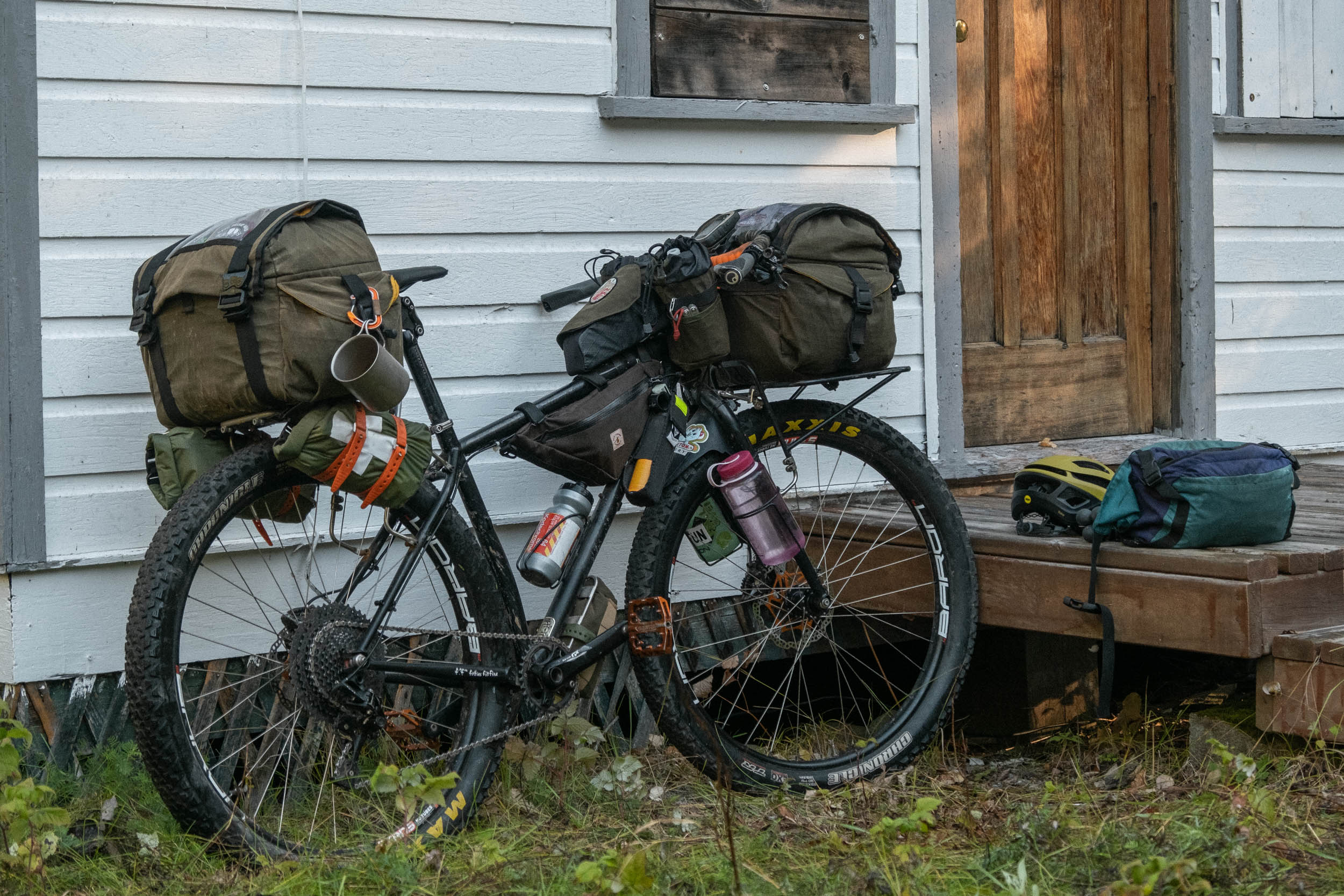
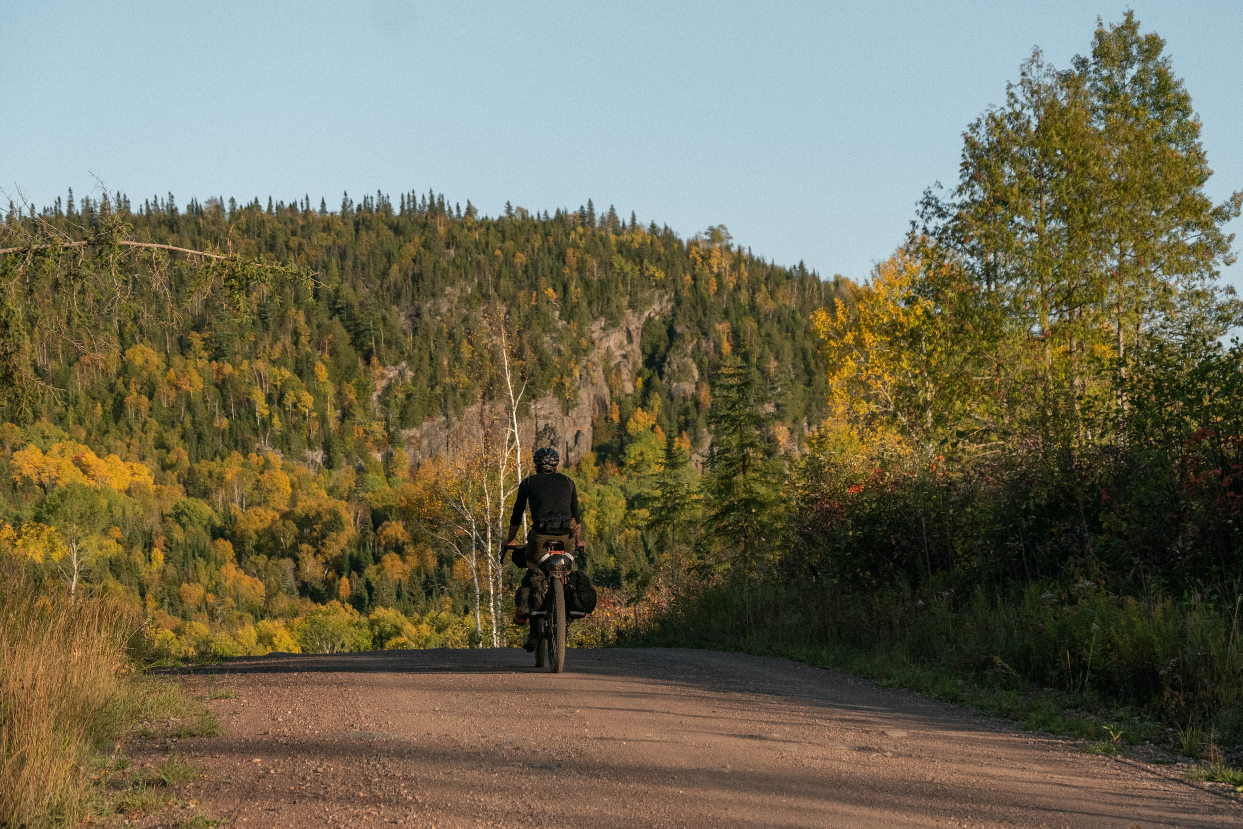
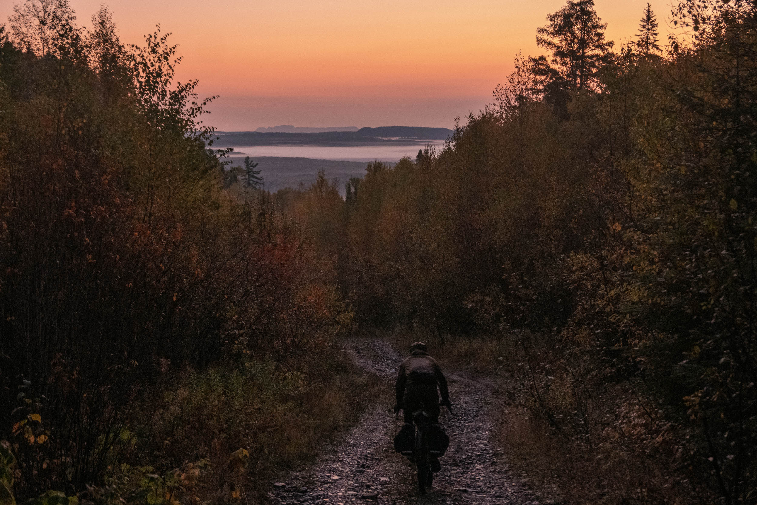
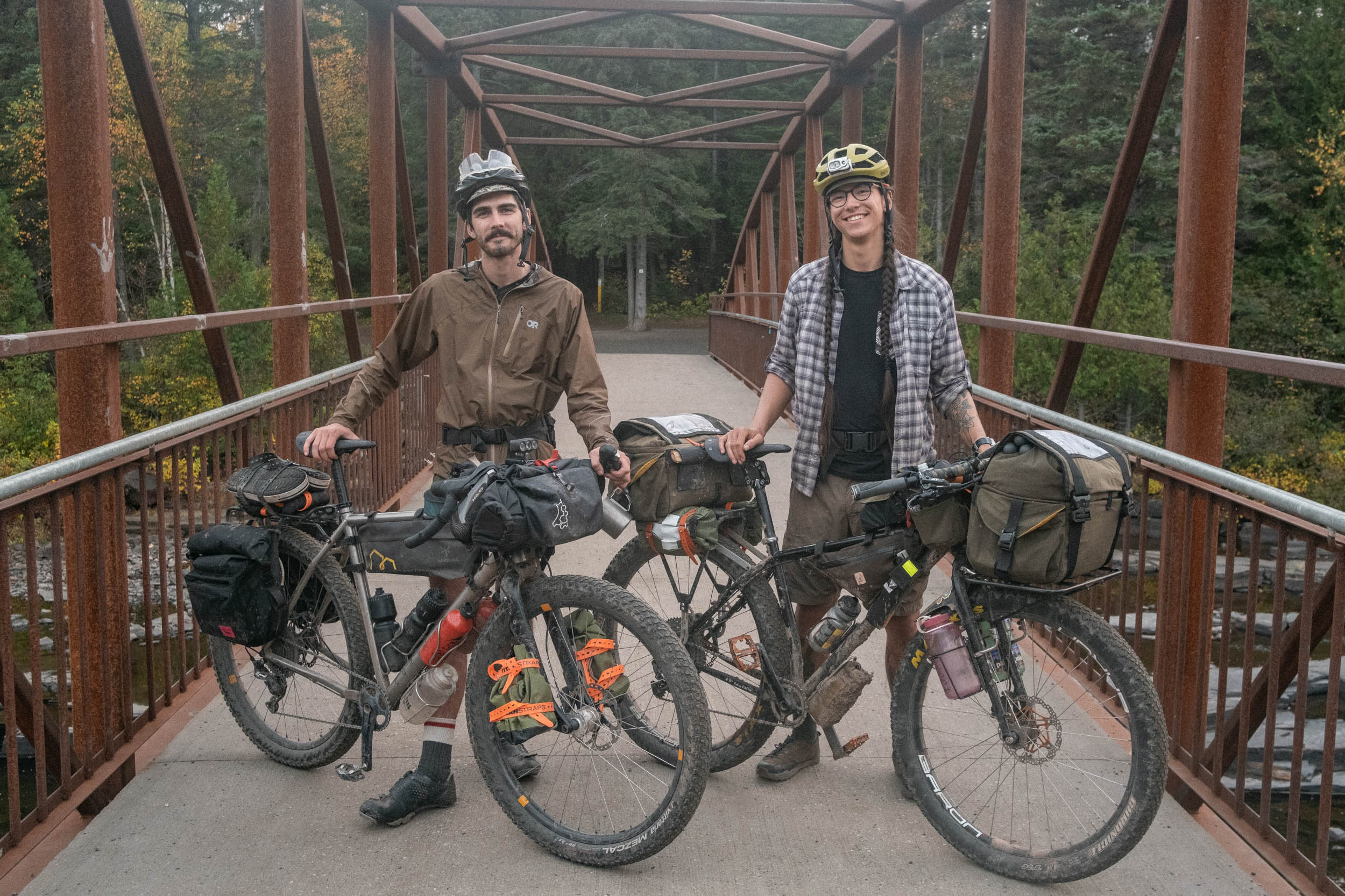
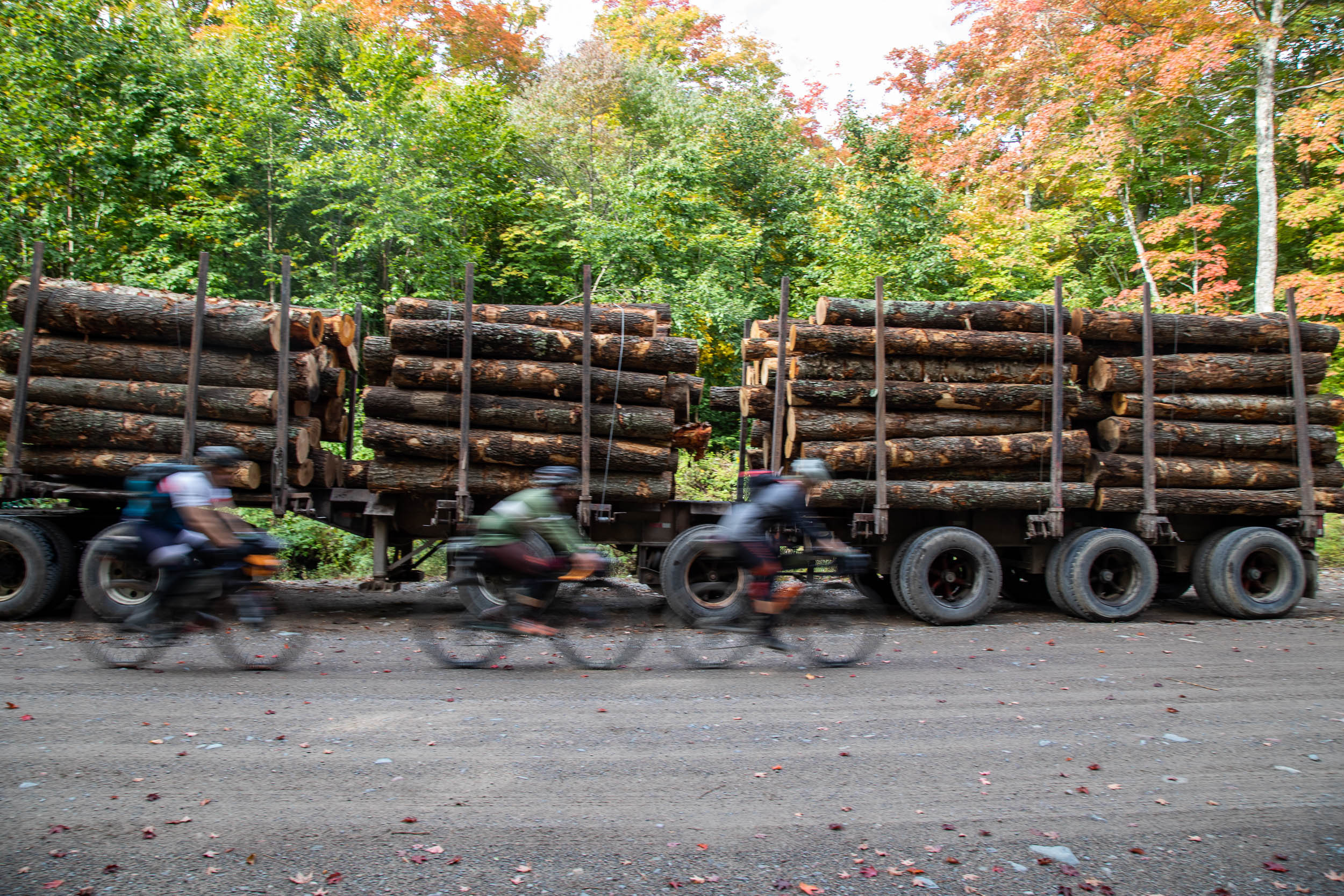
Rubbing the sleep from our eyes, we watched as the sun inched over the treeline surrounding Trowbridge Falls Park, a mountain bike trail network on the edge of Thunder Bay, Canada. Slowly, the golden rays pushed away the chill in the air, a welcome change to the typically cold and wet conditions of a late September morning in Northwestern Ontario. Standing on the iron bridge next to our fully laden bicycles—hauling food and gear for nine days in the bush—we were riddled with anticipation and eager to get on the road. After a few photos, we saddled up and began to slowly pedal out of the park.
Our plan was to follow a route developed by Glen, which travels almost entirely off sealed roads and is designed to take in some of Northwestern Ontario’s best riding and showcase its often disregarded geological features and natural splendor. Glen worked on the route over the course of four years while living in Thunder Bay doing his undergrad at Lakehead University, studying outdoor recreation, parks, and tourism. He combined dozens of smaller rides and scouting missions deep into the bush surrounding the city and beyond, eventually linking them all up to create an 800-kilometer loop.
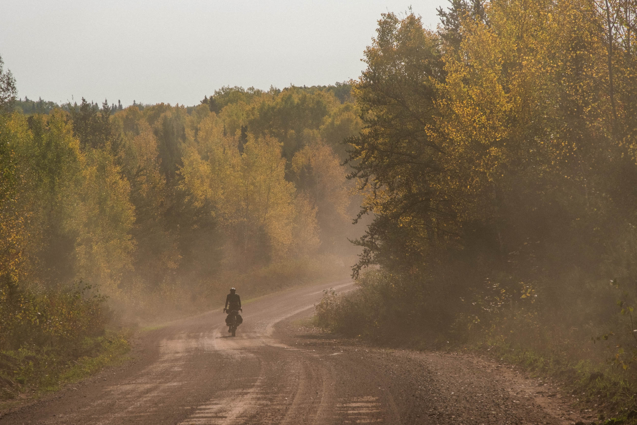
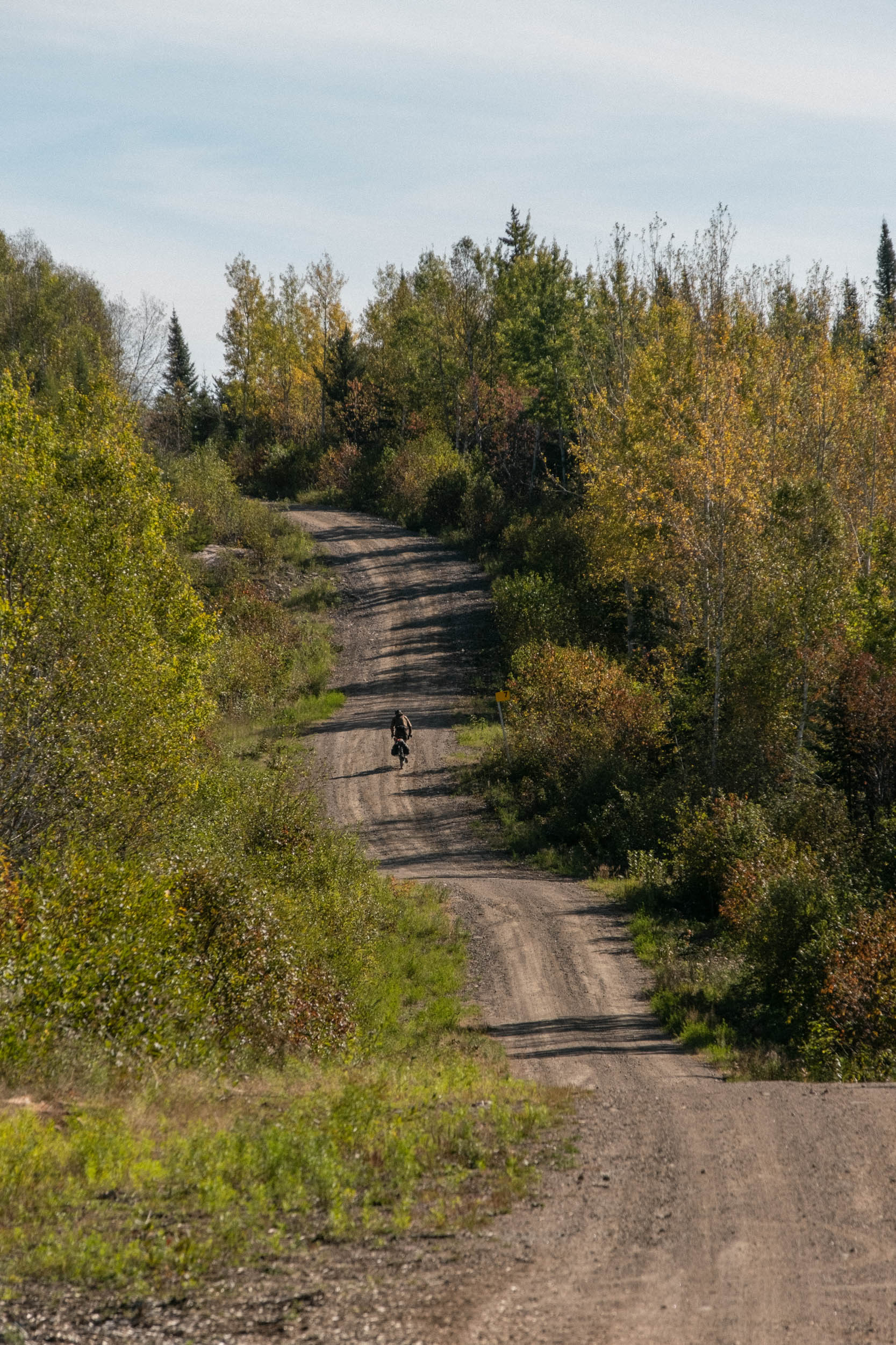
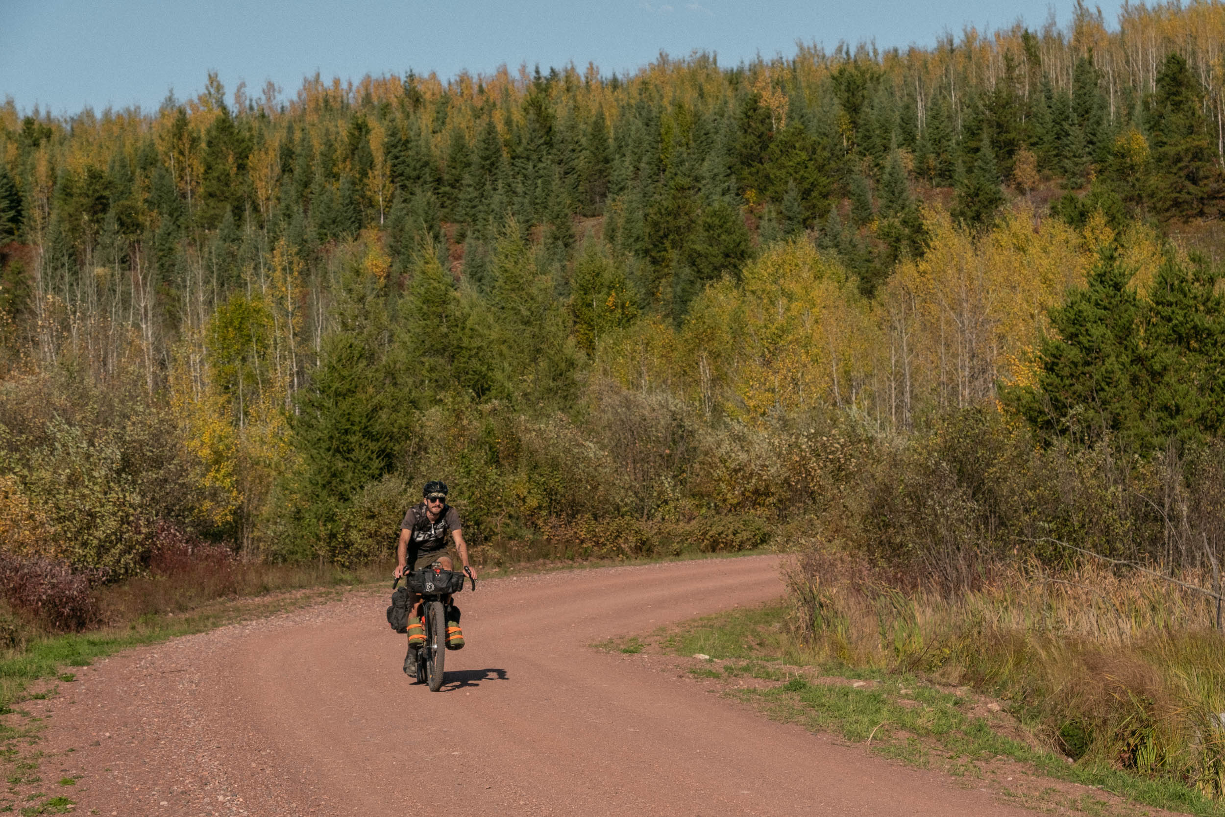
After a quick jaunt on some small gravel connector roads, we jumped on the Armstrong Highway to get a bit of distance from the city. A headwind and a slight uphill grade quickly let us know just how difficult it is to pedal a 90-pound bicycle at any kind of reasonable pace. The requisite highway kilometres quickly came to an end, and we turned off to Magone Lake Road, an old haul road that snakes its way vaguely east, rife with loose, washed-out climbs and descents, fast gravel, and 15% grades.
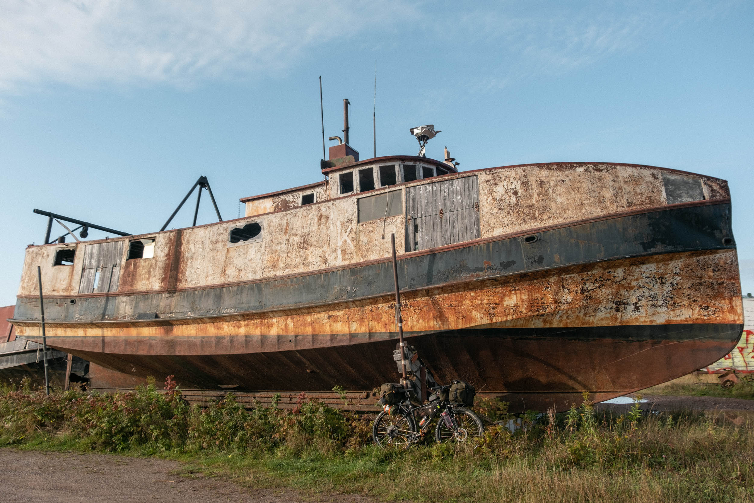
Much of the day was spent transiting the backroads from Thunder Bay across Canyon Country, out to the small fishing settlement of Hurkett, where we’d make camp for the evening. Thankfully, our climbing efforts were rewarded with several ripping descents, including quite a memorable one down the winding hardpack gravel road from the Greenwich wind farm. Road closures along the route necessitated some on-the-fly re-routes, which led to the discovery of an ATV track out to the disused rail bed that would take us out to Hurkett Cove, our camp for the night. The cove was a surprise to us both, several large derelict fishing vessels from the ‘40s populated the small inlet, which we spent a good deal of time exploring before setting up camp and cooking dinner.
The next morning, we made our coffee and oats by the light of our headlamps and situated ourselves on the dock to watch the sun cast a golden swathe of light across the hulls of the fishing vessels we’d slept beside. This was our first morning waking on the trail, a chilly one at that. After finishing our breakfast, it was time to change into our riding clothes for the day and pack away the down puffies. As we rolled away from Hurkett Cove, we pointed ourselves due north to make our way up the Black Sturgeon Road. Pedalling up the corrugated haul road, we both remarked how we could see our breath on exhale, until the sun made its way above the treeline, warming our frosty fingers and toes up. As we ducked and wove our way through five or so kilometres of overgrown bush track, we had to keep our wits about us as we listened to the crack of gunshots nearby.
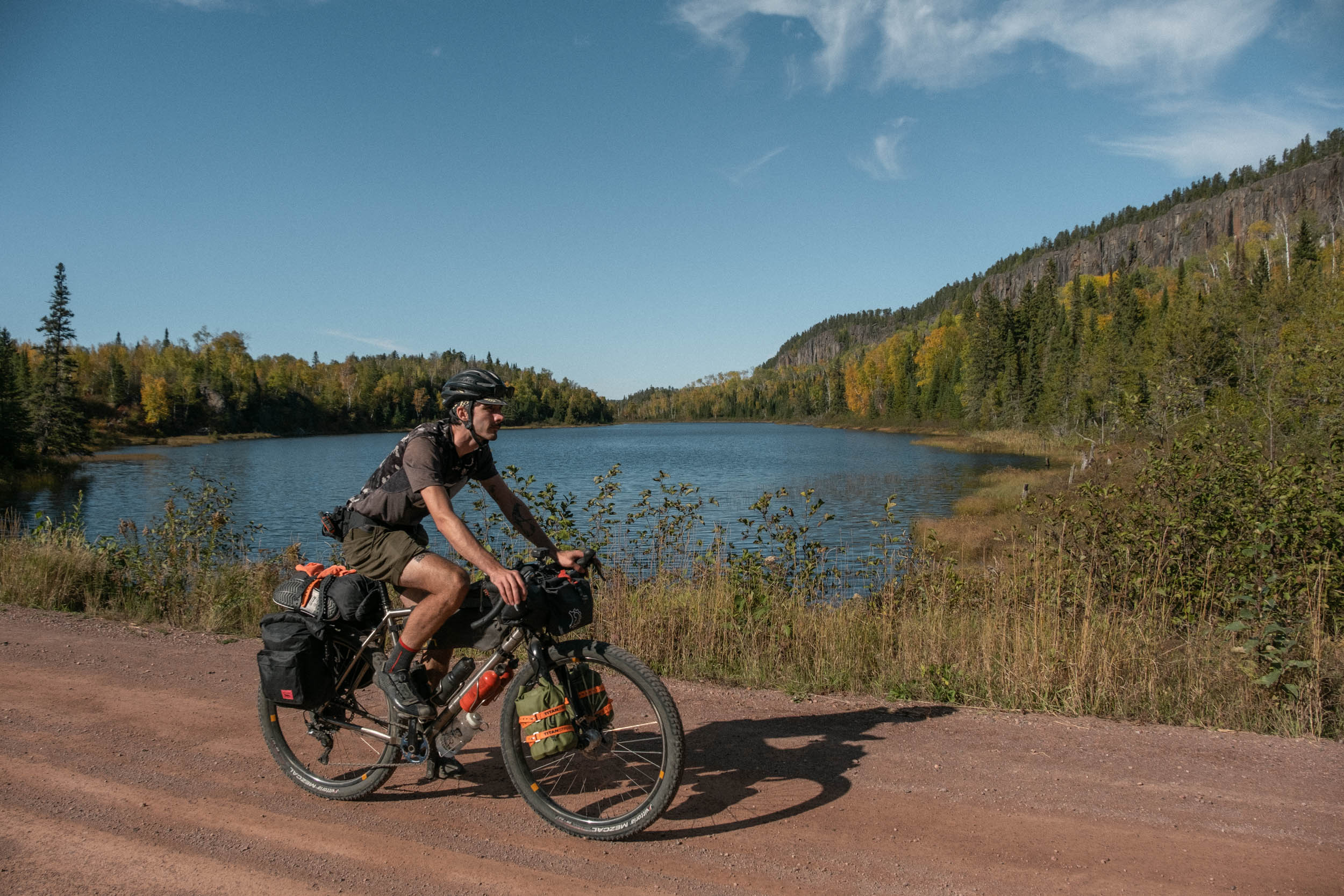
Around 50 kilometres into our day, we dipped off the main road to the shores of Eskwanonwatin Lake to enjoy a lunch of bean and cheese burritos. With the temperature now in the mid-to-high 20s, we breezed through the afternoon, remarking how much nicer it was to ride the Black Sturgeon Road in these conditions versus the rain and 0°C Celsius weather we encountered on a scouting ride up here almost exactly a year prior. Along the way, we met a young black bear having a little snack along the side of the road. After a brief introduction, they decided they’d rather not have company for lunch and were on their way.
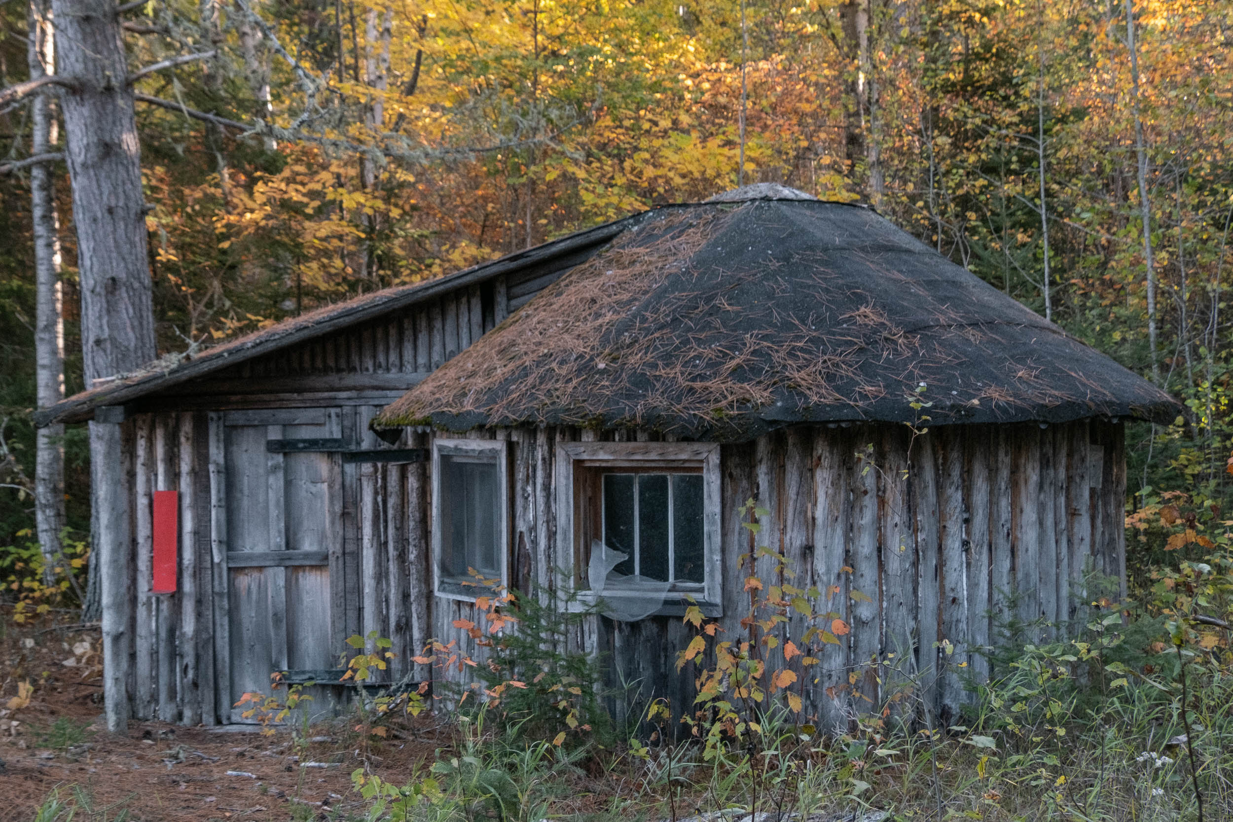
Before we knew it, the GPS was indicating a sharp turn to the right off the main road. We had intel from a friend that there was an old Outward Bound base up here, and that there was even a working sauna, maintained by locals. Given the information was a few years old at this point, we didn’t know what to expect, however, we were treated to a site both in decay and trapped perfectly in time from when the base was closed in 2004. We spent over an hour poking around the various buildings, keeping our eyes peeled for the sauna, which we did eventually find tucked away right next to the shore of Black Sturgeon Lake. After a delicious dinner of rehydrated pad thai, we gathered up some firewood to get the sauna rip-roaring hot and unwound from the day with a good sweat and an icy dip in the lake.


Waking at seven in the morning, the sky outside was still dark. We made coffee and savoured it along the shores of Black Sturgeon Lake just as the sun began to cast its glow across the water. We’d been lucky with the weather so far and it looked like our third day would be no exception. Slow off the mark this morning, we opted to soak in the landscape we found ourselves immersed in. Rolling up the last few kilometres of the Black Sturgeon Road found us at the most remote point of our route, about 100 kilometres from the closest highways. Settling into the rhythm of the day, we pedalled away at one of Glen’s favourite climbs on the route, a steady 20 kilometres of uphill grinding away from the lake. We stopped for lunch at the top before hootin’ and hollerin’ our way down some rowdy bush tracks for the afternoon, tracing ribbons of gravel down towards Mawn Road. As we paused to take some photos, a couple of grouse hunters came up on us and were surprised to find cyclists out this far.
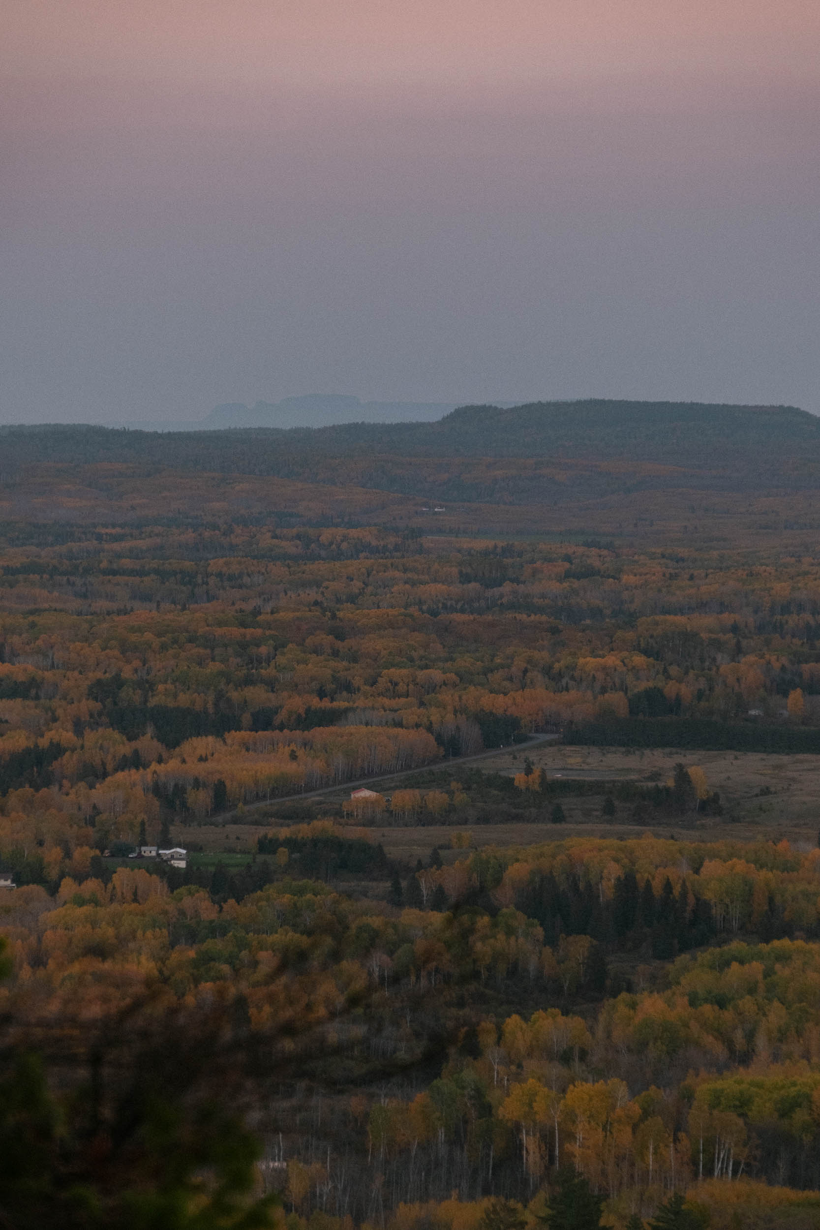
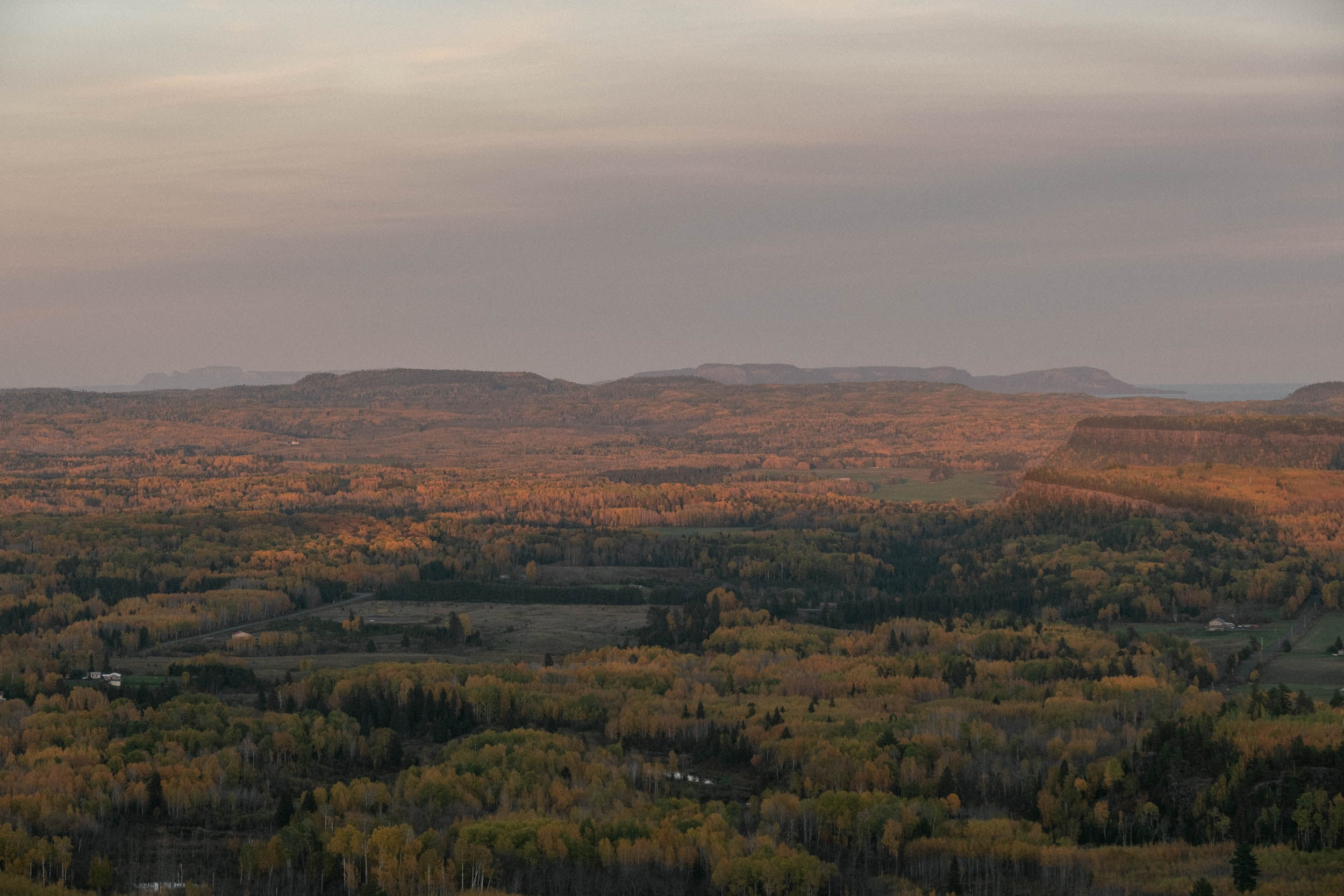
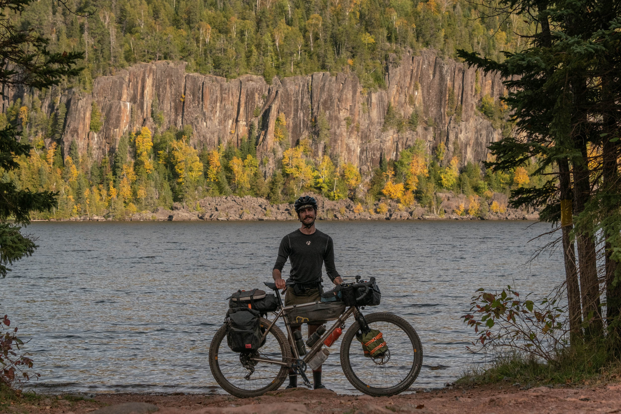
As the sun began to dip low in the sky, we closed in upon our final kilometres of the day, the road weaving through the numerous mesas this area is known for. Formed by the architects of time, thick basaltic sills eroded away by wind, rain, and ice. Once again, we were rewarded with a spectacular sunset over the Albert Lake Mesa to close out our third day on the road.
As we rolled out of camp on the morning of day four, we talked about how we were really beginning to settle into the rhythm of bike touring with each other, both of us usually opting to head out solo. We pondered what today would have in store for us. Little did we know this would be our most trying day yet, testing our spirit and tenacity with a pretty serious hiccup.
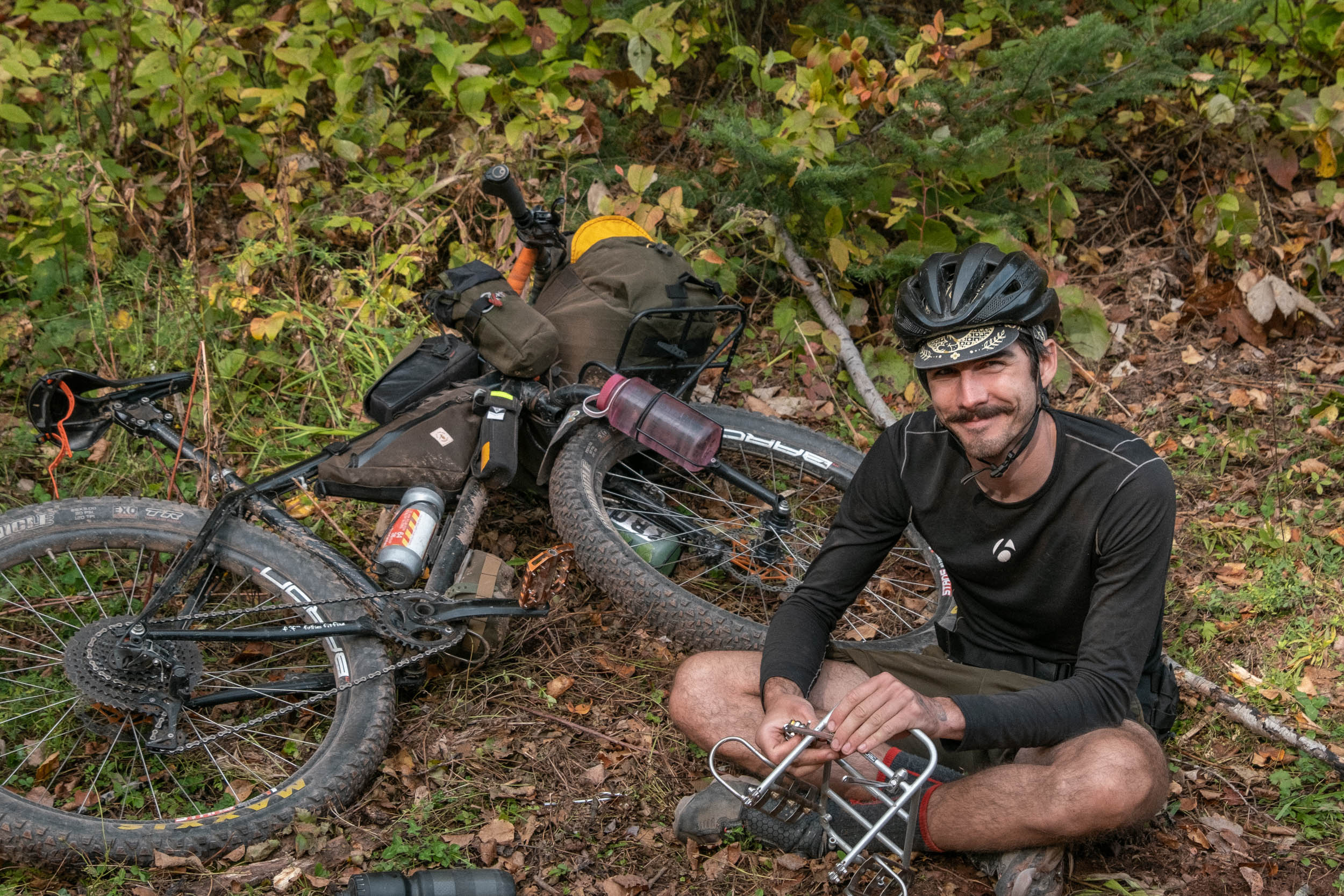
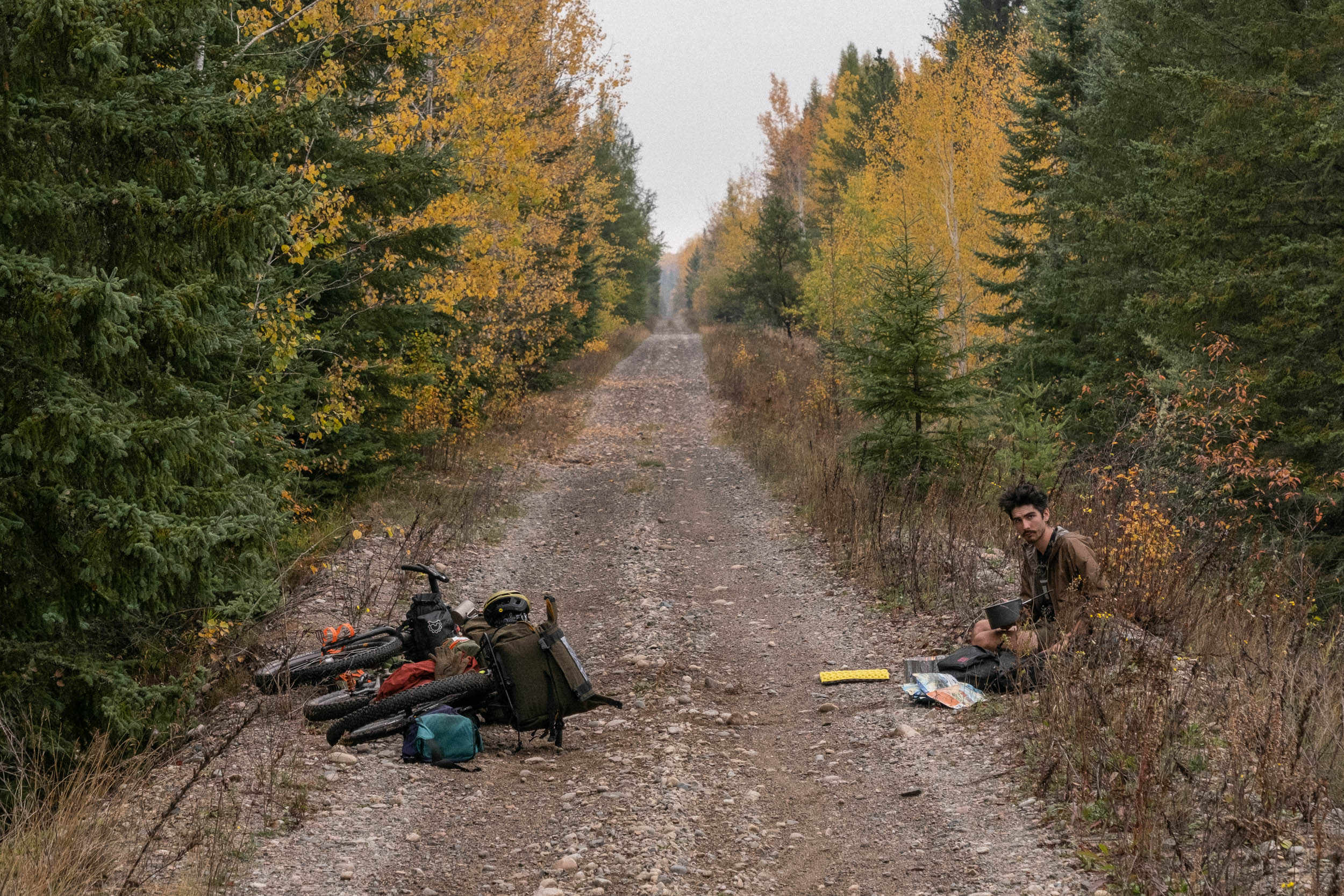
It was at Black Mountain Road where things got interesting. The year before, we’d arrived at this point late in the evening under cover of darkness and decided not to venture down the road on the advice of a friendly haul truck operator. This year, we’d be heading into the unknown. As the road narrowed and the surface became more primitive, it was clear that we’d be nearing the point where road becomes trail, and upon rolling up on the (inactive) brushing machinery, we stopped for a break. That was when Glen said the words no bicycle tourer wants to ever say, especially when you’re hours up a logging road:
“My frame is cracked.” He said, hardly believing the words that were coming out of his mouth.
Sure enough, two cracks had appeared in the seatstays of his frame where his rack was mounted. We spent some time trying to affect a trailside fix, but it was clear that without external help, Glen’s ride would have ended there.
We rolled on quietly, picking our way through the brutally overgrown 4WD track, stopping occasionally to use Glen’s saw to clear downed trees—this was still a scouting trip, after all. We were both grappling with the idea of Glen scratching, and what that might mean for each of us. For Glen, it would mean cutting short a hugely significant tour, abandoning the result of many years of work, and countless hours of poring over maps and satellite images. For Theo, it meant potentially venturing off into the unknown alone and tackling an incredibly challenging ride in some pretty unforgiving country. Neither of these options seemed particularly desirable, and thus a plan was hatched.
We decided that if we could find a bar of cell service, we’d call one of our local contacts in Thunder Bay and see if they could shuttle out a new, stronger rack that we could use to brace Glen’s frame, utilizing the lower, undamaged eyelets at the dropouts. If we could coordinate this, then there was a good chance that Glen could carry on and limp his bike to the finish. After lunch with a newfound sense of optimism and tummies full of rehydrated chana masala, we rolled off towards Wolf River Falls, a spot where Glen knew we could probably find some service.
At the top of the falls, as we paced around trying to get a signal, we were graced with a brief glimpse of one of the most elusive animals in Northern Ontario, a Canada lynx. We just caught sight of it as it bounded away into the woods, its bushy, stubby tail and oversized paws swinging through the air as it made tracks away from us.
After a series of dropped calls and slow-to-send text messages, we eventually got in touch with our contact in Thunder Bay, Keegan, who agreed to bring us a rack. We arranged to meet up in a few hours at our camp spot for the night, and after scrambling down to check out the magnificent waterfall we were back on the bikes, thundering down the road towards our destination.
Keegan showed up right on time with an Old Man Mountain rack, as well as a few beers for us to enjoy later that night after we set up camp. With Glen’s bike slightly more secure, we went to bed that night feeling tested, yet accomplished and confident that we’d be finishing the tour together.
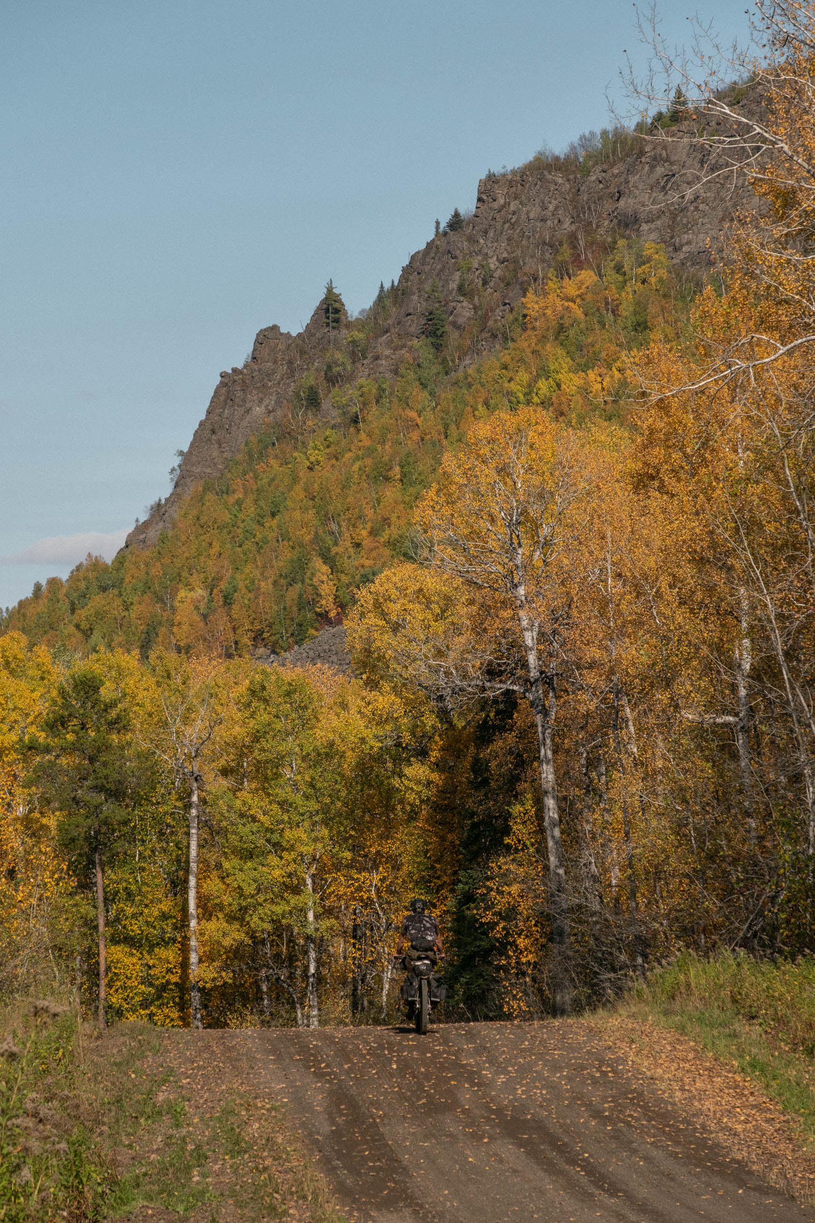
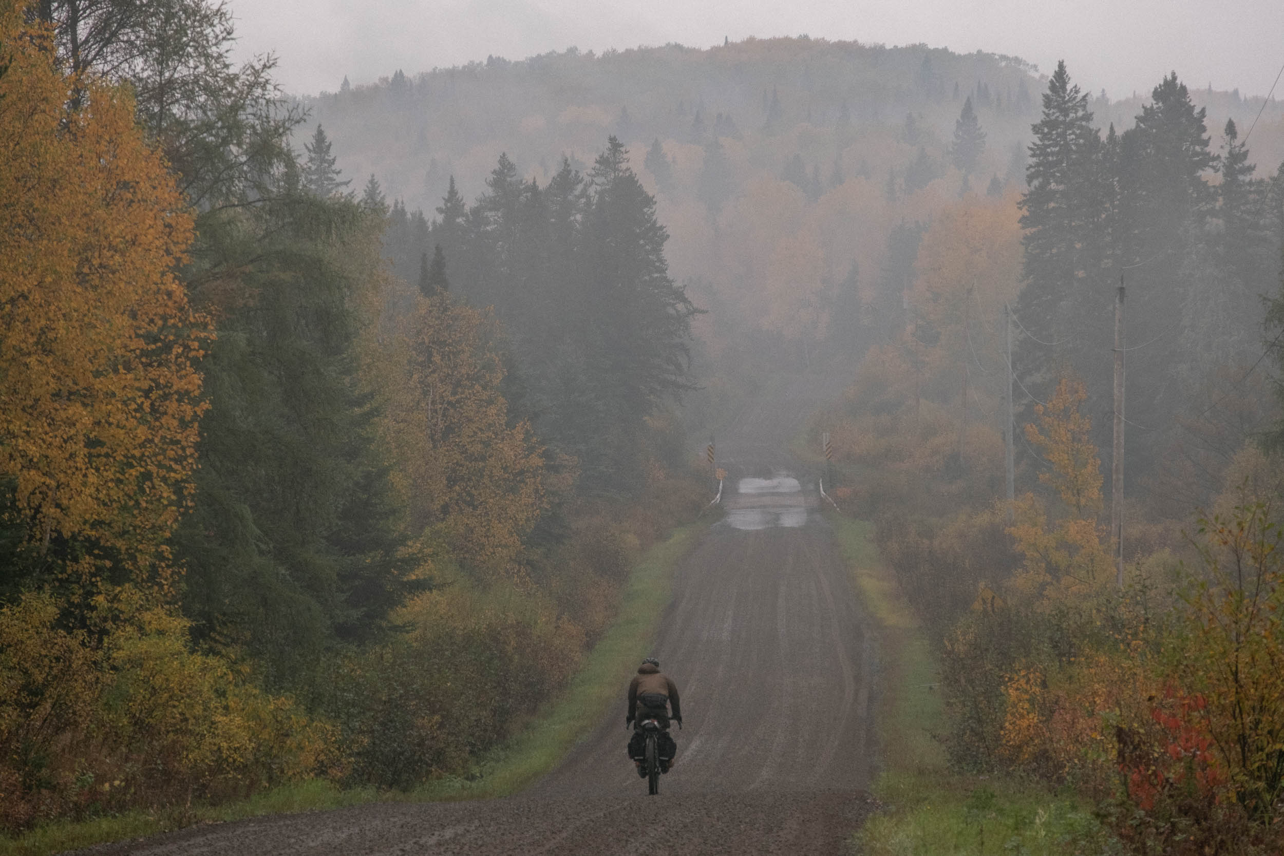
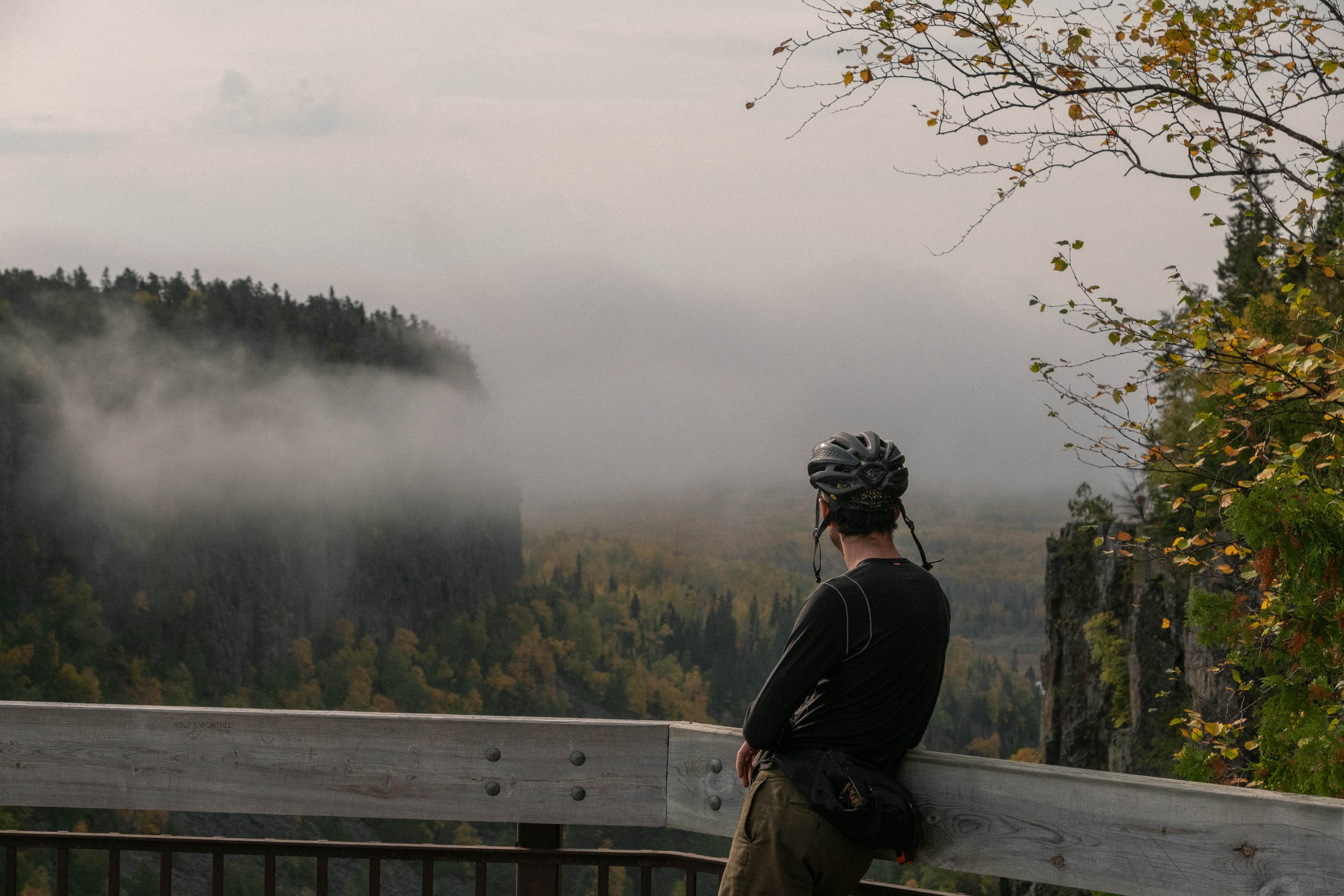
Day five would be our longest day of riding yet, and it also signalled the end of our good weather streak. We rolled out of camp into a thick fog, illuminated in golden light as the sun crept up through the clouds. Enamoured by the spectacular sight, we hardly noticed the wet, prickly branches snagging our clothes and skin as we began the rough climb up to Ouimet Canyon along the remains of a logging road that has been growing in steadily for the last 50 or so years, alternating between gnarled grassy two-track and large slabs of Canadian Shield. Exiting the trail onto a paved road, we both realized this was the first time we’d hit pavement since the first day. We pedalled a few hundred metres to the top of the canyon, parked the bikes, and began to walk along the trail that would take us out to the lookout.

Ouimet Canyon is an absolutely breathtaking geological feature, a massive gorge that plunges over 100 metres into the earth, and provides a view of the Northern Ontario bush that seemingly stretches on forever. A sea of golden birch leaves speckled with small lakes and isolated pockets of bright red maple trees extend farther than you can see, even on a clear day. Interestingly, due to the colder temperatures that persist in the depths of the gorge, Ouimet Canyon is home to a number of rare arctic disjunct species of beautiful flowering plants, mosses, lichens, and liverworts. To find more examples of these plants, one would have to travel 1,000 kilometers north to the shores of Hudson Bay.
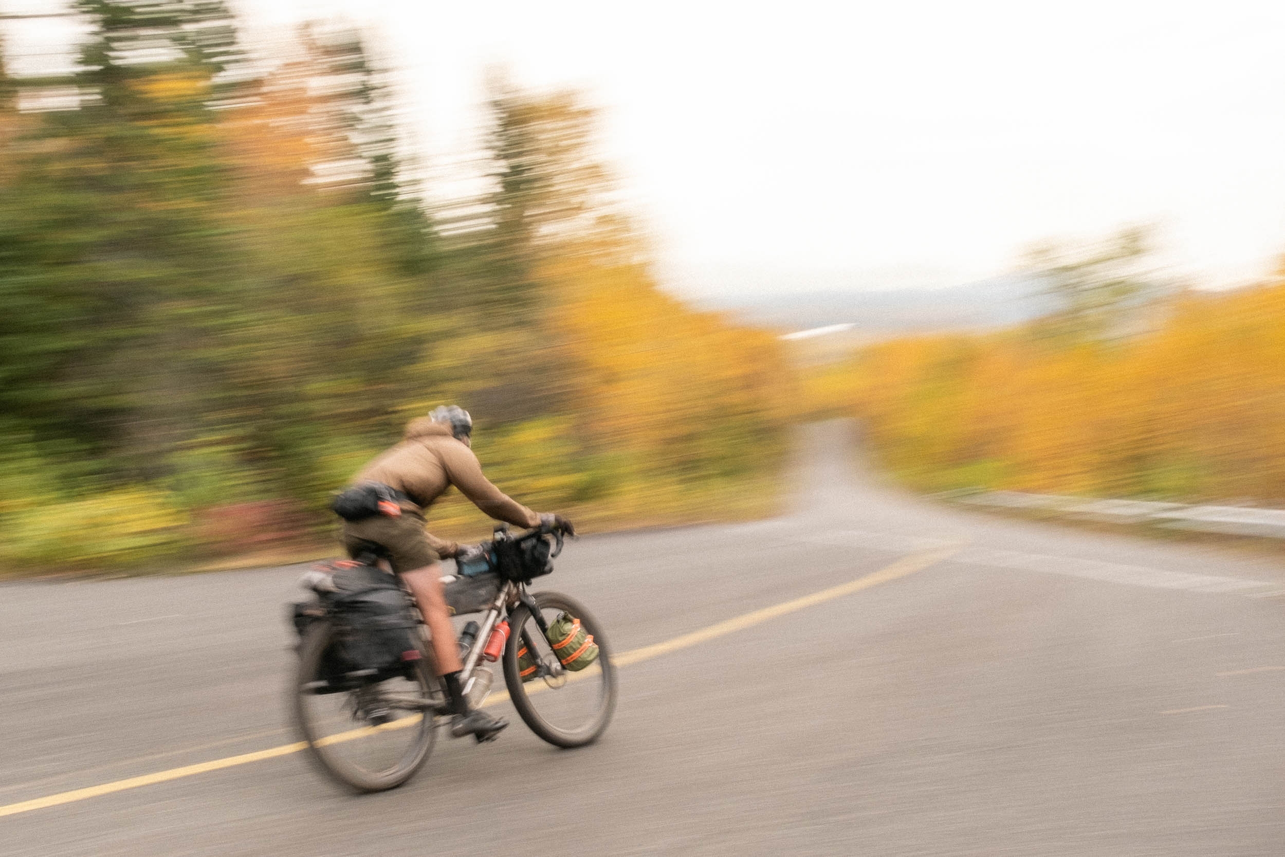
After revelling in the majesty of the canyon for a while, we strolled back to the bikes and prepared for the massive descent off of the canyon. The road down is paved and twisty, and we’d been anticipating this stretch long before we even left for Thunder Bay. We screamed down the three-minute descent, holding speeds of 50-60 km/h the whole time. When your bike weighs 90 pounds, it’s really in control—you just have to gently nudge it in the right direction, which made the descent slightly terrifying, but all the more exhilarating (especially on a cracked frame).
The base of the canyon marked the closure of the first loop of the route, and we’d now be heading back through the wind farm that we’d ridden through on our first day. We began the long grind back up, clocking the dark clouds that slowly began to form over our shoulders, looming in the distance.
We plugged away for a few hours, listening to music and rallying along the rocky haul road. We stopped for lunch at the halfway point for the day, which was rudely interrupted by the arrival of rain clouds. It began to sprinkle lightly as we packed up and continued on our way. Over the next few hours, the rain would intensify and we donned all of our waterproof layers, barely phased by the weather, as we both knew it would happen sooner or later. To have as many sunny days in succession as we did during a Northern Ontario autumn was practically unheard of. You know how it goes: thunder only happens when it’s rainin’.
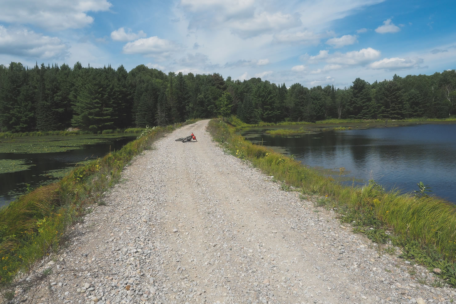
The push to camp was rough, and right near the end, confusing. The grades got steeper and punchier as we headed west until we finally turned off onto what was supposed to be a little ATV track, as it was a year earlier. Now faced with a full-width freshly laid gravel road, we wondered if we’d gone astray, despite the GPS assuring us that we were right where we were supposed to be. We found a small clearing off the road roughly where we’d planned to stop for the night, really a turnaround point for gravel trucks. This would have to do for the night, our tent pitched on the edge; investigation of the road situation could wait until morning.
We woke the next morning to more gray skies but fairly moderate temperatures. Today was day six, a day we’d been anticipating for a long time. While it would be our shortest day in terms of distance, we’d have to contend with the slowest, swampiest section of the route, which involves one lengthy water crossing.
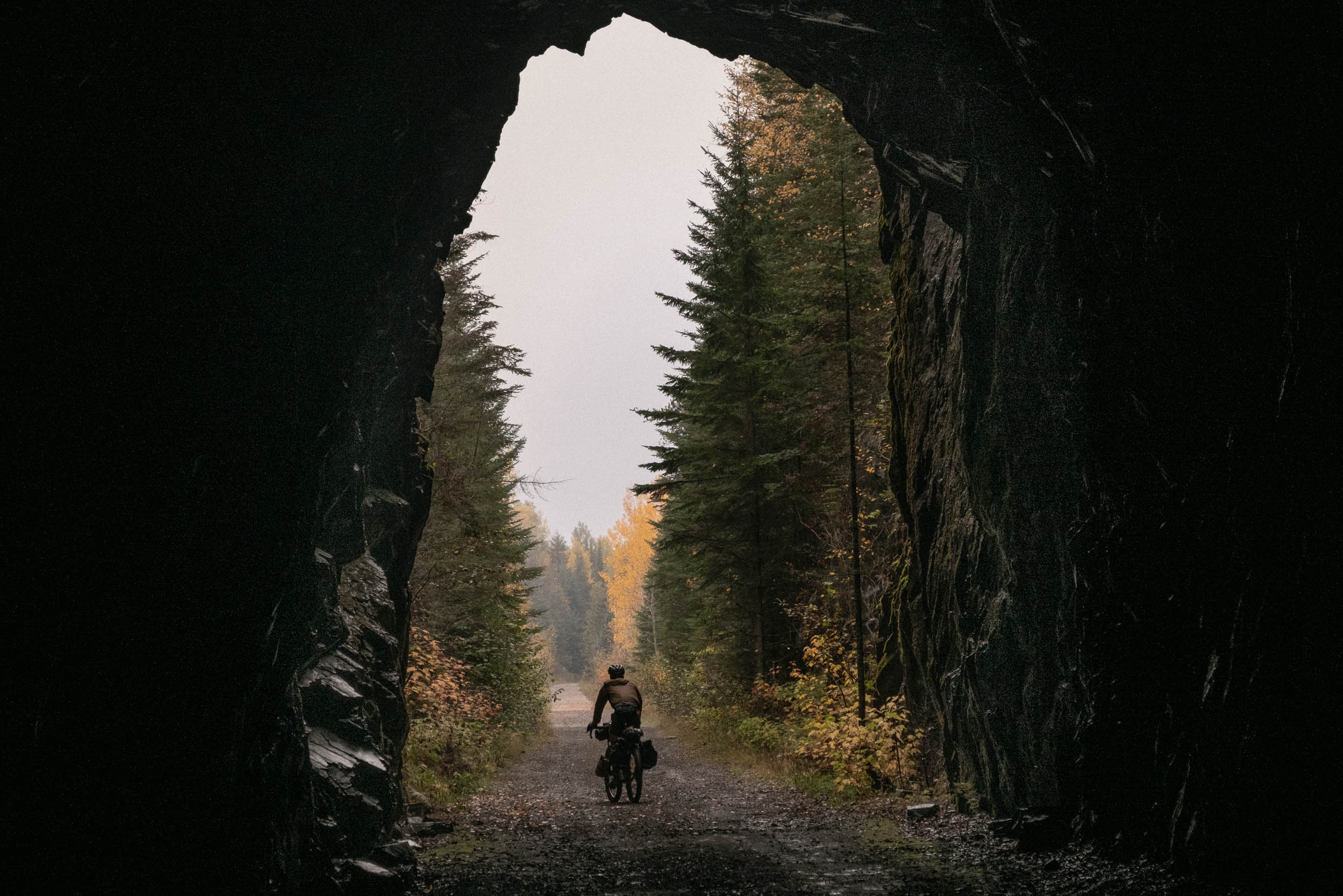
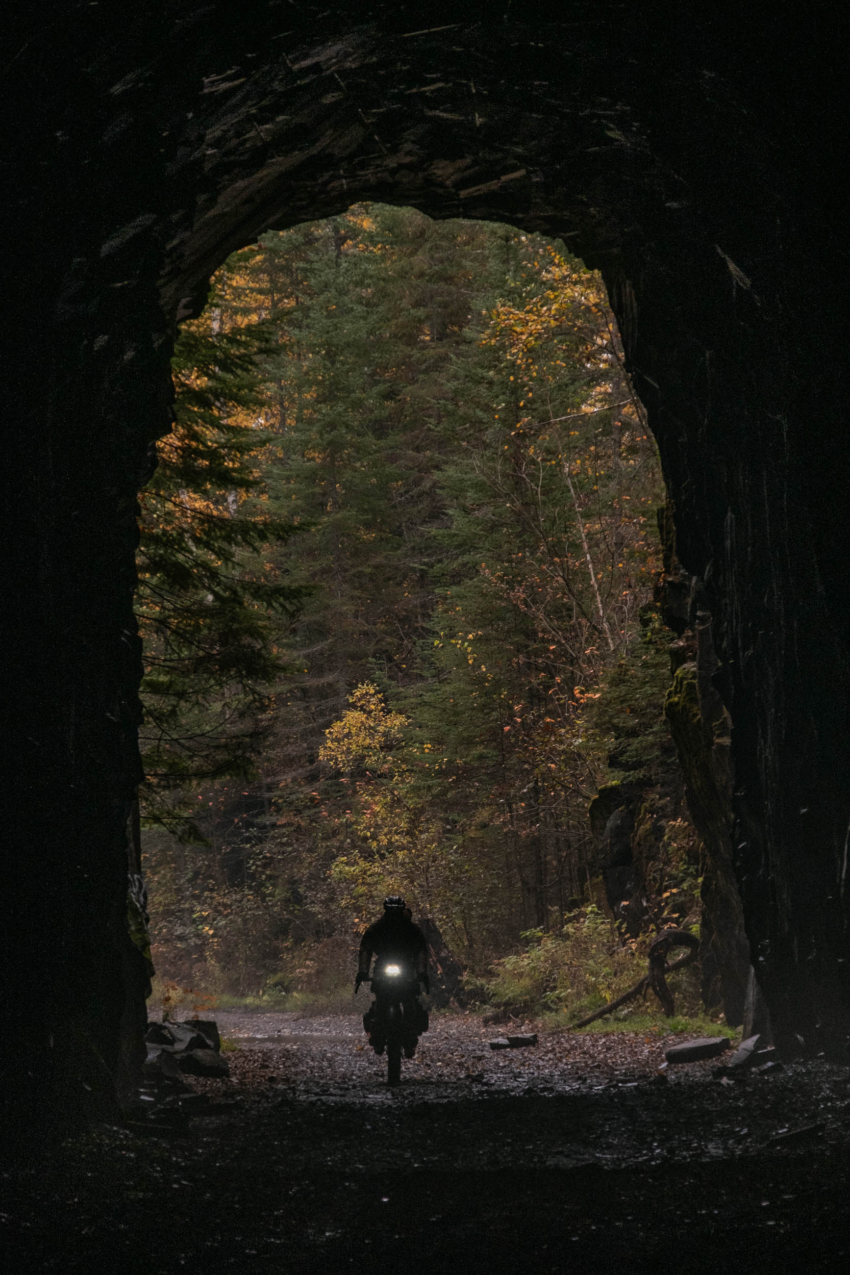
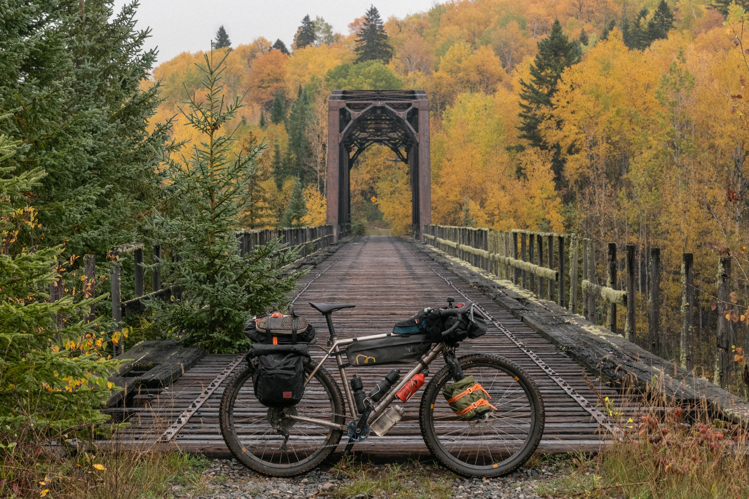
We cruised along dirt roads, old rail beds, and ATV trails to the Flett Tunnel, a fantastic feature of the route. A cavernous tunnel that is part of the former Grand Trunk Pacific Railway, which is now a private recreation trail that can be accessed with the purchase of a permit, available for a nominal fee locally in Thunder Bay. It draws hikers, photographers, four-wheel drivers, and bicycle touring kooks alike.
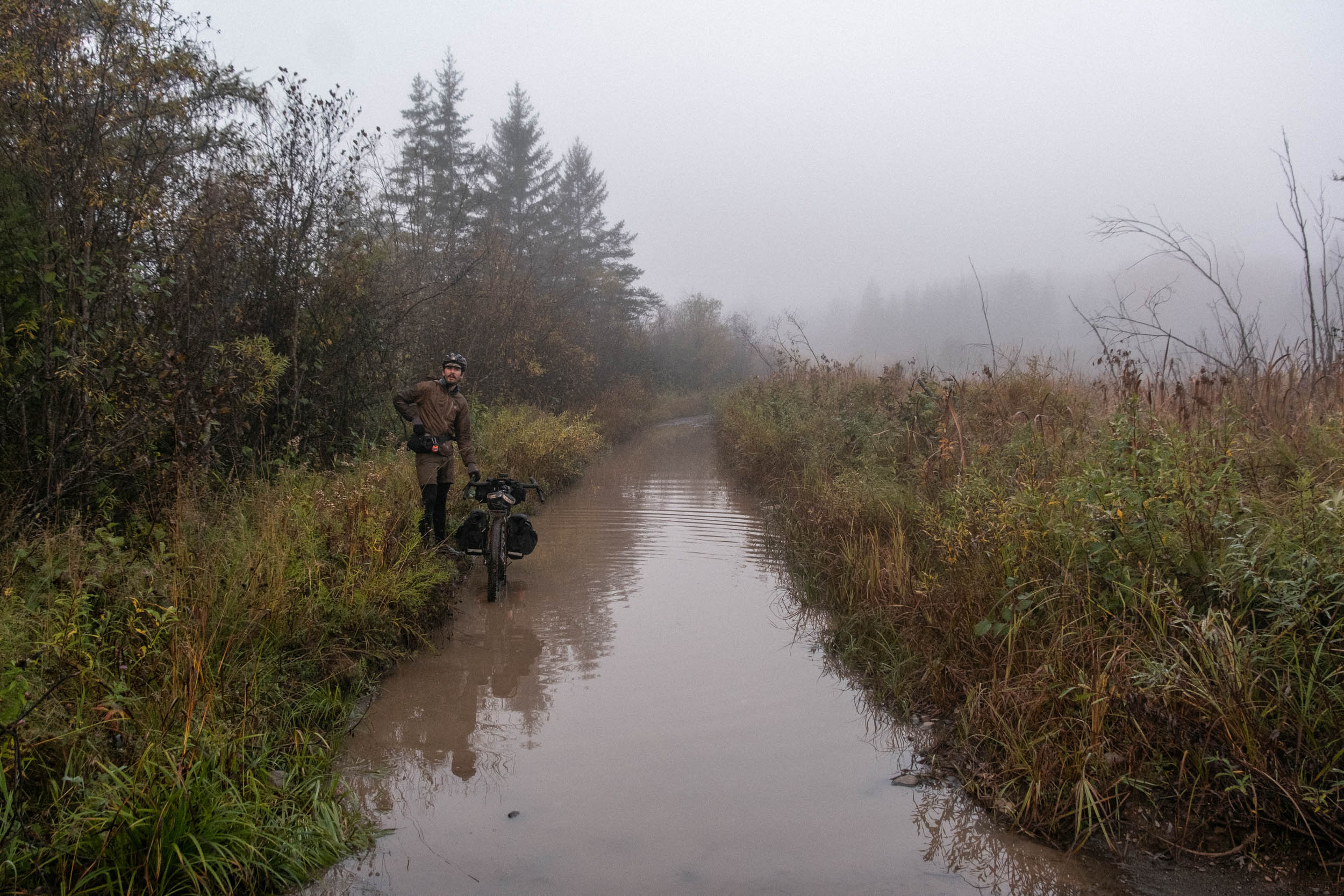
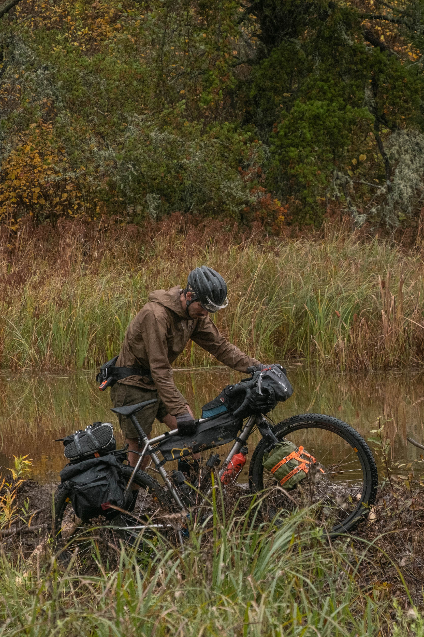
Shortly after transiting the tunnel, we’d reached the natural gas corridor that would lead us to the wetlands. After some grumbling, we got on our way, slowly picking our line through the overgrown, lumpy, rutted-out trail. Upon cresting a large hill, we were graced with a view of our foe, sprawled out before us: a massive marsh with remnants of a trail, barely visible, on the other side.
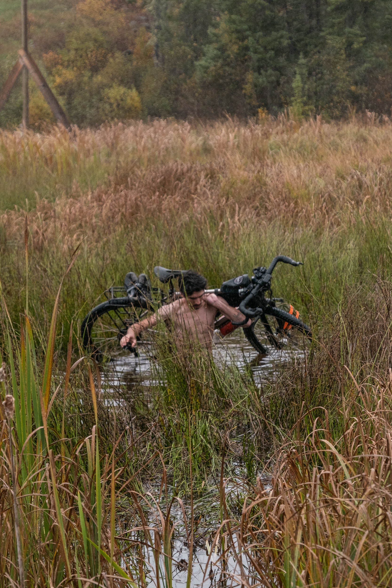
It was raining again by now, so we worked quickly to remove all the bags from our bikes, as well as most of our clothing, stuffing everything into dry bags. We would have to cross multiple times to get all of our gear and bikes across, so there was no time to waste. A crossing would take approximately five minutes in each direction. The first half was trudging through knee-deep mud, making light work of stealing the Crocs off of Theo’s feet, despite his efforts engaging the sports strap, and making forward progress incredibly slow. Eventually, the water got deeper, culminating in a torso-deep pool several meters across. On the other side was dry land, where we cached our gear before making subsequent return trips. In total, we had to perform five crossings to satisfy the bog. What began as a hilarious struggle to get through the mud rapidly deteriorated into a brutally cold, uncomfortable slog back and forth.
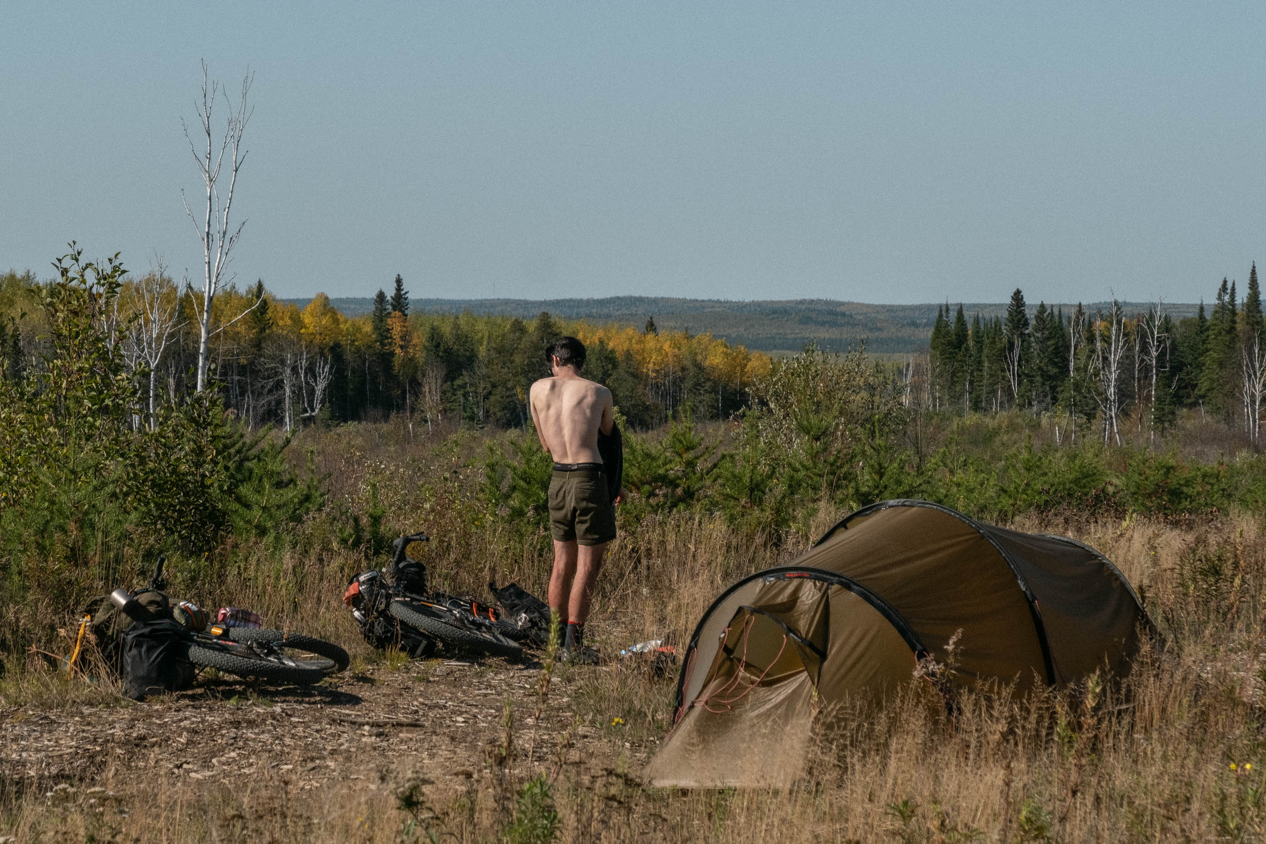
Once safely across with all of our gear, we got dressed again, repacked the bikes, and continued our bushwhack for another 15 minutes until reaching a clearing where we made camp. We put on our warm, dry camp clothes and walked down to the water to watch a pair of otters playing and swimming before we made dinner and tucked into bed early. We were both feeling fairly spent, yet managed to find some humour in the ridiculous situation we’d got ourselves into (and out of). Another day in the books.
Day seven began much like the sixth ended, with a slow grind through more bush, swamp, and tall grass until we hit another large water crossing. “Six kilometers to the road.” We told ourselves. Luckily, beavers greatly outnumber humans out here, and the amount of infrastructure from both species is a clear reflection of this. We managed to scramble across a dam to the other side, a delicate balance of finding the least slippery logs and most solid mud piles, all while balancing our 90-pound bikes beside us. We made it across, then spent a good 20 minutes picking seed pods out of Glen’s leggings. Finally, we were out of the boggy section. It took us three hours to cover those six kilometres. We were back on a firm gravel road again, ready to get riding and make it to our destination for the night, the Aldina Fire Tower.
Back on solid roads again, we were delighted to make our way through a network of rarely used bush roads, mostly frequented by snow machines. This was some of the best riding we experienced on the trip, weaving our way through the bush winding around hillsides, descending into valleys, and climbing back out. The riding was fast and flowing without being overly technical. Just what we needed after our morning.

The last few kilometres of our day had us making our way to the highest point on the route, and the fourth highest peak in Ontario. Glen had come out here on touring skis in the winter to scout, and he was fairly confident that we could access the fire tower from this side of the mountain, but he didn’t really know what to expect. As the last few kilometres to the tower ticked by, we rounded the corner and there it was—the road became a wall. We’d be pushing our bikes the rest of the way. That last hour was spent navigating uphill rock gardens and trudging through the stream that ran down the trail.
The Aldina tower is a deceptive one. It really doesn’t come into view until you’re meters from the base, so you really have little to gauge your distance remaining unless you’ve been up there before. By the time we made it up there, we were spent. It was one hell of a slog. Rather poetic to bookend our day by trudging along at 2 km/h.

As we boiled water for breakfast under the cover of darkness the next morning, the sun slowly began creeping up, hinting at the possibility of blue skies. After three days of rain, the tinges of blue were a very welcome sight. As the sun came into view and showed clear blue skies, we ate breakfast and gave in to our urge to climb the fire tower. Taking turns, we climbed to the top to take in the view, and what a magnificent sight it was to see the vast expanse of Northern Ontario from 80 feet above Carson Creek Peak. A sea of clouds lingering in the low-lying valleys and the rare opportunity to look down upon the tops of the trees, again, spotting isolated stands of red maples amongst the vast sea of evergreen and gold.
Once we’d taken in our fill of the landscape, we packed up our camp and made our way off the peak, picking our way down the rugged bush track. As we were heading from the highest point in the region down towards the shores of Superior, we were graced with fast, flowing, rolling terrain, incorporating a few smooth, winding descents. After a lunch break spent enjoying the sun we hadn’t seen in a few days, we found ourselves rambling down along Border Road near Pigeon River, just a stone’s throw from Minnesota. Now past the furthest southwestern point in the route, we pointed ourselves back towards Thunder Bay and began pedalling up to Cloud Lake. It was time to repay all the descending that the morning allowed.
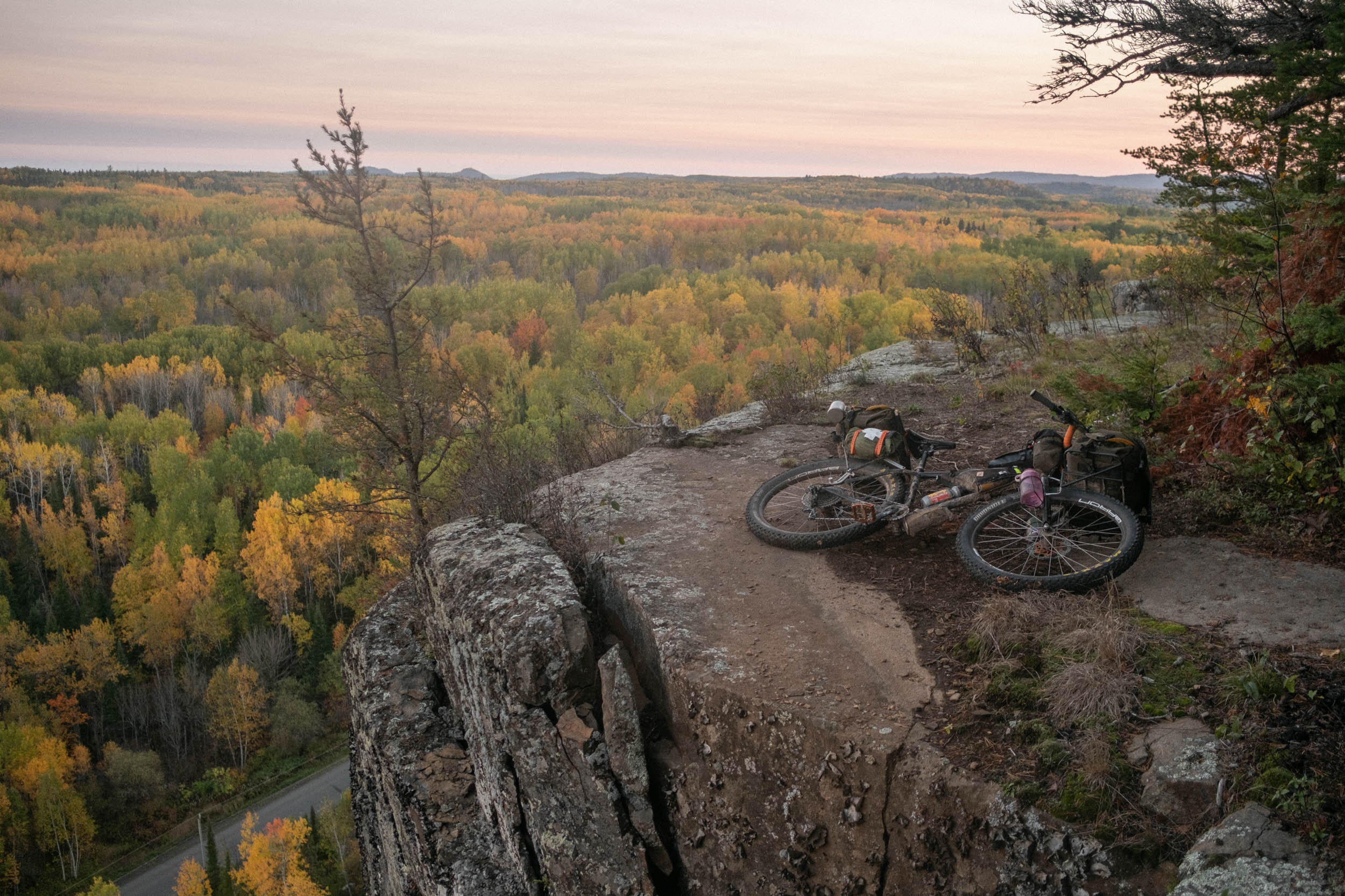
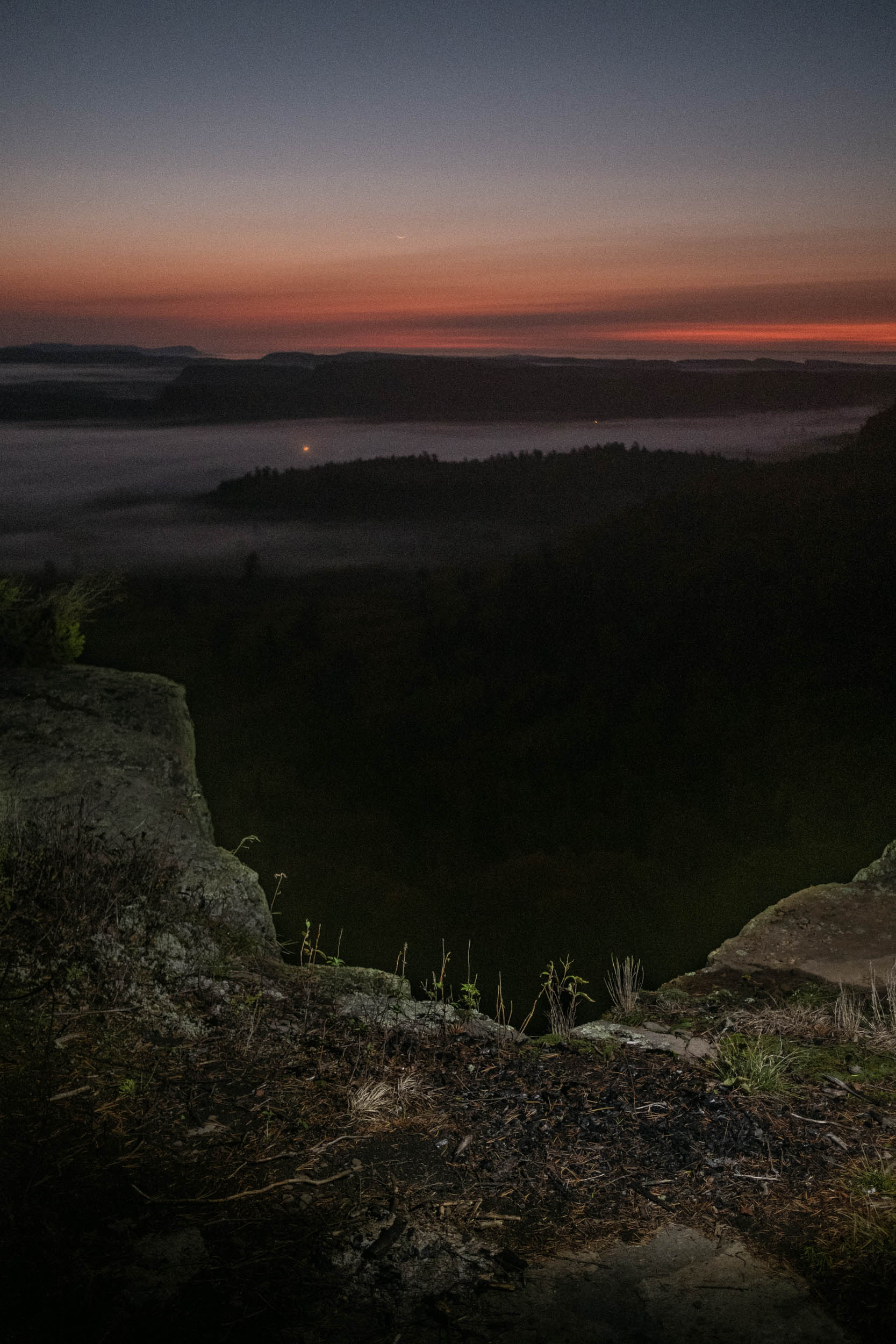
Rounding the corner on Cloud Lake Road and watching the lake come into view was like nothing we could have predicted. A narrow road skirted the edge of the lake nestled in the foothills of the Thunder Bay region before climbing up a ridge affording a vast outlook over the water. Our friend Peter had let us know of a spot atop a cliff just off the road where we’d be able to spend the night. “Look for the cell tower, and don’t miss the access road.” He said. The 1,600-metre access road was a loose, scrabbly, washed-out climb into a bush bash to get around, behind, and atop the 100-metre cliffs we were just at the base of, and what a magnificent spot for our final evening on the road. Once again, we ended our day the same as it began, with an expansive outlook. For the better part of an hour, we simply sat and took in the landscape on our final night.
Our final day began at 4:50 a.m. We were quick to pack up and roll out, but couldn’t resist hanging around to catch the first glimpse of glow in the sky from the top of the cliff. We watched the forest and valleys below slowly illuminate with a dull glow, low-lying clouds lingering in the valleys. It was truly spectacular. We had a job to finish though, so we picked our way back through the woods towards the trail. The descent off the cliff was so incredibly beautiful. A loose, challenging, scrabbly descent into the mist and morning light was one we’d remember for a long while. From there, we would immediately enter a labyrinth of snowmachine trails, solely scouted by satellite view. That was the whole purpose of this trip, after all: tires on the ground to prove that the route goes. Thankfully, there were no major hangups, and the wet sections were manageable. The lingering early morning fog treated us to a cinematic atmosphere for our way-finding. It was the coldest morning yet, and we donned an extra layer and brought out the rain mittens for the first time on the trip. Slowly but surely, the sun crept up and warmed us through, and before we knew it, the sun was beating down from overhead and we were back to riding in T-shirts.
The riding this final day was fast, and we slowly crept back towards civilization. More houses, signs, and infrastructure let us know that our trip would soon come to an end. Reaching Kakabeka Falls, we were overwhelmed not by the thundering water, but by the sheer quantity of people. It was the most people we’d seen in one place in over a week, and it was a lot to take in. Departing the falls, it was a few hours of paved riding back into Thunder Bay city limits.
We settled into a rhythm to grind out the long, flat stretch of Oliver Road that would deposit us on the edge of town, where we’d head up to a sneaky locals lookout for our late afternoon dinner (more rehydrated pad thai, which has no business being as good as it is) and to soak in the last rays of sunshine before our evening pedal through town, completing our tour with a ride through the Trowbridge mountain bike trails—to the astonishment of those out for an after-work rip—and out to the iron bridge over the Cascade River where we’d departed eight days earlier.
We consider ourselves very lucky and are eternally grateful to have had the opportunity to scout this route. While it’s not a route to be taken lightly, with the right experience and preparation, bikepackers will be rewarded with truly incredible riding through some rarely visited parts of Ontario that few people will ever see, and it’s our hope that this story and route is the spark to ignite the Northwestern Ontario bike touring scene. It only took a few hours of relaxing at home before our minds began to wander back out to the trail, pondering how soon we could get back out there…
The Route
You can find Glen’s 800-kilometer Northwestern Ontario Rambler route below. Note that this route is a living document—now in its fourth iteration—and it may be added to or modified periodically.
About Glen and Theo
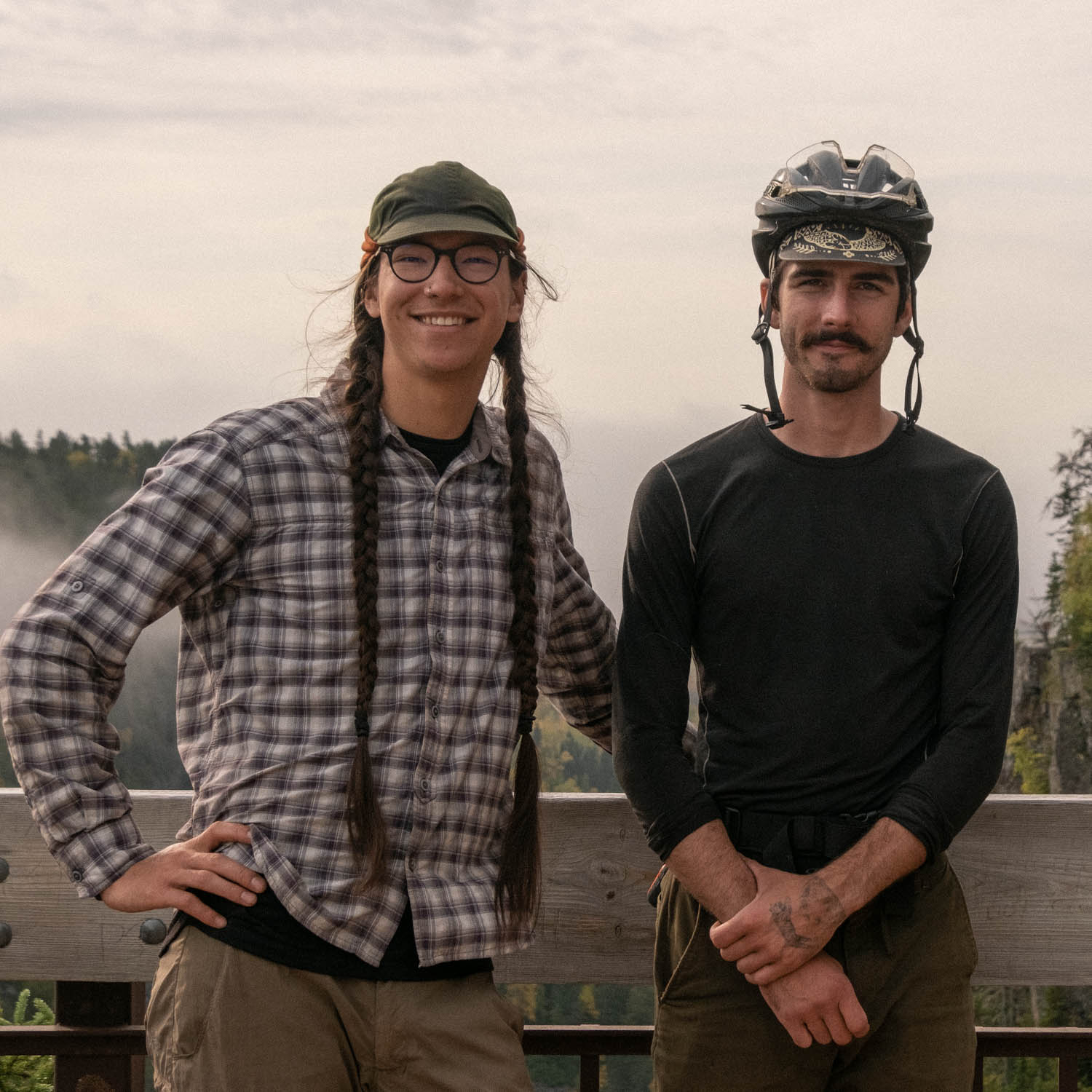
Glen Quinn and Theo Kelsey-Verdecchia work together at Brockton Cyclery in Toronto, Canada. Glen has been an outdoor professional since 2014, with a focus on education, canoe expedition, cycle touring, and making your own gear. Theo is a writer and ultra-endurance athlete who has been working in the cycling industry for nearly a decade. They both share an affinity for lengthy bike rides, sleeping outside, and oat milk. Follow them on Instagram to keep up with their adventures on Instagram at @theokelsey_ and @glenquinn.
Related Content
Make sure to dig into these related articles for more info...
Please keep the conversation civil, constructive, and inclusive, or your comment will be removed.