


SteppenLOST: Wayfinding in a Sandbox


Are we getting lost often enough? Exploring more mindful navigation, Josh Meissner joins a mysterious gathering on the outskirts of Berlin called SteppenLOST. Join him as he gets turned around in the forest, and find a delightful set of photos from the event here…
PUBLISHED Jul 5, 2024
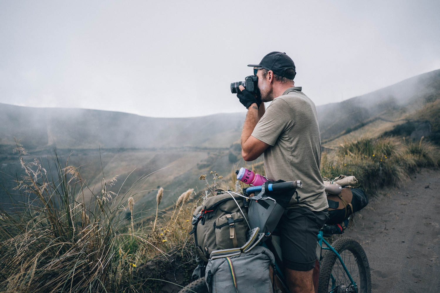
Additional photos by Natasha Meissner
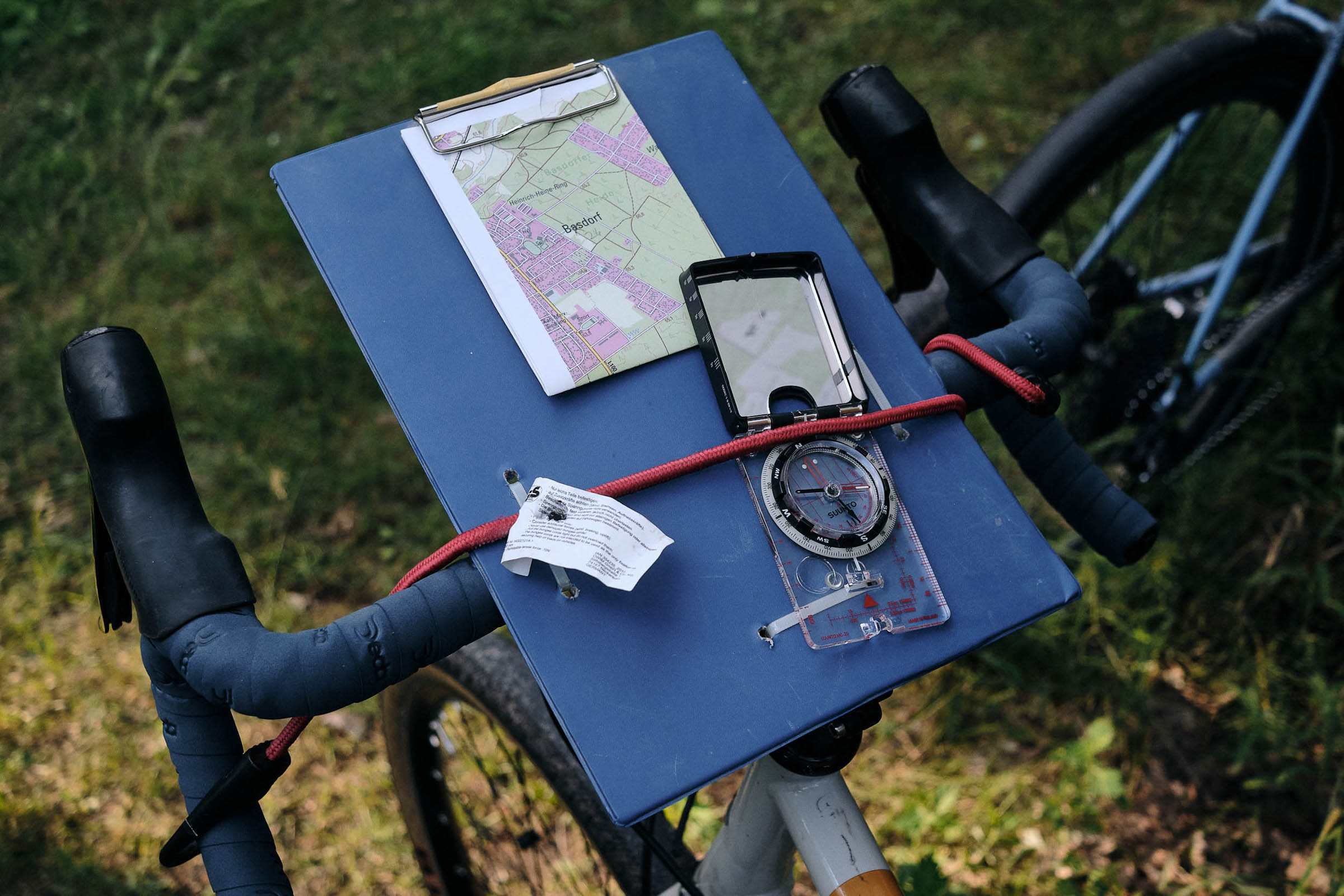
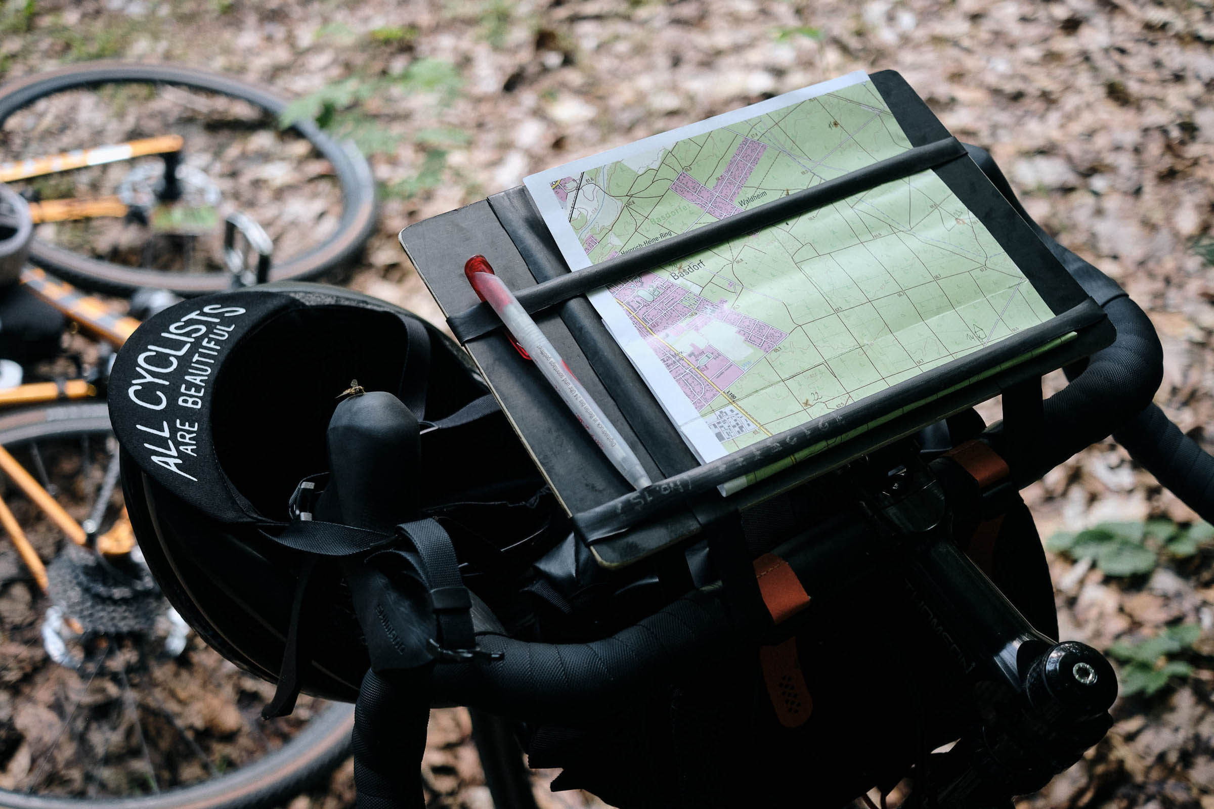
It starts with a message on a private Discord, followed by an invite to a mysterious Signal group. A date is given with no location. Over the next weeks, the group chat fills up through word of mouth and friends of friends. We get a series of oblique hints. A puddle on a gravel road, flashes of pine forest, glints of a lake. It could be anywhere. The organizers share primers on compass use, and we’re to figure out a way to mount a map on our bike. Otherwise, we’re left in refreshing uncertainty.
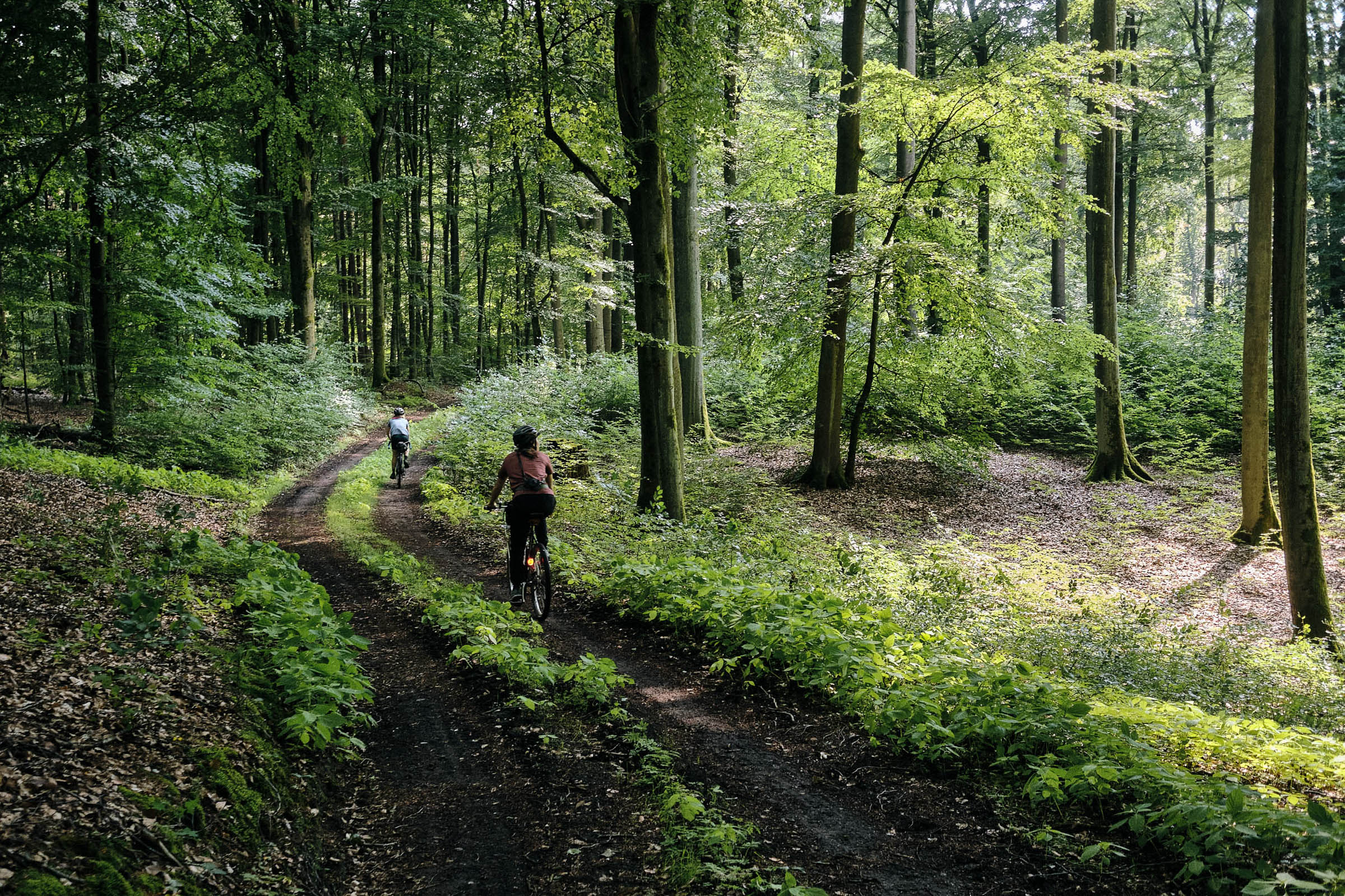
We receive an explicit location in the woods mere hours before the start. The rain clouds part just in time, and I load up my ATB with snacks and water. Rolling out of the train station, I spot another cyclist on a gravel bike with a conspicuous map-holding contraption they’ve affixed to an empty handlebar harness.


We share the short ride to the nearby meeting point, and the other rider, Audrey, tells me she recently lost her cycling GPS. “Maybe it’s a cosmic sign pointing me to this event,” she speculates. I ask Audrey if she feels prepared. Laughing, she replies, “I have no idea what to expect, so no, not at all! But I trust in the group and the Steppenwolf aura.” I get lost in the conversation and lead us on an unintended trajectory out of a roundabout. We eventually notice and adjust our route.
Around Berlin, Steppenwolf is synonymous with the explosively popular Berlin-Usedom-Berlin (BUB) bikepacking race this crew has organized for the last few years. They’re certified off-road fanatics and put community first. The BUB race is, reportedly, as grueling as it can get, yet riders come back and bring their friends, no doubt thanks to the effort the Steppenwolf crew put into creating a welcoming, inclusive atmosphere. Among them is my friend Melina, who joined me last year in Spain and recently finished the Atlas Mountain Race in Morocco.


Lately, I’ve gone from interested to obsessed with the topic of navigation. It seems to be a curious blind spot of the bikepacking community. Sure, we discuss different tools for planning routes and argue passionately about the best apps and devices for consuming them, but whether racing or touring, all I see is the same default approach of following a pre-planned route guided by GPS. Slower, more interactive forms of orienting and finding our way are practically invisible. It’s odd since it fits so well with a bikepacking ethos.
Following my curiosity, I joined an orienteering run and found actively navigating in the landscape a refreshing alternative to the unthinking default mode. We should do this on bikes, I thought. Elsewhere, Hannah from Steppenwolf was similarly inspired, and so the idea of SteppenLOST was born.
Mountain bike orienteering exists but is even more niche. In Germany, the orienteering sport is gated by the official clubs, which aren’t always accessible and inviting to all. SteppenLOST picks up the orienteering idea with less emphasis on ranking and more about having a fun time together in the woods. It’s grassroots all-terrain cycling that is open to all.


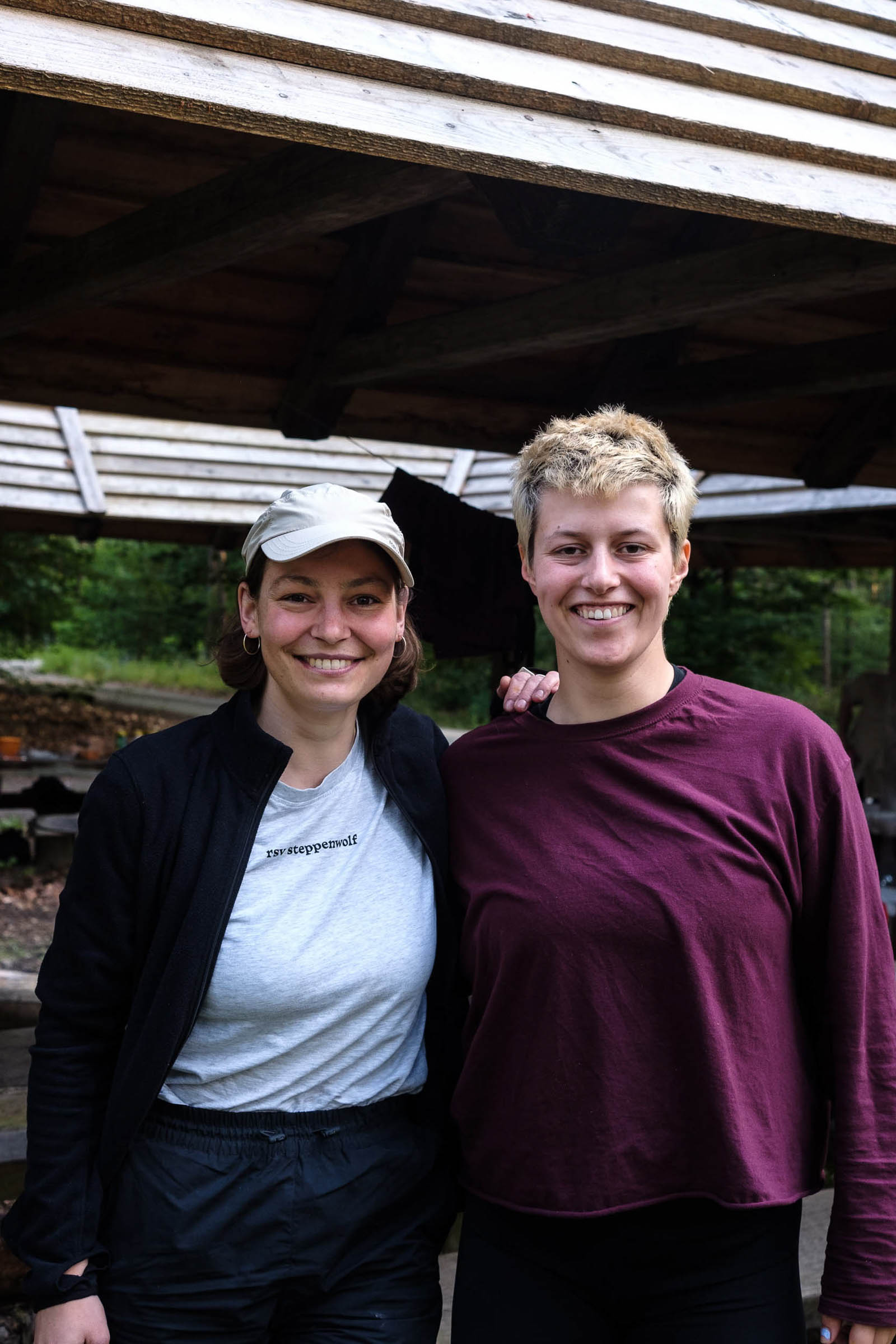
We hear the meeting point before we see it. Around the curve in the path lies a large roofed picnic area at a crossroad, and it’s a hive of activity. A whole bunch of Pizza Gravel friends are on deck, and I greet others I connect with the Chicane and Rückenwind circles. The Steppenwolf folks buzz around in their yellow T-shirts, organizing and participating. It’s a big turnout of around 50 riders despite the threat of a downpour in the morning.
Riders study the large topo maps of the area that have been taped over the info signs and benches. We’re in a mixed woodland on the fringe of suburban Berlin. It’s crisscrossed by access roads, cycle paths, and footpaths. There’s a small lake to the southeast and a swath of open heathland to the southwest. I noted a power line gap dissecting the forest on the way in. Dozens of control points dot the map, and excited strategy talk whirrs through the air.

Looking at the map, my friend and teammate for the day, Pauline, remarks that the arena of action is smaller and more manageable than she expected. Our Pizza Gravel friend Hamza observes, “The lines are pretty well defined, so I feel like we wouldn’t miss a turn.” I’m curious how the wayfinding skills I’ve acquired on solo tours will translate to this setting.
One team seems to be taking the competition aspect more seriously than others. They deduced the location from the scant clues a week ago and scouted all the track surfaces in the area in the interest of optimizing their speed. They are the exception. The gathering here isn’t a bunch of orienteering pros, just regular folks who want to try something new and fun and challenge themselves.
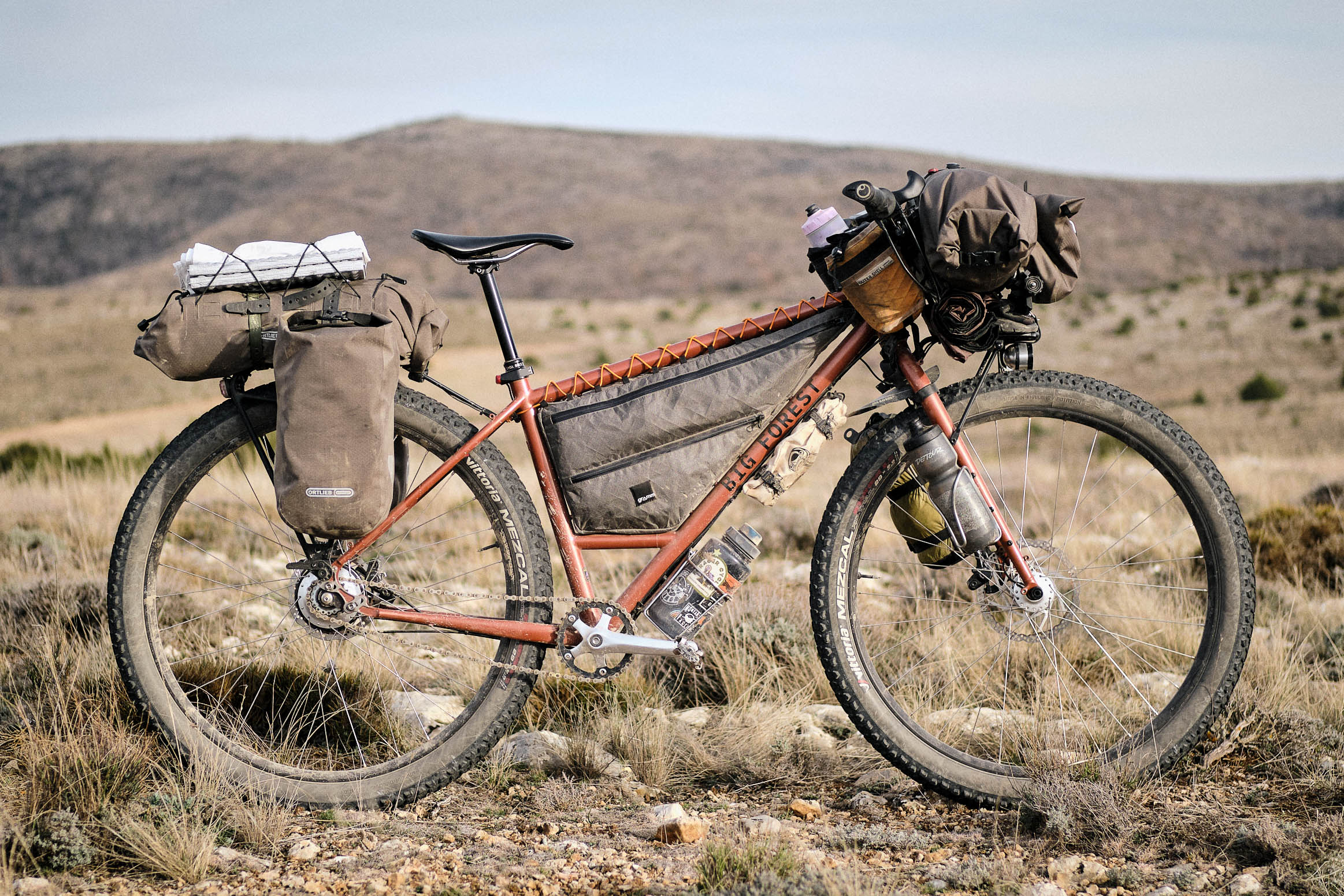
The bikes on display are as diverse as the riders, running the gamut from ’90s mountain bikes to modern gravel bikes and carbon hardtails. They are equipped with an equally diverse range of improvised map holders and compass mounts made of sheet plastic or clipboards, held with zip ties and straps to handlebars, racks, and baskets. The DIY contraptions make for a delightful departure from the slick cycling norm.


Hannah calls to gather around. Briefing time!
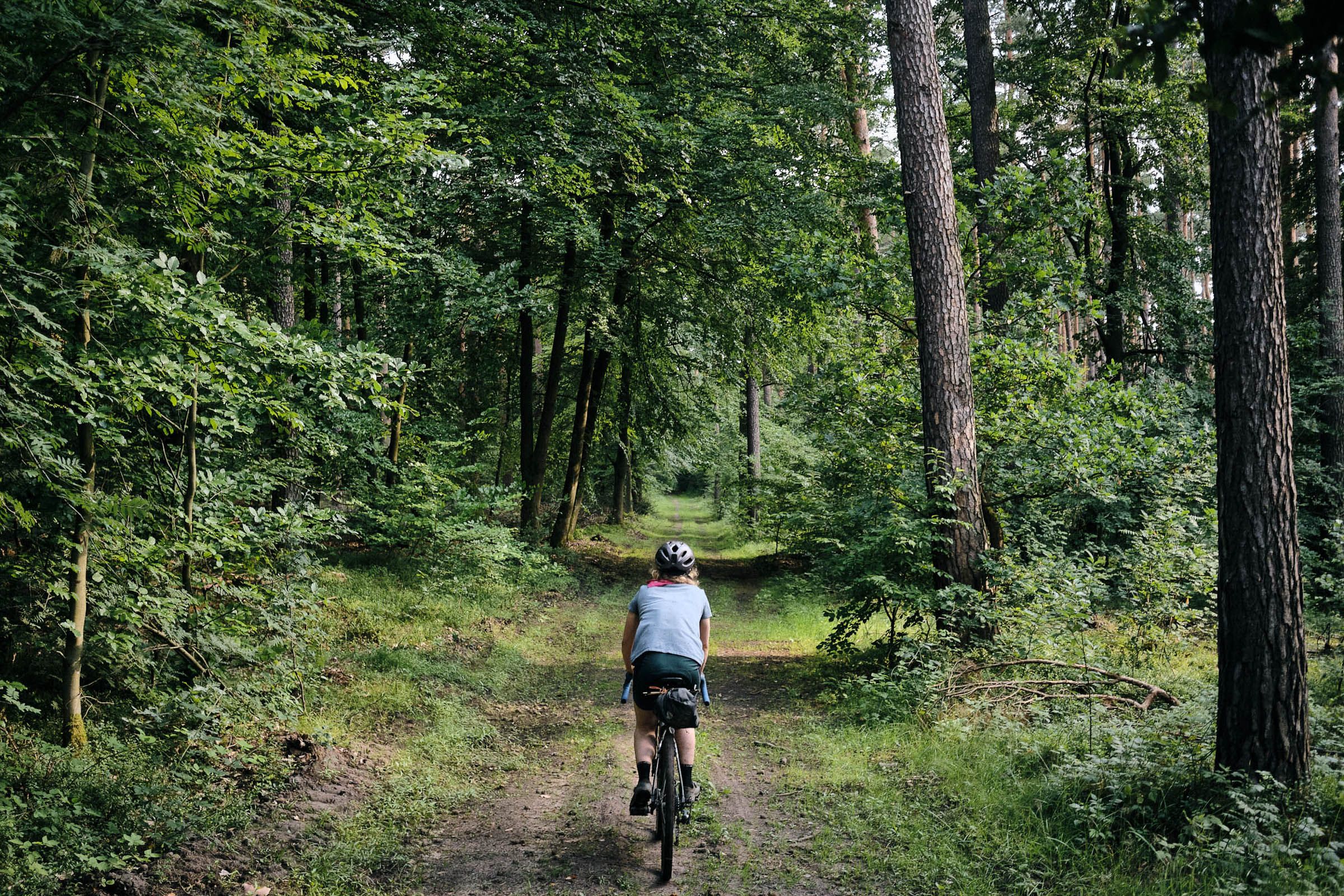
Scattered within the forest are 28 control points. The goal is to visit as many as possible within four hours and note the clues on the hand-drawn manifest we’ve been given, alleycat style. The main rule: no electronic navigation is allowed. The area is bounded by villages and major roads—guardrails to prevent anyone from getting badly lost. Probably. We’re reminded to respect people and nature. Go!
The race starts with a flurry of pens and furious scribbling on paper. The control points need to be transcribed to our personal maps. Not difficult, but it’s easy to make mistakes in the hurry, as many riders including Pauline and me will later find out. We are still plotting an efficient route while other teams start dispersing into the forest. My sister, Natasha, who was photographing the event, joined us for the ride. That made us Team Paparazzi (papa-paparazzi).


The air of competition gets to me, and I take the lead. Splashing through puddles, the forest is a green blur. Nettles nip at our shins. Second left, then hairpin right. Wait, was that already the path back there? My overconfidence blinds me, and I sail right by the first point; Pauline and Natasha discover it hidden in a tree. The pinned notes are easy to miss unless we’re actively searching. It’s amazing how little we often truly see.
We encounter the familiar muddles of wayfinding without GPS. Pauline keeps wanting to turn early, systematically overestimating the distance traveled. Other times, we miss obvious turns as we get lost in rants about the hegemony of cartographic maps and GPS on our mind. Yet today, there’s no disciplining device to scream at us for diverging. We simply double back or take the next possible turn.
In the vicinity of the control points, we meet other teams, and things get silly with bluffing and heckling; it’s the blind (mis)leading the blind. The points give us clues and riddles; other times, we are to draw portraits, pack out trash, or do handstands. We search the forest floor for the heaviest stones and most beautiful deadwood branches. In Pauline’s words, it’s “pure childhood joy. ”

This forest—if you can call this mono-crop field of pines a forest—is a tricky landscape for wayfinding. Densely planted, it offers no visible landmarks to home in on and little variation or line of sight that would support our inquiry. The few major boundaries are only visible when we’re right on top of them. It feels claustrophobic. An airy stand of beech trees on the northern end provides a short reprieve before we dive back in.
We find our way by dead reckoning, counting turn-offs, and matching the intersection configurations to the lines on our map. I’m familiar with these challenges, but the team context is new to me. With others, I feel like I should have all the answers. Yet not knowing is not the end of the world but the beginning of something else.
Finding the next point rests, perhaps counter-intuitively, on approaching our current location with calibrated uncertainty. Are we really where we think we are? Every recognizable intersection becomes a meaningful success. Wayfinding merges reasoning and feeling, healing the violence that long ago tore them apart.


“Raspberries!” Natasha exclaims, redirecting our attention. Low bushes heavy with ripe berries line the path as if waiting to see if we’d notice. They’re early this year. We eagerly stuff our mouths.
After collecting about a dozen points and many more raspberries, we take our first proper break. Two and a half hours have passed in a flash. Absorbed by the forest, we completely lost track of our bodies’ needs. Thirsty and starving, we rip into our snacks.
Wayfinding under pressure is surprisingly taxing, even in mellow terrain. There’s no zoning out and just pedaling. Pauline takes back her optimistic initial appraisal. The forest seems vast and mysterious now that we’re in it without a fixed route and all-knowing GPS. It’s a thoroughly humbling experience.

We ricochet off the highway, bounce over cobbles, and retrace tire tracks back across the power line gap. The riddles continue throughout the afternoon. Unmarked paths screw with our confidence. Lines on the map find no counterpart in the real world. In a dense grove of young birches, we get thoroughly disoriented searching for a missing point. Even the forest is always shifting. The next village feels miles away. We’re stumped. Stuck. Lost?
As it turns out, there are many different ways one can be lost. The most common trap we fall into is not paying enough attention. Combined with over-confidence, that’s a sure way to end up somewhere else than we expect. Even a simple sequence of turns is easy to forget or mess up. The map may well be wrong. This inscrutable landscape routinely defies our attempts at knowing.
And “lost “has degrees. GPS guidance tempts us with perfect certainty everywhere and at all times, yet that’s neither realistic nor necessary while finding our way. Our confidence fluctuated, but we were never irredeemably lost. It’s unusual to exist in this persistent, dynamic uncertainty, but also oddly liberating, not needing to always have the answer. Navigating with Pauline takes on a collaborative character, more conversation than a goal.
From among the birches, we follow a bearing that takes us to a nearby village, reaffirming our location on the map. We adjust our routing to be easier to follow, aiming for paths we’re unlikely to miss. Irrelevant details aren’t. We’re gaining an intuition—far from an understanding—and adjusting our perception.


In the end, every team succeeded in getting lost and found the majority of the control points in creative ways. Back at the start, right at the 6 o’clock cutoff, we present our manifests, drop our heavy stones, and persuade the jury of the beauty of our deadwood branches. We made our own adventures.
As we wait for the points to be counted, we slump into the warm grass and share our experiences. Hamza remarks, “I’ve ridden through this forest twice but paid much more attention and saw so much more this time.” It’s the same for me, and I’ve crossed this stretch of woods dozens of times over the years. I overhear another team debriefing over their map. “It’s interesting how it’s no problem to retrace our path. No way we could do that if we’d ridden with GPS,” one of them notes.


The ambitious team that scouted the path surfaces ahead of time wins the points ranking. We receive the award for the most recognizable team portrait thanks to Pauline’s drawing skills and Da Brim. Riotous cheers go up for the Steppenwolf volunteers for organizing a phenomenal first orienteering event. Wayfinding in the sandbox provided by SteppenLOST was a majorly empowering experience for all.
The riders start dispersing into the forest. I meet the power line once again and, on a whim, turn and follow the gap into the city. The evening sun warms my back. I wonder what we’re missing by treating navigation as a solved problem. I wonder how bikepacking could involve more wayfinding. I wonder if Audrey will replace her lost GPS.
Further Reading
Make sure to dig into these related articles for more info...
Please keep the conversation civil, constructive, and inclusive, or your comment will be removed.