


The Bartang Valley, Tajikistan
Distance
258 Mi.
(415 KM)Days
5
% Unpaved
77%
% Singletrack
0%
% Rideable (time)
98%
Total Ascent
21,114'
(6,436 M)High Point
14,042'
(4,280 M)Difficulty (1-10)
7?
- 5Climbing Scale Moderate82 FT/MI (15 M/KM)
- -Technical Difficulty
- -Physical Demand
- -Resupply & Logistics
Contributed By
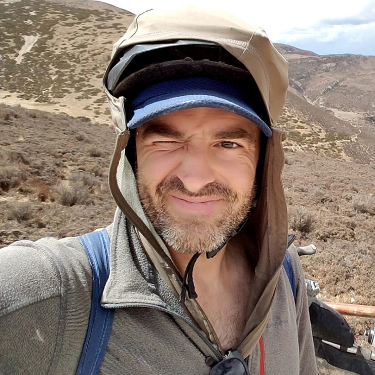
Matthew Crompton
Guest Contributor
Matthew Crompton is an award-winning writer and photographer preoccupied with bikes, hikes, and the mystical solitude of the way-out. His latest project for 2017 is a 29+ fat-tyred expedition from the Tibetan Plateau thru Central Asia and onward to Europe. Follow Matthew’s travels on Instagram or his website.
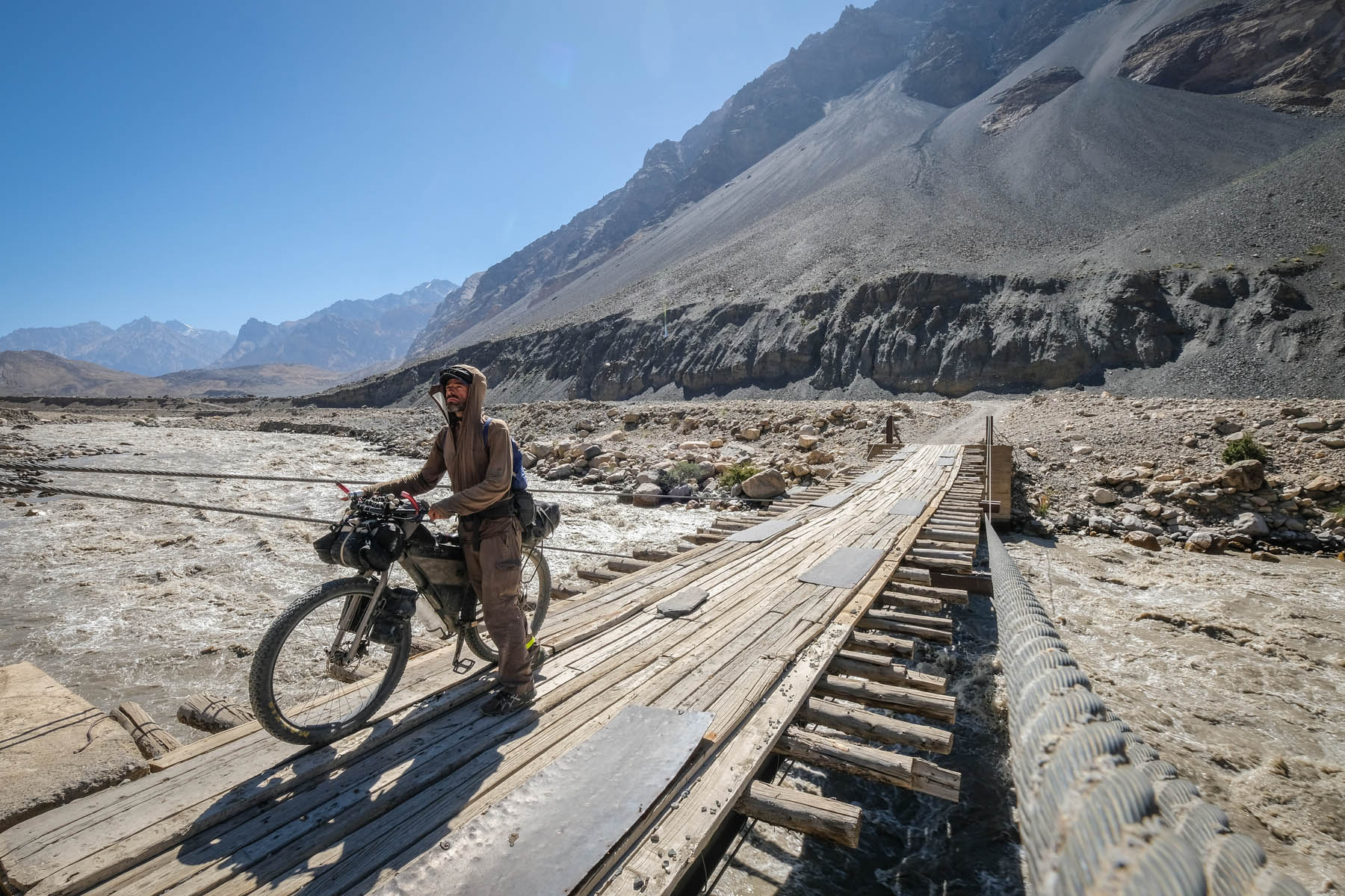
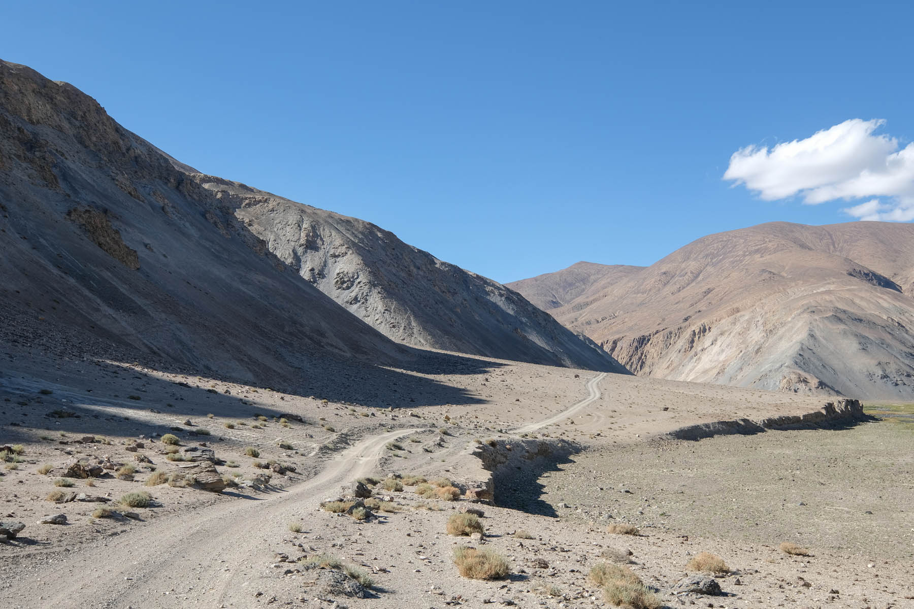
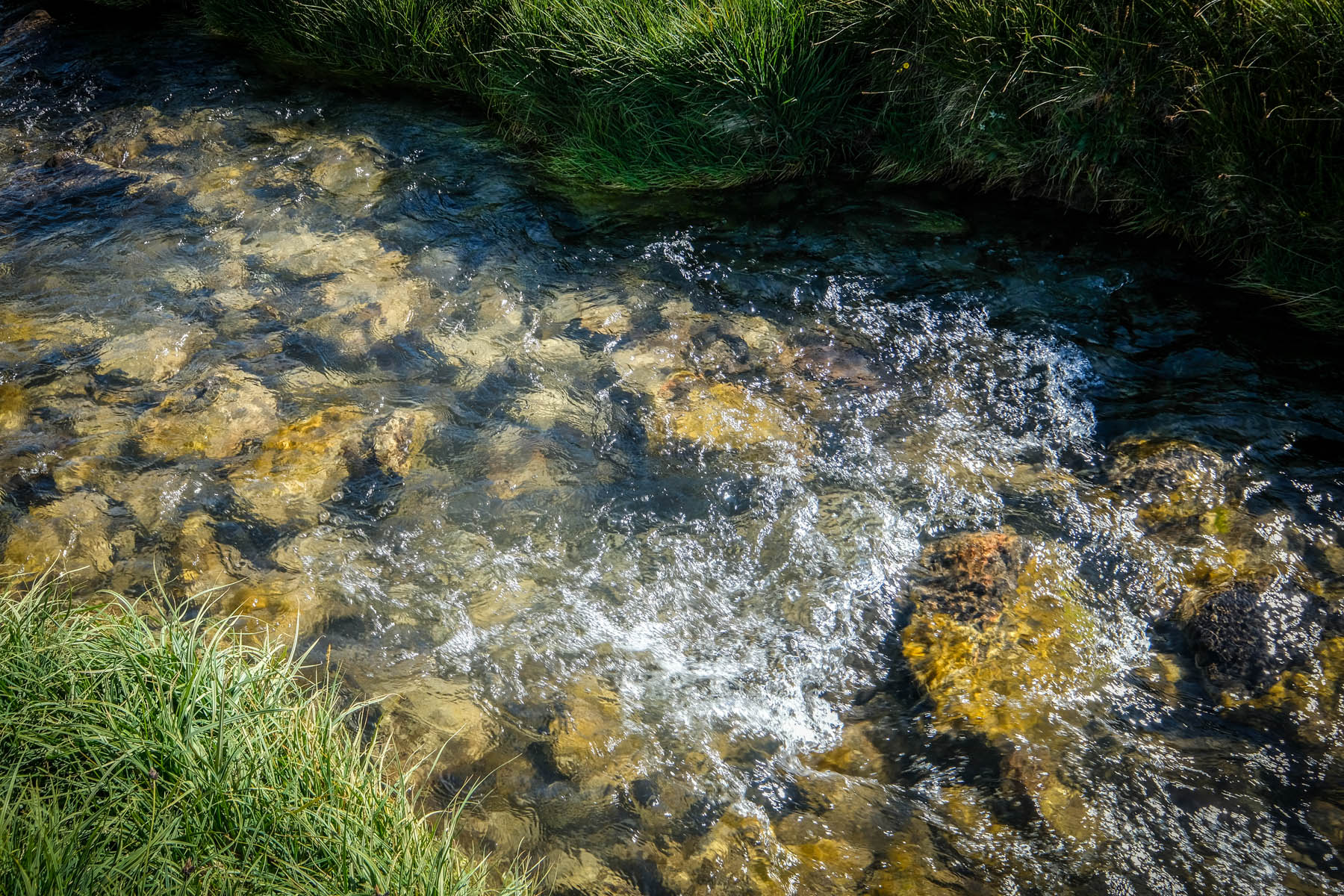
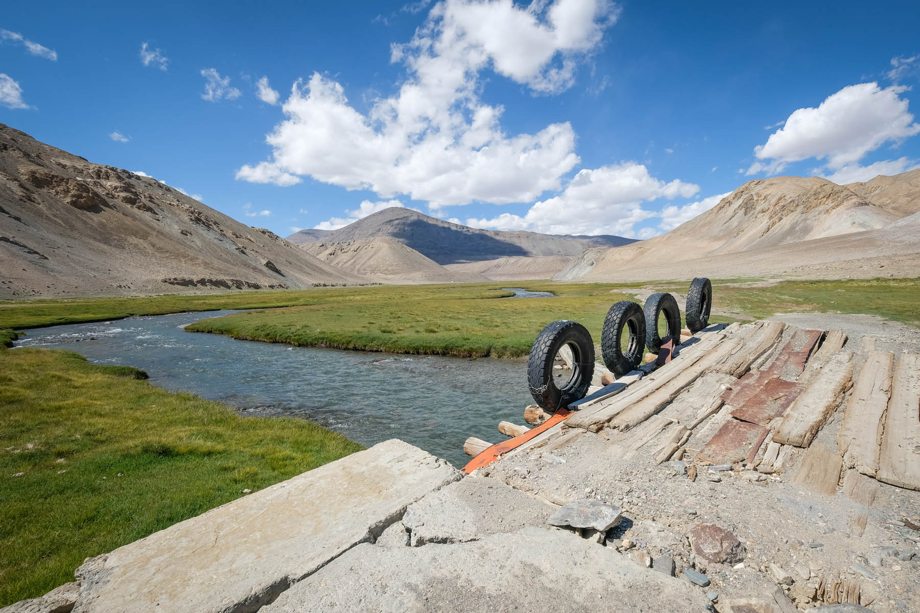
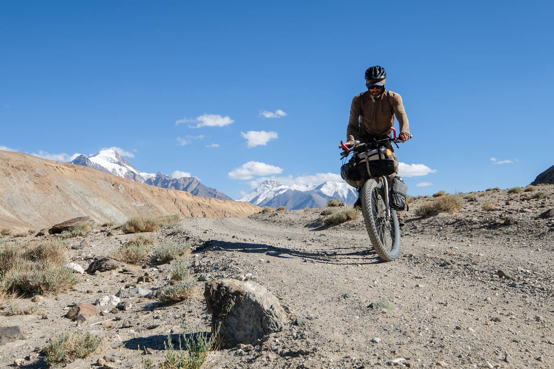
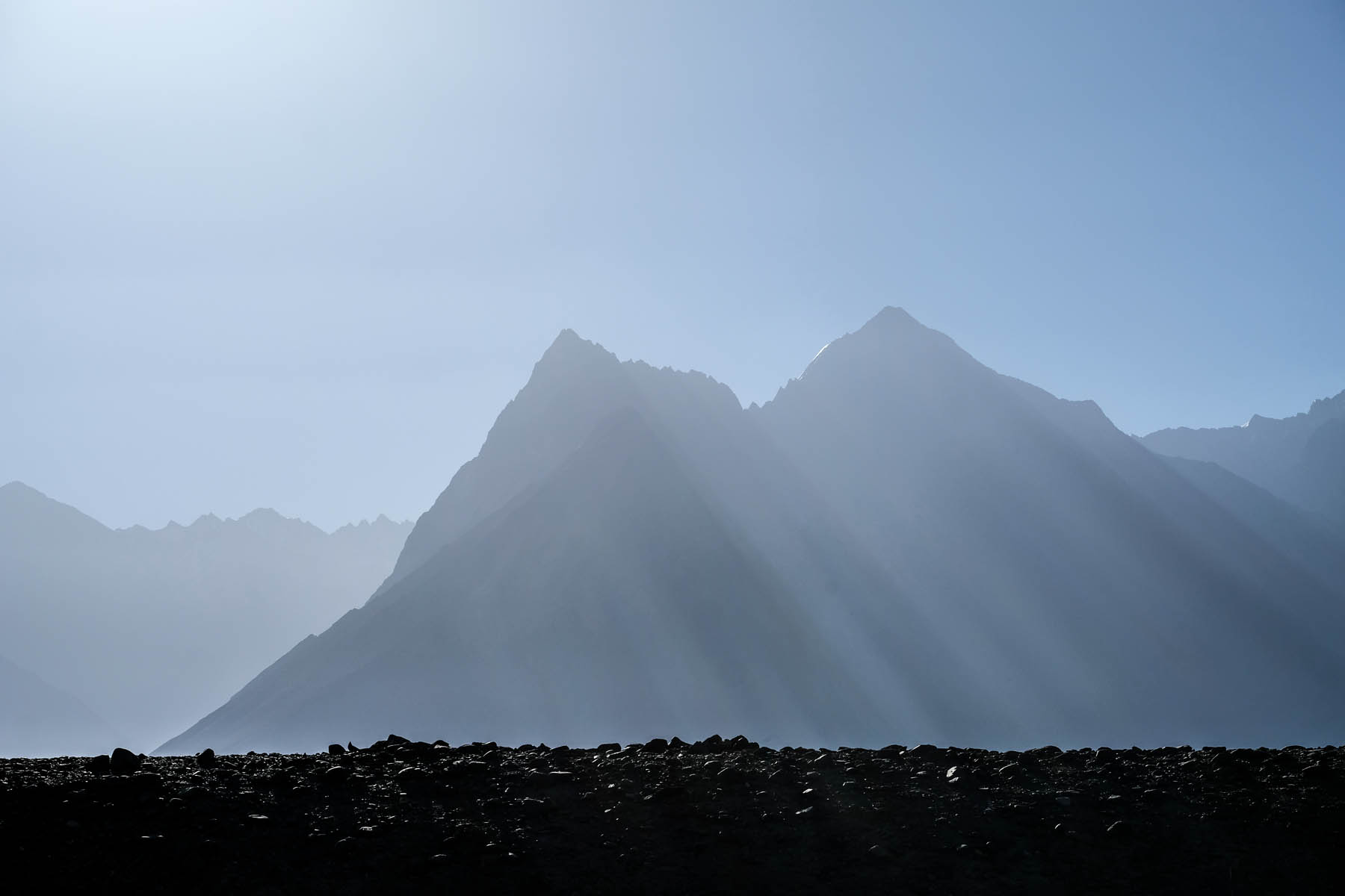
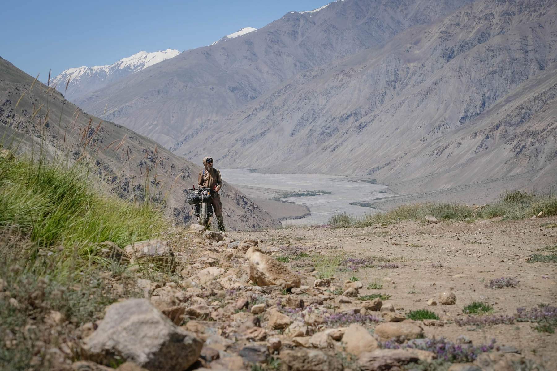
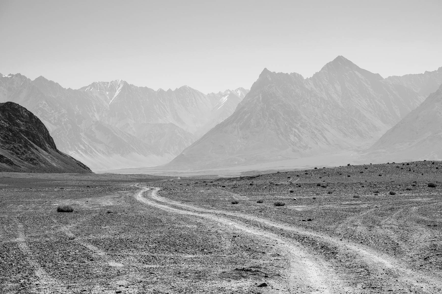
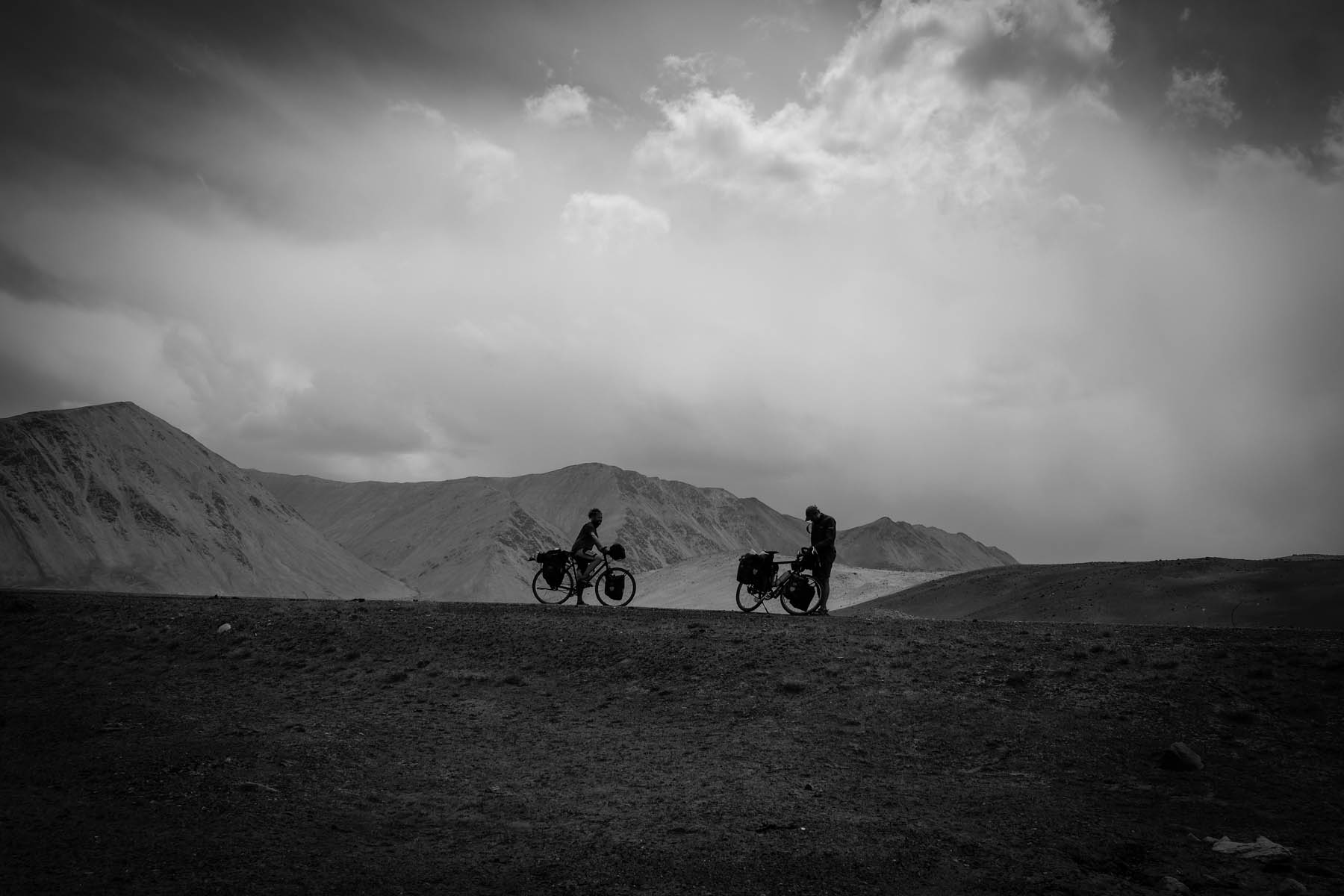
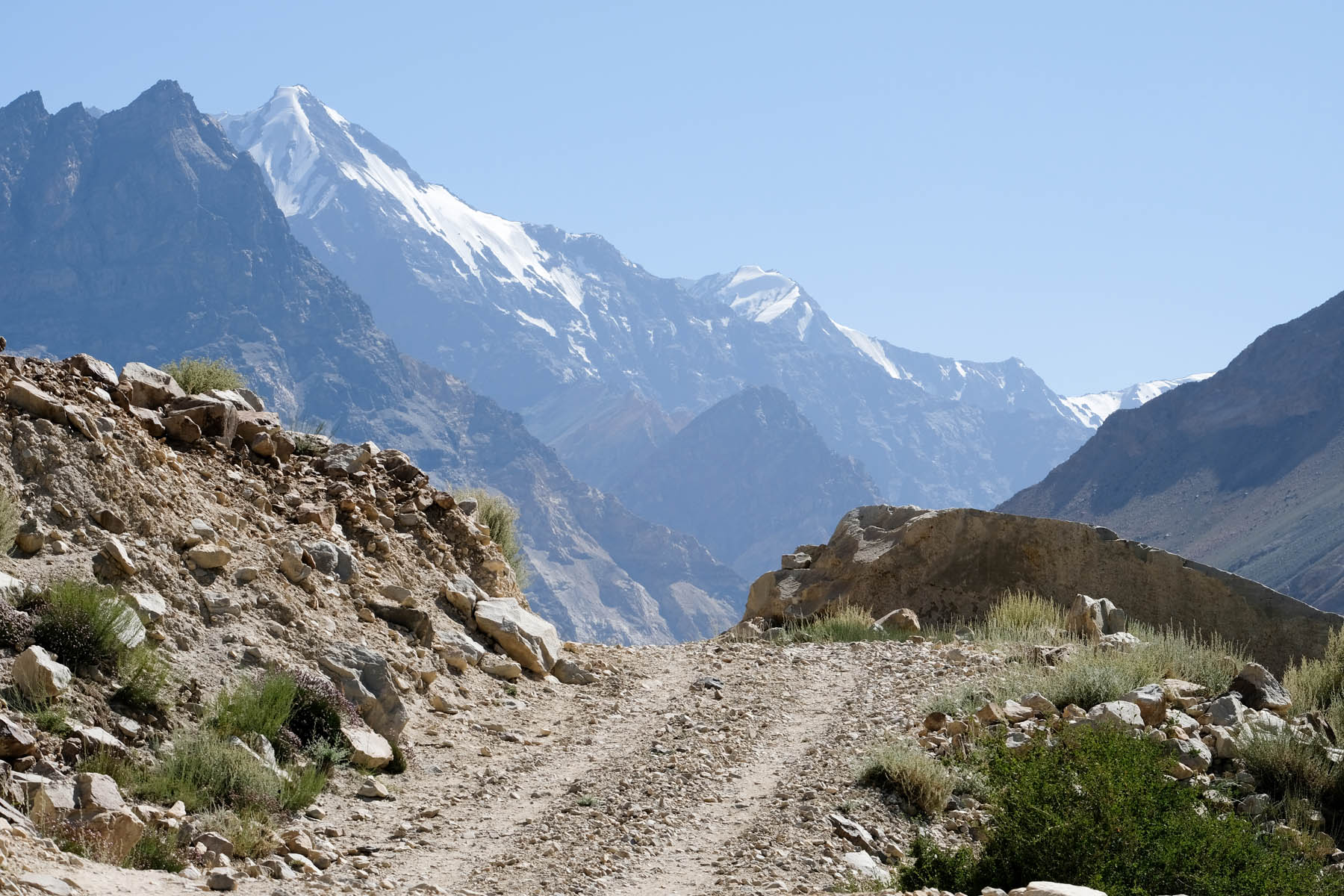
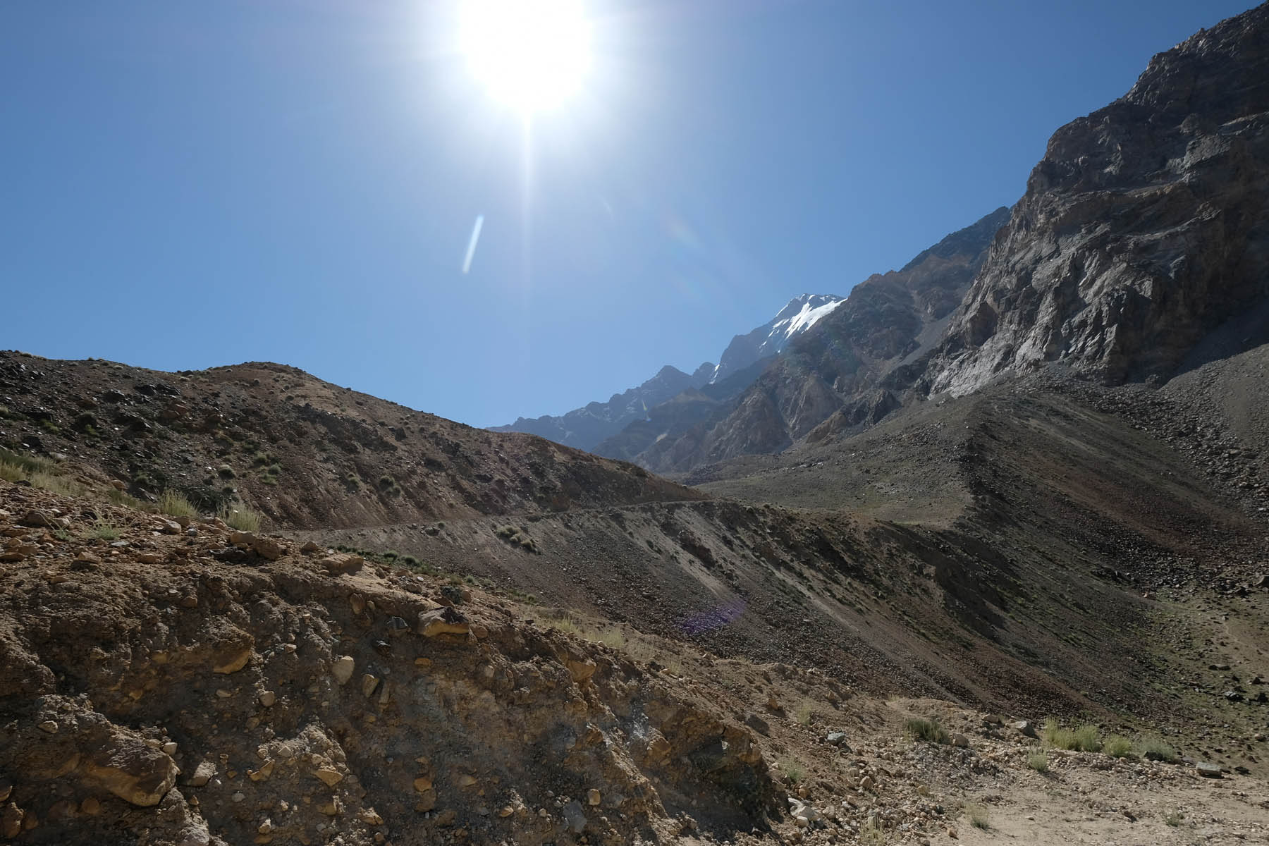
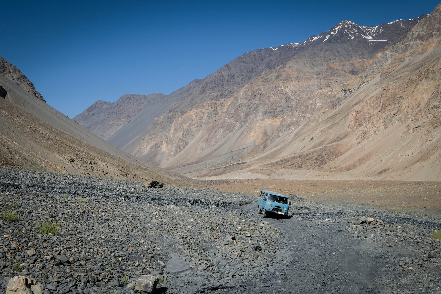
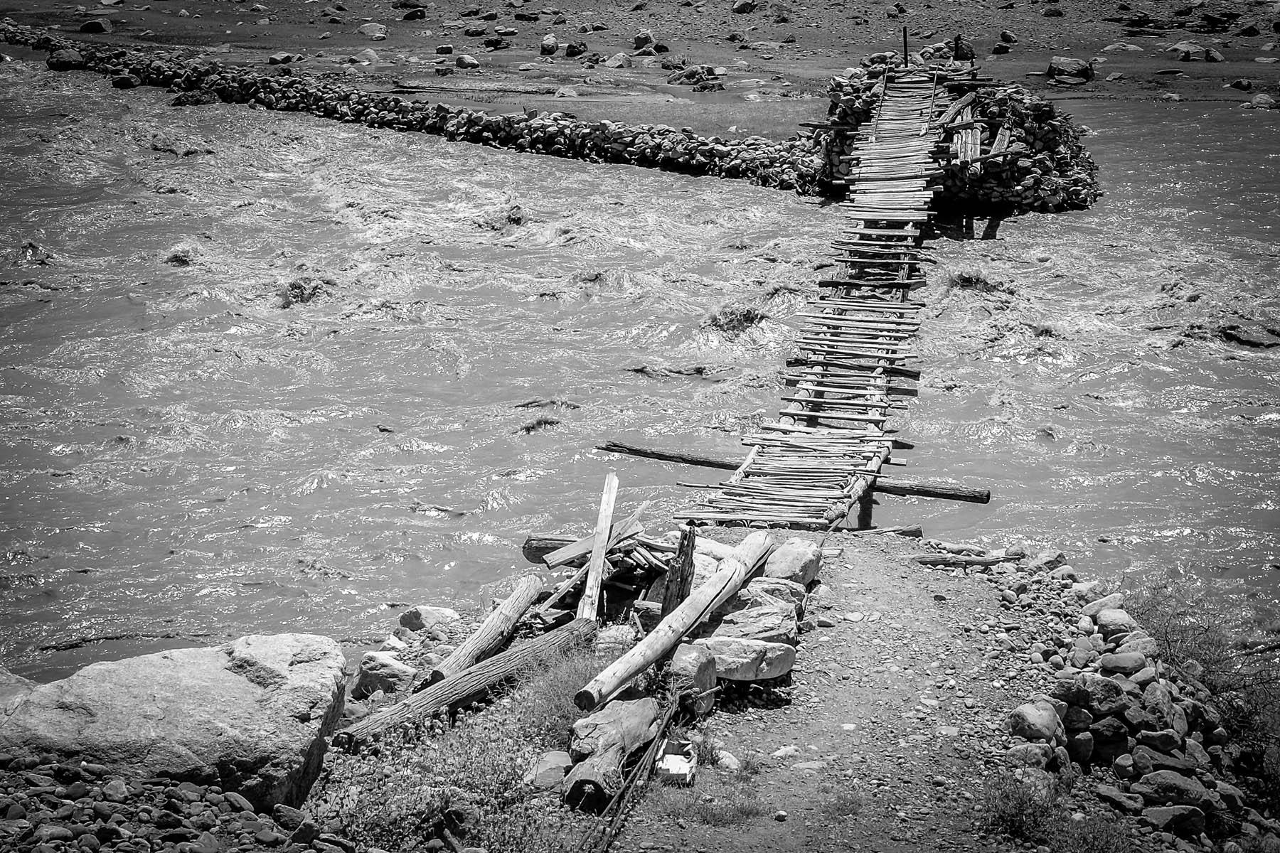
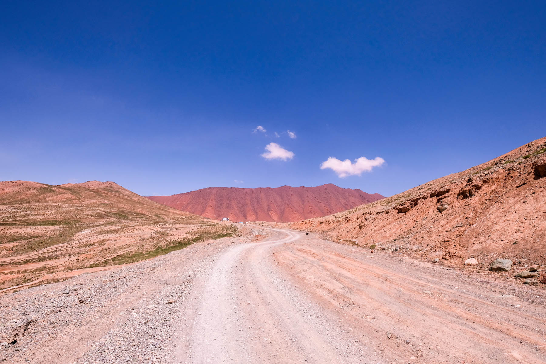
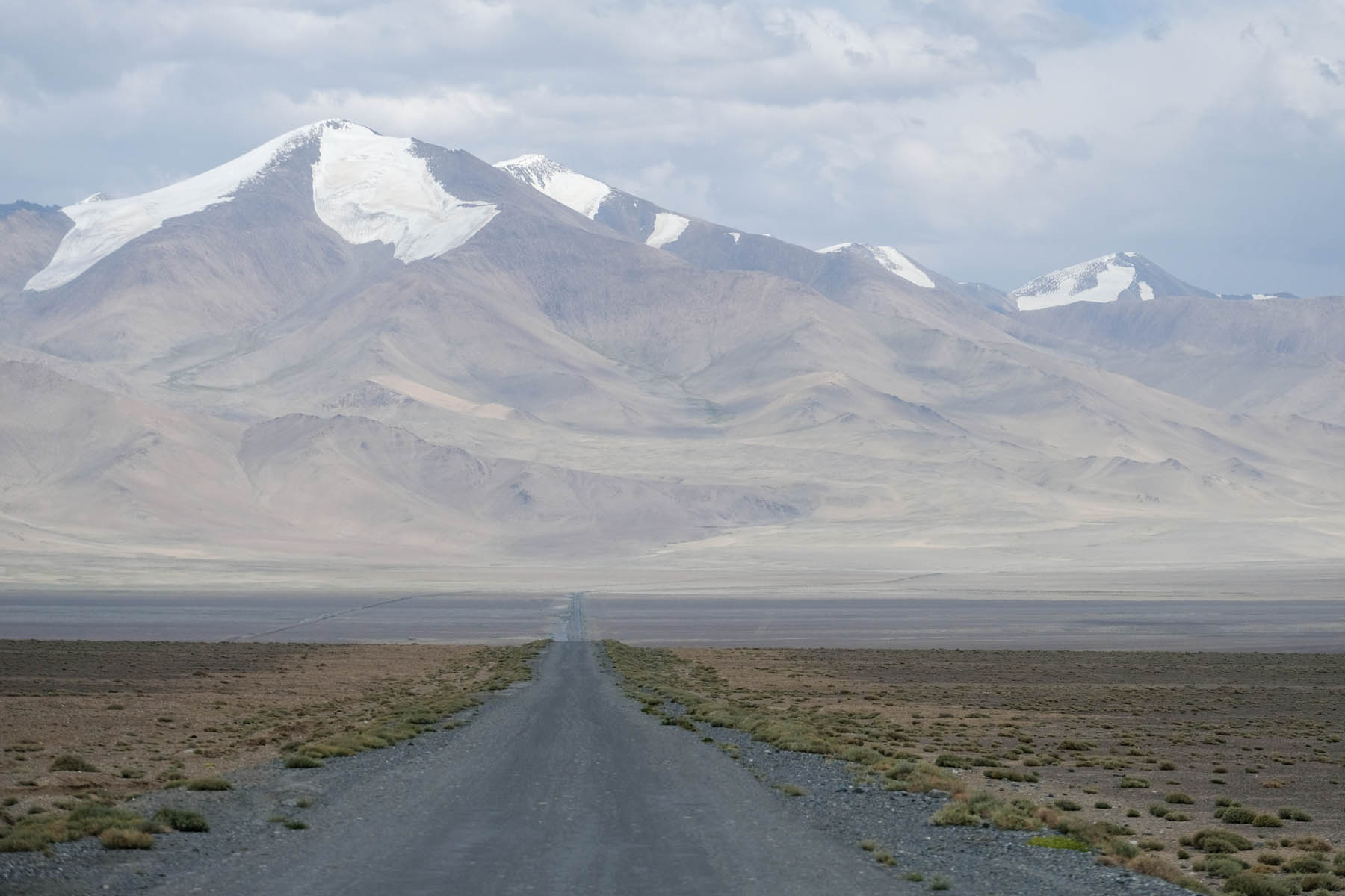
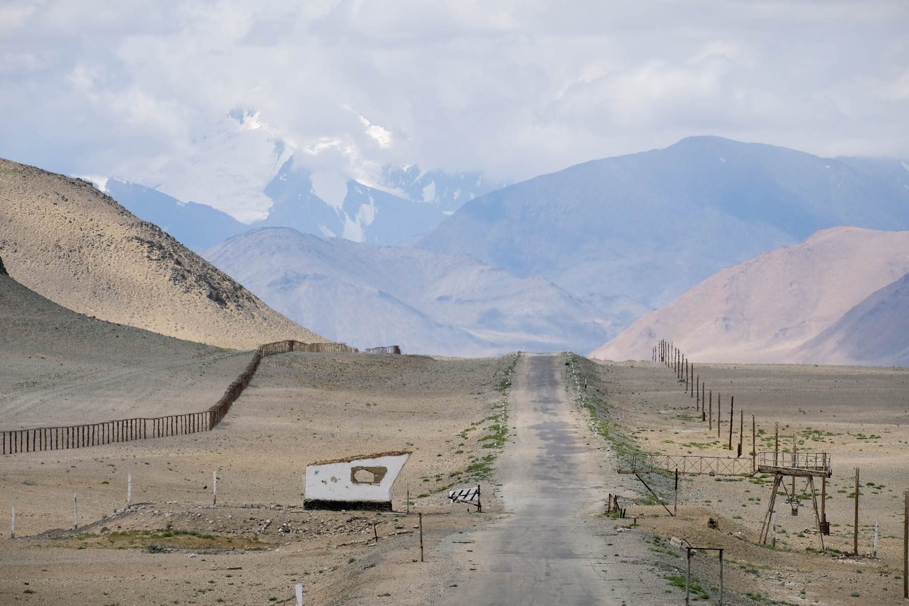
Beginning with a climb through the vast no man’s land between Kyrgyzstan and Tajikistan, the route emerges onto the barren, wind-whipped moonscape of the Murghab Plateau, stopping in the end-of-the-world village of Karakul beside a deep blue lake at nearly 4000m. The track then turns west off the M41 Pamir Highway across the lonely high-altitude desert and the first of the route’s many water crossings. A day’s ride later, the track hits the edge of the plateau and drops more than a thousand metres on steep, fast switchbacks to the bend of the Bartang River in the valley far below. The route crosses many swollen streams (stories of lost panniers and even lost bicycles abound) before finally hitting the village of Khudara, the most remote inhabited place in the Bartang.
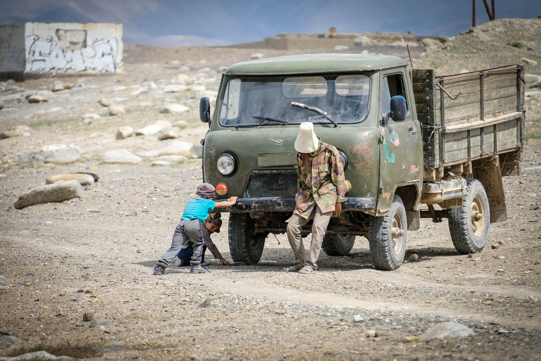
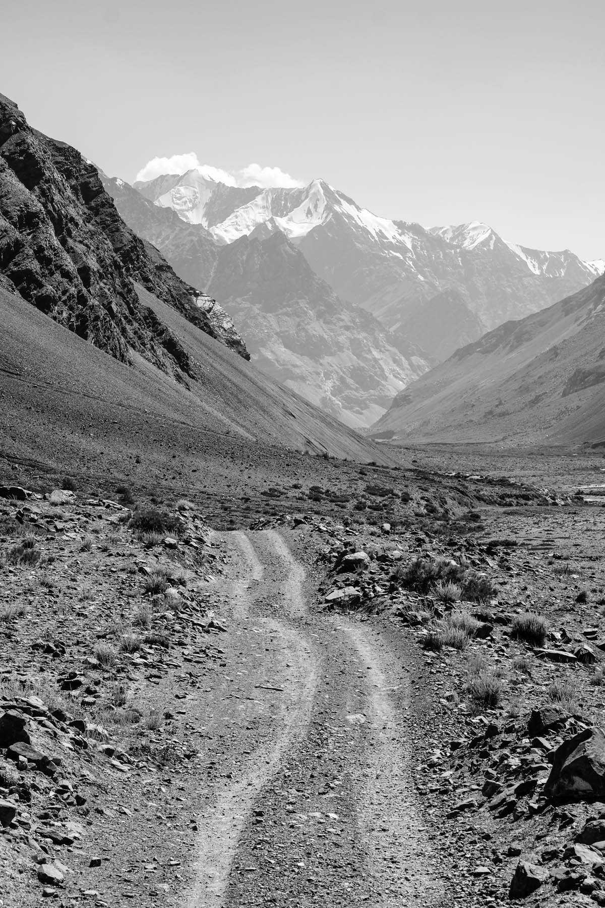
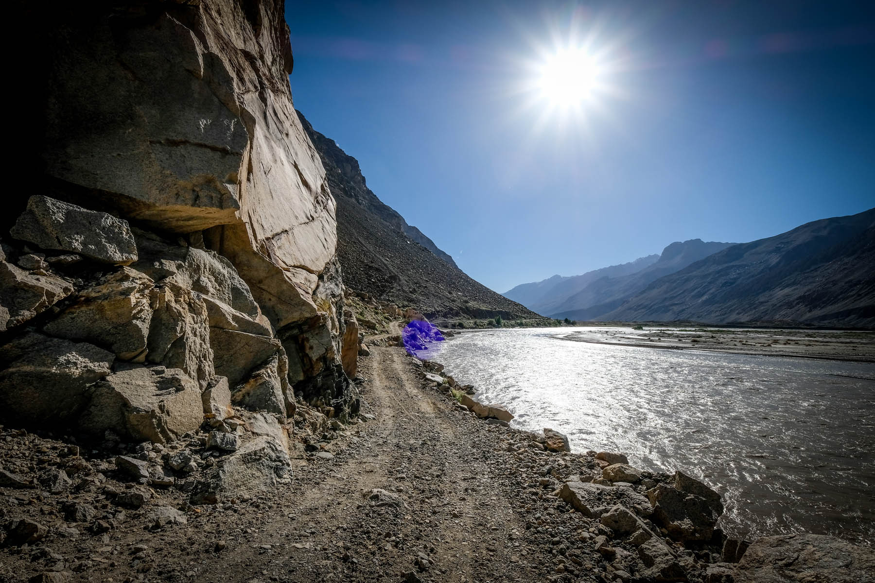
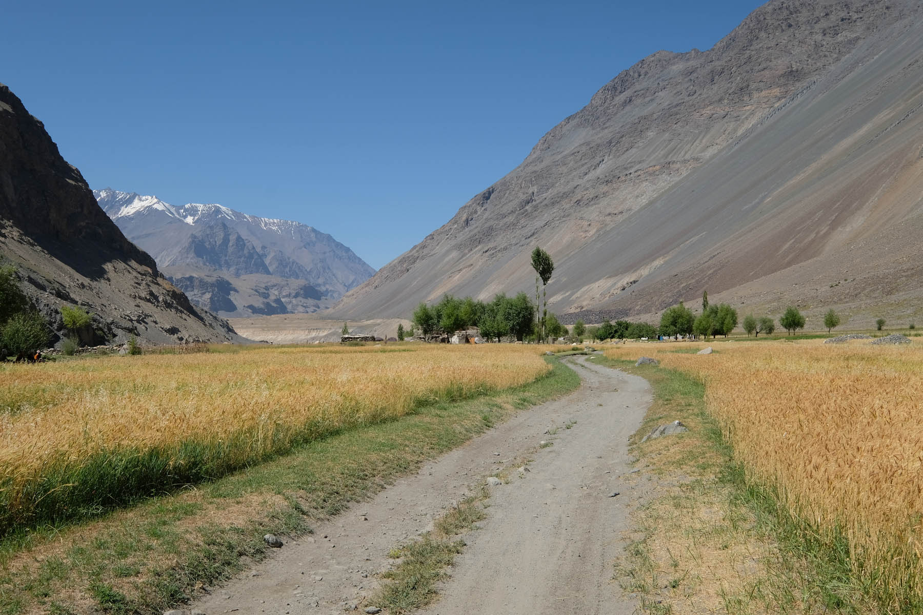
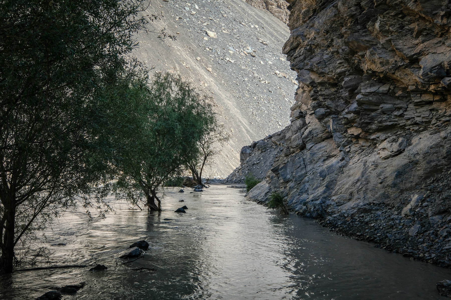
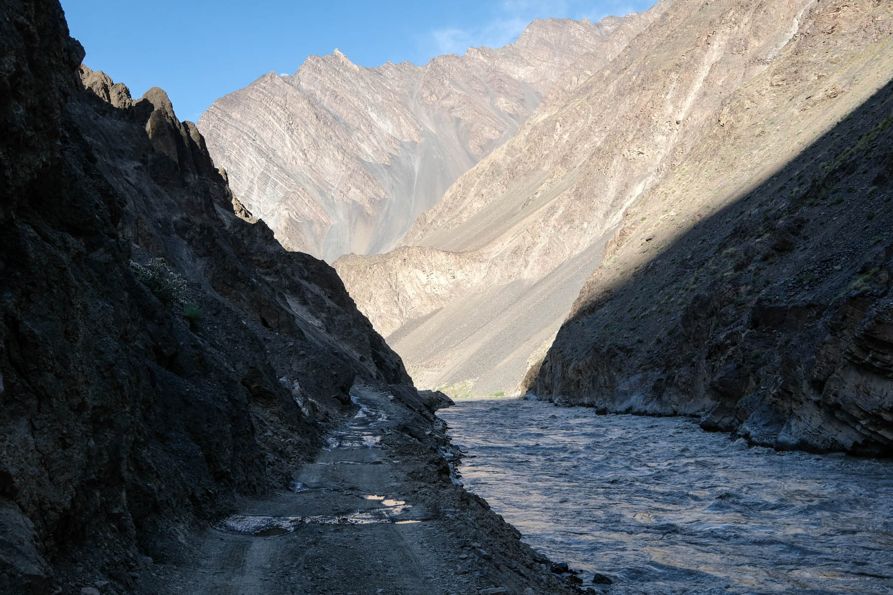
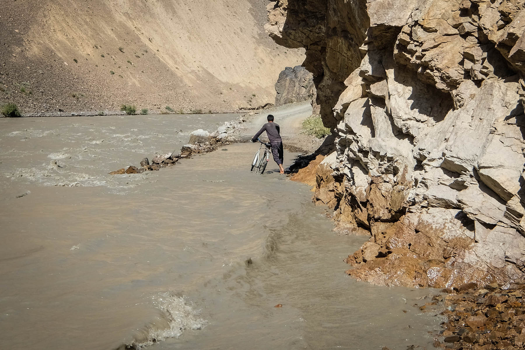
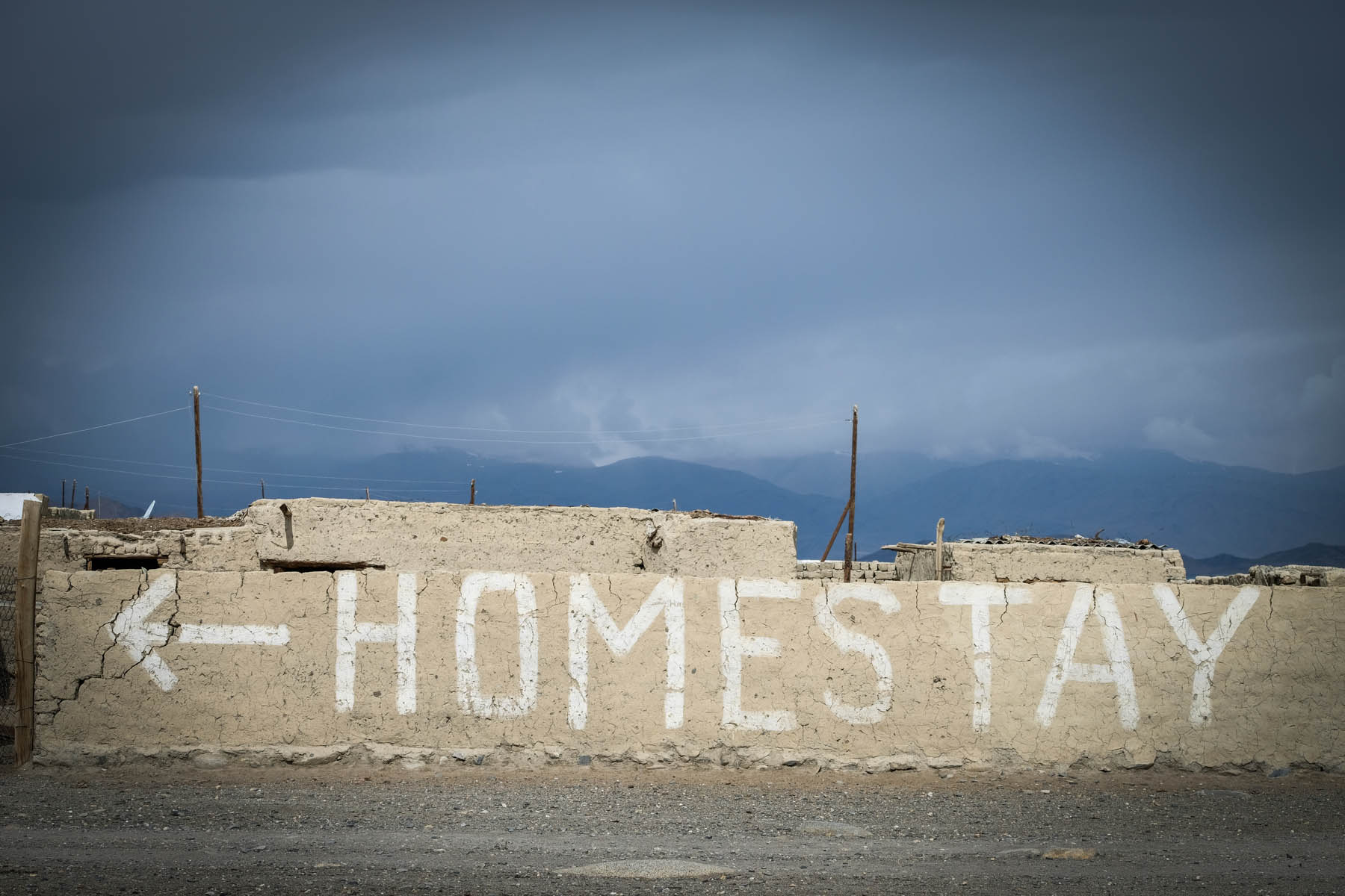
From Khudara, the route follows the path of the muddy Bartang River through an upland desert on rough jeep tracks that may be covered by recent landslides or by the rising waters of the river itself, requiring either hike-a-bike or wading to pass. If you’re unlucky, conditions can occasionally make the area totally impassible. As a consolation, small villages fed by snowmelt emerge from the barren landscape like green oases. When passing through them, you will almost certainly be asked to stop for tea or a meal with locals, or even to stay the night (a little bit of Russian proficiency goes a long way here). The road is often likely to be flooded as you follow the undulating jeep track down along the river during the route’s final days, during which the villages slowly become larger. Finally, you’ll hit the service town of Rushon and the M41 that you left behind four days earlier, feeling like you’ve emerged from another century, or maybe even another world.
Physical demand: 5. Even with the overall descent of the route, assume you’ll have a hard time with water crossings or landslides (or both), plus some shockingly bad road surfaces.
Resupply and Logistics: 6. After having passed through the desert of the Murghab Plateau, there are generally heaps of decent clean-running water sources. Options for supplying with food at the start of the route in Karakul and across the Kyrgyz border in Sary Tash are not great. Expect a subsistence diet of noodles, rice, chocolate bars, etc. Some homestays in the villages may offer more nourishing, simple meals.


Submit Route Alert
As the leading creator and publisher of bikepacking routes, BIKEPACKING.com endeavors to maintain, improve, and advocate for our growing network of bikepacking routes all over the world. As such, our editorial team, route creators, and Route Stewards serve as mediators for route improvements and opportunities for connectivity, conservation, and community growth around these routes. To facilitate these efforts, we rely on our Bikepacking Collective and the greater bikepacking community to call attention to critical issues and opportunities that are discovered while riding these routes. If you have a vital issue or opportunity regarding this route that pertains to one of the subjects below, please let us know:
Highlights
Must Know
Camping
Food/H2O
Trail Notes
Resources
- The incredible, austere landscapes of the Murghab Plateau
- Karakul Lake, with its backdrop of 6000m peaks and its little end-of-the-world village
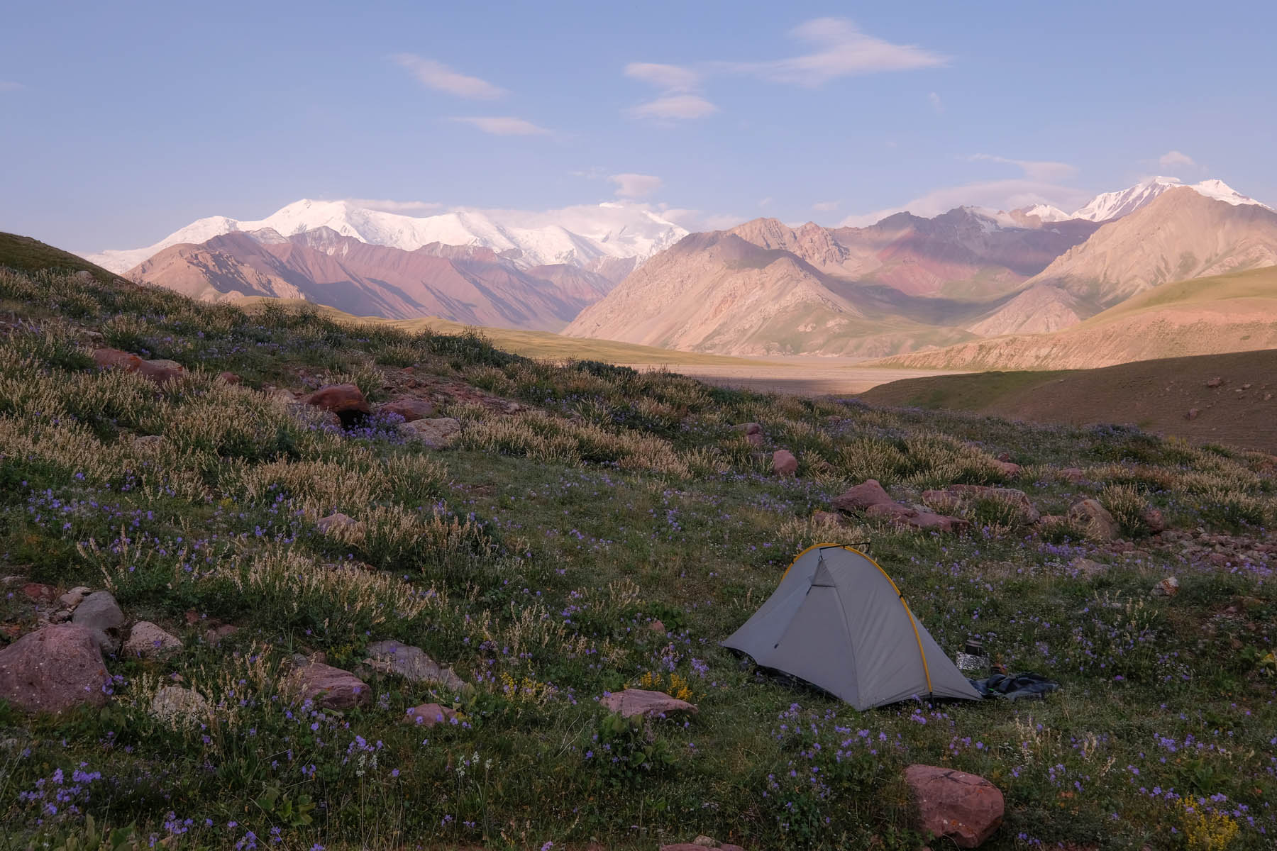
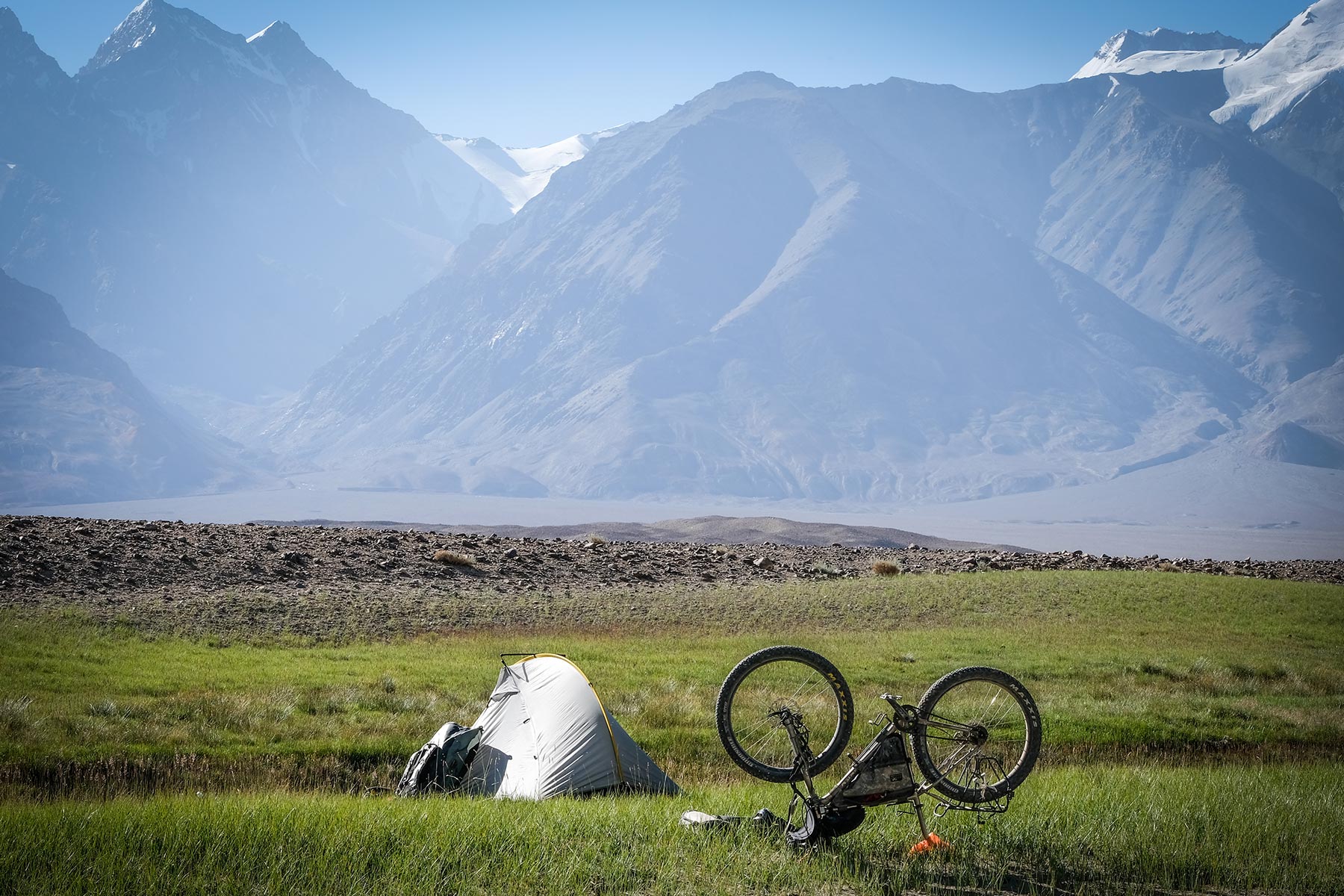
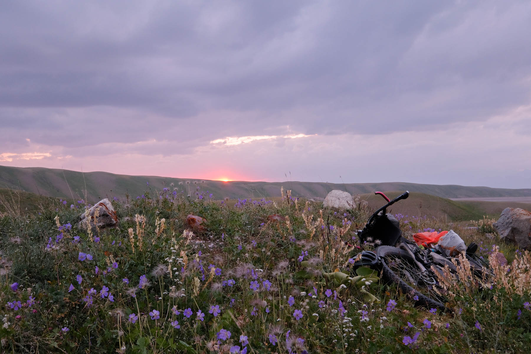
- Superb wild campsites on the Murghab Plateau and in the Bartang Valley itself
- The incredible hospitality and friendliness of the Bartangi people
- The long, fun, fast descent off the plateau
- Travelling through a wilderness largely untouched by the modern world
- A sense of genuine adventure in pedalling the Pamirs’ hardest route
- When to go: Usually navigable June-September, but always check latest conditions.
- Logistics: The route starts in border town of Sary Tash in Kyrgyzstan, from which it’s possible to overland through the rest of Kyrgyzstan or across the Chinese border to Kashgar. The nearest international airport is at Osh, a three-hour taxi ride (or two-day cycle) away. From Rushon, at the end of the route, it’s a 12-16 hour jeep taxi ride to the Tajik capital of Dushanbe (it’s far faster if you hire the whole jeep yourself), or a 5-7 day cycle along the M41. The first two days of the route are in Tajik National Park, where the fee is ~$3 USD/day, though the only official place I found to buy one was at the PECTA office in the town of Khorog, near Rushon. I met men at a camp on the Murghab Plateau who looked to be running a permit scam, and purchased one from the official office instead. People along the route will accept Tajik somoni, US dollars, and often Kyrgyz soms as payment. The nearest working ATMs are far away in Osh (Kyrgyzstan) or Dushanbe (Tajikistan), so bring all the money you’ll need with you, including lots of small bills.
- Dangers and Annoyances: Water crossings, flooding, and landslides are an ever-present possibility along the route, and negotiating them can range from fun to foolhardy. Talk to people you meet along the road and check out the forums at https://caravanistan.com/forum/ for the most up-to-date conditions. There’s a lot of hearsay about the Bartang, so it’s best to only heed information from people who have recently seen it for themselves. The Tajik border at Kyzyl-Art used to be notorious for scams and bribes, but (happily!) it lately seems to have cleaned up its act, at least as regards not fleecing cycle tourists.
- Travel basics: A visa is required for Tajikistan and for the GBAO (Gorno-Badakhshan Autonomous Oblast, the region where the Pamirs are located). You can apply for the e-visa and GBAO permit online, here: https://www.visa.gov.tj/index.html. The visa is valid for 45 days within a 90-day period from the entry date you fill in, and is single entry. It normally takes a couple days to process and is delivered by email. Print out the visa grant page and bring it with you to the border. Most people will be able to visit Kyrgyzstan (at the start of the route) visa-free for 90 days. A permit is also required to exit the Kyrgyzstan border and enter Tajikistan. To get yours, contact Destination Pamir. Permits take 1-2 days to process.
- The Bartang is a wild-camping paradise, so pitch up wherever you want!
- Homestays including dinner and breakfast are available in Karakul for around 80-100 somoni a night. Homestay Sadat, visible off the main road, is a good choice.
- Informal homestays exist in villages along the way (people will find you as you ride through). Expect to pay $10-15 USD a night for a place to sleep, dinner, and breakfast. The one official homestay in the village of Basid (near the end of the route) is excellent.
- If you happen to find yourself at the Kyrgyz-Tajik border a day before your official entry date into Tajikistan, it’s perfectly okay to camp in the no man’s land between countries for a night.
- There are clear, free-flowing water sources along most of the route (filter or disinfect to be safe!), and well water pumps in some of the villages. The section between Karakul and the edge of the Plateau is largely dry for most of the day’s ride, but eventually joins a clear-flowing river. This is the longest section through which you’ll have to carry significant water.
- There are two basic, unmarked magazins (shops) in Karakul that can be found by asking around. Both carry a pretty depressing assortment of sickly biscuits, rice, noodles, pasta, chocolate, fizzy drink, and a bit of fresh veg. If you want gourmanderie, stock up at a supermarket in Osh (Kyrgyzstan). Meals in homestays along the way will provide better, more filling nutritional options.
Day 1 (~99km / 61mi)
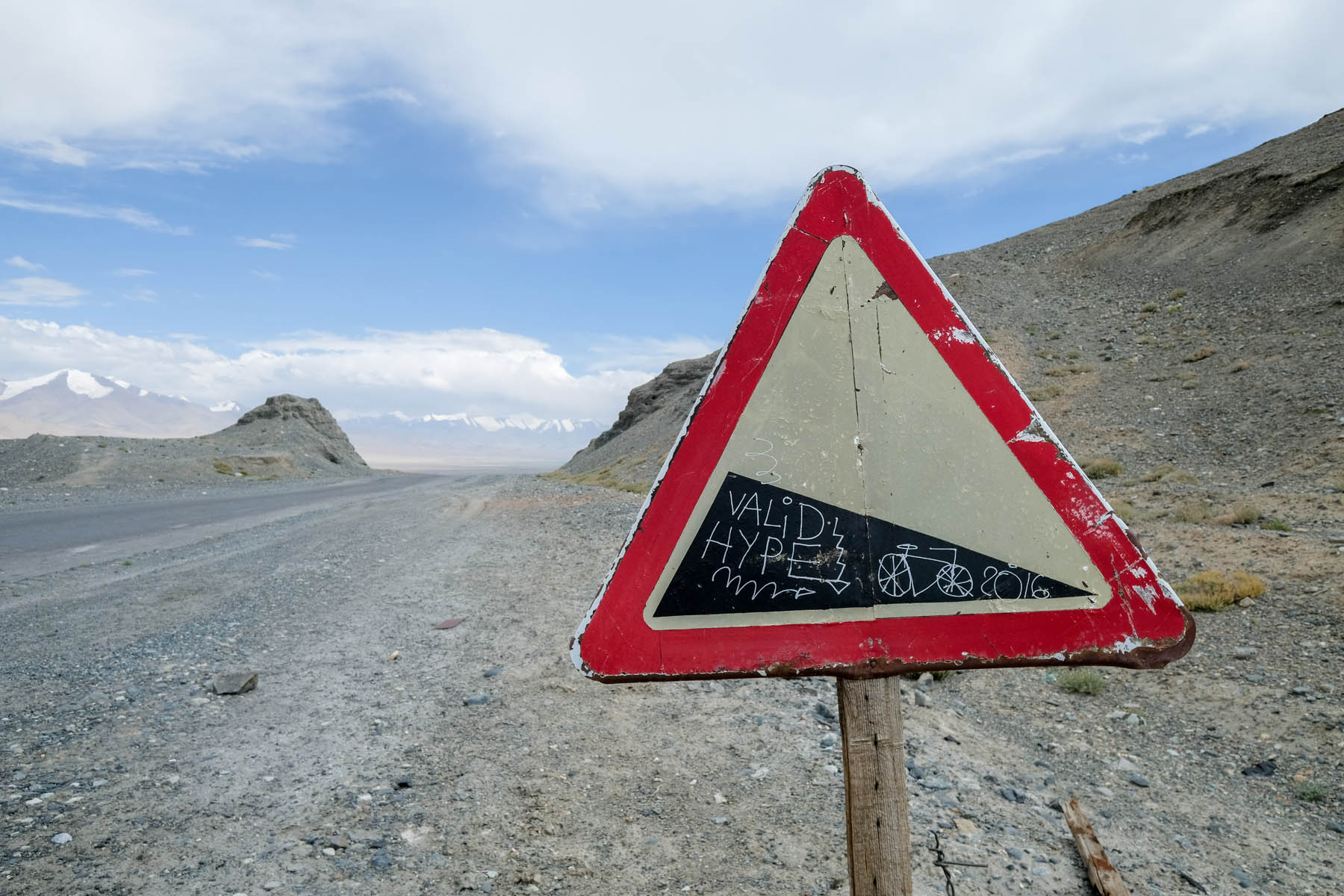
Leave the Kyrgyz border town at Sary Tash and head up the M41 to the Kyrgyz border checkpoint (you’ll get through faster if you arrive when the border first opens in the morning), then climb the dirt track for a few hours through no man’s land to Kyzyl-Art Pass (4280m) and the Tajik border there. Allow a couple of hours to pass the border. Once you’re through, enjoy the wild desert landscape (plus a couple small stream crossings) on the comically bad paved road to the gorgeous lakeside village of Karakul. The thing that looks like an abandoned hotel across the road is actually a military base, so avoid wandering into it!
Day 2 (~71km / 44mi)
Fight the headwinds for an hour or so down the M41 to the turnoff west across the desert. You’ll pass through austere, windy wastelands for several hours, ford a small river, and wind between mountain ridges before you reach and follow a narrow valley beside a clear-flowing stream. Enjoy an incredible wild camp streamside for your final night on the Murghab Plateau.
Day 3 (~79km / 49mi)
Continue through the desert via a gap in the mountains, cross another stream, and you’ll eventually hit the edge of the Plateau. The Bartang River Valley opens up in a vast panorama before you as you rip down steep switchbacks. Follow the rocky jeep track gradually downhill across numerous side-stream crossings (you may have to shuttle luggage if water levels are high) to the village of Khudara at the end of the day, where you can either wild camp or find a homestay.
Day 4 (~72km / 45mi)
Continue following the jeep track along the Bartang River, potentially climbing over landslides or pushing through flooded sections of road. Stop in a tiny village or two along the way and enjoy a cup of tea with the friendly Bartangi locals, who are virtually guaranteed to wave you down. Wild camp or stay with the amazing family who runs the homestay there.
Day 5 (~85km / 53mi)
Tackle the climbs, shockingly bad track, and potential river wading as you make your way back out to civilisation at Rushon, then finally grab a beer and a real meal to celebrate.
Additional Resources


Terms of Use: As with each bikepacking route guide published on BIKEPACKING.com, should you choose to cycle this route, do so at your own risk. Prior to setting out check current local weather, conditions, and land/road closures. While riding, obey all public and private land use restrictions and rules, carry proper safety and navigational equipment, and of course, follow the #leavenotrace guidelines. The information found herein is simply a planning resource to be used as a point of inspiration in conjunction with your own due-diligence. In spite of the fact that this route, associated GPS track (GPX and maps), and all route guidelines were prepared under diligent research by the specified contributor and/or contributors, the accuracy of such and judgement of the author is not guaranteed. BIKEPACKING.com LLC, its partners, associates, and contributors are in no way liable for personal injury, damage to personal property, or any other such situation that might happen to individual riders cycling or following this route.
Please keep the conversation civil, constructive, and inclusive, or your comment will be removed.