


Bikepacking The Iron Mountain Trail, Virginia
Distance
45 Mi.
(72 KM)Days
2
% Unpaved
66%
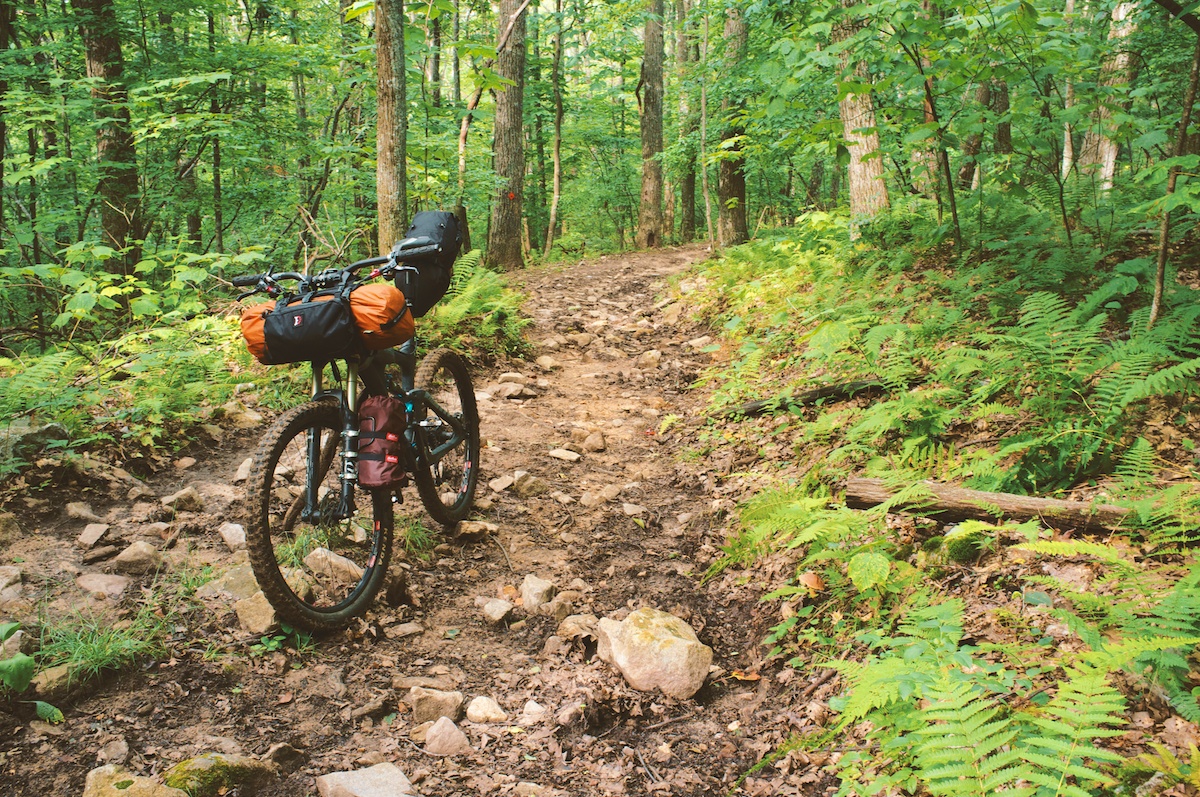
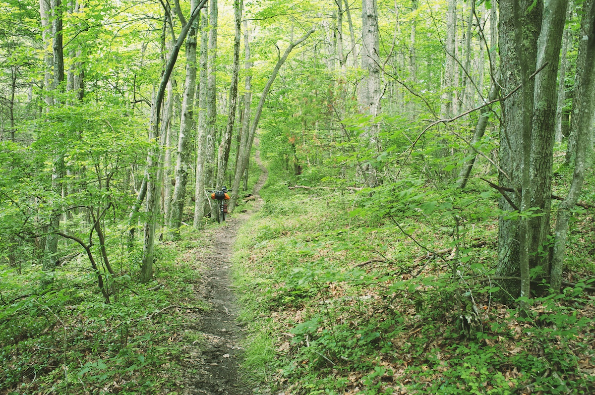
% Singletrack
50%
% Rideable (time)
99%
Total Ascent
4,847'
(1,477 M)High Point
5,000'
(1,524 M)Difficulty (1-10)
5?
- 7Climbing Scale Strenuous108 FT/MI (20 M/KM)
- -Technical Difficulty
- -Physical Demand
- -Resupply & Logistics
Contributed By

Logan Watts
Founding Editor
The Iron Mountain Trail in Virginia was formerly a 24 mile section of the Appalachian Trail until 1972 when they reoriented the trail slightly to the south. This ridgeline gem is perfect for an overnight bikepacking trip and can even be done without a tent or bivy via the two shelters that were built during its AT history.
The IMT traverses a long ridge in a beautiful tract of wilderness. When ridden east to west, it climbs up, then has a hearty dose of ups and downs before it finishes with 6 miles of screaming downhill, creek crossings, and rock gardens that spit you out right into the town of Dmascus.
Route orientation: I rode this route starting at the parking pull out where specified on the map. In hindsight. I’d probably recommend starting the route in Damascus, then riding about 48 miles to camp at Cherry Tree Shelter. This would allow the majority of the Iron Mountain trail to be ridden on day two. However, it does make for a solid day one of climbing (a little under 3,000ft).


Submit Route Alert
As the leading creator and publisher of bikepacking routes, BIKEPACKING.com endeavors to maintain, improve, and advocate for our growing network of bikepacking routes all over the world. As such, our editorial team, route creators, and Route Stewards serve as mediators for route improvements and opportunities for connectivity, conservation, and community growth around these routes. To facilitate these efforts, we rely on our Bikepacking Collective and the greater bikepacking community to call attention to critical issues and opportunities that are discovered while riding these routes. If you have a vital issue or opportunity regarding this route that pertains to one of the subjects below, please let us know:
Highlights
Must Know
Camping
Food/H2O
- A beautiful slice of the Appalachian wilderness.
- Several old 3-wall huts from the AT days allow a tent less ride, if you wish.
- After the initial 4 mile grunt, a nice, long ridge ride awaits with several very long downhills.
- The Virginia Creeper Trail, a long gravel climb through some beautiful forests along a scenic creek.
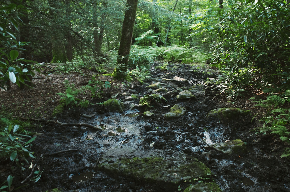
- Because the IMT is shared with equestrians, parts can degrade in to pretty thick mud bogs. If riding the trail from east to west, most of the muck concludes after a few miles and the fun begins.
- The best time to ride it is early spring or fall. However, given the elevations, it perfectly good summer route as well. It could be ridden in the winter too, but might get pretty cold and the risk for snow and ice would be high.
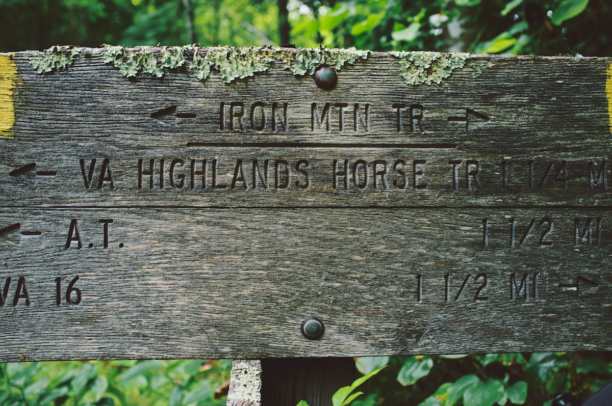
- Park at the Northeast end (FSR 741 and FSR 4402) — see ‘route orientation’ above for a good alternative.
- It gets pretty muddy for the first 5 miles after a hard rain.
- The route back is has a long stretch of tarmac. There is not a heavy amount of traffic, but it’s advisable to wear visible clothes and being lights.
- A few outfitters in Damascus offer shuttles if you are interested in getting a ride back up the mountain.
- There are 2 different 3-walled shelters on the trail. One at about 5 miles (Cherry Tree) and one at about 10 (Straight Branch).
- There is also camping and lodging in Damascus. Check out Crazy Larry’s hostel for a budget alternative.
- There are several campsites along the Virginia Creeper Trail as well.
- Food and restaurants are available in Damascus.
- There are no water sources after Straight Branch until the last 5 mile descent; plenty until then though.
- There are a couple water sources along the Creeper Trail.


Terms of Use: As with each bikepacking route guide published on BIKEPACKING.com, should you choose to cycle this route, do so at your own risk. Prior to setting out check current local weather, conditions, and land/road closures. While riding, obey all public and private land use restrictions and rules, carry proper safety and navigational equipment, and of course, follow the #leavenotrace guidelines. The information found herein is simply a planning resource to be used as a point of inspiration in conjunction with your own due-diligence. In spite of the fact that this route, associated GPS track (GPX and maps), and all route guidelines were prepared under diligent research by the specified contributor and/or contributors, the accuracy of such and judgement of the author is not guaranteed. BIKEPACKING.com LLC, its partners, associates, and contributors are in no way liable for personal injury, damage to personal property, or any other such situation that might happen to individual riders cycling or following this route.
Please keep the conversation civil, constructive, and inclusive, or your comment will be removed.