


The Border Roads, Tibet
Distance
213 Mi.
(343 KM)Days
5
% Unpaved
72%
% Singletrack
0%
% Rideable (time)
100%
Total Ascent
20,392'
(6,215 M)High Point
16,060'
(4,895 M)Difficulty (1-10)
6?
- 6Climbing Scale Moderate96 FT/MI (18 M/KM)
- -Technical Difficulty
- -Physical Demand
- -Resupply & Logistics
Contributed By
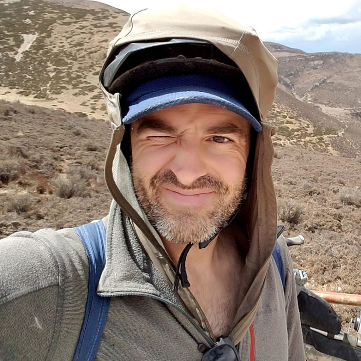
Matthew Crompton
Guest Contributor
Matthew Crompton is an award-winning writer and photographer preoccupied with bikes, hikes, and the mystical solitude of the way-out. His latest project for 2017 is a 29+ fat-tyred expedition from the Tibetan Plateau thru Central Asia and onward to Europe. Follow Matthew’s travels on Instagram or his website.
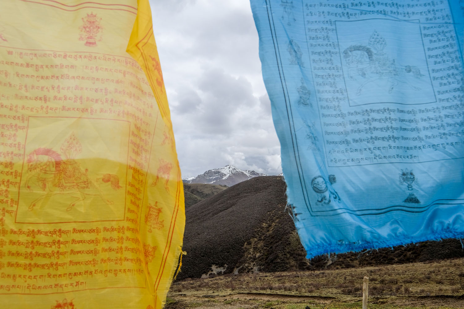
Tibet is much more than just the tightly restricted Tibet Autonomous Region (TAR). The Tibetan Plateau extends far to the east, with the ancient Tibetan region of Kham existing — accessibly — in the far west of the provinces of Sichuan and Qinghai, allowing visitors to the area to experience a Tibetan landscape and culture without the restrictions of travelling to the TAR. Likewise, with its breakneck pace of road construction, it can be difficult to find off-pavement routes in China lasting more than a part of a day.
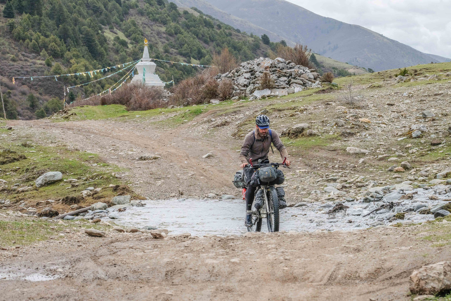
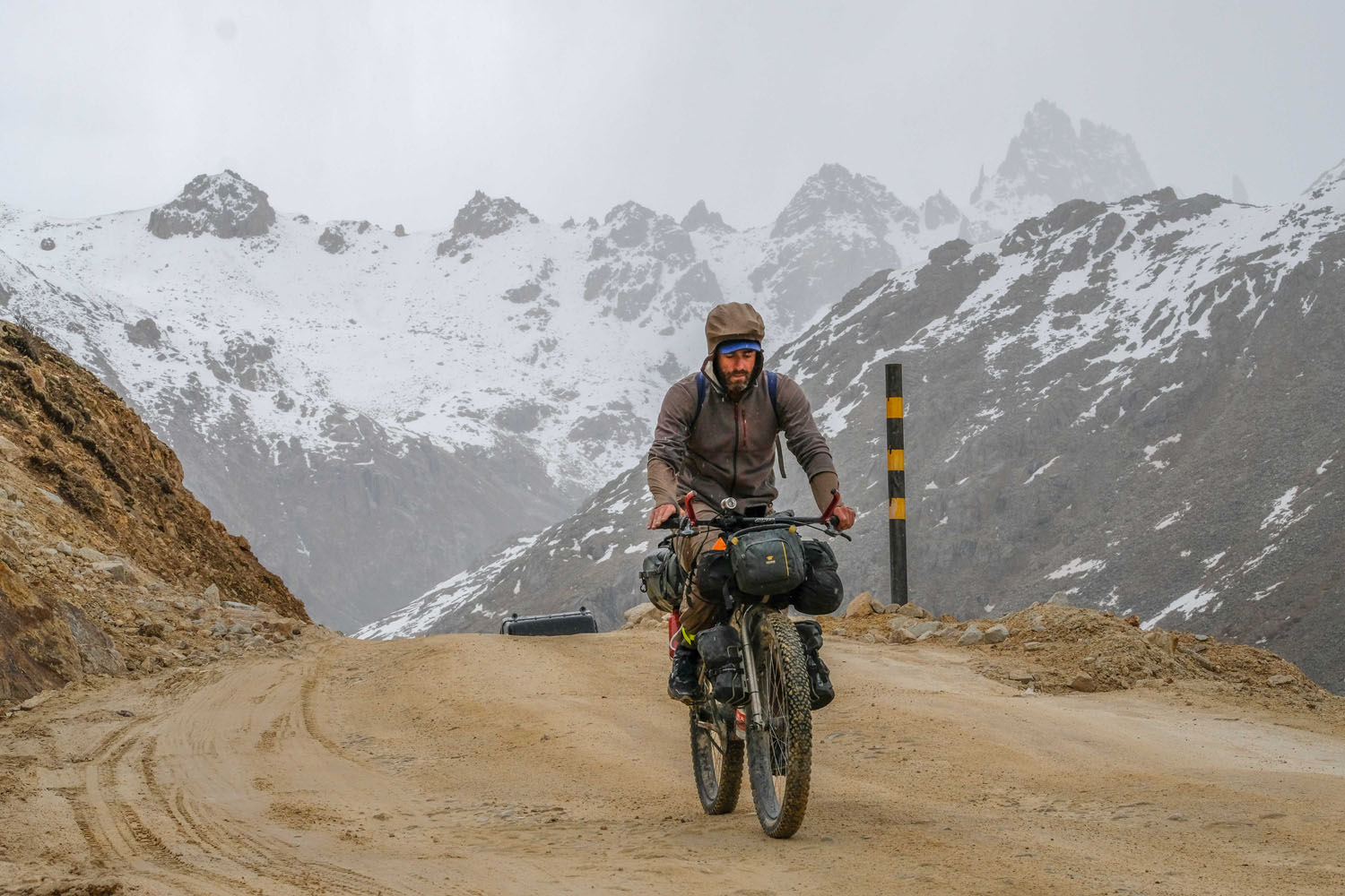
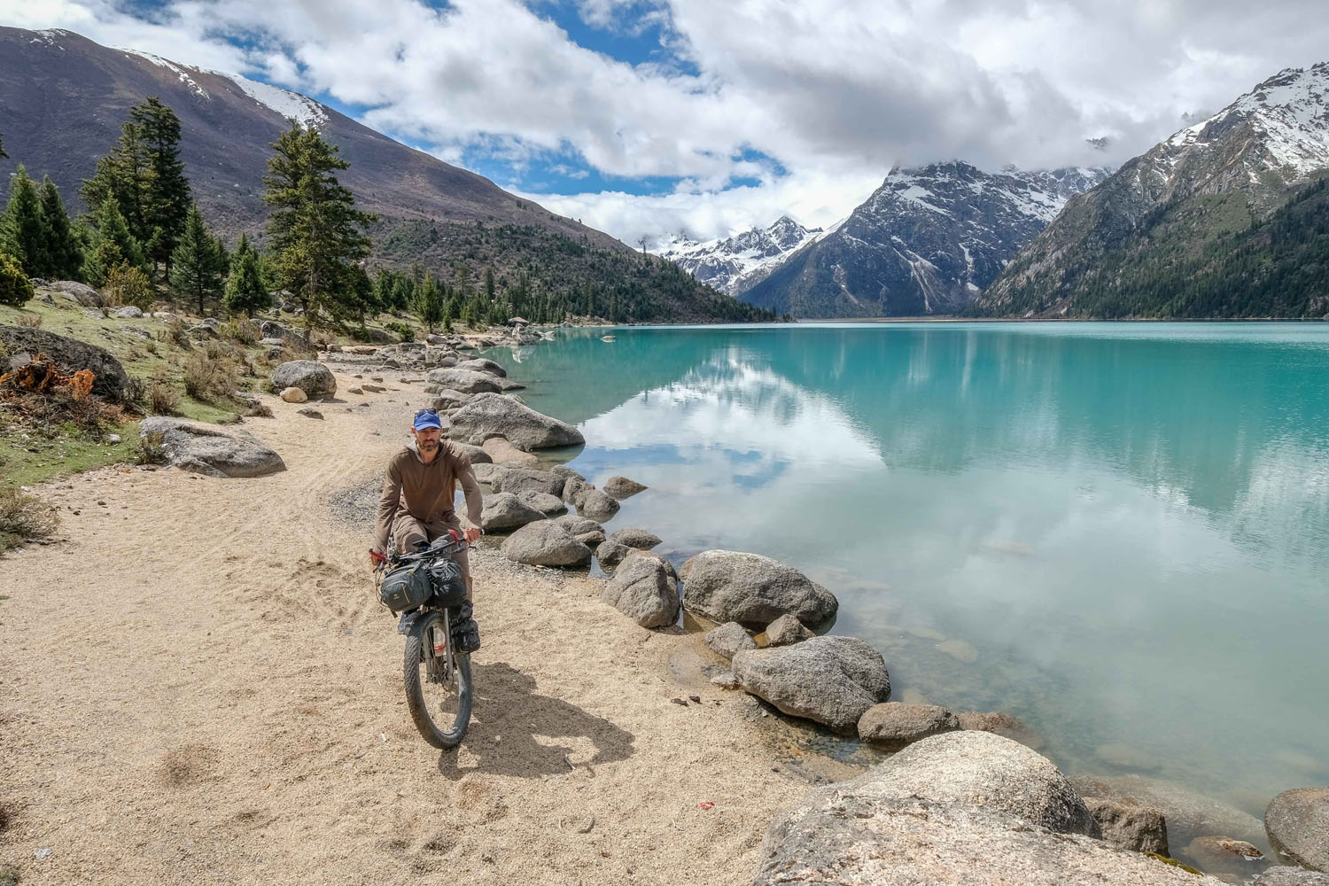
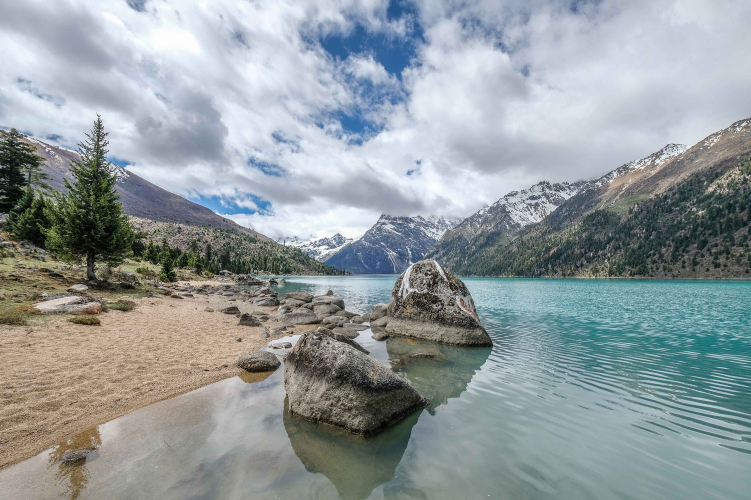
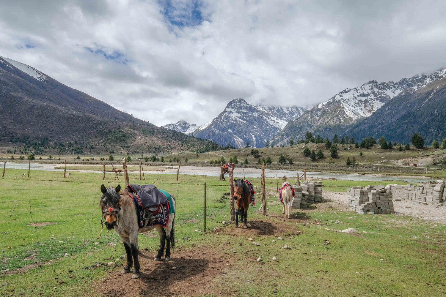
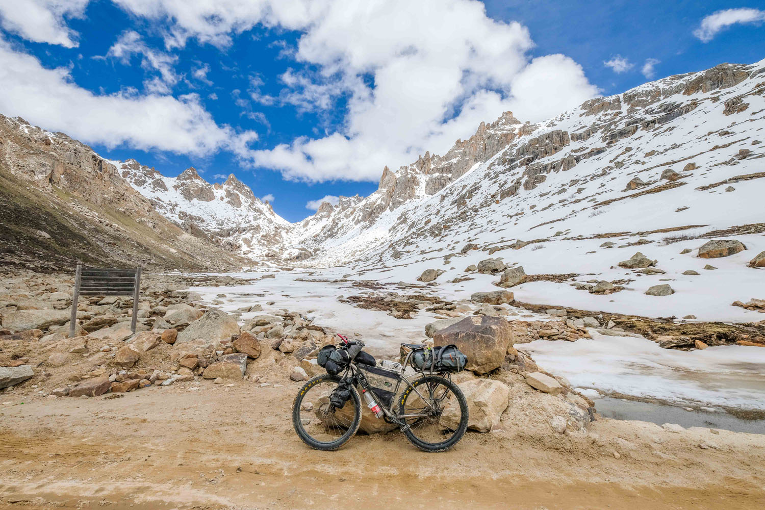
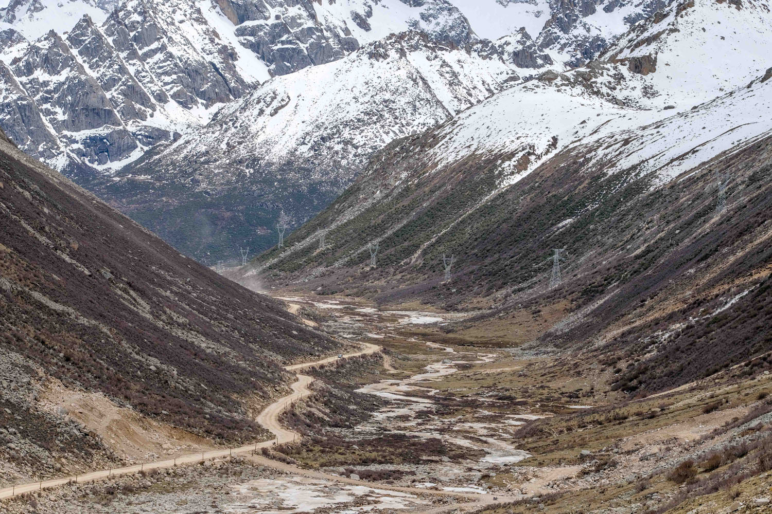
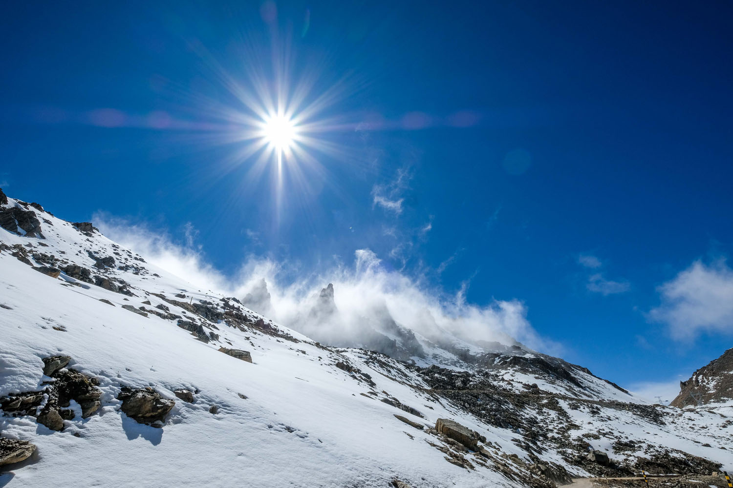
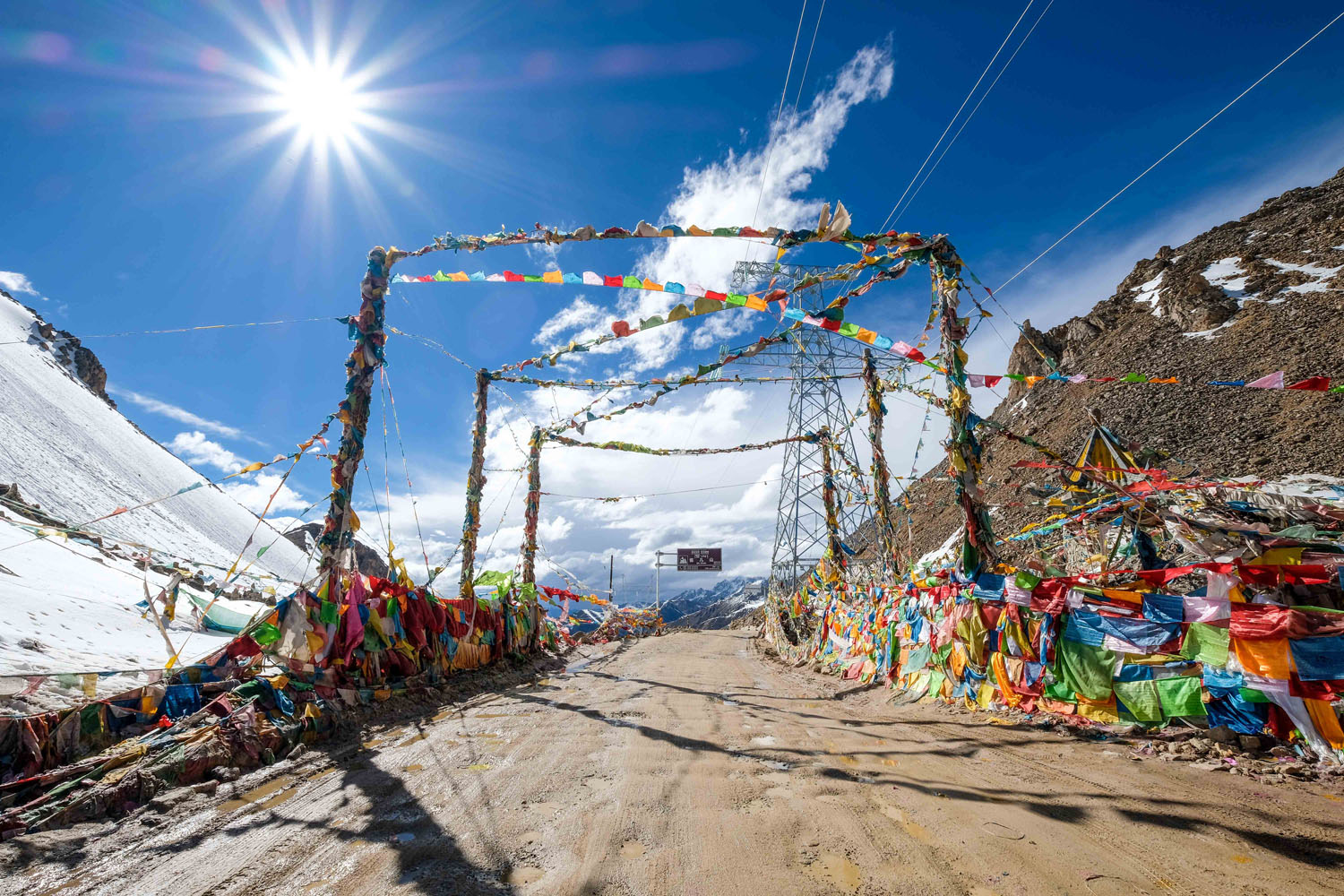
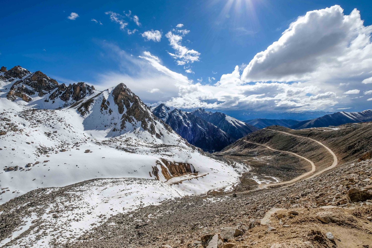
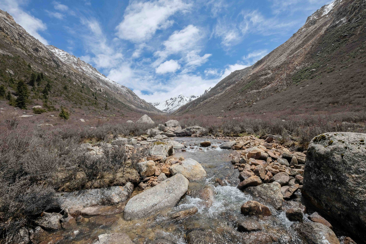
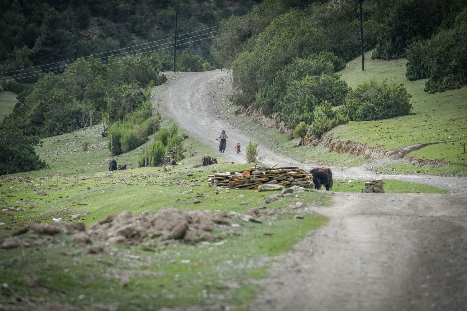
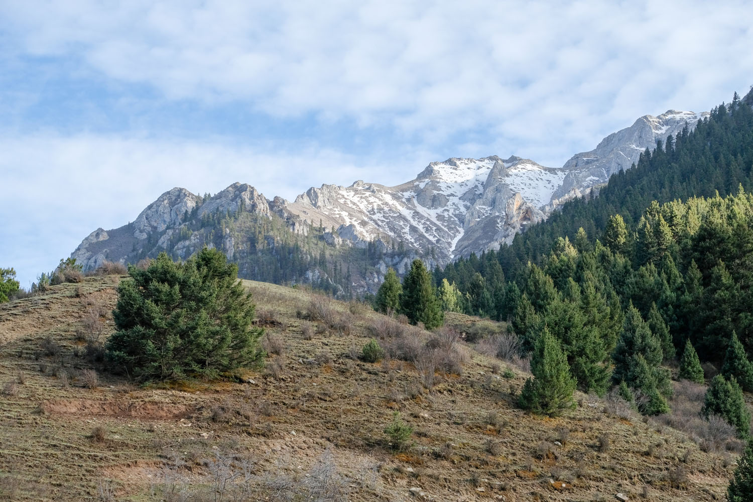
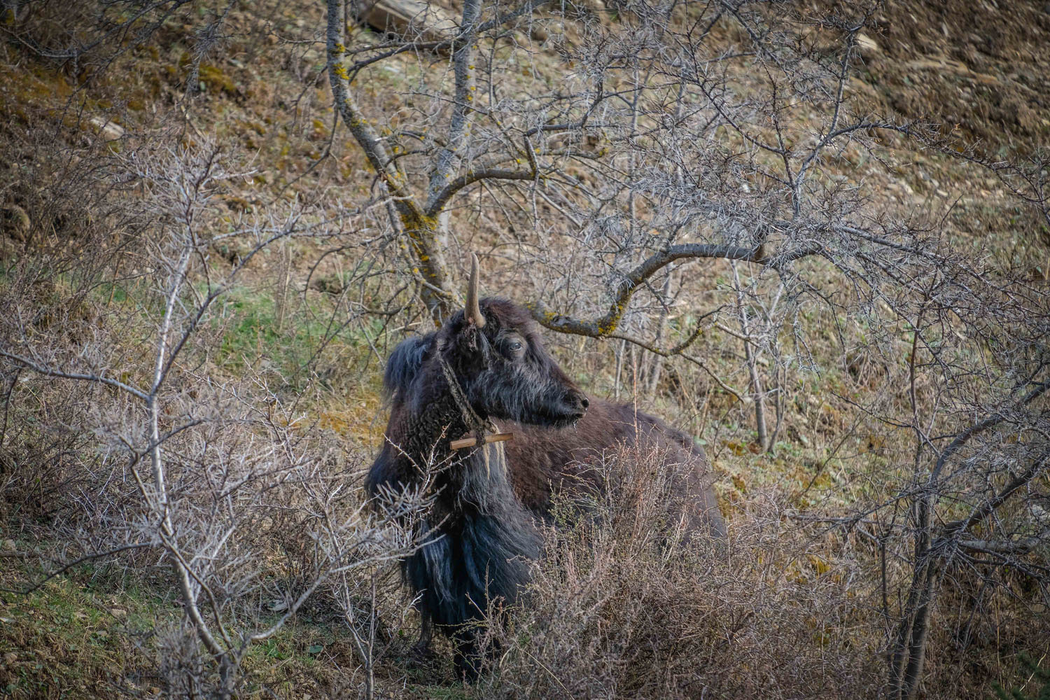
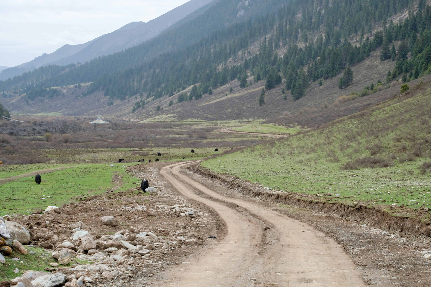
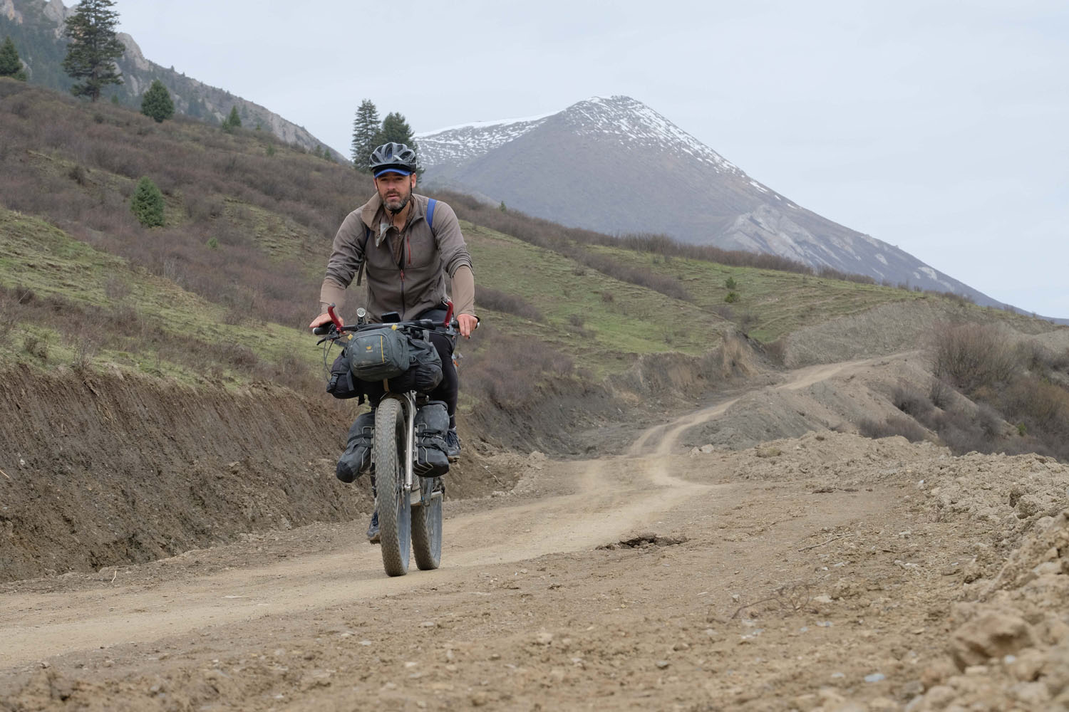
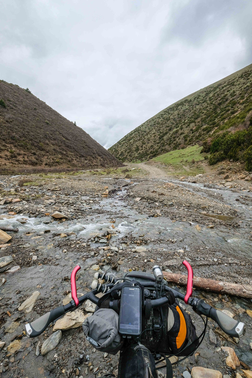
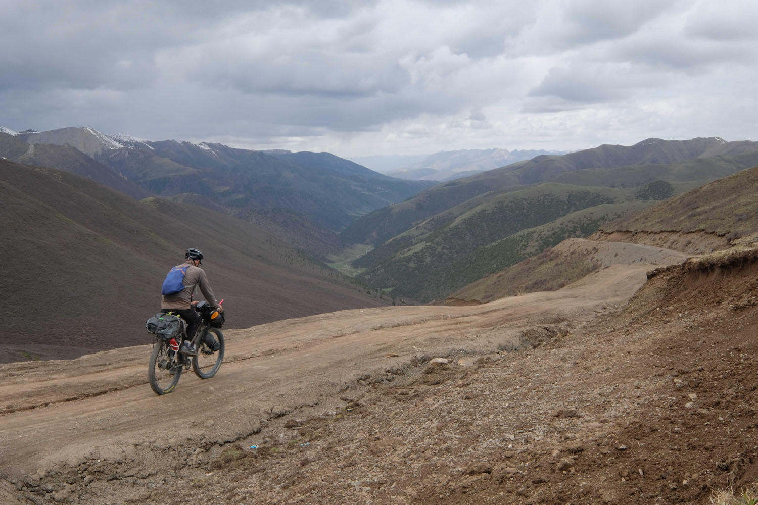
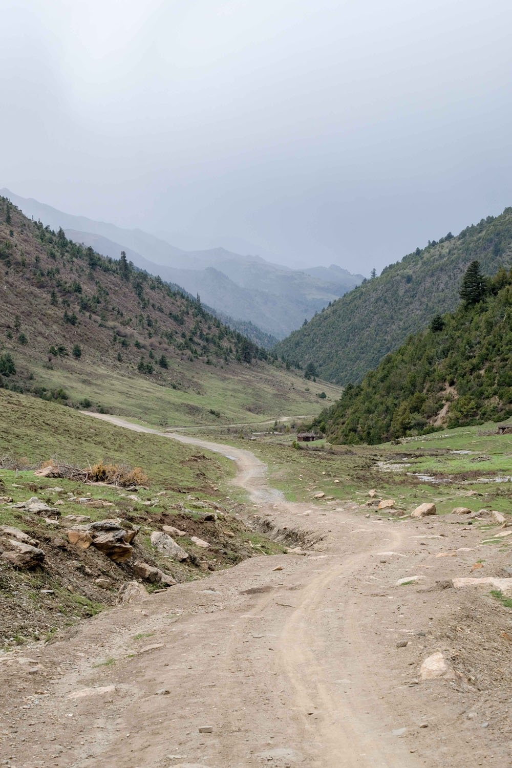
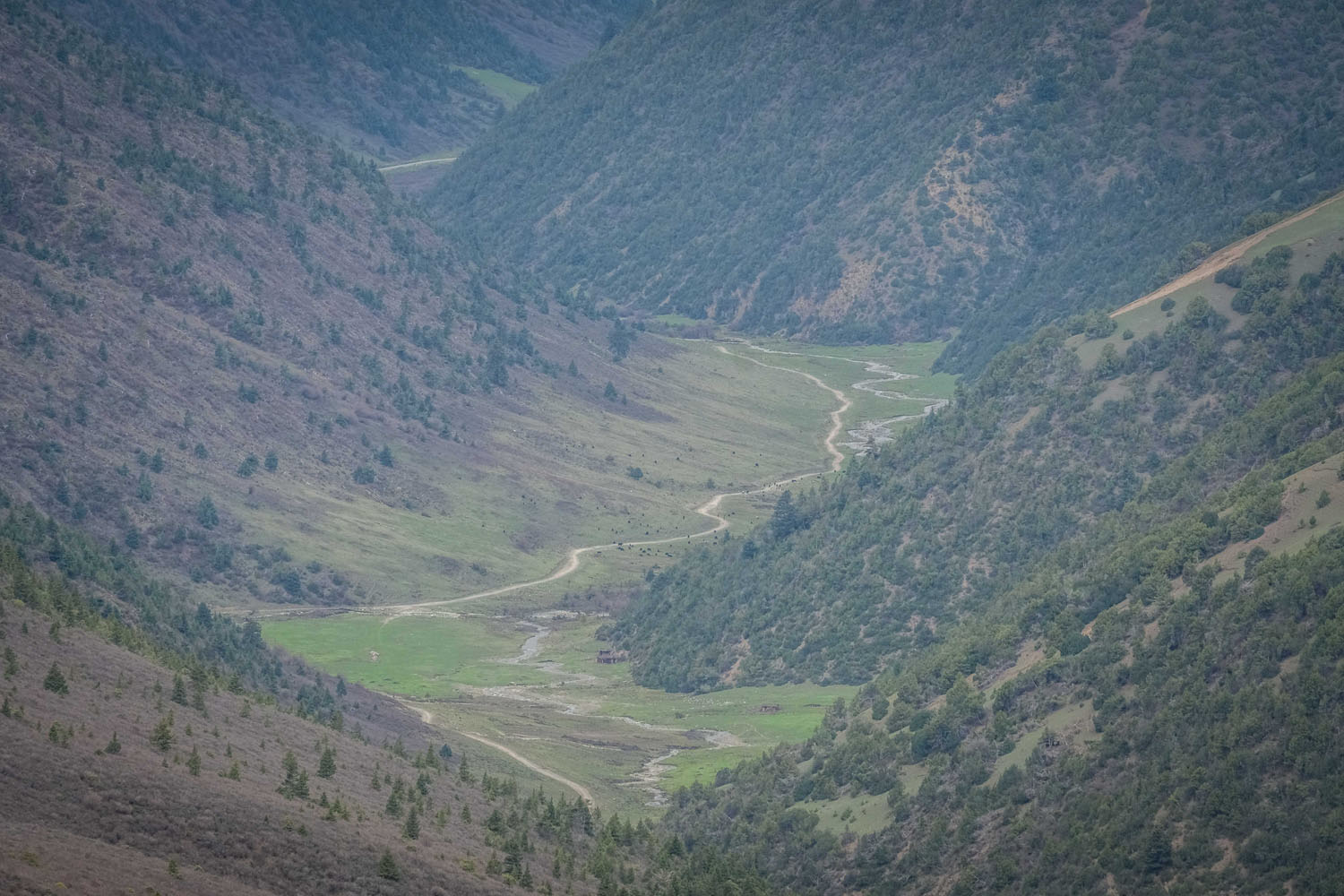
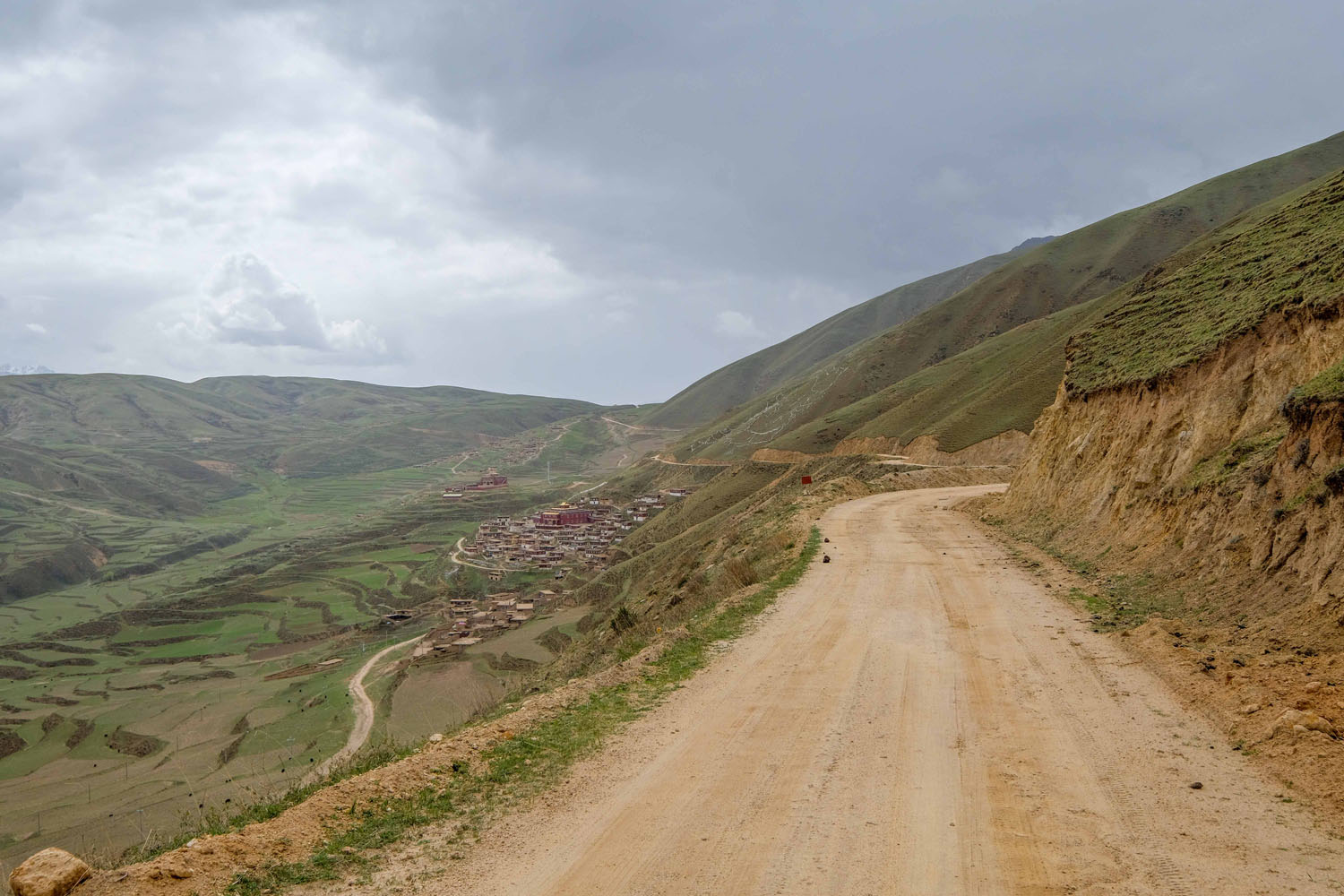
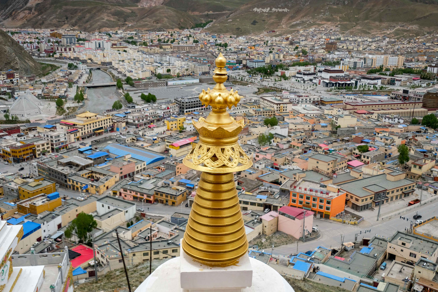
This route follows a series of dirt roads and tracks skirting along the eastern border of the TAR, taking 4-6 days and starting in the west Sichuan crossroads town of Manigango. It crosses the spectacular 4900m Cho La pass on dirt, descends to a river valley at 3500m, then turns north into the Si Chu Valley along unnamed backcountry track through high grassland dotted with grazing yaks and past tiny villages populated by herders. A spur northwest leads on through unpopulated country on increasingly rough and river-crossed track before climbing to a pass at 4500m, with a fast, rippy descent to a river valley on the other side, and a more gradual descent to County Road X038. This winding dirt road runs west along the hillside high above valley grassland below, passing villages and monasteries, with a wall of snowcapped mountains rising all along its length to the south. It then descends to the market town of Luoxu, following the Chiang Jiang river west on sometimes hairy dirt road cut into the cliffside above the river. Crossing the river on a single-lane suspension bridge, the route climbs north along the west bank of the river before turning west into a broad valley bounded to the north and south by high mountains. This eventually leads on to major highway G214, and about 30 paved kilometres north to the city of Yushu. The centre of Yushu Tibetan Autonomous Prefecture, Yushu has transit connections onward by air and road to the rest of China.
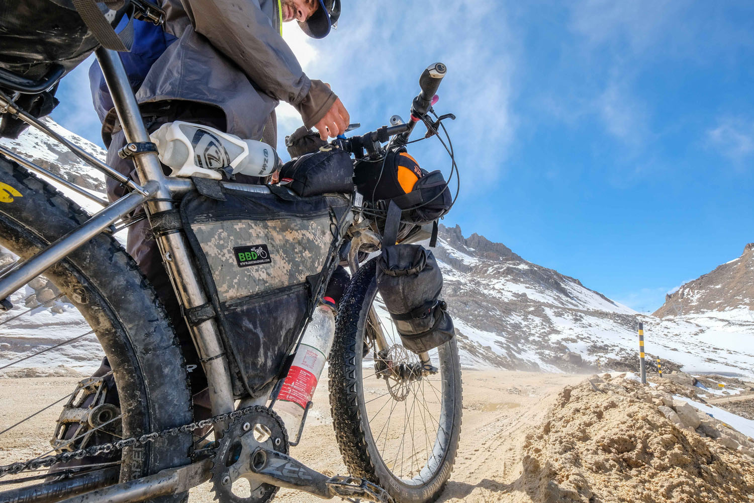
This route is best suited to those with a bit of time in the region who would like to get off the pavement and explore rural Tibet away from the popular routes connecting the big monastery towns. It can, however, also be done by bikepackers on shorter schedules, with reasonable access to the start of the route possible with a few extras days by catching transport onto the Tibetan Plateau from Chengdu. Total vertical ascent for the route is around 5500m. I did this route on a rigid 29+ platform, which was ideal. Much of the route would also be suitable on gravel bikes running high-volume tyres. An extended section of the backcountry track, however, is very rough and would pose a problem for skinnier tyres.


Submit Route Alert
As the leading creator and publisher of bikepacking routes, BIKEPACKING.com endeavors to maintain, improve, and advocate for our growing network of bikepacking routes all over the world. As such, our editorial team, route creators, and Route Stewards serve as mediators for route improvements and opportunities for connectivity, conservation, and community growth around these routes. To facilitate these efforts, we rely on our Bikepacking Collective and the greater bikepacking community to call attention to critical issues and opportunities that are discovered while riding these routes. If you have a vital issue or opportunity regarding this route that pertains to one of the subjects below, please let us know:
Highlights
Must Know
Camping
Food/H2O
Trail Notes
Resources
- Incredible mountain scenery across the whole route
- Rolling across the Cho La Pass at almost 4900m
- Rough backcountry riding through the Si Chu Valley
- Fun, fast descents from the high passes
- Some gorgeous wild-camping spots
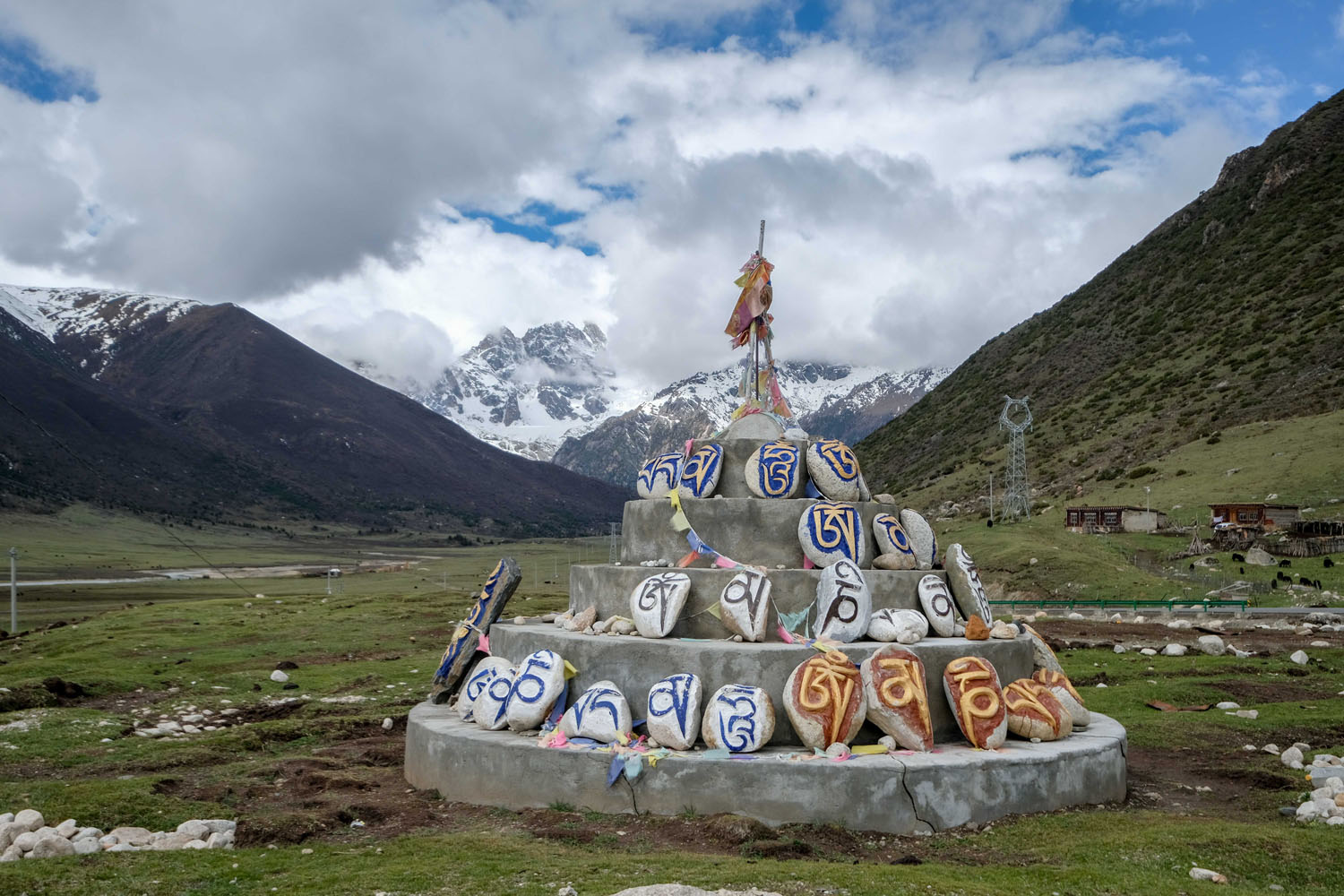
- Heaps of Buddhist temples, shrines, stupas, prayer flags and mani stones
- A genuine look at real Tibetan culture away from the cities
- When to go: Passes in the mountains will generally be open by May and start getting snowed in by October or so. The route will generally be greener the later in spring you go, and you run less risk of being caught in serious storms (though snow is possible on the passes at any time of year).
- At present, no travel restrictions under an ordinary Chinese tourist visa, though this being China, access to the Kham region (or anywhere in it) can be suddenly closed down at short notice. If applying for a Chinese tourist visa it’s generally best not to mention that you’re heading to a Tibetan area. The city of Chengdu in Sichuan Province is the closest major international airport to the route.
- Reaching the start of the route from Chengdu will require two days of long bus trips from Chengdu to Kangding and Kangding to Ganzi.
- At the end of the route in Yushu, there are flights to Chengdu, Xining, Lhasa and Xi’an.
- Dangers and Annoyances: The possibility of snowstorms in the mountains, heavy trucks on the Cho La pass, and aggressive dogs (I carried a few rocks in my top-tube bag to throw if they got too close).
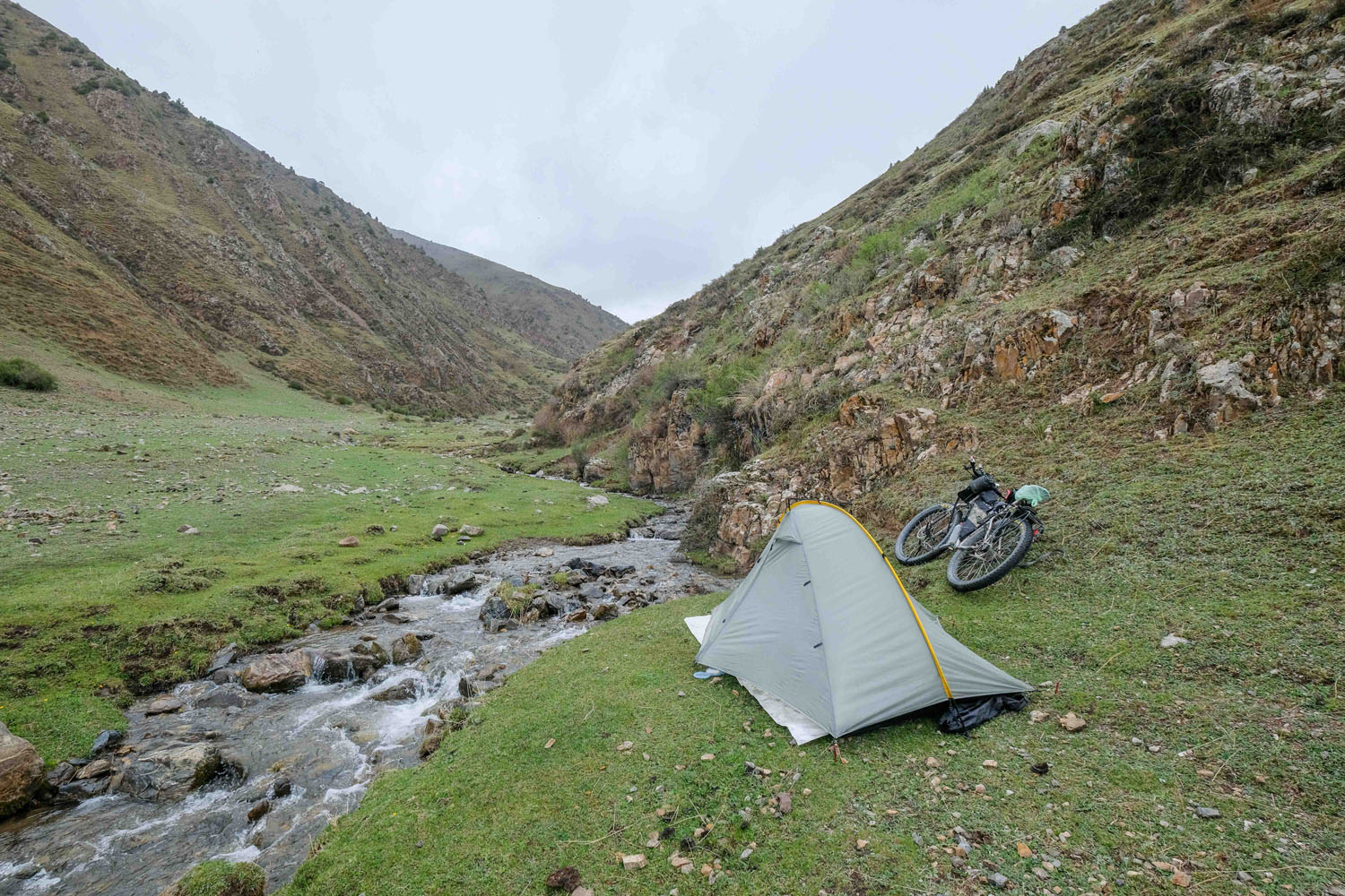
- The route is a wild-camping paradise – just pick a hidden spot off the road and set up a tent.
- The exceptions to this are the ascent and descent of Cho La pass, which features no reasonable places to camp, and the much of the section along the river road between Luoxu and Yushu, which is between a cliff face and a sheer drop.
- Given that this is Tibet, you may also ride up a hidden valley to camp only to find a family of herders living at the far end. In practice, this is seldom a problem, but if you’re setting up camp in someone’s pasture it’s polite to ask if it’s okay when you see them (generally when they’re rounding up animals just before sunset).
- Being the high mountains, fresh water is available at countless places along the route, so you shouldn’t need to carry more than a couple litres at a time. In some cases the streams and rivulets are pure snowmelt with no upstream habitation or grazing, but even in the worst case, much of the route follows rivers that can be safely drunk from with proper treatment (though I generally drank treated water from side streams).
- The towns of Manigango and Luoxu are the major supply points for food, having reasonably well-stocked stores. Smaller villages along the way often have a shop (look for advertising posters pasted to the side of a building) where you can buy basics like instant noodles and biscuits.
- There are a number of excellent Buddhist temples and monasteries near the main route that are worth a detour or side trip. These include famous monasteries in Dege and Ganzi.
- A tunnel is currently under construction that goes beneath the Cho La Pass, and skips 1000+ metres of climbing. Chinese road tunnels are, however, terrifying.
- Language presents a significant difficulty. Google translate is often useless, as few of the people you encounter will be literate in Chinese, which is a second language here, and sometimes may not even be able to speak it.
Additional Resources


Terms of Use: As with each bikepacking route guide published on BIKEPACKING.com, should you choose to cycle this route, do so at your own risk. Prior to setting out check current local weather, conditions, and land/road closures. While riding, obey all public and private land use restrictions and rules, carry proper safety and navigational equipment, and of course, follow the #leavenotrace guidelines. The information found herein is simply a planning resource to be used as a point of inspiration in conjunction with your own due-diligence. In spite of the fact that this route, associated GPS track (GPX and maps), and all route guidelines were prepared under diligent research by the specified contributor and/or contributors, the accuracy of such and judgement of the author is not guaranteed. BIKEPACKING.com LLC, its partners, associates, and contributors are in no way liable for personal injury, damage to personal property, or any other such situation that might happen to individual riders cycling or following this route.
FILED IN (CATEGORIES & TAGS)
Asia
Please keep the conversation civil, constructive, and inclusive, or your comment will be removed.