


La Gira de Costa (Costa Rica)
Distance
406 Mi.
(653 KM)Days
12
% Unpaved
70%
% Singletrack
2%
% Rideable (time)
99%
Total Ascent
25,246'
(7,695 M)High Point
2,720'
(829 M)Difficulty (1-10)
5?
- 4Climbing Scale Fair62 FT/MI (12 M/KM)
- -Technical Difficulty
- -Physical Demand
- -Resupply & Logistics
Contributed By

Matt Kadey
Guest Contributor
Ontario adventure cyclist Matt Kadey has pedaled everywhere from Myanmar to Costa Rica to Sri Lanka. His real gig is writing nutrition, recipe, and travel pieces for publications such as Bicycling, Men’s Health, and Runner’s World. He is also the author of Rocket Fuel and is the creator of the BT700, a new bikepacking route and race in Ontario. Learn more at matthewkadey.com
Tucked in between Nicaragua and Panama, Costa Rica is a country famed for its richness in ecological biodiversity and political stability, but it’s also a land oozing with bikepacking potential. But Costa Rica’s sunny surf spots and rainforest canopy walks aren’t gringo secrets. With a reputation for peacefulness and an overabundance of natural wonders, it’s no wonder winter-dodging tourists come here in droves. But on two wheels it’s very much possible to tap into the country’s less trodden terrain and untouched corners. Rugged dirt roads beckon for fat tire exploration and a different version of ecotourism.
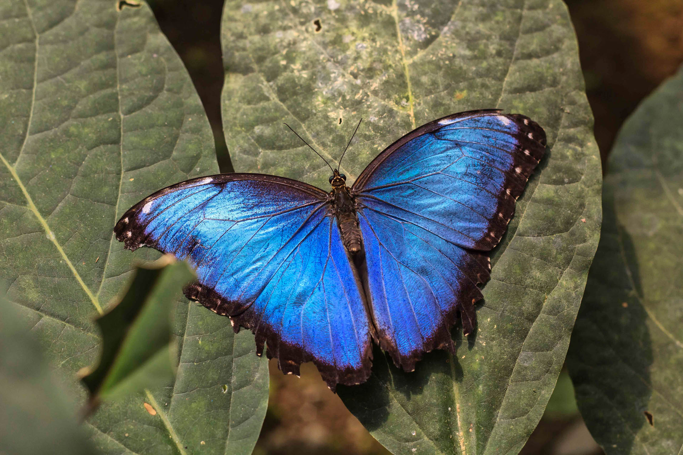
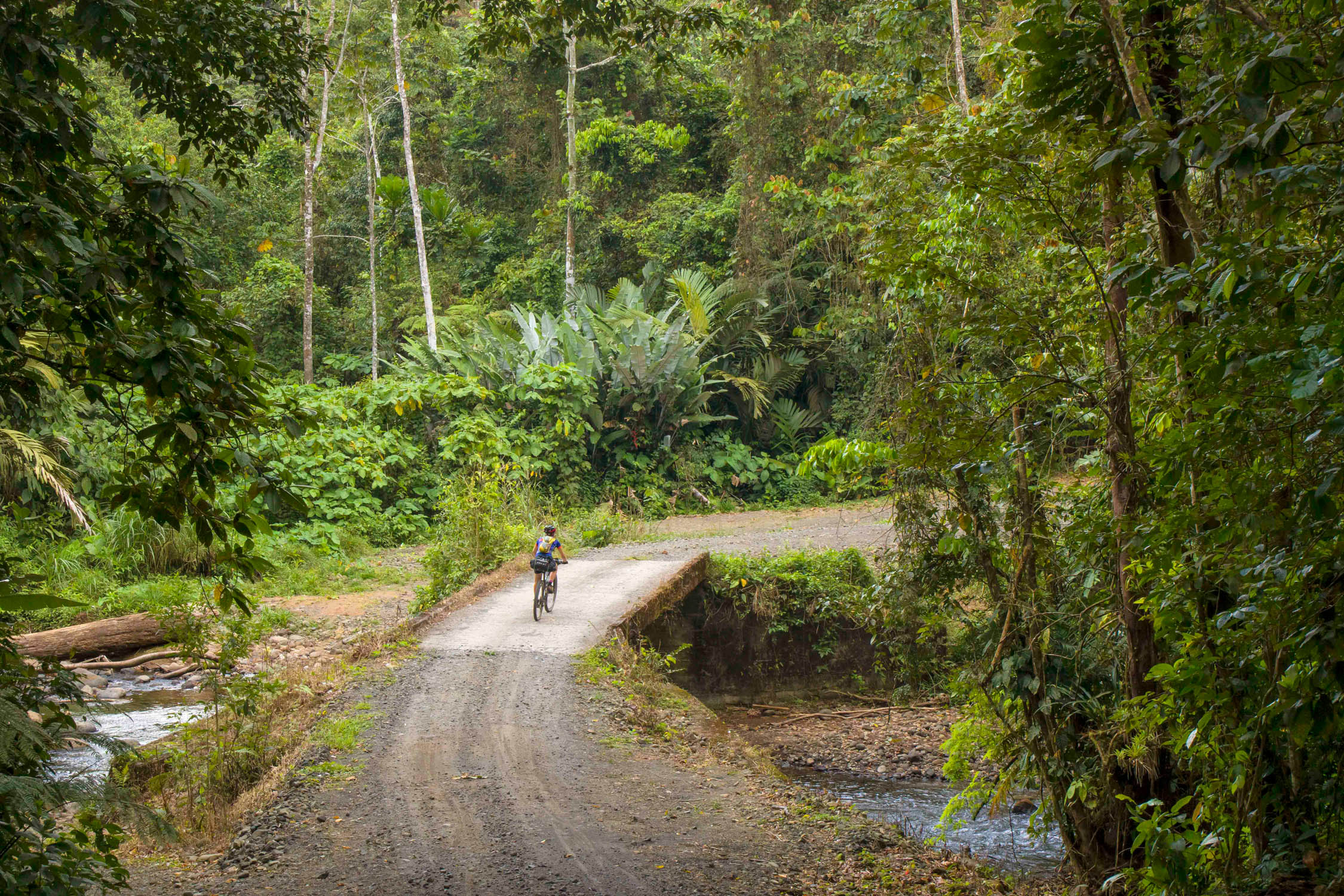
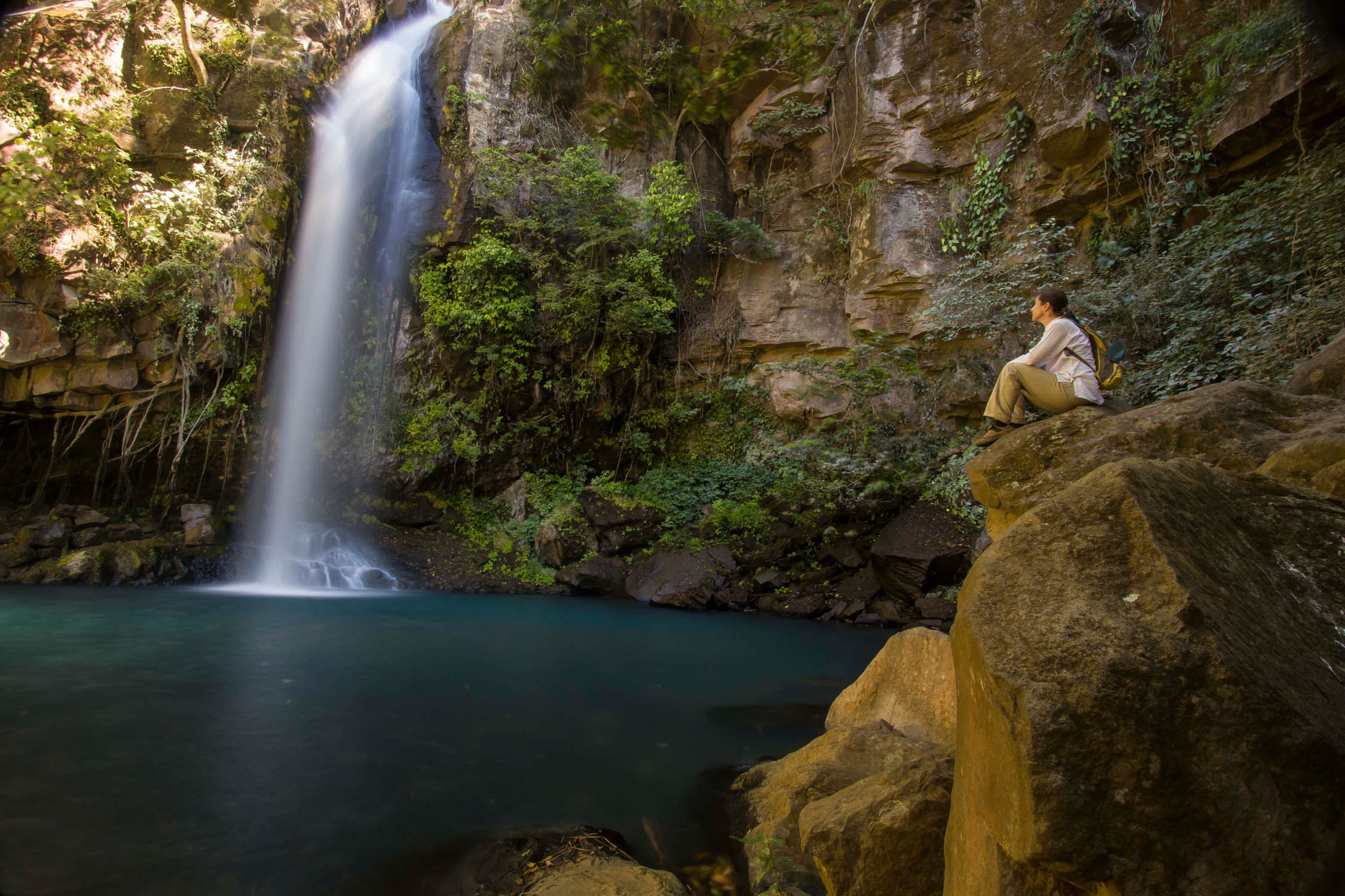
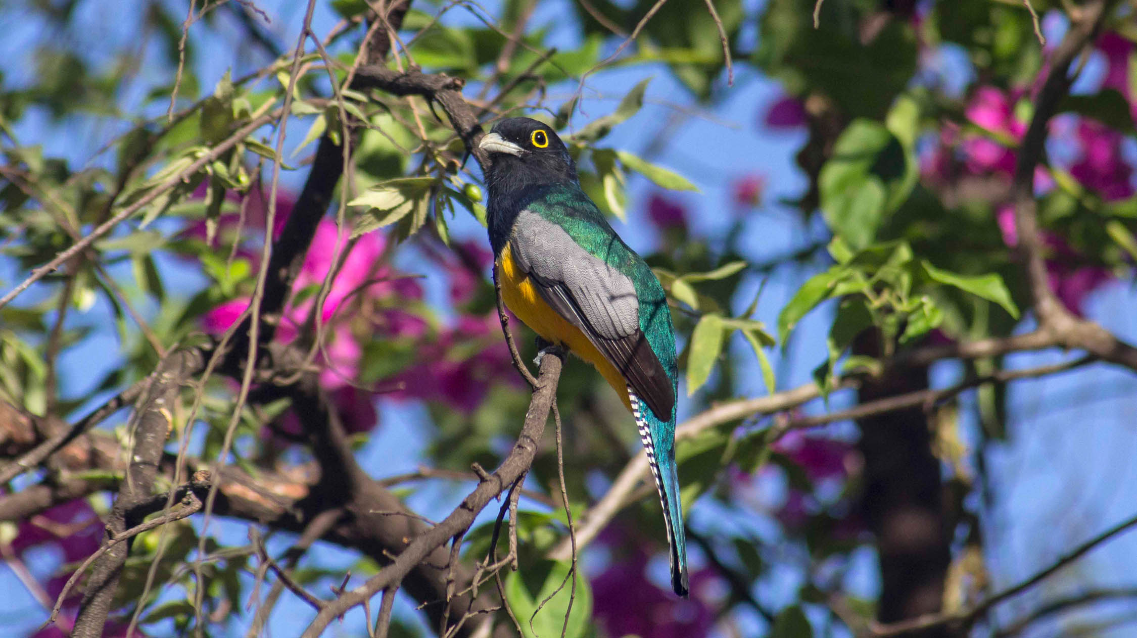
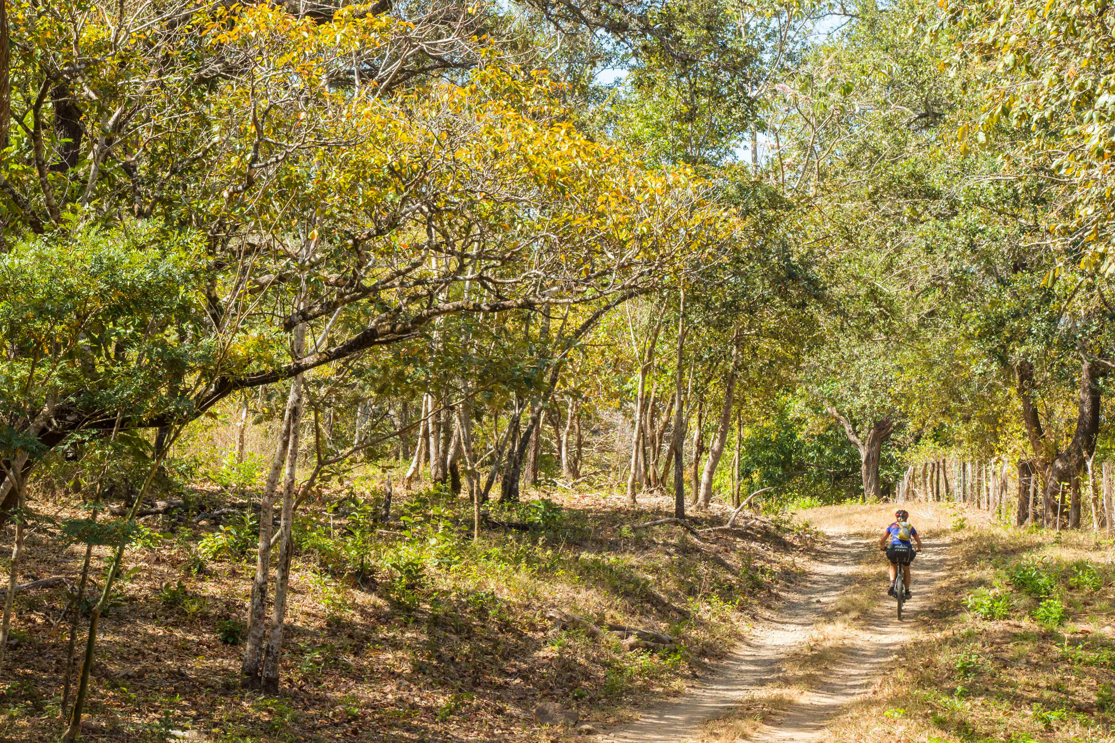
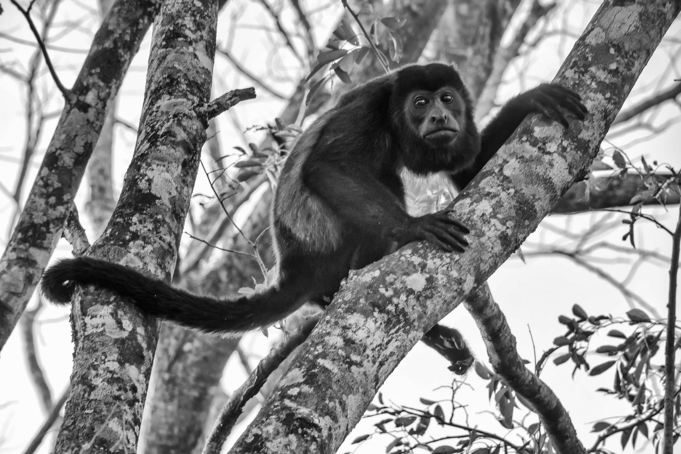
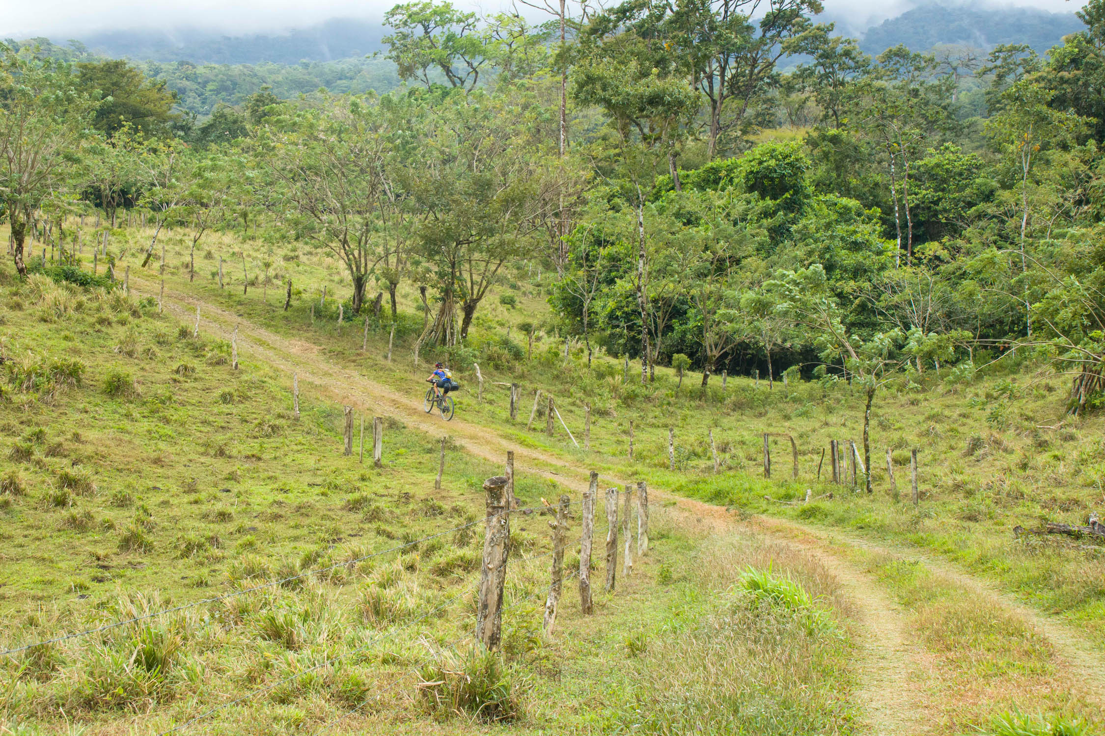
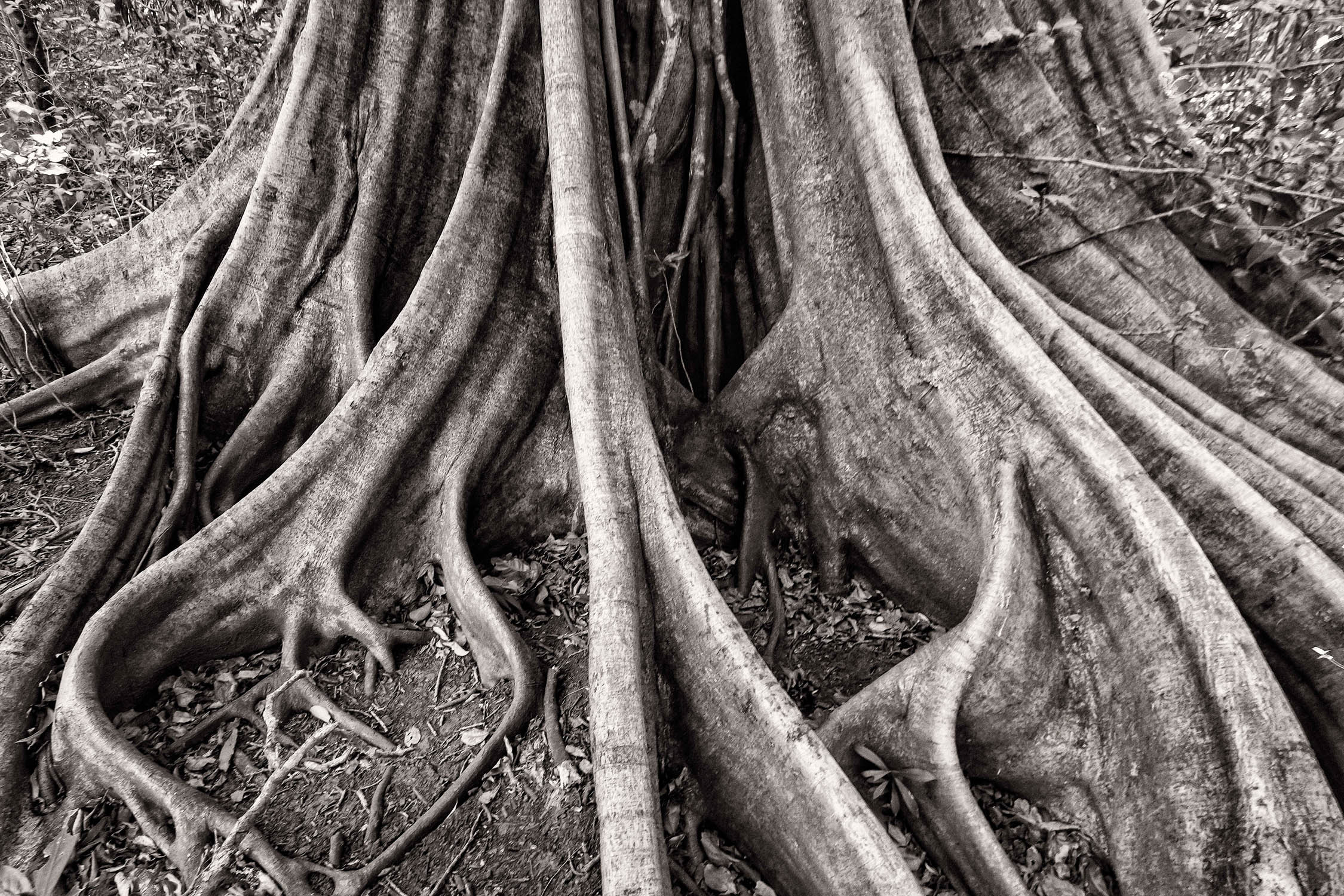
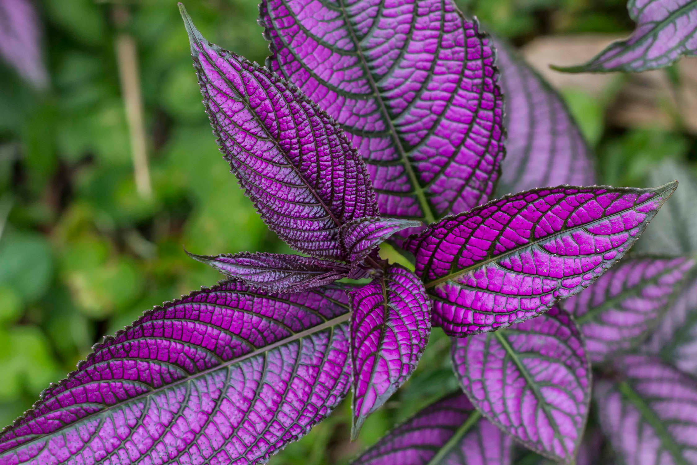
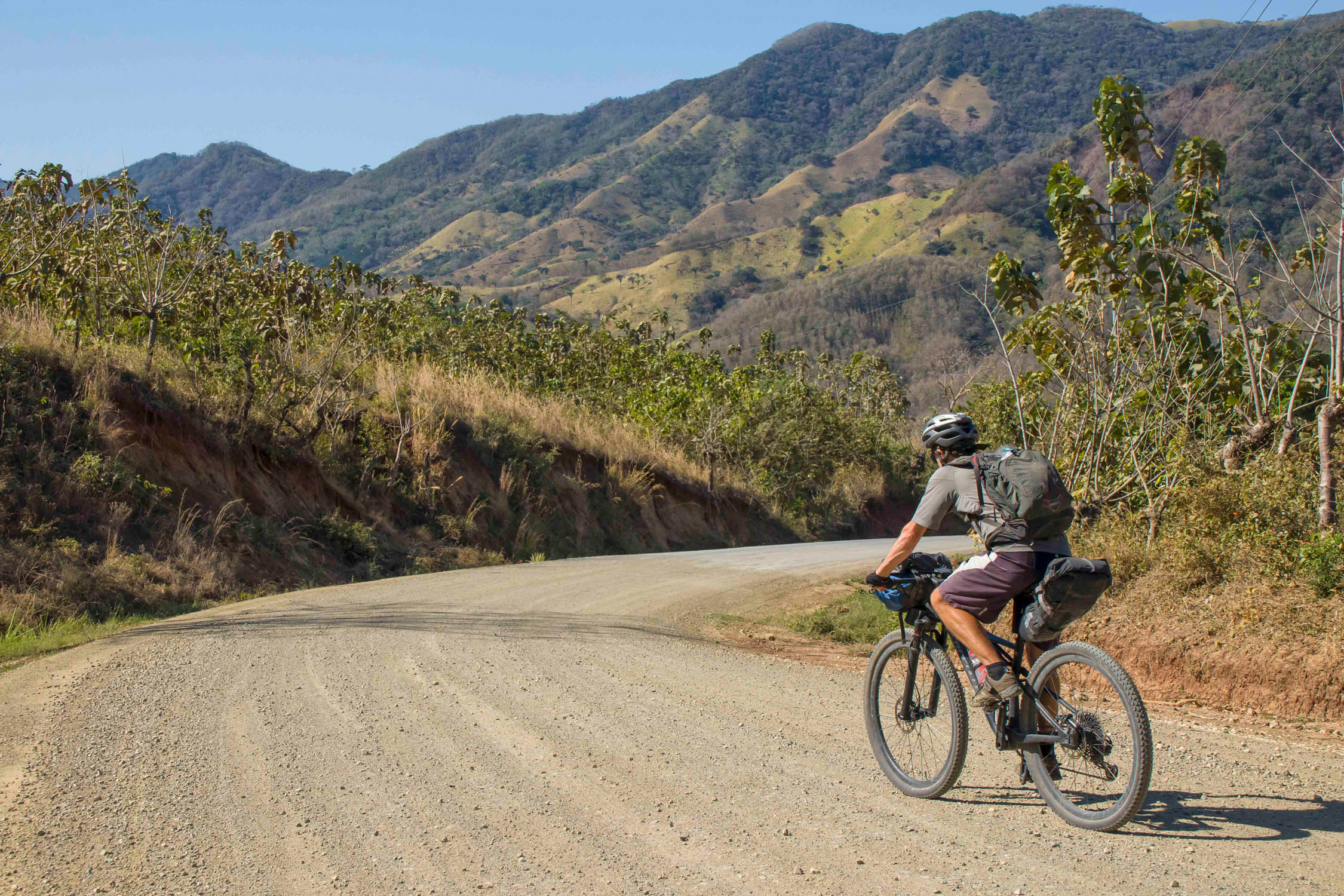
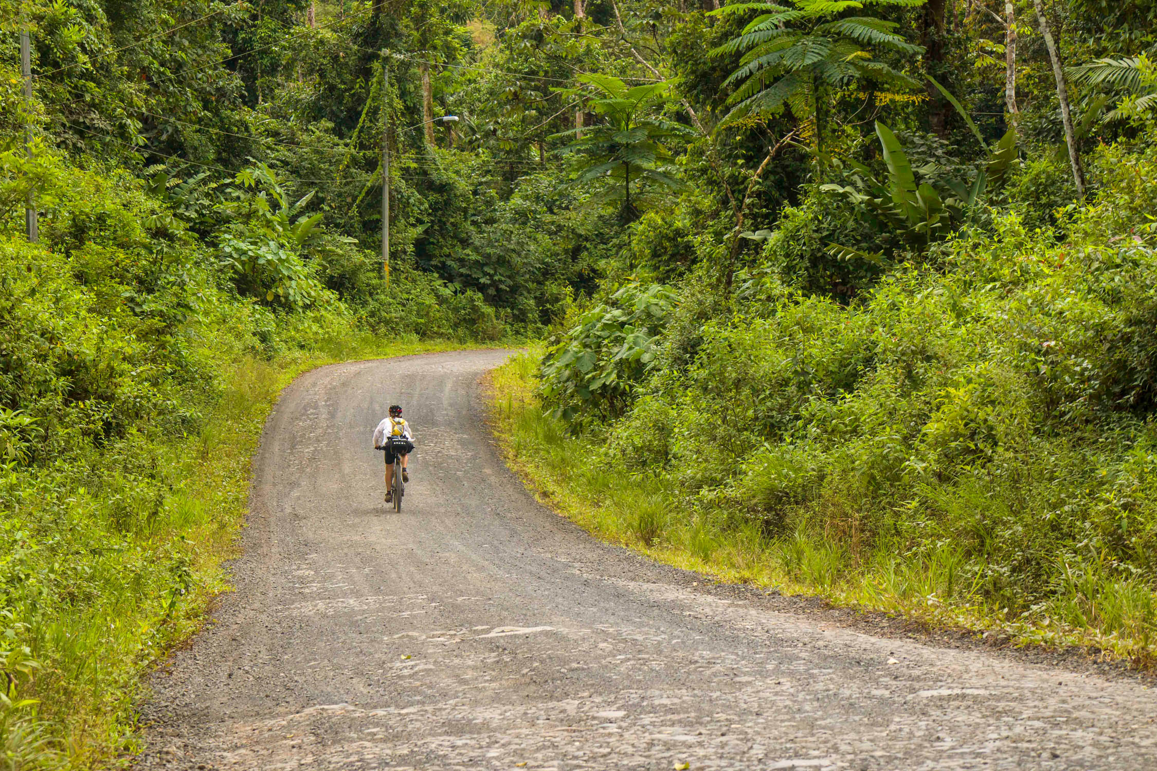
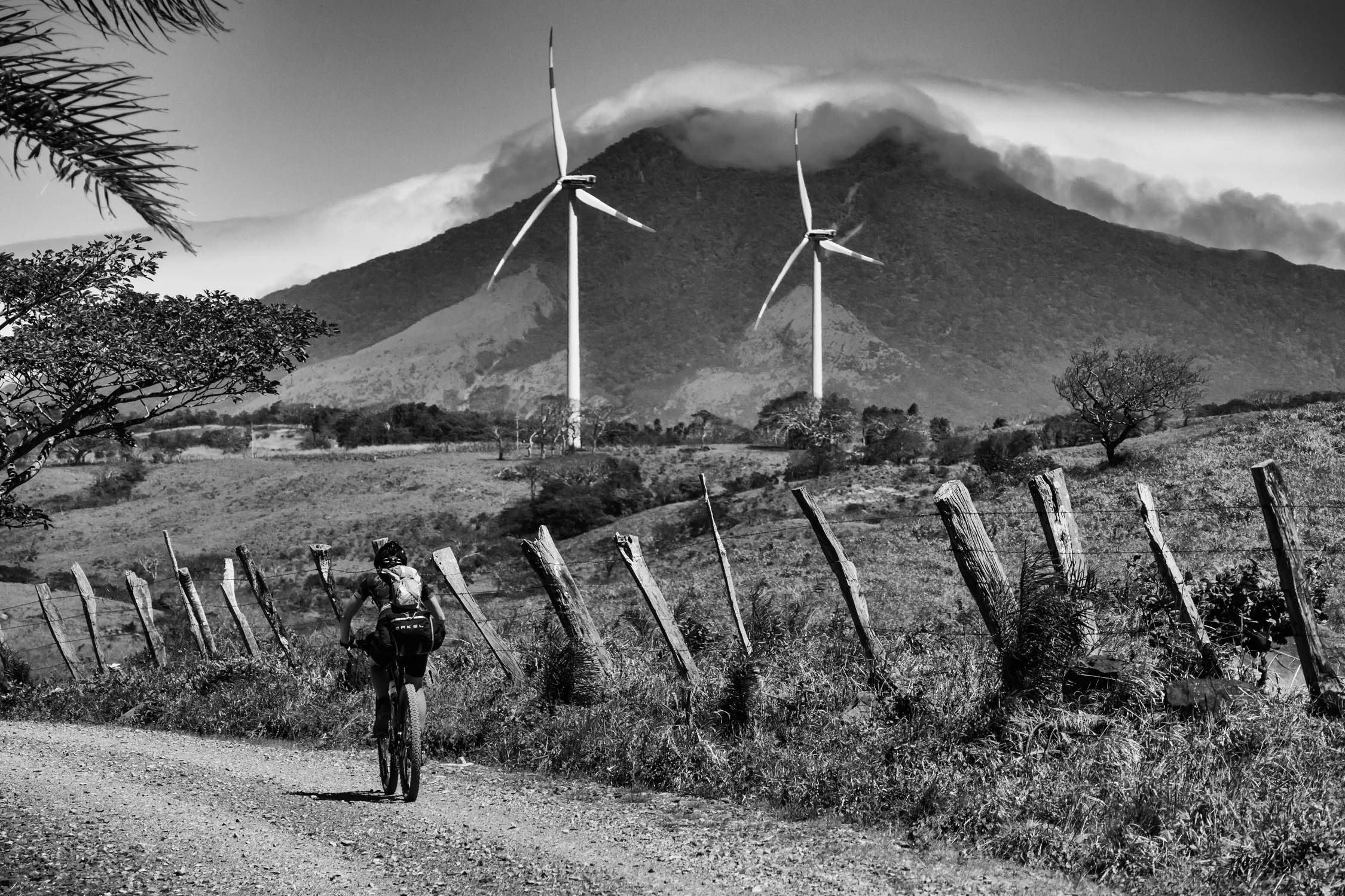
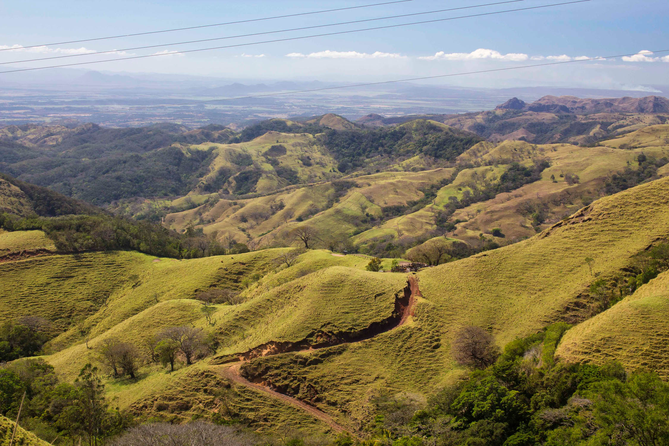
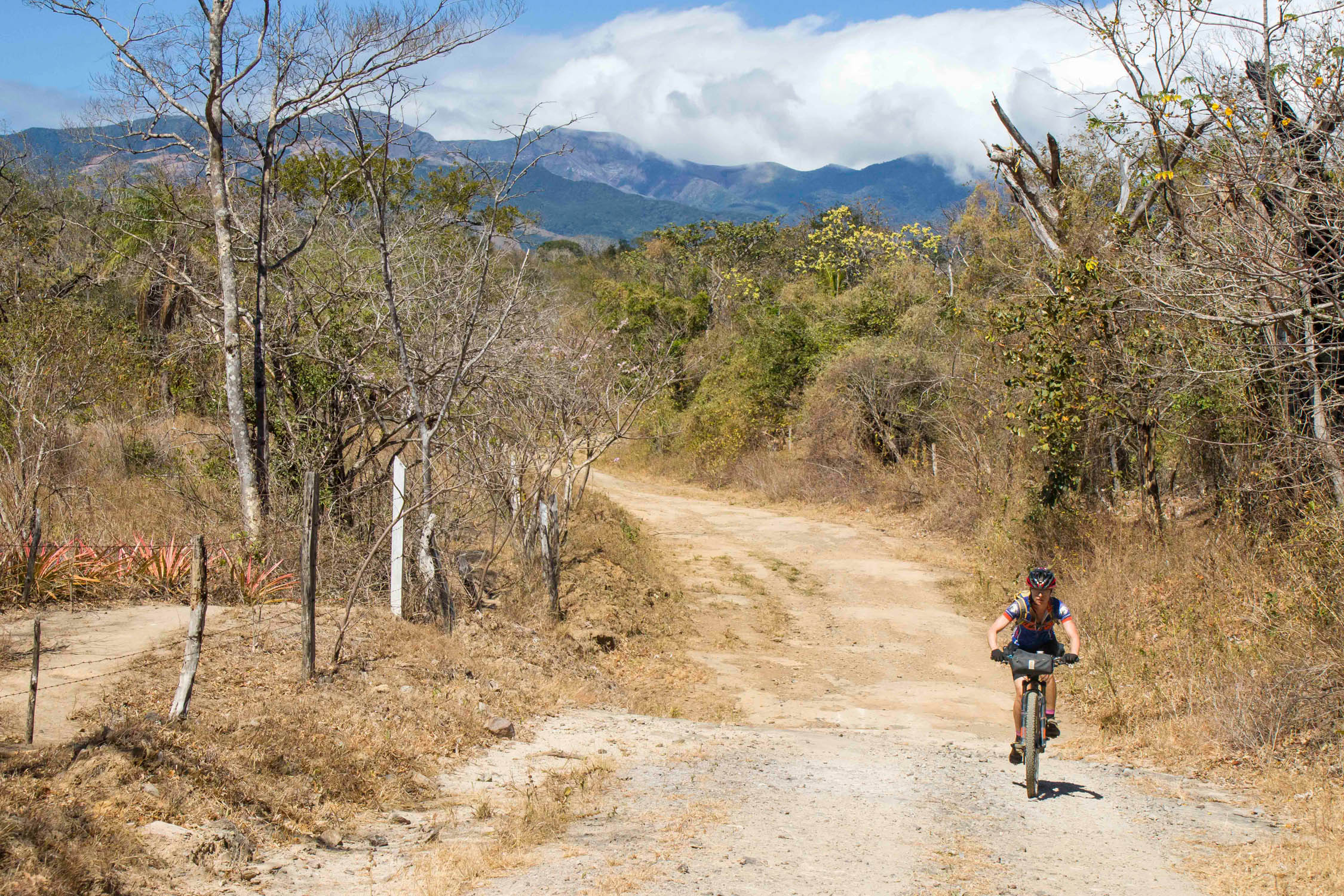
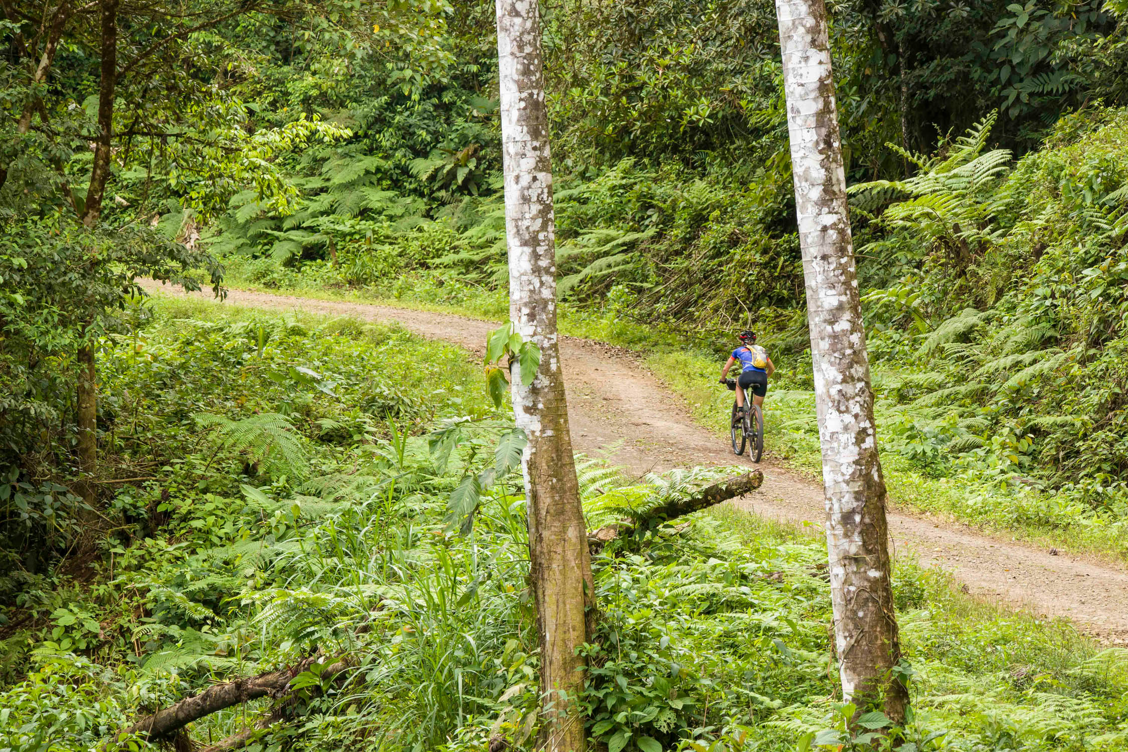
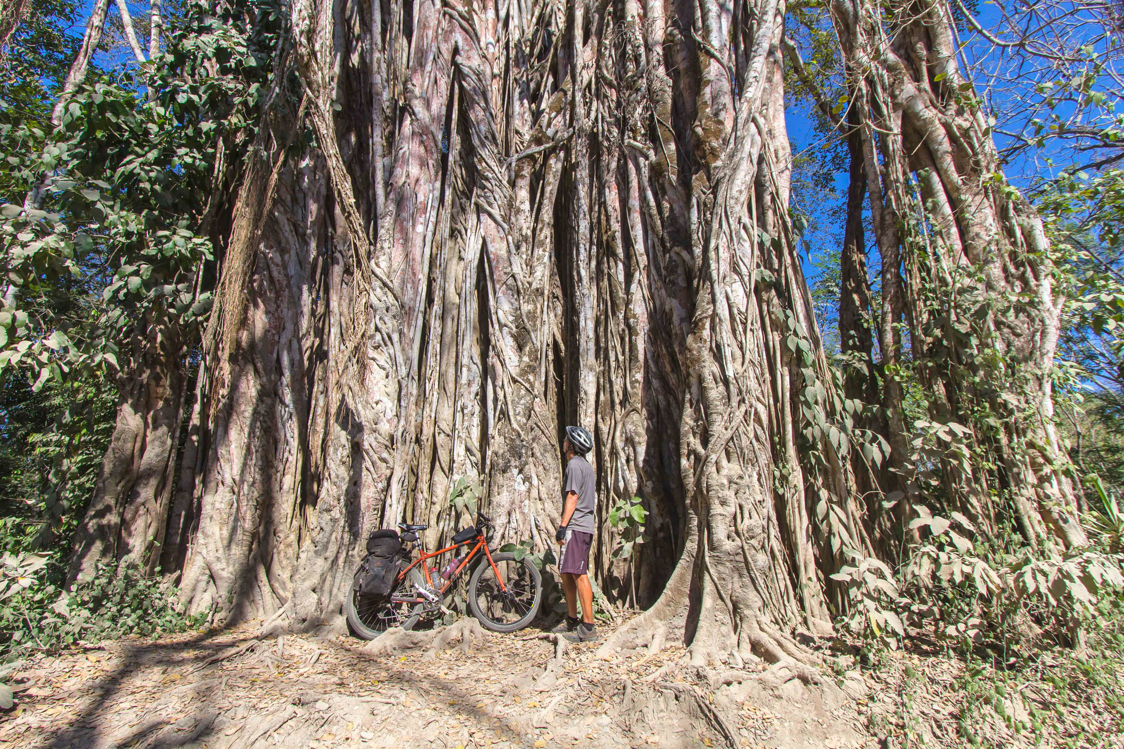
La Gira de Costa is an adventurous bikepacking route that kicks off in the working man’s town of Liberia before heading upwards into the Guanacaste cordillera, a lush biodiverse volcanic mountain range that forms part of the southern region of the Continental Divide. Here, riders will be presented with a panoply of riding surfaces, including sun-bleached volcanic rock, dirt roads, jungle-damp paths through a corridor of vivid green, and just a touch of pavement. Along the way there are plenty of opportunities to spy on the mighty Miravalles volcanic massif, a kaleidoscope of birdlife, clear rivers cruising down mountain flanks, fluttering butterflies (including the always impressive electric blue morpho), and a towering jungle canopy — all the while testing out your fitness on the collection of angry inclines. Hunker down in the friendly town of Curubande for a couple of days, and you can strike out on foot into heavily forested Rincón de la Vieja National Park or take a rip around the surrounding mountain bike trails.
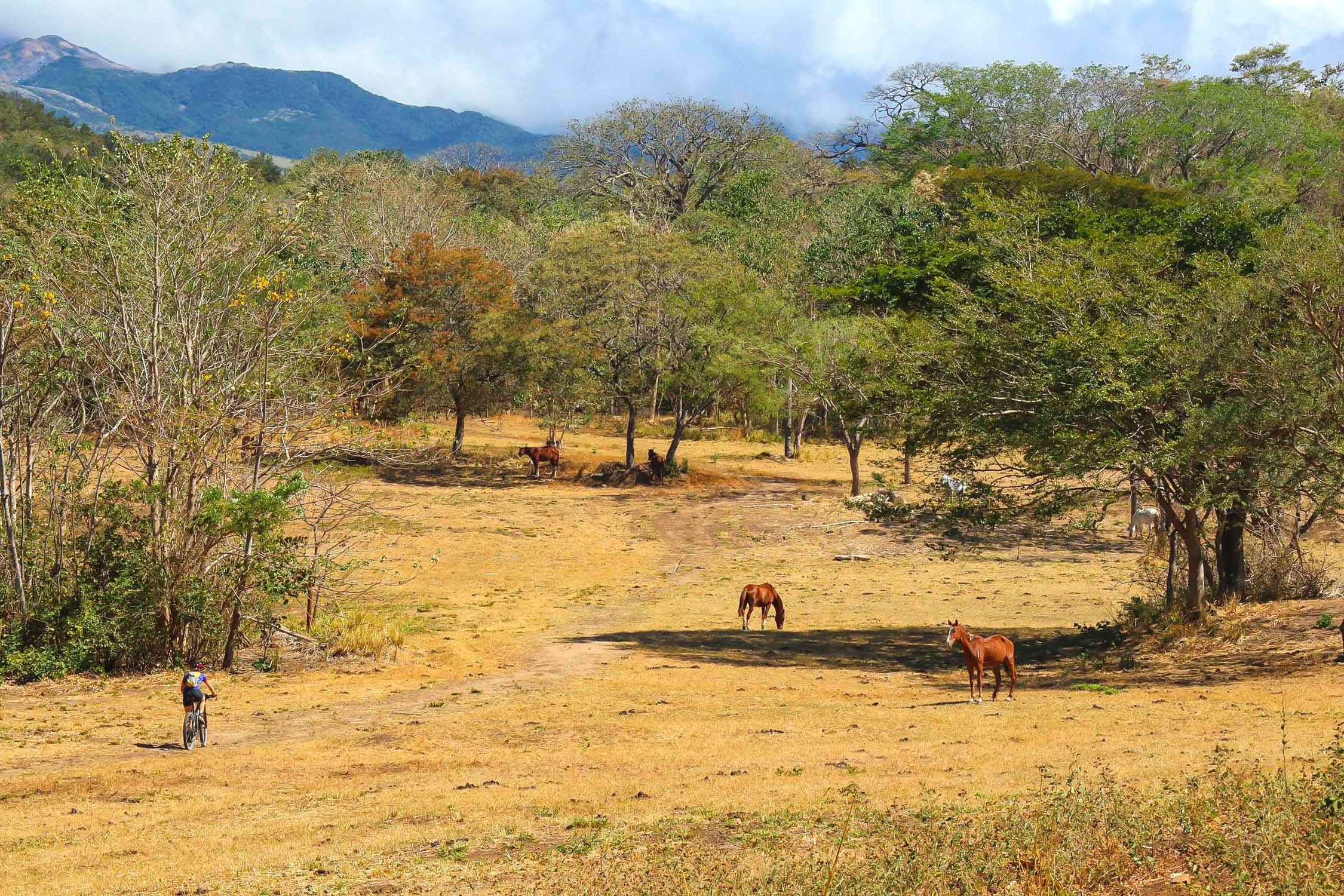
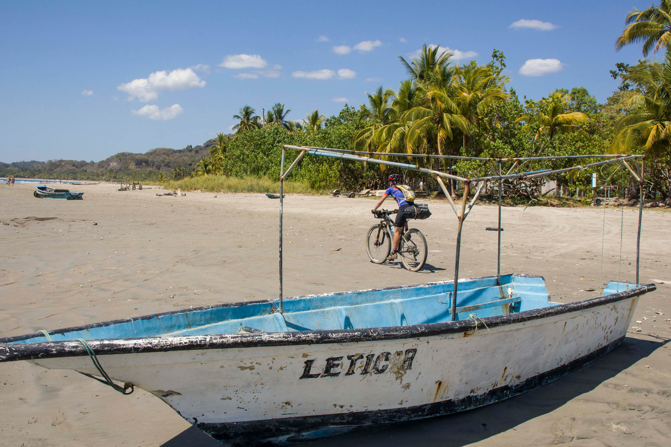
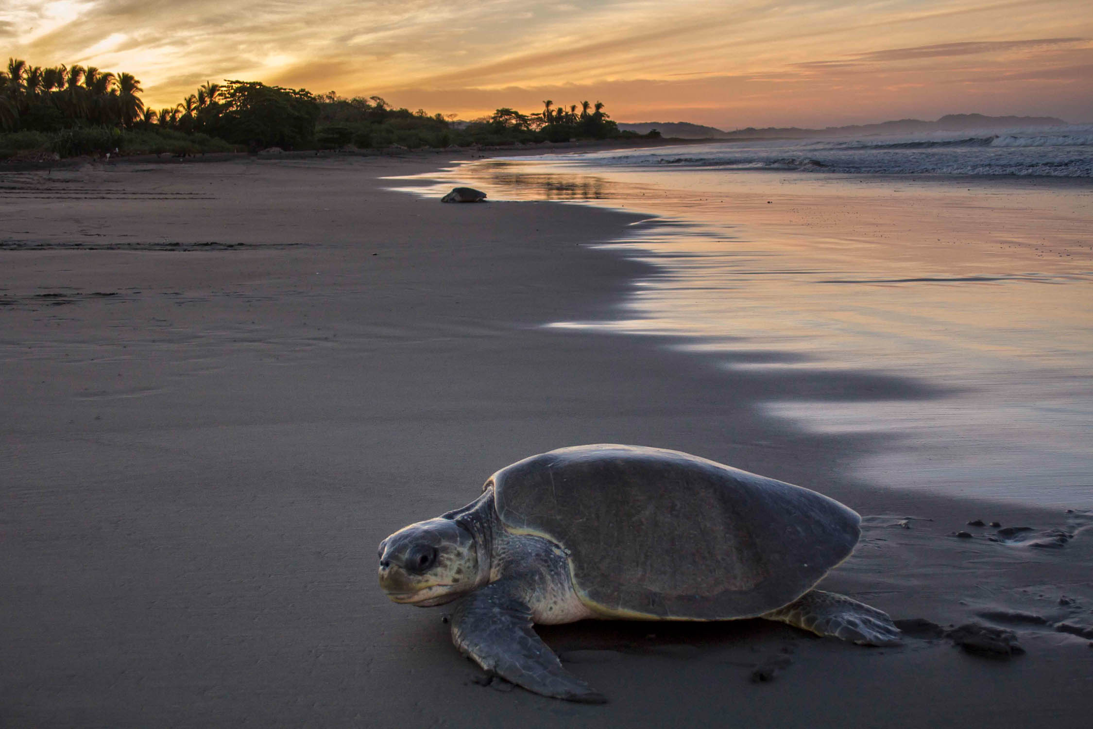
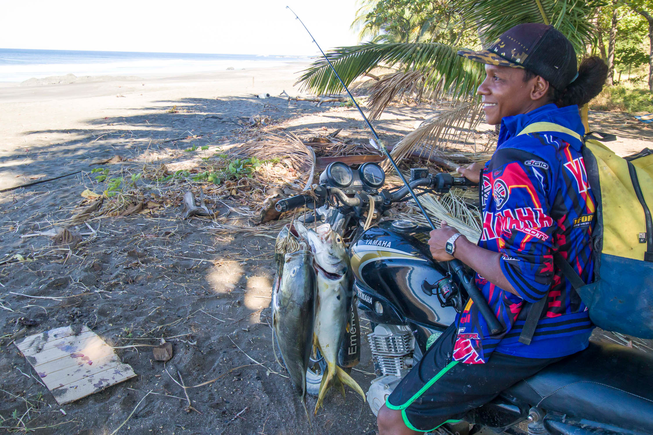
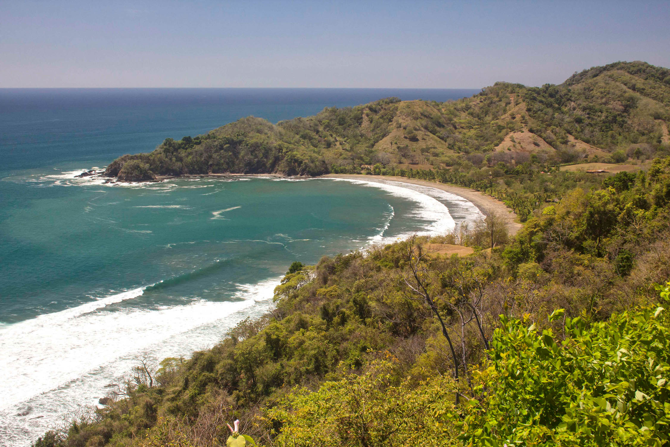
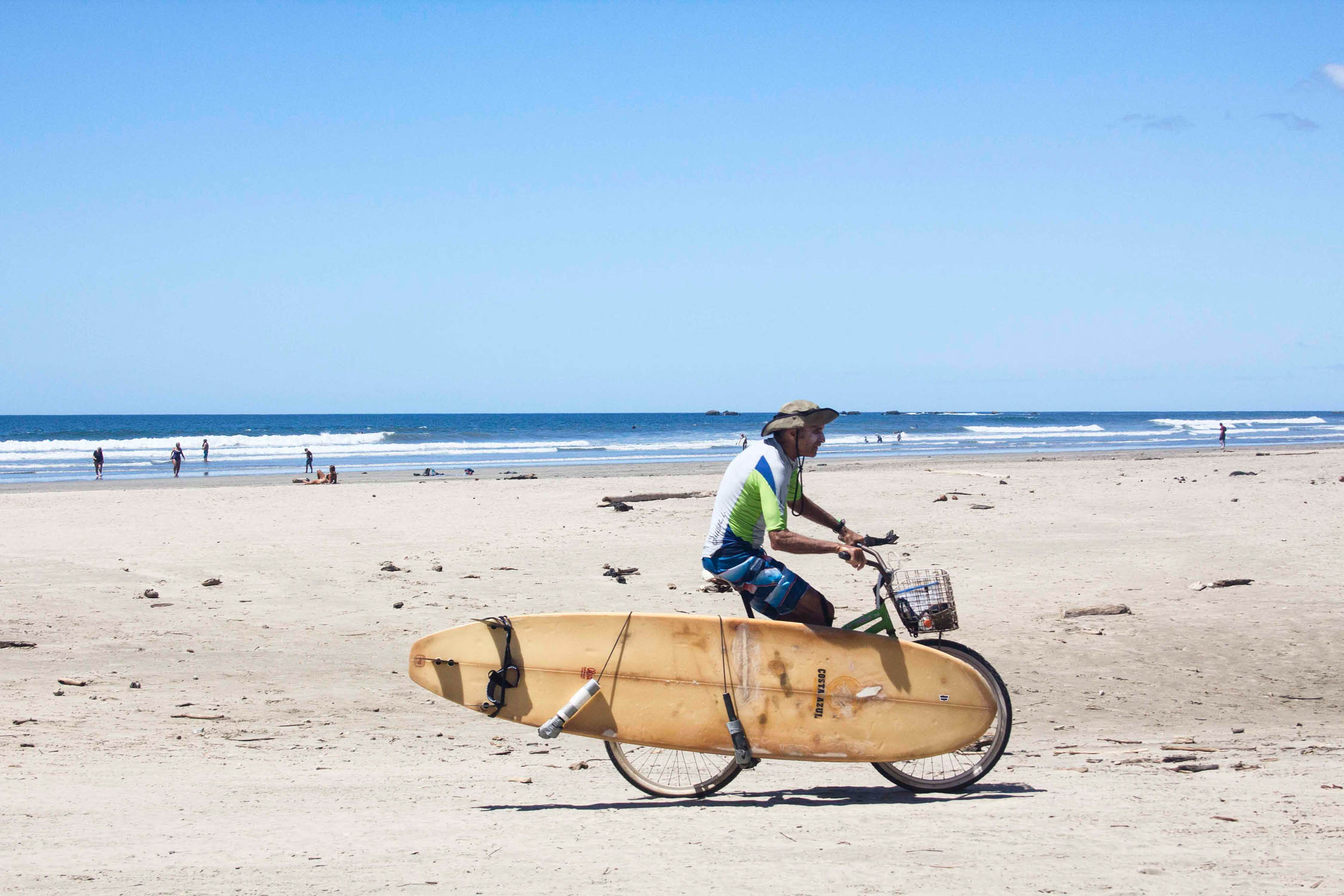
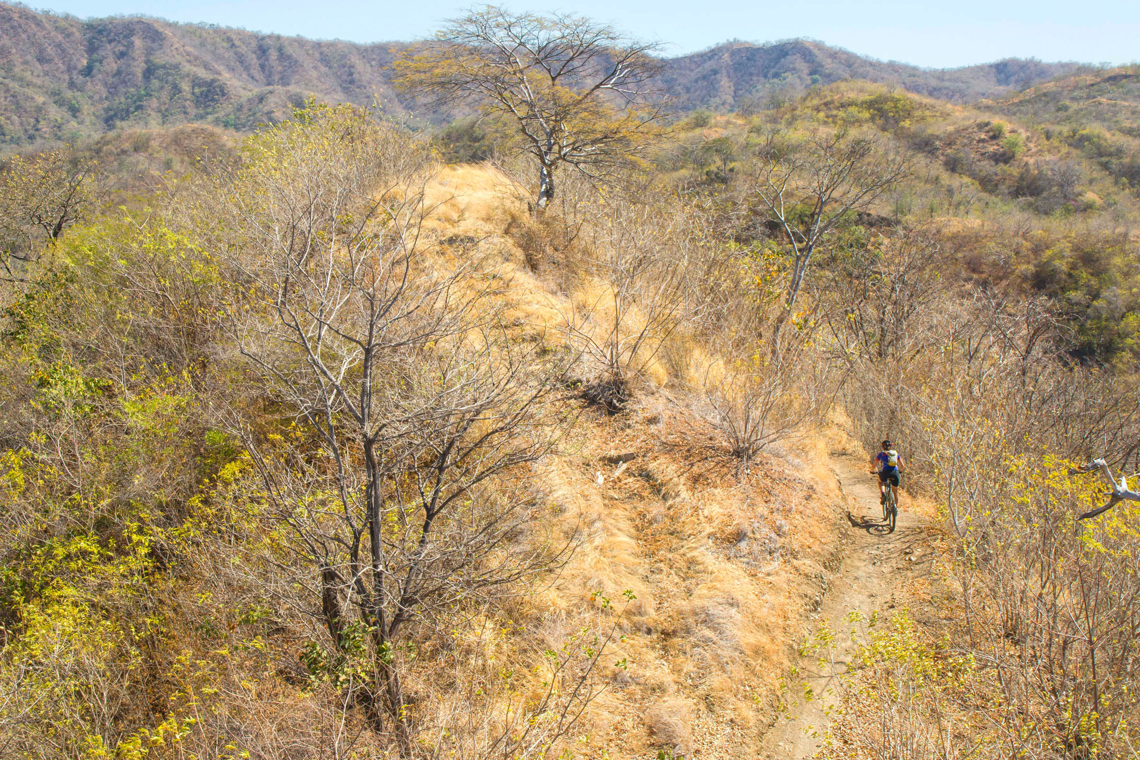
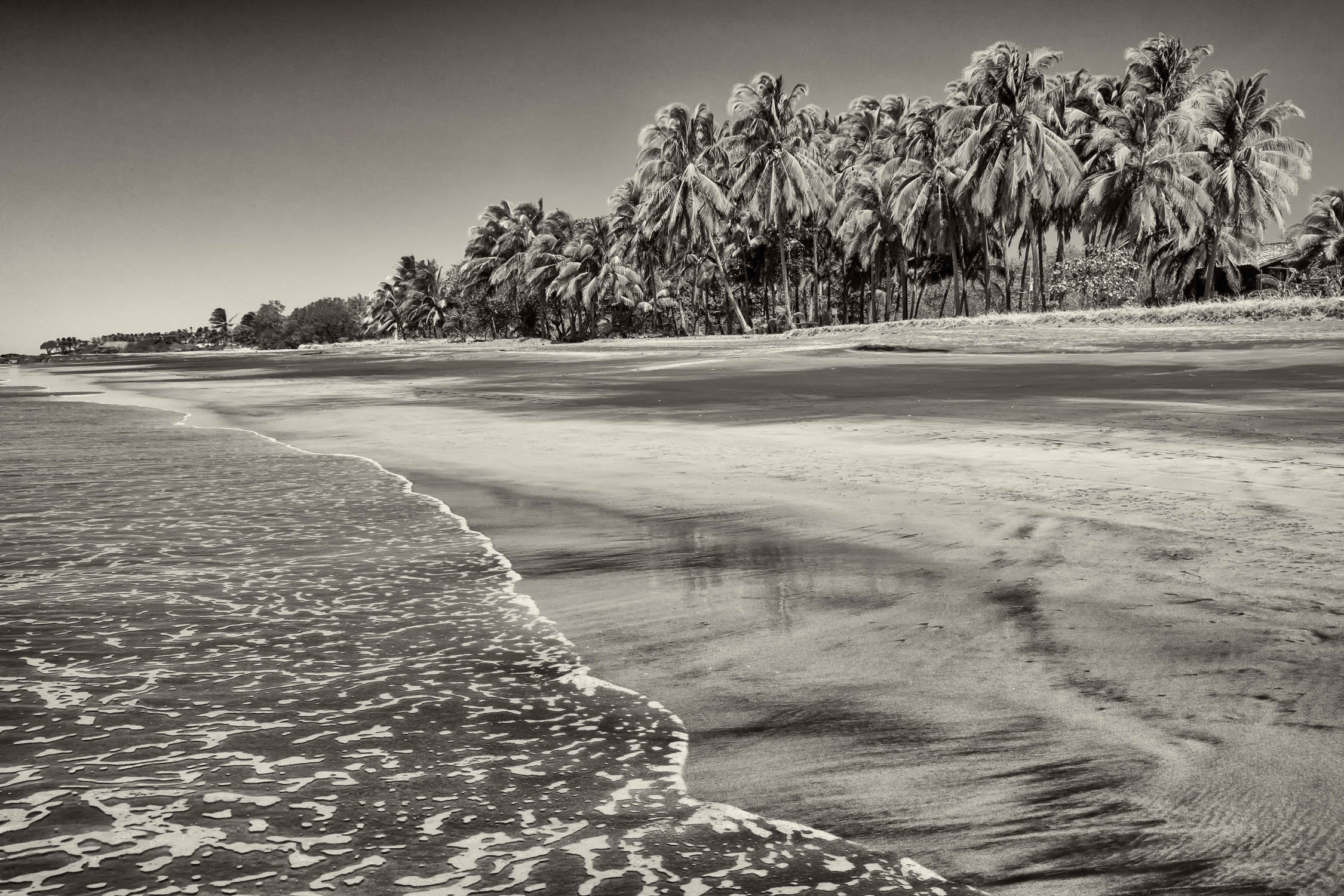
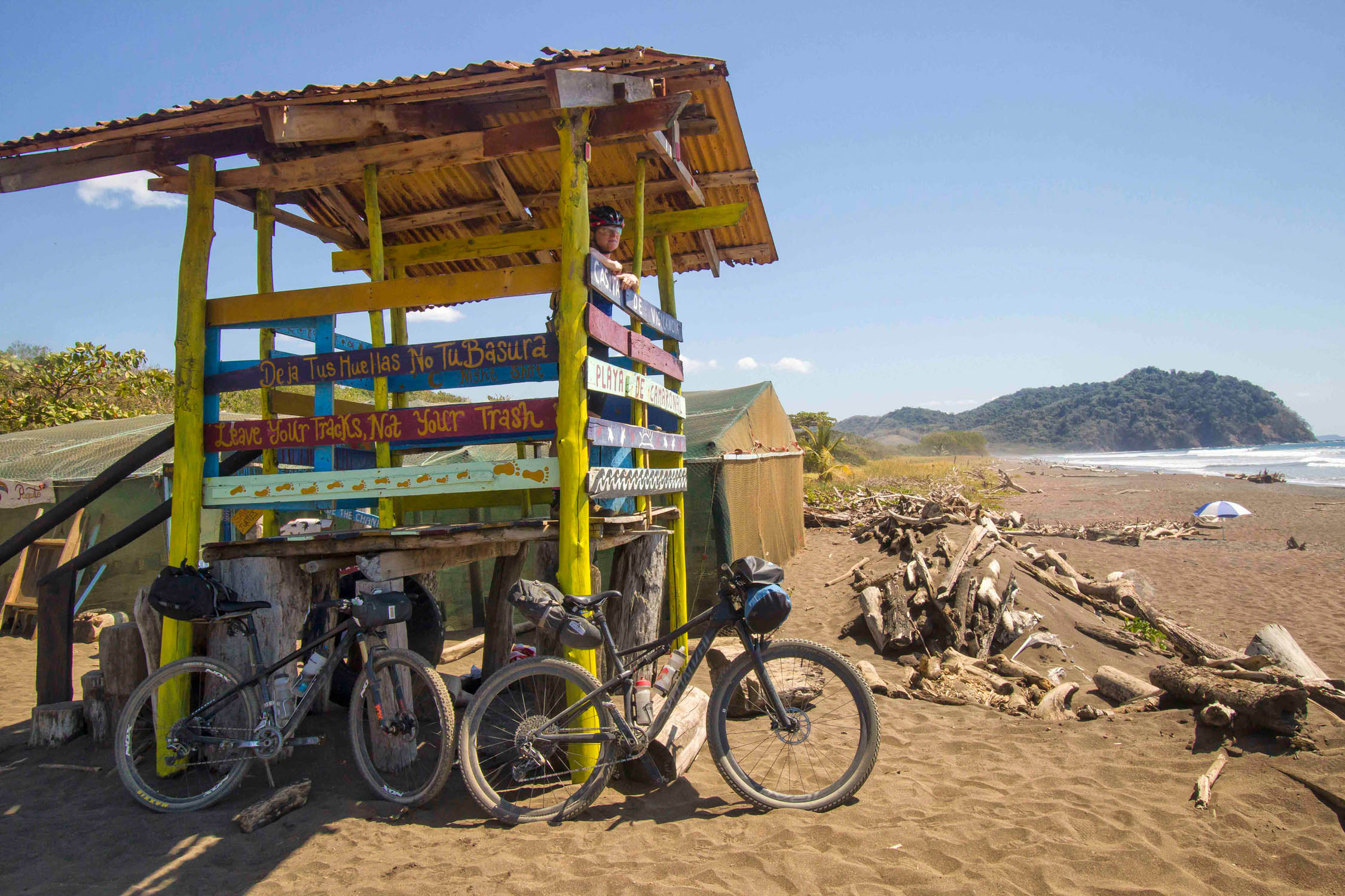
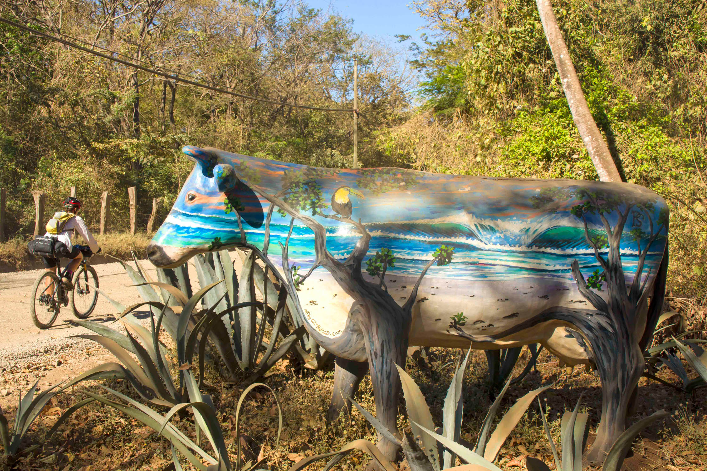
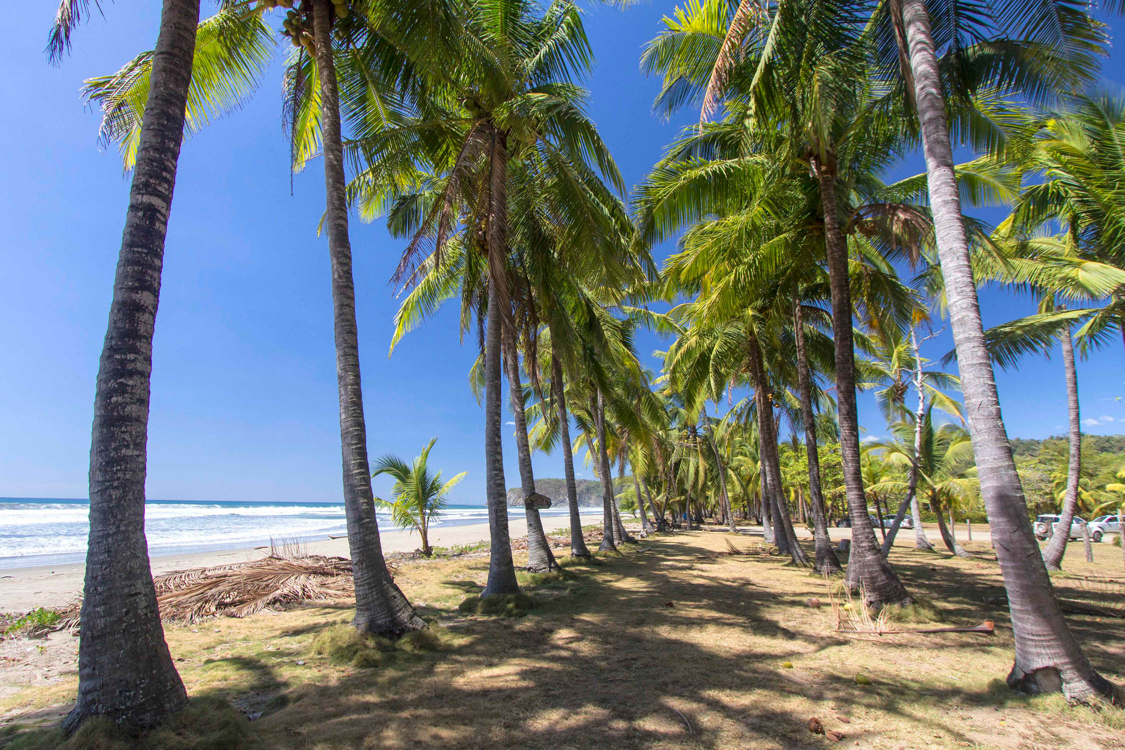
From here, the route wanders south through steamy rural countryside that’s far removed from the tourist crush before starting a sojourn under bluebird skies around the beach-heavy Nicoya Peninsula. Jutting out into the Pacific from the Northwest of the country, the Nicoya land mass is comprised of hilly, dry tropical forest, craggy bays, and a nearly endless string of renowned sand that will surely appease any sun-worshiping beach lover. National Geographic has identified the Nicoya as a Blue Zone, a region of the planet that produces an especially high rate of centenarians. The combination of bumpy dirt roads, impossibly steep and loose inclines, water crossings, and the haunting roars of shaggy howler monkeys will keep riders on their toes. When possible, the route wanders away from the main drag and onto secondary paths, where your only other company will be ticos herding their cattle, sprawling strangler fig trees, and yellow-bellied kiskadee belting out their archetypal kis-ka-dee to cheer you on. Then you’re guided onto beachfront for some thrilling hard-packed sand riding and the opportunity to recharge with a dip in the warm waters. Stay an evening at ungentrified Playa Ostional for the chance (fingers-crossed) to witness Olive Ridley sea turtles lumber ashore to lay their eggs in the early morning glow.
Nicoyans are very proud of their abundance of beaches, which shows in how relatively spotless they are, owing to frequent community clean-ups.
The route visits a few busier touristy towns like Samara and Montezuma, but for the most part these are exceptions to the rule, giving you plenty of chances to peacefully soak up the nature. Rides can be very dusty and scorchingly hot, so start early in the day, don’t expect to keep a rapid pace, bring extra chamois cream, and never turn down a chance to hydrate with a batido (blended fruit drink). Finish your day by pitching a tent on any number of blissfully underdeveloped beaches, and as the sun dips behind the Pacific you’ll luxuriate in having the entire view to yourself.
Difficulty
Never venturing too far from civilization where there are frequent resupply points and often the option for a place to rest for the night, the difficulty rating here is mainly a testament to the physical demands of fat-tire riding in Costa Rica. We rated the route a 5 out of 10 as a whole: a 7 for physical difficulty, a 4 for the technical challenge, and a 3 for its fairly straightforward logistics. Rarely a day will pass where you aren’t challenged by a handful of stiff inclines. What the route lacks in multi-mile climbs, it makes up for with a bounty of short punchers on rough surfaces that can easily approach gradients of 20%. You will most certainly have to get off your bike and push it upwards on more than one occasion. The volcanic highlands have the longest climbs, but it’s the rough kickers on the Nicoya Peninsula that can beat you up the most. And the Nicoya’s dusty downhill runs can be jarringly rutted and offer little respite, especially if running a rigid rig. Combine this with the Nicoya’s soaring temperatures and the real possibility of facing off against some fierce winds in volcano country, and you have a route that will test your fitness and is always rewardingly challenging. That said, there is nothing overly technical about the route save for the skill of mastering inclines on loose dirt. By keeping daily mileage on the low side (about 40 miles a day on average should suffice), you’ll make the rides more manageable and, in the end, more enjoyable.
Route Development; Piecing together La Ruta Gira bikepacking route has been a collaborative project with my long-time riding companion, Tabi Ferguson, whose assistance with route planning and with my pretty awful Spanish skills during two scouting missions in 2018 and 2019 were a massive help. And a big thanks to Logan Watts for posting the original dirt road route along the Nicoya, which got us jazzed to ride here in the first place. But after spending time exploring other areas we knew that Costa Rica was deserving of a grander bikepacking loop for anyone interested in a single country experience instead of simply using the one-way Nicoya route as a means of getting from A to B as part of a long-haul trip.


Submit Route Alert
As the leading creator and publisher of bikepacking routes, BIKEPACKING.com endeavors to maintain, improve, and advocate for our growing network of bikepacking routes all over the world. As such, our editorial team, route creators, and Route Stewards serve as mediators for route improvements and opportunities for connectivity, conservation, and community growth around these routes. To facilitate these efforts, we rely on our Bikepacking Collective and the greater bikepacking community to call attention to critical issues and opportunities that are discovered while riding these routes. If you have a vital issue or opportunity regarding this route that pertains to one of the subjects below, please let us know:
Highlights
Must Know
Camping
Food/H2O
Trail Notes
- The wild, jungle-clad ride in the shadow of volcanic Rincon Vieja National Park, using the Volcano 100 race route.
- Fantastic beach riding along the Nicoya – no fat bike required – and the opportunity to take a refreshing dip in the Pacific along the way.
- Birds galore! From motmots to trogons to the impressive toucan, the avian life that accompanies your pedal strokes won’t disappoint. I even packed lightweight binoculars so I could geek out on the flyers.
- Bouts of thrilling riding on white volcanic rock that’s reminiscent of Moab.
- Opportunities to camp on remote-feeling beaches where you’ll be lulled to sleep by crashing waves under starry skies.
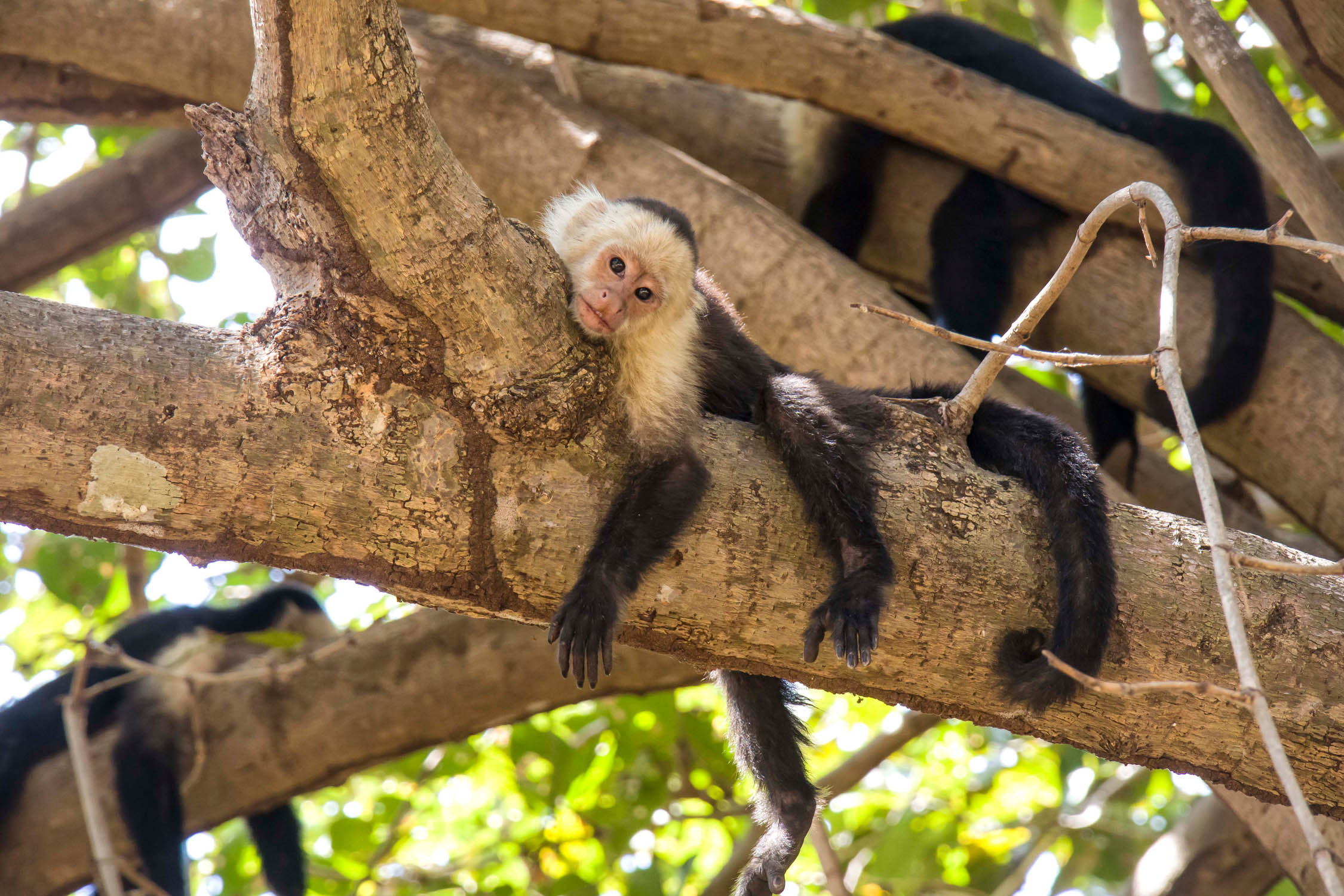
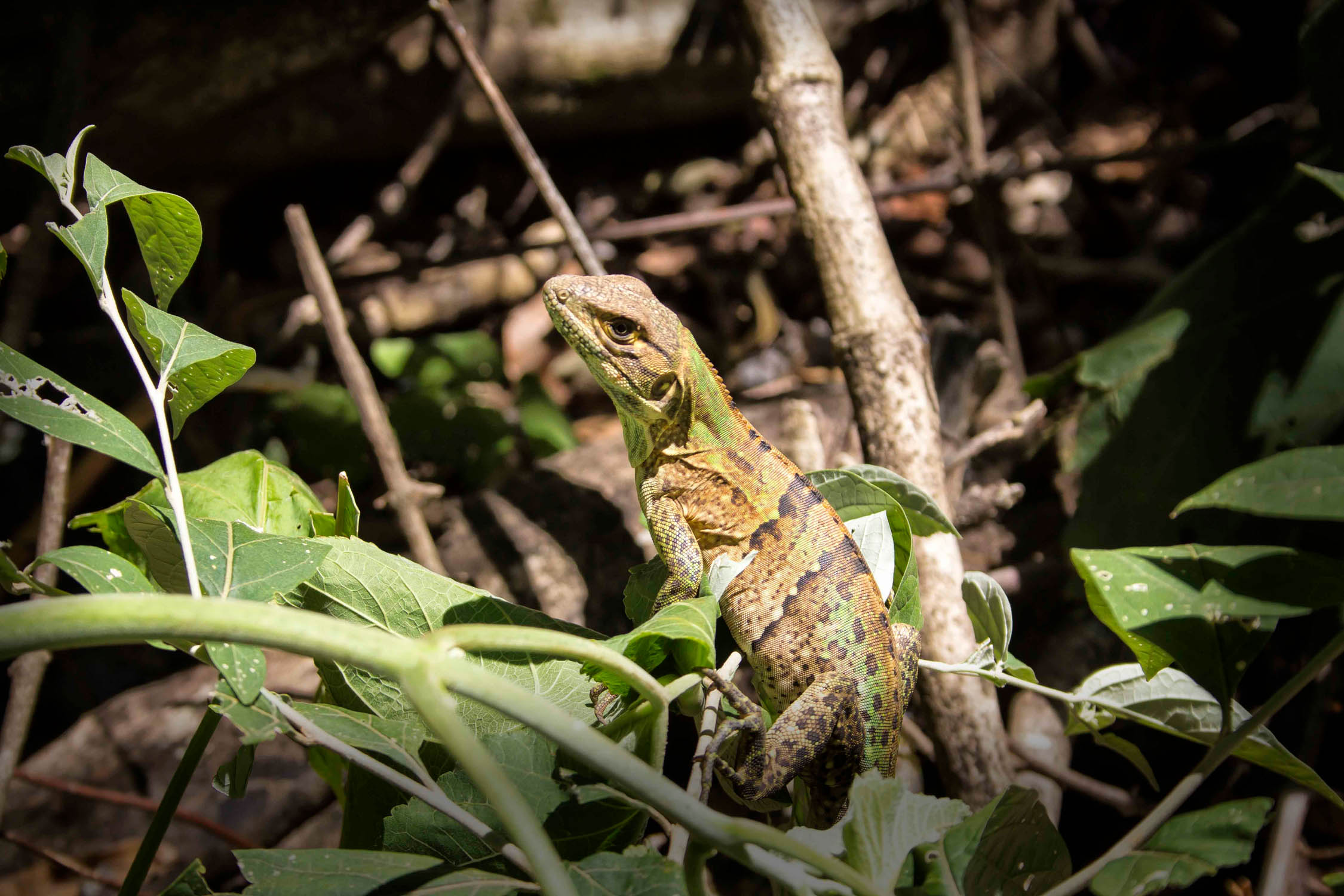
- Possible day ride into steamy Palo Verde National Park where you’ll encounter white faced monkeys, scurrying iguanas, water loving birds, and whimsical coatimundi.
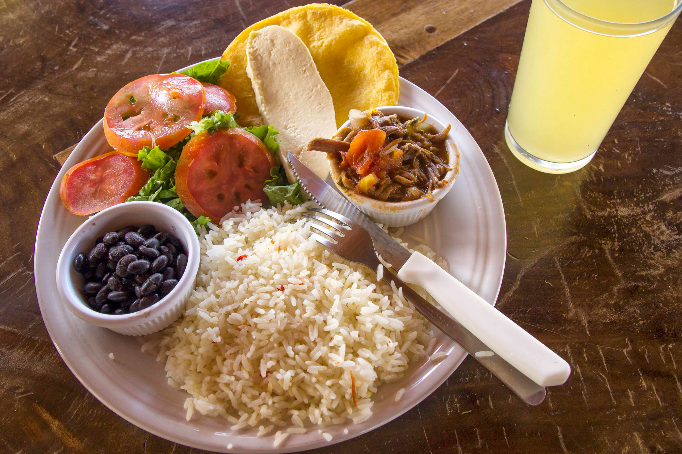
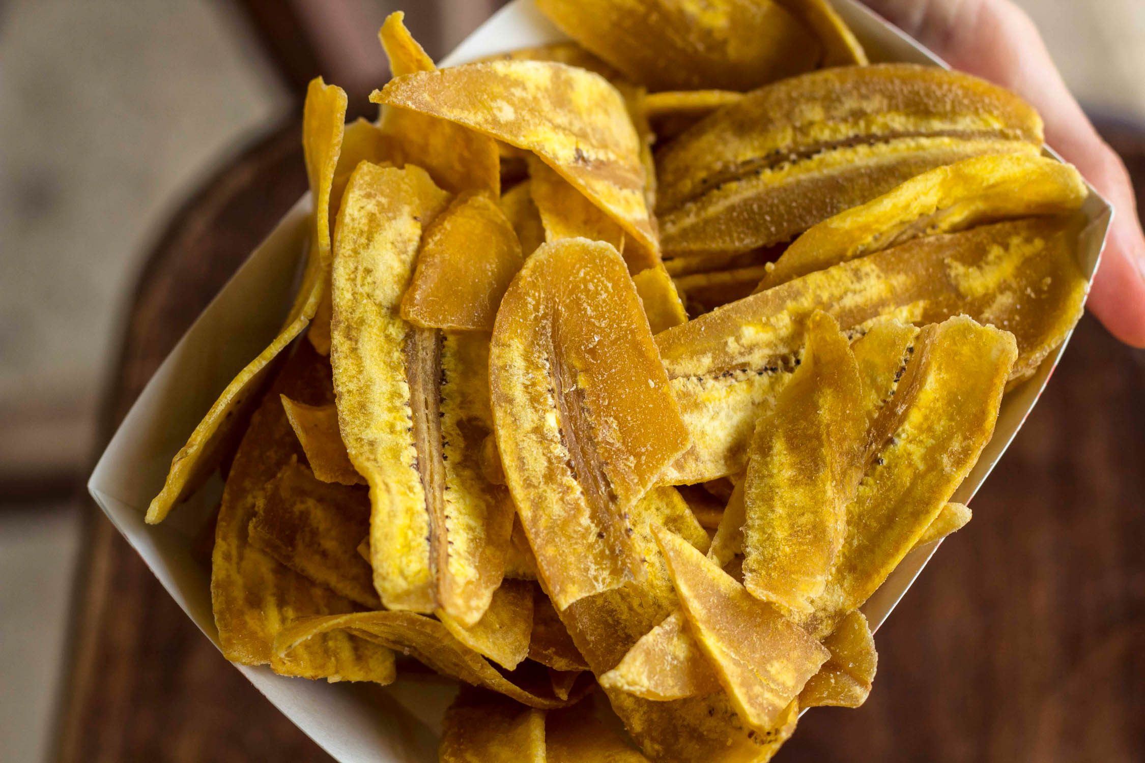
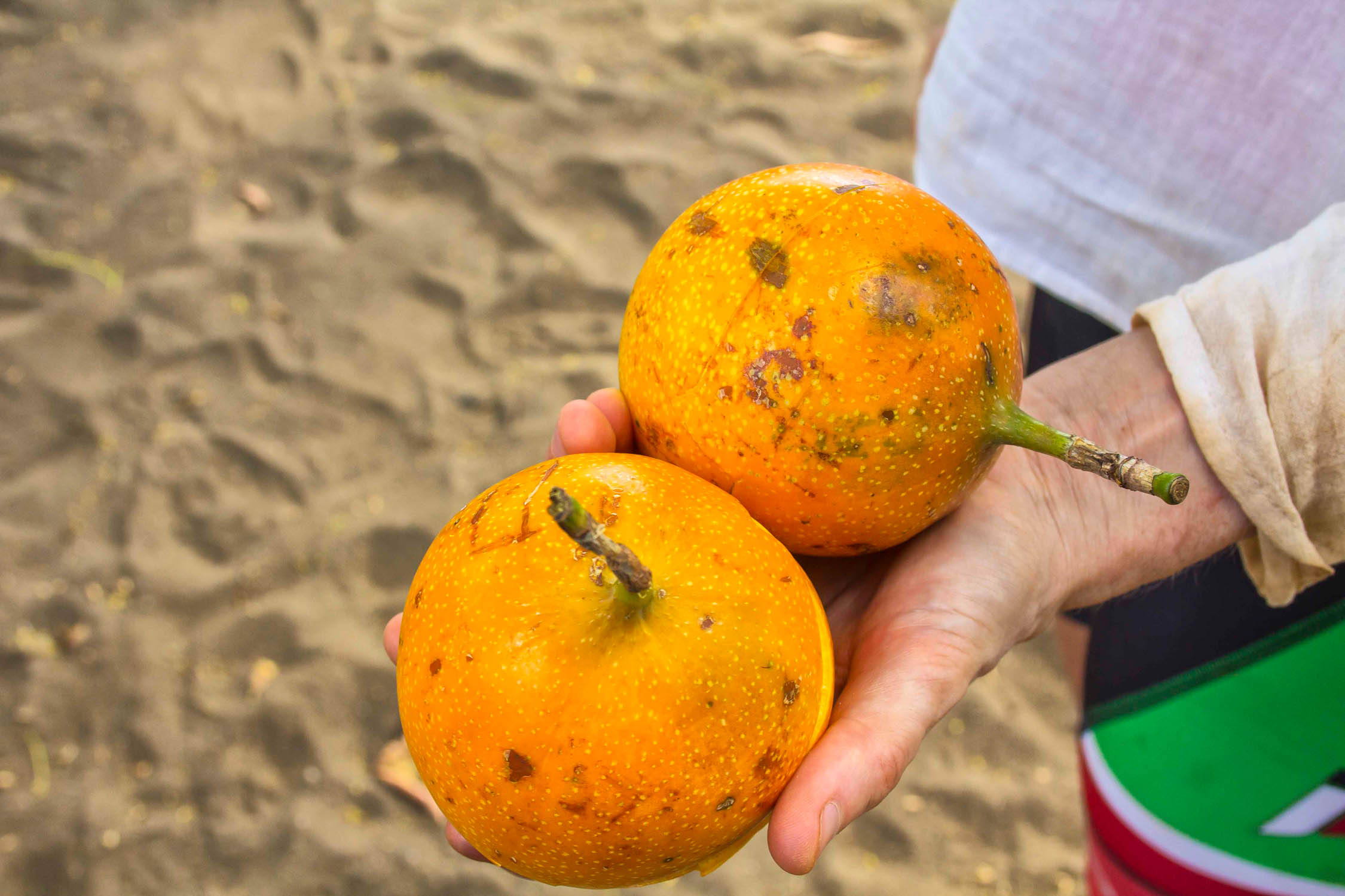
- Satisfying your appetite with gallo pinto, ultra-fresh smoothies, fried plantains, and a bounty of tropical fresh fruits.
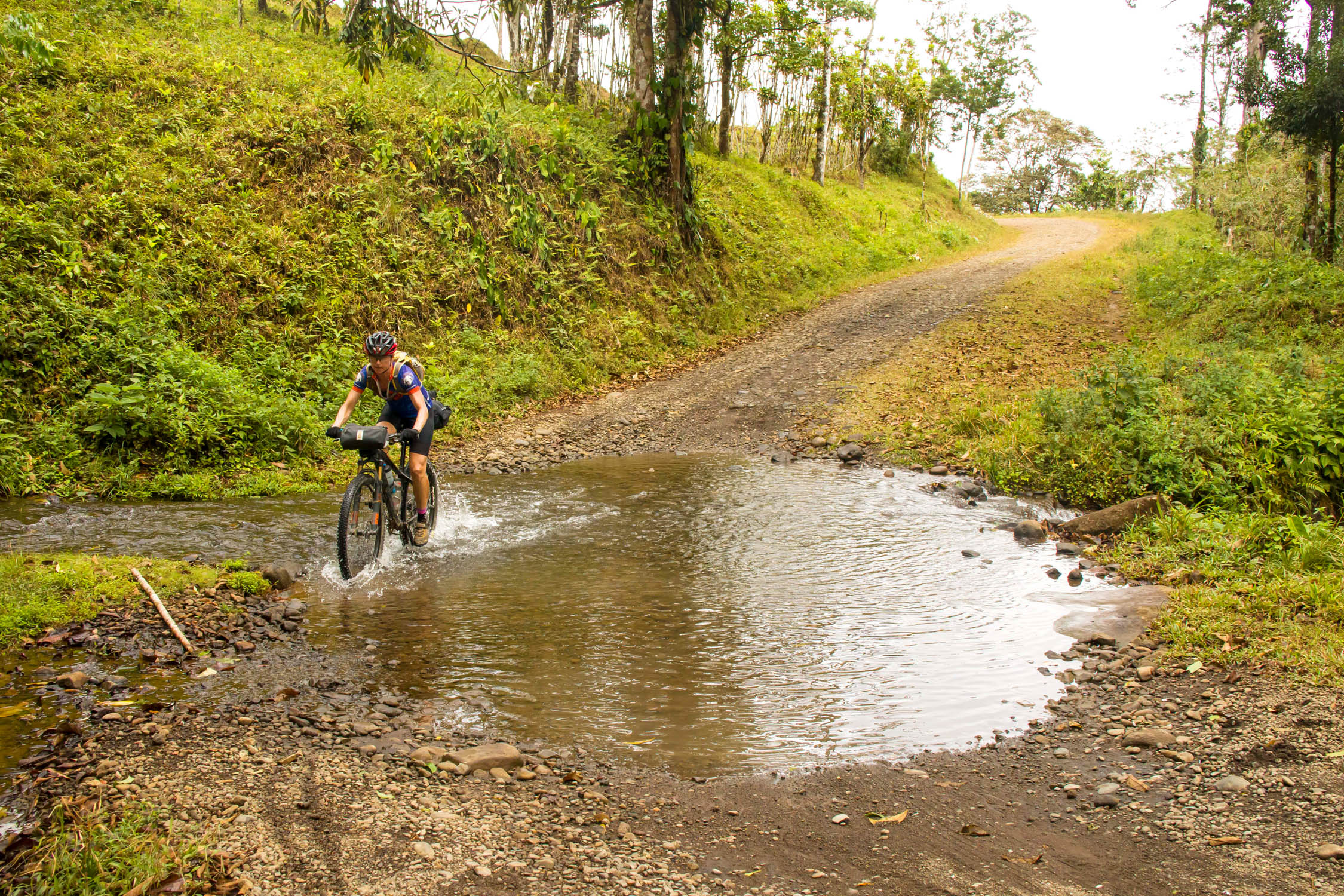
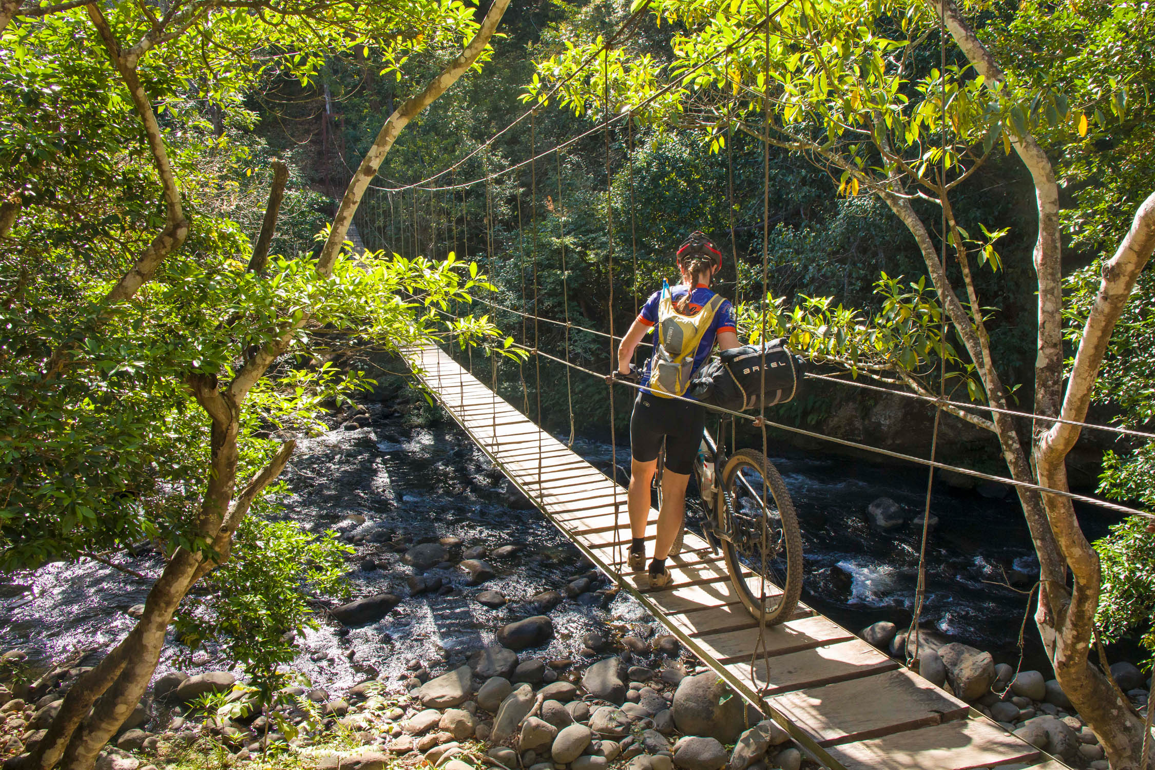
- The ideal time to ride this route is between December and March, which is the dry season and perfect for escaping the North American winter chill. The route includes a countless number of river and stream crossings that are much easier to navigate when they are not swollen by the wet season rains. Locals are quick to point out that crossing deep bodies of water such as muddy tributaries along the Nicoya brings the real risk of hungry crocodiles. But riding during the tail end of the wet season in November comes with the perk of lusher surroundings and less dusty conditions, and locals can boat you across extra high waterways. Pushing deeper into the dry season – late March and April – comes with the challenges of soaring temperatures and heavy amounts of the Nicoya’s infamous polvo (road dust).
- Allowing yourself at least three weeks to tackle the route gives you some wiggle room for rest days and partaking in off-bike activities such as hiking, surfing, and beach chilling.
- The route can be ridden clockwise or counter clockwise, but we think it flows a bit better when tackled in the direction plotted.
- The trip begins in the city of Liberia. An increasing number of flights from North America are landing in Liberia, which makes a more convenient launch point than much more chaotic San Jose. Liberia is nothing exceptional, but it’s safe and relatively easy to cycle out of.
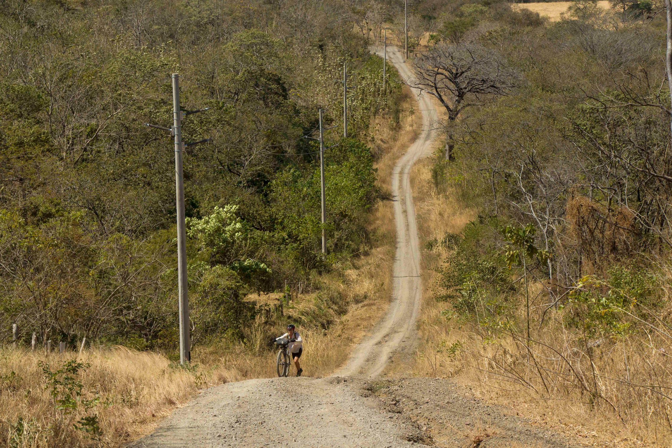
- Roughly 70% of the route is unpaved, made up of gravel roads, dirt jungle paths, and volcanic rock. There are also options for tacking on some seriously fun singletrack in Curubande and Las Catalinas. Generally, the paved sections, such as the north-eastern part of the Nicoya, are not excessively busy with vehicular traffic, but good shoulders can be hit and miss. Costa Rican drivers tend to give you some breathing room. The glaring exception is the airport road to Liberia – this is a hazardous ride. See route map for an alternative transport option for this stretch of nerve-wracking pavement. There are a few stretches of dirt road along the southern flank of the Nicoya, such as around Santa Teresa, that can become busy with tourist and local traffic, even more so on weekends when people are heading to the beach or local festivals.
- If there was ever a bikepacking tour suited to a mountain bike set-up this would be it. The rugged terrain that is the norm in Costa Rica calls for fatter tires and a sturdier ride. Suspension, either front or dual, is also a good idea for added comfort. I used a rigid bike on the first trip and found the dual suspension ride on the second tour to be an enjoyable upgrade. But a hardtail will do the trick as well. We ran 29-inch tires in the 2.2+ range and found that to be adequate without yearning for anything fatter. If using a gravel-style bike, it would ideally be outfitted with 650b wheels and 2.1 tires or larger. Riders have completed the route using drop bar bikes with 700c wheels, but try to stuff as much rubber as possible. You should have some experience riding with this set-up on rougher terrain. You’ll be bombarded with loose, steep inclines, so packing your bike as light as possible is recommended as is making sure your rig is outfitted with climbing-friendly gear ratios.
- There are a handful of bike shops on this loop, which are marked on the route map. Costa Ricans are crazy for their mountain biking (hello, La Ruta) so obtaining quality parts and service is possible.
- Both U.S. dollars and the Costa Rican colon are used in the country. In general, most accommodations and restaurants accept both currencies, but for smaller establishments like local eateries and mini supermarkets, it’s preferable to work in colones. The exchange rate at the airport sucks, so it’s best to use an ATM in Liberia to obtain local currency. Costa Rica is on the expensive side with respect to food and accommodation compared to most Central American countries. (Many things are more expensive here than other Central American countries because wages are higher by law and employers have to pay extra to cover a certain percentage of employee healthcare on top of each employee’s salary. Sometimes foods for sale like avocado are imported from other countries because local options are much more expensive.)
- Despite its long history with gringo tourism, English is definitely not universally spoken in Costa Rica. It’s helpful to know some phrases in Spanish to get along easier. When all else fails, fire up the Google Translate.
- Overall, Costa Rica is one of the safest Latin American countries for two-wheel exploration. The country is politically stable and for the most part has not witnessed the dark days inflicted on many other Central American countries by the all-too-often brutal drug trade. In our two months of riding we never once felt uneasy with our surroundings or that our personal safety was in jeopardy. The biggest annoyance you might encounter is petty theft, so always keep a watch on your belongings, particularly in any heavily touristed areas. And don’t leave your bike unattended and unlocked.
- When temperatures hover around 100°F along the Nicoya, you’ll have to stay on top of your hydration needs.
- A couple of the beach rides are tide dependent, especially the one along Playa Manzanillo. See route map for a tide chart.
- You will come across a few livestock gates that you’ll need to open to continue onwards. Make sure to close these afterwards so that finca (ranch) owners don’t sour on cyclists passing through their land.
- Finding a place to pitch your tent is not overly challenging along the route. The best place to ask for an overnight camping spot is at a local tienda (food store) or restaurant in a town/village, and someone will likely direct you to where it is OK to camp for a night. The Nicoya Peninsula is riddled with empty beaches that are ideal for discreet sandy camping, as long as you stay away from rising tides. There are a few beaches that explicitly state “no camping allowed,” and you’ll probably want to avoid stealth camping on the more heavily populated beaches such as Samara. Wherever you camp, it’s best not to leave valuables unattended for extended periods of time.
- There are a handful of paid campgrounds scattered throughout the route; a few are marked on the route map.
- The most budget-friendly roofed accommodation, especially if stuffing two or more riders into a room, comes in the form of local guesthouses that are most often called cabinas. Most towns have one or more of these, and as a general rule they are well kept. Cabinas are not always listed in guidebooks, but often if you zoom in on an area with Google Maps they’ll pop up.
- Of course, there is no shortage of more opulent accommodation options including larger hotels and boutique yoga retreats. Airbnb is also a viable option as there are plenty of listings, especially in the beach areas of the Nicoya.
- When visiting more touristy spots like Samara and Montezuma it’s often a good idea to book accommodation ahead of time if travelling during the height of tourist season.
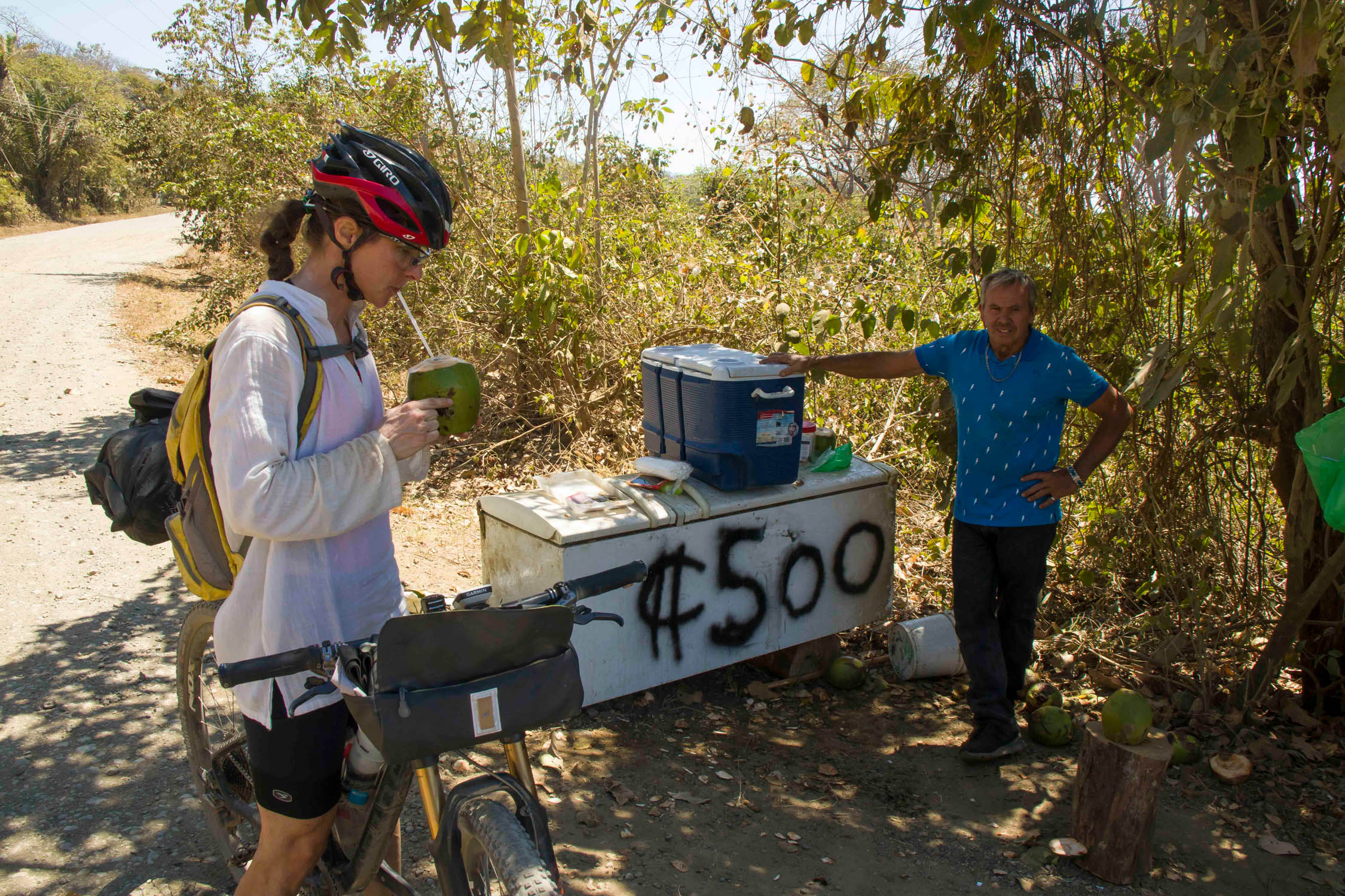
- For the most part, this route can be tackled without being weighed down by pounds of food and water, since resupply points in the forms of grocery stores and restaurants occur at fairly regular intervals. The longest you may go without a resupply option is about 20 to 30 miles. Some food options are marked on the map, but by no means is this an exhaustive list. You will also likely come across several roadside fruit stands with ticos selling everything from juicy watermelon to more exotic specialities like granadilla, a delicious type of passion fruit.
- For a hearty meal worthy of a hungry touring cyclist, you’ll want to seek out family-style restaurants called sodas. You can usually fill your tummy with a big plate of food (meat, beans, rice, fried plantain, cheese, etc.) and a juice for $10 or less. Many serve breakfast, lunch, and dinner.
- Many towns also have a bakery (panaderia) that offers up a tasty bounty of calories. Musmanni is a popular bakery chain where you can also get sandwiches to go.
- Fruit smoothies (batidos) are widely available and are a refreshing way to beat the heat.
- In tourist-oriented centers or bigger towns like Montezuma and Nicoya you’ll also find several options for more familiar types of food such as pizza if you’re a bit burnt out on beans and rice.
- Many people drink the tap water in Costa Rica without issue, but to be overly safe we still often treated it. Bottled water is fairly expensive (and not eco-friendly) so not something you want to rely on for all your hydration needs. Some public squares in towns have fountains that provide safe drinking water.
We consider this the master Costa Rica loop as it takes in a magnificent variety of terrain. But we have also scouted out some other options based on how much time you have and other sites you may wish to visit.
Loop 2
A good loop if you are short on time but still want to hit up a bunch of highlights such as the lush volcanic region and a string of postcard-worthy beaches. It cuts off half of the Nicoya Peninsula. Direct link to RWGPS.
Loop 3
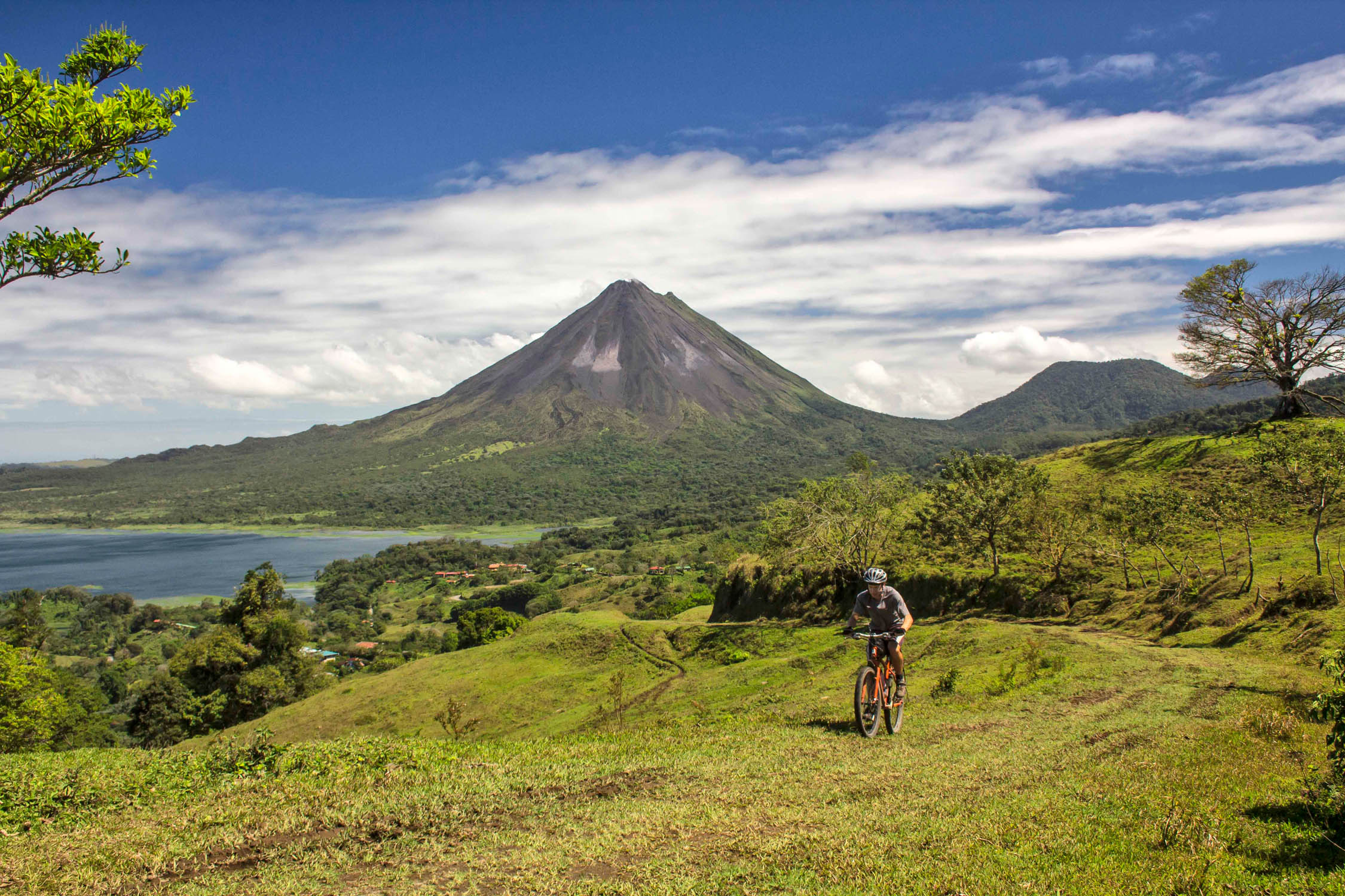
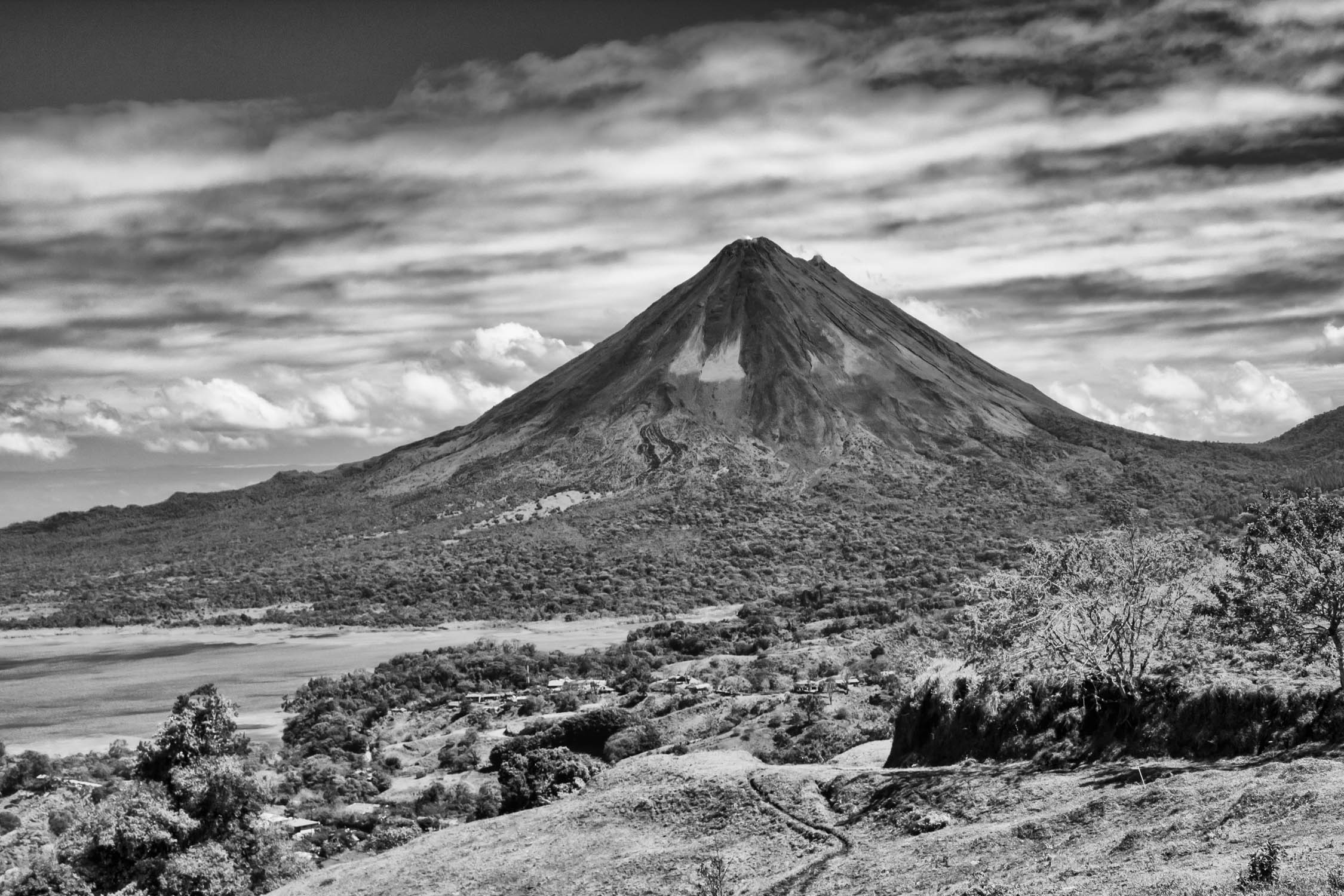
This loop includes a challenging but oh-so rewarding circumvention of Lake Arenal. The road running along the north section of the lake is paved, but the southern road is as wild as it gets. If you’re lucky with the weather, you’ll be confronted with stunning views of Arenal Volcano at nearly every turn. Just be aware of the real possibility of experiencing strong winds on the approach to the lake. The wind turbines hint to this. Direct link to RWGPS.
Loop 4
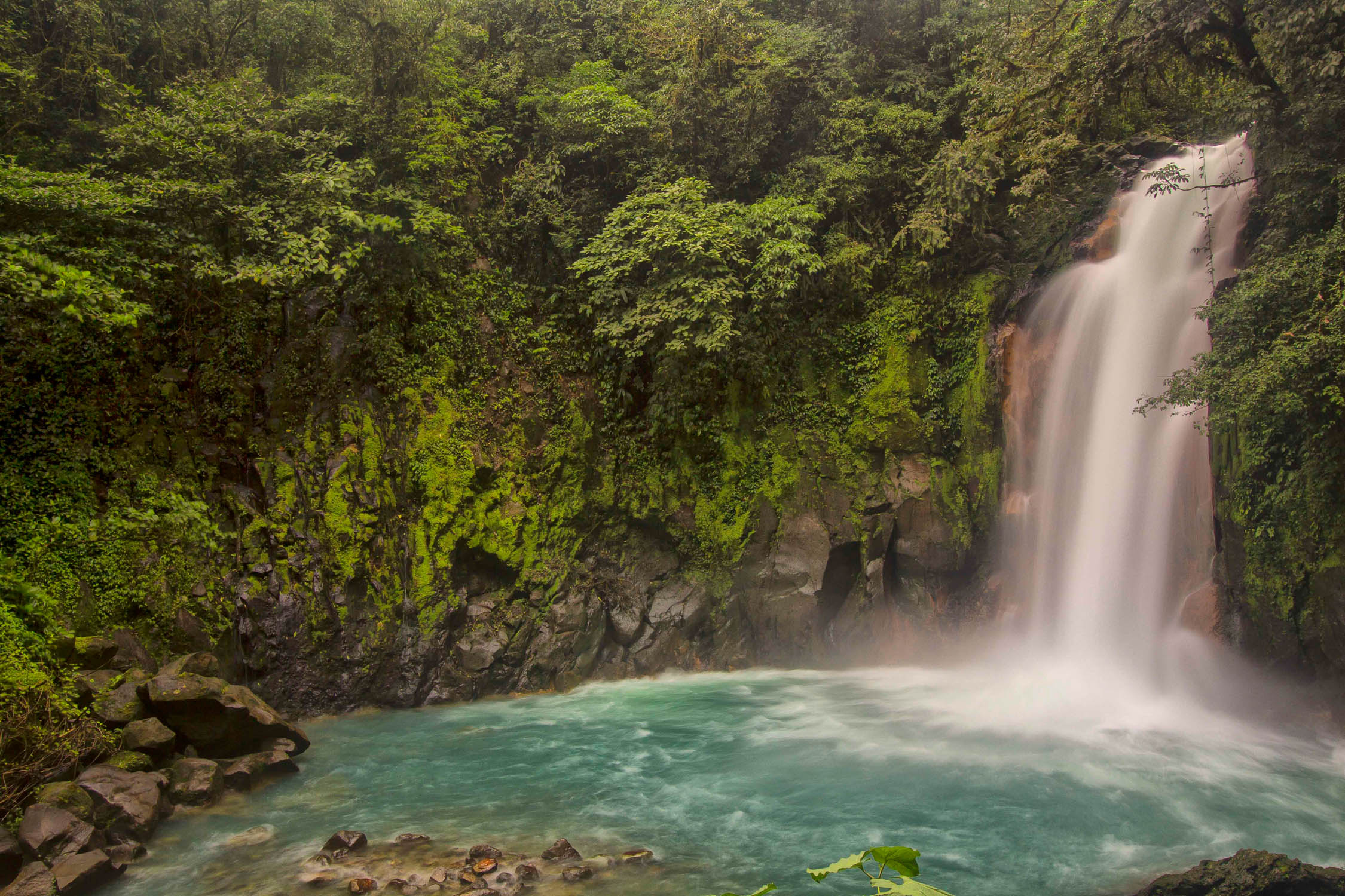
This grand loop includes a trip to the excellent Cano Negro Wildlife Refuge and also the Tenorio Volcano National Park. Boat trips at Cano Negro – which put you up close with a bounty of birdlife and other residents like giant caimans – come highly recommended. The highlight of a trip to dripping-wet Tenorio Park is a hike to the beautiful Rio Celeste waterfall. Try to set aside about a month to complete this loop. Direct link to RWGPS.
Loop 5
If you just want to maximize your beach time in 10 to 14 days of riding, this loop is for you, as it only involves cycling around the Nicoya Peninsula. Direct link to RWGPS.
Loop 6
This is an option if you still want to take in some of the views of lago Arenal via excellent dirt roads but don’t want to circumvent the lake.


Terms of Use: As with each bikepacking route guide published on BIKEPACKING.com, should you choose to cycle this route, do so at your own risk. Prior to setting out check current local weather, conditions, and land/road closures. While riding, obey all public and private land use restrictions and rules, carry proper safety and navigational equipment, and of course, follow the #leavenotrace guidelines. The information found herein is simply a planning resource to be used as a point of inspiration in conjunction with your own due-diligence. In spite of the fact that this route, associated GPS track (GPX and maps), and all route guidelines were prepared under diligent research by the specified contributor and/or contributors, the accuracy of such and judgement of the author is not guaranteed. BIKEPACKING.com LLC, its partners, associates, and contributors are in no way liable for personal injury, damage to personal property, or any other such situation that might happen to individual riders cycling or following this route.
Please keep the conversation civil, constructive, and inclusive, or your comment will be removed.