


Hey Joe Safari, Moab, Utah
Distance
98 Mi.
(158 KM)Days
3
% Unpaved
100%
% Singletrack
22%
% Rideable (time)
90%
Total Ascent
5,900'
(1,798 M)High Point
6,031'
(1,838 M)Difficulty (1-10)
5?
- 4Climbing Scale Fair60 FT/MI (11 M/KM)
- -Technical Difficulty
- -Physical Demand
- -Resupply & Logistics
Contributed By
Colt Fetters
Averagely Stoked
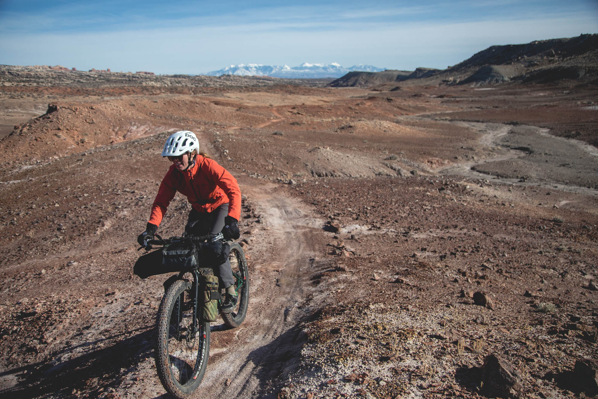
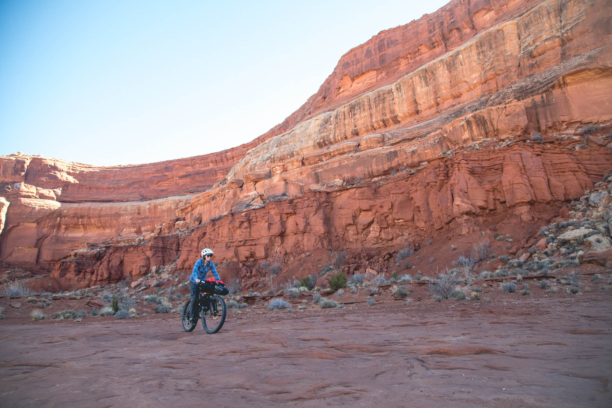
A trip to Moab, Utah, is considered a pilgrimage of sorts for many mountain bikers. It’s a special place, with its desert landscape, expansive trail network, and Martian terrain. Bikepackers looking for a weekend route are often steered toward the Island in the Sky (where permit reservations are needed), or the Kokopelli Trail (which can be plagued by snow in winter). Moab is rarely a quiet place, but in the milder winter months, those looking for solace can find it with a little bit of effort. This is where the Hey Joe Safari shines. It’s rideable during the winter months when the weather is mild and it has long sections that are largely undisturbed by other travelers.
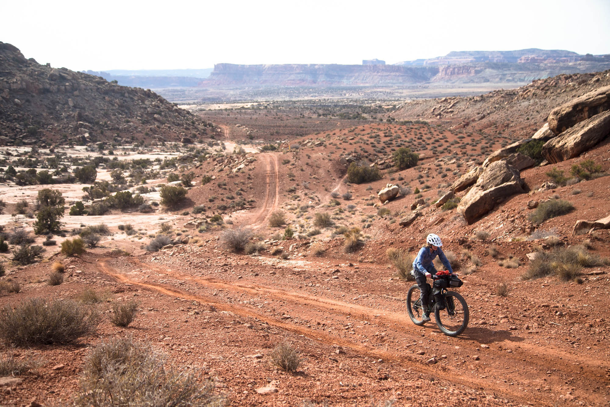
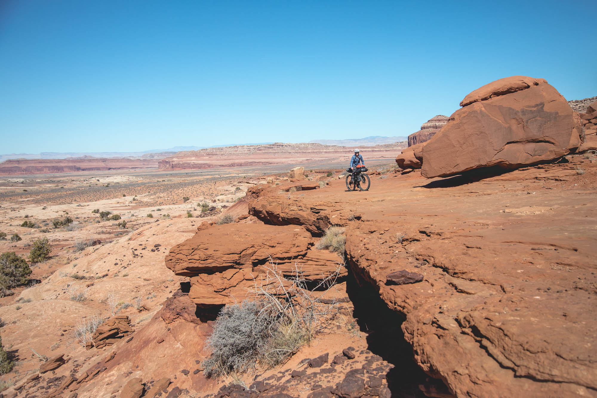
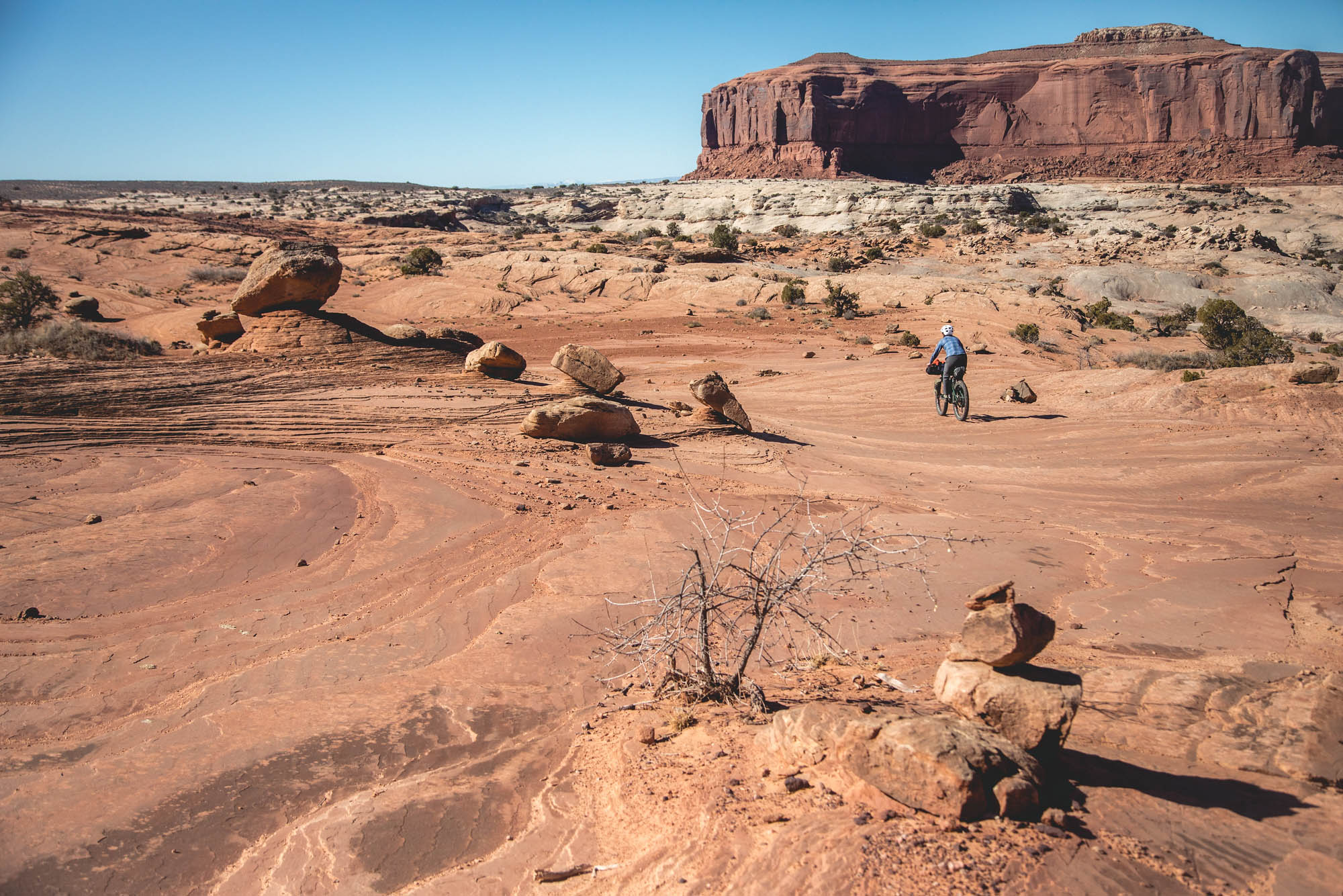
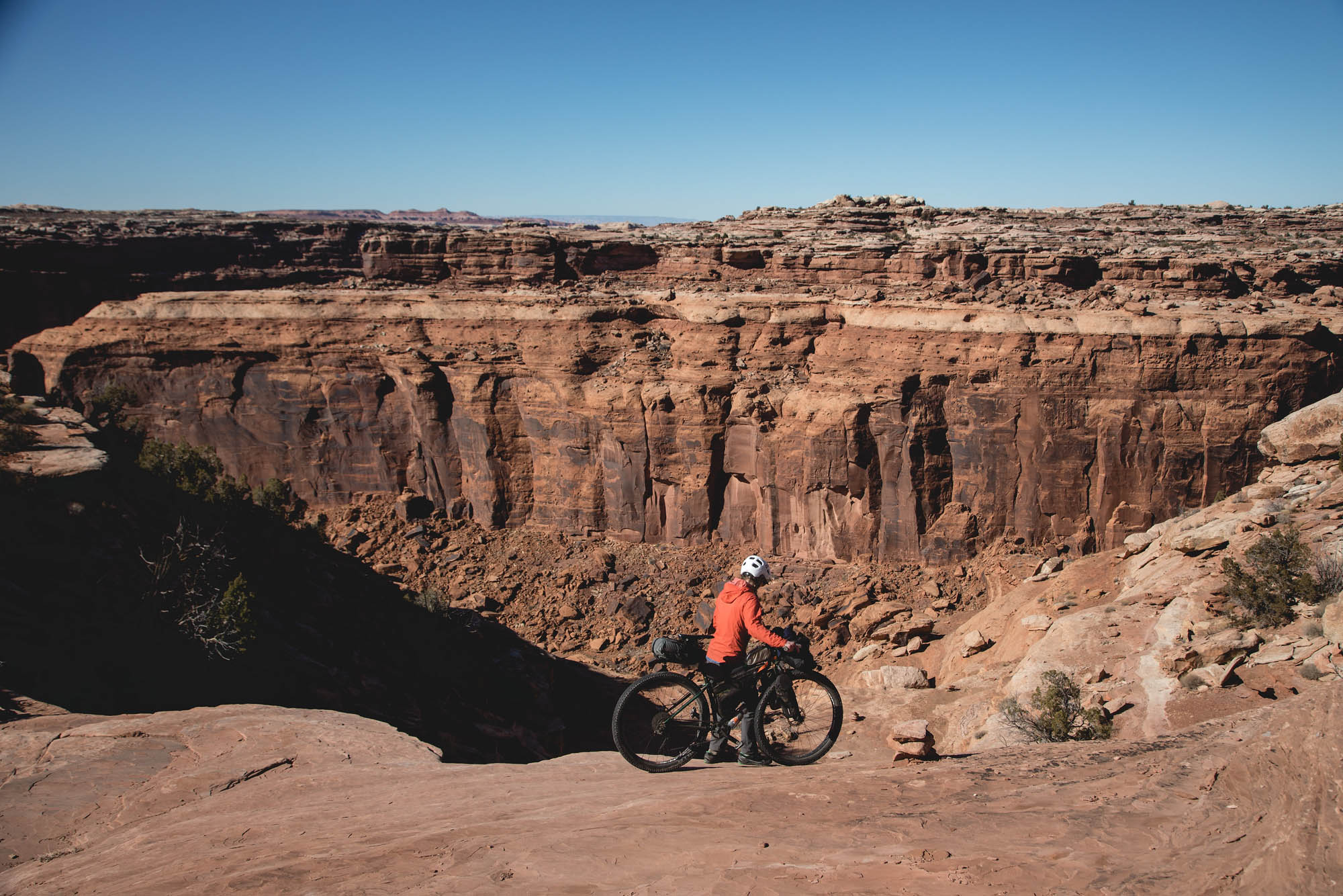
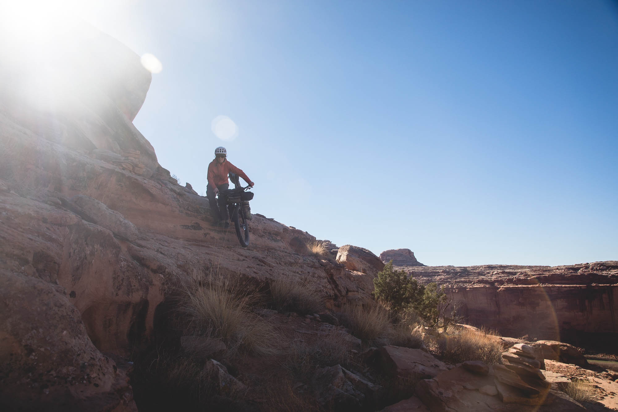
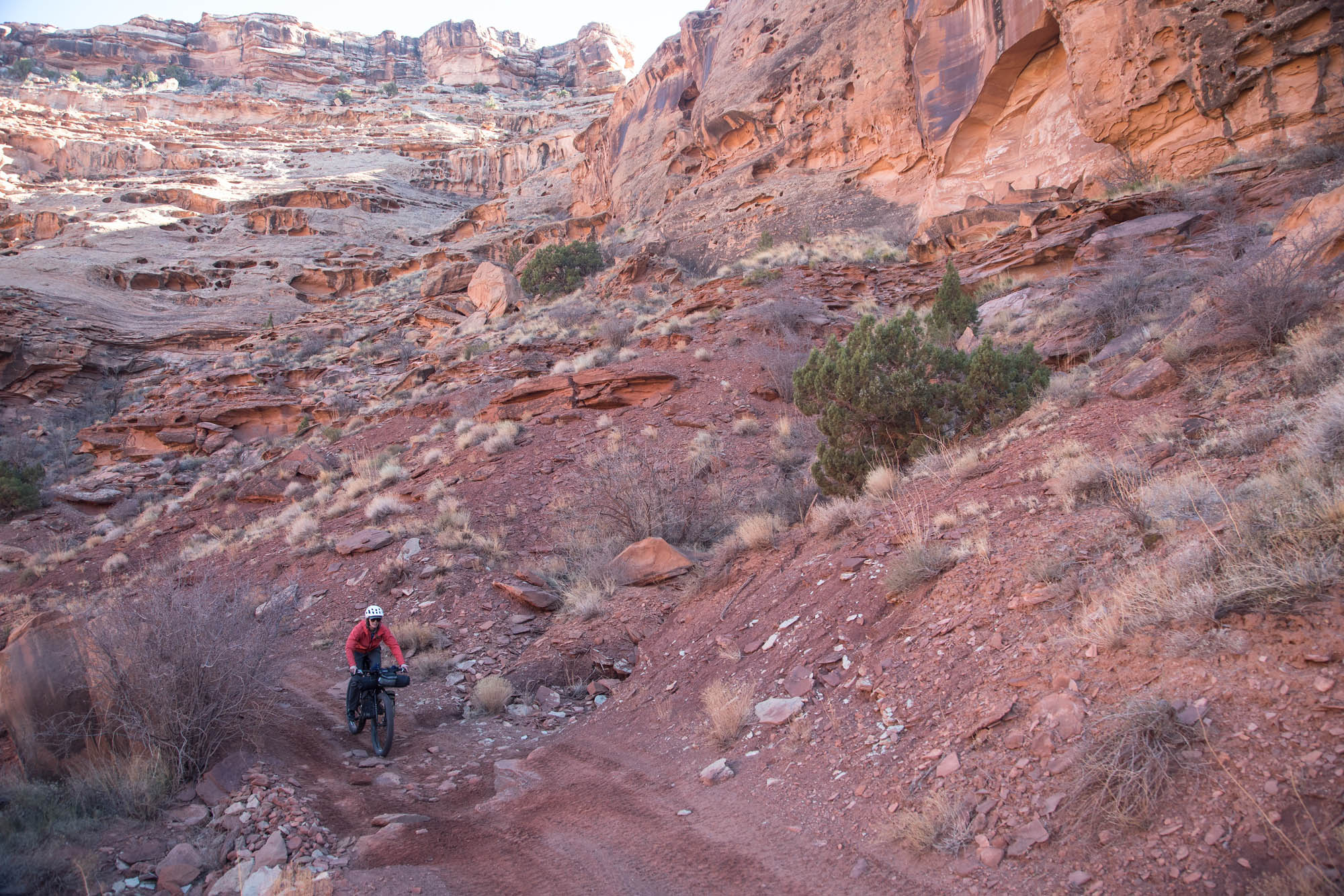
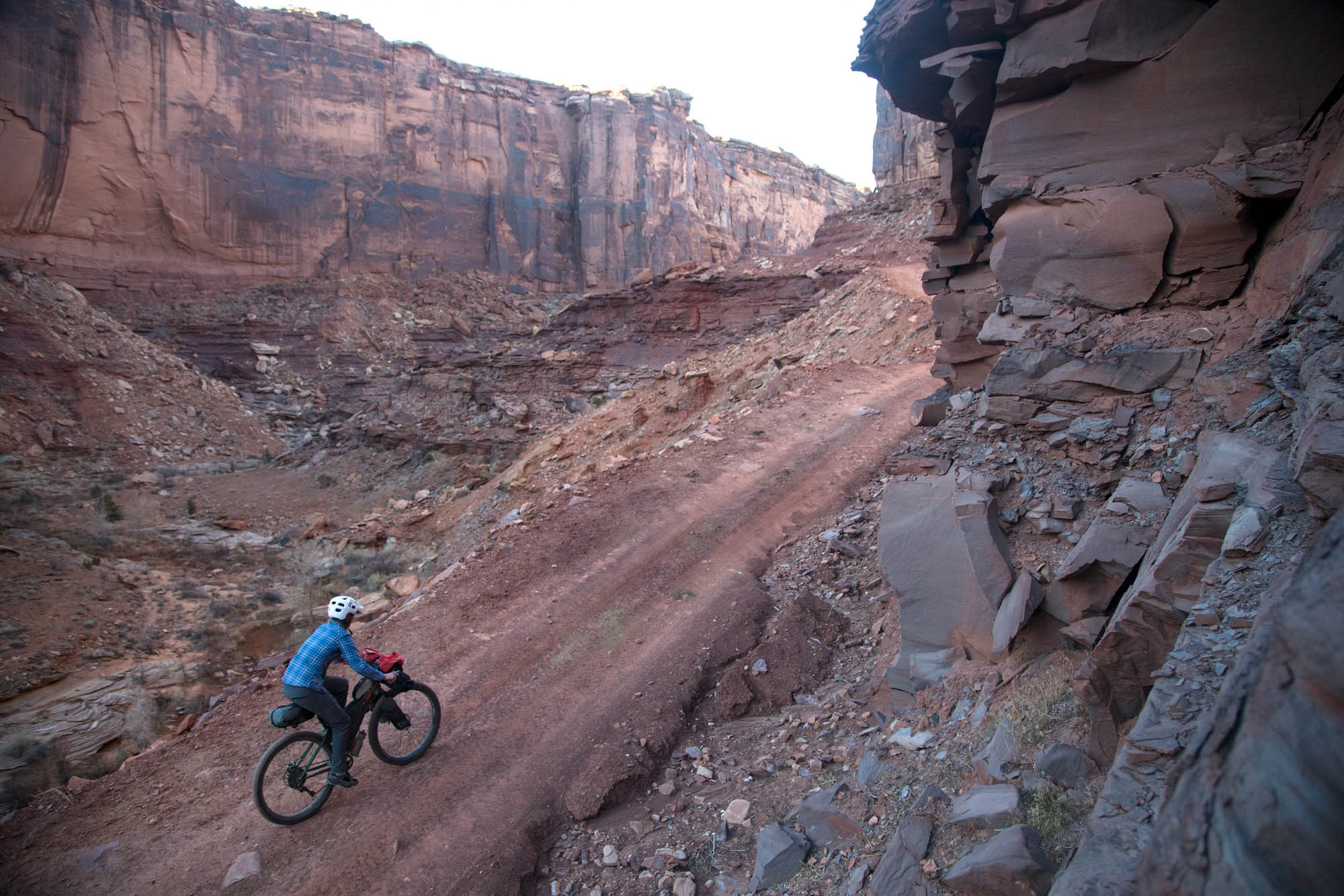
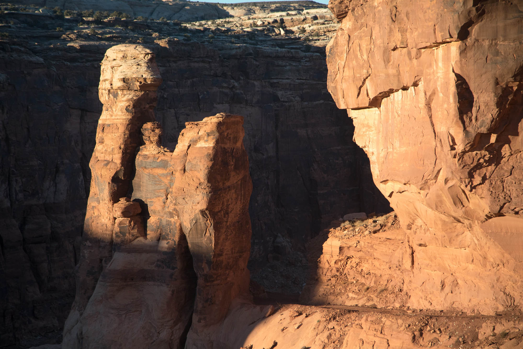
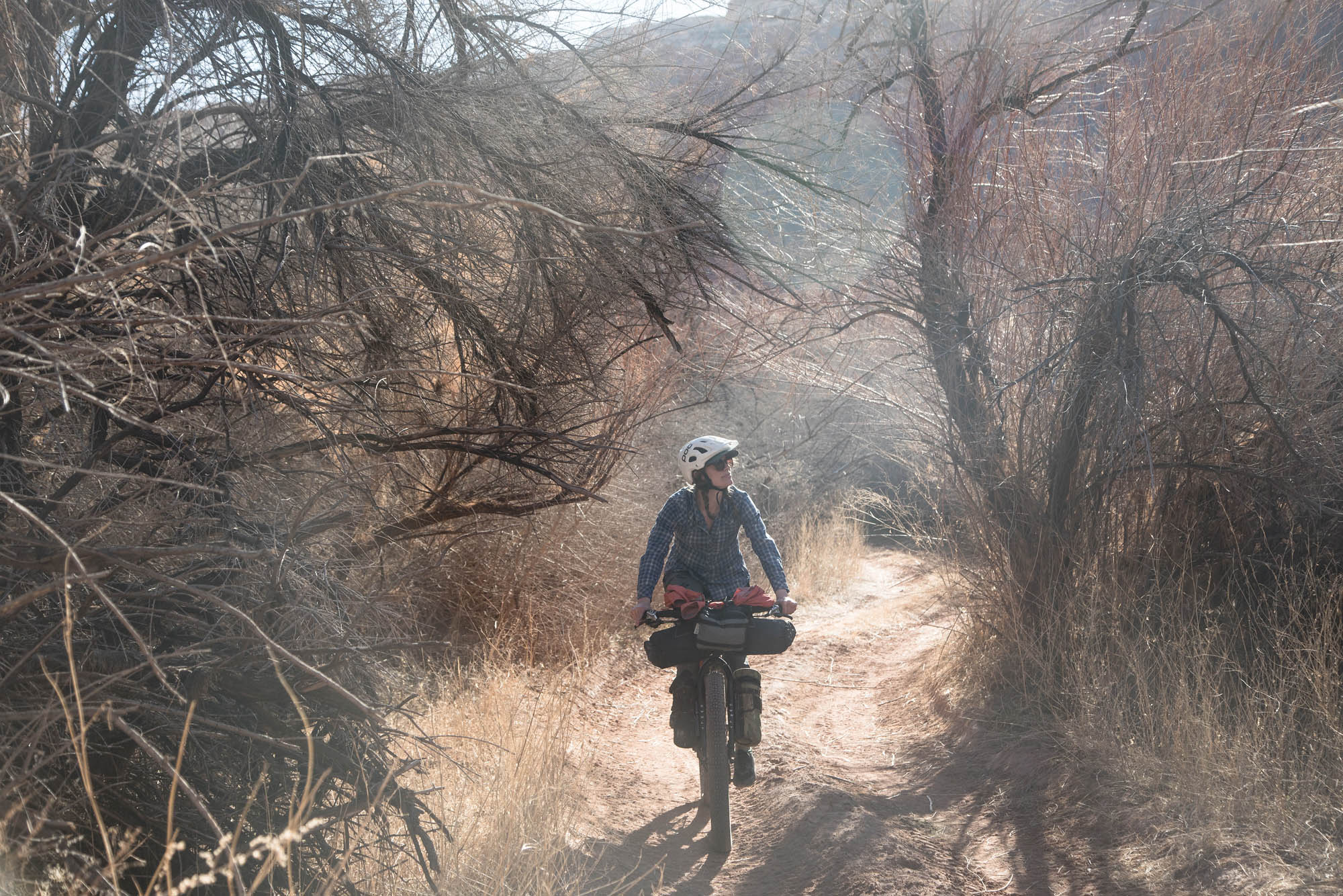
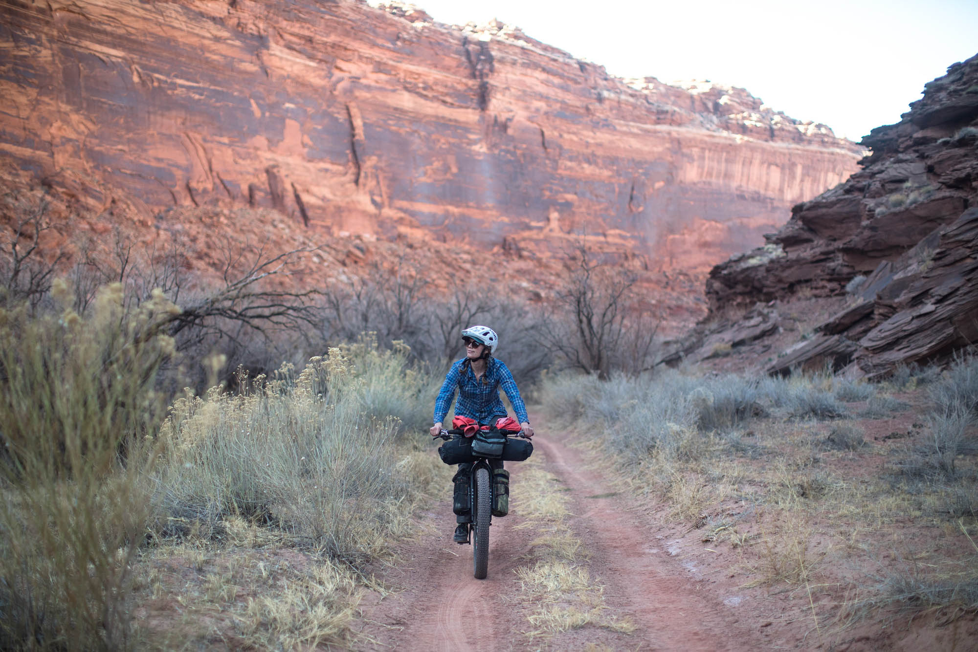
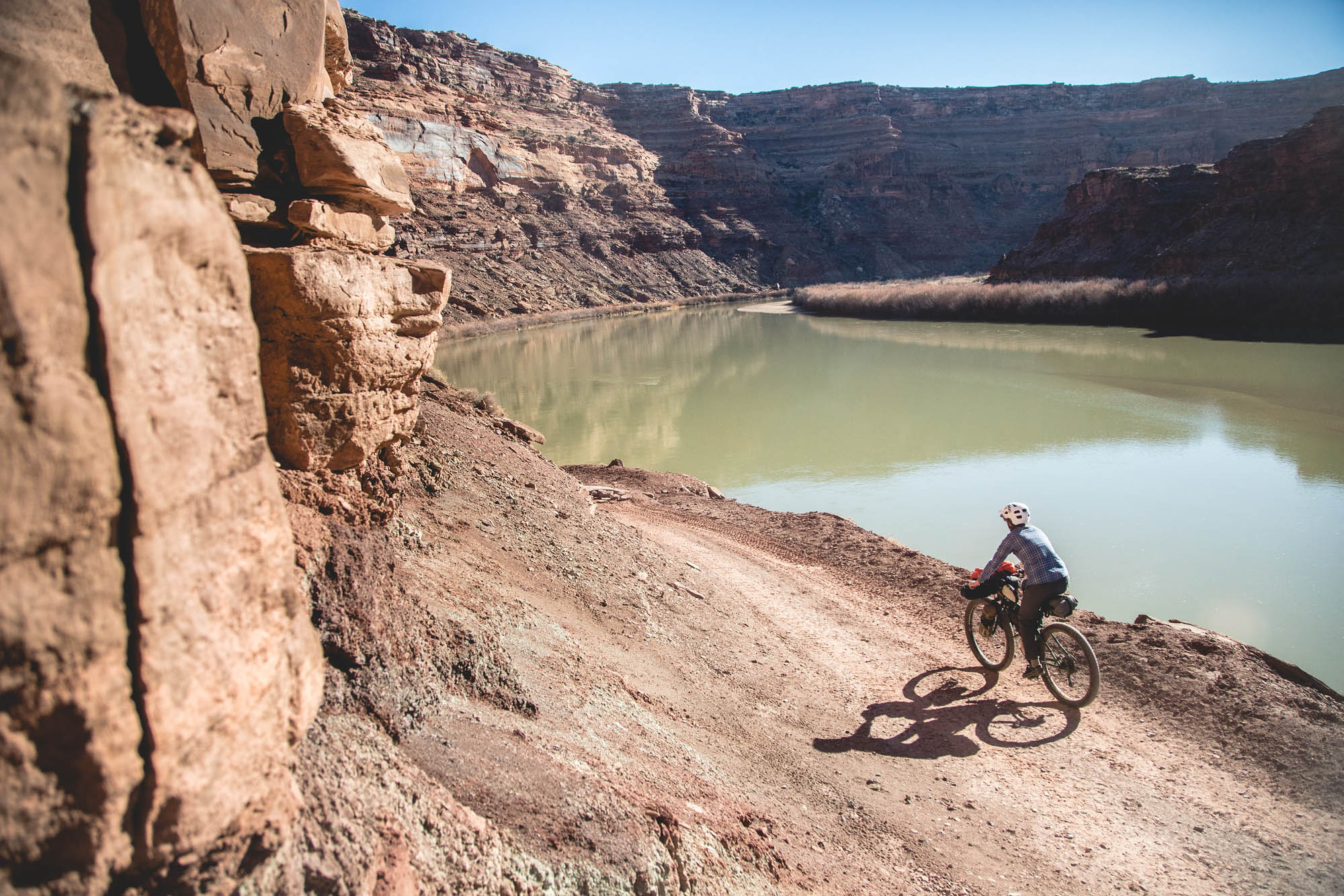
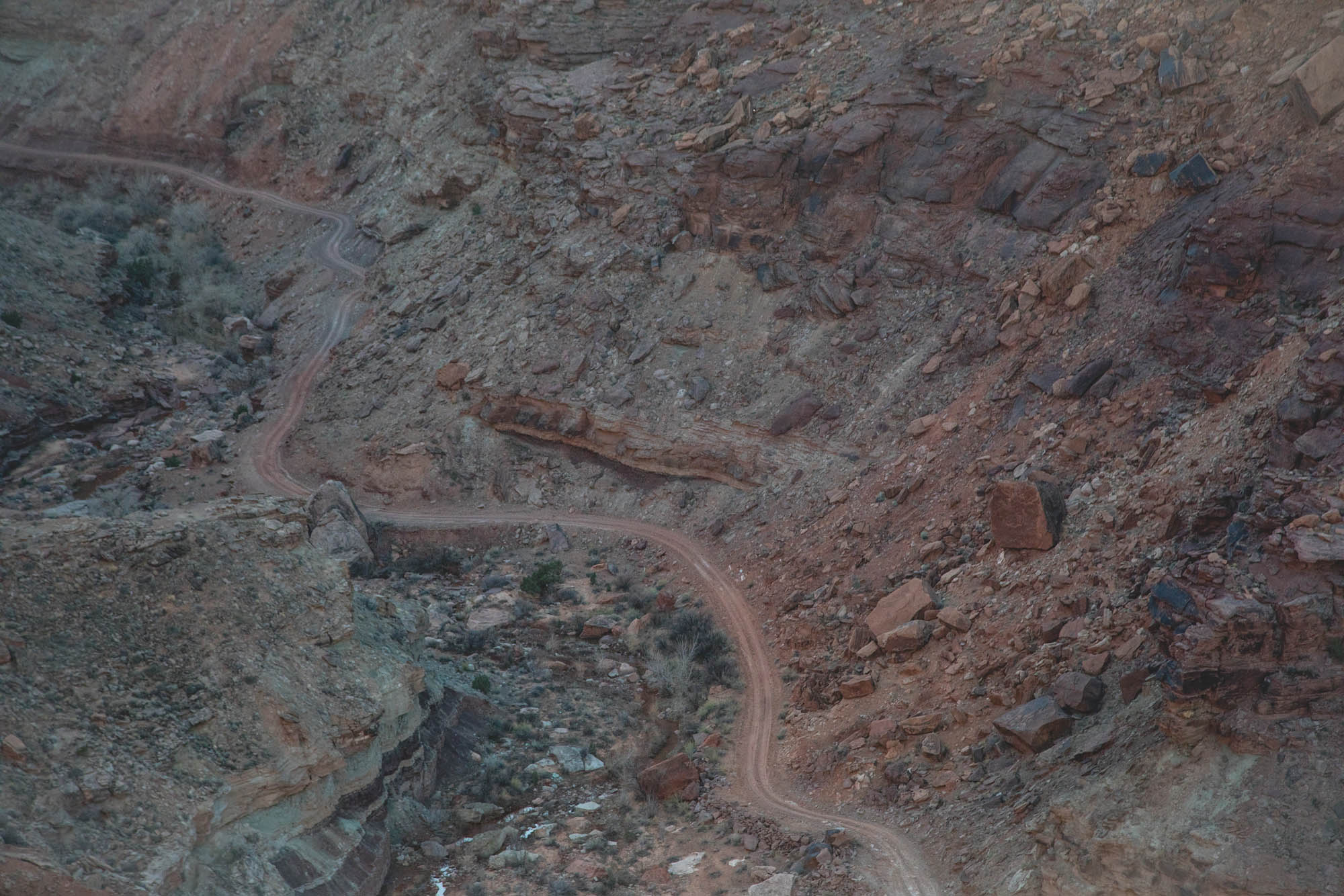
The almost entirely unpaved Hey Joe Safari explores nearly every type of surface you could hope to ride on a visit to this epic little pocket of SE Utah, from slickrock slabs and sandy roads to twisting singletrack. Its name is derived from two parts: Hey Joe Canyon and the sandy Jeep Safari routes it follows. Known as canyon country, most mountain bikers rarely experience the beauty of these winding and beautiful drainages. The 1,000-foot hike-a-bike down into Hey Joe Canyon feels wildly exposed and requires a good sense of route finding to pick your way down. Yet, when you find yourself at the bottom, having unlocked this piece of the puzzle, you’re rewarded with fantastic riding along the Green River, something not many cyclists get to experience. Though it’s steep and long, the climb out offers breathtaking views of an infrequently traveled area.
Moab makes for a brilliant place to plan a bikepacking route, not only because of its expansive trail network, but because of the many dirt roads that offer endless options along the mesa tops. During the Cold War, when the United States’ need for uranium was at an all time high, small-time prospectors took to the hills of the Colorado Plateau in search of carnotite, a mineral rich in uranium. Subsequently, roads were built all over SE Utah – especially around Moab – to facilitate digging during this prospecting boom. These roads hold boundless touring potential, though unfortunately the downside is that the abandoned mines have proved to be highly toxic to area water supplies, most notably affecting the Navajo and Ute Nnations.
Route Development
This route was developed as a result of two other options being shut down. Even so, we were extremely happy that these circumstances led to the creation of this route. Weather turned us away from a scouting trip in the Bears Ears National Monument area, we didn’t want to deal with permits for the White Rim, and the La Sals still held snow. Thus came the Hey Joe Safari, cobbled together after lurking around the internet and finding reports from others who had climbed out of Hey Joe Canyon. By combining classic singletrack, a few random roads, and Hey Joe Canyon, we had ourselves a pretty neat weekend loop. After sending our proposed itinerary to several locals for feedback, Eric at Moab Cyclery responded with a bit of beta and a concern for the hike-a-bike into the Canyon. He’d never heard of anyone cycling it before. We’re happy to report that the hike-a-bike, although precarious, is manageable.
Route Difficulty: This route has been awarded a 5 out of 10 difficulty rating. A combination of sandy surfaces, a thrilling hike-a-bike, and water scarcity help this route earn its grade. The sandy sections can make for some hard hours in the saddle, especially without the right tires. The hike-a-bike into Hey Joe Canyon is fairly easy to follow as long as the cairns are in place. If not, it’ll be a hell of an adventure finding the way down. The route is based upon about 35-mile days, although some of those miles can roll fairly slowly due to the substantial amount of singletrack and small sections of sand. Make sure to check out the Must Know tab below for details.


Submit Route Alert
As the leading creator and publisher of bikepacking routes, BIKEPACKING.com endeavors to maintain, improve, and advocate for our growing network of bikepacking routes all over the world. As such, our editorial team, route creators, and Route Stewards serve as mediators for route improvements and opportunities for connectivity, conservation, and community growth around these routes. To facilitate these efforts, we rely on our Bikepacking Collective and the greater bikepacking community to call attention to critical issues and opportunities that are discovered while riding these routes. If you have a vital issue or opportunity regarding this route that pertains to one of the subjects below, please let us know:
Highlights
Must Know
Camping
Food/H2O
Resources
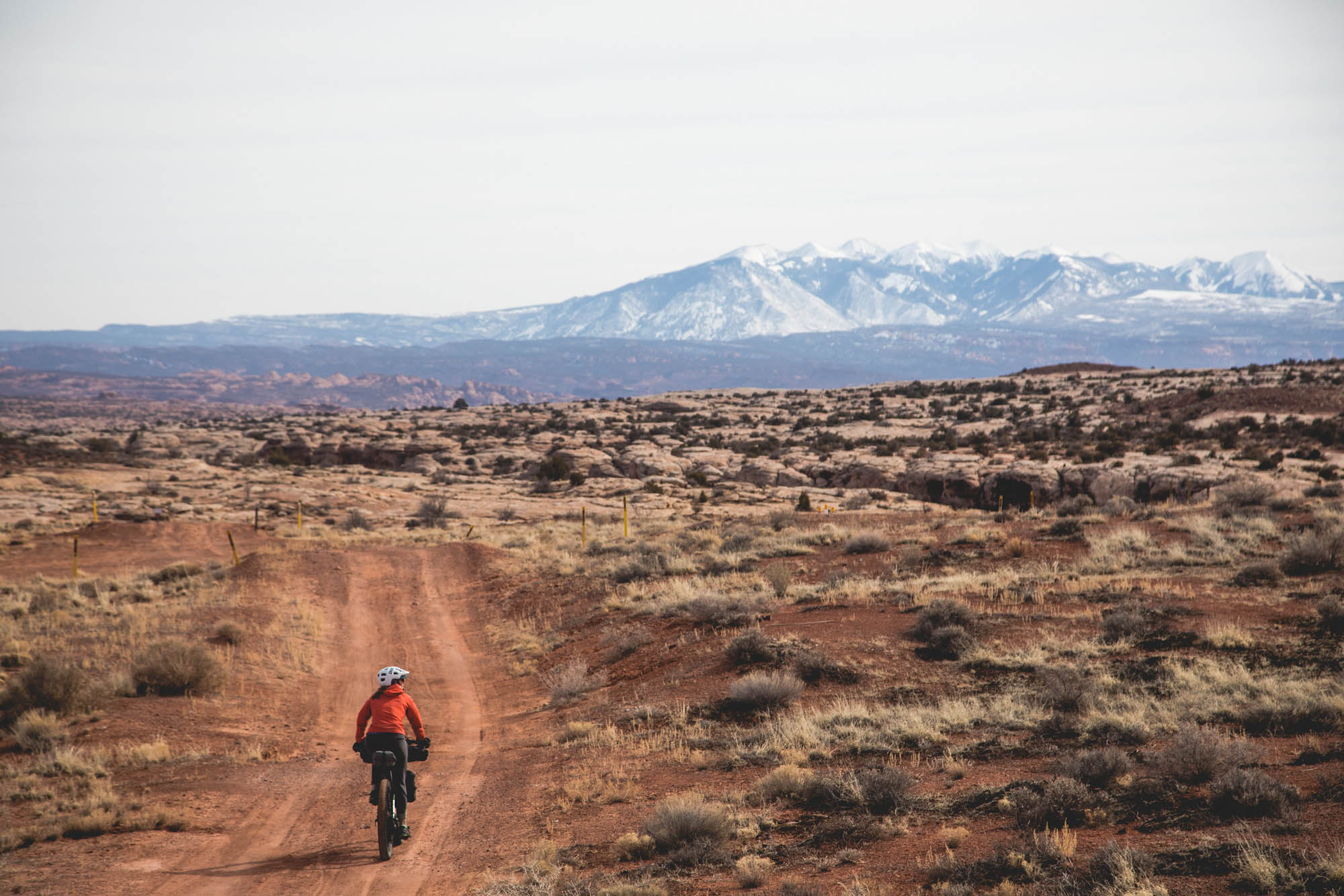
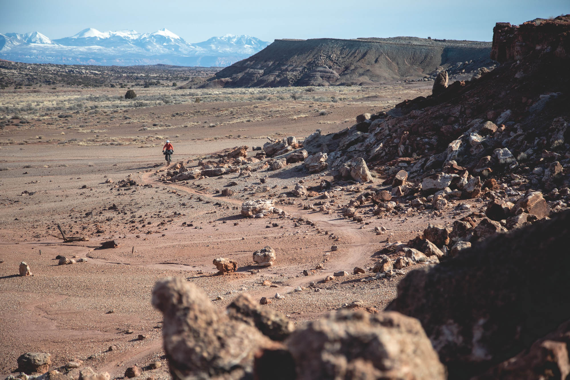
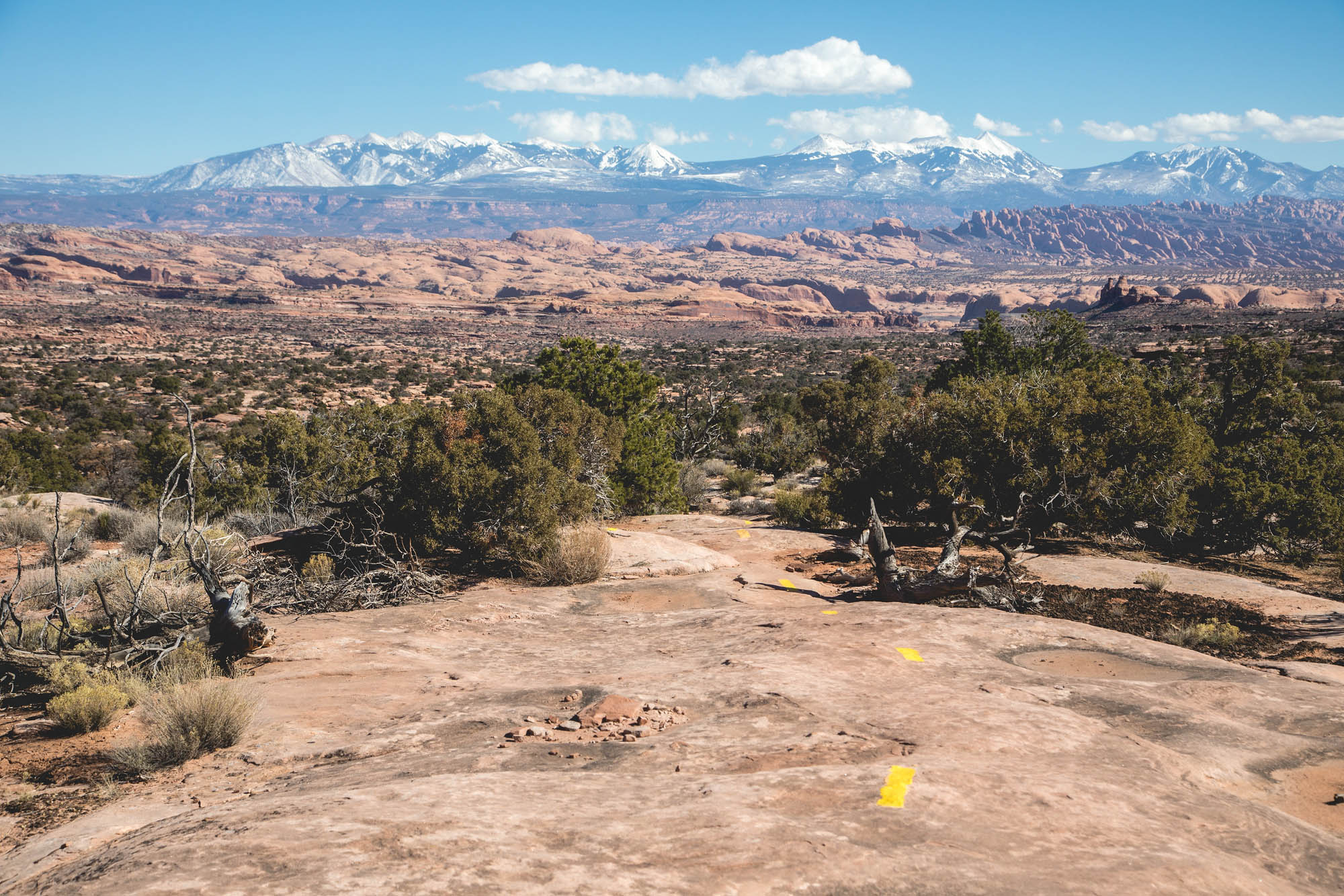
- The views of the nearby La Sal Mountains. Visiting during the winter months creates quite the contrast between the red desert and snowy peaks.
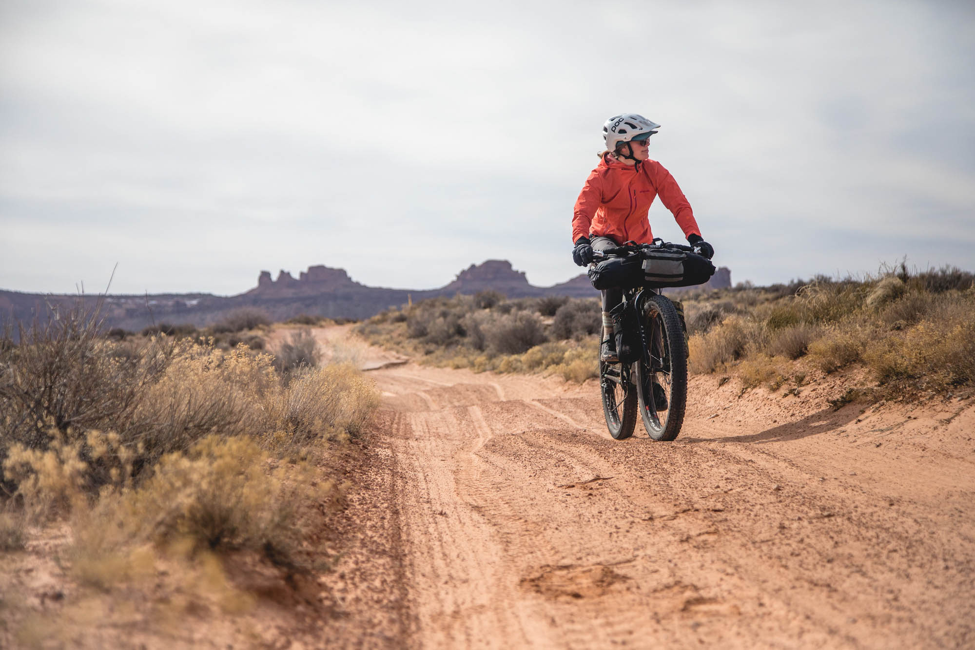
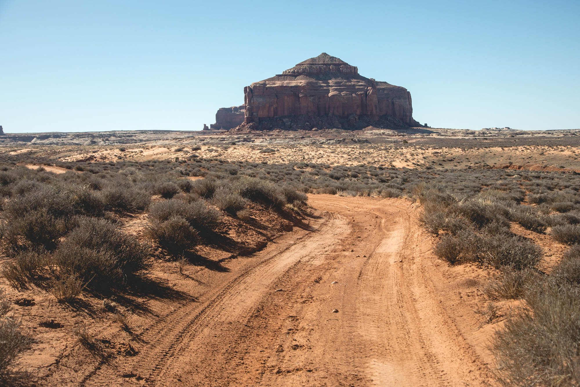
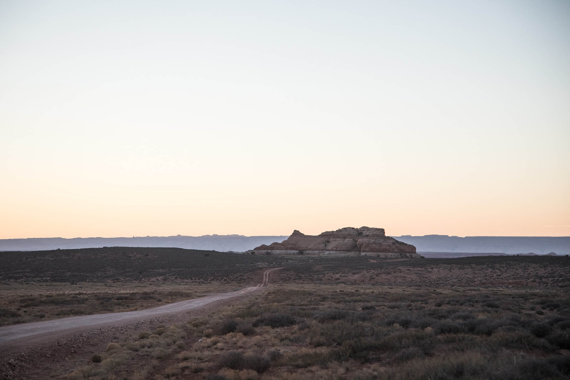
- The seldom traveled and lesser-known “Needles Area,” not to be confused with The Needles in Canyonlands National Park.
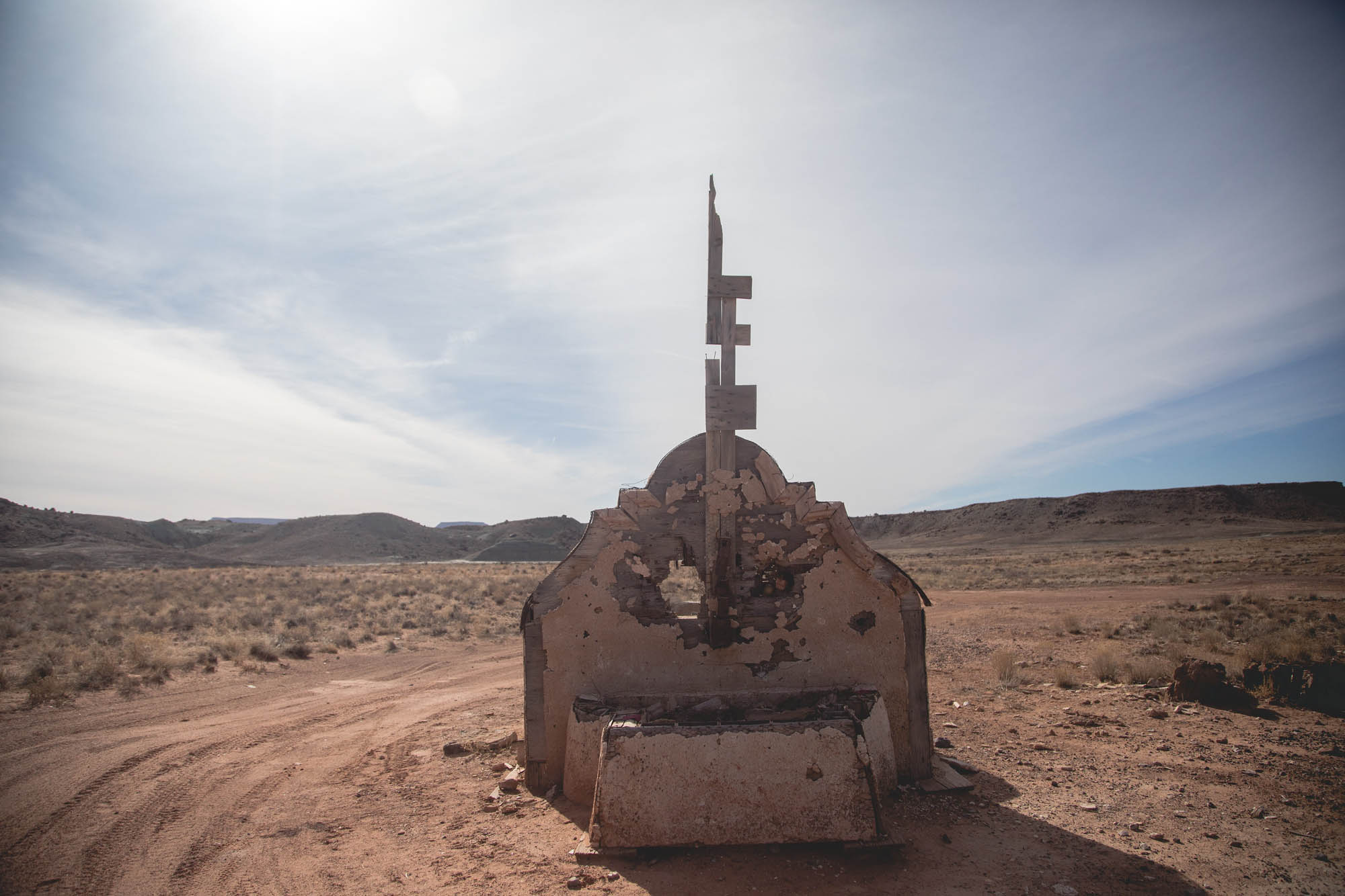
- The hike-a-bike into Hey Joe Canyon and the ride back out along the Green River. Mining equipment still remains in the bottom of the canyon from a long-abandoned uranium mine.
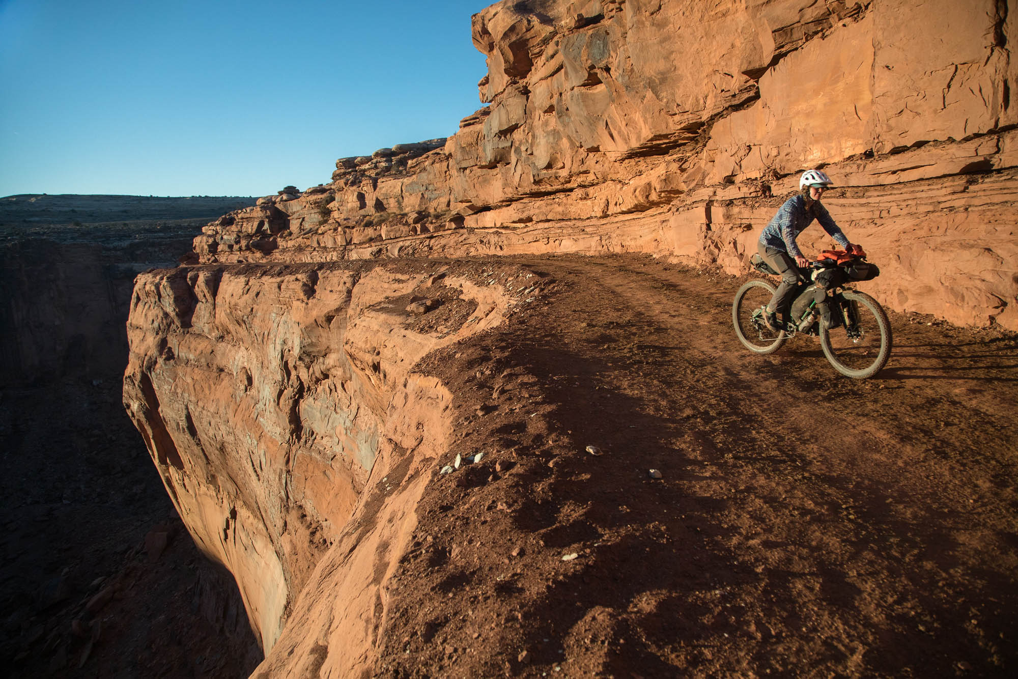
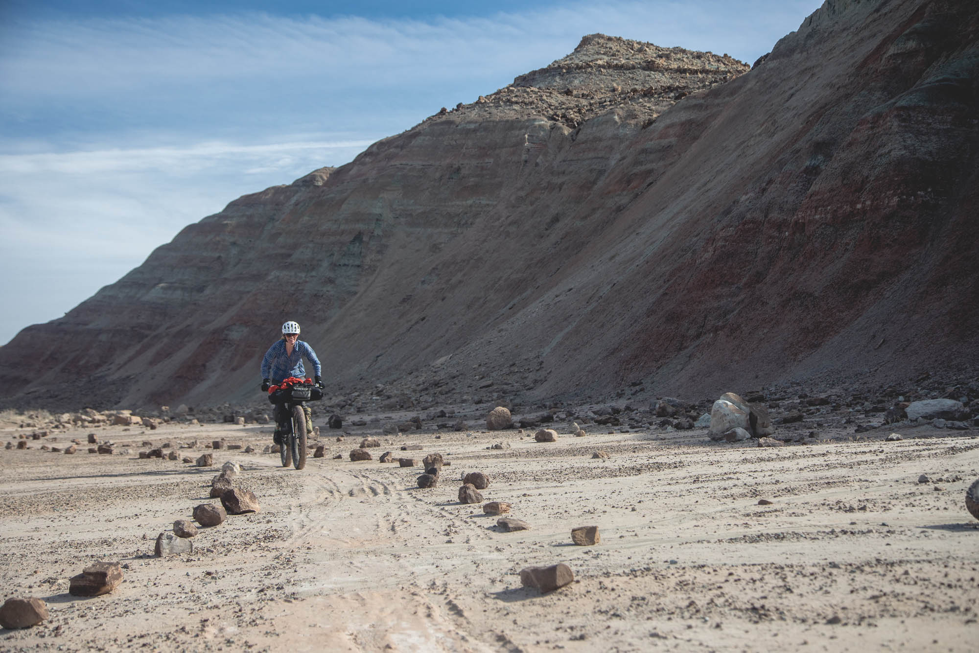
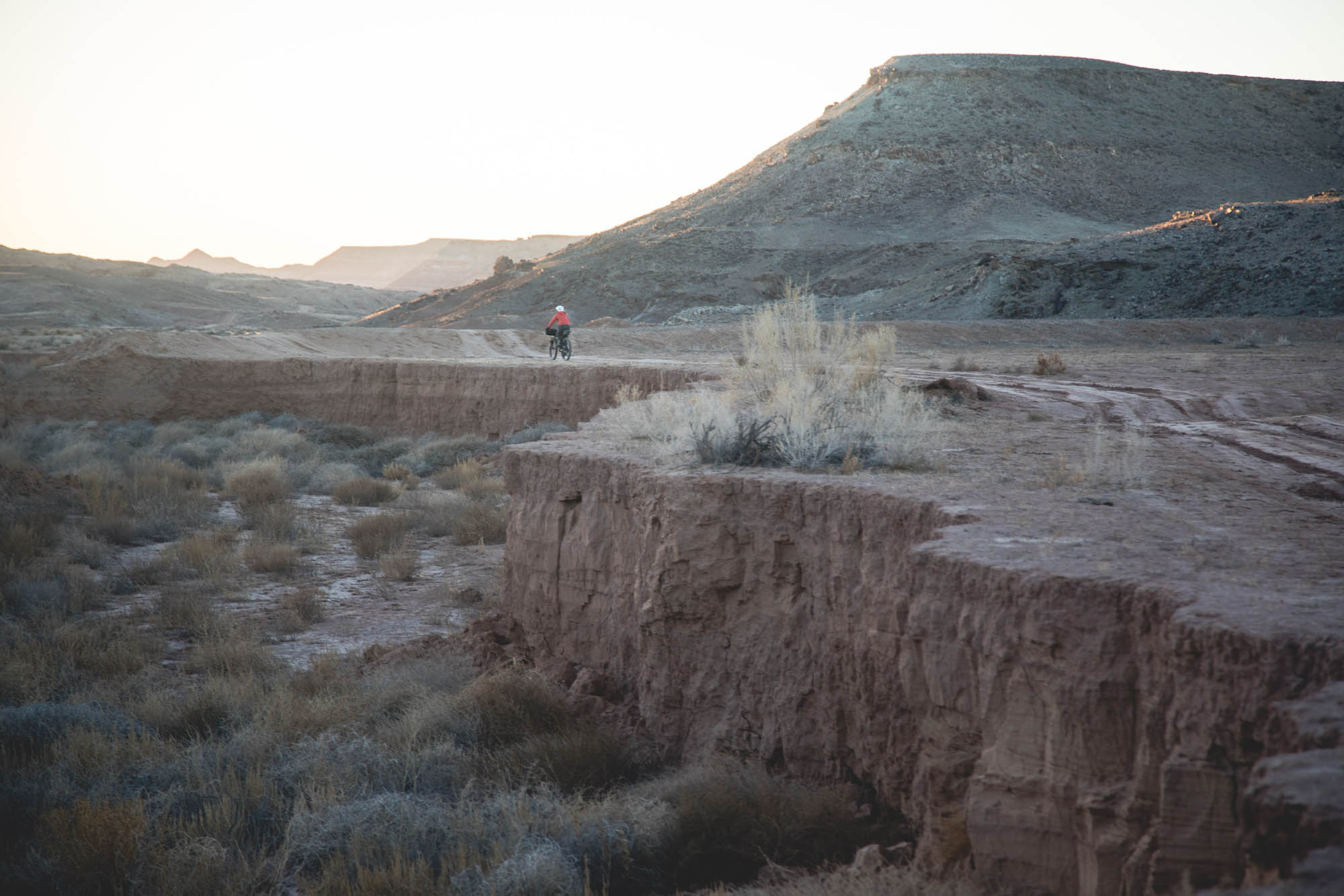
- The climb out of Spring Canyon. The wildly exposed edge drops away to reveal some gorgeous views of the canyon and the Green River.
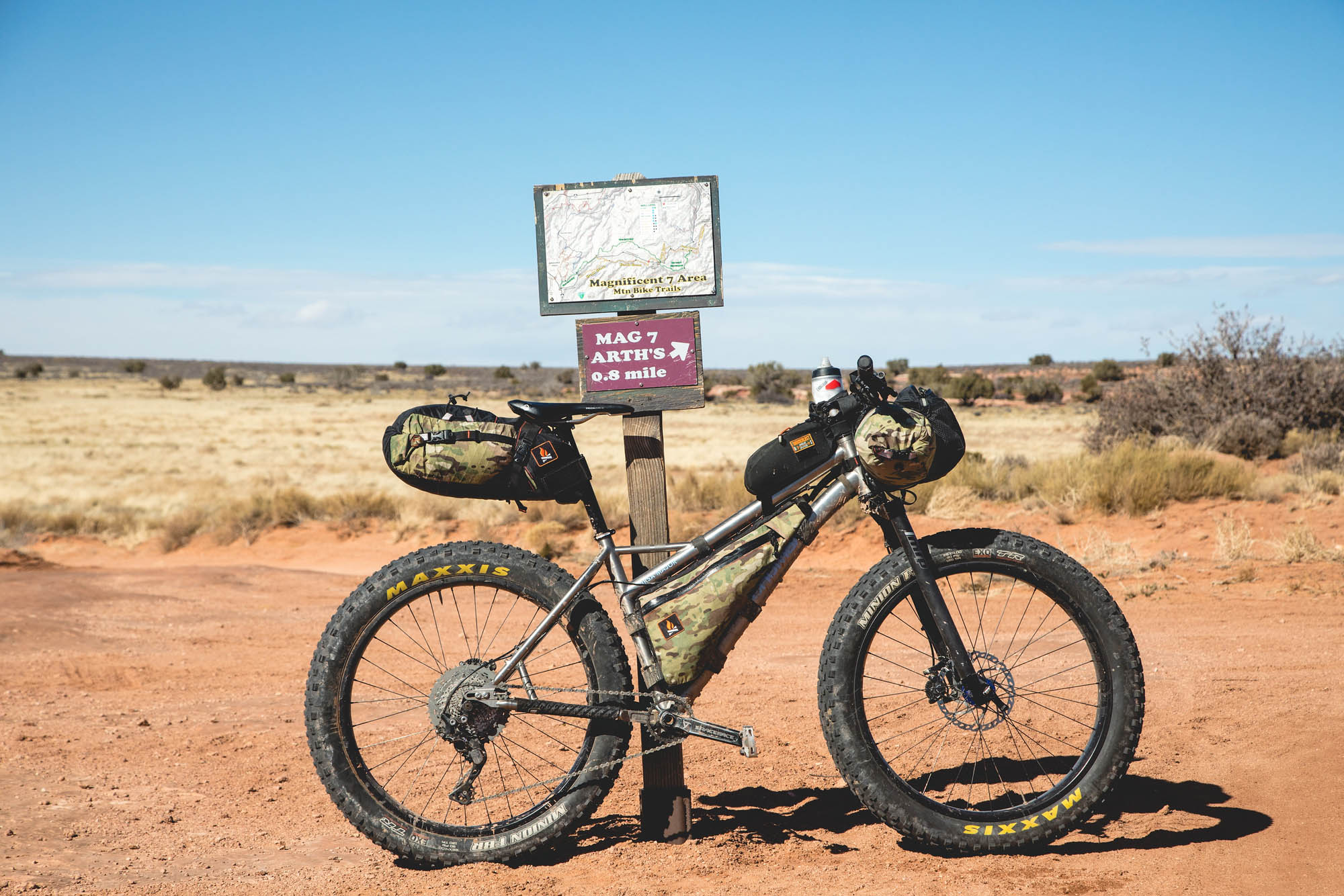
- Riding the Magnificent 7 trails almost all the way back to the starting point.
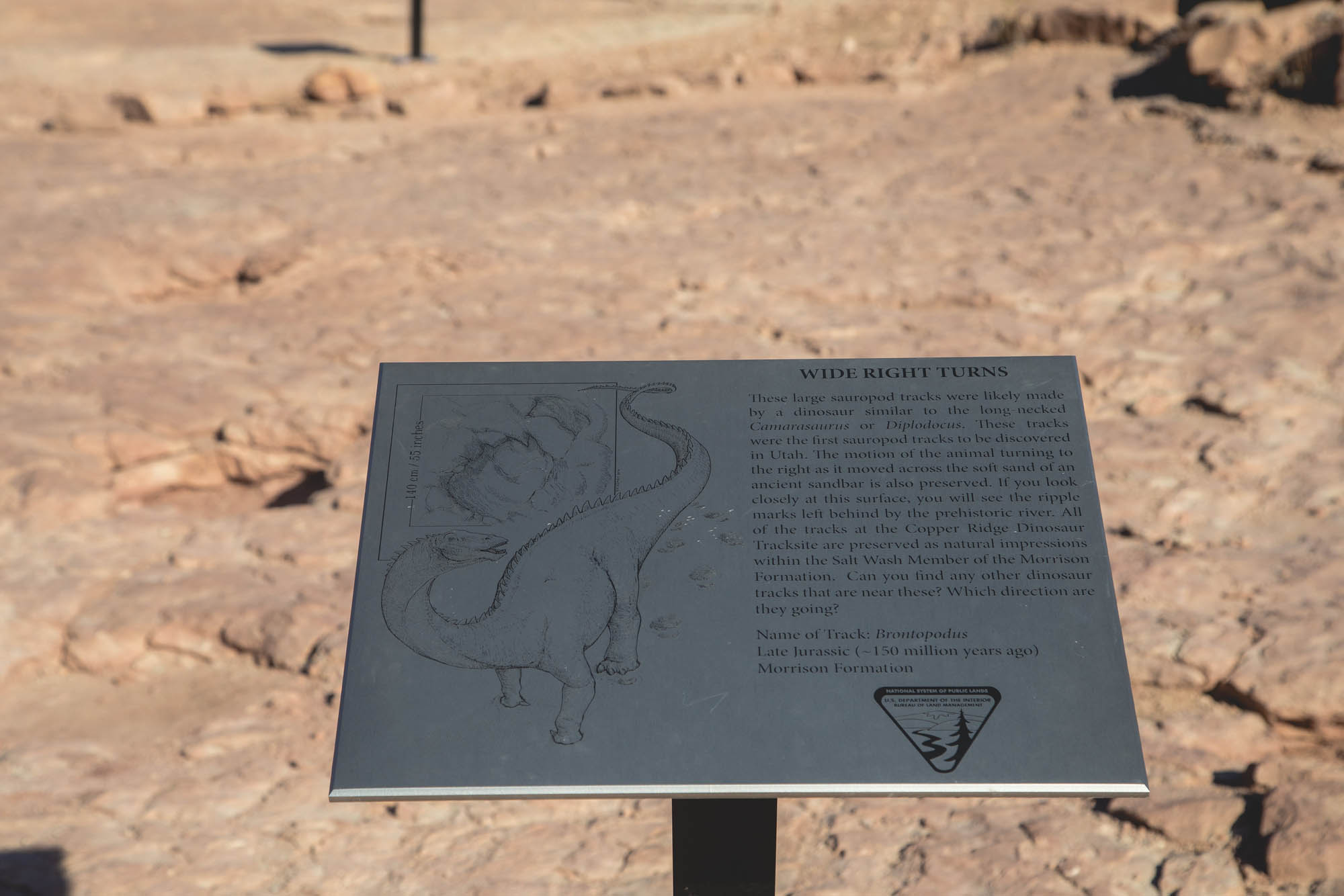
- The Copper Ridge Dinosaur Tracks (and, from what I’ve heard, the Dinosaur Stomping Grounds are quite impressive, just a short hike away).
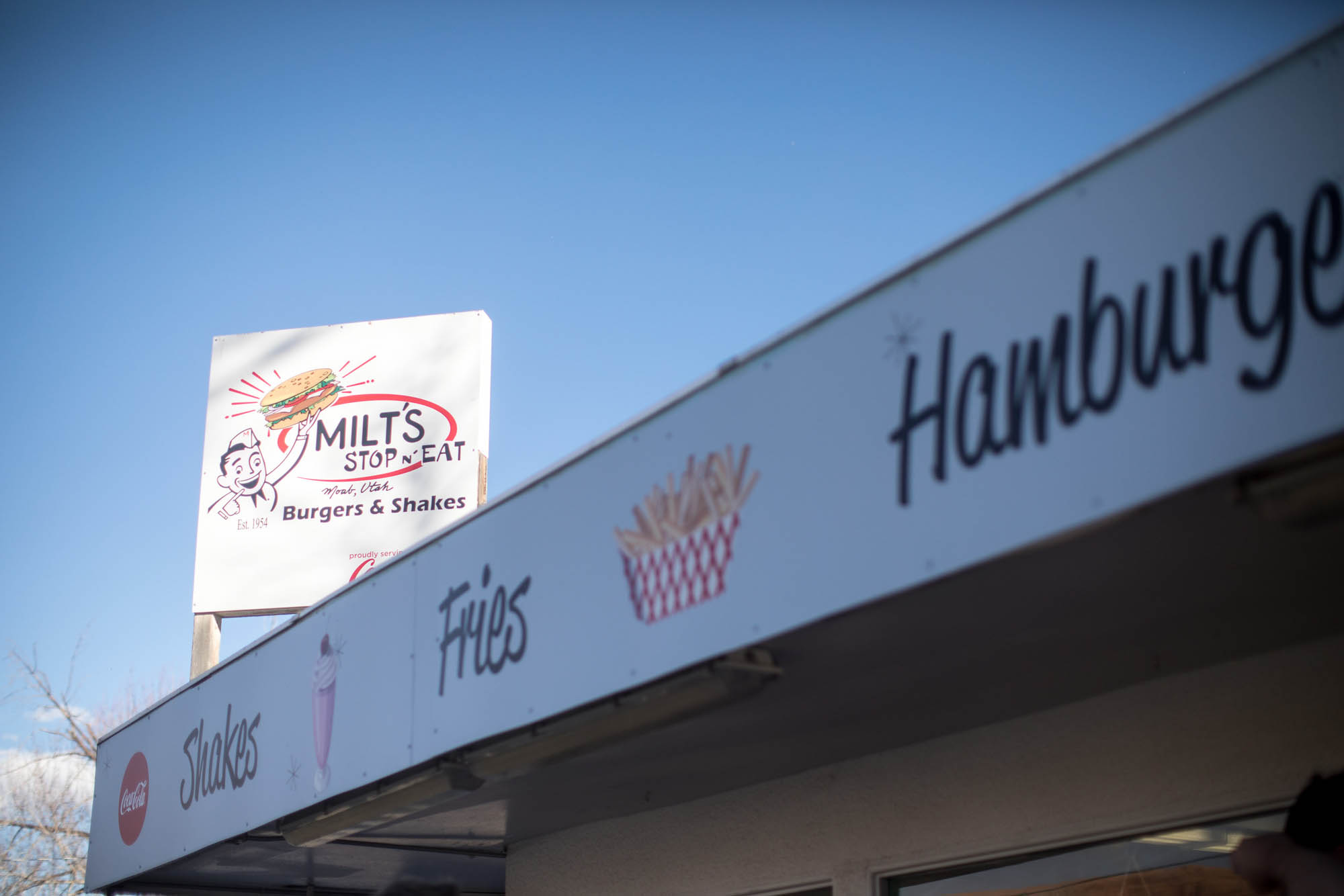
- The feast waiting for you at Milt’s Diner just off the highway in Moab.
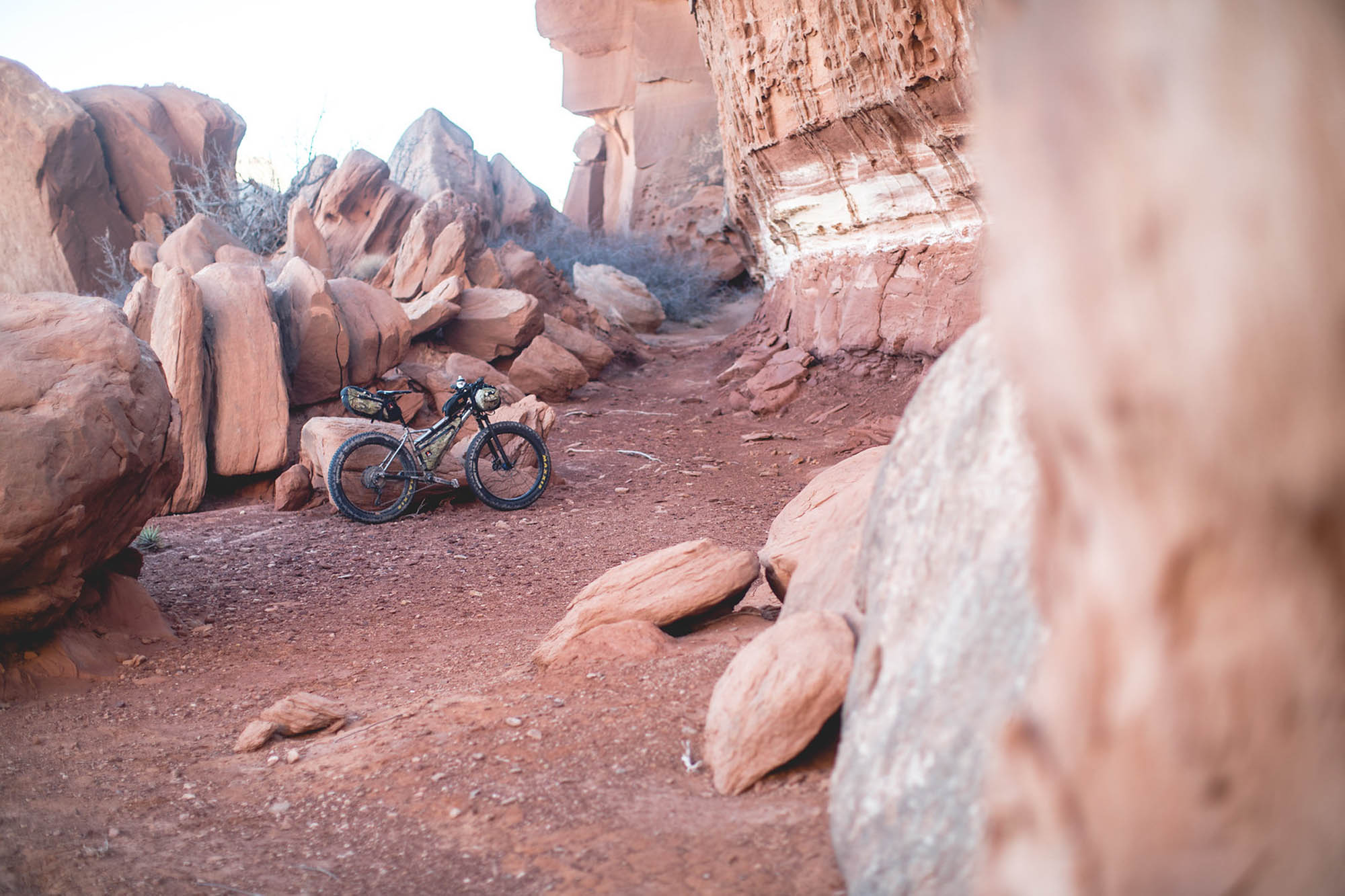
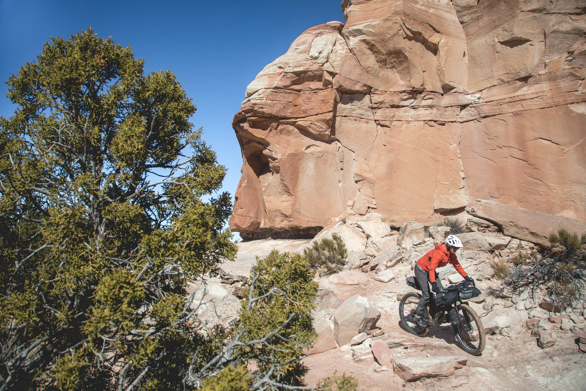
- Best Bike: A plus sized tire is a good idea due to the sandy nature of some of the roads. Progressive geometry and possibly even some suspension would suit the singletrack nicely, especially the Magnificent 7 Trails.
- Cold Nights and Hot Days: Even though the days can get quite warm, the nights still get very cold. We rode the route in February during a mild winter. Transitional months from winter to spring or fall to winter are great times to ride it.
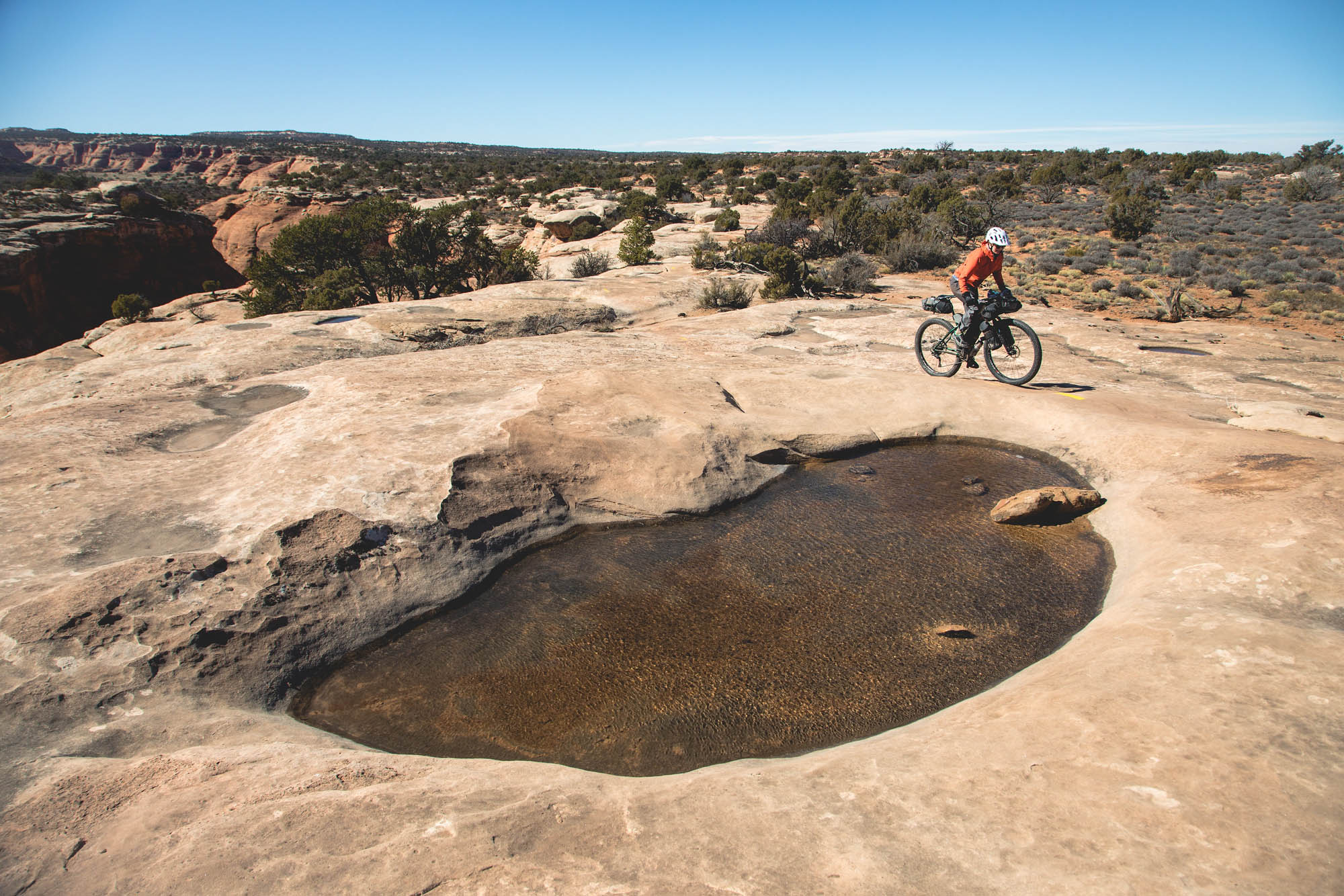
- Water: Although it’s possible to find water along the route, it takes familiarity with the desert landscape to make that happen. It also can require a good amount of time off trail, searching for muddy potholes. Alternatively, we choose to stash water at the Lone Mesa Campground (1 gallon/person) and the most northern crossing of Highway 191 (1 gallon/person). It’s not recommended to drink from the Green River. If you must, the water should be left to settle, allowing the silt to separate from the water. Make sure to treat liberally!
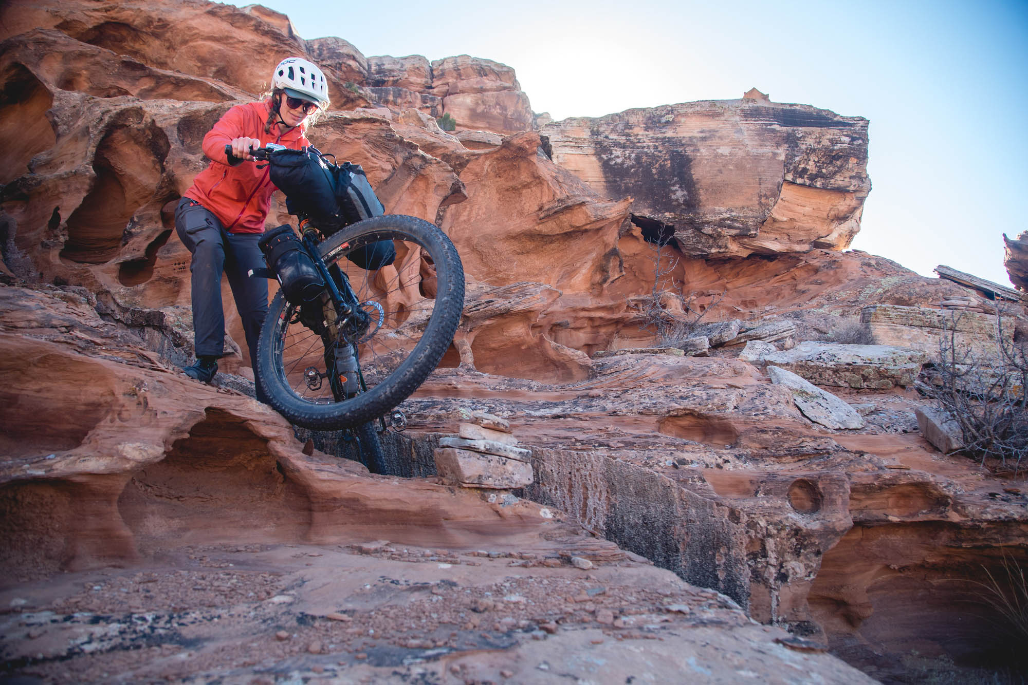
- Hey Joe Canyon hike-a-bike: This 1,000-foot scramble to the bottom of the canyon requires patient route finding, facilitated by fairly obvious cairns. To borrow some climbing terminology, many portions of this hike-a-bike would most likely be considered an exposed Class 2. (Class 2: Simple scrambling, with the possibility of occasional use of the hands. Falls could be serious or potentially fatal. Hiking Boots highly recommended).
- Bring proper footwear: Just to reiterate the seriousness of the hike-a-bike above, clipless shoes would not fare well on this terrain. Flat-soled shoes with sticky rubber will work best for this section.
- Adaptability: With all of the roads in the area, it’s very easy to substitute one road for another. For instance, BLM 137 to Secret Spire Safari Rte might result in less sand riding. Or, if for some terrible reason, skipping the climb into Hey Joe Canyon was of interest, the Secret Spire Safari Route leading to BLM 137 would direct you straight to Lone Mesa Campground.
- Highway Crossing: The road crossing on the northern section of Highway 191 can be done in two ways. As mapped on RWGPS, the route involves crossing over a wire fence, which keeps you from riding a couple miles of highway. The alternative is to ride Highway 191 from BLM 143, where the shoulder is large enough but vehicles are moving at 60+ mph.
- You must pack out your poop. Moab is a highly-visited area and the area’s desert soil is not conducive to decomposition. Moab’s tourism authority clearly states on their website, “When developed facilities are not available, all solid waste should be packed out in approved waste bags.” Learn how here.
- Suggested camping for the first night is along Levi Well Road near 10 Mile Wash. Please be careful to find a durable spot in which to set up camp. This is not a designated campsite and desert flora, including cryptobiotic soil, is very susceptible to being trampled.
- Aside from the suggested area above, camping can be found at several spots along Levi Well Road as well as the Needles Area Rd (seen on the Ersi Topo map overlay).
- The Lone Mesa Campground is a designated campground. Although there will most likely be other campers, it should be fairly easy to find a spot to camp.
- Additional camping is available near the Copper Ridge Dinosaur Tracks.
- There are no resupplies along the route.
- The City Market in Moab is a decent place to find groceries for the ride.
- Water is difficult to find along the route. There are places to stash water at Lone Mesa Campground and the northern crossing of Highway 191. Stashing water takes about an hour of driving and is well worth the time. Please collect your trash from your stashes. This was easiest for us after the tour, on our drive out. At least 1 gallon/person/day is absolutely necessary.
- It is enthusiastically encouraged to eat at Milt’s Diner after your tour, and possibly before it as well. I suggest ordering a large milkshake, a double chipotle green chili burger, and pepper jack bacon fries. If you’re not yet convinced, let Brendan Leonard have your ear.
Additional Resources
- Moab Cyclery – There are plenty of bike shops in town, however, Eric at the Moab Cyclery was very helpful when planning our route.
- Dino Beta – discovermoab.com/moab_dinosaurs.htm
- Leave No Trace desert considerations – lnt.org/blog/minimum-impact-desert-considerations
- Moab West Trail Map


Terms of Use: As with each bikepacking route guide published on BIKEPACKING.com, should you choose to cycle this route, do so at your own risk. Prior to setting out check current local weather, conditions, and land/road closures. While riding, obey all public and private land use restrictions and rules, carry proper safety and navigational equipment, and of course, follow the #leavenotrace guidelines. The information found herein is simply a planning resource to be used as a point of inspiration in conjunction with your own due-diligence. In spite of the fact that this route, associated GPS track (GPX and maps), and all route guidelines were prepared under diligent research by the specified contributor and/or contributors, the accuracy of such and judgement of the author is not guaranteed. BIKEPACKING.com LLC, its partners, associates, and contributors are in no way liable for personal injury, damage to personal property, or any other such situation that might happen to individual riders cycling or following this route.
Please keep the conversation civil, constructive, and inclusive, or your comment will be removed.