


Marmot’s Land
Distance
170 Mi.
(274 KM)Days
5-6
% Unpaved
78%
% Singletrack
20%
% Rideable (time)
95%
Total Ascent
26,094'
(7,953 M)High Point
8,757'
(2,669 M)Difficulty (1-10)
6?
- 10Climbing Scale Very Strenuous153 FT/MI (29 M/KM)
- 7Technical Difficulty Difficult
- 7Physical Demand Difficult
- 2Resupply & Logistics Easy
Contributed By
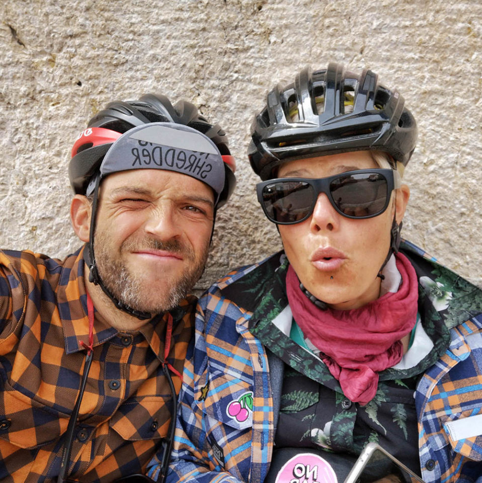
Sara and Andreas
Guest Contributor
Riding all kinds of bikes in and around Switzerland for years, Sara and Andreas finally made a dream come true and left home in Summer 2019 with their loaded bikes for an open-ended adventure. Due to the pandemic, they returned to Switzerland and are now discovering new corners of their homeland until it’s possible to travel further again. Follow their journey on their website, or on Instagram @projectpedalfurther.
Last published in 2021, Marmot’s Land underwent a significant update in October, 2025.
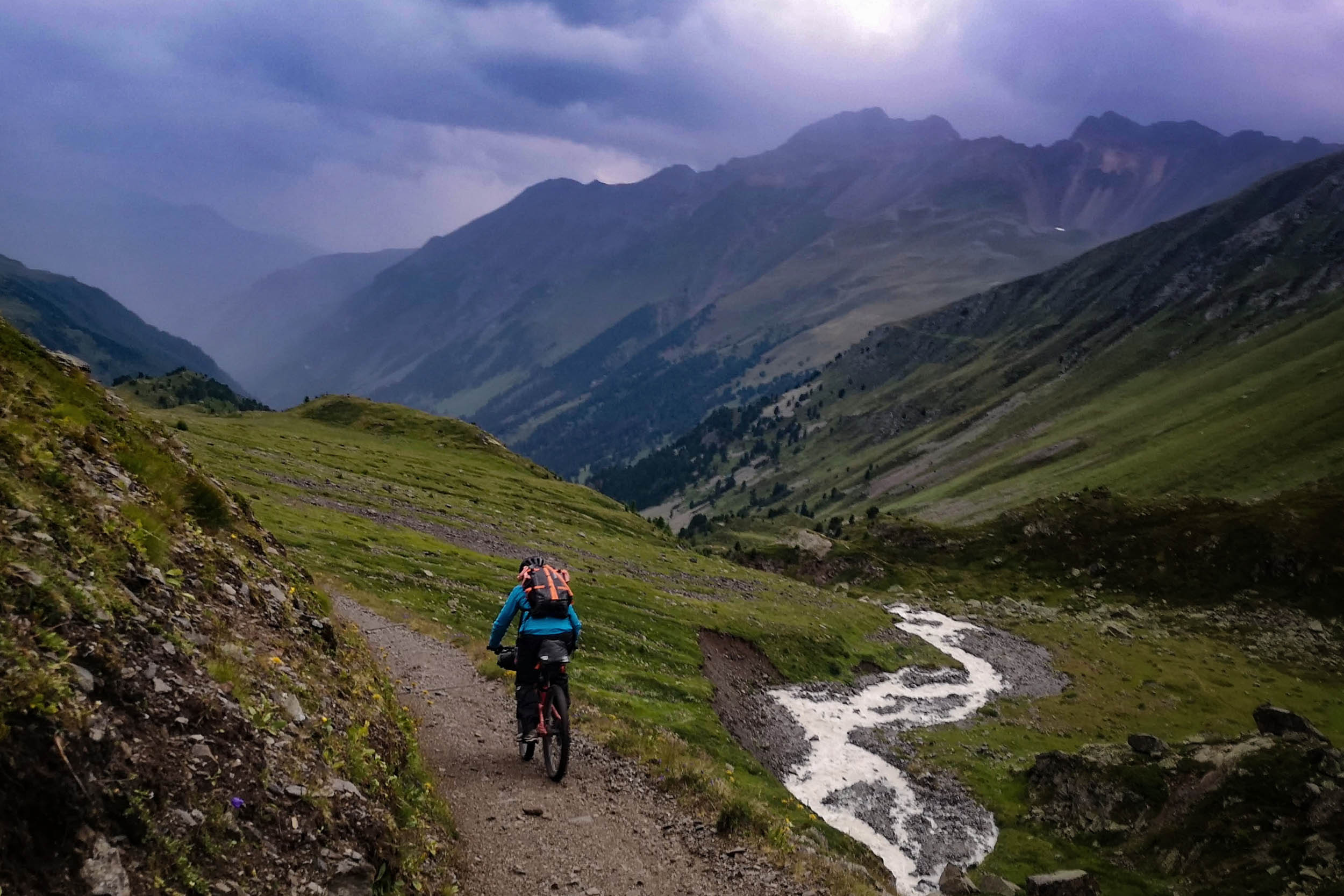
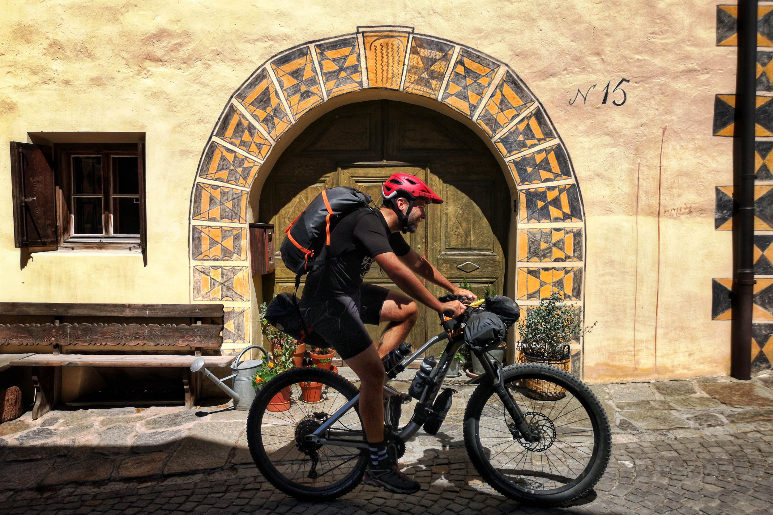
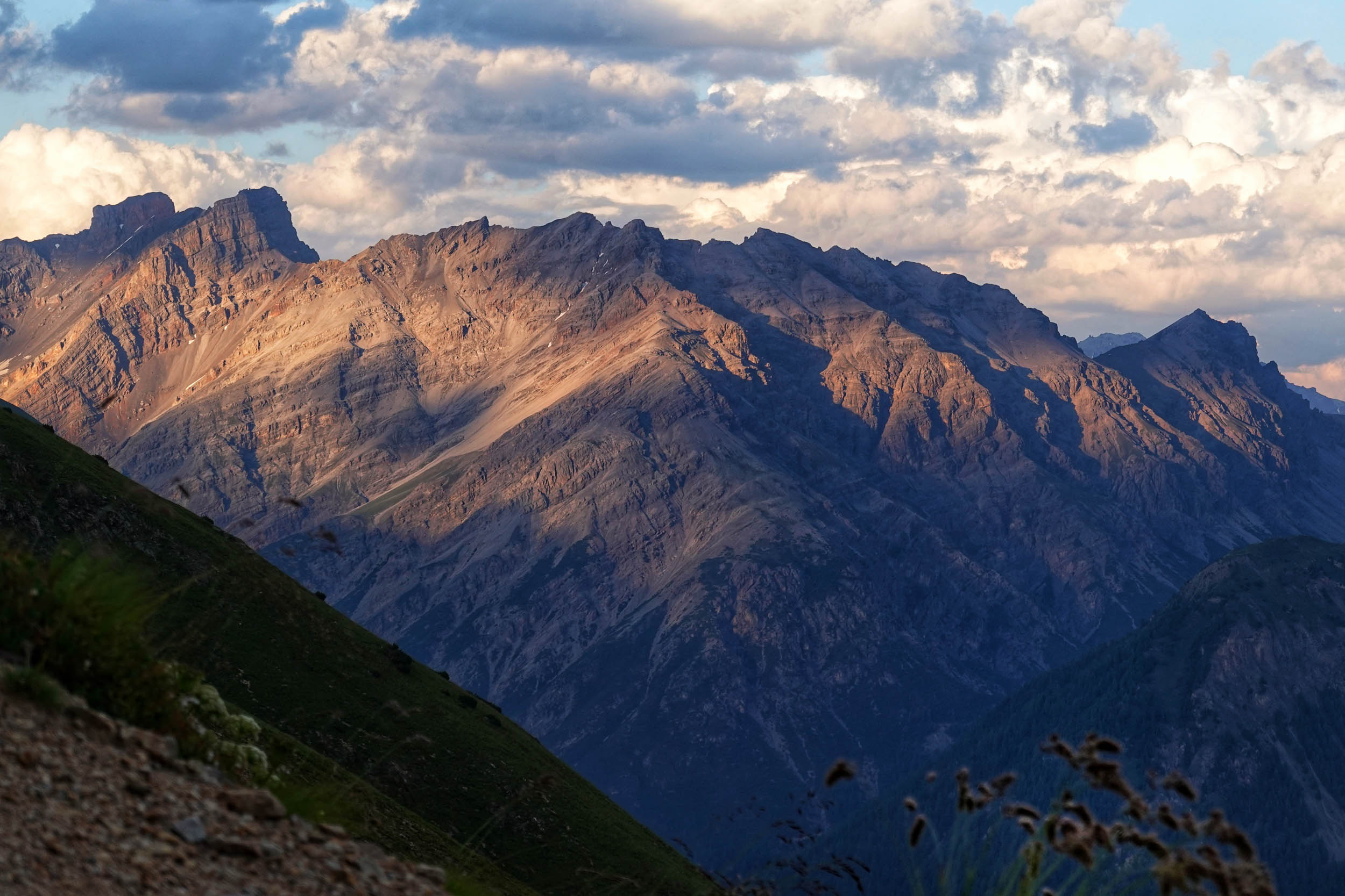
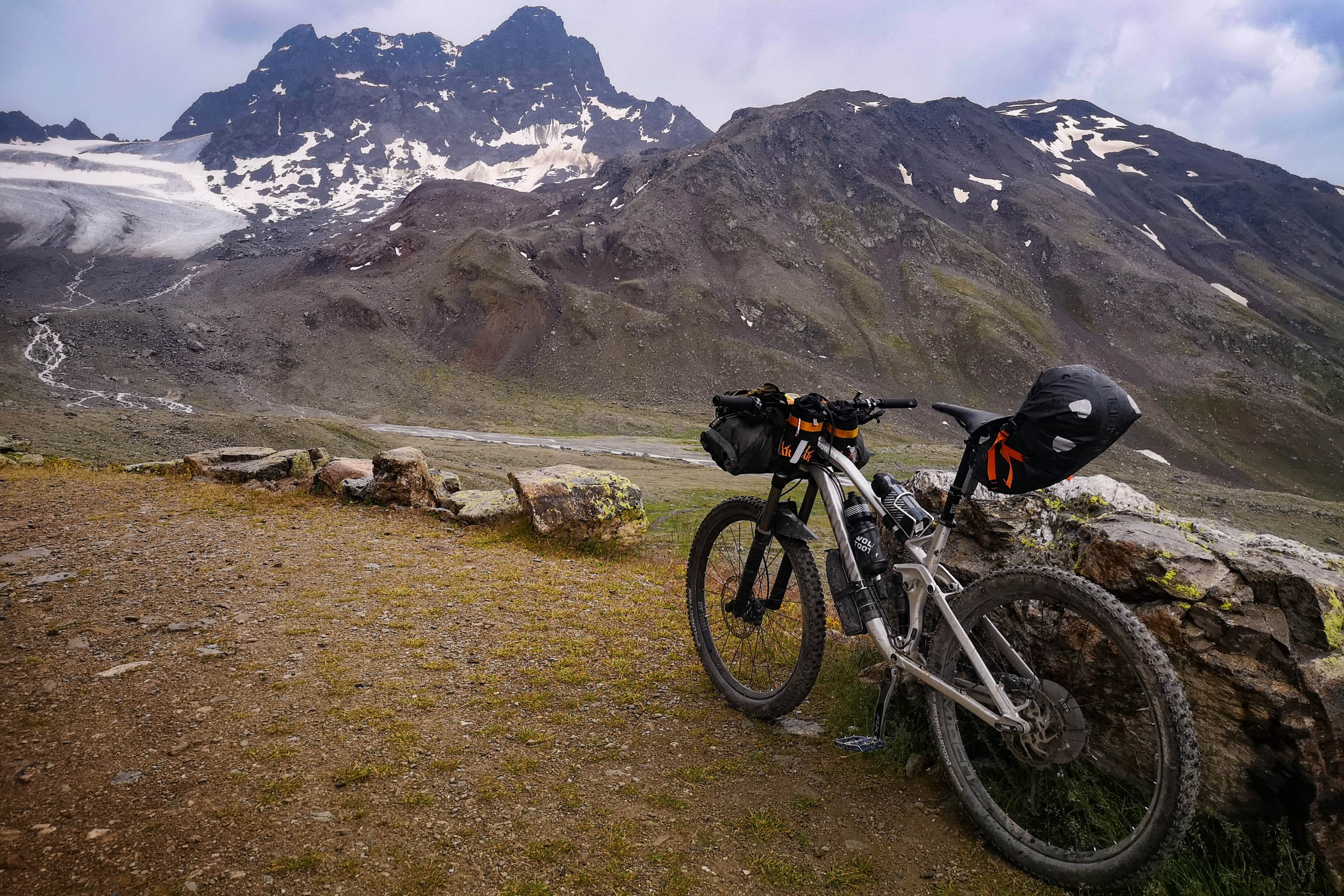
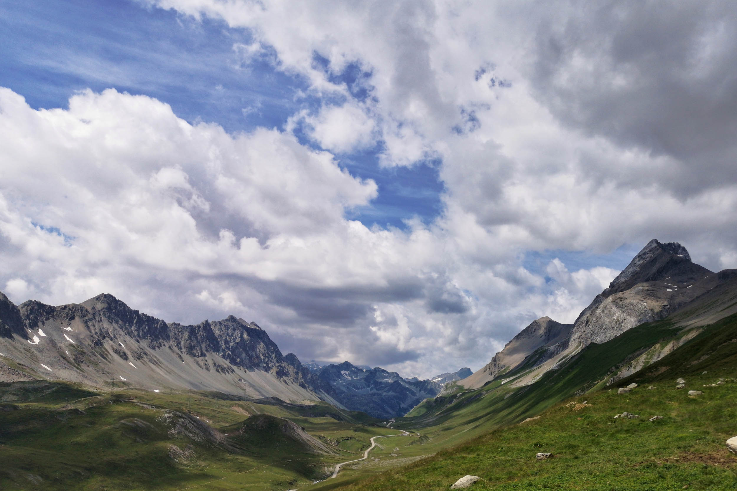
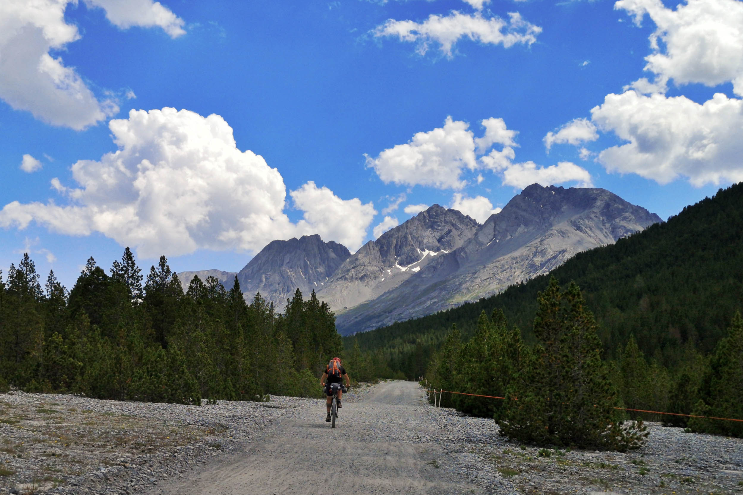
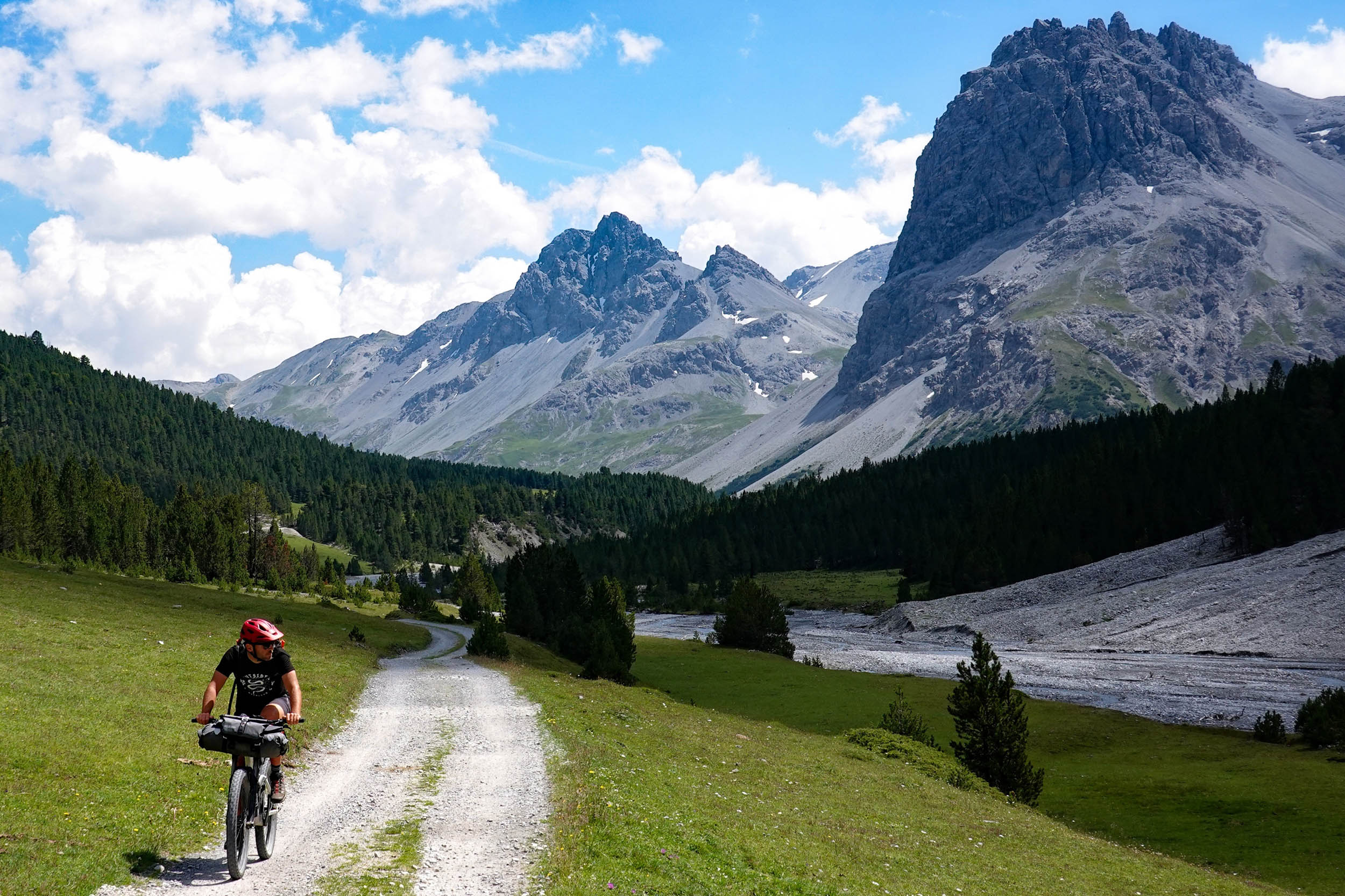
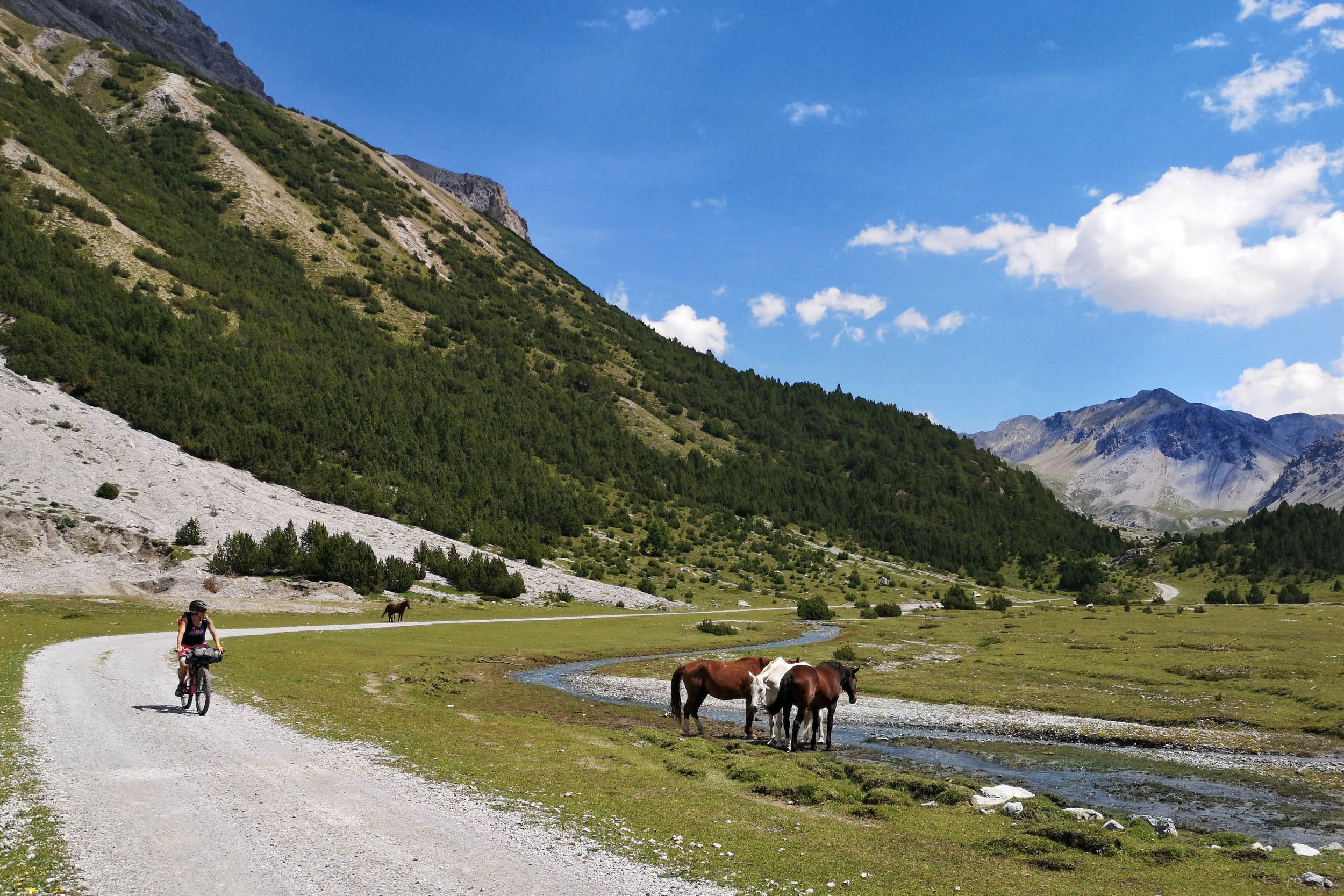
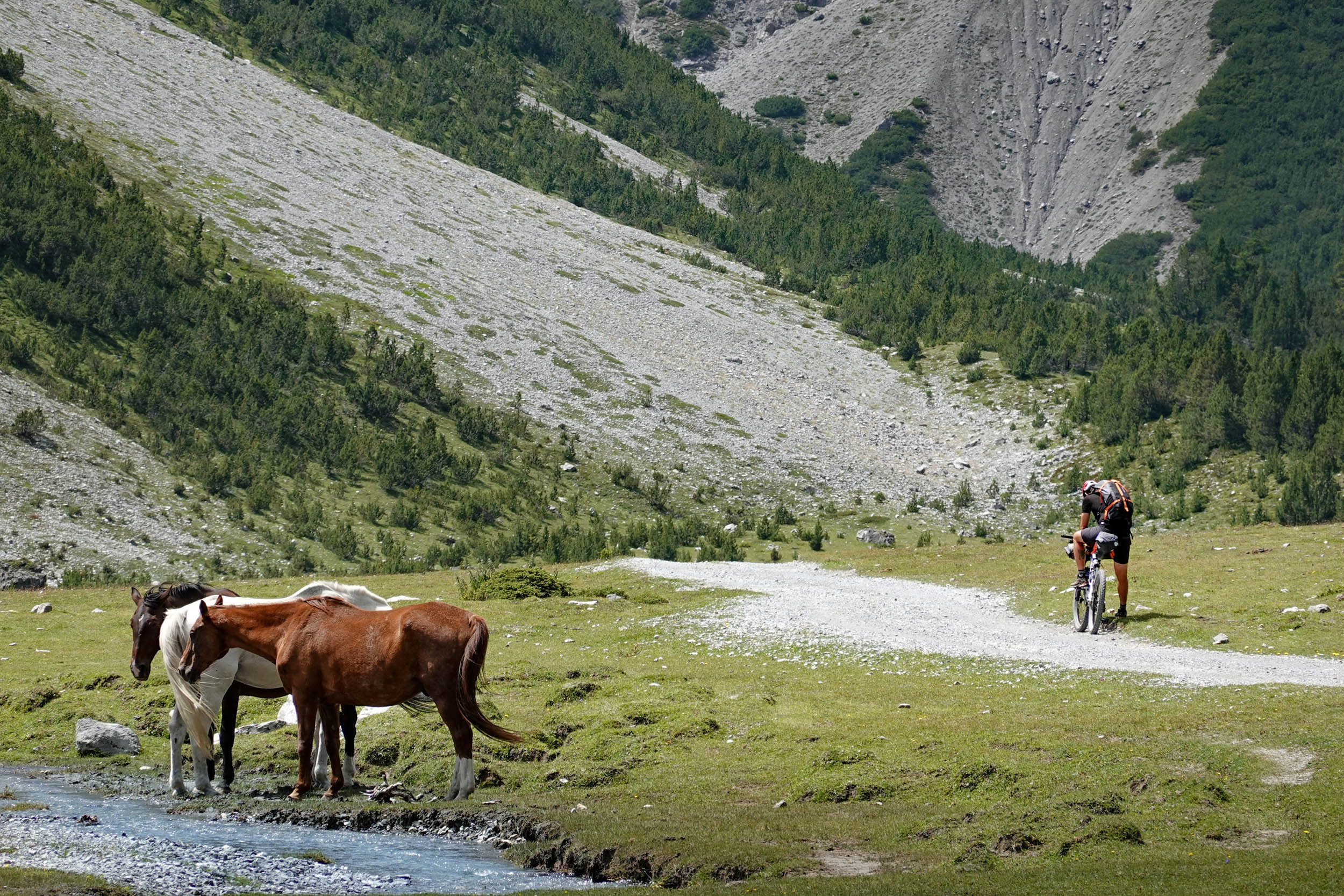
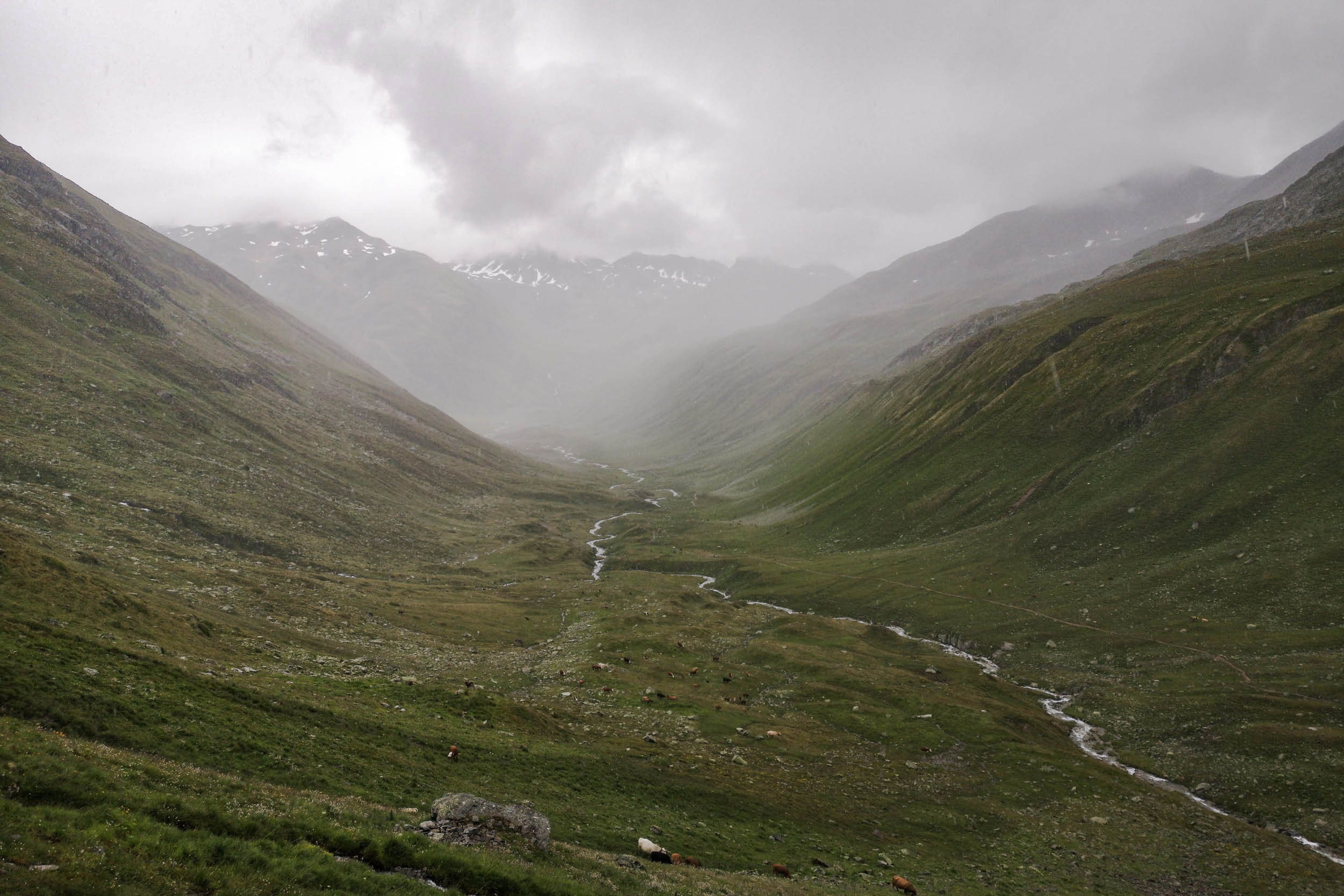
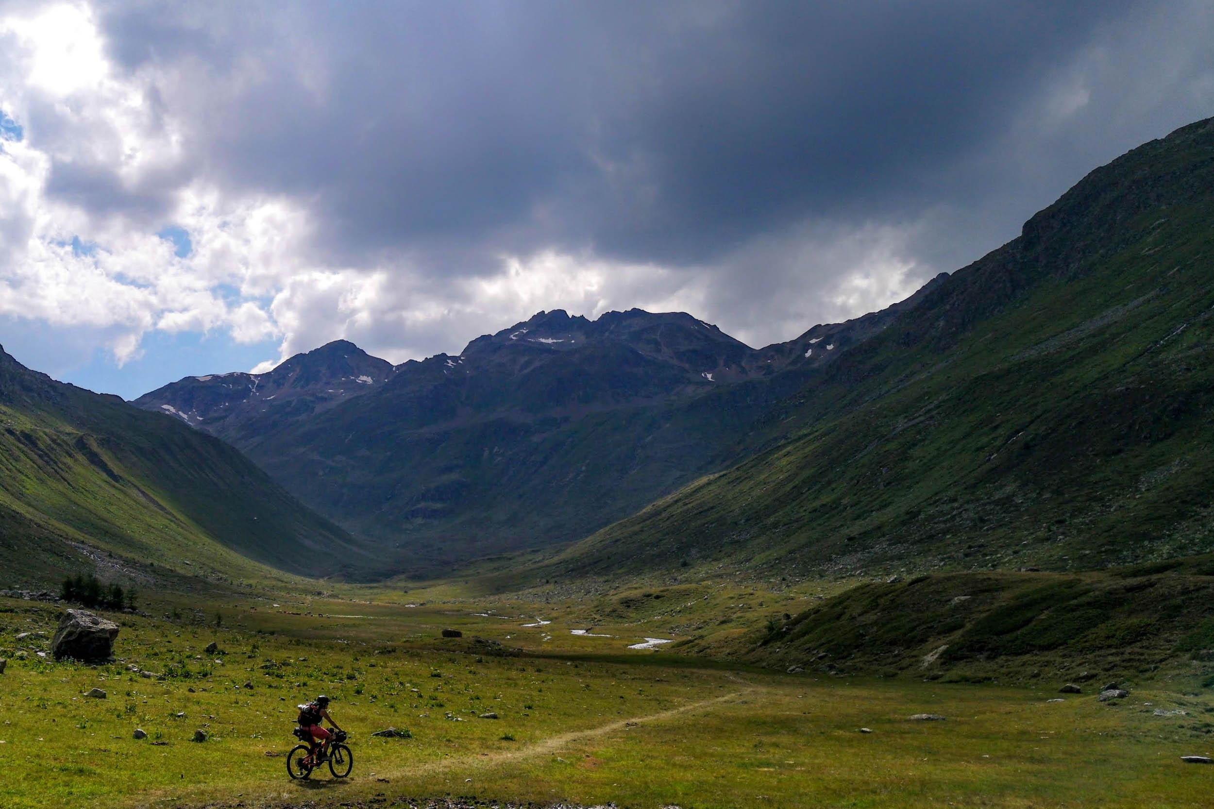
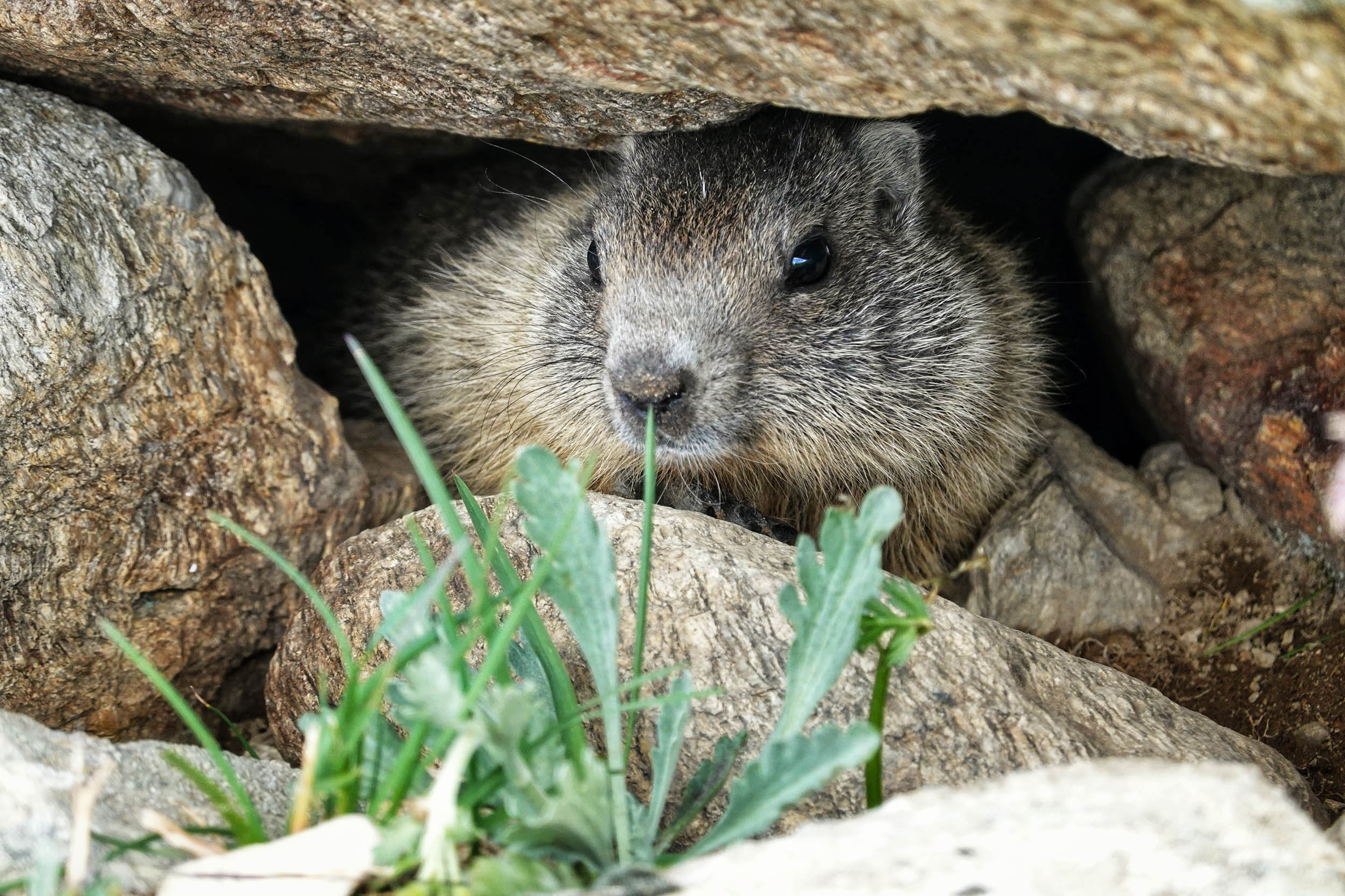
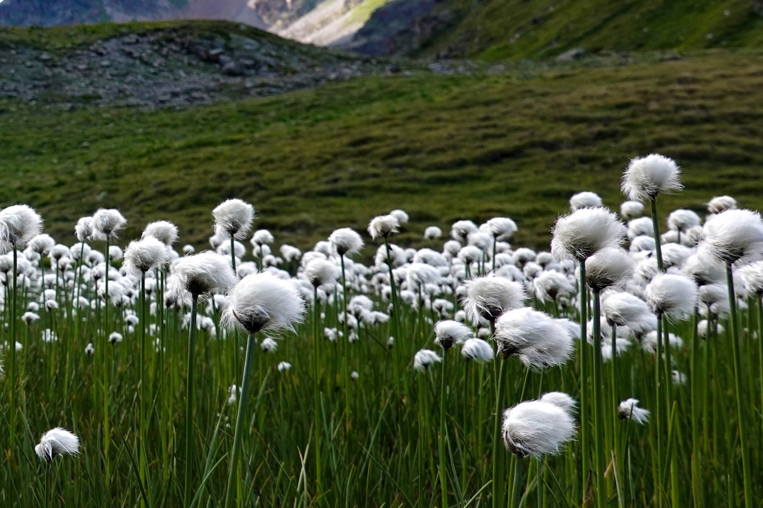
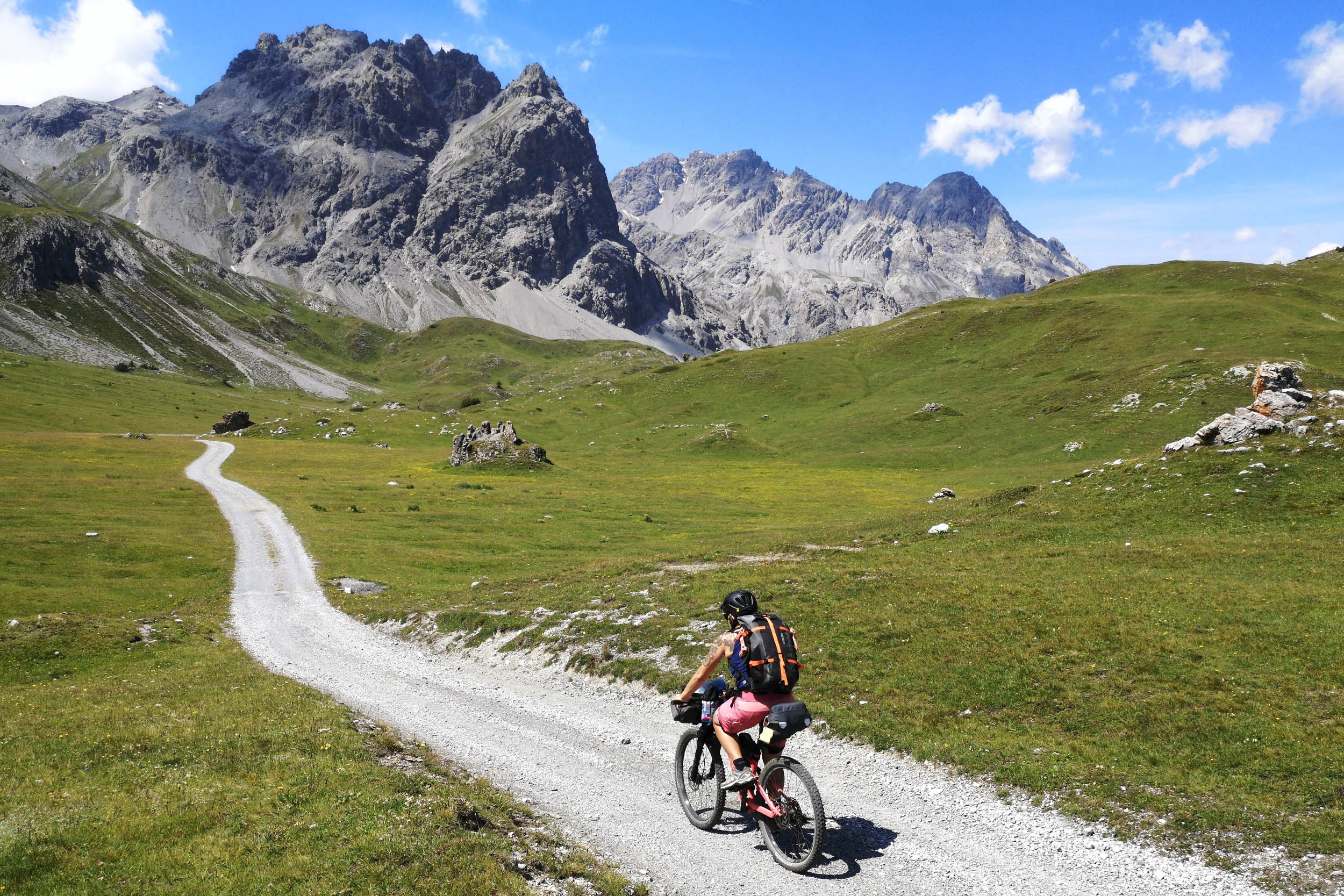
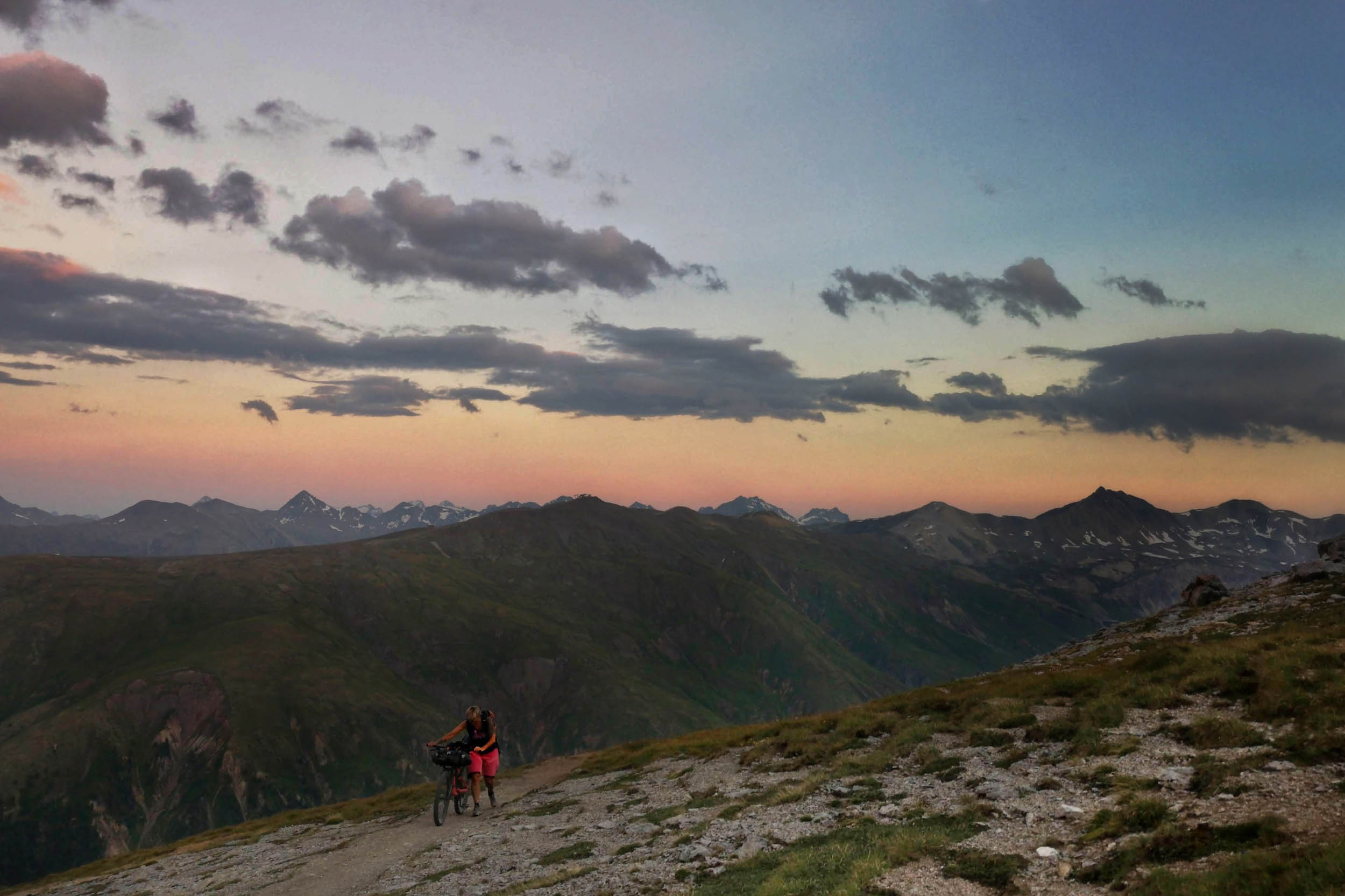
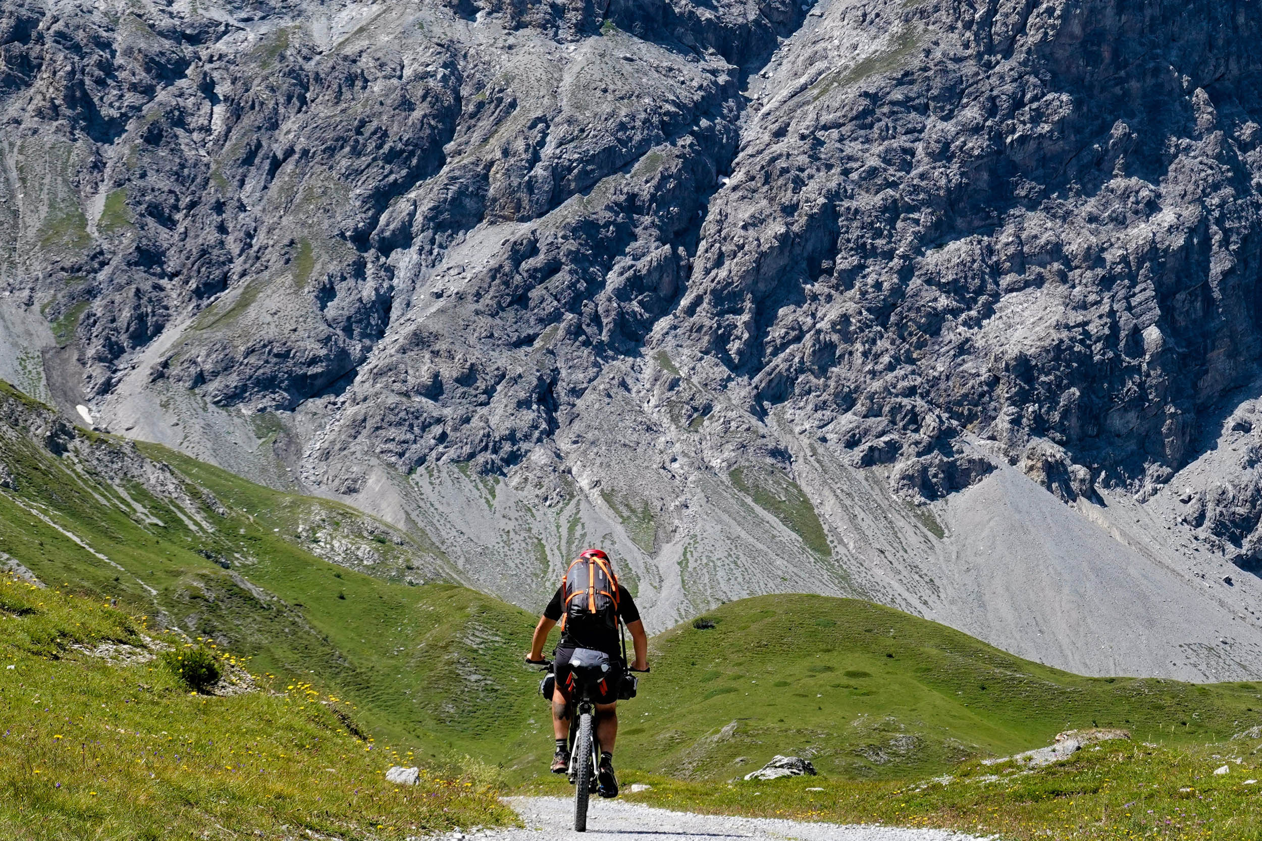
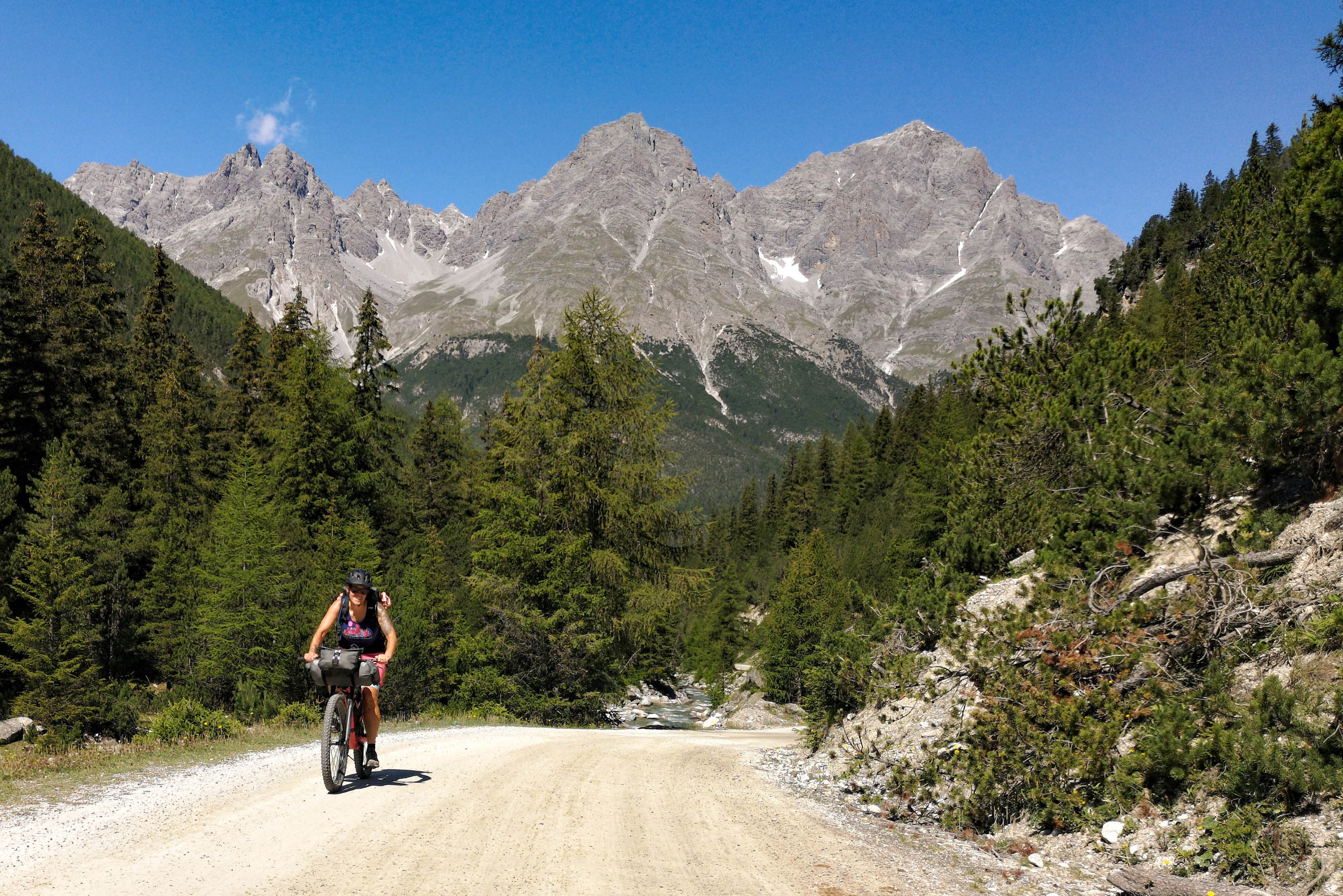
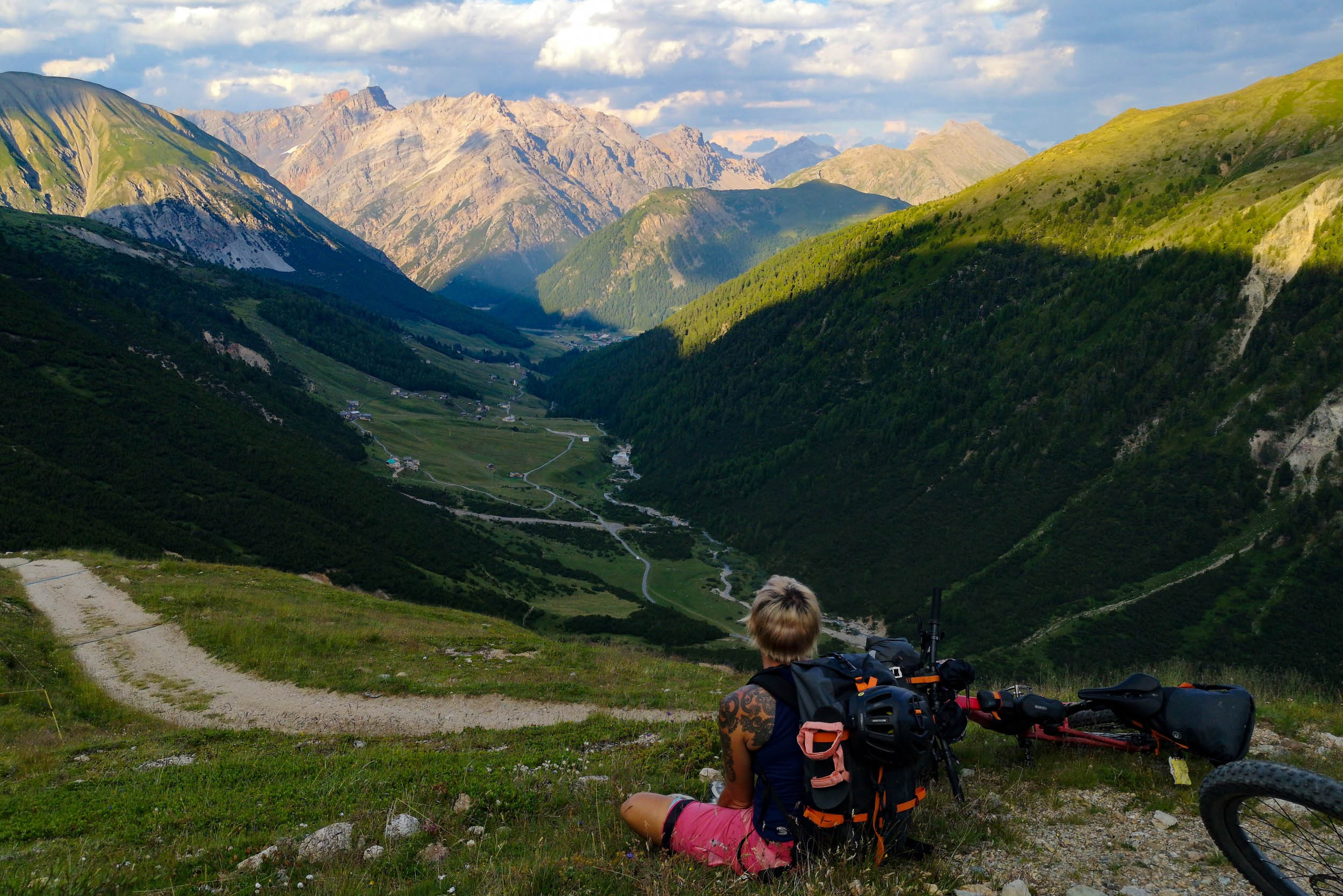
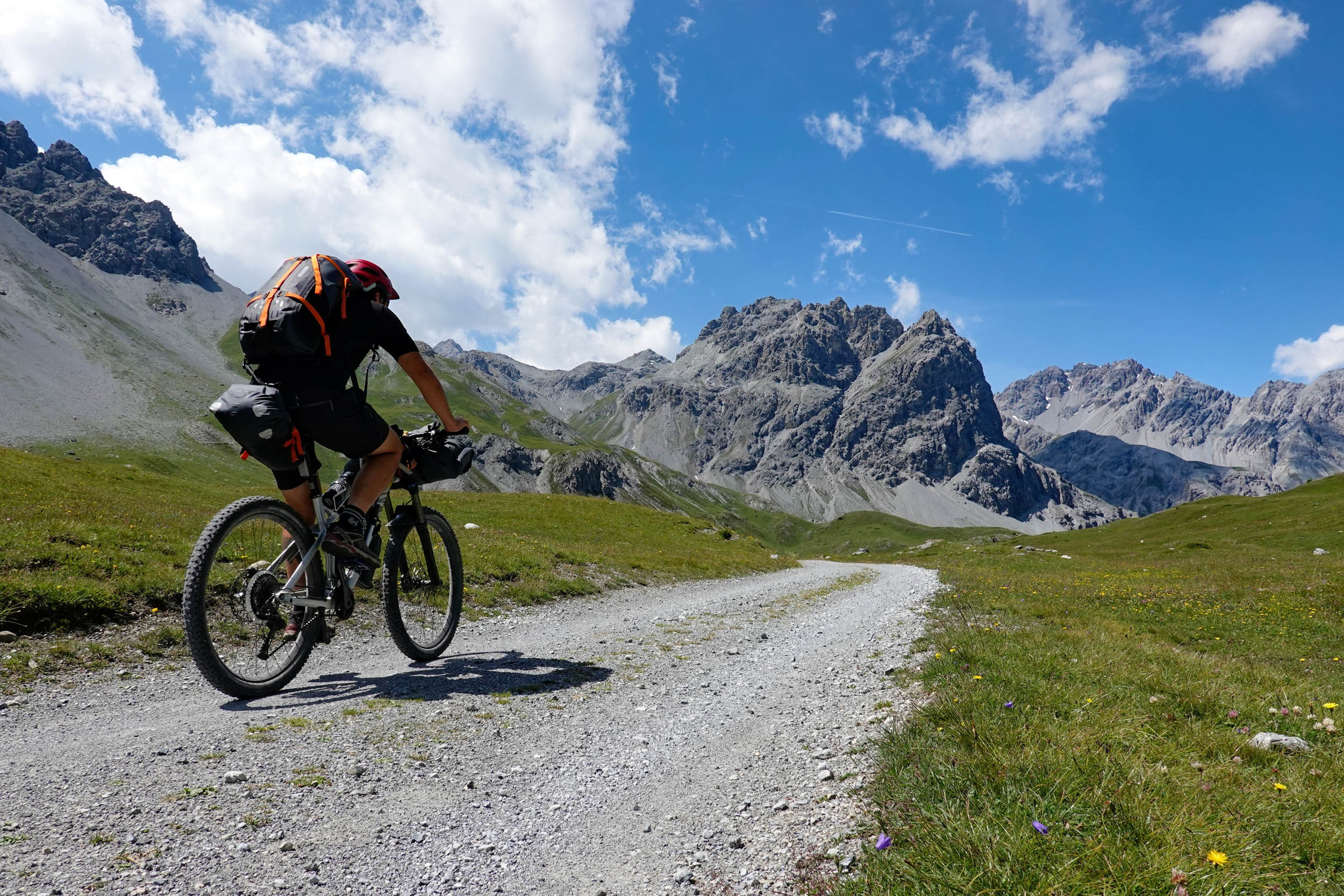
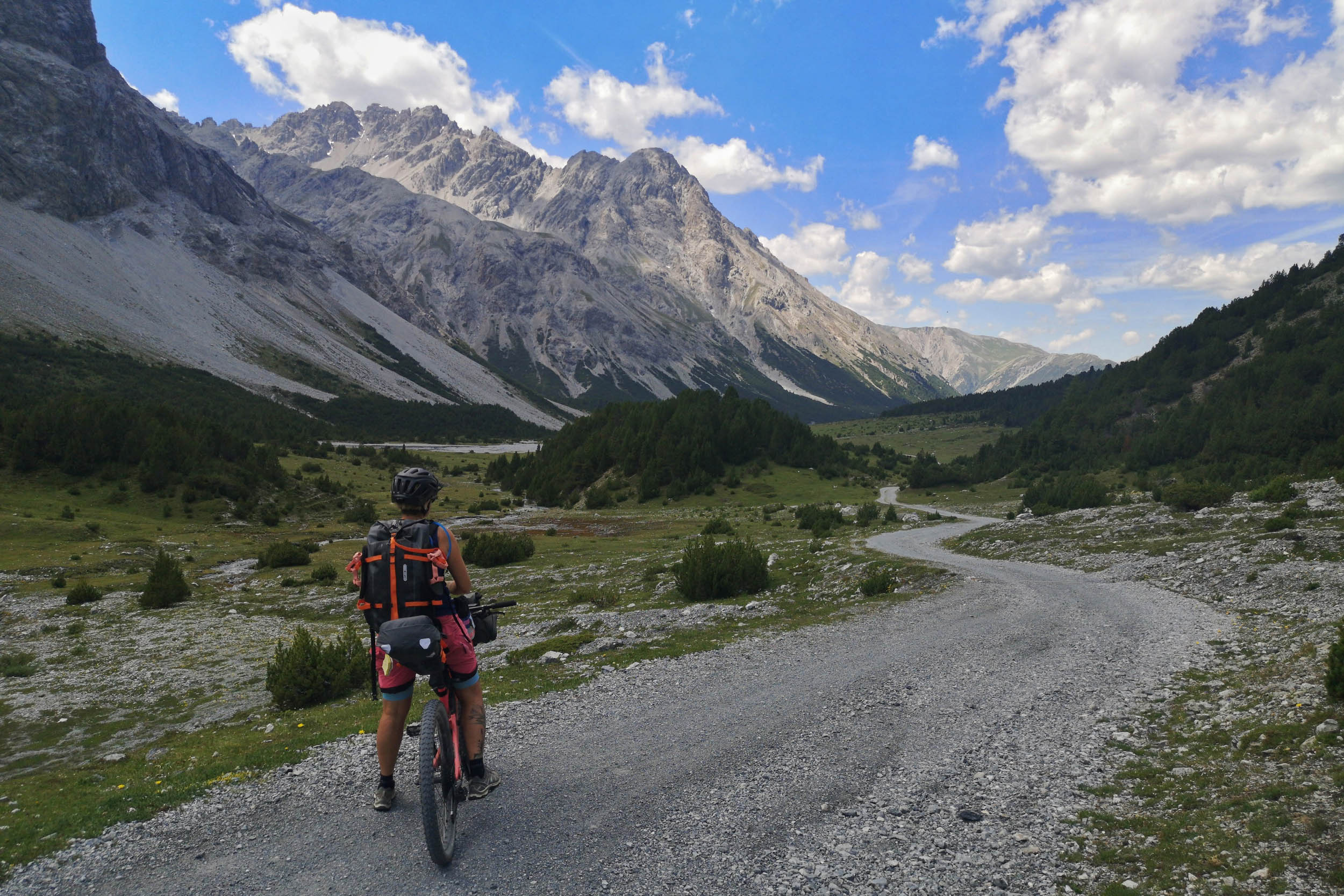
This route runs through the southeast of the Swiss canton of Graubünden, which is famous for its mountains. It is also the most sparsely populated canton and home to the smallest official language group in Switzerland, Rumantsch. It takes you through beautiful villages with centuries-old houses, by ruins from the past, and interesting buildings from the present. You will ride on smooth and seemingly endless gravel roads, sweat your way up mountains, and enjoy the wind on incredibly fun singletrack. Lush meadows with happy cows are as much a part of the picture as deep gorges and rugged rock faces. With a bit of luck, you will even meet the heraldic animal of the canton of Graubünden, the imposing ibex. Once nearly extinct, it’s now becoming more and more common to spot one. You will certainly see and hear countless marmots too. These little furry creatures are a constant companion and often see you before you see them. The valleys are framed by impressive mountains more than 3,000 meters high, of which Piz Kesch, at an incredible 3,418 meters, is one of the highest. It is circumnavigated on the route.

The region has a rich history. It once belonged to Austria, was a French protectorate for a while, and since 1803 has been part of what is now Switzerland. Since the middle of the 19th century, tourism has been an important source of income for the local communities. The various mineral springs were used for medicinal purposes and the characteristic grand hotels of that time were built in that era. With the First World War, tourism came to a standstill, and from the 1970s on it became popular for winter sports tourism.
The route is exhausting and rewarding at the same time. It is adventurous and yet relatively carefree if a few basic principles are followed. The quality of the trails and the breathtaking views make this route an incredibly beautiful experience!
Route Difficulty
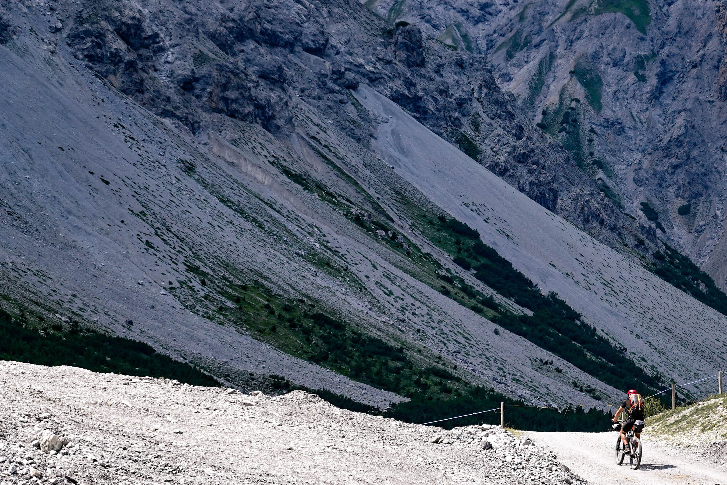
Technically, this route is for the most part relatively easy to ride, but there are also a few passages that are challenging. Since it runs through high alpine areas, great attention should be paid to the weather. Thunderstorms can come up very quickly and can easily become dangerous.
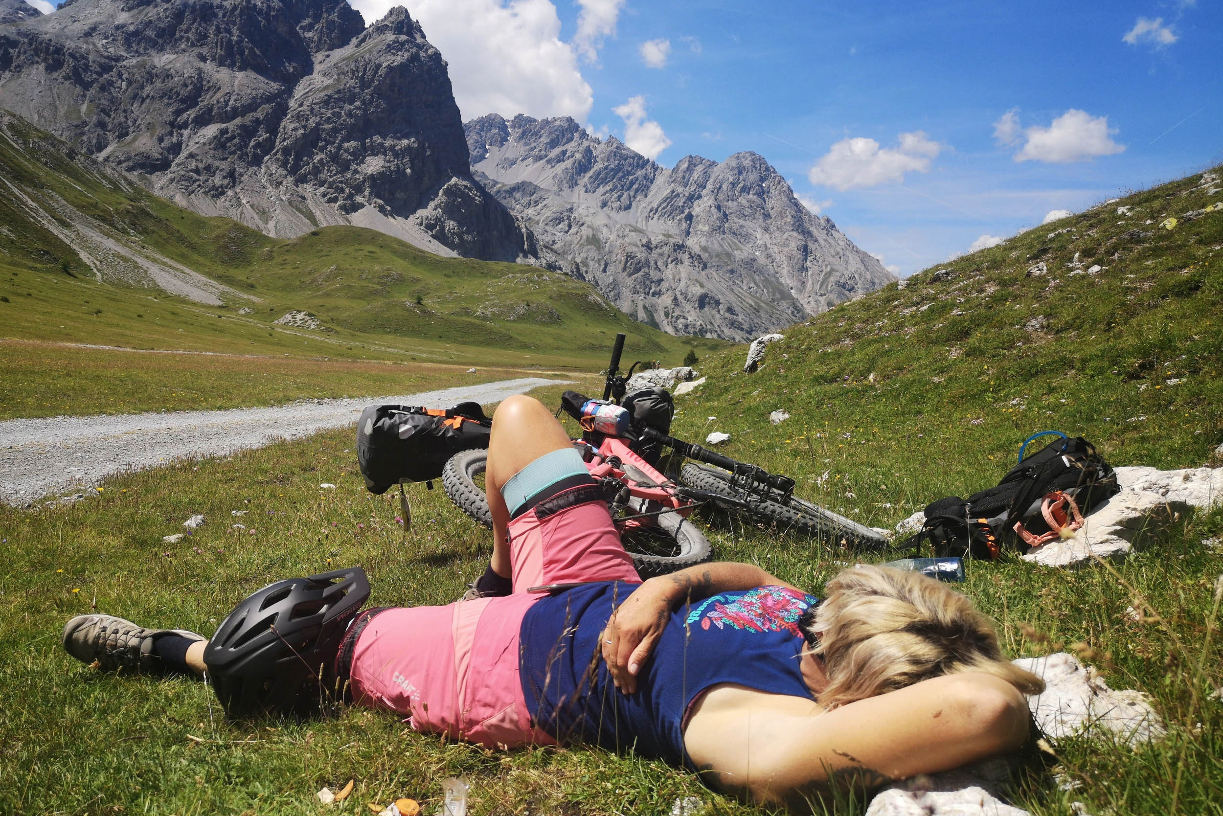
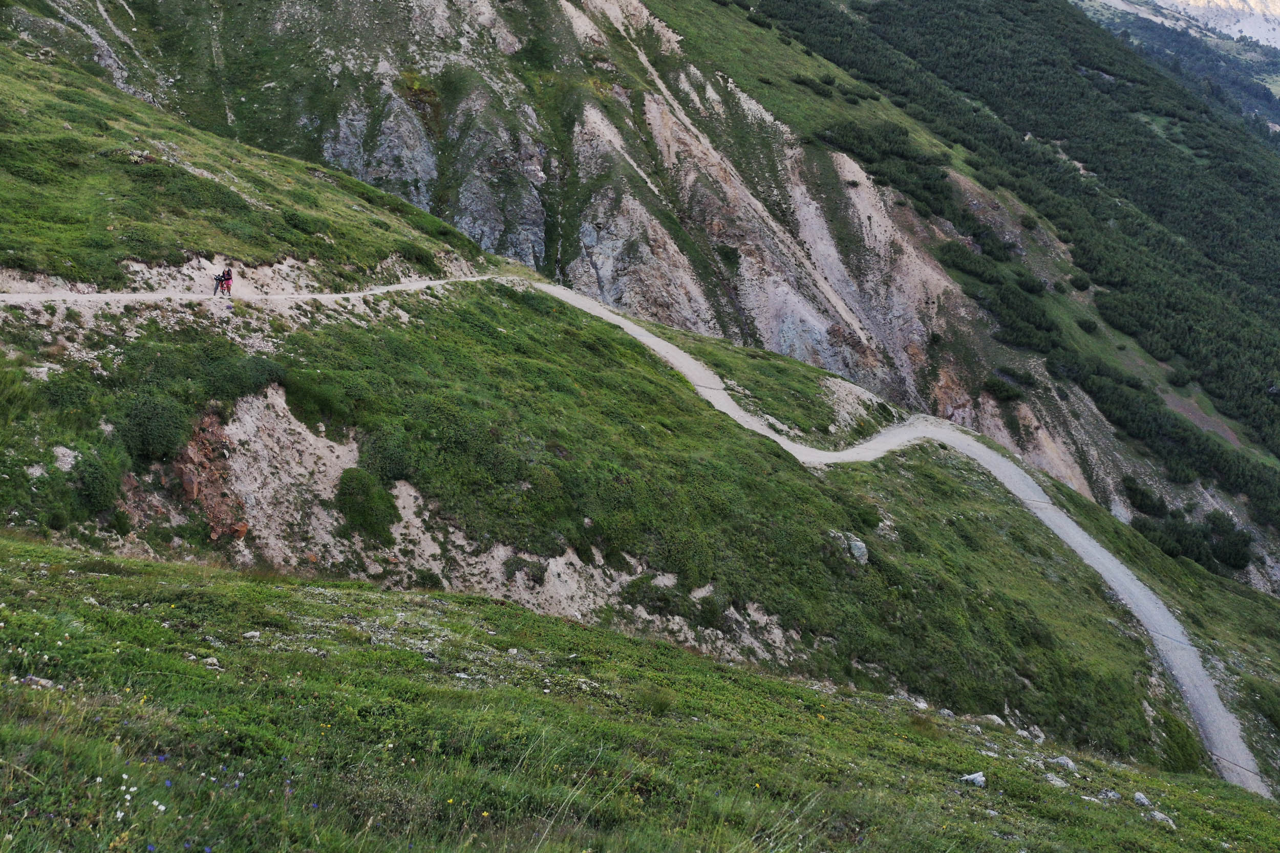
How challenging the route is in terms of physical fitness depends very much on how many days you plan to ride. Although the route is only 274 kilometers long, it covers 9,000 vertical meters. Of these, not all are rideable and to push a packed bike up a mountain requires a considerable amount of energy. The climb to Chaschauna Pass is extremely demanding, and descending on the trails requires a high level of concentration. There are of course riders who could complete the route in one go, but we recommend taking it at a more leisurely pace and allowing at least four days. Even then, it’s almost 2,000 meters of climbing per day.
The route is not difficult in terms of logistics. Arrival and departure are uncomplicated. We recommend taking the train. There are always villages that allow you to buy groceries and if there is a problem with the bike, there are good bike stores in Scuol and Livigno. Water is available everywhere and therefore isn’t marked on the map.
Route Development: The route partly follows the track of the annual “Nationalpark Bike Marathon” and connects sections of existing “SwitzerlandMobility” mountain bike routes. The official bike routes described by the “Scuol cable cars” were also helpful in planning the route.


Submit Route Alert
As the leading creator and publisher of bikepacking routes, BIKEPACKING.com endeavors to maintain, improve, and advocate for our growing network of bikepacking routes all over the world. As such, our editorial team, route creators, and Route Stewards serve as mediators for route improvements and opportunities for connectivity, conservation, and community growth around these routes. To facilitate these efforts, we rely on our Bikepacking Collective and the greater bikepacking community to call attention to critical issues and opportunities that are discovered while riding these routes. If you have a vital issue or opportunity regarding this route that pertains to one of the subjects below, please let us know:
Highlights
Must Know
Camping
Food/H2O
Trail Notes
Resources
- Guarda is situated on a plateau above the Engadin Valley and was once voted the most beautiful village in Switzerland. Cobblestones and ancient houses line the narrow streets of this beautiful village. Guarda is also the setting for one of Switzerland’s most famous children’s books, Schellenursli.
- Ftan and Pastizeria Cantieni: It seems that every valley and village in the Swiss Alps claims to produce the best nut cake, or Nusstorte. We’re pretty sure we found the best one here. And don’t worry, you’ll burn off the calories on the climb afterwards!
- Muot da l’Hom: The area around Muot da l’Hom offers breathtaking views and countless possibilities to spend the first night. Push your bike a little further up and enjoy a cold bath in Lake Lai da Minschun.
- Scuol is the largest village in the Lower Engadin Valley. The area became famous for its mineral springs, which were used for curing ailments from the second half of the 19th century. There are many fountains in the village and it is well worth tasting the different waters. The inhabitants of Scuol speak mostly Vallader, a Rhaeto-Romanic dialect. As many may not know, Rhaeto-Romanic is the fourth official language of Switzerland and is spoken by only about 60,000 people out of 8,000,000.
- S-Charl is a small place with a long history. Nowadays, the hamlet of S-Charl is inhabited only in summer. In the past, silver and lead were mined here, the ruins of which are still visible today, and there is a small museum. In 1904, the last brown bear in Switzerland was shot here. After that, there were no more bears in Switzerland until 2005. Today, isolated bears are on the move again. Further into the valley on the slopes of the Piz Plazer, an American B17 bomber crashed in February 1945.
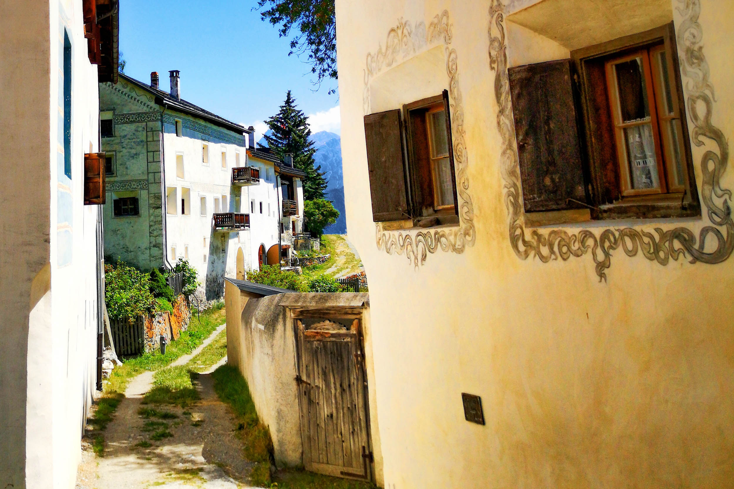
- Sgraffito are beautiful engravings that decorate the typical Engadin houses. The houses are also characterized by thick walls and deep windows. They are usually three-storied and have a barn for the livestock in the cellar.
- The God Tamangur is the highest pine forest in Europe. Some of the stone pines are up to 800 years old. However, it is not only of importance for this reason; it also symbolizes the determination of the Romansh people to preserve their culture and language.
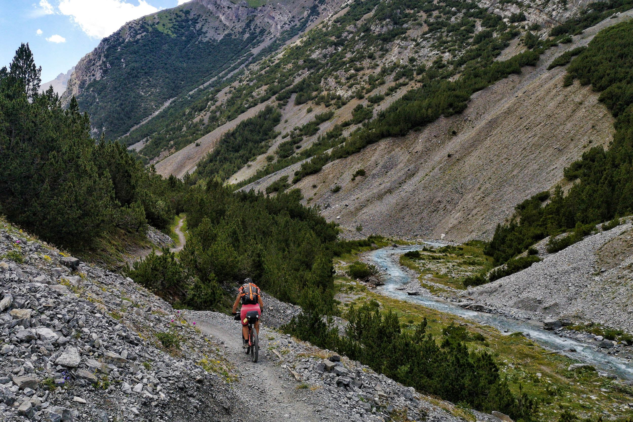
- Val Mora: There are many people who call the Val Mora the most beautiful valley in Switzerland and we absolutely agree. Take your time, there is no reason to rush through! At the beginning, you ride on a fine gravel road through the valley, which is bordered by impressive mountains. Later, it becomes singletrack, which leads to the Italian border.
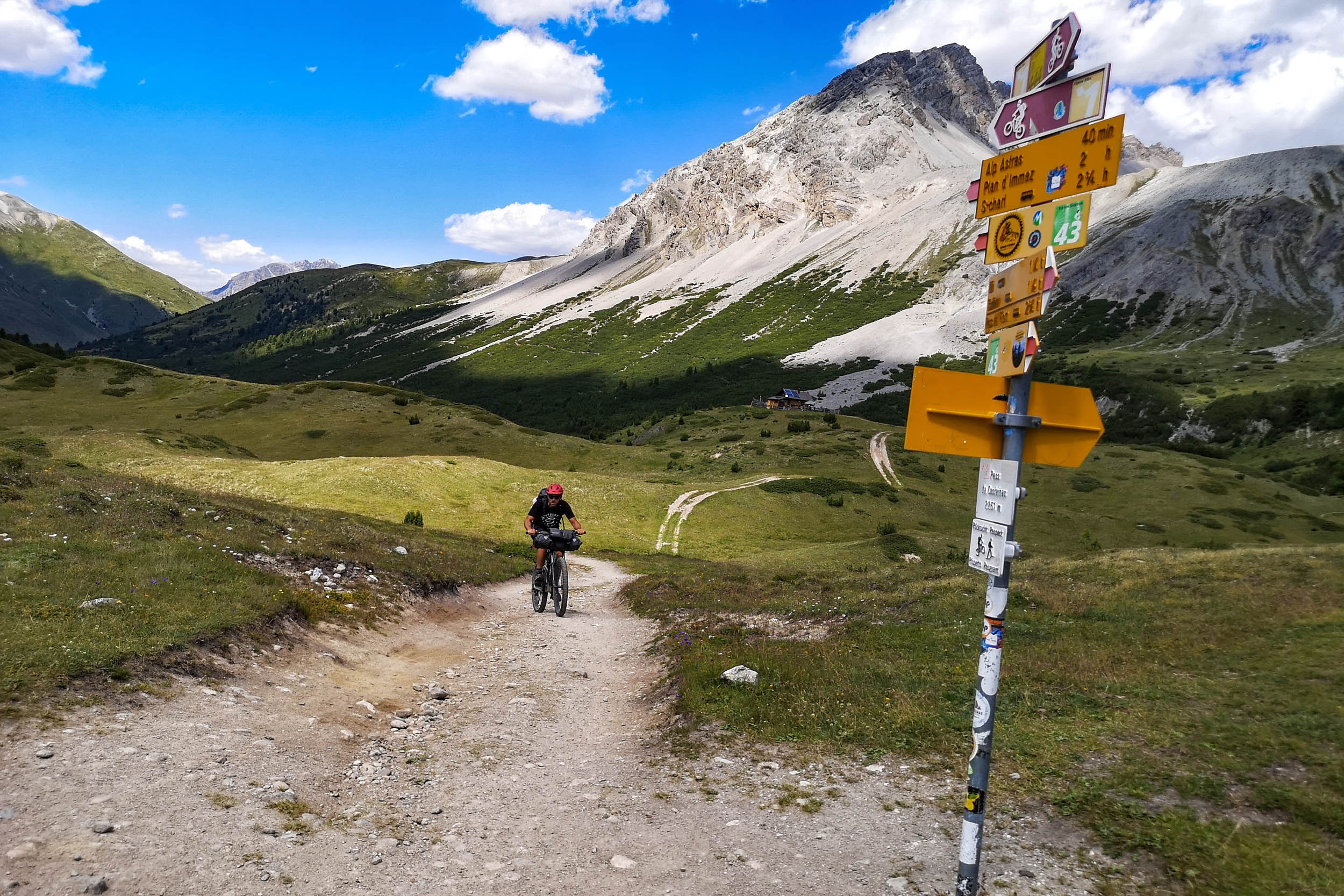
- Passo di Val Trela and Malga Alpe Trela: From the Lago di San Giacomo, a spectacular gravel road leads to Malga Alpe Trela, where you can enjoy local Alpine products and recharge your batteries before tackling the tough climb to the pass. The other side of the pass offers a fantastic single trail all the way down to the Lago di Livigno. The climb is definitely worth it!
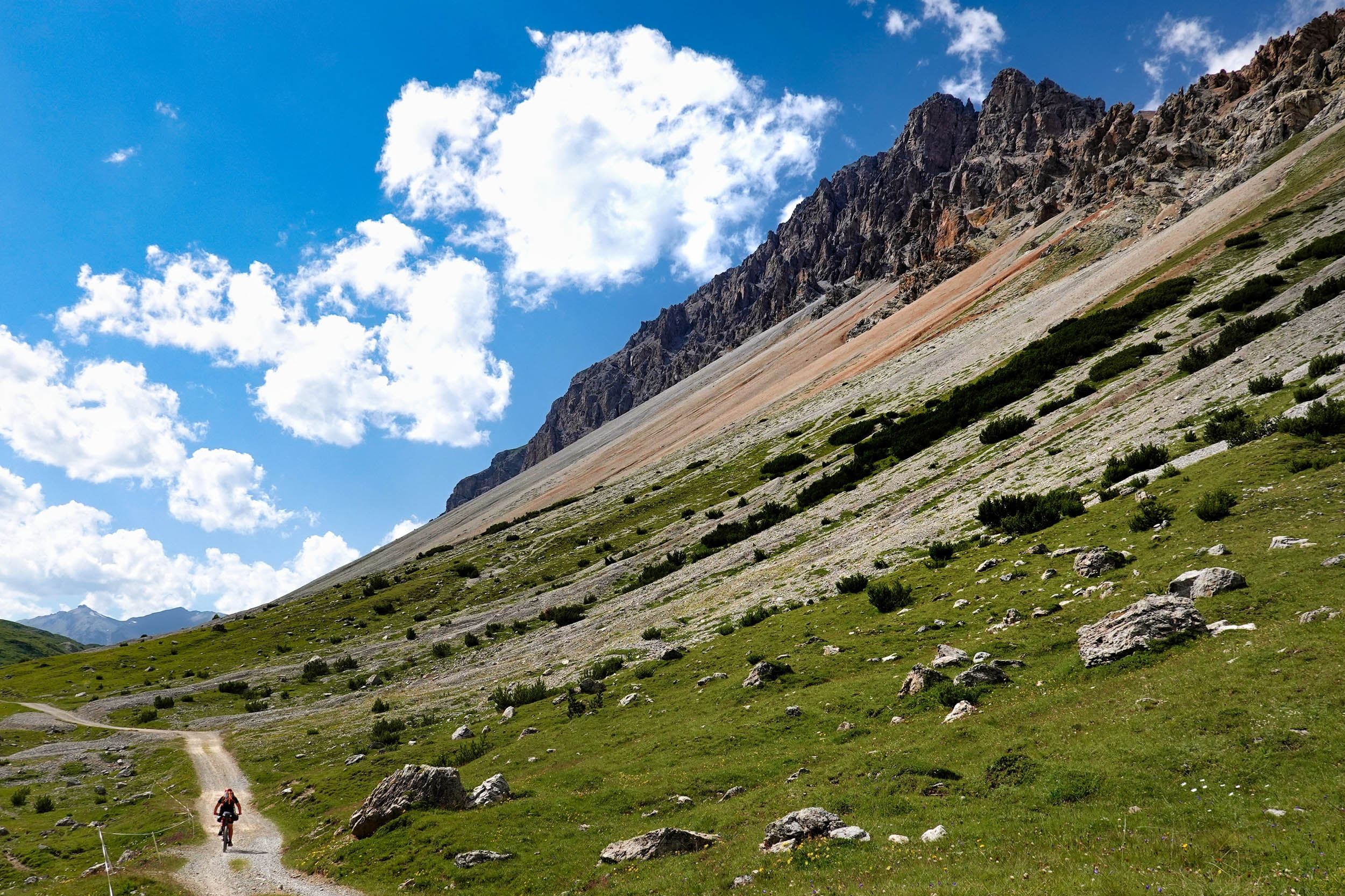
- The Chaschauna Pass is the highest point of the route and is definitely impressive. From the valley, a gravel road leads to the summit. The surface is good but it’s so incredibly steep that the 600 meters in elevation gain can only be mastered by pushing your bike. The reward is a newly built singletrack trail back to Switzerland, which is incredibly fun to ride.
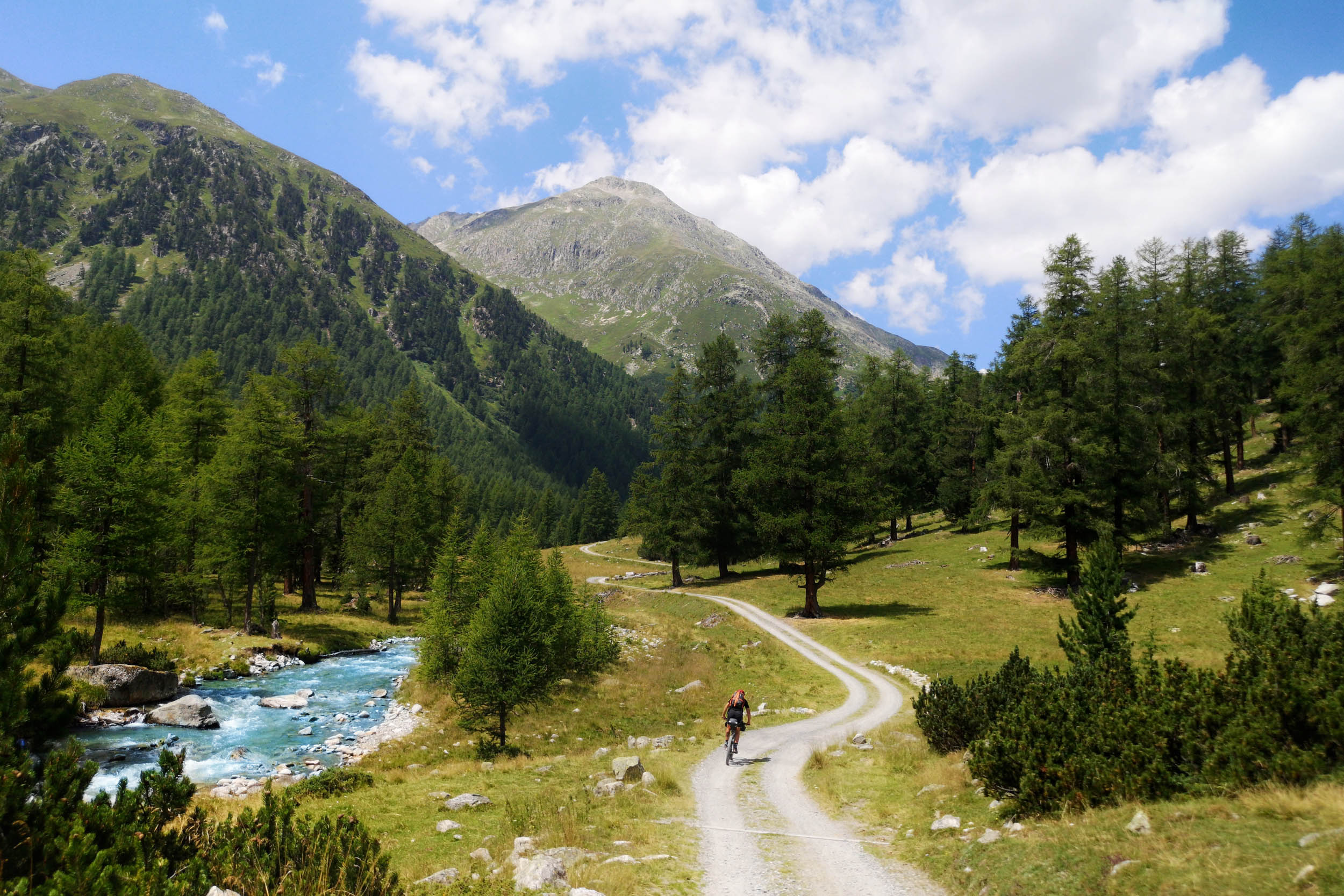
- Val Susauna: Maybe it’s the contrast with the brutal climb to the Chaschauna Pass, or maybe it’s just the beautiful nature, but the lower Val Susana invites you to linger. The creek meanders peacefully through meadows and loose groups of trees and you can’t help but stop somewhere, take a short dip in the creek, and let the sun dry you.
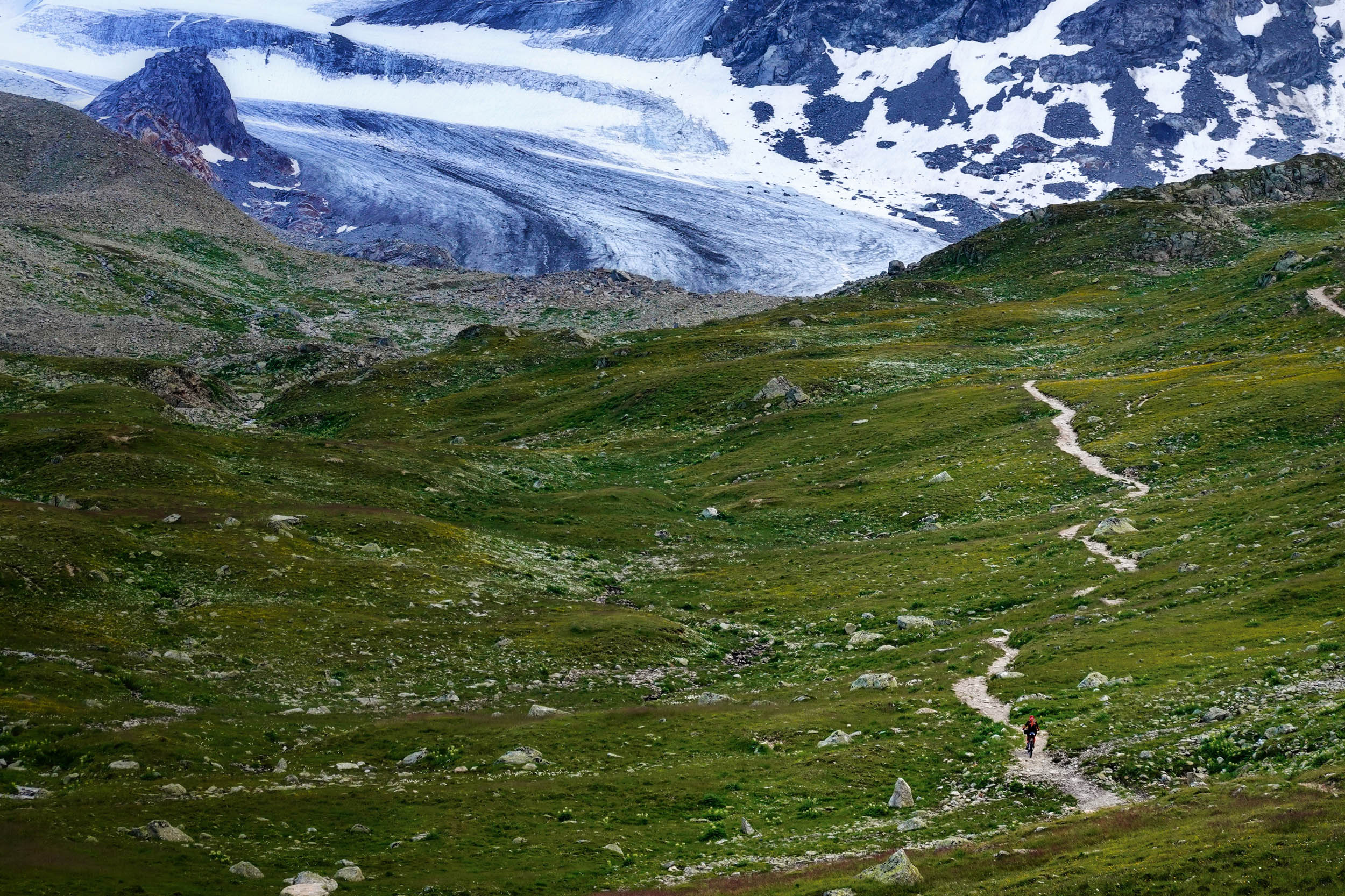
- The Kesch Hut belongs to the Swiss Alpine Club SAC and is built on a rocky plateau a bit above the Funtauna Pass. The modern hut has several dormitories and a cozy common room. What makes the hut special is the friendly team and of course the impressive view of Piz Kesch and the associated glacier. On the climb to the hut and on the descent we encountered an incredible number of marmots. We saw these cute animals on the whole route, but nowhere as many as here!
- The climb to the Albula Pass is the longest asphalt section of the tour. For road cyclists, it’s considered one of the most beautiful passes in Switzerland. This is not only due to the impressive road layout and views, but also because there is often only little traffic as the majority of cars take the nearby Julier Pass. Several times the road crosses the tracks of the Albula Railway, which is a UNESCO World Heritage Site, and you’re sure to bump into a few train spotters along the way.
- When to go depends on how much snow fell in winter and how quickly it melts in spring, but the route should be rideable from the end of June on. A look at the webcams of the surrounding ski resorts helps to evaluate the situation. In fall, it comes down to when the first snow falls. We have done parts of the route into November, but it’s usually no longer possible after mid-October. The colors of nature are at their best in fall.
- Getting to the starting point in Zernez is super easy. By train, for example, it is only 2.5 hours from Zürich. It’s also possible to get there by car, and there are plenty of parking possibilities. Since the route crosses an international border, it is necessary to bring an official ID. For the border crossing, however, no further formalities are necessary. If you want to spend money in Italy during your rather short stay there, don’t forget to bring Euros.
- As everywhere in the mountains, the weather can become a danger. Temperatures can drop quickly and thunderstorms can develop spontaneously. After heavy rains, there is also a risk of landslides and rock falls. Therefore, it’s important to consult the weather forecasts every day. It’s easiest to download the weather app from MeteoSchweiz. Cell phone reception is usually available.
- The route runs along the border of the Swiss National Park. Bears and wolves have been sighted in this area in recent years. However, there are no known cases of attacks on humans.
- People from outside the EU need a Schengen visa to travel to Switzerland. Public transport is exceptional in Switzerland. The route can be left at various points and you are always relatively close to a train or bus stop.
- This is a mountain bike route and we suggest you ride at least 2.2″ tires. Even though many of the gravel roads are doable with a gravel bike, the numerous singletracks are more fun with a proper MTB. Whatever bike you bring, make sure the gearing is as easy as possible!
- There are several beautiful official campgrounds along the route, mostly near small villages. These cost about 30-40 Swiss francs for two people and a tent. The larger villages also have hotels and/or hostels in every price range and there are also options to stay in beautiful traditional Engadin houses.
- If you prefer to be on your own, you have to pitch your tent at an altitude of more than 2,000 meters above sea level. Above the tree line, it is generally allowed to camp for one night. However, further below, different rules apply from municipality to municipality. Camping is absolutely forbidden on the territory of the Swiss National Park.
- As everywhere when you are in nature, leave no trace and carry your garbage to the next public trash can.
- The route runs through an area that is rich in water. You can drink the water from small streams directly, for larger streams it may be advisable to filter. However, it is not necessary to bring a filter, as the next possibility to refill the bottles is never far. Just make sure there are no livestock further up the stream, otherwise the water could be contaminated. We recommend that you bring bottles or hydration packs with a capacity of at least 1.5 liters with you.
- Many places sell fresh milk, cheese, and other local products and almost every village has a small store to buy other food. You will never have to slip into your sleeping bag hungry.
- The route can easily be extended. For example, after 34.9 kilometers, you could turn left and ride via Fuorcla Champatsch into the beautiful Val Sinestra. Be prepared for some hike-a-bike if you want to do this. Another option would be to continue from Livigno to the Passo del Bernina and thus reach the Upper Engadin.
- If there is enough time, it’s also recommended to stay a day or two in Scuol, dismount the bags from the bikes and enjoy this beautiful area with more than 500 kilometers of signed trails without any additional weight strapped to your bike.
- The route is about 95% rideable with a mountain bike. The longest passages where the bike has to be pushed are the ones above Malga Alpe Trela and on the climb to the Chaschauna Pass. Also, depending on your riding skills, not everything is rideable on the climb to the Kesch hut.
Additional Resources
- Information the Swiss National Park is available at the park center in Zernez and online at nationalpark.ch/en/
- Find wonderful trip report about the area of this route was published by Kristi Stump and Steffen Schraegle: bikepacking.com/plog/heres-the-story/


Terms of Use: As with each bikepacking route guide published on BIKEPACKING.com, should you choose to cycle this route, do so at your own risk. Prior to setting out check current local weather, conditions, and land/road closures. While riding, obey all public and private land use restrictions and rules, carry proper safety and navigational equipment, and of course, follow the #leavenotrace guidelines. The information found herein is simply a planning resource to be used as a point of inspiration in conjunction with your own due-diligence. In spite of the fact that this route, associated GPS track (GPX and maps), and all route guidelines were prepared under diligent research by the specified contributor and/or contributors, the accuracy of such and judgement of the author is not guaranteed. BIKEPACKING.com LLC, its partners, associates, and contributors are in no way liable for personal injury, damage to personal property, or any other such situation that might happen to individual riders cycling or following this route.
Please keep the conversation civil, constructive, and inclusive, or your comment will be removed.