


Ruta de Los Seis Miles, Norte
Distance
487 Mi.
(784 KM)Days
21
% Unpaved
88%
% Singletrack
0%
% Rideable (time)
90%
Total Ascent
33,500'
(10,211 M)High Point
16,400'
(4,999 M)Difficulty (1-10)
10?
- 4Climbing Scale Fair69 FT/MI (13 M/KM)
- -Technical Difficulty
- -Physical Demand
- -Resupply & Logistics
Contributed By
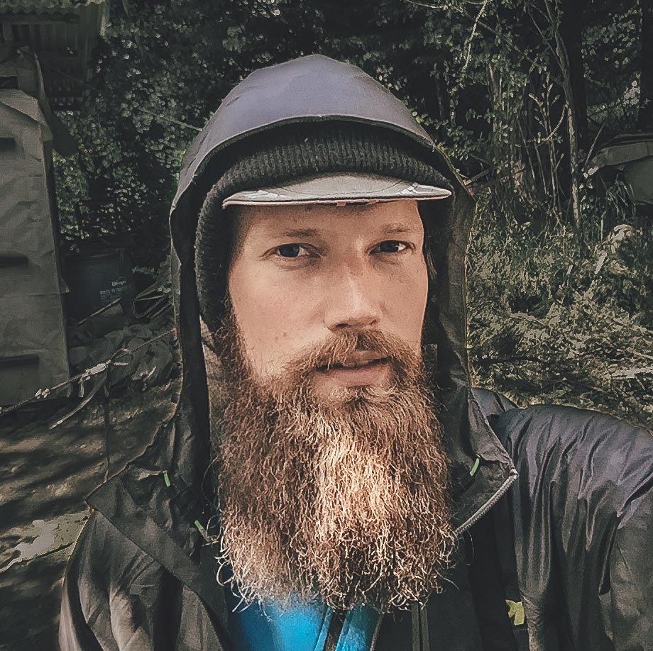
Taneli Roininen
Gone Bikefishing
For Ruta de los Seis Miles Sur, see here.
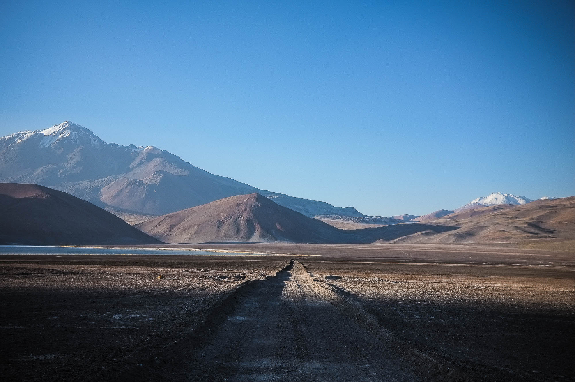
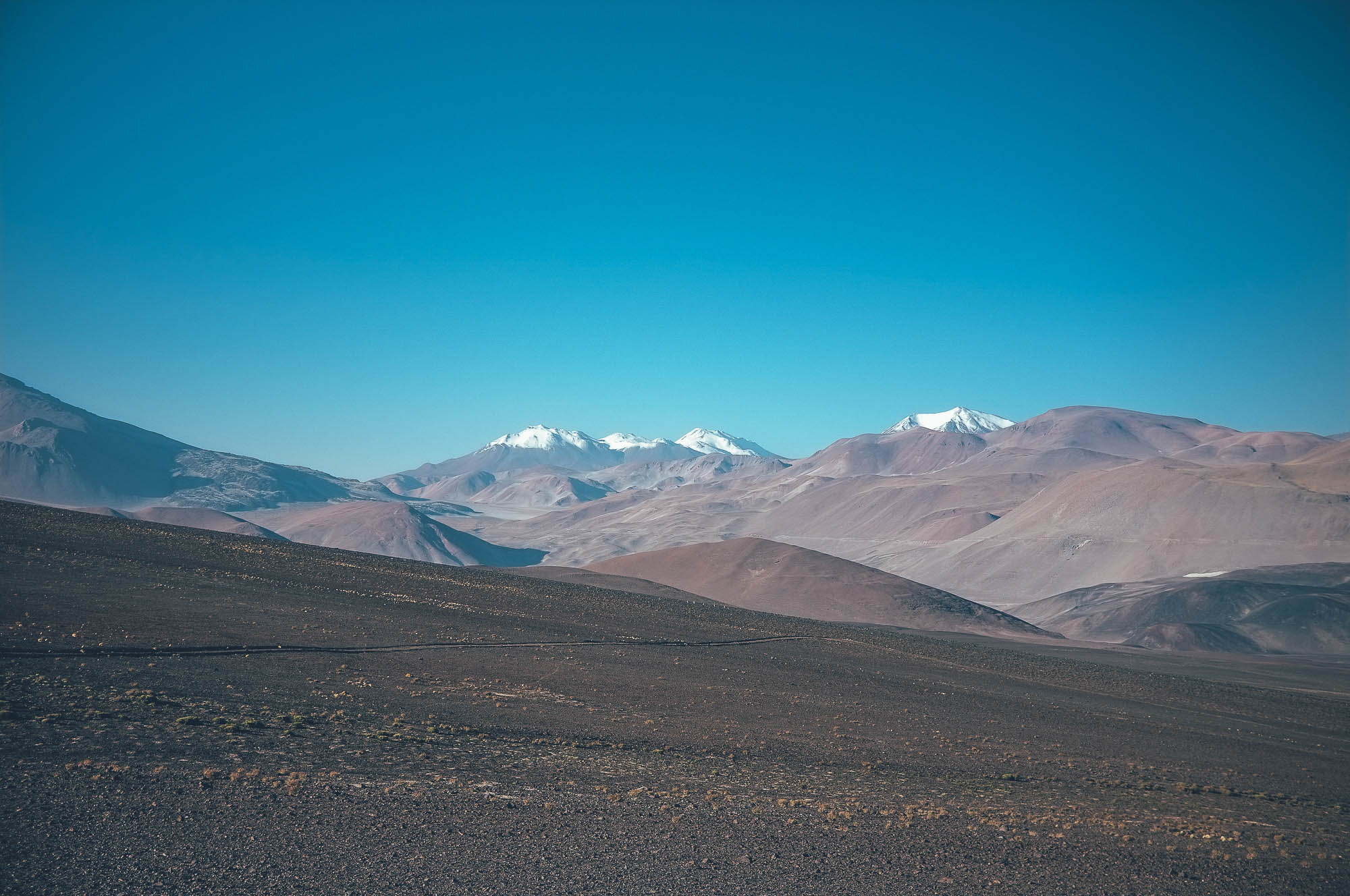
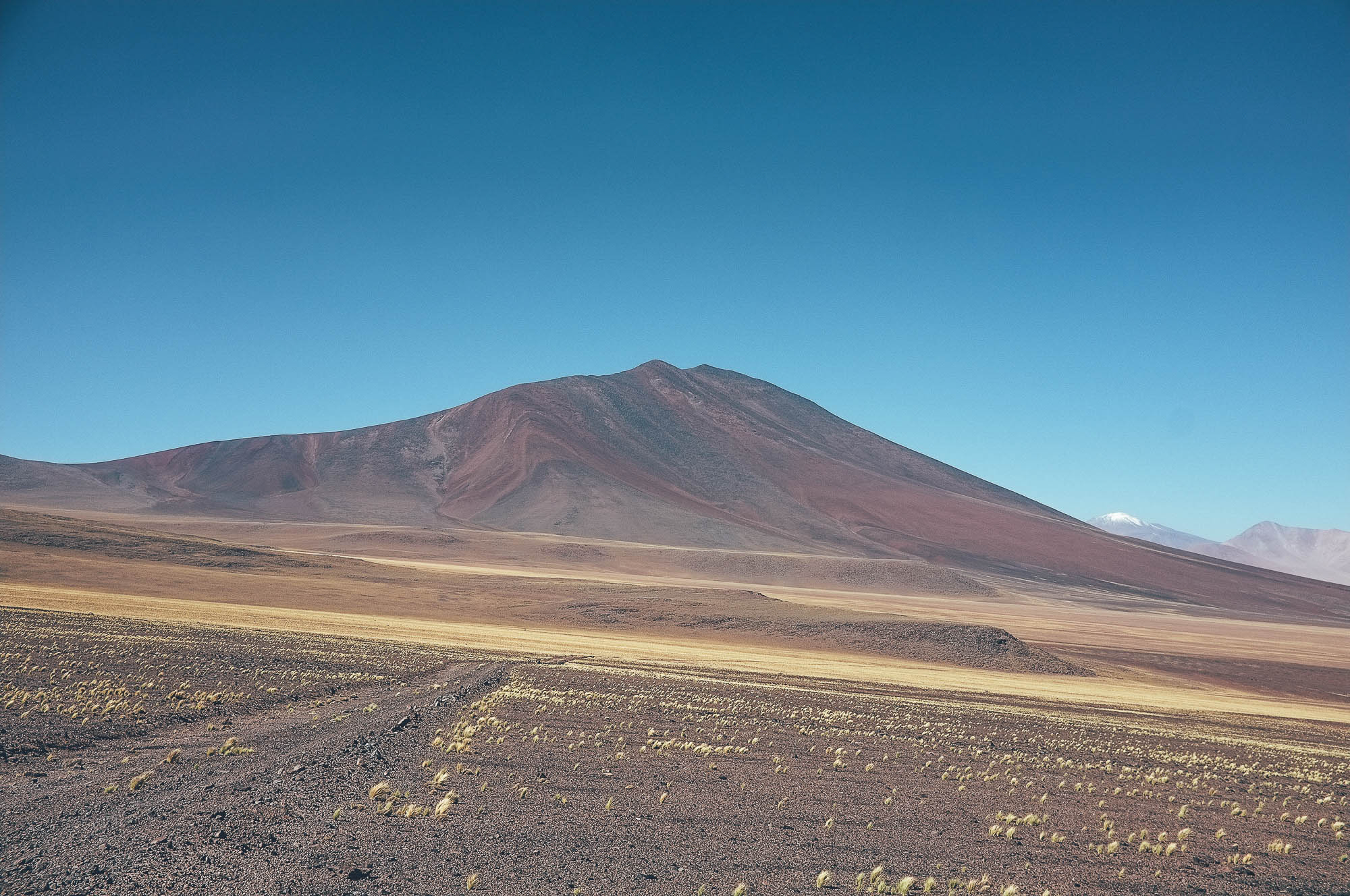
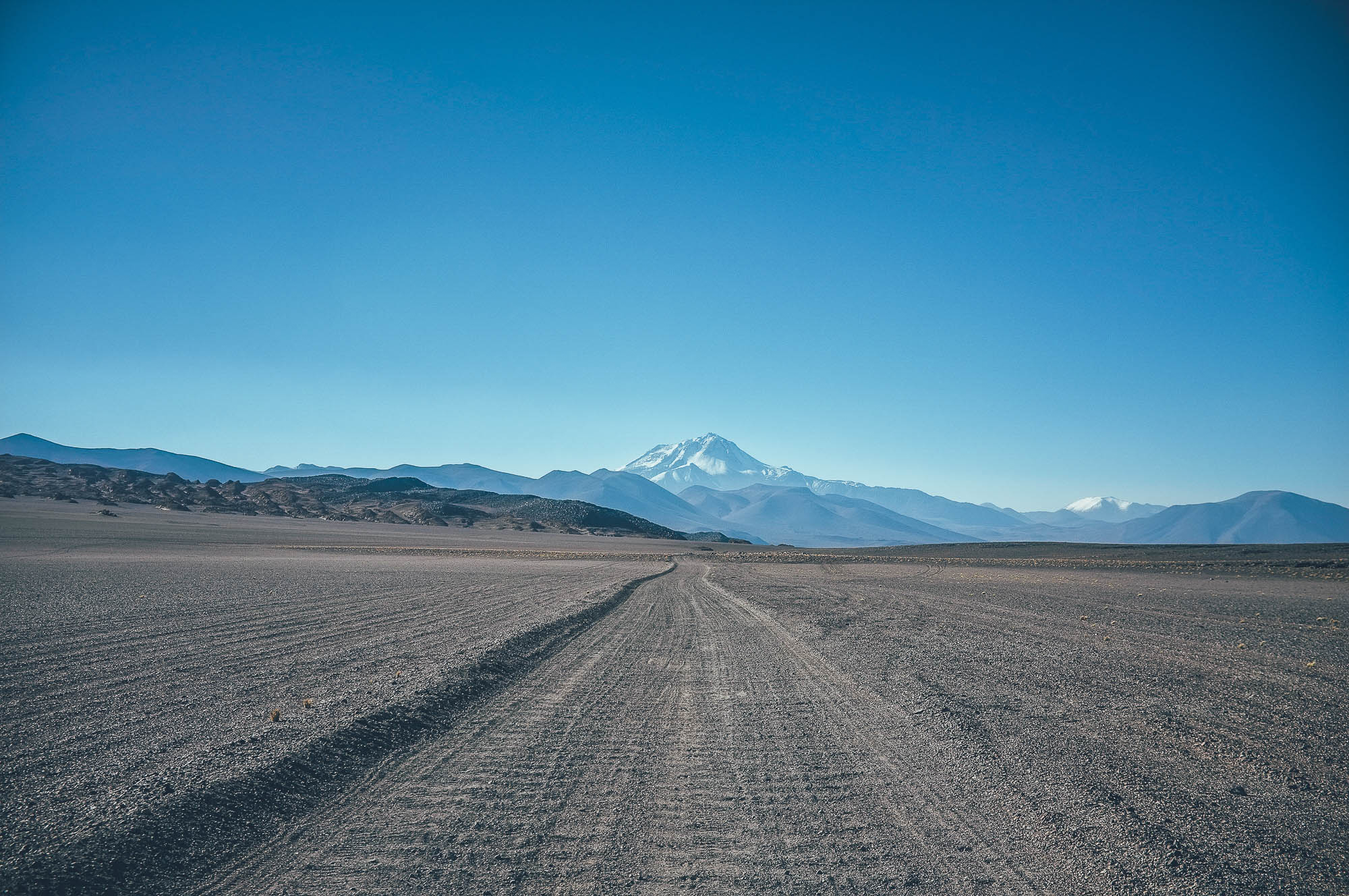
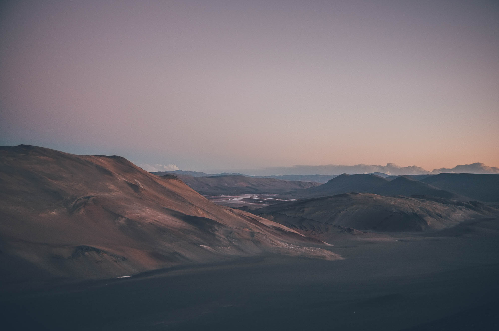
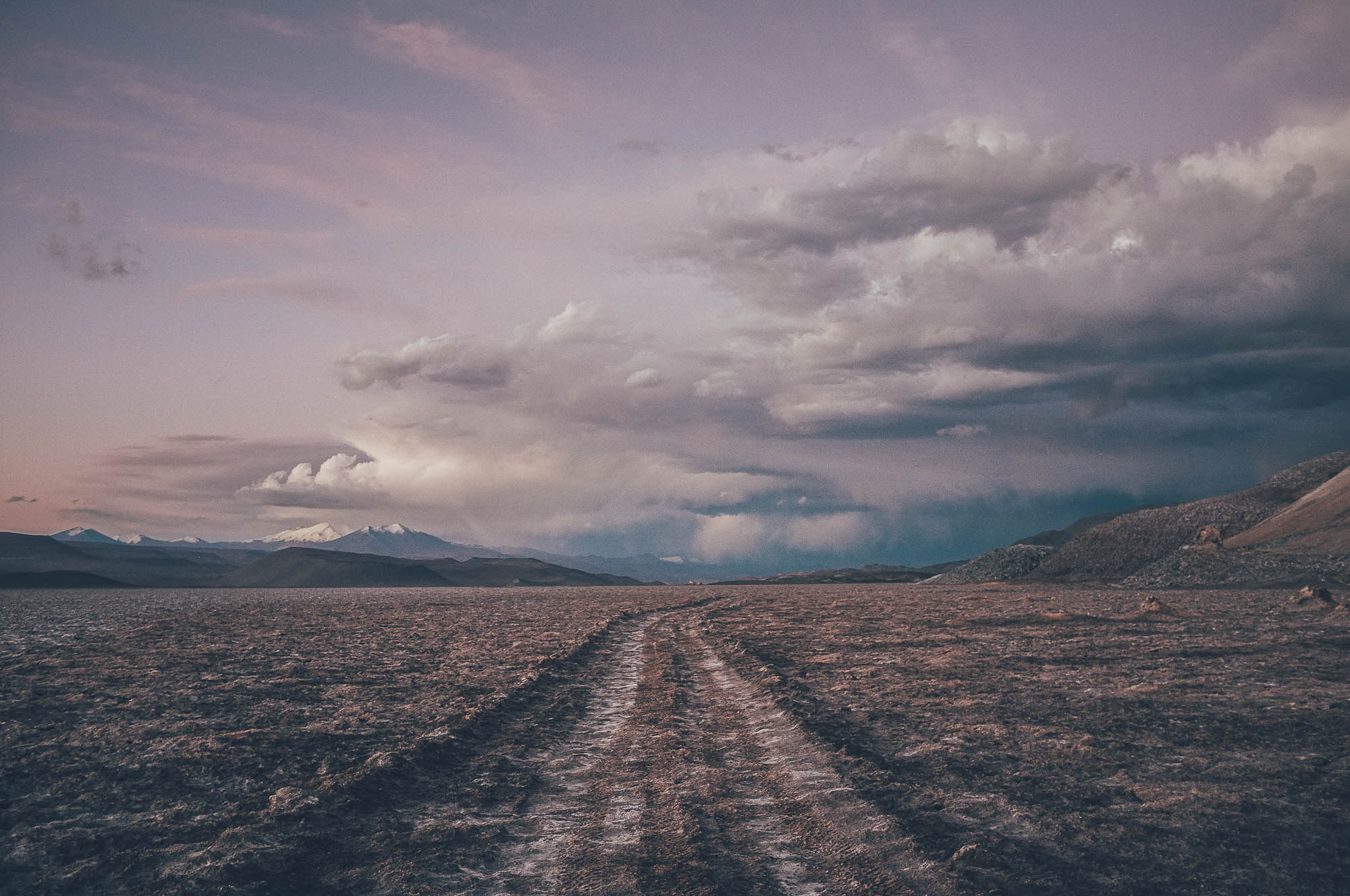
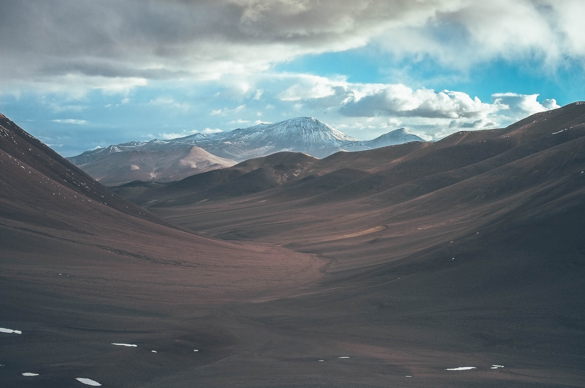
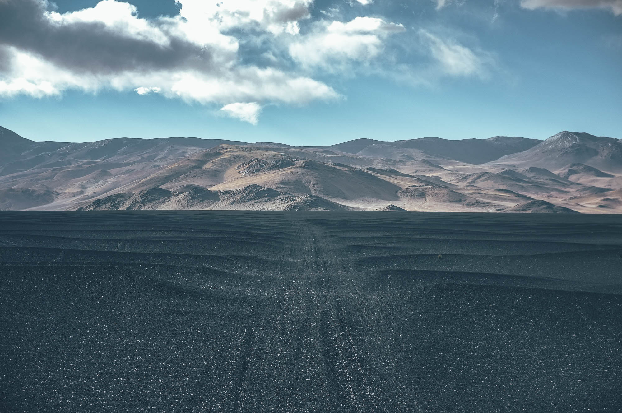
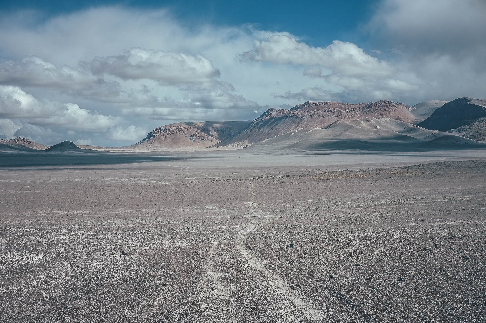
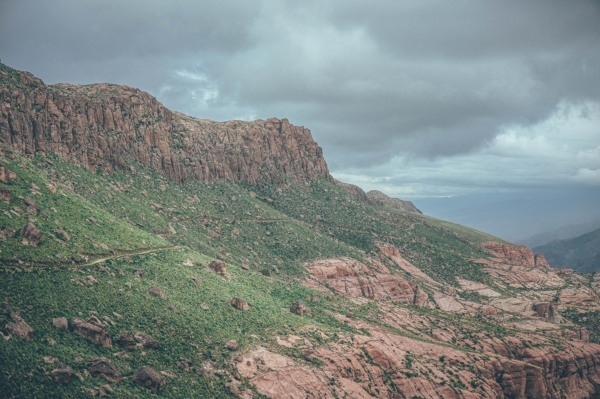
If there is one part of the world that long-distance cyclists talk about and are drawn back to, it is the Central Andean Dry Puna. This desertic area, located mainly in the Atacama desert, covers 307,400 km2 (118,700 sq mi) in the central Andes in northern Chile, north Argentina and southwest Bolivia, at altitudes of 3,500m-5000 m (11,500-16,400 ft). During the summer months, the area is cleared of snow and a grid of old mining roads and other double tracks offer some of the most remote, demanding and spectacular bike touring anywhere on Planet Earth.
Ruta de Los Seis Miles, Norte, connects the desert towns of San Pedro de Atacama in northern Chile and Fiambalá in north western Argentina. The route is 786km long, which can take 21 riding days. The route is very remote: you need to be able to carry 18 days of food, cooking fuel, and 10 litres of water, simultaneously. The combination of a heavily loaded bike, thin air, occasional sections of strong headwind and long soft climbs makes the route extremely demanding. Total hike-a-biking can add up to three days, depending on your acclimatization, route condition, fitness, and tire width. The route is best ridden with a fatbike, or at the minimum, a bike with plus-sized tires.
The best time to attempt the route is when Paso Socompa is open (from the beginning of November to the end of March) and before the storm season in the valleys north of Fiambalá (from mid January to late March) washes the road away and can make the river between the villages of Las Papas and Punta de Aqua impossible to cross.
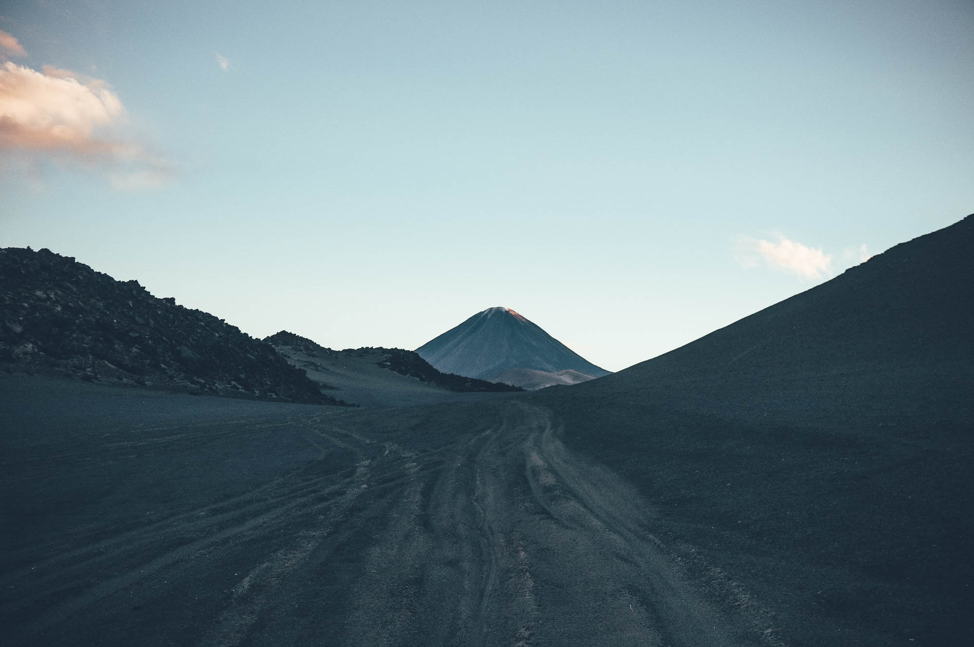
The route follows the Los Seis Miles, the line of over 6000m (20,000 ft) volcanoes. If you can fit a backpack, ice axe, crampons and mountaineering boots into your packs (and can carry some extra food), you are set to summit Monte Condor (6440 m/21,129 ft), Monte Antofalla (6,440 m/21,129 ft) and Monte Llullaillaco (6,750 m/22,145 ft) which are on the route, in the spirit of Janne Corax’s expeditions and Neil and Harriet Pikes Puna 9 project.
For a more more detailed description of each section of this route, be sure to read the Trail Notes below.
If you want to extend this route and connect it with the Ruta de los Seis Miles, Sur, it will create a 1313km, 33 day Puna crossing.
Difficulty: This route has been awarded a difficulty rating of 10, so is not to be undertaken lightly. A heavily laden bike combined with soft terrain and high altitude makes this route physically extremely demanding. 30km days are likely to be your reality, especially when there is a strong headwind. This said, the real challenge could be mental one, as human contact along the route is rare and freshwater sources are located far apart. Note that this route is easier to attempt with a fatbike, but it can just about be done with 2.8in tires as well.


Submit Route Alert
As the leading creator and publisher of bikepacking routes, BIKEPACKING.com endeavors to maintain, improve, and advocate for our growing network of bikepacking routes all over the world. As such, our editorial team, route creators, and Route Stewards serve as mediators for route improvements and opportunities for connectivity, conservation, and community growth around these routes. To facilitate these efforts, we rely on our Bikepacking Collective and the greater bikepacking community to call attention to critical issues and opportunities that are discovered while riding these routes. If you have a vital issue or opportunity regarding this route that pertains to one of the subjects below, please let us know:
Highlights
Must Know
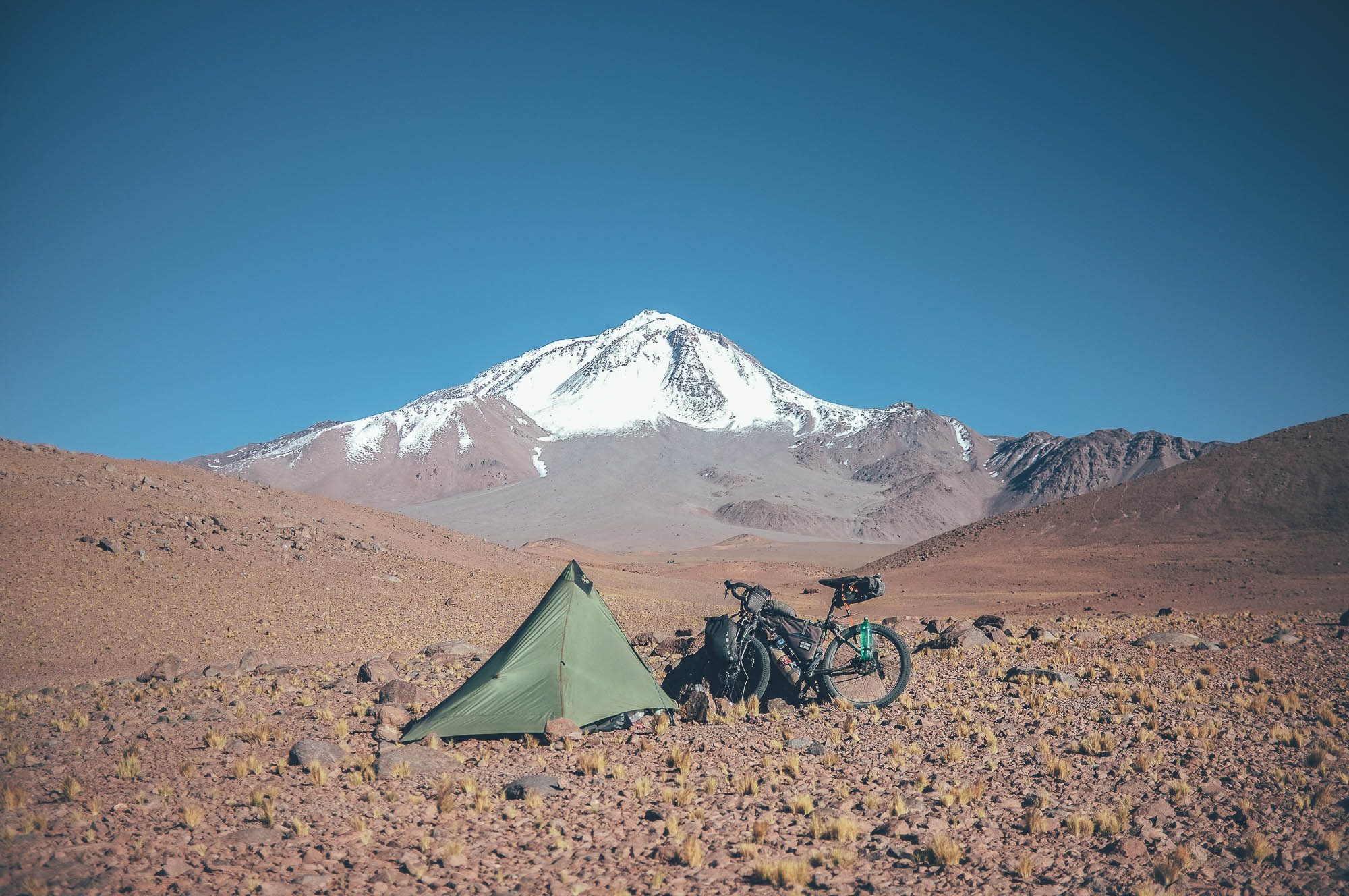
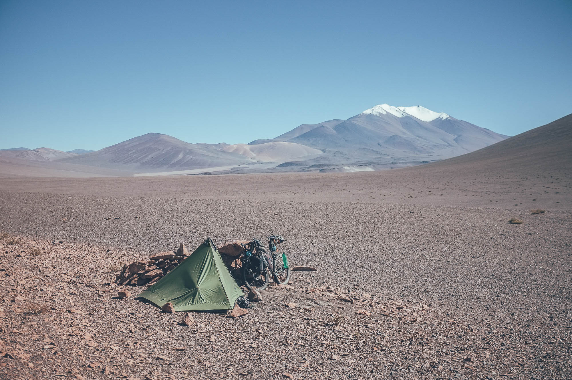
Camping
Food/H2O
Trail Notes
Resources
- Riding along the line of Los Seis Miles, the highest volcanoes in the central Andes
- Endless moon-like sceneries from the over 4900m passes
- Navigating through vast lava flows
- Crossing massive salt fields
- Perfect solitude far away from human civilisation up to weeks at a time
- Unreal colors of valleys and mountain faces
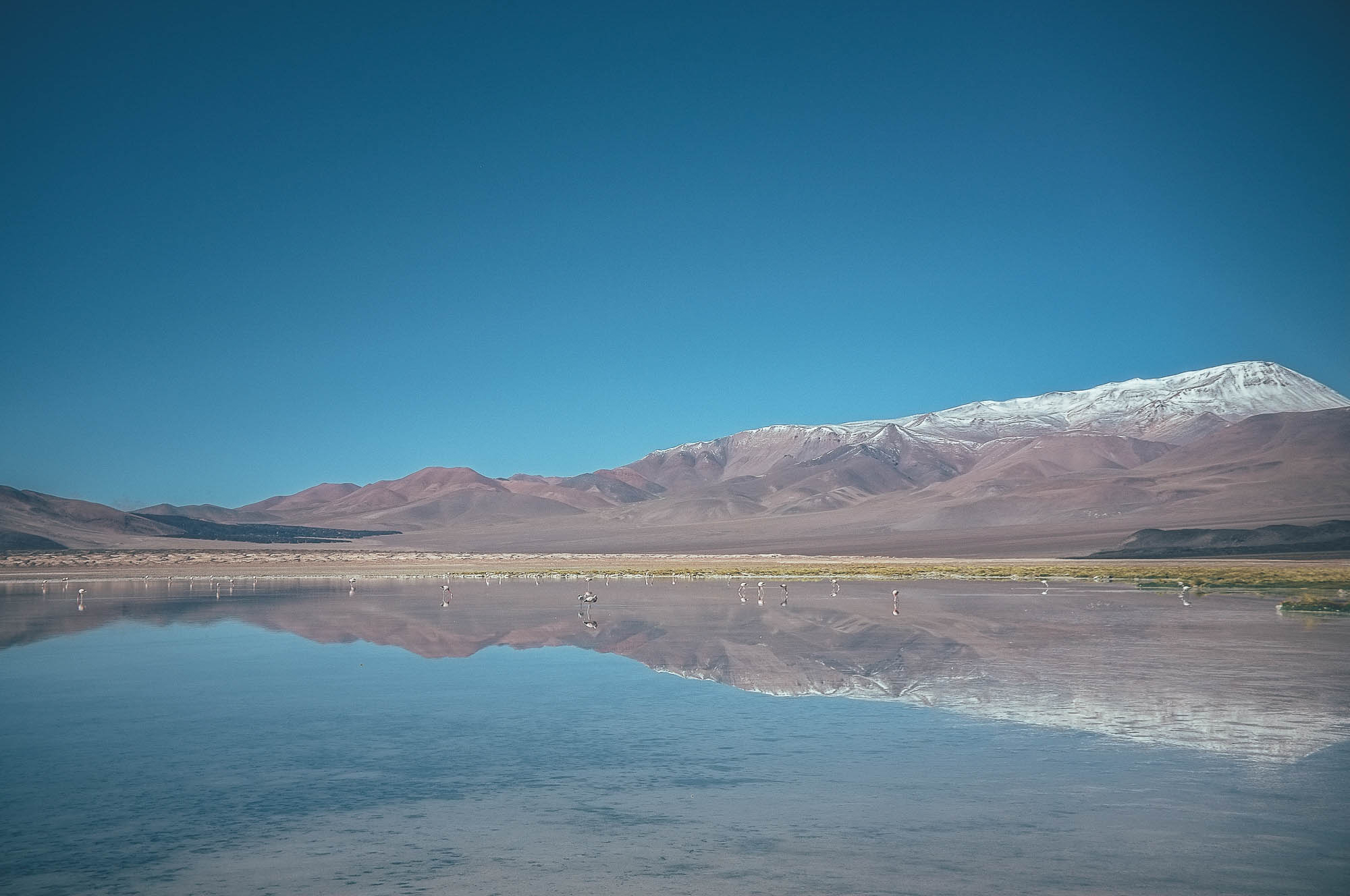
- High altitude lakes with hundreds of flamingos
- The joy of finding high quality fresh water again!
- Paso Socompa is open from the beginning of November to the end of March, but the route is best ridden before the storm season in the valleys north of Fiambalá (from mid January to late March) washes the road away, making the river between the villages of Las Papas and Punta de Aqua impossible to cross. The route is rebuilt in the valley annually by May. Contact Jonson in Fiambalá before setting out on the route, especially out of the summer months.
- Due to the soft terrain at times, a plus bike with 2.8 tires is the minimum requirement for this trip, but a fat bike is better.
- The route can be ridden from both directions, though the two highest passes could be easier if riding south to north. However, if you are also riding the Ruta de Los Seis Miles, Sur, you will need to ride the route north to south.
- The route passes through two countries, Chile and Argentina. Check your visa status.
- You need to be able to carry nearly three weeks of food, cooking fuel and 10 litres of water simultaneously.
- Winds on the route are often strong, on some sections you have headwind and on others tailwind. Prevailing winds are from Chile to Argentina.
- Chile and Argentina have extremely strict food import regulations, for instance importing any fresh food, meat or nuts, is not allowed. Check the latest import regulations. You are allowed to consume the food which cannot be imported at the border.
- Total hike-a-biking can add up three full days, depending on your fitness, route condition and tire width.
- There is no phone signal up in the mountains and parts of the route are extremely solitary, carrying personal emergency beacon is highly recommended.
- Night time temperatures can drop down to -10 Celsius degrees at high altitudes even in the summer, plan your sleeping system accordingly.
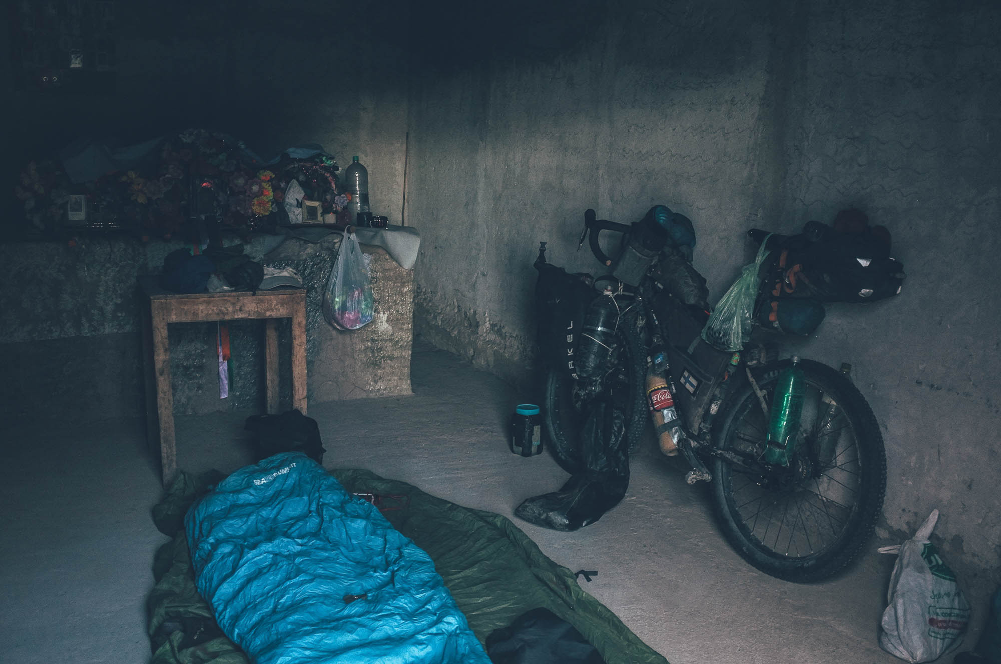
- The route needs thorough preparation, both food and setup wise. The weight of three week worth of food easily amounts to 15kg and is likely to take the majority of the total volume of your carrying system. There are as many ways to carry this amount of food and 10 litres of water as there are riders, but adding a rear or front rack to your usual bikepacking setup is likely to be necessary, at least if you want to ride without a backpack.
- There are flights from Santiago de Chile to Calama, located 100km northeast of San Pedro de Atacama.
- The best wild camping spots are marked on the map, only a few of the campsites are near a water source.
- Only a few camp spots have wind cover. Your tent needs to be able to take gale force winds. Single pole, single layer tarp tents and similar are recommended as they are strong, light, pack small (more space for food!) and relatively easy to pitch in strong winds.
- There are sleeping options of varying quality available in San Pedro de Atacama. Prices for a dormitory bed start from around 15 USD and room prices around double of that. Basic hospedajes and a nice organised campsite is available in Fiambalá.
- The Atacama Desert, where the route starts, is the driest desert in the world. High quality fresh water is a treat on the route and the locations of springs and oasis rhythm the progress in the mountains. Some marked campsites have a water source, some don’t.
- The longest distance between freshwater sources is 107 km and 2-3 riding days between Laguna Socompa and Mina La Casualidad. Water carrying capacity of a minimum of 10 litres is necessary.
- Some of the water sources marked on the map are slightly saline and only suitable for cooking, and some might exist only seasonally. Read the full details of the marked water sources and plan your refills and water usage accordingly. Water treatment is often necessary.
- Be prepared to carry 18 days of food between Peine and Las Papas, though stocking up already in San Pedro de Atacama is recommended due to a better selection of foods available.
- Chile and Argentina have extremely strict food import regulations. Importing any fresh food, meat or nuts, for instance, is not allowed. Check the latest import regulations. You are allowed to consume the food which cannot be imported at the border.
- If you are slower than planned or cannot carry food for 18 days to start with, rerouting to restock food in Antofalla is possible. Water sources off the route to Antofalla marked on the map. Road visible in Open Street Map Data.
North to south: San Pedro de Atacama to Fiambala.
1 – San Pedro de Atacama – Paso Socompa (227 km, 2554m, 3-4 days)
The route starts from the desert town of San Pedro de Atacama at 2500m, with an easy day on the edge of the Salar de Atacama, partly on pavement and partly on a fast hard packed gravel road. The villages of Toconao and Peine have mini markets and restaurants; don’t dig into your tightly packed provisions yet or replace what you eat. After Tilomonte, on the edge of the Salar, the route becomes finally less used and a gentle 1.5-2 day climb towards the Paso Socompa starts. There are good quality water sources on the way to the border, so you don’t need to carry a day’s worth. The views to the endless line of volcanoes is magnificent from the short section of rail trail. At Paso Socompa the border officials have little experience in processing the paperwork of travellers, so make sure you get a stamp out of Chile and a stamped into Argentina (no joke). Argentinian border officials are likely to offer you a place to sleep or at least a spot to camp in wind cover, if you arrive late and do not want to cruise down to camp at Iglesia Vega Socompa.
2 – Paso Socompa – Mina La Casualidad (125 km, 2311m of climbing, 2-3 days)
If you are unacclimatized, advance planning of sleeping altitudes is recommended. Iglesia Vega Socompa at 3660m has fresh water, so if you need to acclimatize a couple of nights, this is the place for it. There is no fresh water between the springs of Lago Socompa/Vega de Socompa and the spring at abandoned mining village of Mina La Casualidad, so you need to do the first high passes in Argentina heavy. From Lago Socompa an old rough gravel road climbs first to a 4373m pass and soon after to a 4630m pass close to the Base Camp of Monte Llullaillaco. After following the side of the beautiful Salar Llullaillaco the road starts a gradual climb on a road used by miners to a 4540m pass, before descending to the ghost town of Mina La Casualidad. The church offers good protection for the night and the spring water nearby is saltless.
3 – Mina La Casualidad – Vega de Brea (155 km, 2161m of climbing, 4-6 days)
The route follows a side of a salar and then passes some great quality water sources, before climbing on soft tracks for a small 4180m pass. Refugio de Salar de Archibarca offers good wind protection in the moon-like scenery (but only very poor quality fresh water), if you do not climb to the base camp of Monte Antofalla on the same day. The route to the unnamed 5003m pass is very soft and is likely to be a hike-a-bike, even with a fatbike. After the highest pass on the route, there is a line of decent quality fresh water sources nearly all the way to the Salar de Antofalla. The only family living in the area, Familia Brea, is likely to be happy to see you and might invite you to camp on their land.
4 – Vega de Brea – Termas Los Baños (175 km, 3188m of climbing, 5-6 days)
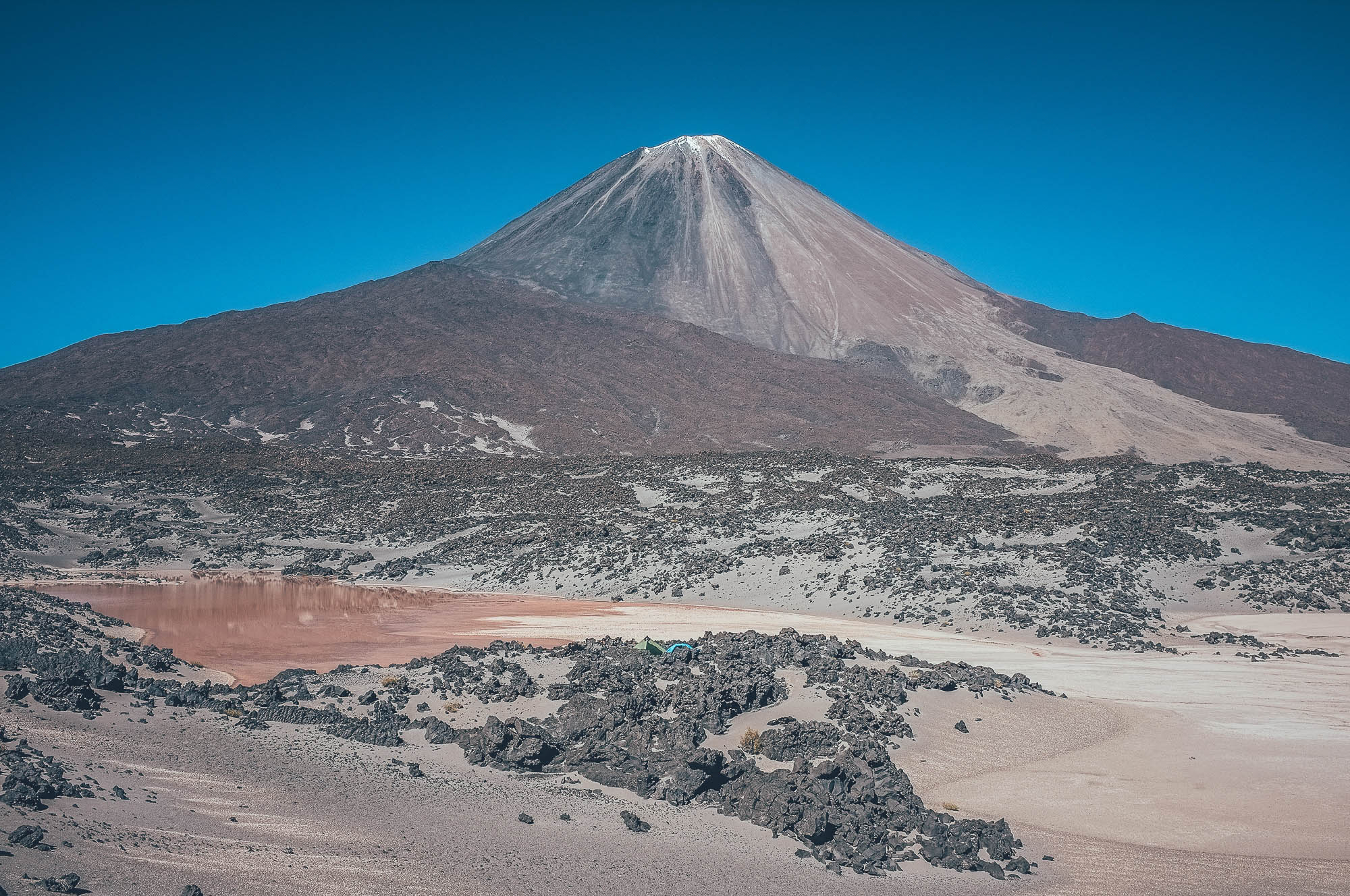
Salar de Antofalla is extremely bumpy and reaching the next water source (Vega Agua Dulce) 62 km away can take you easily two days. Cycling speed does not necessarily exceed walking speed. Colorful mountain sides and massive lava flows theme the landscape. Vega Agua Dulce has great quality fresh water and making the climb from the Salar to the puesto is worth it. The route follows an edge of lava flows mostly on soft sand to Lago Peinado, where a still untouched hotspring helps you to wash the volcanic dust off your skin. Hundreds of flamingos colour the shallow parts of the lake. You cross a small mudflat and a labyrinth-like lava flow next to nearly perfectly symmetrical Volcan Peinado, before starting an extremely demanding 1150m climb on soft surfaces to the 4990m pass. The second half of the climb, at least, is likely to be a hike-a-bike and slow progress might force you to camp on the mountain side. There is no fresh water at Laguna Purulla, so reload water from a small spring after the pass. Views to the Lagunas de Purulla, a field of sand dunes behind the lakes, and some lava flows are spectacular from the long downhill. Lagunas de Purulla does not have much wind cover, but camping by hundreds of flamingos is unforgettable. After crossing the field of sand dunes, hard enough to make your own way, the route continues across the large crater of Volcán Blanco. From the crater rim you have a nearly continuous gentle downhill to the Laguna Aguada Alumbrera, which has small freshwater springs at the shoreline, but if you have still daylight left, you stock up water from a small vega instead and can continue directly to the Termas Los Baños for the night. The perfect temperature hot spring with a small hut to sleep in and plenty of firewood, is a fantastic place to spend the night and worth the extra 200m of climbing in the morning.
Termas Los Baños – Fiambalá (110km, 720m of climbing, 2-3 days)
The route literally drops off from the edge of the desertic altiplano to the green valley where the village of Las Papas is located. Villagers are happy to offer you a place to sleep and small shop in town is the first one since Peine on the edge of Salar de Atacama. Assuming that you are doing the route early in the season, before the storm season starts in the valleys north of Fiambalá, the last few days to the town are laid back, unless the afternoon winds slow your progress to a walking pace, despite the nearly constant downhill. Try to regain weight that you lost in the high mountains in Fiambalá, by eating ice cream and pastries.
Updates 23.1.19 on the Ruta de Los Seis Miles Norte Map info:
- The spring on Paso Peinado was dry in December 2018, info added to the map.
- Shortcut avoiding the big climb to the basecamp of Mt. Llullaillaco exists and it is doable without a fatbike.
- The north side of the high pass next to Volcan Peinado has been reported to be mostly rideable, in contrast to assumed 1.5 day hike-a-bike.
- Less important, but good to know: Springs on the riverbed between Las Papas and Punta de Aqua were dry in December 2018.
Additional Inf0
- Thanks are due to Kai Larsen for checking out the Termas Los Baños, Vega Aqua Dulce and the info regarding to the restocking detour to Antofalla.
- Taneli’s blog post for his sponsor WTB, on the creation of the route.


Terms of Use: As with each bikepacking route guide published on BIKEPACKING.com, should you choose to cycle this route, do so at your own risk. Prior to setting out check current local weather, conditions, and land/road closures. While riding, obey all public and private land use restrictions and rules, carry proper safety and navigational equipment, and of course, follow the #leavenotrace guidelines. The information found herein is simply a planning resource to be used as a point of inspiration in conjunction with your own due-diligence. In spite of the fact that this route, associated GPS track (GPX and maps), and all route guidelines were prepared under diligent research by the specified contributor and/or contributors, the accuracy of such and judgement of the author is not guaranteed. BIKEPACKING.com LLC, its partners, associates, and contributors are in no way liable for personal injury, damage to personal property, or any other such situation that might happen to individual riders cycling or following this route.
Please keep the conversation civil, constructive, and inclusive, or your comment will be removed.