


Salt and Silver Overnighter
Distance
66 Mi.
(106 KM)Days
2
% Unpaved
96%
% Singletrack
0%
% Rideable (time)
100%
Total Ascent
1,861'
(567 M)High Point
4,862'
(1,482 M)Difficulty (1-10)
2?
- 2Climbing Scale Easy28 FT/MI (5 M/KM)
- 1Technical Difficulty Easy
- 2Physical Demand Easy
- 5Resupply & Logistics Moderate
Contributed By

Tyler Torres
Guest Contributor
Tyler grew up along the Wasatch Front and, after several stints in the service and mountain tourism industries, has built a career in transportation planning focused on accessible mobility and transit (and bike lanes!). Now based in Boston, he spends his free time doom-scrolling, reading books about sci-fi and municipal regulation, experimenting in the kitchen, and grimly noodling on the idea of purchasing a road bike. More at @torrtyla.
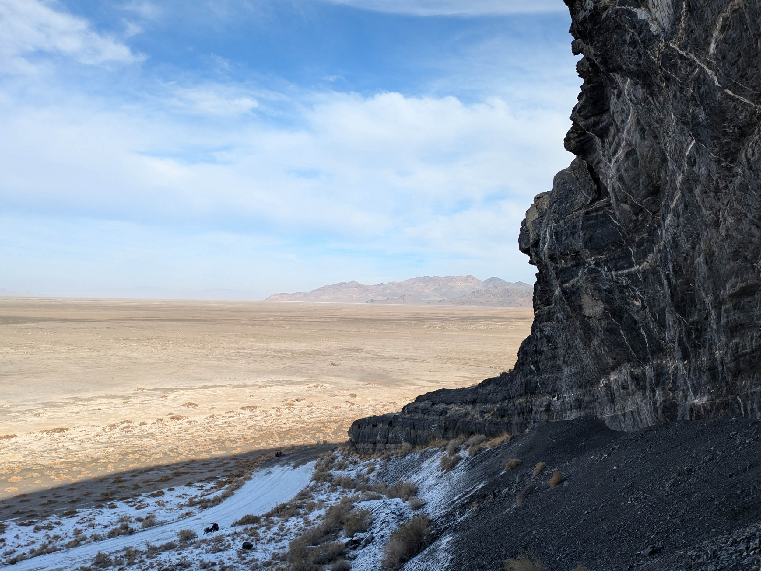
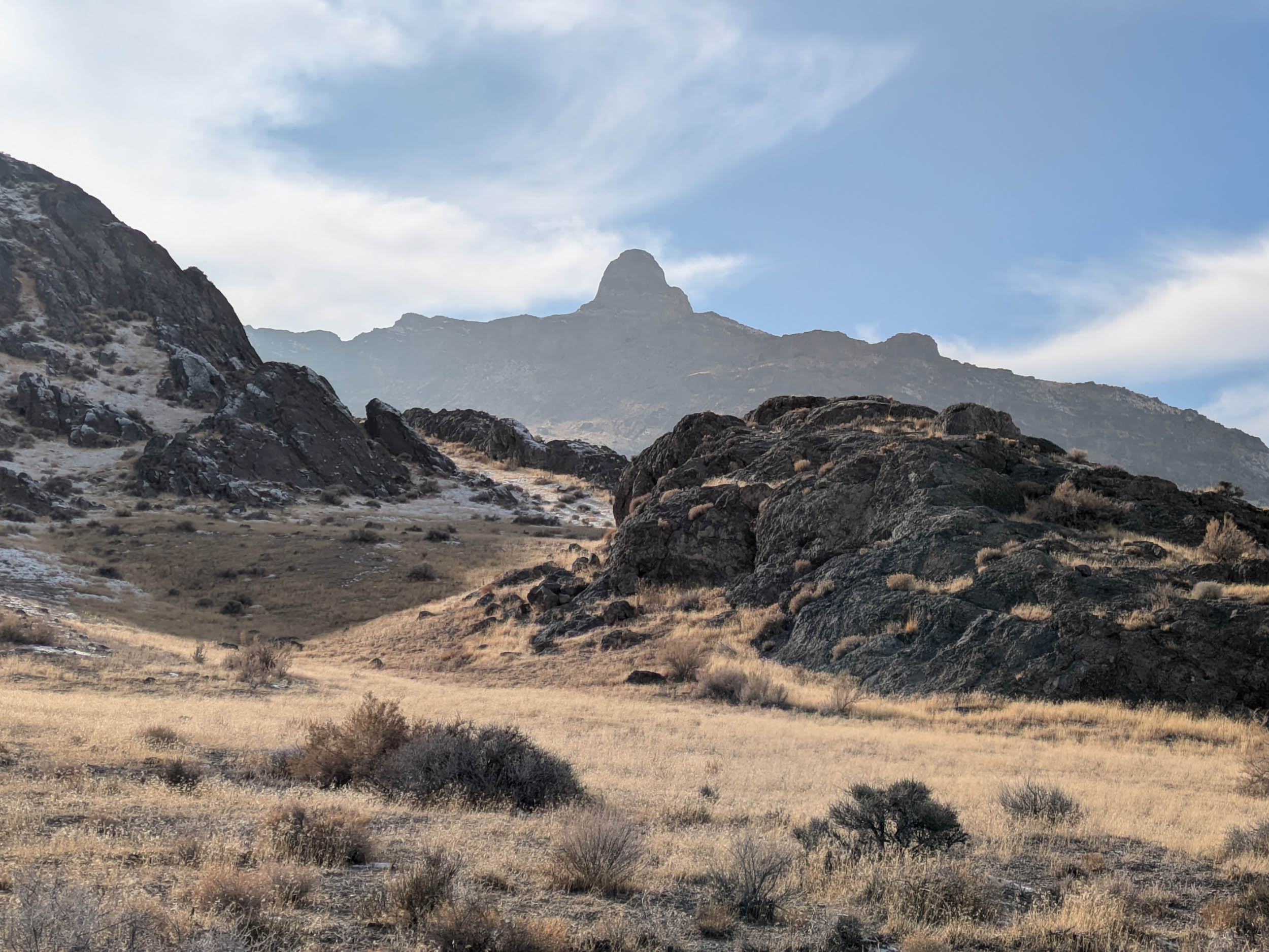
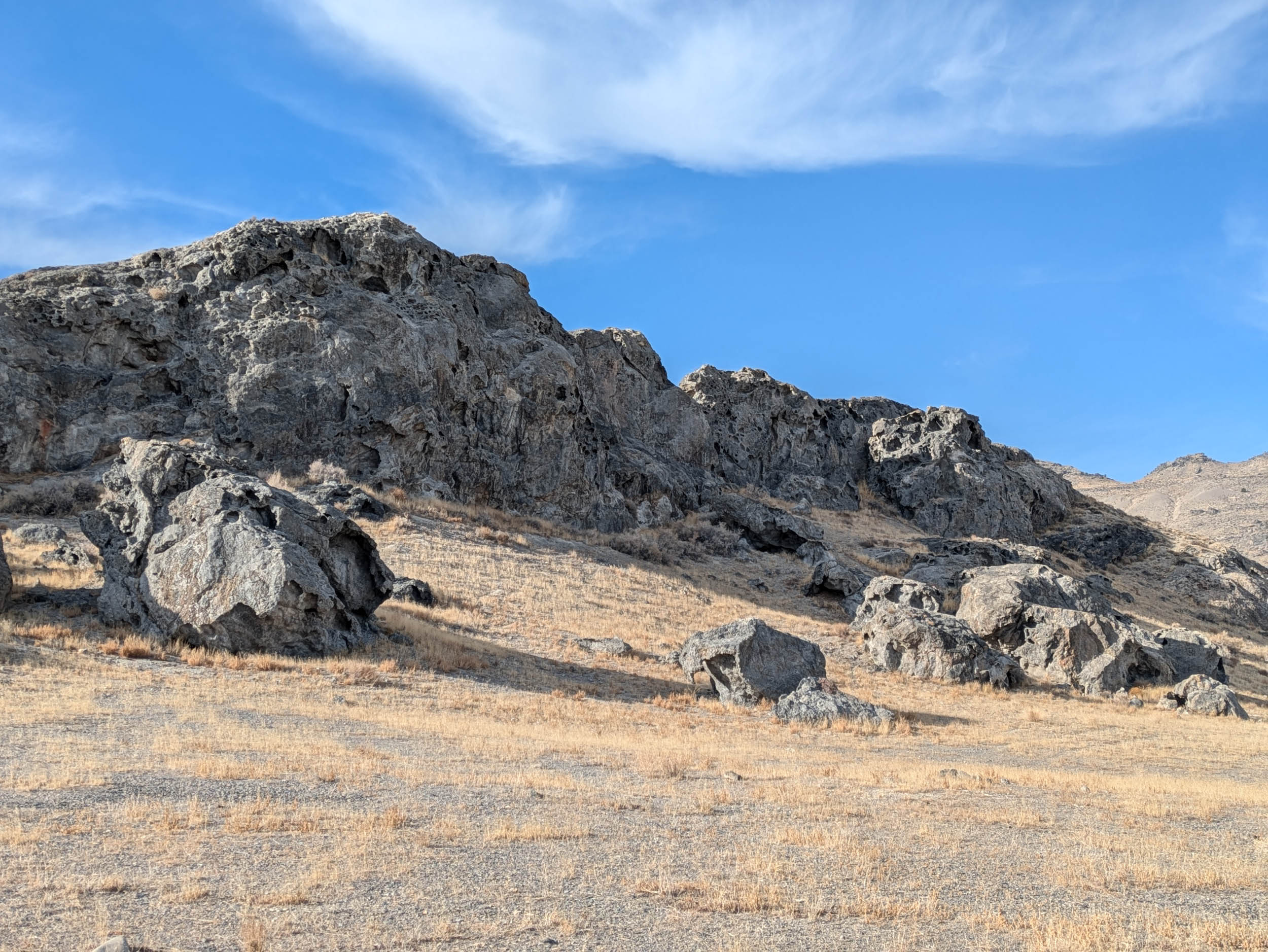
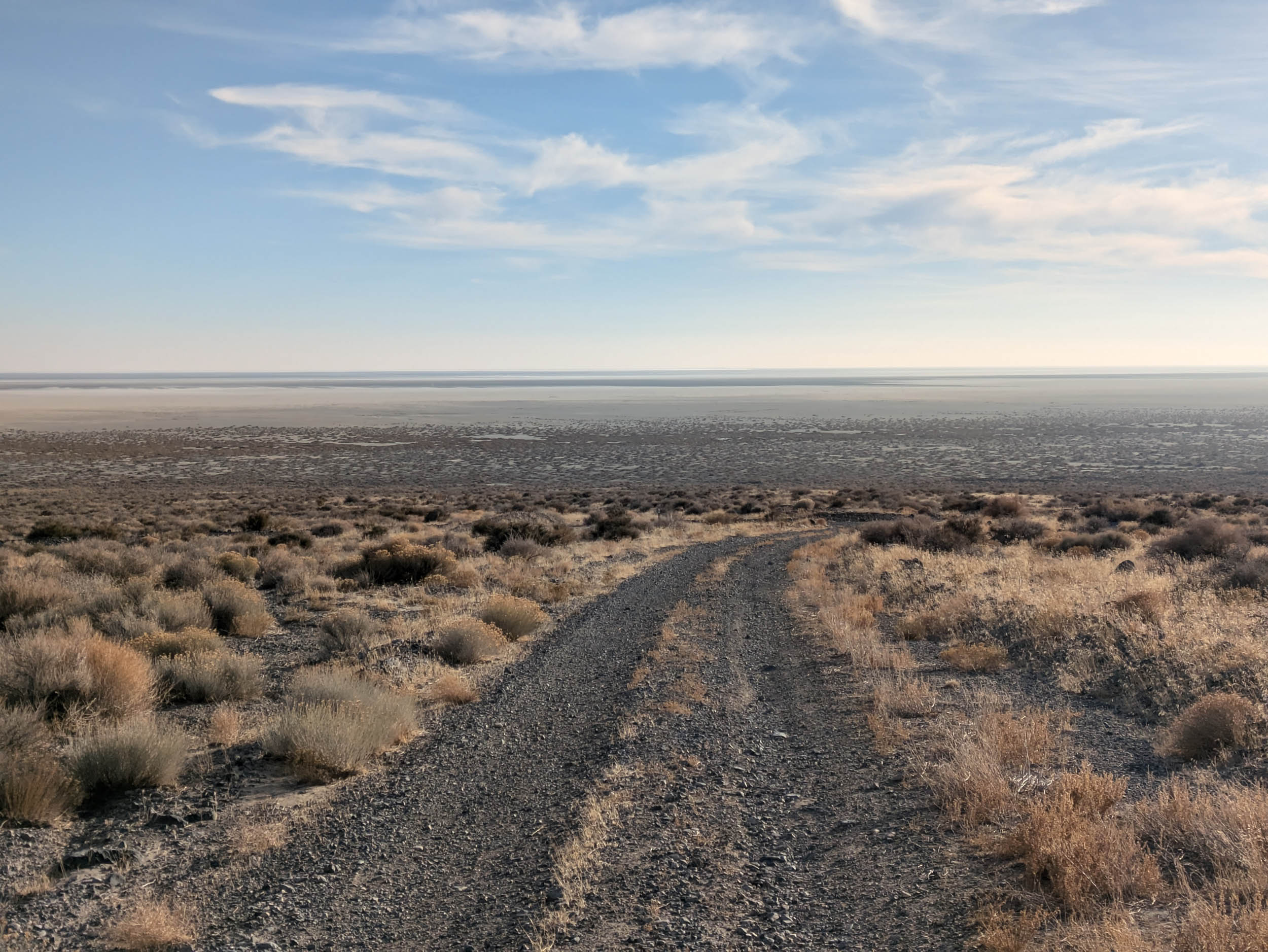
Rising from the Bonneville Salt Flats and West Desert (Best Desert), the Silver Island Mountains form a ring of salt-dusted limestone peaks sticking sharply above an ocean of arid white, grey, and tan. This 66-mile, overnight loop circles nearly the entire range on smooth, graded dirt and gravel. The riding is easy, the logistics less so. There’s no water, no shade, and limited cell reception for nearly the entire route. That contrast is the point. It’s a true beginner-friendly overnighter for riders with limited time or fitness—parents, students, the bikepacking-curious—who want a big sky desert experience without technical riding or grueling climbs.
Starting and finishing outside Wendover, Utah, the loop follows the Silver Island Backcountry Byway as it skirts sage, shriveled horsebrush, dry washes, and pale rock outcrops, with long, uninterrupted views across the Great Basin. Encircled by barrens, the Silver Island Mountains are a true island massif, twisting remnants of a crust left standing in a land pulled thin between hundreds of fault-bounded basins and ranges. Riding clockwise clears the modest climbing early and sets up riders for sunset below the most scenic peaks, whereas counter-clockwise riders can expect a sunset over pure salt flats with a zippy descent from the mighty Leppy Pass the next morning. The terrain invites lingering rather than pushing in either direction, with mileage that leaves time for side trips and exploration.
The history of the range runs alongside you. Rock overhangs hold traces of the Goshute and Shoshone peoples, whose visible presence on their land stretches back over 10,000 years and continues today, seen from smoke stains and faint pictographs in the caves along the route. In 1846, the Donner-Reed Party passed nearby while attempting the Hastings Cutoff, a supposed shortcut to California that promised speed but delivered mud. Later came small-scale mining attempting to wring veins of copper, gold, and silver from the rock, which left a handful of winding jeep roads into the rocky slopes that now offer riders detours to explore.
By the 1930s, attention shifted to the surrounding salt itself, as the Bonneville Salt Flats became a proving ground for land speed records. Some of the surrounding peaks and geographic features bear the names of figures from that racing history, tying the mountains to both endurance and ambition. These overlapping uses hint at a larger story. As the Great Salt Lake shrinks to historic lows, the exposed flats offer a stark preview of the challenges facing the Salt Lake Valley and surrounding urban areas, where mismanagement of a scarce and vital resource threatens both environment and economy. The flats remind riders that the seemingly empty landscape is far from inactive, shaped by geological forces and a human presence that remains impermanent.
Along with all this history and chance for self-reflection, the loop also offers a more immediate, approachable experience. For experienced riders, the loop is an easygoing cruise through a majestic landscape, with enough flexibility to be back in town for brunch or to tack on riding and hiking detours, such as the 13-mile Floating Island spur, jutting out into the eastern flats. Beginner riders will appreciate the low barrier to entry in terms of gear, while gaining a chance to sharpen packing and planning skills. The ride finishes where the desert’s long view snaps back to pavement, with an easy return to Salt Lake City or Wendover, where those with a taste for local color can make their pilgrimage to the eternal Pancho & Willie’s Cantina, the perfect ending for a perfect bike trip.
Route difficulty
This is a good opportunity to test gear, systems, and logistical thinking before venturing into more committing routes in other parts of Utah. Mostly firm gravel and doubletrack with occasional patches of chunk and loose sand. Modest grades and short distances reward with big views. Pick your conditions and let the wind and sun test your mettle. Riders should note that there is no option for resupply once the riding has begun, unless making a cache drop. This contributes to a sense of adventure and an increase in difficulty. No cell reception, no water, no firewood, and no services once you leave “town.”
Route Development: This route was pulled together from a mix of local blog posts, word of mouth, and casual visits to the Silver Islands and surrounding areas over the years. It follows existing clues rather than breaking new ground. Riders familiar with the Wasatch Front may recognize recurring themes and familiar places, and newer riders can use this write-up to navigate the loop more confidently.


Submit Route Alert
As the leading creator and publisher of bikepacking routes, BIKEPACKING.com endeavors to maintain, improve, and advocate for our growing network of bikepacking routes all over the world. As such, our editorial team, route creators, and Route Stewards serve as mediators for route improvements and opportunities for connectivity, conservation, and community growth around these routes. To facilitate these efforts, we rely on our Bikepacking Collective and the greater bikepacking community to call attention to critical issues and opportunities that are discovered while riding these routes. If you have a vital issue or opportunity regarding this route that pertains to one of the subjects below, please let us know:
Highlights
Must Know
Camping
Food/H2O
Resources
- Enjoy a true gateway route with easy pedaling, straightforward navigation, big scenery, and weekend-friendly logistics.
- Cinematic sunsets and moonrises stretch over the rugged desert mountain ranges of the Great Basin.
- Tip your Da Brim to the Hastings Cutoff of the California National Historic Trail as you pass through, a route steeped in history and pioneer misadventure.
- Refuel with hearty Punjabi cuisine at the nearby truck stop, and if you’re up for it, wander a few steps into Wendover’s smokey little neon world of slot machines and retro kitsch.
- Utah’s world famous Bonneville Salt Flats offer motivated riders the opportunity to break the single-cog land speed record and visit the public art dotted alongside I-80.
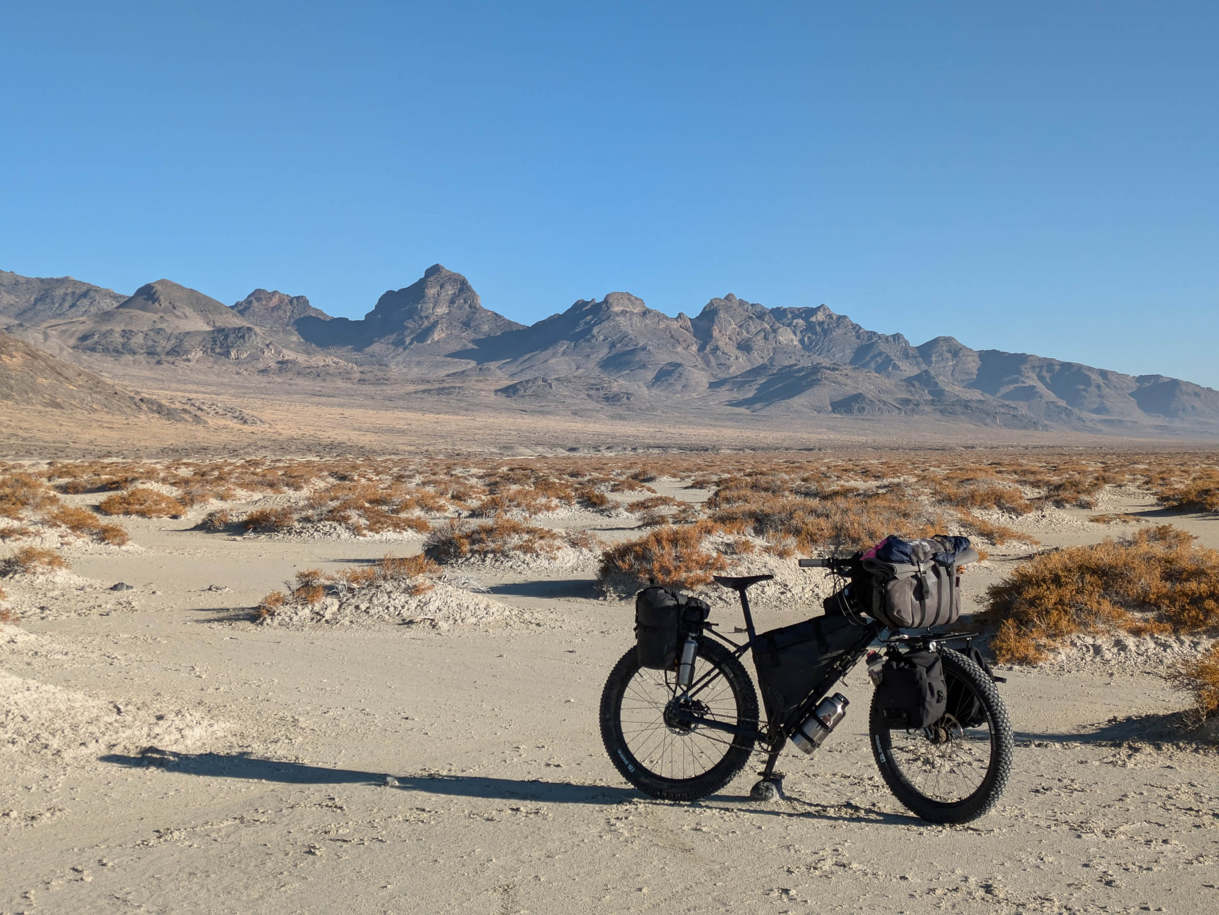
- An optional 13-mile side trip leads to Floating Island, jutting into the Salt Flats and amplifying the route’s otherworldly vibes. To the north, faster riders could add mileage by heading off route to Crater Island or beyond, staying mindful of wet conditions.
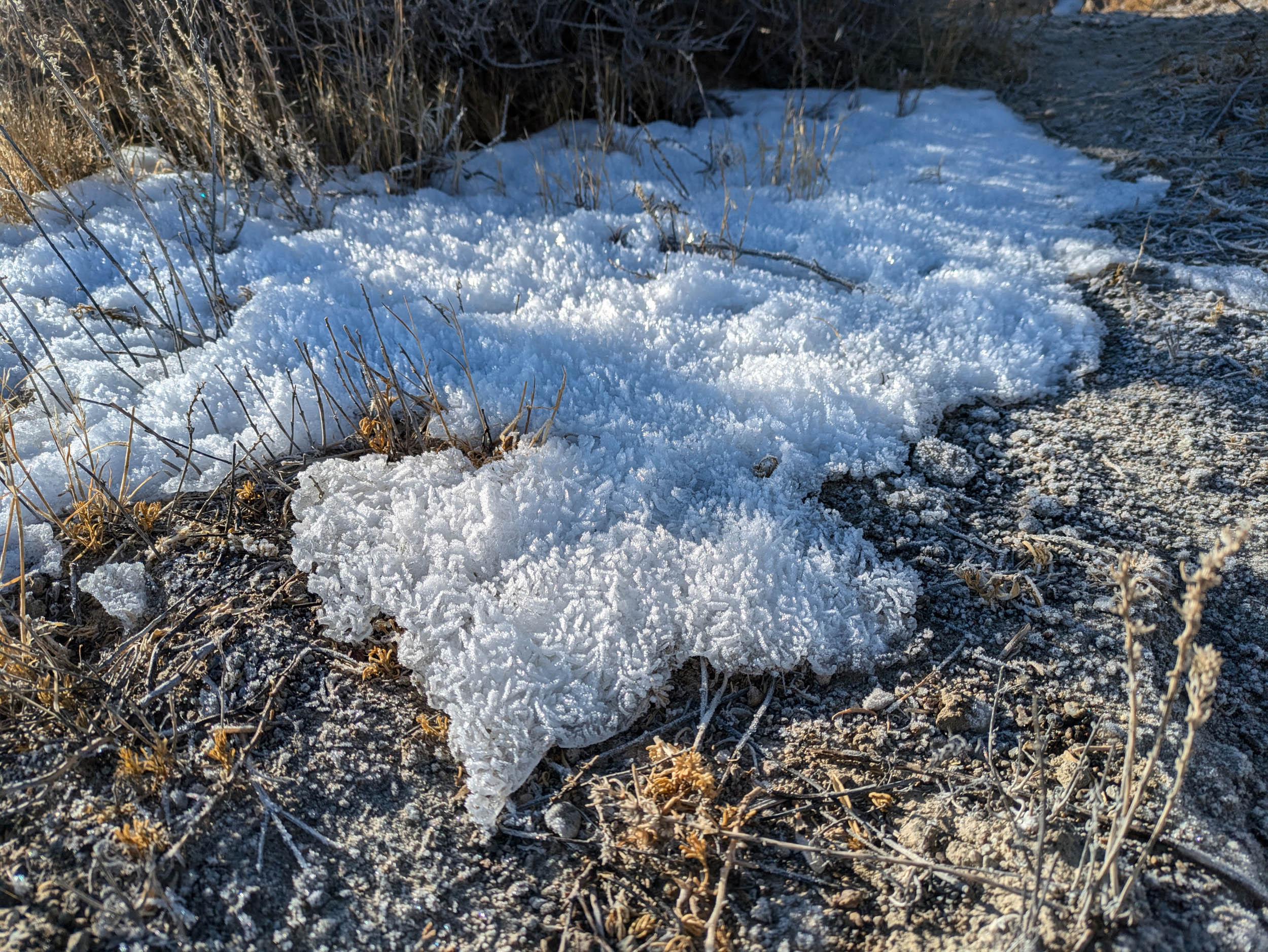
- Keep an eye out for roadside limestone caves and wildlife such as owls, raptors, jackrabbits, and migrating pronghorn. Desert quiet belies abundant life.
- Attempt to heed the charmingly confusing sign near the start, seemingly a vestigial piece of a more complete thought.
- Access the start of the route near the Wendover Truck Stop (Exit 4, Utah side I-80). There is plenty of parking space in the flat area near the Scenic Byway Sign. Coordinates: 40.772496, -113.981448
- Clockwise is recommended for sunset and early climbing; rides fine either way.
- When dry, the Byway will roll fast. After rain, salty clay surrounding the route risks turning to glue. Time trips for dry windows, avoiding storms.
- If including the Floating Island Spur, go only when roads are dry and don’t go east beyond the island itself, or you will end up in the northern section of one of the US Air Force’s beloved weapons testing ranges.
- Pack like you mean it and carry at least 5-8 liters of liquid per person along with your full repair kit. While the road sees the occasional overlander, traffic is sparse.
- The route is best ridden between fall and spring. Summer will be brutally hot and shade-free, not recommended. Winter, by contrast, offers a solid opportunity to practice different logistics.
- Plan for no cell reception for most of the loop. Download offline maps as necessary.
- Gravel/touring/rigid MTB all work fine; 2.0-2.75” tires are probably most ideal. One member of the group rode this route on rock hard 35mm Schwalbe Marathons, a choice best appreciated with time and distance. Your sit bones can, in theory, do the same.
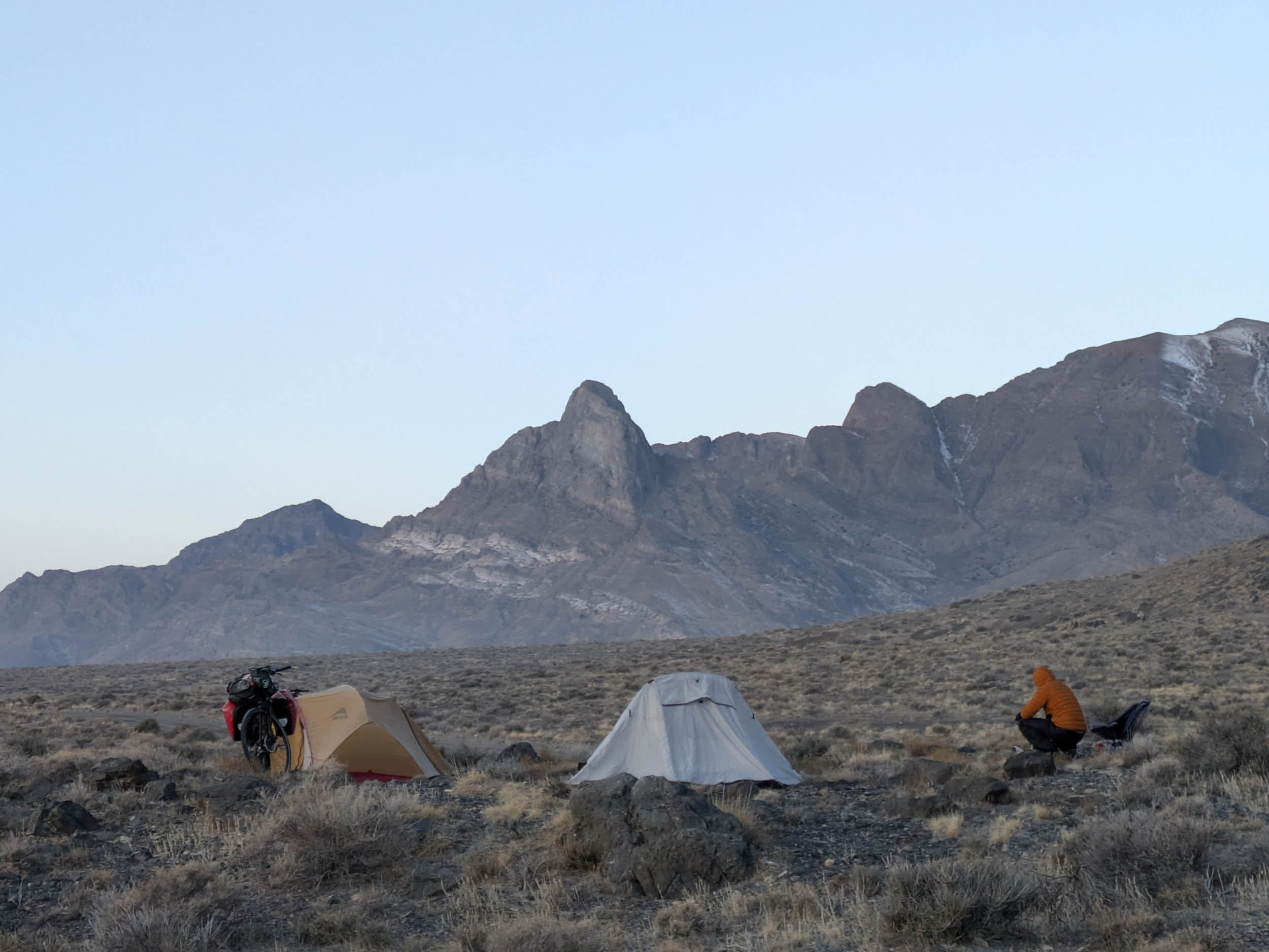
- Dispersed BLM camping is allowed nearly everywhere along the Byway. Campsites on the east offer sunrise views, while broad western mountain faces catch the alpenglow. Camping on the western side of the range all but guarantees stunning sunsets over the Pilot Range.
- Wood and other campsite spirit-lifters were stashed along the route in advance by previous winter riders. This is smart and likely increases happiness. The writers of this report opted to carry all firewood and treats by bike instead, an experience best described as humbling and easily avoidable.
- Consider crashing at an affordable Wendover hotel and making a solemn, pre-ride pilgrimage to the legendary Pancho & Willie’s Cantina.
- The frequent clear skies and low bugsmake cowboy camping a delight, though late spring could deliver hordes of gnats and deer flies. The nearby-ish Antelope Island State Park Station hotline may have clues on whether these cherished members of the ecosystem have emerged.
- Store food carefully, desert rodents may find the taste of your bags and dinner too tempting to resist.
- For a post-ride bite, hit the nearby truck stop’s kitchen to blow out the camping cobwebs with delicious, fiery curry and steaming chai or gamble with Wendover’s neon buffets for a quick pivot from desert stillness.
- There are no natural water sourcesand no dependable shade on route. Start fully loaded from the parking area and mind your ambition. Water can be obtained at the truck stop.
Additional Resources
- Visit the BLM website for the Silver Island Mountains Backcountry Byway for a brief overview and map.
- Check out blog posts from Into The Outdoors and Road Trip Ryan for additional perspectives and sightseeing along and around the route.


Terms of Use: As with each bikepacking route guide published on BIKEPACKING.com, should you choose to cycle this route, do so at your own risk. Prior to setting out check current local weather, conditions, and land/road closures. While riding, obey all public and private land use restrictions and rules, carry proper safety and navigational equipment, and of course, follow the #leavenotrace guidelines. The information found herein is simply a planning resource to be used as a point of inspiration in conjunction with your own due-diligence. In spite of the fact that this route, associated GPS track (GPX and maps), and all route guidelines were prepared under diligent research by the specified contributor and/or contributors, the accuracy of such and judgement of the author is not guaranteed. BIKEPACKING.com LLC, its partners, associates, and contributors are in no way liable for personal injury, damage to personal property, or any other such situation that might happen to individual riders cycling or following this route.
Further Riding and Reading
Here are some connected/nearby routes and related reports...


Please keep the conversation civil, constructive, and inclusive, or your comment will be removed.