


The Salt and Wine Road
Distance
53 Mi.
(85 KM)Days
2
% Unpaved
82%
% Singletrack
26%
% Rideable (time)
98%
Total Ascent
9,640'
(2,938 M)High Point
9,006'
(2,745 M)Difficulty (1-10)
7?
- 10Climbing Scale Very Strenuous182 FT/MI (34 M/KM)
- -Technical Difficulty
- -Physical Demand
- -Resupply & Logistics
Contributed By

Francesco and Denis
Guest Contributor
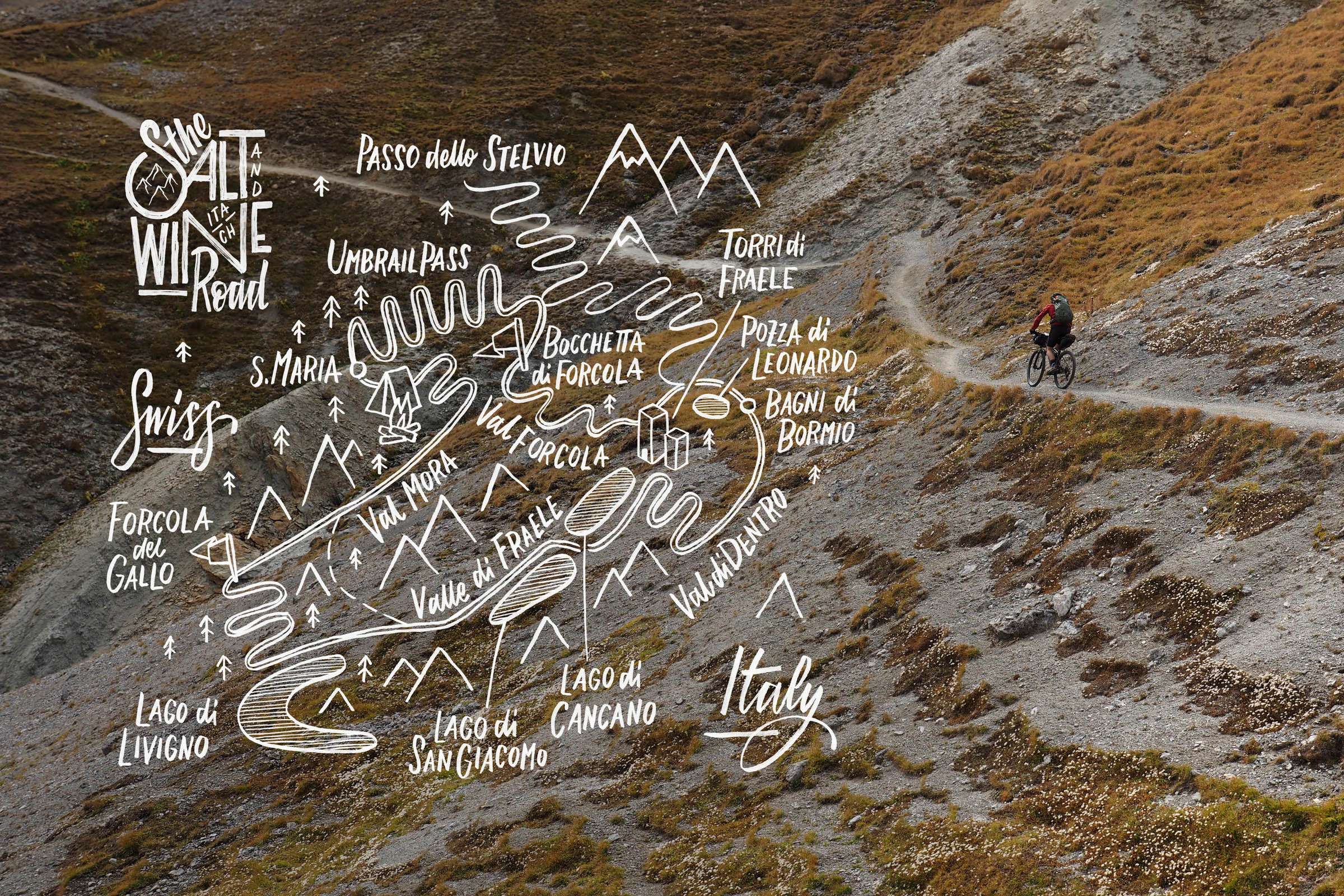
Long-time friends and mountain enthusiasts based in Trentino, Italy, Francesco Bonvecchio and Denis Sassudelli discovered cycling a few years ago, first through road touring, and then MTB bikepacking to truly enjoy the mountain environment of their homeland. The two also share a passion for route planning and storytelling. Denis never leaves home without his camera and Francesco often translates the tours into graphic maps and illustrations (@bonvecchiofrancesco).
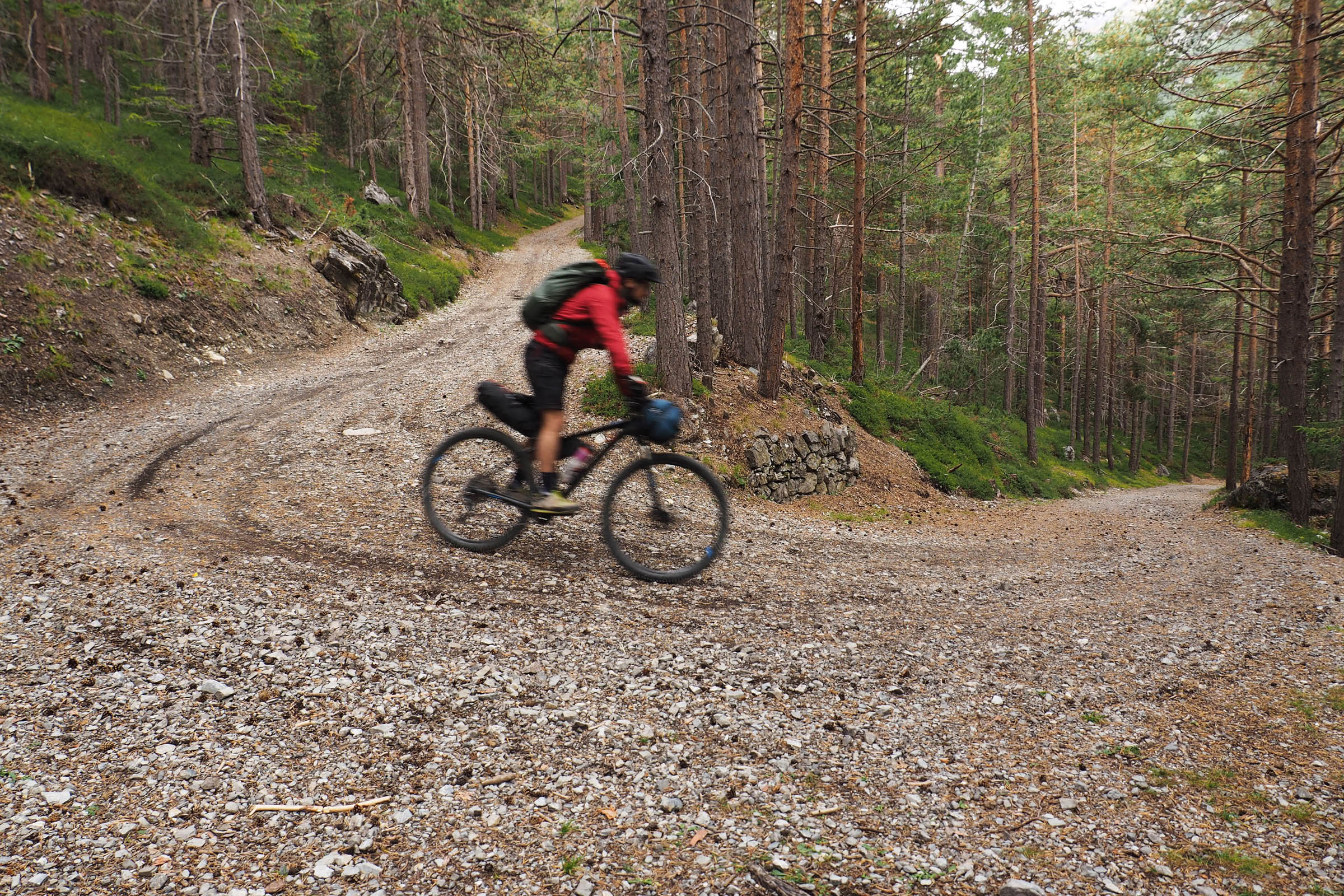
The Salt and Wine road was created to combine several mountain bike routes into a great two-day bikepacking loop. It packs a lot into a short distance: wide valleys, big blue lakes, majestic views of massive peaks, a small and charming Swiss village, and a natural hot water pool for relaxing at the end of the ride.
The Stelvio National Park and the Val Mustair Biosfera are famous for their singletrack trails, and they make a true paradise. For this reason, both can become crowded during the height of the summer season. As such, we chose to ride the loop in autumn since it’s the ideal time to enjoy the wild character of these landscapes without the crowds. Learn more about the ride itinerary under Trail Notes and when to ride it under Must Know.
Route Difficulty
The loop uses a variety of surfaces, including a little tarmac, lots of smooth and fast gravel roads, as well as some challenging singletrack. The Alpe del Gallo uphill section presents loose rock and roots that make it more demanding to ride. The alpine mountain environment also plays a role in the difficulty of the Salt and Wine Road, as the route reaches an altitude of 2,700 meters (8,900 feet), where bad weather can cause rough and dangerous conditions. For that reason, this loop is generally unrideable during winter and spring when it’s is covered in snow. Resupply is fairly straightforward (see Food/H2O below for details).


Submit Route Alert
As the leading creator and publisher of bikepacking routes, BIKEPACKING.com endeavors to maintain, improve, and advocate for our growing network of bikepacking routes all over the world. As such, our editorial team, route creators, and Route Stewards serve as mediators for route improvements and opportunities for connectivity, conservation, and community growth around these routes. To facilitate these efforts, we rely on our Bikepacking Collective and the greater bikepacking community to call attention to critical issues and opportunities that are discovered while riding these routes. If you have a vital issue or opportunity regarding this route that pertains to one of the subjects below, please let us know:
Highlights
Must Know
Camping
Food/H2O
Trail Notes
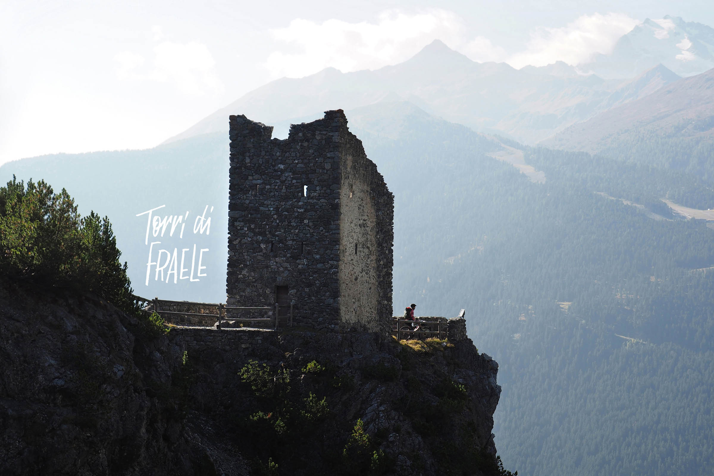
- TORRI DI FRAELE (FRAELE’S TOWERS): Middle Age towers from 1300, built to control and secure the commercial path.
- LAGHI DI CANCANO (CANCANO’S LAKES): Artificial but beautiful lakes, the two dams date back to the early 1900s. Flat and fast dirt roads line the lakes on both sides.
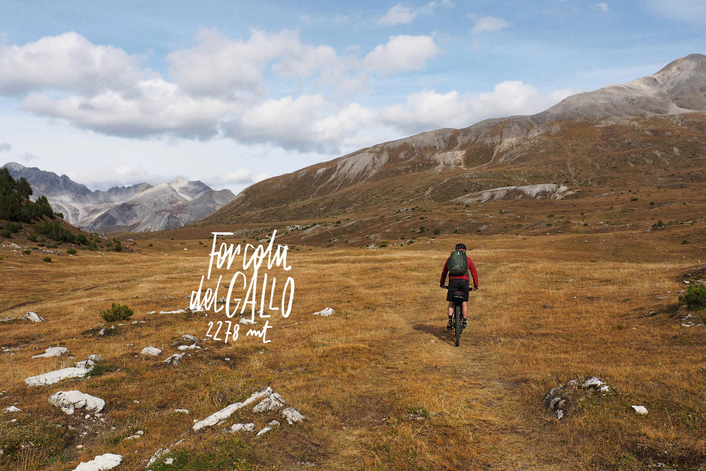
- ALPE DEL GALLO (ROOSTER ALP): Wooded and grassy area that starts at Acqua del Gallo river (that flows directly into the Lago di Livigno) and rises to Forcola del Gallo at 2,260 meters, then passes between Italy and Switzerland and the highest point on day one.
- VAL MORA (MORA VALLEY): Long, wide, and scenic valley that descends from Forcola del Gallo to Santa Maria.
- SANTA MARIA: Small Swiss village in the Müstair Valley. We recommend refueling here with a rich breakfast before climbing the Umbrail Pass, and don’t forget to buy some local delicious cheese for lunch!
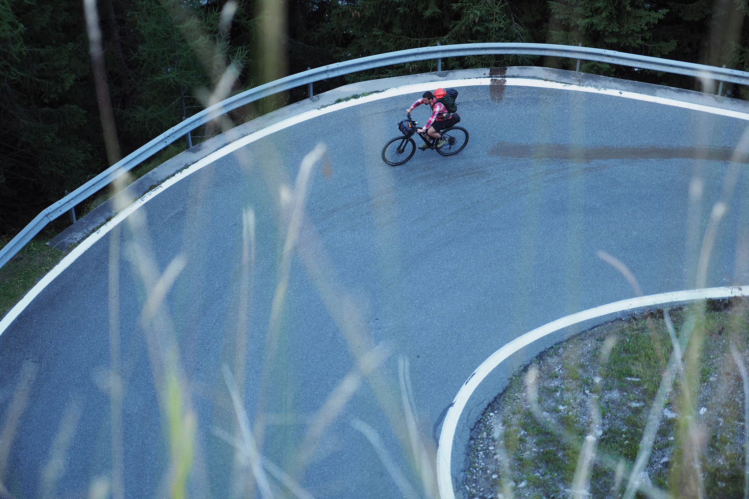
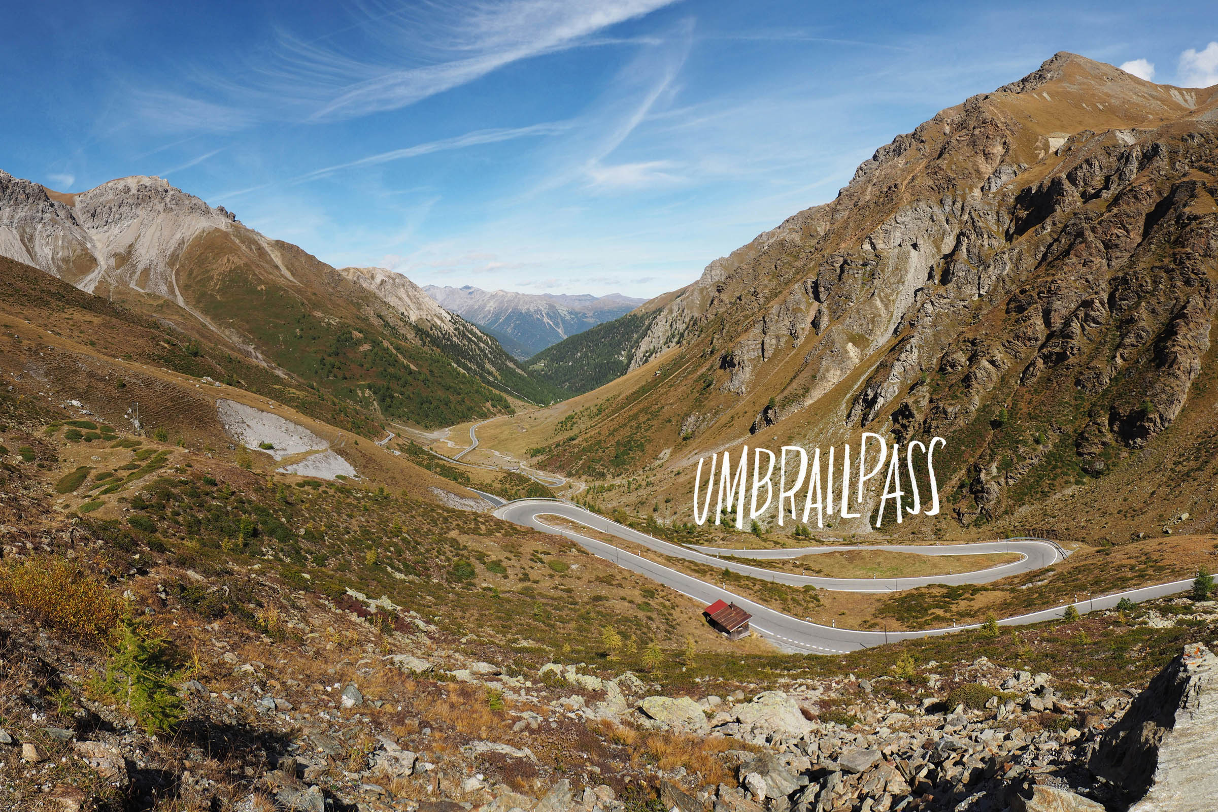
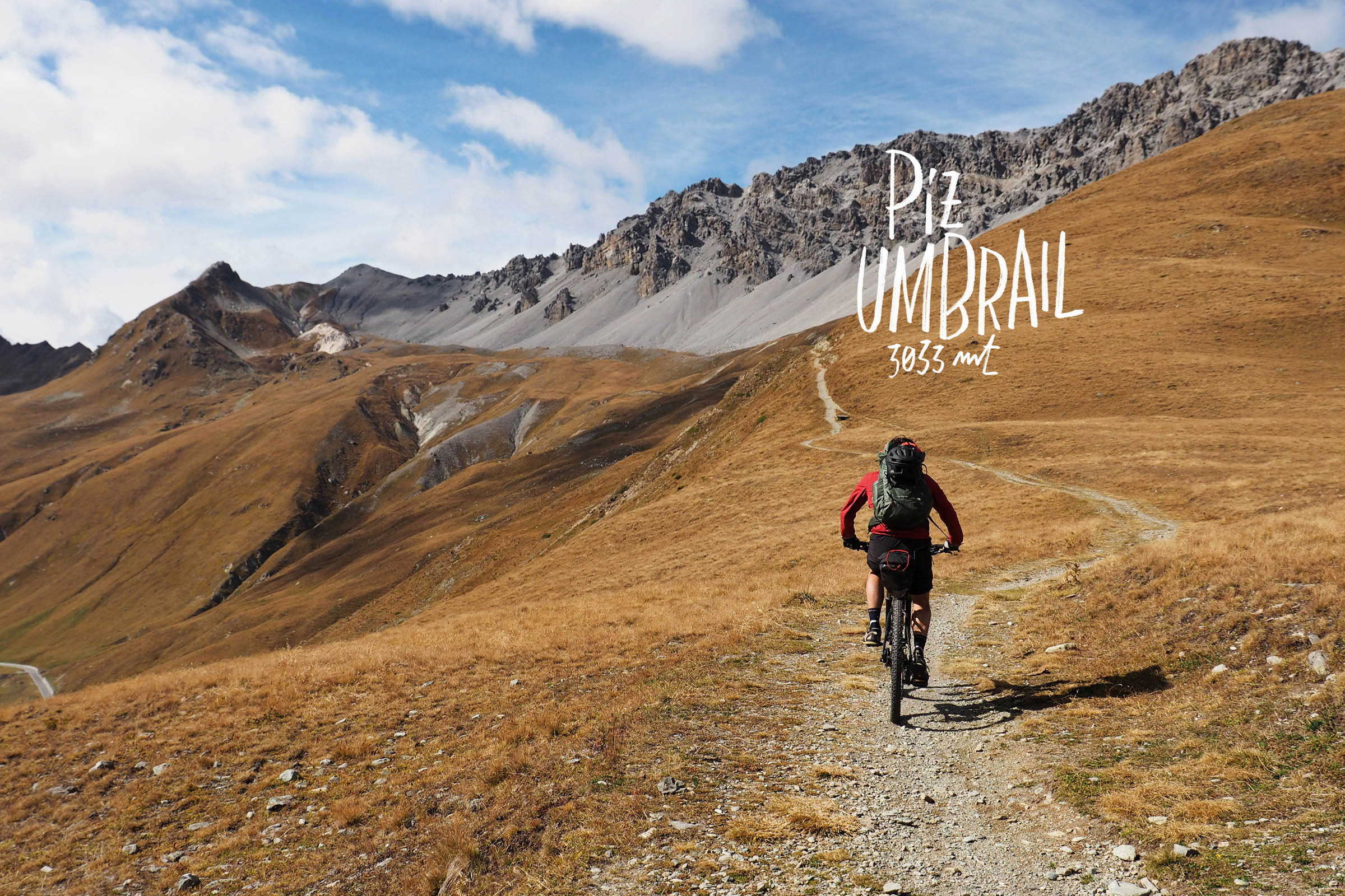
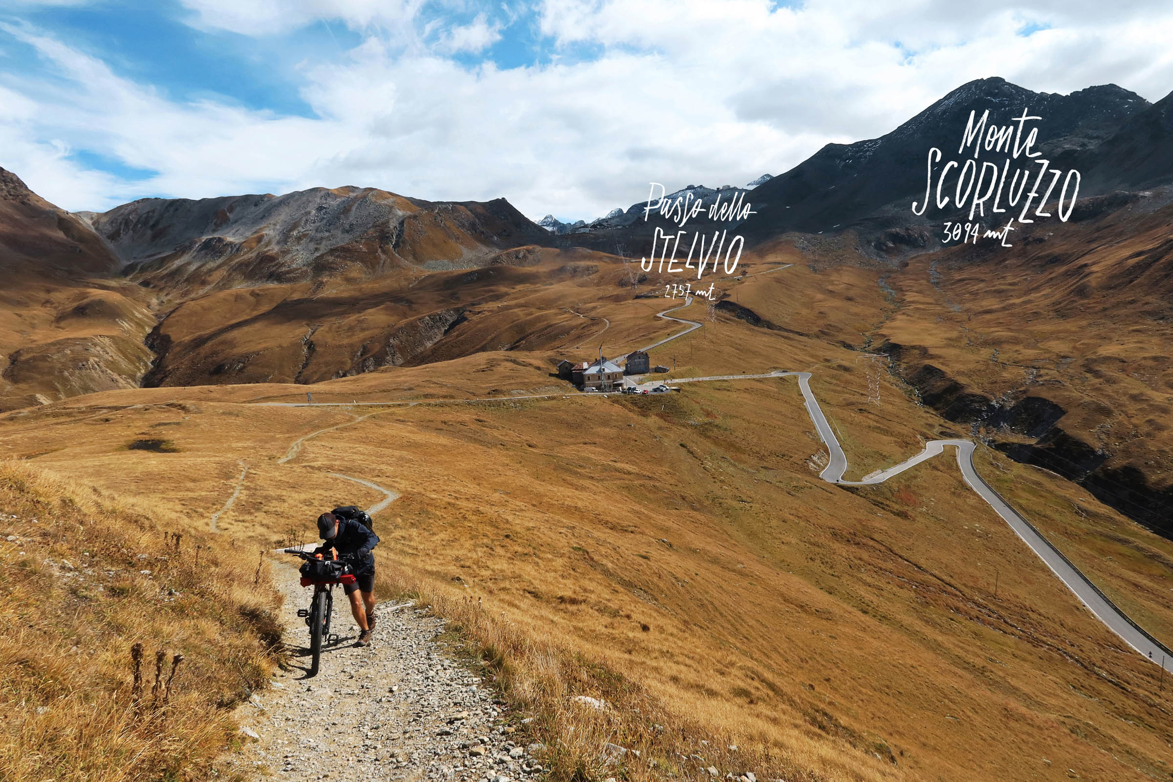
- UMBRAIL PASS: Long, winding, and scenic climb that leads towards the Stelvio pass. Not extremely steep, and paved with perfect tarmac.
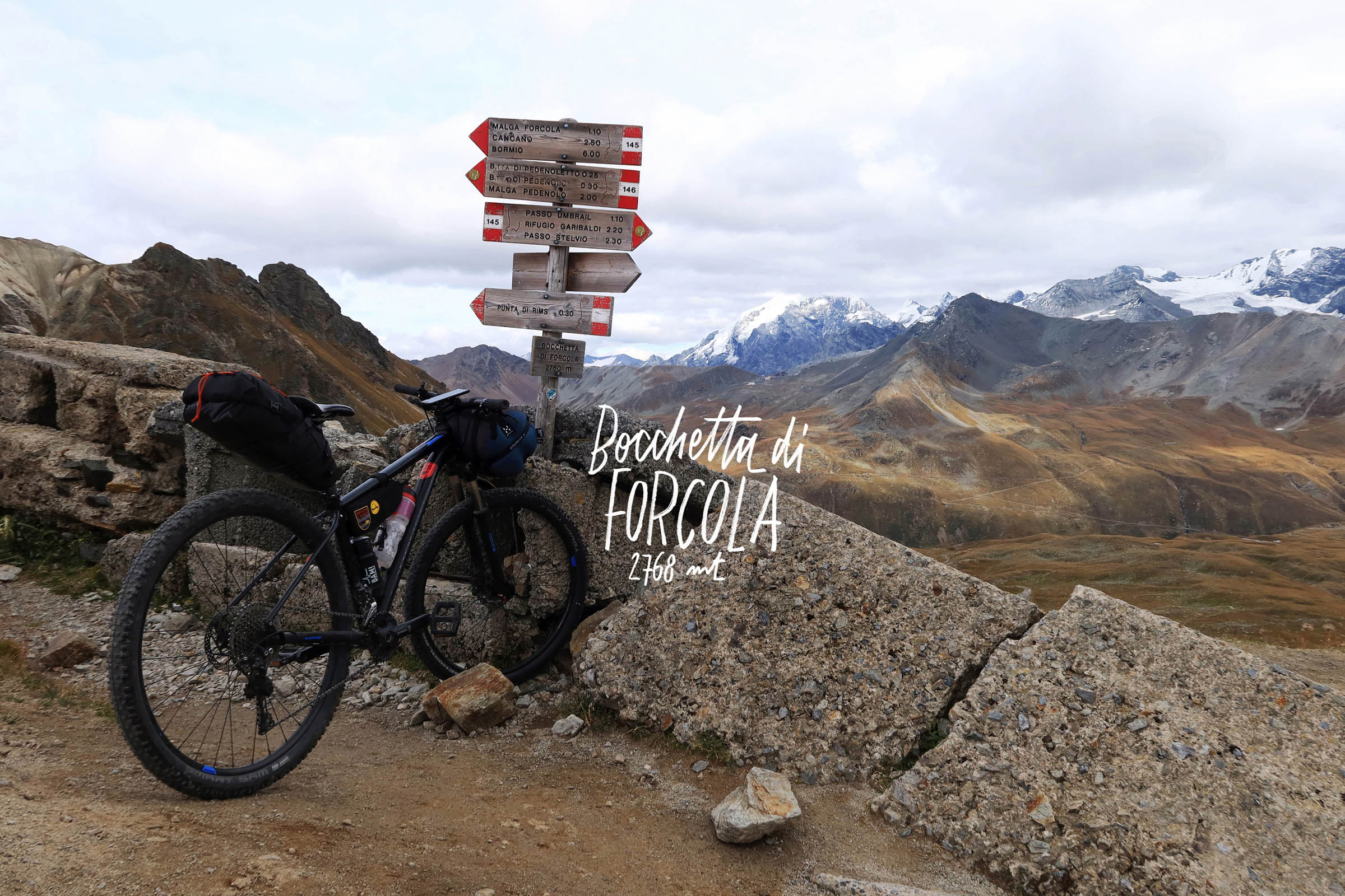
- BOCCHETTA DI FORCOLA: The highest point of the tour at 2,760 meters offers a superb view on the Stelvio Pass and the Ortler mountain group.
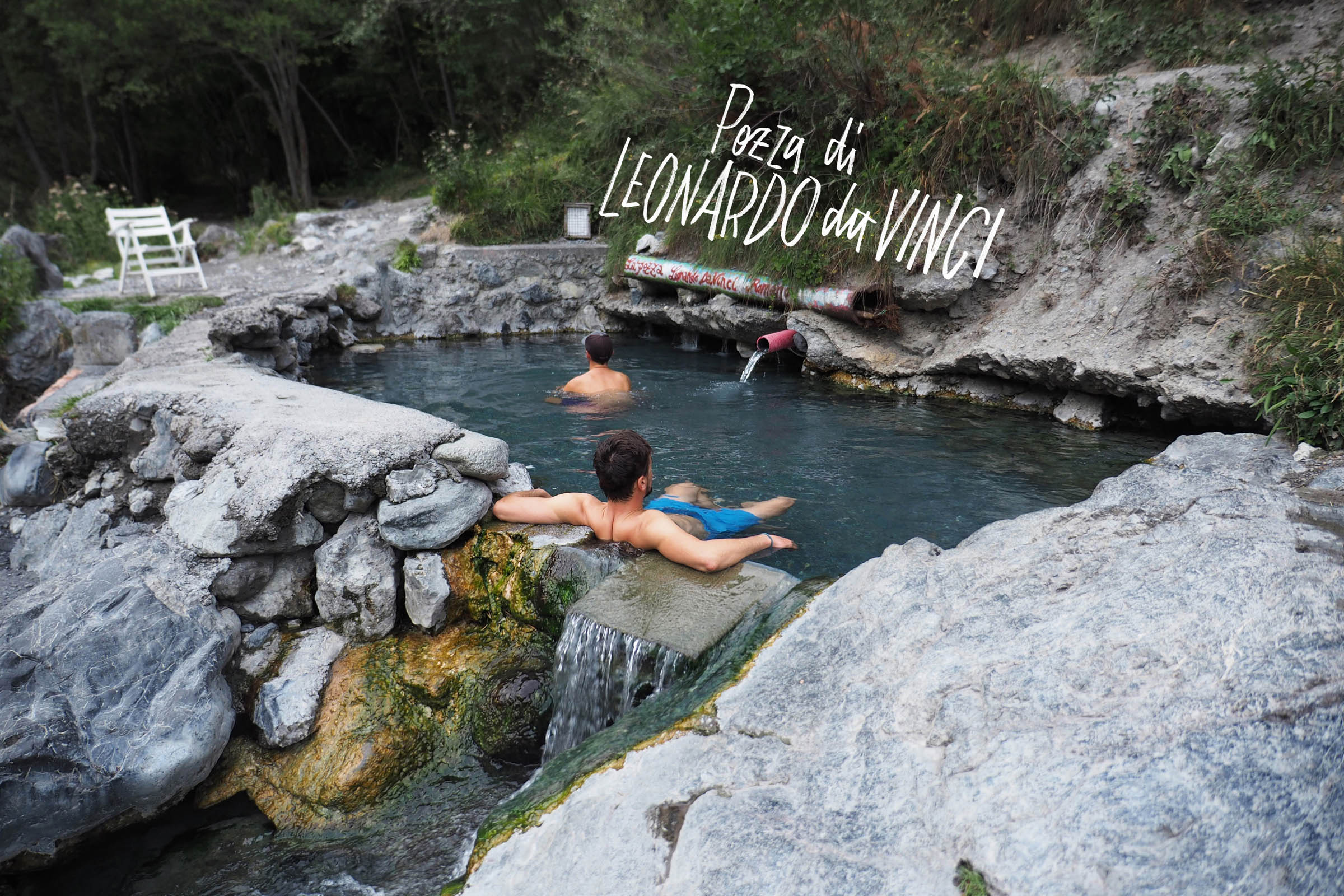
- POZZA DI LEONARDO DA VINCI (LEONARDO DA VINCI’S POOL): Small and free thermal pool with 38-degree water located along the Braulio River. For a complete wild spa experience, it’s definitely recommended to dive into the river’s freezing water before and after relaxing in the pool.
- When to ride this route depends on the experience you want to have, and obviously on the amount of snow on the ground. A call to the Bormio Alpine Guide office is always a good idea to get more info about temperatures and snow cover. Another option is checking the several Passo dello Stelvio live webcams, such as this one.
- During winter and spring, the higher elevations of the route are covered in snow. And in the summer, the area can become crowded with hikers and tourists. In May/June the Cancano lakes area may already be pretty crowded, and at 2,700 meters (Bocchetta di Forcola) you will likely still find snow.
- We recommend autumn as the best season to ride this loop. October is the perfect month. At this time, the snow has melted completely and there are fewer tourists in the area. And, if you are lucky, the weather is still nice and warm.
- Bormio is not an easy place to reach without a car. However, you can reach Tirano by train (2.5 hours) from Milan and then cycle to Bormio (40 kilometres, 800 metres of climbing).
- A hardtail or full-suspension mountain bike would be the best option to enjoy the ride.
- The temperatures on the route may vary a lot depending on the weather. It’s mandatory to bring an insulated jacket and waterproof layer.
- Wild camping is generally not permitted in Switzerland. However, if you must use your tent for an emergency bivouac if you can’t reach your destination, camp late, leave early, and #leavenotrace, even if you need to pitch camp at an established campsite in the backcountry.
- There are some established campsites along the route, but it’s encouraged to stay in or near Santa Maria; there is a pay campground just south of town at the Campingplatz Pè da Munt.
- If you prefer, you can spend the night in a hotel, a B&B in Santa Maria.
- THERE ARE SOME RESUPPLY POINTS along the way, so it’s not necessary to carry all the food and water you’ll need for the two days. And if you’d like, you can ride even lighter without camping gear and sleep in Santa Maria.
- BORMIO: Right before the start (and the end) of the tour, you can find various markets, restaurants, and bike shops.
- RIFUGIO RISTORO VAL FRAELE: A sunny hut on the side of Cancano Lake that’s run by some young and friendly locals, perfect for a “second breakfast” on the first day or to refill your water bottles.
- “VAL MORA HUT”: There’s a nameless hut a the start of the gravel road of Val Mora with a fountain where you can refill your bottles. You could probably you can even eat something there, but it was closed during our ride.
- SANTA MARIA: A small and beautiful Swiss village, perfect for breakfast on the second day and to buy food along the way.
Day 1
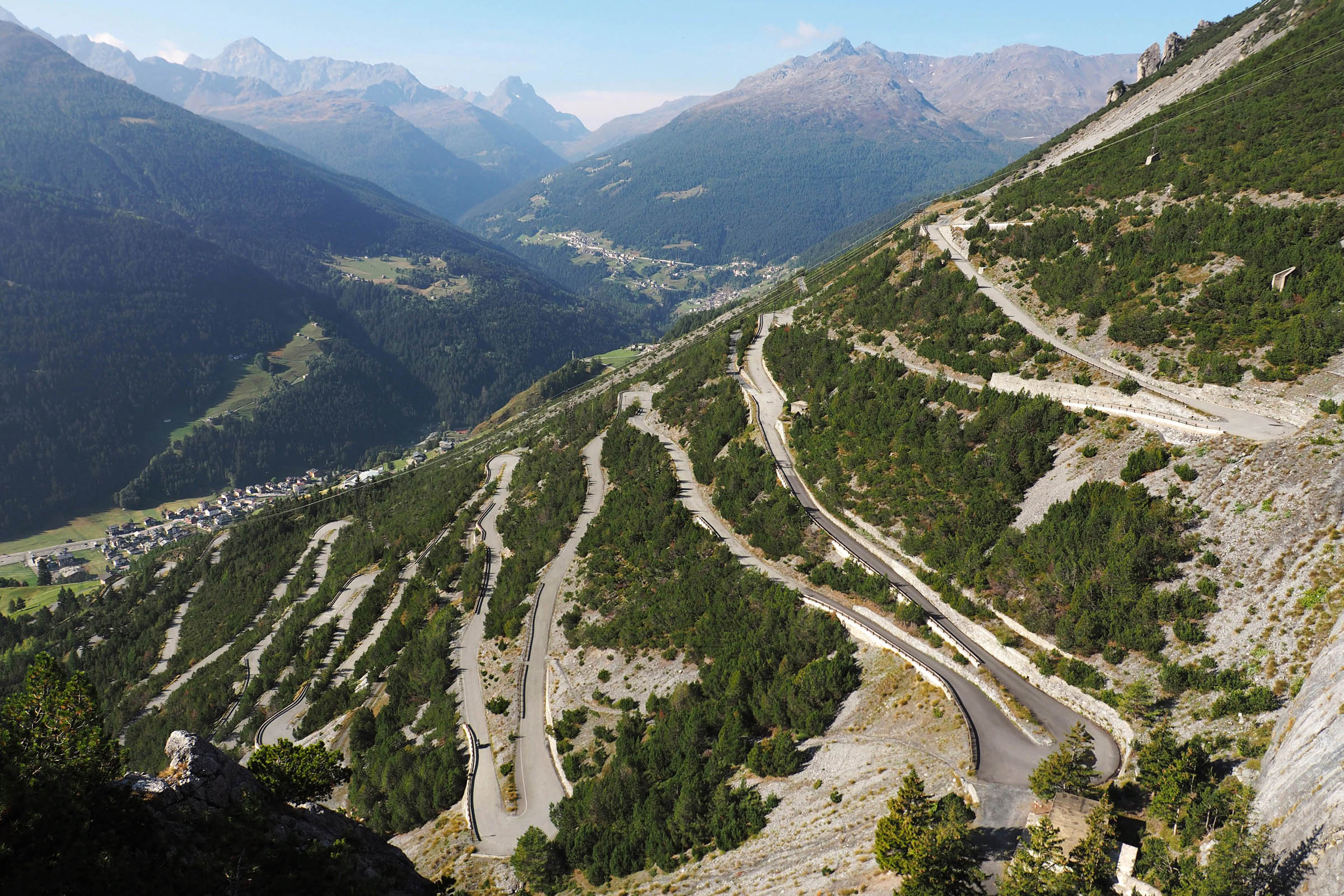
Starting from Bagni di Bormio, the ride begins with an uphill section, a gently sloped tarmac road full of hairpin bends and climbs from the Valdidentro Valley floor up to the almost 2,000 metres of the ancient Fraele’s towers.
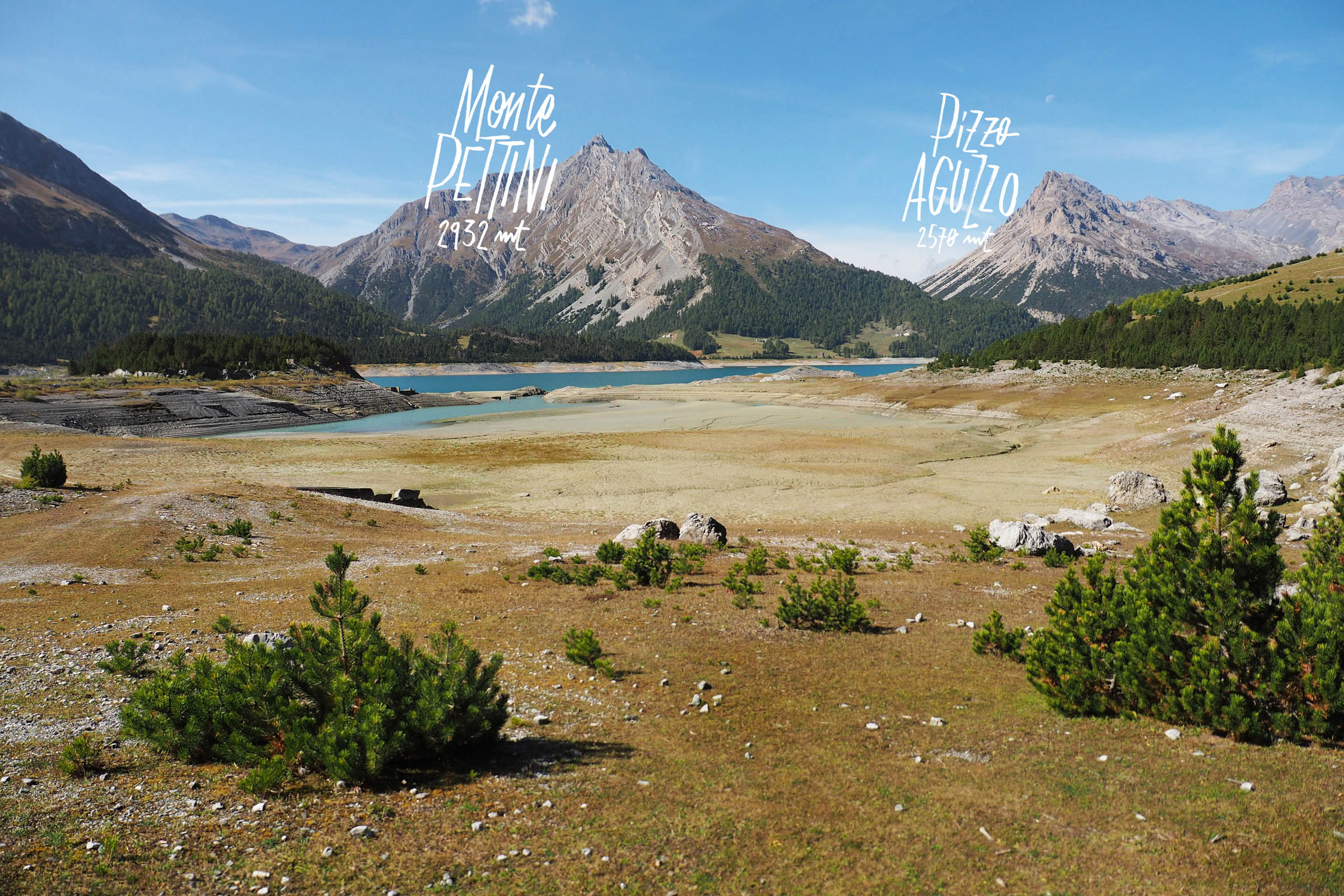
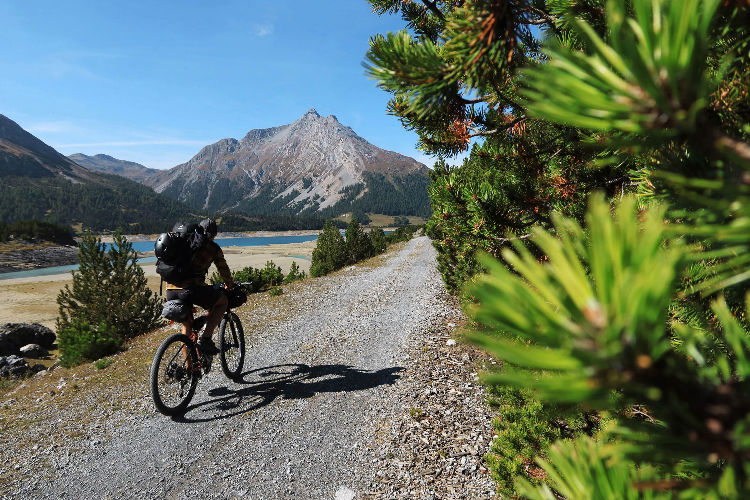
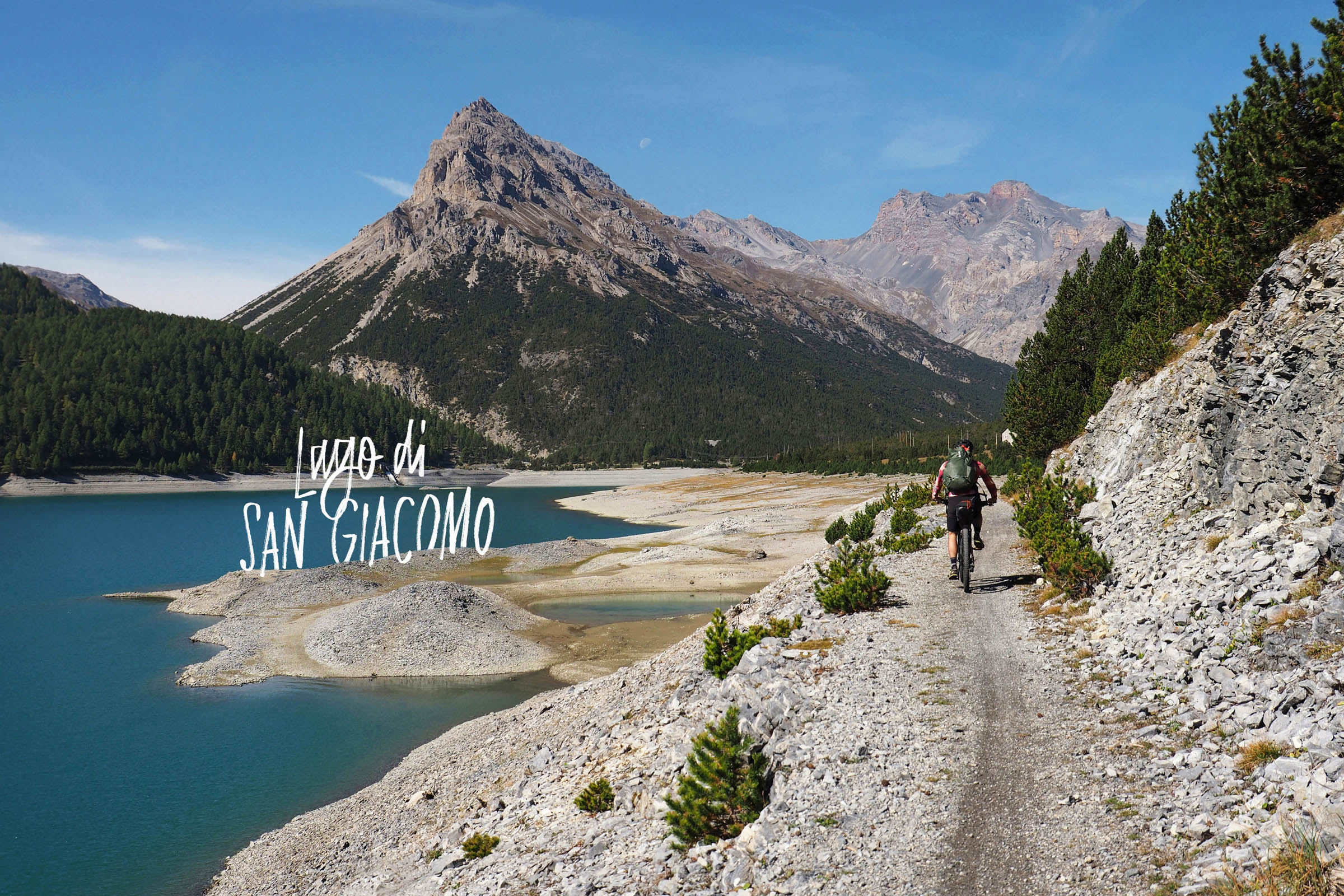
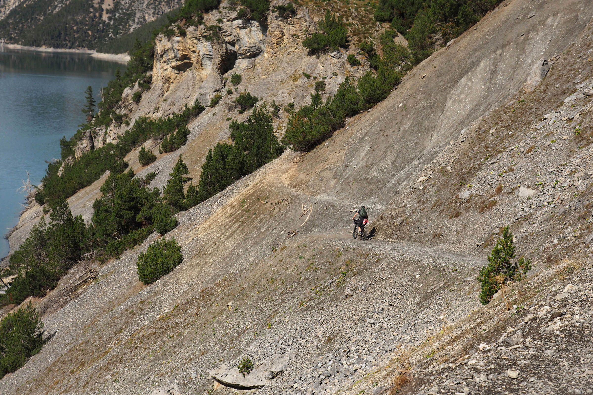
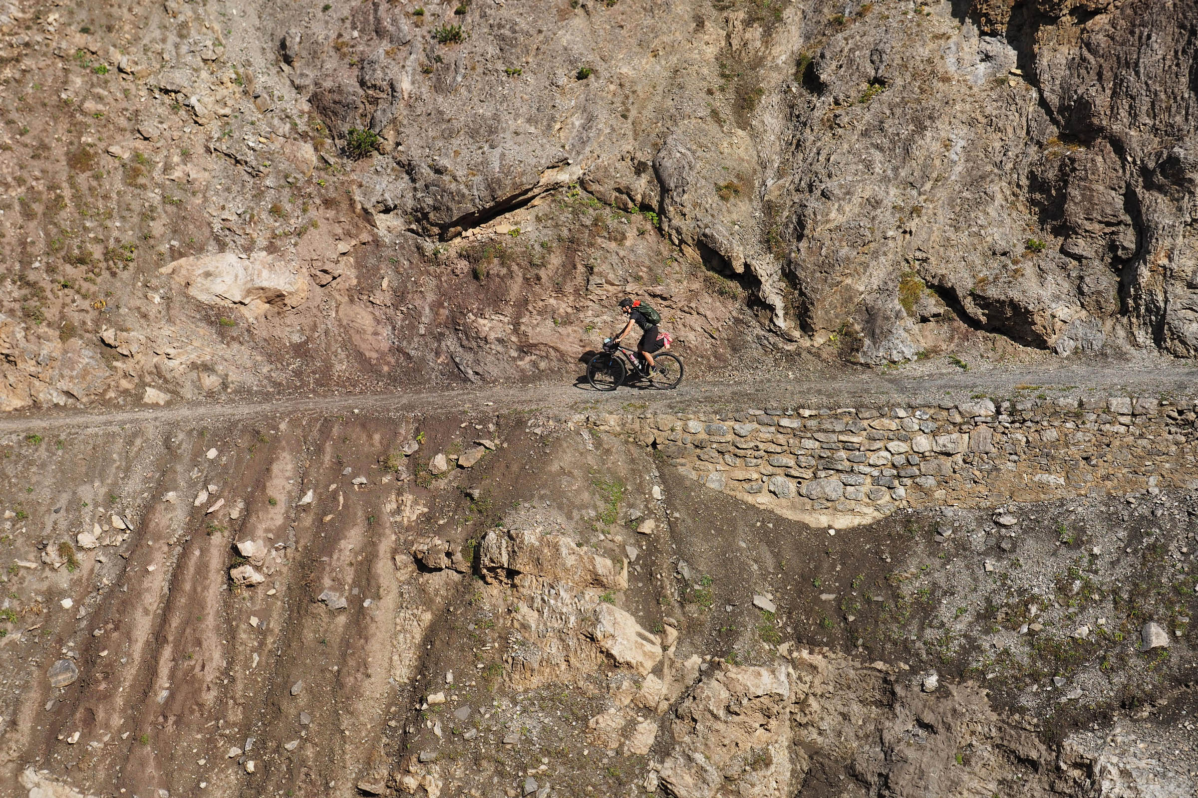
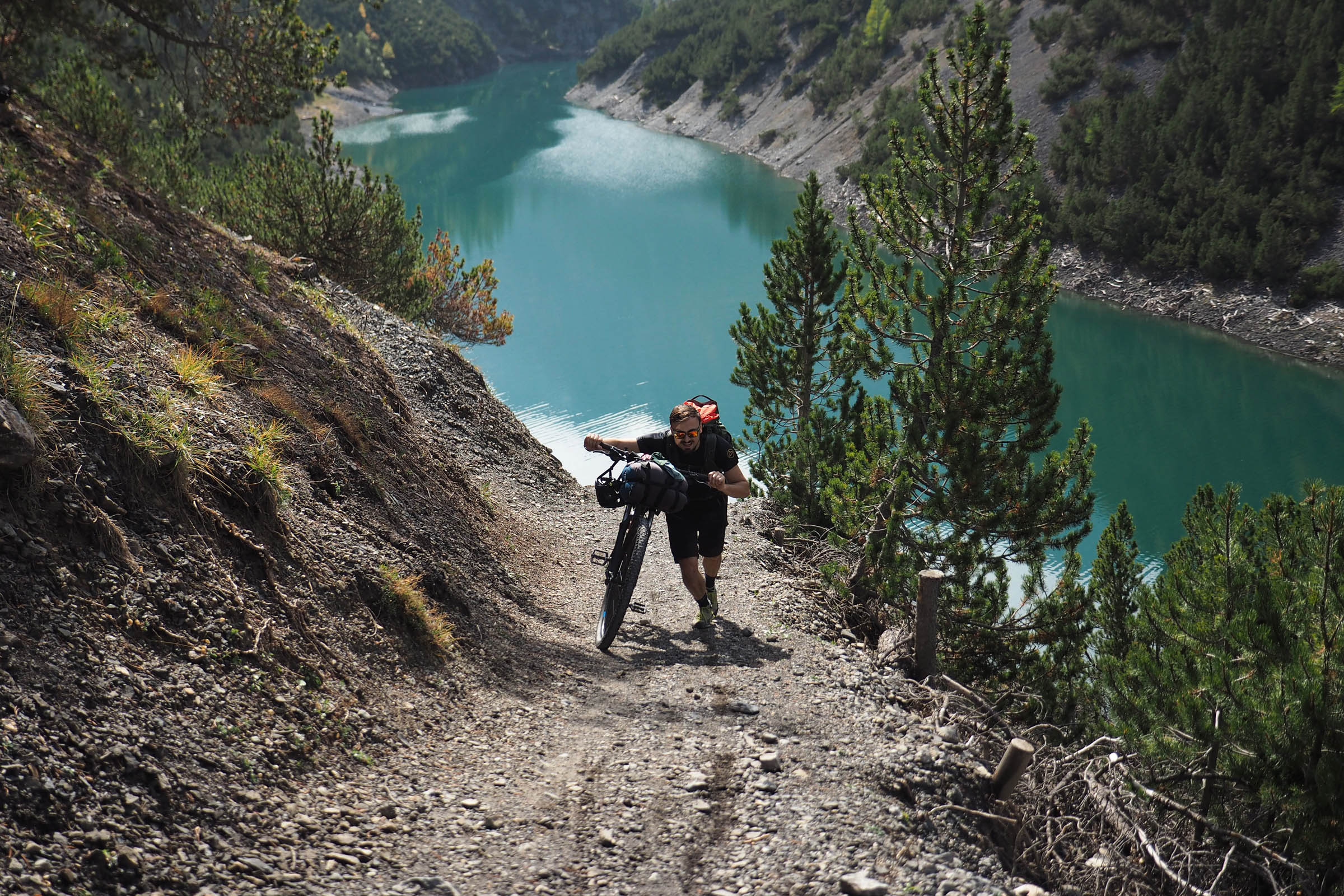
As you coast alongside both Cancano Lakes on large, flat gravel road, the Valle del Gallo (Rooster’s Valley) gets tighter and wilder, framed by a crown of 3,000-metre peaks. The road changes into a gentle downhill trail that cuts along a steep gravel slope until Lago di Livigno (Lago del Gallo).
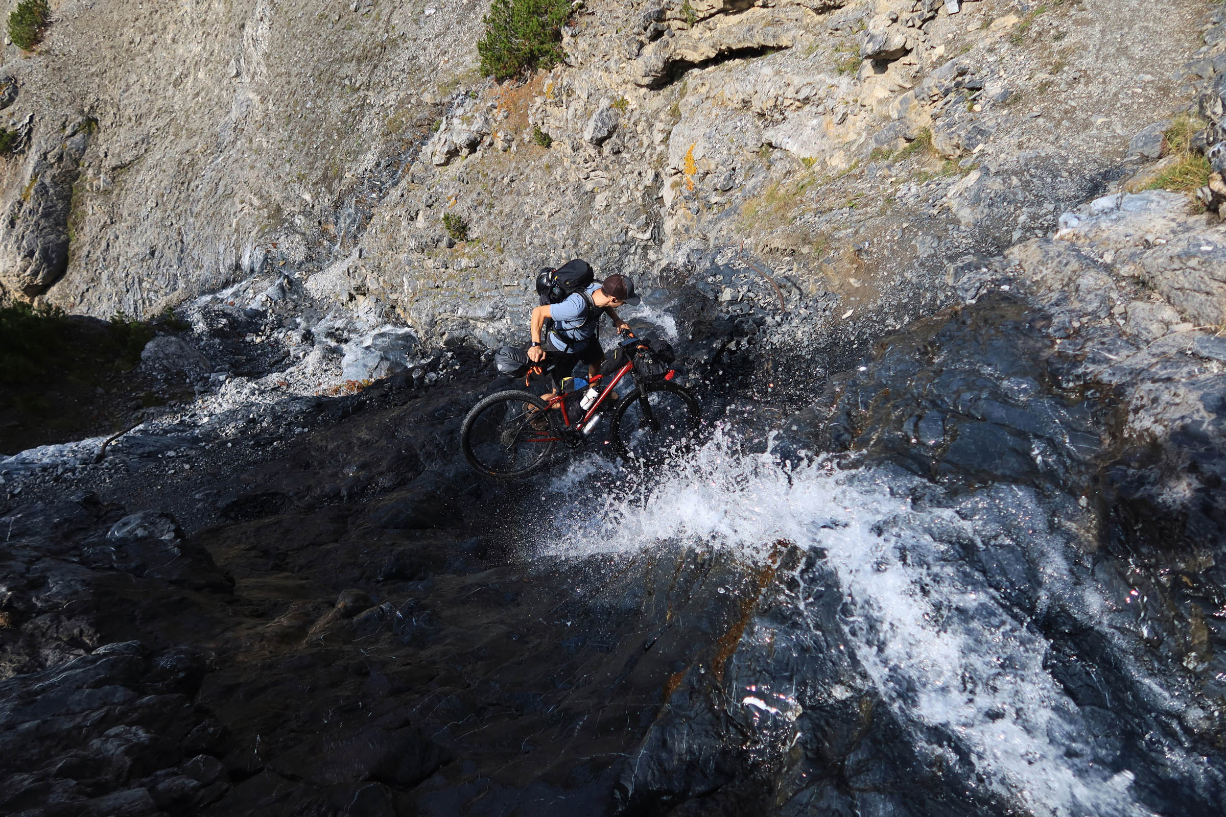
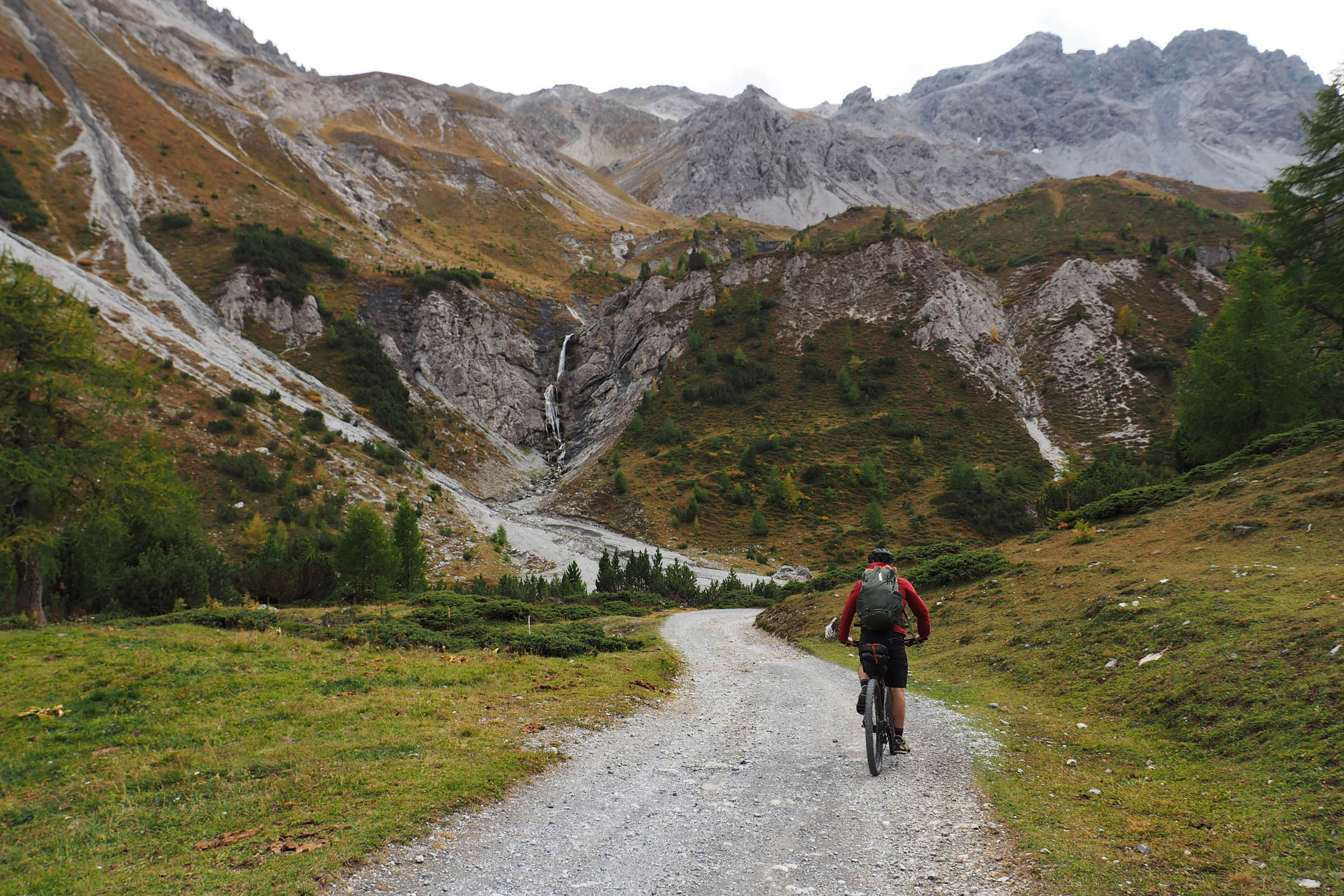
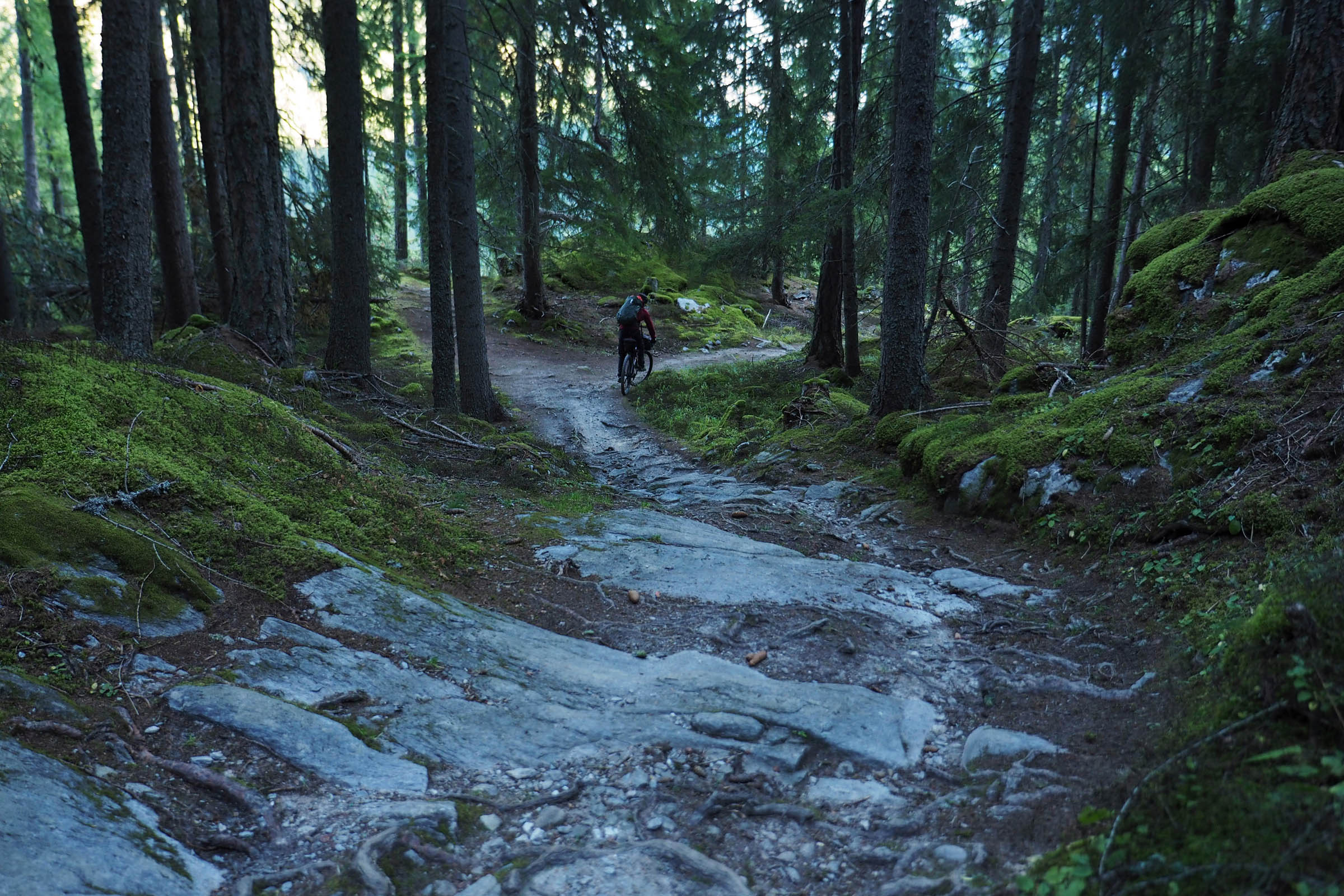
After crossing a small stream on the trail, the terrain gets exposed and slippery, so it’s preferable to hike the bike and avoid the risk of slipping underfoot. Once past the waterfall, you begin a long climb up a steep and bumpy road into the woods. Gradually, it becomes more pleasant, crossing wide pastures up to Forcola del Gallo at 2,280 meters.
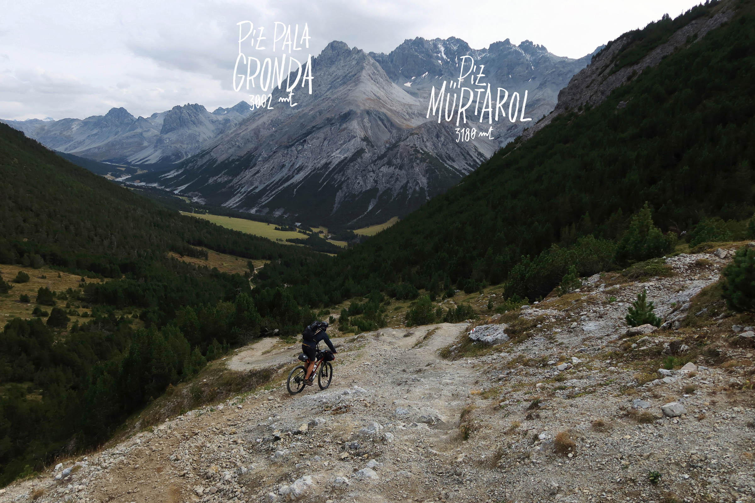
On the righthand side of the trail, there’s a panoramic point over the beautiful Val Mora and the majestic Piz Mürtarol (3,180 metres). From there, you begin a rocky singletrack descent that quickly takes you to the valley floor dirt road. There’s a fountain near a hut that’s perfect to refill the water bottles for the night.
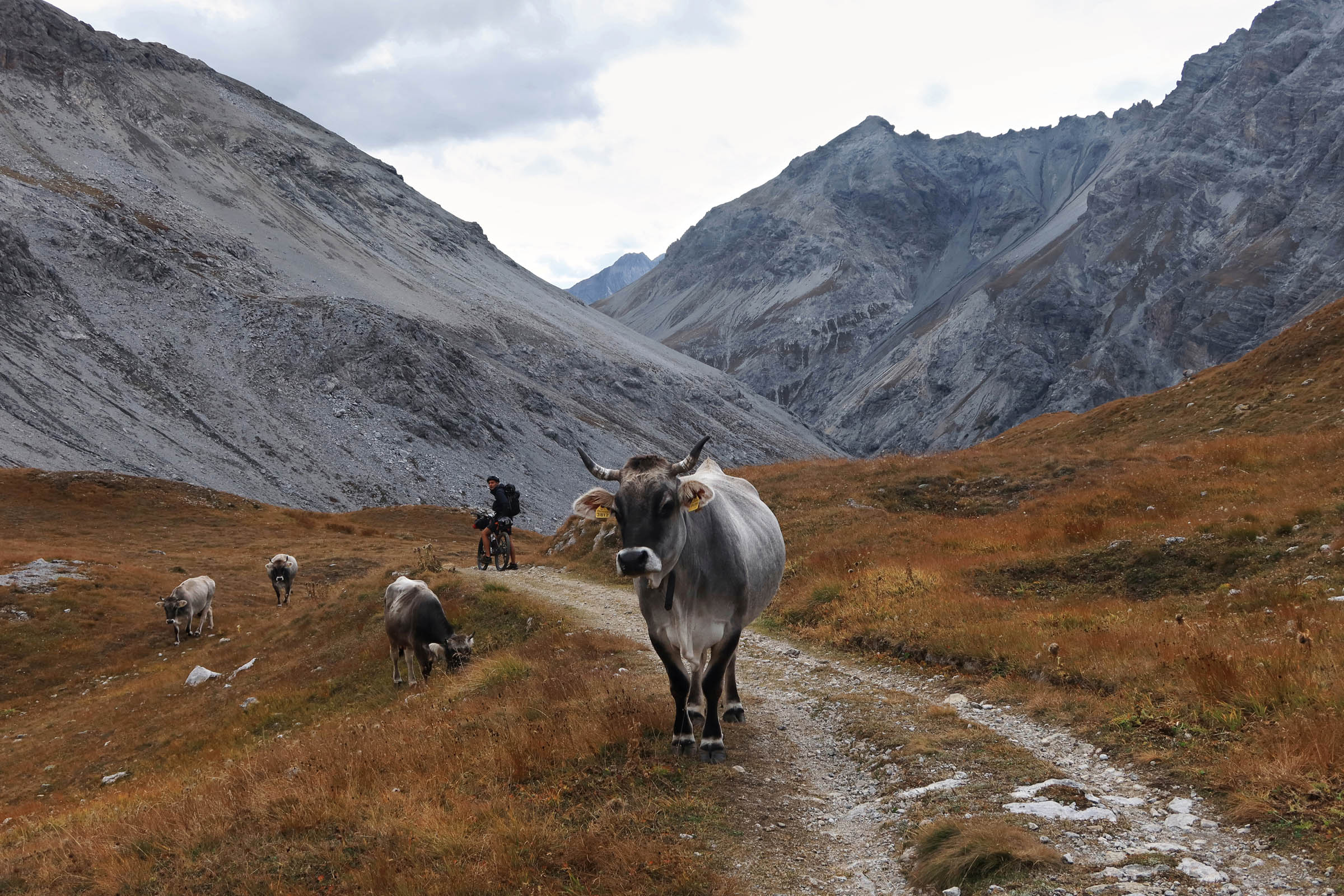
The yellowish dried grass contrasts with dark grey rocky mountains that surround the valley, giving the place an even more wild and austere feeling. The road keeps running more or less flat in the center of the valley for a while, then it starts to descent gently and after a few bends it returns into the woods. We opted for a shortcut trail that drops on the right. It gets pretty spicy with heavy bikes, rocks, and root-strewn sections.
Once the trail ends, a small stretch of tarmac road leads to Santa Maria, a charming village in Val Müstair, perfect for lodging, buying some local cheese, picking up a serious breakfast, and warming up before facing the long Umbrail Pass.
Day 2
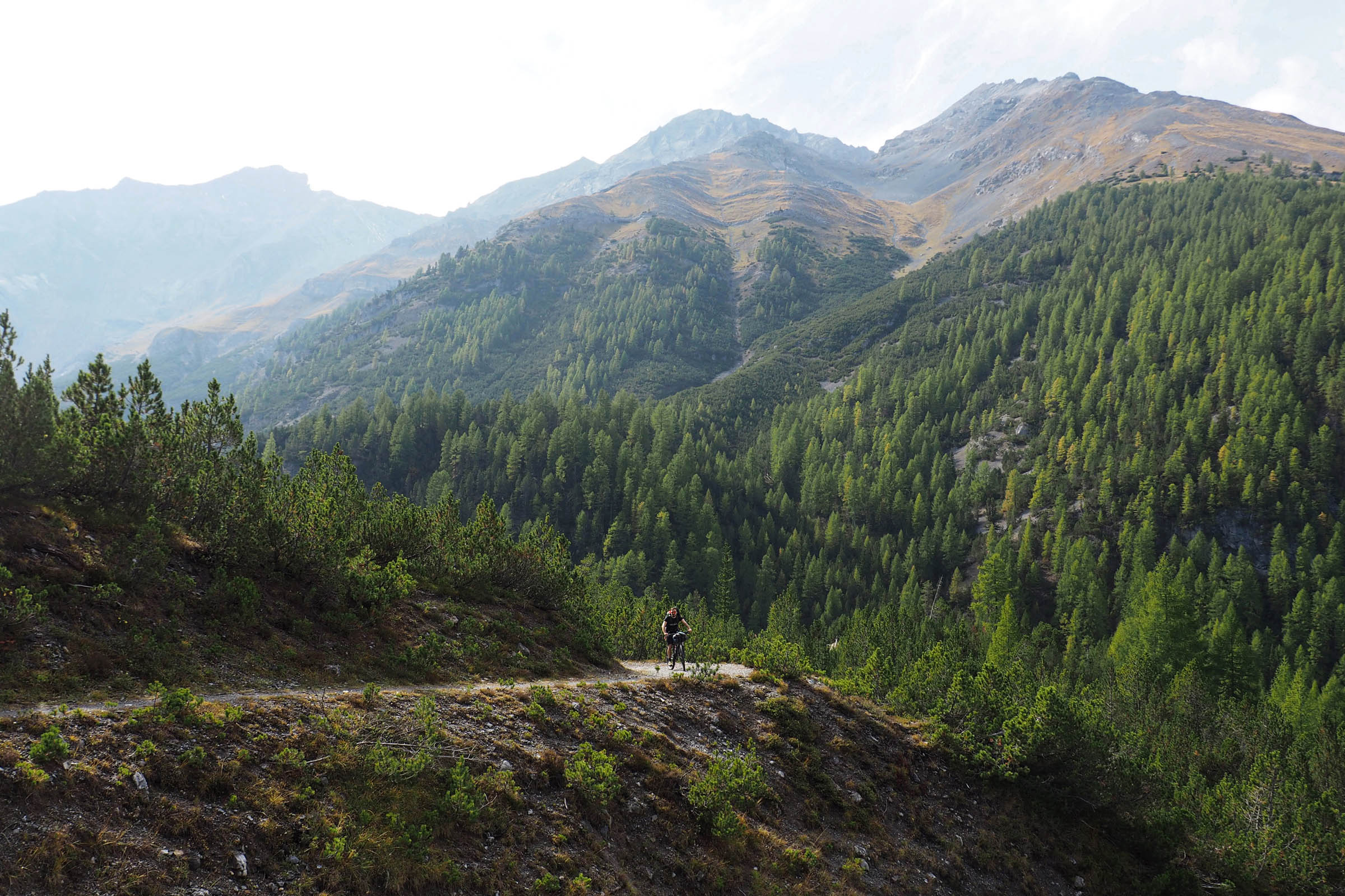
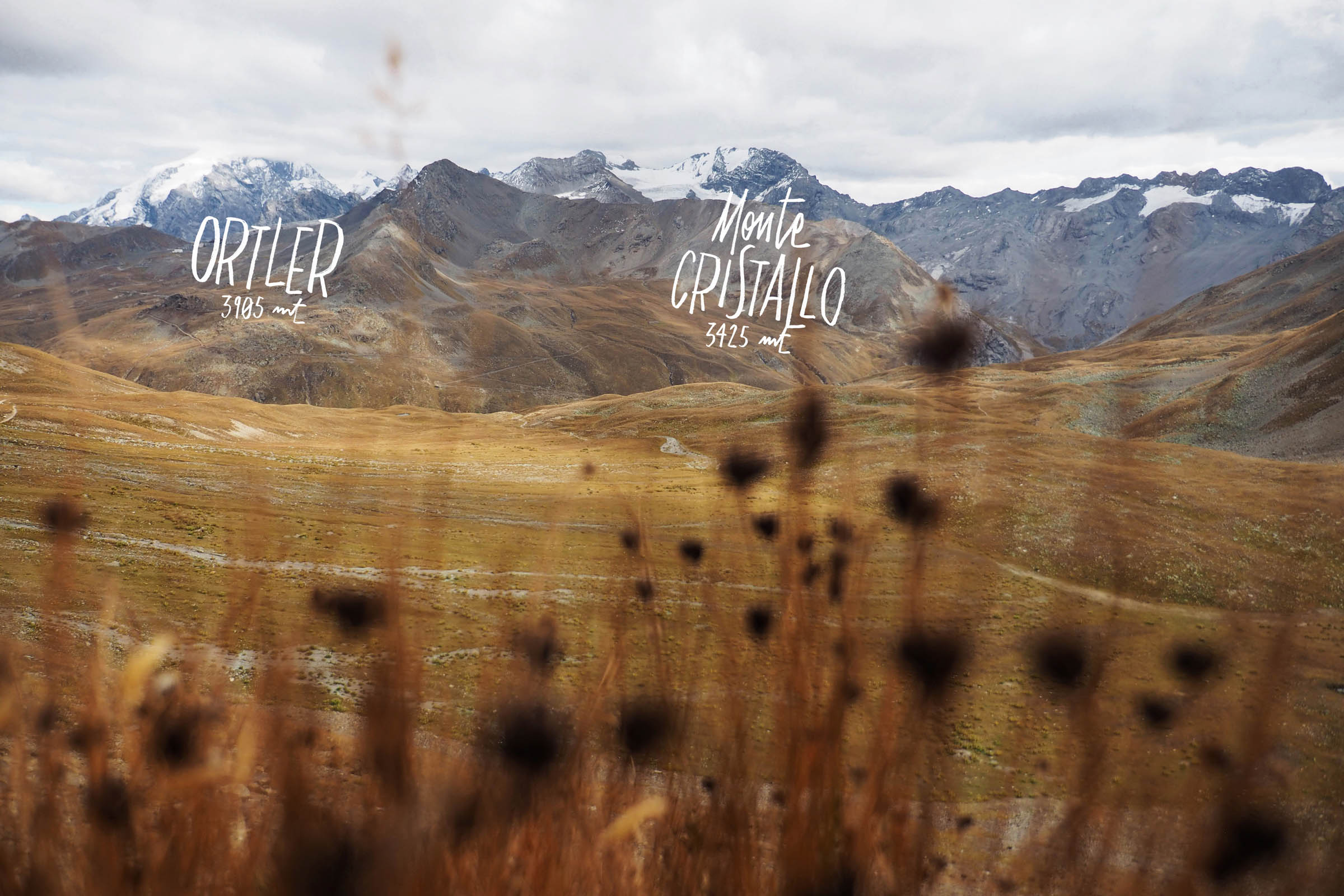
The 1,100 metres of altitude gain on this climb are spread over many hairpin bends, and the slope is never too excessive with smooth tarmac. The coniferous forests fade into wide yellow meadows, with Stelvio Pass standing out in the distance. Behind it is the regal profile of the M. Ortler (3,905 metres), which is covered by an ice cap all year.
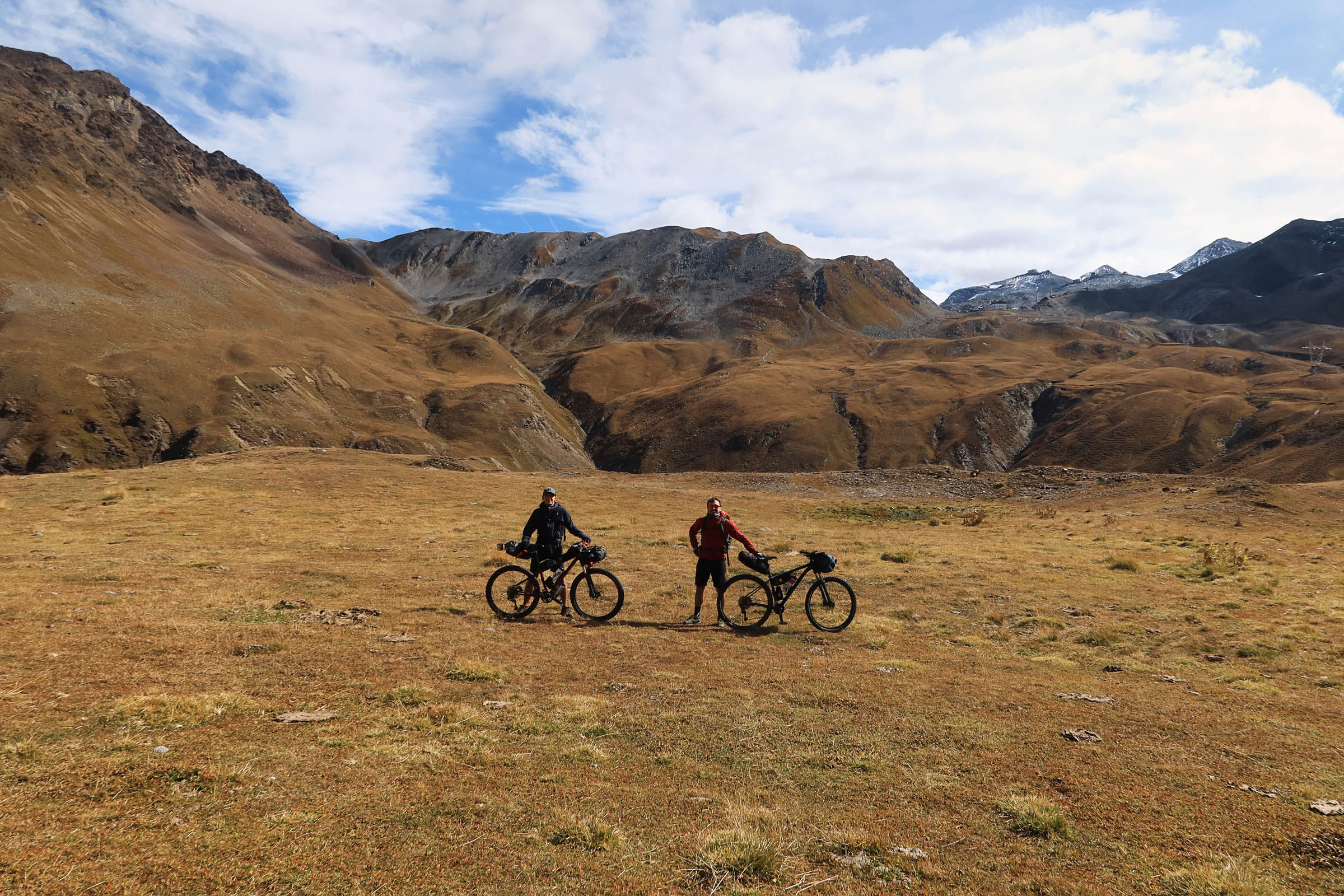
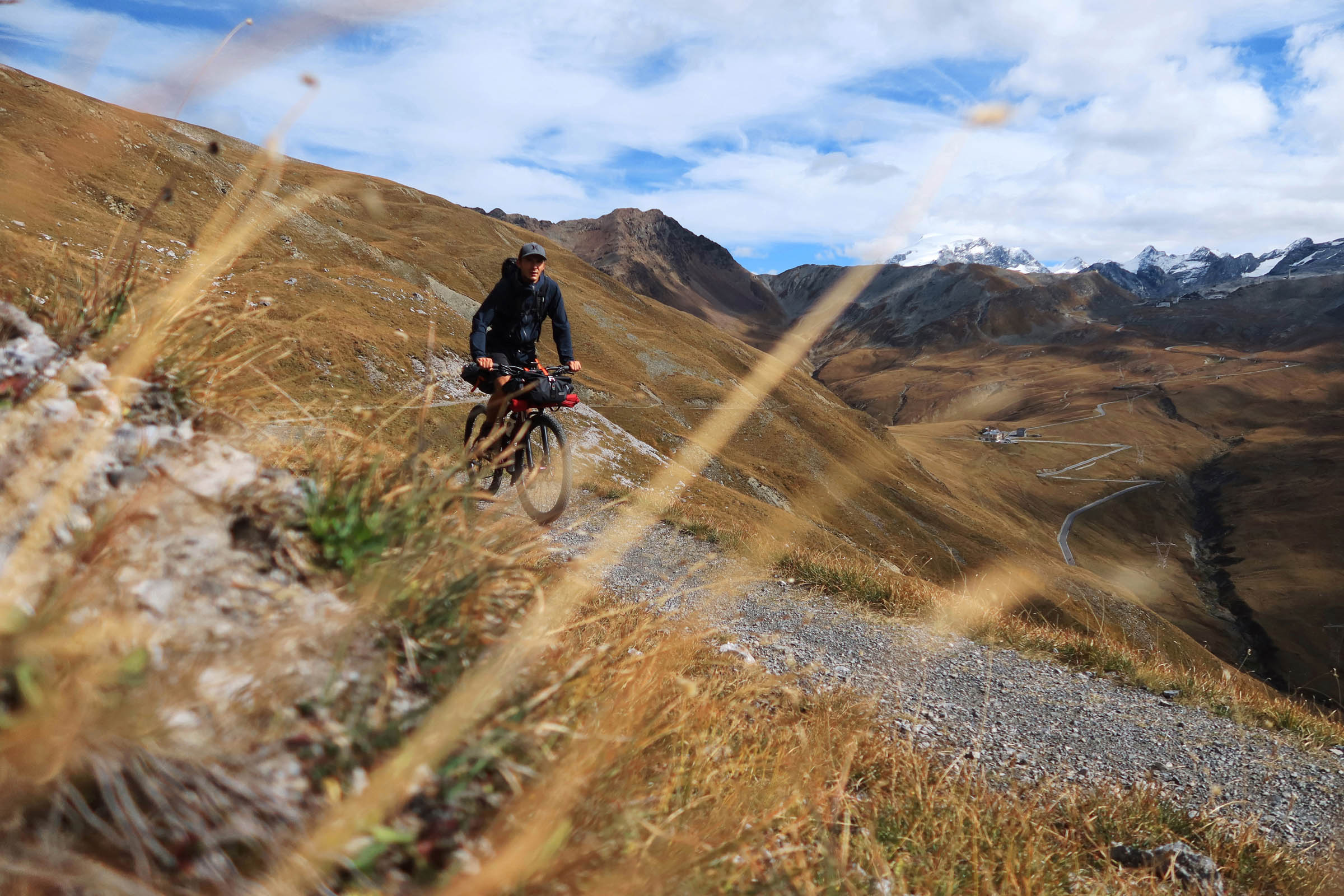
From the top of Umbraill Pass at 2,500 meters, you could easily descend to Bormio on the tarmac main road through Braulio Valley, where the Homonym River flows. With one last effort, the best option is to face the final small climb that leads to the Bocchetta di Forcola at 2,760 meters.
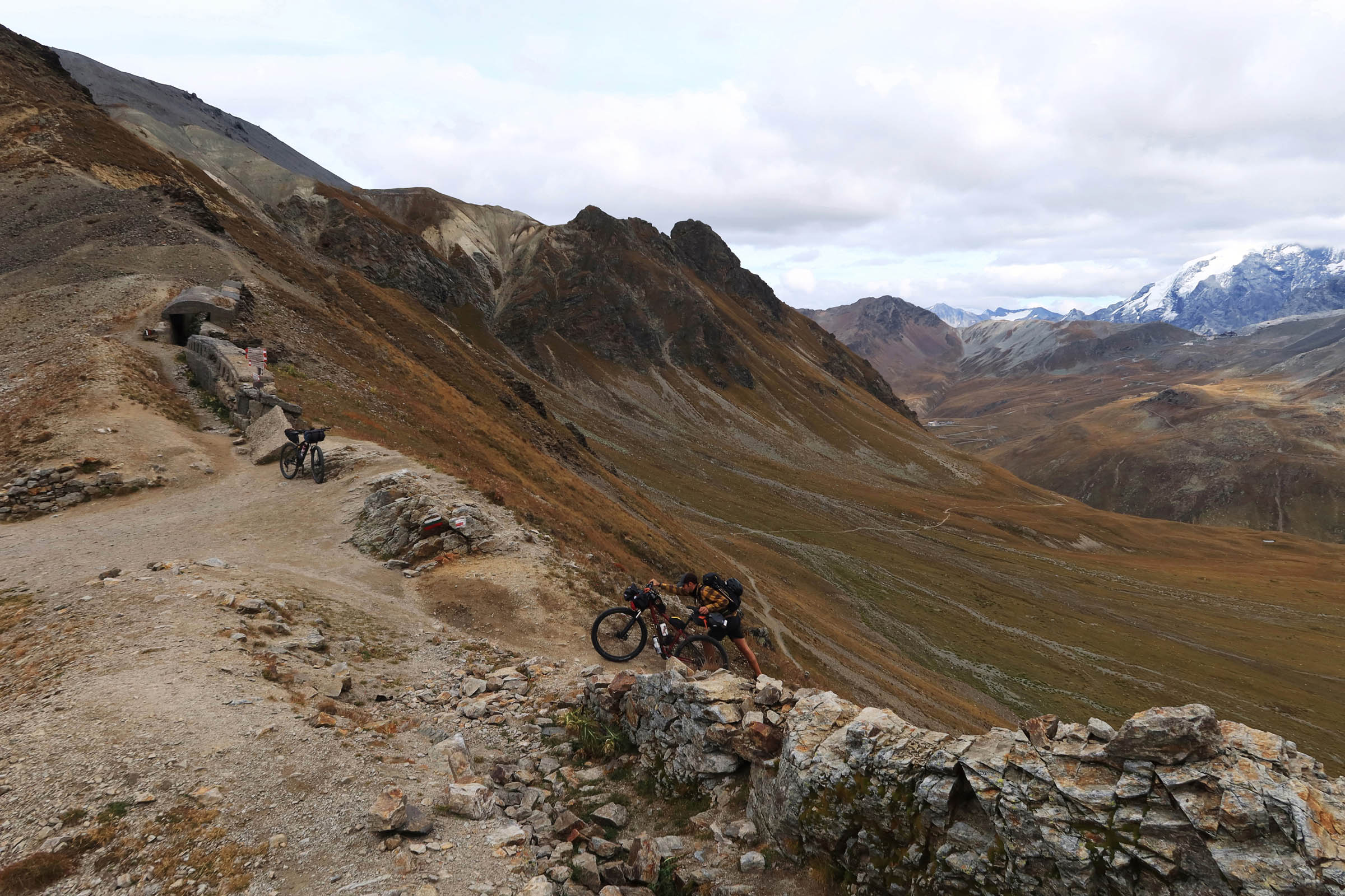
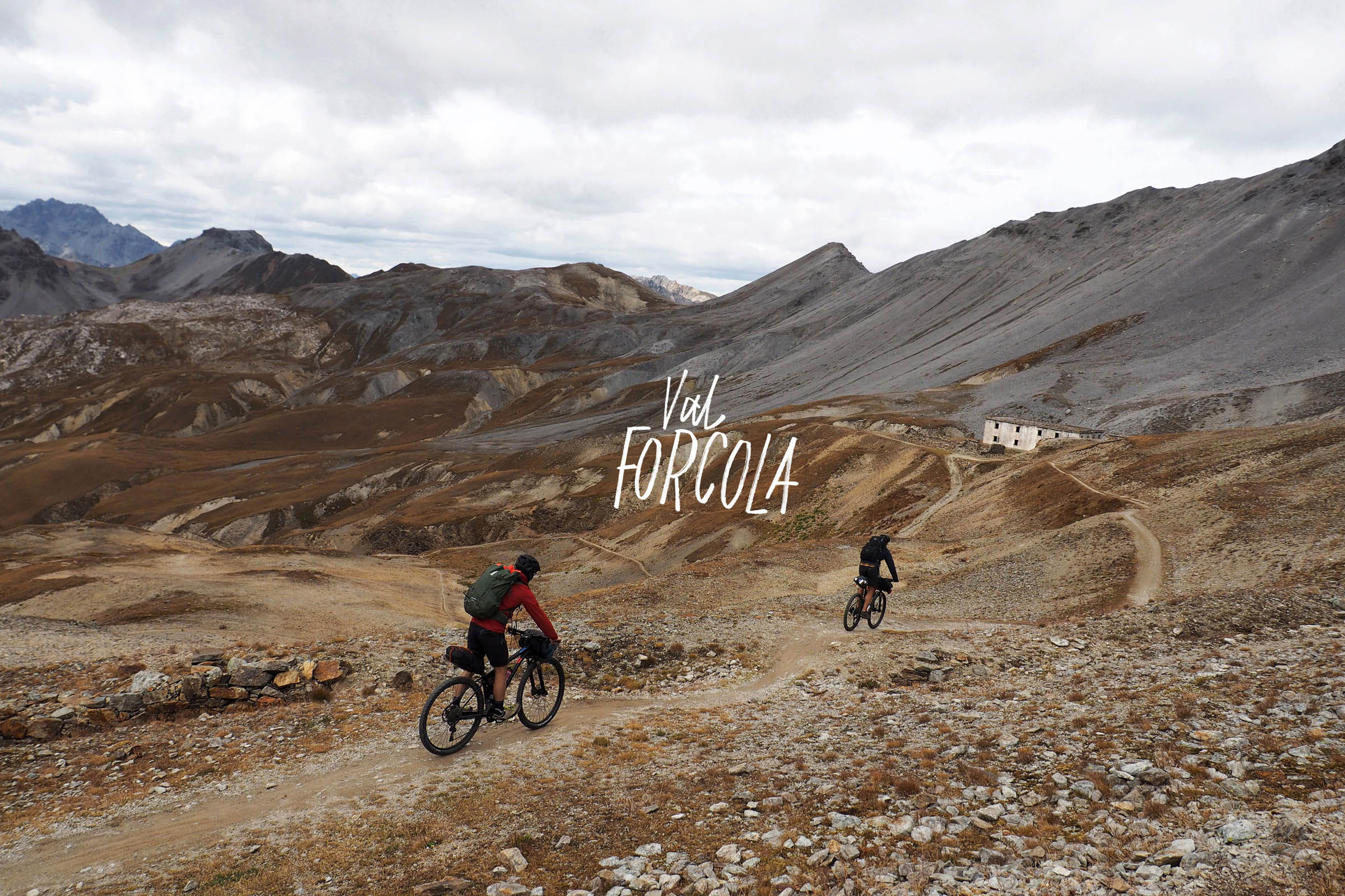
The singletrack cuts along a steep grassy slope, alternating flat sections and steep climbs. We were exhausted at this point and pushed our bicycles to the top. The view from there is sensational on both sides and gives a taste of the descent into Val Forcola. The neverending descent (-1,700 meters) starts on loose rocks and wide singletrack at the base of the Schumbraida (3,125 metres) and then onto a very raw fire road. At several points, the road is washed away by landslides, but there’s works in progress to restore it.
The fire road leads to forest level and down to the valley floor, where you then reconnect to a tarmac road that descends from the Stelvio Pass, arriving in Bagni di Bormio. Sore arms and incandescent brakes are a sure result! A cold beer and a dip in the naturally warm waters at the small pool of San Leonardo is the perfect way to end this epic tour.


Terms of Use: As with each bikepacking route guide published on BIKEPACKING.com, should you choose to cycle this route, do so at your own risk. Prior to setting out check current local weather, conditions, and land/road closures. While riding, obey all public and private land use restrictions and rules, carry proper safety and navigational equipment, and of course, follow the #leavenotrace guidelines. The information found herein is simply a planning resource to be used as a point of inspiration in conjunction with your own due-diligence. In spite of the fact that this route, associated GPS track (GPX and maps), and all route guidelines were prepared under diligent research by the specified contributor and/or contributors, the accuracy of such and judgement of the author is not guaranteed. BIKEPACKING.com LLC, its partners, associates, and contributors are in no way liable for personal injury, damage to personal property, or any other such situation that might happen to individual riders cycling or following this route.
Please keep the conversation civil, constructive, and inclusive, or your comment will be removed.