


The Annapurna Circuit (Bikepacking Route)
Distance
240 Mi.
(386 KM)Days
12
% Unpaved
65%
% Singletrack
15%
% Rideable (time)
85%
Total Ascent
33,776'
(10,295 M)High Point
17,670'
(5,386 M)Difficulty (1-10)
8?
- 9Climbing Scale Very Strenuous141 FT/MI (27 M/KM)
- -Technical Difficulty
- -Physical Demand
- -Resupply & Logistics
Contributed By

Robin Patijn and Sabina Knezevic
Guest Contributor
Robin Patijn and Sabina Knezevic aim to show people the world from the perspective of their handlebars. They share a passion for cycling, photography, and travel to tell unique stories about their adventures all over the world. Follow their journey on Instagram @farawayistan or at Farawayistan.com.
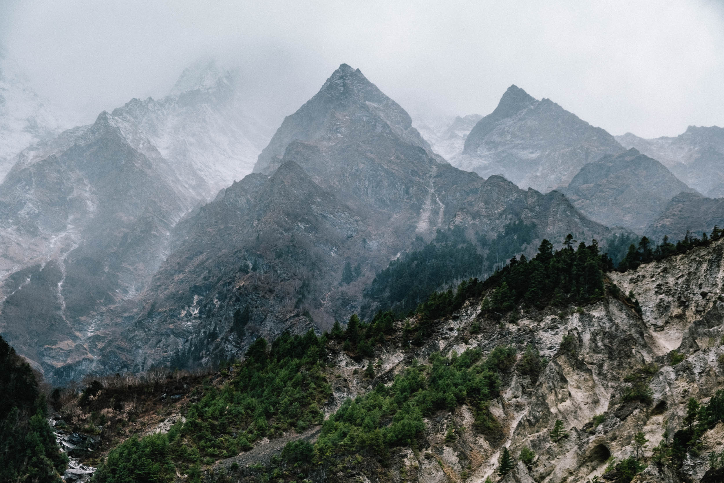
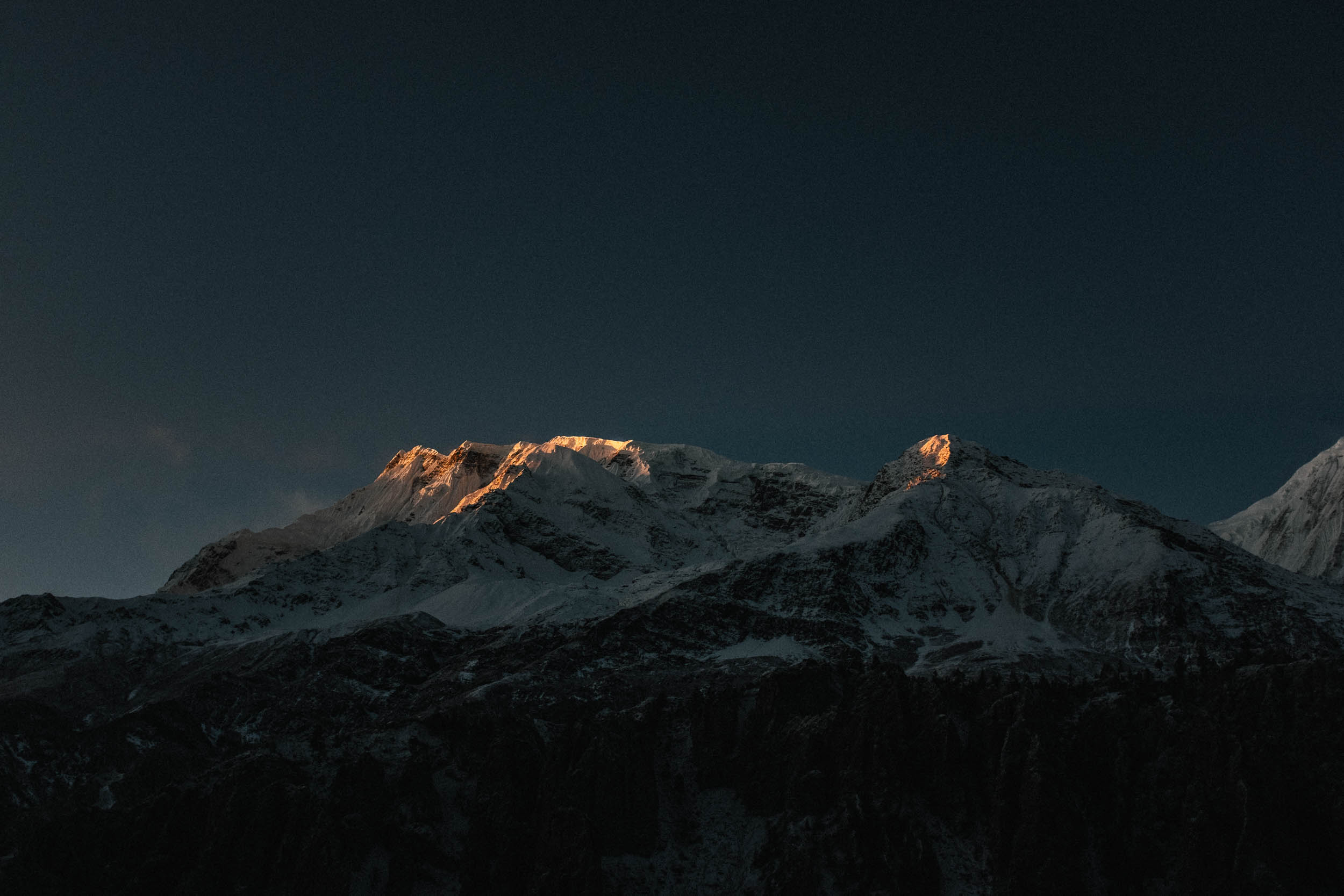
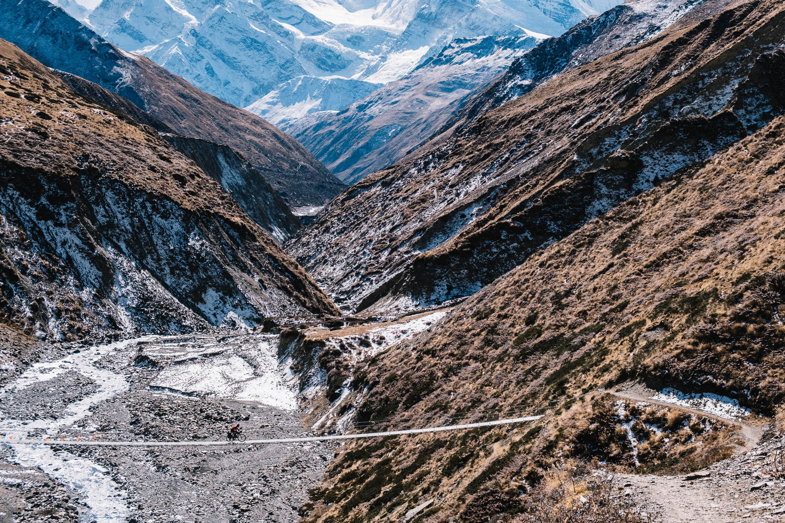
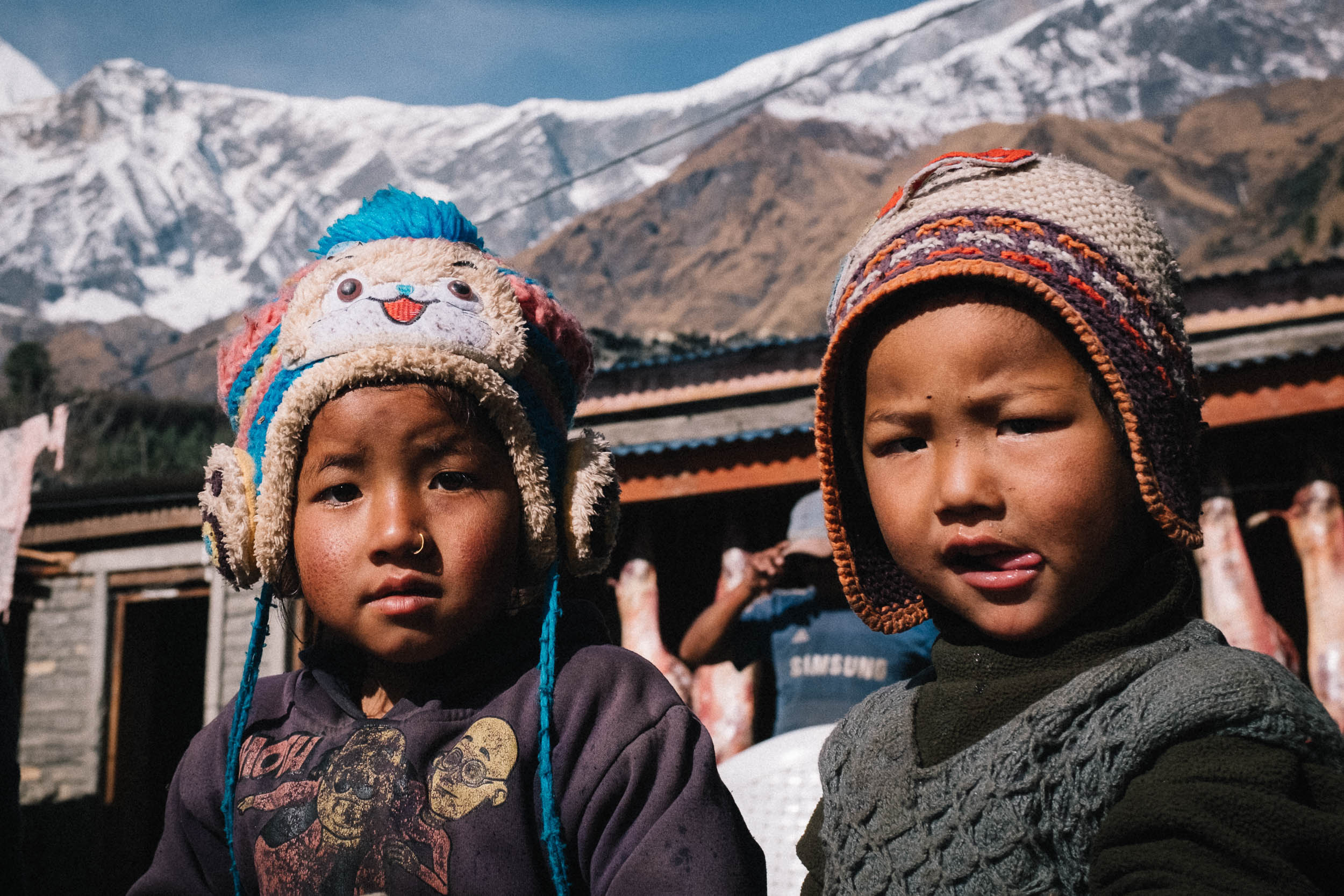
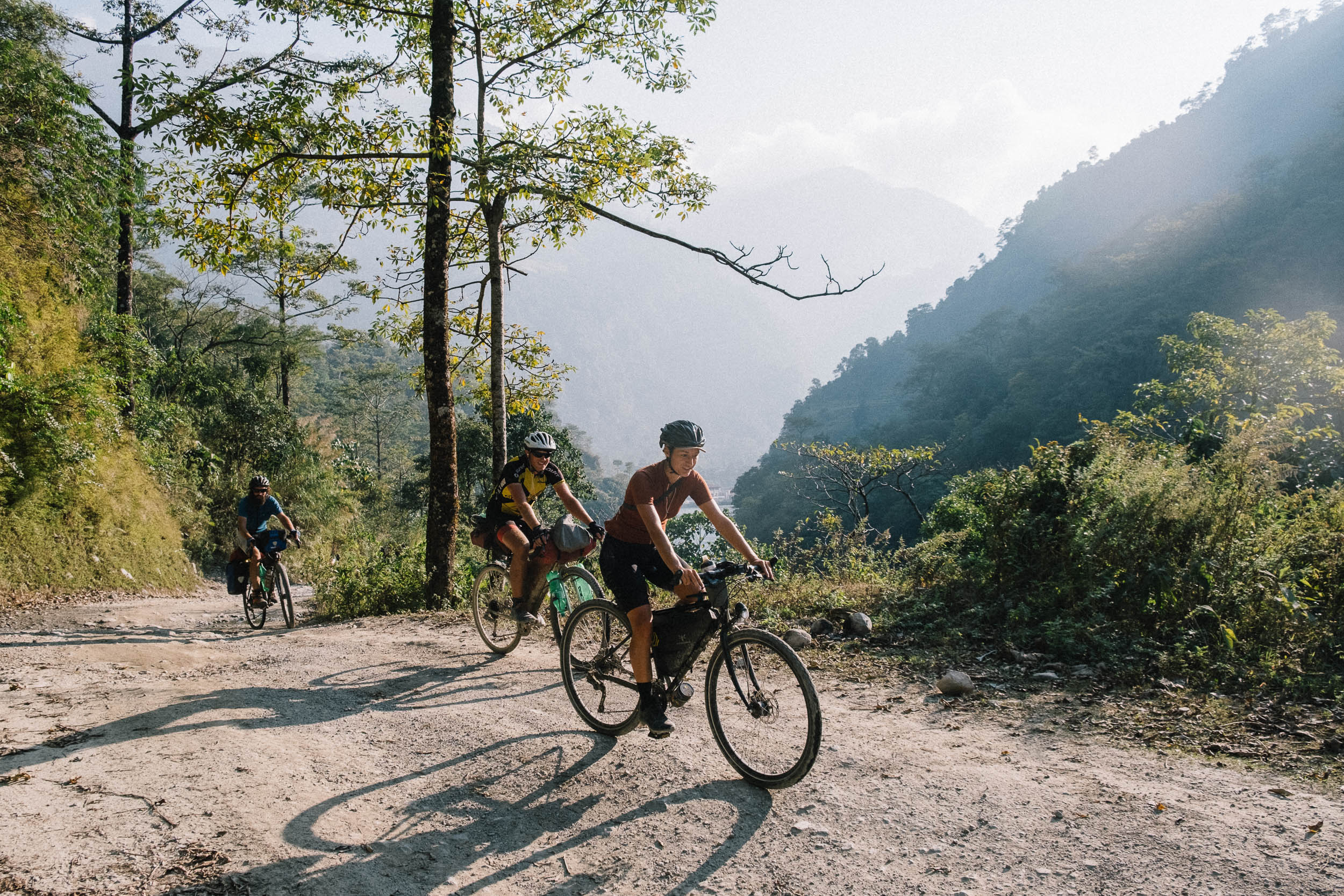
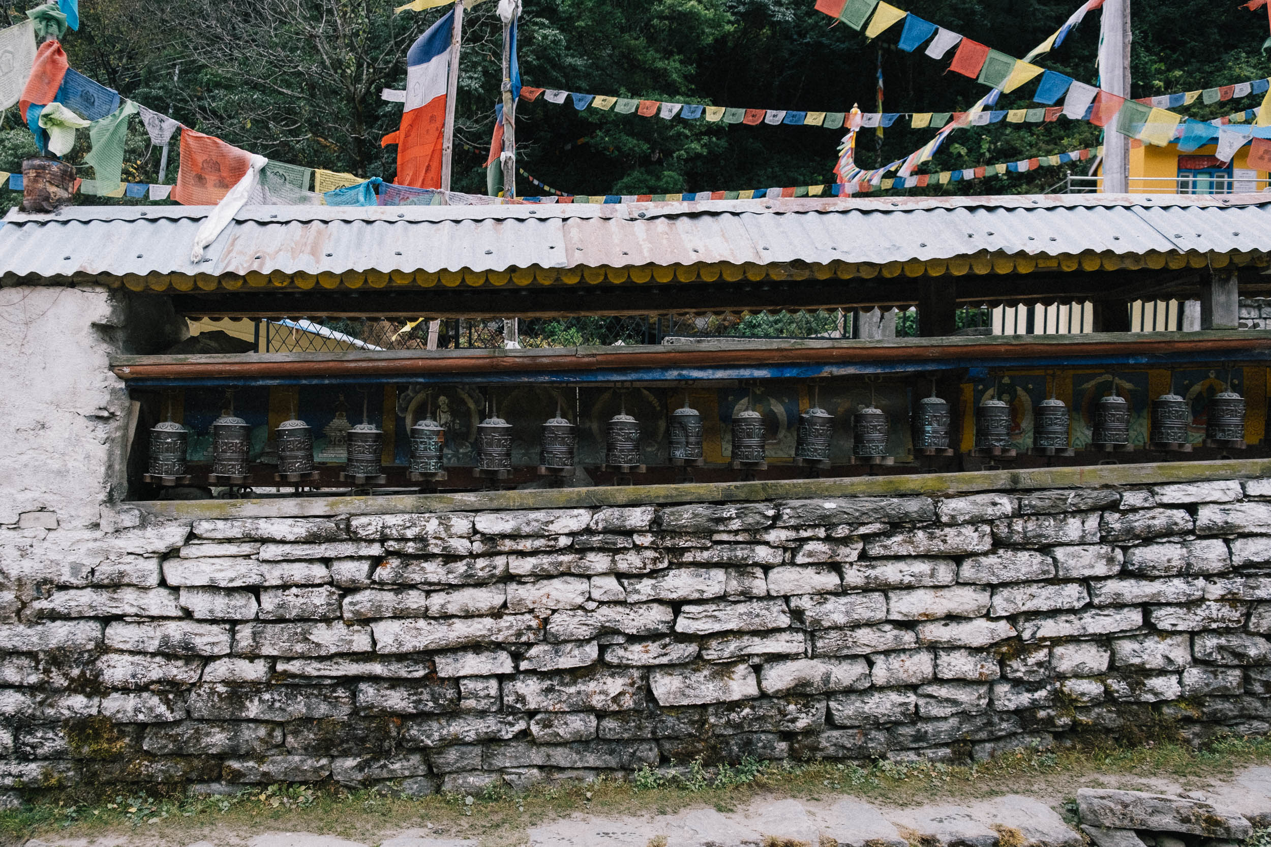
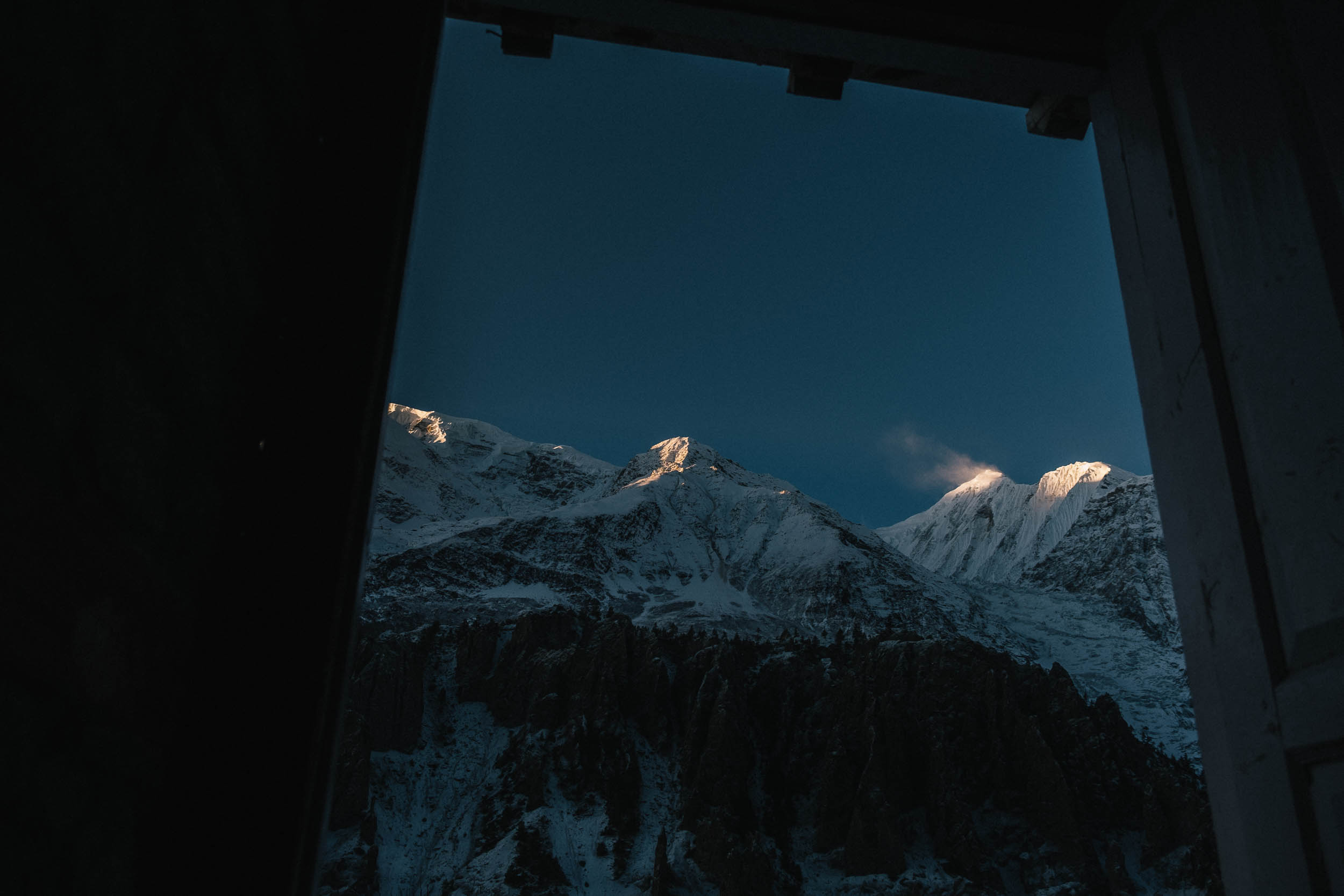
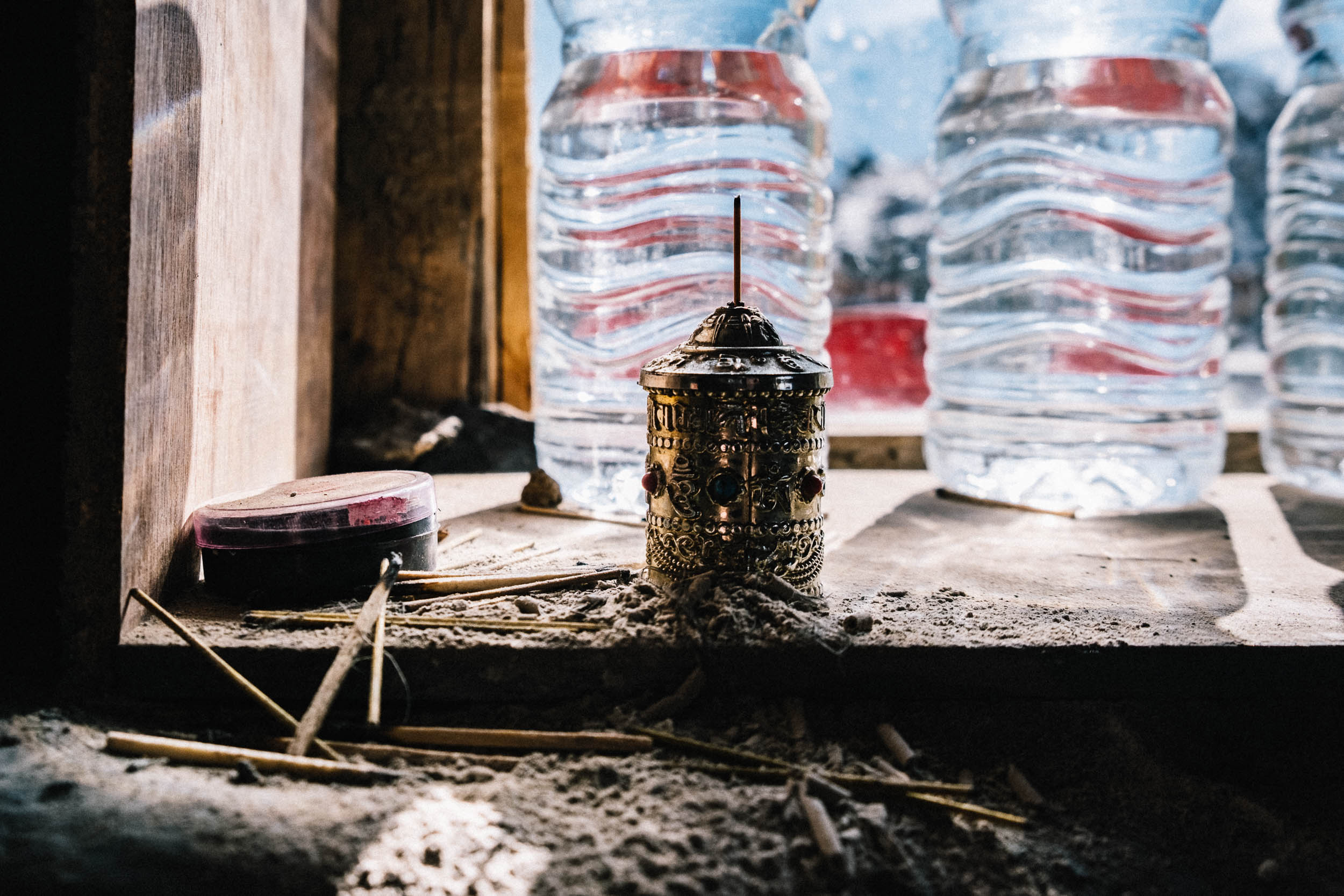
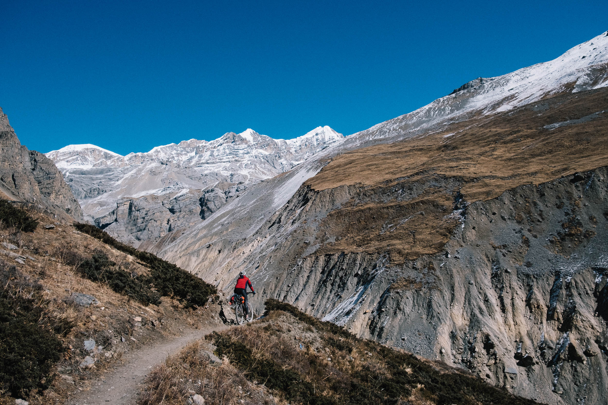
Ride on rickety suspension bridges, quickly cross over active landslide zones, and gaze at peaks while going up against gravity. Spin the Buddhist prayer wheels clockwise when you ride along them and get mesmerized by clouds falling over the white giants after a long day in the saddle. This is the Annapurna Circuit.
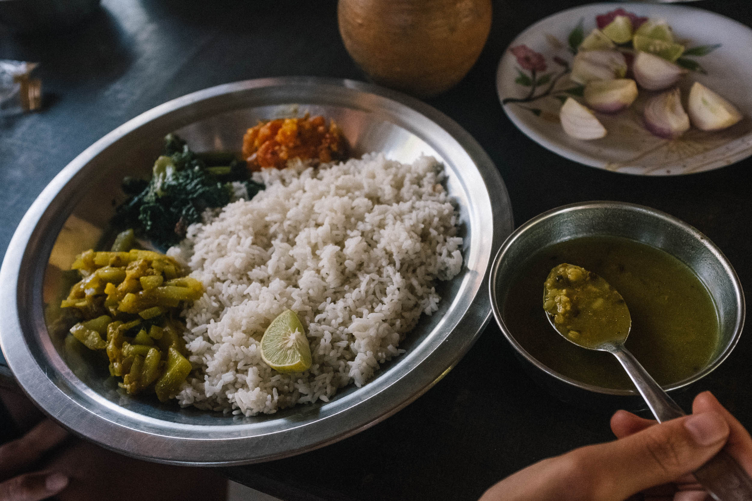
Although the route is anything but easy, it’s one of the easier mountain treks to ride in terms of logistics. Teahouses serve steaming plates of dal bhat and offer a place to shelter or spend the night, and after resting and refueling on carb loaded meals, you’ll be ready to hit the trail.

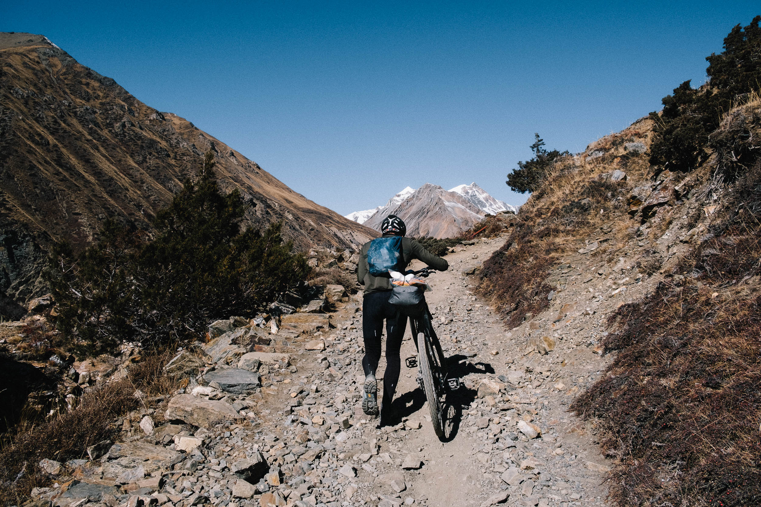
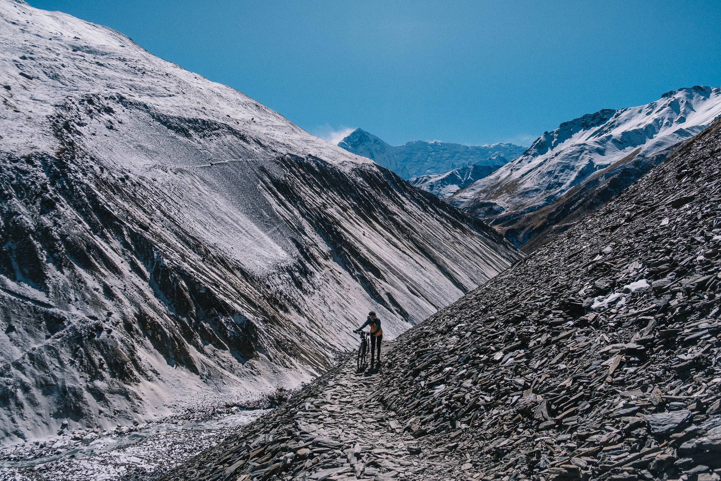
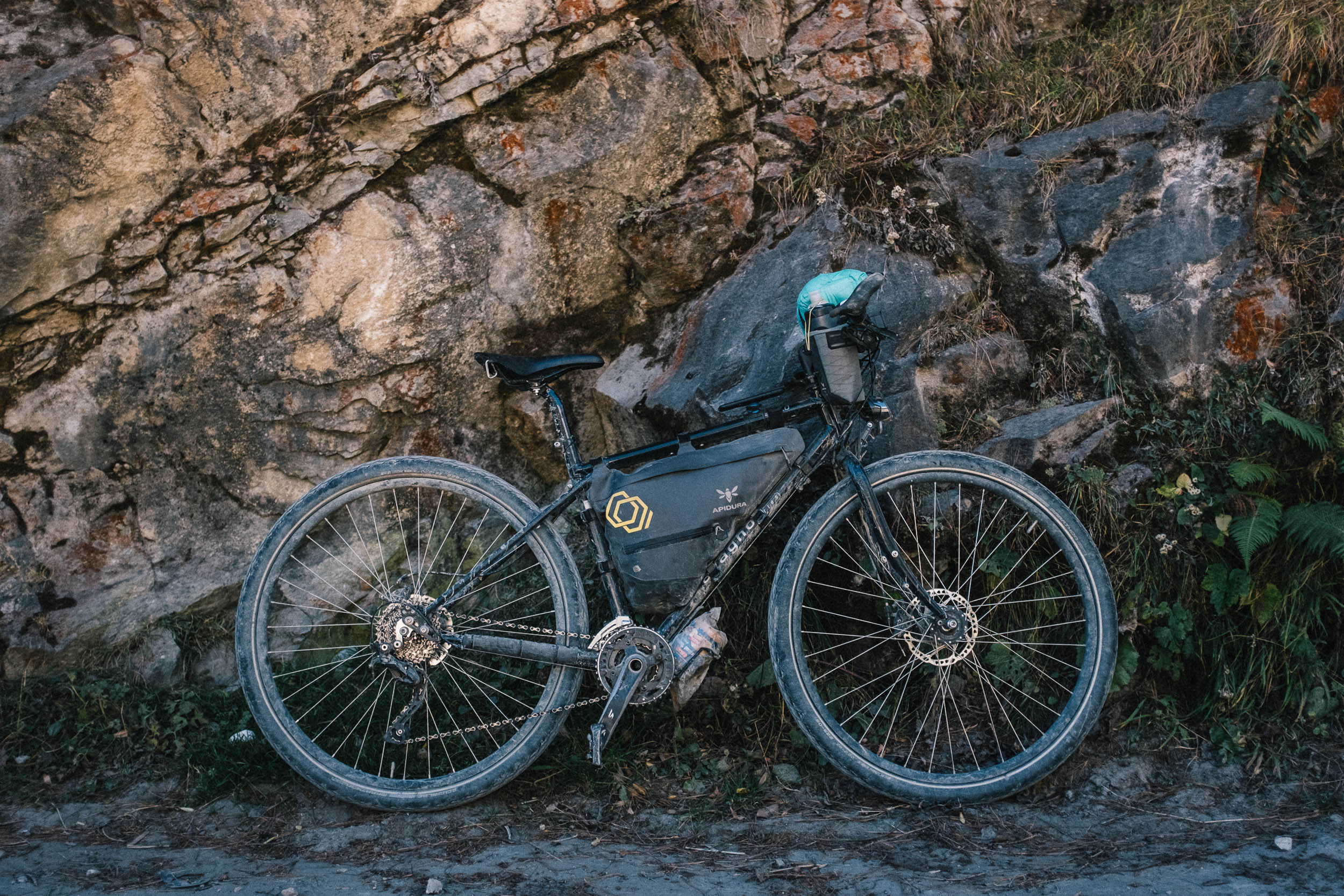
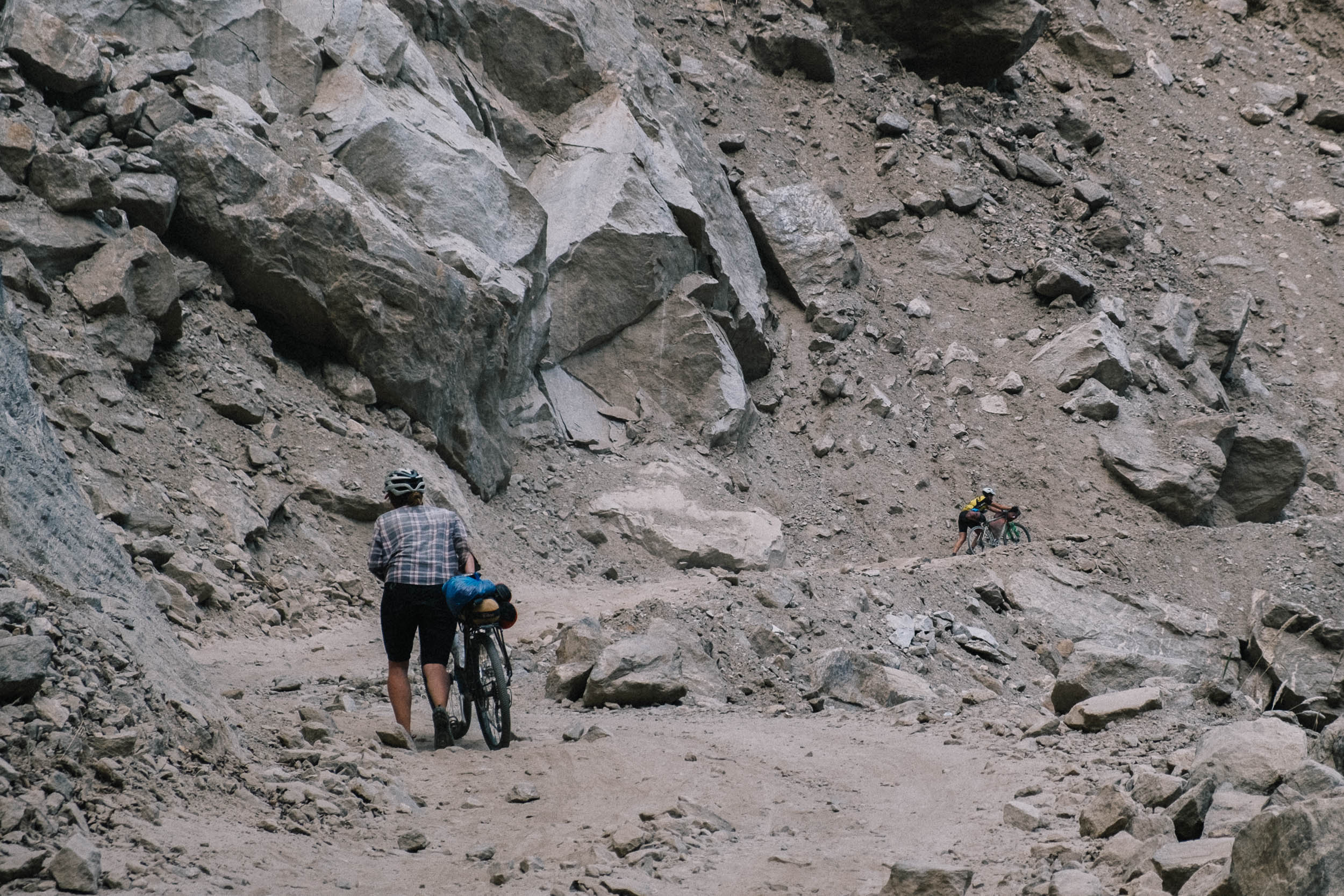
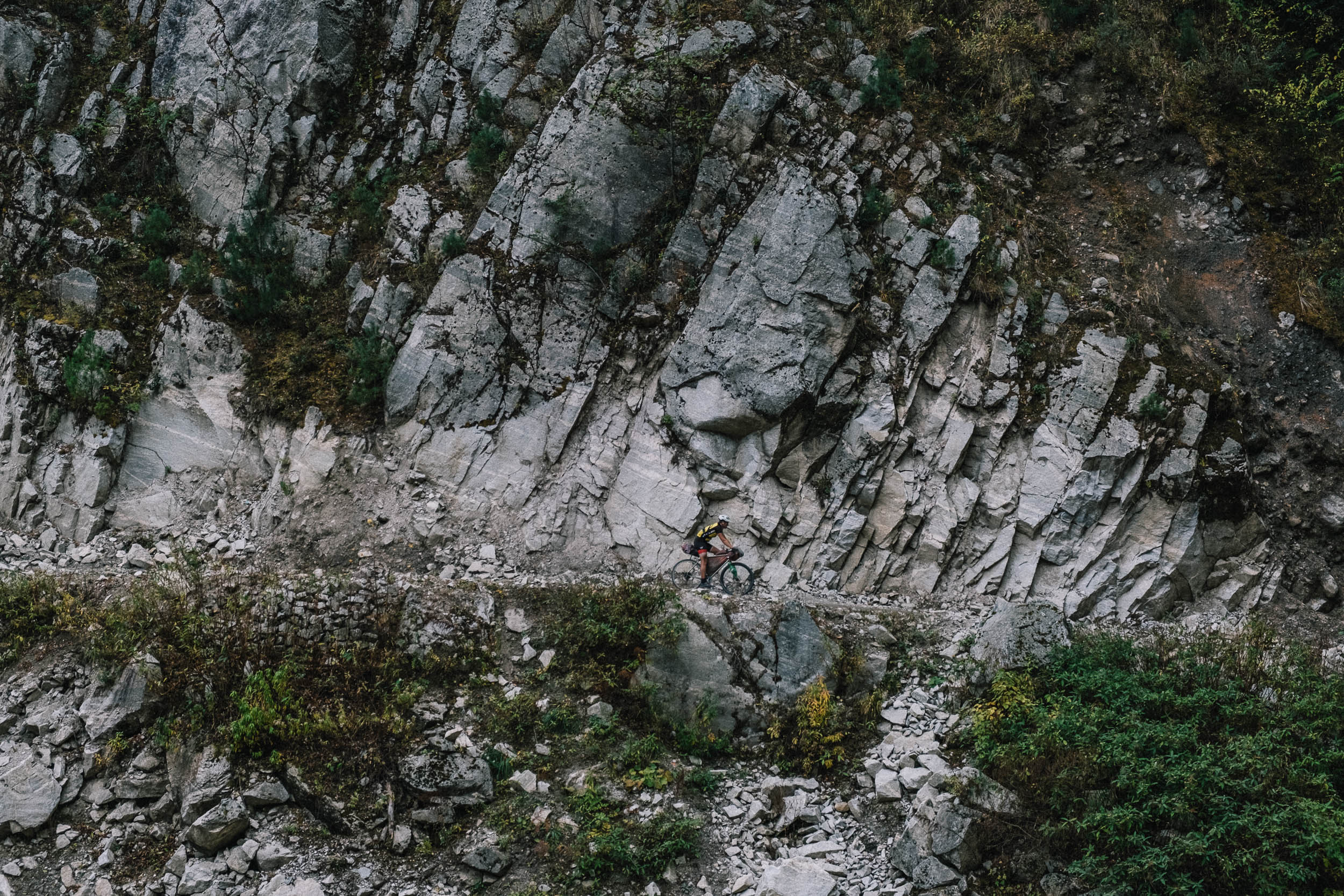
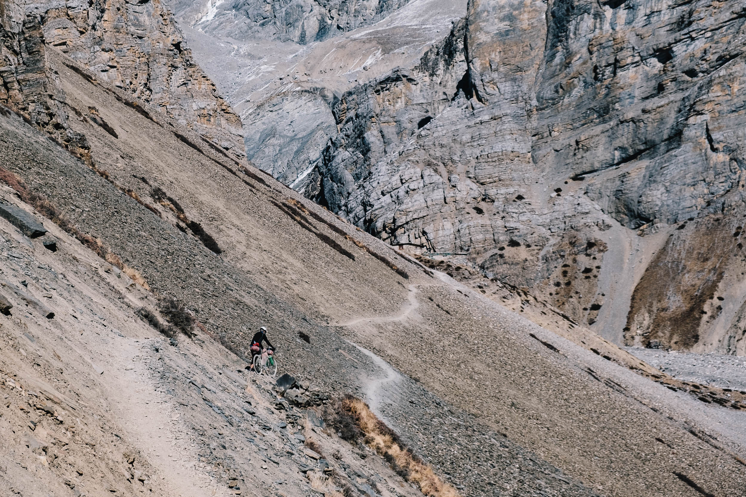
Expect steep, technical jeep tracks and a precipitous trekking trail in the shadow of the highest peaks on earth. This Himalayan adventure is not for the faint of heart. Comfort and luxury should be put aside to strive for as light a setup as possible. You will probably be pushing and carrying your bike a lot on this route, so keeping weight to a minimum is crucial.
Difficulty
The Annapurna Circuit bikepacking route has been assigned a difficulty of 8 out of 10. About half of the route is on a reasonably maintained jeep track, but there are lots of technical climbs with hairpin turns on loose gravel with big rocks. The oxygen deficiency at high altitude also adds significantly to the overall difficulty. The lack of oxygen makes it feel like you’re breathing through a straw, especially while pushing your loaded bike up an incline that sometimes reaches 40%. The good news is you don’t have to carry much food, cooking gear, or even a tent. The next teahouse is never more than 10 kilometers away, but on the Annapurna Circuit, that short distance could easily take half a day. Plan ahead and carry energy-dense snacks.
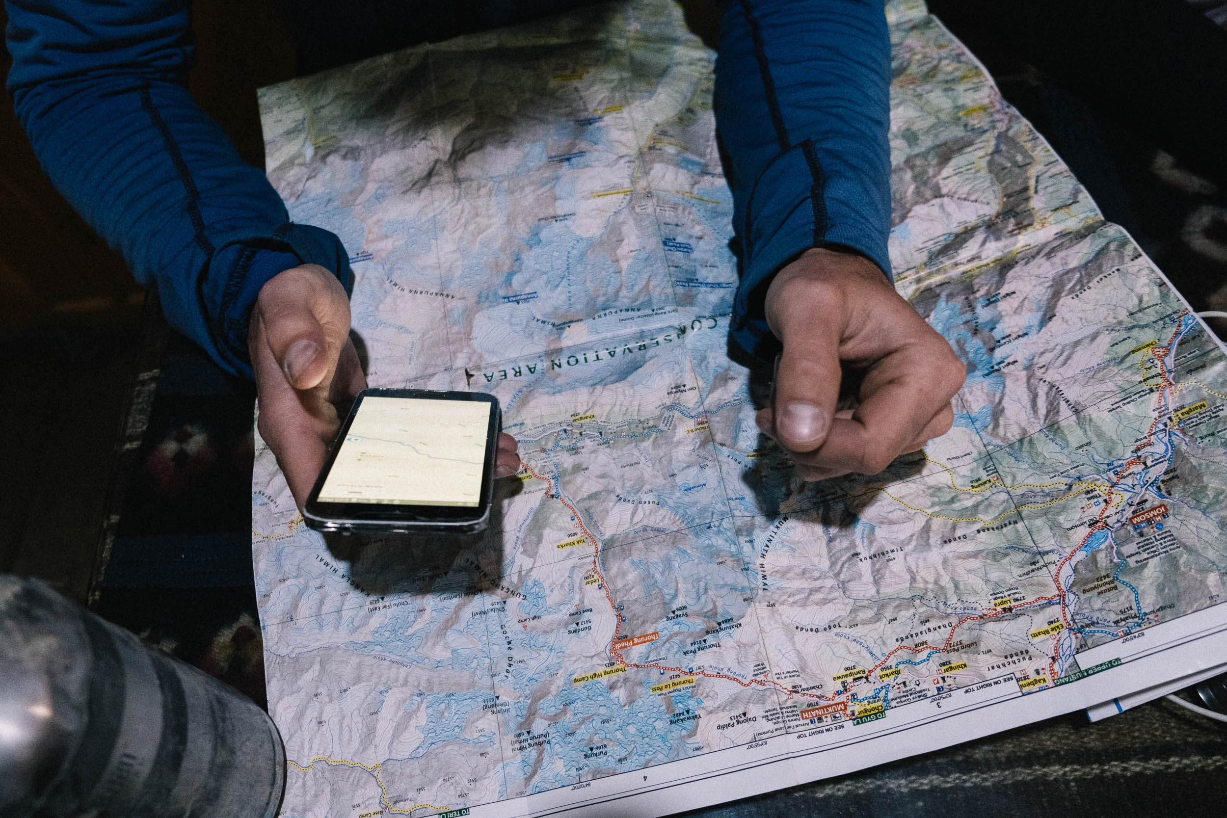
Route Development: The official Annapurna hiking route starts in Besisahar. For cycling it makes a lot more sense to start in Pokhara. Most hotels in Pokhara are located along the Lakeside Road, so it is logical to start and end there. The bikepacking version follows much of the same route as the Annapurna Circuit hiking trail, but cyclists use the jeep track until Manang. After Manang the jeep track runs out and the route follows the hiking trail. You’ll receive a paper map of the route when you purchase your permits. This map is made for hiking but it can be used for cycling as well. The Annapurna Circuit Trek is a well-established route and for the most part there is only one road to follow.


Submit Route Alert
As the leading creator and publisher of bikepacking routes, BIKEPACKING.com endeavors to maintain, improve, and advocate for our growing network of bikepacking routes all over the world. As such, our editorial team, route creators, and Route Stewards serve as mediators for route improvements and opportunities for connectivity, conservation, and community growth around these routes. To facilitate these efforts, we rely on our Bikepacking Collective and the greater bikepacking community to call attention to critical issues and opportunities that are discovered while riding these routes. If you have a vital issue or opportunity regarding this route that pertains to one of the subjects below, please let us know:
Highlights
Must Know
Camping
Food/H2O
Trail Notes
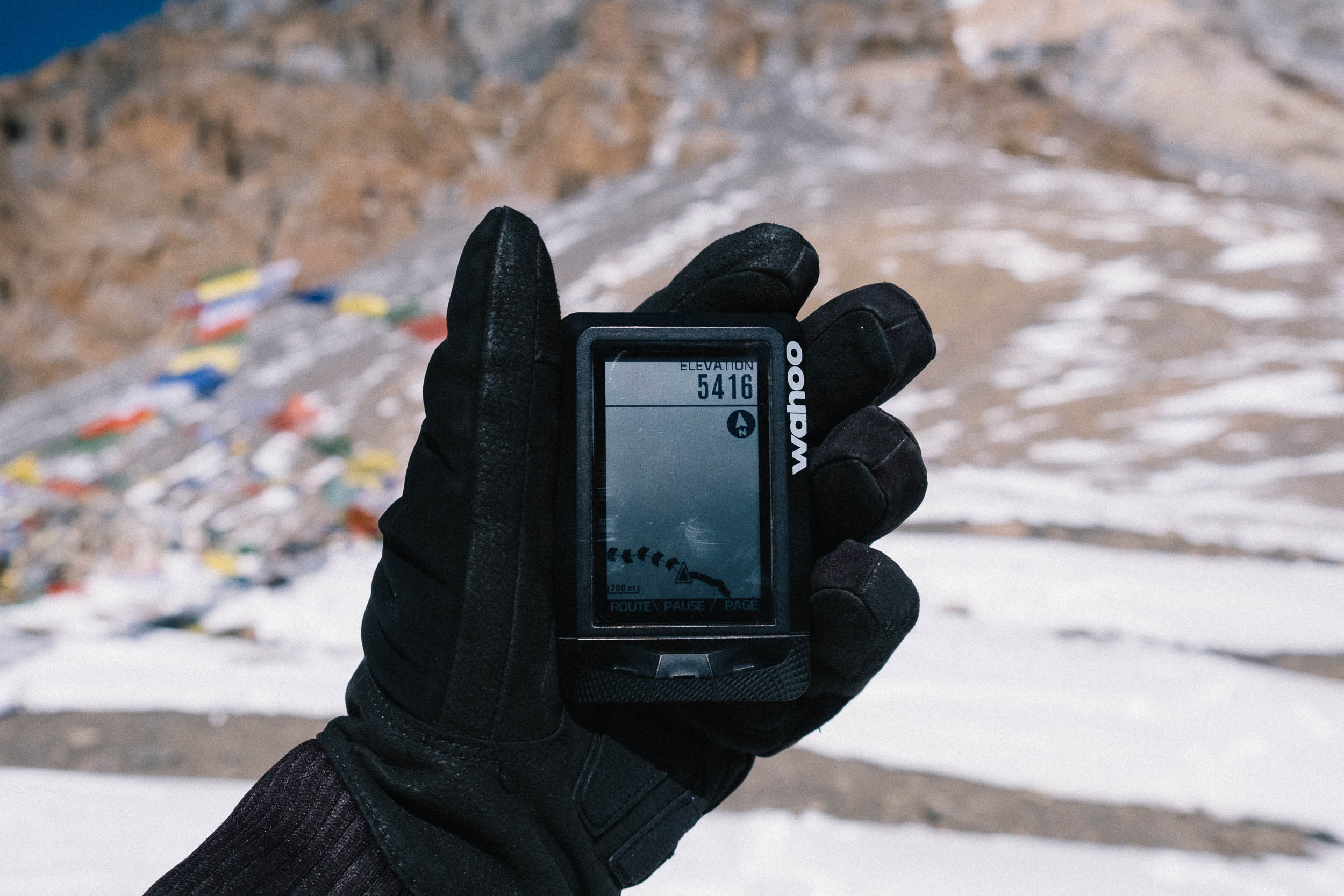
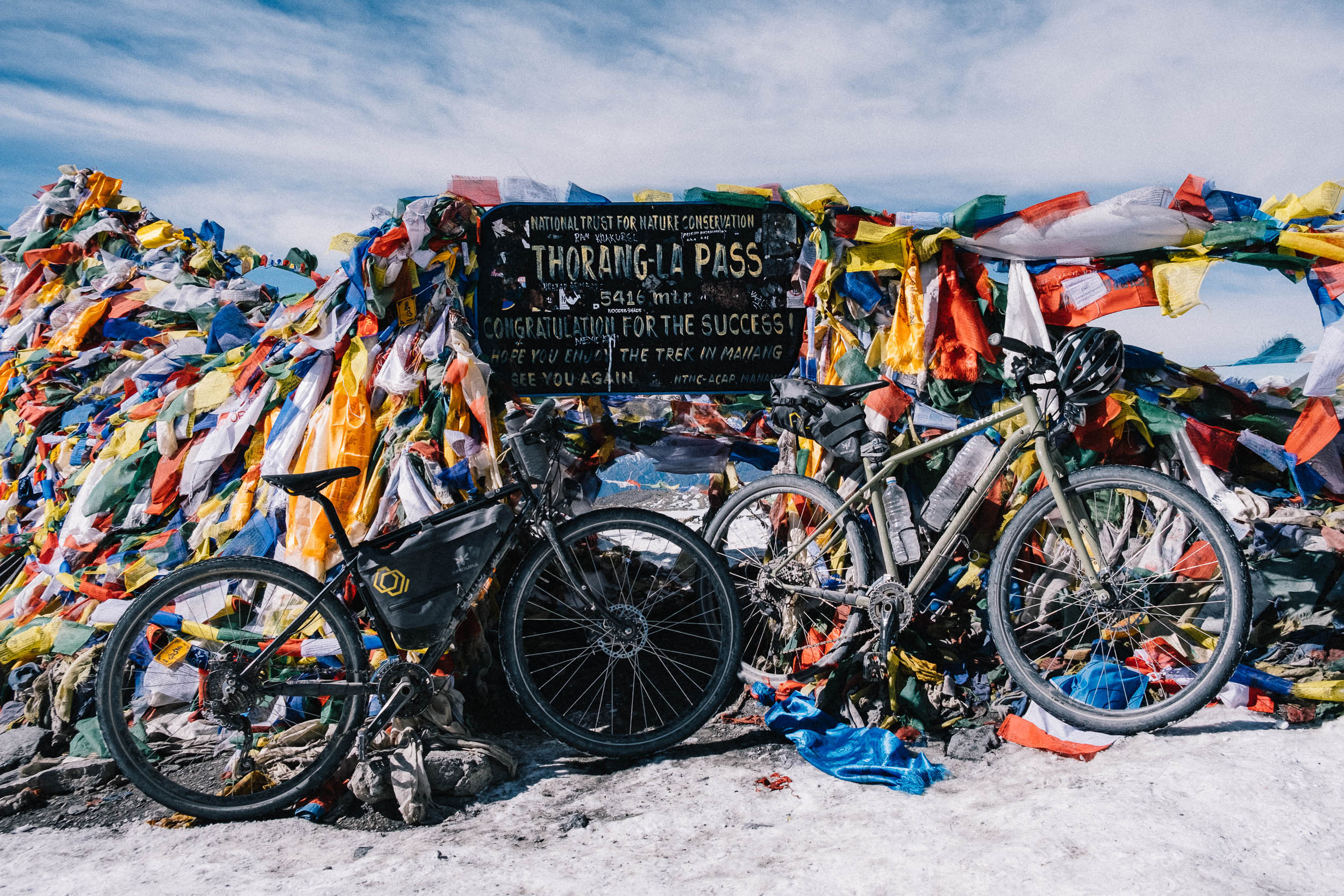
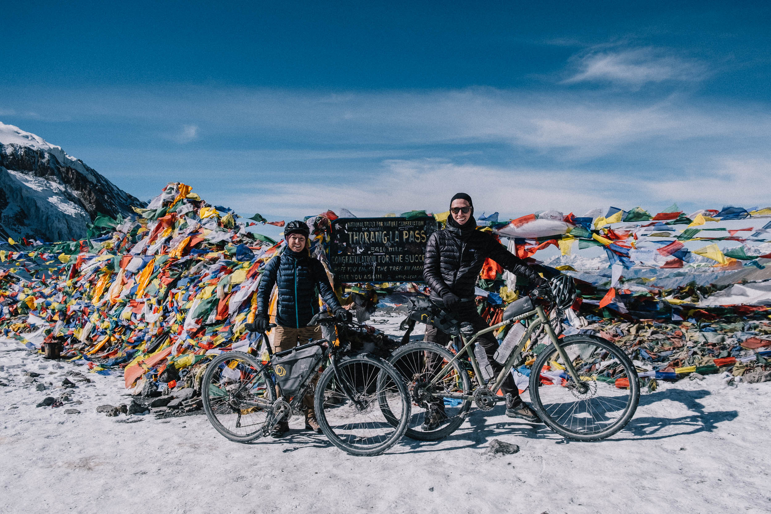
- Thorung La Pass. The view from Thorung La Pass, with an elevation of 5,416 meters above sea level, is magnificent. Colorful prayer flags mark the crossing point, which is one of the highest passes in the world.
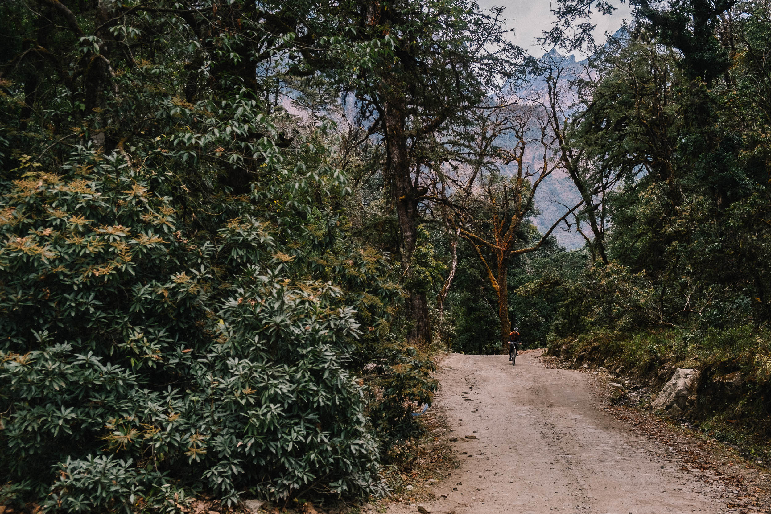
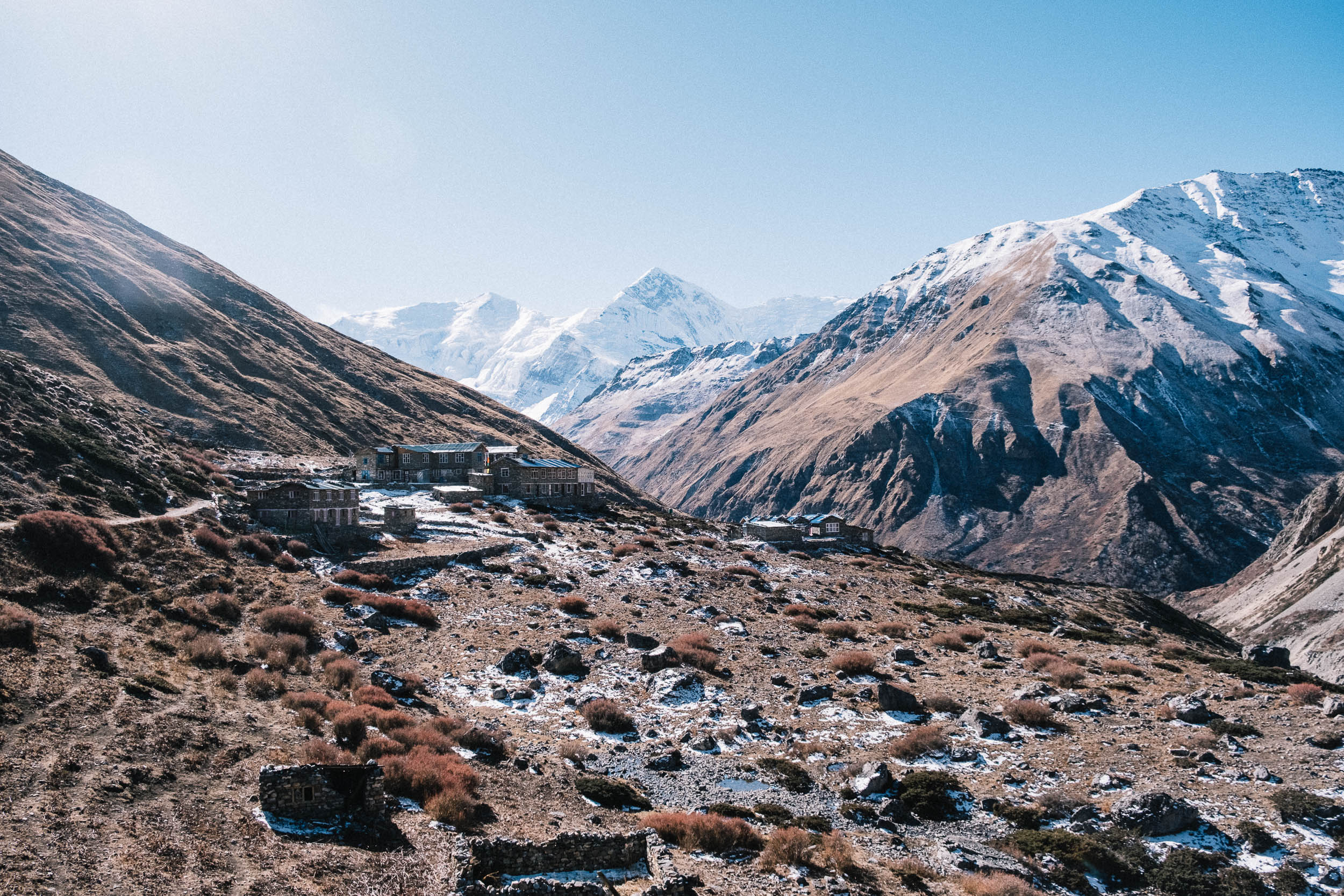
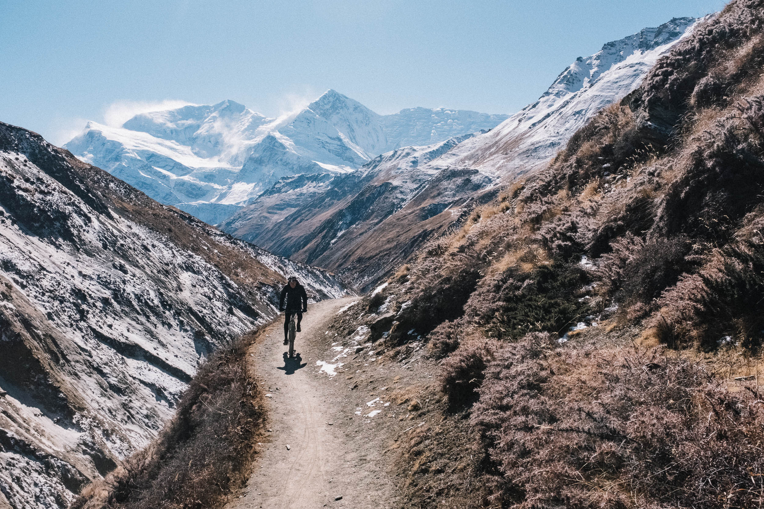
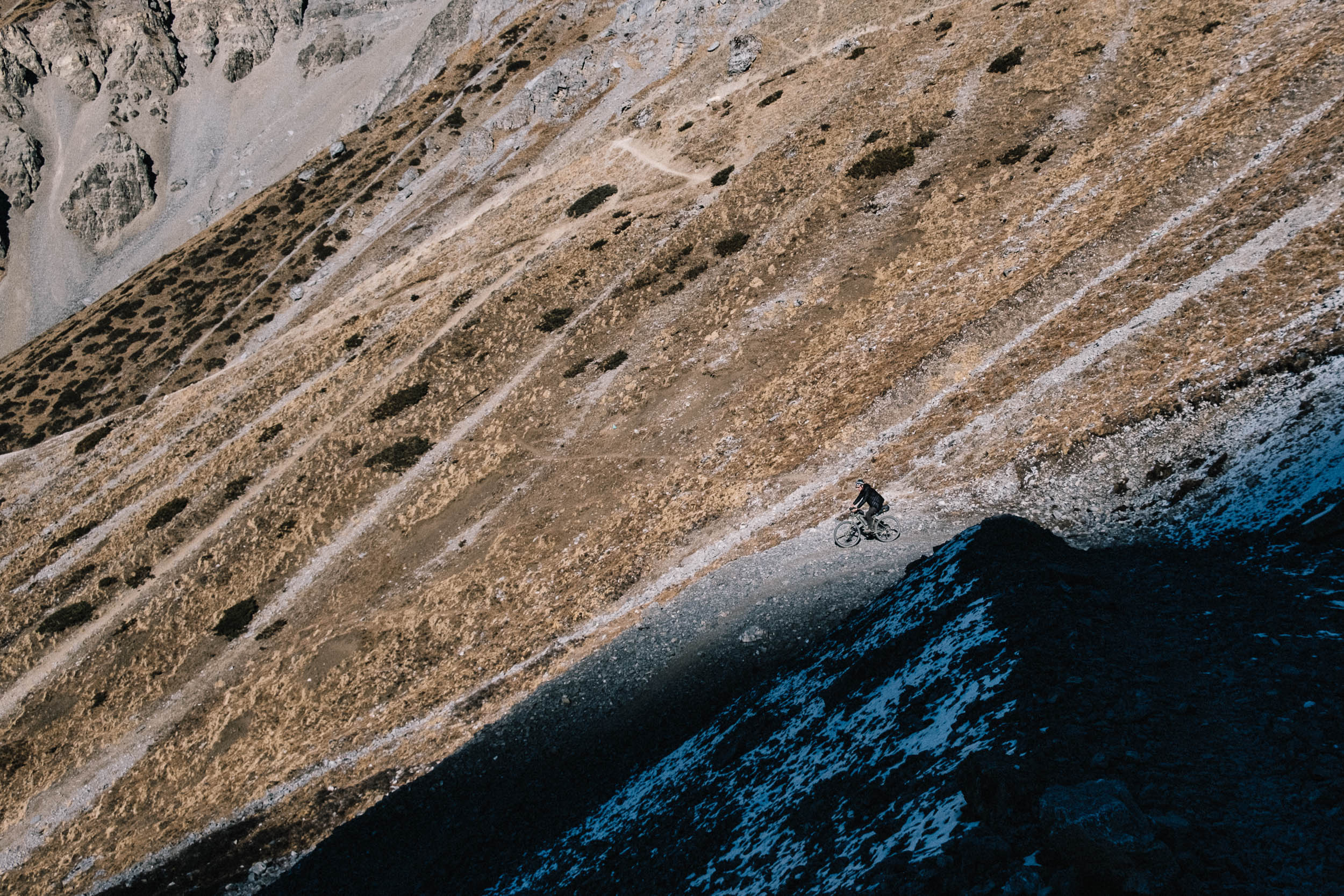
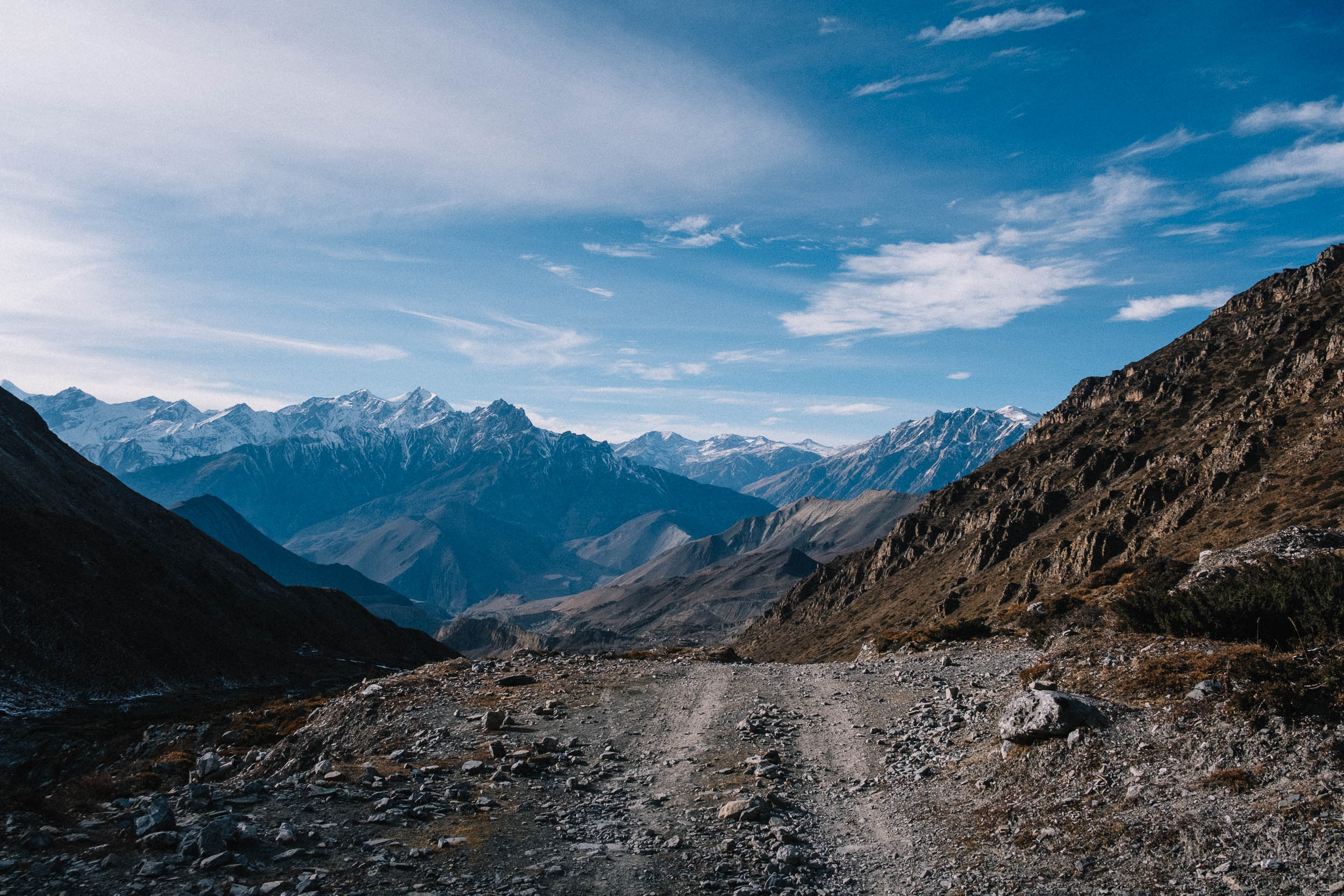
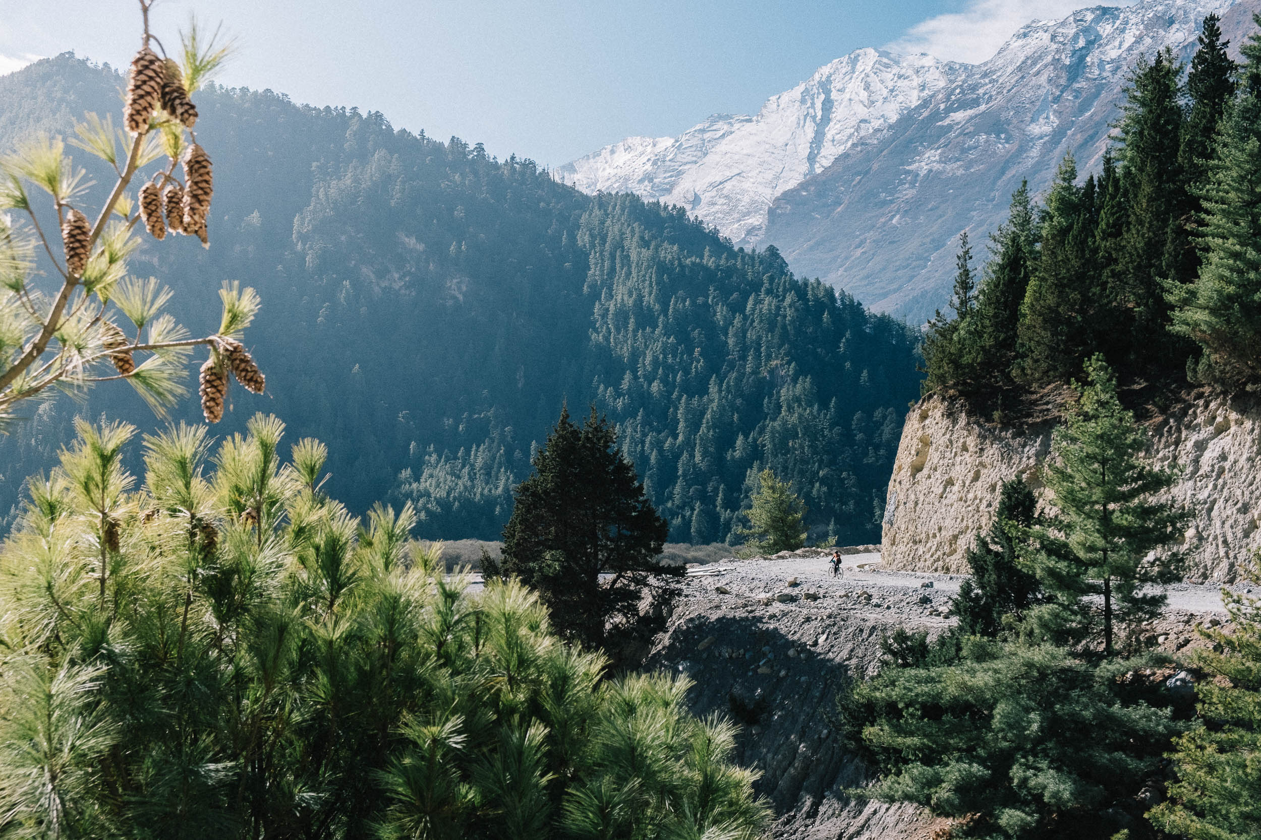
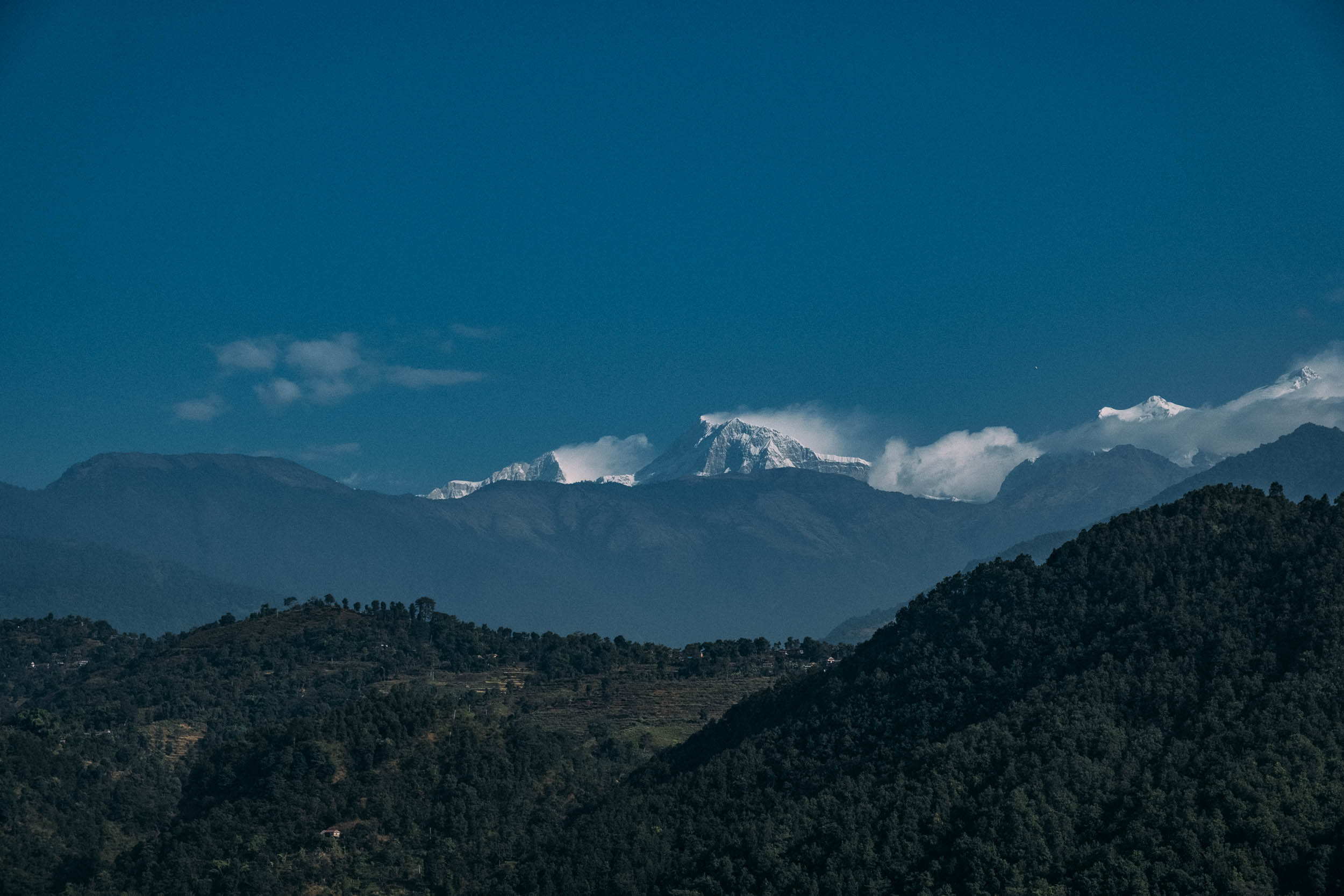
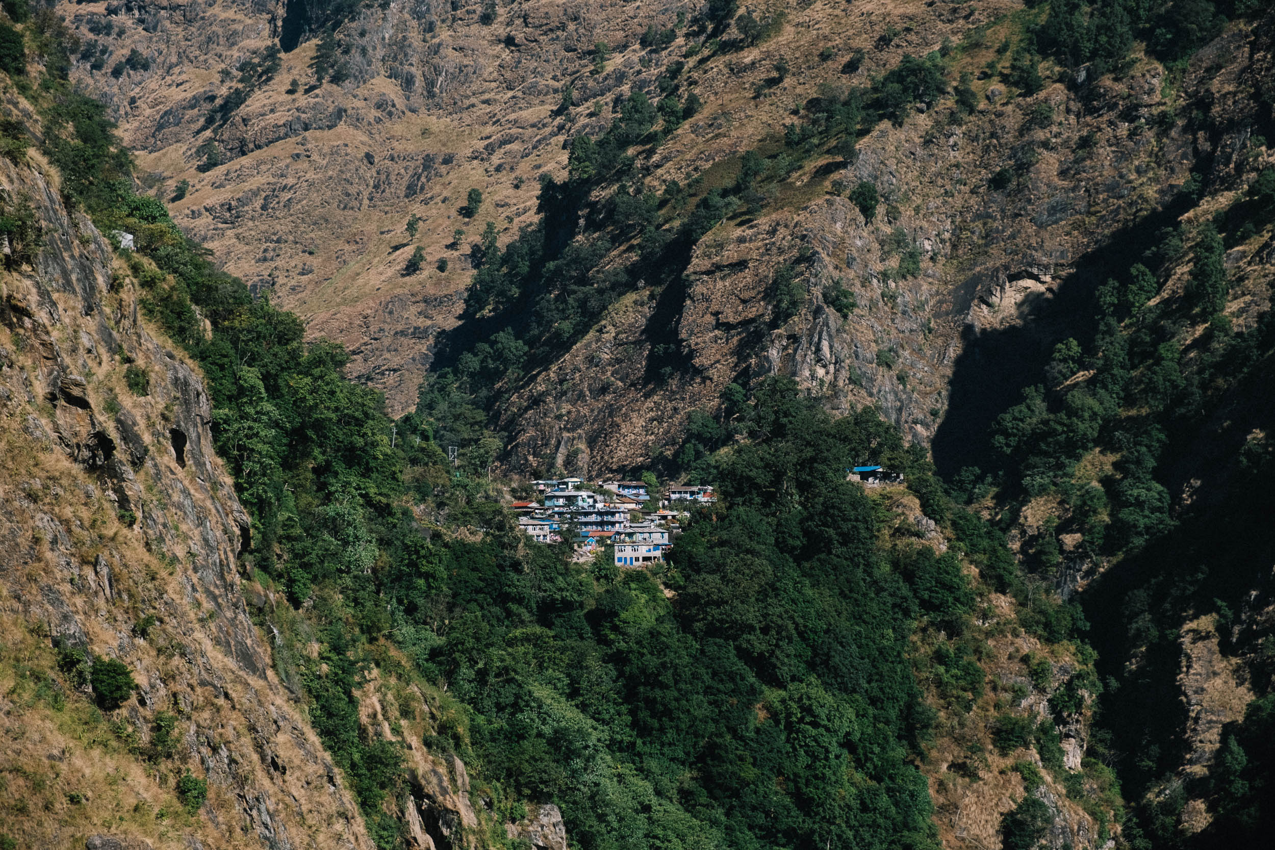
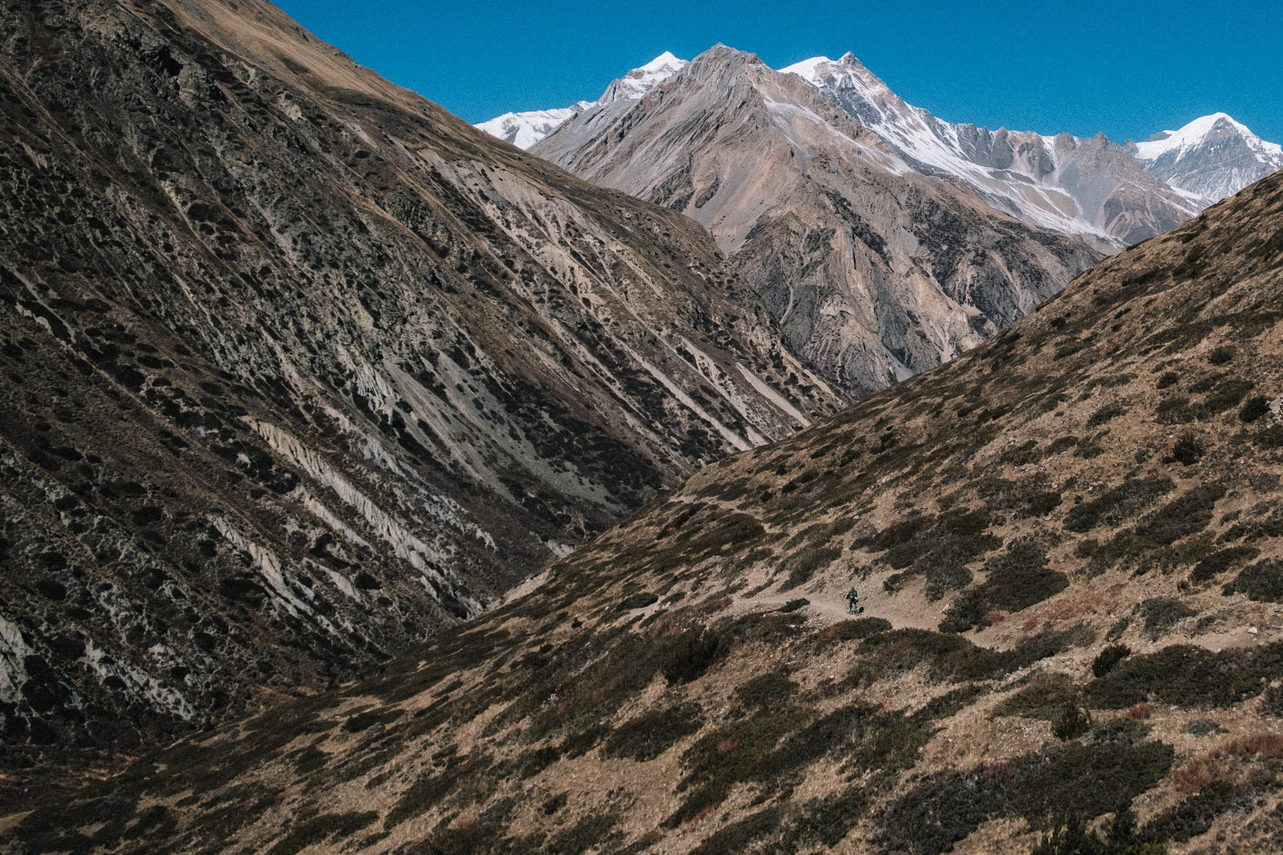
- Views, views, views. The changing scenery while the road winds up along deep cliffs and massive peaks is spectacular. From the dusty subtropical jungle to the higher pine forests, and from rocky landscapes to the snow-capped giants above, there’s always something new to observe.
- Chame – Manang trail. The part between Chame – Pisang – Manang is stunning. The valley opens up and for some stretches the trail is smooth and flowy and offers for great riding. You’ll definitely enjoy picking up some speed after long, slow days.
- Milk tea and Dhal Bhat. Enjoy a cup of Nepali tea (chai) with loads of sugar for extra energy and a plate of Dhal Bhat. Dhal Bhat is Nepal’s national dish of rice, soup, curry, and vegetables.
- Resting and acclimatizing in Manang. The mountain town of Manang is located at 3,500 meters, making it the perfect place to rest and recover. There are several great day hikes you can take, like the ice lake or a visit to the Praken Gompa, a small monastery where you’ll be blessed for a safe passage over Thorung La.
- Side trip to Tilicho Lake. If you have some time to spare, you can make an overnighter to Tilicho, a high-altitude lake (4,919 meters) with incredible views of Mount Annapurna I (8,091 meters), Manaslu (8,163 meters) and Dhaulagiri (8,167 meters).
- Hot springs. Along the route there are plenty of hot springs. Most of them are marked with a sign reading “Tatopani.” Perfect to wash off the dust and give your sore muscles a rest.
When to go
- April to May/October and November. The best time to cycle the Annapurna Circuit is early spring from April to May, or after monsoon season between October and November (high season). Flowers and other vegetation are in bloom, but it can be warmer and more humid. Heavy rains during monsoon season clear the air in October and November and temperatures are mild. We cycled the route in December. It’s certainly doable, but there’s a larger risk of being snowed in at higher altitudes. The difference in temperature between day and night can be drastic, so pack enough warm gear.
Logistics
- Kathmandu International Airport. Most people fly in and out at the international airport in Kathmandu. From Kathmandu there are busses to Pokhara or Besisahar, the official starting point for most hikers since it’s closer to the trail.
- Clockwise vs. counterclockwise. Because the Annapurna Circuit is a loop, it’s possible to ride clockwise or counterclockwise from Pokhara. Go clockwise for a gentler gradient to Thorung La Pass or counterclockwise for a slightly more rideable trail down. We preferred a steady climb so we could stick to the rule of not climbing more than 500 meters per day above 3,500 meters. Altitude sickness is something to take seriously in Nepal.
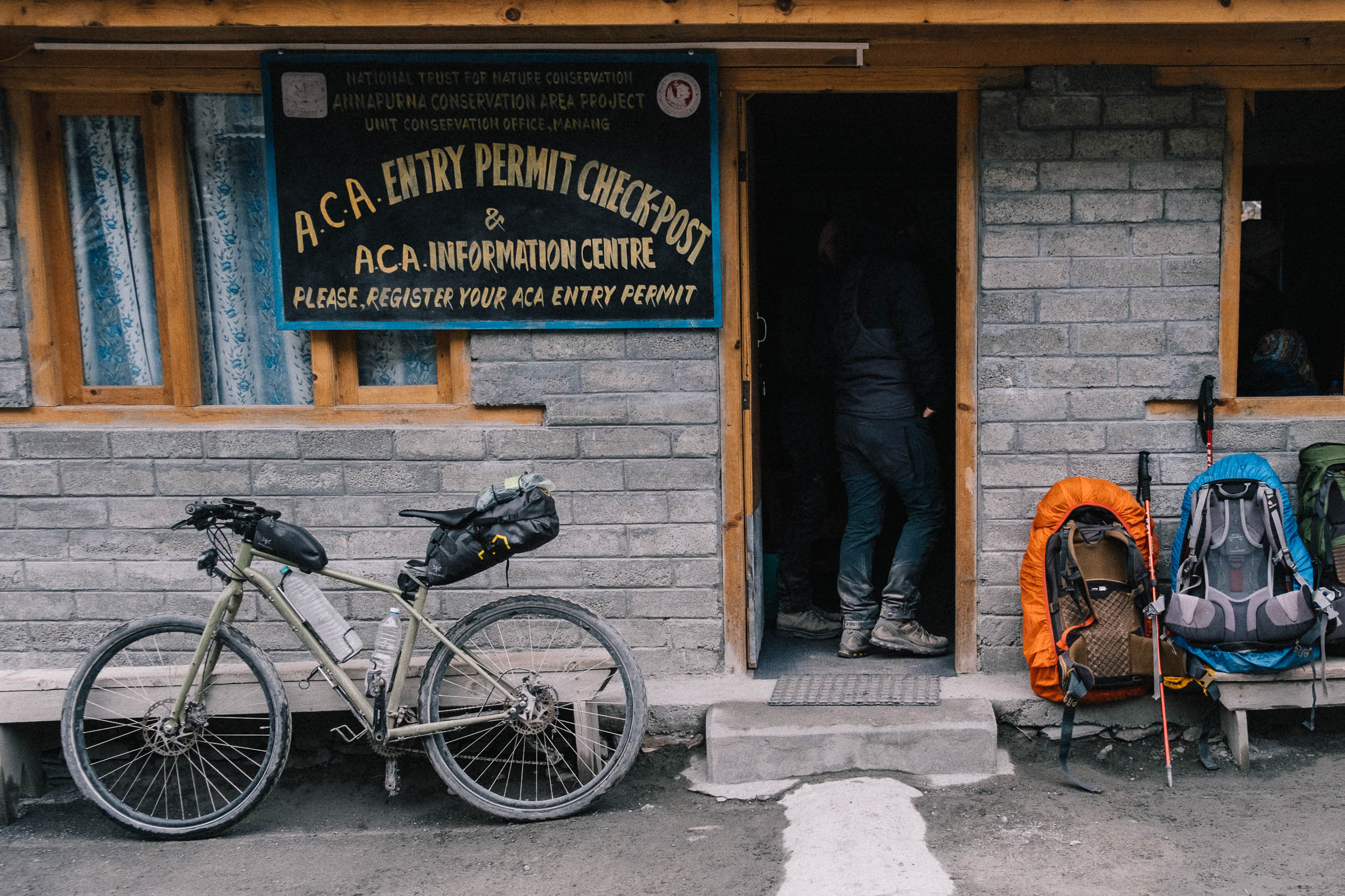
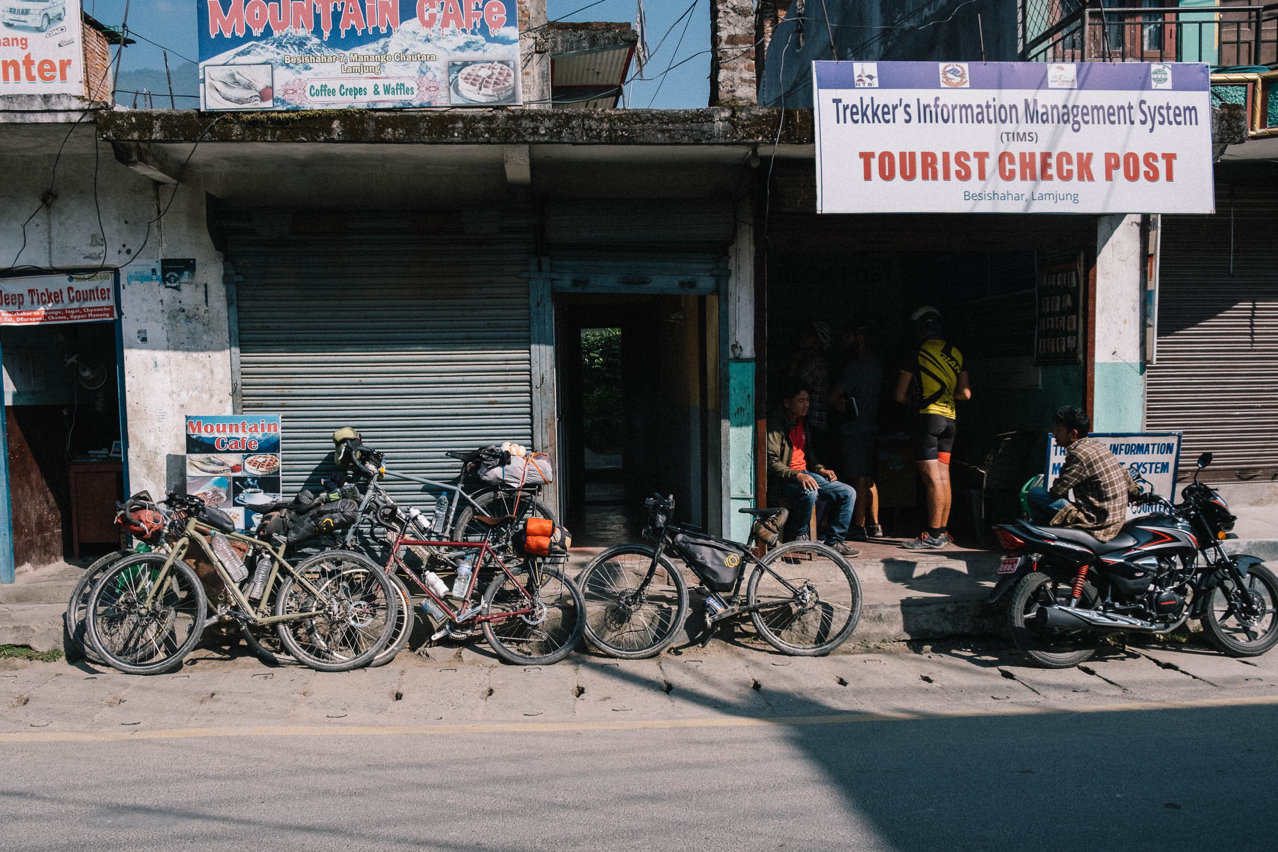
- Permits. Before starting, you’re required to obtain two necessary permits (ACAP & TIMS) to enter the “Restricted Areas.” You need to apply for these at the Department of Immigration in Kathmandu or in Pokhara. The costs are approximately $40 USD and you’ll need three passport photos.
- Money. There are no ATMs along the trail, so make sure you’ll bring enough cash for the whole circuit. We worked with a budget of 10 USD per person a day and that was more than enough for us. Be sure you have crisp euros or dollars upon arriving at KTM airport to pay for the visa on arrival in cash.
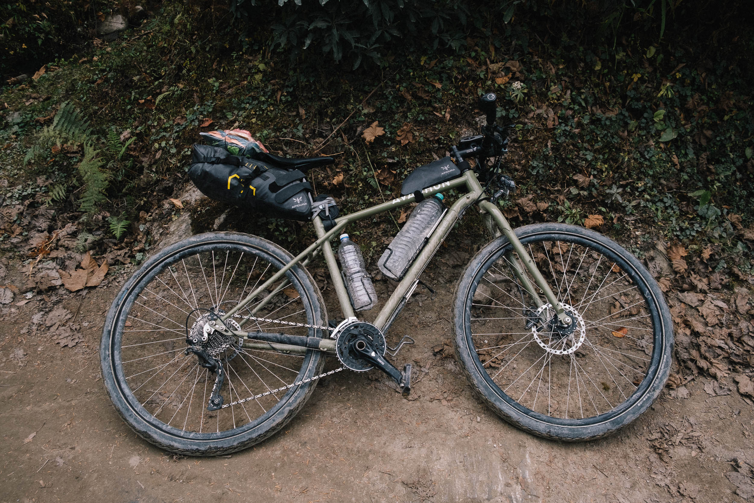
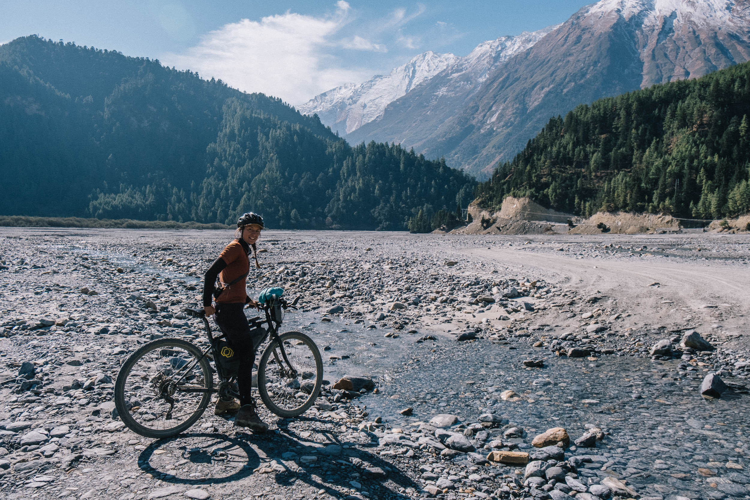
- Bicycle and tires. The ideal bicycle would probably be a full-suspension mountain bike. However, the trail is suitable for gravel and touring bicycles with slightly wider rubber. The trail is mixed: rocky, dusty, hard packed gravel, and even some asphalt. We rode the Annapurna Circuit with Schwalbe Marathon 2.0” tires, which is the minimum width you can comfortably ride the route on. Next time we would go with wider and chunkier tires. Anything wider than 2.3” will do.
Dangers
- Altitude sickness. The Annapurna Circuit is a high-altitude trail, so there’s an inherent risk of getting altitude sickness. It’s important to acclimatize, take it easy, and drink a lot of water. In terms of altitude acclimatization, it is safest to ride from east to west, so counterclockwise. You can buy Diamox (used to prevent and reduce the symptoms of altitude sickness) in Pokhara and Kathmandu and in some shops in Mangang.
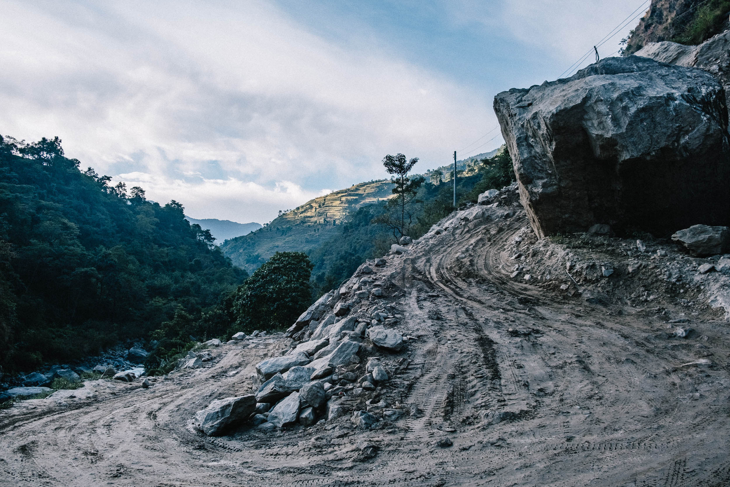
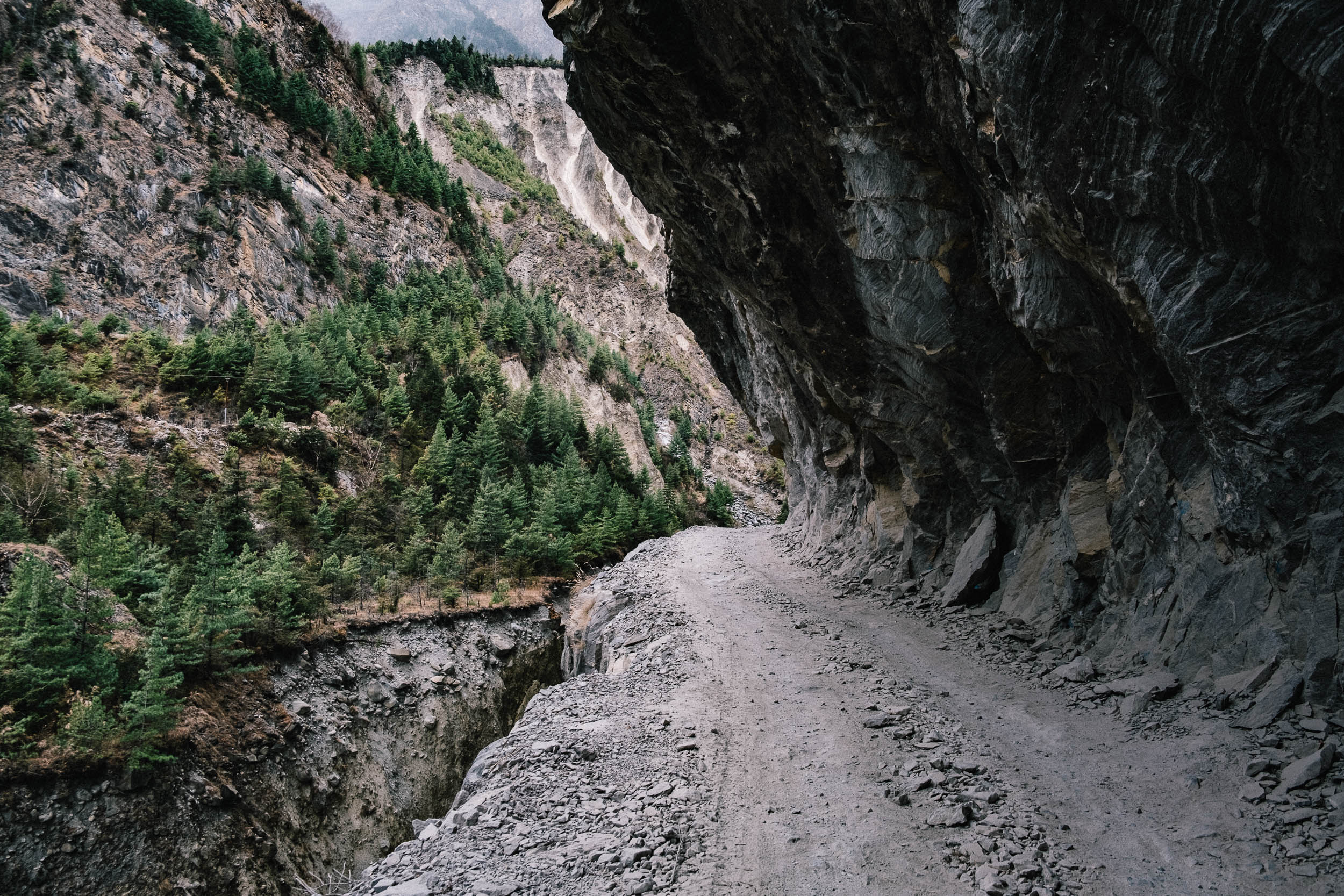
- Landslides and falling rocks. There are some dangerous landslide areas along the trail. These are marked with signs, so don’t linger around here. There’s also a risk of falling rocks and trails can be slippery, especially near river crossings. Caution and excellent bike handling skills are both needed.
- Weather. The weather in the mountains is unpredictable and can change drastically from one moment to the next. Pay close attention to the weather forecast.
- Lock. Bring a small lock and take your stuff from your bikepacking bags at night. Some of our tools and our bib shorts got stolen while up at 5,000 meters.
Travel Basics
- Manang, Muktinath, and Jomsom are bigger towns that offer some facilities. It’s possible to arrange public transport here, get medical attention, or visit the police station. There’s even an airport in Jomsom, which most hikers use to fly out to Pokhara.
- Don’t forget a buff or mask to cover your mouth from dust, as well as warm gloves.
- Camping is possible, although it can be hard to find a flat section outside of the villages. That said, camping isn’t necessary since lodging is inexpensive and you’ll probably be eating at the teahouses anyway. After Besisahar it is impossible to buy ingredients to prepare your own meals. You’ll also need to carry a lot of extra gear if you’re planning to camp—something to keep in mind when considering the massive push up and over Thorung La Pass.
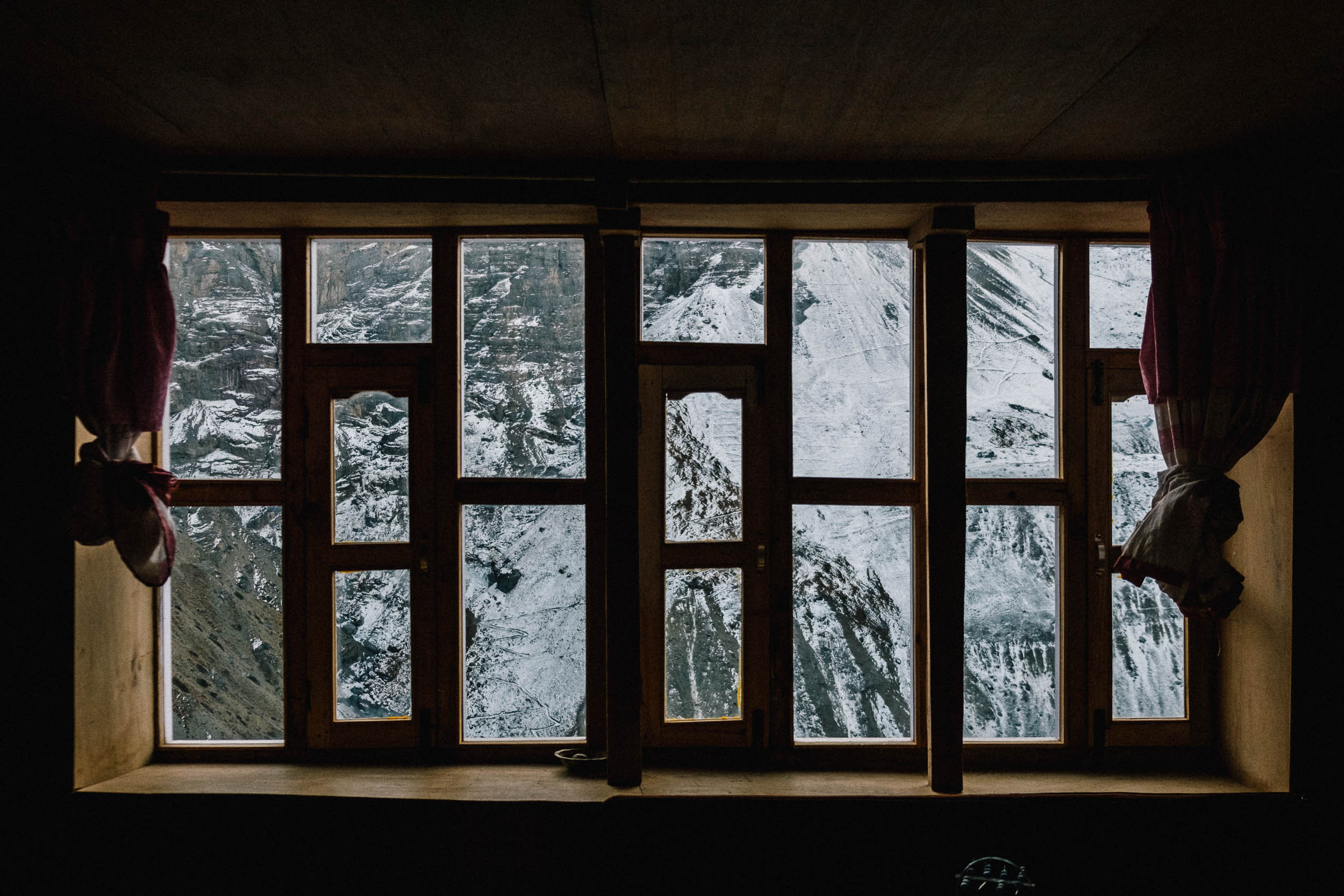
- Nepali teahouses. Every 10 kilometers or so there are small villages with teahouses that offer lodging. The rooms are very basic but equipped with a good mattress and warm blanket. Bathrooms are mostly shared. All teahouses also provide a wide selection of food and drinks. Most will request that you eat dinner and breakfast with them and charge very little for lodging.
- Charging and staying connected. All teahouses have a wifi connection, but this usually costs you a little extra. As does charging your electronics at higher altitudes. So, make sure you recharge your batteries and other devices in Manang.
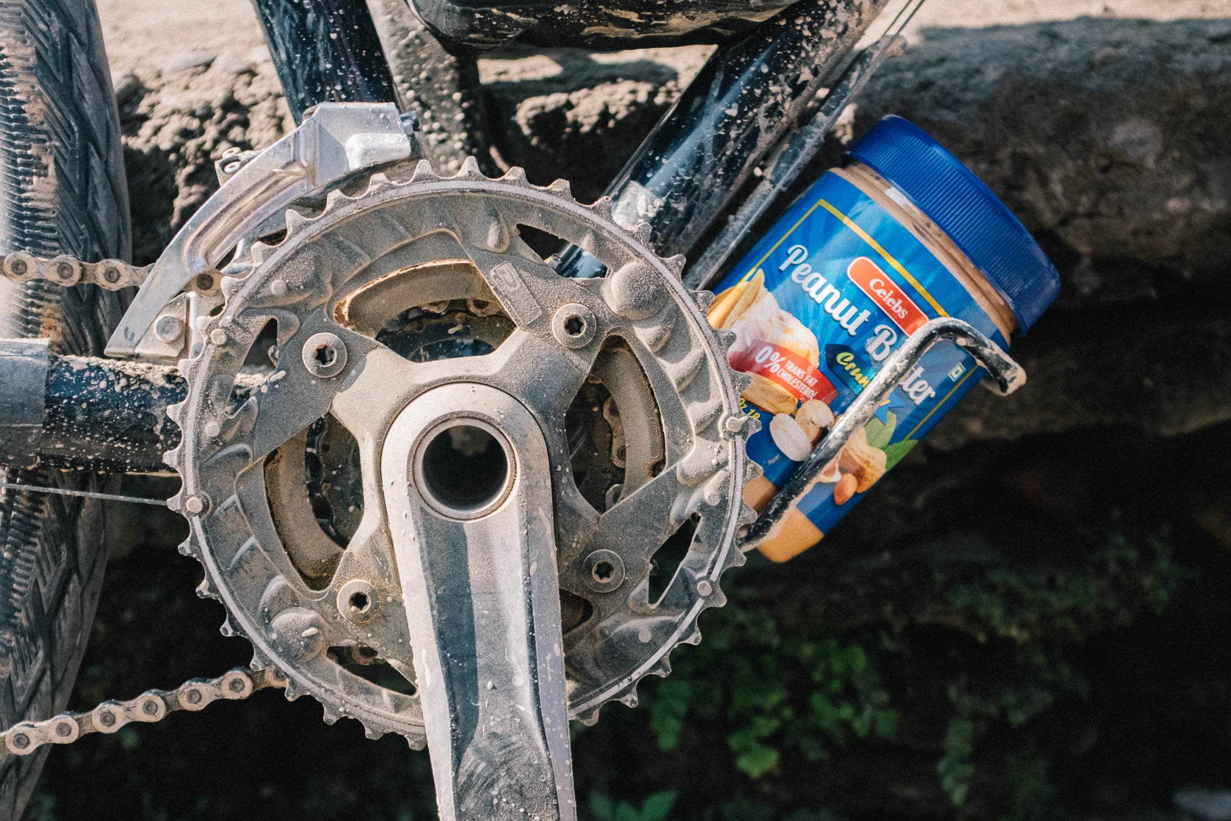
- Pricey snacks. Along the trail there are many small shops that sell energy bars and sodas. If you’re on a budget, make sure you pack enough snacks with you because the price of food and drinks increases in tandem with the altitude. A snickers bar can easily cost you up to $4 USD by the time you reach Manang.
- Teahouses offer local and westernized food. Our go-to meal was Dhal Bhat, as mentioned earlier. The best thing about this dish is that it’s typically unlimited, so refill your plate if you are still hungry!
- Croissants and pain au chocolats. In Manang you’ll find teahouses that sell delicious Nepali coffee and all kinds of luxurious baked goods.
- Water taps and fresh water streams are widely available on the trail. Bring your water filter, but all water should be fine to drink after filtering it. Avoid buying plastic bottles whenever possible. It isn’t an easy task to get trash back down again, so it will most likely be burned.
Pokhara – Besisahar
Bring a buff and cover your mouth on these dusty roads filled with busses driven by maniacs. Use caution! Luckily, you can leave this crazy Nepali main road for a quieter side road through farm fields with small traditional villages where you can stop for a chow mein (fried noodles) and a cold drink.
Besisahar – Chame
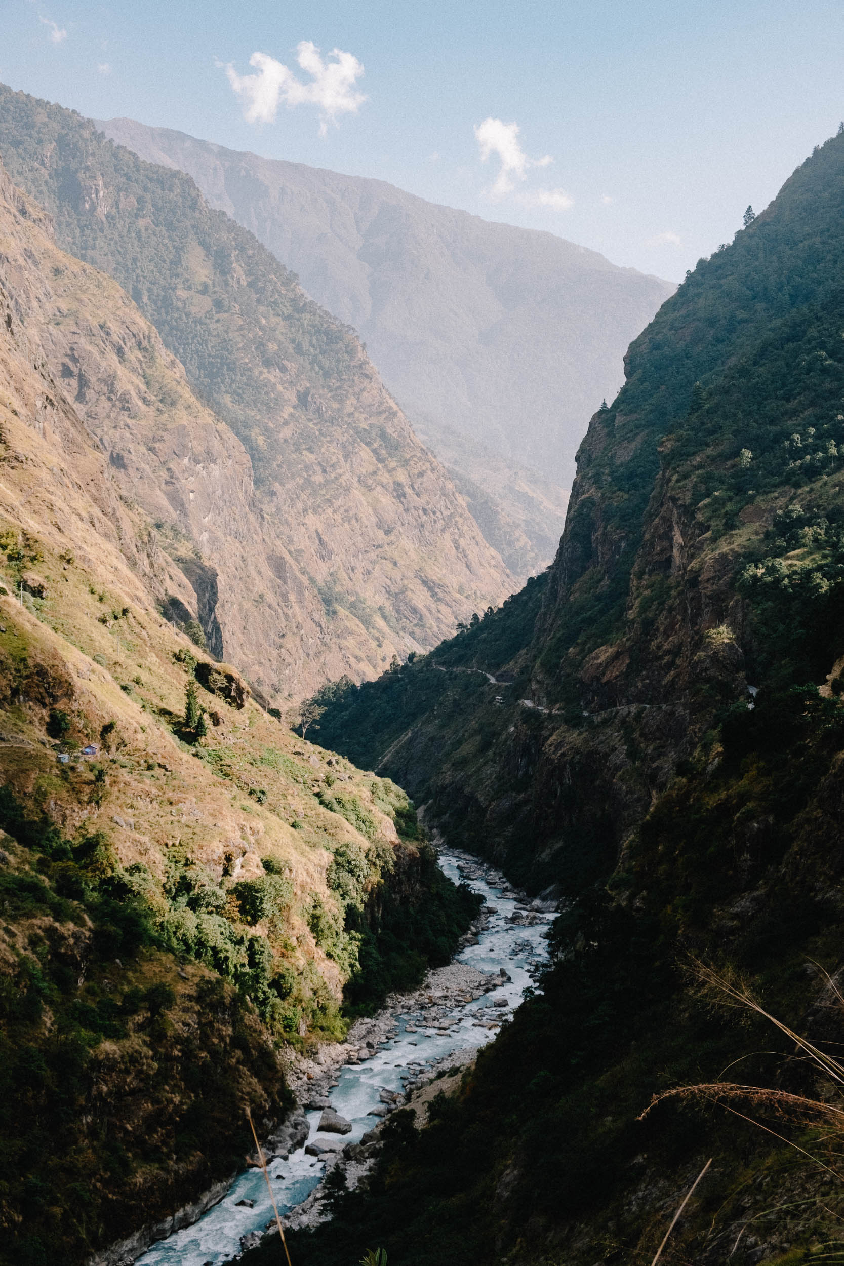
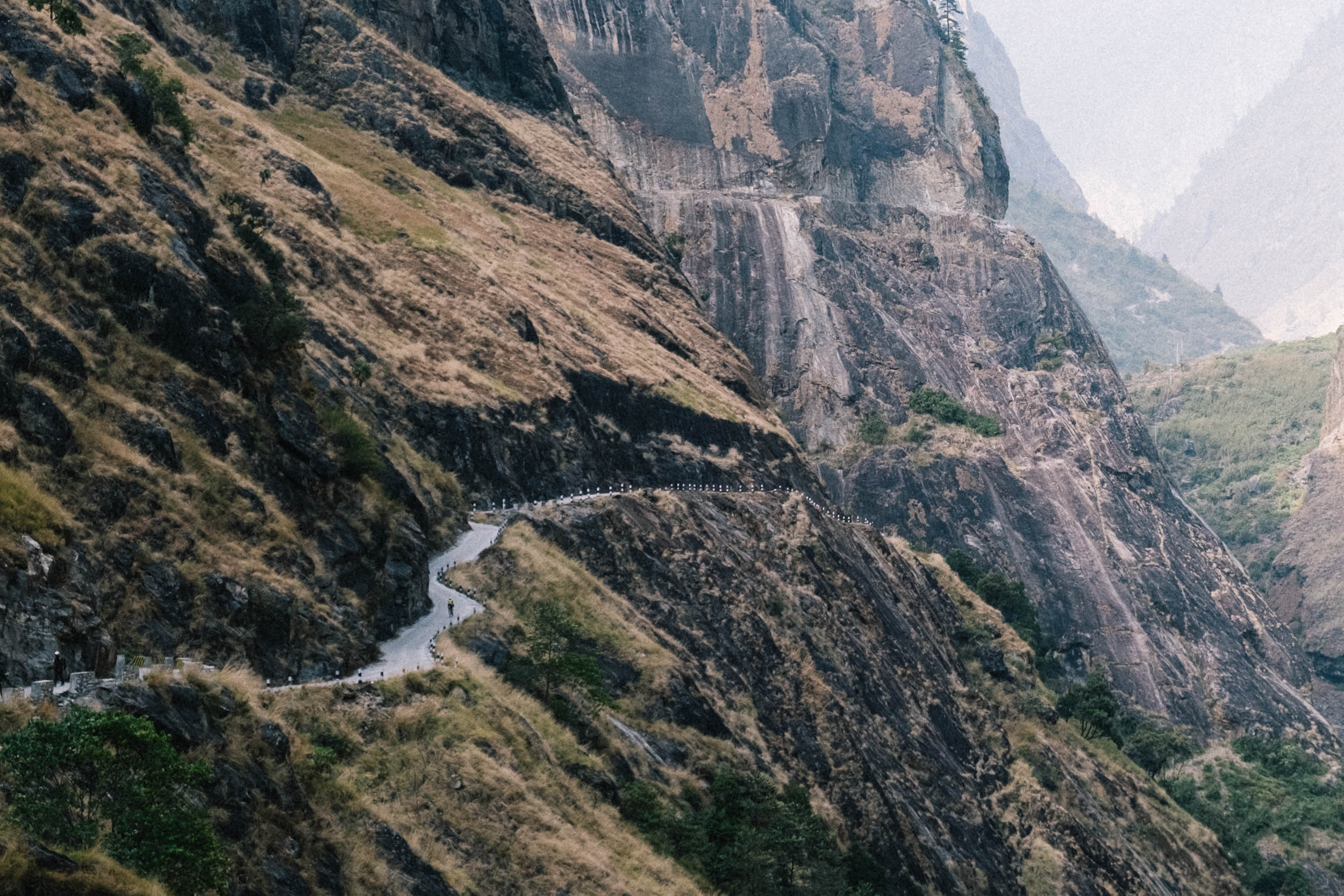
The official start of the ACT begins on a hiking trail, but shortly turns into a jeep track. Some places are paved (mostly around the Chinese hydro plants) but for the most part the track is clay and cobble. The road winds along massive cliffs and often runs parallel to the main trekking path. Subtropical jungle sets the scene, followed by leafy forest.
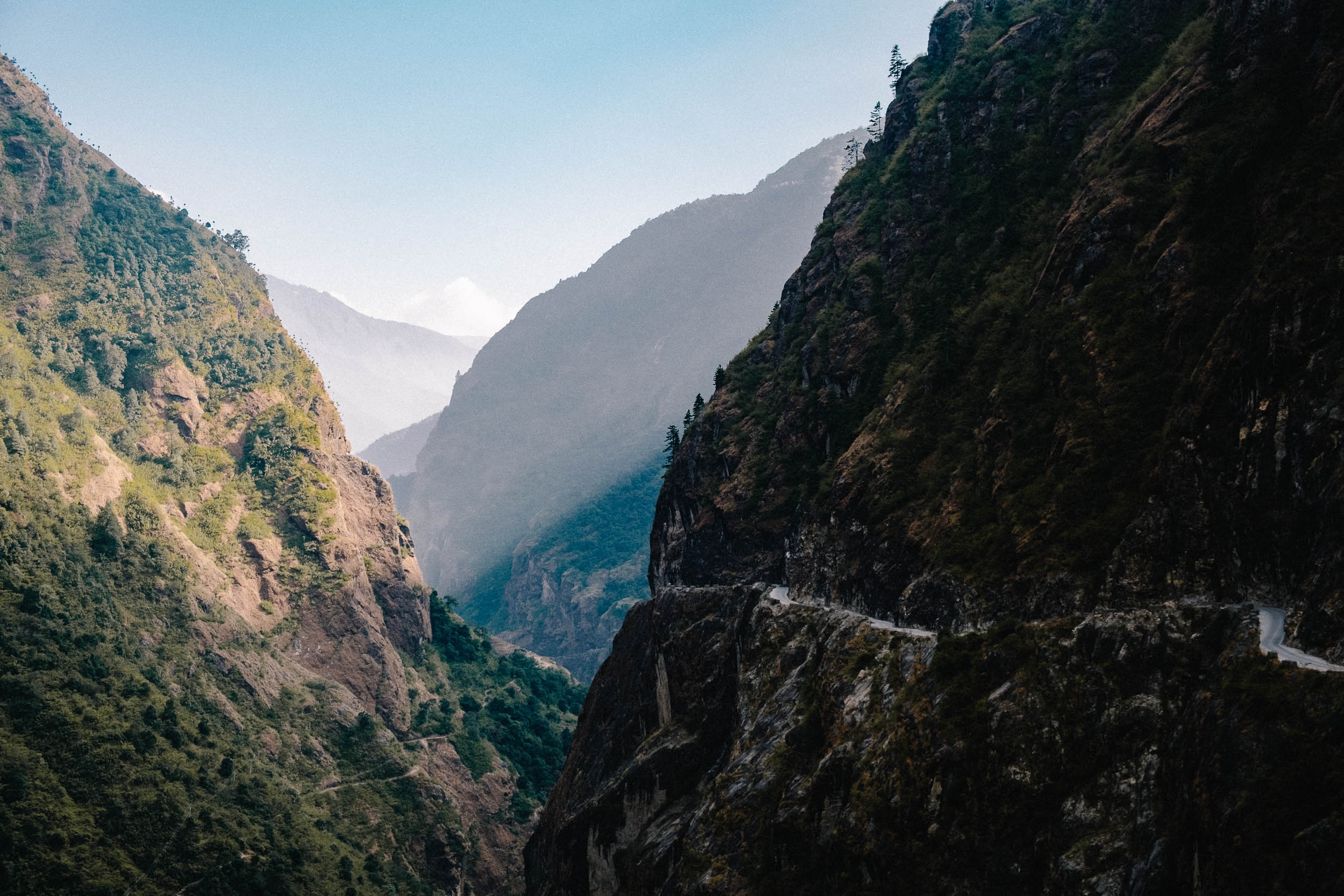
Chame – Manang
The road winds along massive cliffs with a raging river directly below. The trail becomes more challenging with steeper and steeper climbs. The climate also changes as you get higher. Spruce and pine forests decorate the foothills of the Annapurna mountain range and its snow-covered peaks. Choose between the easier, lower trail or the challenging MTB trail via Upper Pisang. The singletrack fun begins after the climb immediately following Pisang. A downhill portion through the woods is followed by a gradual climb to Manang. You’ll likely start to feel the altitude here, so take your time to acclimatize.
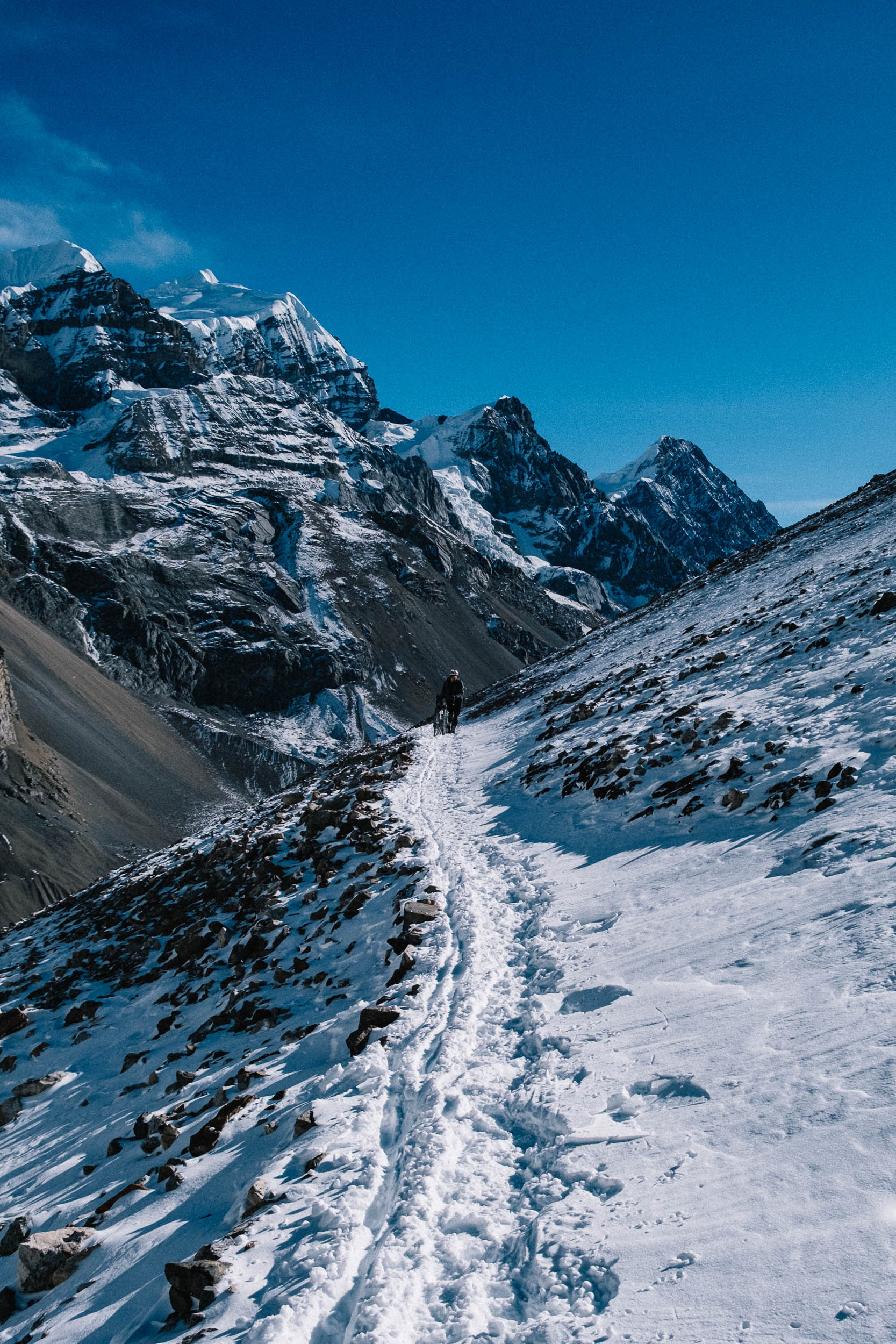
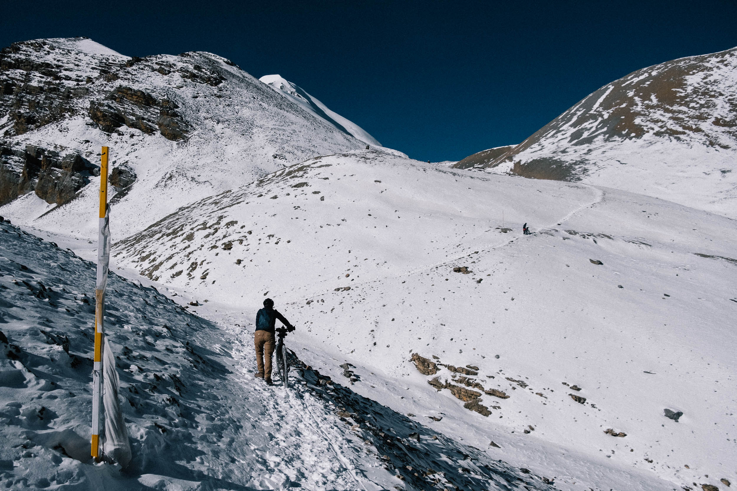
Manang – Thorung La
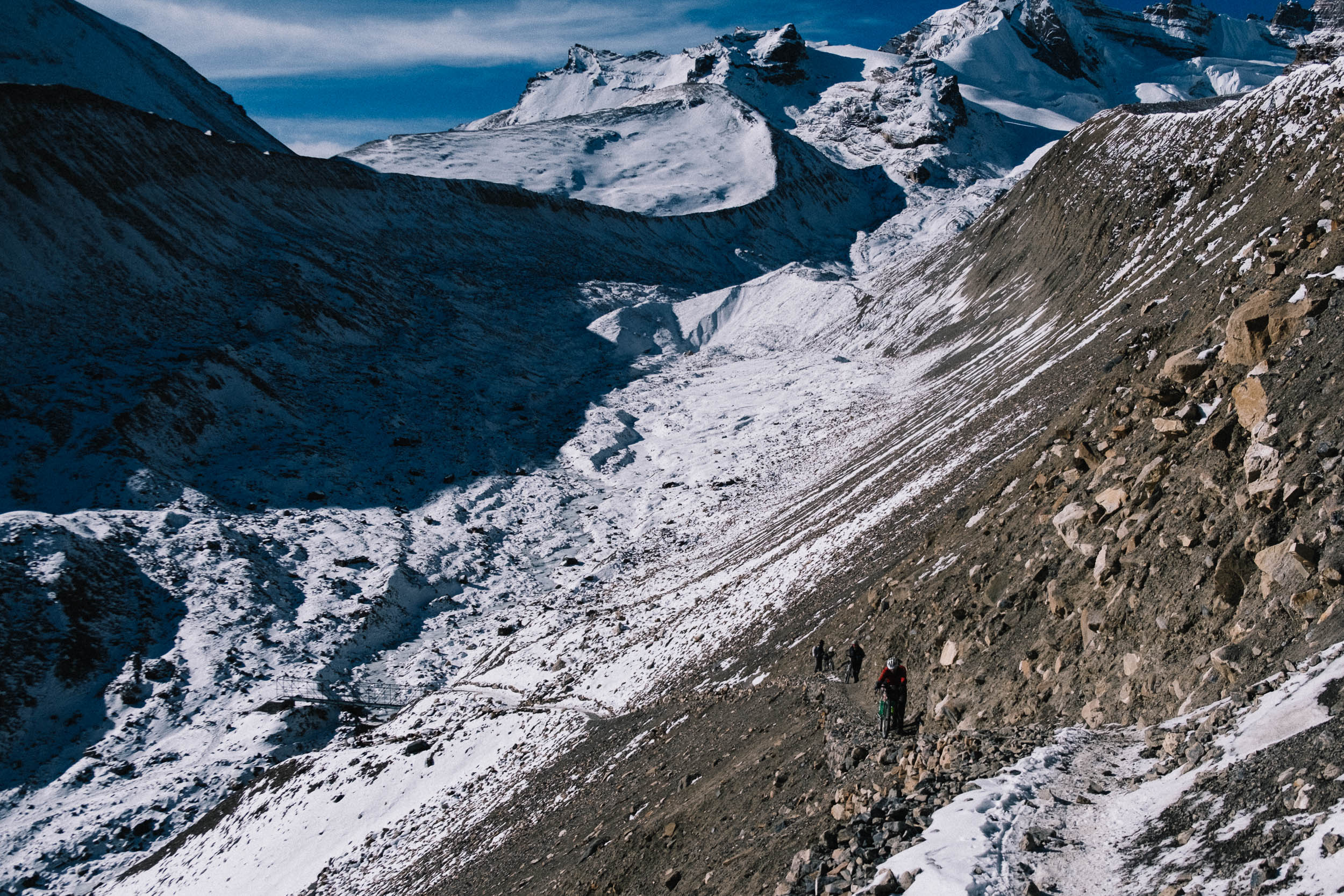
The road ends and after carrying your bike up a flight of stairs and you now share the narrow trail with hikers. You will cross the valley a few times on suspension bridges. Make sure you get some speed to make it all the way over! Make a good plan on how to continue after Manang. How much can you climb each day to avoid altitude sickness? We did it in three days. On day one we had a short easy ride to Yak Kharka. The next day we rode to Thorung Pedi, and on the same day hiked our bikes up as far as we could get them, well past high camp. You could stay in high camp, but we chose for the safer and lower Thorung Pedi. The part between Thorung Pedi and high camp is also extremely steep, sometimes up to a 40% incline, so it helps that you can leave your gear at the teahouse. This way your bicycle is as light as possible for one of the hardest parts of the trek. Start to hike back up to your bike with your gear well before sunrise the next morning so you can cross the pass early and have less risk of getting caught in dangerous weather.
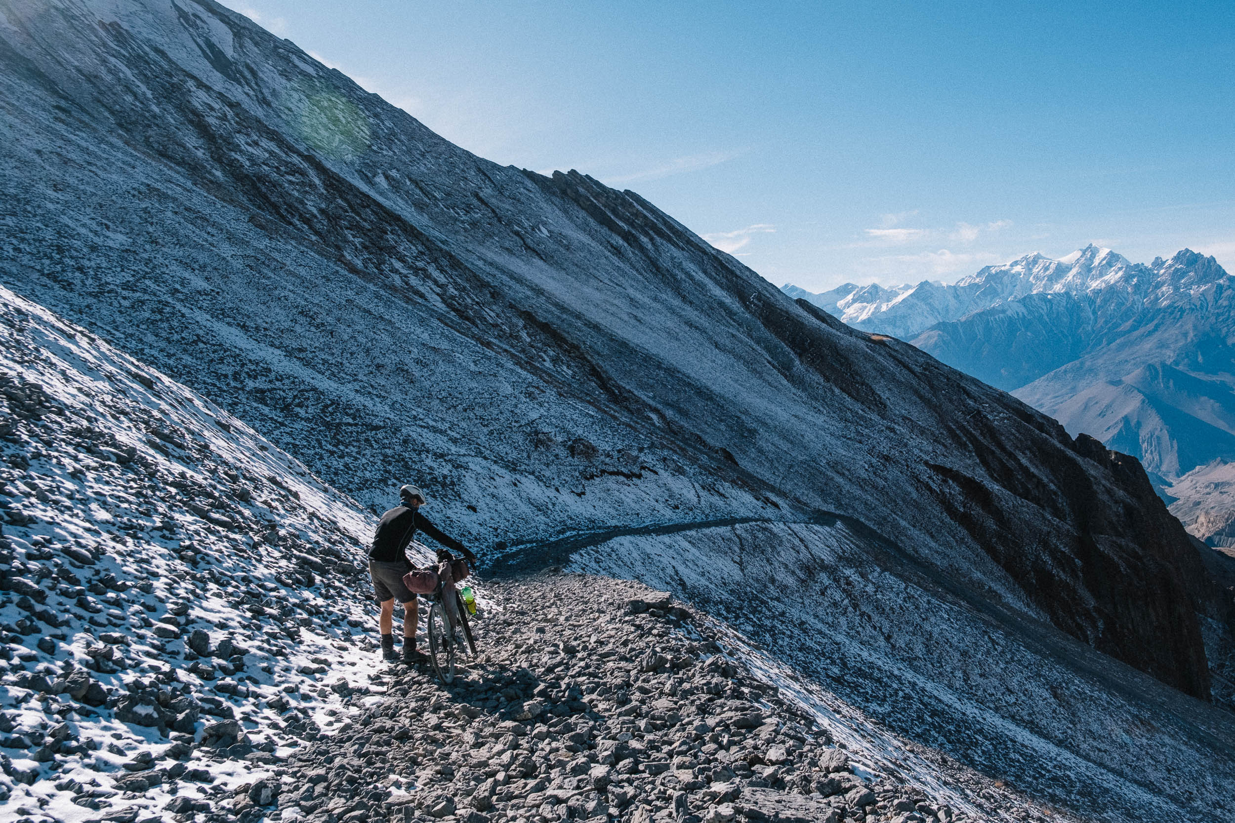
Thorung La – Muktinath
After a very long push through the snow (depending on the season) you will finally reach the pass you’ve been working so hard for. It’s a magical moment, but don’t linger too long. It’s not an easy ride down to the next town, Muktinath. This is where a full-suspension bike would come in handy. The trail is extremely technical and steep and only very experienced riders should attempt actually cycling the whole thing. You can choose between a jeep track and a hiking path. The hiking path is super steep and the jeep track can only be ridden with plus or fat tires because the rocks are so big. Muktinath has plenty of well-equipped teahouses where you can finally get a hot shower again!
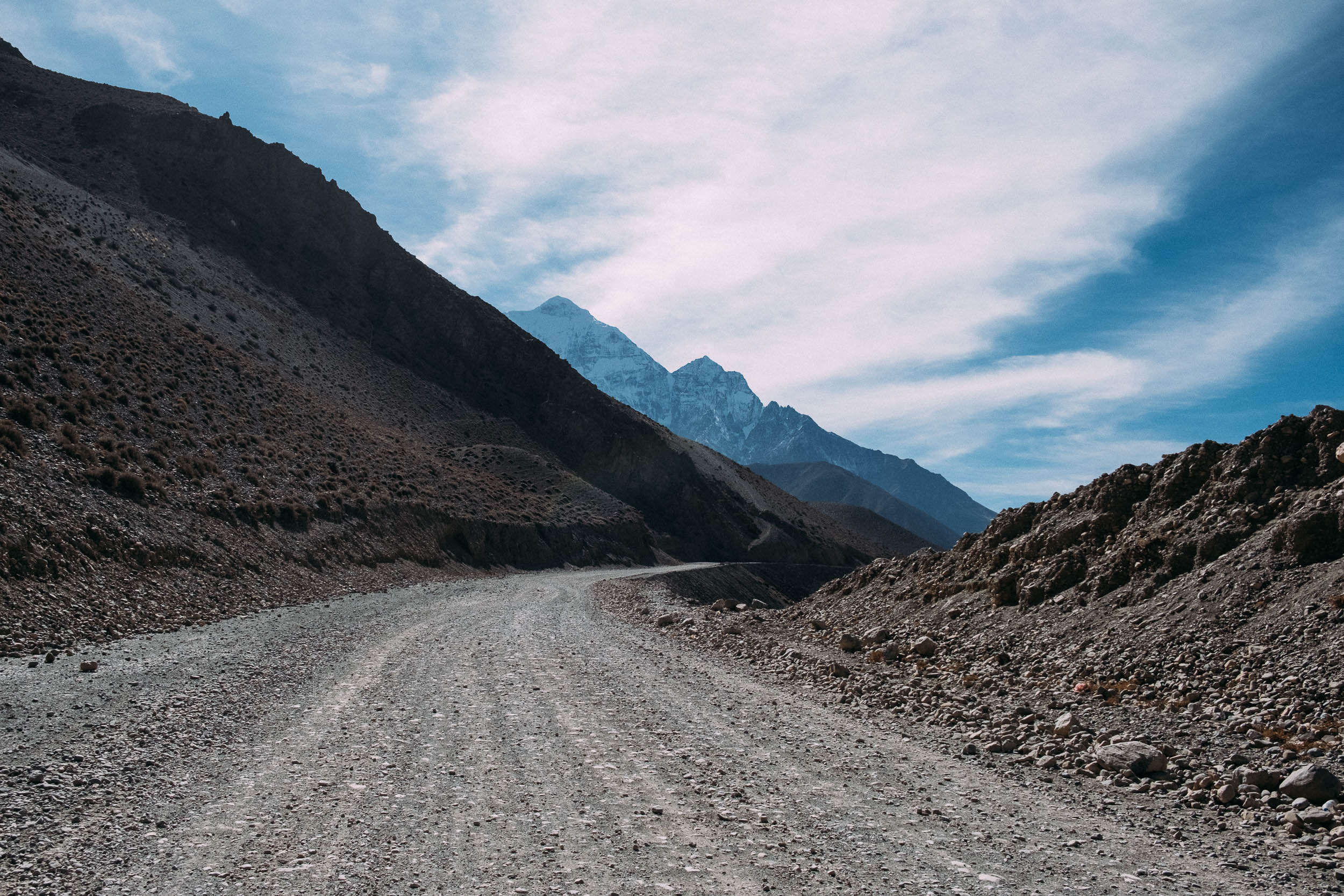
Muktinath – Jomsom
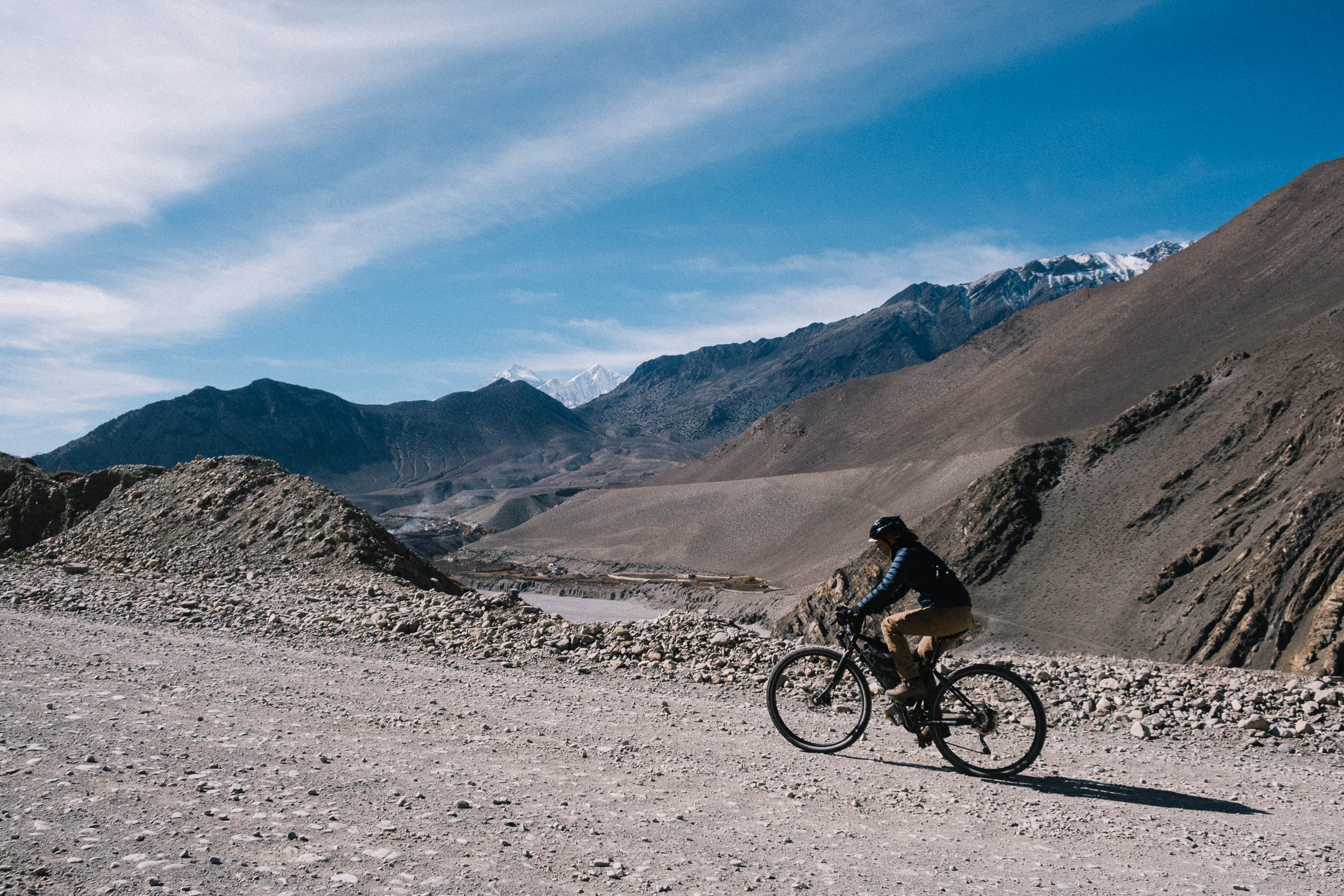
You won’t believe your eyes when you ride out of Muktinath, with beautiful hairpin turns on smooth asphalt. This fairytale is soon over because the surface quickly turns into a gnarly, rocky, dusty road. Get your buff out, because the busses racing by fill the air with clouds of dust.
Jomsom – Pokhara
There are more and more busses on the road that is literally falling apart in many places. You reach the leaf forest again and afterwards the subtropical jungle. The road is littered with rocks from landslides. Motor bikes, jeeps, and busses create long traffic jams. Carrying your bike over various sections of road work and other obstacles will likely be necessary along this stretch. There are some alternate hiking trails you can ride, marked by signs along the road. These will be a treat because the traffic can get very dull and you’ll already be missing the high-altitude singletrack by now. It’s very likely that on the way back down to Pokhara you’ll already be dreaming about your next adventure, though it may never top this one…
Points of Interest (by kilometer, counterclockwise from start)
- 18: Viewpoint Begnas Lake and Rupa Lake.
- 79: Big town of Besisahar—last opportunity to stock up on supplies at normal costs. Plenty of hotels. Also the first checkpoint to check permits.
- 104.8: Village of Syange—tea houses and restaurants.
- 125: Village of Dharapani—tea houses and restaurants.
- 143.3: Beautiful village of Chame. Plenty of tea houses and great place for fresh Nepali coffee.
- 155: Little detour possible to Upper Pisang. Great MTB trail.
- 158: Stunning part of the route between Chame, Pisang, and Manang with flowy trails.
- 173.5: End of the jeep trail.
- 174: Village of Manang; one of the biggest along the Annapurna Circuit. Lots of accommodations and restaurants. Great place for rest and acclimatization or day hikes. Permit check before entering Manang.
- 175: Start of steep hiking trail to the pass.
- 184.1: Village of Yak Kharka—tea houses and restaurants.
- 188.9: Amazing suspension bridge with snow-capped mountains in the background.
- 191.3: Village of Thorung Phedi. Last village before the pass. Tea houses and restaurants.
- 197.6: Thorung La Pass at 5,416 meters above sea level. Colored prayer flags.
- 210: Village of Muktinath—famous pilgrimage site for Buddhists and Hindus.
- 231.5: Village of Jomsom—lots of facilities (hotels, restaurants, police station, airport, and bus station).
- 279.7: Village of Tatopani—tea houses and restaurants. Natural hot springs.
- 340.4: Village of Nayapul—tea houses and restaurants


Terms of Use: As with each bikepacking route guide published on BIKEPACKING.com, should you choose to cycle this route, do so at your own risk. Prior to setting out check current local weather, conditions, and land/road closures. While riding, obey all public and private land use restrictions and rules, carry proper safety and navigational equipment, and of course, follow the #leavenotrace guidelines. The information found herein is simply a planning resource to be used as a point of inspiration in conjunction with your own due-diligence. In spite of the fact that this route, associated GPS track (GPX and maps), and all route guidelines were prepared under diligent research by the specified contributor and/or contributors, the accuracy of such and judgement of the author is not guaranteed. BIKEPACKING.com LLC, its partners, associates, and contributors are in no way liable for personal injury, damage to personal property, or any other such situation that might happen to individual riders cycling or following this route.
Please keep the conversation civil, constructive, and inclusive, or your comment will be removed.