


Top of the South (TOTS), NZ
Distance
688 Mi.
(1,107 KM)Days
20
% Unpaved
75%
% Singletrack
15%
% Rideable (time)
95%
Total Ascent
57,677'
(17,580 M)High Point
4,510'
(1,375 M)Difficulty (1-10)
5?
- 5Climbing Scale Moderate84 FT/MI (16 M/KM)
- -Technical Difficulty
- -Physical Demand
- -Resupply & Logistics
Contributed By
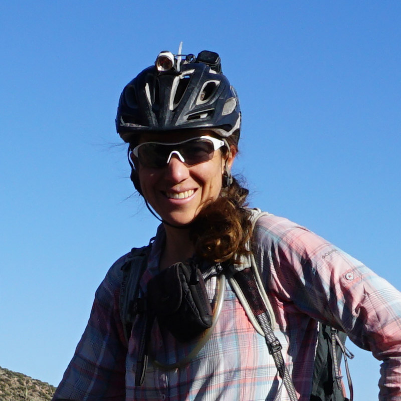
Eszter Horanyi
EZ Gone Coddiwompling
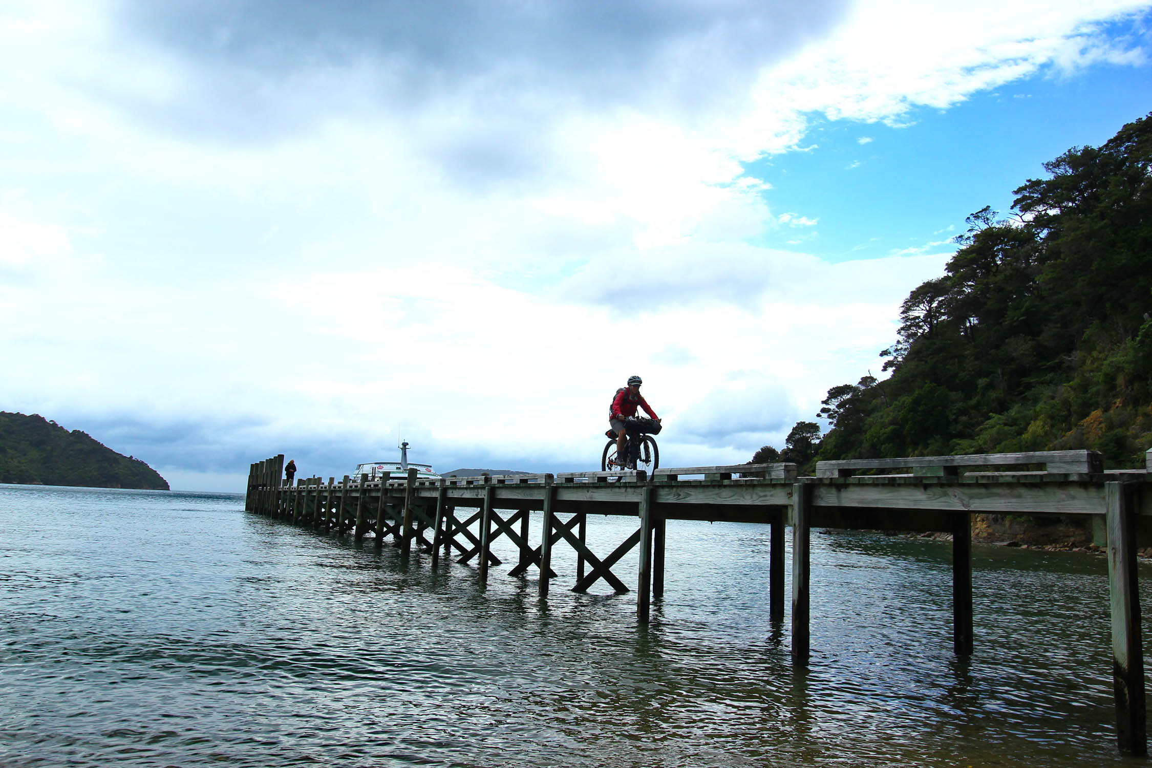
Please note: Because of seasonal route closures, the TOTS route is accessible to bikes from May 1st until November 30. Variations can be done throughout the year, as discussed later. Ride from Hanmer Springs, easily accessed from Christchurch, or take the Interisland ferry to start in Picton.
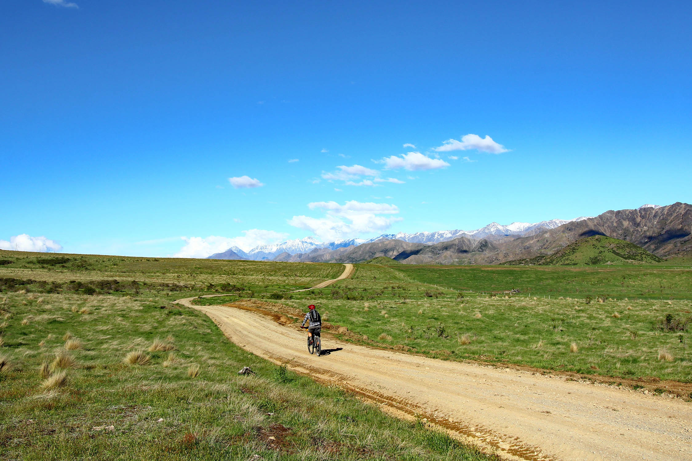
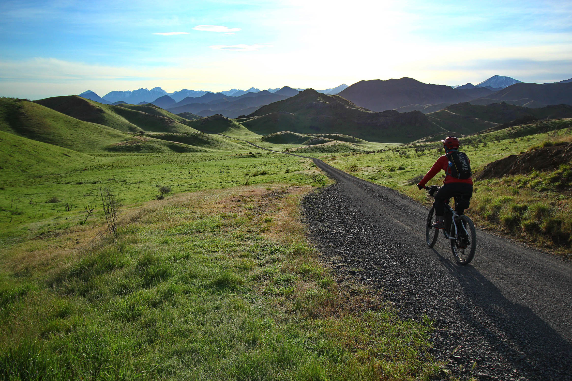
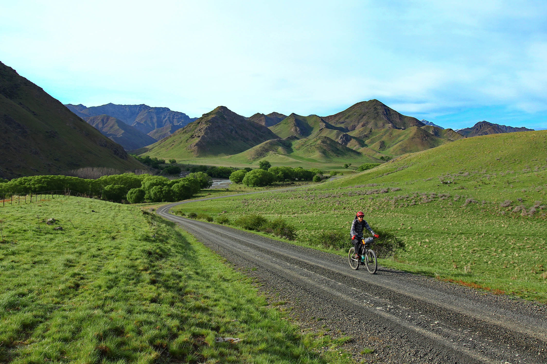
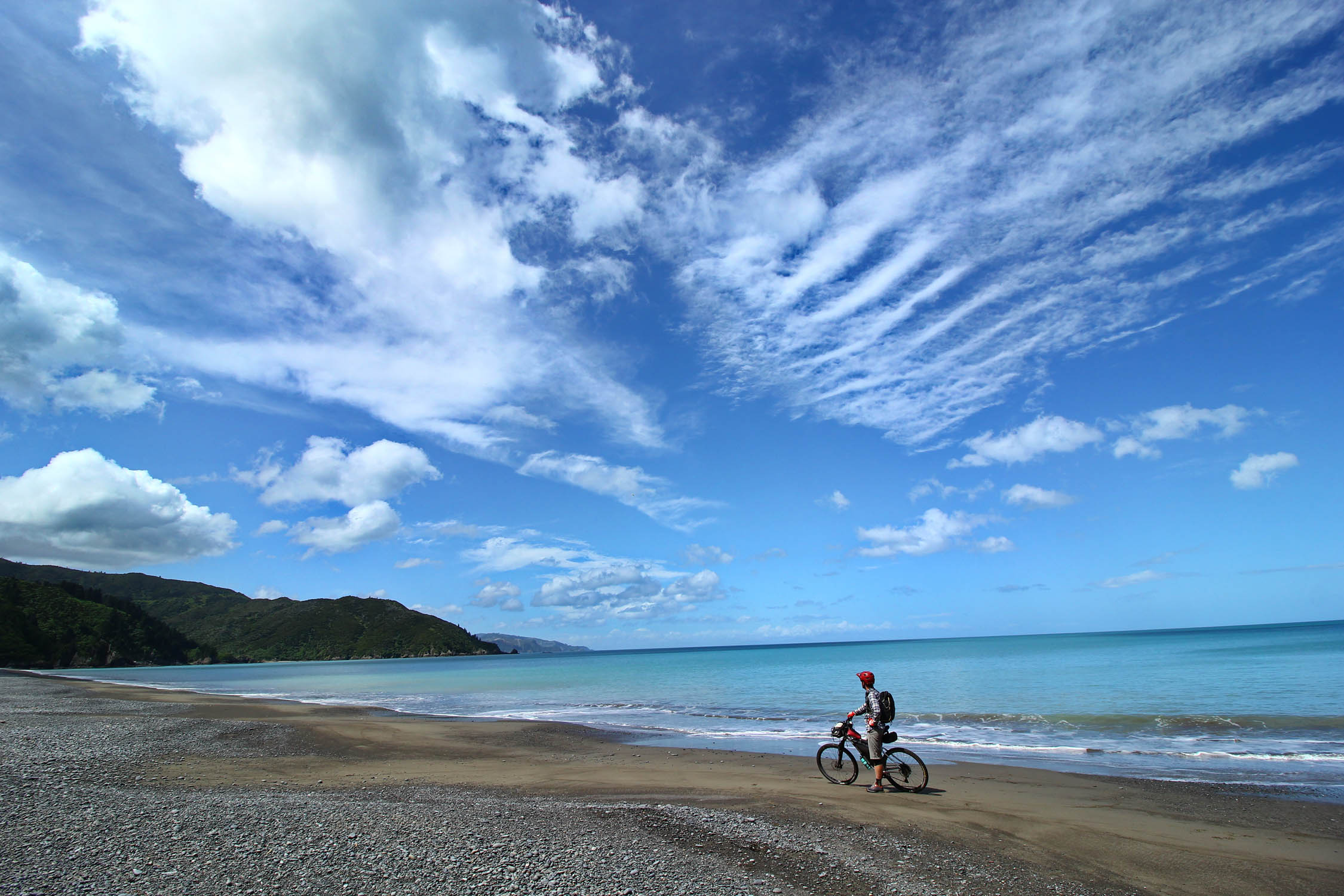
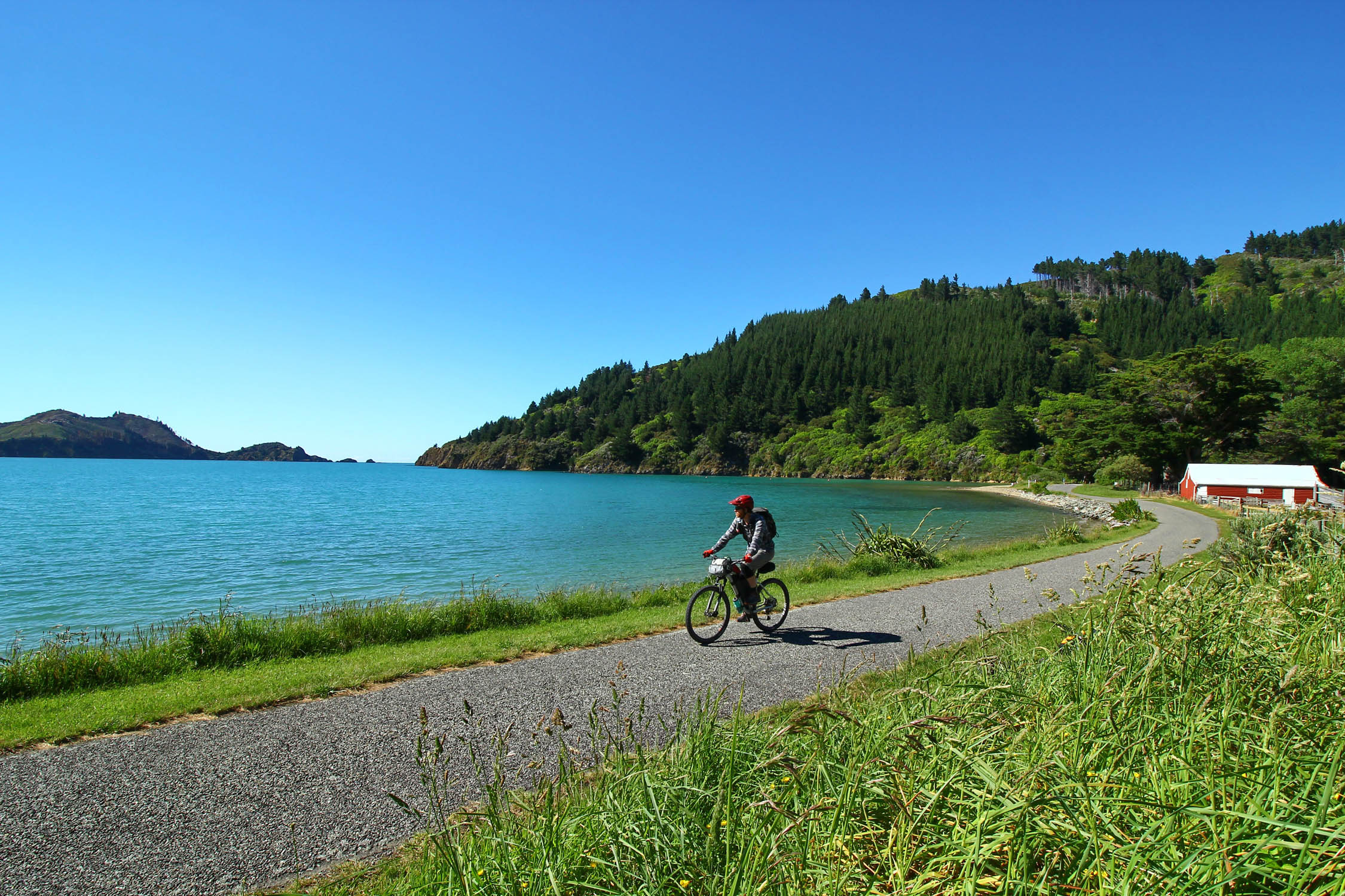
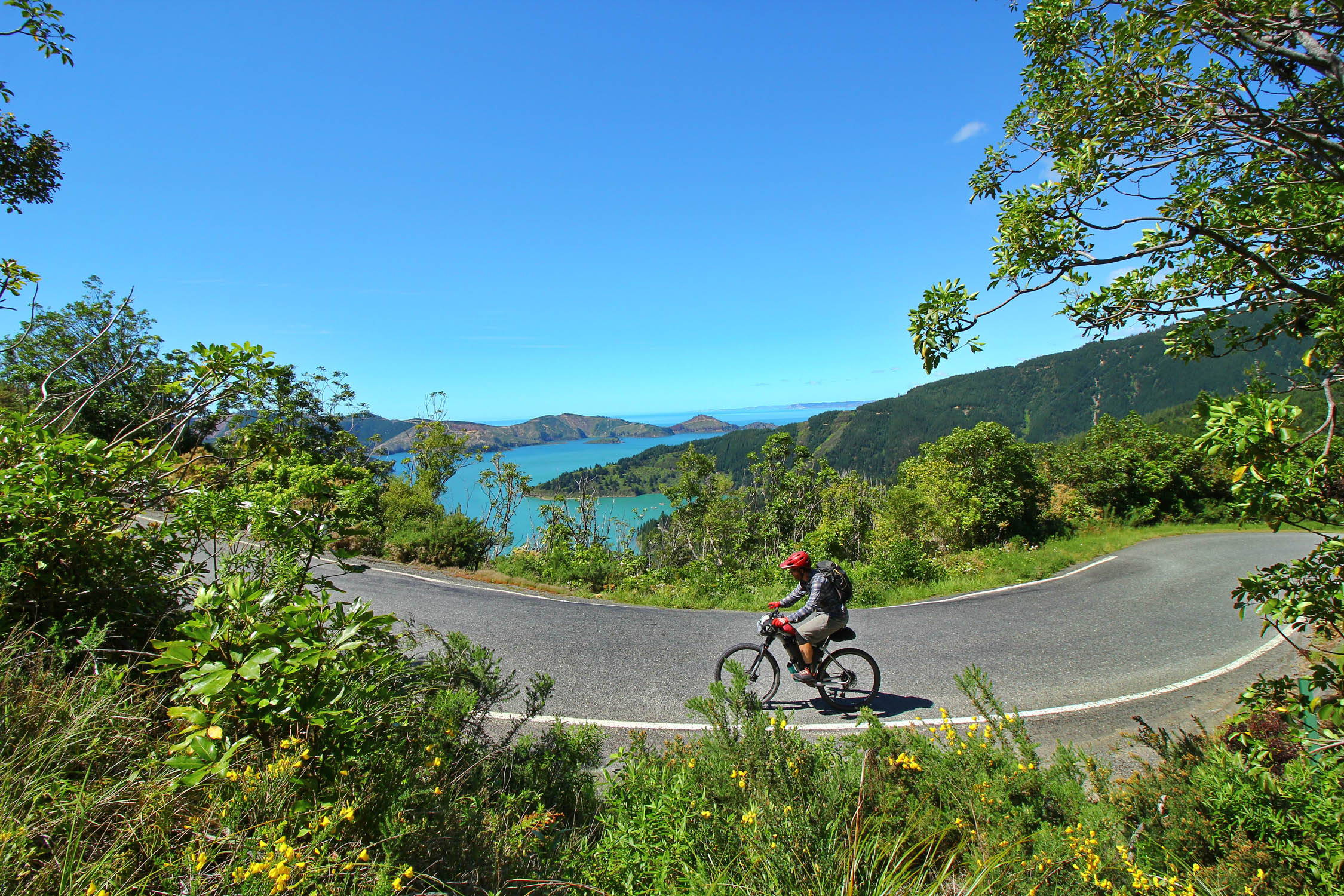
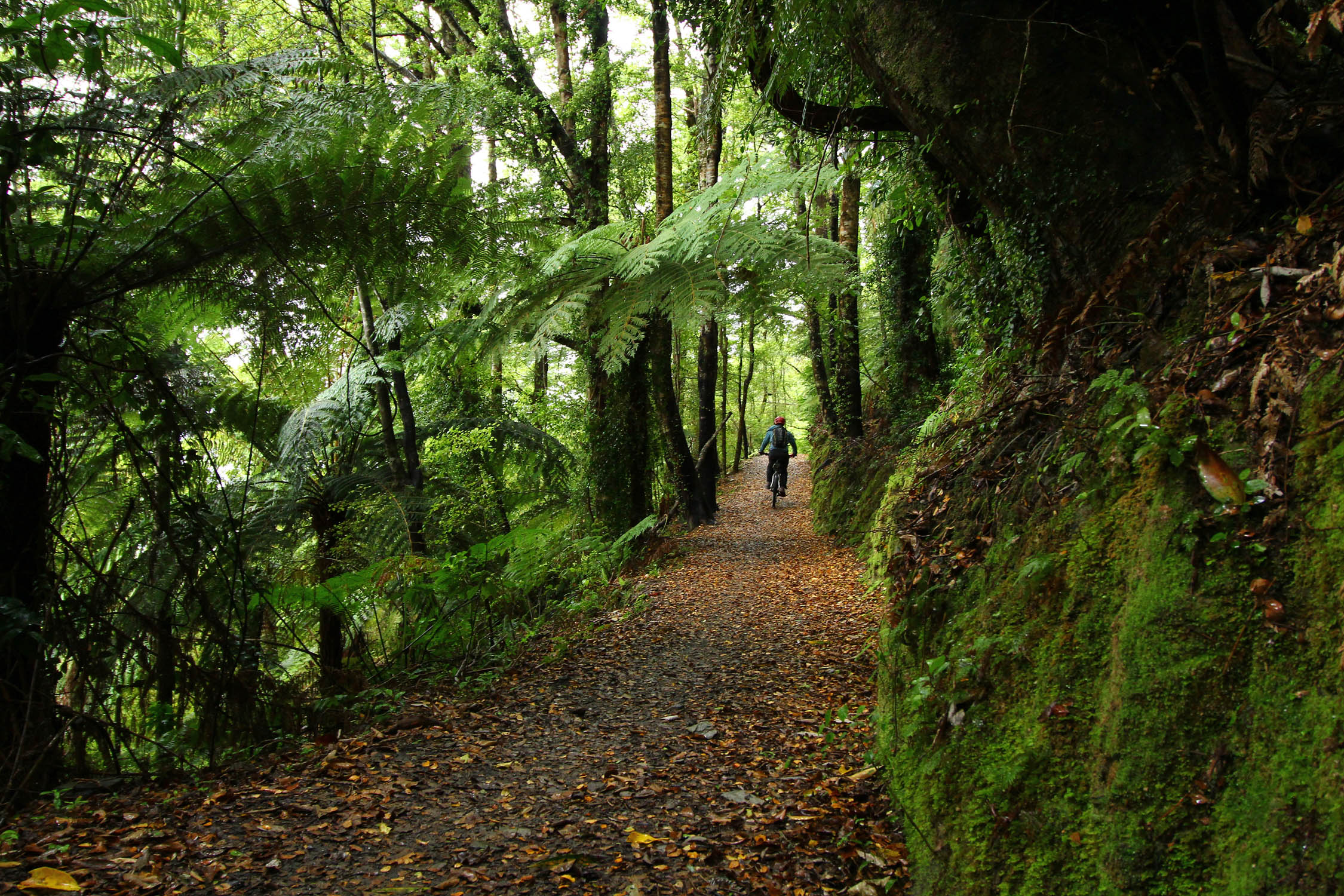
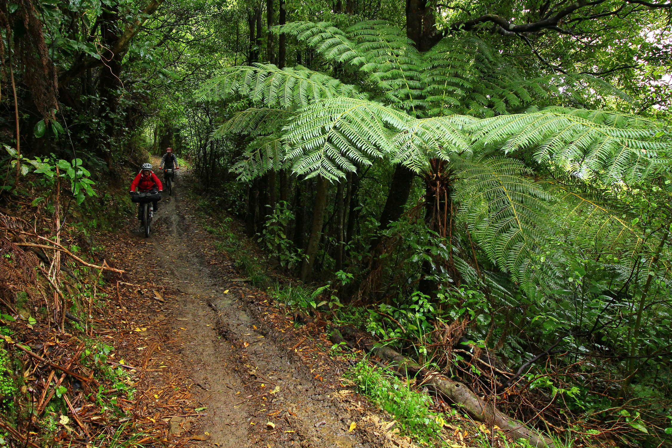
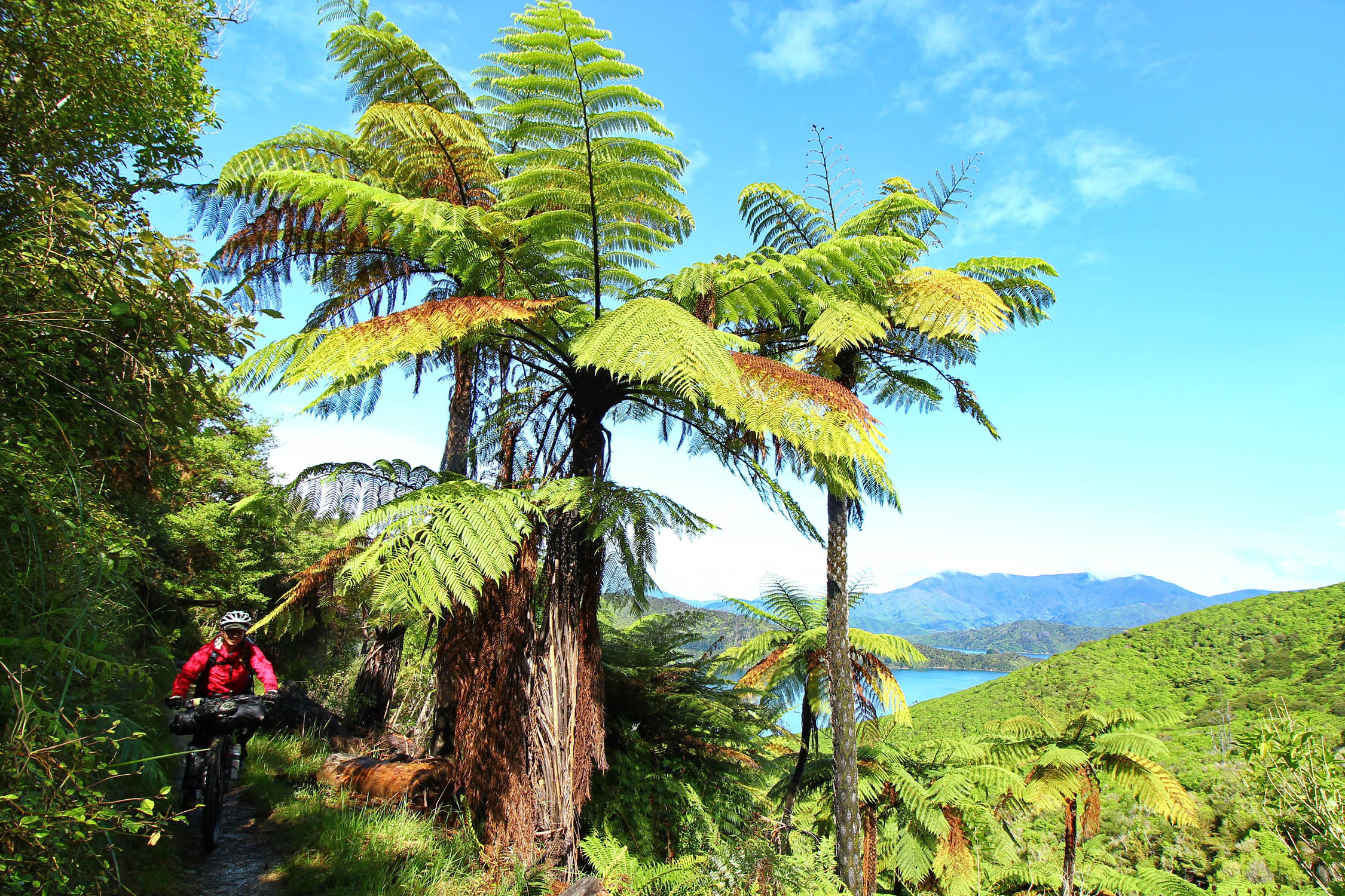
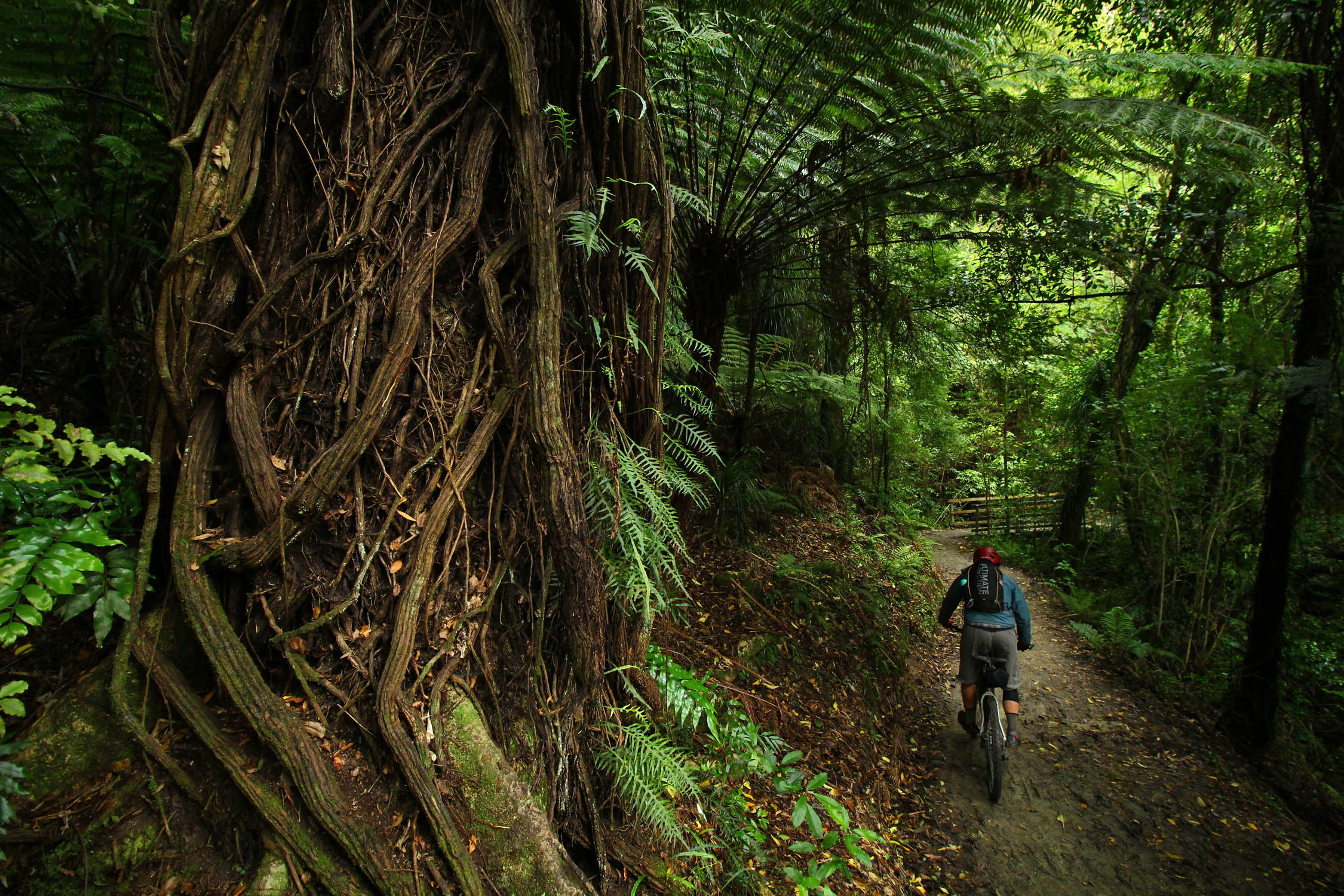
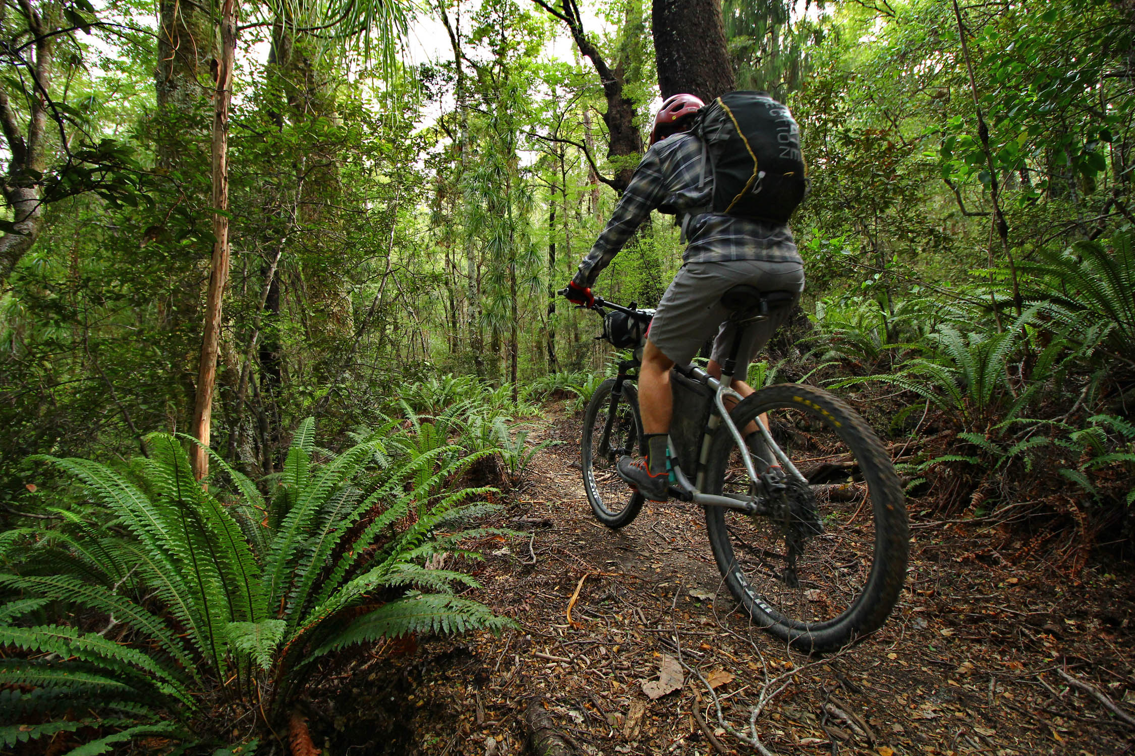
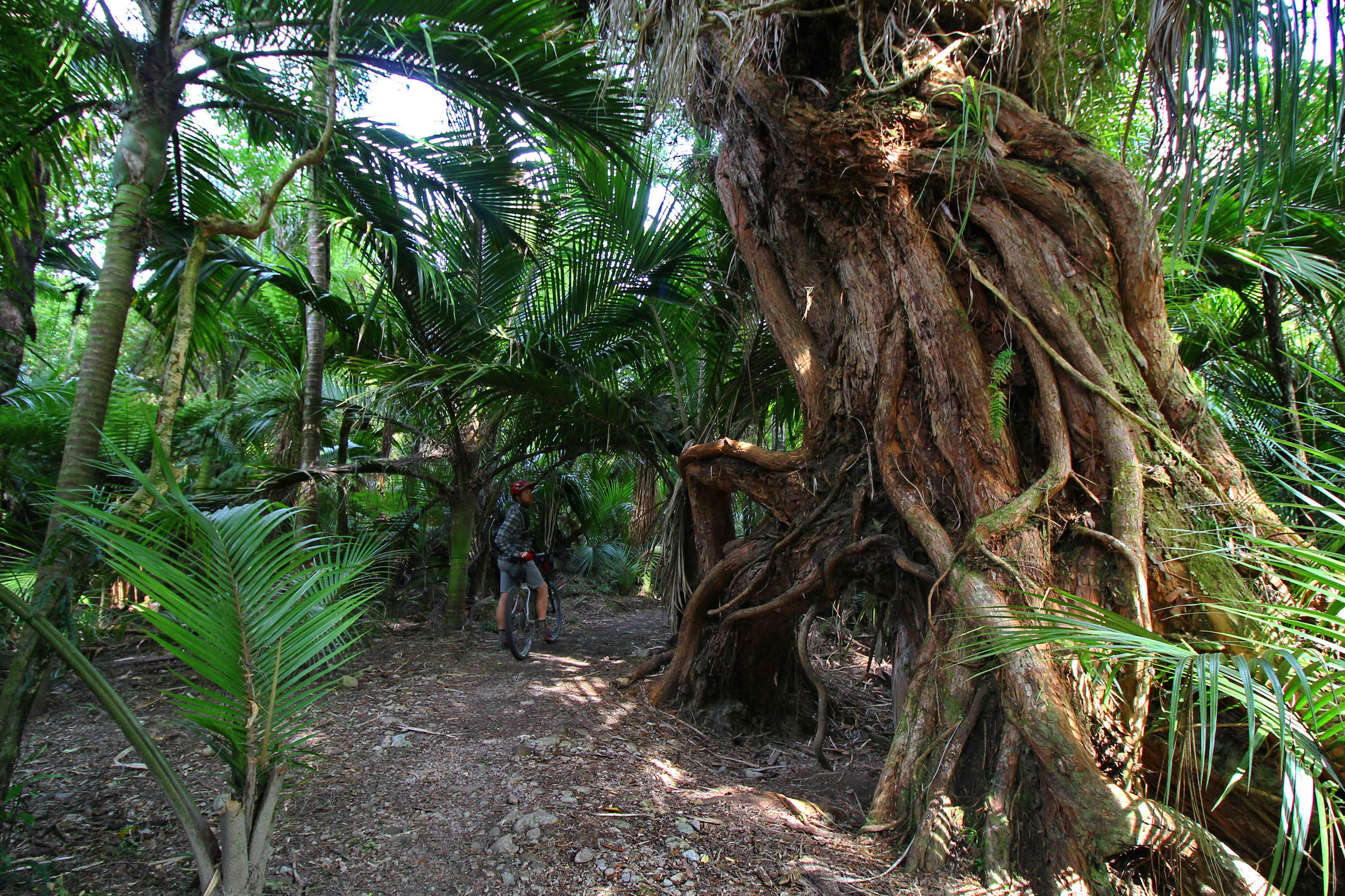
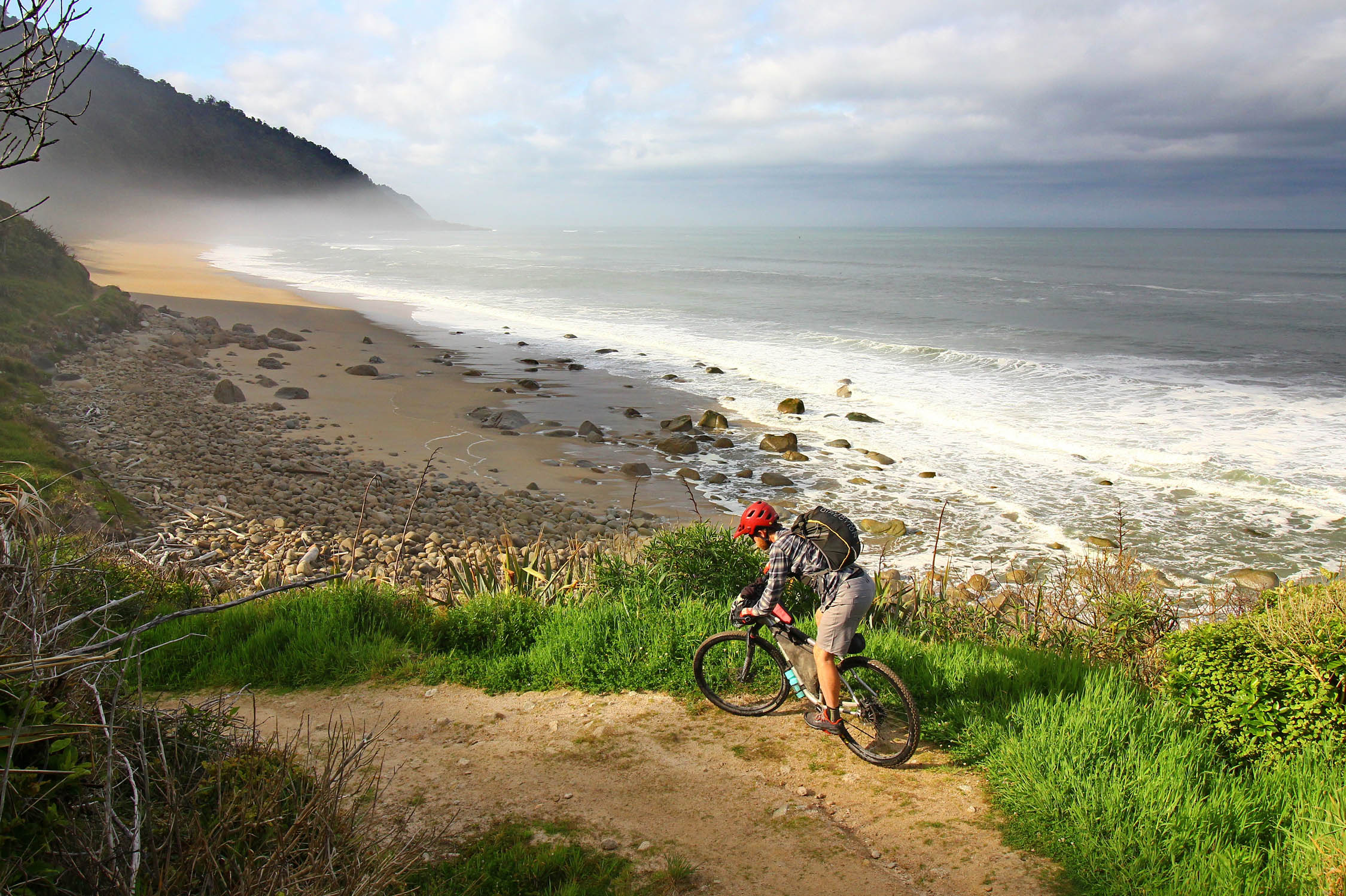
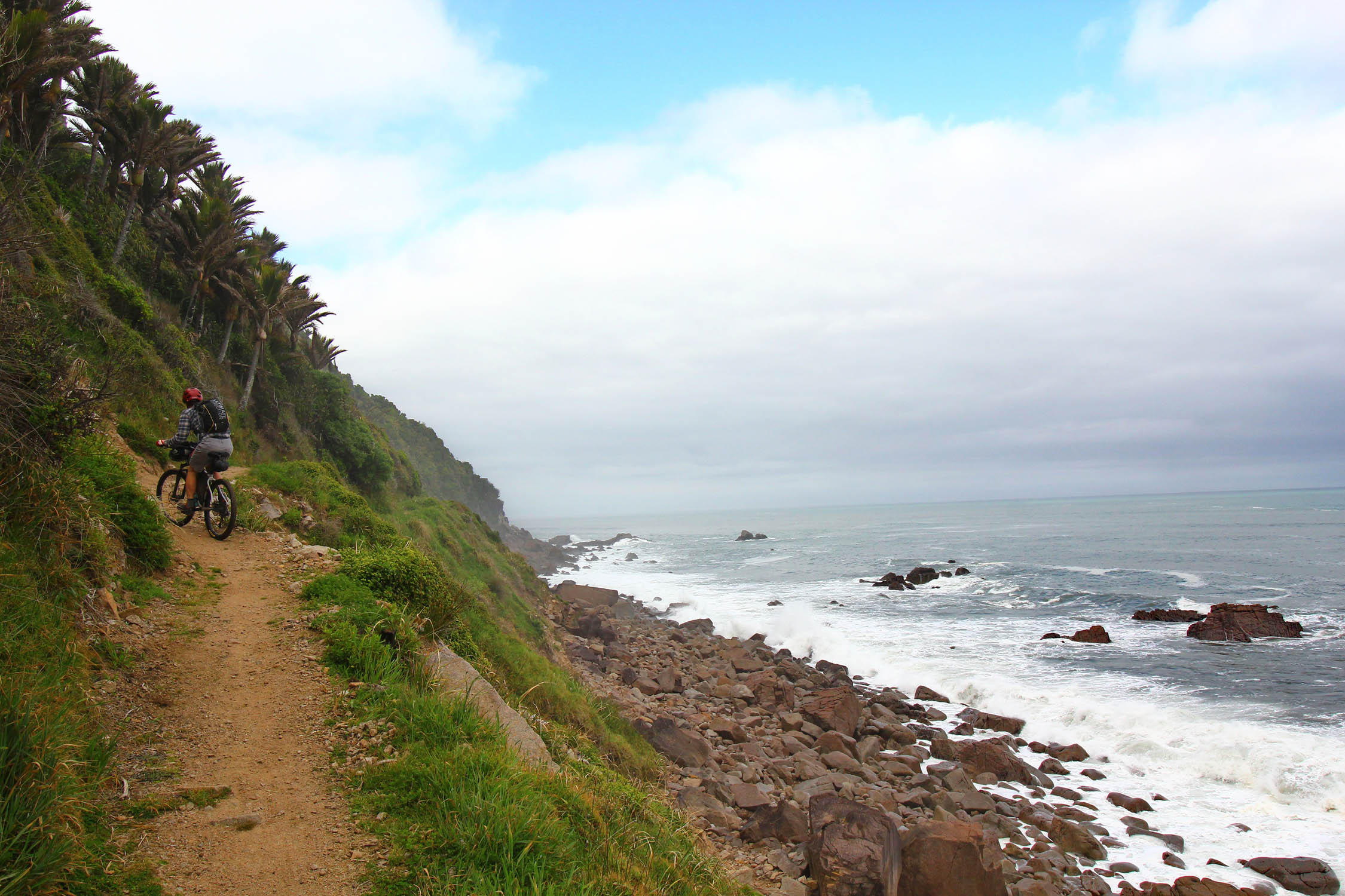
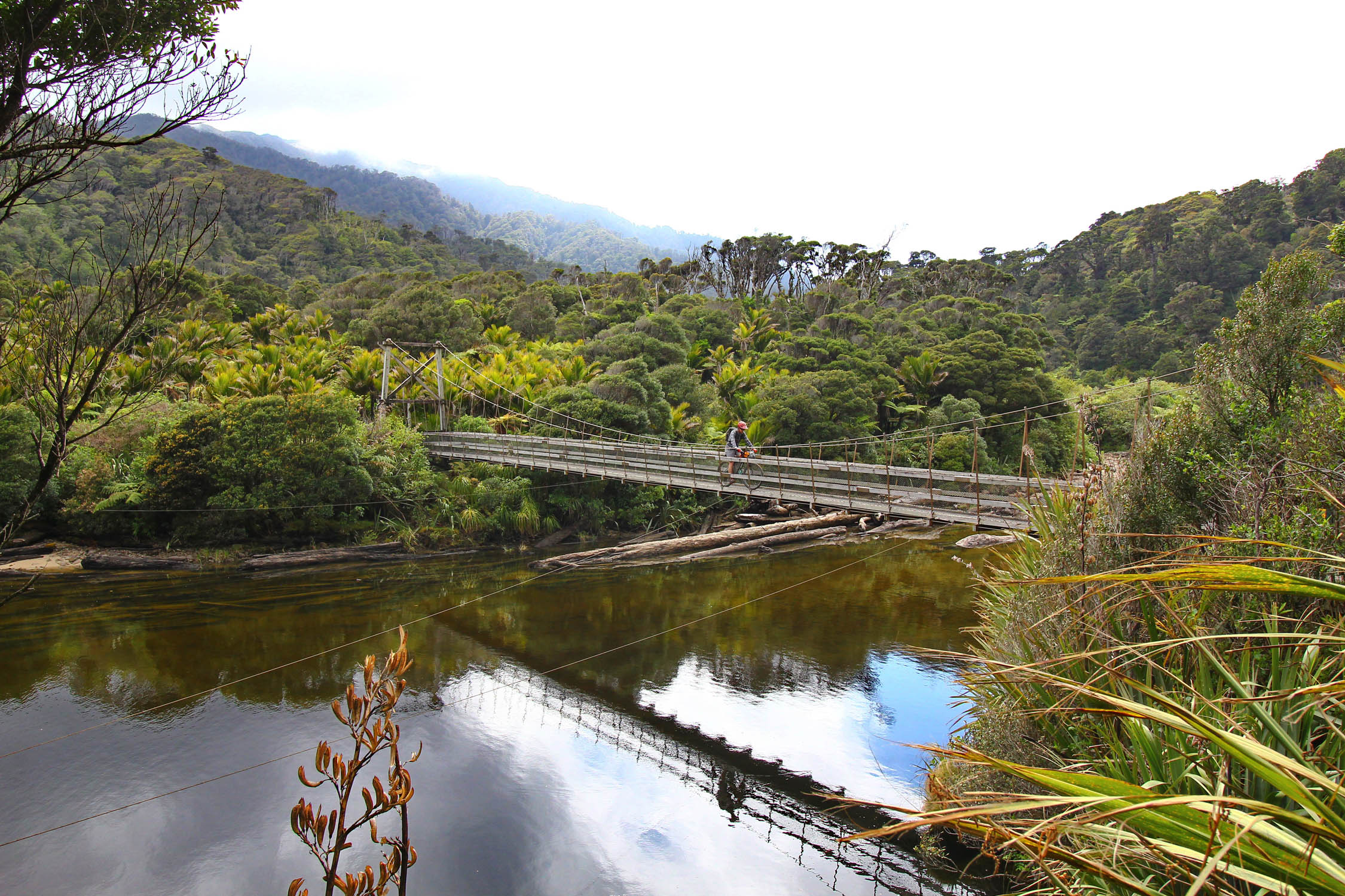
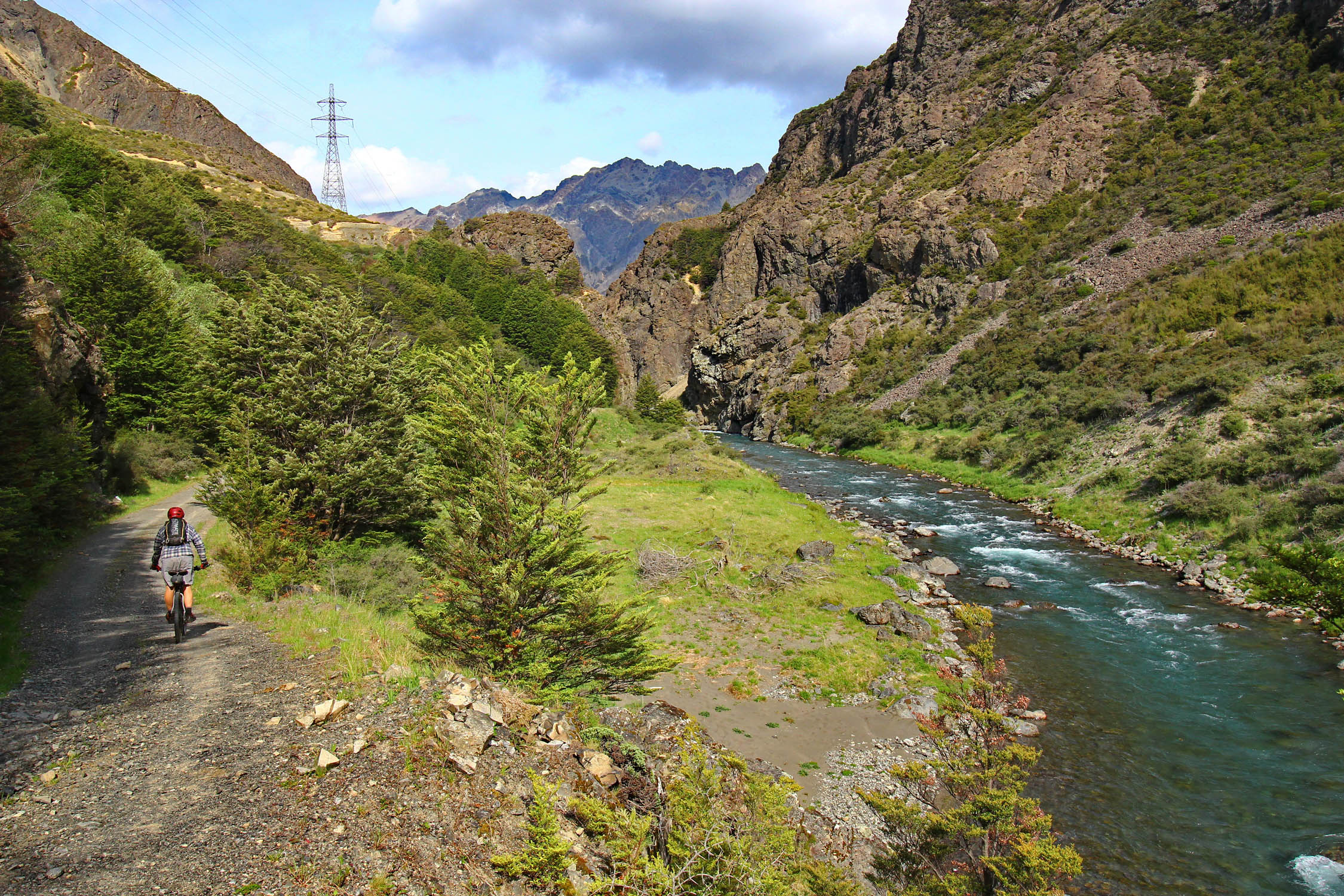
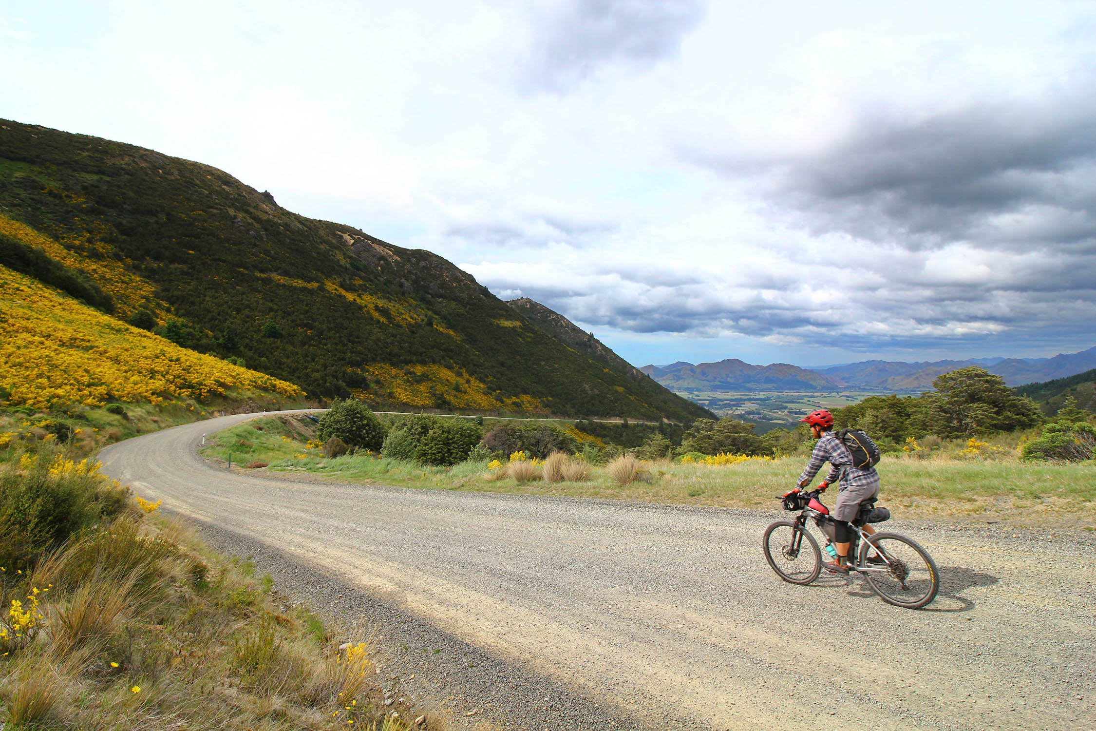
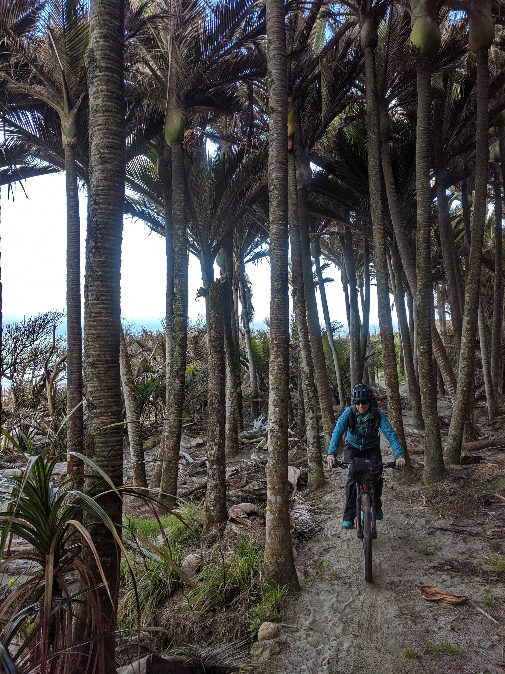
While the west coast of New Zealand is covered in thick rainforest, the central and eastern portions have stunning, wide-open plains. The TOTS tour showcases high-country sheep stations, two of the designated Great Rides in the country, the giant lakes of Nelson Lakes National Park, rainforests, beaches, the remote back roads of the Denniston Plateau, and the newly constructed St. James Cycle Trail. It even includes two boat rides. Roads and tracks link up the alpine village of Hanmer Springs, the port town of Picton, the sunny mountain bike mecca of Nelson, the hippy Golden Bay area, the wild West Coast, and the quaint hamlet of St. Arnaud.
The Queen Charlotte and Heaphy Great Rides combine with the St James Cycle Trail and the Historic Rameka track to provide extended periods of fun mountain biking. The Molesworth Muster Track, Nelson Great Taste Trail, and Rainbow Road are all parts of the NZ Cycle Trails Network and provide a low-traffic gravel experience.
Route Development
Many of these routes were developed as part of the Kiwi Brevet and the Tour Aotearoa, both created by the Kennett brothers. The Kiwi Brevet event is currently organized by Scott and Jo Emmens. The Historic Rameka Track was created with help from the Kennett Brothers and is maintained by locals in the Golden Bay area. There’s a great Kiwi bikepacking community responsible for all of this info. Thanks!
Route Difficulty: The TOTS tour is rated as a 5/10 overall. Here are the other metrics: Technical: 5; Physical demand: 6; Resupply and logistics: 4.


Highlights
Must Know
Camping
Food/H2O
Trail Notes
Resources
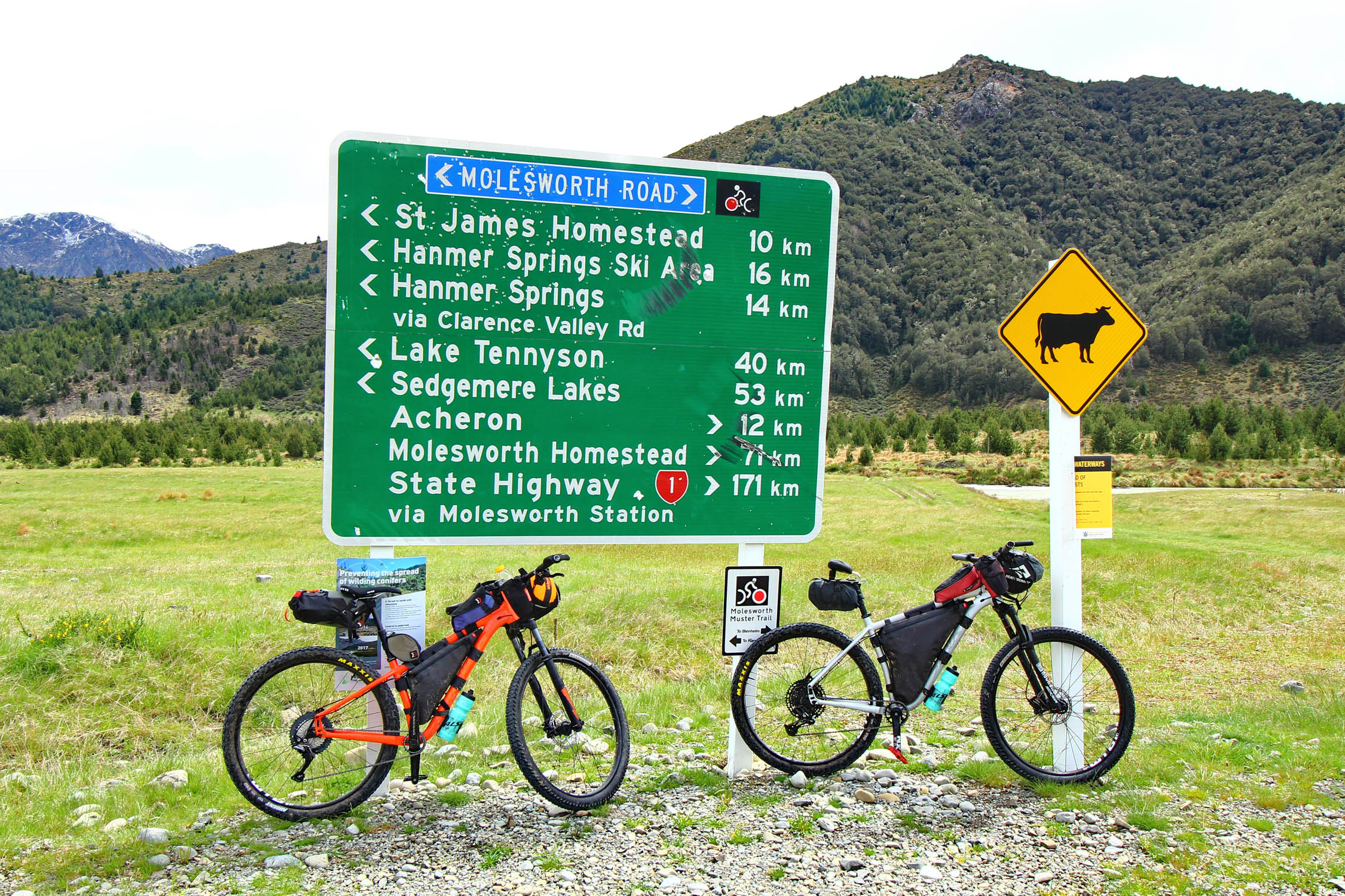
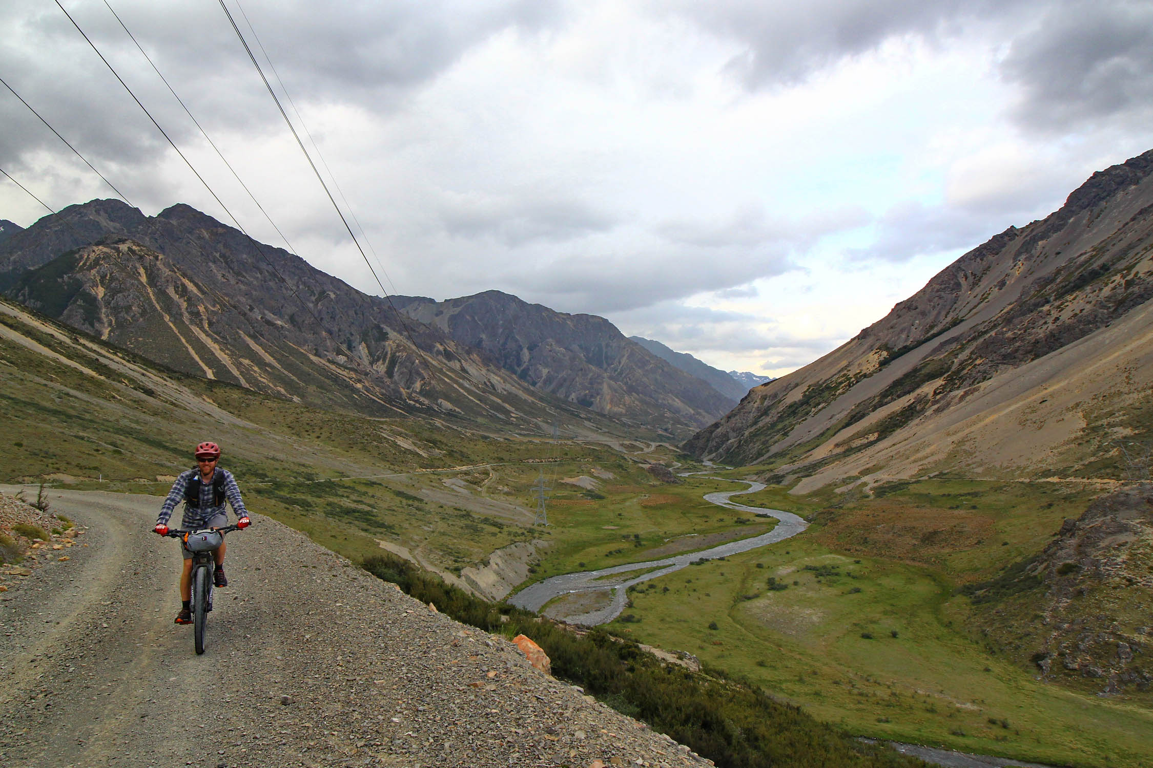
- Molesworth Muster Route – The largest working sheep station on the South Island, now donated to the Department of Conservation.
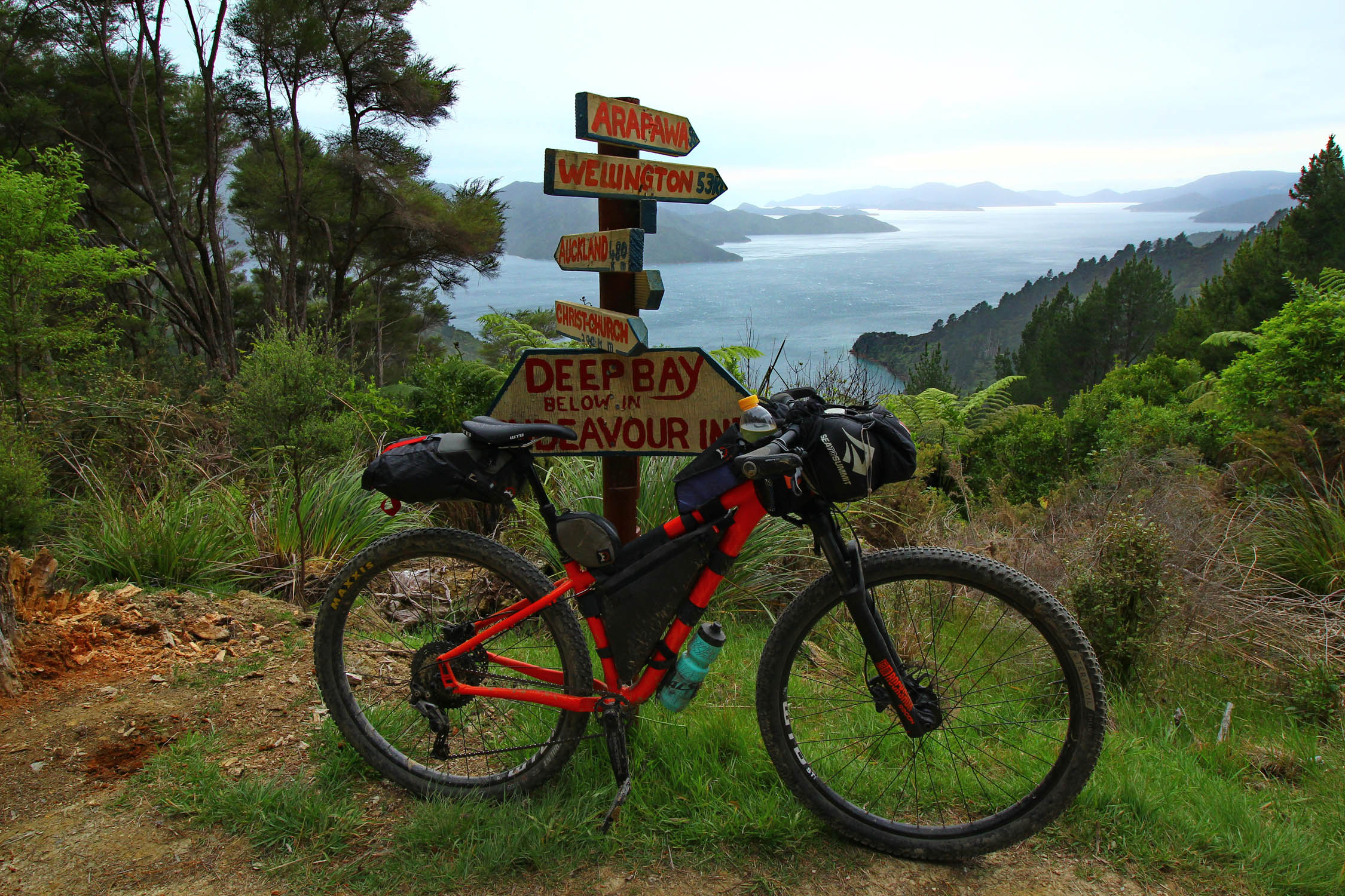
- Queen Charlotte Track – Take a boat ride to Captain Cook’s favorite anchorage at Ship Cove to start the ride. Have your luggage taken to specific campsites for fun unloaded riding.
- Murderer’s Rock – Practice ambushing your riding partners from Murderer’s Rock, where a gold heist and murders took place on the Maungataupu in 1866.
- Tame giant eels – Stop at the Jester’s House on the Tasman Great Taste Trail to see and feed giant freshwater eels living in the neighborhood stream.
- Harwood’s Hole – Take a walk from Canaan Downs to the deepest vertical shaft of a cave in NZ and see stunning karst rock formations.
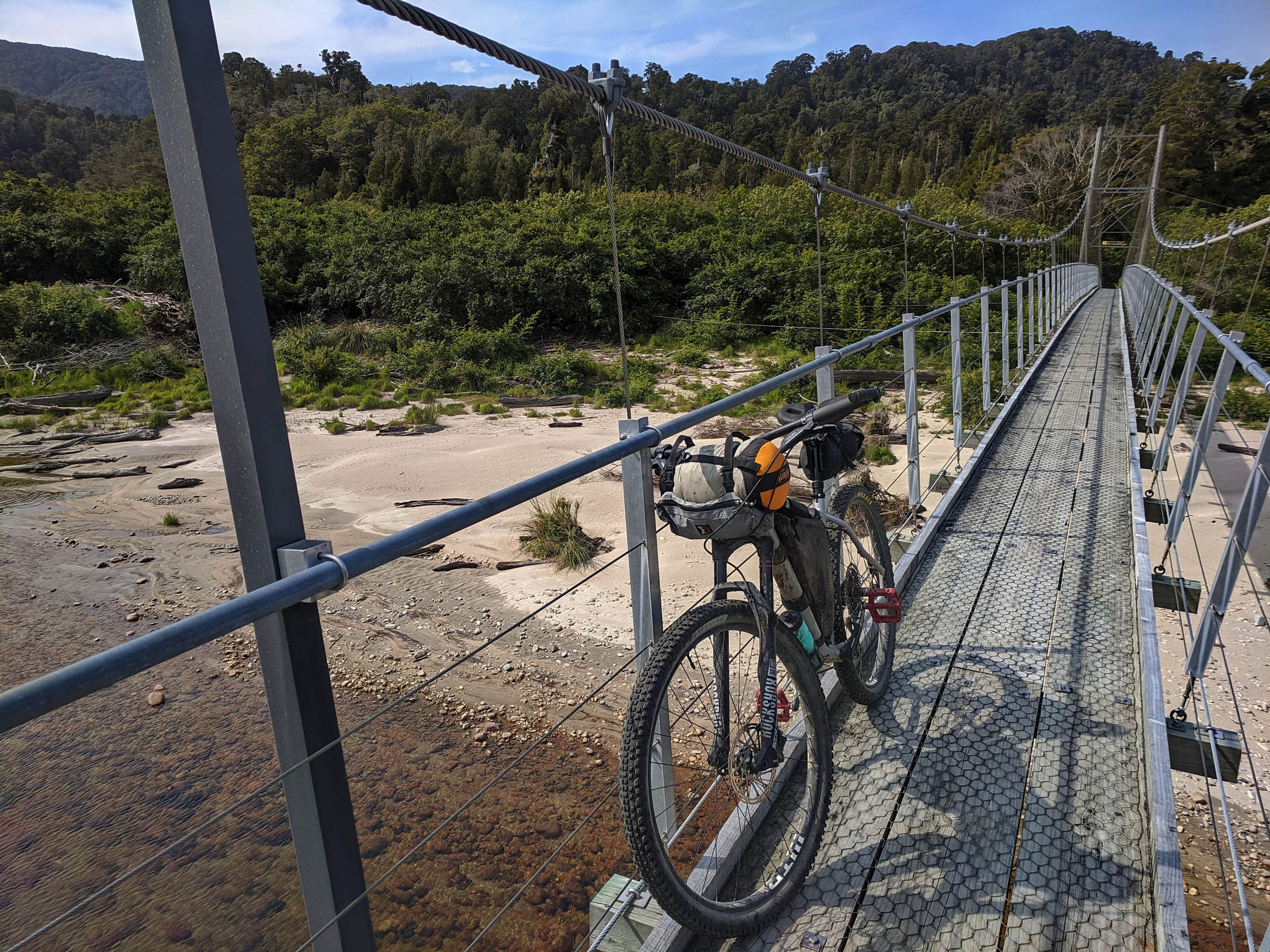
- Heaphy Track – A NZ Great Walk/Ride with incredible diversity and takahē birds, once thought to be extinct but now being reintroduced onto the mainland.
- Scullery Coffee Cart – Outstanding coffee before you start your climb into the Denniston Plateau.
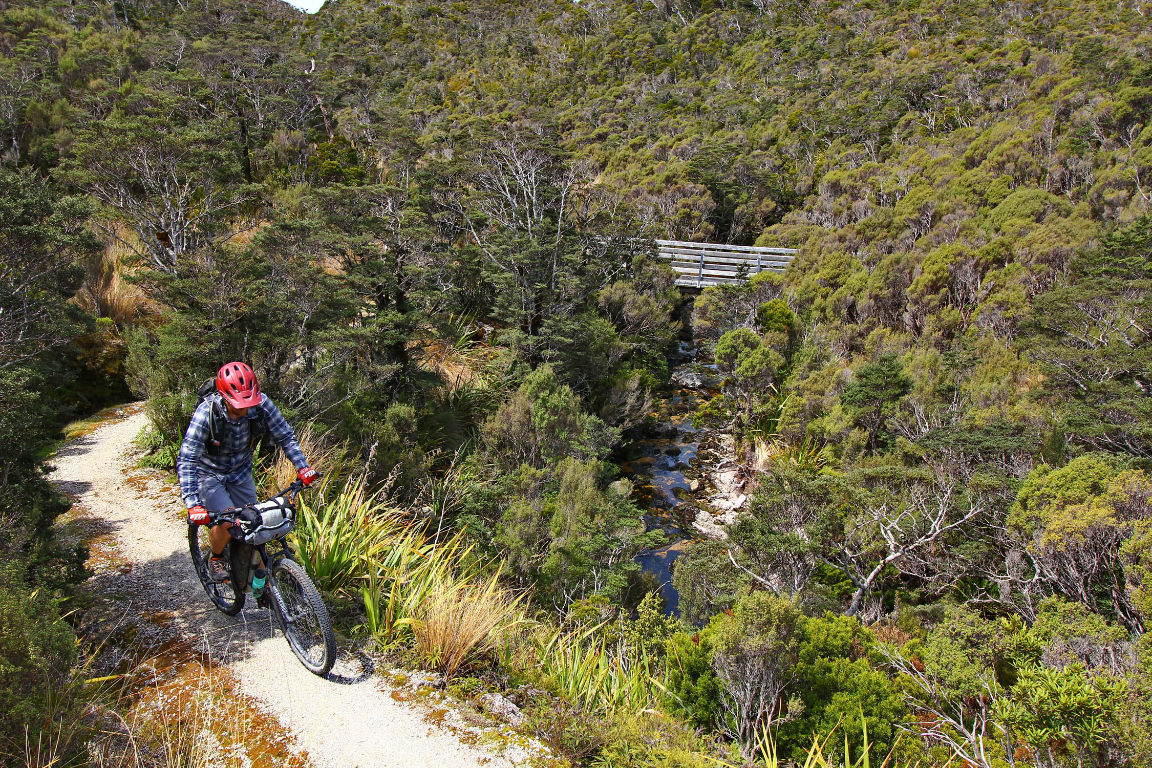
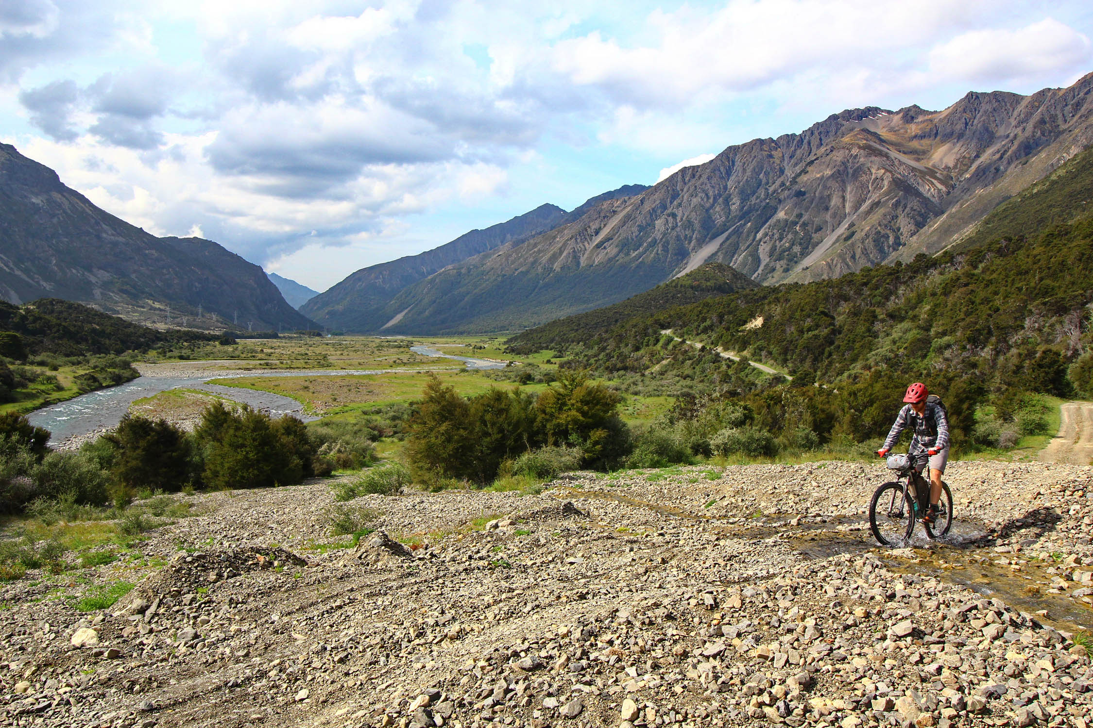
- Rainbow road – Follow the stunning Waiau River through Hell’s Gate and into the high country.
When to go
- This loop can only be ridden in its entirety from May 1st to November 30.
- November weather can be clear and beautiful or rainy and miserable. Or both. Several alternate options are discussed under “Trail Description.”
Logistics
- Booking a boat to Ship Cove from Picton gets you to the far end of the Queen Charlotte track. This can be done through Beachcomber Cruises. You’ll also have to pay a $25 fee for crossing the private land portions of the track.
- Camping on the Heaphy Track needs to be pre-booked on the Department of Conservation (DOC) website. Both huts and camping options are available.
- You must request permission to ride the Rainbow Road and a pay a $5 per bike fee. Check the website for current conditions and phone numbers.
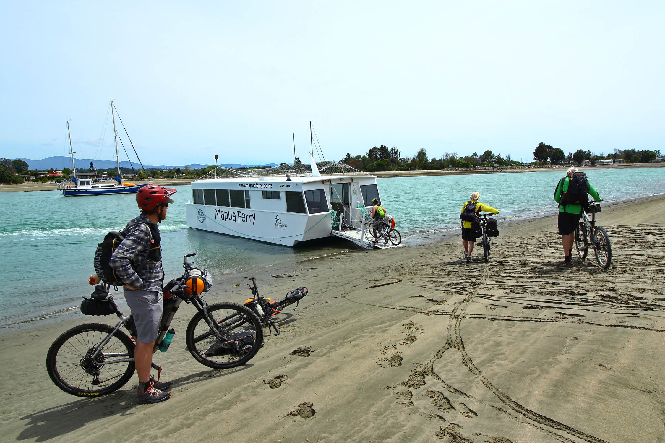
- Take the Mapua ferry from Rabbit Island to Mapua while on the Tasman Great Taste Trail. Ferry runs every hour and costs $8.
Dangers
- Severe weather, flooding, and earthquakes are all part of life in New Zealand. Slips (landslides) closing roads is commonplace. Be prepared to be flexible.
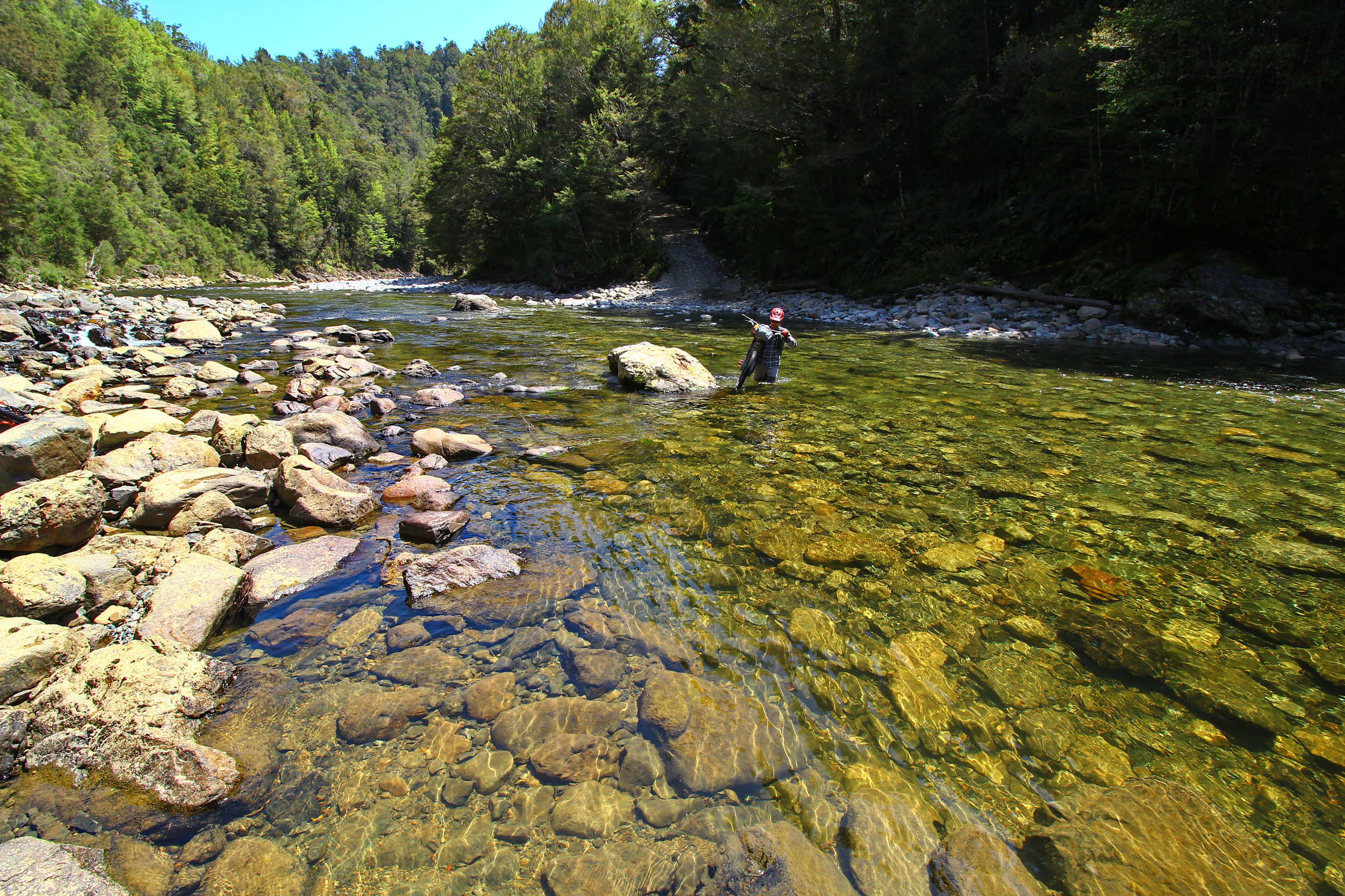
- The Mackley River on the Denniston Plateau cannot be crossed safely when running high. Don’t try to cross during a rain event or on the day following one.
- The sun is exceptionally strong. Be diligent with sunscreen.
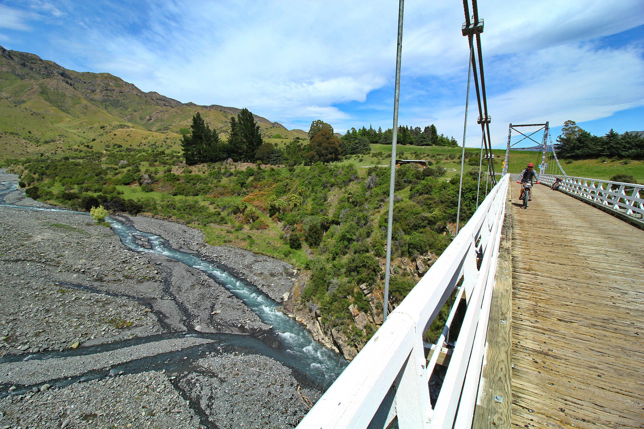
- Highways in NZ are narrow and winding. People drive very fast. This route only includes two small sections that need to be negotiated with care: Havelock to Pelorous Bridge and the end of the Denniston Plateau to Murchison. Riding before 9:00 AM seems to be key if possible.
- Sandflies. Be warned!
Travel Basics
- The Hanmer Connection shuttle can take you from Christchurch to Hanmer Springs. There are bike assembly stands at the Christchurch airport. For a Picton start, fly into Wellington and take the Interisland ferry to Picton.
- Americans can travel on a three-month tourist visa waiver program by applying for an Electronic Travel Authorization online.
- Denatured alcohol is called methylated spirits and can be found in gas stations and grocery stores. Isobutane canisters are available in many places.
- Most DOC campsites cost $8 per person.
- Most towns have a holiday park with various amenities. Tent camping will be $15-$20pp.
- Camping is allowed on all DOC land, except for within 500 meters of the Heaphy Track (and other Great Walks). See map of DOC land on DOC website.
- Download the Rankers or WikiCamp app for more camping options
Key Camping on Route
- Molesworth Muster Route – There are two campsites (Acheron Accommodation House and Cob Cottage) that bookend a 70km section of road that can only be ridden from 7:00 AM – 7:00 PM and can’t be camped on. After Cob Cottage, camping options are non-existent until a free site at the base of Taylor Pass.
- Port Underwood Road – Free DOC campsite at Robin Hood Bay.
- Queen Charlotte Track – Several DOC campsites are available. Much of the track crosses private farms and can’t be camped on.
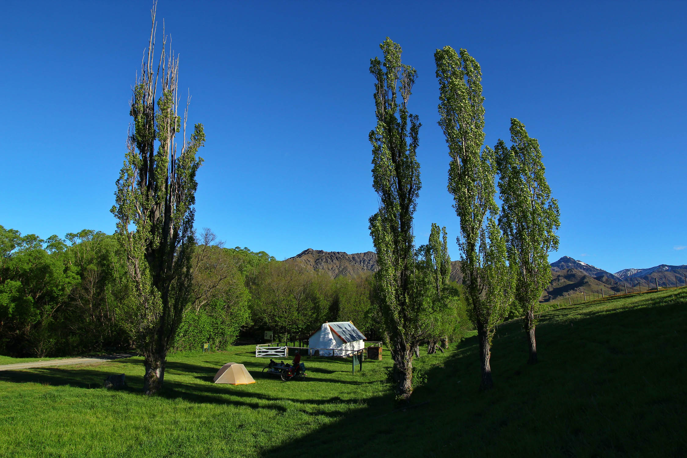
- Great DOC campsite at Canaan Downs before starting the Rameka Track. Mountain bike tracks to ride, and a hike to Harwood Hole is worth the effort.
- Heaphy campsites/huts need to be pre-booked. The Heaphy hut is at a stunning location and should not be missed. If camping at Heaphy Hut, watch out for the cheeky weka birds. They can get into feedbags and will steal anything that is unattended.
- The Denniston Plateau is on DOC land and has several nice campsites. No camping once you cross the farm gate 5km from the end.
- No camping on the Rainbow Road until crossing the second locked gate. There is a DOC campsite just outside of the station. The Sledgemere Sleepout and Island Hut are on the route before crossing Island Pass. Pre-buy a $5 hut pass at any DOC office to stay a night in a hut.
- St James Cycle Trail has several huts to stay in. Buy hut passes at a DOC office.
- Water is everywhere. This trip can be done with a single 0.6L filter bottle without going thirsty.
- Queen Charlotte track has several cafes on route. The Punga Bay cafe is located near a DOC campsite about a five-hour ride from the boat drop-off and serves up beer, pizza, and coffee in an oceanside setting.
- Takaka to Karamea over the Heaphy Track is the longest stretch without resupply. Get your last coffee and ice cream in Bainham, 15km before the start of Heaphy.
Alternates
- Old Ghost Road instead of the Denniston Plateau. Riding the Old Ghost Road in the “wrong” direction may actually be easier than the Dennison Plateau route. A flat fee is charged to use any of the huts/camp on route (take two days or five, same price), or pay a smaller fee to ride the 85kms in one day.
- Skip the St James Cycle Trail. Stay straight on the main Top House Road following the Clarence River instead of turning up Maling Pass to ride St James. This will save you a day of riding.
- Skip the Porika climb out of Lake Rotoroa. Head out to the highway at Lake Rotoroa and ride it to St. Arnaud to skip a pretty major hill with a good bit of hike-a-bike (but stunning views).
Outside of November Options
- The Molesworth Road is open from Labour weekend (end of October) to Easter weekend.
- The Heaphy Track (mile 392-440) is open to mountain bikes from May 1 to November 30.
- To ride before Labour weekend, skip the Rainbow Road and Molesworth Muster Route by riding 100km of fairly quiet pavement between St. Arnaud and Blenheim.
- After November 1 on the Queen Charlotte, you can take a boat to Camp Bay, instead of Ship Cove, and ride the track from Kenepuru saddle. You’ll have to skip the Heaphy completely, but from Nelson, you can take the Golden Downs route to St. Arnaud and choose how to continue from there.
Trail Notes
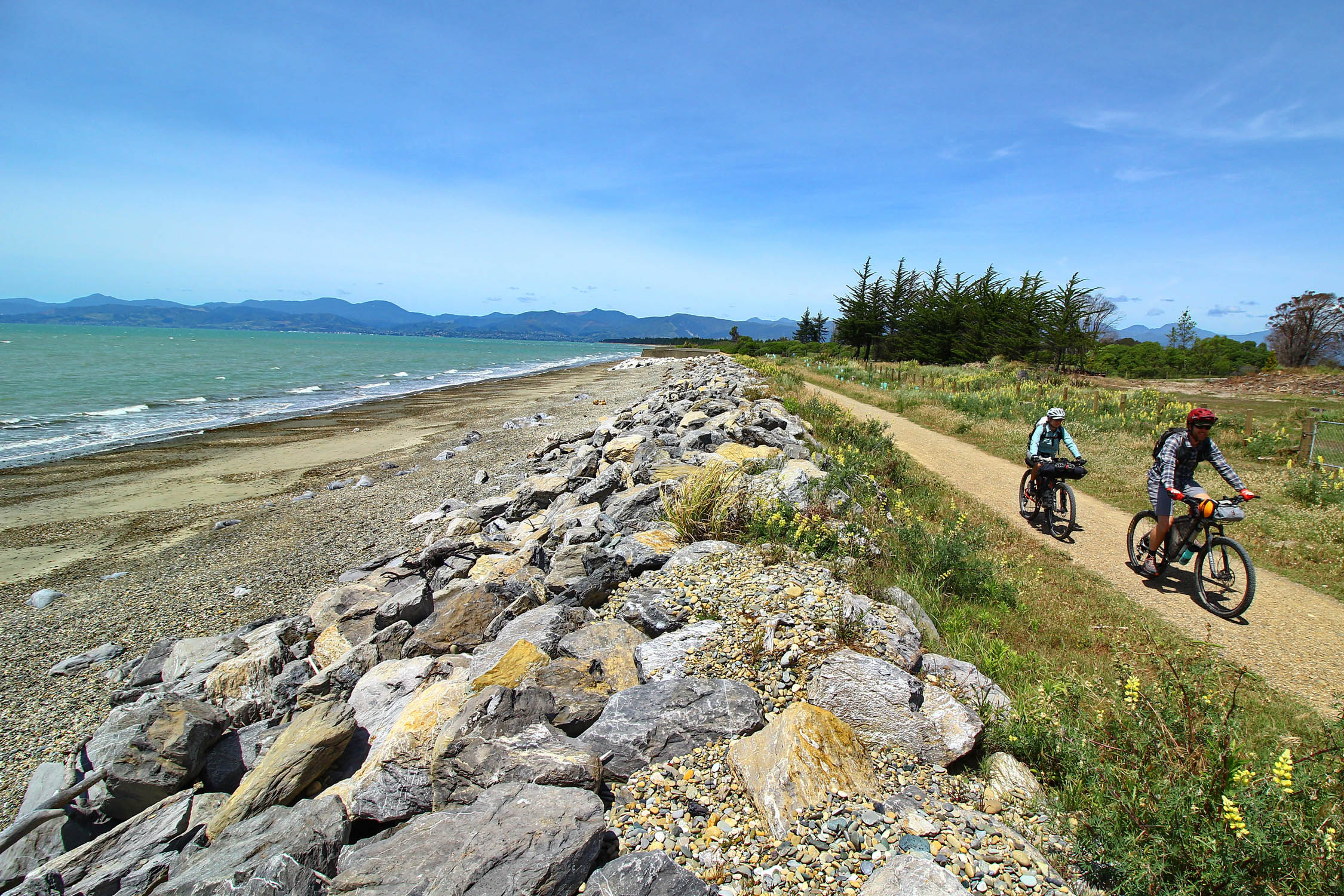
- Hanmer Springs – Blenheim. Molesworth Muster Route and Taylor Pass is wide open, good gravel with a paved section in the Awatere Valley.
- Bleniem – Picton. Port Underwood Road is a hilly gravel route with very few cars.
- Queen Charlotte Track. Some singletrack, some doubletrack. There are some steep hike-a-bikes in the second half.
- Pelorous Bridge to Nelson via Maungataupu. This is a big hill that gets progressively steeper and looser as you near the top.
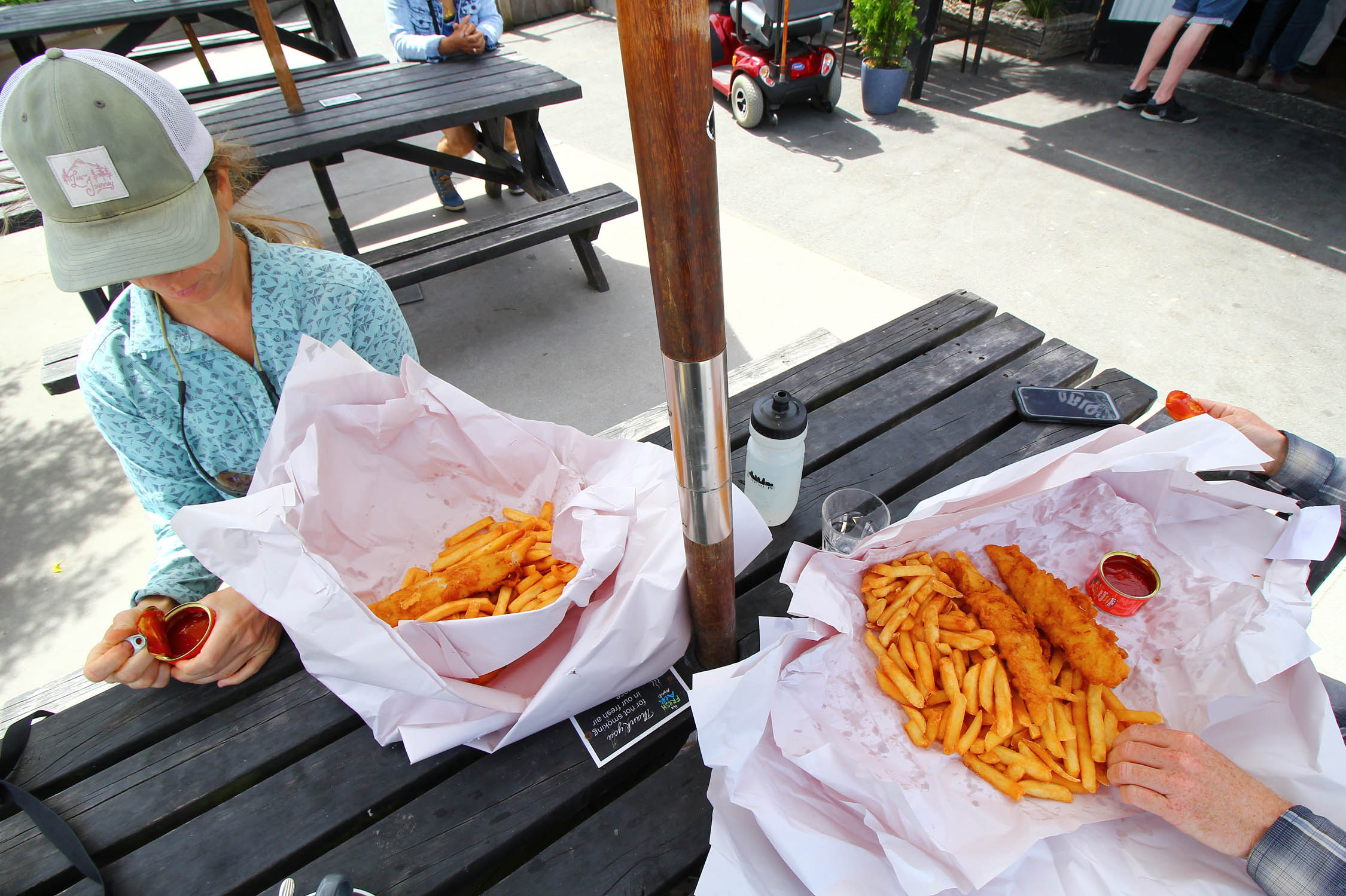
- Tasman Great Taste Trail. A set of bike paths and some quiet back roads from Nelson to Motueka. Don’t miss the eels or the fish and chips in Mapua.
- Takaka Hill to Canaan Downs. Paved to the top of Takaka Hill (there’s also a cafe here), ride this section early in the morning to avoid traffic. Gravel climbing to Canaan Downs.
- Rameka Track. Choose your own adventure. First ride the pack track through Abel Tasman National Park, then choose between a gravel road descent, a fun and challenging trail down Lower Rameka, or a Grade 5 shred down some technical trails.
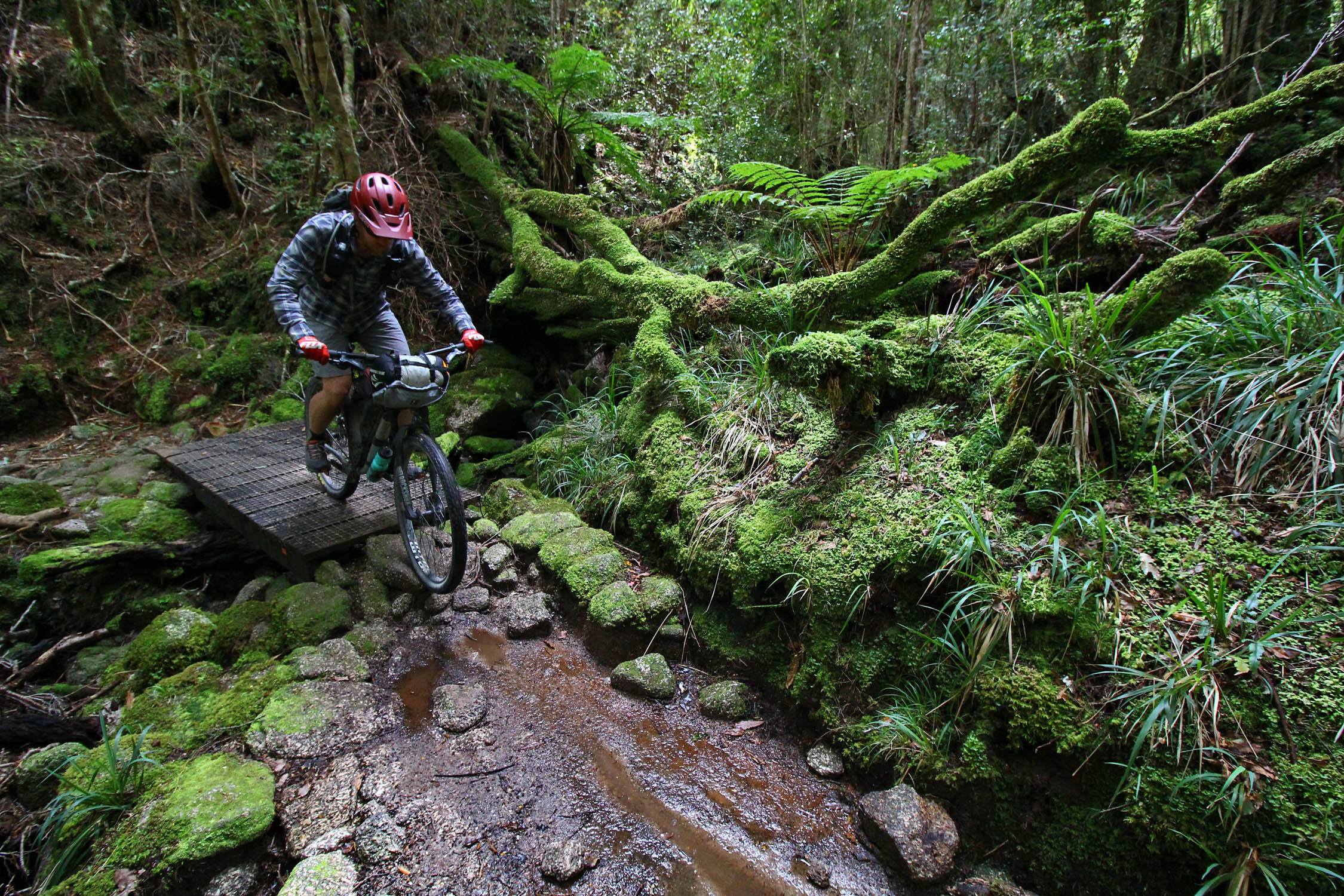
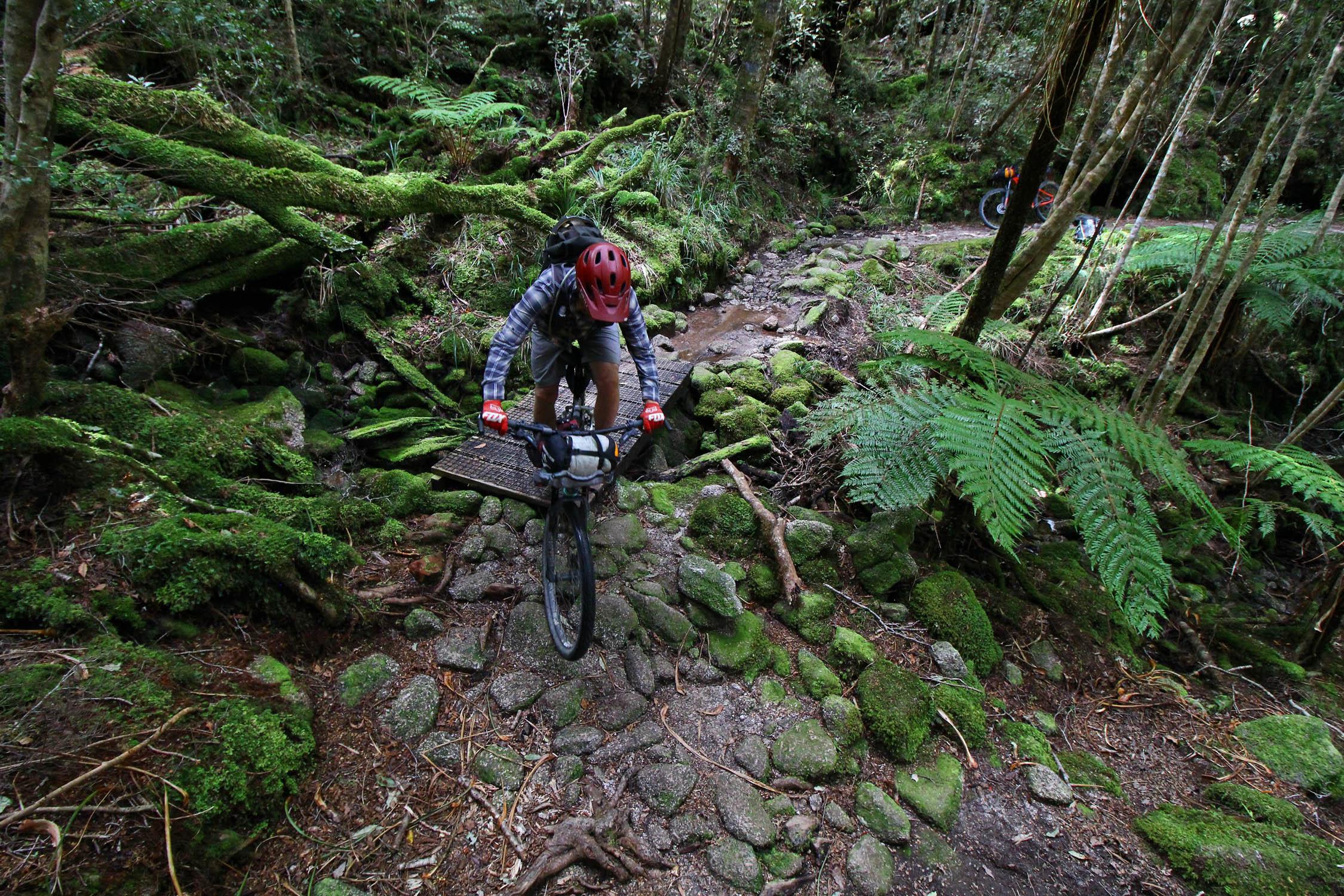
- Heaphy Track. One of the most diverse 70km of trail you’ll see. Be extra nice to any hikers you encounter. Mountain bike privileges are still being viewed as a trial and can be removed at any time.
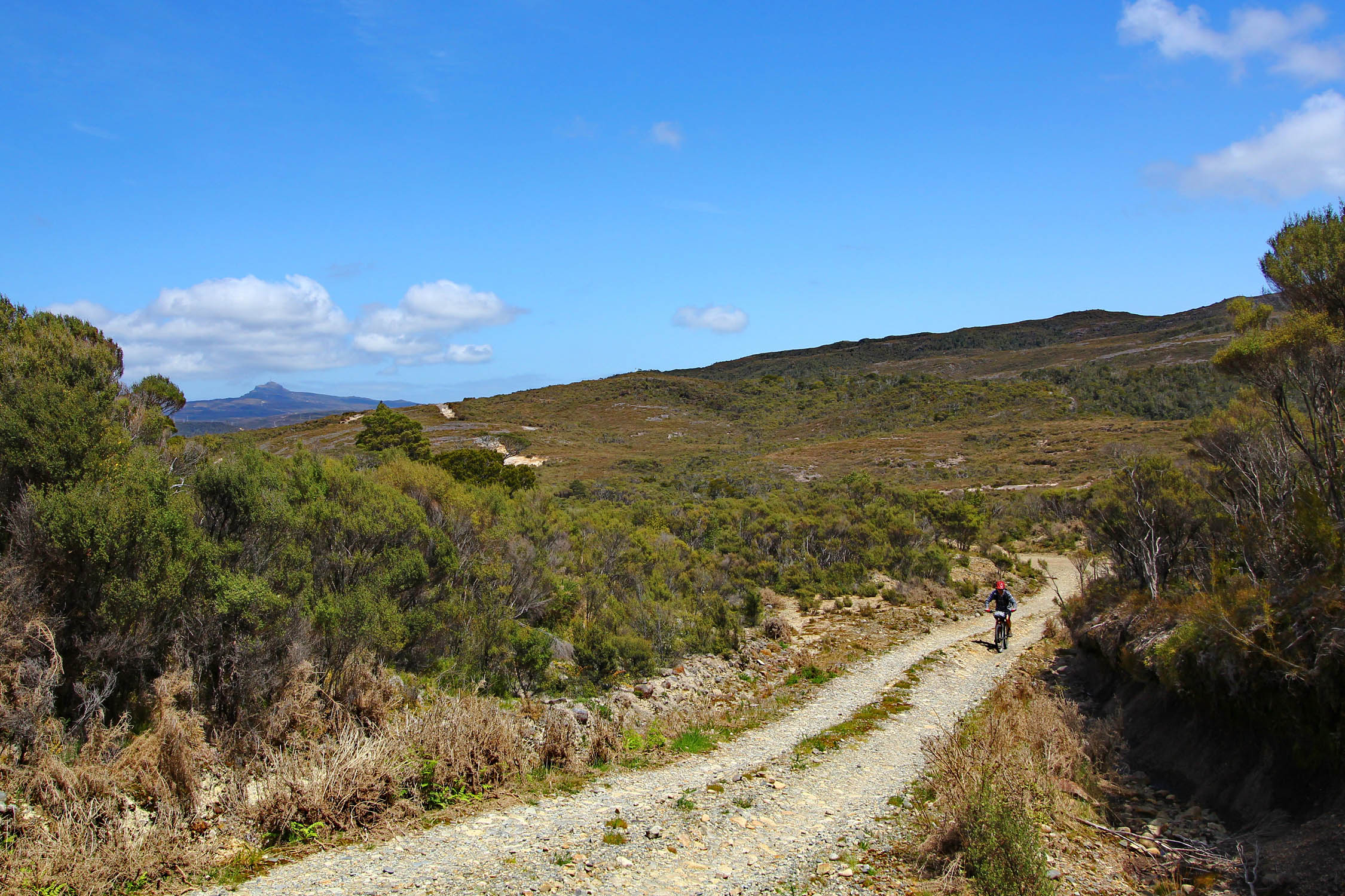
- Denniston Plateau. After a paved climb to the Plateau, get ready for some of the steepest climbing and descending on the route. Chances are you won’t see anyone back here.
- Murchison to St. Arnaud. Braeburn and Porika Track. Braeburn is mellow. Porika is steep and will require some walking. Watch out for the sandflies at Lake Rotoroa.
- Rainbow Road. Quiet gravel and stunning views.
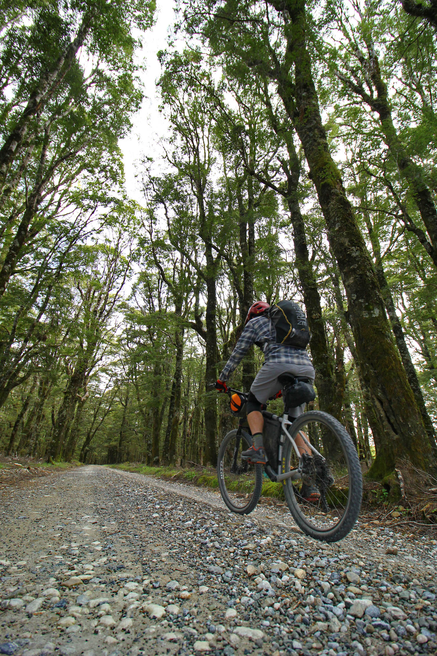
- St James Cycle Trail. A newer track created with mountain bikes in mind. Nice huts and actual mountain biking.
Additional Resources
- kiwimaps.com – Kiwi Maps Northern South Island (not shown on webpage but available in most iSites) – great map with entire route, including cycle trails, on it. Also has all Lord of the Rings filming locations marked.
- nzcycletrail.com – information on the St James, Queen Charlotte, and Old Ghost Road.
- doc.govt.nz/parks-and-recreation – info on the Heaphy Track.
- mtbtrailstrust.org.nz/rameka-track – info on Rameka Track.
- doc.govt.nz/parks-and-recreation – Rainbow Road info.


Terms of Use: As with each bikepacking route guide published on BIKEPACKING.com, should you choose to cycle this route, do so at your own risk. Prior to setting out check current local weather, conditions, and land/road closures. While riding, obey all public and private land use restrictions and rules, carry proper safety and navigational equipment, and of course, follow the #leavenotrace guidelines. The information found herein is simply a planning resource to be used as a point of inspiration in conjunction with your own due-diligence. In spite of the fact that this route, associated GPS track (GPX and maps), and all route guidelines were prepared under diligent research by the specified contributor and/or contributors, the accuracy of such and judgement of the author is not guaranteed. BIKEPACKING.com LLC, its partners, associates, and contributors are in no way liable for personal injury, damage to personal property, or any other such situation that might happen to individual riders cycling or following this route.
Please keep the conversation civil, constructive, and inclusive, or your comment will be removed.