


Wisconsin Waterfalls Loop
Distance
382 Mi.
(615 KM)Days
6-8
% Unpaved
85%
% Singletrack
1%
% Rideable (time)
95%
Total Ascent
18,523'
(5,646 M)High Point
1,784'
(544 M)Difficulty (1-10)
5?
- 3Climbing Scale Fair48 FT/MI (9 M/KM)
- -Technical Difficulty
- -Physical Demand
- -Resupply & Logistics
Contributed By

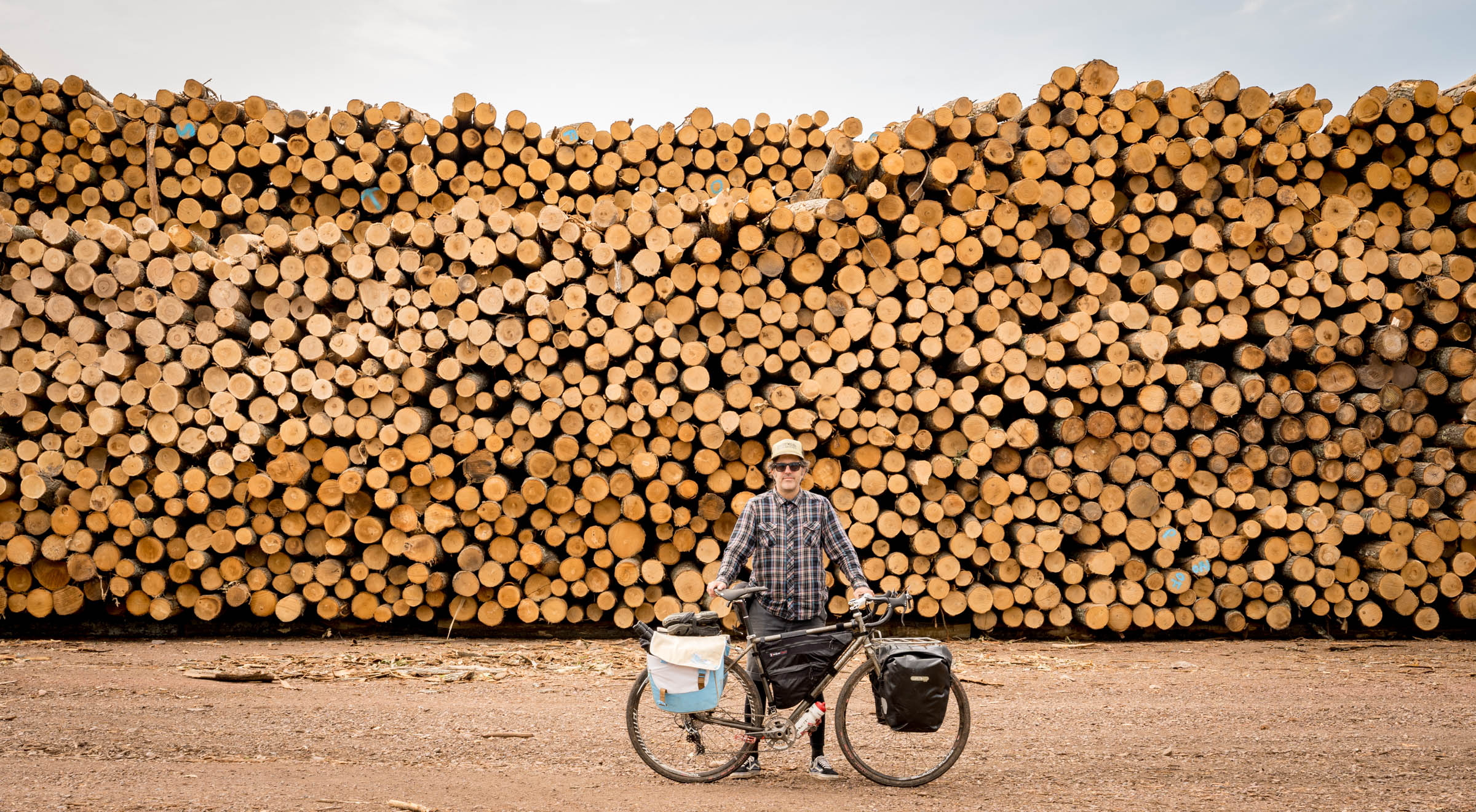
Dave Schlabowske
Guest Contributor
In December of 2020, Dave retired to Seeley, Wisconsin, after working in bicycle advocacy for the last 20 years. Before that, he was an editorial photographer working for magazines, newspapers, and wire services. The Tour de Chequamegon route he developed has become extremely popular, as is the guided version of that trip he coordinates with the crew from Fyxation Bicycle Company. He is planning a guided version of this Waterfall route for 2022. Interested people can find out more at his site Life Above Eight.
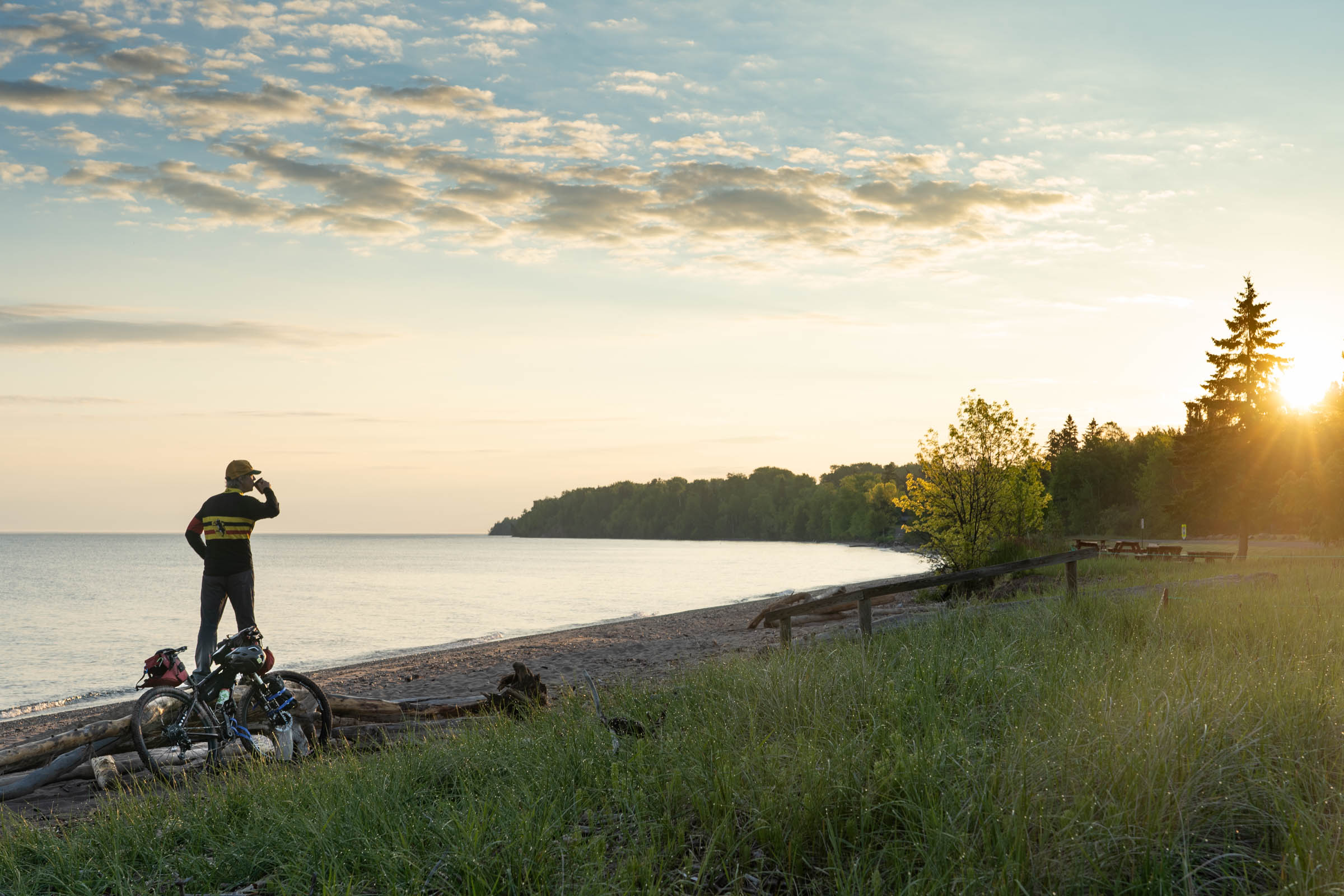
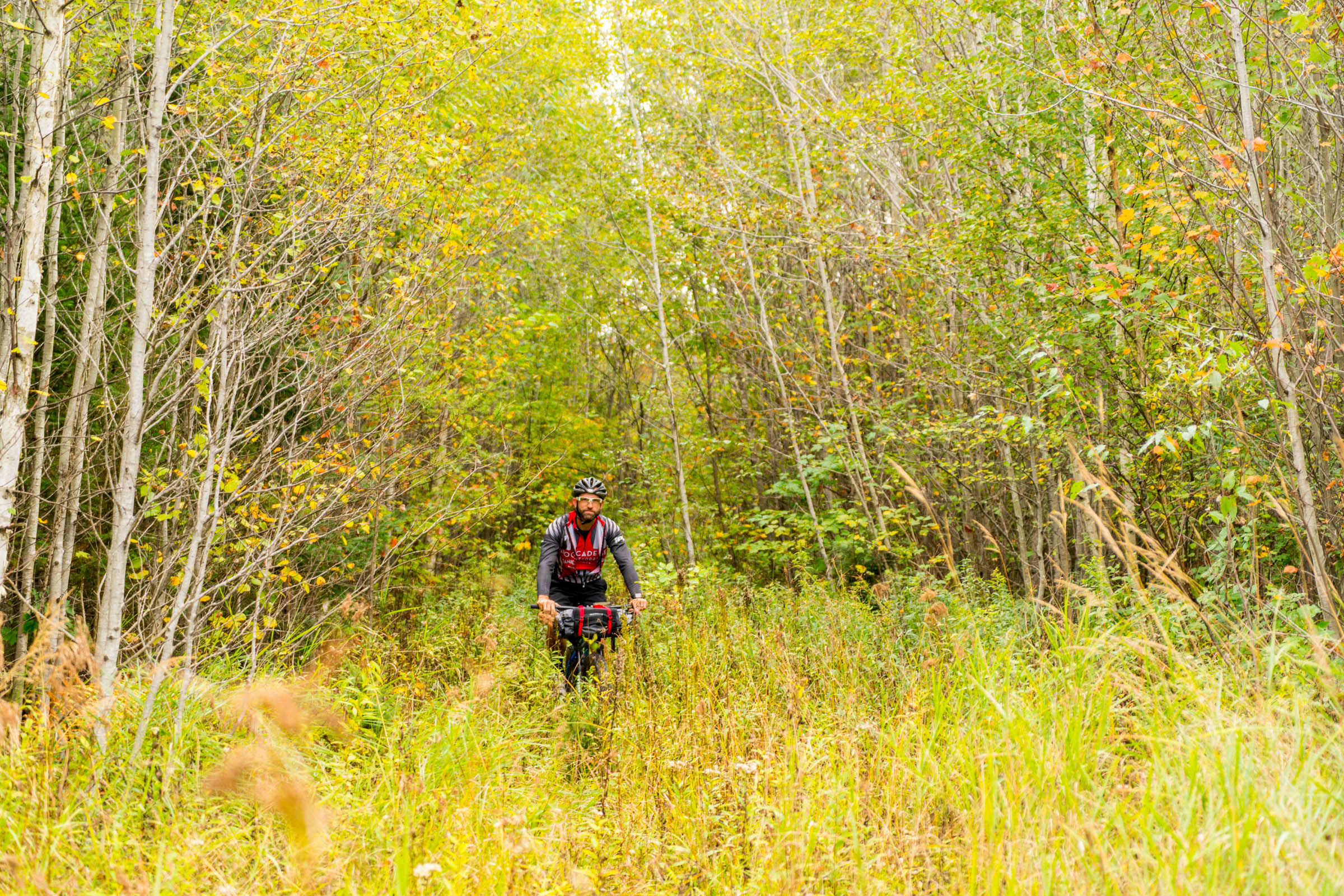
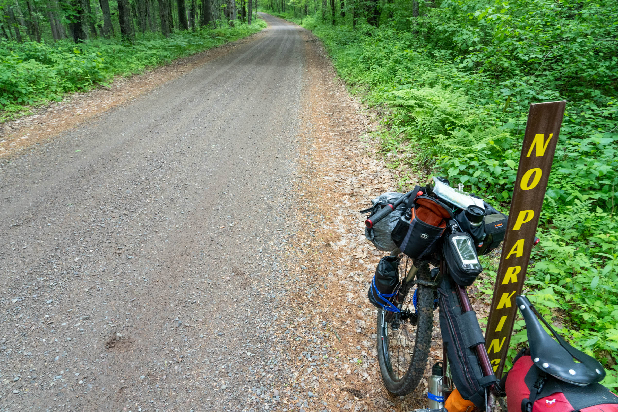
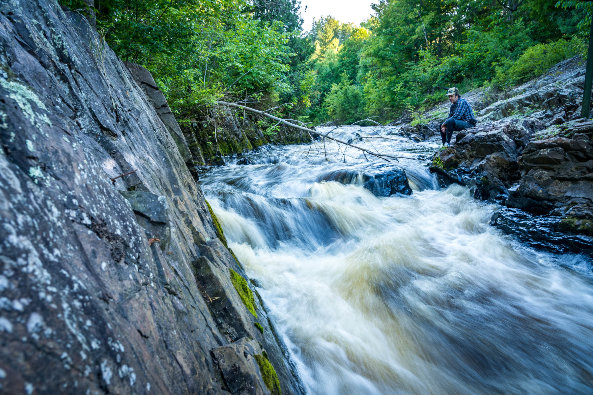
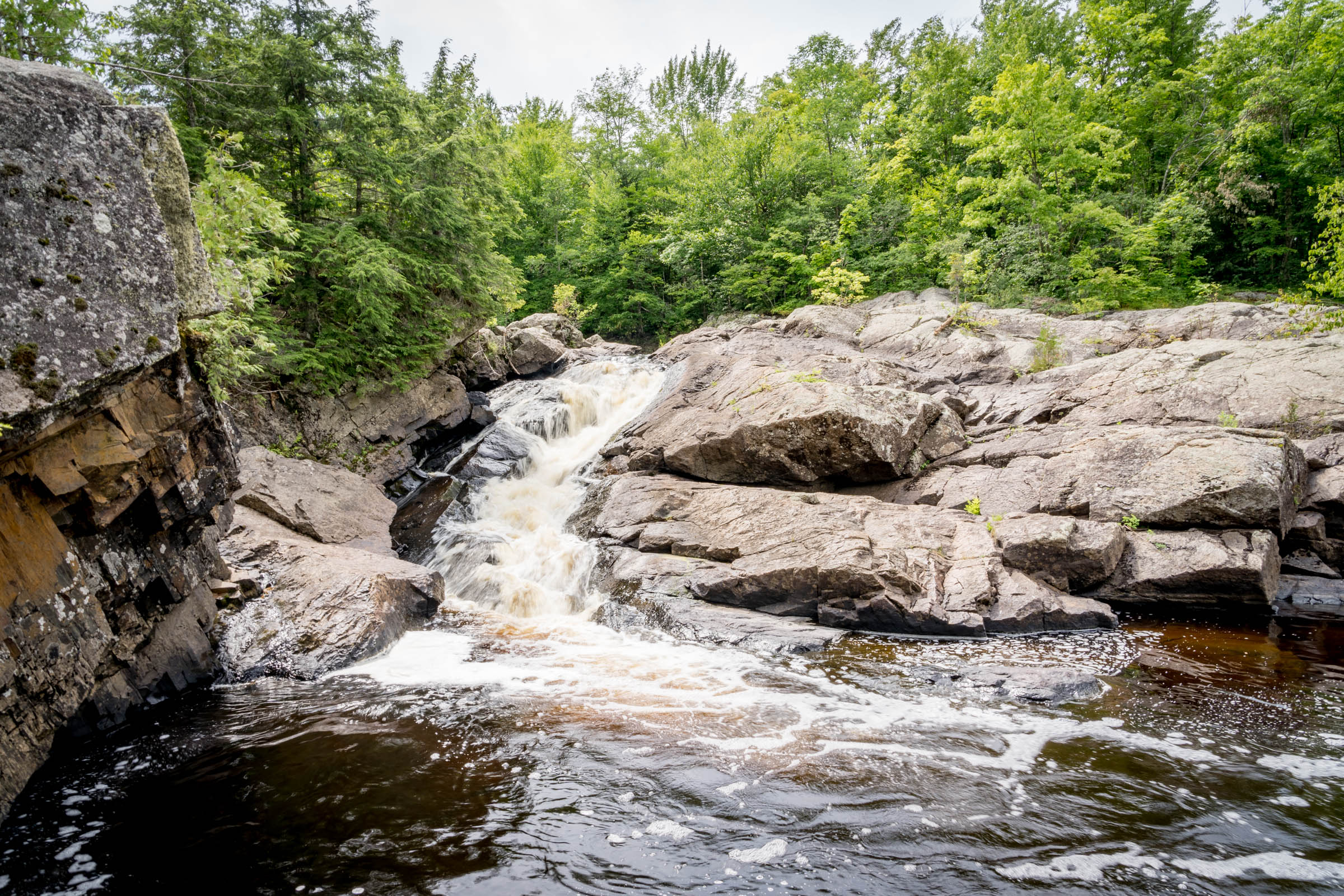
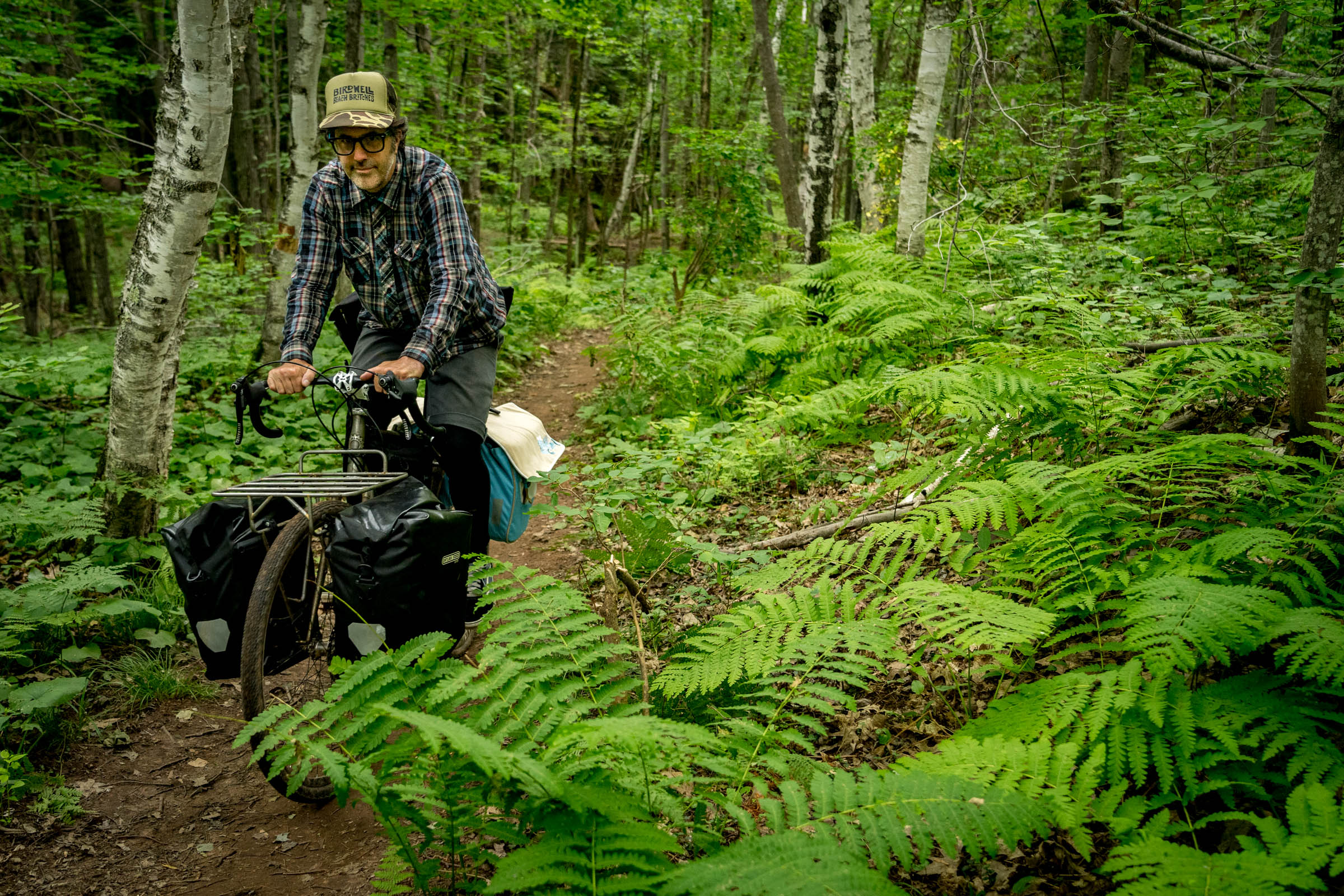
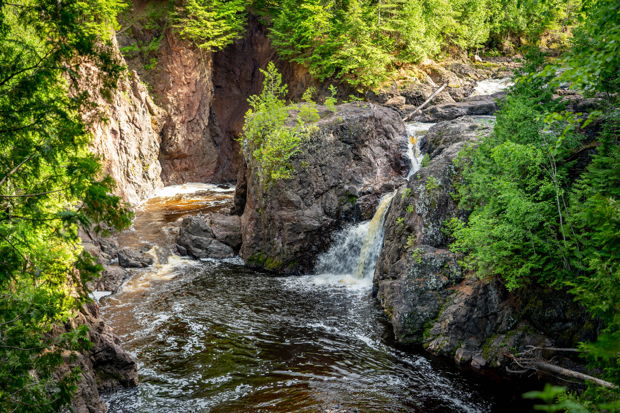
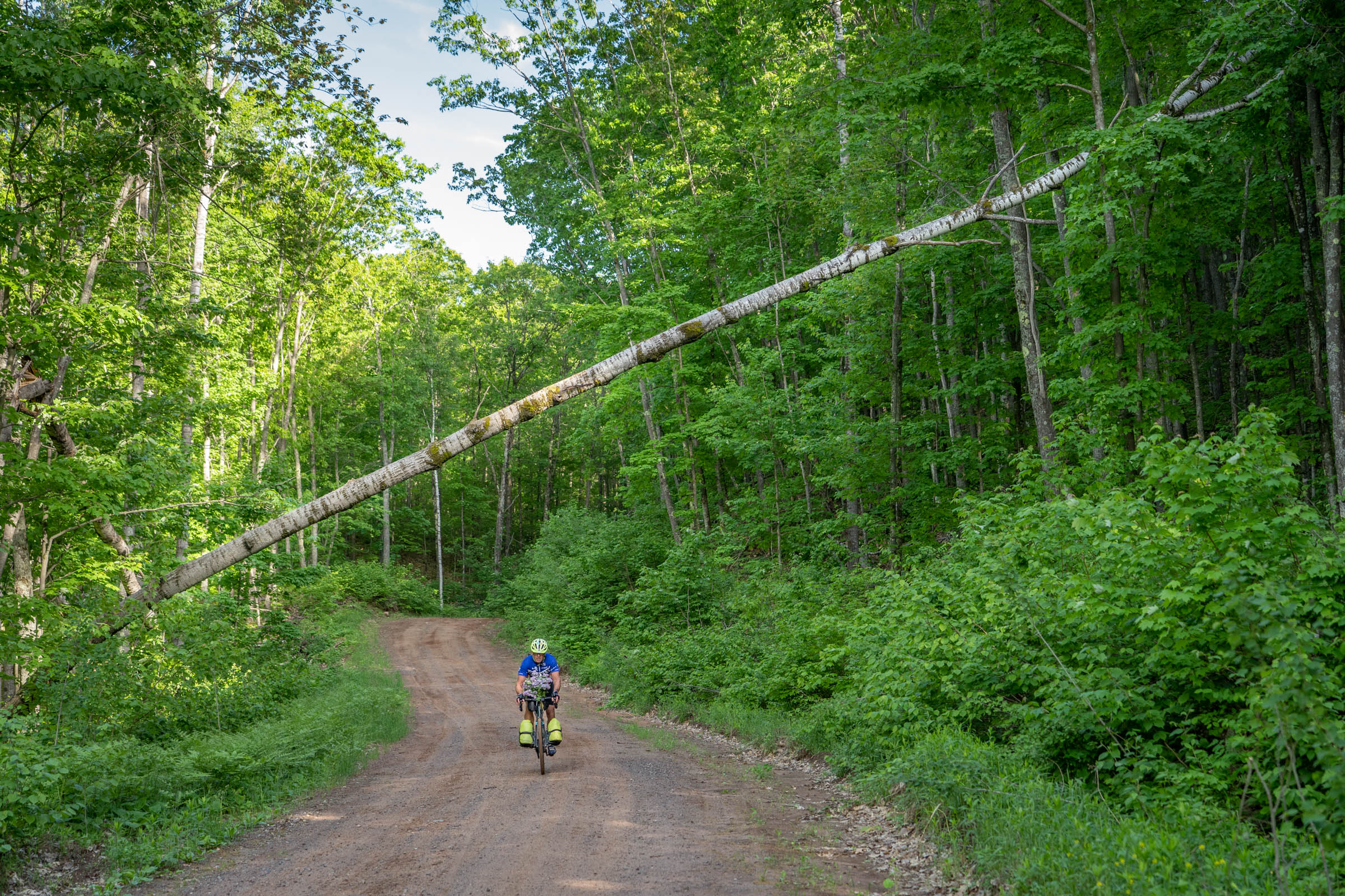
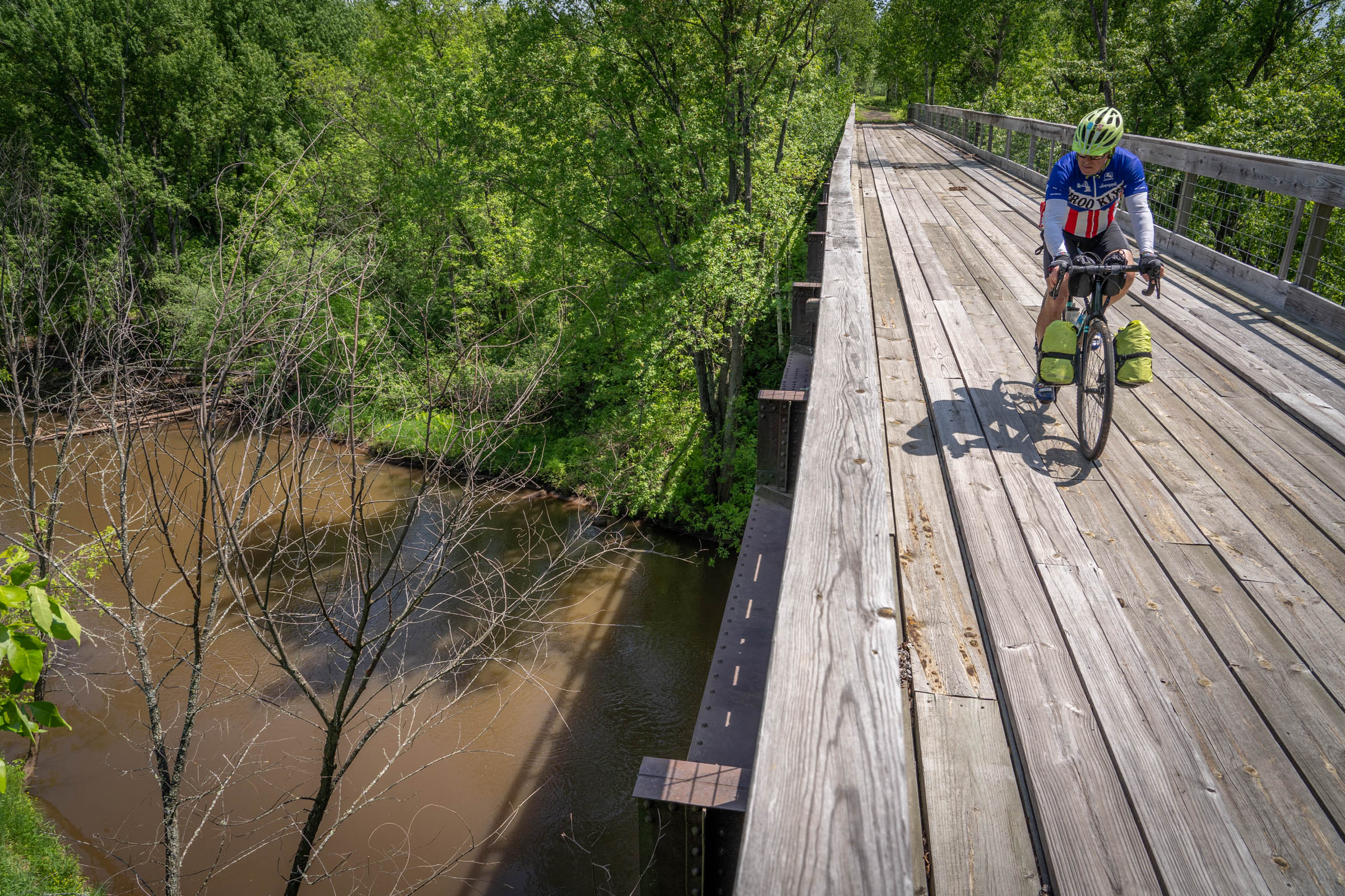
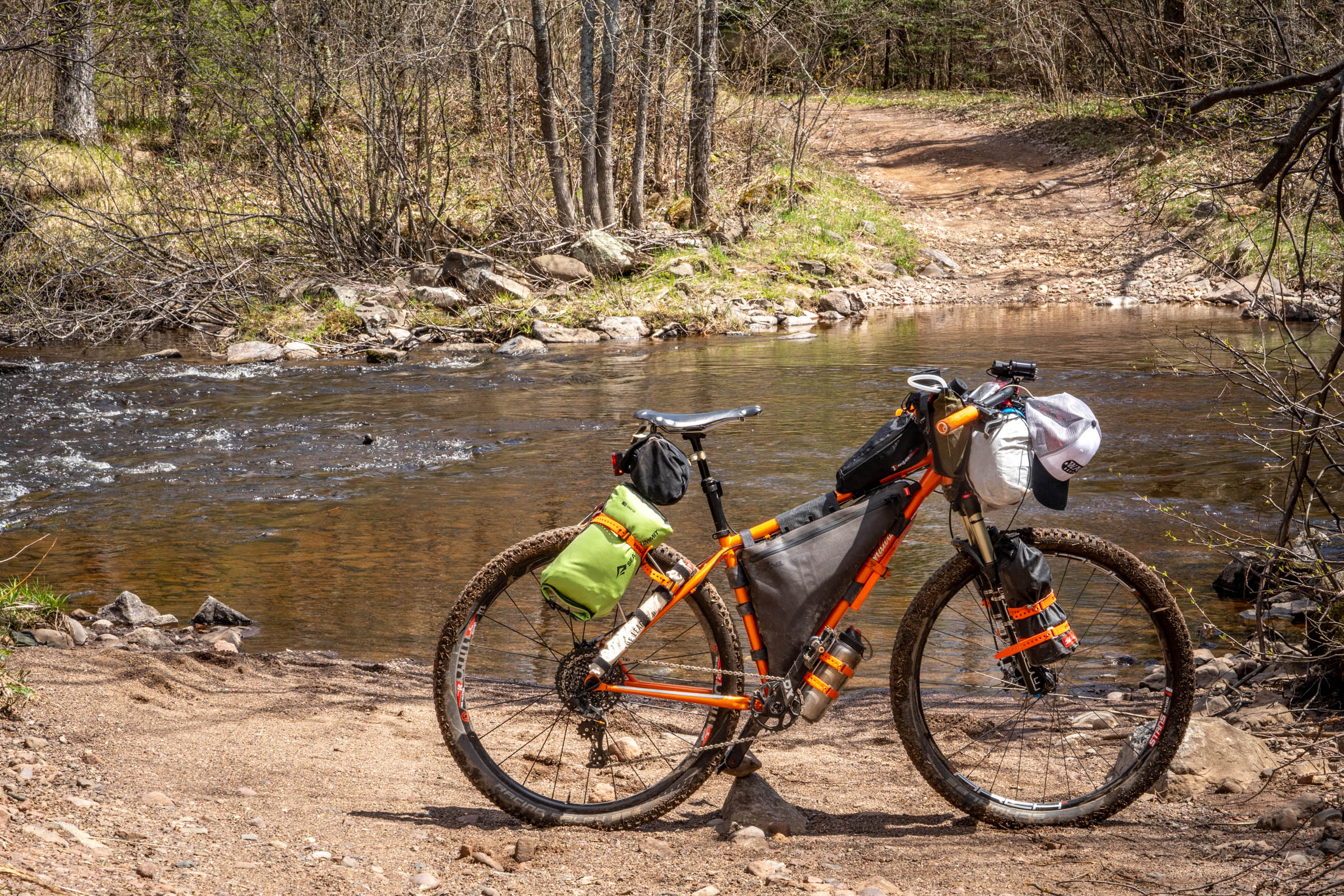
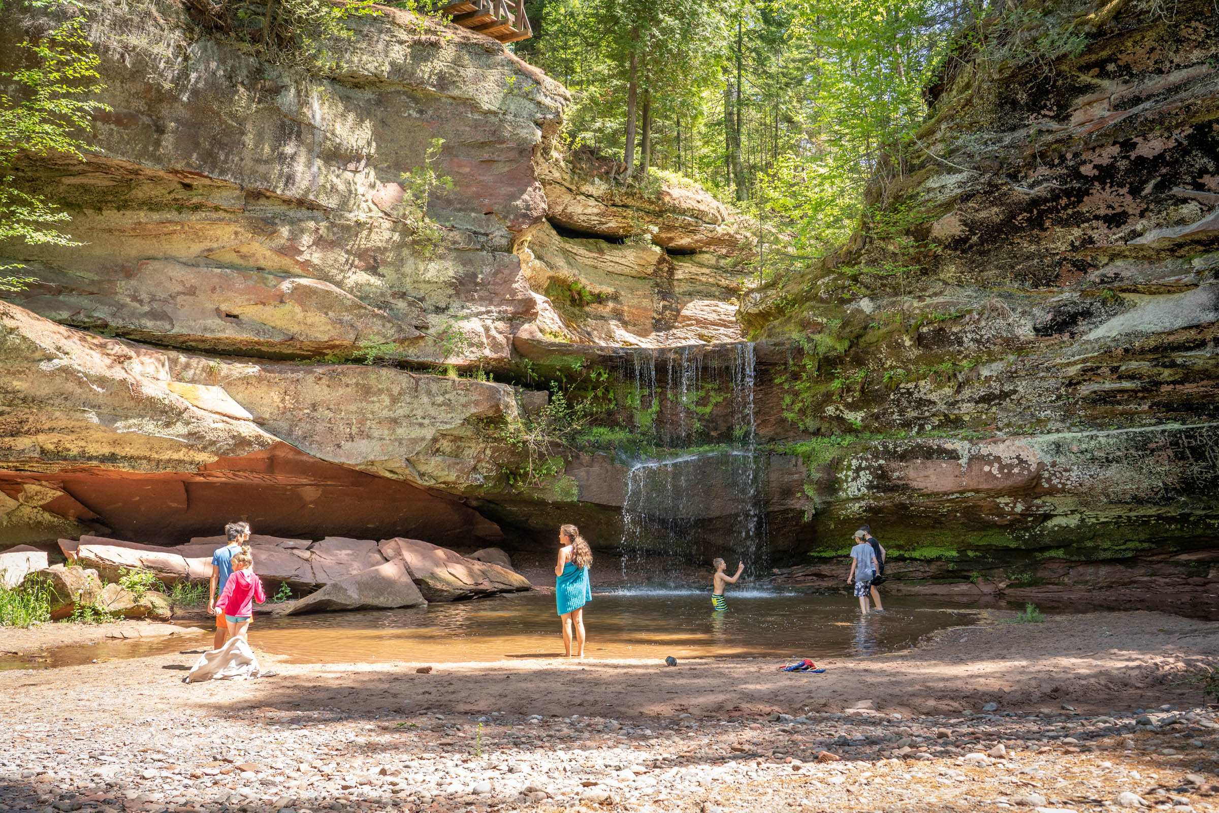
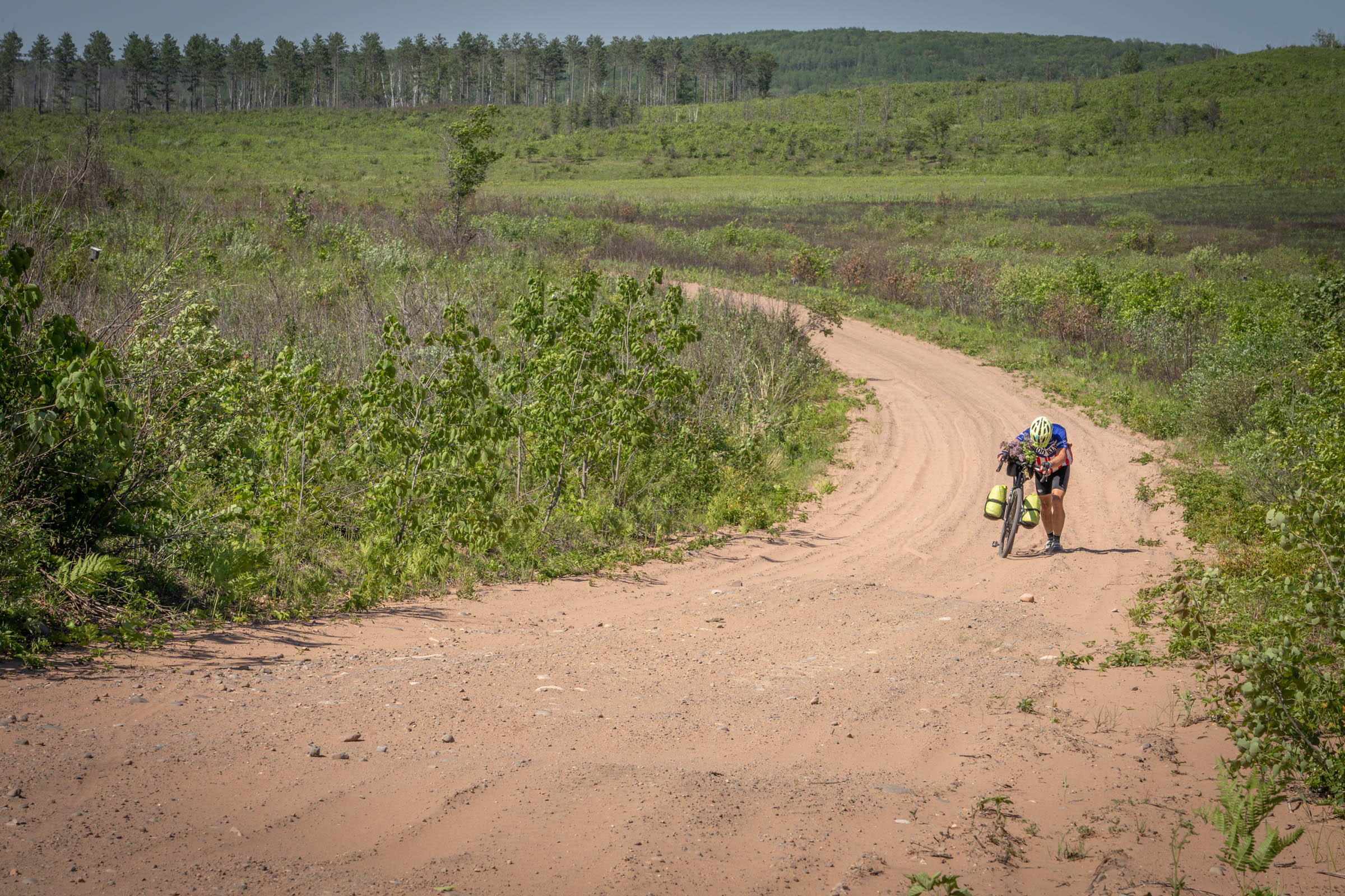
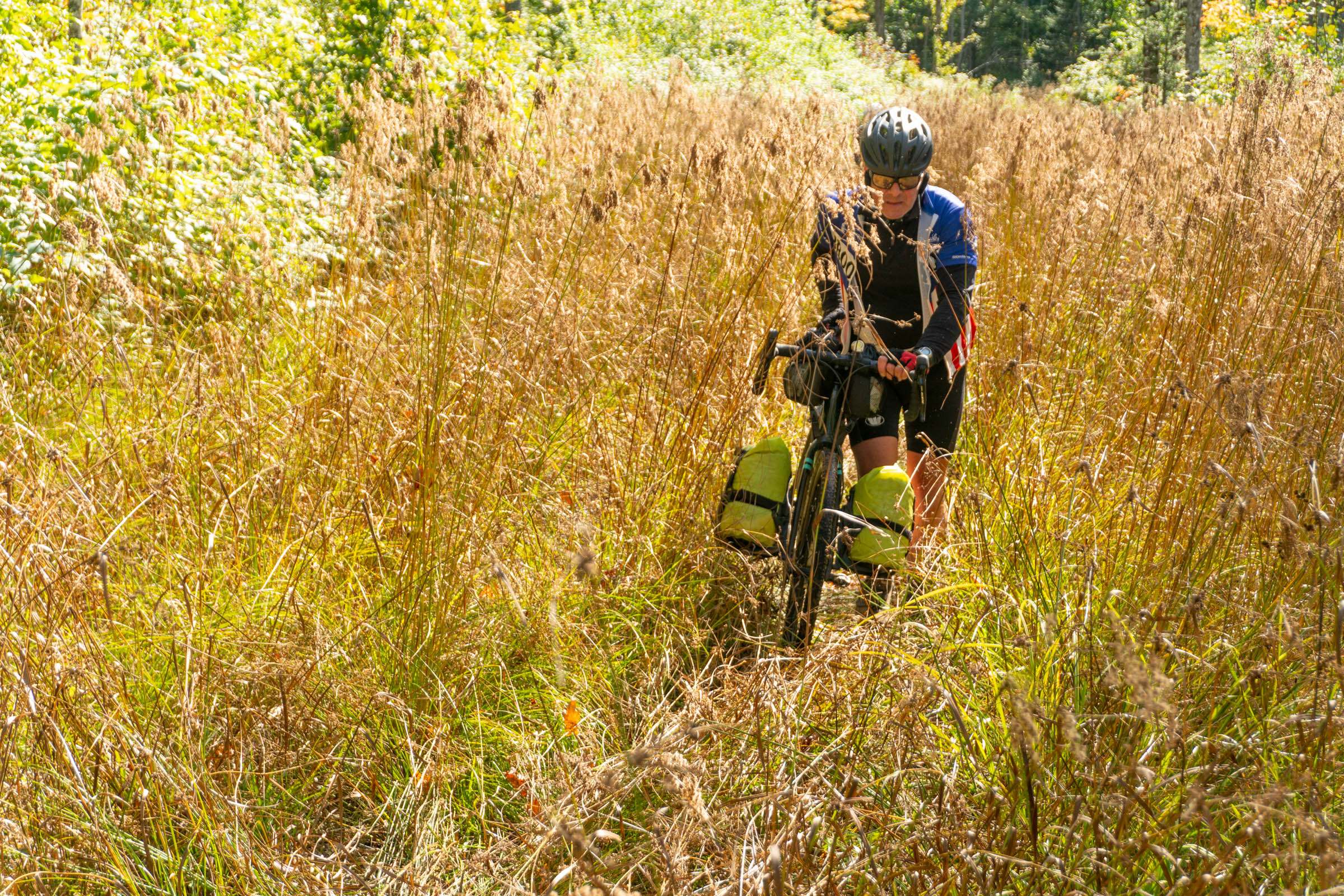
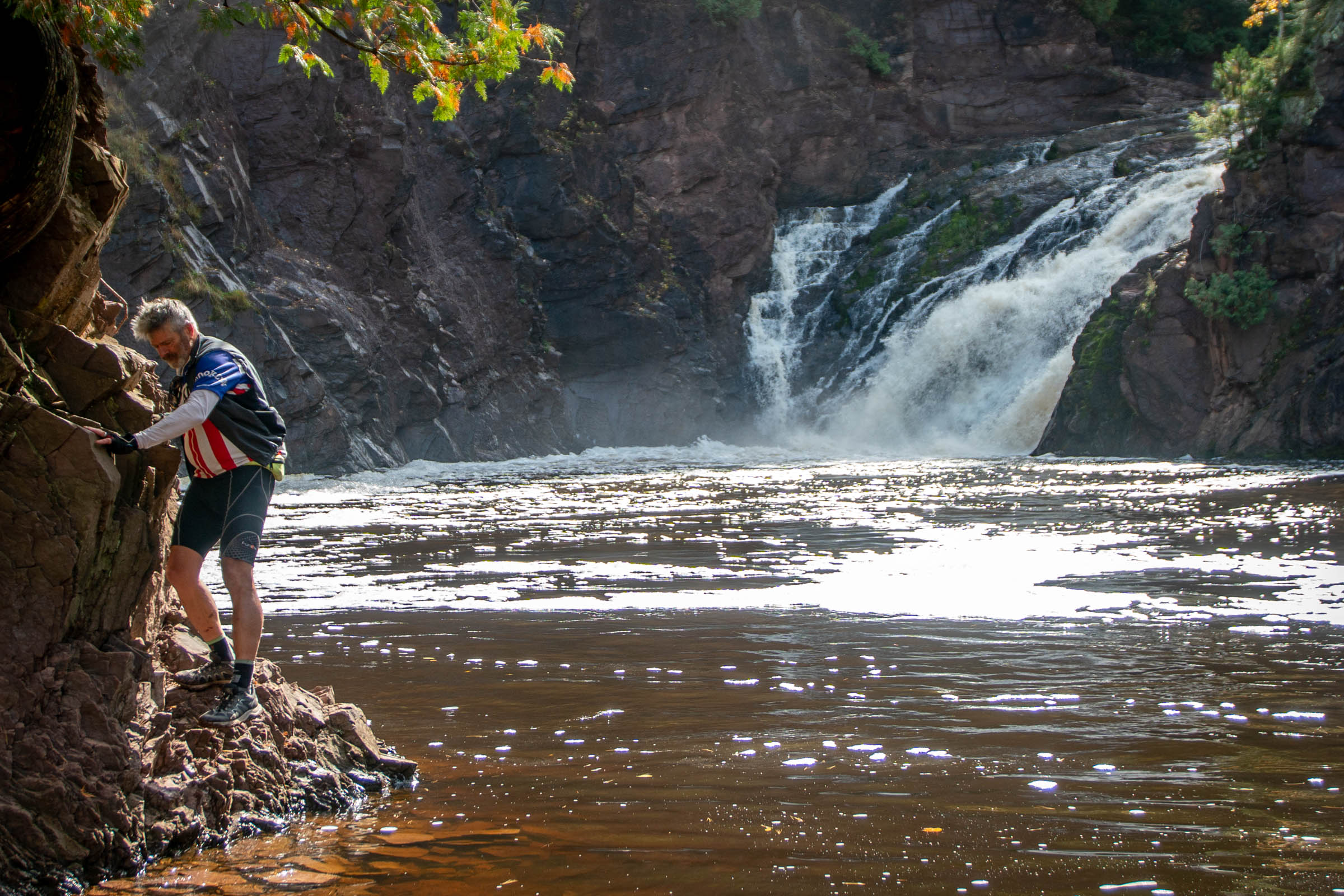
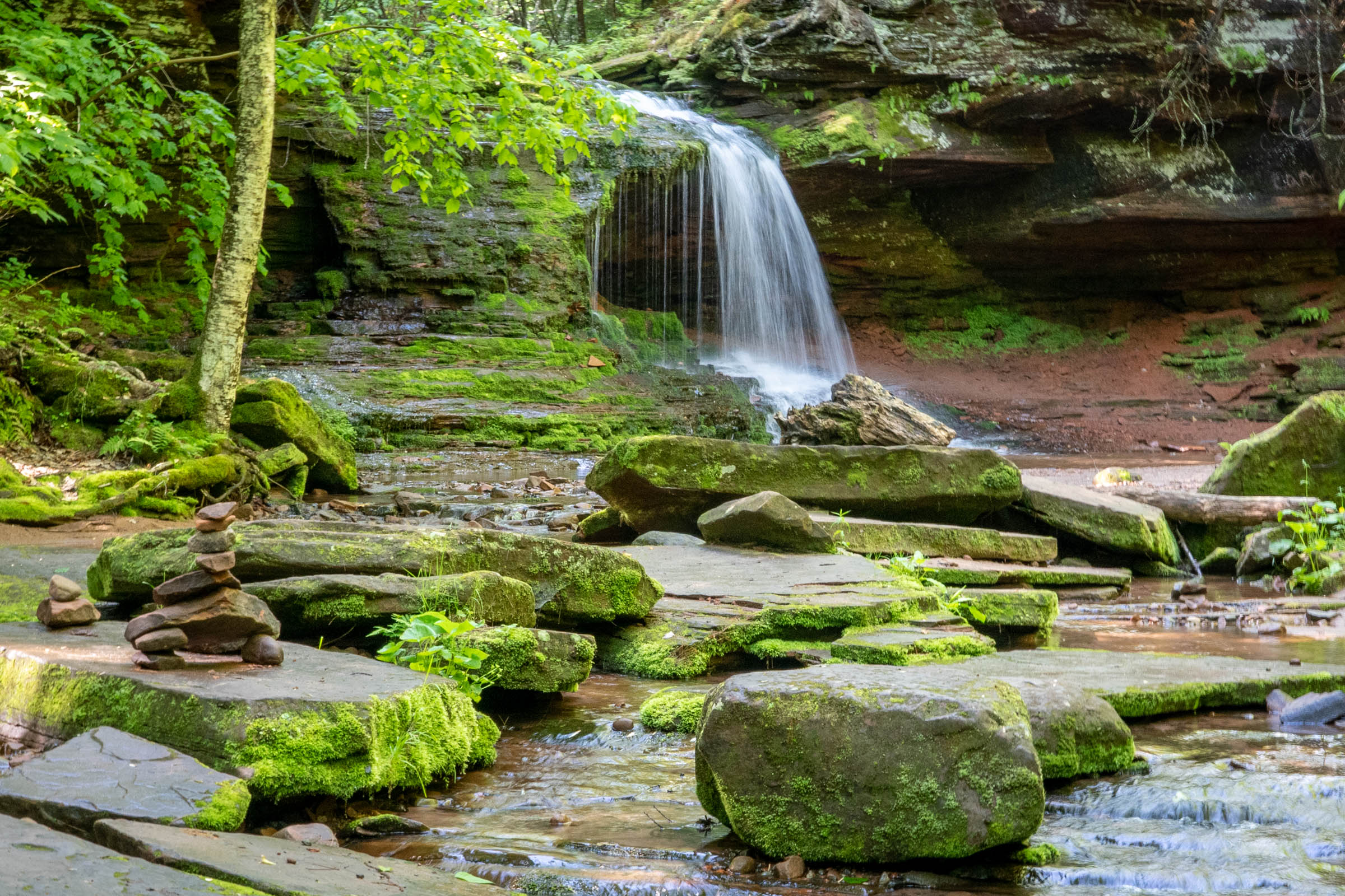
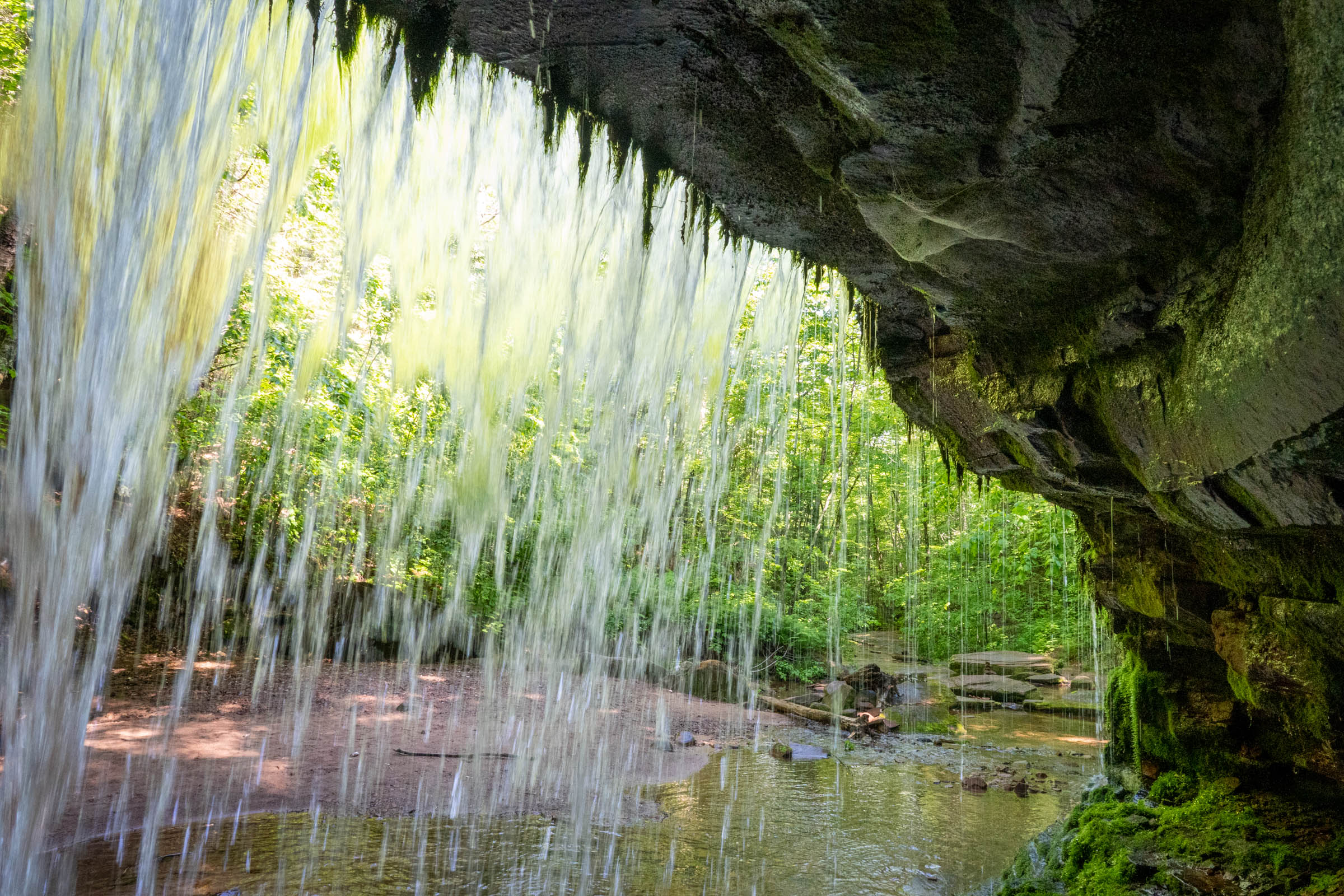
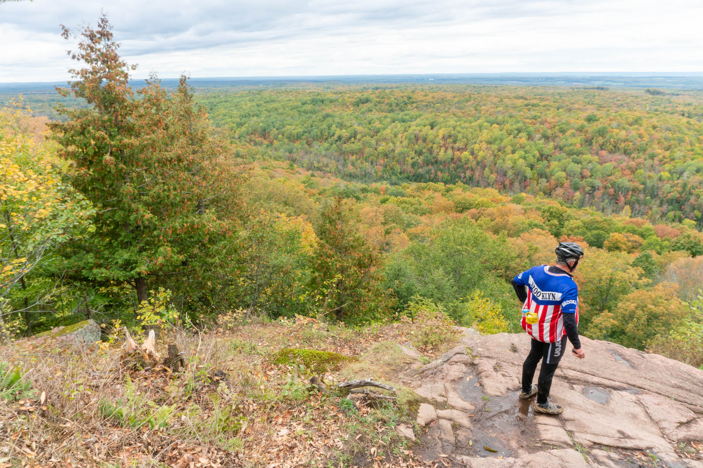
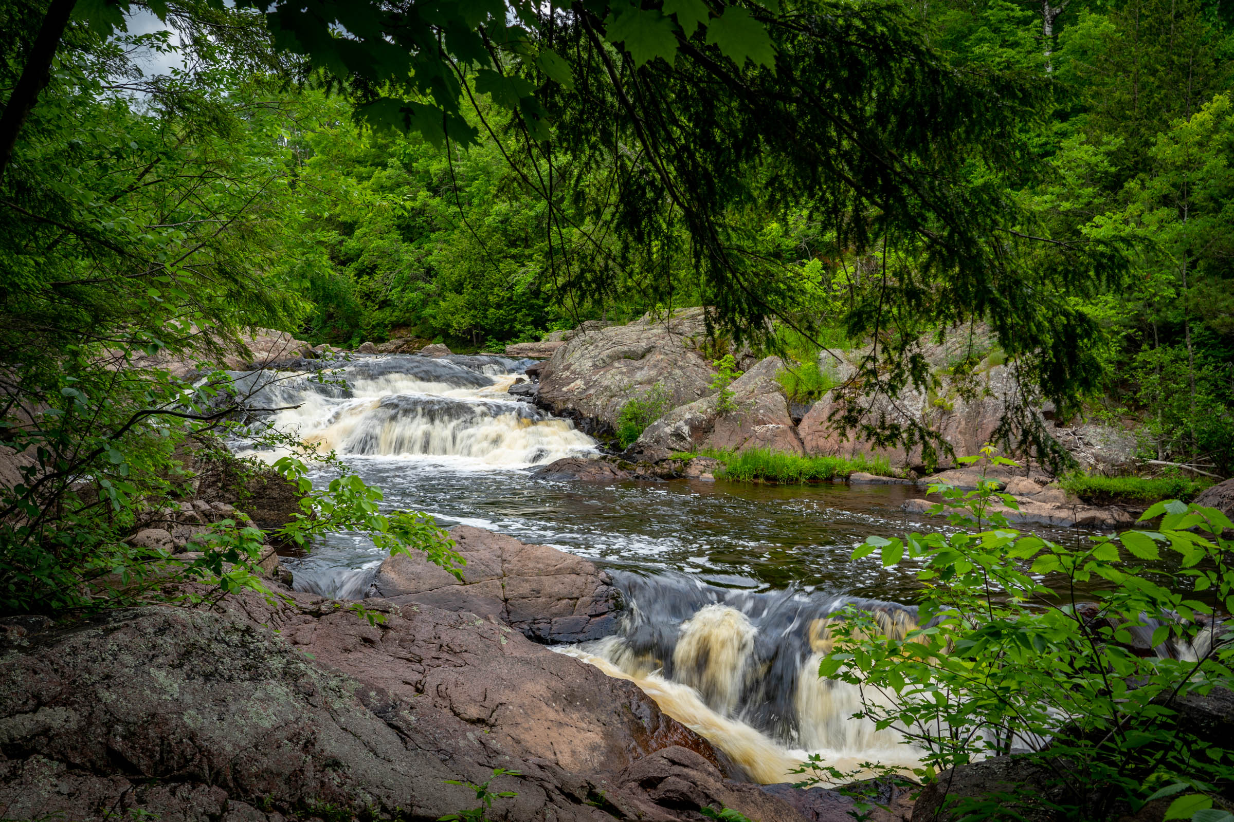
This 382-mile loop takes you past nearly 30 waterfalls, including some larger and well-known falls, some smaller ones, and others that are only known to locals and are hard to find without a POI. The majority of the route is on gravel or sandy forest roads and the remaining miles are on mountain bike trails or Davement. Davement is a term my friends coined for a connector I found that helps avoid paved roads but might be too overgrown to actually pedal. These old logging roads and rough ATV/snowmobile trails might require you to hike-a-bike, but that’s part of the fun of bikepacking. Bring a paper map to help orient yourself and find alternate routes if you want to skip some Davement.
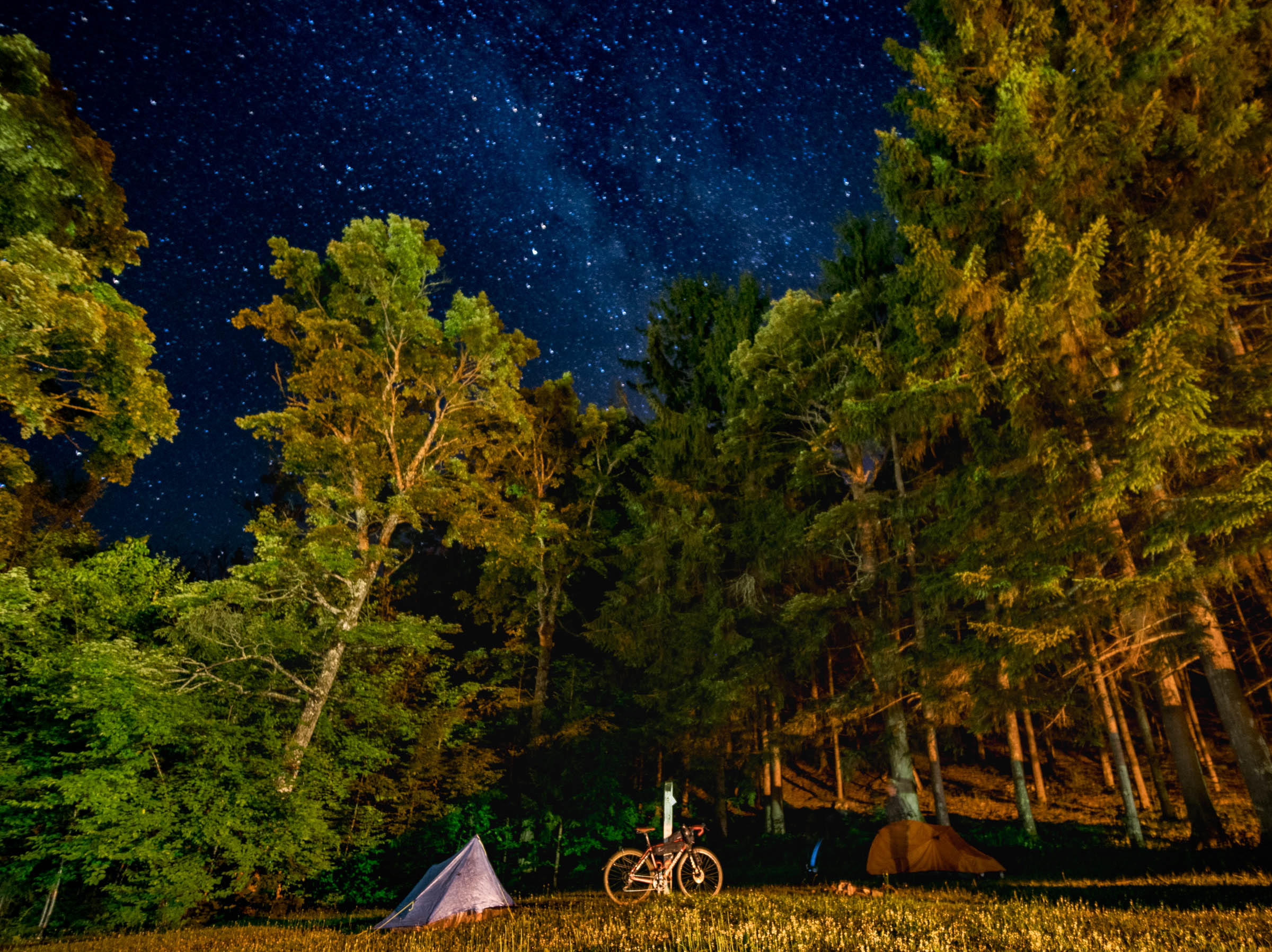
All the waterfalls are on the northern part of the loop, but the southern segments of the route are still great riding on a variety of gravel roads, two-track, and MTB trails with very nice campgrounds. In the dozens of times I have ridden segments of this loop, I have always found an empty campsite without advance reservations. If a campsite was full, I would just go find a dispersed spot in the nearby county or national forest. Those who like to plan can make reservations ahead of time.

I chose to start and end this loop in Cable, Wisconsin, because I live in nearby Seeley, and because they have a free municipal parking lot where you can leave your car or truck, no questions asked. Despite having a population of 263, Cable has a good hardware store, grocery store, book store, coffee shop, three great restaurants, and a fancy new bar. Starting in Cable also lets you ride the CAMBA MTB trail sections of the route right at the start when you’re fresh. However, you could pick anywhere to start and end your ride. Ironwood or Watersmeet might make good alternatives.
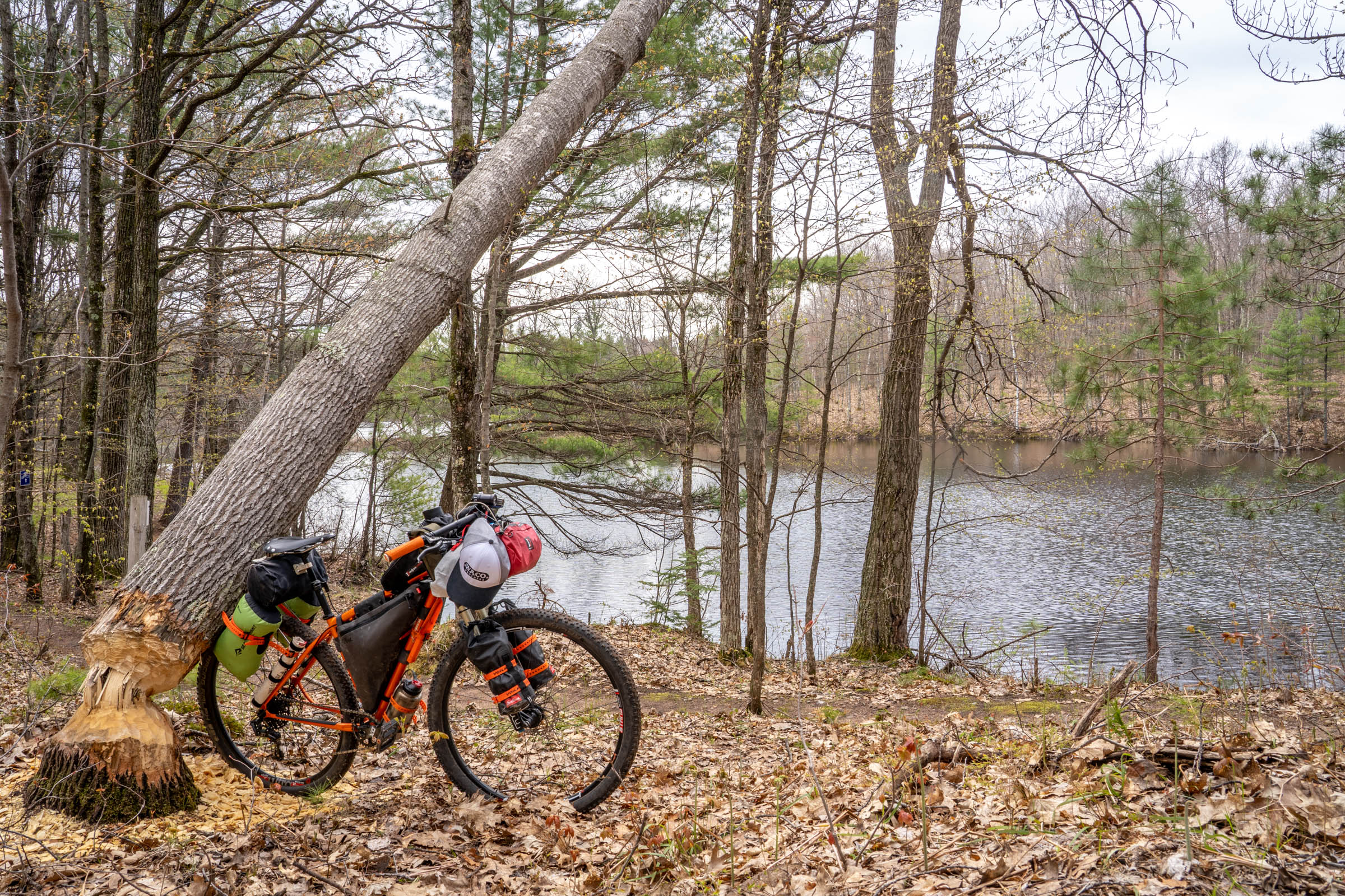
What Bike to Ride
The terrain on these three rides varies from very hilly hard-packed gravel to super soft sand. The sandy sections are limited to the Bayfield Peninsula, though. I have ridden those sections on my Fyxation Crusher carbon adventure bike with 42 mm tubeless tires, but let the air down to 10 to 12 psi when I hit the sandy sections so I was able to ride. The gravel road bike is ideal for the vast majority of the waterfall route, but it really does struggle in the sand.
While gravel tires are doable in the sand and riding a gravel road bike makes for faster going on the majority of the route, I think my Milwaukee Bicycle Company Feral 29er with 2.4” tubeless tires is a better compromise. Again, I drop the air pressure when I hit the sandy stuff and pump them back up once I am on firmer ground. Even a fat bike with 5” tires will still struggle in the sandy sections if it is dry, but a fat bike is overkill for most of the route. For me, the 29er is a good compromise, but you can do these routes with whatever bike you have. Don’t let the bike stop you if you want to try.
Route Difficulty: I would rate the route a 5 out of 10 for difficulty because there are some long, very sandy sections, some rough two-track/ATV trails that often require hike-a-bike due to deadfall, and lots of hills. The route is 85% unpaved roads, 14% pavement, and 1% singletrack. Between stopping for food, photos, and waterfalls, I typically find 60-80 miles is a full day riding for me. Of course, fitness levels vary. Find the suggested itinerary under Trail Notes below.
Route Development: See Resources tab below.


Submit Route Alert
As the leading creator and publisher of bikepacking routes, BIKEPACKING.com endeavors to maintain, improve, and advocate for our growing network of bikepacking routes all over the world. As such, our editorial team, route creators, and Route Stewards serve as mediators for route improvements and opportunities for connectivity, conservation, and community growth around these routes. To facilitate these efforts, we rely on our Bikepacking Collective and the greater bikepacking community to call attention to critical issues and opportunities that are discovered while riding these routes. If you have a vital issue or opportunity regarding this route that pertains to one of the subjects below, please let us know:
Highlights
Must Know
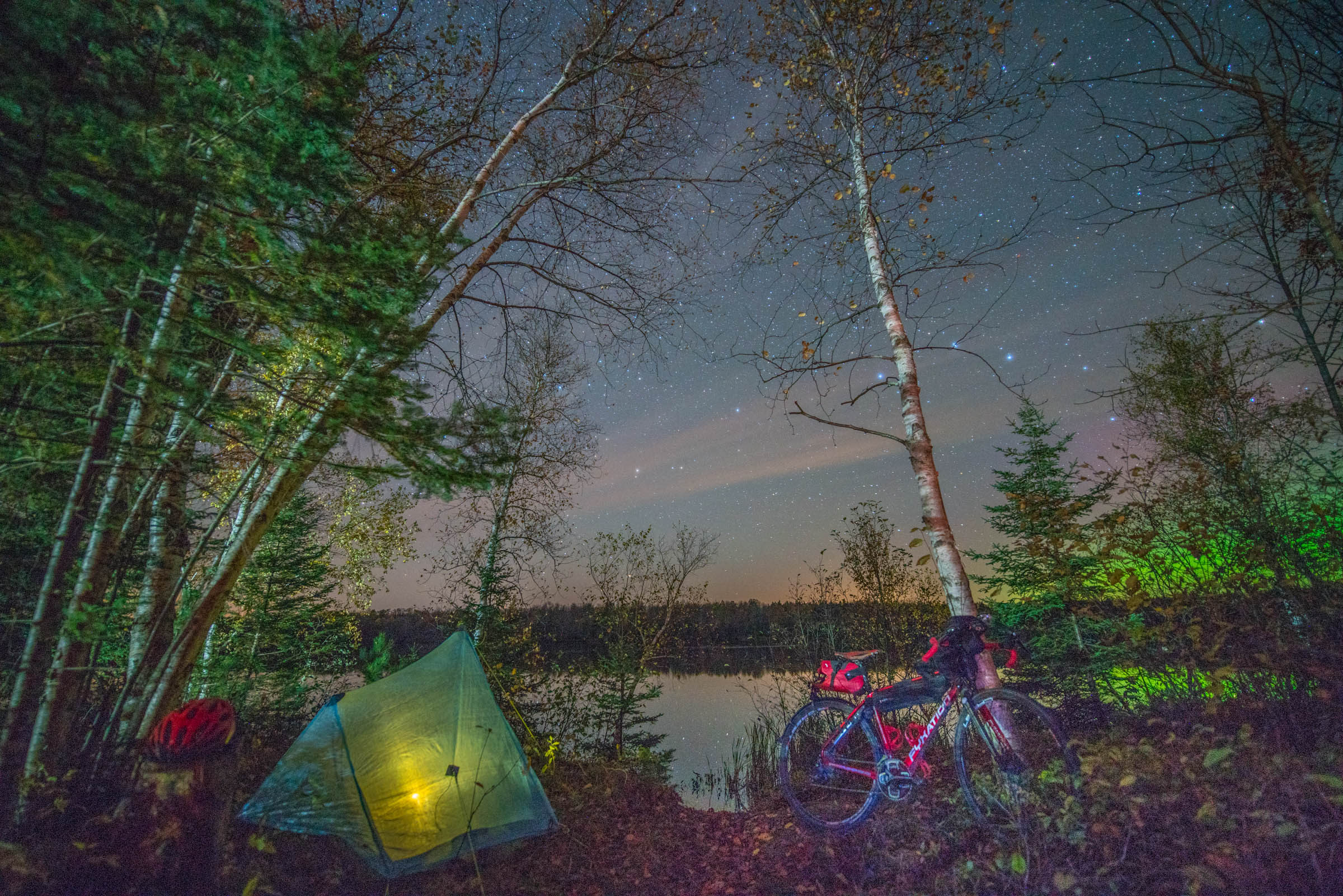
Camping
Food/H2O
Trail Notes
Resources
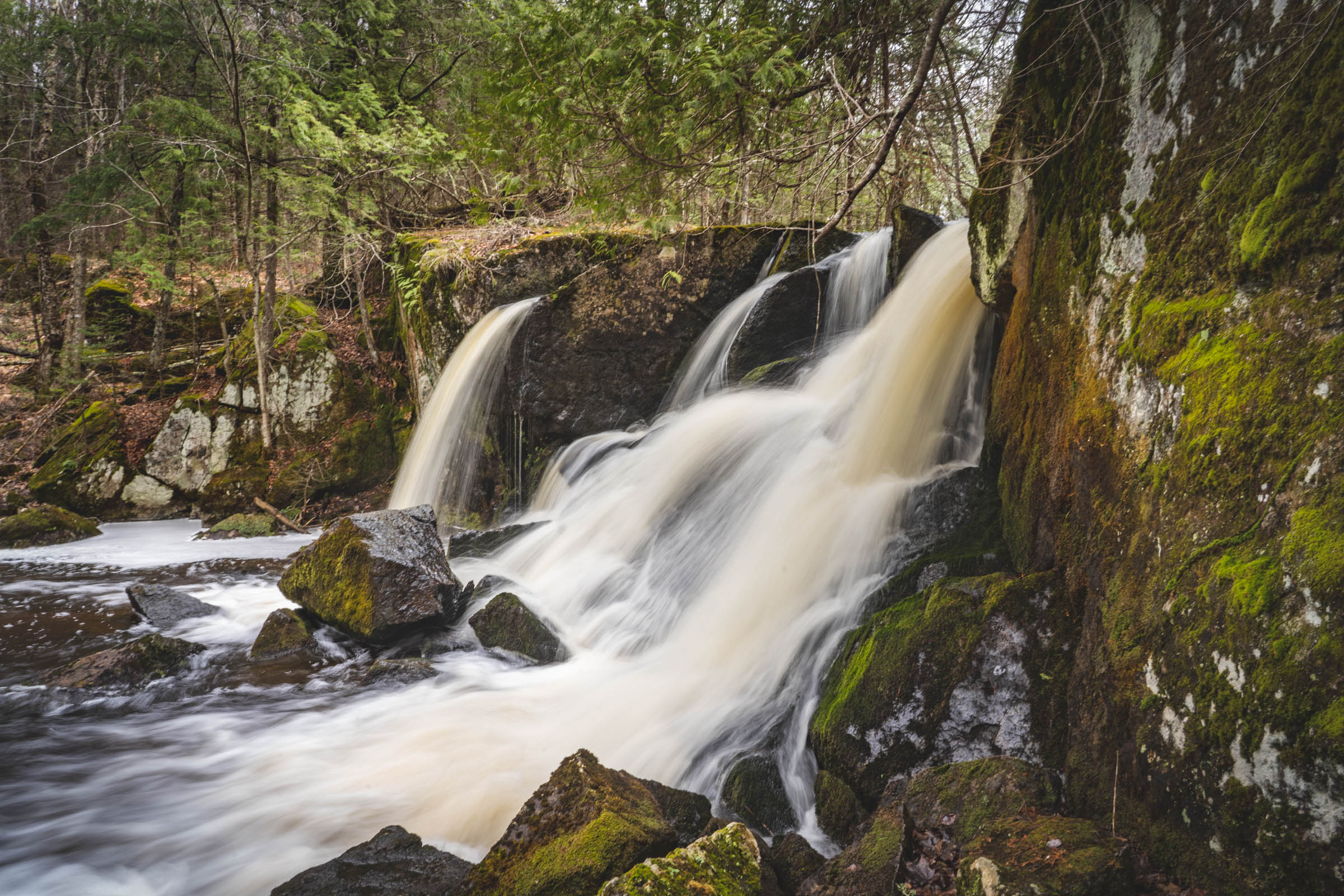
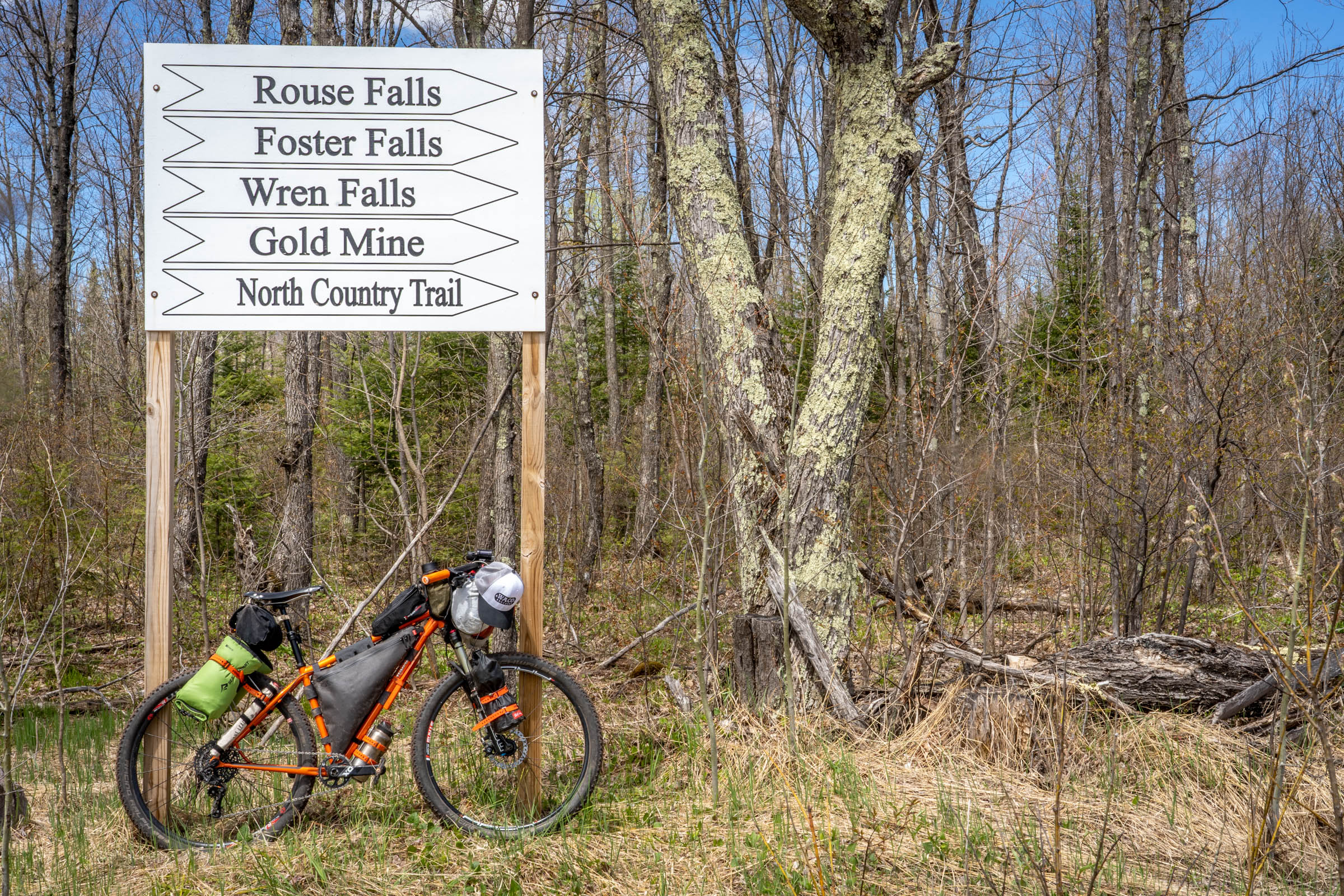
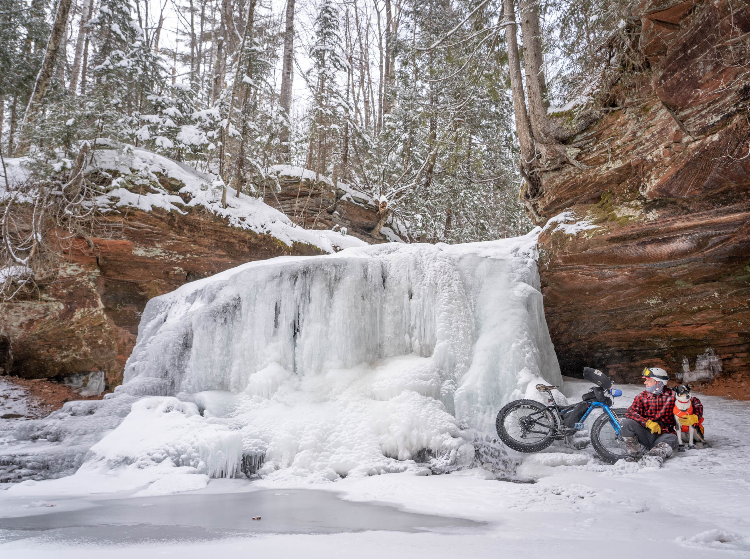
- Waterfalls!
- Start on CAMBA singletrack
- The Cable/Seeley/Hayward area is a silent sports paradise, home to the American Birkebeiner and the Chequamegon MTB Festival, two of the oldest large silent sports events in the country. The area has all the amenities you are looking for, from great bike shops to craft beer and good food and coffee.
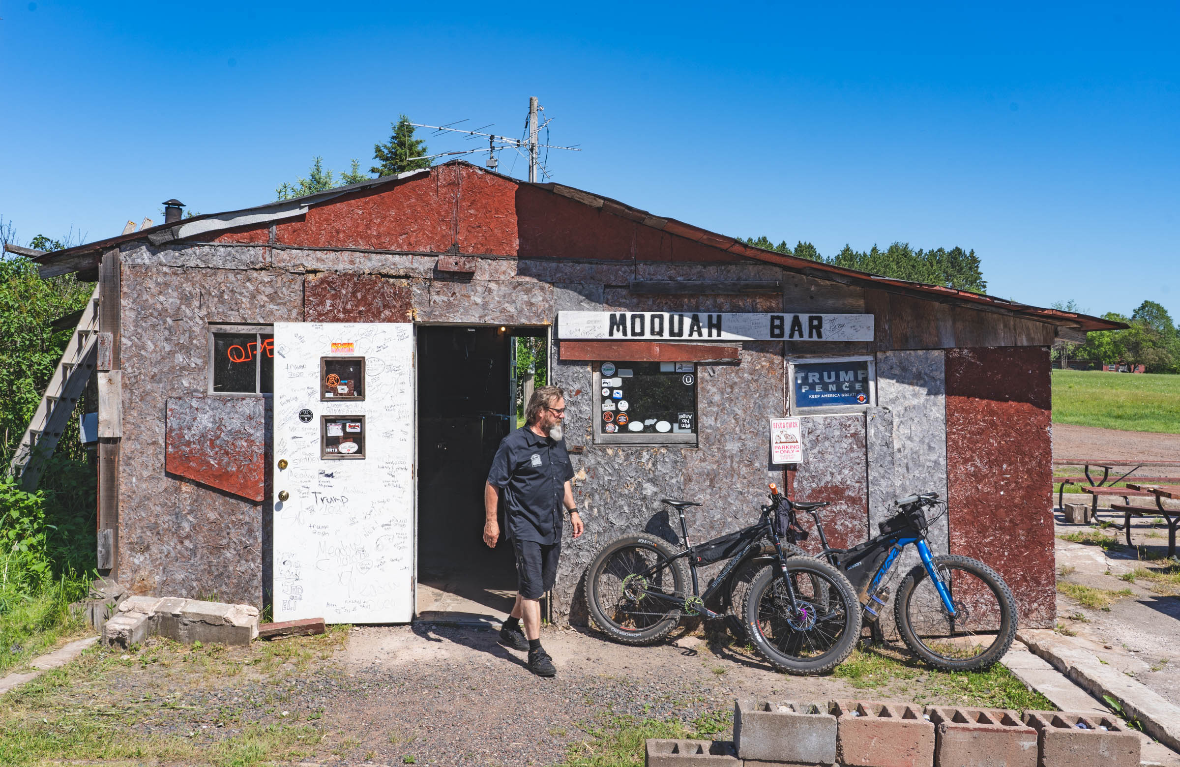
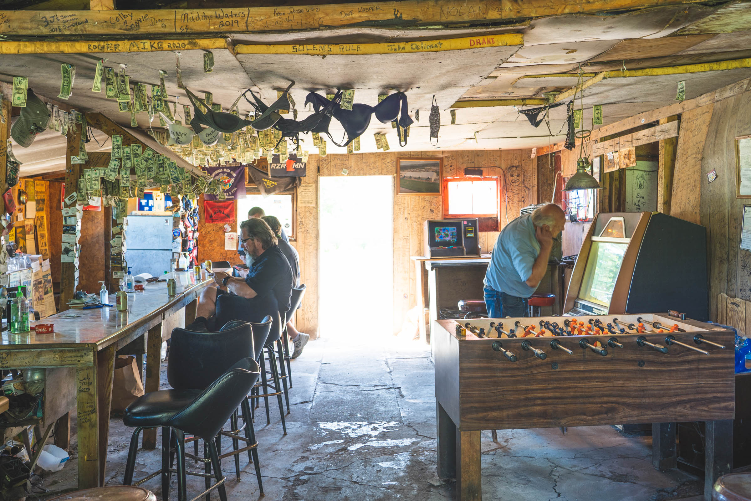
- Must stop: Freshwater Fishing Hall of Fame and the Moccasin Bar in Hayward. Gary Fisher loves them; you will too.
- The River’s Eatery wood-fired pizza in Cable is off-the-hook good and has veggie and gluten-free options. I suggest the red-cabbage sauerkraut and pulled pork. The owners are big supporters of cycling and skiing, so the walls are covered by bib numbers and jerseys from famous pro athletes who have been there. It is in the back of the Ideal Market (43455 Kavanaugh Rd, Cable, WI 54821). The Ideal Market also houses a small bookstore featuring many local authors and sells great coffee, sandwiches, and organic foods.
- You can park for free without any permit in the Cable municipal parking lot. There is a bathroom and water at the lot.
- Find a suggested itinerary with mileage markers for most of the waterfalls and food stops under the Trail Notes tab.
- Maps: The Wisconsin Bike Fed sells excellent paper maps that identify most unimproved (gravel) roads. You likely won’t have cell phone service outside Cable or Hayward, so download Ride with GPS or other digital maps to your phone or GPS device before you leave.
- These forests are actively logged, and logging roads change with new timber sales. Follow your dots on your GPS if things get confusing near a new timber sale, or hop on a parallel paved road.
- Best time to go: October when the fall colors are in full effect. The best time to go if you want to swim is July-August, but black flies and mosquitoes are in abundance during the summer months so bring DEET (can you hear the black flies laughing?) and a head net. November is also a good time to go, but Wisconsin’s nine-day rifle season for deer hunting begins the Saturday before, so avoid that time or wear blaze orange when you ride.
- If you want to come up the day before and spend the night at the Lenroot Lodge in Seeley, check in at the bar next door at the Sawmill Saloon.
- You can jump on this route directly from the Seeley and leave your car there, or do what we did and have a huge, delicious breakfast at the Brickhouse Cafe in Cable (six miles north) and leave your car in the gravel municipal parking lot behind the cafe. Heather from Brickhouse can also prepare food to go, wrapped in foil for you to pack on your trip.
- There is no water at or near the Potato River Falls Campground. If you plan to camp there, bring water.
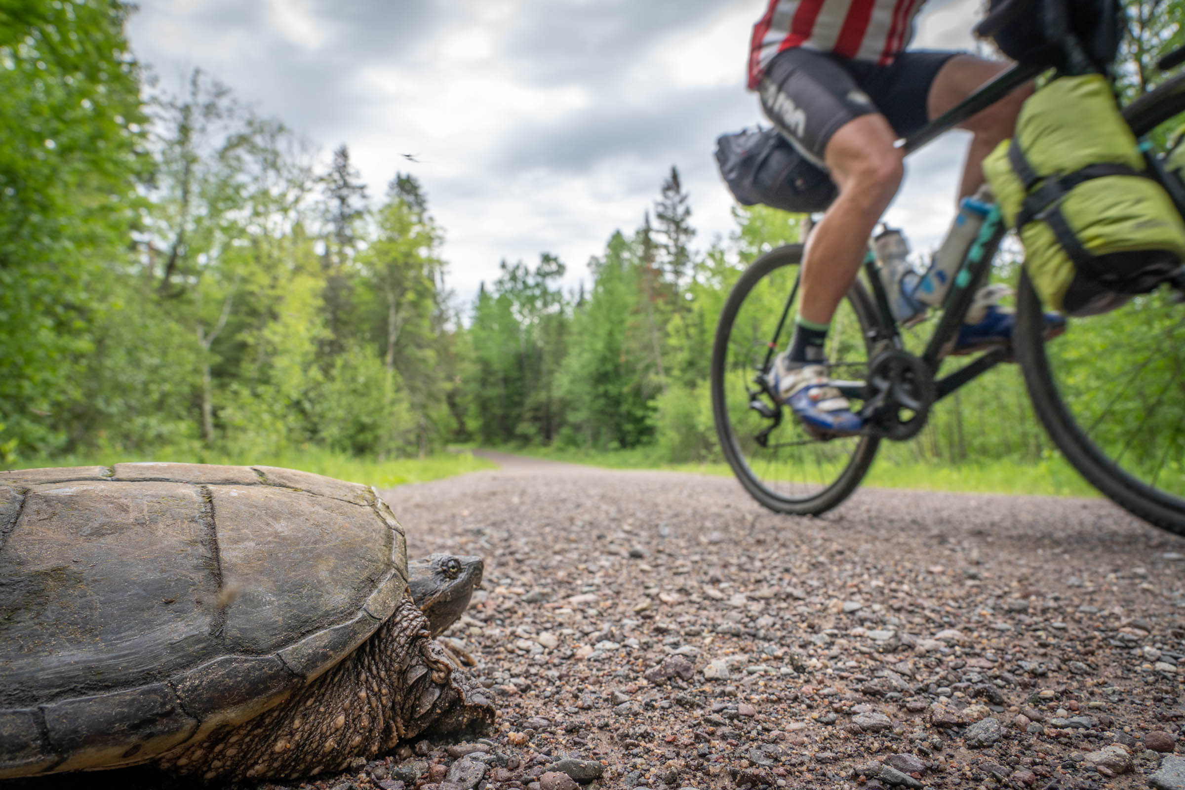
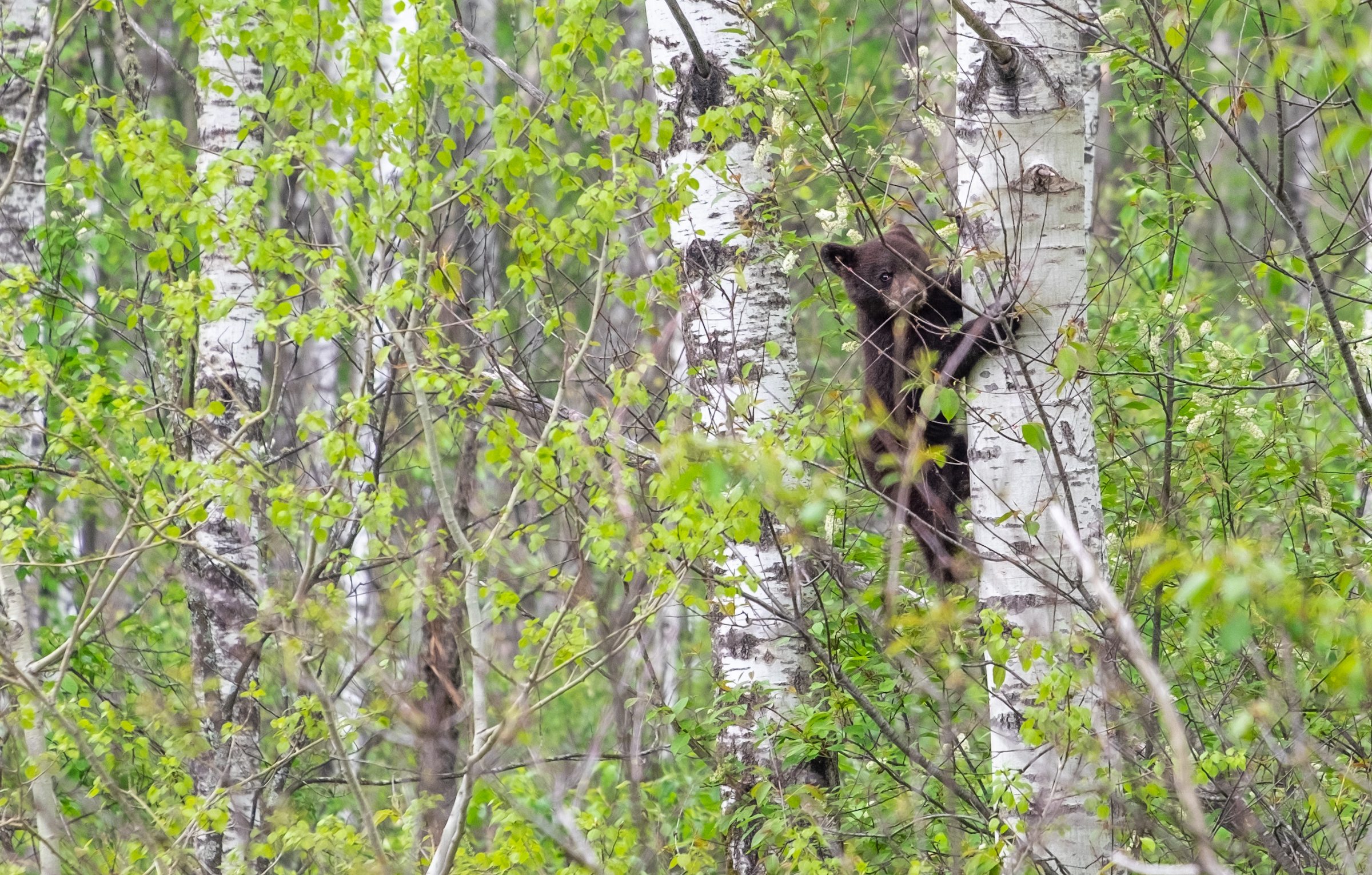
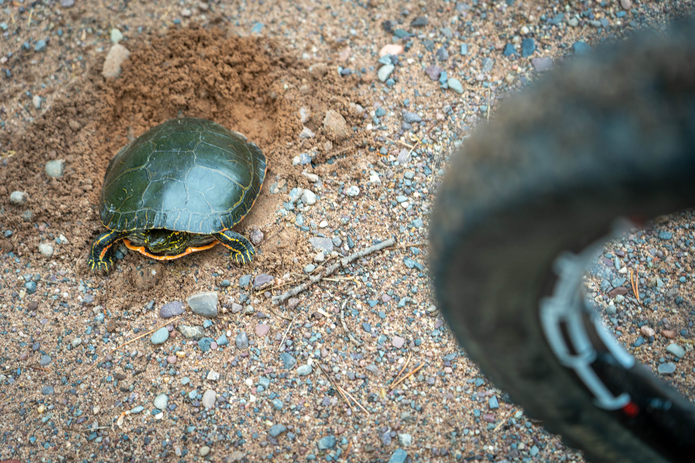
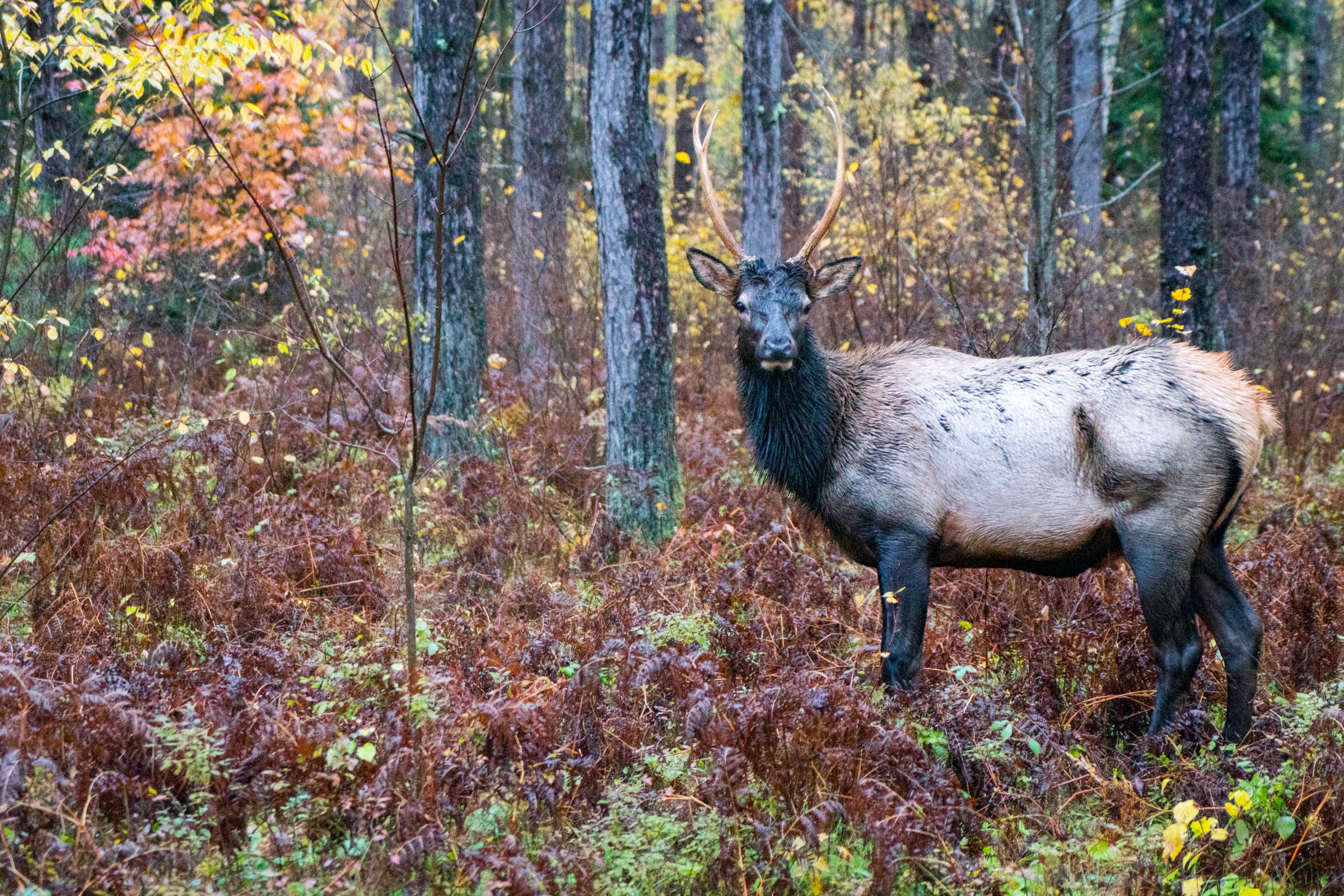
- Bears, elk, and wolves: I hope you get to see a black bear. If you do, they will likely run away before you can get a photo. Bears are particularly afraid of humans. The only thing to remember is to hang food away from camp if you are dispersed camping. Elk are not very afraid of humans, but it is pure luck to see one as our herd is small. Wolf sightings are extremely rare, but wolf tracks and scat are easy to spot.
- Most campsites along the route are marked with a POI on the map containing details about each site.
- Most can be reserved online between May 1 and September 31st. You can’t make reservations after September, but the sites typically don’t fill up in October or November.
- If you go in November, check with the ranger district to see if the wells and toilets are still open. They shut them down after it begins to freeze.
- Campsites are closed and no longer maintained after November.
- The campsites have wells and pit toilets; some have cabins. The two we stayed at did not have camp hosts or sell firewood. You can probably scavenge for wood in the forest just outside the campground.
- Wisconsin has a state rule that you can’t be turned away for camping if you arrive on foot or on a bike, but these are national forests, and when I asked about that, the rangers did not know about it.
- I have never made reservations for a campground and have always been able to stop when I wanted. If a campground was full when I arrived, dispersed camping is allowed in both county and national forests.
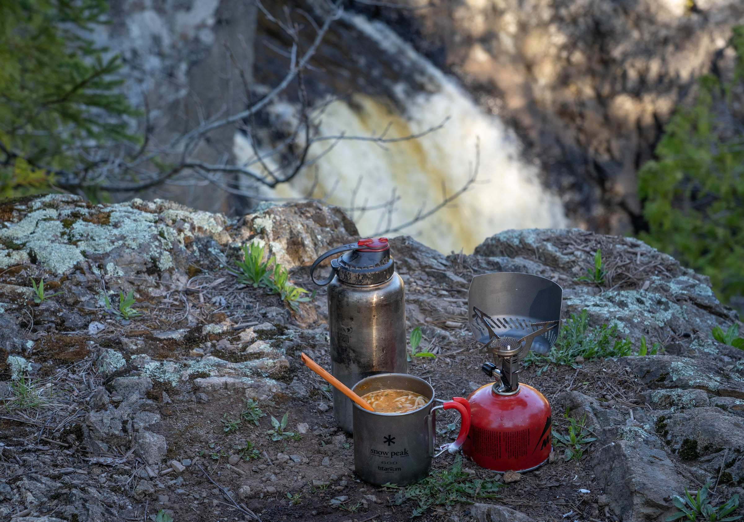
- I typically carry a handful of dehydrated meals and some instant oatmeal with me, but other than the first day or two, there are enough taverns, restaurants, convenience stores, and even grocery stores along the route that I typically don’t cook later in the trip. Of course, you could avoid those trips into town if you prefer. Just pack enough bikepacking meals and bring the stove of your choice.
- Pack food for the first couple of days. After that, there are plenty of places to resupply and grab meals along the route.
- Rondeau’s Grocery and Hardware at the start in Cable is a great place to get anything you forgot.
- Before you leave, grab breakfast at the Brick House Cafe in Cable. Chef Heather Ludzack is a local food network star. Then order a breakfast burrito to go from Velo Cafe next door to pack for lunch.
- Most POIs include details about hours for bars and restaurants on the route.
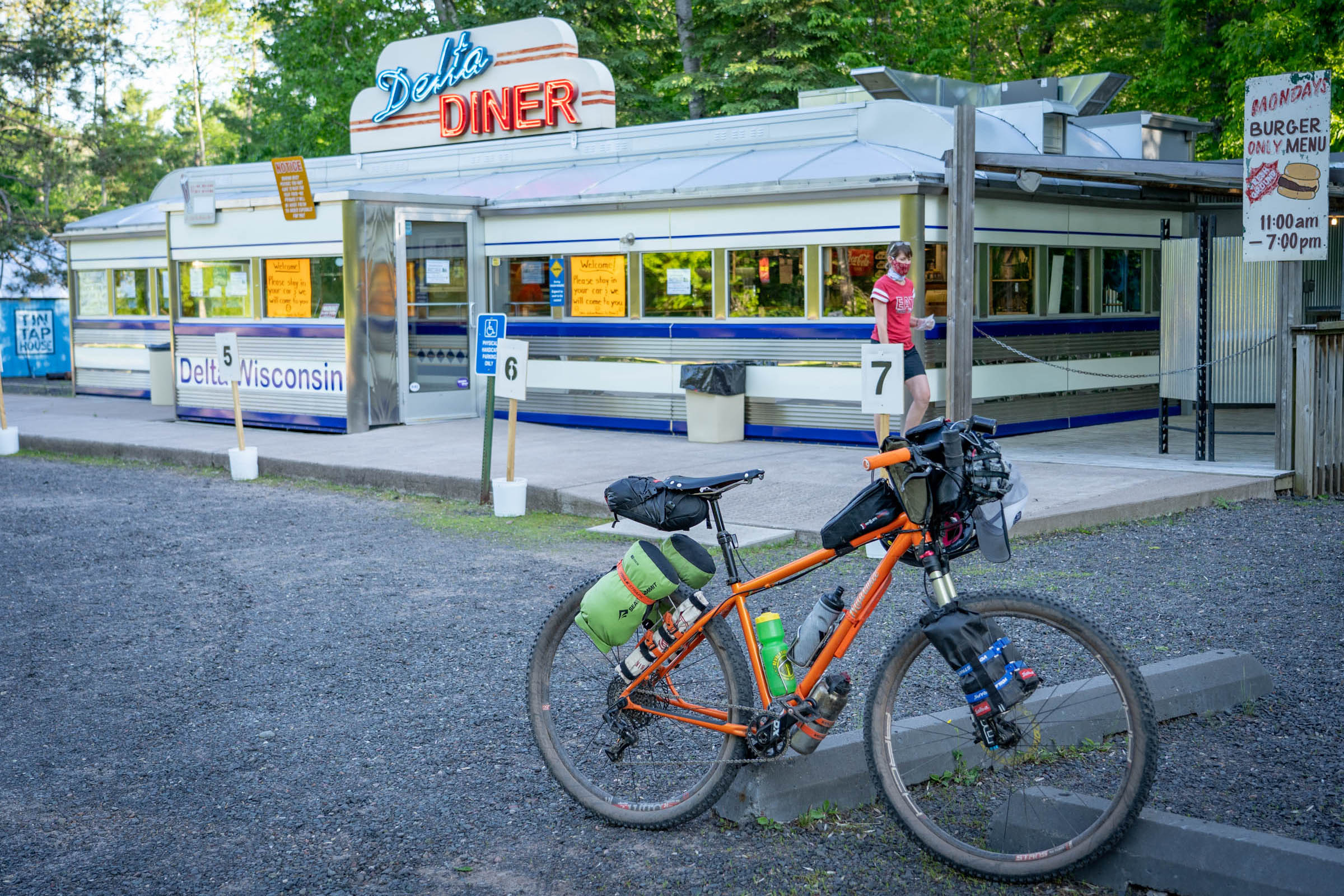
- The Delta Diner has amazing food, including a jerk shack on Saturdays and Sundays.
- Bring a method to filter water. There are plenty of streams, lakes, rivers and of course, waterfalls where you can get water. Most campgrounds have water as well.
Cable Start
Park in the Cable Municipal Lot. Stock up at Rondeau’s Grocery and Hardware. Eat a meal at Velo or Brick House and get a wrap to go in foil to pack for the next meal of the day.
Day 1: Mile 53, Stockfarm Bridge Campground
Day 2: Mile 122 (69 miles), Curry Park Campground
Day 3: Mile 184 (62 miles) Upson Falls Campground
Day 4: Mile 225 (41 miles) Lake Three Campground
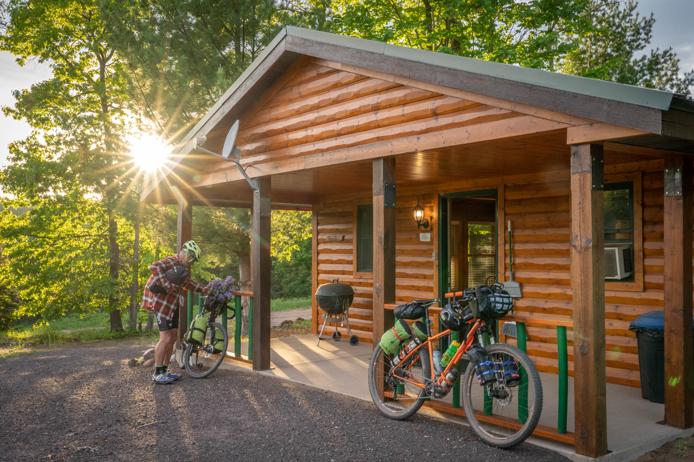
Day 5: Mile 272 (47 miles) Valhalla View Cabins
Day 6: Mile 340 (68 miles) Wanoka Lake Campground
Day 7: Mile 382 (42 miles) Finish in Cable!
Food
- Bear Crossing convenience store in Glidden, 66 miles
- Roxy’s Tavern in Glidden, 66 miles
- Northern Lure Resort & Campground, 70 miles (2 miles off route, north of Glidden, good food)
- Bear Chasers, 86 miles (might be closed)
- Willy’s Still, 89 miles (just snacks)
- Joany’s Sidekicks, 110 miles in Iron Belt (great food, worth the slight detour)
- DO Drop Inn, 111 miles
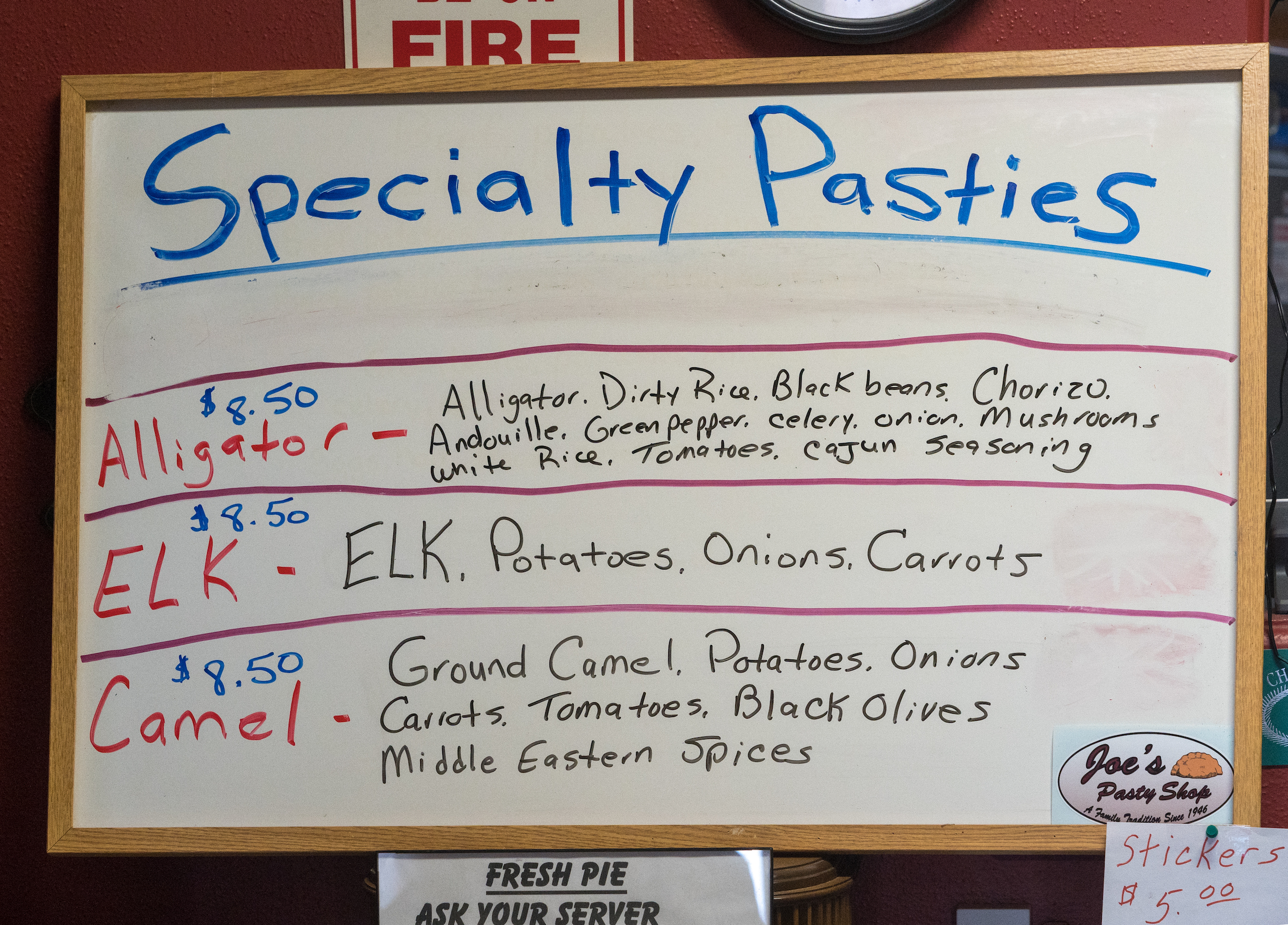
- Joe’s Pasty Shop, 117 miles (might be closed during pandemic)
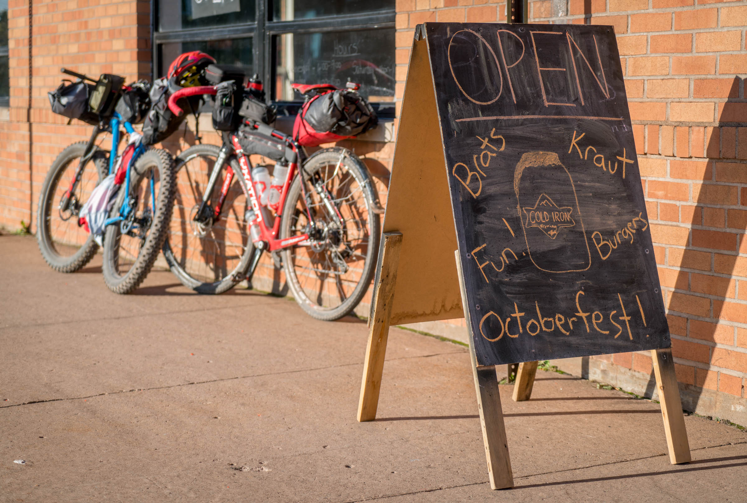
- Cold Iron Brewing, 118 miles (good beer, very limited food)
- Harbor Lights Bar, 148 miles
- Frontier Bar and Campground, 155 miles
- Whitecap Mountain Resort, 189 miles
- Copper Ridge Bar and Grill, 216 miles
- Northland Foods & Hardware, 216 miles
- White River Saloon, 247 miles (great burgers and pizza, but could be changing ownership and not open)
- Valhalla View Pub & Grub, excellent food and cabins to rent! 279 miles
- The Fat Radish, 288 miles (great food)
- Halvorson Fish Market, 289 miles
- Ehler’s General Store, 289 miles
- Johnson’s Store, convenience store with fresh smoked fish, 317 miles
- Delta Diner, Amazing food, Earthrider Beer jerk tap shack on weekends, burger night on Mondays, 350 miles
Camping options
- Moose Lake, 37 miles
- Black Lake, 42 miles
- Stockfarm Bridge, 53 miles
- Northern Lure Resort & Campground, 70 miles (2 miles off route, north of Glidden, food, showers)
- Peeksville hunting shack, 76 miles
- Ashland or Iron County Forest Dispersed, begins at mile 71
- Bear Chaser’s Lodge, 85 miles, likely closed
- Schomberg County Park, off route option
- Curry Park, 122 miles
- Saxon Harbor County Park and Marina, 149 miles
- Frontier Bar & Campground, 154 miles
- Potato River Falls Campground, 160 miles (5 sites, no water!)
- Foster Falls Campsite, 169miles, requires stream crossing
- Wren Falls, 171 miles, only one site, but does have privy
- Upson Falls Campground, 184 miles
- Weber Lake Campground, 188 miles
- Copper Falls State Park, 212 miles
- Lake Three Campground, 228 (closed or dispersed?)
- Beaver Lake Campground, 229 miles (two miles off route west on FR198)
- Birch Lake Campground, 267 miles
- South Shore Campground, 288 miles in Cornicopia
- Herbster Campground, 298 miles (bathrooms closed during pandemic)
- Anchor Inn Cabins and Campground, 311 miles
- Wanoka Lake Campground, 340 miles
- Delta Lake Campground, 345 miles (closed to transient camping during pandemic)
- Delta Civilian Conservation Corps Camp, 347 miles, slightly off route dispersed site next to Bass Lake
Waterfalls and Other Viewpoints
- Worlds Largest Black Bear, 66 miles in Glidden
- Kids Camp Arrow, 84 miles
- Island Lakes Old-Growth Hemlock Forest, 91 miles
- Spring Camp Falls, 102 miles
- Plummer Mine Headframe, 110 miles
- Montreal Mining Town Company Homes, 113 miles
- Gile Falls, 115 miles
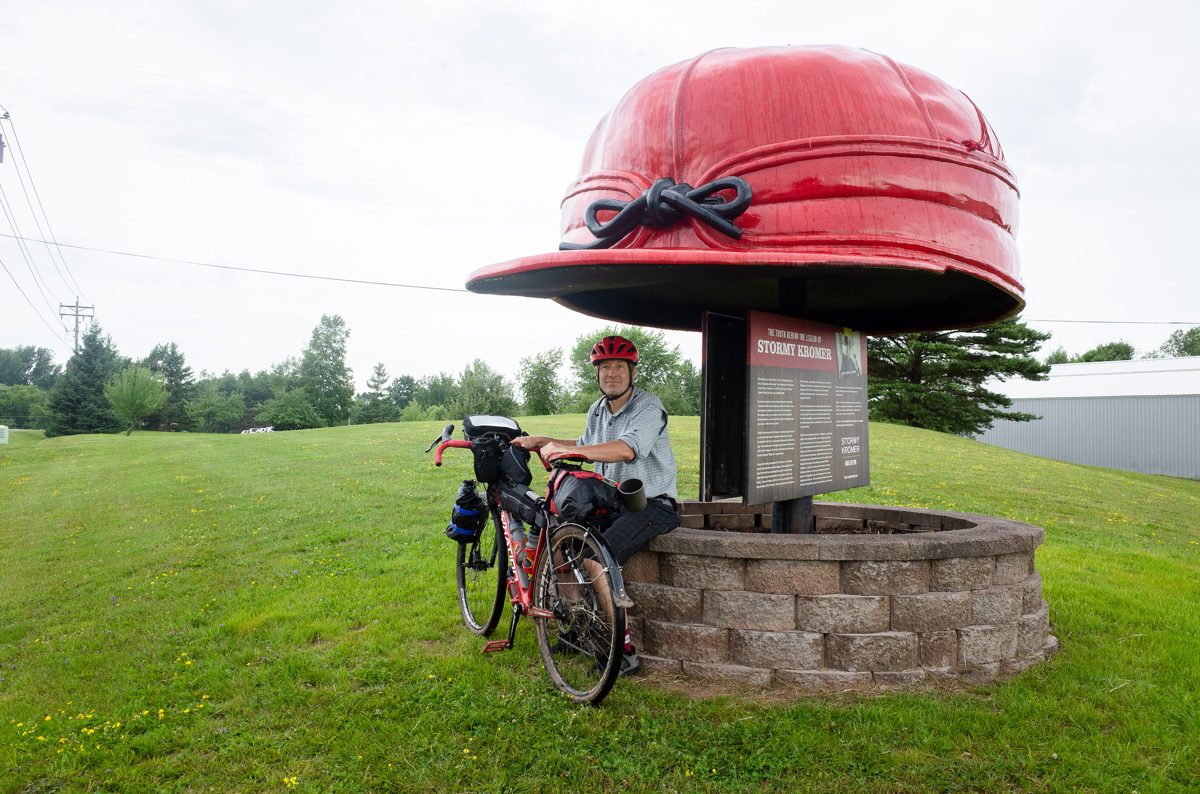
- Stormy Kromer Factory, 120 miles
- Interstate/Peterson Falls, 124 miles
- Kimball Falls, 127 miles
- Saxon Falls, 142 miles
- Superior Falls, 146 miles
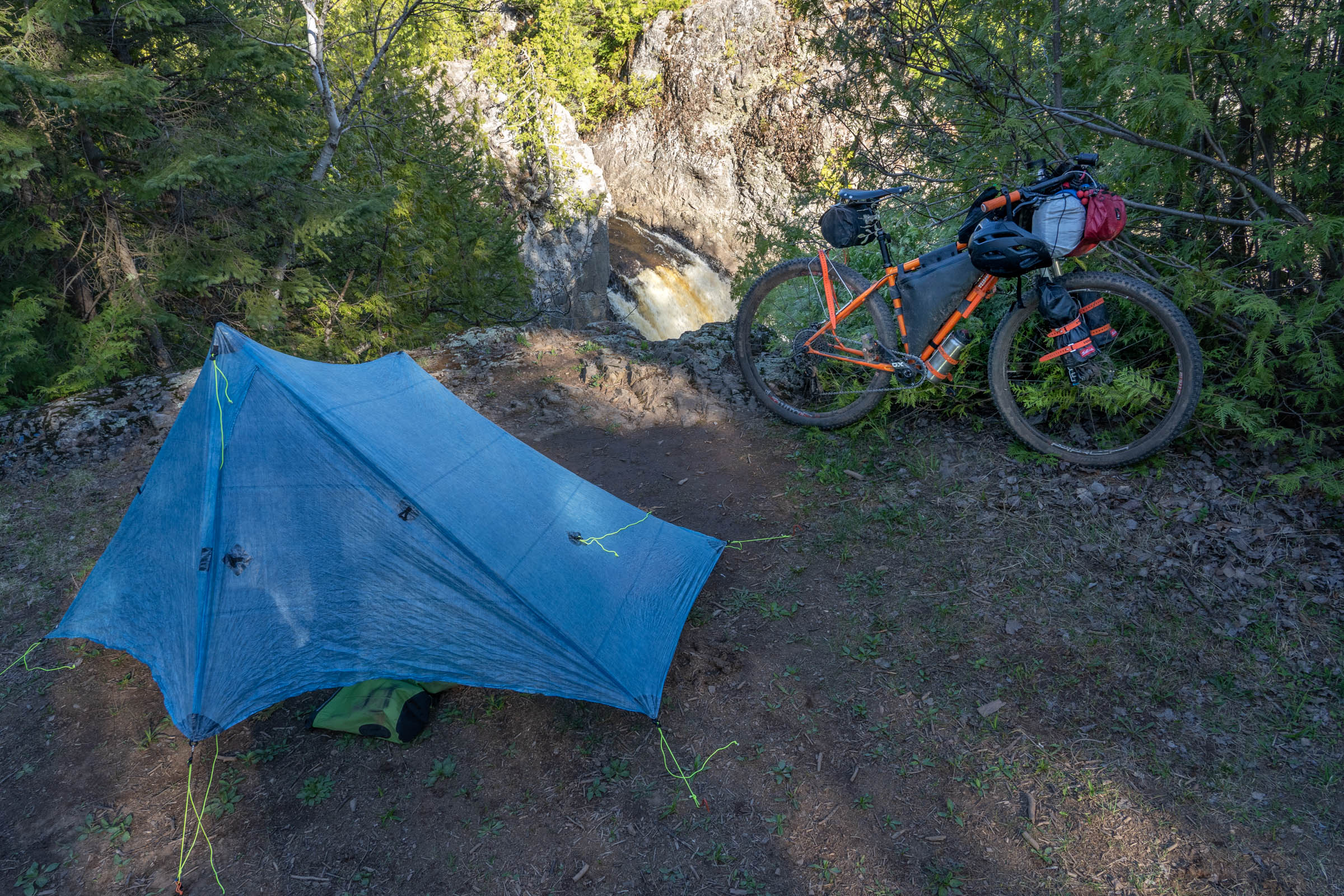
- Potato River Falls (upper and lower), 160 miles
- Willard Falls, 162 miles
- Potato River Rapids, 166 miles
- Foster Falls, 169 miles
- Wren Falls, 171 miles
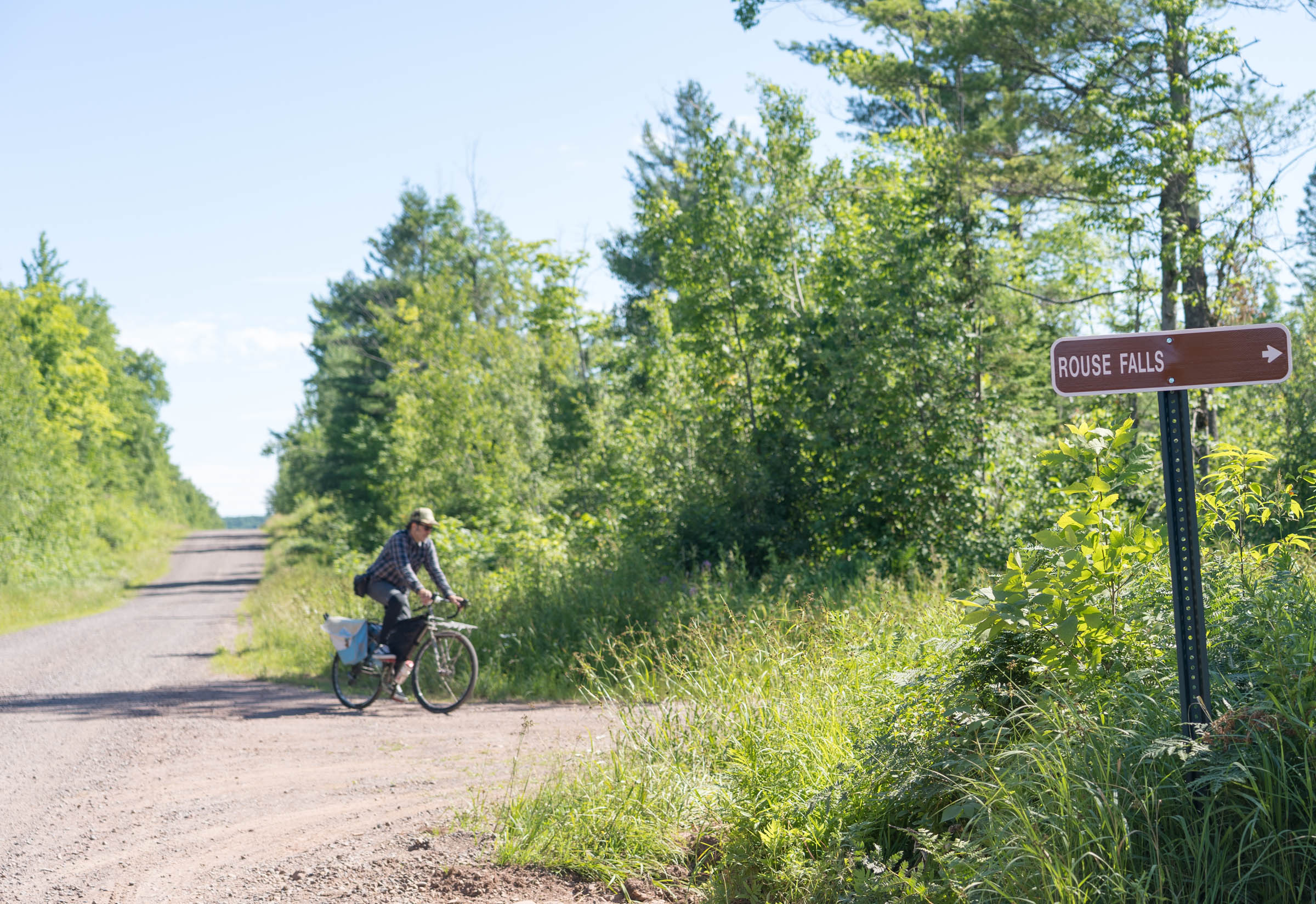
- Rouse Falls, 179 miles
- Upson Falls, 185 miles
- Corrigan’s Lookout, 191
- Tyler Forks Dells Falls (upper and lower) 200 miles
- Brunsweiler Falls, 226 miles
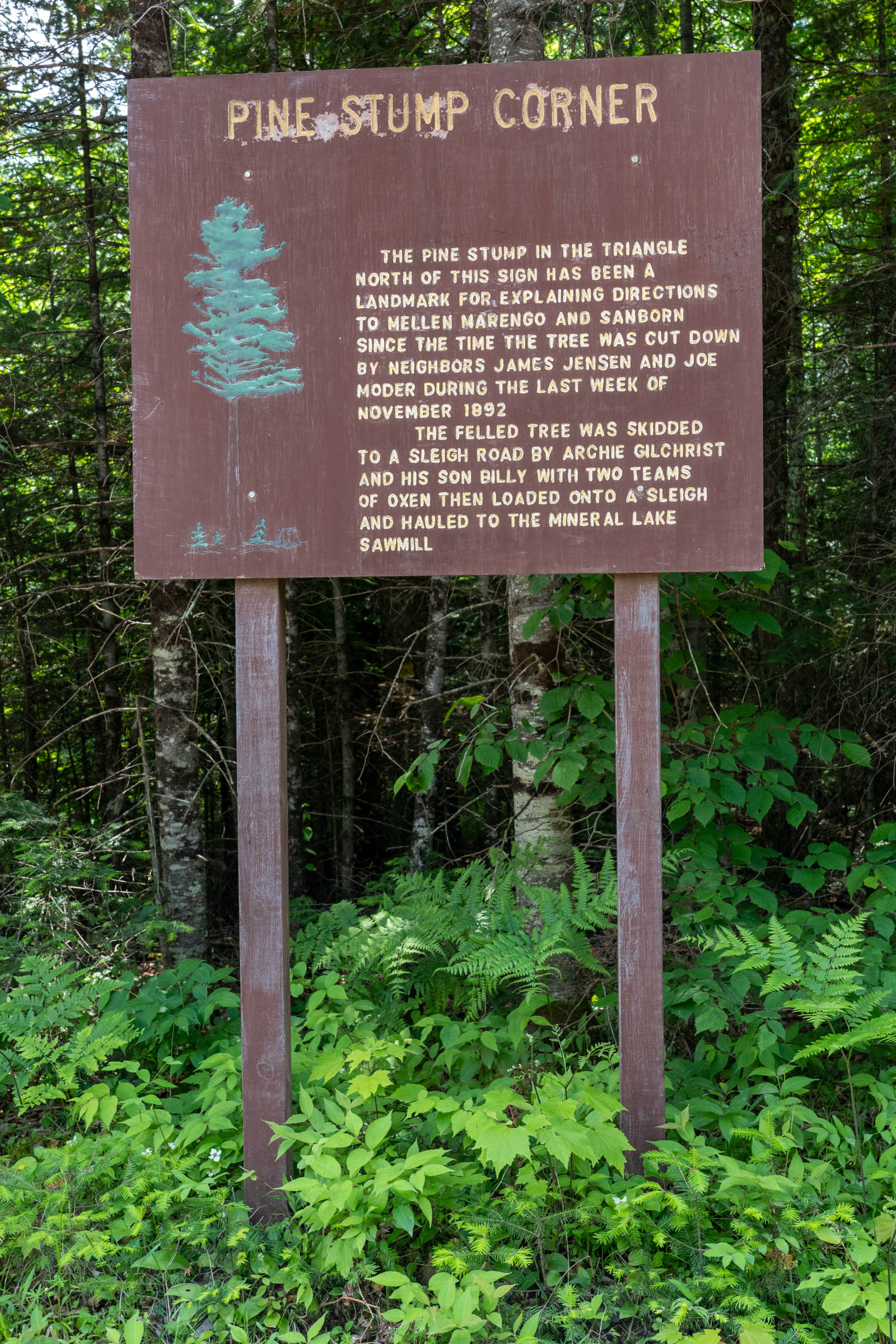
- Pine Stump Corner, 227 miles
- Morgan Falls/St. Peter’s Dome, 234 miles
- Lost Creek Falls, 286 miles
- Siskiwit Falls, 288 miles
- Green Shed Museum, 288 miles
- Twin Falls, 317 miles
- Heritage Hall Museum, 317 miles
Route Development: Chasing Waterfalls and Stormy Kromer
Even before TLC popularized the phrase in modern culture, bicycle advocates had built careers based on the metaphor. Since I retired after two decades working in bicycle advocacy, I’ve mostly given up tilting at windmills, but I do have a lot more time to literally chase waterfalls. This loop sticks mostly to the plentiful unimproved forest roads in northern Wisconsin and dips into Michigan’s Upper Peninsula to take the rider past 28 waterfalls.
The Stormy Kromer connection is because the iconic hats of the Northwoods are now made in Ironwood, Michigan. They used to be made in Milwaukee, where I was born. And the owner of the company is an avid cyclist who even sells SK jerseys and cycling caps made by Wisconsin’s own Borah Teamwear down in Coon Valley. The UP also has lots of waterfalls and if not for the Toledo Compromise should be part of Wisconsin anyway.
I have been bicycling and hunting along the gravel fire lanes and logging roads of Northern Wisconsin for more years than I like to remember. In those travels, I have often stumbled across a beautiful, but unexpected waterfall. While I like surprises, I realized that with some research, I could draw some lines and drop some POIs in Ride with GPS, to plan a Northwoods bikepacking trip that includes lots of waterfalls.
Some of the falls are well known, others are lesser-known and difficult to find. Having the POIs on RWGPS makes the trip a lot more enjoyable and Iets people skip a lot of the bushwhacking I put into the development of this route.
To pinpoint the waterfalls, I relied on my past trips, gowaterfalling.com, Bob Schneider’s waterfallwisconsin.com, and his wonderful printed companion book, Wisconsin Waterfalls Travel Guide. If you want to explore other waterfalls, Schneider’s helpful book includes 222 cascades and is the most inclusive and complete Wisconsin guide I could find.
With so many waterfalls to choose from and thousands of miles of gravel roads, ATV, and mountain bike trails, it took longer than I thought to put together a few route options I felt comfortable sharing. After about 200 hours of research and a dozen reconnaissance bike trips, I have finalized three different, but overlapping, waterfall routes. The first is a big loop that includes 28 waterfalls. The other two are day trips from the same basecamp to create a nice weekend trip in which you only have to set up camp once:
- Wisconsin Waterfall Weekend Day One – 58 miles
- Wisconsin Waterfall Weekend Day Two – 64 miles


Terms of Use: As with each bikepacking route guide published on BIKEPACKING.com, should you choose to cycle this route, do so at your own risk. Prior to setting out check current local weather, conditions, and land/road closures. While riding, obey all public and private land use restrictions and rules, carry proper safety and navigational equipment, and of course, follow the #leavenotrace guidelines. The information found herein is simply a planning resource to be used as a point of inspiration in conjunction with your own due-diligence. In spite of the fact that this route, associated GPS track (GPX and maps), and all route guidelines were prepared under diligent research by the specified contributor and/or contributors, the accuracy of such and judgement of the author is not guaranteed. BIKEPACKING.com LLC, its partners, associates, and contributors are in no way liable for personal injury, damage to personal property, or any other such situation that might happen to individual riders cycling or following this route.
Please keep the conversation civil, constructive, and inclusive, or your comment will be removed.