

 Mountain Bike (MTB)
 Gravel Bike
 All-Terrain Bike (ATB)
 Fat Bike


The Malchin Trail
Distance
227 Mi.
(365 KM)Days
5
% Unpaved
98%
% Singletrack
0%
% Rideable (time)
100%
Total Ascent
12,666'
(3,861 M)High Point
5,998'
(1,828 M)Difficulty (1-10)
5?
- 4Climbing Scale Fair56 FT/MI (11 M/KM)
- 3Technical Difficulty Fair
- 4Physical Demand Fair
- 7Resupply & Logistics Strenuous
Contributed By

Kiseok Uhm
Guest Contributor
Kiseok was born in Gangwon-do, a region in Korea renowned for its mountainous terrain. For about eight years, he contributed a column introducing MTB routes to a bicycle magazine. He currently enjoys bikepacking in Korea and various other countries. You can view more photos at @uhmkiseok.
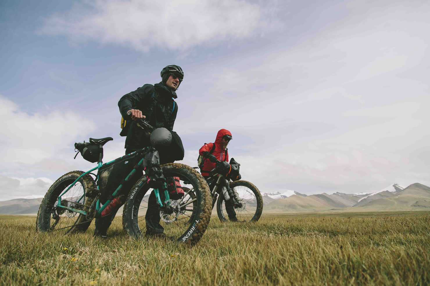
“Malchin” is the Mongolian word for nomad—someone who tends to livestock. Following the Malchin Trail bikepacking route, you will encounter a nomadic way of life that has remained virtually unchanged since prehistoric times.
The loop stretches along the southern edge of the Khan Khentii Special Protected Area, east of Ulaanbaatar. This region lies at the intersection of the Taiga and Steppe regions of the Khentii Mountains, creating a unique natural environment where these two ecosystems coexist.
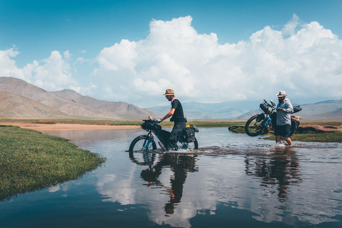
Most of the terrain along the route consists of smooth, unpaved tracks cutting across open grasslands, with occasional stretches of rougher ground. You will cross shallow streams about 15 times throughout the journey—all knee-deep or shallower—and traverse one area of marshy, grass-covered terrain. Although modern-day nomads sometimes travel by vehicle, encountering cars while riding is extremely rare—we saw fewer than ten vehicles over five days.

During our rides, we frequently crossed paths with herds of cattle, horses, sheep, and goats. It was a striking experience that offered a vivid glimpse into a nomadic culture that has endured for thousands of years.
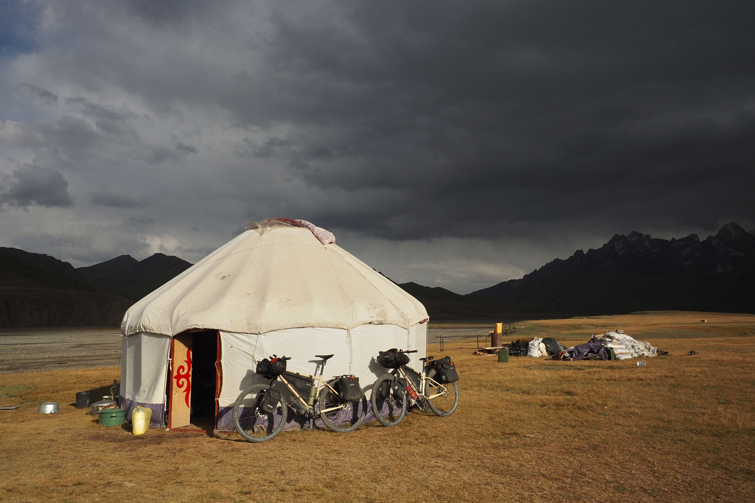
Although Mongolia has low precipitation, you may occasionally encounter thunderstorms and hail. In such moments, the clouds create dramatic scenes that truly fire the imagination. And because there is no light pollution, the clear night skies reveal a breathtaking expanse of stars.
Riding this route, you’ll pass prehistoric deer stones, historic Buddhist monasteries that once flourished, Blue Lake, where Temujin was proclaimed Genghis Khan by the tribal khuliltai, and the clean, beautiful Khangal Lake. Perhaps you’ll experience “the other end of the world” on the Mongolian Plateau.
Route Difficulty
The terrain consists almost entirely of well-packed doubletrack. While there are occasional shallow stream crossings, skilled riders can cross them easily. The route has two or three relatively steep descents (around -10%), but they remain doubletrack and are less than 2 kilometers long. The longest ascent spans 10 kilometers but gains only 400 meters, for an average gradient of 3.5%. The next-longest climb is about 4 kilometers, and the route has only three such climbs. As a loop, logistically, the route is also relatively easy. It begins outside the mining town of Baganuur, near the Kherlen River, an area home to several resorts. Four intercity buses depart daily from Ulaanbaatar to Baganuur, but a shared minivan is more practical, since you will need to transport a bicycle. Carry enough food for the first three days, and be aware that there are no bicycle repair shops along the route.
Route Development
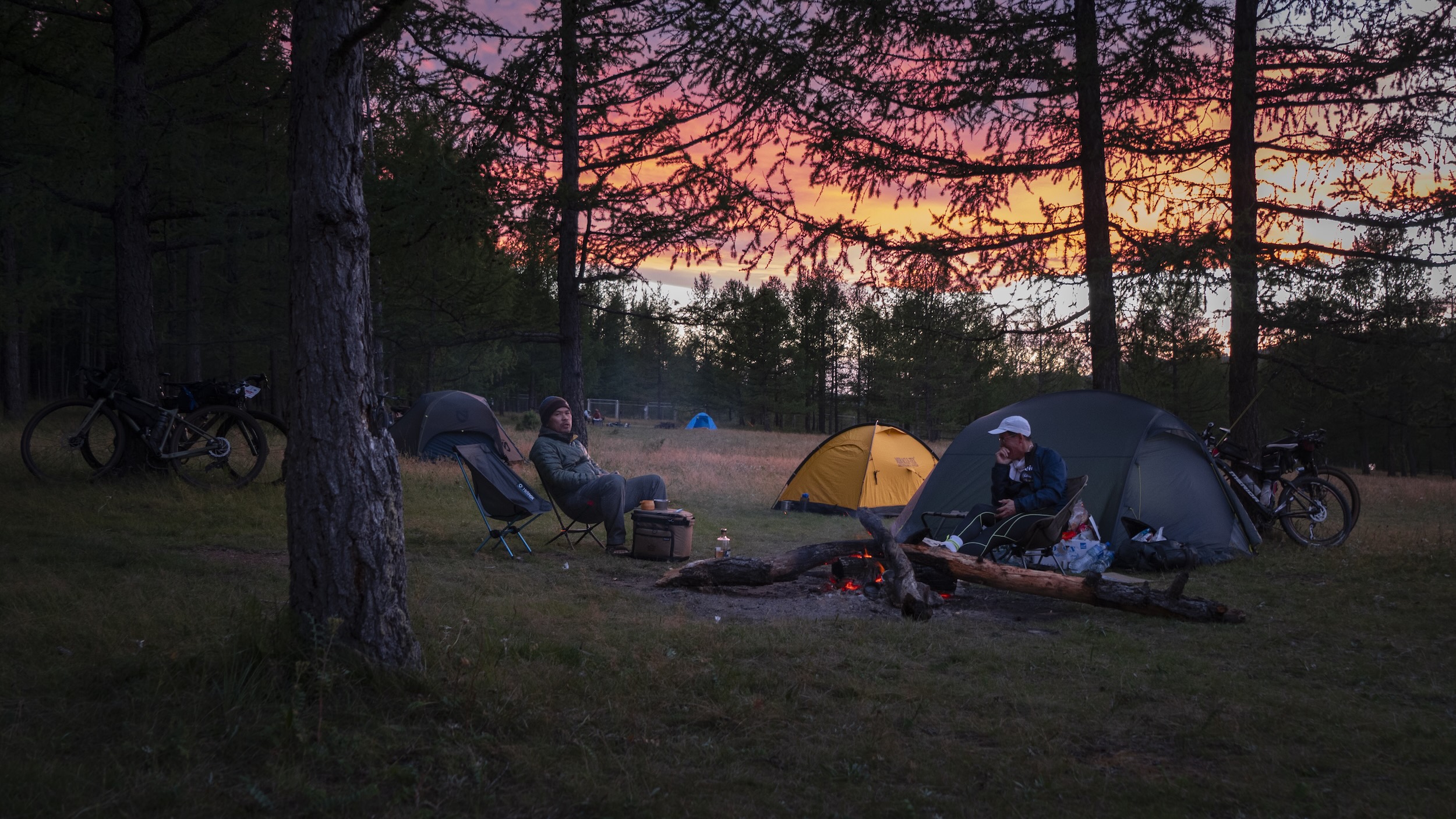
In August 2025, I went on a week-long bikepacking tour in the Terelj National Park area of Mongolia with some friends. That experience made me realize just how ideal Mongolia is for cycling and, more specifically, what a perfect environment it offers for bikepacking. Once you leave the villages, there are hardly any fences, and vast, flat grasslands stretch out in almost every direction. The entire country feels like one giant campsite.
This route runs through the Khan Khentii region. This area holds immense historical significance: it is the birthplace of Genghis Khan (the founder of the Mongol Empire), the site where Temujin was proclaimed Genghis Khan, and the suspected location of his tomb.
After completing the reconnaissance trip, I decided to organize a bikepacking event along the route. The inaugural event took place in August 2026 with 22 participants. All of them rode the entire route. Learn more about the event at the website.


Submit Route Alert
As the leading creator and publisher of bikepacking routes, BIKEPACKING.com endeavors to maintain, improve, and advocate for our growing network of bikepacking routes all over the world. As such, our editorial team, route creators, and Route Stewards serve as mediators for route improvements and opportunities for connectivity, conservation, and community growth around these routes. To facilitate these efforts, we rely on our Bikepacking Collective and the greater bikepacking community to call attention to critical issues and opportunities that are discovered while riding these routes. If you have a vital issue or opportunity regarding this route that pertains to one of the subjects below, please let us know:
Highlights
Must Know
Camping
Food/H2O
Trail Notes
Resources
- “Khar Zurkhni Kokh Nuur” means “Blue Lake of the Black Heart” in Mongolian. The lake is widely believed to be where Temujin was proclaimed Genghis Khan in 1189 by the tribal khuriltai (council), making it one of the most legendary sites in Mongolian history.
- Baldan Bereeven Monastery is a Gelugpa (Yellow Hat) Buddhist monastery. Its name translates to “abundant rice.” Founded in 1654, it grew into one of Mongolia’s largest and most important monasteries during its mid-19th-century heyday, housing up to 8,000 monks.
- Deer Stones are ancient megalithic monuments found in Siberia and Mongolia, often featuring depictions of deer. The archaeological culture defined by these artifacts is known as the “Deer Stone Culture” and is frequently associated with the Kheryksüür burial culture. To date, researchers have discovered over 1,500 deer stones, with approximately 1,300 in Mongolia.
- The Heling Bayan Ulan Mountains, a range extending south from the Khentii Mountains, lie at the intersection of forest and grassland zones, naturally enriched by abundant pastures and a mild climate. This is why it has long been known as “the mountain of a thousand winter pastures” (Myangan Uvuljuut).
- Across the vast, sweeping grasslands, you frequently encounter herds of cattle, horses, sheep, and goats grazing freely, without the supervision of a herder.
- A profound, absolute silence stretching for tens of kilometers without a single person or Ger in sight.
- Meadows blanketed in edelweiss, a flower that thrives only in high-altitude alpine regions.
- The village of Hentiy, where the remains of old wooden houses stand as eerie, ruined structures.
- The unexpected, warm hospitality of nomads who, true to their traditions, offer guests cheese, bread, and milk tea.
When to go
- This route can be ridden from May to September. The best time is during the summer months of June through August.
- I rode it in late August, and at around 1,500 meters, the water would freeze at night.
Logistics
- The most economical option is to take a regular intercity bus departing from Bayanzürkh Bus Terminal, located in the eastern part of Ulaanbaatar. Most travelers opt for private transport services or shared cars.
- Familiarize yourself with the etiquette for visiting a ger (a nomad’s tent). Guests should enter and sit on the left side. The stove is considered sacred; do not throw trash into it or rest your feet on it. Locals typically offer visitors milk tea and bread.
What bike and gear
- While it is possible to ride using 38mm gravel tires, slick-tread tires might prove challenging for potentially sandy or muddy terrain, though such conditions are quite rare. Tires with a more aggressive tread pattern are recommended. If you are using a hardtail mountain bike equipped with tires two inches or wider, you will have a very comfortable ride.
- Mongolia experiences extreme temperature fluctuations between day and night, so you need to pack appropriate clothing. During our ride in late August, the temperature difference reached 30°C. Water froze at dawn, yet it felt hot in the middle of the day.
Dangers & Annoyances
- There are hardly any road signs or distinctive landmarks, so you must learn how to navigate using GPS before setting out.
- Mobile service is available only in limited areas, such as near villages. Keep in mind that internet access is virtually non-existent.
- Animals such as bears, wolves, and foxes inhabit the taiga forest, though actual encounters with them are rare. The real threat comes from dogs. Nomads keep dogs to protect their livestock, and the traditional Mongolian breed—the “Bankhar”—is fierce enough to fight off wolves. However, most dogs we encountered along the route approached in a friendly manner and rarely showed strong territorial aggression.
- You can camp almost anywhere, provided there is a water source.
- Drinking water can be found in locations other than those marked on the map. You can obtain water from gers, but it is best to purify it before drinking. Gers are moved seasonally; a ger present at one time might not be there during a future visit.
- Homestays offering food and accommodation are available at the 46- and 133-kilometer marks from the starting point. Grocery stores are available at the 206-kilometer (Omnodelger town) and 290-kilometer (Bayanmod town) marks. Overall, conditions for resupply are very favorable.
- This route passes through two villages with grocery stores. Since there are no stores during the first three days, you must carry at least three days’ worth of food. You will pass a couple of homestays before then, where you might be able to obtain limited supplies.
- Although there is plenty of water, to the point where you might cross a stream three or four times a day, the amount of water actually safe for drinking is limited. This is because many livestock animals are left to graze freely; consequently, the larger the stream, the more likely it is to be contaminated by animal waste. While groundwater and well water are generally safe to drink, it is strongly recommended that you purify any flowing water before consuming it.
- A representative traditional Mongolian dish is khorkhog. It is prepared by placing lamb and various vegetables into a large pot or milk can and cooking them with hot, heated stones. Khuushuur, a meat-filled dumpling, is also commonly eaten.
- Locals often use water from flowing streams for drinking. Therefore, exercise caution when using water from such sources. If you need to shower or do laundry, do not enter the stream; instead, fetch the water and perform these activities at a location at least five meters away. Even then, do not use soap.
Suggested Itinerary
The following is the itinerary for the Malchin Trail event, a supported bikepacking ride held annually in August along this route. This itinerary also works well for touring riders who want to split up the route.
locationBaganuur to Blue Lake
Day 1 (70km, +685m)
The ride begins on the banks of the Kherlen River. Upstream of the Kherlen River lies Burhan Khaldun, believed to be the birthplace and tomb of Genghis Khan. UNESCO designated Burhan Khaldun a World Heritage Site in 2015.
Stage 1 ends at Khar Zurkhni Kokh Nuur, which means “blue lake of the black heart” in Mongolian. Khar Zurkh Kokh Nuur (Mongolian: Хар зүрхний хөх нуур) is a small but historically significant freshwater lake nestled among forested mountains in Khentii Province, eastern Mongolia. The lake is widely believed to be the site where Temujin was proclaimed Genghis Khan in 1189 by the tribal khuriltai (council), making it one of the most legendary locations in Mongolian history.
locationBlue Lake to Baldan Bereeven Monastery
Day 2 (66km, +628m)
Forty-four kilometers into Stage 2, you’ll see a sign on a hill that reads “Khangal Nuur.” Nuur means lake. The lake view from here is breathtaking. A short downhill leads to the lakeside, where you’ll circle the northern perimeter. Deer statues stand on the lake’s east and west sides. Deer were likely abundant in ancient times. Of course, some still live in the forest today. This lakeside area is a great place for lunch, and there’s even a small observation deck on the east side.
Stage 2 ends at Baldan Bereeven Monastery. Baldan Bereeven Monastery is a Gelugpa (Yellow Hat) Buddhist monastery, whose name means “abundant rice.” Founded in 1654, it grew into one of the largest and most important monasteries in Mongolia during its mid-19th-century heyday, housing up to 8,000 monks. The monastery and its complex were destroyed by the Mongolian Communist regime in 1937. Today, three monasteries have been restored, and the grounds contain the remains of approximately 50 temples, stupas, and other religious structures.
locationBaldan Bereeven Monastery to Ömnödelger
Day 3 (72km, +723m)
From Baldan Bereeven Monastery, follow the Baruun Jargalant River eastward for 14 kilometers to reach the Deer Stones. Deer Stones are ancient megalithic monuments found in Siberia and Mongolia, often depicted with deer figures. The archaeological culture defined by these marker artifacts is called the Deer Stone Culture and is often associated with the Kheryksüür burial culture. Over 1,500 deer stones have been discovered to date, approximately 1,300 of which are in Mongolia, particularly in the well-watered steppe regions of northern Mongolia.
Thirty km from the start of Stage 3, you cross the Baruun Jargalant River and descend south. There’s a wooden bridge over the river. After 44 kilometers, you reach the village of Hentiy. The village of Henty has a rather peculiar appearance, with old, disused wooden buildings scattered about. There is also a large school building that is no longer in use. Some of the gers are inhabited.
locationÖmnödelger to Bayanmod
Day 4 (91km, +1,243m)
Tsenchernmandal Soum is also renowned for its unique ecological environment, encompassing taiga forests and grasslands. It boasts thriving wildlife, migratory birds, and pristine waters. Its thriving agriculture and livestock provide a vibrant opportunity to experience traditional Mongolian nomadic life. Tsenchernmandal Soum, a harmonious blend of nature, history, and traditional culture, offers a unique destination in the Khentii region, providing both a peaceful respite in nature and a historical experience. This region lies at the intersection of the coniferous forests and steppe regions of the Khentii Mountains, creating a unique natural environment where these two ecosystems coexist. The forests boast high biodiversity, with 27 species of rare wildlife, including argal serow, maral deer, mountain weasels, and brown bears. It is considered a key natural complex in the eastern Mongolian ecosystem.
Bayanmod is a town in Chemhermandal Soum. It offers services like a supermarket, bank, hospital, and public showers, so riders can restock if they need food or wait.
locationBayanmod to Baganuur
Day 5 (56km, +817m)
Heling Bayan Ulan Mountains, a mountainous region extending south from the Khentii Mountains, lies at the intersection of forests and grasslands, naturally enriched by abundant pastures and a mild climate. This is why it has long been known as “the mountain of a thousand winter pastures” (Myangan Uvuljuut).
Centered by the 2,042-meter Delgerkhang Peak, the region’s humid climate and abundant pastures provide ideal conditions for livestock to survive the harsh winters. During years of extreme cold or drought, hundreds of nomadic families from neighboring regions like Khentii, Tuyev, Dundgovi, and Dornogovi have traditionally migrated here, making it a prosperous winter haven.
Additional Resources
- The Malchin Trail is a supported bikepacking event that takes place on this route every August. Please visit MalchinTrail.com for details about the event.

Terms of Use: As with each bikepacking route guide published on BIKEPACKING.com, should you choose to cycle this route, do so at your own risk. Prior to setting out check current local weather, conditions, and land/road closures. While riding, obey all public and private land use restrictions and rules, carry proper safety and navigational equipment, and of course, follow the #leavenotrace guidelines. The information found herein is simply a planning resource to be used as a point of inspiration in conjunction with your own due-diligence. In spite of the fact that this route, associated GPS track (GPX and maps), and all route guidelines were prepared under diligent research by the specified contributor and/or contributors, the accuracy of such and judgement of the author is not guaranteed. BIKEPACKING.com LLC, its partners, associates, and contributors are in no way liable for personal injury, damage to personal property, or any other such situation that might happen to individual riders cycling or following this route.
Further Riding and Reading
Here are some connected/nearby routes and related reports...
Please keep the conversation civil, constructive, and inclusive, or your comment will be removed.