


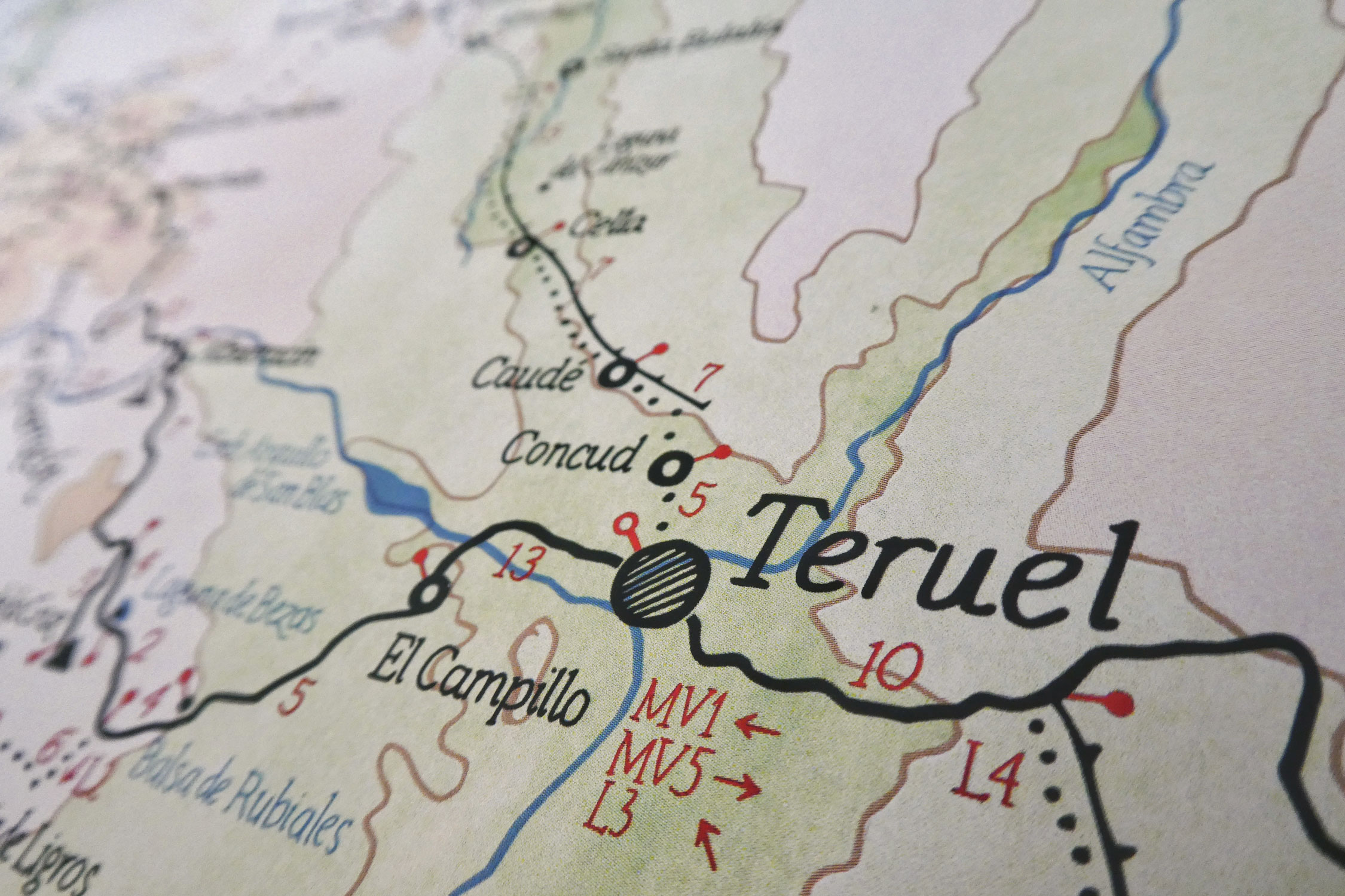
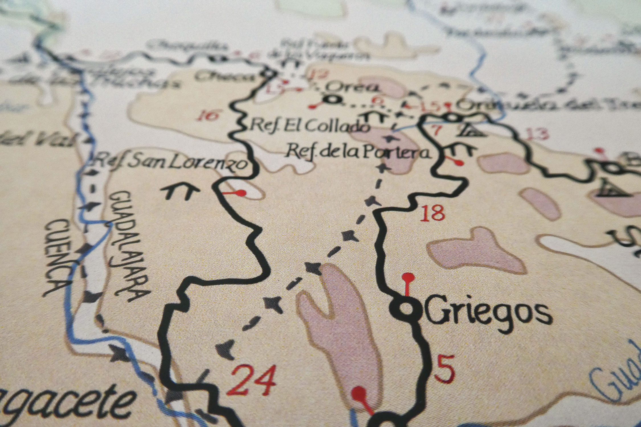
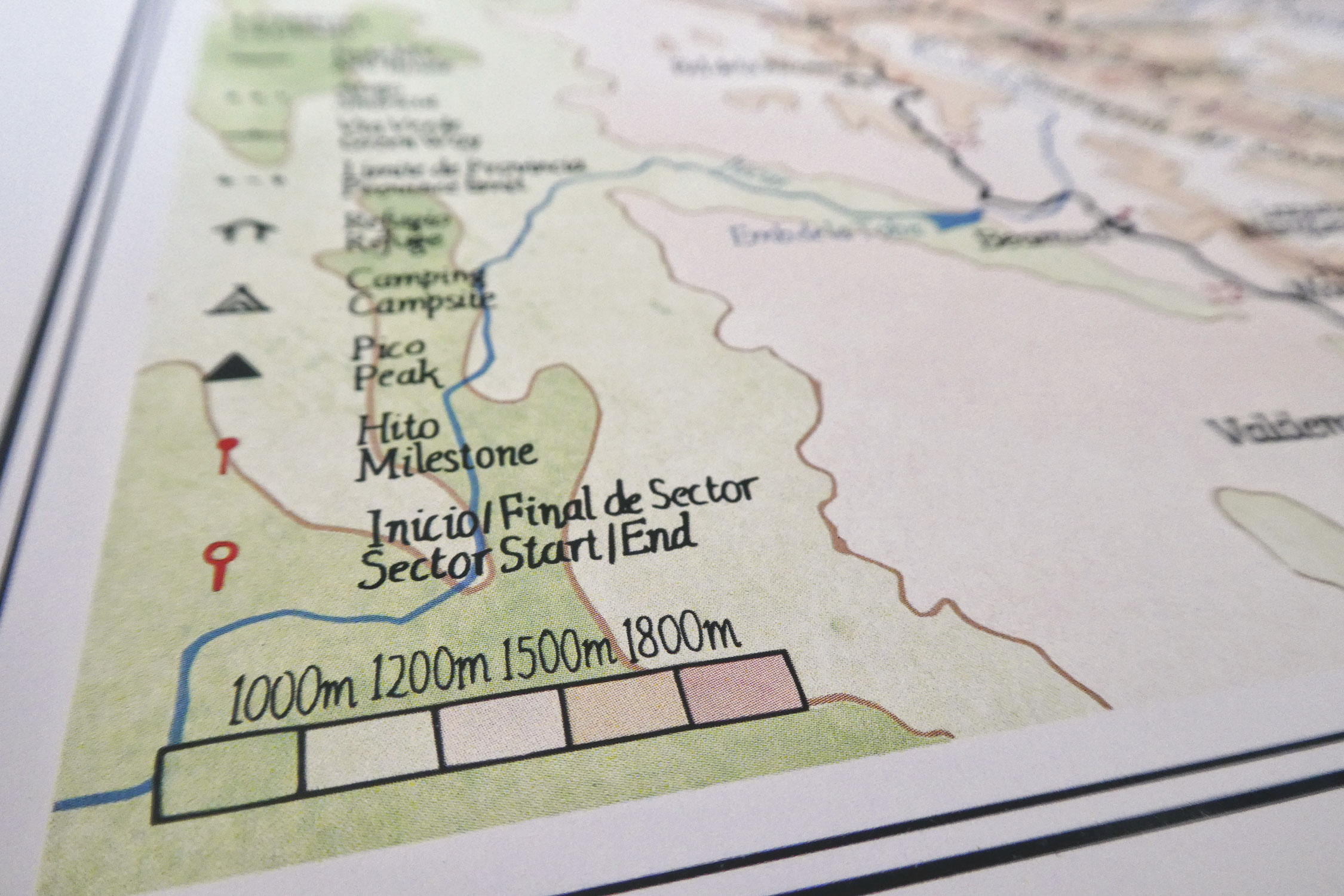
This hand-drawn map of the Montañas Vacías bikepacking route will be printed in two sizes and is now available for pre-order. Learn more about the route, the map, and how to get a copy on waterproof, travel-friendly paper.
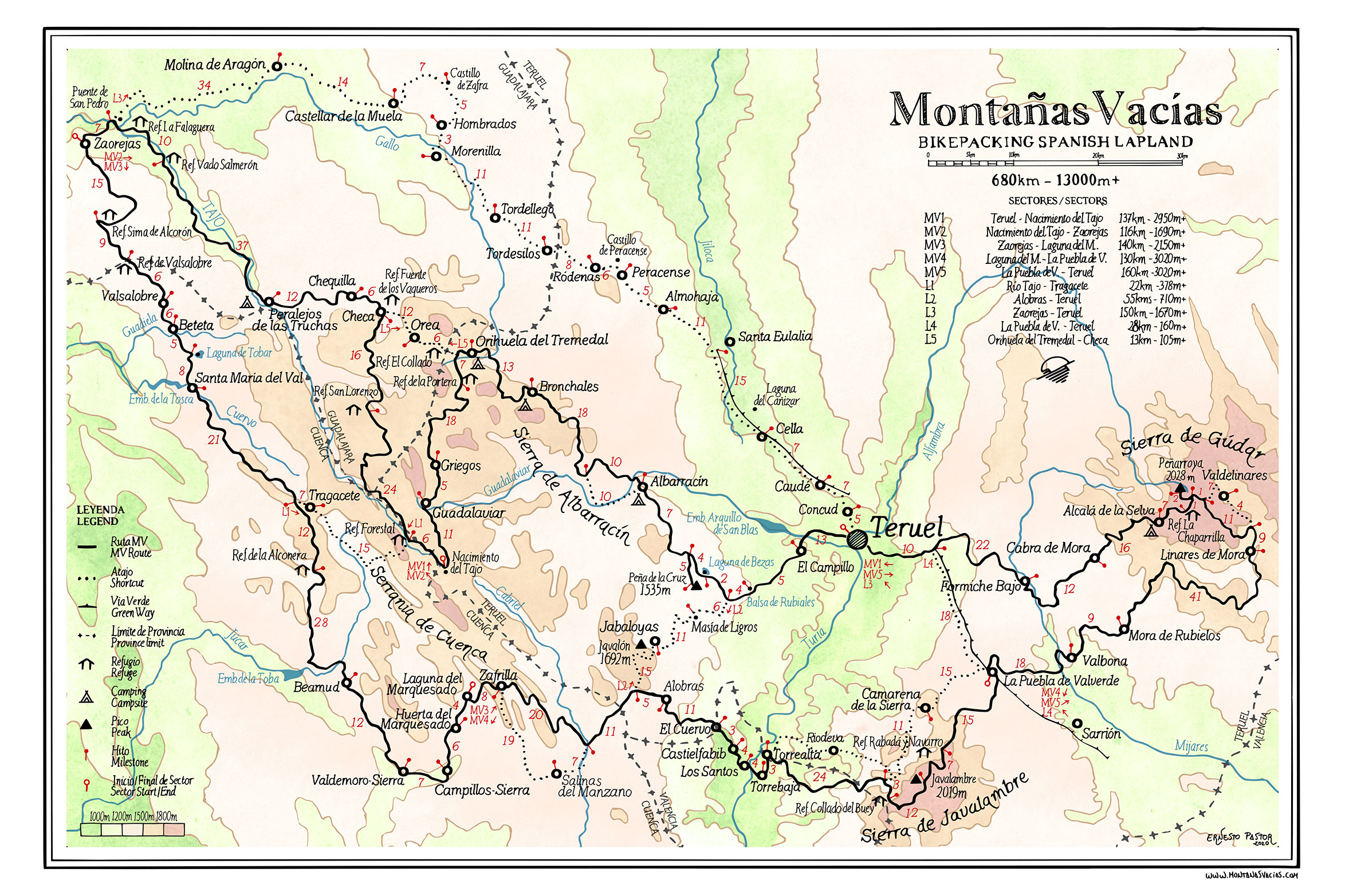
Montañas Vacías creator Ernesto Pastor set out to draw a detailed map of the route with the intention to simply display it in his house. The route has become a big part of his life and it deserved a physical presence in his home. However, after finishing the map and seeing it printed on A2 (59.4 x 42 cm) paper, Ernesto felt that it might be worth sharing…
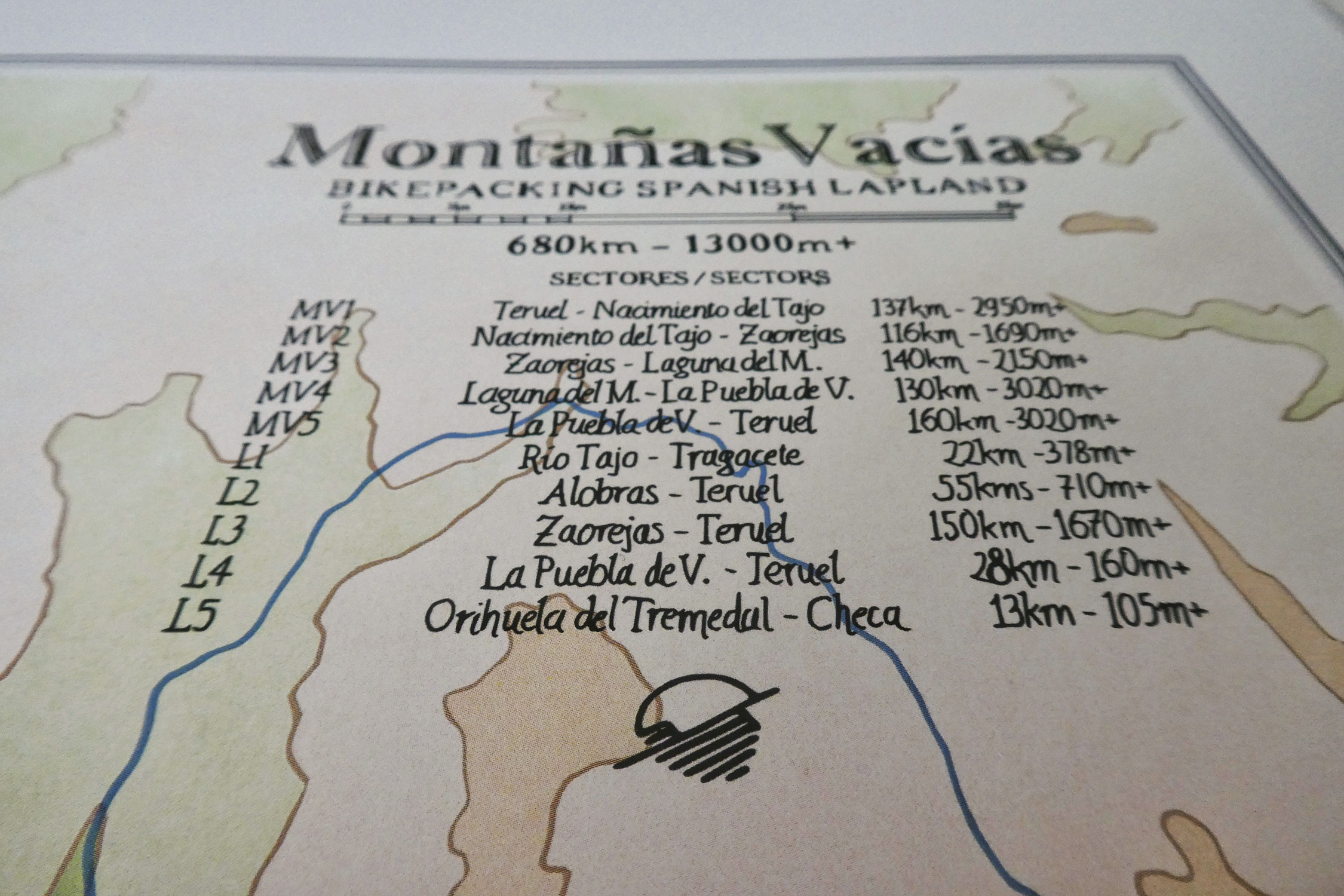
Ernesto has prepared a joint order to share costs and have the map printed in two sizes. The A2 (59.4 x 42 cm) version is designed to be displayed. And the A3 (42 x 30 cm) size will be a folded version printed on waterproof, anti-tear paper, for those interested in carrying a map along the route. The pre-order form can be found here and will be open until Sunday, July 26. There may be more orders later in the year if people are are interested.
FILED IN (CATEGORIES & TAGS)
Dispatch
Please keep the conversation civil, constructive, and inclusive, or your comment will be removed.


