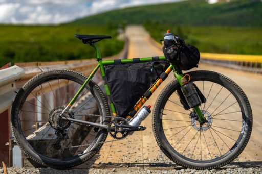

Ride With GPS just released its new surface types feature, which displays unpaved surfaces as a percentage and as dotted lines in their maps. We’ve been beta testing it for a month or so now; find details in the press release and our impressions here…
As of today, Ride With GPS has officially unveiled an all-new Surface Types feature on both their web and mobile platforms. This is something we’ve been waiting on for a long while. The feature allows you to see whether a road’s surface type is paved or unpaved as you plan or view routes so that you can prepare accordingly. We’ve been playing with the Surface Types feature as a beta tester for over a month. Read on for details and impressions…
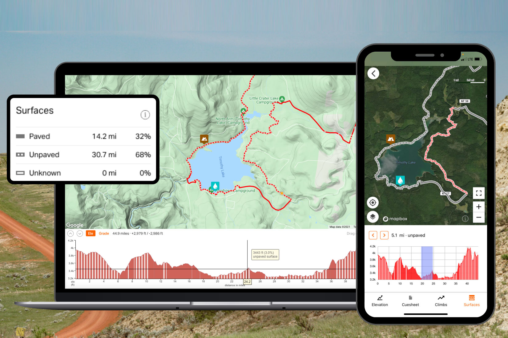
In short, the Surface Types feature breaks down the terrain visually on the map and by numerical percentages with the goal of showing riders what to expect on a route. We’ve been documenting surface type percentages in all of our original bikepacking routes since we launched our routes network nearly eight years ago, so it’s nice to see our partner Ride With GPS take it a step further. “Our mission is to help users go on better rides, more often. Knowing the surface type doesn’t just help route planners, it provides a better riding experience for everyone, and encourages folks to discover more places to ride,” said Zack Ham, Ride with GPS founder.

Surface Type Categories
There are essentially three surface type categories used by Ride With GPS:
- Paved: Paved surfaces include asphalt, concrete, and chip seal. Paved surfaces are shown as a solid line.
- Unpaved: Unpaved surfaces include gravel, dirt, and natural/unimproved trails. Unpaved surfaces are shown as a dashed line.
- Unknown: When there is insufficient data available about a surface it will show up as unknown. Unknown surfaces are shown as an outlined white line.
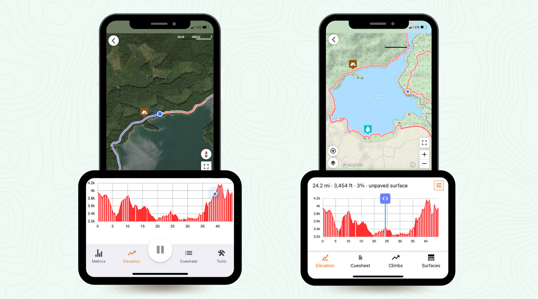
The display works by showing a red and white dotted line on the route—in both planning and viewing modes—which translates to a red and white striped color field on the elevation profile. Generally speaking, it’s quite easy to visualize and use. You can also toggle the surface types display on and off in the settings menu. Additionally, RWGPS displays the percentages on the left column.
In Use
Surface Types was designed to seamlessly take guesswork out of route planning. However, it’s not quite that easy. Don’t get me wrong, the RWGPS Surface Type feature is a giant step for the application, and no doubt the best of its kind out there. But, from my experience, it’s not 100% accurate, 95% of the time. As we’ve found viewing most of our routes—many of which were meticulously documented with notes specifying where pavement starts and ends—the percentages are usually off. Most of the routes are off between 5-30%, but there are some that have been a couple others that are significantly inaccurate.
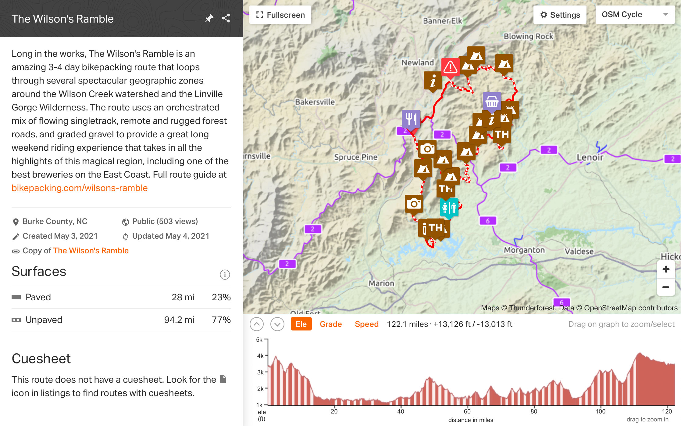
One example of a typical minor inaccuracy is the recent Wilson’s Ramble above. The route is 82% unpaved, but Ride With GPS shows 77%. When looking at it closely, there are a couple minor stretches that are shown as paved that in fact are not. When I asked RWGPS about it for another route that was about 70% inaccurate, they explain that certain road types are categorized as unclassified or residential, which automatically specifies them as paved. This apparently affects some routes in the Midwest more than others due to road classifications. There are reasons for this…
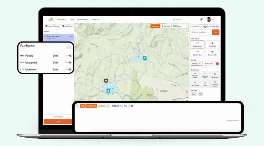
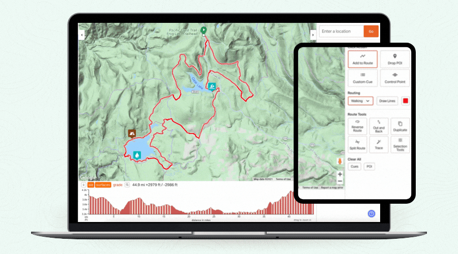
Like many other services out there, Ride with GPS relies on surface type data from OpenStreetMap (OSM), an open-source mapping service of the entire world. They also recognize that this data is incomplete, and that users riding those routes will know best. Therefore, users can visually adjust the surface types of routes using the Ride with GPS Route Planner, as shown in the animated gif below.
This will adjust the route on RWGPS—but not relay that info to OSM, however. For permanent changes, Ride With GPS encourages users to contribute up-to-date surface types information to OSM as well. To do so, you will need to be an OSM account holder. Ride with GPS let us know that they sync OSM updates every two weeks, so anyone making changes should see updates pretty quickly.
All in all, we are quite impressed with the new Surface Types feature. It serves as a great baseline, and alongside heatmaps and all the other available layers and tools, this is another excellent resource to help plan routes and rides. And, as with all of RWGPS’ other functionality, we expect it to improve over time. The new Surface Types feature is available today for web and mobile apps.
Please keep the conversation civil, constructive, and inclusive, or your comment will be removed.