


Wapusk Trail: The World’s Longest Winter Road (Film)


In 2020, Buck Miller, Ryan Atkins, and Eric Batty set out to tackle Canada’s 721-kilometer Wapusk Trail from Peawanuck, Ontario, to Gillam, Manitoba. Five years later, you can finally watch the 30-minute film they produced from the remote expedition. Find it with a stunning collection of photos and a daily journal here…
PUBLISHED Mar 9, 2025
Five years ago seems like just last year. At the same time, it also feels like a lifetime ago. So much has happened in the world since then. In 2020, the Expeditions Ontario trio of Ryan Atkins, Buck Miller, and I embarked on the first-ever Fat Bike Expedition down the world’s longest seasonal winter road, the Wapusk Trail. Our team completed the route and successfully raised over $12,000 for True North Aid. What makes this route unique is that the 720 kilometers along the south shore of Hudson Bay is a rarely seen, very remote area of Canada, home to thousands of polar bears and only a few hundred people. It’s also home to the southernmost area of tundra in the world.


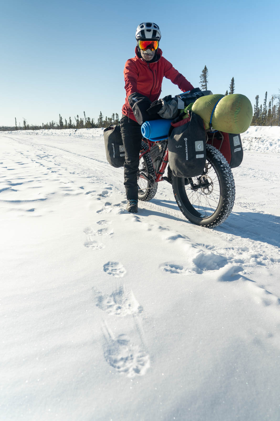
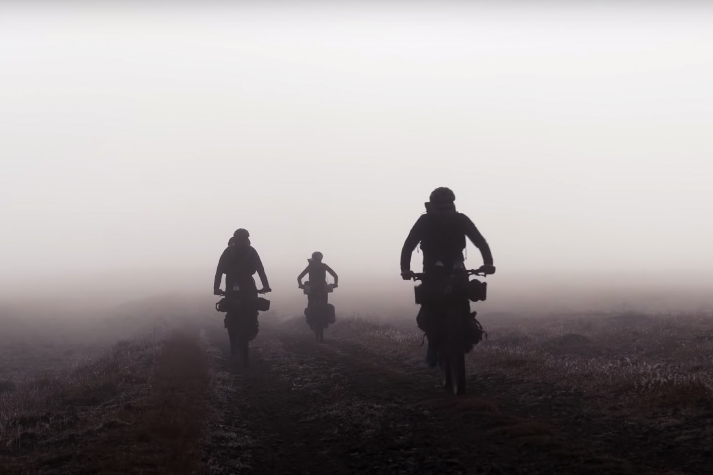
Starting in the small community of Peawanuck, Ontario, we pointed our bikes west, 200 kilometers to the town of Fort Severn, the most northern community in Ontario. For around two-thirds of this section of winter road, we would be in Polar Bear Provincial Park. This time of year, polar bear sows are leaving their dens, which are inland off the Hudson Bay coast, and are taking their cubs back to the sea ice. Because the mothers with cubs are heading north to the ice and we were heading west, we crossed many polar bear tracks. Approximately every 40 to 50 kilometers, we would see tracks the size of snowshoes.
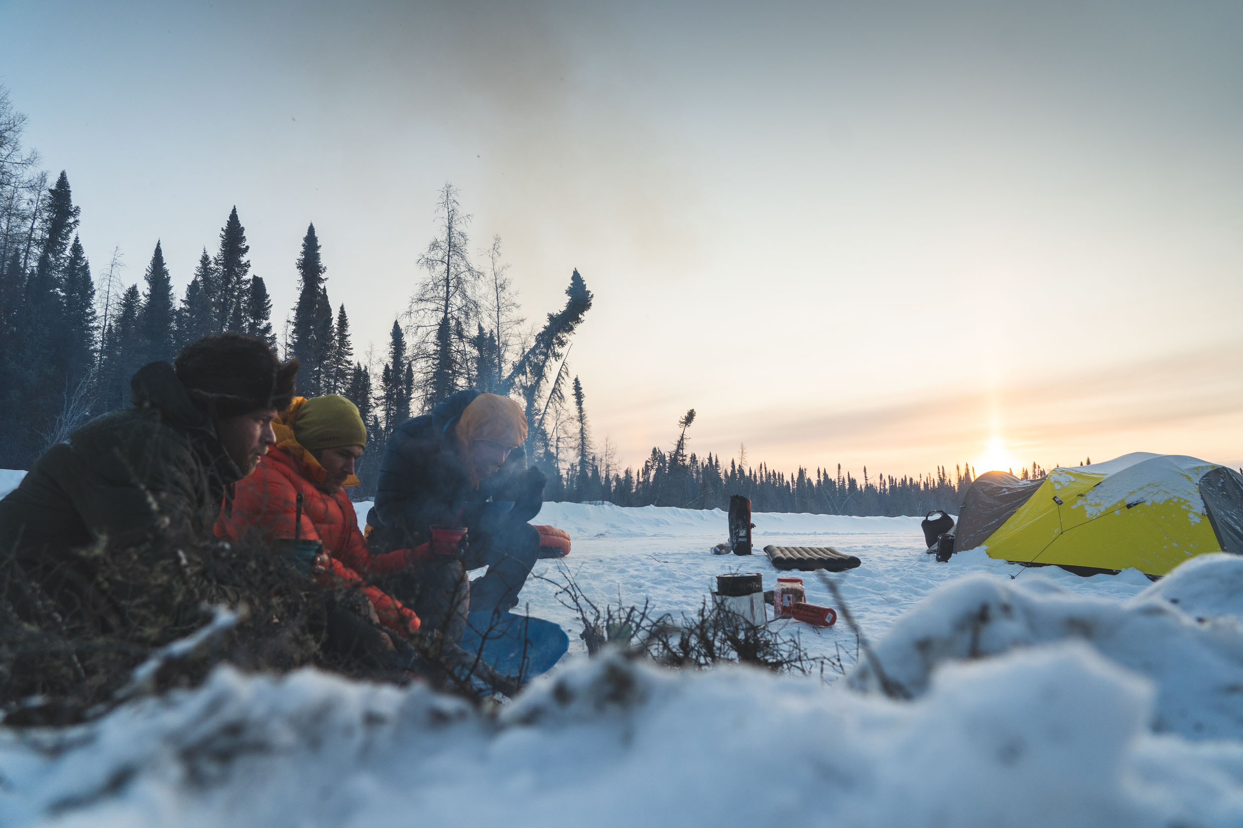
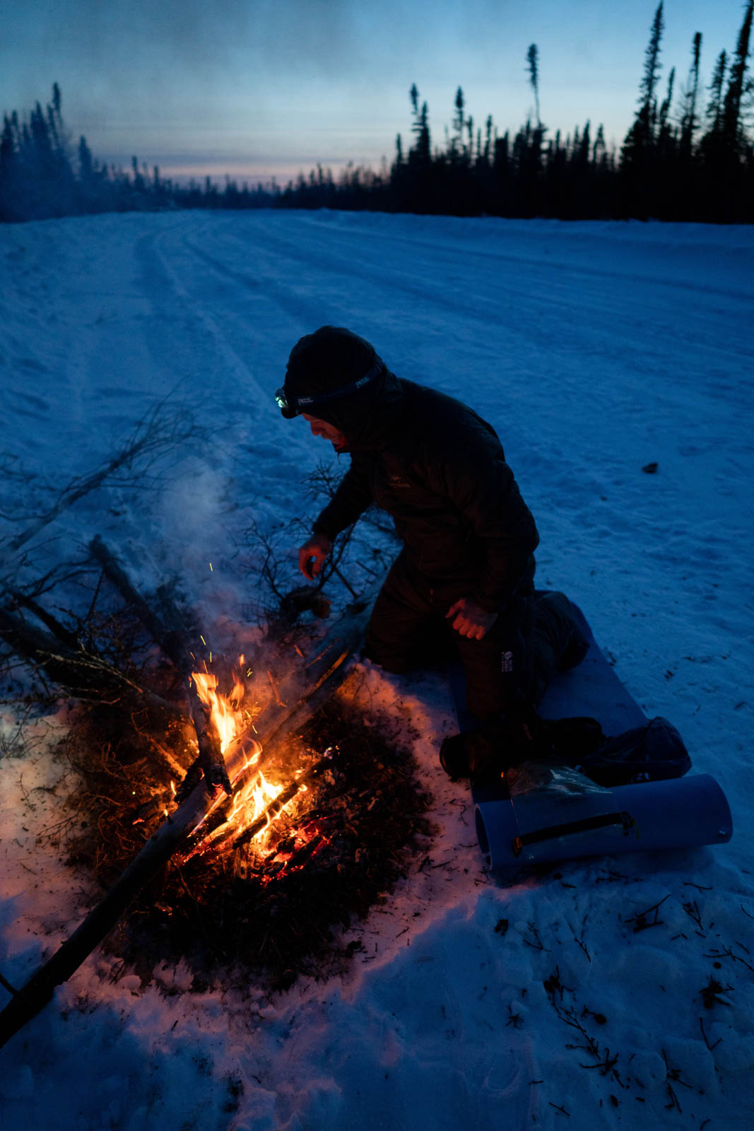
We got a bit of a later start on the first day after our flight up and a few hours building our bikes at the airport and stocking up supplies at The Northern, the only store in town. We rolled out mid-afternoon and enjoyed beautiful sunshine warming our faces and the temps a comfortable -20°C. After almost two full days of travel, it felt great to be riding. We found a nice spot to camp around the 42-kilometer mark. We debated whether we needed to set up the polar bear fence. When we woke the next morning, the polar bear tracks just a couple hundred yards from our tent confirmed that setting it up was the right call.
Day two was our first full day on the winter road. We were tired from travel and arriving at camp late the night before, so we didn’t mind a later start. The morning temps were well below -30°C, and our electronics and cameras were having some trouble. We managed to get in around 94 kilometers and saw many sets of polar bear tracks. At this point, we had only seen one truck on the road that was headed 700 kilometers west for a funeral. It’s interesting to think that to drive to the year-round road and to a small town with normal services, you have to drive so far and can only do it for about five weeks each winter.
The winter road is not ice like some other roads in the north. This road is packed snow that crosses mostly muskeg, some rivers and lakes, and many creeks. Even in a pick-up, it is slow going and incredibly rough. One of the main purposes of the road is to bring fuel and building supplies into the communities for their annual resupply. The three remote northern communities we rode through are all powered by large diesel generators.

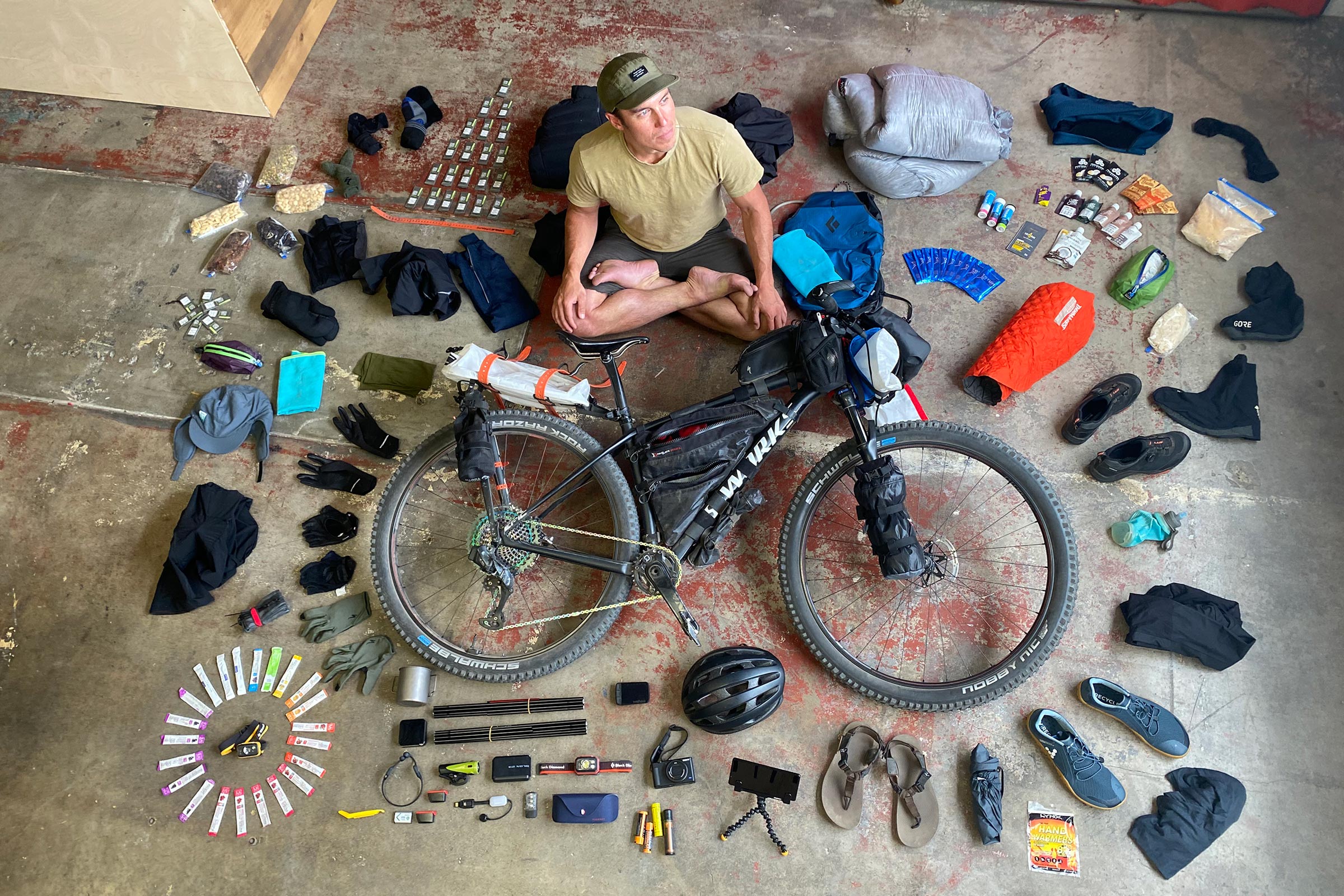
Day three met us with a brisk 50-kilometer-per-hour headwind to Fort Severn. We rode the 65 kilometers in the morning and stopped for a resupply in Fort Severn, Ontario’s most northern community. The dogs and puppies were the first to greet us at the town border after crossing the massive Severn River. After a top-up of whatever food we craved at The Northern—again the only store in town—we pedaled another 30 kilometers or so until we found a nice little site on a tree island in a massive expanse of muskeg/swamp. We were three fairly strong riders, all with elite cycling backgrounds, and with our bikes loaded and an endless headwind with nowhere to hide, we managed just under 15 kilometers per hour. Because we were burning so many calories, we had our 45Nrth Cobrafist pogies filled with the days’ riding fuel. Every 10 kilometers or 40 minutes, we would make a two-minute stop to adjust clothing, eat more, and grab a drink. It became the system that we dialed in over the 720-kilometer route.


Day four was longer, rougher, and windier. We would see some small tree islands in the distance, and another 20 minutes (or an hour) later, we would find some refuge from the wind behind the stunted spruce trees. Distance was tough to gauge and then became the game of guessing how far away the trees were. Most often, the “strong mile” was a winner. A strong mile is anything up to 1.99 miles (3.203 kilometers) but not a full 2 miles. Jokingly, it’s a great way to crush your teammates’ souls, especially if they’re hurting a bit. We also use miles instead of kilometers because miles seem shorter when you think about it, but they always seem to take more than the equivalent in kilometers. With time and good friends, you always find silly games to keep you occupied when the spirits are high or low.


We were pretty tired by the day’s end after 85 kilometers of dealing with the wind. Just as we were starting to look for a place to camp, we found an abandoned cabin that we made home for the night. It was ripped apart by polar bears and lacked any source of heating, windows, or doors, and it was full of garbage. We decided to sleep on the floor and save the time required to set up the tent. We all woke having a terrible night’s sleep and wondered why. We were all warm, and everything seemed good, but were unsure why we would all sleep restlessly and agitated. Later, we ran into the road crew, who informed us that that cabin was haunted and that we were bonkers for sleeping there. I guess that explains it.
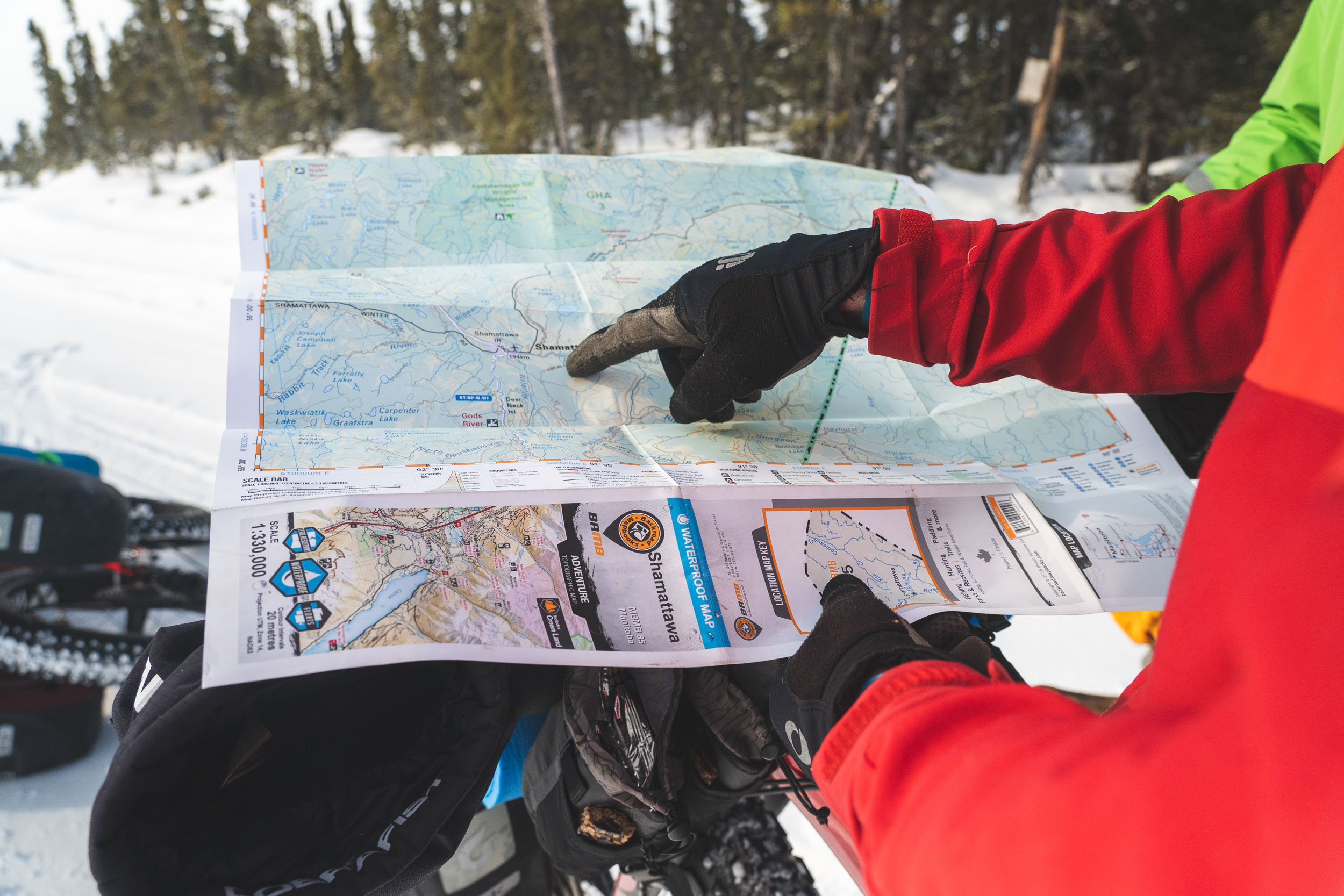
Day five, leaving the haunted cabin, was similar to the day before: filled with lots of big swamps and a head/crosswind. The day was uneventful as we were falling into the rhythm of the routine. Wake up, eat, break camp and load bikes, ride all day, then make camp, eat, and sleep. We ended the day with 95 kilometers on the GPS. We made it to the Manitoba/Ontario border at Husky Lake, which was pretty cool! We could literally see the distance we had traveled moving west on a global map. We made camp near the road crew in charge of clearing the 320-kilometer section of road from Fort Severn to Shamattawa. The next morning was the coldest so far. It was about -36°C without the wind as we slowly rolled out of camp. After crossing the lake, which was the first one of the day, we were now in Manitoba and around 100 kilometers to Shamattawa from Severn.


Day six was filled with many big swamps and muskeg. We saw a massive great grey owl, an Arctic fox, and a bunch of other beautiful, smaller wildlife. We rolled into Shamattawa at the end of the day. We were tired, hungry, and ready to make camp. The grocery store was closed as it was Sunday evening, so our only resupply option was some chips and candy from the local gas bar. It still tasted delicious and we now had enough food to keep us fed until the end. Apparently, the saying “hunger is the best seasoning” really is true. With all our winter gear, bike gear, and camera gear, we only had so much room for food. So, naturally, we were hungry most of the time. We rolled about five kilometers west of Shamattawa toward our final destination of Gillam and found a campsite in a recent forest fire burn area to set up. The day was our biggest so far, reading just over 105 kilometers.
The last two days would bring more wind and more big swamps. We were now pointed away from the Hudson Bay and were riding up the longest false flat and gaining so little elevation that normally we would never notice it. Add the 50-kilometer-per-hour head/cross wind and 100-pound bikes, and you feel every minuscule incline. As we rode away from the bay, the trees started to get larger and weren’t just the dwarfed spruce we had seen the last week.
Leaving Shamattawa in the morning, we were on the bikes early as we were going to try to get the 200 kilometers to Gillam done in two days. We were riding straight into the wind for the entire day. The bikes were wide and seemed to add even more drag and resistance as we slowly pressed west. By day’s end, we were exhausted. We made camp around the halfway point for this leg of the journey. Our daily total was a hard-fought 85 kilometers. Buck got up to pee at 2 a.m. and woke us all up because the Northern Lights were going wild! We all suited up, went out in the -35°C temps, grabbed the bikes and cameras, and snapped a few photos. It was a surreal moment as the light danced overhead.


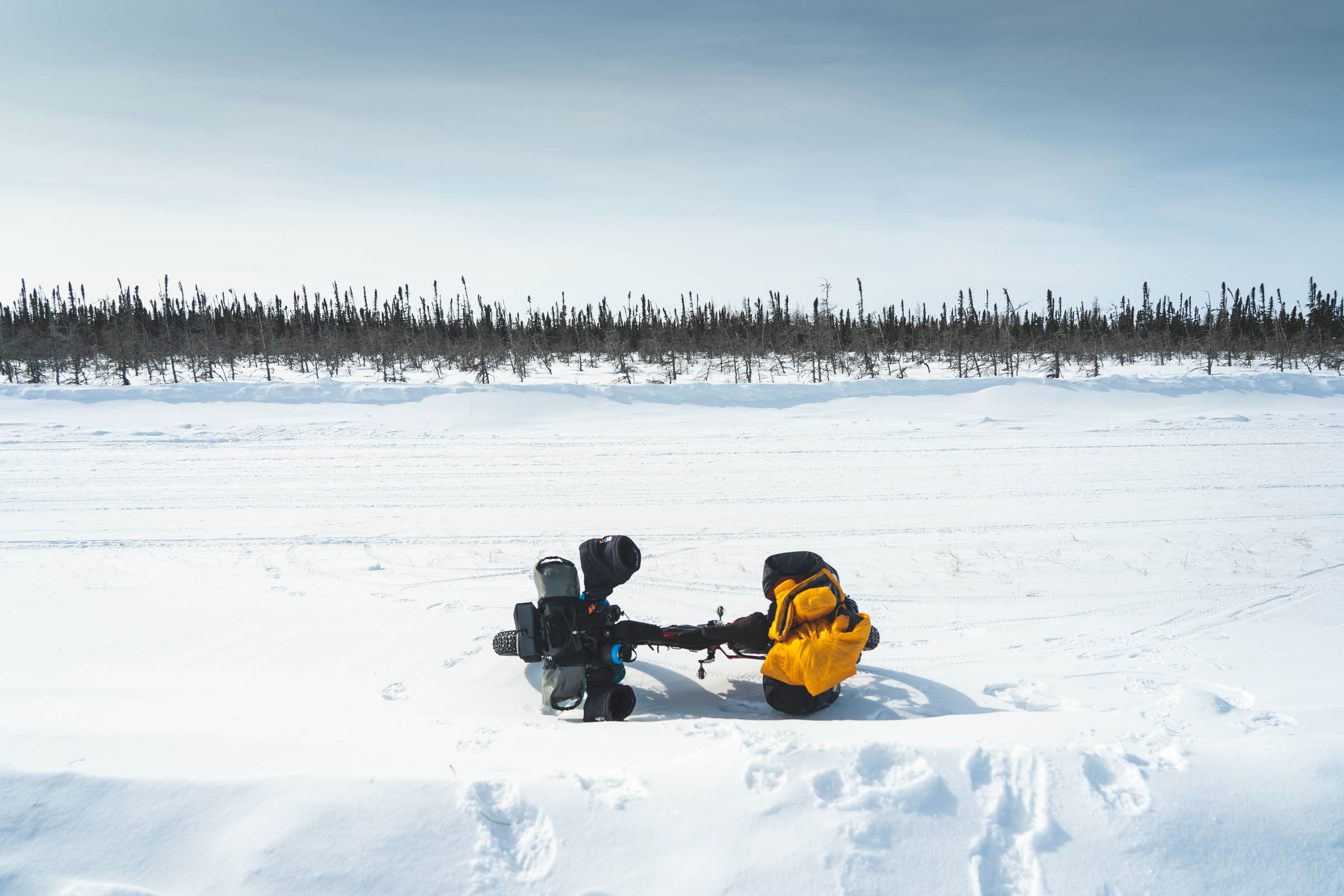
Day eight would be our last and the coldest yet. It was also the windiest and was planned to be the longest at around 120 kilometers. We were very cold starting out. Our hands lacked feeling as we rode. We made a routine of stopping every five kilometers for a quick break. We’d have a few bites of whatever snacks we had left, adjust any clothing, and be off into the wind again. We were taking five-kilometer pulls at the front and rotating through. It was soul-crushingly slow as we inched our bikes west.
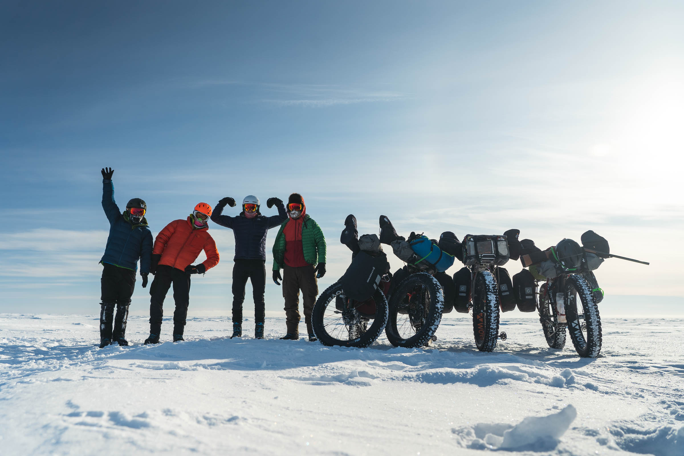
Around 20 kilometers out from the end of the winter road, Ryan’s bottom bracket had a bearing that was slowly seizing up on him crack and added to the already tough going. With 10 kilometers to go, we improvised a quick tow solution to help take the work of the added friction the seizing bearing was creating. After almost 11 hours on the bikes and around 120 kilometers, we finally hit the end of the winter road and made it to Gillam, Manitoba. How remote is the Wapusk Trail?


In 721 kilometers, we encountered only 14 private vehicles and maybe 12 tractor-trailers. When we left Peawanuck eight days earlier, COVID-19 was barely in the news and certainly wasn’t on our radar. When we arrived in town, we were met with a lockdown, doors closed, and signs up everywhere. People were wearing masks and fighting over toilet paper. We were planning on speaking at the local school and having dinner with the mayor. The school was closed, and we never had that dinner with the mayor. We pointed the van south for a 3,000-kilometer drive back down to southern Ontario, which became a stark contrast to the simple times we left behind: wake, eat, ride, joke, ride, eat, sleep.
The film was shelved until now. We think it was worth the wait, and we hope you enjoy it!
Further Reading
Make sure to dig into these related articles for more info...
Please keep the conversation civil, constructive, and inclusive, or your comment will be removed.