Introducing The Southern Highlands Traverse
Share This
Just announced, the Southern Highlands Traverse joins three existing routes and the new Trans WNC (Western North Carolina) to create the first long-distance bikepacking route (1,000+ miles) on the East Coast. The Southern Highlands Traverse will serve as a singletrack-heavy alternate to the forthcoming Eastern Divide Trail.
The Southern Highlands Traverse is the culmination and evolution of the southeastern United States’ most challenging bikepacking routes into one long-distance route spanning the Southern Appalachians. Starting in Front Royal, Virginia and finishing at Flagg Mountain, Alabama, at the southern terminus of the Pinhoti Trail, the route traverses a mix of over 1,200 miles of gravel roads, forest doubletrack and plenty of the South’s most challenging singletrack.
The Southern Highlands Traverse combines the Virginia Mountain Bike Trail, the Trans WNC (Western North Carolina), the Trans North Georgia, and the Alabama Skyway (formerly the Talladega Traverse, based on the classic Skyway Epic), all of which are bucket list rides in their own right. The Southern Highlands Traverse will also serve as a southern singletrack alternate to the Eastern Divide Trail, a 4,500+ mile bikepacking route from Newfoundland to Key West, Florida.

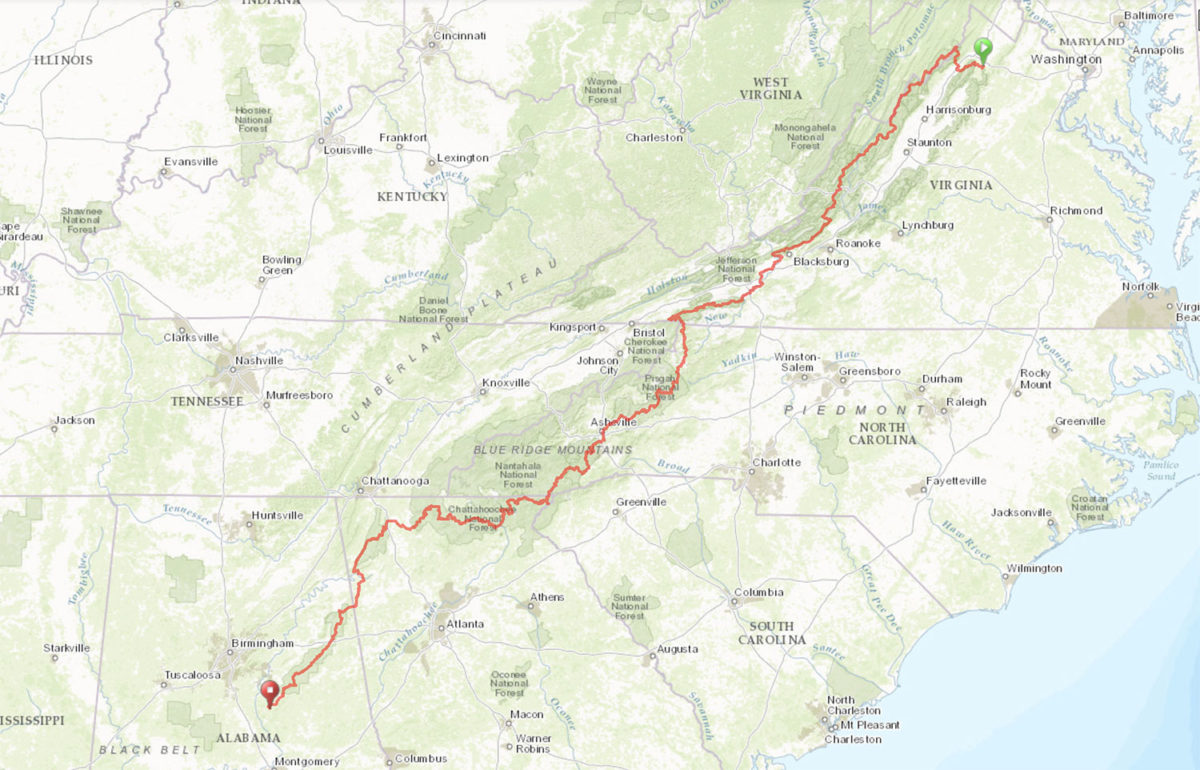
- Distance 1,270 Miles (2,044 kilometers)
- Total ascent ~141,000 feet (~43,000 meters)
- Recommended time 20-30 days
Crossing the Blue Ridge Province almost in its entirety, the Southern Highlands Traverse passes through the ecologically and culturally significant landscapes of the Southern Appalachians and connects much of the best singletrack trails in the Southeast. Below you’ll find a summary of each of the four routes that make up the Southern Highlands Traverse, followed by an update on the status of the Eastern Divide Trail…
Route Development
The Southern Highlands Traverse was created to establish the first long-distance, 1000+ mile prize bikepacking route in the eastern United States. The concept was created and routed by Brett Davidson and Logan Watts, and combines the work of route creators such as, but not limited to, David Muse, Chris Scott, Ryan Sigsbey, Colt Fetters, Brent Marshall, and contributors TJ Kearns, Karlos Rodriquez Bernhart, Kim Jordan Murrell, Daniel Jessee, Chris Brown, Matt Fusco, Brad Kee, Chris Tompkins and Barnabas Froystad.
The Virginia Mountain Bike Trail (VMBT)
Originally created by Chris Scott and Shenandoah Mountain Touring, and later scouted by Logan Watts, the VMBT is an epic, diverse, and wits-crushing bikepacking route that follows the endless ridges of the Allegheny and Blue Ridge mountains along a continuous, 473 mile off-road route from Front Royal to Damascus. The VMBT writhes its way through isolated farming communities, remote forests, panoramic crags, and historic rail grade trails.
It is only appropriate that the Southern Highlands Traverse starts with the most technically and physically demanding of the four routes that make up its backbone. In addition, the Virginia Mountain Bike Trail is arguably the most scenic and remote of the four. As such, the VMBT is relatively unestablished and ridden very little, which might intrigue many bikepackers. Other than Chris Scott’s initial ride and Logan’s scout in 2015, only two other riders — that we are aware of — have completed it. For that reason, we also suggest diligent research prior to taking it on. We plan to rescout this route in October. Until then, our route guide can be found at the link below.
473 miles (761 km)
53,428′ (16,285 meters) Total Ascent
Route Guide
Trans-WNC (Western North Carolina)
The Trans-WNC bikepacking route runs the length of the North Carolina Appalachians and takes in some of the best singletrack in the Blue Ridge. Created by Ryan Sigsbey, the official route starts at the terminus of the Virginia Mountain Bike Trail in Damascus, VA and finishes at the head of the Trans North Georgia on the Chattooga River just north of Mountain Rest, SC. The Trans WNC is part two of four in the greater Southern Highlands Traverse and is specifically designed to be ridden from north to south.
314 miles (505 km)
35,458′ (10,807 meters) Total Ascent
Route Guide
Trans North Georgia (TNGA)
The third stage of the Southern Highlands Traverse is the most established of the four. The Trans North Georgia is a 350 mile (560 KM) route that snakes through the southern Appalachian mountains from South Carolina to Alabama. The TNGA was a result of five years worth of scouting and planning efforts by David Muse and is held as an annual event every August. The TNGA can be ridden in the annual group start or independently, and while it’s not as technically challenging as the VMBT or Trans WNC, it’s no easy task. With a lot of climbing for a relatively short distance, the route is comprised of formidable singletrack, steep abandoned jeep tracks, and endless National Forest roads. The TNGA is a big bikepacking route that will test your mettle. Find our full route guide below.
357 miles (560 KM)
38,690 feet (11,793 meters) Total Ascent
Route Guide
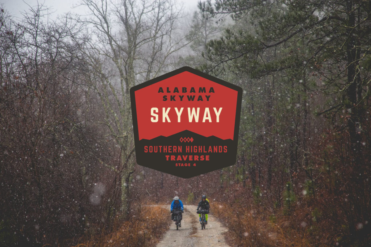
Alabama Skyway
Formerly known as the Talladega Traverse, designed and contributed by Colt Fetters, the Alabama Skyway has since been tweaked to connect the TNGA and extended to Flagg Mountain, one of the southernmost mountains above 1,000′ along the eastern seaboard and the southern terminus of the Pinhoti Trail. The Alabama Skyway is partially based on the formidable Skyway Epic, a 60, 100, or 200 mile endurance mountain bike race created by Brent Marshall of Southern Fried Rides.
The route itself is a southern red dirt road bikepacking route traversing the Talladega National Forest of central Alabama. The Skyway winds through rugged pine forests, shady gaps, and along ridge tops that offer panoramic views of the east-central Alabama countryside. View our full route guide at the link below.
123 miles (198 km)
11,004′ (3,354 meters) Total Ascent
Route Guide
State of the Eastern Divide Trail
The Eastern Divide Trail was created by the Eastern Divide Project, a collaboration of east coast bikepackers whose mission is to design and map the premiere long distance mixed surface bikepacking route in the Eastern United States from Newfoundland, Canada to the Southernmost Point of the Continental United States in Key West, Florida. With a proposed distance of over 4,500 miles, the Eastern Divide Trail has the potential to be the longest mixed surface cycling route in the United States designed for bikepacking by bikepackers. Highlighting the rich geographical diversity of the Eastern United States, the Eastern Divide Trail will traverse the ecologically and culturally significant landscapes of the East Coast, all while providing the potential for a lifetime achievement in multi day bicycle touring on the route.
The Eastern Divide Trail will have seven route segments, the Southern Highlands Traverse alternate and a Florida Panhandle Connector. Each segment is designed to be ridden independently. These segments have been designed by geographical significance and for shuttle opportunities and optimized for section biking the route. Currently the EDT is approximately 40% complete and has been scouted by bike by Brett Davidson and TJ Kearns from Damascus, Virginia to Key West, Florida. The route is complete as a conceptual gpx file from St Johns, Newfoundland, the EDT’s northern Terminus, to Damascus, VA.
The Eastern Divide Project has partnered with BIKEPACKING.com and the new non profit Bikepacking Roots to finish the EDT north of Damascus and to publish the route and it’s segment guides. The 7 proposed segments will be released on BIKEPACKING.com and the new website as the route scouts and guides are completed. Look for a reveal of the new website soon and the release of segments 5-7 in the first half of 2018. In the meantime, follow along on Instagram @easterndivideproject.
FILED IN (CATEGORIES & TAGS)
Inspiration
Please keep the conversation civil, constructive, and inclusive, or your comment will be removed.


