


8 Rivers Overnighter
Distance
128 Mi.
(206 KM)Days
2-3
% Unpaved
100%
% Singletrack
8%
% Rideable (time)
98%
Total Ascent
10,525'
(3,208 M)High Point
5,965'
(1,818 M)Difficulty (1-10)
6.5?
- 5Climbing Scale Moderate82 FT/MI (16 M/KM)
- 6Technical Difficulty Moderate
- 7Physical Demand Difficult
- 6Resupply & Logistics Moderate
Contributed By

Nathan Siemens
Guest Contributor
Nathan Siemens is an overly enthusiastic chatterbox who makes friends with anything that crosses his path. He is always up for telling you how great the East Kootenay Region is, even if you don’t want to hear about it. If you want to see what he finds interesting, you can check his ‘Gram @yepyepnotnope.
The 8 Rivers Overnighter is on the unceded territories of the Secwepemc and Ktunaxa people and the chosen home of the Metis People of BC. It is my honour and duty to bring Truth and Reconciliation, and the Calls to Action to life in this region, in partnership with our Indigenous and Metis communities.
The 8 Rivers Overnighter starts right at the White River Campground, a couple of kilometres northeast of Whiteswan Lake. This starting point is easily accessible by all but the lowest of vehicles, though keep in mind that the start point is 30 kilometres up a well-maintained but heavily trafficked logging road. On the drive in, you will notice Lussier Hot Springs, a rustic and beloved local grouping of hot pools right on the Lussier River. Keep this spot in mind for after the ride.
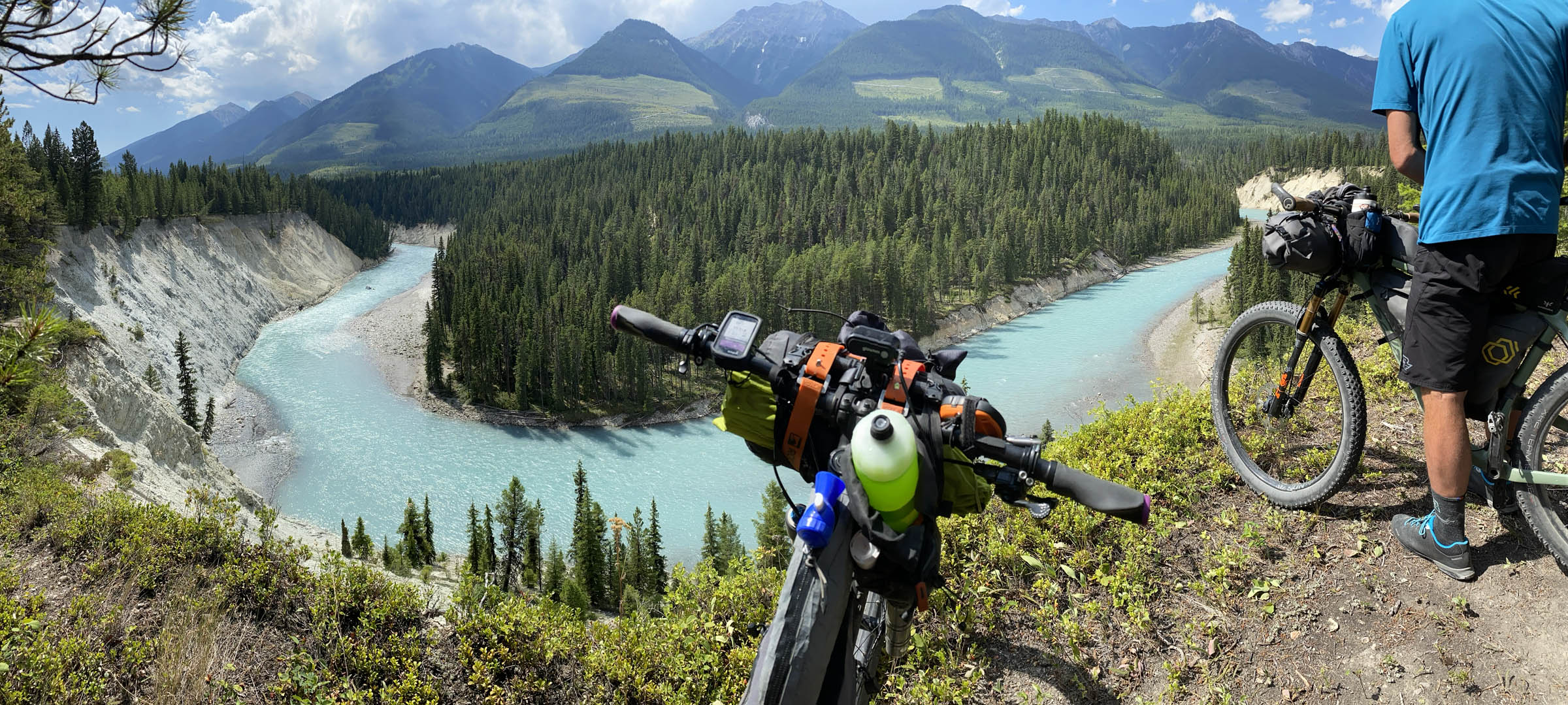
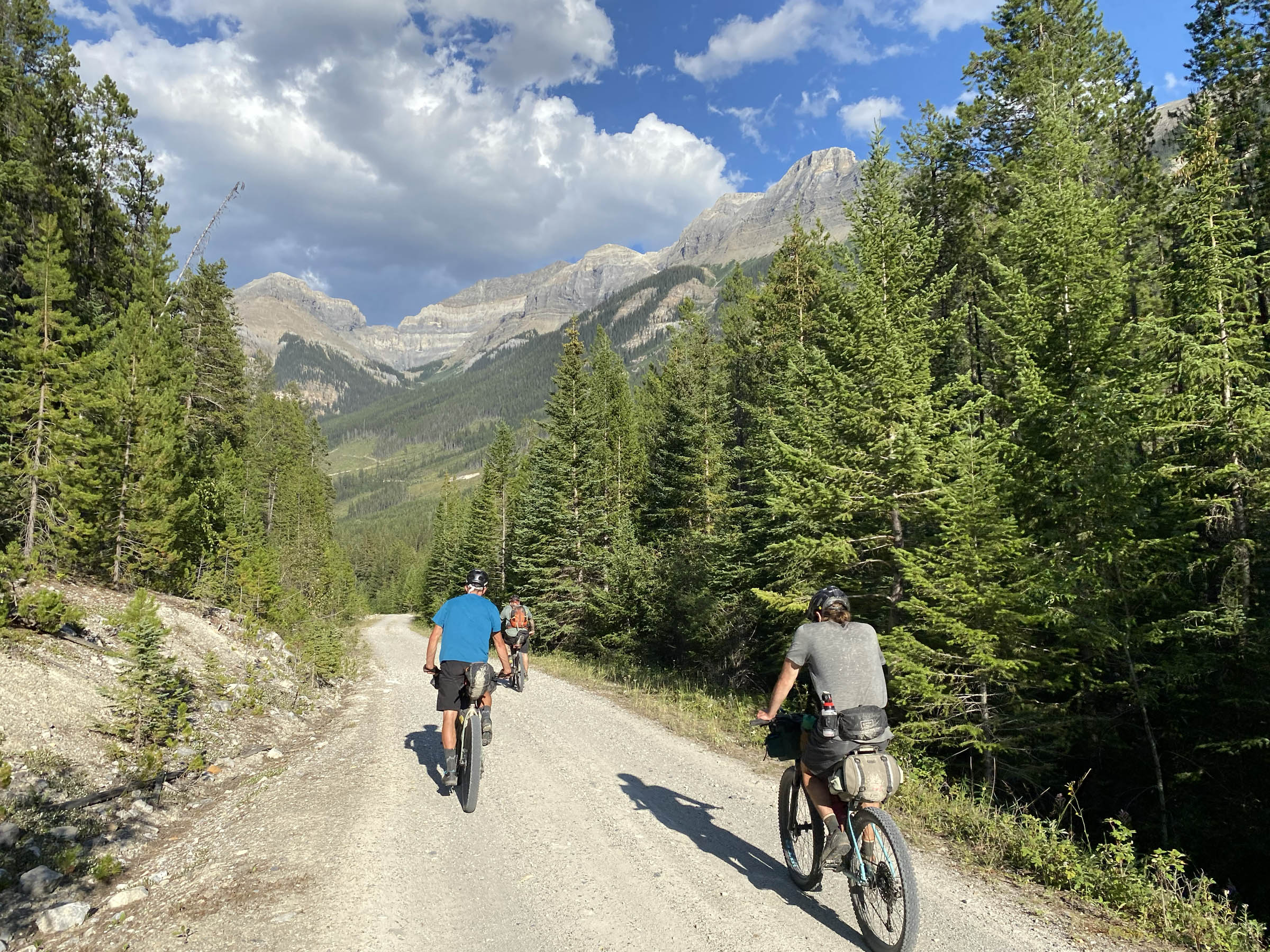
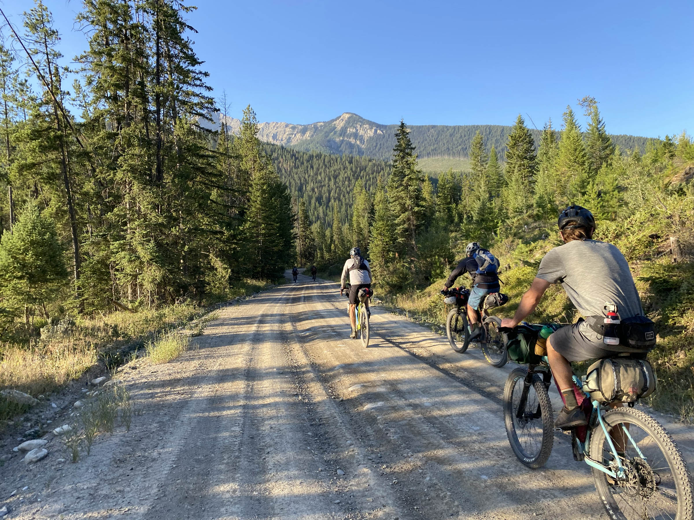
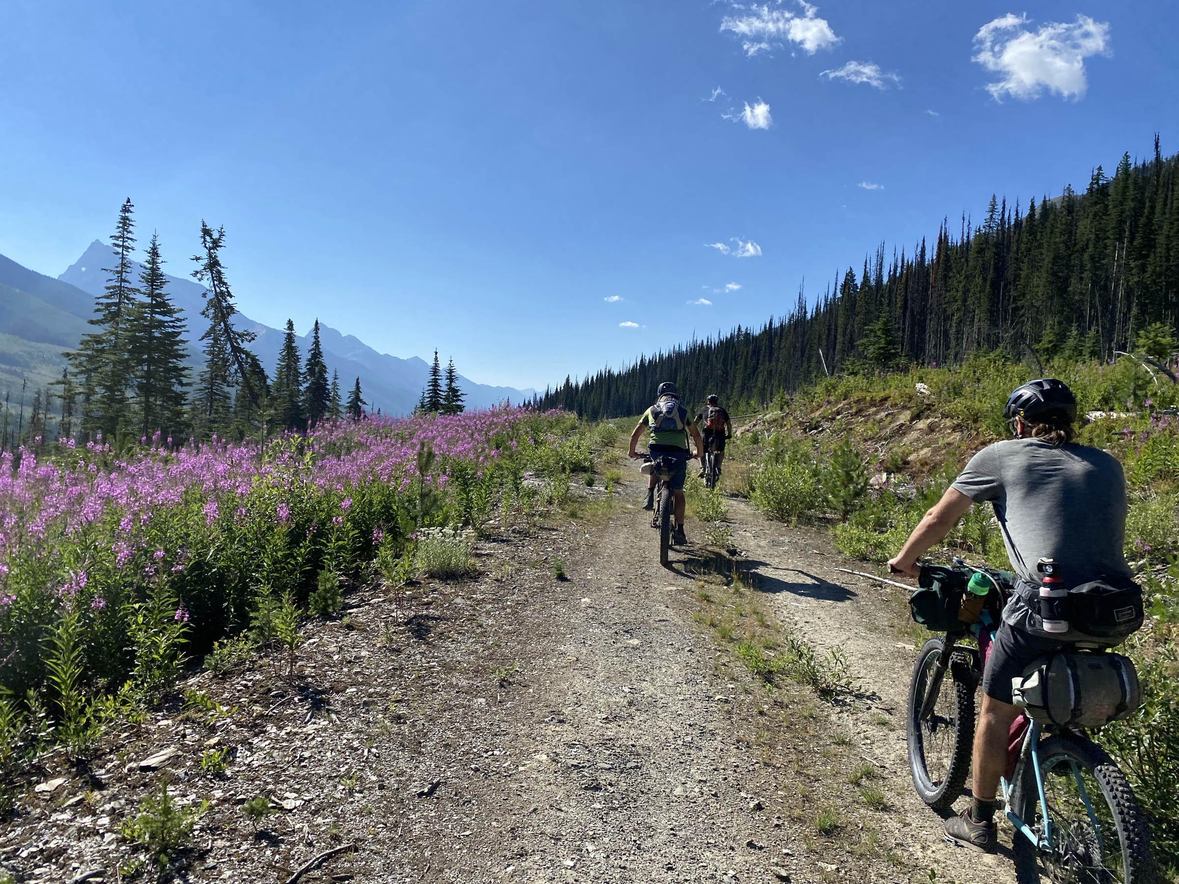
The first 60 or so kilometres of riding are fast-rolling, wide forest service roads that offer hints of views of the White River and Kootenay River to the west and some spectacular sights looking up the drainages to the east. Forty-eight kilometres in, there is a great place to set up a tent, as well as some spectacular waterfalls at Fenwick Creek Rec Site. This is a nice option if you are wanting to stretch the ride into two nights.
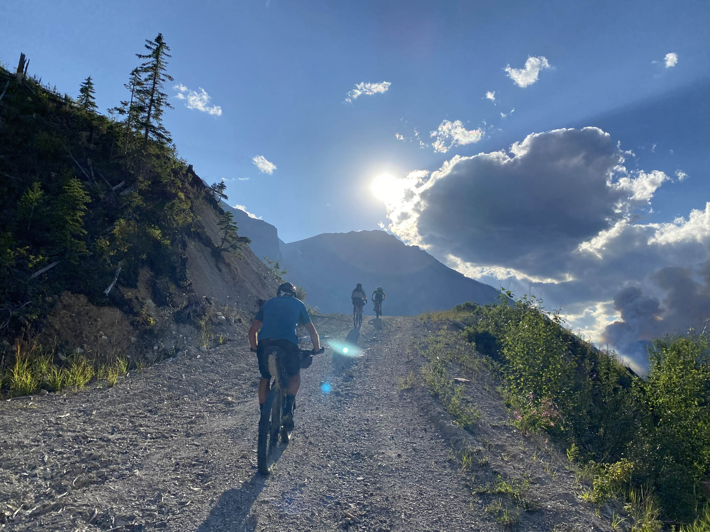
The route’s first proper climb the route is at the 58-kilometre mark. Little Elk Pass is where the road starts to get a little more rustic, a little more steep, and a little more bear-y. It was along the rugged and rowdy descent off of Little Elk Pass that we came across the first of six bears. None of the bears were anything but hospitable. They gave us some space, we gave them some space, and we all had a great time. But it was a reminder to keep making some noise and to deal with our food properly at night.
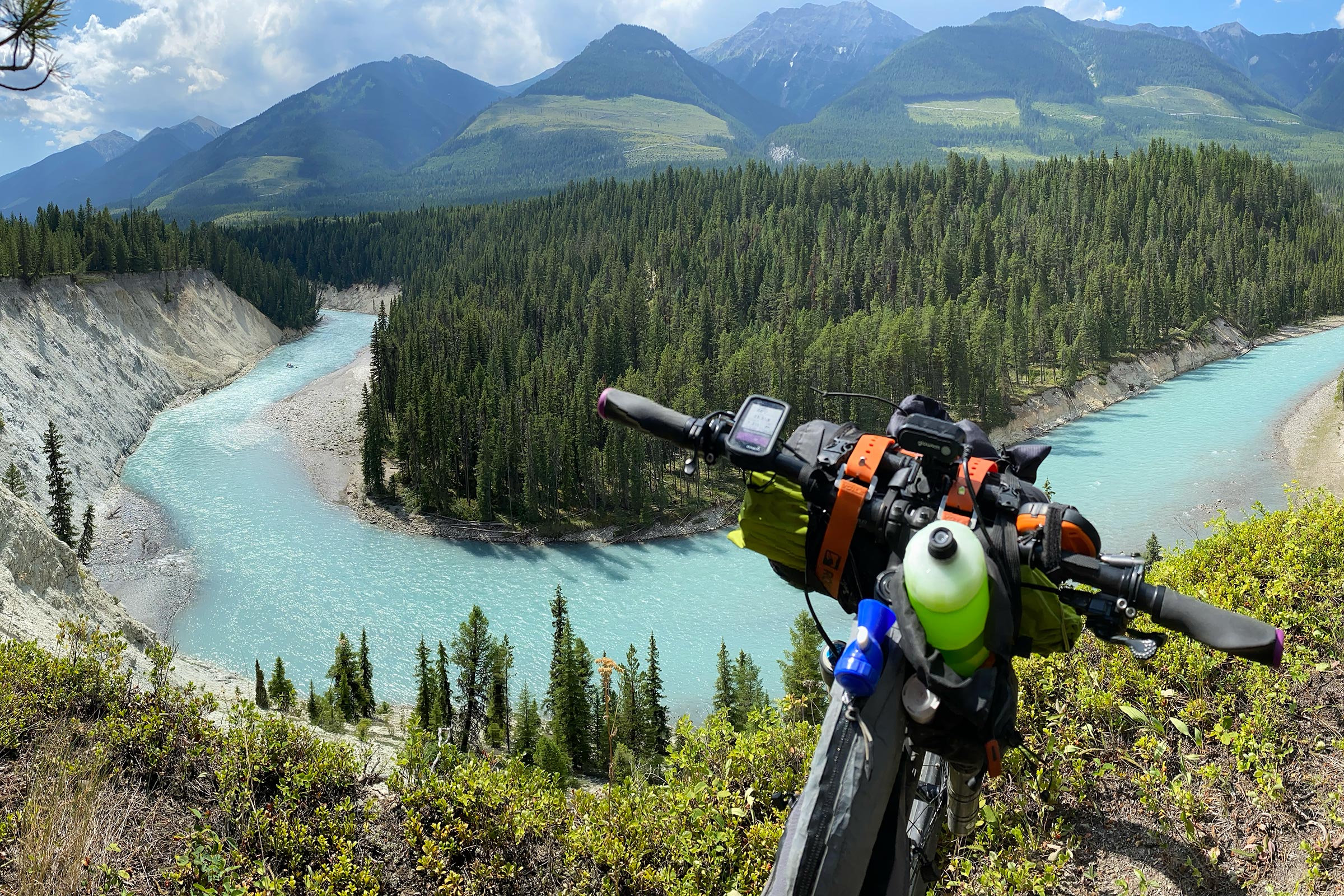
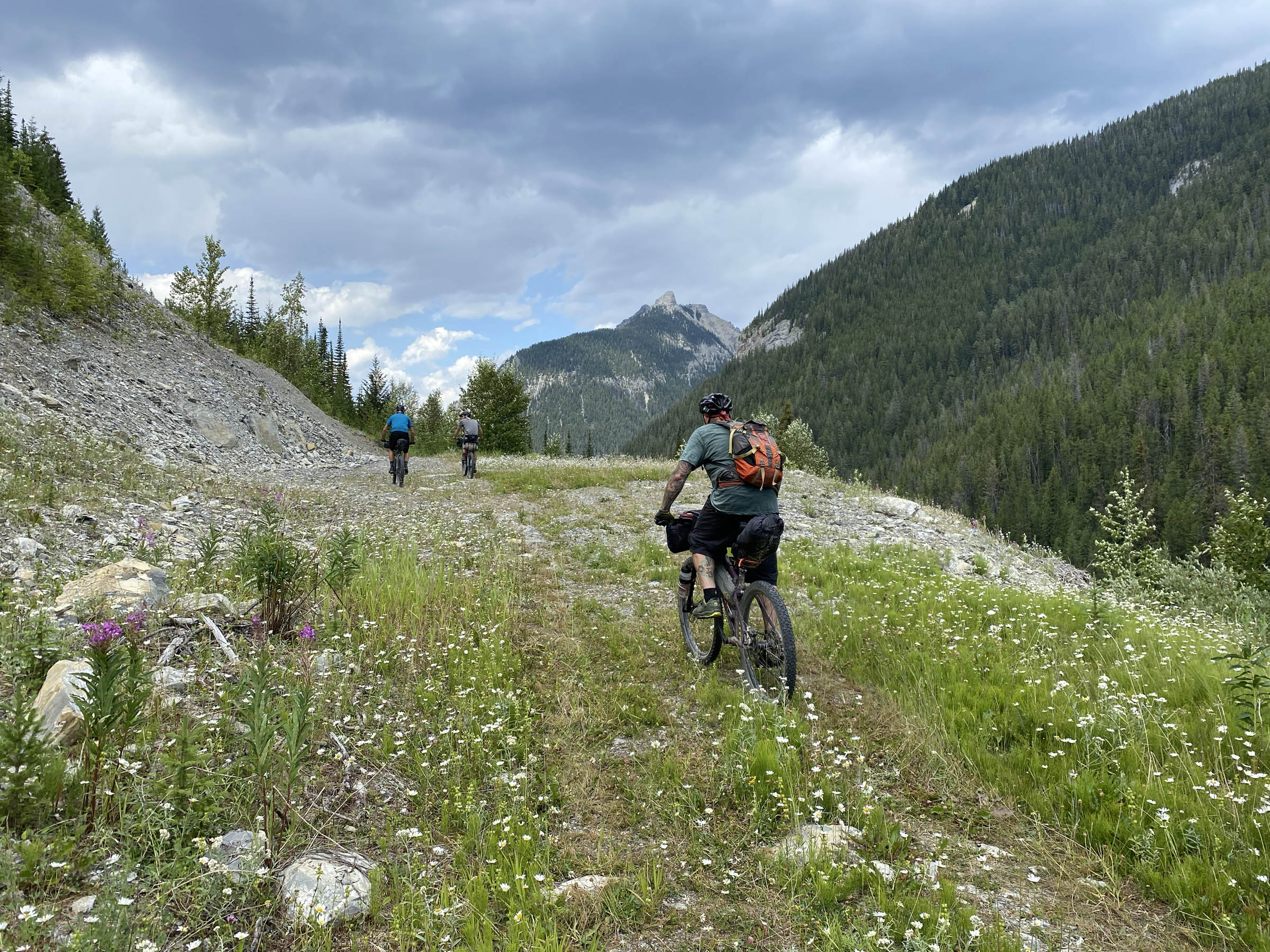
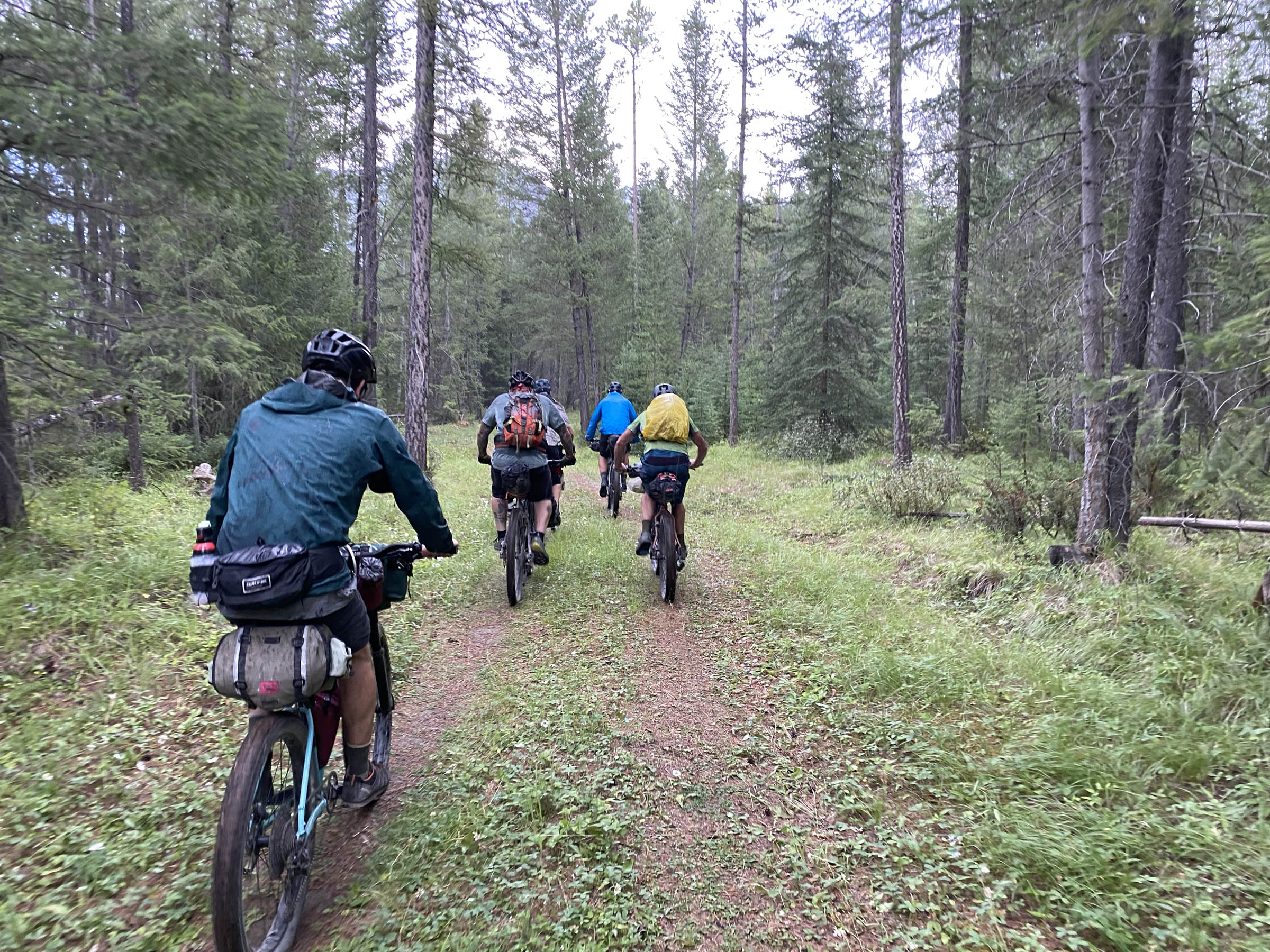
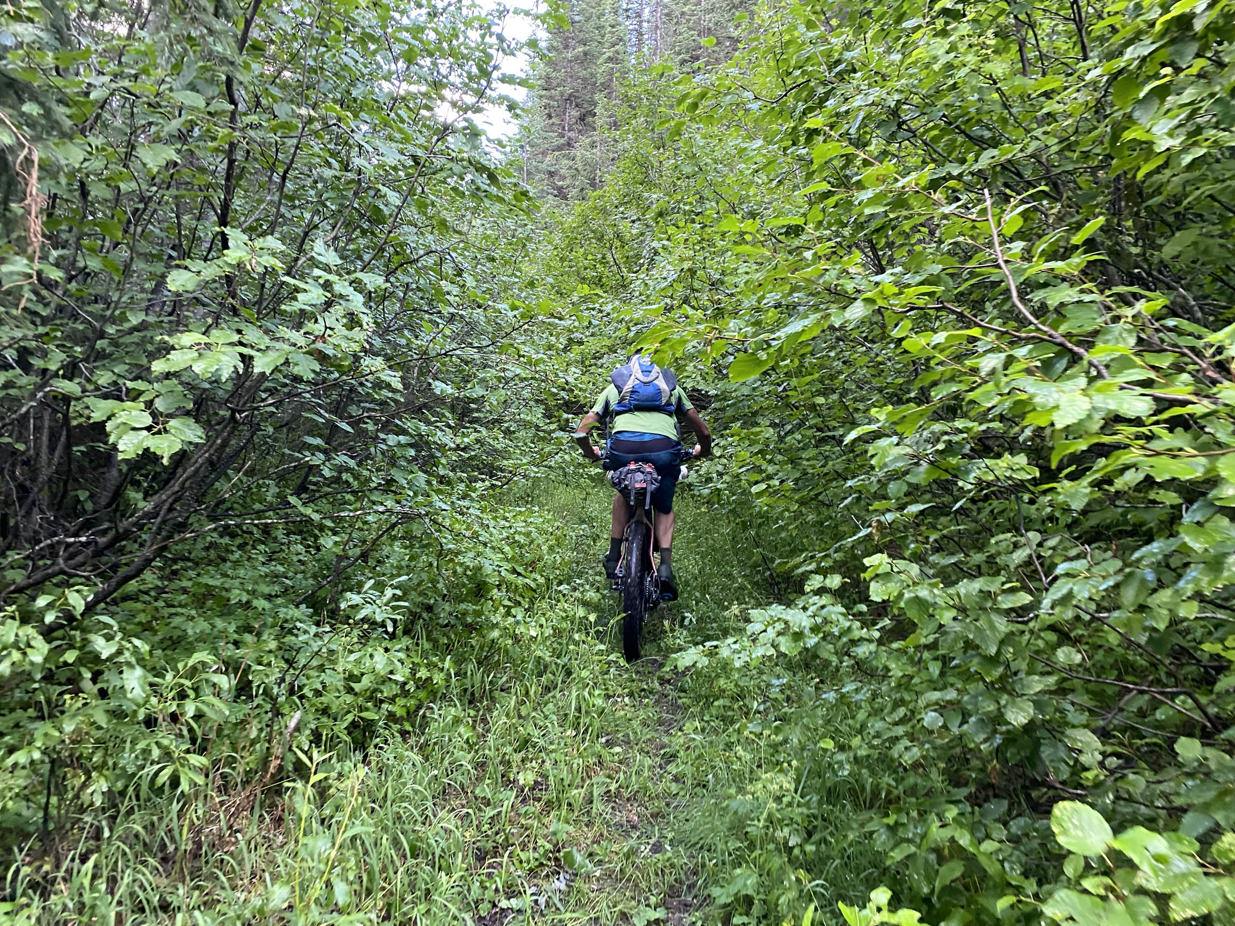
After the Little Elk Pass descent, you will find yourself on Kootenay Palliser Forest Service Road, but not for long, because at the 75-kilometre mark, you get to dive into the finest singletrack that Nipika Mountain Resort has to offer. At this point, the views of the Kootenay River are outstanding, but so is the riding, so choose wisely.
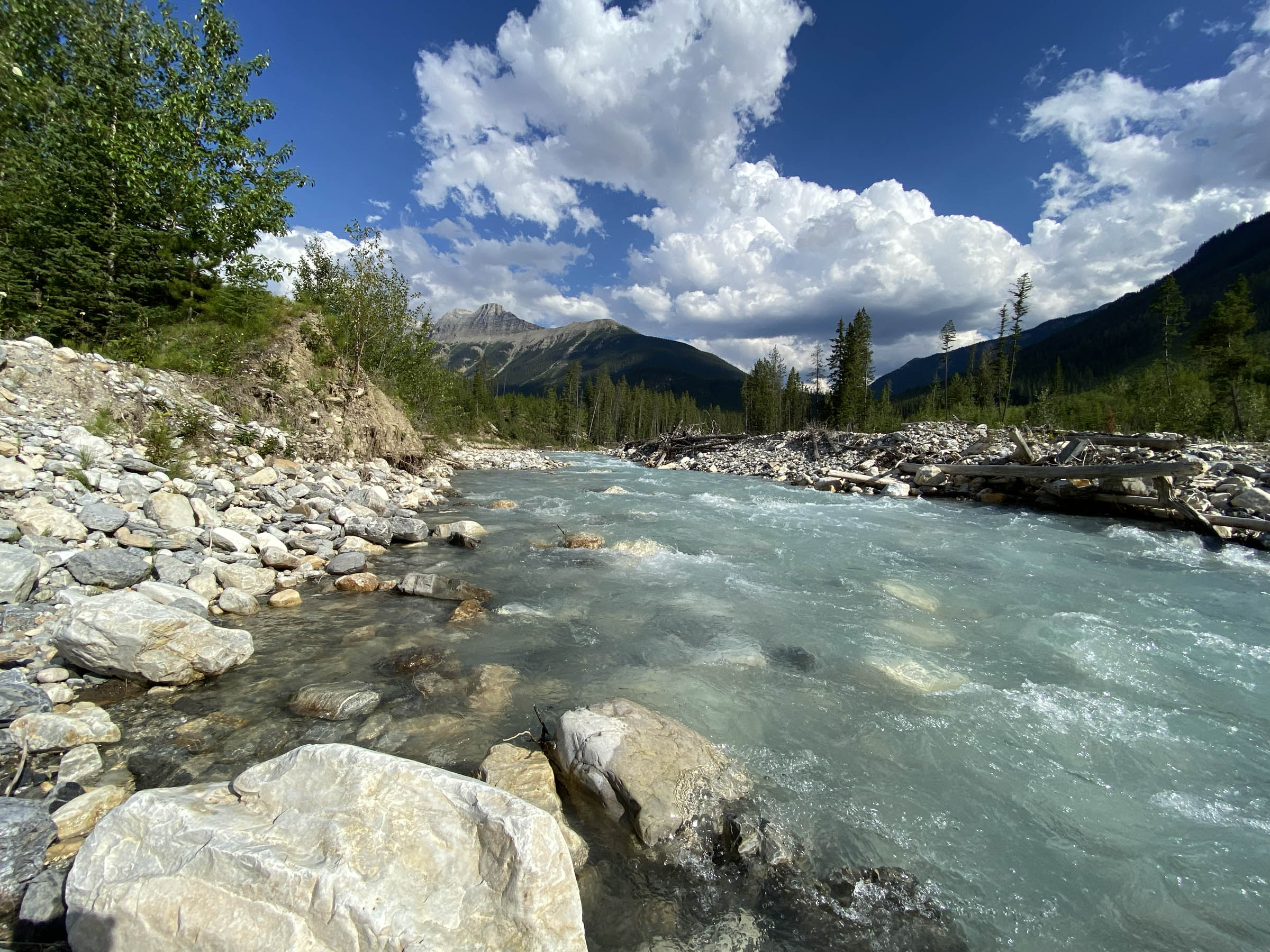
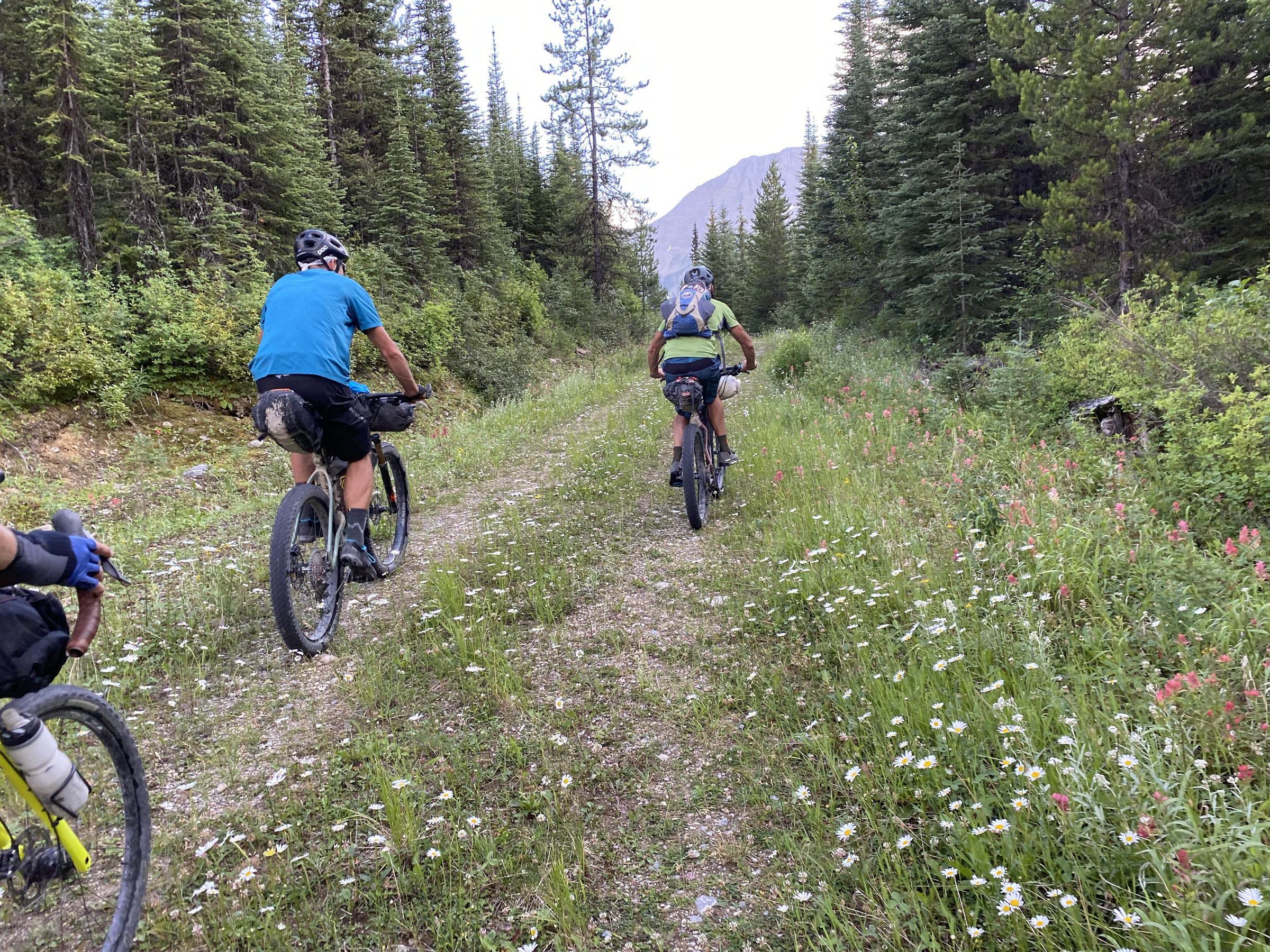
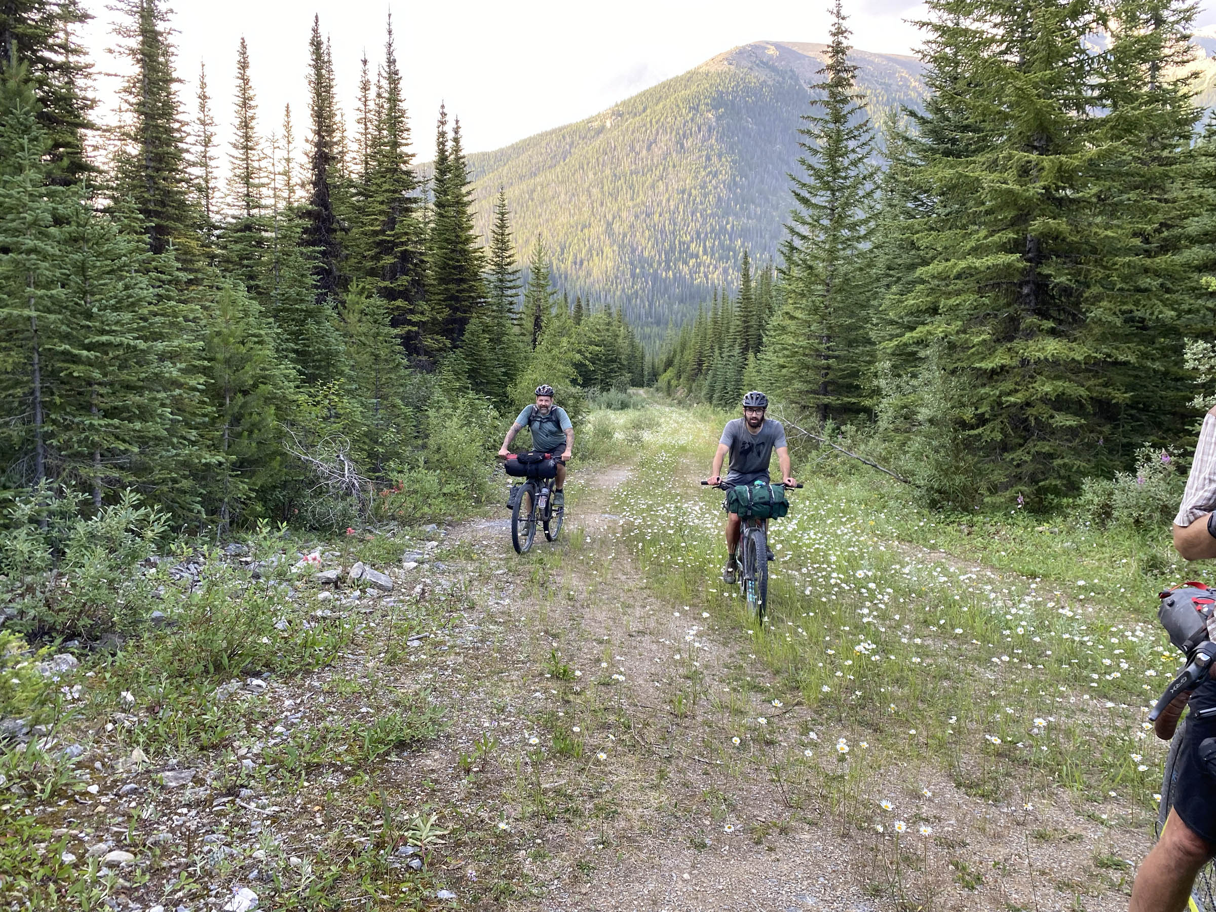
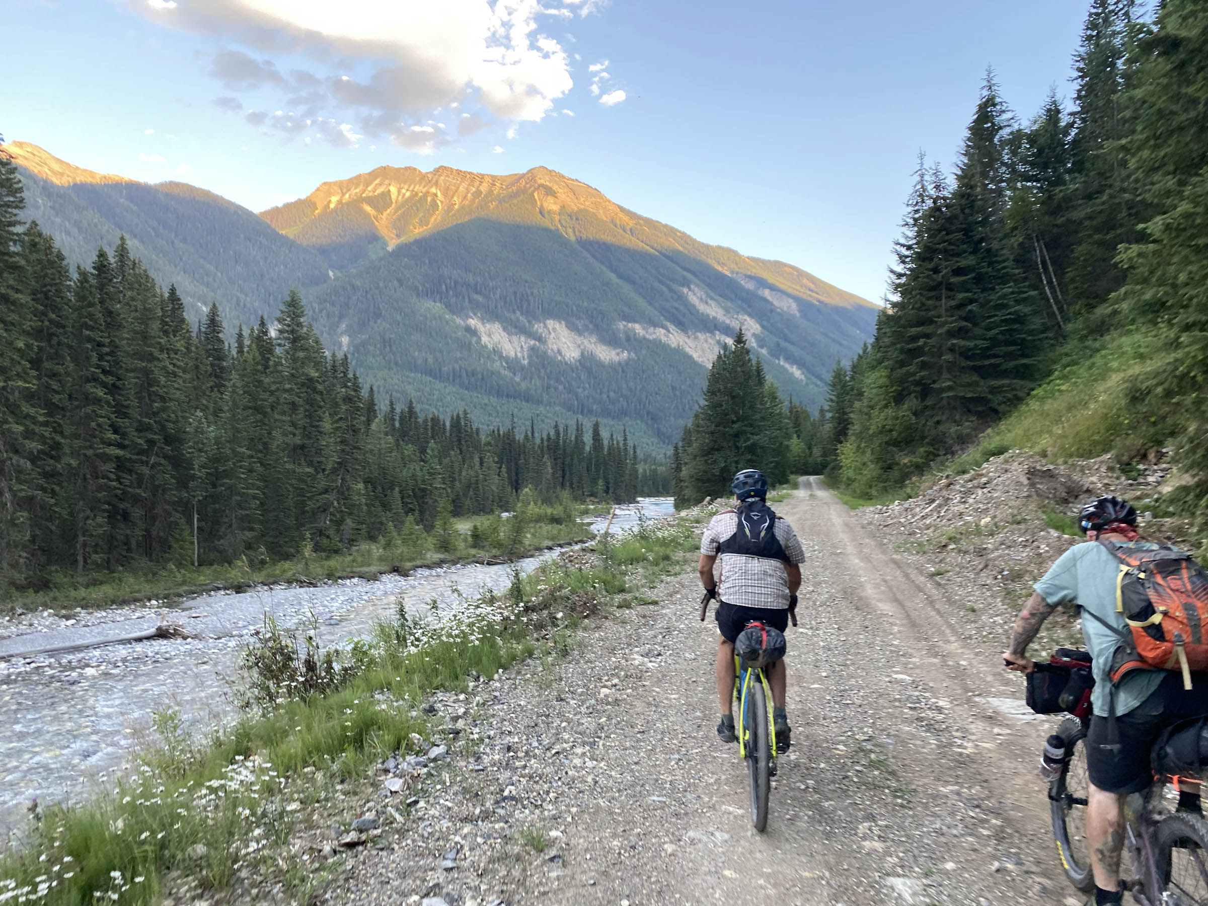
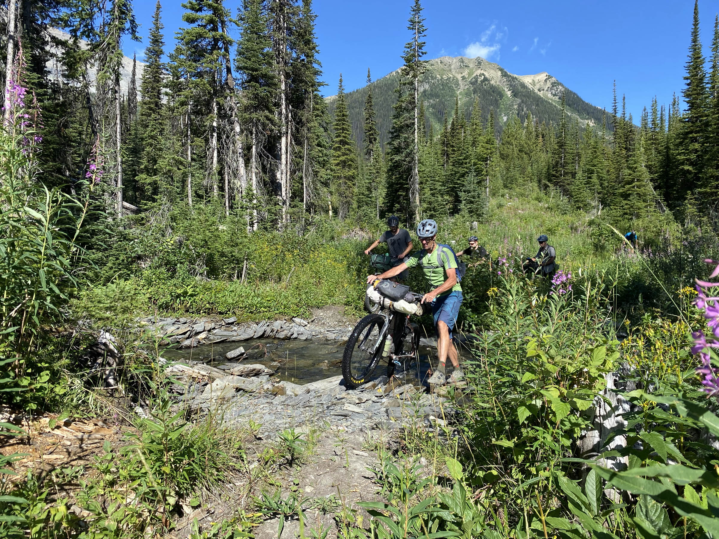
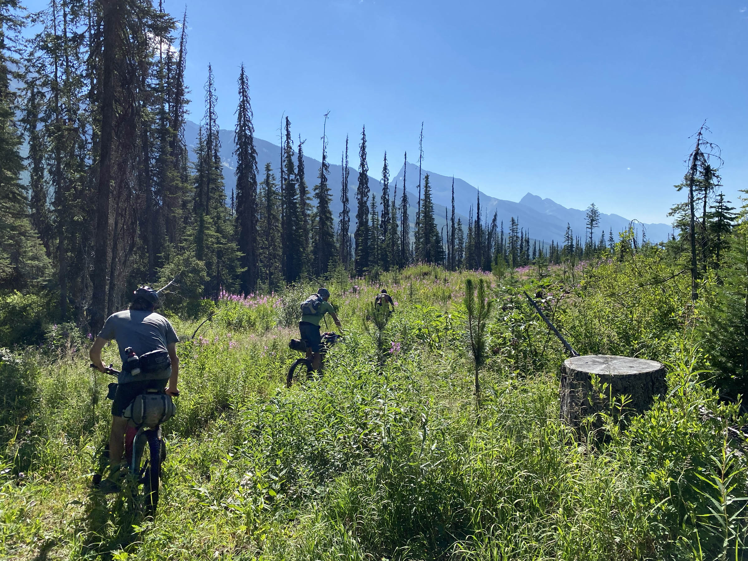
The next section is a well-maintained Forest Service Road that takes you right into the heart of the Canadian Rockies. Following the Cross River, you may notice the aftermath of the 2022 Mount Docking Wildfire on the north side of the river. At the 102-kilometre mark, you will leave the main road and get on a quiet and decidedly more rustic road. The Continental Divide, which serves as the border between British Columbia and Alberta, will now start dominating your surroundings. At 106 kilometres, there is a nice halfway point campsite. This is a wild site with no pit toilet or picnic tables, but the river serves as a great shower facility. The route continues following Cross River before crossing through the stream and then starts pointing upwards for a few kilometres. At the top of Miller Pass, you will enter a section that was densely overgrown up until the summer of 2022, when it was cleared to make way for the Gravel Royale gravel race. These days, it is a fun and flowy grassy quad track.
Once on the Albert River Forest Service Road, it is a fast pedal to the Paliser/Albert Junction Rec Site. This is where we set up tents on our ride of the route. If you see a bunch of trailers and campers set up, don’t be deterred from staying here, as there is a tonne of space to go around. There are also pit toilets, which is nice. If you venture into the Rec Site a bit, you will find plenty of room for weary bikepackers right down by the river.
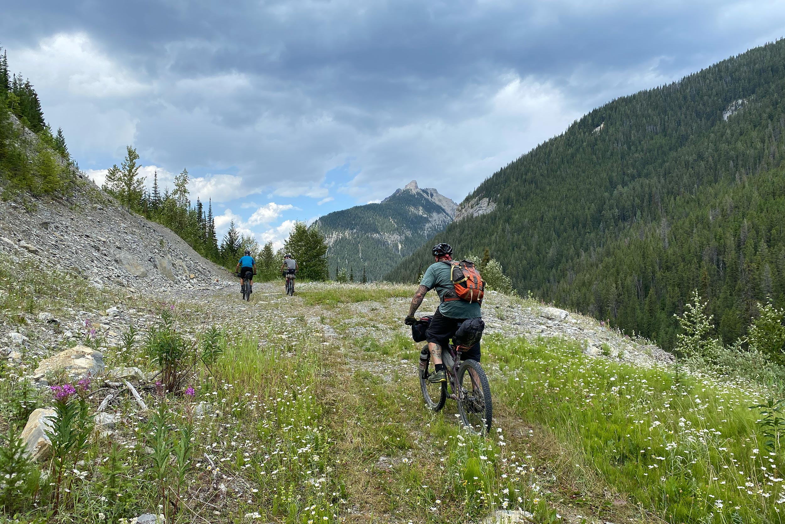
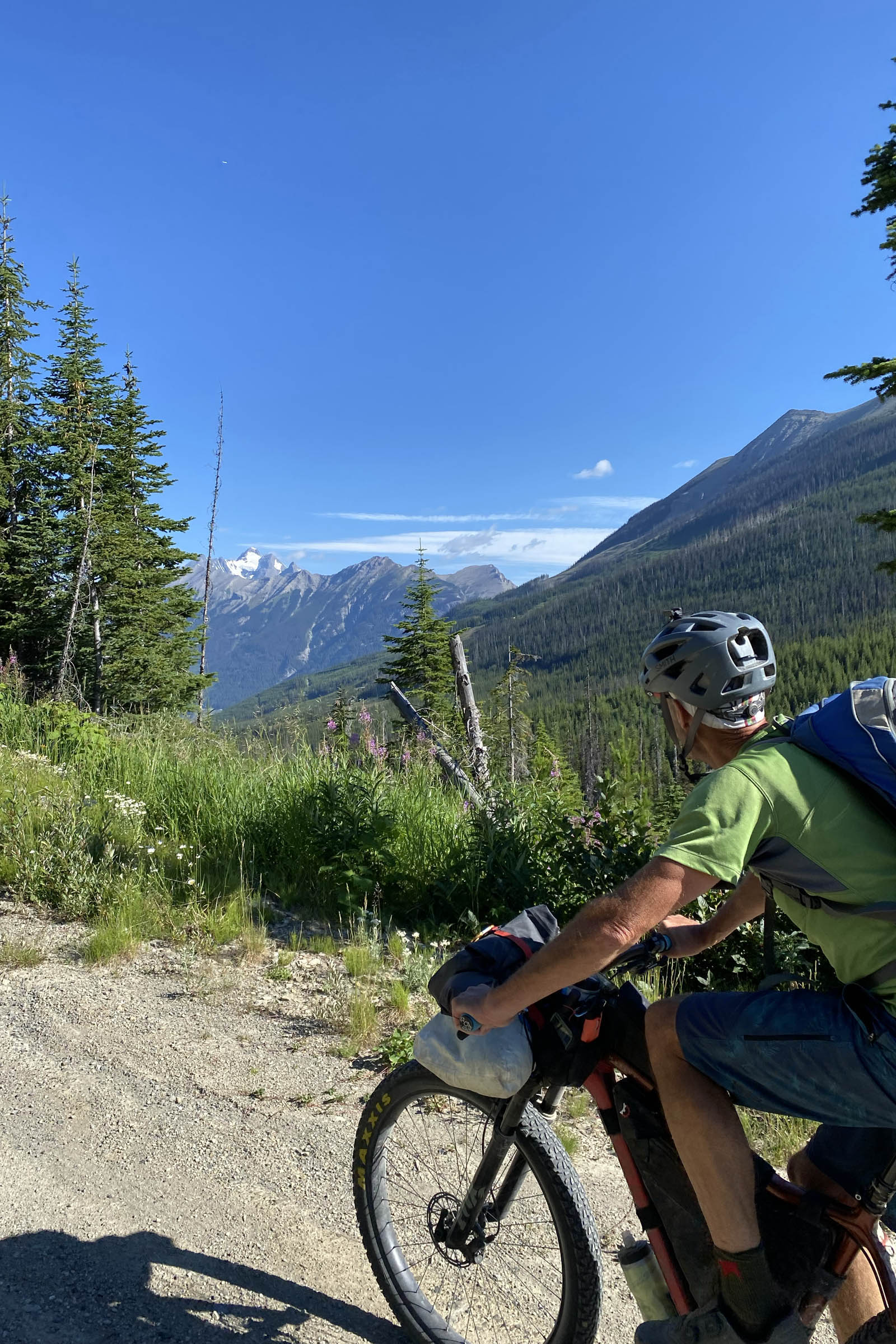
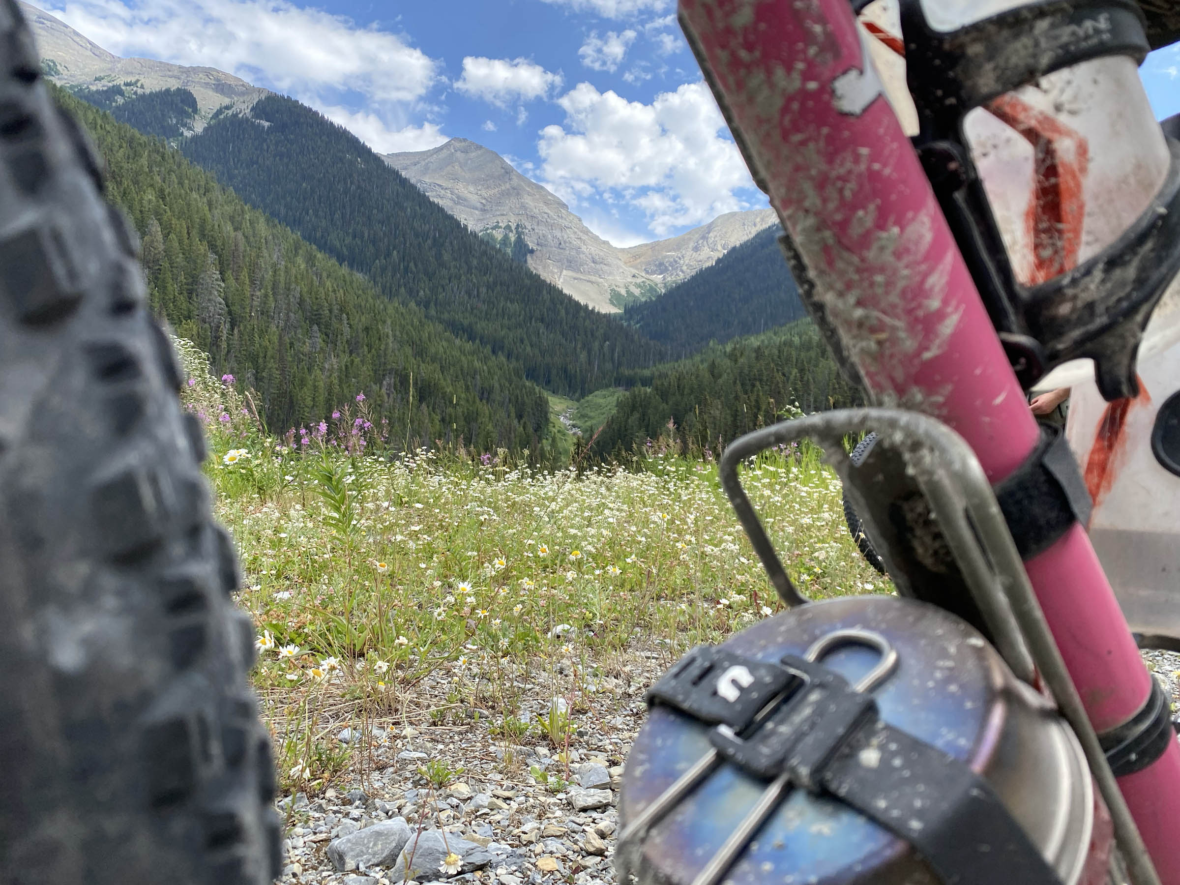
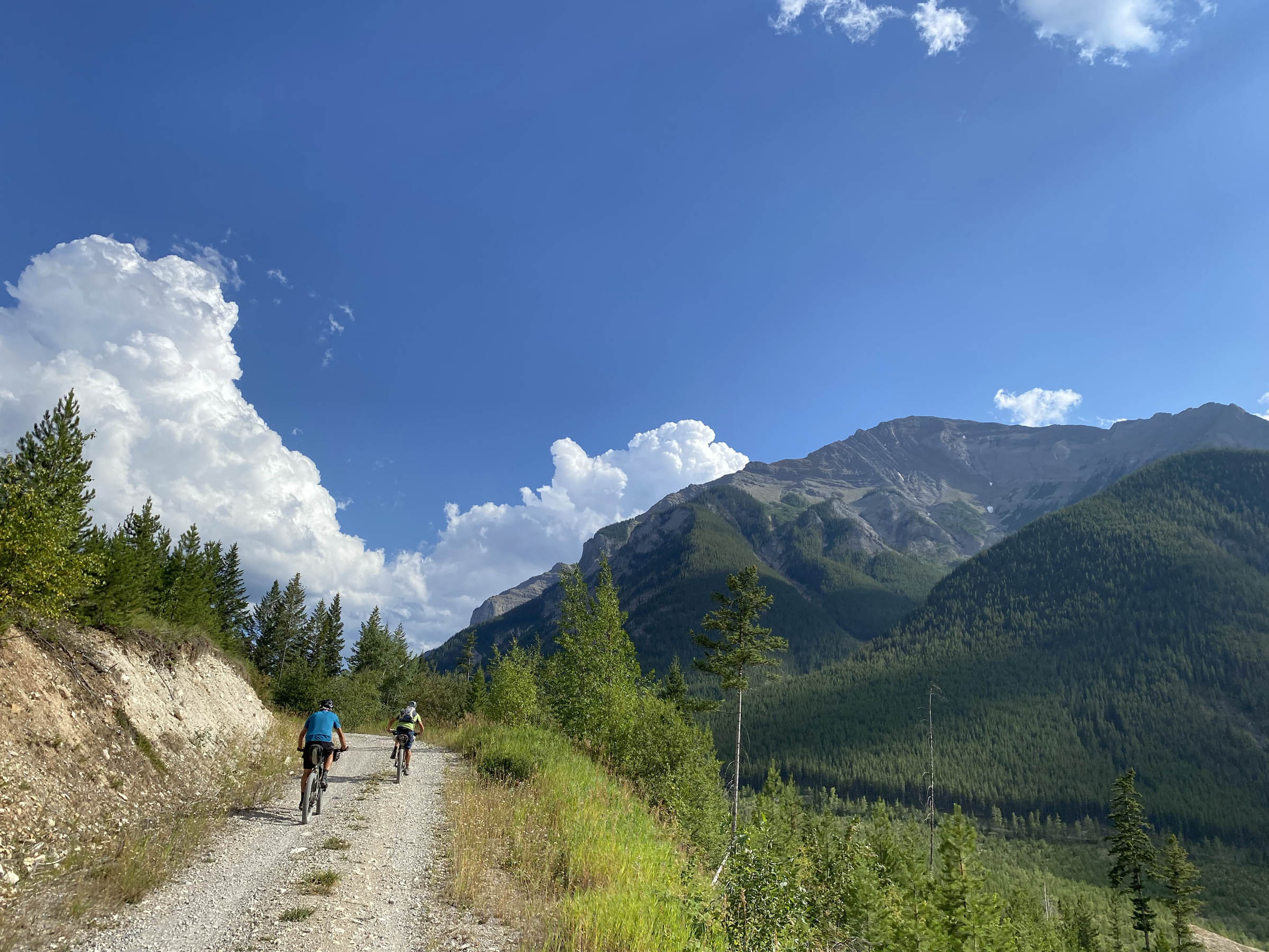
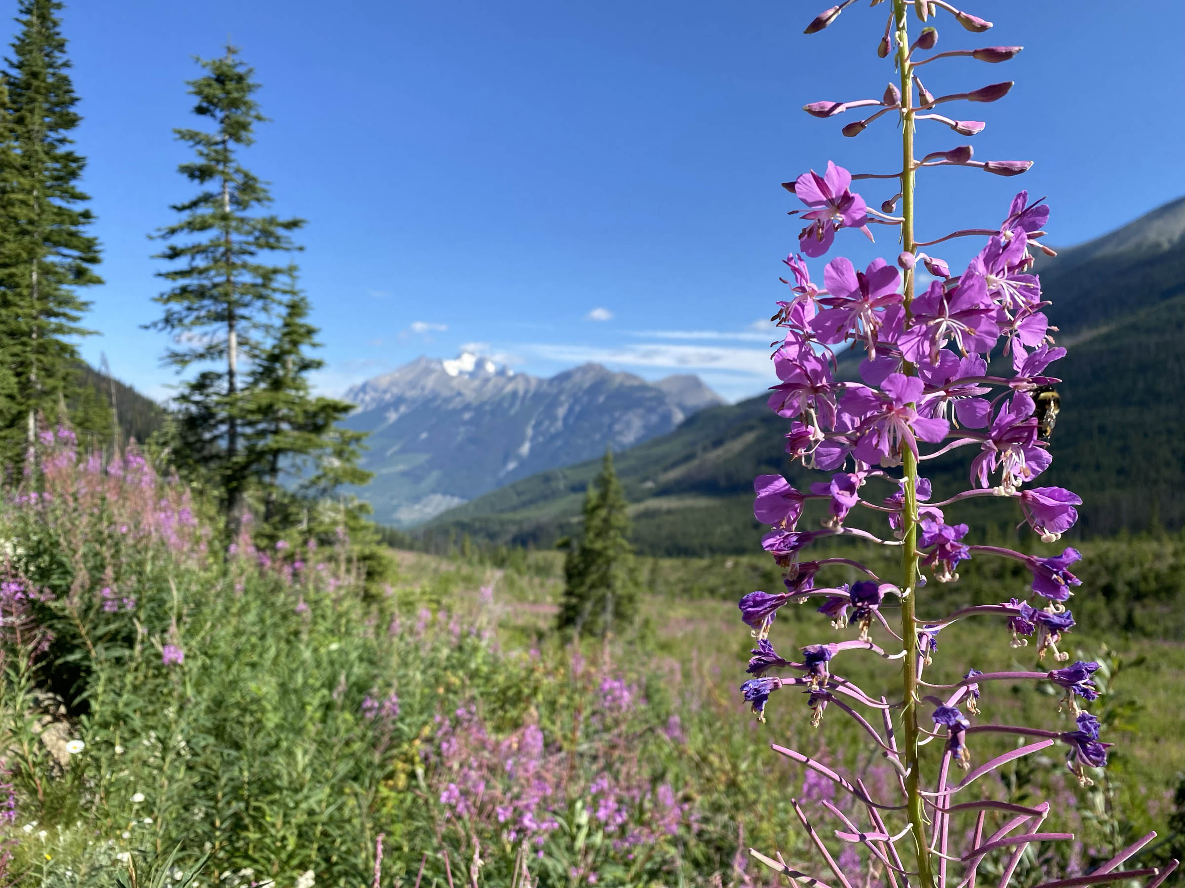
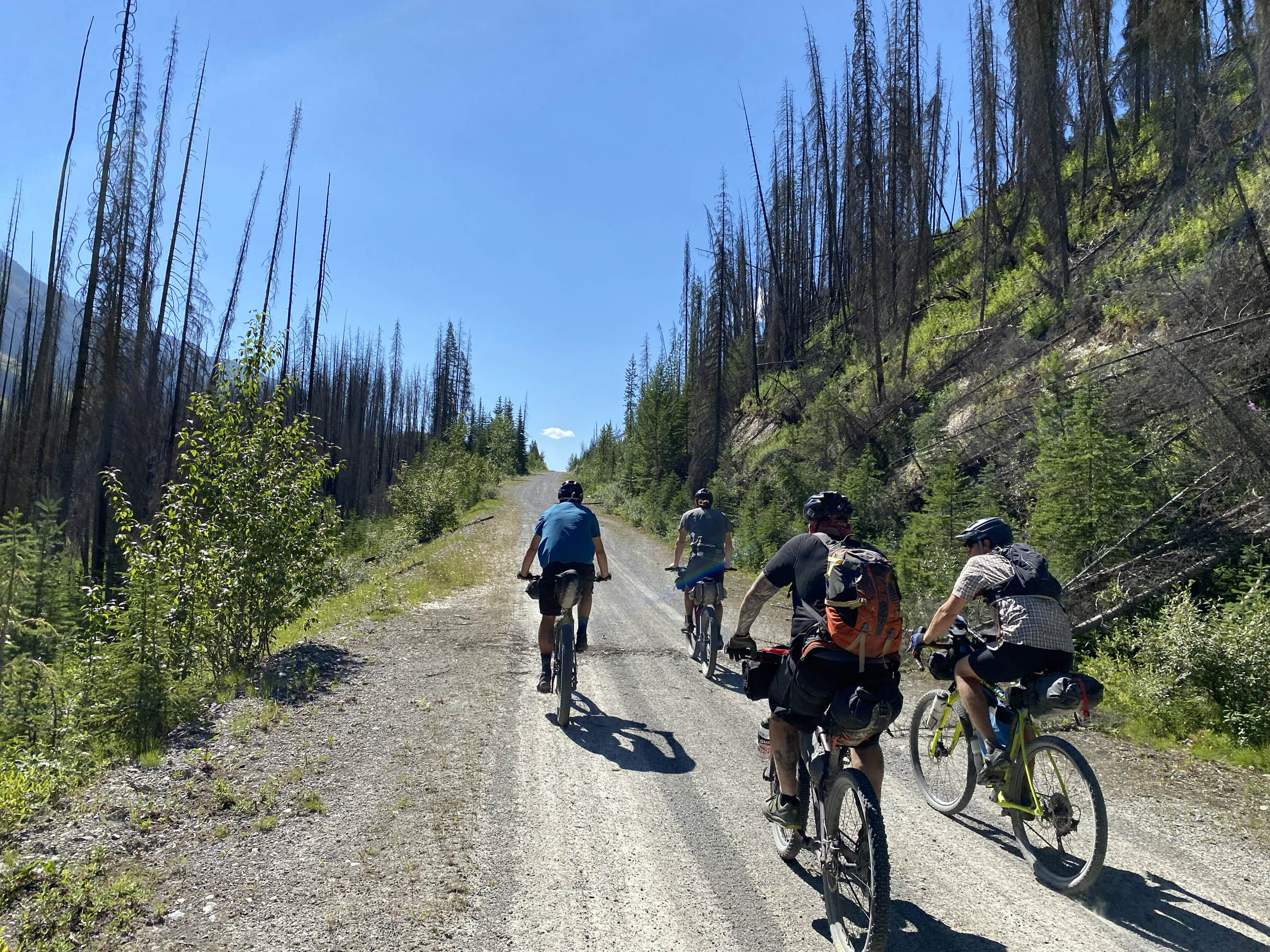
At the 151-kilometre mark, you will begin the last of the major climbs. This pass was unanimously voted the highlight of the weekend. Wildflowers, meadows, and sweeping views of the Rockies on both sides—this is why we ride bikes. The ride continues through the remains of an old wildfire from 2017 that is absolutely staggering in scope and illustrates the vibrant regrowth that occurs in the aftermath of these powerful events. Take some time and soak it in. Well, actually, you won’t have a choice, since you will be riding in it for hours. Nature is amazing.
Route Difficulty
Overall, this route deserves a 6.5 on the ol’ dificulty-o-meter. The terrain is not technically very difficult and could be handled on a bike with 47mm tires. For maximum enjoyment, a proper hardtail or at least rigid mountain bike would be best. There are some high-speed descents that are a lot more fun if you aren’t rattling your dentures out. The climbing can be steep, but it is all rideable, and there are a few water crossings that are manageable as long as you go later in the summer or into fall. The streams may be completely impassable in spring or early summer. Water is easy to find, so bring a filter and fill your boots. As far as snacking goes, you better bring a good-sized satchel, because there are no resupply options on route.


Submit Route Alert
As the leading creator and publisher of bikepacking routes, BIKEPACKING.com endeavors to maintain, improve, and advocate for our growing network of bikepacking routes all over the world. As such, our editorial team, route creators, and Route Stewards serve as mediators for route improvements and opportunities for connectivity, conservation, and community growth around these routes. To facilitate these efforts, we rely on our Bikepacking Collective and the greater bikepacking community to call attention to critical issues and opportunities that are discovered while riding these routes. If you have a vital issue or opportunity regarding this route that pertains to one of the subjects below, please let us know:
Highlights
Must Know
Camping
Food/H2O
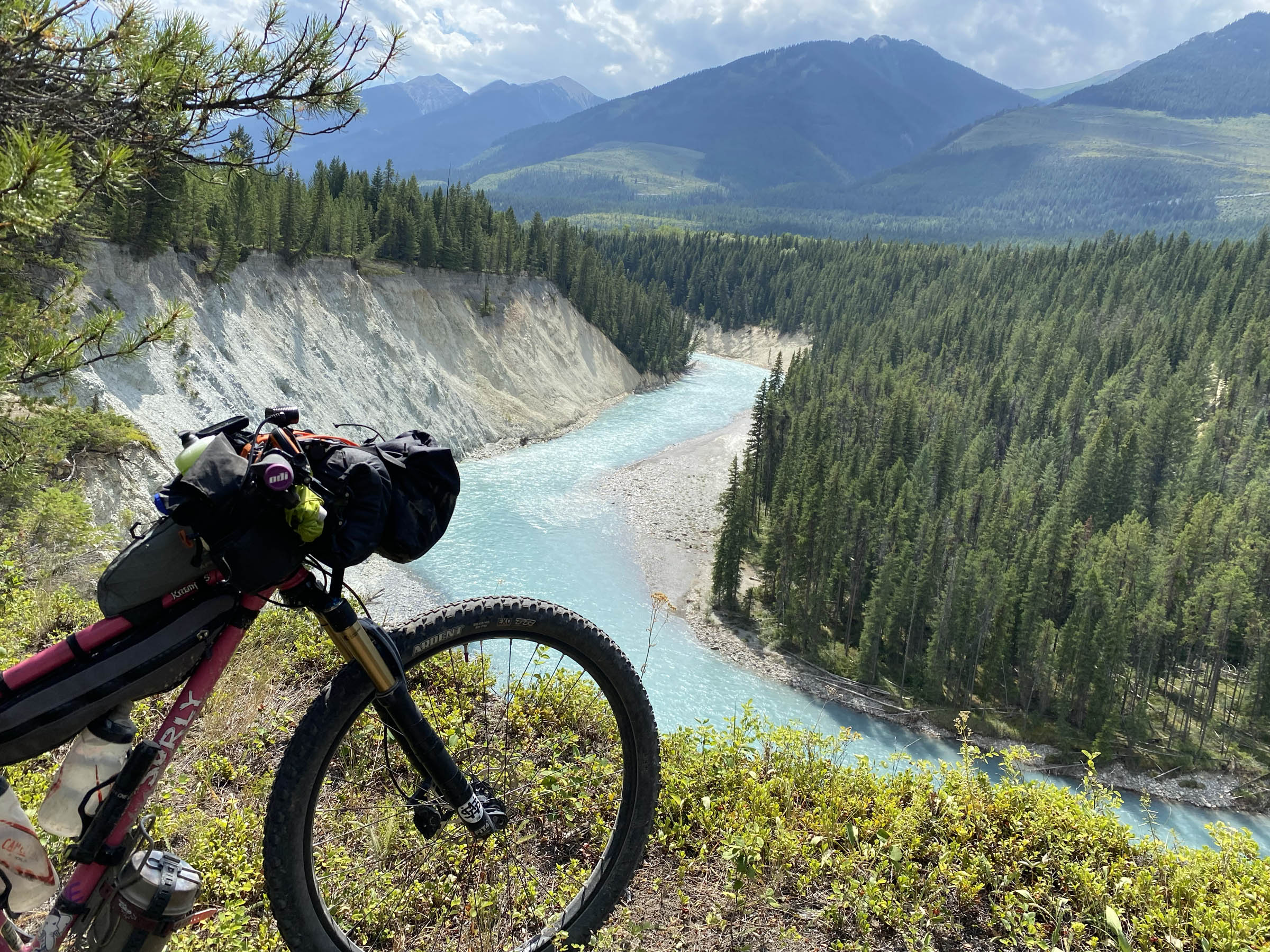
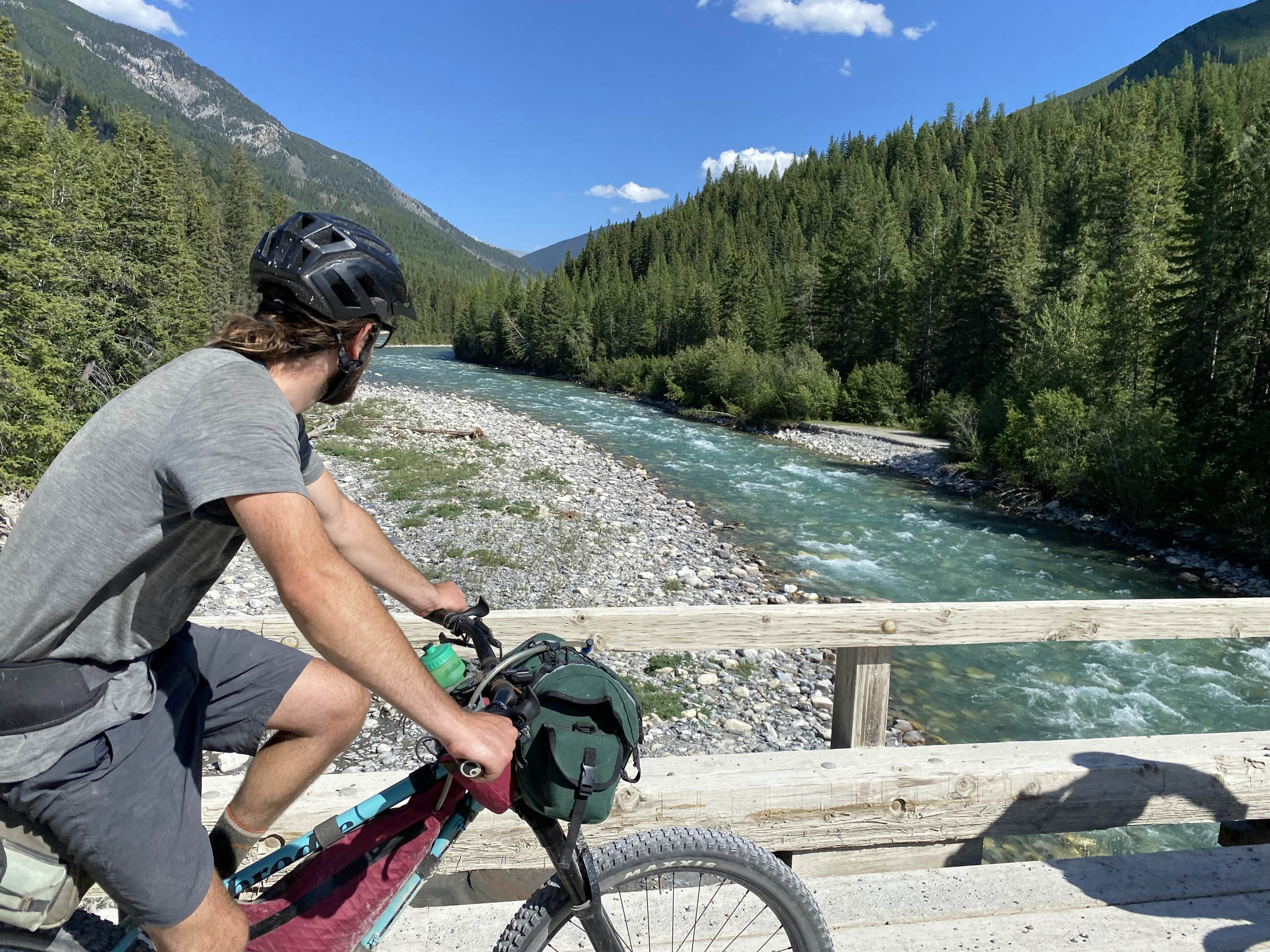
- The cool blue glacial-fed rivers are a true sight to behold. These are the rivers that make the Canadian Rockies so beloved.
- The singletrack around Nipika Resort is a great time.
- Stop and check out Fenwick Falls (at kilometre 48 on the first day).
- Passing through the remnants of some truly massive wildfires.
- Black and grizzly bears… we saw six in our 1.5-day scouting ride.
- Wildflowers aplenty. The previous wildfires have made room for amazing wildflower growth.
- The climbs can be arduous, and they are generally accompanied by breathtaking views of the surrounding peaks that keep you dreaming of all the potential adventures to be had.
- Lussier Hot Springs, a natural hot spring right on the Lussier River that awaits your weary bones on the drive out. Fairmont Hot Springs and Radium Hot Springs are also nearby, but they are commercialized and developed, while Lussier remains free and less developed.
- When to go: July, August, September. The rivers and streams will be running too high until July, and the snow will still be prevalent. You may get away with early October but be prepared for early season snowstorms.
- The start/end of this route is 30 kilometres up the White Swan Lake Forest Service Rd. There is a great parking spot/staging area there. This gravel road is accessible by virtually any vehicle and is generally fairly heavily trafficked. Beware of logging trucks and other industry vehicles, and make sure to give them the right-of-way.
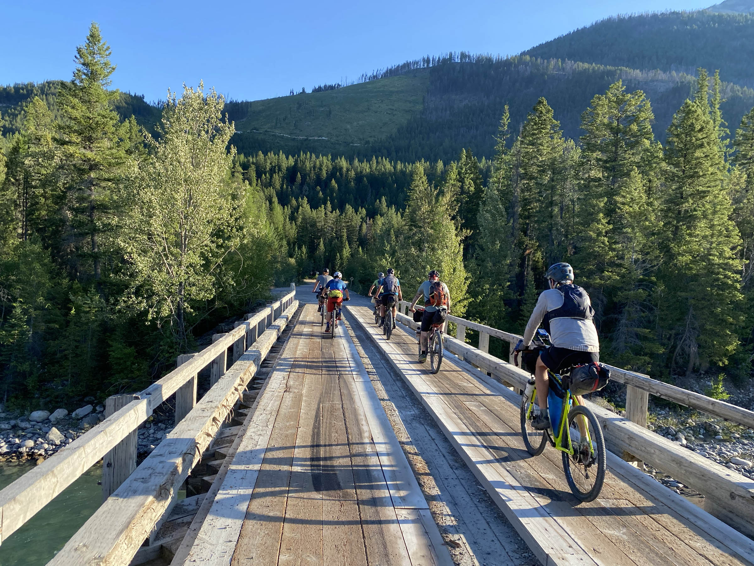
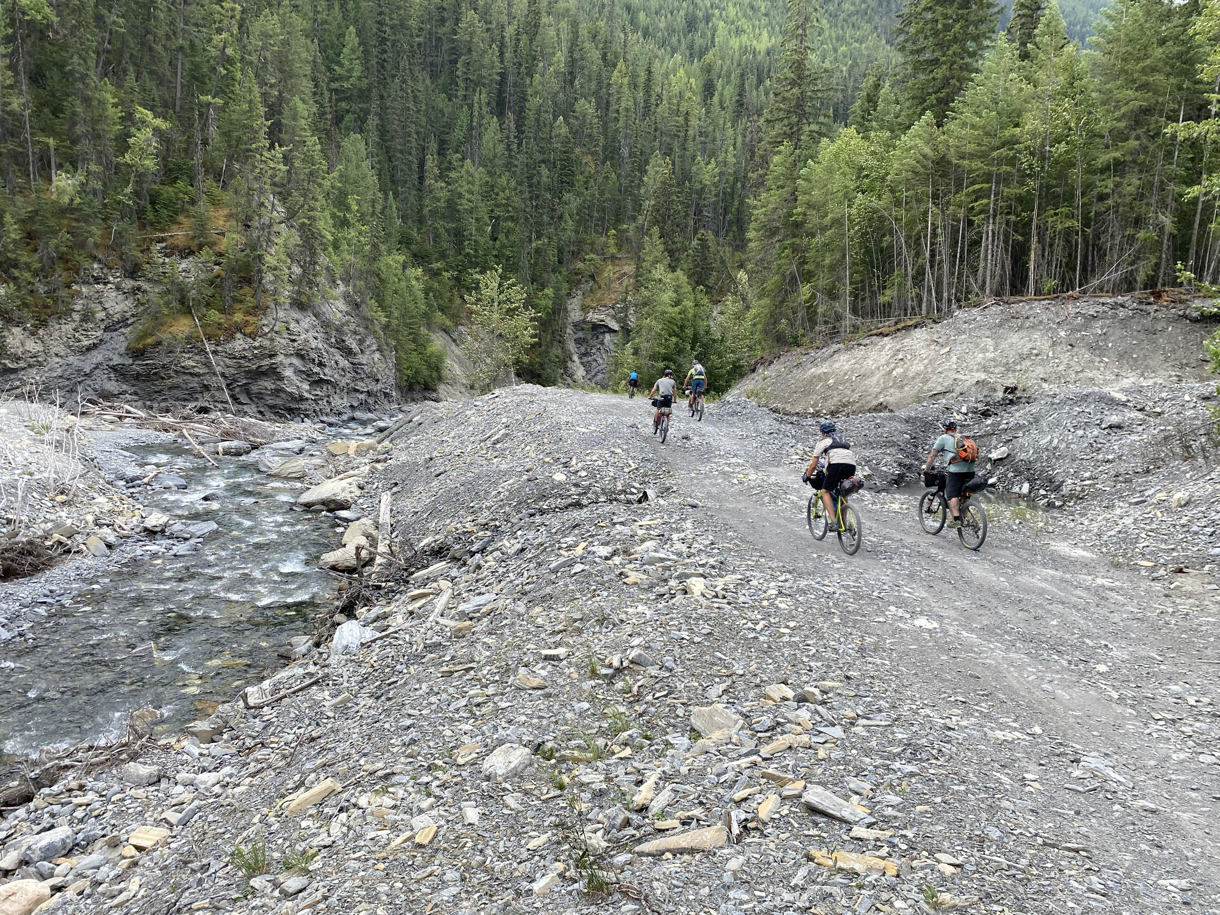
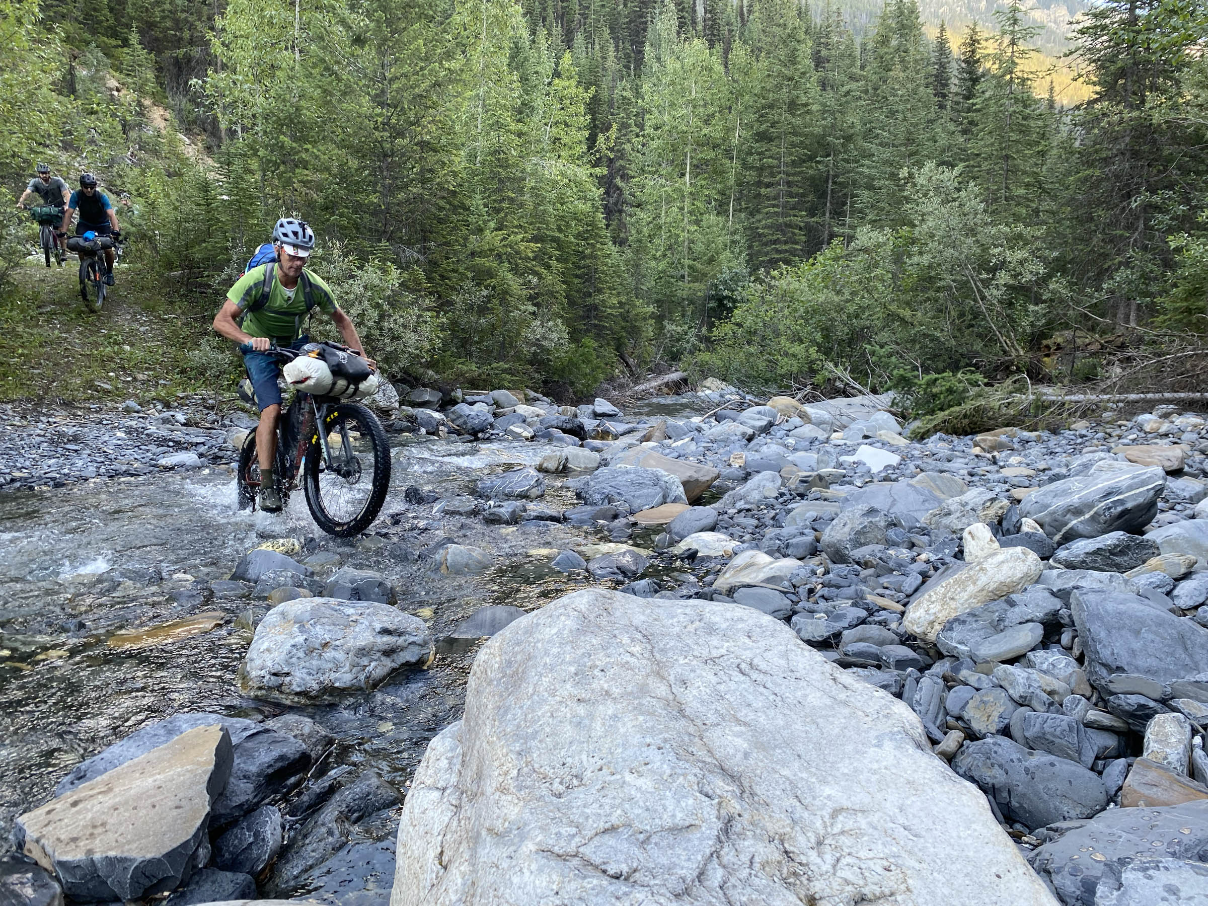
- There are a handful of river crossings on this route, and we were able to ride through all of them in mid-August. They will obviously be a bit deeper earlier in the summer but shouldn’t be too much trouble.
- The Canadian Rockies International Airport (between Cranbrook and Kimberley) is the closest airport, and Calgary is about 350 kilometres away. If you’re coming from far away, make sure to spend some time in Cranbrook, Kimberley, or Invermere and sample the amazing mountain biking in the area.
- The route abounds with BC Rec Sites. These are rustic sites that are popular with all types of outdoor enthusiasts and generally have pit toilets and picnic tables. They’re first come, first served, but you’ll always be able to find a little corner to set up a tent as long as your group isn’t too big
- Wild camping is plentiful.
- Water is abundant, and filtering is always a good idea.
- Food is non-existent, so make sure to stock up and plan ahead for what you’ll need.
- If you’re coming from the south (Cranbrook/Kimberley area), you’ll need to stock up there.
- If you’re coming from the north (Invermere/Radium), the closest grocery store is in Fairmont Hot Springs.


Terms of Use: As with each bikepacking route guide published on BIKEPACKING.com, should you choose to cycle this route, do so at your own risk. Prior to setting out check current local weather, conditions, and land/road closures. While riding, obey all public and private land use restrictions and rules, carry proper safety and navigational equipment, and of course, follow the #leavenotrace guidelines. The information found herein is simply a planning resource to be used as a point of inspiration in conjunction with your own due-diligence. In spite of the fact that this route, associated GPS track (GPX and maps), and all route guidelines were prepared under diligent research by the specified contributor and/or contributors, the accuracy of such and judgement of the author is not guaranteed. BIKEPACKING.com LLC, its partners, associates, and contributors are in no way liable for personal injury, damage to personal property, or any other such situation that might happen to individual riders cycling or following this route.
Please keep the conversation civil, constructive, and inclusive, or your comment will be removed.