


Bikepacking The White Rim
Distance
97 Mi.
(156 KM)Days
3
% Unpaved
90%
% Singletrack
0%
% Rideable (time)
100%
Total Ascent
5,459'
(1,664 M)High Point
6,170'
(1,881 M)Difficulty (1-10)
5?
- 4Climbing Scale Fair56 FT/MI (11 M/KM)
- -Technical Difficulty
- -Physical Demand
- -Resupply & Logistics
Contributed By

Logan Watts
Founding Editor
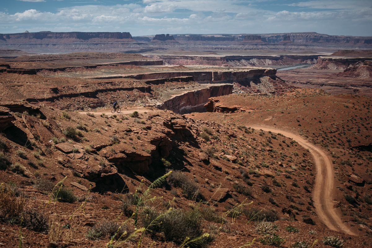
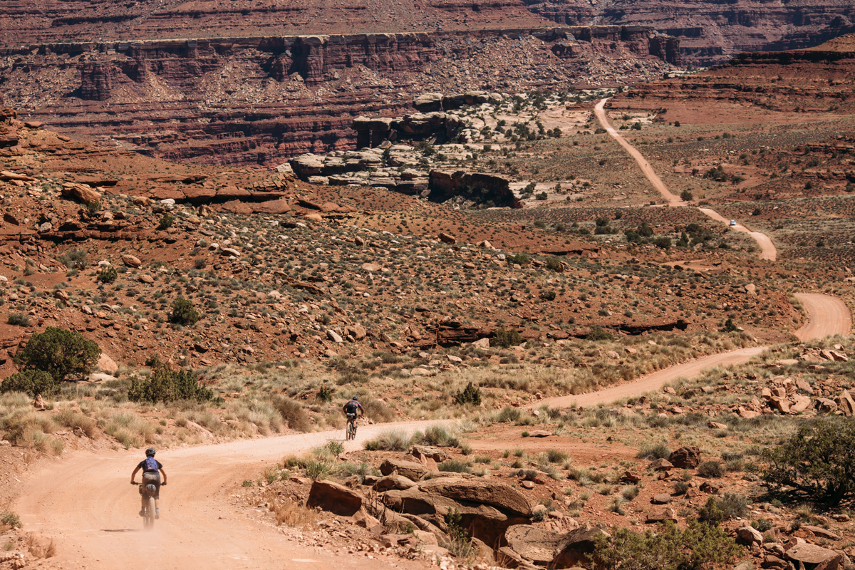
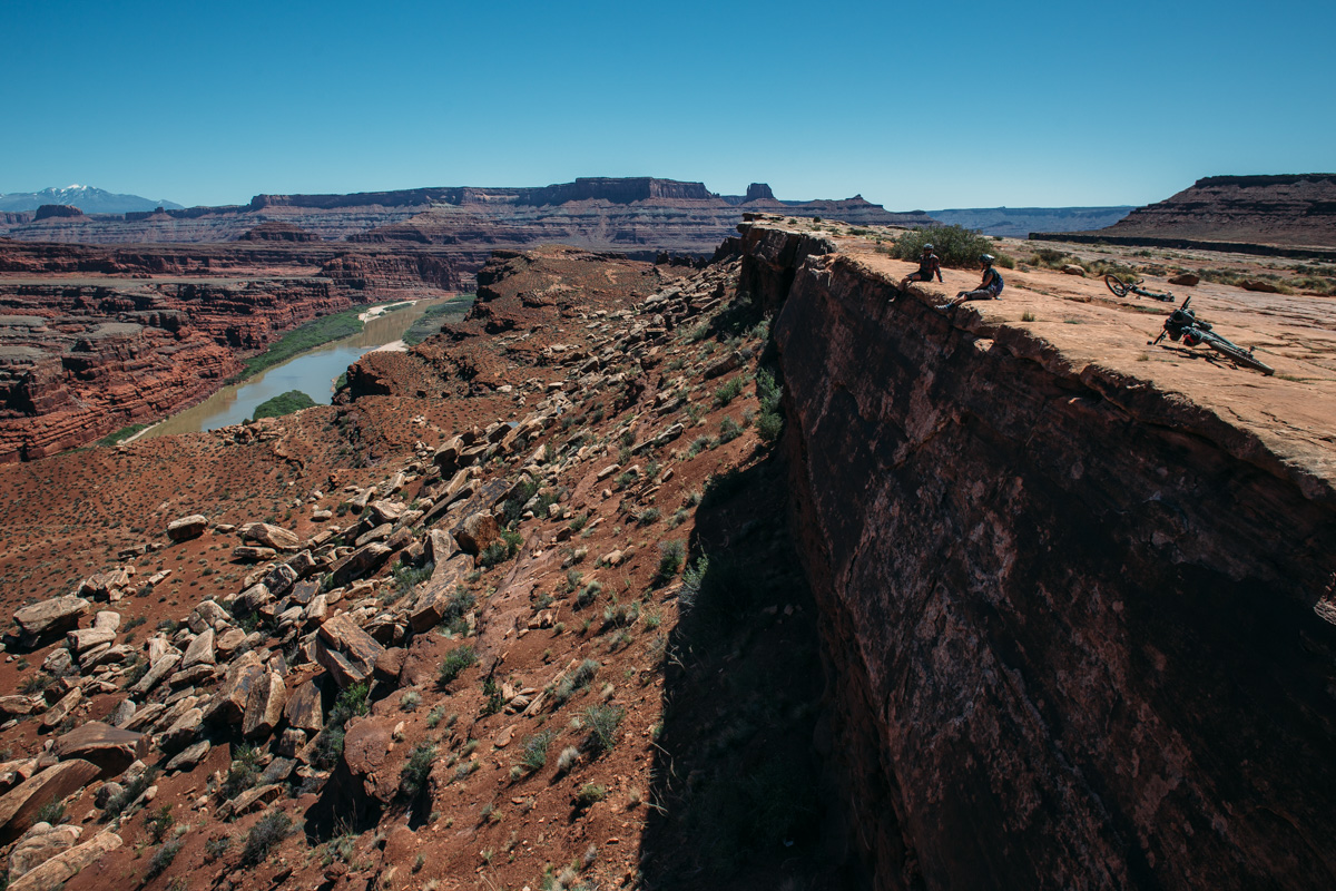
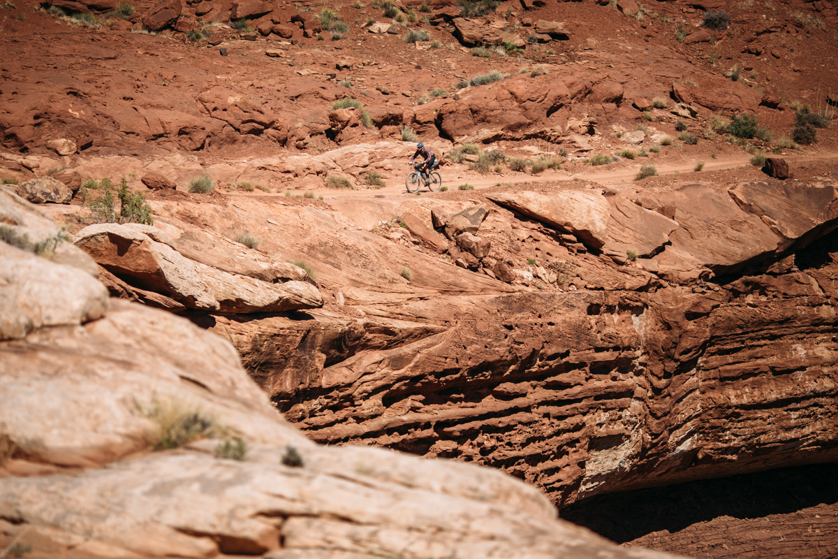
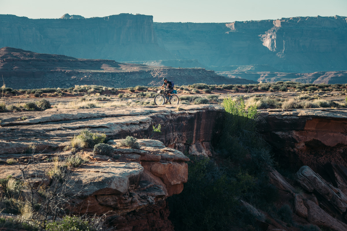
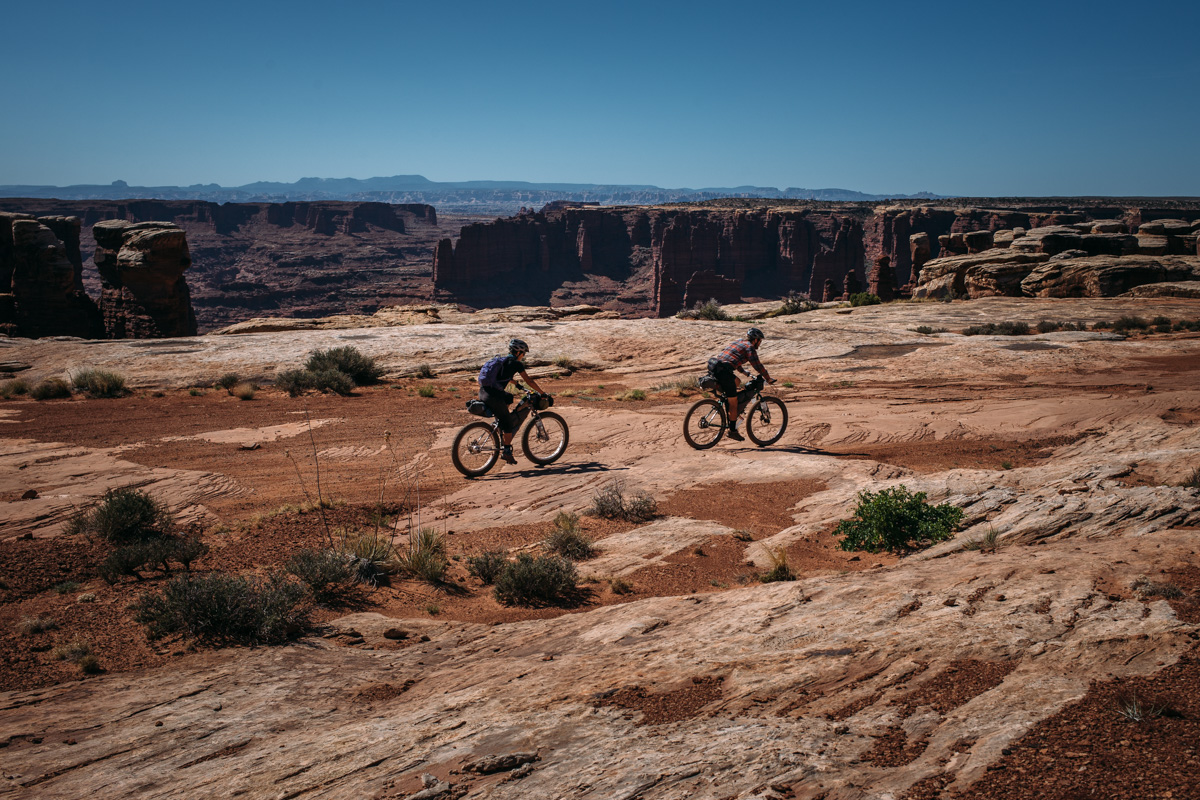
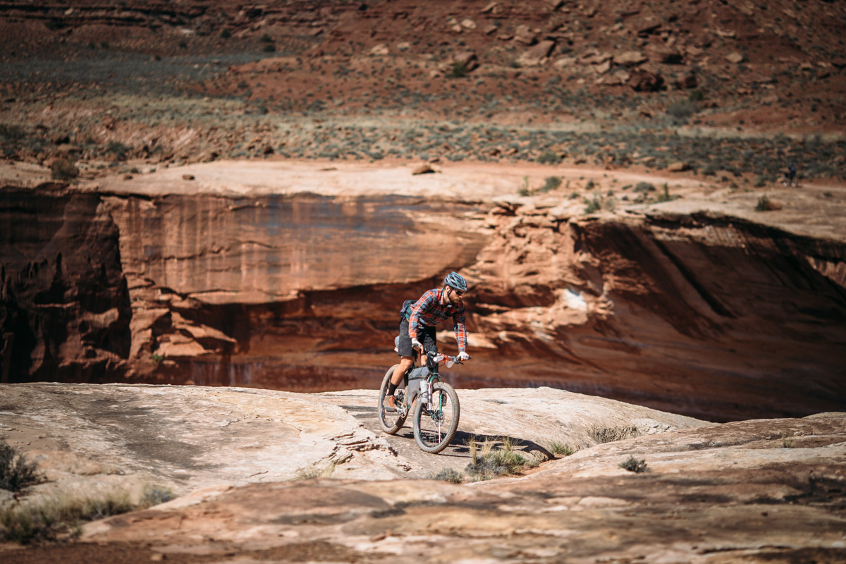
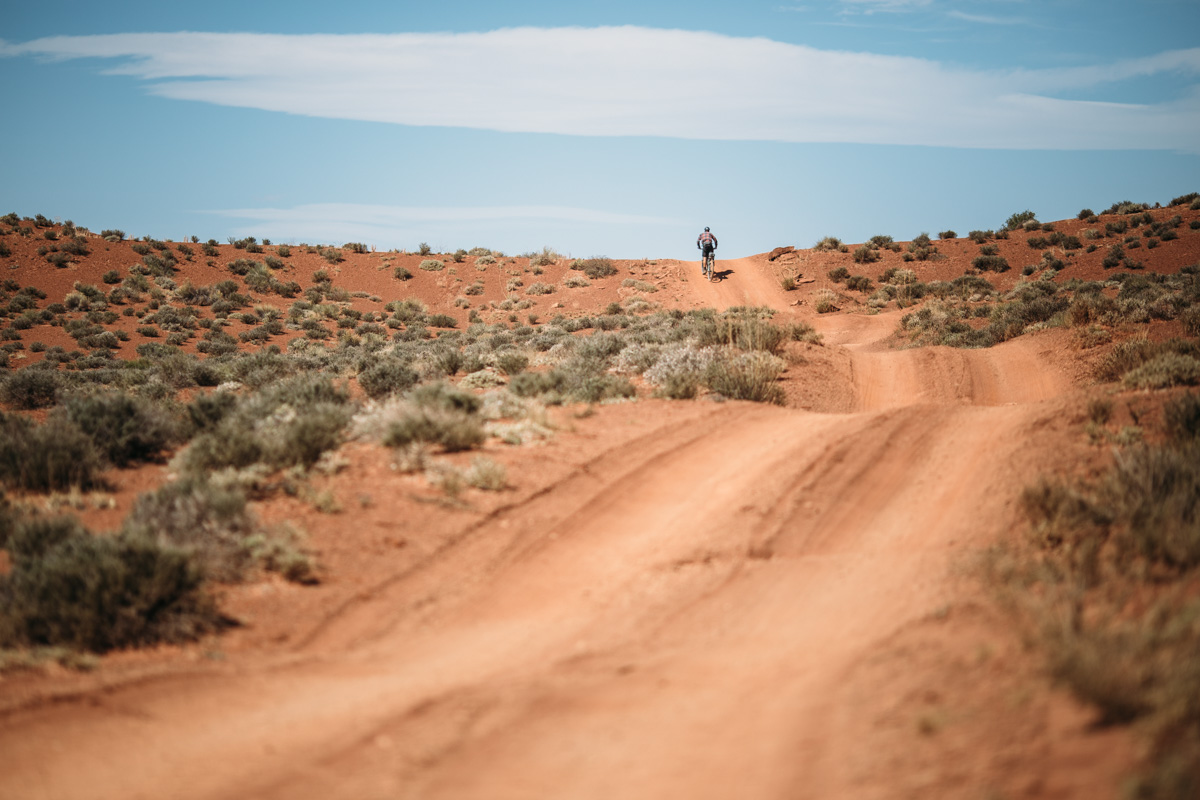
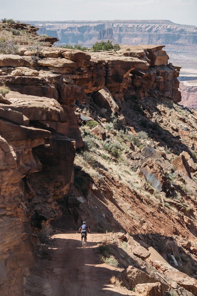
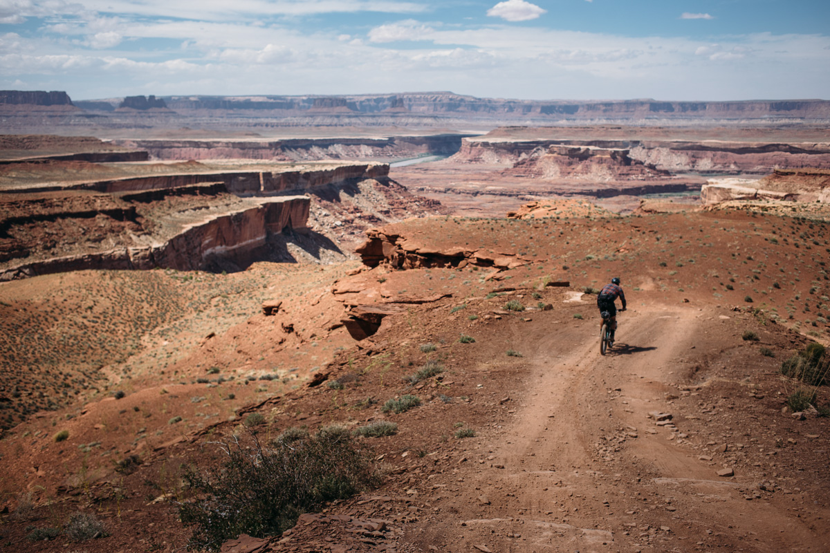
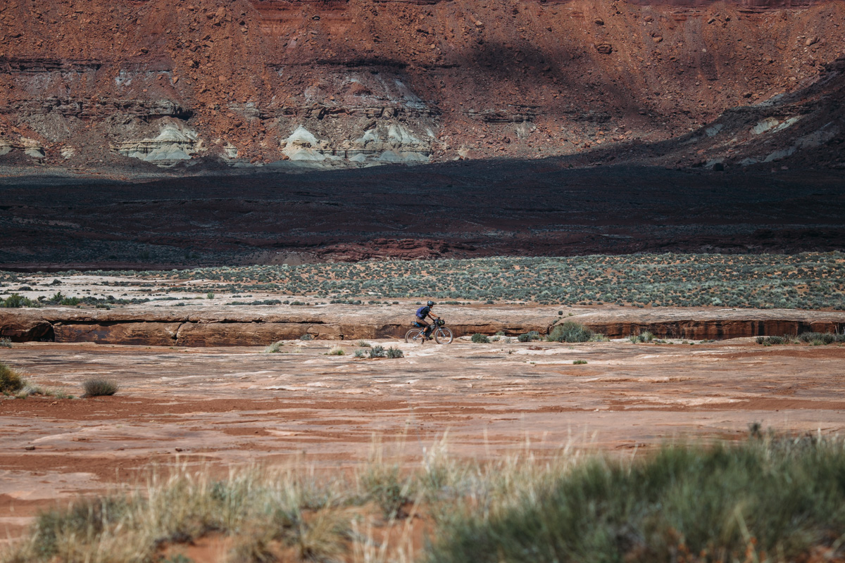
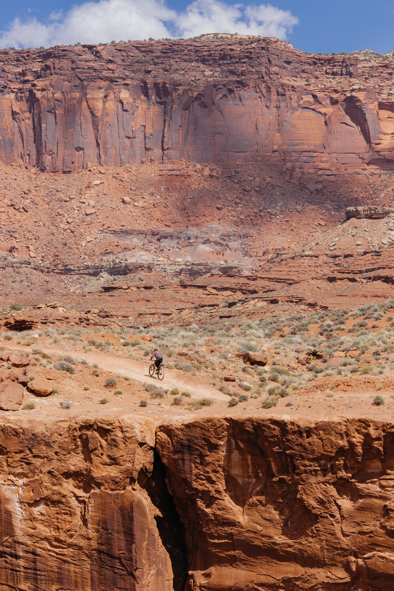
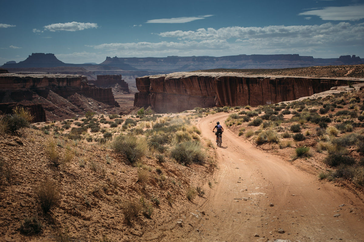
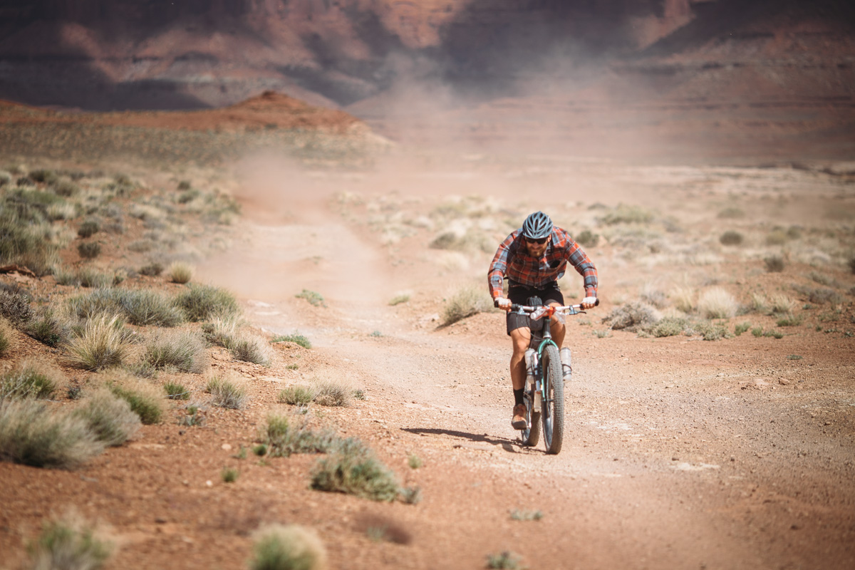
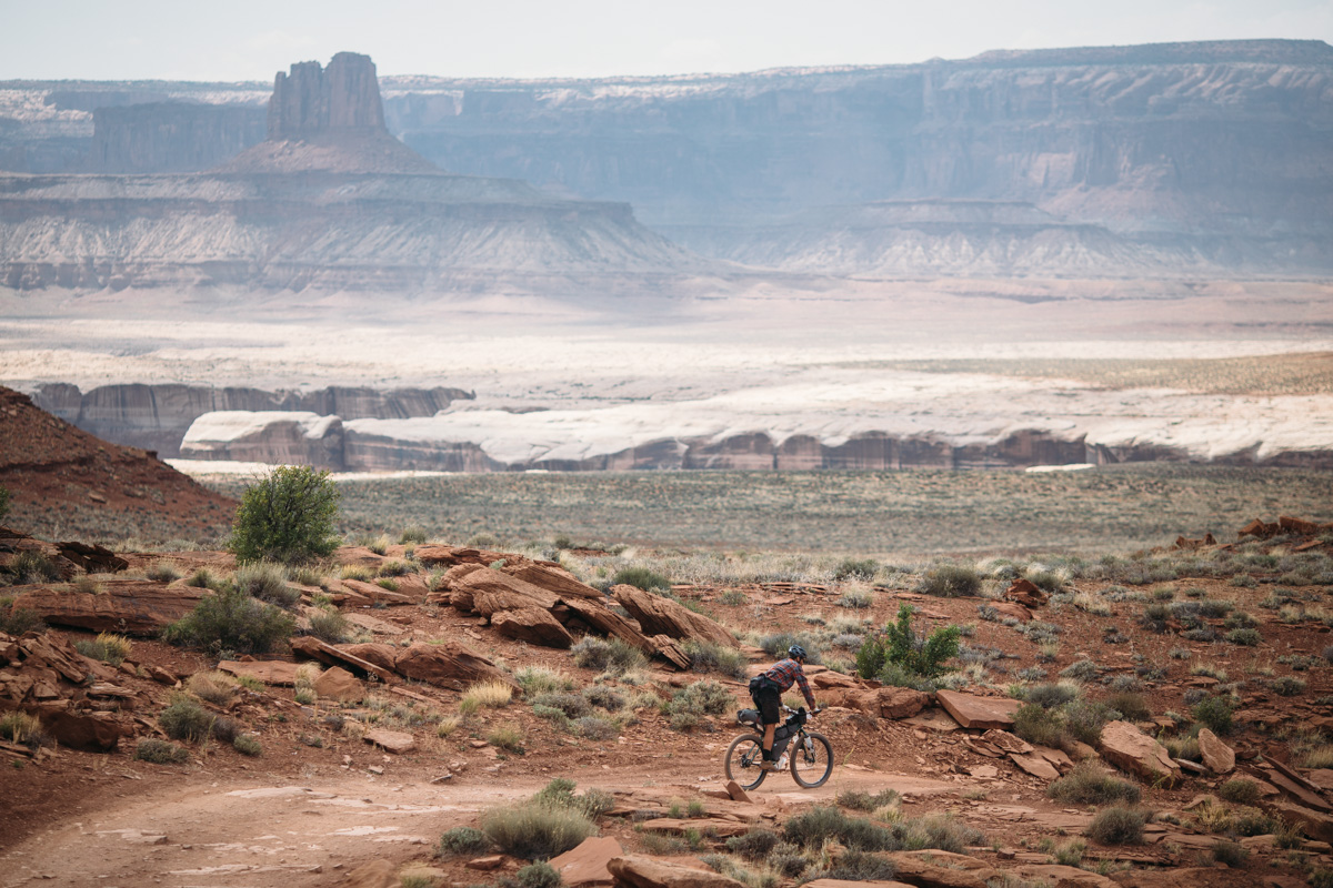
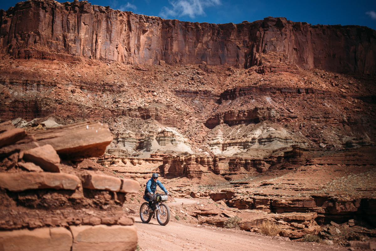
Beginning on Shafer Canyon Road, the White Rim Trail descends onto the aptly named white rim and follows breathtaking plateaus along the Colorado and Green rivers via slickrock, graded gravel, dirt roads, semi-technical rocky doubletrack, and thick sandy bottoms. Although the route can be ridden either way, most prefer to tackle the 100 mile loop in a clockwise direction starting with a spiraling descent on Shafer Road. The easiest place to begin is at the Island in The Sky Visitors Center to obtain a backcountry permit and then leave a vehicle at the Shafer Canyon lookout parking area (details in the Need To Know section below). Other options include parking at the end of Mineral Bottom Road at Hwy 313, or above the switchbacks 10 miles from the pavement.
There are reservable campsites along the route (details below). It is highly recommended to reserve a campsite well in advance as backcountry zone camping impossible with bikes. Also, please note that this route is not to be taken lightly for the lack of water resupply.


Submit Route Alert
As the leading creator and publisher of bikepacking routes, BIKEPACKING.com endeavors to maintain, improve, and advocate for our growing network of bikepacking routes all over the world. As such, our editorial team, route creators, and Route Stewards serve as mediators for route improvements and opportunities for connectivity, conservation, and community growth around these routes. To facilitate these efforts, we rely on our Bikepacking Collective and the greater bikepacking community to call attention to critical issues and opportunities that are discovered while riding these routes. If you have a vital issue or opportunity regarding this route that pertains to one of the subjects below, please let us know:
Highlights
Must Know
Camping
Food/H2O
- The geologic wonderland and unbelievable scenery that is Canyonlands National Park.
- Great riding along the White Rim allows for unbelievable sightseeing.
- Camping along the rim under an incredible starry sky.
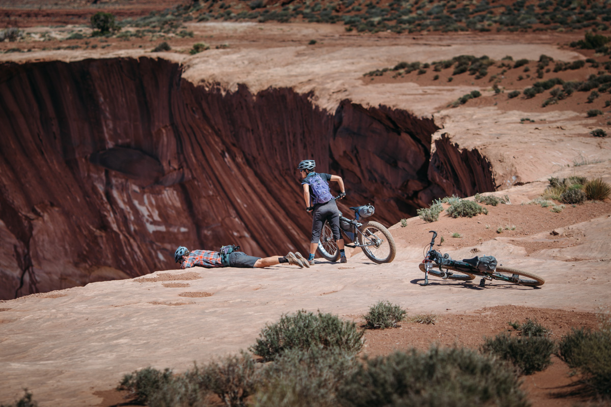
- Peering into the abyss of the canyons.
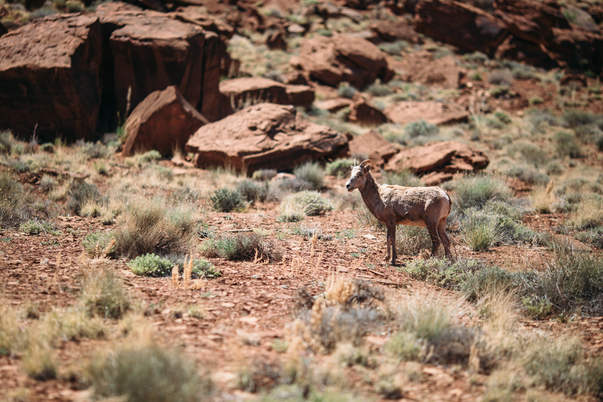
- Spotting big-horned sheep and other wildlife.
- The unmatched views in the Needles area.
- It is required to obtain and carry a backcountry permit reservable online here or available for purchase at the Island in The Sky Visitors Center.
- Spring and fall are the best times to ride the White Rim (April/May or September/October are ideal).
- The highest point on the route is over 6,000 feet so nighttime temps can dip well below freezing anytime of year; bring proper clothing. Also, be prepared for snow.
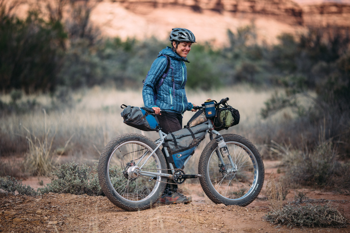
- The sand can be fairly thick near the river bottom areas and sometimes challenging for even a fatbike; large tires are recommended, although not necessary for 95% of the route.
- The ideal bike for the route is a ‘Plus Bike‘, because of a few stretches of sandy terrain. However, a lot of folks ride on a standard mountain bike with 2.1 or larger tires.
- In summer, temperatures can reach over 100°F on a regular basis, plan accordingly or, ideally, ride in the spring or fall.
- Designated campsites must be reserved well in advance and some are booked over a year in advance; group camping permits are $36 (reservation fee) and $5/per person, per night; more info here.
- Backcountry camping is not possible with bikes. There is a map in the visitor center that provides ‘zone’ boundaries for backcountry camping; however, the rules for cyclists prohibit bicycles from designated hiking trails and anywhere off the White Rim Road. At the time we rode this, if you wished to camp in the backcountry, it was necessary to stash your bike along the road in order to hike to the permitted zone. According to the park office: possession of a bicycle off of a designated road is prohibited in Canyonlands National Park. Camping with a bicycle is considered vehicle camping, which is only legal in 20 designated vehicle campsites, in 10 locations along the road. At-large zone permits are intended for backpackers only. They are not meant to be a way to travel the White Rim when vehicle sites are full.
- Abide by common sense and stay on the road.
- This is a destination route, and as such, it experiences a lot of tours and visitors. If you choose to do this route, please leave no trace, or better yet, pick up a piece of trash or make it better. Doing so will help preserve this area for future use.
- Check the weather in advance; flooding may occur in spring or fall.
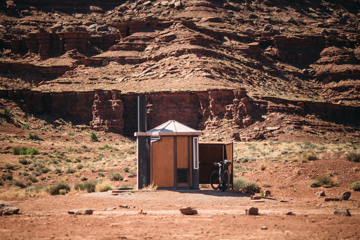
- There are pit toilets along the route (near designated campsites) that are available for use; most are stocked with toilet paper.
- The only water source available on the route (waypoint on GPS map above) is the Green River which is very silty and needs filtering. Filtering directly from the river will damage your filter, so let the water settle (typically overnight) in a bucket or jug before filtering to remove the sediment. To speed up the process you can add alum to the water which caused the sediment to stick together and settle out faster (in about 15-30 minutes.) Alum is a food safe additive commonly used in pickling, so it can be found in the spice aisle of most grocery stores.
- During wetter times, there may be water available in puddles on the rock mesas.
- If intending to stay more than one night, caching water is recommended. We cached on the Gooseberry Trail which was about 30 miles from the start; this required a significant hike the day before (about 5 miles round trip with a climb of 1,400 feet), but the water was well worth the effort.
- The National Park Service recommends 1 gallon of water per day.
- During the high season, there may be options to beg water from tour guides and jeeps along the way, but don’t depend on it.
- If you’d prefer to cache water along the route beforehand, you can email the permit office (CANYres@nps.gov) for a cache form.


Terms of Use: As with each bikepacking route guide published on BIKEPACKING.com, should you choose to cycle this route, do so at your own risk. Prior to setting out check current local weather, conditions, and land/road closures. While riding, obey all public and private land use restrictions and rules, carry proper safety and navigational equipment, and of course, follow the #leavenotrace guidelines. The information found herein is simply a planning resource to be used as a point of inspiration in conjunction with your own due-diligence. In spite of the fact that this route, associated GPS track (GPX and maps), and all route guidelines were prepared under diligent research by the specified contributor and/or contributors, the accuracy of such and judgement of the author is not guaranteed. BIKEPACKING.com LLC, its partners, associates, and contributors are in no way liable for personal injury, damage to personal property, or any other such situation that might happen to individual riders cycling or following this route.
Please keep the conversation civil, constructive, and inclusive, or your comment will be removed.