


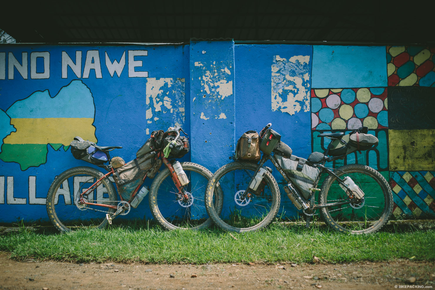
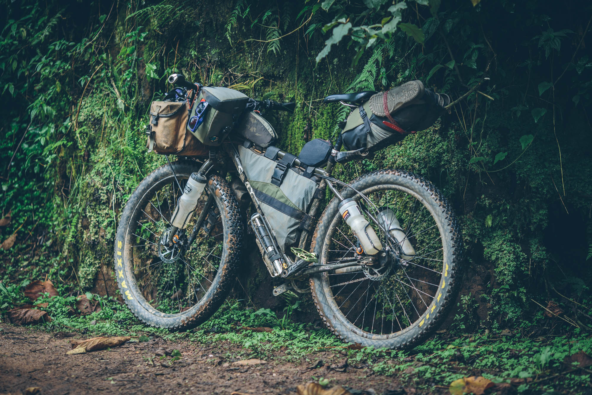
The Congo Nile Trail (Bikepacker’s Edition)
Distance
160 Mi.
(257 KM)Days
5
% Unpaved
75%
% Singletrack
12%
% Rideable (time)
98%
Total Ascent
19,100'
(5,822 M)High Point
8,200'
(2,499 M)Difficulty (1-10)
6?
- 8Climbing Scale Strenuous119 FT/MI (23 M/KM)
- -Technical Difficulty
- -Physical Demand
- -Resupply & Logistics
Contributed By

Logan Watts
Founding Editor
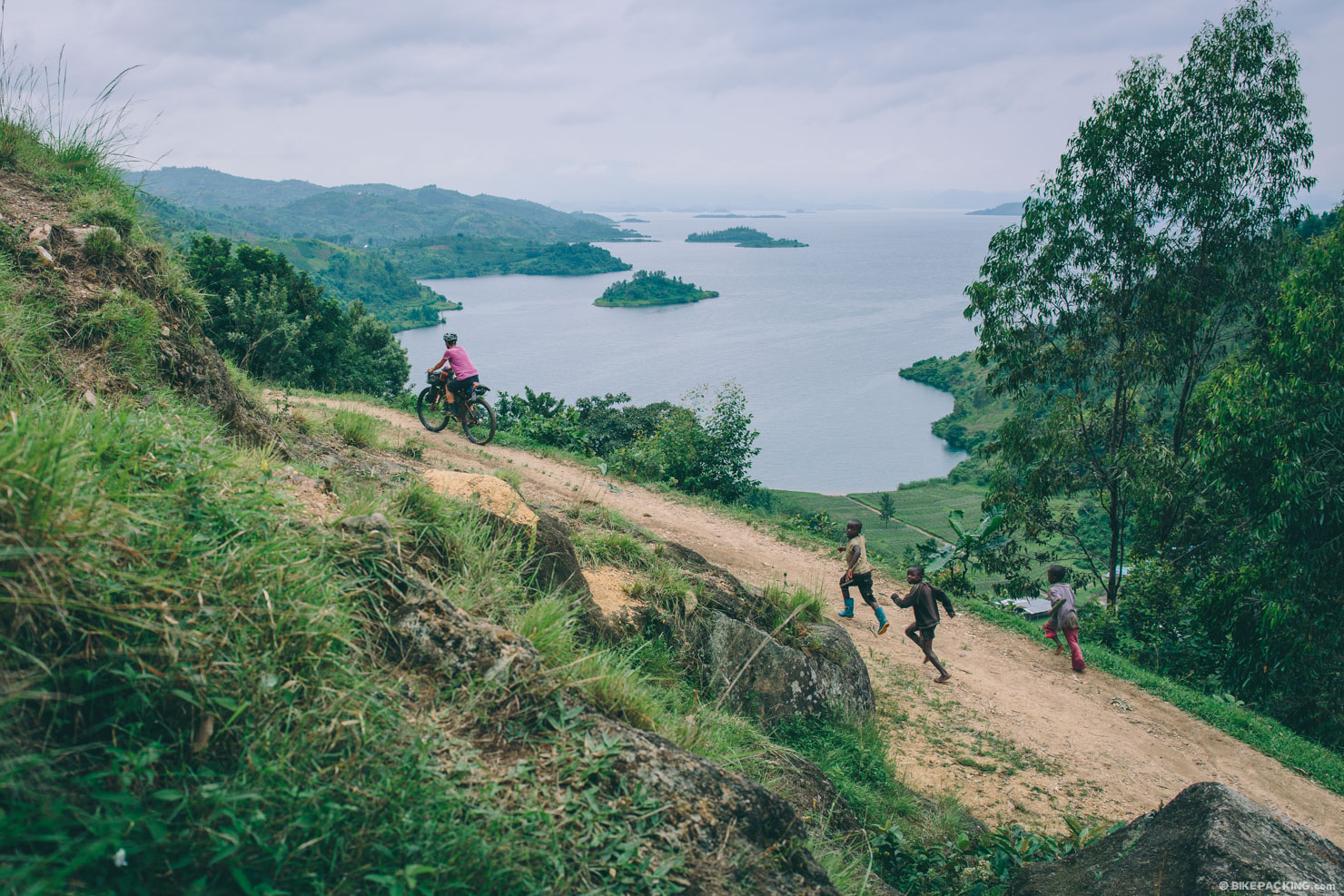
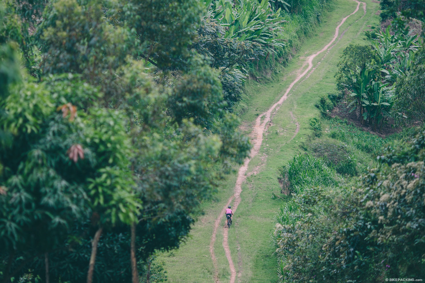
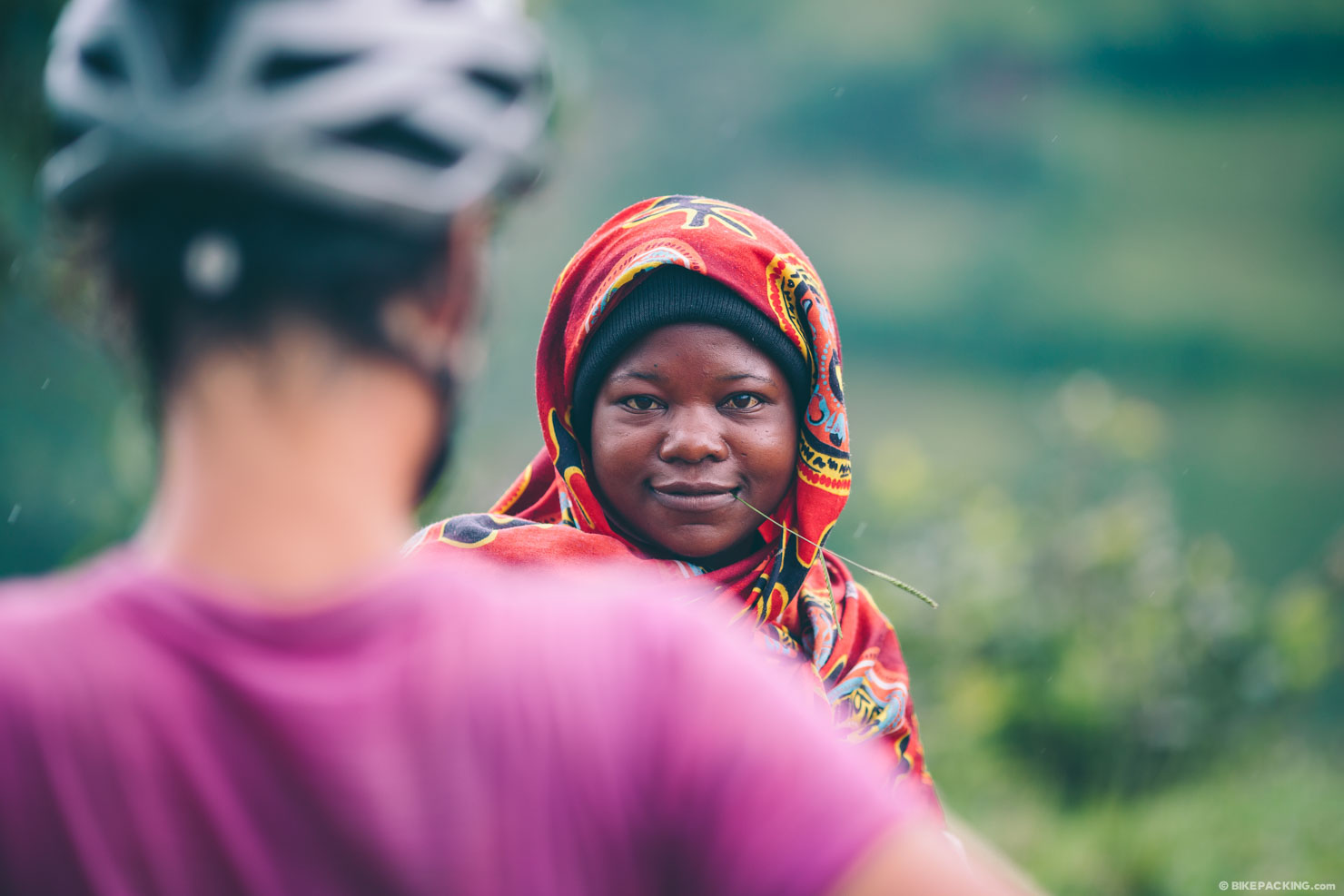
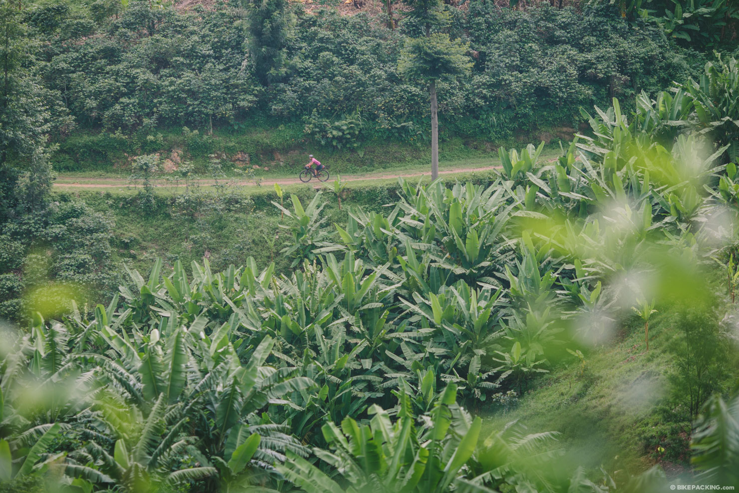
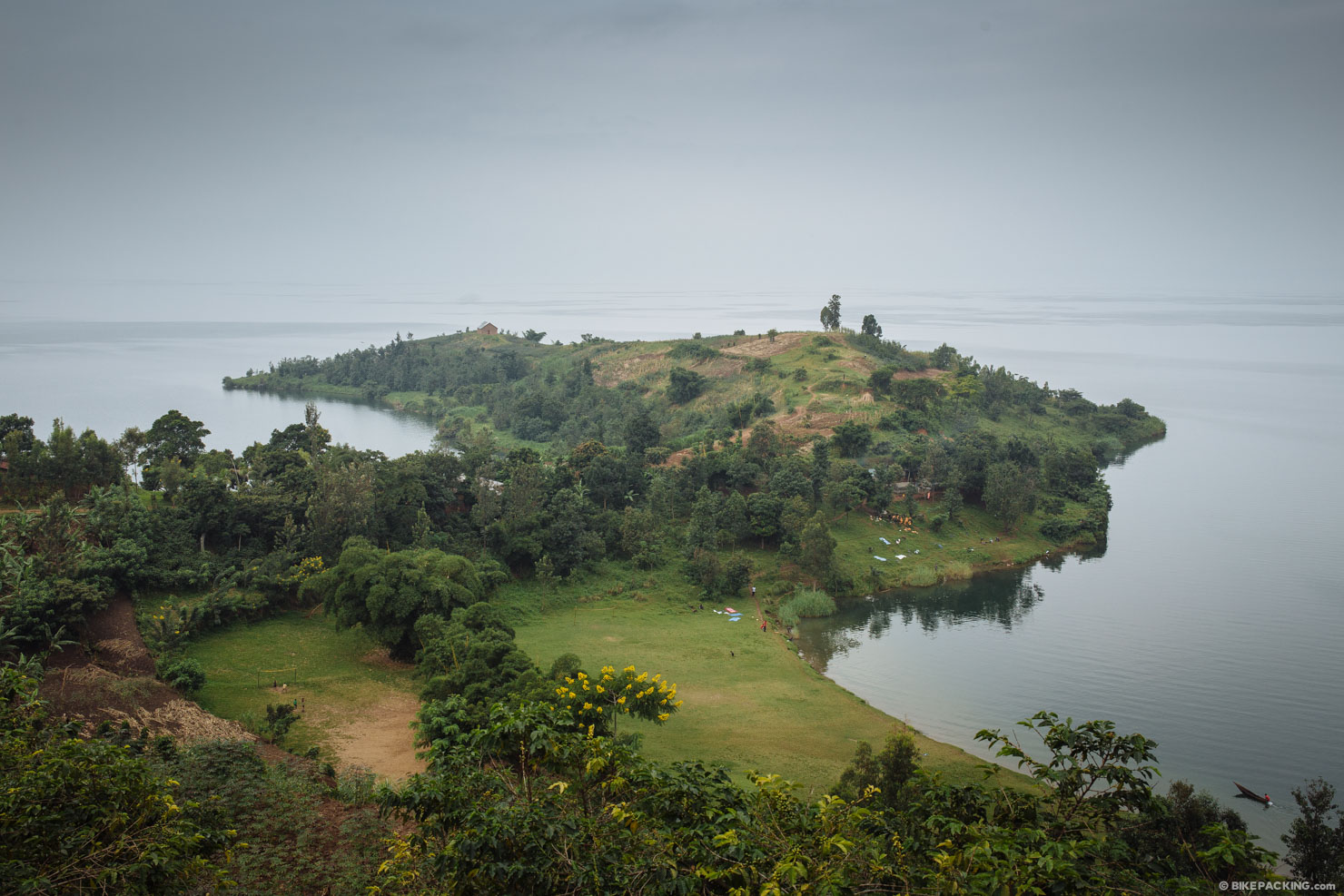
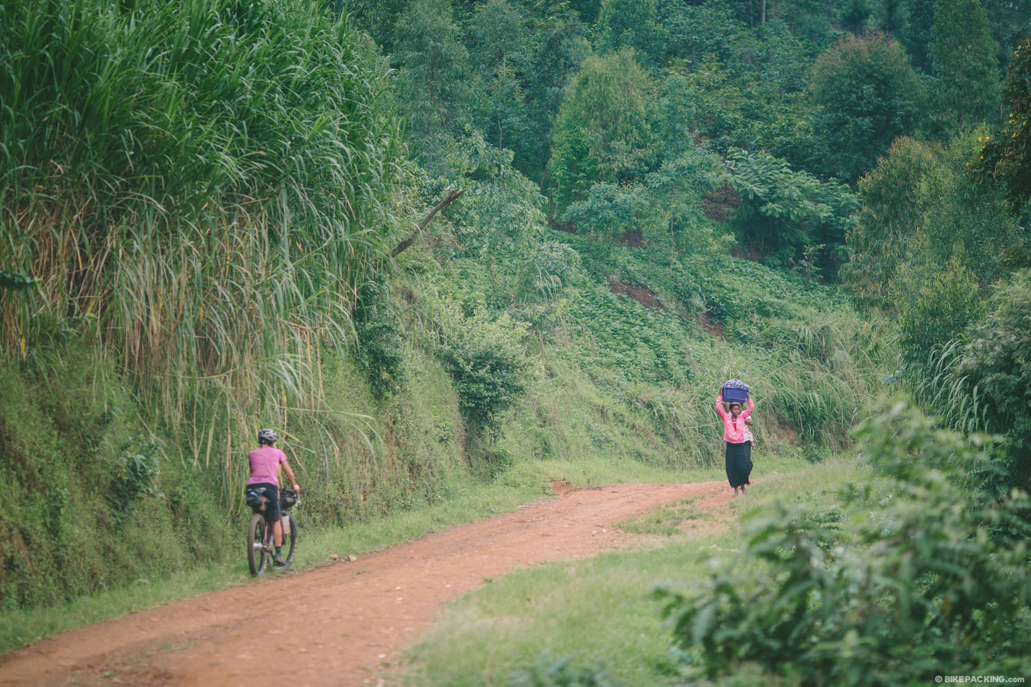
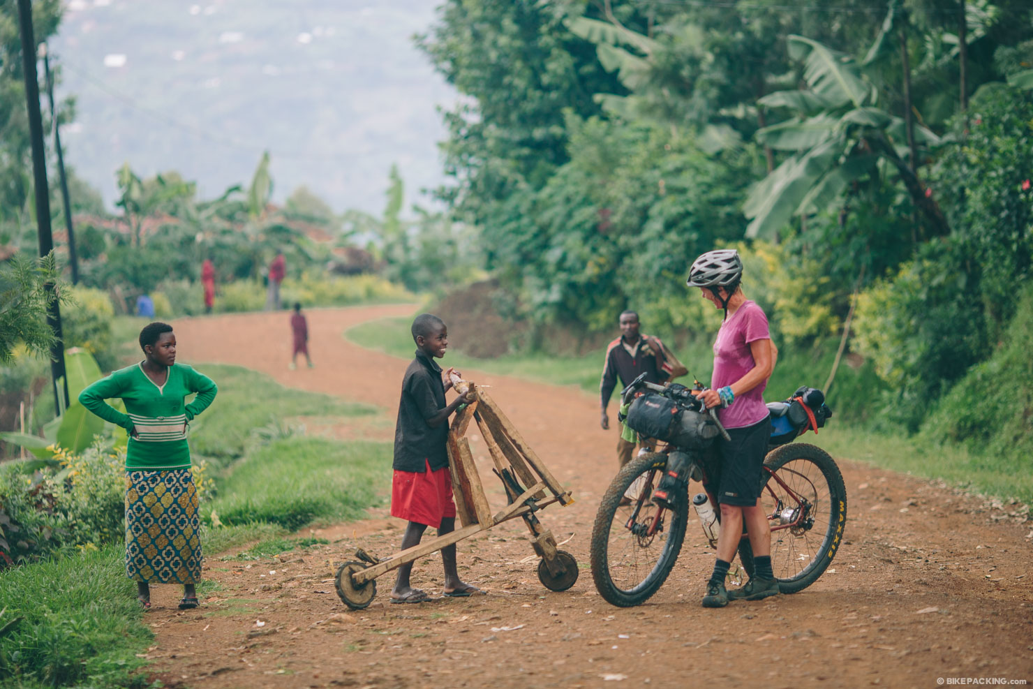
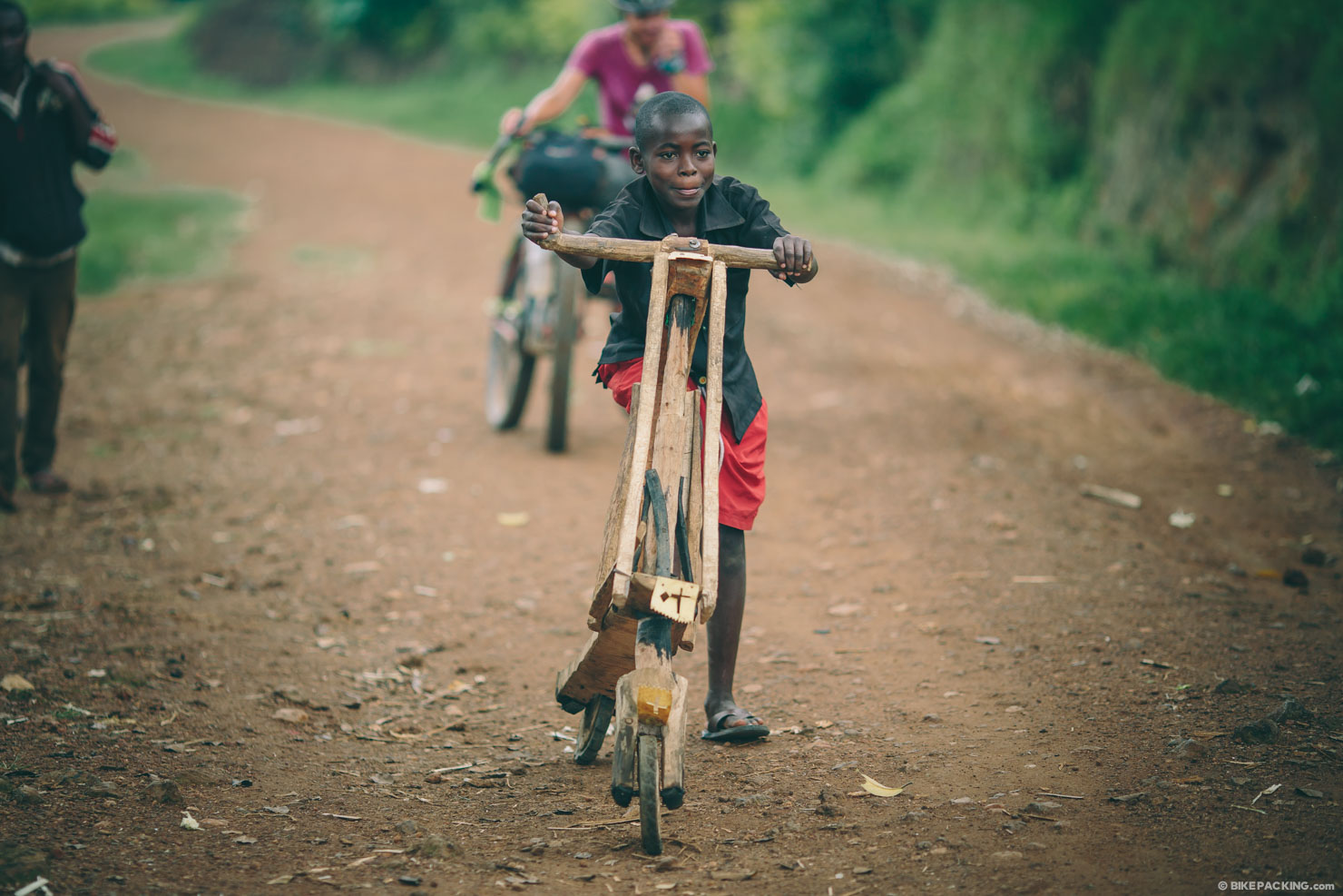
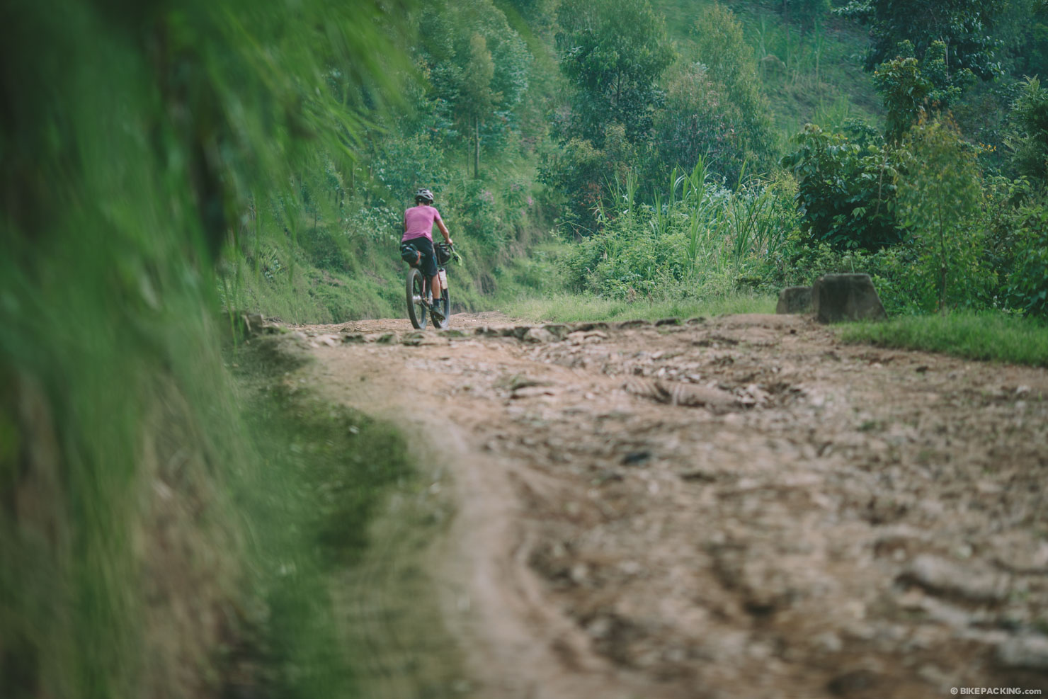
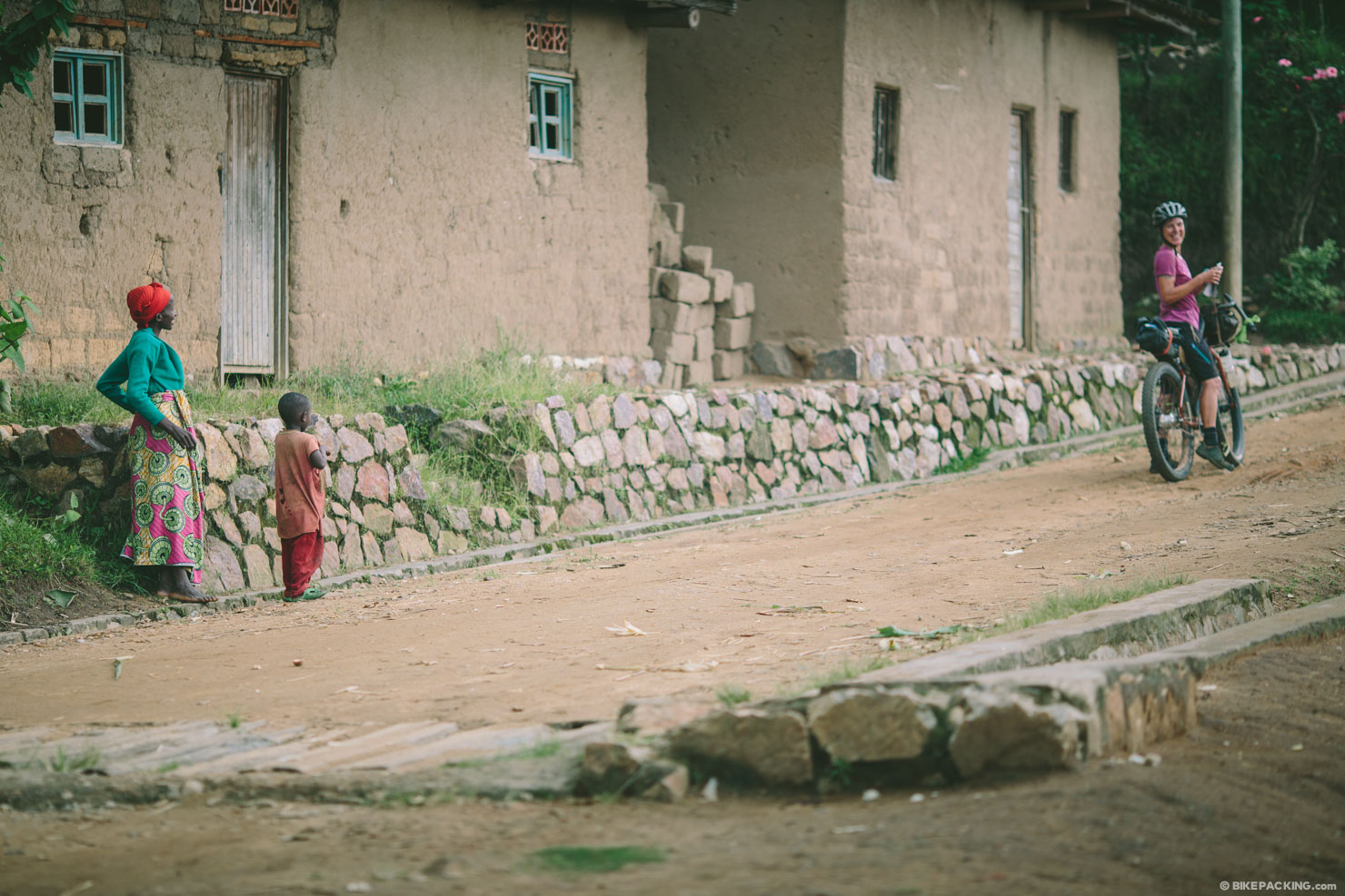
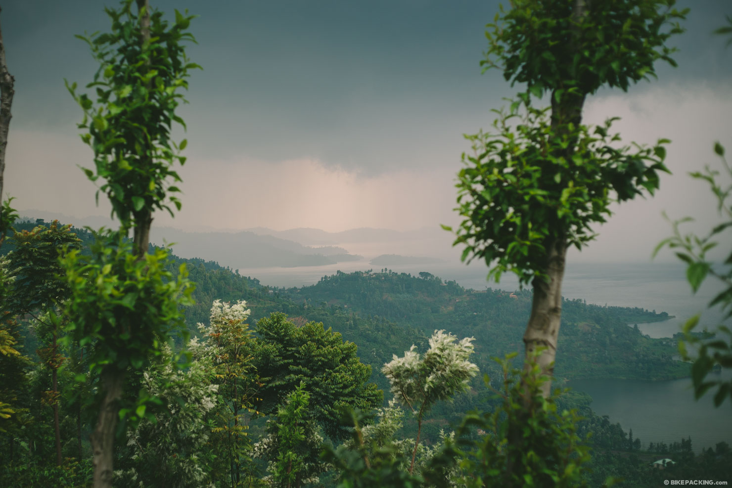
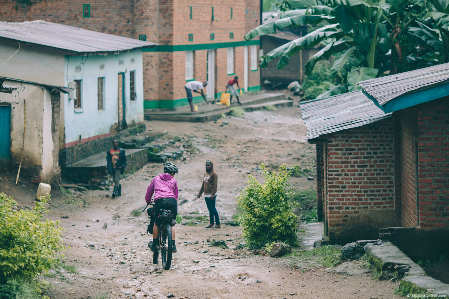
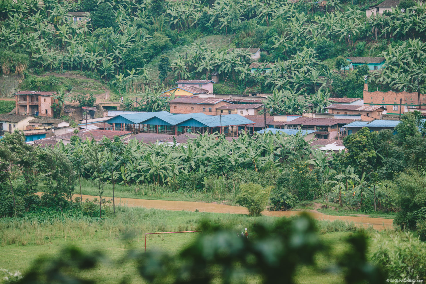
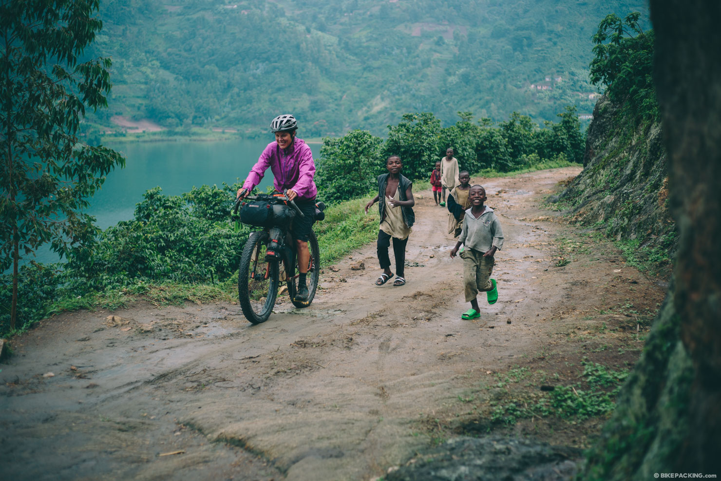
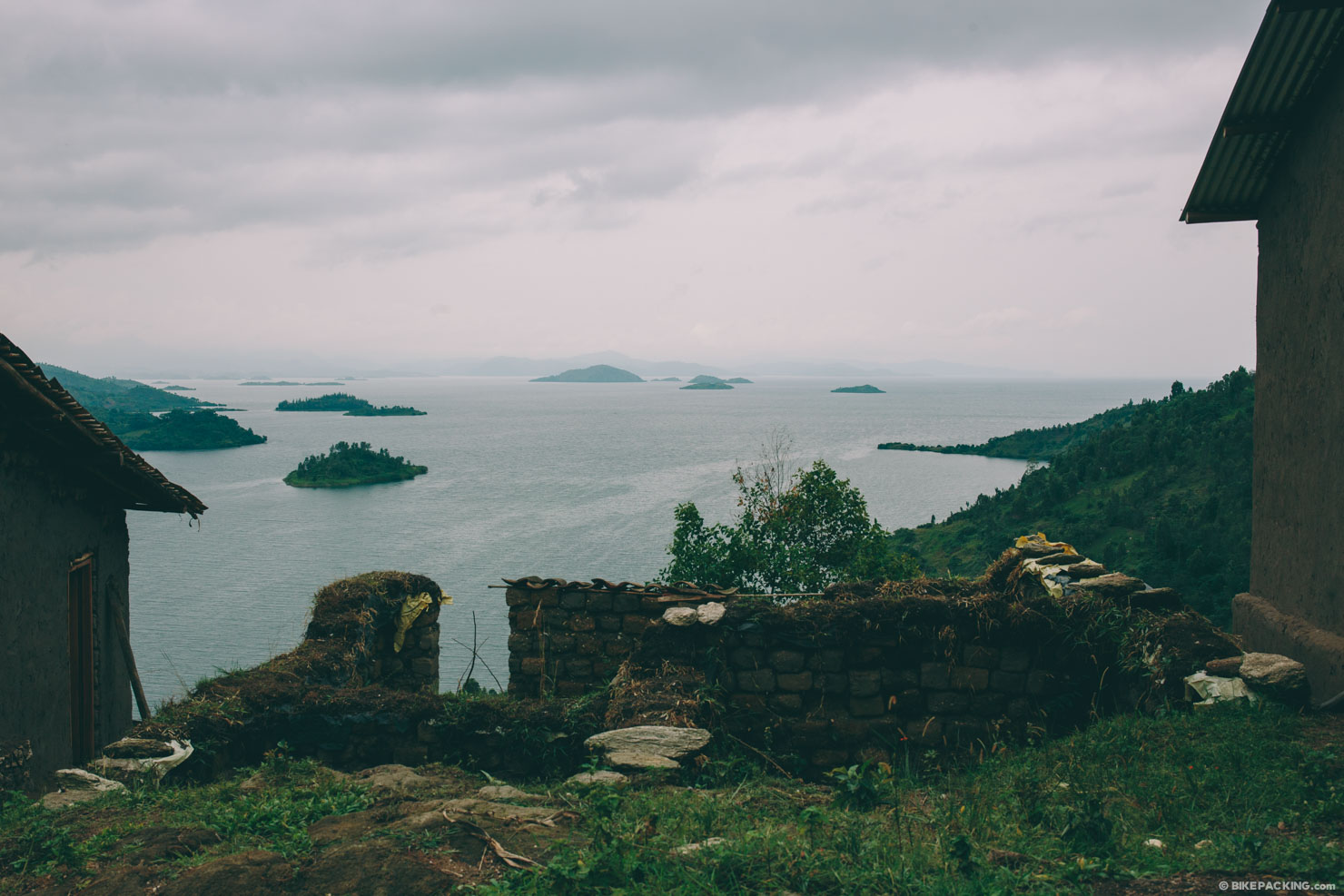
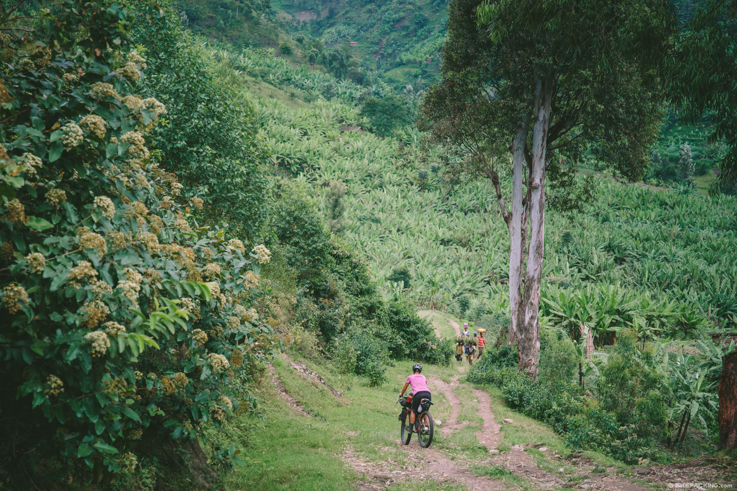
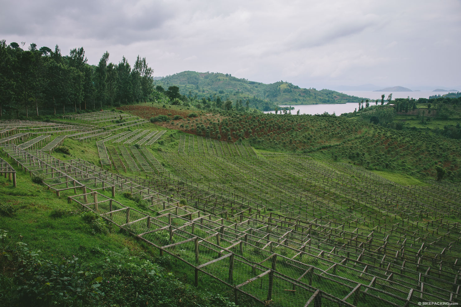
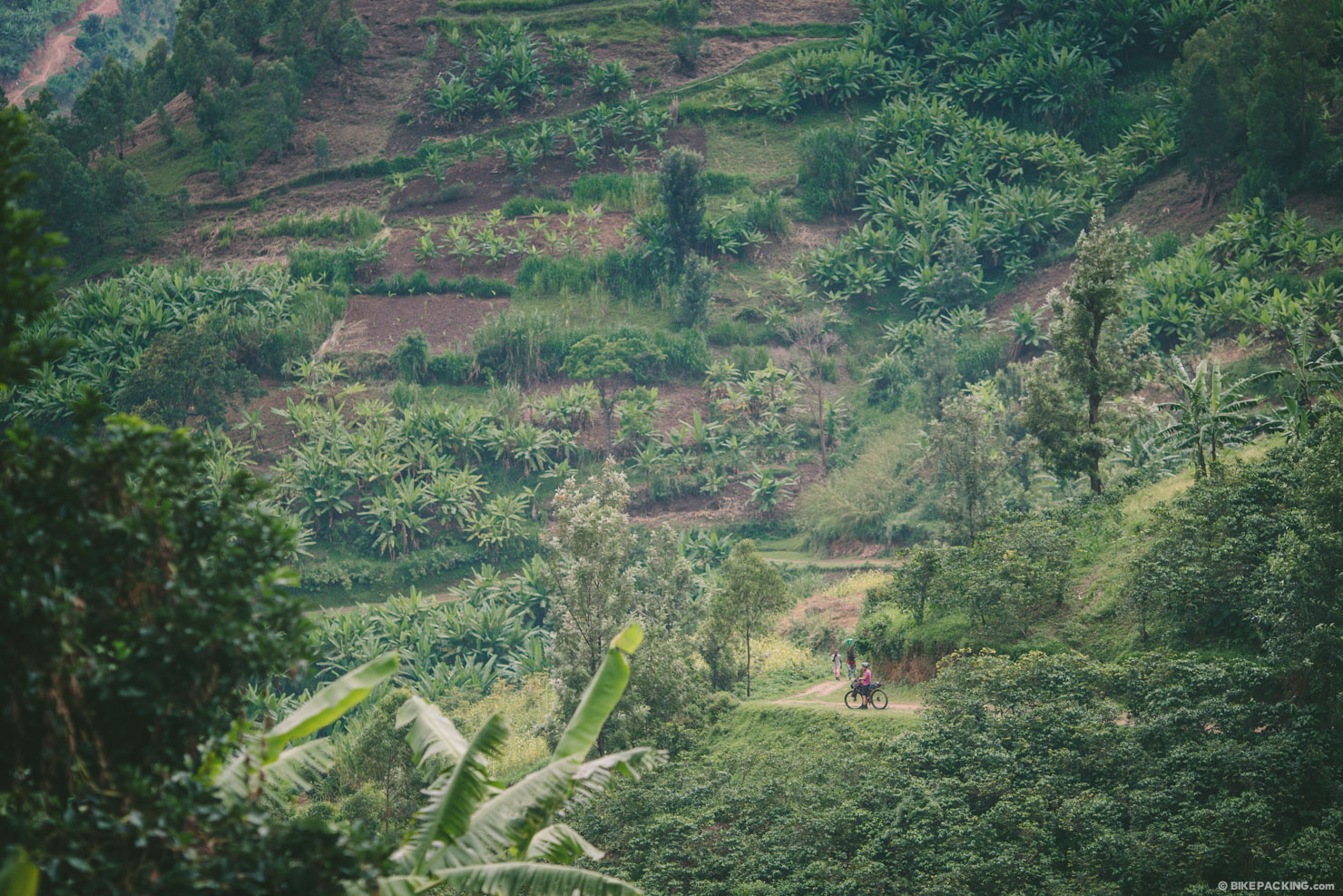
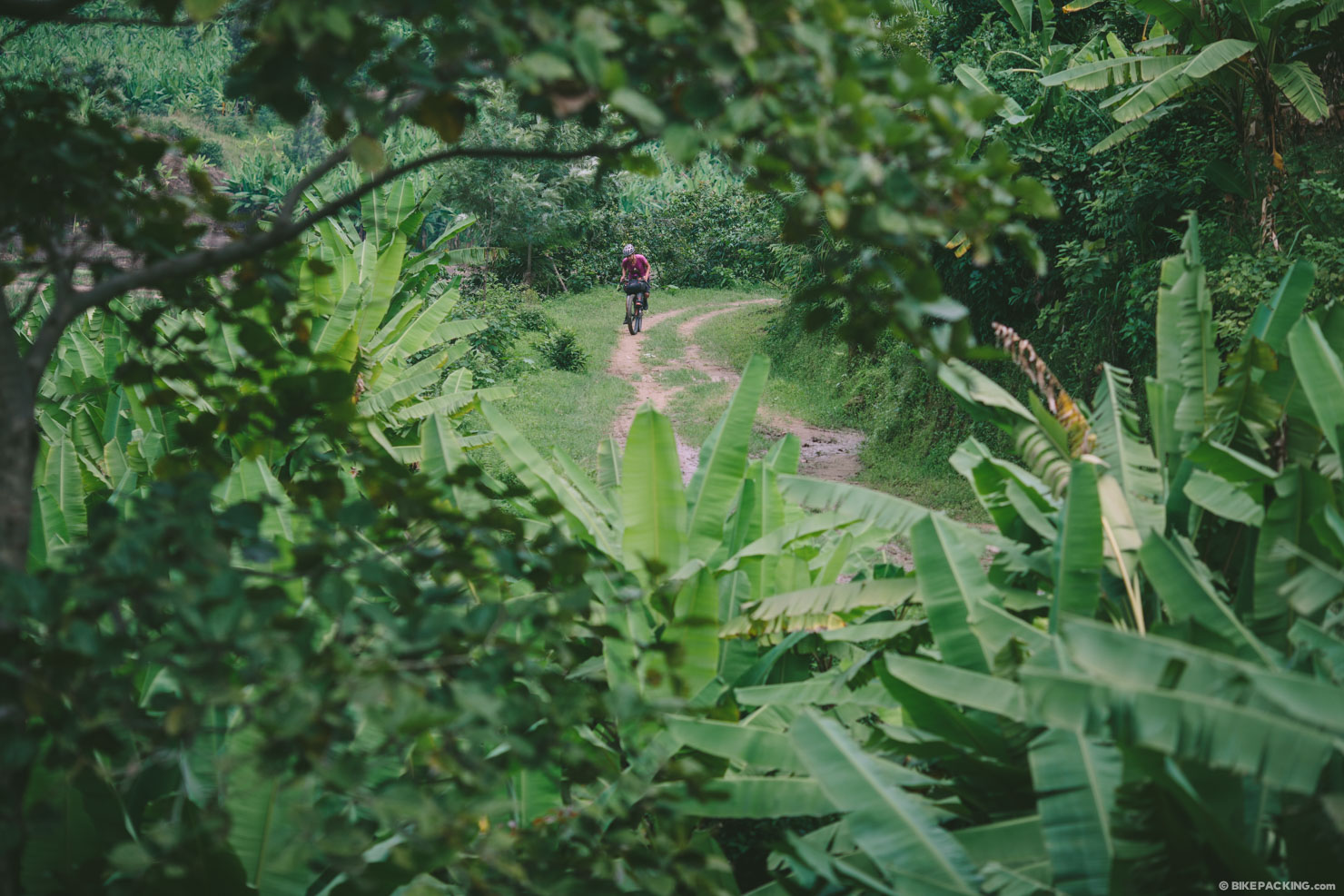
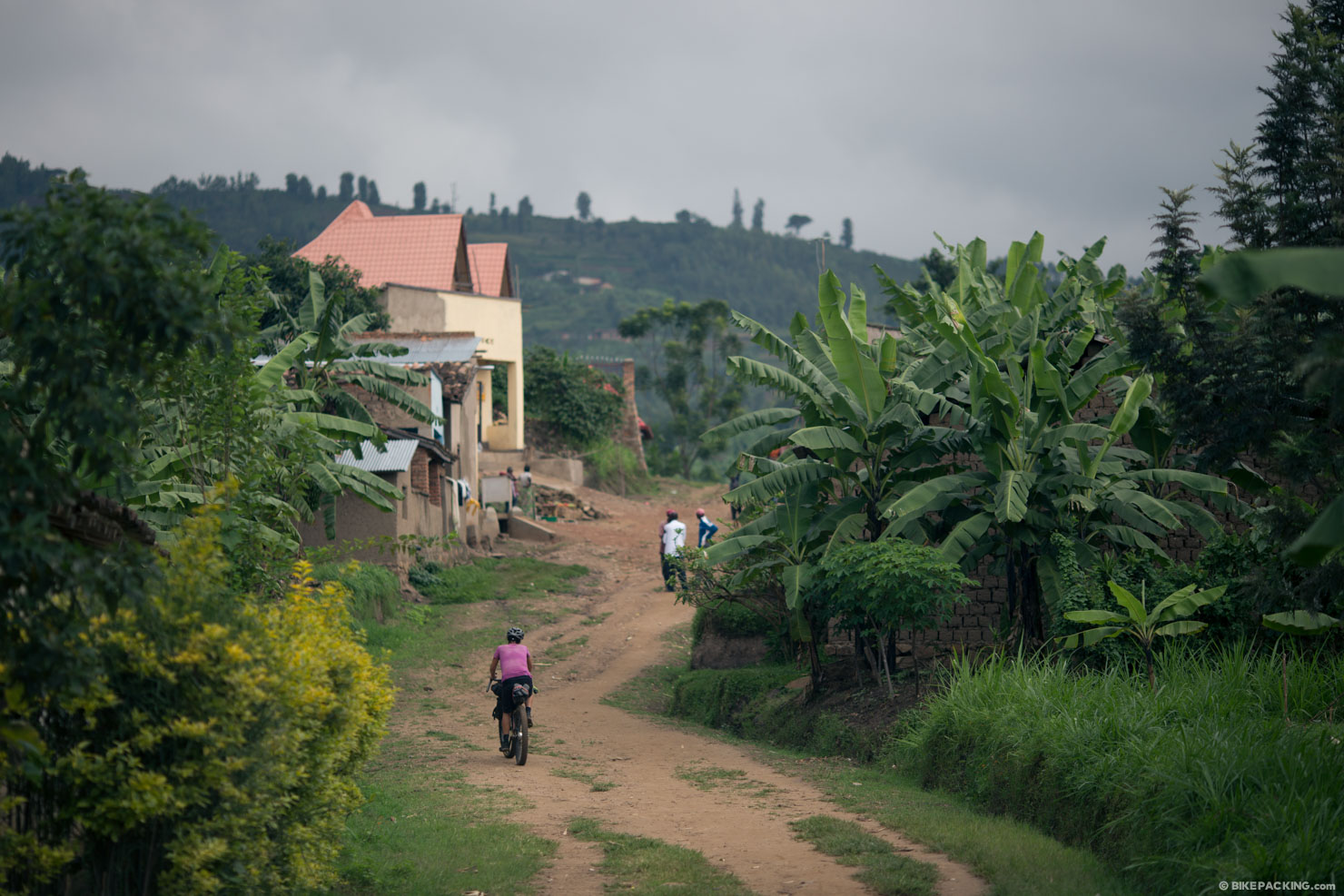
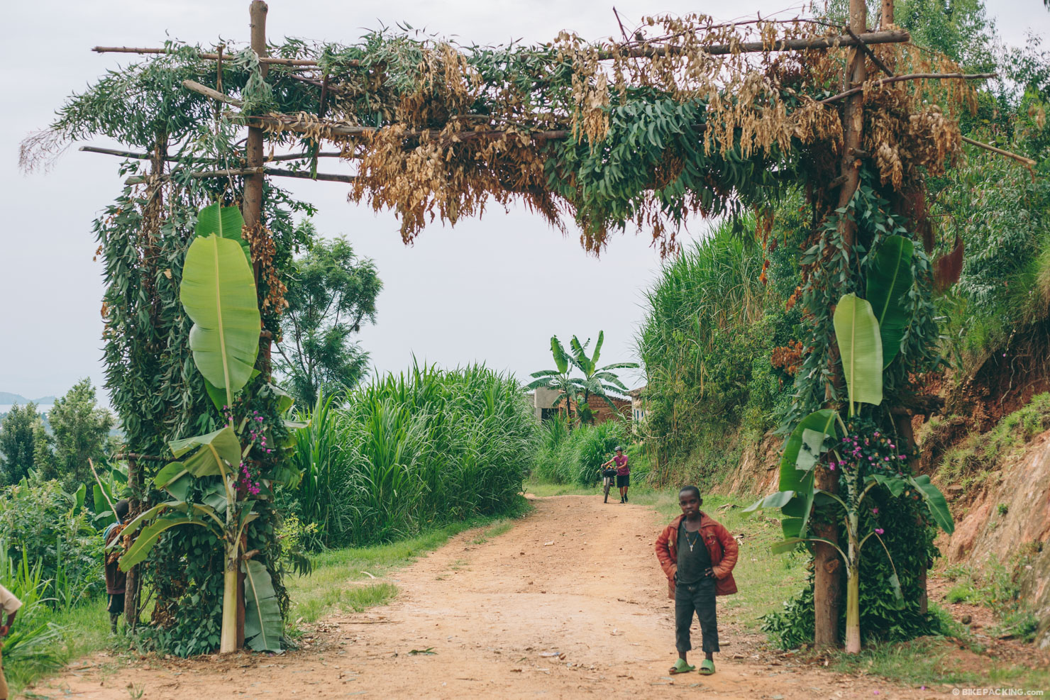
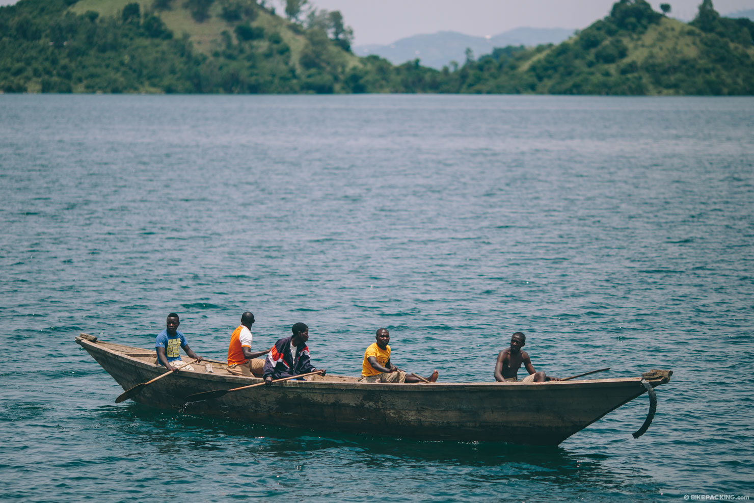
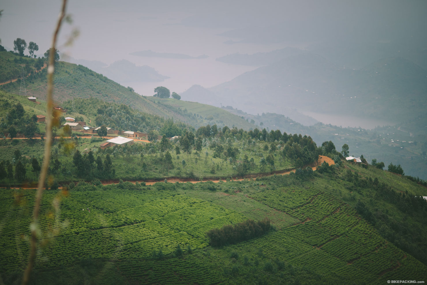
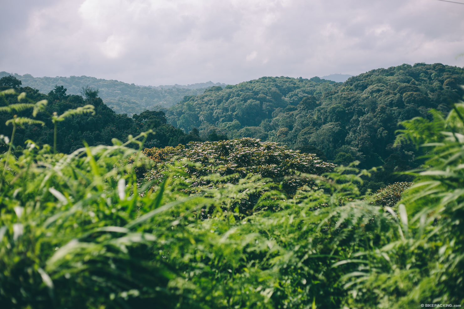
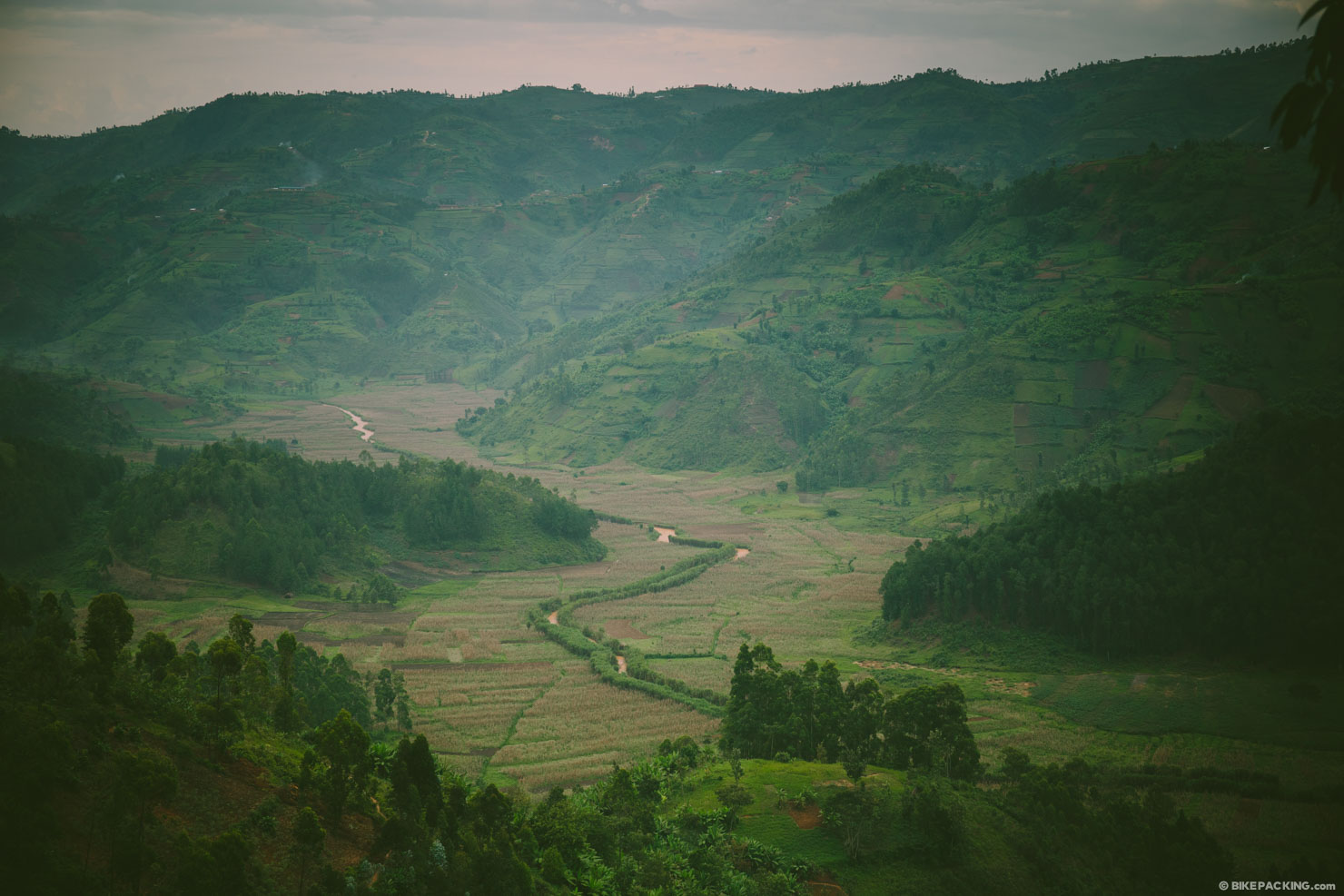
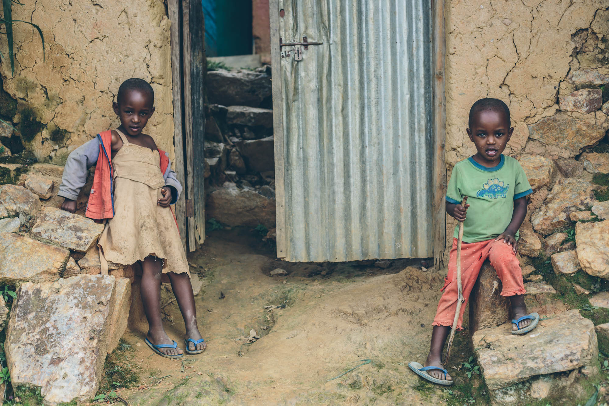
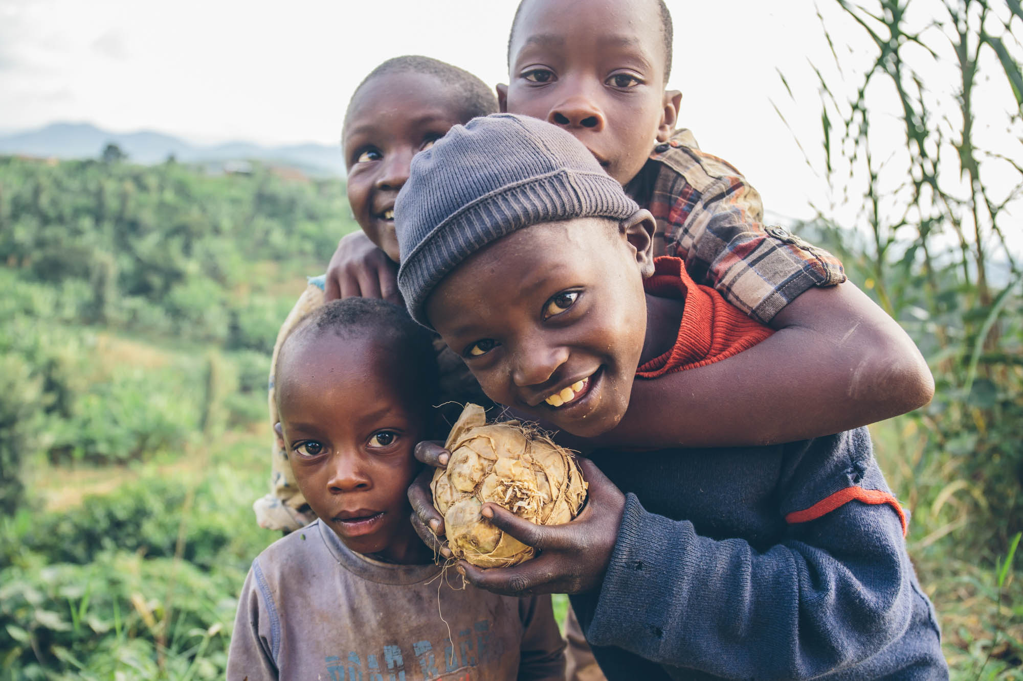
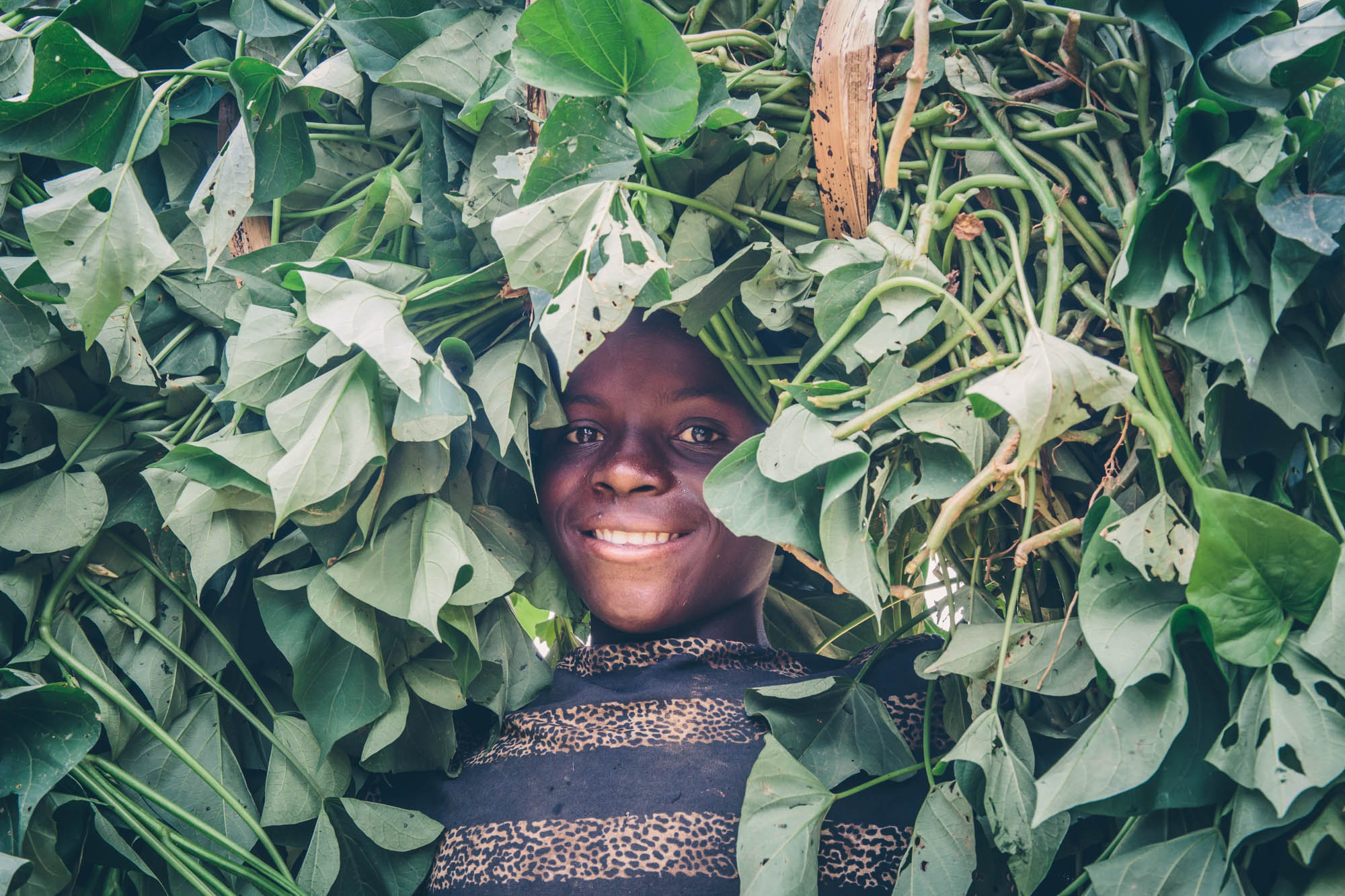
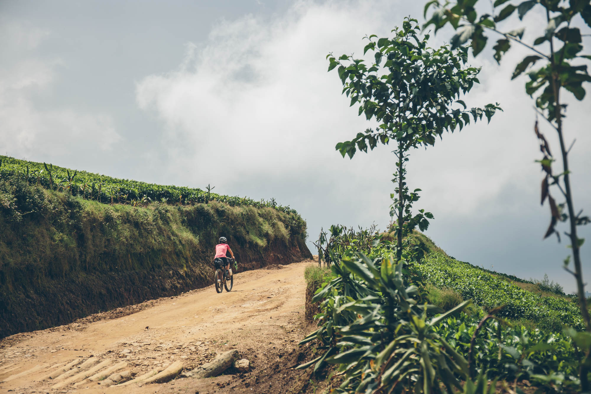
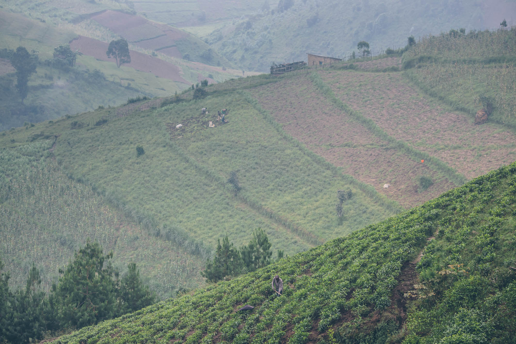
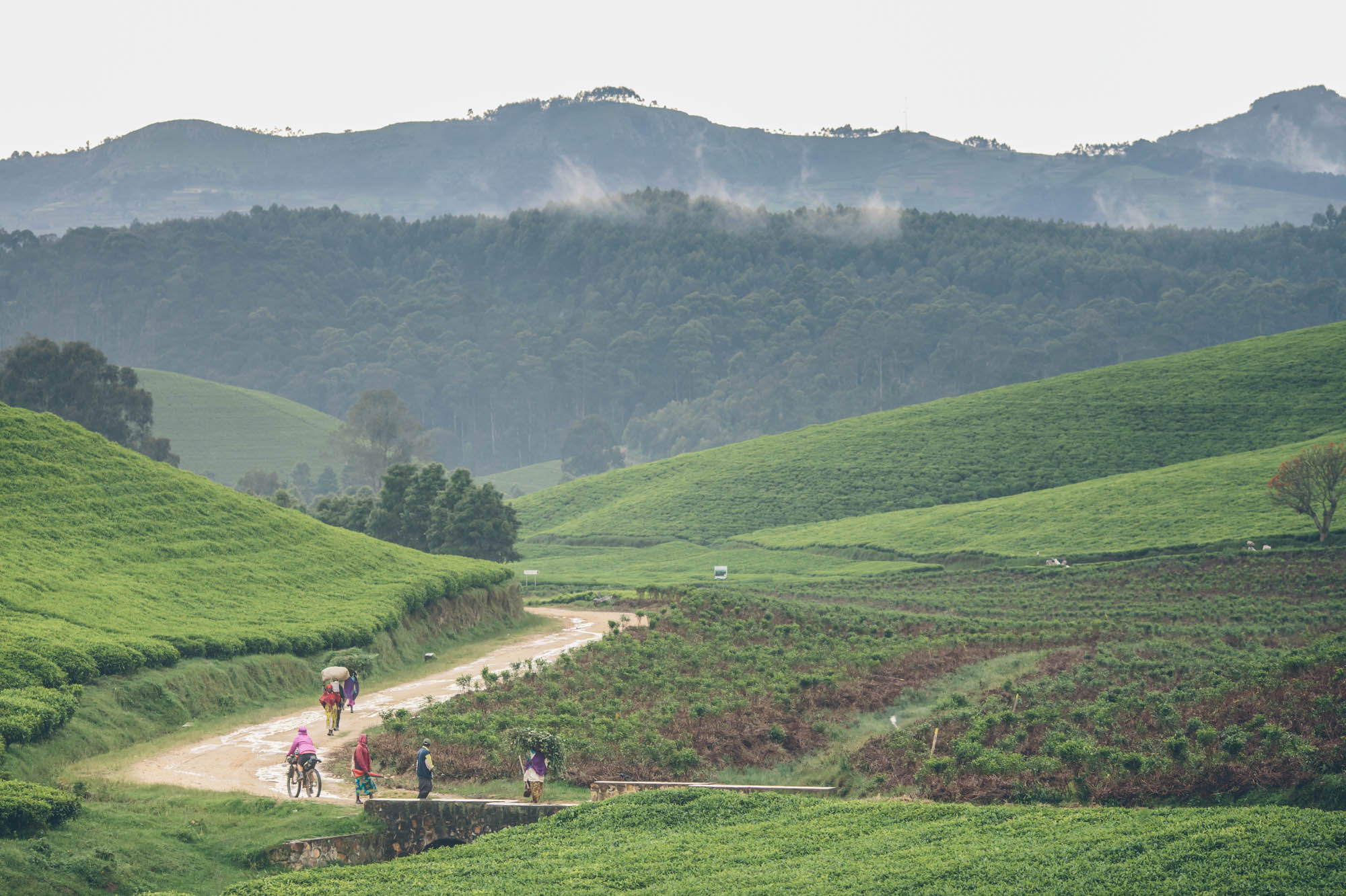
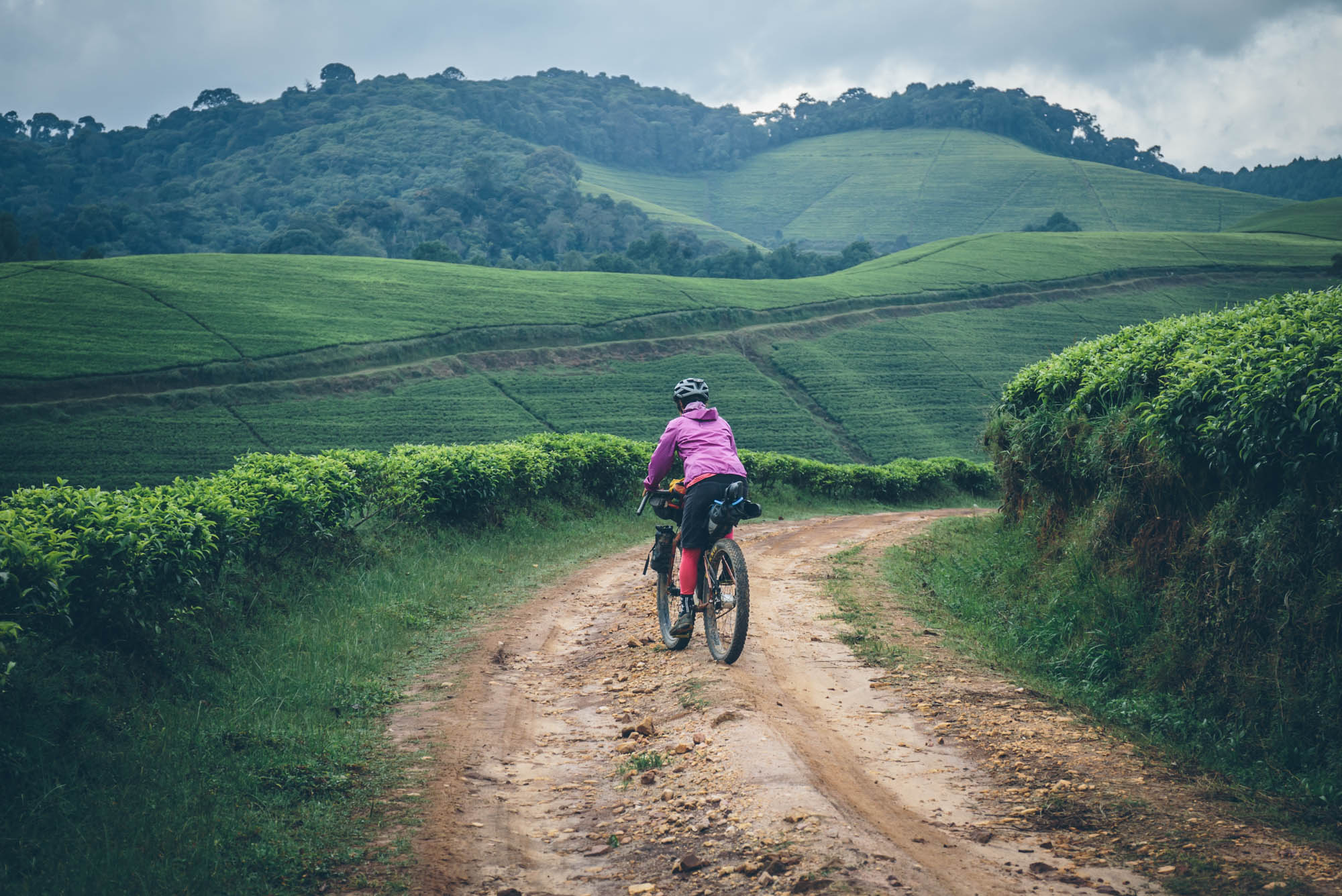
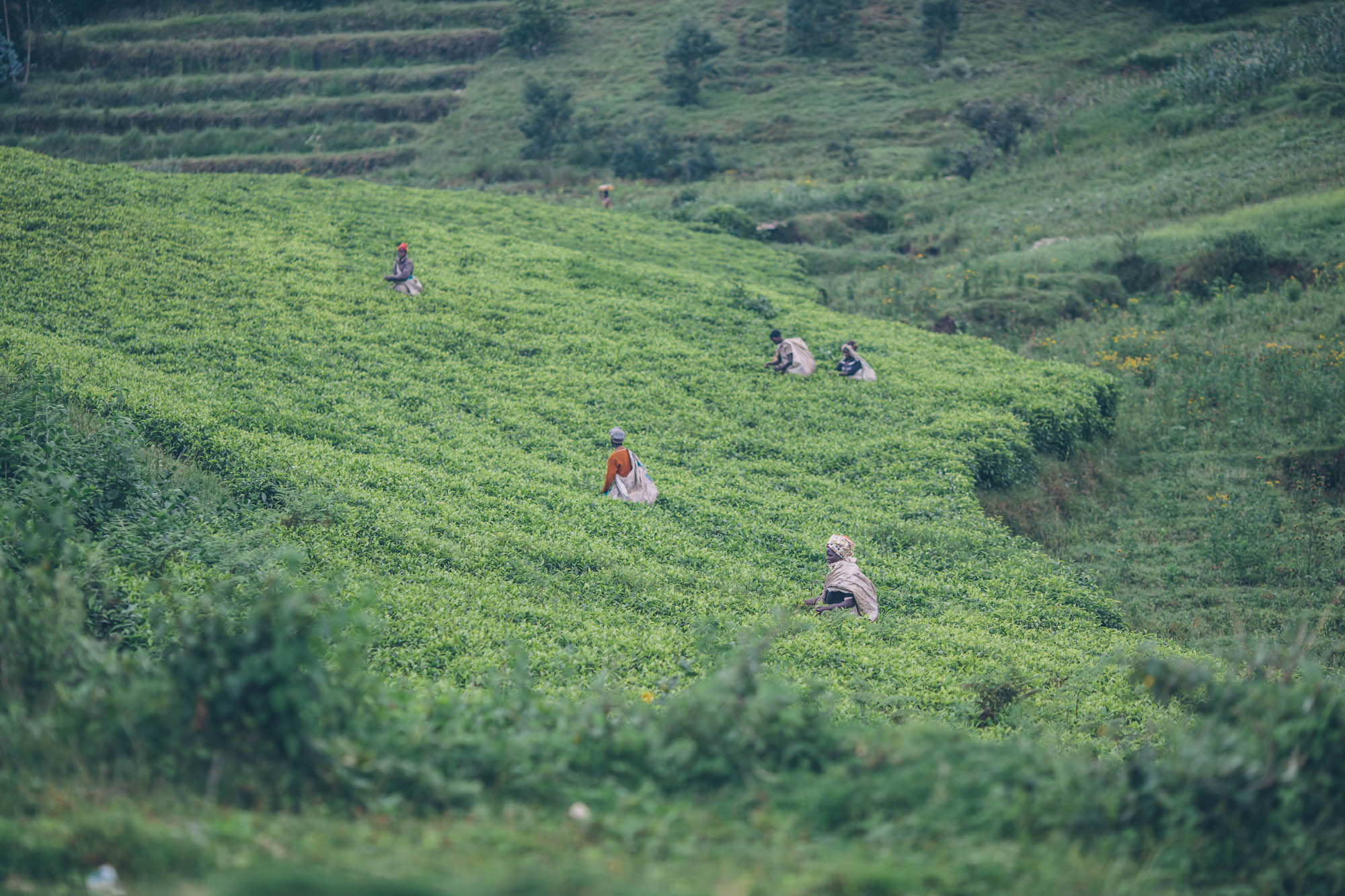
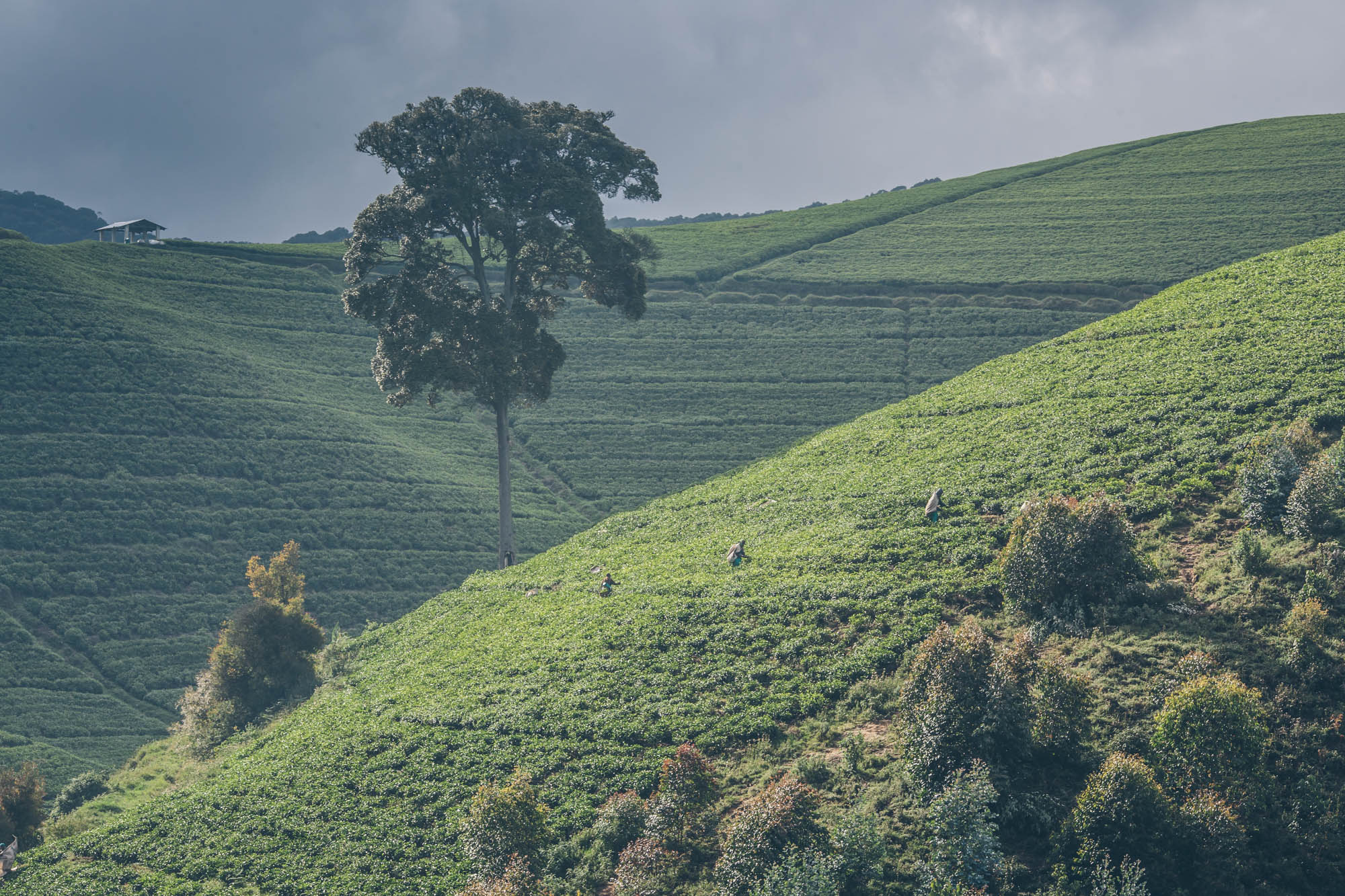
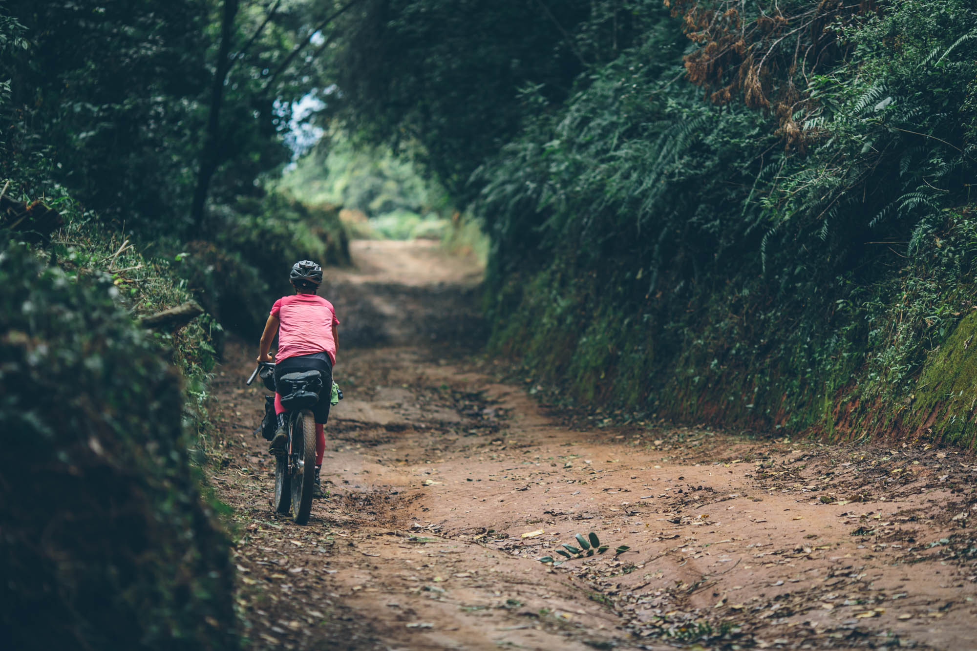
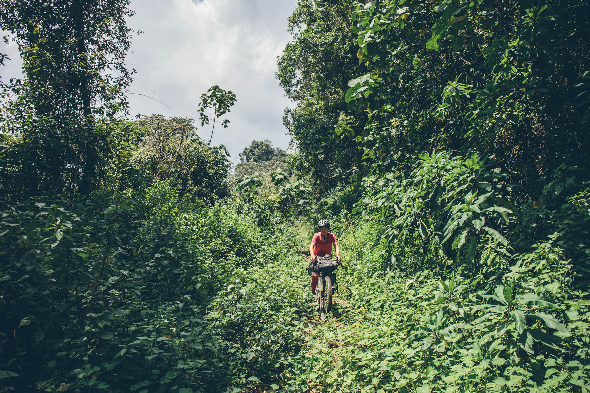
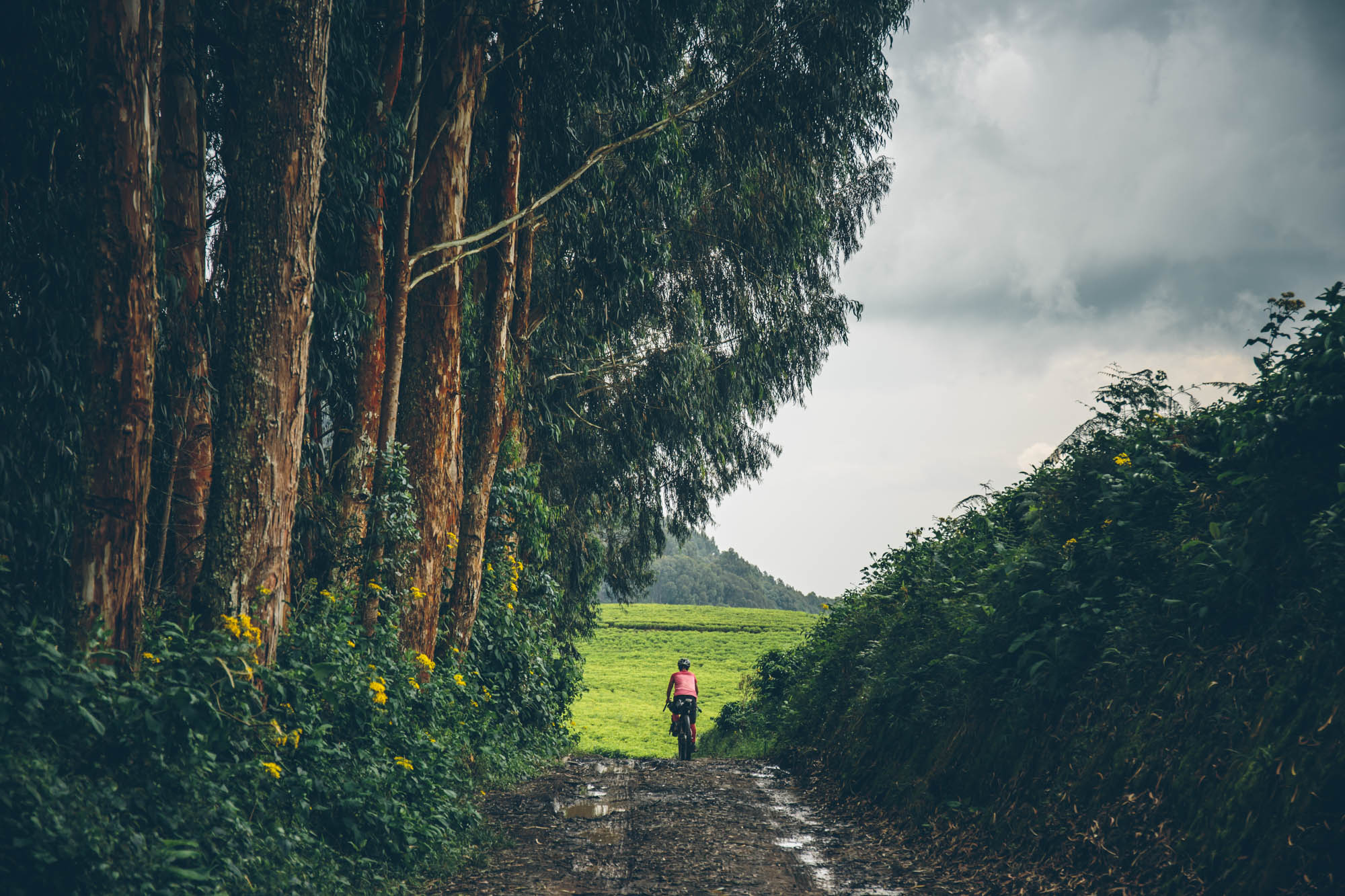
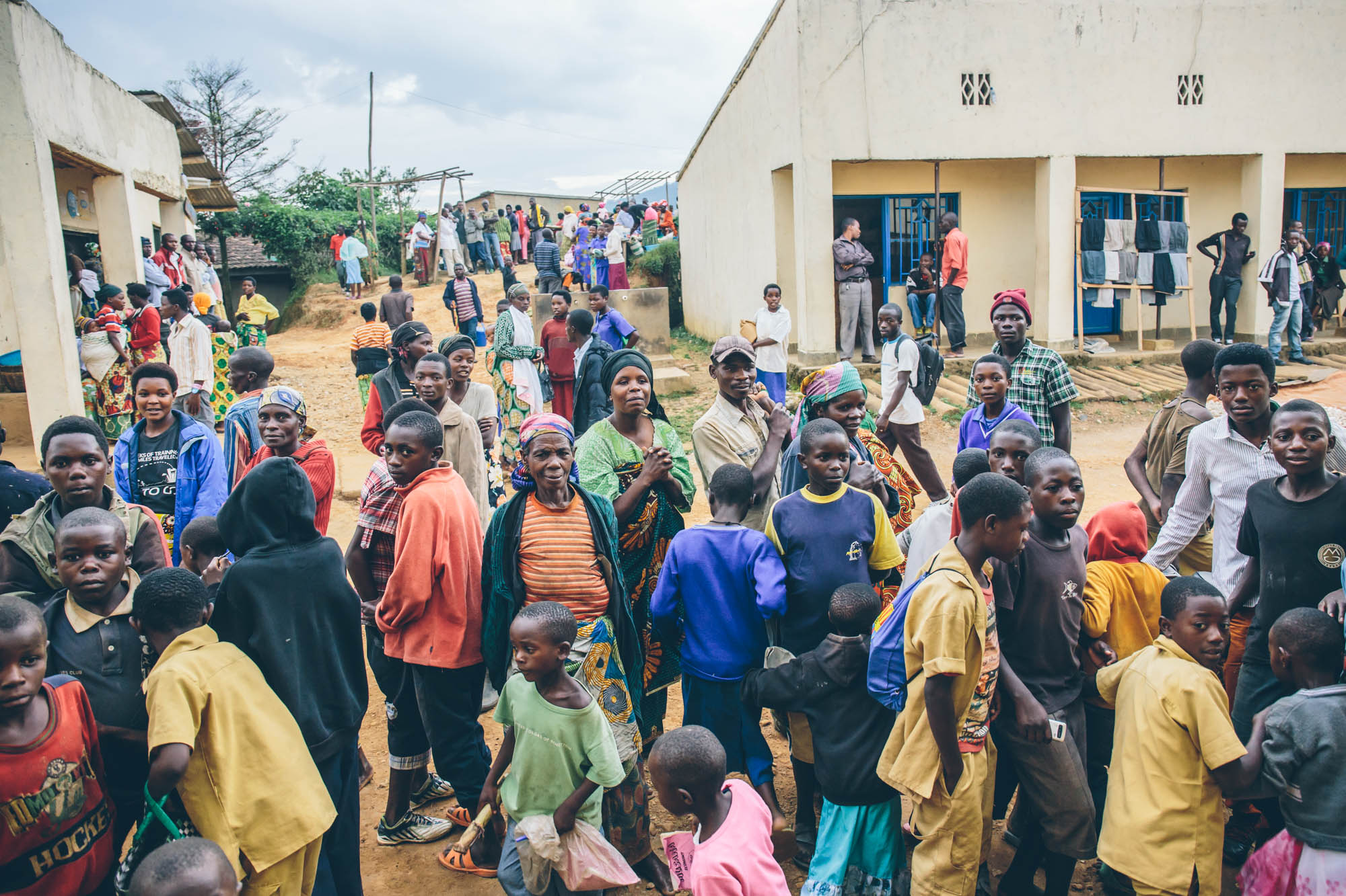
Imagine a stretch of primitive dirt roads and single trails winding through verdant jungle and farmland, exuberant children cheering and chasing as if you were riding for Team Rwanda. There are banana trees, coffee plantations, small fishing communities, and colorfully dressed women carrying impossibly large bundles of firewood, bananas, and avocados to market. To your right, peninsulas of terraced hillsides create the amorphous coastline of Lake Kivu and countless islets dot its sparking waters. The track pulls away from the lake and ascends into the crisp air that surrounds the enchanting emerald tea plantations, where pickers shear an endless wave of black tea. The route continues to ascend along the divide that separates the Nile and Congo rivers, hence the name. Rugged dirt roads turn in to a faint path that enters the thick Nyungwe rainforest in which the call of chimpanzees can be heard; there’s a good chance that you’ll encounter orchid, tropical birds, butterflies, chameleon, and at least one of 13 species of primates.
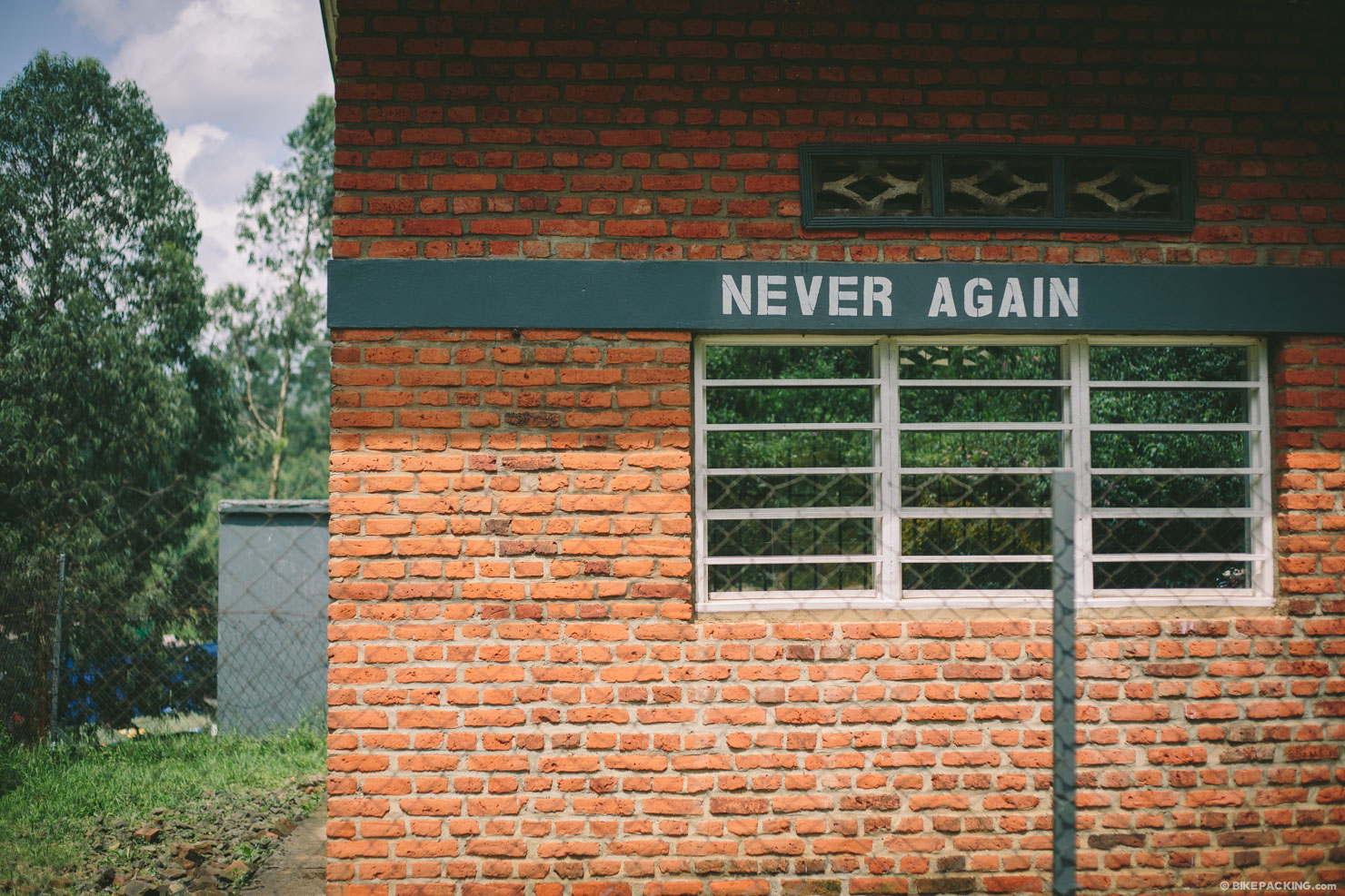
This vignette pretty much sums up the Congo Nile Trail — a far cry from Rwanda’s tarnished reputation, one that’s been long overshadowed by the 1994 genocide. The reality is that today, the country is among the most politically stable, safe, and beautiful destinations in Africa. This is a result of a massive reboot and the unusually well-managed appropriation of international funds, which includes a required national monthly cleanup day. The government has made a significant effort to position Rwanda as a mainstream destination, and the tourism industry has benefited. There’s no doubt that they made a good decision when they founded the Congo Nile Trail in 2011. Unfortunately in 2014 (well, fortunately for the Rwandans who live in these parts), the latter half of the original Congo Nile Trail became a paved thoroughfare to connect Kabuye and Kamambe. This won’t effect folks who plan to simply stop at Kabuye and take a ferry back to the start, and it will no doubt be welcome by cycle tourists who like tarmac. Being dirt seekers, we wanted to continue the full length of Lake Kivu to the port of Kamambe, where it’s possible to either ferry back to Gisenyi, or take a bus to the capital of Kigale.
There have been talks about reworking this portion to appease hikers and mountain bikers, but nothing is yet published. That’s where the ‘Bikepacker’s Edition’ comes in. We took it upon ourselves to find an alternate reroute to connect Kabuye to Kamambe at the southern end of the lake, via mostly dirt road and trail. This is the portion that traverses tea plantations and the Nyungwe National Park. Read details in the trail notes below for options and a detailed itinerary.


Submit Route Alert
As the leading creator and publisher of bikepacking routes, BIKEPACKING.com endeavors to maintain, improve, and advocate for our growing network of bikepacking routes all over the world. As such, our editorial team, route creators, and Route Stewards serve as mediators for route improvements and opportunities for connectivity, conservation, and community growth around these routes. To facilitate these efforts, we rely on our Bikepacking Collective and the greater bikepacking community to call attention to critical issues and opportunities that are discovered while riding these routes. If you have a vital issue or opportunity regarding this route that pertains to one of the subjects below, please let us know:
Highlights
Must Know
Camping
Food/H2O
Trail Notes
Resources
- Pedaling an incredibly scenic stretch of trails, primitive dirt roads, and paths along Lake Kivu.
- Interacting with curious and friendly locals along the way.
- Being immersed in a culture of subsistence farming and fishing, and the sights that go along with it.
- An epic climb through the verdant green tea plantations near Gisovu.
- Spotting primates and other wildlife amongst the thick forests of Nyungwe National Park.
One thing to note about this route, and other routes in developing countries, is that things often change. As of March 2016, the bulk of this route is made up of incredible, and very rugged, dirt roads and paths, but that could change. It’s hard to gauge when and where will be paved next. So if you plan on making this trek, make sure to do a little extra research to check the status of the trail. Also, please update us on any related recon.
Weather and When to Go
- Rwanda experiences two dry seasons, the long dry season from mid-May to mid-September, and a shorter ‘less-dry’ season from December to February. We went in the shorter dry season, which is quite nice as long as you don’t mind getting wet on occasion. Generally the land is greener, temperatures are more mild, and roads are less dusty at the beginning of the long dry season or during the shorter dry season. If you choose the longer dry season, it might be worth considering May or early June while the scenery is still lush from the rains.
- Bring rain gear; more than likely, you’ll need it at one time or another.
- Temperatures are generally warm and pleasantly cool at night. In the highlands and the forest temps can get fairly chilly at night. Bring a couple of extra layers.
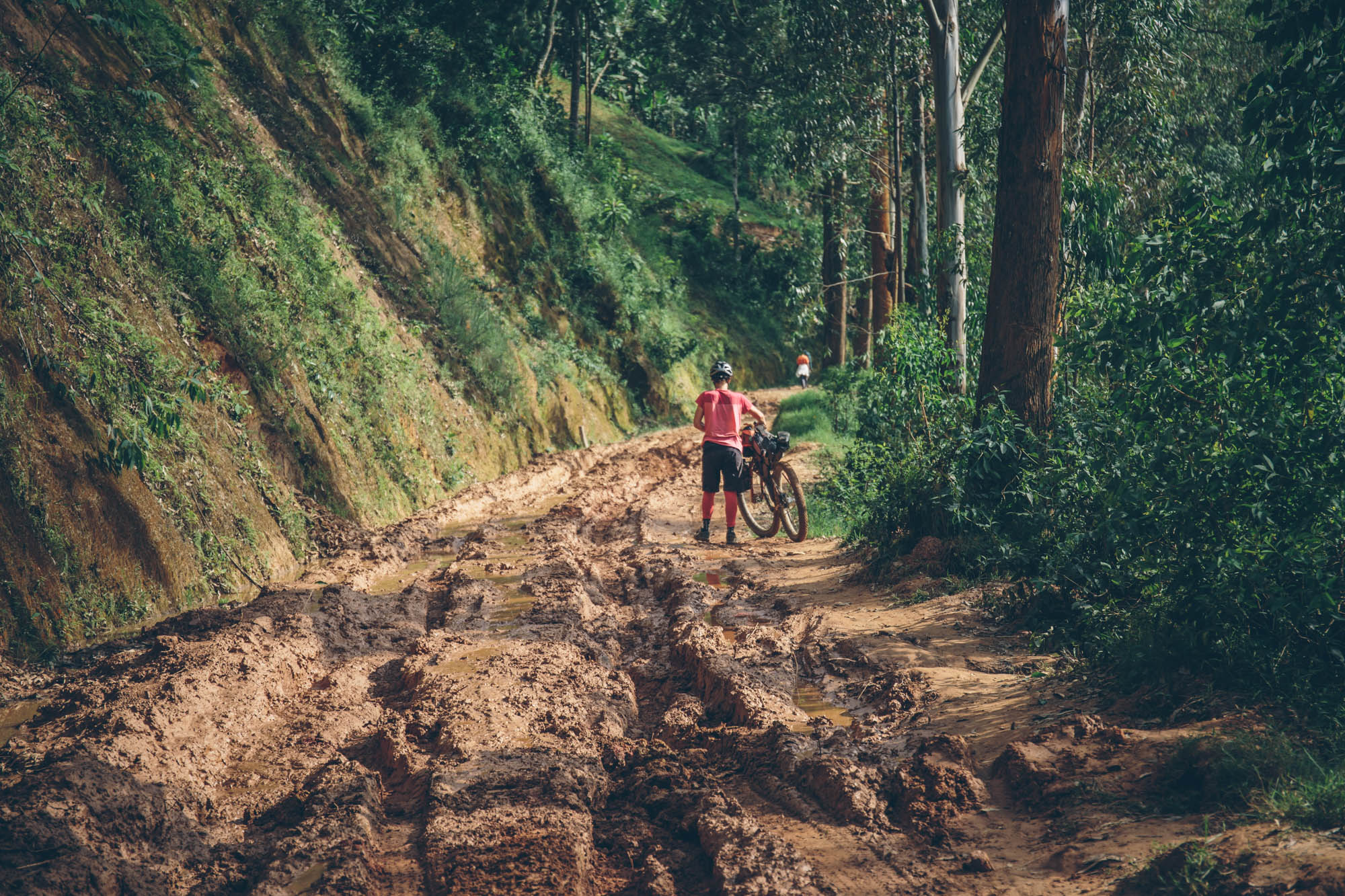
- The section in Nyungwe National Park may be difficult and seemingly impassable in the wet season or just after as there is a lot of thorny vegetation that can choke the trail between mile 93 and 105 on the route. We are talking with the Rwanda Tourism Board about having this as an official part of the CNT, but until we get verification that it will be cleared regularly, you may consider connecting dirt roads just west of the park and reconnecting with the route at mile 108. See the ‘Nyungwe Bypass’ in the map above.
Logistics
- Flying: There are multiple flights weekly to Kigali from Qatar on Qatar Airways (which doesn’t charge for bikes).
- Riding to Gisenyi: The roads from Kigali to Musanze, then Gisenyi aren’t too bad. Drivers in Rwanda are much more courteous than those in neighboring countries. We didn’t have time, but there is also an off-tarmac option from Musanze, through the volcanic highlands. Ultimately, it might be nice to make that part of this route.
- Bus from Kigali to Gisenyi: There are multiple bus types and lines. The easiest are the mid-sized ‘short’ busses. However, bikes require seats; if they are unboxed, expect to buy 2 seats per bike. If they are in boxes, you should be able to fit two in two seats. Tickets are around $5/seat from Kigali to Gisenyi (3.5 hours). Busses leave from the Nyabugogo bus station.
- Bus from route end (Kamambe) to Kigale: The same seat rules apply, but prices are a little higher at $7-10 per seat.
- Ferry on Lake Kivu: One of the perks of this route is that if you time it correctly, you can make it a loop by taking the ferry from Kamambe back to Gisenyi, where the route starts. The boat costs about $5 and takes 9 hours. At the time of this writing, ferries departed from Cyangugu (Kamambe) on Tuesdays and Fridays.
Dangers and Annoyances
- Some folks might complain about the children on this route. They do see tourists on occasion and some will ask for money. Our general stance is to ignore these requests. You might think it a kindness to give a small gift, but giving money or sweets to people who beg on the street perpetuates a cycle that encourages people to think of foreigners as a source of money, which in the long run causes many more problems. As a more impactful alternative, there are many great charities and organizations operating in Rwanda, and if you would like to help, we would suggest making a donation to one of them instead.
- The general rule of thumb in off the beaten path East Africa is that if you stop and stand still, a crowd of curious and friendly folks will gather and want to talk. If this bothers you, this route might not be a good fit for you.
- There have been reports of occasional, and very petty, theft on this route (water bottles mostly). Virginia actually dropped a strap and turned around to find it gone before her eyes. This isn’t a serious problem, but worth noting.
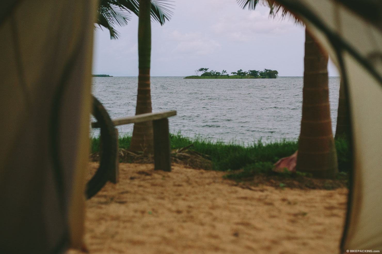
- There are a multitude of Base Camps built in to the route. Some are primitive camping, and others are lodges. Before setting out, if you aren’t planning the suggested itinerary (in Trail Notes), ask Rwandan Adventures to find out which are open.
- There aren’t many options for backcountry camping, save a few level spots in the Nyungwe National Park.
- Water can generally be found in the form of springs or boreholes. Bring a filter; there are plenty of parasites and bacteria lurking in this H20. We used a combination of a Sawyer Squeeze filter and a Steripen Freedom.
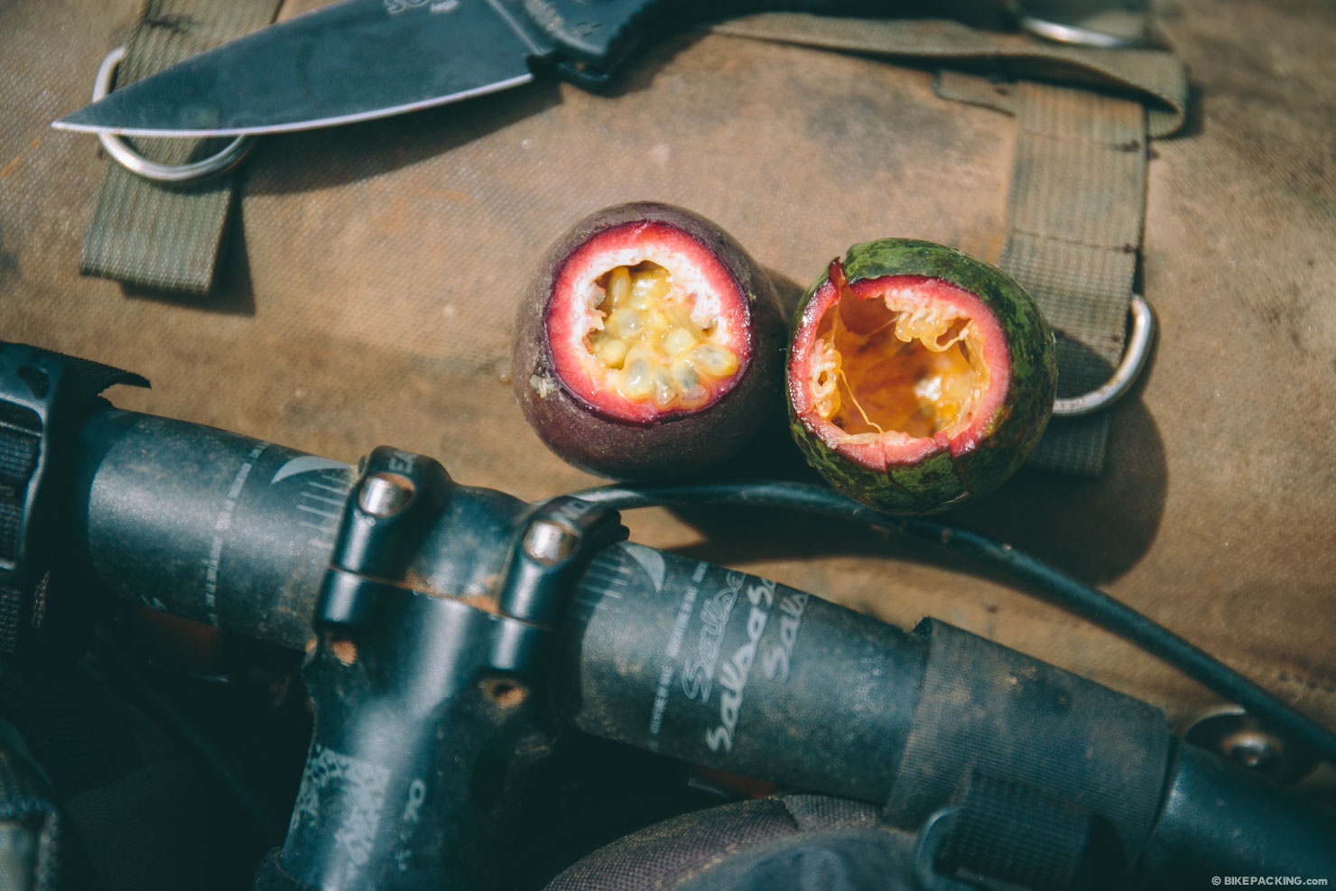
- Most lodges on route offer a complimentary breakfast that consists of bread, an omelette ,coffee or tea, and local fruit such as bananas, passion fruit, and pineapple.
- The main sources of resupply are at the route start in Gisenyi, very minimal snacks in Kinunu, Kabuye, Gisovu, and the town at mile 129.
- Additional snacks, fruit, and bare necessities can be found in small villages throughout the route.
- The longest stretch without food is the forested track between Gisovu and the highway at mile 129.
Suggested Itinerary
All rider’s are different. This itenerary is designed for cyclists who are in decent phyisical shape with some experience bikepacking. That said, it’s easy to use available lodging and make this a longer 7 day trip. See GPS for available points.
Day 1: Rubavu (Gisenyi) to Kinunu (26 miles/42 km)
This is probably one of the most scenic and rewarding days of the trip. Follow along the shores of Lake Kivu, through fishing villages and over pristine dirt roads and tracks. Arrive in Kinunu and descend to the shore of Lake Kivu for a camp at Rashel Kivu, or the adjacent Base Camp.
Camping at Rachel Kivu Lodge ($20 with Breakfast)
Day 2: Kinunu to Kabuye (40 miles/64 km)
This is possibly the toughest and most challenging day. There are options to break it in two days. To do this, stay at the base camp in Musasa (noted on GPS) or Bumba (not on on the GPS as we didn’t go offroute to the location, but look for it around or after mile 40; ask locals and look for signage).
Lodging in Kabuye at Hotel Bethany ($25 and up rooms)
Day 3: Kabuye to Nyungwe (28 miles/~45 km)
Expect a long climb on day 3. The dirt road from Kabuye climbs over 3,200′ (almost 1,000 meters into the beautiful tea highlands, then into the Nyungwe forest.
Camp at National Park outpost or in the backcountry (free); other options include the guesthouse at Gisovu Tea factory (this may require advance booking).
Day 4: Nyungwe to Ishara Beach (40 miles/64 km)
Don’t underestimate the difficulty of this section of the route. During our forest traverse we had to negotiate about a dozen tree falls. Also, the weather can change at any time; it is a rainforest. Expect a muddy slog should a storm arise. Should you desire a less ‘adventurous’ option, there is an alternate route to avoid the very primative forest track traverse. To do this, at mile 93 follow the newer gravel road that spins off to the west; this will lead down to the paved road (the old Congo Nile Trail). To see it on a map, use the Open Cycle base map. Do note that this alternate will require a bit of extra tarmac, and you’d miss the chance to spot wildlife.
Camp at Ishara Base Camp or a stay at adjacent lodge.
Day 5: Ishara to Kamembe (45km)
This is the easiest day of the route, and relatively the most boring. It’s 100% tarmac all the way to the route end at Kamambe/Cyangugu. But it’s still beautiful, nonetheless.
Lodging options abound in Kamembe and Cyangugu, including the recommended Hotel De Chutes.
Parting Thoughts
Would we recommend the Congo Nile Trail as a destination bikepacking route? Folks from North America might consider it difficult to justify the travel time and expenses, only to spend 5 days cycling the route. However, combine this bikepacking trip with some of Rwanda’s other attractions and it becomes the trip of a lifetime. Rwanda is home to three national parks (complete with giraffe, elephant, and other big game), over 700 bird species, 13 primate species, and is one of three countries where you can see the last remaining mountain gorillas on earth, albeit an extremely expensive endeavor. Almost 22 years since the horrific genocide which killed over 20% of the population, Rwanda now has a bright future and is generally recognized as one of the most beautiful and safe places to travel in Africa.


Terms of Use: As with each bikepacking route guide published on BIKEPACKING.com, should you choose to cycle this route, do so at your own risk. Prior to setting out check current local weather, conditions, and land/road closures. While riding, obey all public and private land use restrictions and rules, carry proper safety and navigational equipment, and of course, follow the #leavenotrace guidelines. The information found herein is simply a planning resource to be used as a point of inspiration in conjunction with your own due-diligence. In spite of the fact that this route, associated GPS track (GPX and maps), and all route guidelines were prepared under diligent research by the specified contributor and/or contributors, the accuracy of such and judgement of the author is not guaranteed. BIKEPACKING.com LLC, its partners, associates, and contributors are in no way liable for personal injury, damage to personal property, or any other such situation that might happen to individual riders cycling or following this route.
Please keep the conversation civil, constructive, and inclusive, or your comment will be removed.