


Cotopaxi 360, Ecuador
Distance
67 Mi.
(108 KM)Days
2-3
% Unpaved
100%
% Singletrack
35%
% Rideable (time)
96%
Total Ascent
7,200'
(2,195 M)High Point
13,650'
(4,161 M)Difficulty (1-10)
8?
- 7Climbing Scale Strenuous107 FT/MI (20 M/KM)
- -Technical Difficulty
- -Physical Demand
- -Resupply & Logistics
Contributed By

Cass Gilbert
Contributing Editor
Images by Cass Gilbert and Michael Dammer.
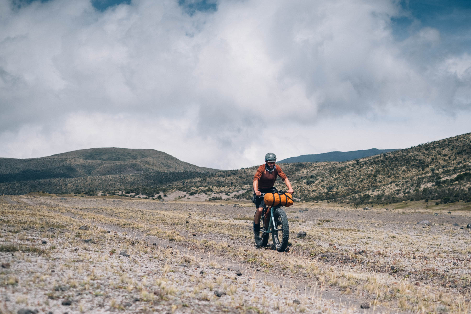
Easily accessed by public transport from Quito, Cotopaxi 360 begins with an extended climb away from Pan American highway along forested dirt roads, before meandering onto the network of double track and singletrack that course through Ecuador’s most popular national park.
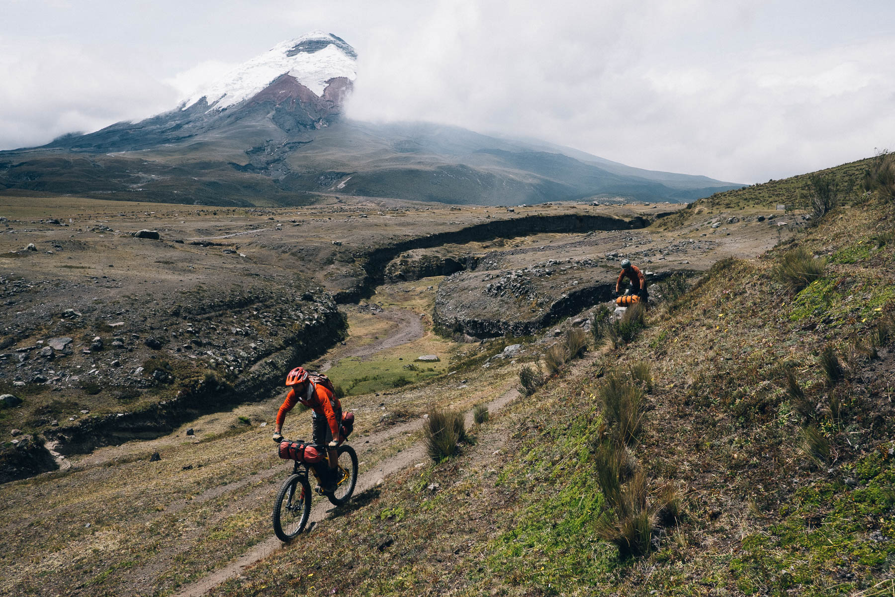
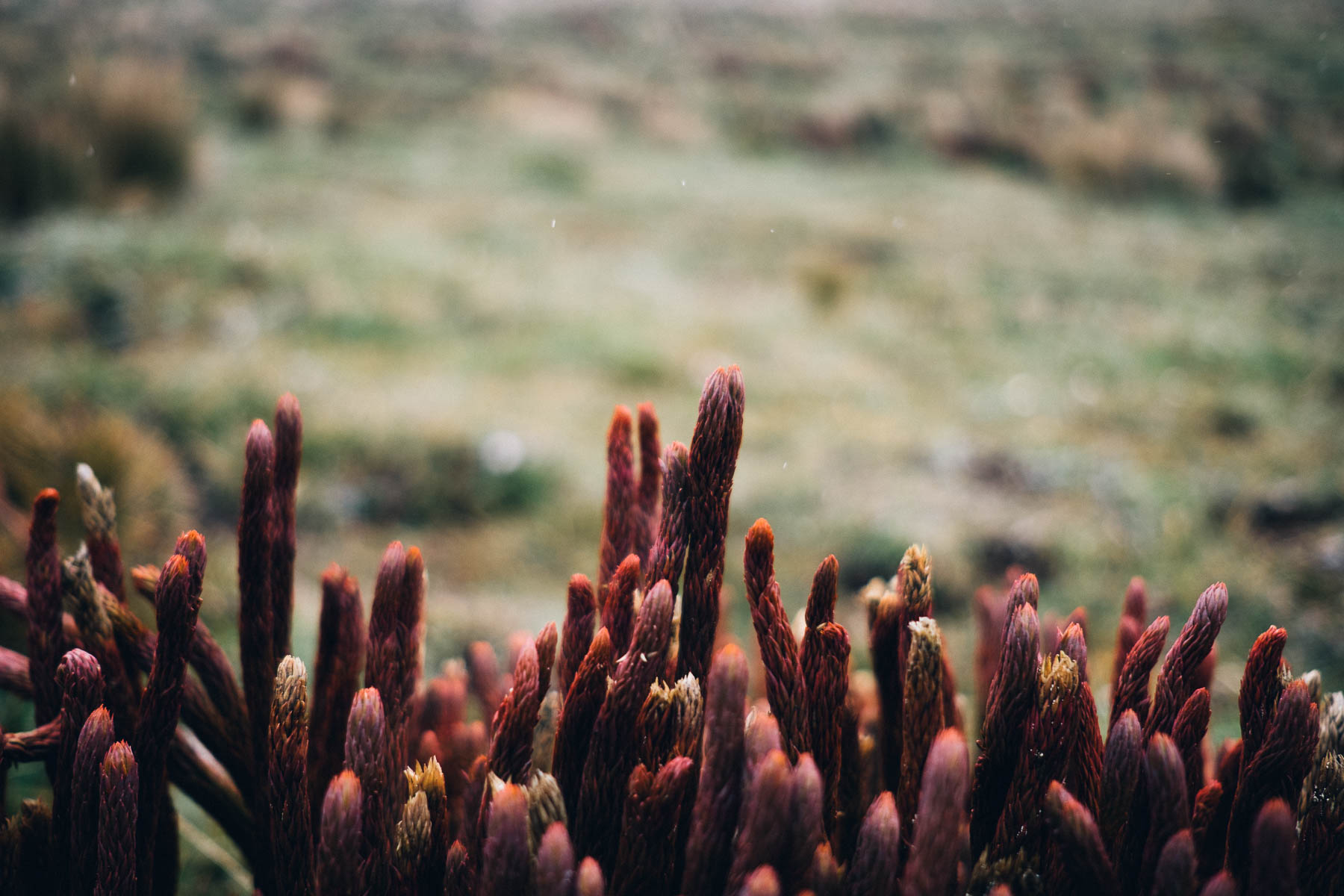
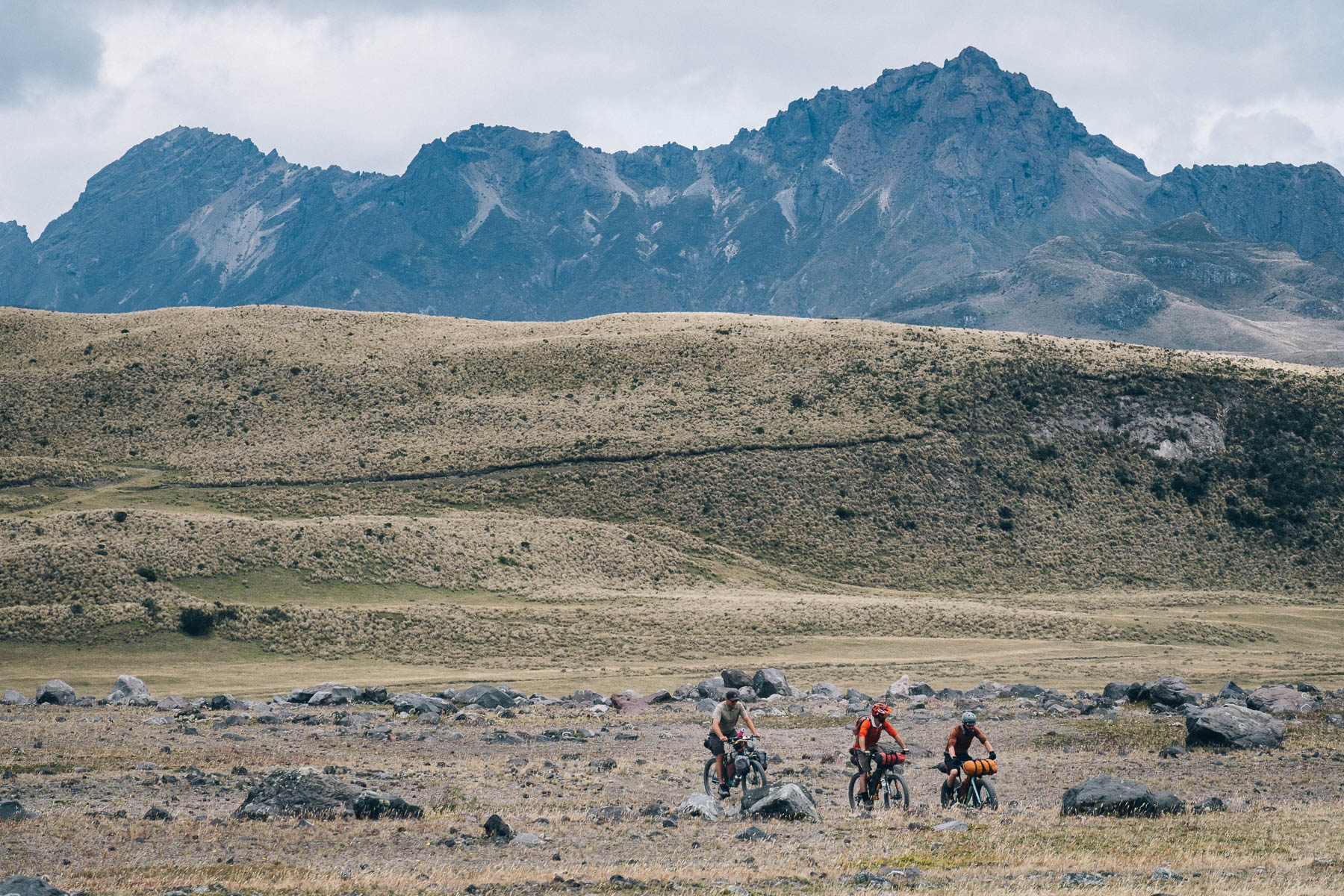
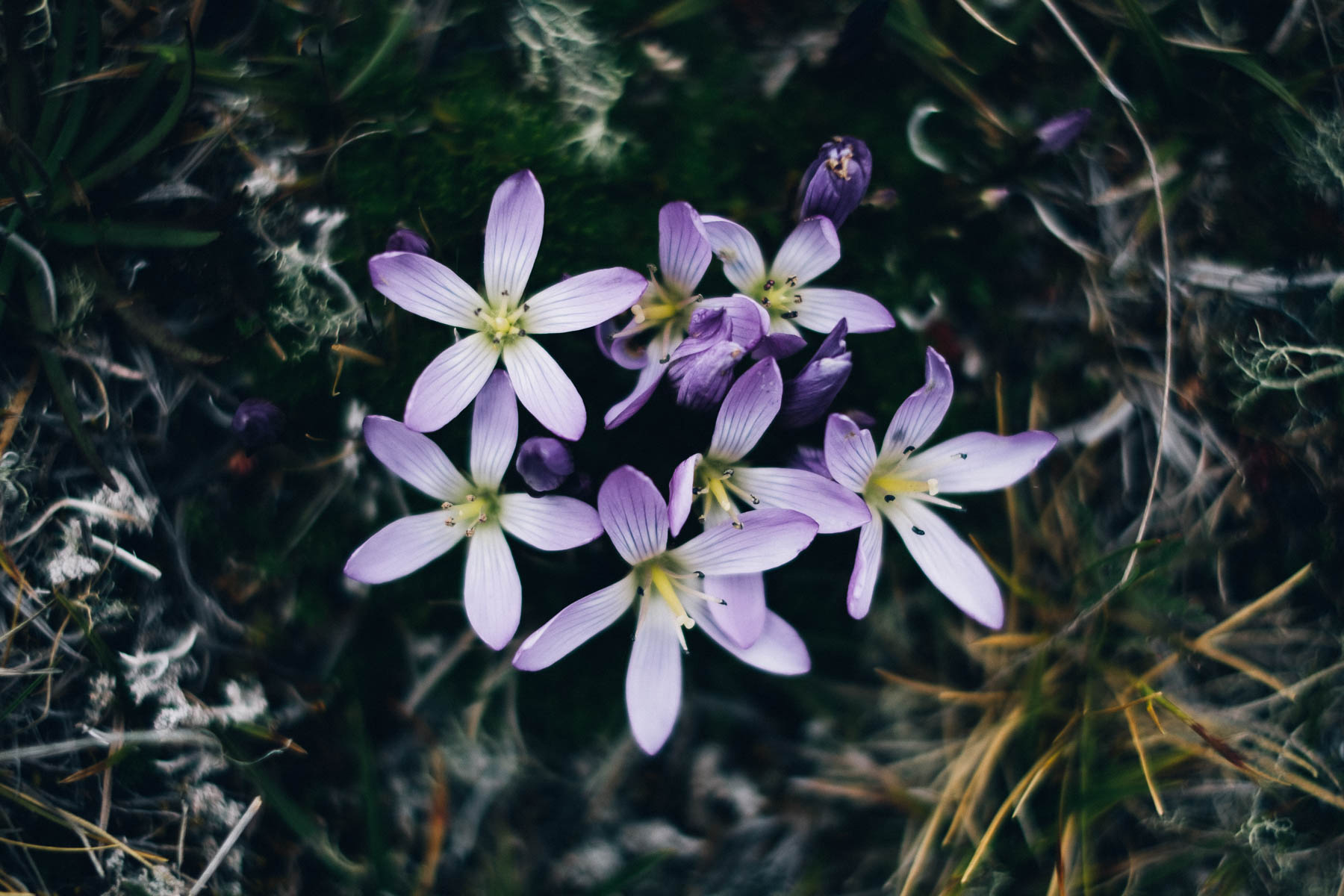
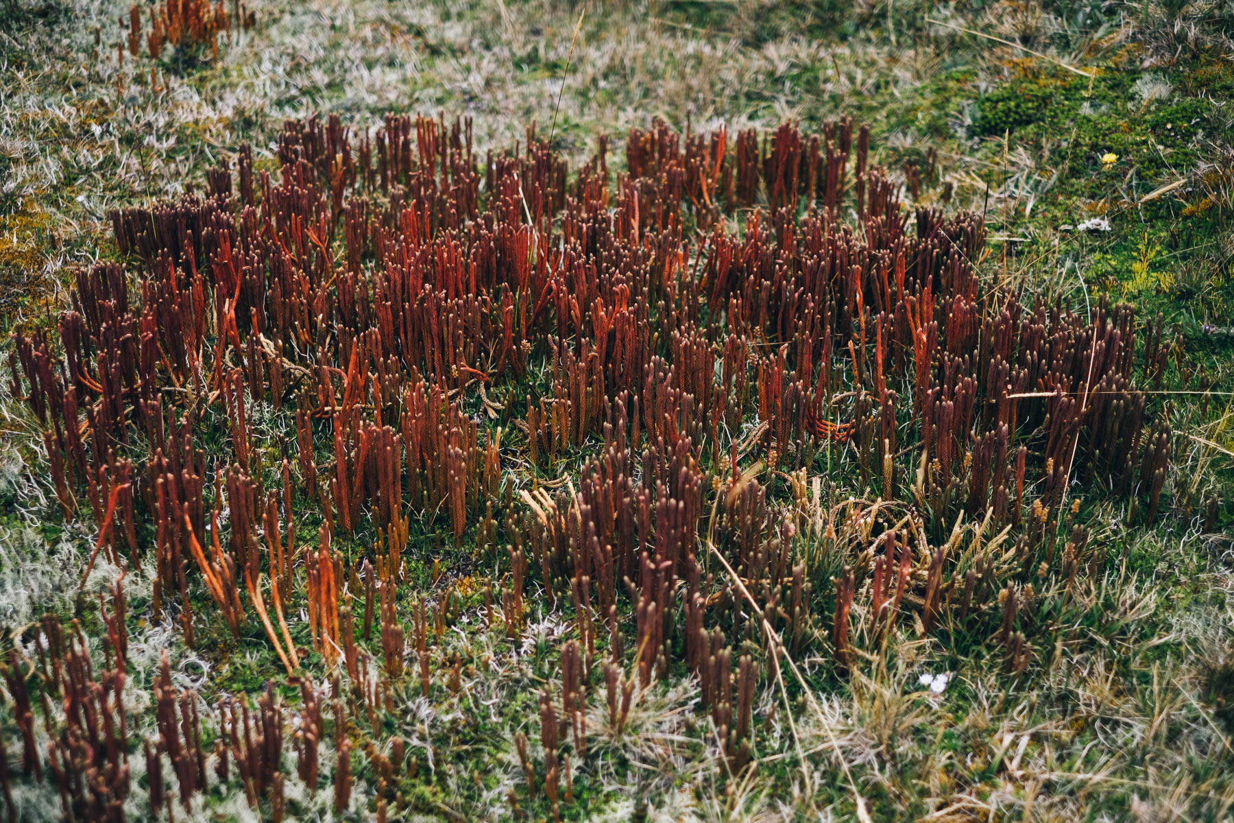
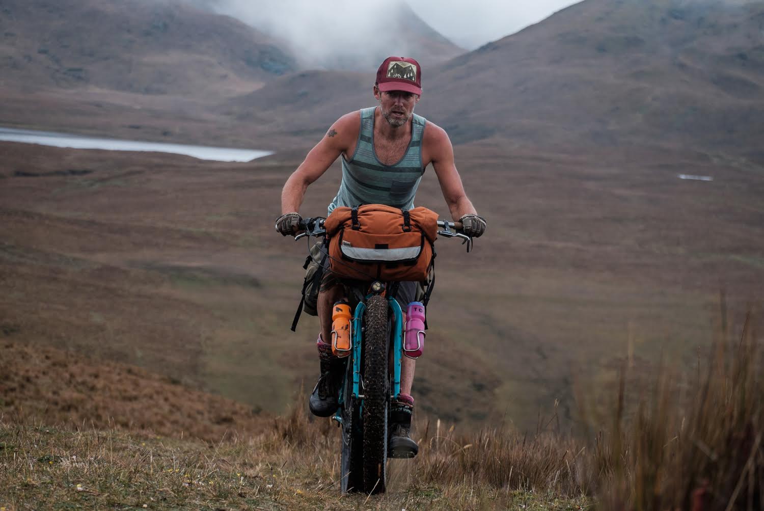
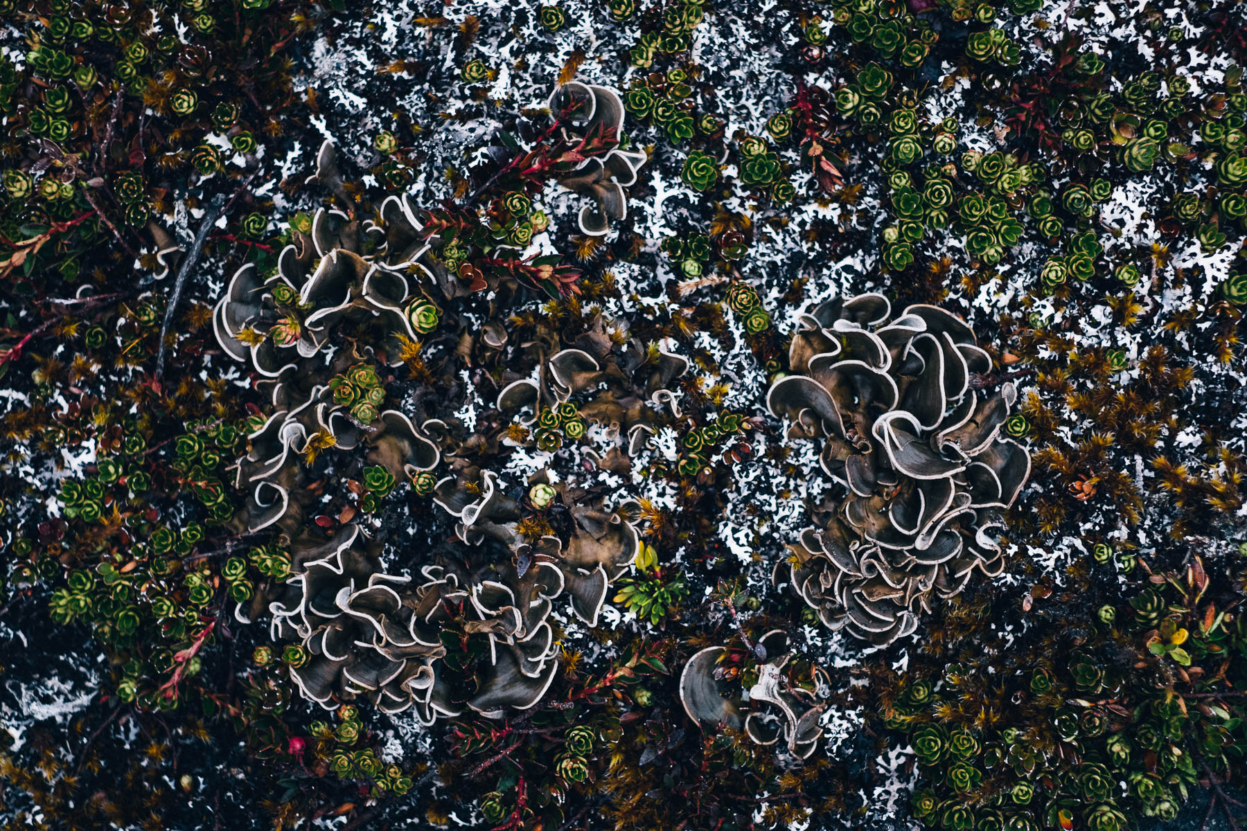
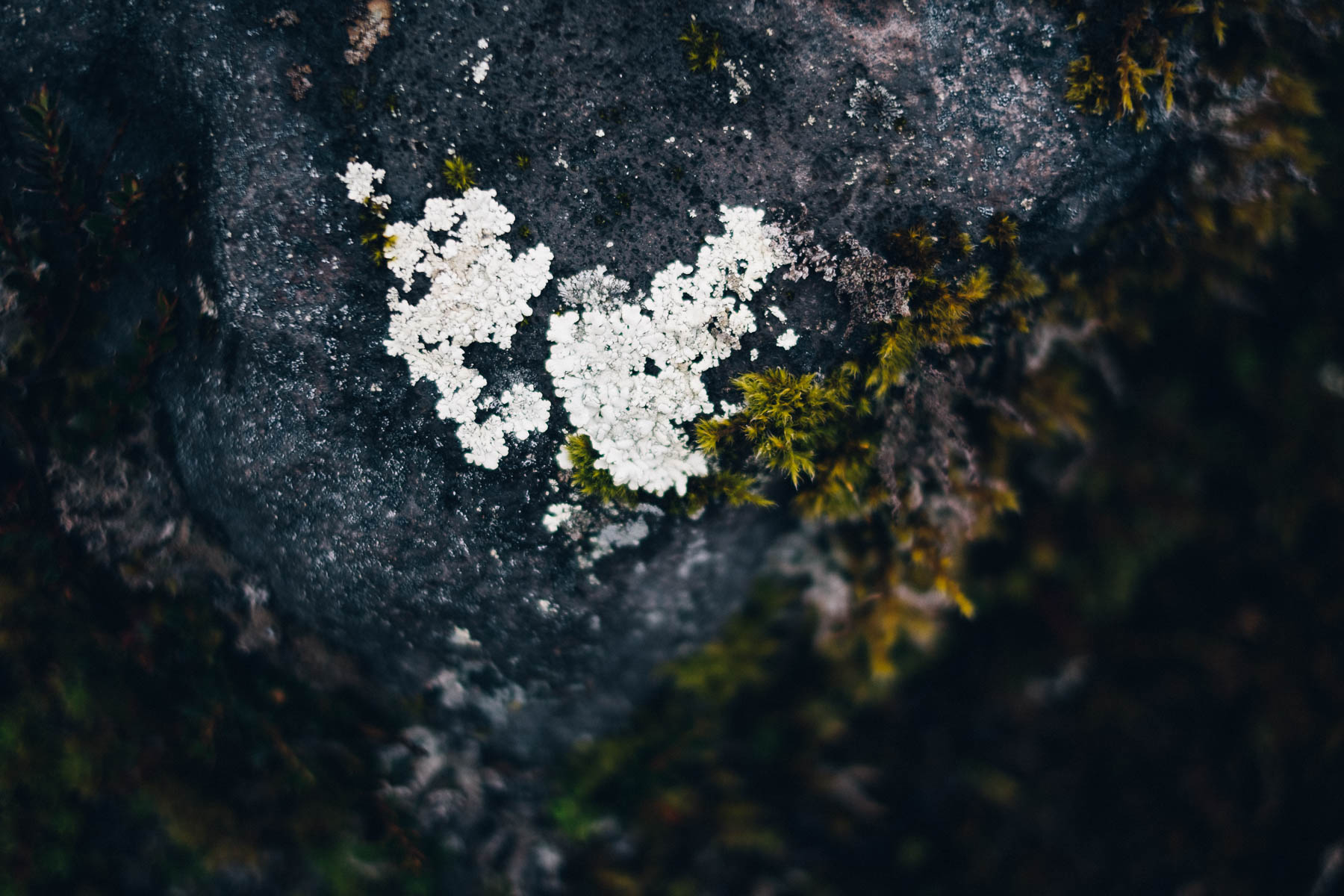
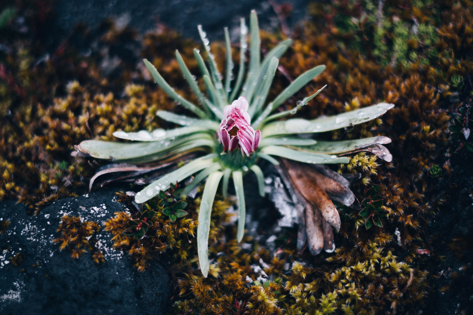
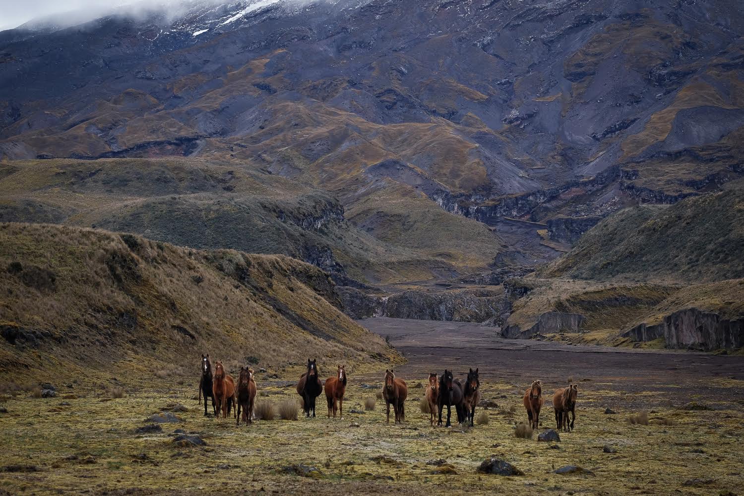
And what a park it is! A beautiful and otherworldly landscape, Cotopaxi National Park is like nowhere else in South America. Given its tropical latitude and lofty elevation, plant life is typified by a diverse array of mosses, lichens, and groves of Polylepis, a tree that grows only between 3500m and 5000m. My personal favourite? The finger-like lycopodium, a plant that looks like it’s more at home on the bottom of an ocean than on land. Keep your eyes peeled for fauna too, as aside from some 200 plant species native to the park, there are also pumas, marsupial mice, llamas, wild horses, Andean wolves, deer and birds to be spotted.
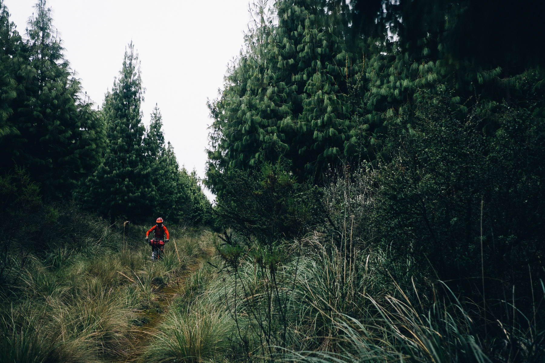
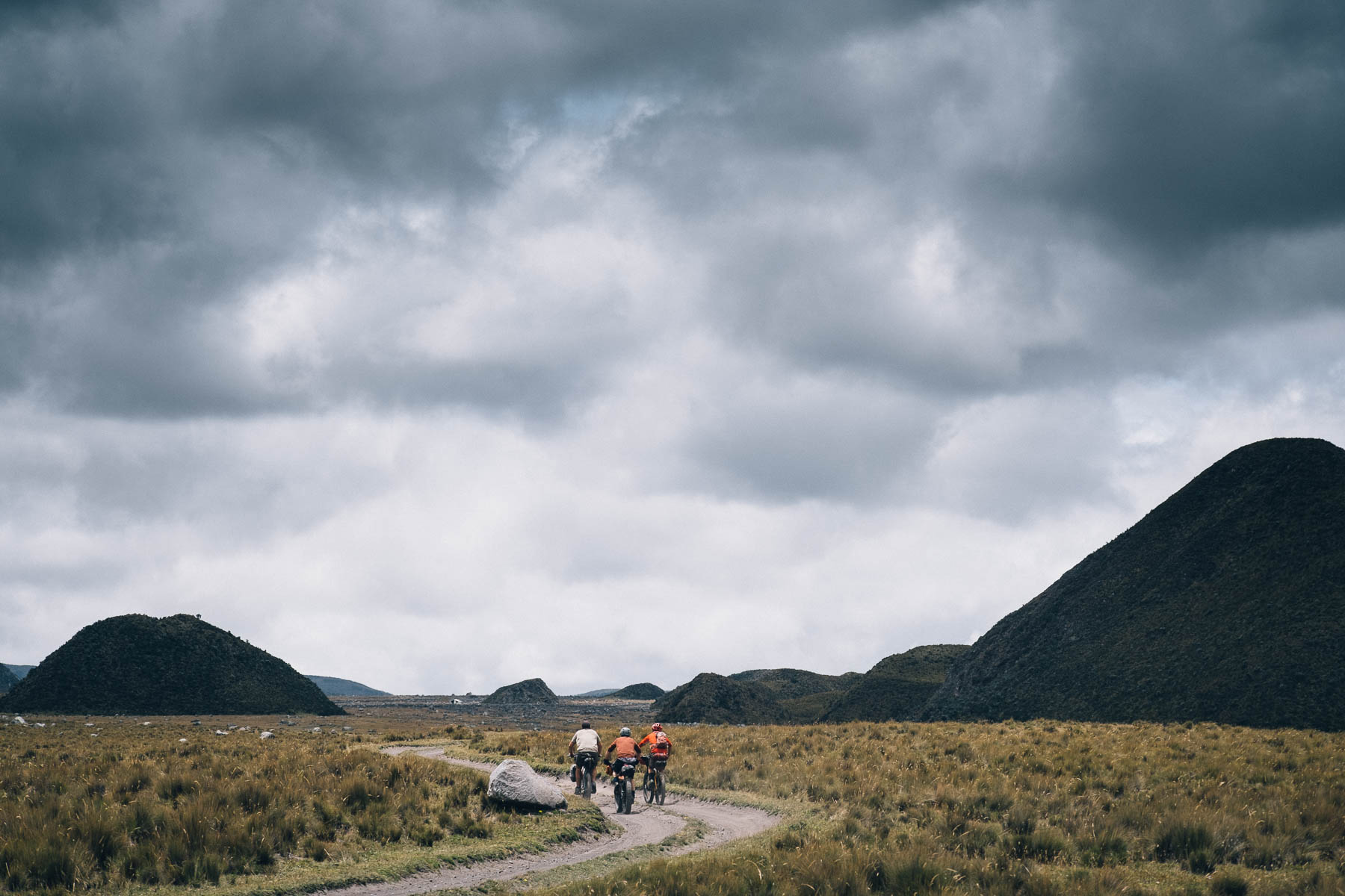
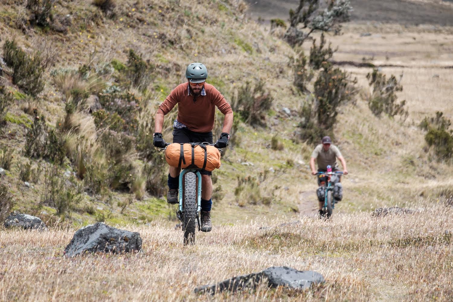
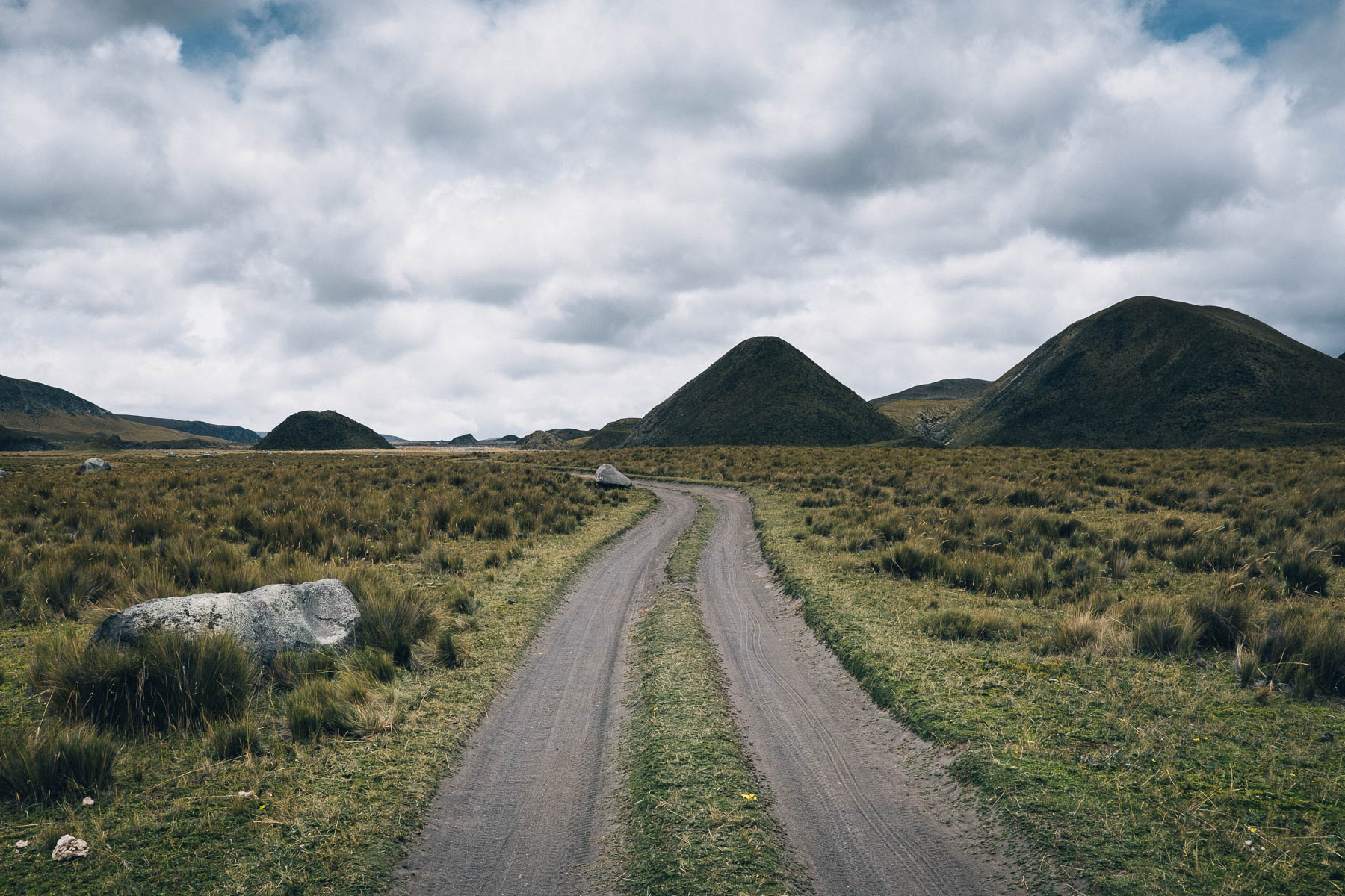
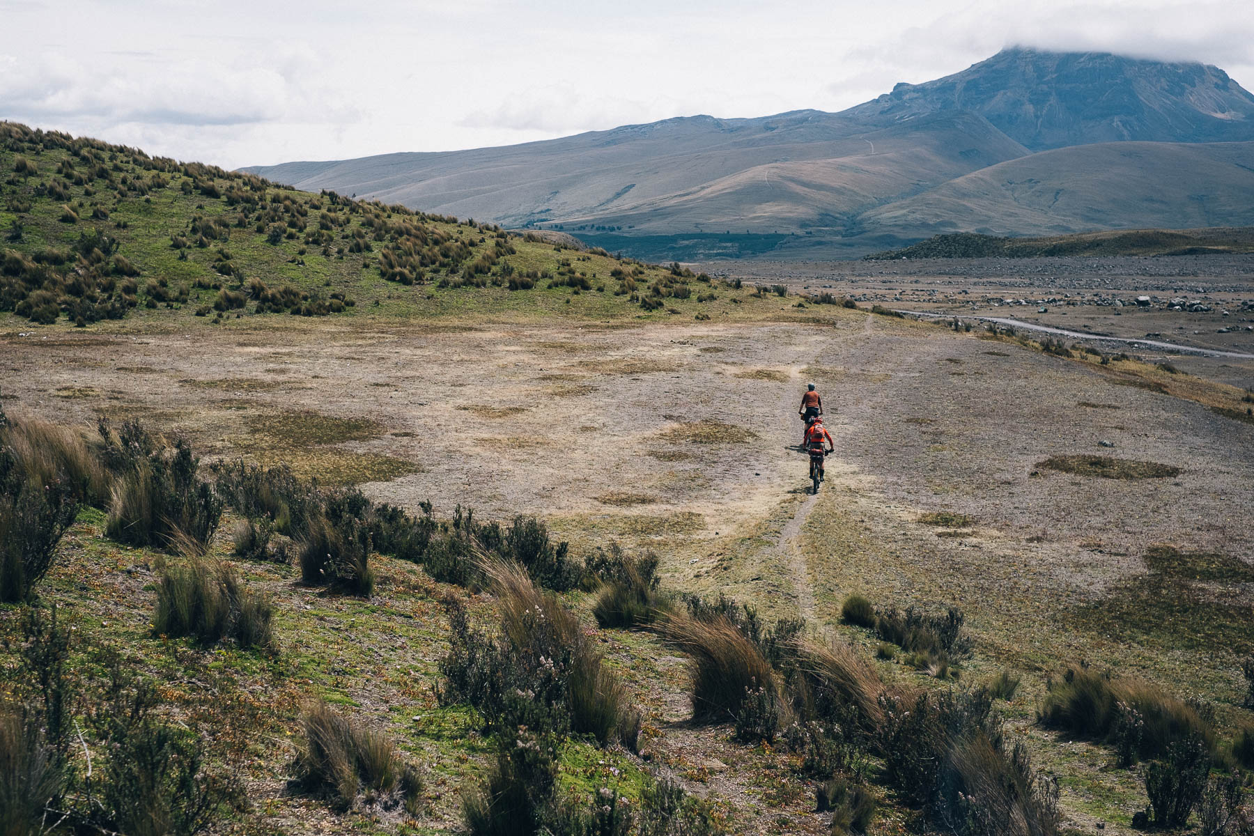
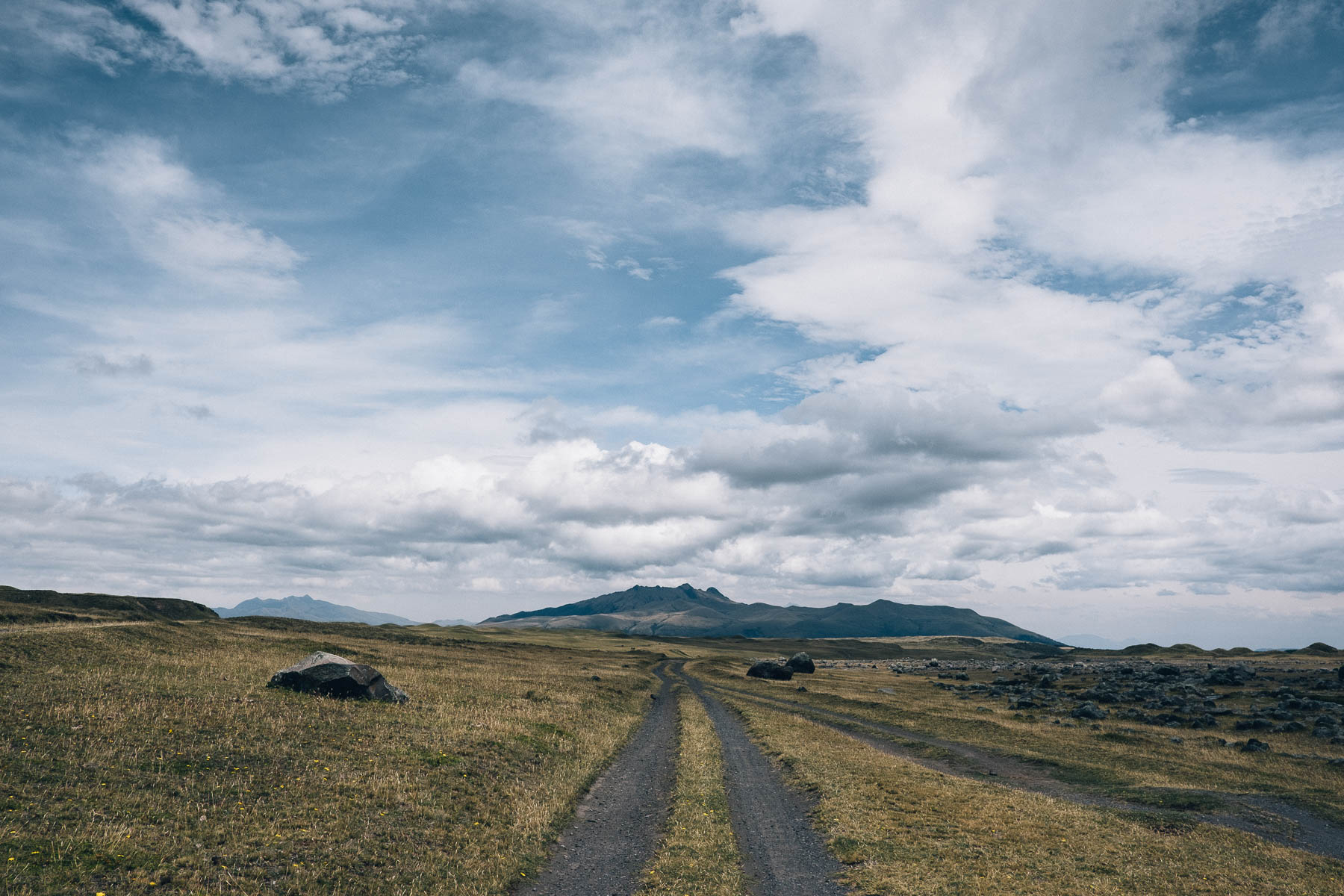
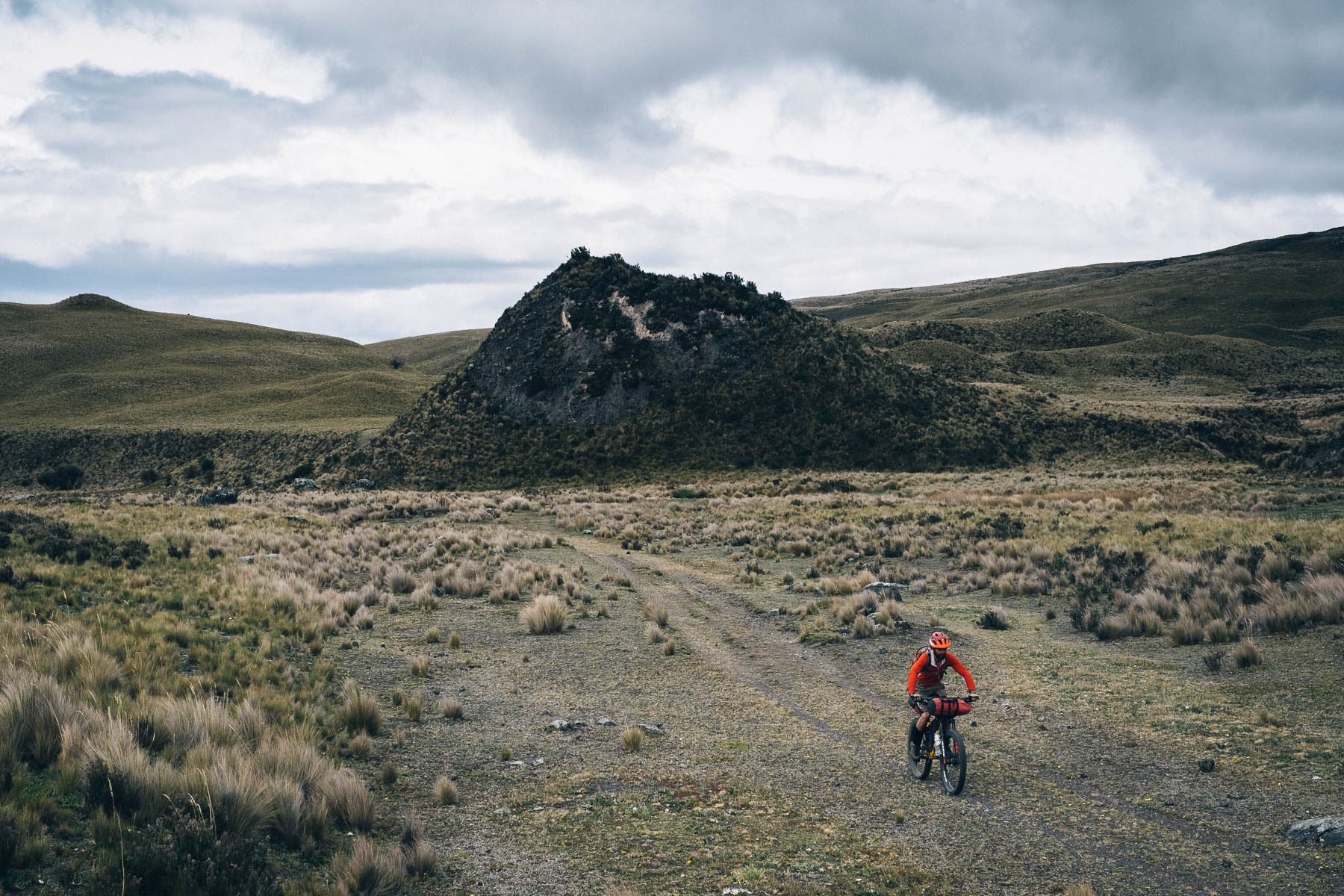
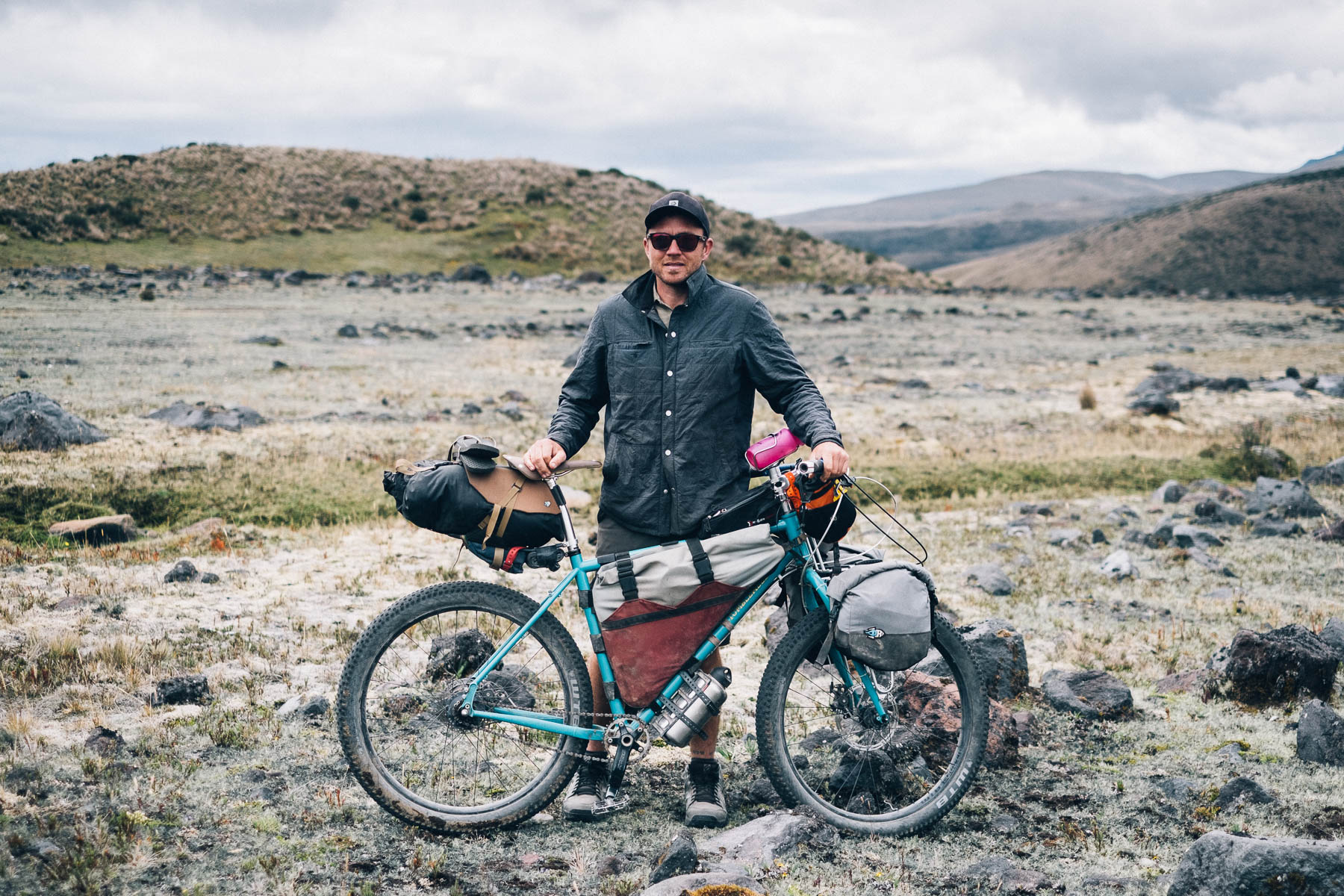
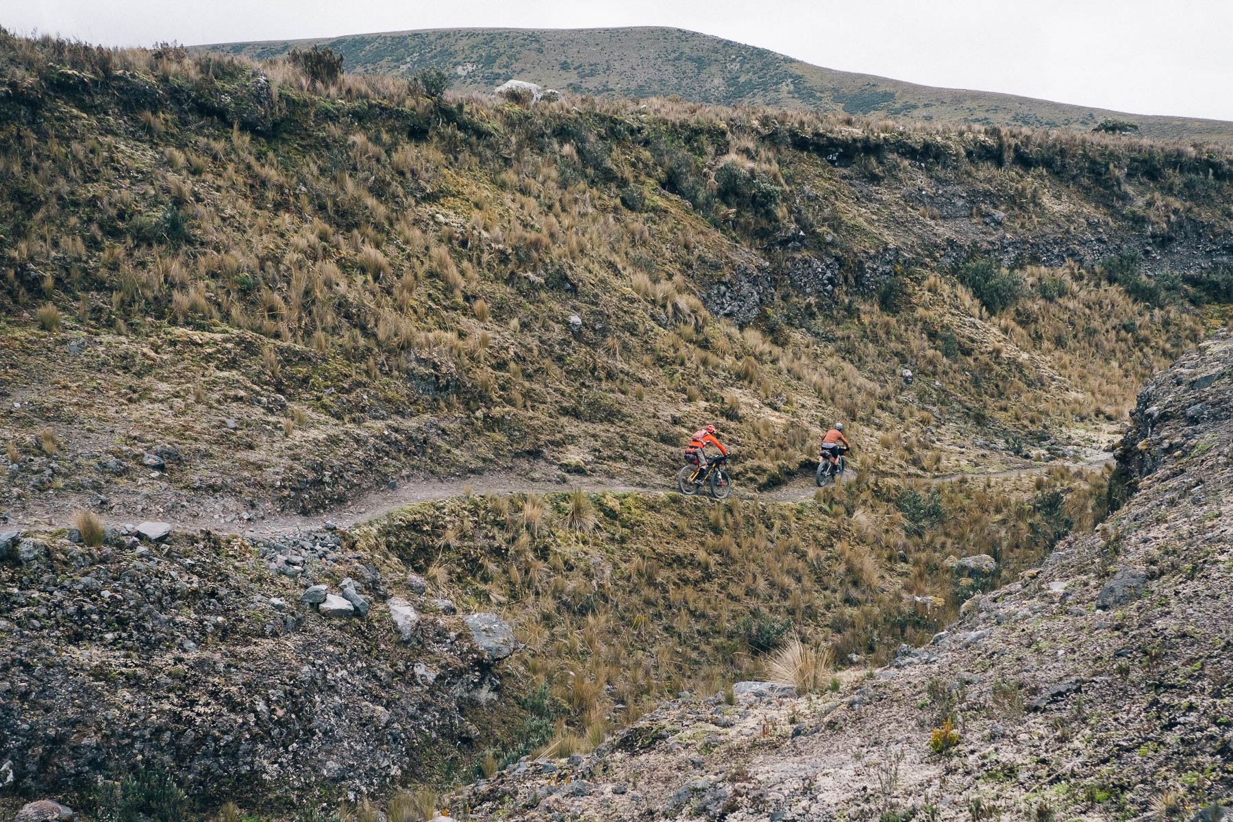
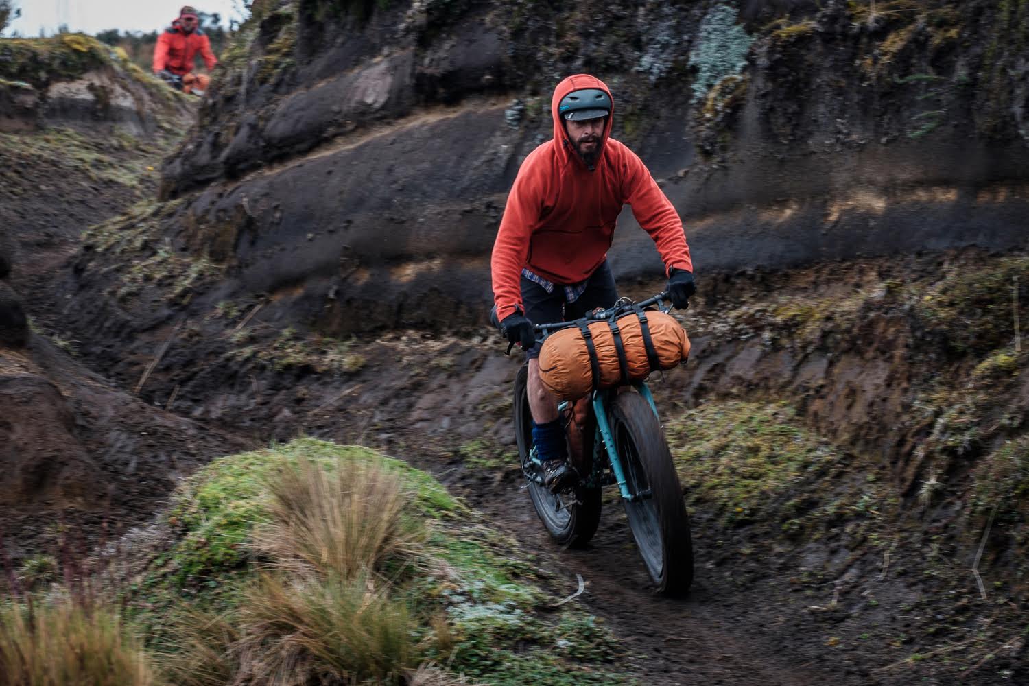
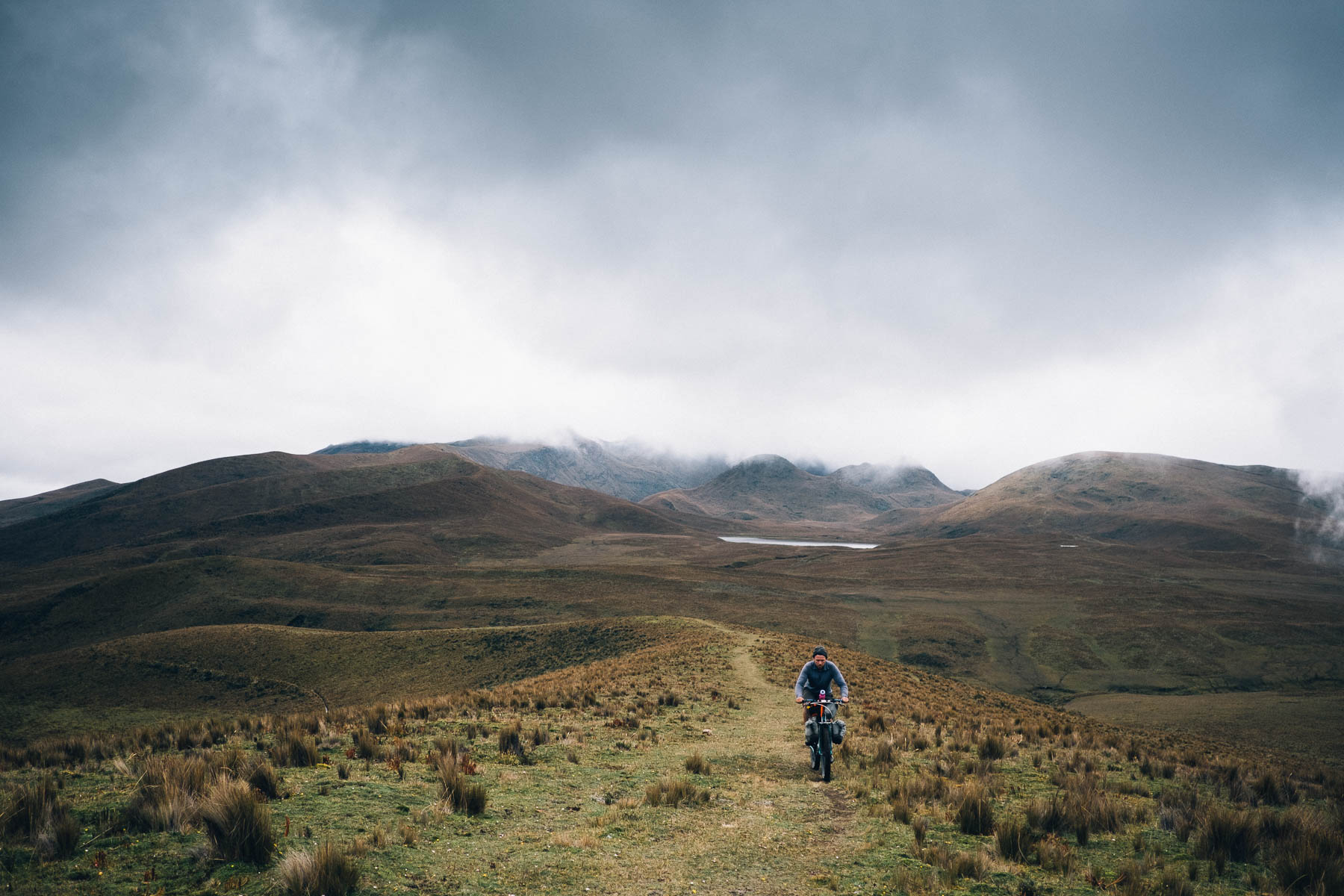
As for riding, much of the terrain surrounding Cotopaxi feels almost lunar-like; dark, hardpack dirt roads chicane through lichen-speckled rock and unusual, triangular volcanic formations created by volcanic deposits. Elsewhere, the landscape is typically Ecuadorian, with faint singletrack wending its way through a complex puzzle of tufty páramo, the tropical tundra that lies high above treeline.
Route Development
Cotopaxi 360 is based on the popular Vuelta al Cotopaxi, a long established highlight in the Ecuadorian cross country racing calender, devised by Daniel Espinos and held towards the end of October. The exact route changes from year to year; this particular version has been fine tuned by Michael Dammer, to work in some the lesser travelled tracts of páramo and singletrack that are found within the farther reaches of the park.
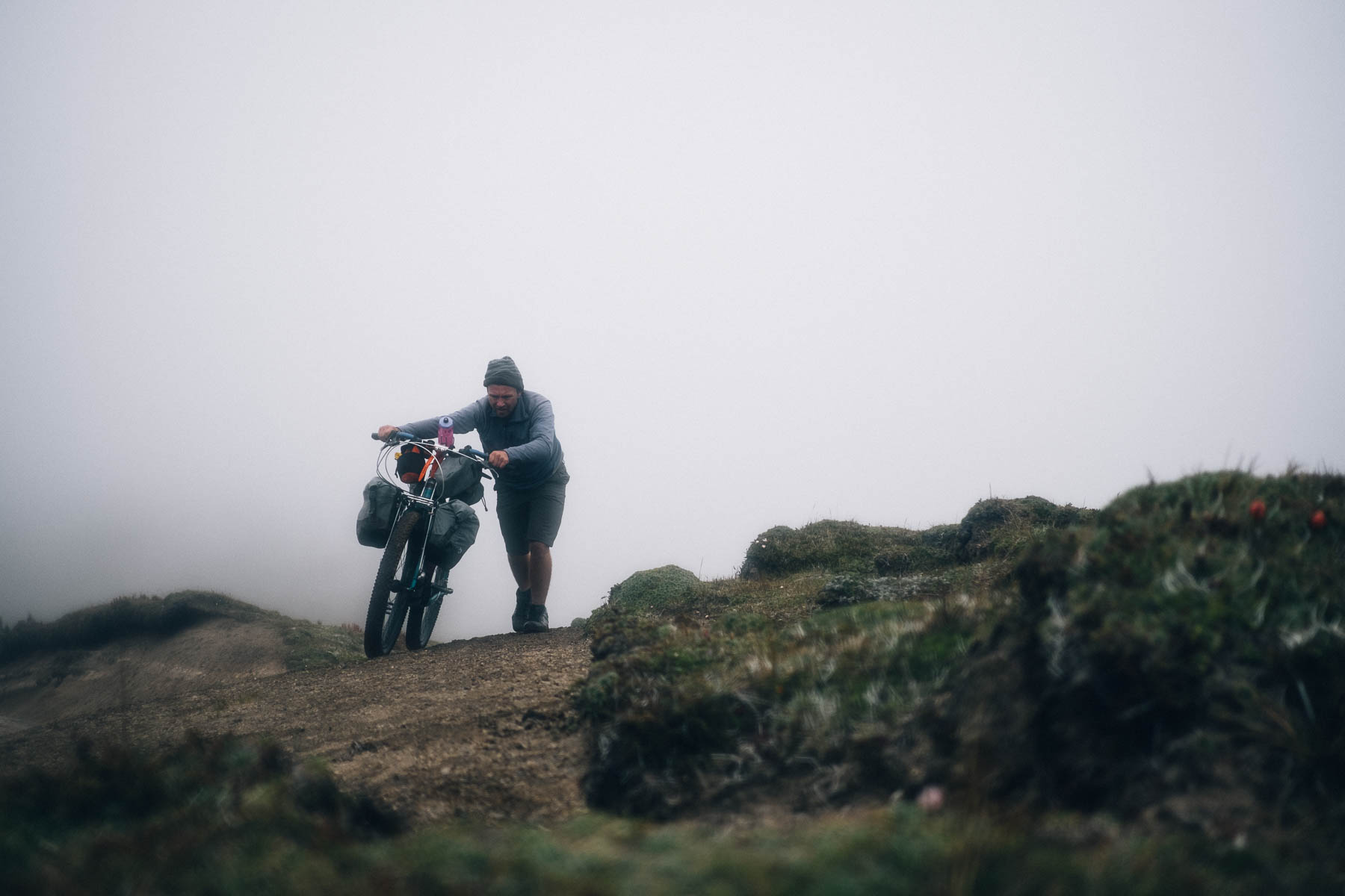
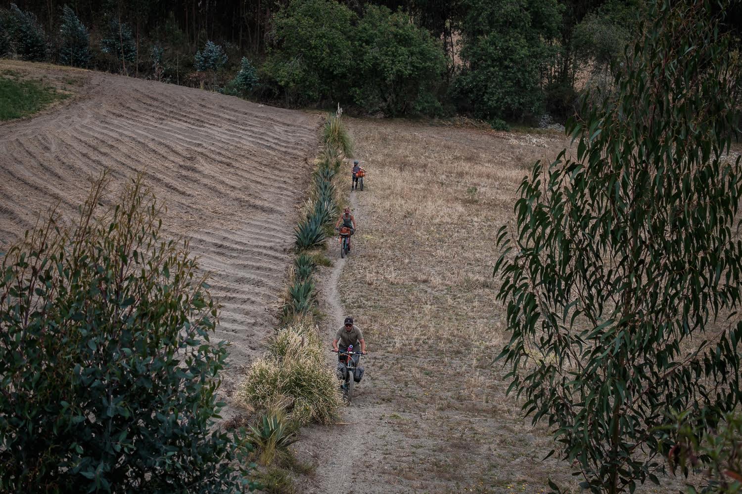
If tackled in a clockwise direction, as suggested, there’s one stout hike-a-bike to contend with, a short but awkwardly challenging graft up and over Cerro El Morro, a hilltop marked by a huge chunk of andesite that stands sentinel on the horizon – an igneous rock type named after the Andes itself. From there, it’s a fast descent on rutted dirt roads in various states of repair… down, down, down towards the Inter Andean Valley once more. Only a tough traverse lies ahead to close to loop, across a series of quebradas – deep canyons created by Cotopaxi’s volcanic eruptions – following sandy tracks and village roads.
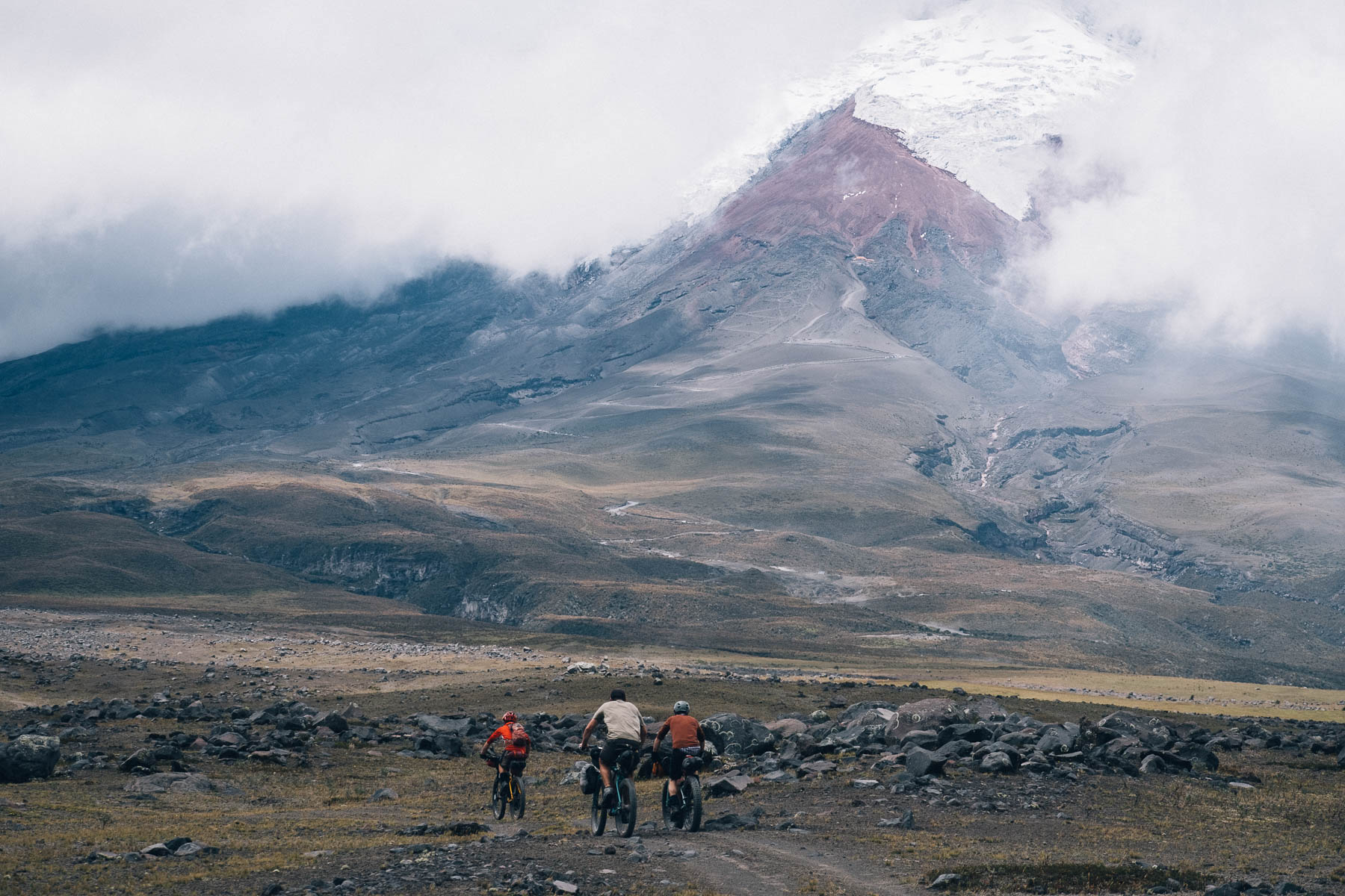
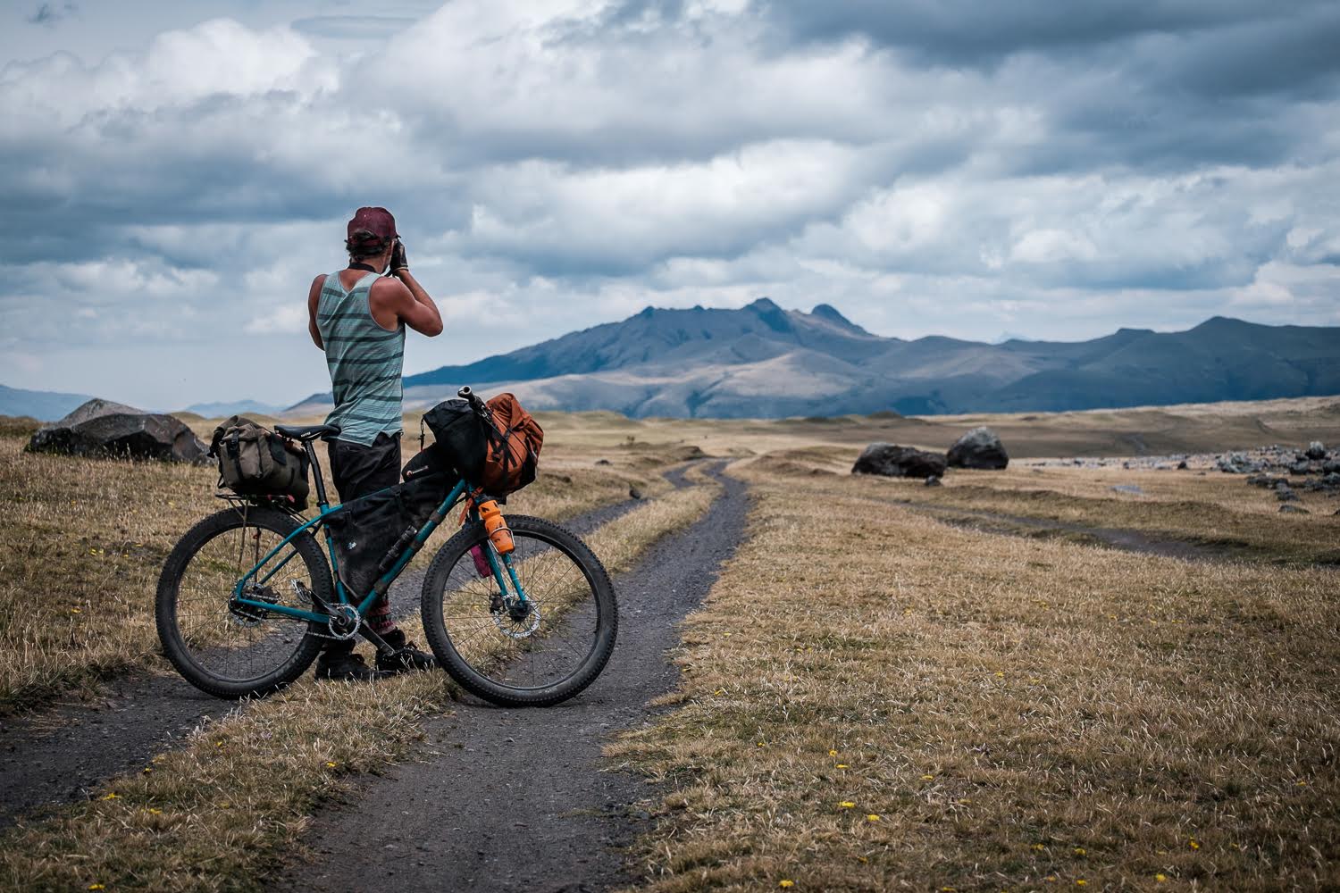
When it comes to views of Cotopaxi herself – which, at 5,897m, is Ecuador’s second highest volcano – these can sometimes be fleeting, depending on the time of year and the whims of lady luck. But whatever the weather, the unique landscape and the very nature of Ecuador’s volcanic trails mean there’s nowhere quite like bikepacking through Cotopaxi National Park.
Difficulty
This route has been awarded an 8, reflecting Ecuador’s challenging terrain, the altitude of the national park, and the region’s often mixed weather conditions. The riding for the most part is relatively non-technical, though negotiating the tufty paramo requires its own particular skillset. If tackled in a clockwise direction, as suggested, there are two short but steep hike-a-bikes to contend with, in order to hurdle the rugged outcrop of El Morro.
Note that this loop can easily be woven into one of the long distances bikepacking routes that are posted on this site, including the Trans Ecuador (both Dirt and Singletrack) and the Tres Volcanes.
Cotopaxi has erupted more than 50 times since 1738. The most recent eruption lasted from August 2015 to January 2016. It’s only just reopened, after being officially closed for climbing since then.


Submit Route Alert
As the leading creator and publisher of bikepacking routes, BIKEPACKING.com endeavors to maintain, improve, and advocate for our growing network of bikepacking routes all over the world. As such, our editorial team, route creators, and Route Stewards serve as mediators for route improvements and opportunities for connectivity, conservation, and community growth around these routes. To facilitate these efforts, we rely on our Bikepacking Collective and the greater bikepacking community to call attention to critical issues and opportunities that are discovered while riding these routes. If you have a vital issue or opportunity regarding this route that pertains to one of the subjects below, please let us know:
Highlights
Must Know
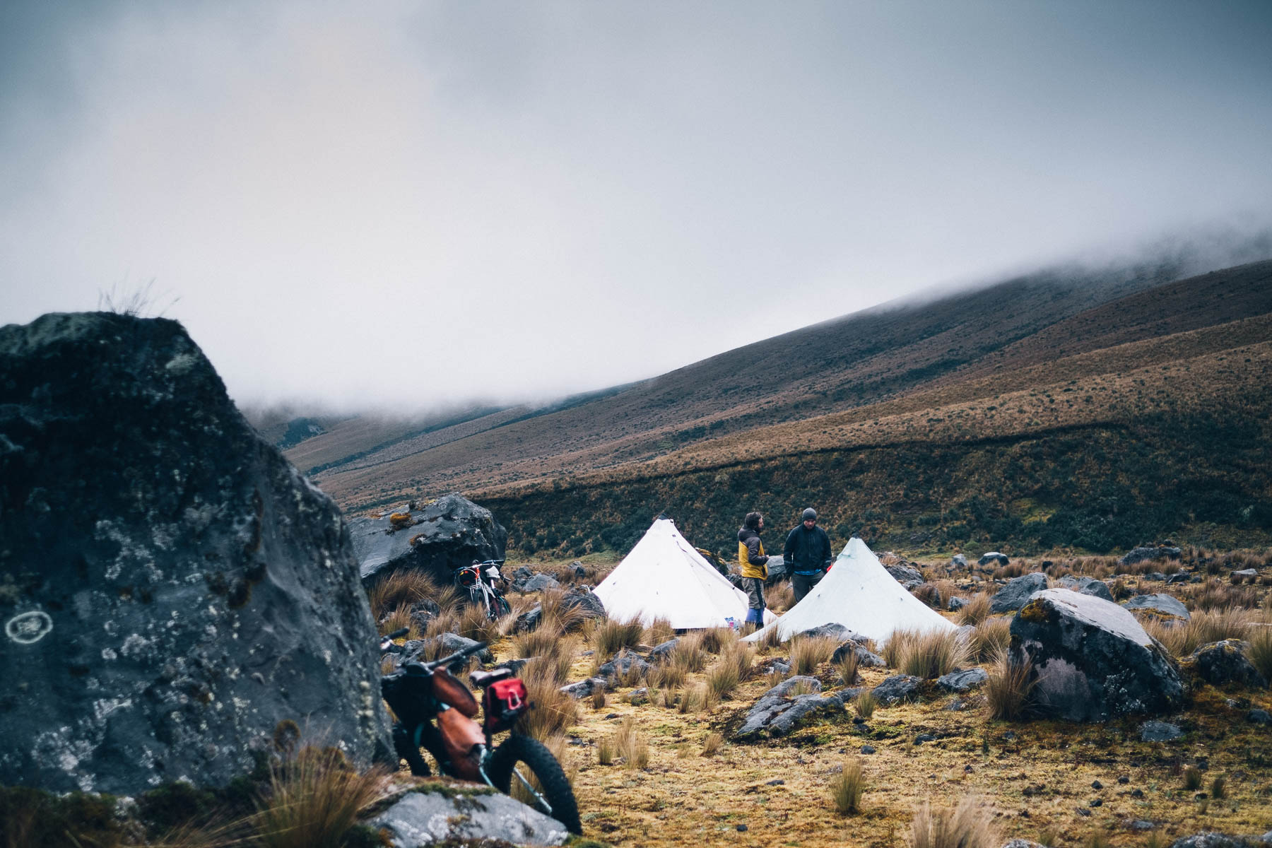
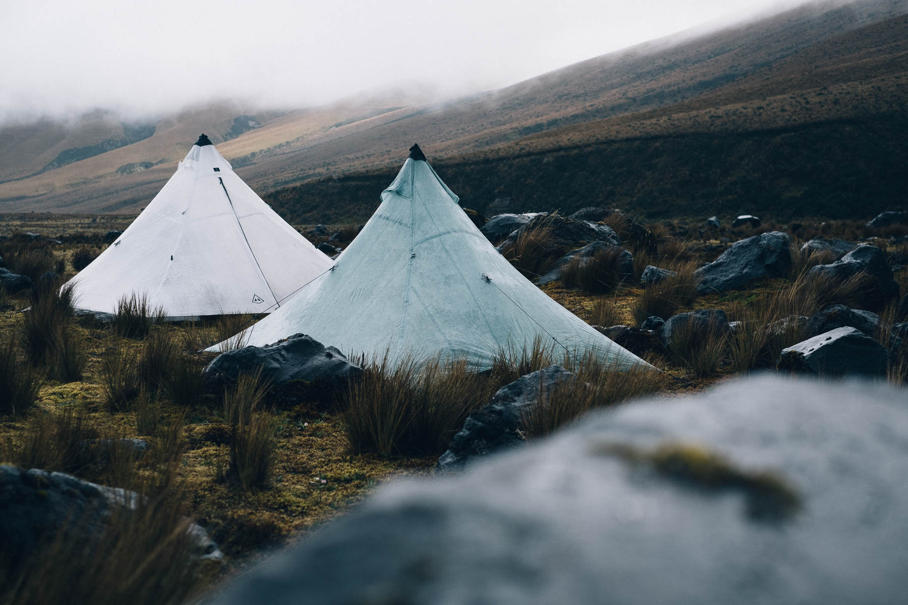
Camping
Food/H2O
- Riding mellow and meandering singletrack across the high plateau that surrounds Volcan Cotopaxi.
- Learning new riding skills required to negotiate Ecuador’s treeless páramo.
- Marvelling at the profusion of miniature flora… like lichens and mosses.
- Enjoying panoramic views of Cotopaxi… if you’re lucky with the weather!
- We’ve mapped out this route from Lasso, as it’s easy to reach by bus from Quito. But you could also base yourself at one of the area’s many hostels, allowing yourself time to acclimatise and relax before tackling the ride. These include Tierra del Volcan, whose owner Jorge Perez rents bikes and has been developing local trails, or the popular Secret Garden.
- Entrance to the park is free.
- June to mid-September is the high season in the Ecuadorian Andes and is the driest time of the year. Outside of this, be prepared for extended bouts of very heavy rain. Traditionally, there is often a ‘mini dry season’ in December and January.
- Always expect mixed weather in the highlands of Ecuador, whatever the season. Be prepared for persistent rain at times, and/or four seasons in one day. Bring a quality, reliable waterproof jacket.
- The route passes through isolated areas, some of which can be private or communally owned. Whenever you encounter anyone, please ask for permission to ride, by saying “Preste pasito, por favor”. Be sure to reassure them that you will close all gates behind you (“Yo cierro las puertas”).
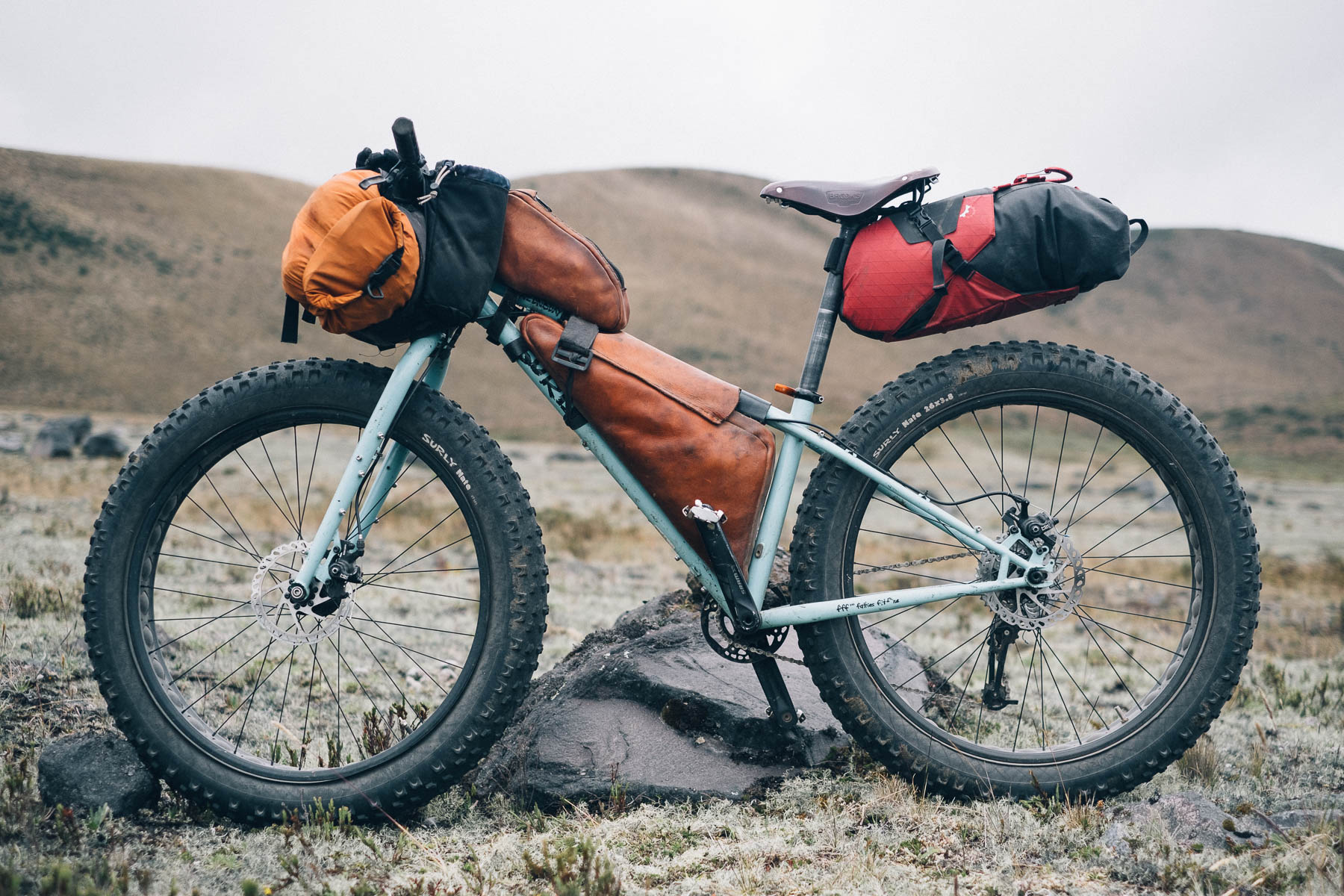
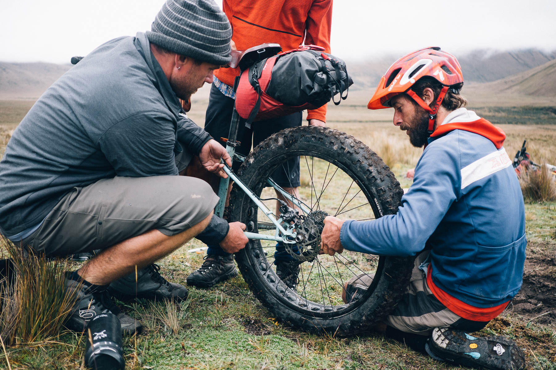
- This route is well suited to ‘plus’ and full-fat bikes, given the unorthodox nature of the páramo. Otherwise, we suggest a 2.25in tire with front suspension.
- Clipless pedals are preferable to platform ones, as they’re less likely to get caught up in the tufty, grassy páramo.
- There are high-end bike shops in Quito, including Cikla, whose owner, Daniel Espinosa organises the yearly Vuelta al Cotopaxi. A broad range of Revelate bikepacking gear is available at the shop.
- Quito is well stocked with quality camping gear. The Ecuadorian chain Tatoo has an REI-like selection of high-end gear. Pressurised cannister bottles are available and denatured alcohol is easy to find locally, under the name alcohol industrial, sold in hardware stores and pharmacies.
- A general note on buses. Most have room for a bike or two in the trunk; wheels may need to be removed and an extra charge may be levied.
- Camping in the park is only allowed in designated areas – see map – but once outside its boundaries, it’s not an issue.
- The route passes by Tambopaxi Lodge, where rooms, dorms, and camping are available. Food is expensive but good, and there’s wifi too.
- Bring food for the loop. Other than Tambopaxi lodge, there is nowhere to resupply en route.
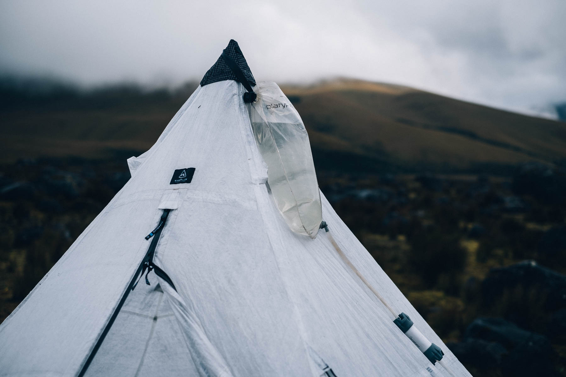
- Clean water is readily available; use a filter if unsure of its source.


Terms of Use: As with each bikepacking route guide published on BIKEPACKING.com, should you choose to cycle this route, do so at your own risk. Prior to setting out check current local weather, conditions, and land/road closures. While riding, obey all public and private land use restrictions and rules, carry proper safety and navigational equipment, and of course, follow the #leavenotrace guidelines. The information found herein is simply a planning resource to be used as a point of inspiration in conjunction with your own due-diligence. In spite of the fact that this route, associated GPS track (GPX and maps), and all route guidelines were prepared under diligent research by the specified contributor and/or contributors, the accuracy of such and judgement of the author is not guaranteed. BIKEPACKING.com LLC, its partners, associates, and contributors are in no way liable for personal injury, damage to personal property, or any other such situation that might happen to individual riders cycling or following this route.
Please keep the conversation civil, constructive, and inclusive, or your comment will be removed.