


Trans Ecuador Mountain Bike Route: Dirt Road Version
Distance
858 Mi.
(1,381 KM)Days
23
% Unpaved
70%
% Singletrack
0%
% Rideable (time)
99%
Total Ascent
115,795'
(35,294 M)High Point
14,780'
(4,505 M)Difficulty (1-10)
8?
- 9Climbing Scale Very Strenuous135 FT/MI (26 M/KM)
- -Technical Difficulty
- -Physical Demand
- -Resupply & Logistics
Contributed By

Cass Gilbert
Contributing Editor
Update August 5th, 2023: A group of riders were attacked and robbed while camping at Laguna Chiquita, a small lake south of Otavalo, a few days ago. We strongly suggest avoiding this camping area (POI has been removed from map) and staying closer to established campgrounds and towns.
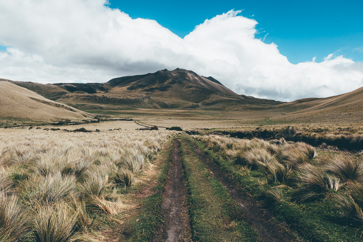
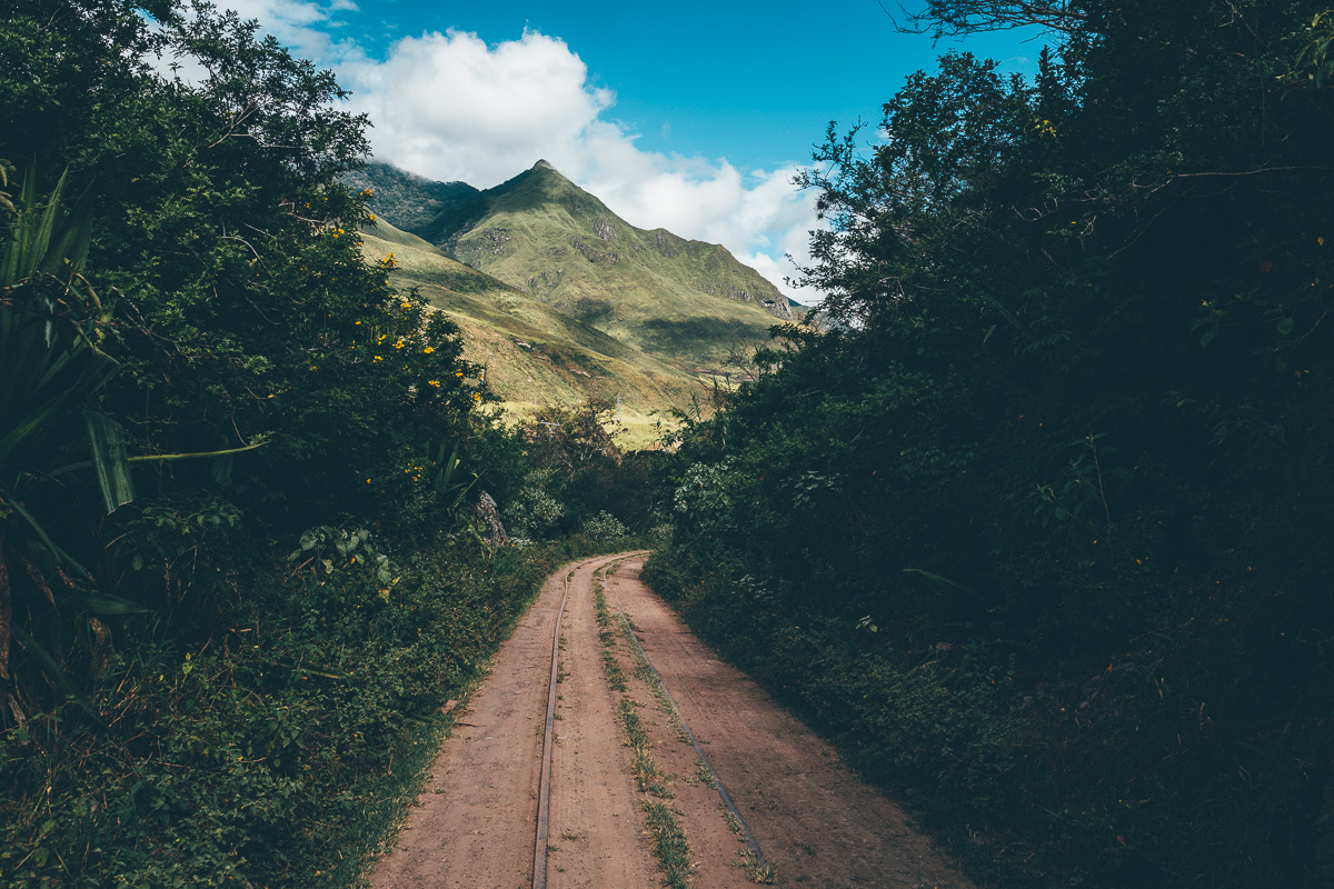
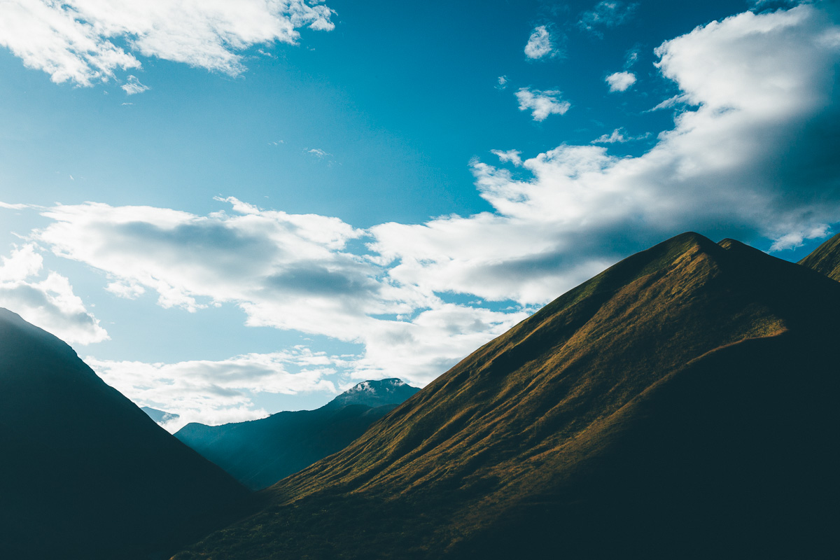
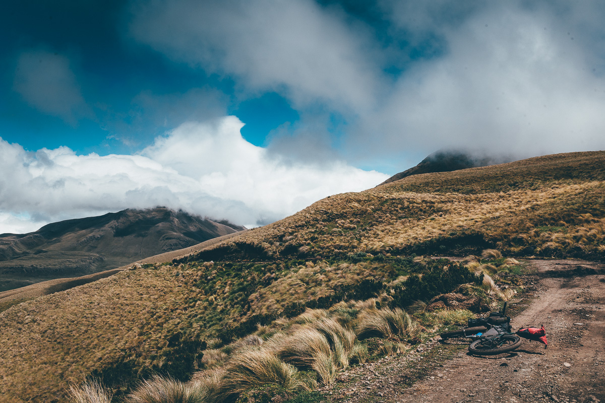
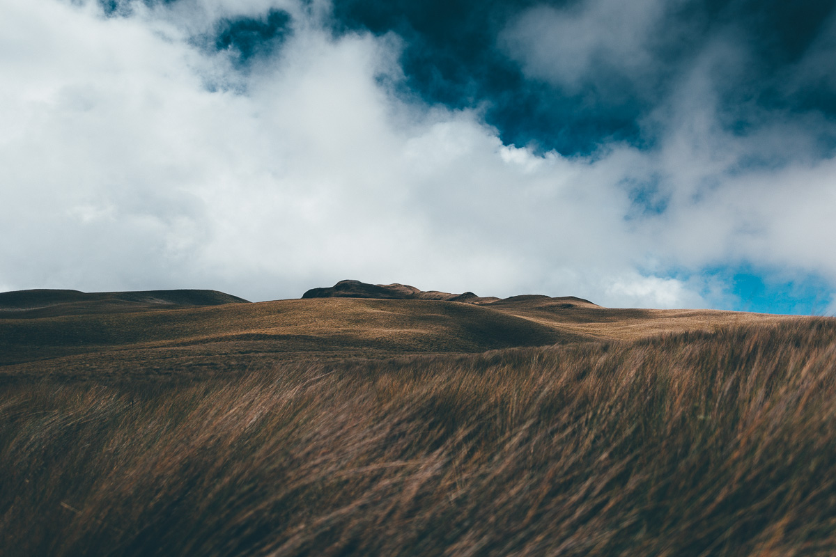
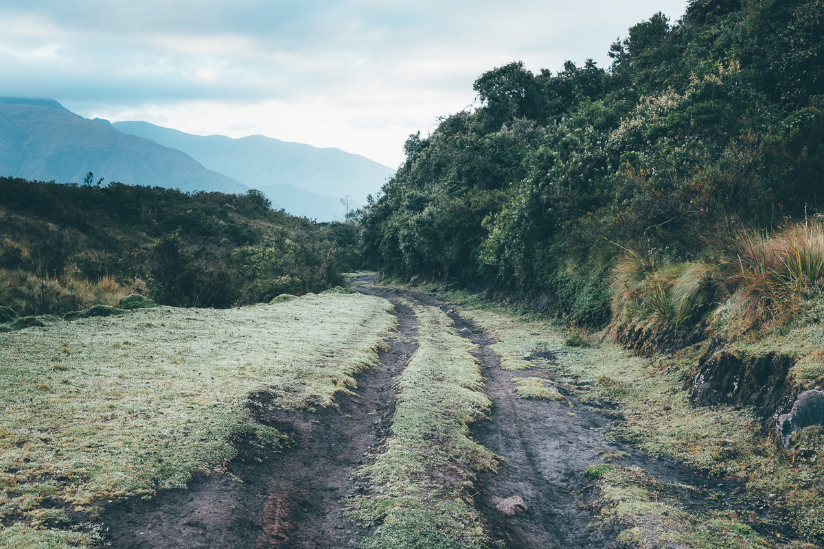
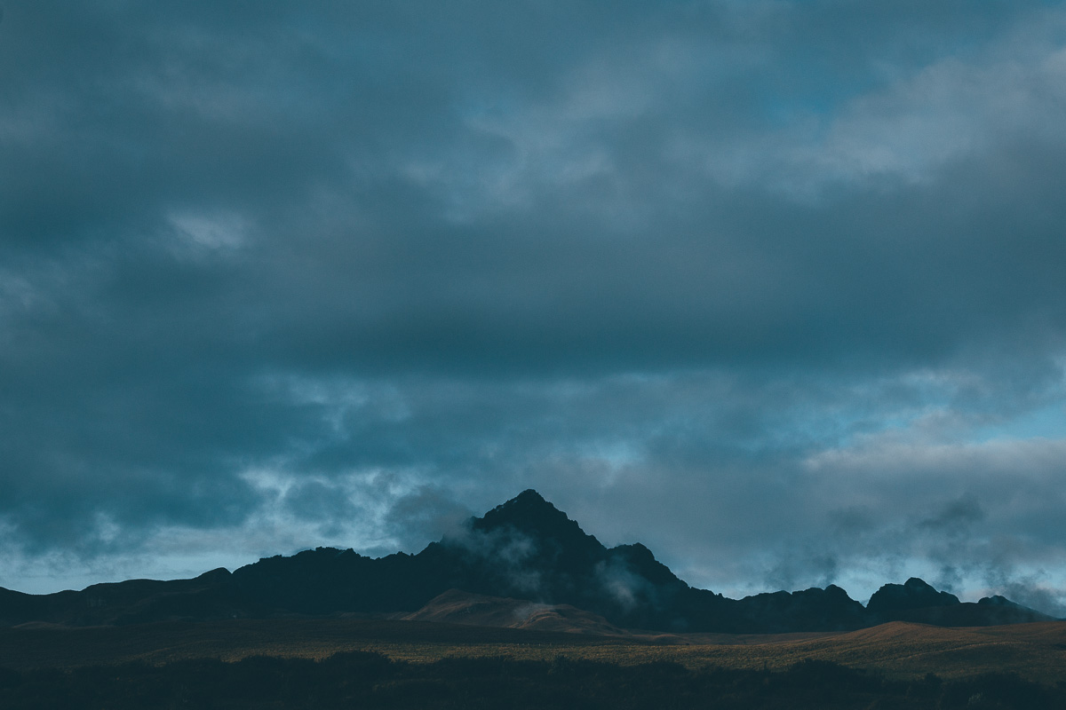
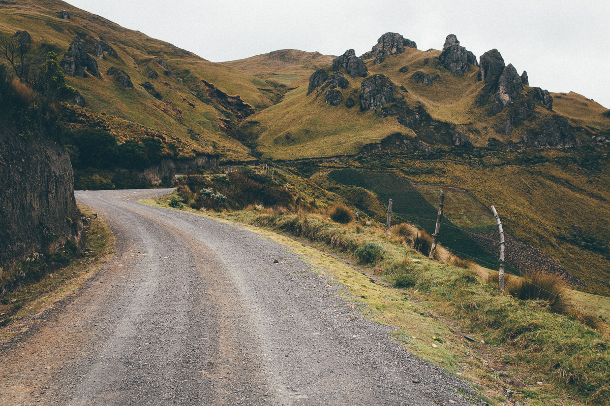
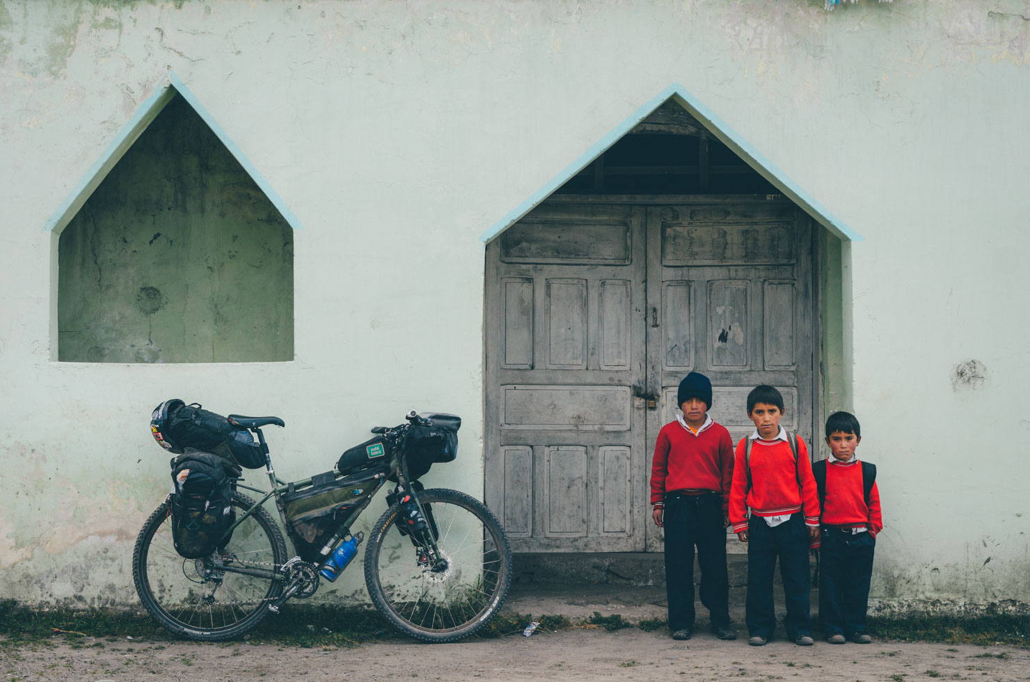
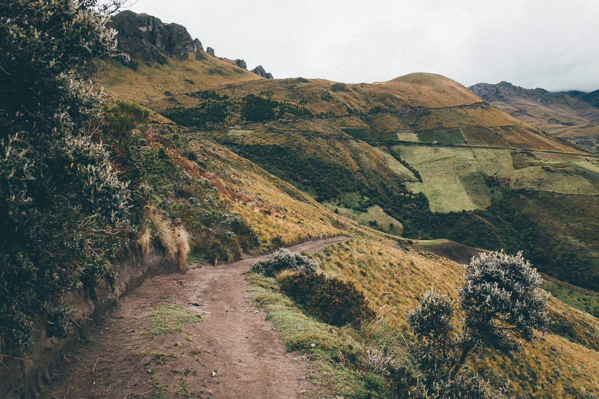
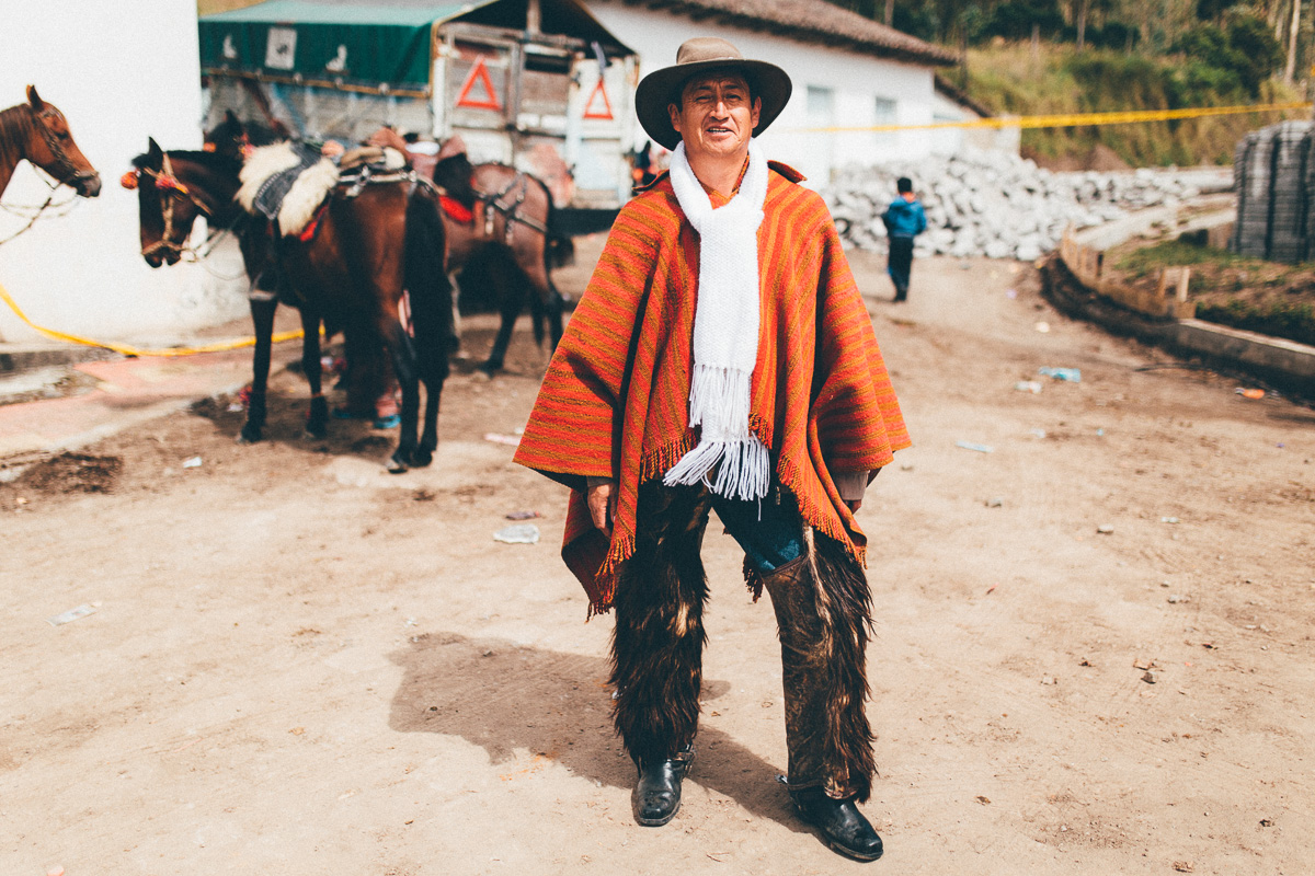
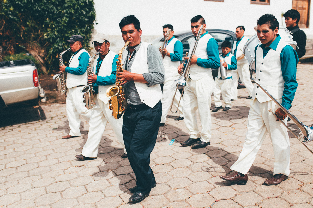
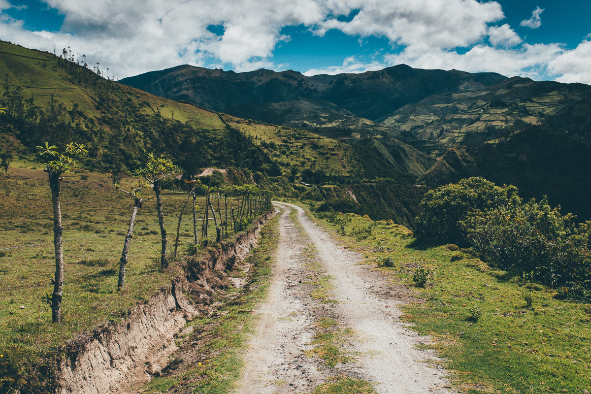
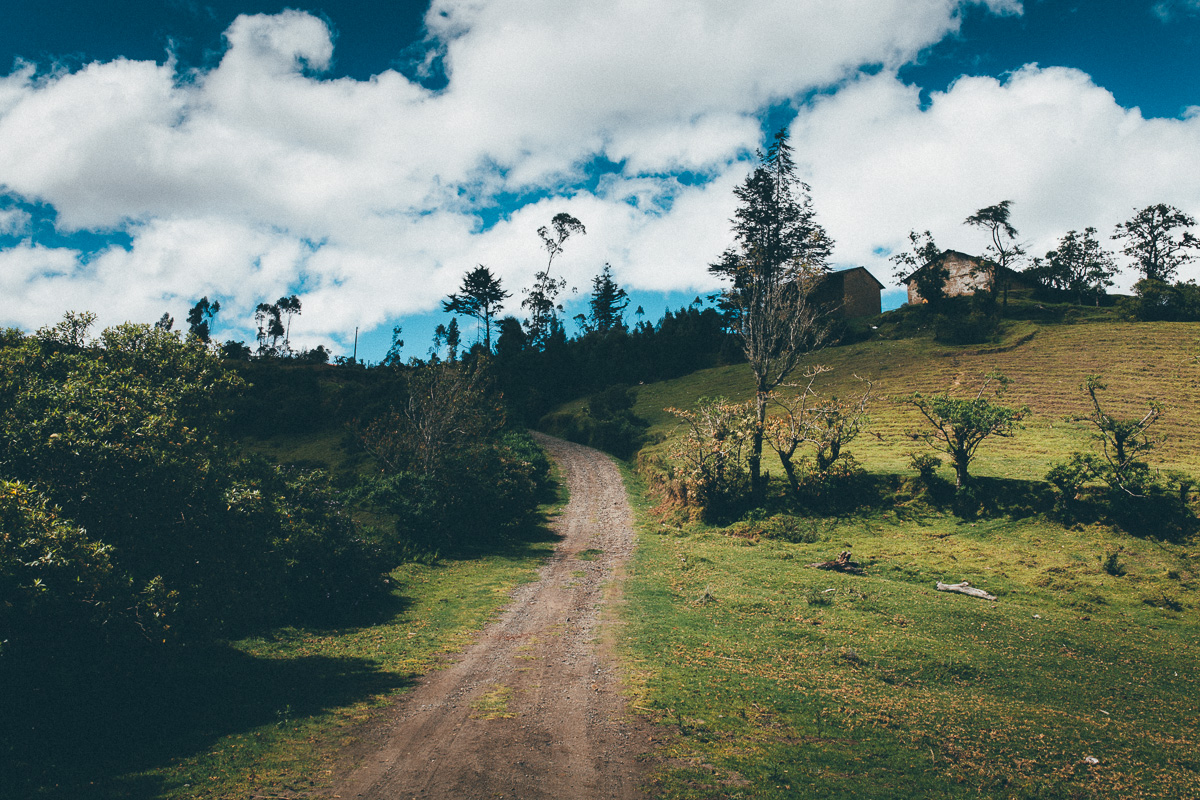
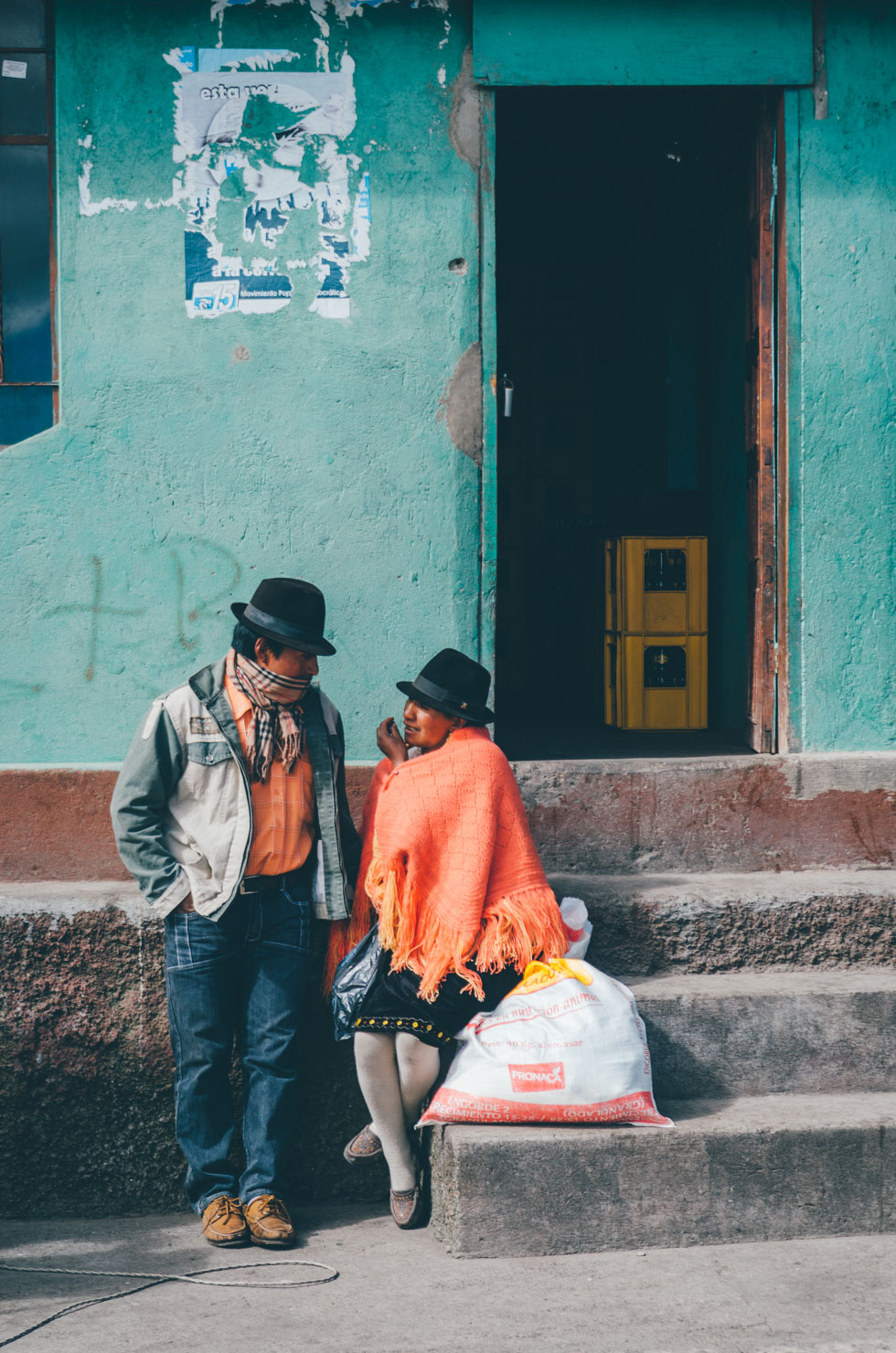
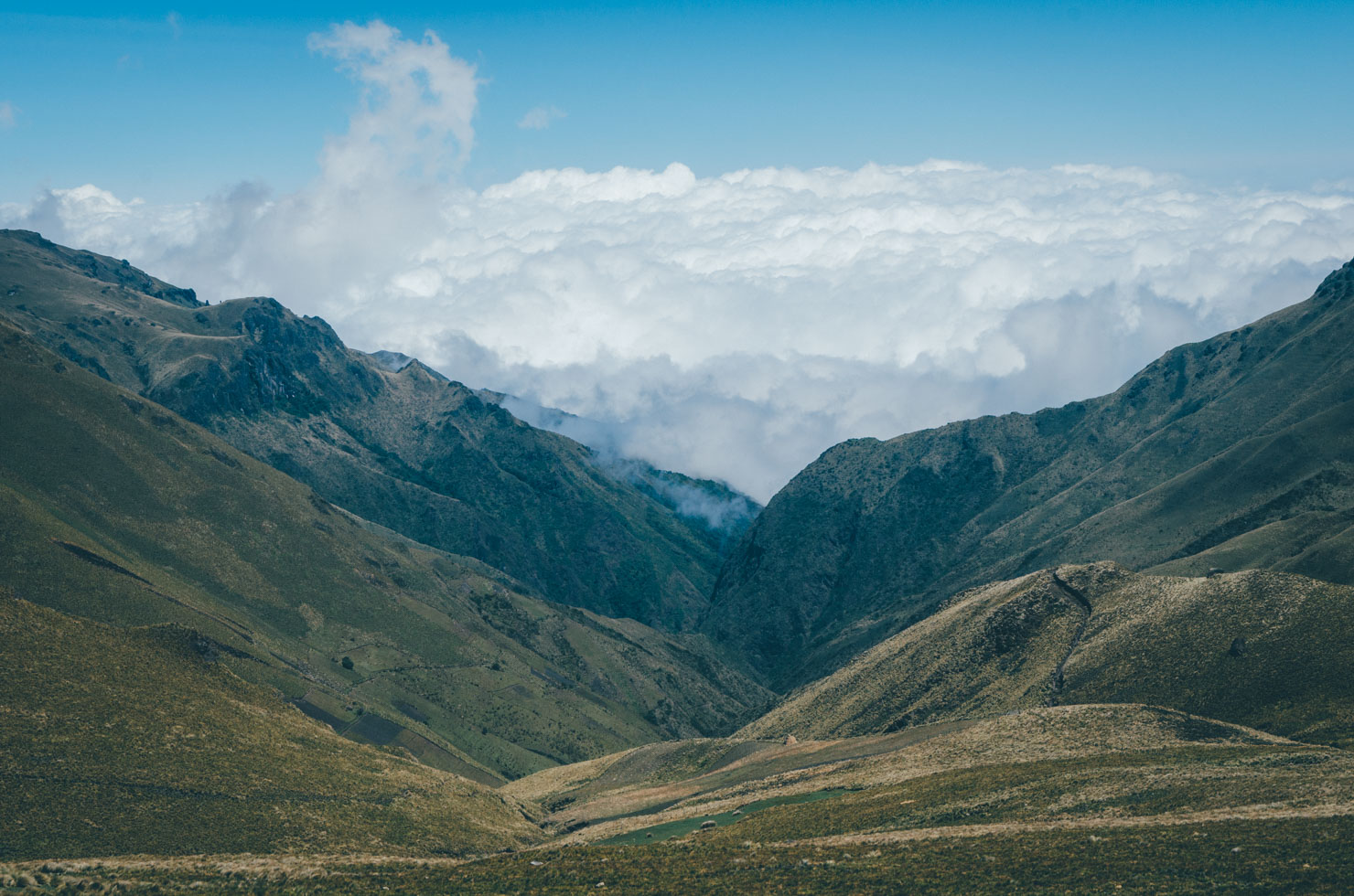
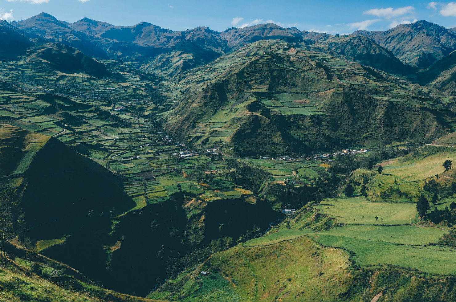
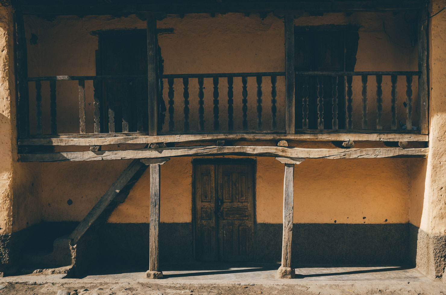
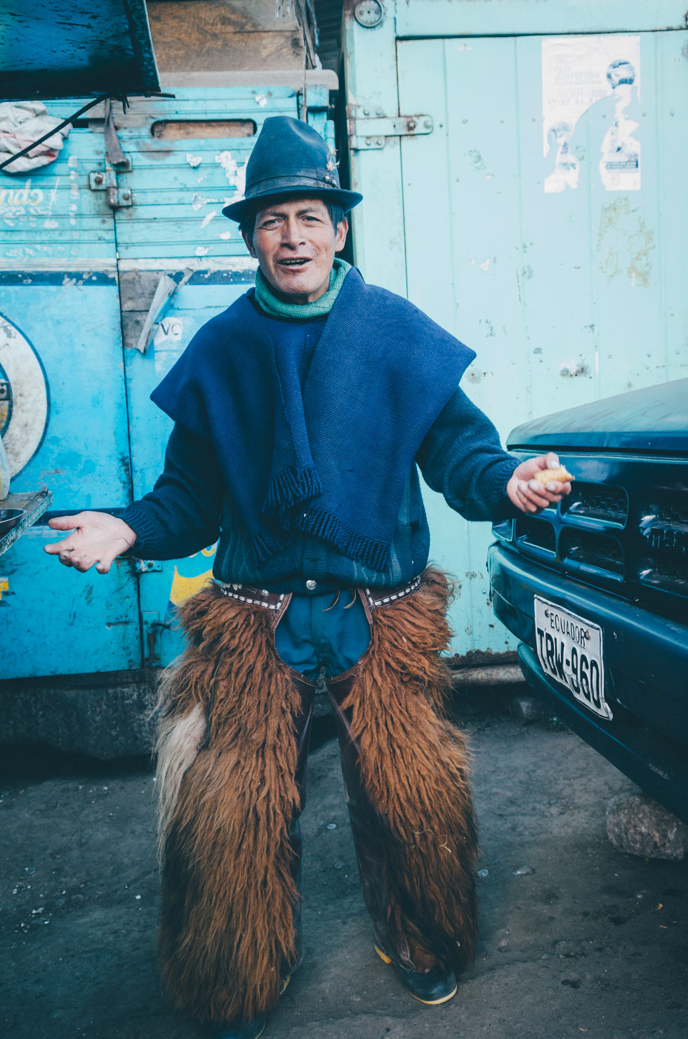
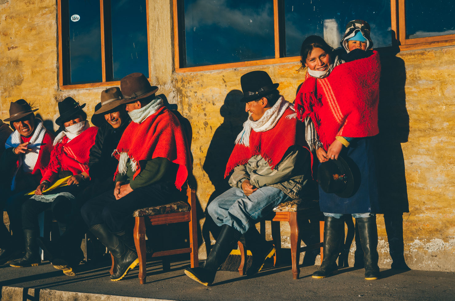
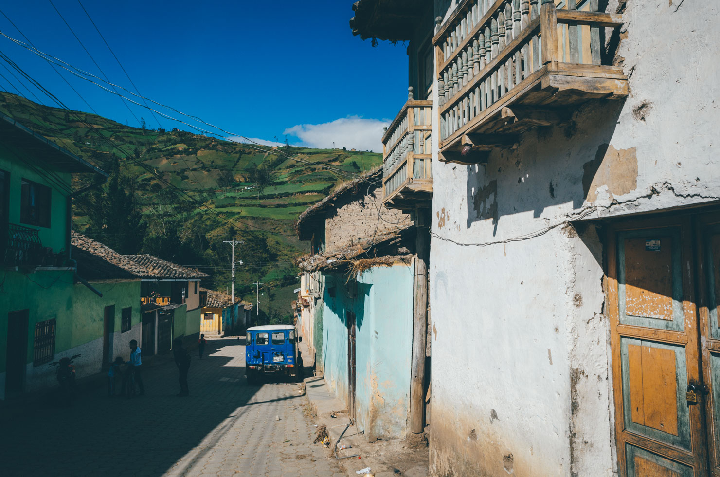
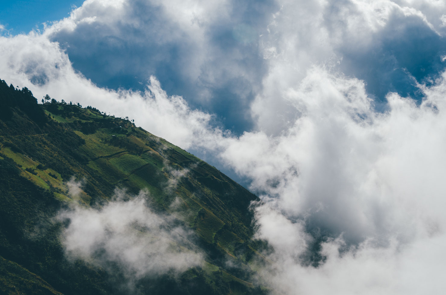
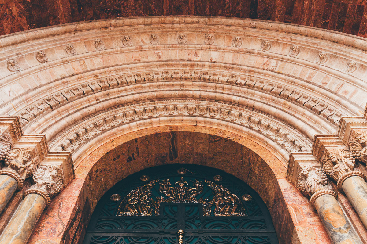
TEMBR Dirt is the mellower hermano to the unremittingly challenging TEMBR Singletrack. It strives to encourage bicycle tourists to escape the hectic traffic of the Panamerican Highway and delve deep into Ecuador’s backcountry, without missing some of the country’s classic sights. Staying high in the Andes for much of the time, it’s a showcase for Ecuador’s remarkable mountain diversity; patchwork fields in its rural settlements, the technicoloured hubub of its markets, its quiet and ethereal páramo, the beautiful colonial city of Cuenca, and of course, the majestic volcanic backdrop for which Ecuador is known. In tackling this route, it’s hoped riders will spend their time and money in small communities along the way, helping encourage low impact, positive tourism across these often overlooked regions.
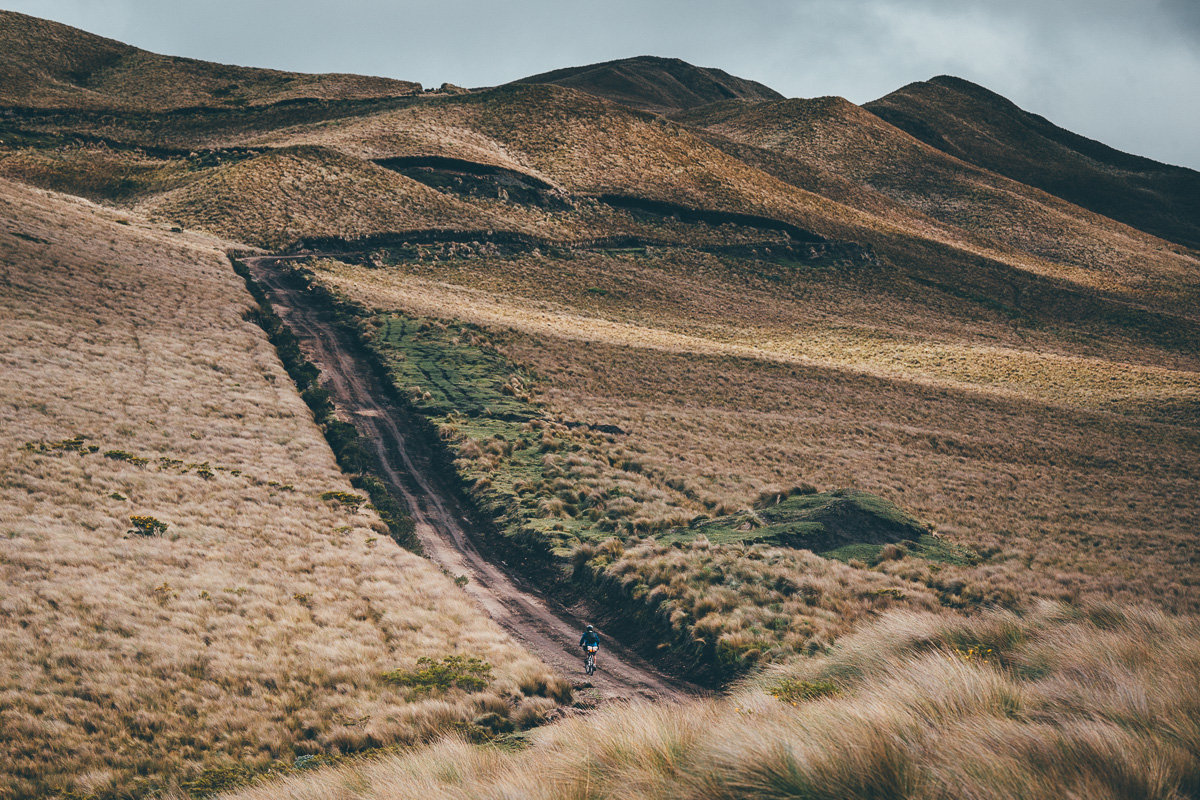
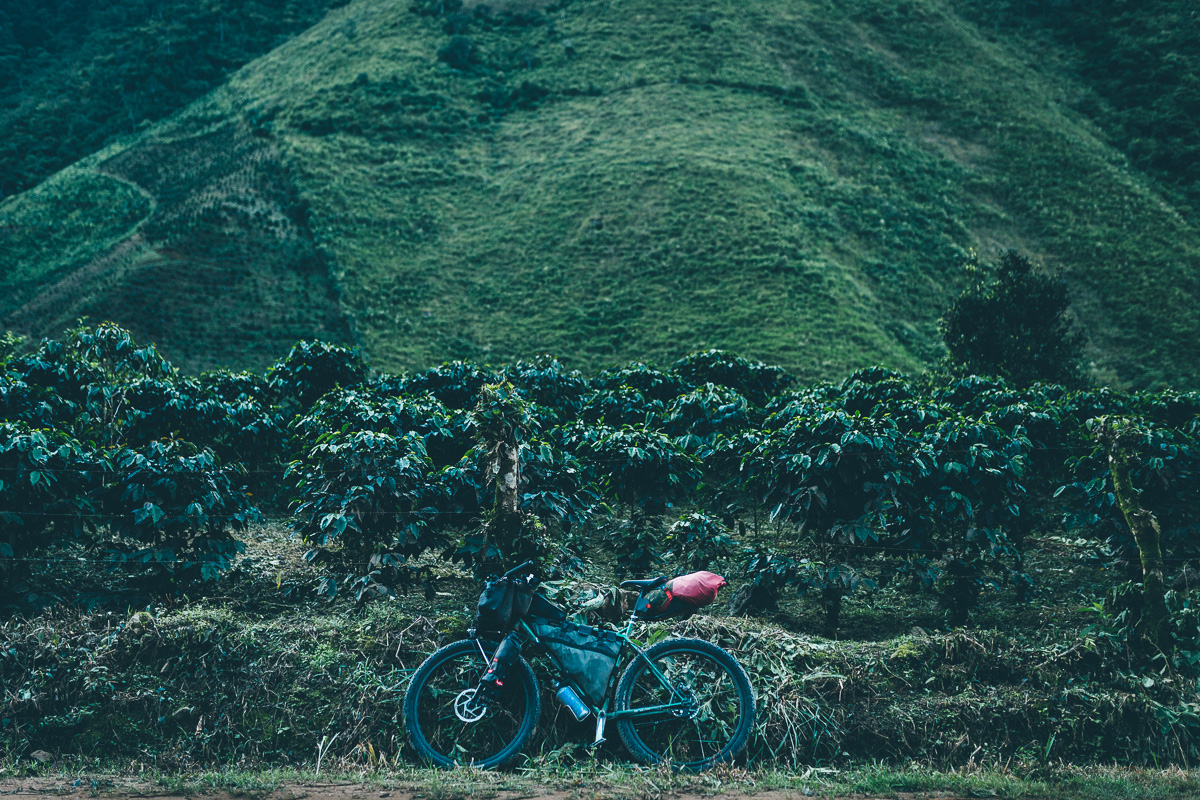
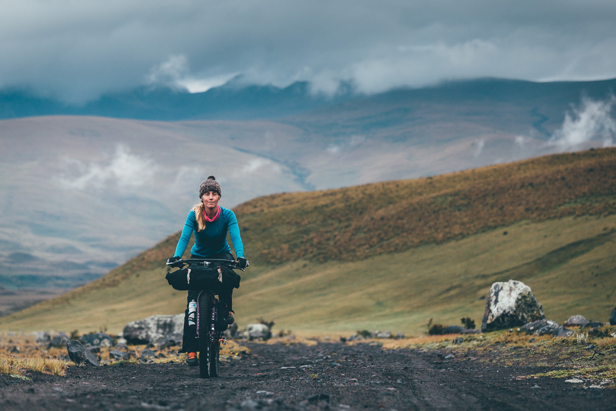
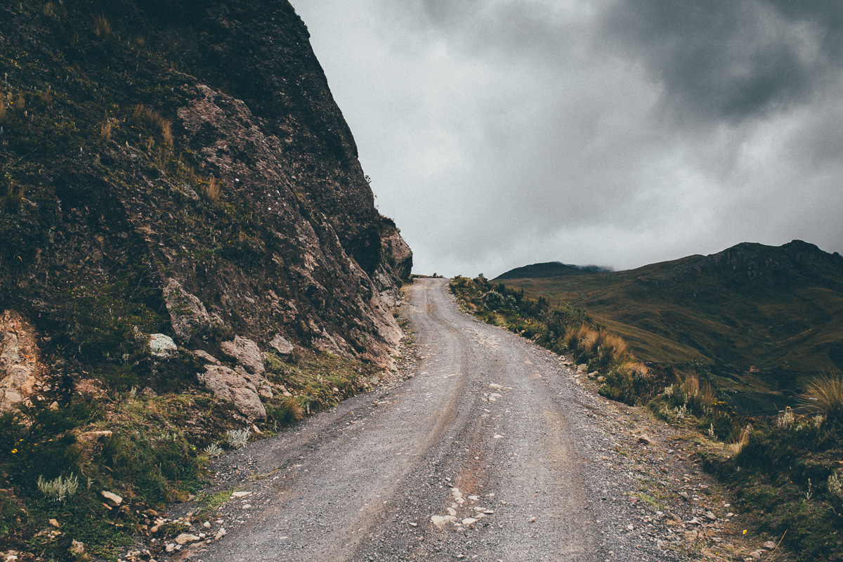
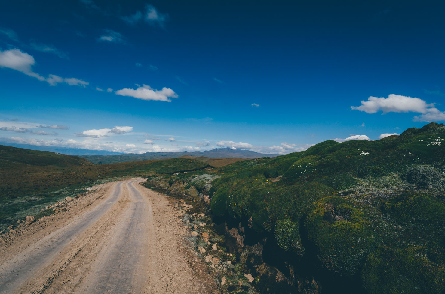
Unlike its hike-a-bike obsessed sibling, the TEMBR Dirt is almost completely rideable, bar the odd push and shove, depending on the vagaries of Ecuador’s tempestuous weather and its impact on road conditions – be sure to read the Difficulty Box Out for more details. Although the mid-fat (2.8 to 3in tire) platform suits the country especially well (and helps iron out its infamous cobbles), this is a ride that will appeal to anyone with a standard mountain bike, a relatively light load, a good level of fitness, and the desire to experience the Ecuadorian Andes. Still, as mellow as this ride may be compared to the Singletrack version, this is very much a ‘character building’ journey, with constantly changing and often challenging conditions… so bring along a stoic state of mind!
The crux of this route runs from the Colombian border to Cuenca – effectively, the country’s volcanic corridor. Cuenca also provides a wonderful finale and easy logistics for returning to Quito. But for those continuing their journeys southwards, the route also suggests an additional, predominantly low-traffic connection to Vilcamaba, near the Peruvian border. See Trail Notes for details.
Route Development
The Trans Ecuador Mountain Bike Route is a part of the greater Andes Traverse, an ongoing project to build a long distance route that runs along the spine of the Andes, between Colombia and Chile. Piecing this route together has been a collaborative effort. Enormous thanks are due to the Dammer Brothers for sharing their unparalleled knowledge of the country and to Nick Gault, for his extensive beta testing and feedback. TEMBR Dirt is still being fine-tuned and is subject to modifications. Thanks to the TEMBR Facebook group for valuable feedback. For the latest updates, be sure to download the gpx from Ride With GPS and take note of the many waypoints we’ve included. Please let us know if you run into any issues or inconsistencies. Thanks!
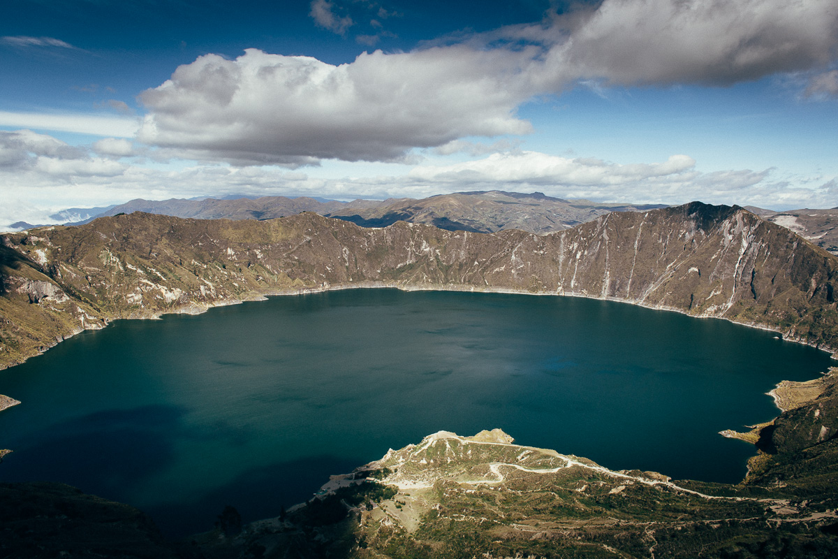
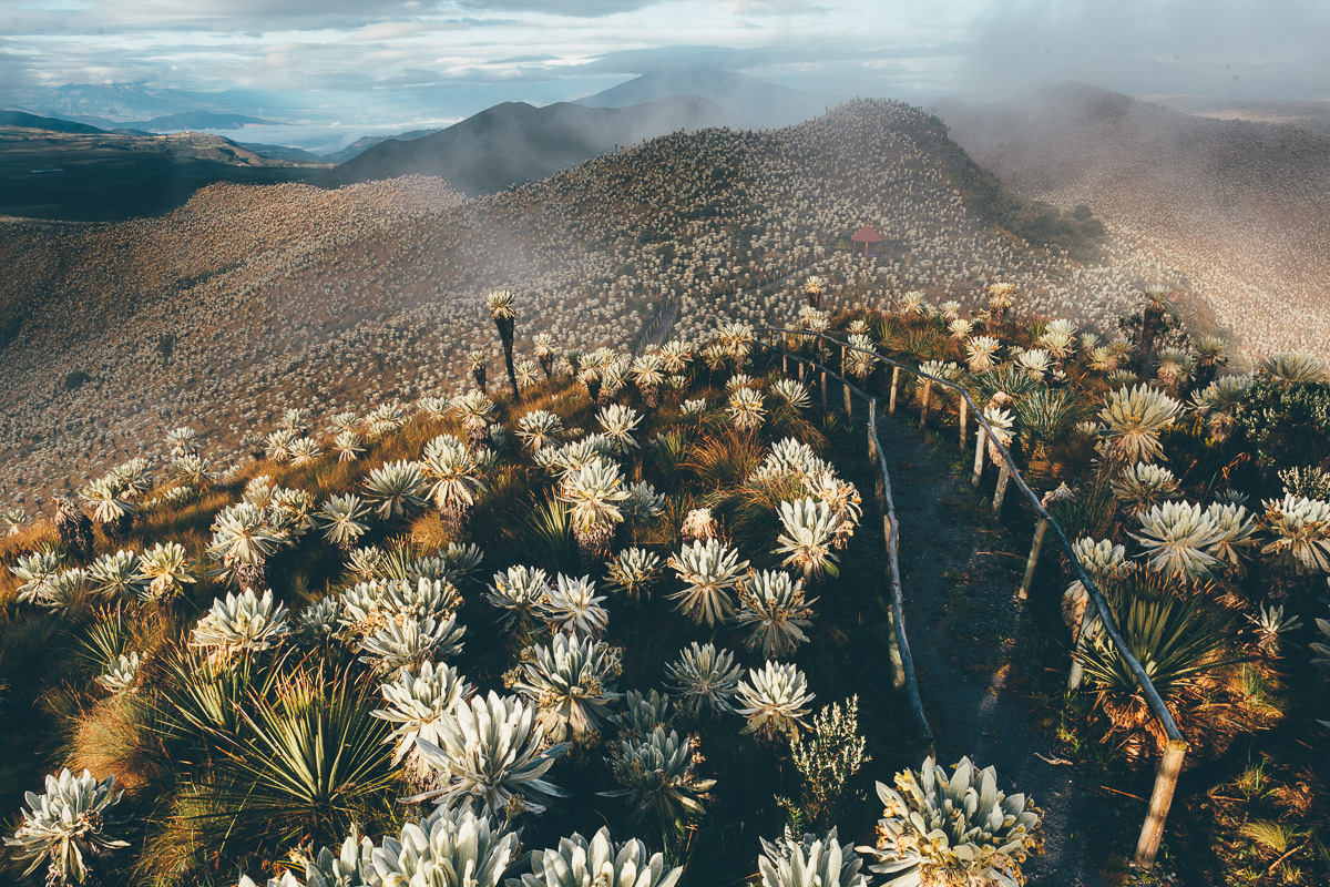
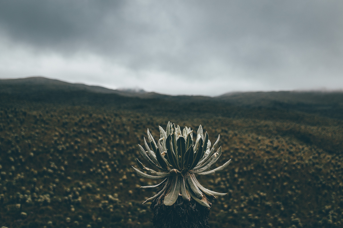
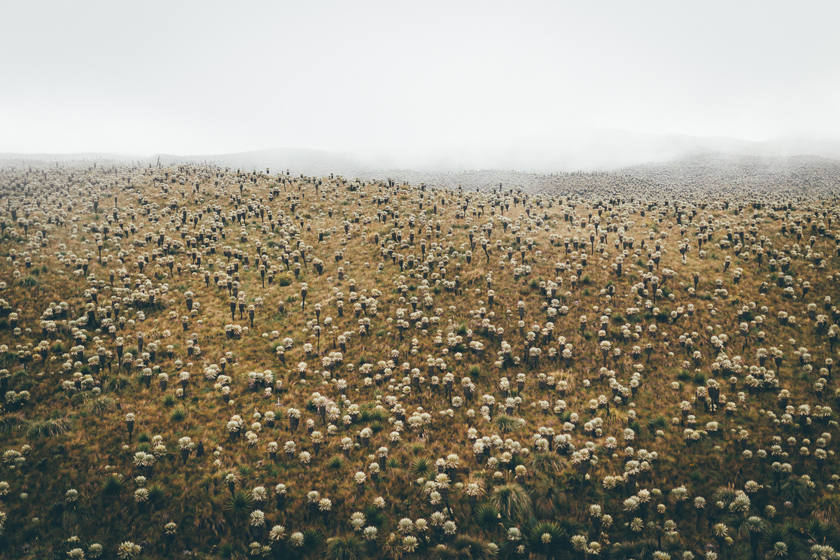
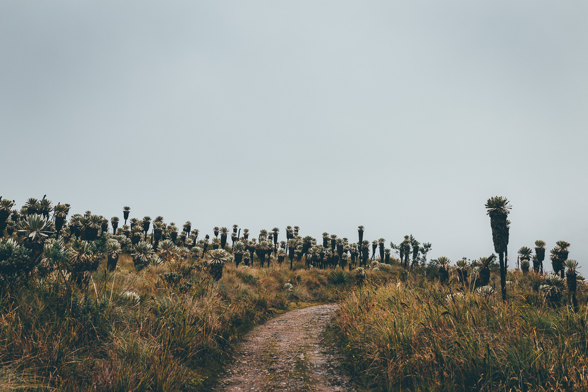
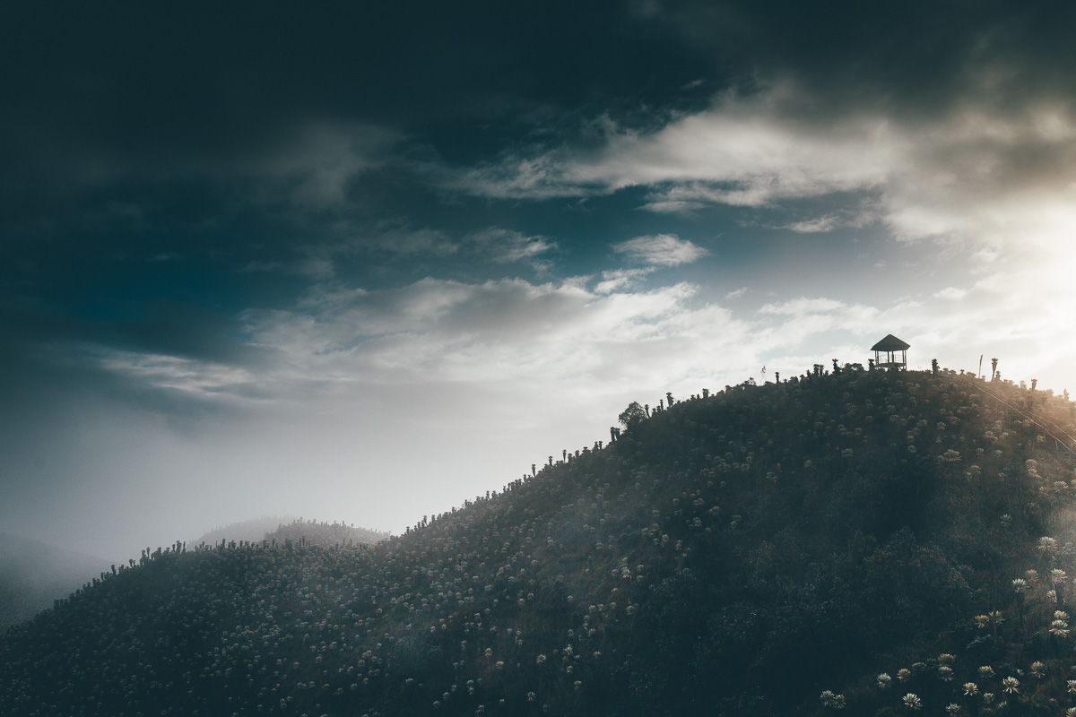
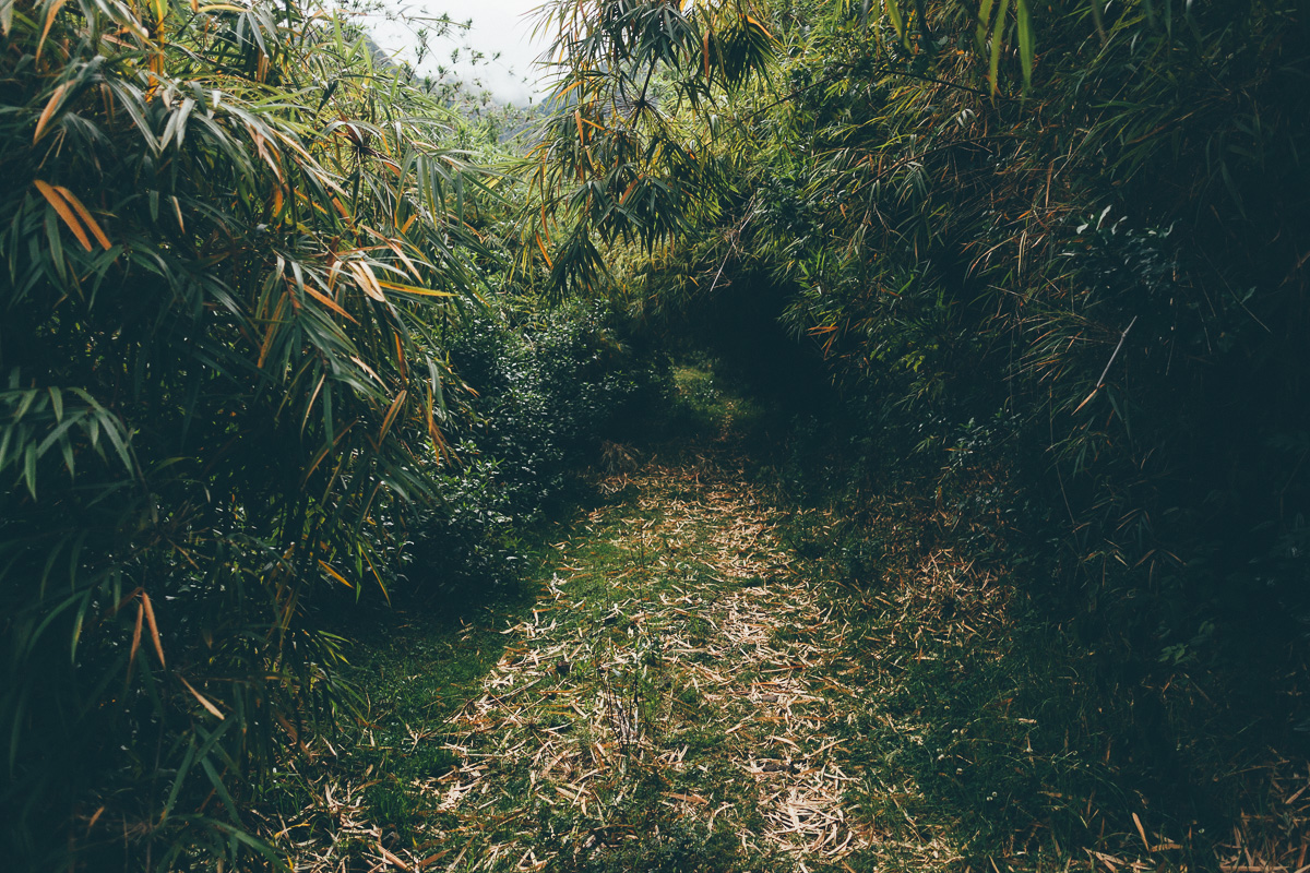
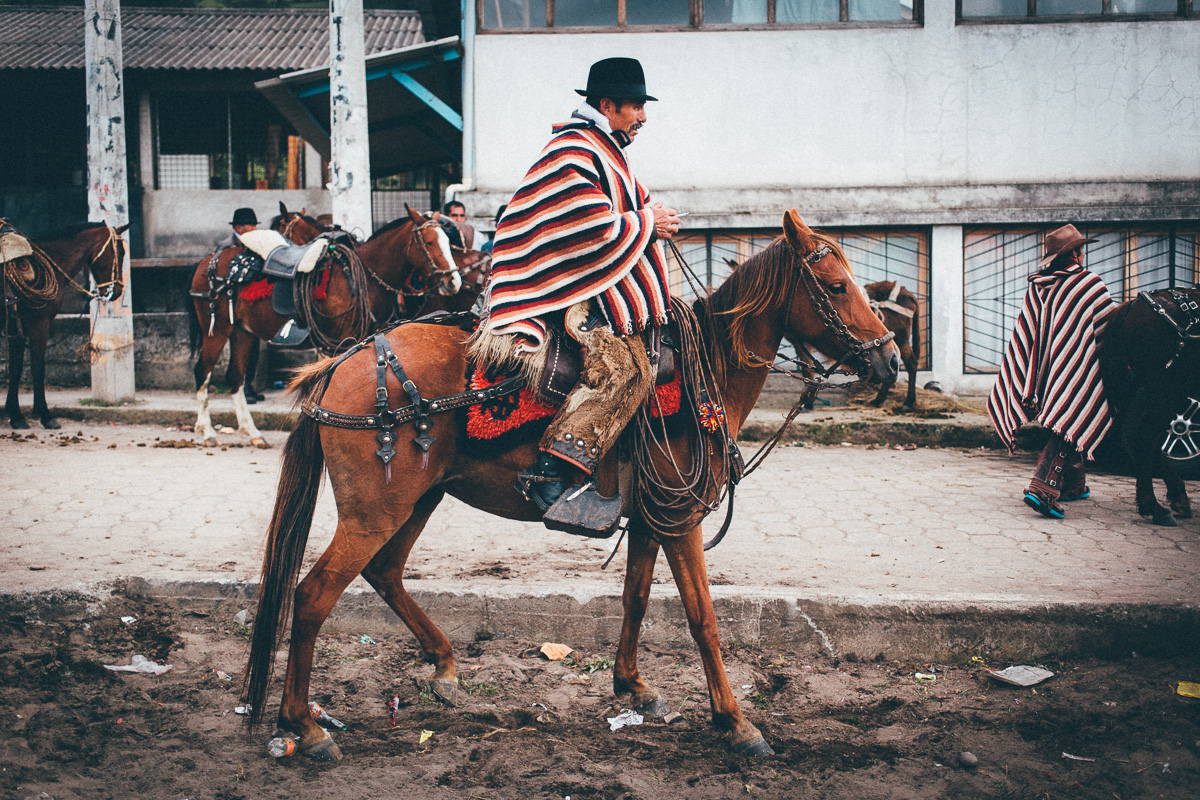
Reflecting Ecuador’s beauty and diversity, TEMBR strikes a balance between revealing remote backcountry riding and visiting points of touristic interest. As such, it opens with a fascinating meander through groves of otherworldly frailejon, by way of the El Angel Ecological Preserve, followed by a herculean climb to the equally beautiful páramo near Piñan – don’t miss it, it’s worth the effort! Descending back down to the Inter Andean Valley, R&R takes the form of a stopover in Otovalo, home to Ecuador’s biggest textile and handicraft market. A classic, Ecuador-style cobbled climb leads onwards to windswept Lago Mojanda, from where an unconventional dirt and sandy descent funnels riders to Guayllabamba, home to delicious the cherimoya fruit. From there, it’s a relatively flat stint (at last!) as the route picks up a bikepath along the old railway line to Tumbaco.
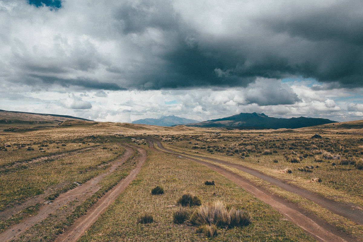
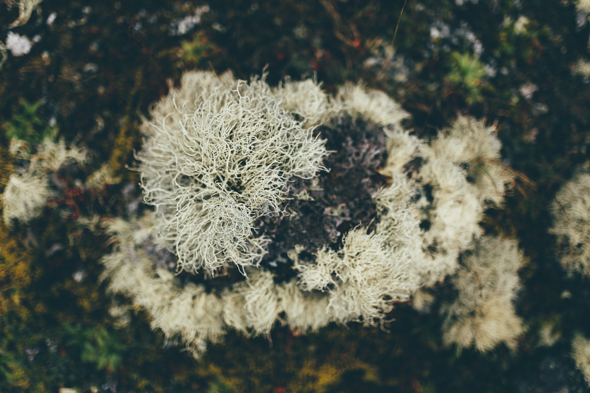
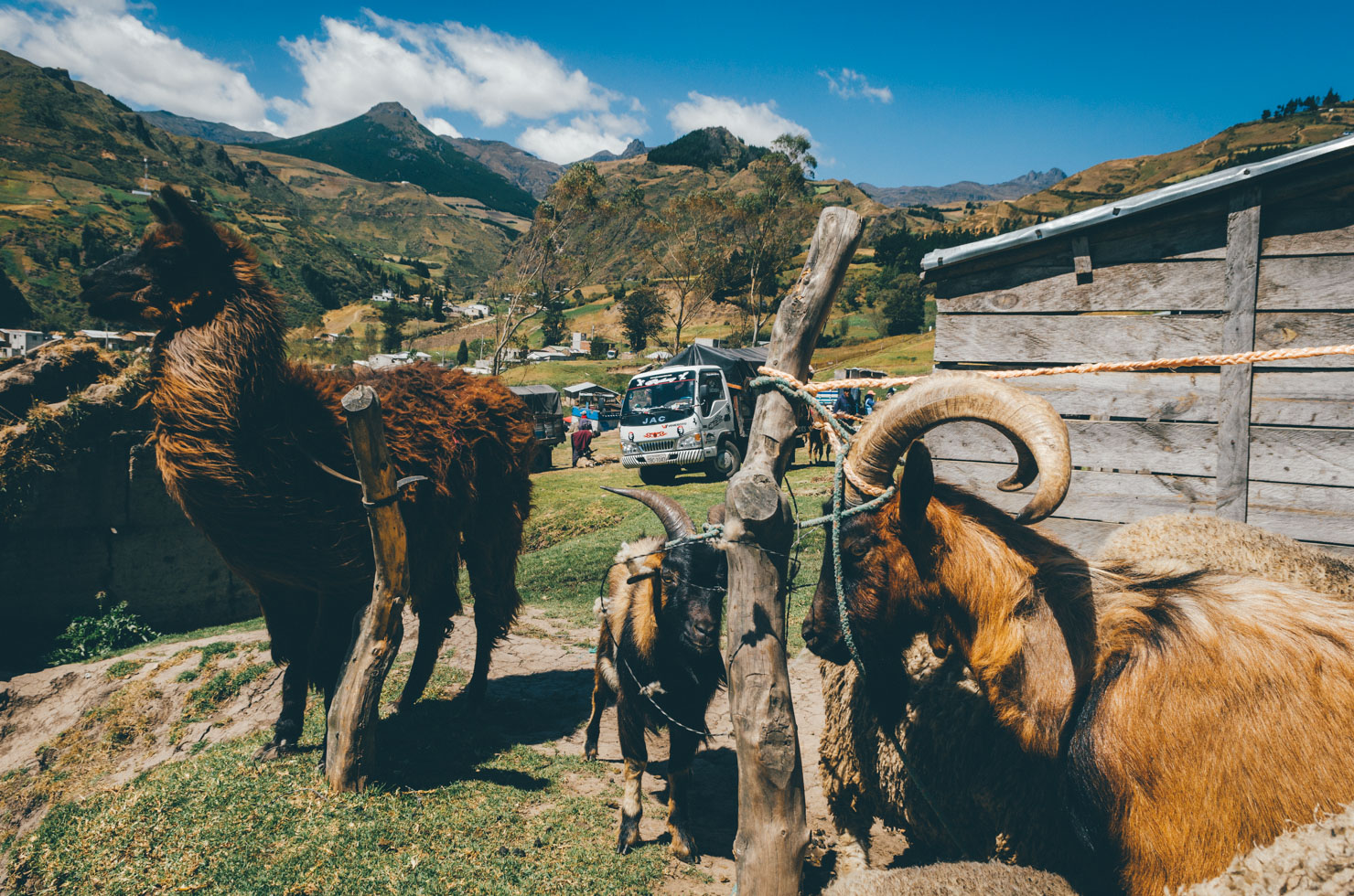
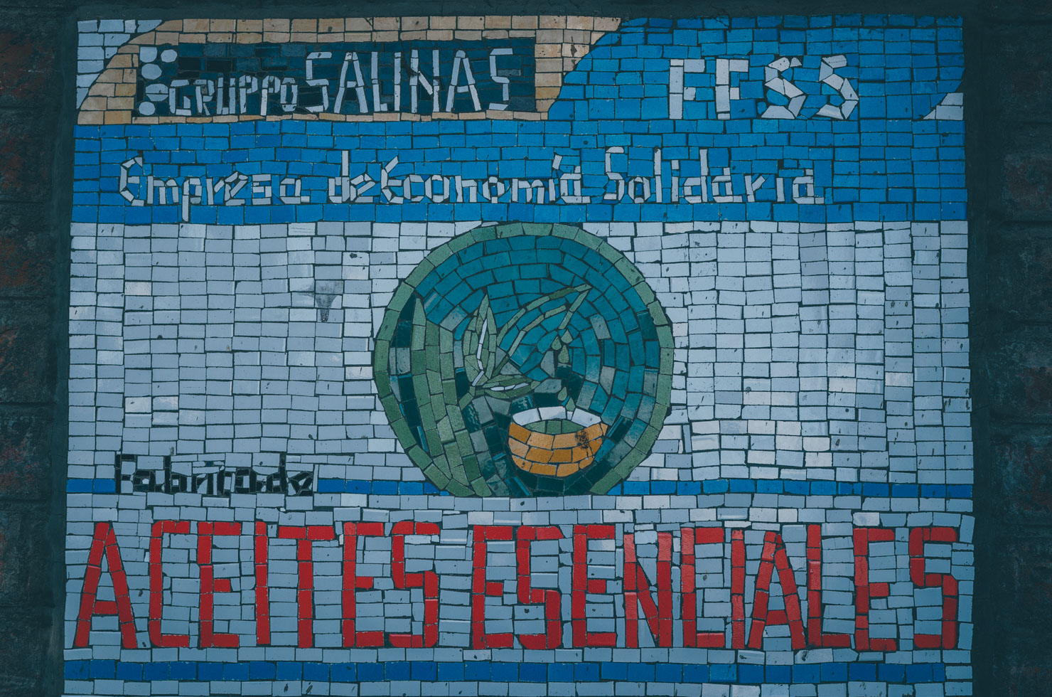
Onwards, a network of unpaved, sometimes grassy backroads sees riders gaining altitude once more in search of the perfectly conical Cotopaxi volcano, its National Park speckled with delicate, mossy flora, particular to Ecuador’s tundra. Striking into the fertile highlands around Quilotoa, the landscape here is completely different; steep-sided hills are home to shepherds herding sheep and llamas, as well as patchwork quilts of quinoa and potato fields, staples of the Quechuan diet. A popular backpacking destination, Quilatoa and its surrounding villages are home to a number of excellent choices in accommodation, details of which you’ll find on the GPX file. Beyond the rustic market town of Zumbahua, the riding becomes remote once again, en route to forlorn Angamarca and rugged Simiatug. Nearby Salinas de las Montanas is home to a thriving, grassroots tourism and local business infrastructure – amongst its many projects, this small settlement even boasts a chocolate factory.
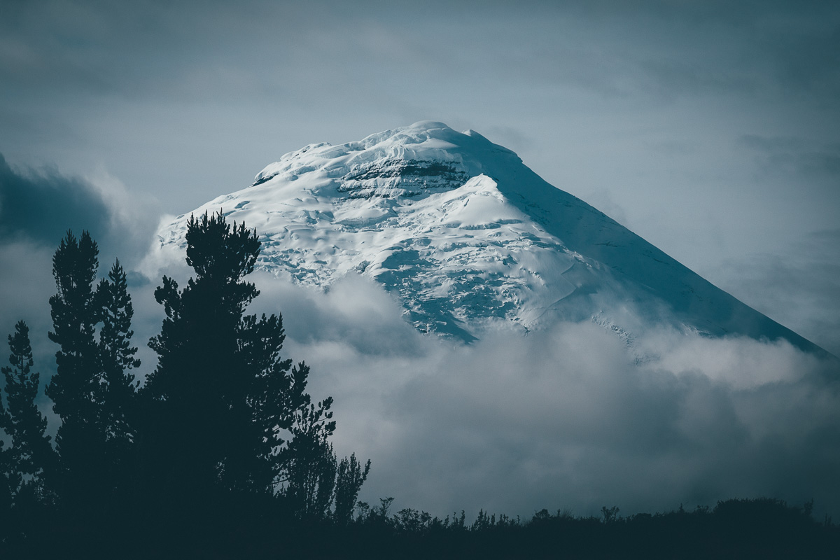
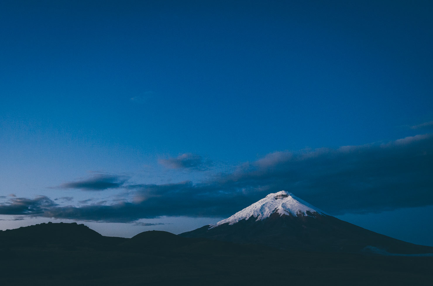
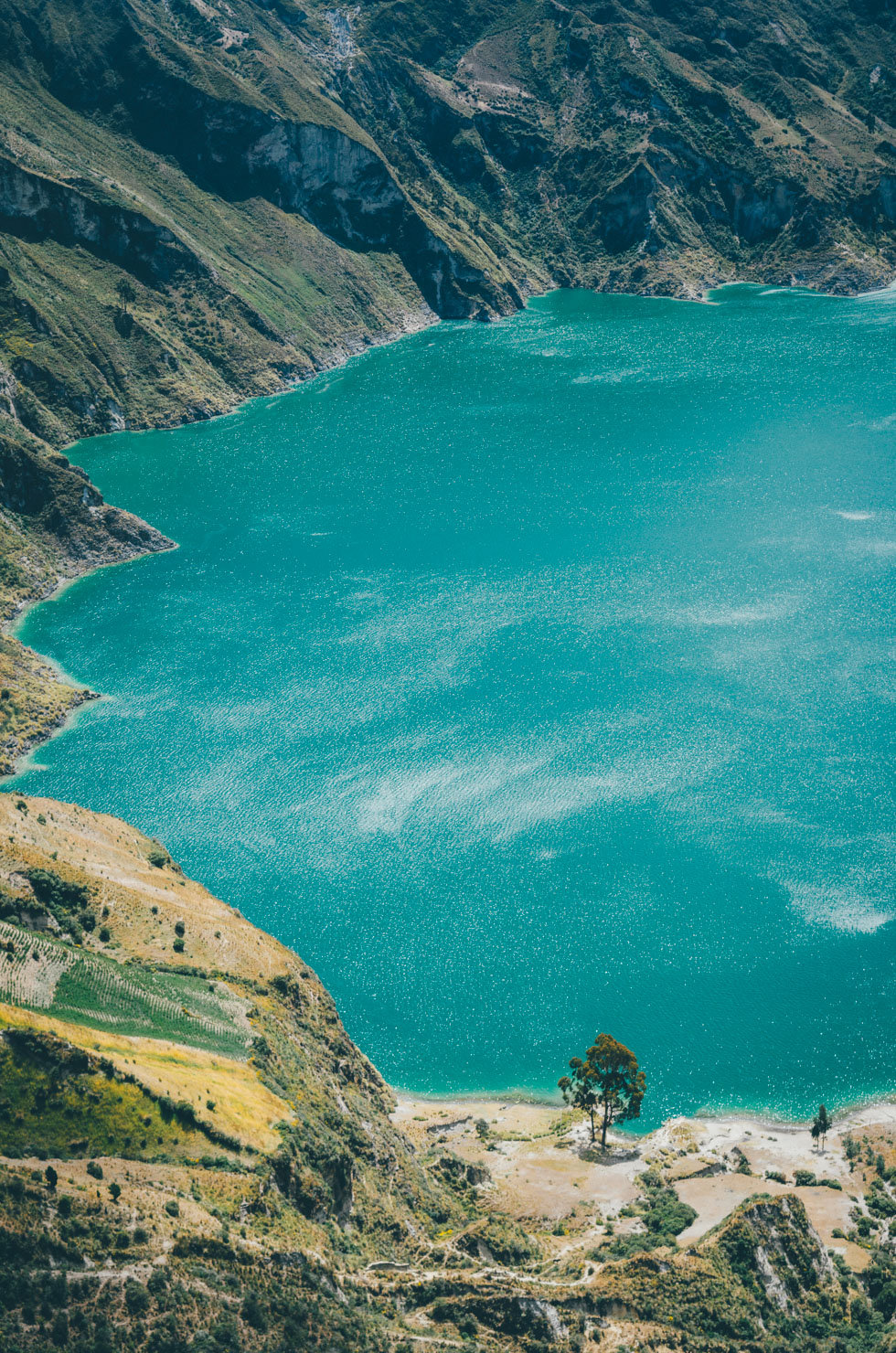
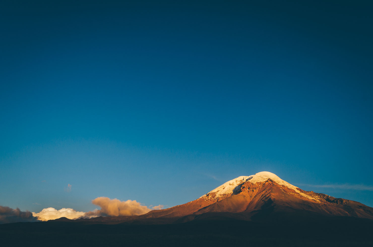
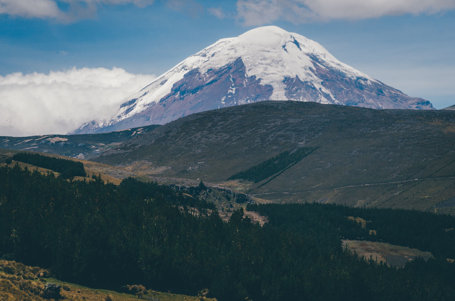
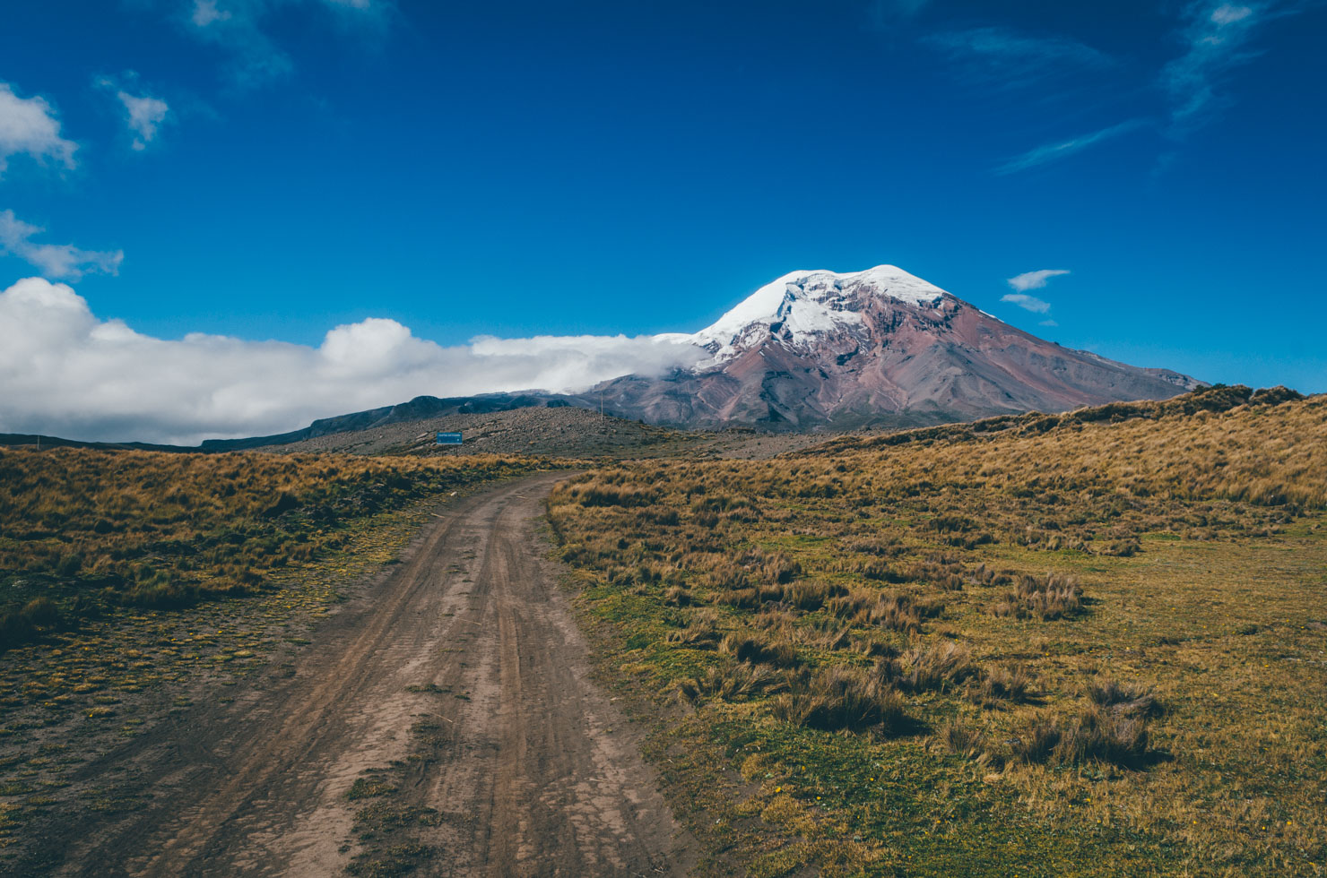
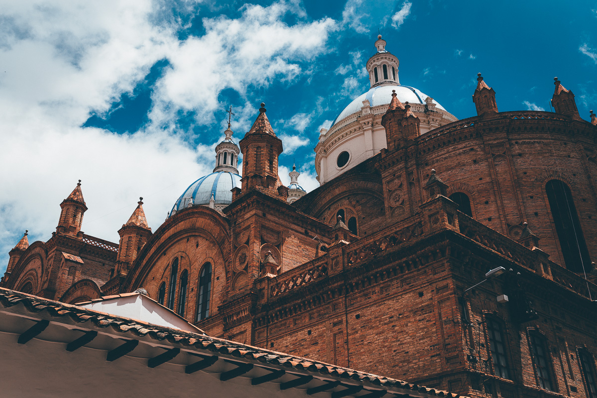
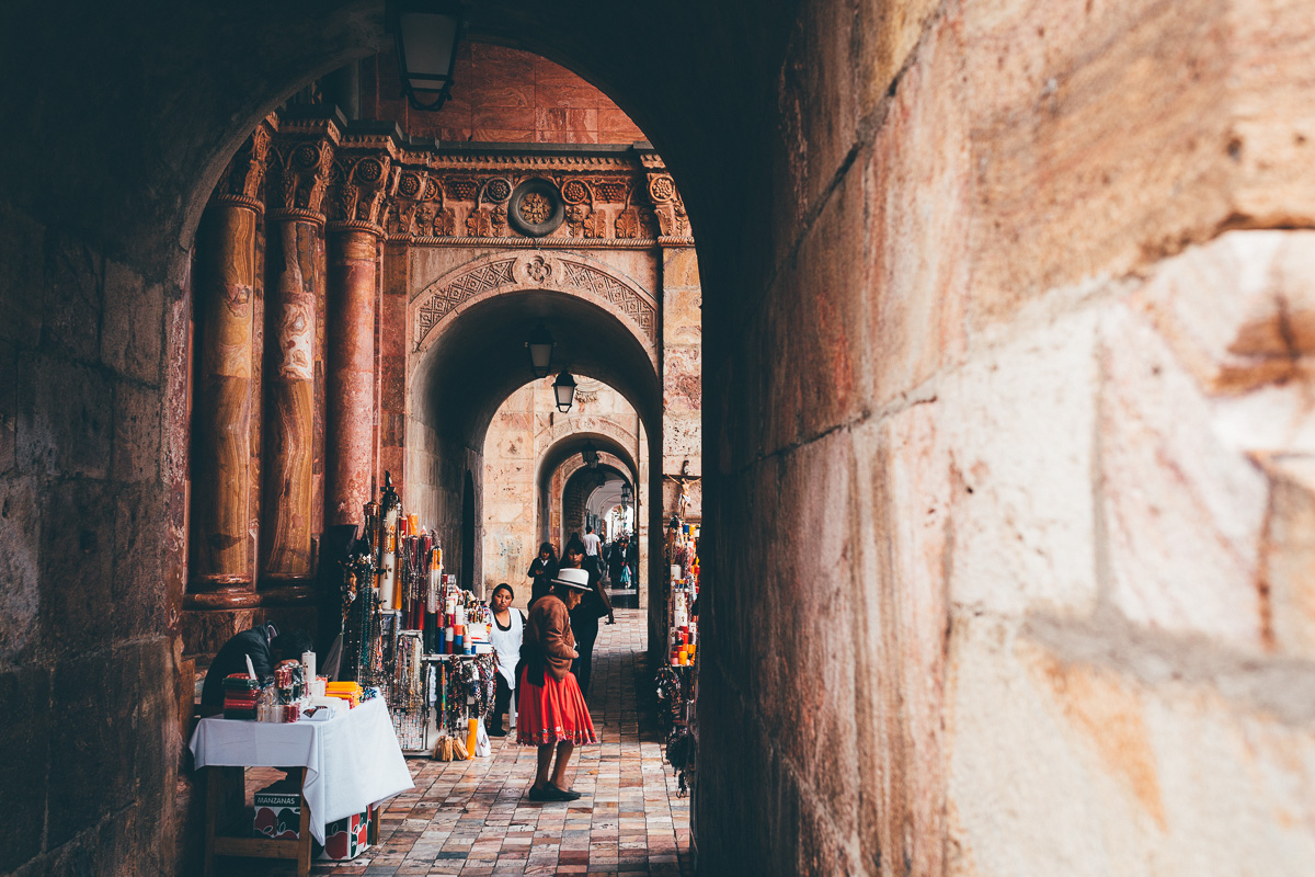
No visit to Ecuador would be complete without taking in the grandeur of Volcan Chimborazo – assuming the weather gods are on your side – connected via a series of paved and unpaved backroads to Guamote and its colourful Thursday market. Ahead lies the push to Cuenca, reached via Ecuador’s most noted Incan ruins, Ingapirca. Cuenca itself is the country’s most appealing city, where you’ll find a rich display of colonial architecture, as well as a strong artistic and musical vibe. For those headed onto Peru, Loja marks the last sizeable settlement before the border, from where dirt roads will lead you to Vilcabamba, a quirky town known for the longevity of its local inhabitants – and the North American and European expats who have now usurped the area.
TEMBR can be completed in its entirety, or section ridden. Public transportation between segments is easy, cheap and omnipresent – see Trail Notes for more details on how to break it down. Help is often at hand if you need a ride up one of the route’s many long climbs; a number of pickup trucks and local buses ply the highlands and will take you and your bike, generally at the cost of just a dollar or two. This means sections of the route can become a feasible undertaking for adventurous families too, the section around Quilotoa being an example. For a recent gallery of sections of the route and ride impressions, see here.
Should you prefer to crank up the challenge level, consider mixing up your own blend of TEMBR Dirt, TEMBR Singletrack, and Los Tres Volcanes, ideas for which also be be found in Trail Notes.
Just be warned. Ecuador is an extremely rugged country, rippled with arduous climbs. When locals tell you the road ahead is plano – flat – they are talking ‘Ecuadorian flat’. Altitudes along the whole of TEMBR fluctuate wildly, from the hot and steamy lowlands, where coffee and sugar cane grow in abundance, to extended stretches at 4000m and more. Embrace the climbs, savour the dirt, ready yourself for Ecuador’s mixed weather… and enjoy!
For up to date info and rider feedback, check out the TEMBR Facebook Group.

Difficulty
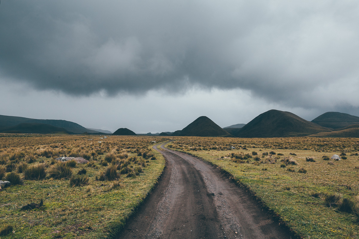
Ecuador being Ecuador, TEMBR Dirt is a very challenging undertaking: you’ll need grit, determination, acclimatised lungs, and mountain legs to complete it successfully. Although there’s no technical singletrack or hike-a-bikes to contend with, we’ve awarded this route a solid 8 in difficulty due to its prolonged climbs, extended stints at high elevation, cobbled surfaces, linguistic hurdles, and its overall length. Grades can be steep and terrain very mixed. Even during the dry season, weather can be extremely variable; during the rainy season, conditions can become particularly challenging in places. Check out the elevation profile below to see what you’re letting yourself in for and pack light. Lastly, use this route as a guide – during the rainy season, you may well need to detour around smaller, unsurfaced tracks and resort to more paved backroads.


Submit Route Alert
As the leading creator and publisher of bikepacking routes, BIKEPACKING.com endeavors to maintain, improve, and advocate for our growing network of bikepacking routes all over the world. As such, our editorial team, route creators, and Route Stewards serve as mediators for route improvements and opportunities for connectivity, conservation, and community growth around these routes. To facilitate these efforts, we rely on our Bikepacking Collective and the greater bikepacking community to call attention to critical issues and opportunities that are discovered while riding these routes. If you have a vital issue or opportunity regarding this route that pertains to one of the subjects below, please let us know:
Highlights
Must Know
Camping
Food/H2O
Trail Notes
Resources
- Discovering the real Ecuadorian backcountry, away from the motorized frenzy of the Panamerican Highway.
- Experiencing the vibrancy – and culinary delicacies – of Ecuador’s market towns.
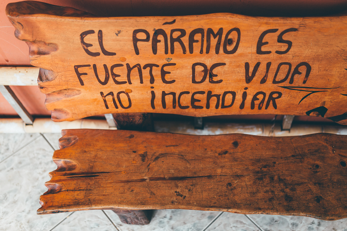
- Meandering across the beautiful, enigmatic páramo, Ecuador’s high altitude, treeless tundra.
- Sleeping in a community owned ‘choza’, the traditional huts that dot the country’s highlands, if you’re lucky enough to come across one.
- Riding through Cotopaxi National Park and around Chimborazo – the latter’s peak marks the closest point to the sun.
- Treating yourself to comfortable, eco-friendly accommodation in Isinlivi, on the Quilatoa Loop.
- Getting fit – with the amount of climbing on this ride, you have no choice!
- Mid-June to mid-September is the high season in the Ecuadorian Andes. By Ecuadorian standards, this is the driest time of the year and the recommended time to ride this route. Outside of this, be prepared for extended bouts of heavy rain, which will affect road/trail conditions, and in some cases, where you can ride. If you’re fortunate, mornings will be clear and afternoons wet in the rainy season, but consecutive rainy days are likely too. Traditionally, there is often a ‘mini dry season’ at some point within the months of December and January, but it can’t always be relied upon as much as the months of June-Sept, so the weather can still be very mixed. Hour to hour temperatures can be extremely variable, depending on altitude and weather, though being the sub tropical highlands, they don’t change much throughout the year. It’s rare to experience temperatutes much below freezing; a 0 to -5c bag is generally sufficient with wear extras layers if needed, as ambient dampness can make nighttimes feel cooler than they are. Our advice? Stick to the dry season if you can… and if you can’t, bring good quality waterproofs and a positive attitude!
- Always expect mixed weather in the highlands, whatever the season. Be prepared for persistent rain at times, and/or four seasons in one day. Bring a quality, reliable waterproof jacket (rather than the kind that pack down tiny but wet out quickly).
- For the same reason, waterproof footware or shoes that dry out quickly are recommended.
- Mosquitos aren’t a problem along the route, outside of occasional low lying areas. Bring a little repellent if you’re concerned. Aside from occasional black flies and horse flies, TEMBR is mostly bug free.
- The sun is especially powerful at high altitude and over the equator, even under cloud cover; bring strong sunscream.
- This is a high altitude route, so allow time to acclimatise first. Never rush into high mountain rides.
- Getting there: TEMBR isn’t routed through Ecuador’s capital, Quito. If you’re arriving at Quito Mariscal Sucre (the international airport), you can ride/catch a taxi from the airport to the nearby town of Pifo. From there, catch a direct bus to the start point at Tulcan ($6, 5 hours, Expreso Tulcan). If this doesn’t connect, Cita Express runs an hourly bus to the larger terminal at Ibarra (2 hours 2o), from where there are many buses headed to the border, as well as accomodation options in town. If you want to decompress for a couple of days, which we’d recommend, consider catching a taxi to the city of Tumbaco and heading out from there; Tumbaco is an easy place to resupply, draw out cash, and get your bearings.
- A general note on buses. Most have room for a bike or two in the trunk, depending on the bus, wheels may need to be removed and an extra charge may be levied, which is sometimes the value of the ticket. Although buses can often be hailed down from the roadside, it’s often to find one that starts in a particular town, so there’s time/room to fit the bike.
- Quito is probably best visited by bus as a side trip from Tumbaco; on Sundays, much of the center is car free between 8am and 2pm, making it a great time to explore the neighbourhoods.
- High quality topographic maps can be obtained in Quito but following this gpx with a general country map (eg ITMB or Reise Know How) is all you’ll need. An ideal navigation solution compromises of an app (eg Gaia GPS or Mapout) on your smartphone and/or a GPS for the handlebars for inclement weather. Make sure your smartphone is stored in a watertight sleeve. There are charging opportunities en route but bring a cache battery too.
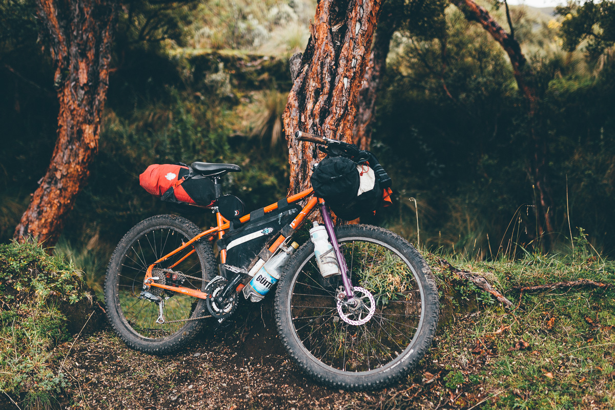
- Best Bike: Ecuador is well suited to ‘plus’ bikes, given the cobbled backroads and the sometimes swampy nature of the páramo. Otherwise, we a minimum of 29×2.25in tires, ideally with front suspension. Lightly laden, fully rigid touring bikes with panniers will be fine too, but the wider tyres you can fit, the better. More than tyre choice and the panniers v bikepacking debate, the main recommendation is to pack as light as you can. For the most part, TEMBR is definitely not a route that lends itself well to a gravel or cyclocross bike.
- Safety: The Ecuadorian mountains are generally a very safe and hospitable place to travel. But incidents do happen. Don’t flash your money around and be careful and low key with your valuables, especially cameras and phones.
- Bike security: After a few recent bike thefts along the route, we are strongly recommending riders lock their bicycles at night, to other bikes in the group and to their tents, or keep them inside their hotel rooms. Where possible, seek a camping spot out of view of roads and be discreet, to help avoid any issues.
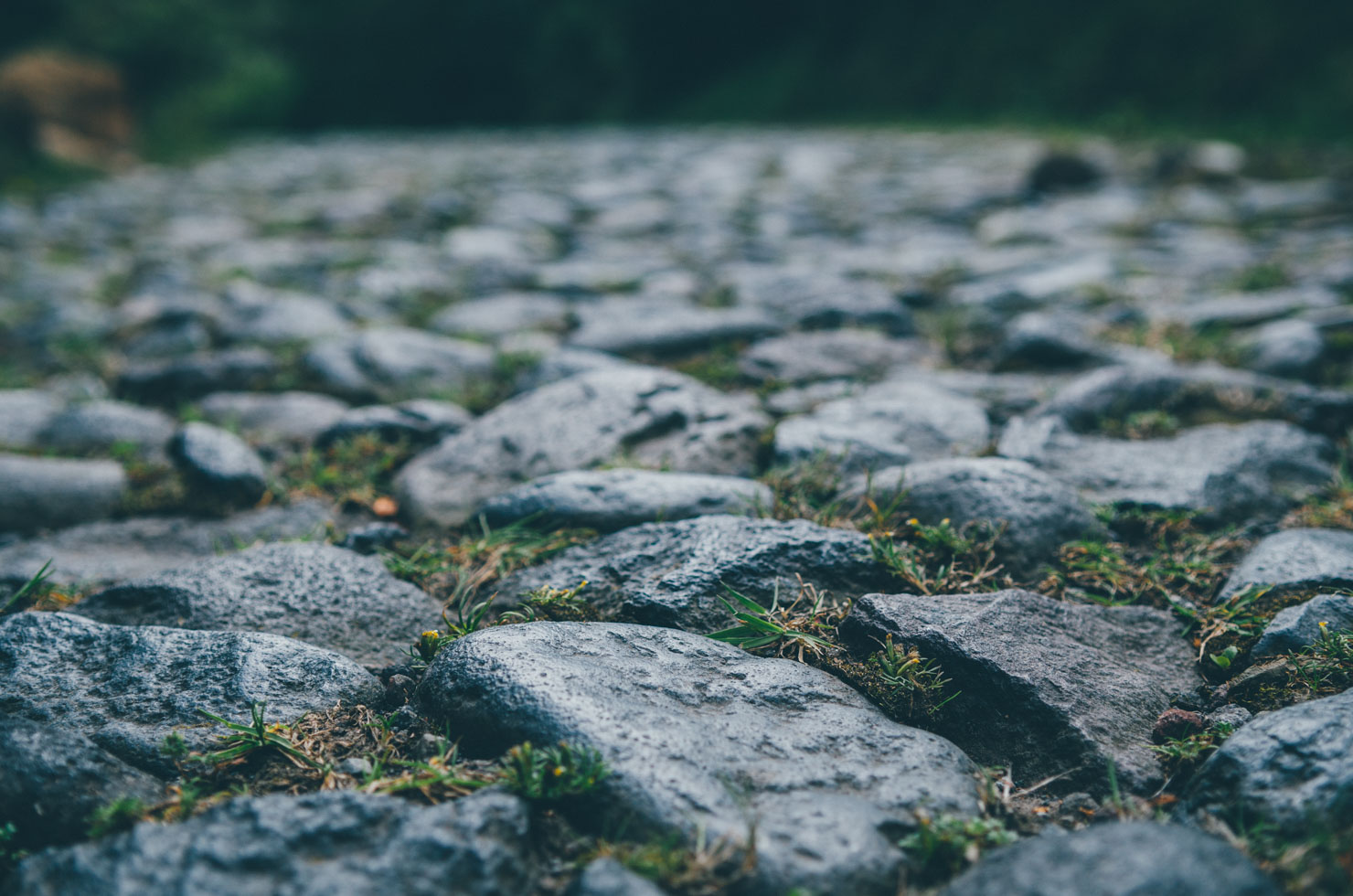
- Cobbles 101: Like the Paris Roubaix? You’ll love Ecuador! There are several extended sections of cobbles along the route. Best advice for taming them on a rigid bike? Fit the largest tyres you can, avoid running your tyre pressure too high (tubeless setups works best), and pack lightly and ride carefully so you don’t ding your rims. If the cobbles are messing with your head, take a moment to reflect on how historic they are, the hard work that’s been required to set each one by hand… and how much more beautiful they are than a coat of intoxicating asphalt!
- There are high-end bike shops in Ibarra (off route), Quito (off route), Tumbaco (on route), Riobamba (off route), Cuenca (on route) and Loja (on route). Euadorian shops stock, or should be able to order, all the latest gear, 29in, 27.5in, and even 27.5+ tire sizes, and sometimes full fat too.
- With its strong tradition in climbing, Ecuador is well stocked with quality camping gear. The Ecuadorian chain Tatoo has an REI-like selection of high-end gear – they have stores in Cuenca and Quito. Pressurised cannister bottles are available in big cities. Denatured alcohol is easier to find in smaller locales.
- Local SIM cards can be purchased almost everywhere (Claro is one of the largest providers), though you may need an Ecuadorian to vouch for you, as a National Identification is required (rather than a passport). Otherwise, wifi is widely available.
- Most large towns have ATMs – but carry extra cash in case any don’t work, to tide you through to each segment of the ride and even beyond. Note that there’s no ATM between the Panamerican Highway (Lasso) and Guaranda (eg no ATM in Sigchos and Salinas). Generally speaking, carry enough cash to tide you through each main segment (see Trail Notes), with some spare cash for emergencies in case an ATM isn’t working.
- Plugs are US-style two prongs.
- A grasp of Spanish will certainly come in useful in the backcountry. A few words of Quechua will be especially welcome by indigenous locals.
- The route passes through isolated areas, some of which can be communally owned. Whenever you encounter anyone, please ask for permission to ride, by saying “Preste pasito, por favor”. Where necessary, be sure to reassure anyone you meet that you will close all gates behind you (“Yo cierro las puertas”).
- South America’s village dogs are very vocal… expect to be chased!
- Every town has affordable accommodation. Expect to pay as little as $5 per person and upwards, or $25 for two, for somewhere a bit nicer. A few recommended options are marked as POIs on the Ride With GPS page.
- There’s no shortage of camping spots, abandoned buildings, and chozas (traditional straw shelters) along this route. Generally speaking, the Ecuadorian Andes is a safe place through which travel, with few safety concerns outside Quito. However, be discreet and always aim to camp out of eyeshot of any road. If you end up close to a community, football pitches or churches are often good options. Due to some opportunistic theft in recent years, lock your bikes to be on the safe side.
- If you spot an empty choza – the community-owned, traditional straw huts used by shepherds – make yourself at home, but be sure to leave it in a better state than you found it. If there are any locals around, it’s always polite to check in with them first.
- Streams and rivers abound. To save weight, a couple of water bottles is generally all you’ll need to carry in the highlands of Ecuador, plus a means to purify anything you find en route. Water filters that work quickly, like Steripens or Sawyers, are great for this.
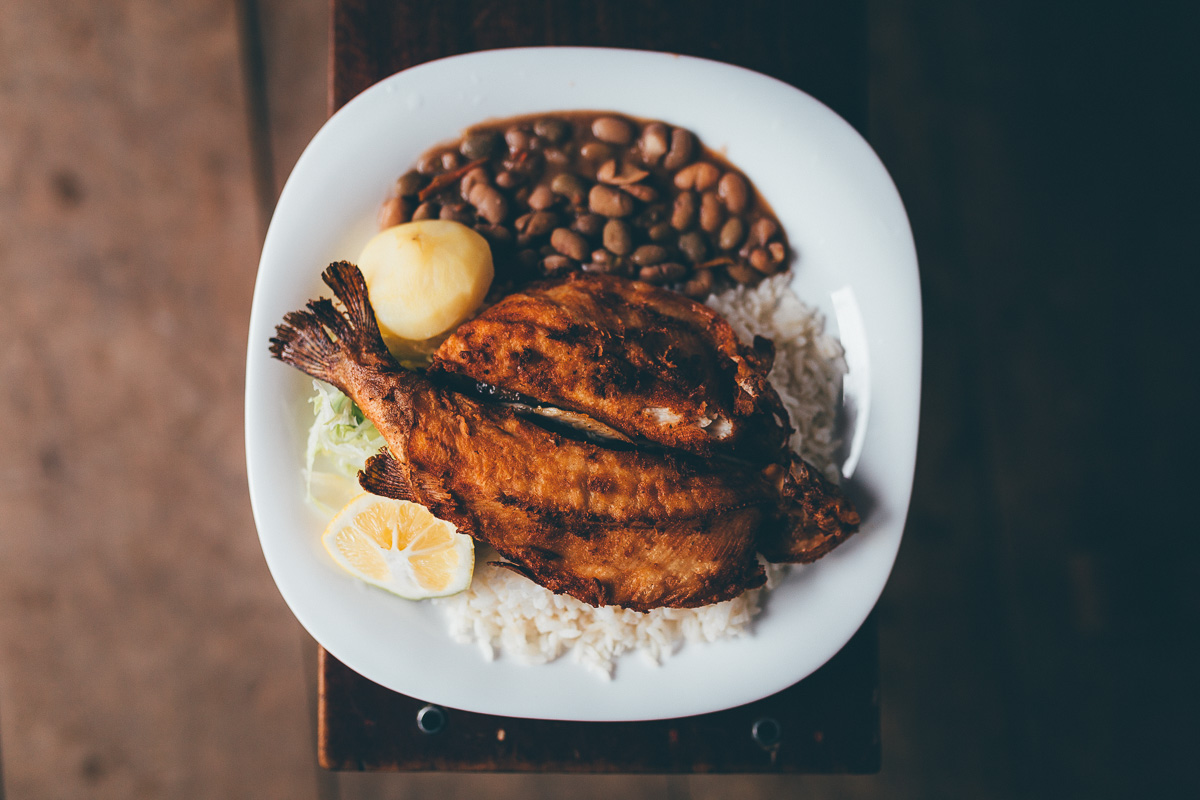
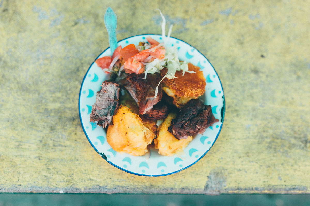
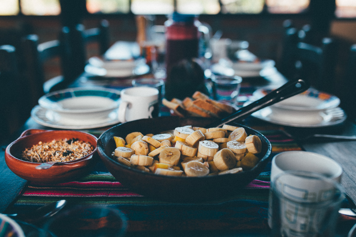
- Every town can serve up a belly-filling set lunch (almuerzo) and dinner (cena) menu. ‘Completos’ costs just three dollars or so and include a soup, main course, and fresh juice. They offer the best bang for the buck. Western food (pizza etc…) is generally available in large town and cities. Fried chicken and chips is another Ecuadorian favourite.
- Veggie? It’s relatively easy to avoid meat in restaurants, but don’t ask if they have anything that’s officially vegetarian because the answer is always “no”. Things to ask for include menestra de lentejas (lentil stew), frijoles (beans), papas cocido (cooked potatoes), ensalada (salad, but this can be anything from mixed vegetables to pasta salad), and verduras (vegetables). White rice is always available.
- Stove or no stove? Whilst there are enough resupply points along the route to avoid the need to carry a stove if you so wish, given the often mixed weather in the mountains, packing a lightweight alcohol stove can be useful. It’s easy to top up the alcohol as you go (sold by volume in hardware stores) and a stove opens up a lot of options for Ecuadorian healthy fare, like quinoa, machica, polenta, chia etc…Personally, I love to have soups in the evening, especially if it’s cold and damp. If I stop at a restaurant at lunch, I’ll sometimes keep the leftovers and add that to the soup too. You can leave oats/chia/machica to soak overnight in a container, then warm it quickly if needed.
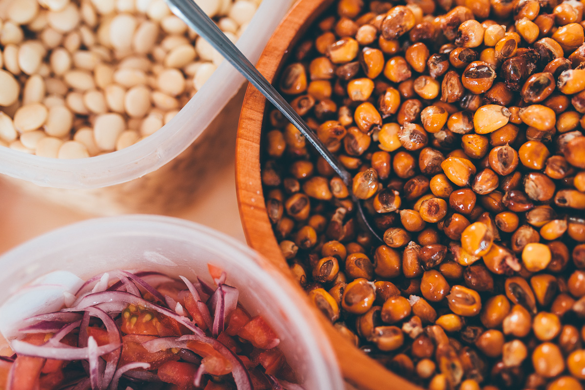
- Sourcing food en route isn’t generally an issue, but carry supplies for a couple of days at all times, to be sure. Easy to find ingredients for picnic lunches include bread, crackers, tomatoes, avocados, local cheese, mayo, and sometimes meat. Dinner-wise, pasta, quinoa, and rice are readily sold, as are oats and machica (roasted barley) for breakfast.
- If you want to make yourself a trail mix, a la Ecuador, keep an eye out for peanuts, almonds, walnuts, and raisins, supplemented with dried snacks like habas, peas, and garbanzo beans, which are generally easy to find. Larger towns with supermarkets are the best places to load up with trail mix.
- In need of peanut butter? Ecuadorian supermarkets sell it, but at a premium. Try pure ‘mani en pasta’ as a subsitute, adding some salt and honey if needed.
- Ecuador has an abundance of exotic fruit. Be sure to sample chirimoya when you’re passing through Guayllabamba. Better still, track down the locally made Chirimoya ice cream.
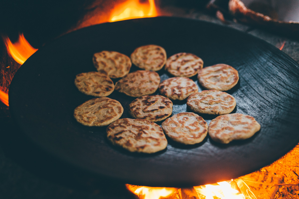
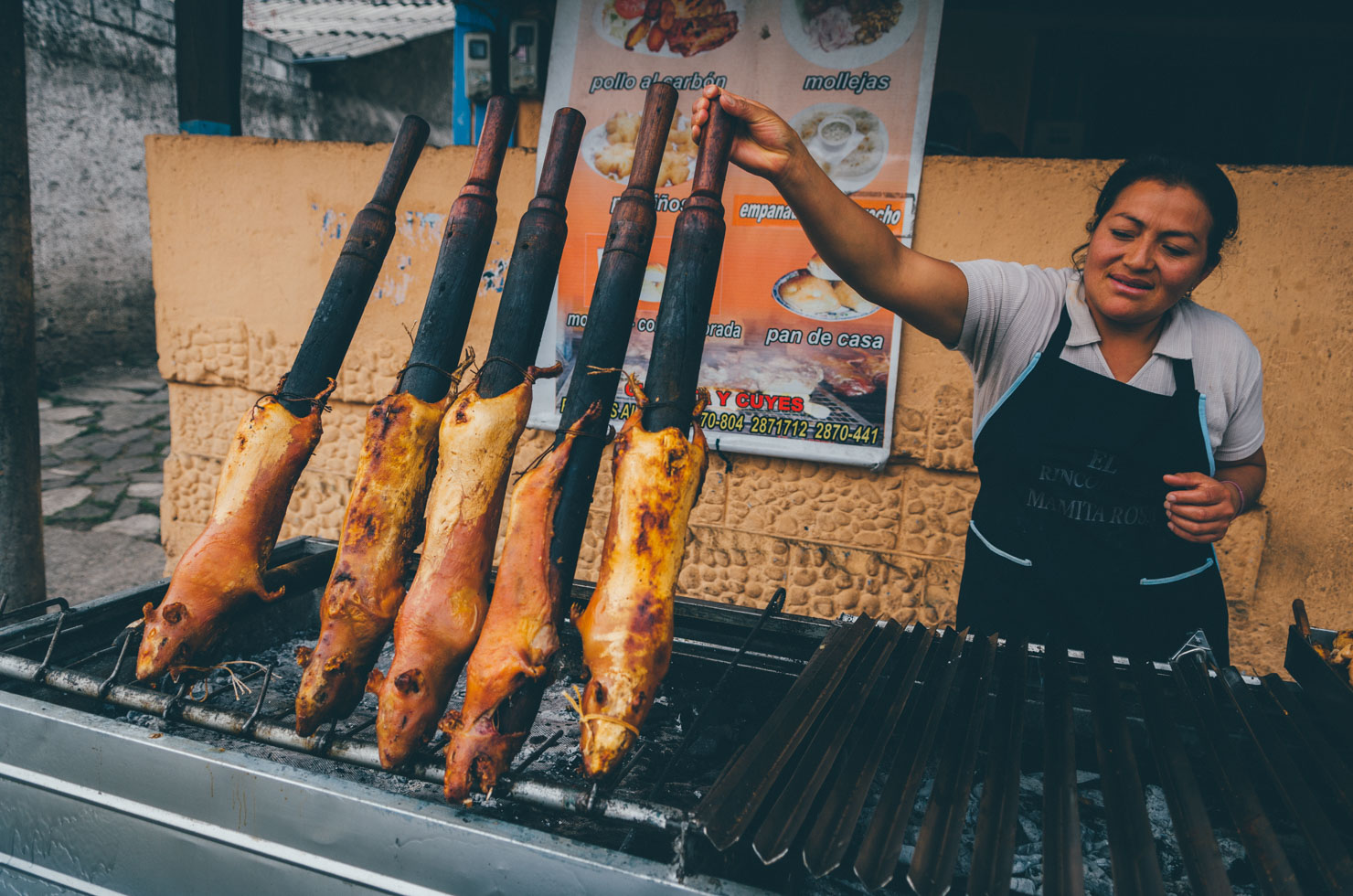
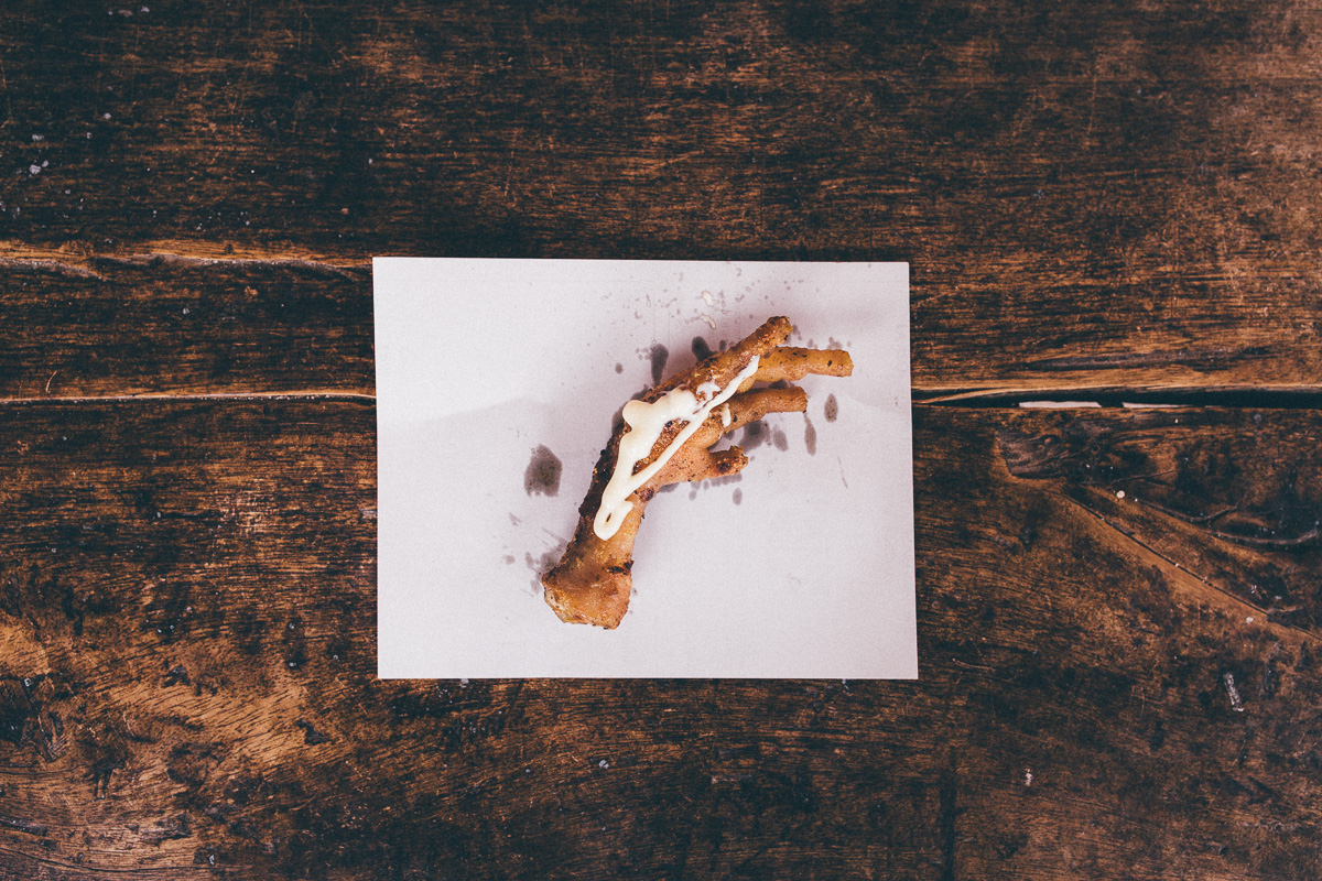
- Other roadside treats to look out for include tostadas – toasted corn – and mote – soaked corn. At the weekend, these are often served with hornada – delicious crispy, roasted pork. If you’re not squeamish, there’s roasted guinea pigs – cuy – to tuck into as well, an Ecuadorian speciality.
- Locro de Papa is a hearty soup that will keep you fueled. It’s loaded with potatoes, onion, garlic, cumin, achiote, milk, cheese and cilantro, garnished with avocado and spicy aji (Ecuadorian hot sauce).
- Always keep your eyes out for local produce. We suggest supporting small businesses when you can. Locally made cheese is commonly available; just add bread, a pinch of salt and a dollop of aji.
- Market towns abound – we’ve listed the days of those that are more established in Trail Notes. They’re great for resupplying on fresh, local produce, as well as experiencing an important part of Ecuadorian life.
- Check out our Ecuadorian recipes here.
At over 1300km in length, TEMBR Dirt can be tackled in its entirety, or broken up into six parts that can be section ridden. Listed below is a suggested breakdown, splitting the ride into five digestible portions. Although the segments vary in length, each offers a suitable locale to spend a rest day or two off the bike.
Note that TEMBR Dirt is still being fine-tuned and is subject to modifications. For the latest updates, be sure to download the gpx from Ride With GPS and take note of the waypoints and the details within each. Please let us know if you run into any issues or inconsistencies. Thanks!
Tulcan to Otovalo: 235km (5 days)
Additional notes
El Angel is small, low key, with a good GH and food; a good rest spot. There is an enormous climb to Buenas Aires and onwards the Pinan paramo. Given that this is region is a highlight of the route, we’d urge you not to bypass it! If necessary, consider taking a bus from the junction to Buenas Aires, which passes through en route from Ibarra – details on the gpx file.
Riding north and like singletrack? Try this trail to Buenas Aires.
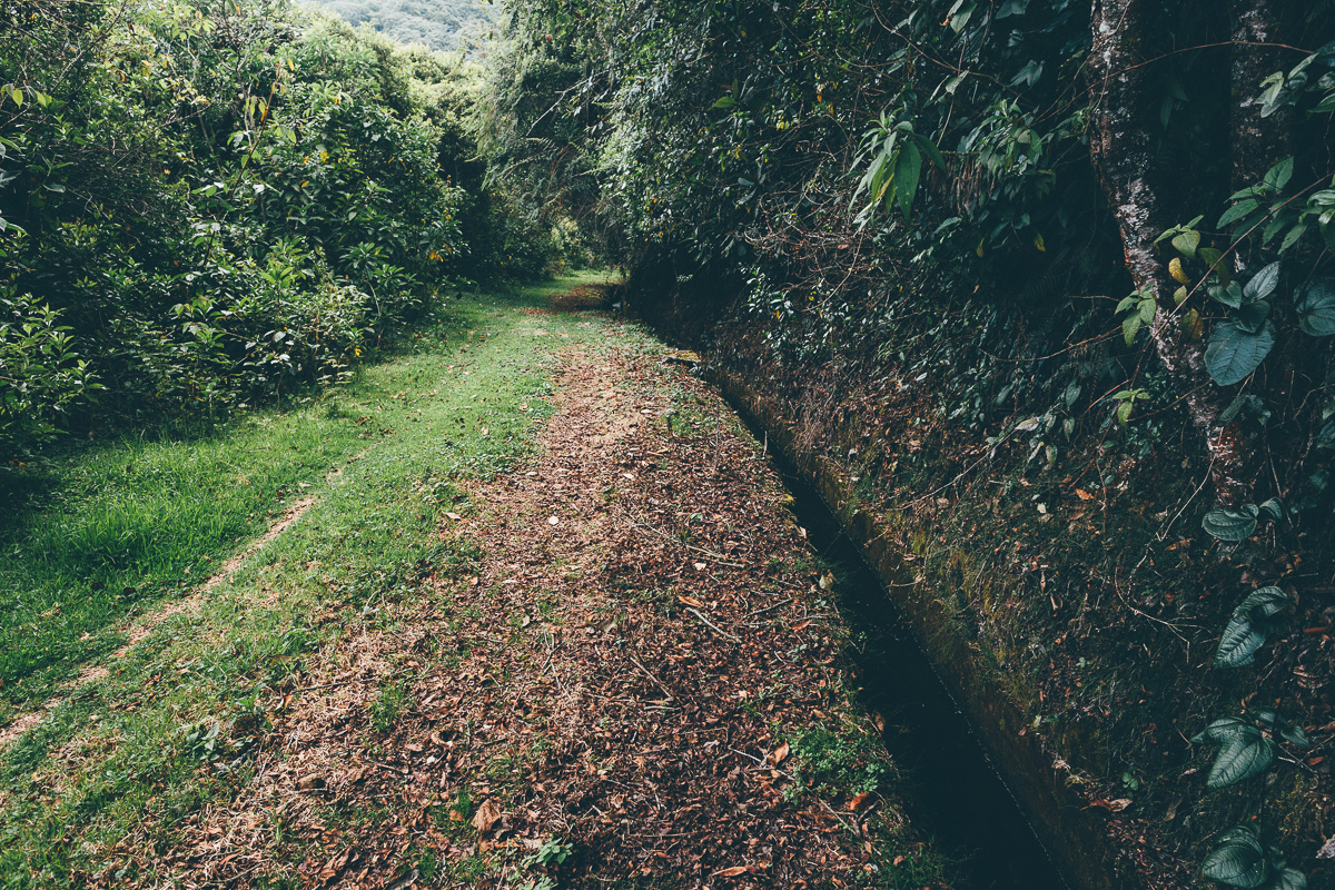
The descent to Otovalo follows an awesome water channel.
May 2018: Please read update at the top of this post re security in this section, due to illegal mining activity
Otovalo to Tumbaco (possible side trip to Quito): 121km (2-3 days)
Additional notes
Otovalo is touristy but a nice place to rest up. The climb out of town is cobbled; dirt roads begin after Lago Mojanda.
The ‘rail trail’ south of El Quinche is a little rough going in places (watch for dogs!) but much quieter than the paved highway alternative.
Tumbaco to Salinas de Guaranda: 325km (6 days)
Additional notes
After the wilderness of Cotopaxi, the settlement of Isinlivi makes a great hangout. There aretTwo good accommodation options in town. Zumbahua has a great Saturday market if you can time your route accordingly, otherwise you can detour around town – see gpx file.
The climb out of Angamarca is steep, protracted, and sometimes muddy. Consider leaving Zumbahua/Quilatoa early and riding beyond Angamarca to clear the first big climb – a few possible campspots are noted – to divide it in two. Then, ride from there to Salinas de Guaranda; a big but do-able day (many rolling hills), with the promise of a great town to rest up in. Stopping short in Simiatug is also a possibility. Be especially aware of local sensibilites in this area, as there’s been disputes between locals and mining interests in the past.
Salinas de Guaranda to Cuenca: 390km (5 days)
Additional notes
The detour to the refugio in the Chimborazo National Park (free entry, free camping, water available) is highly recommended if the weather is on your site. There are some fantastic views on the way up and the gravel road is mellow.
Expect a larger percentage of paved riding between Achupallas and Cuenca – this section is still being developed. Let us know if you find improvements!
Oct 2017 Landslide update, thanks to Onna Voellmer: There is a major landslide just after leaving Achupallus en route to the Panamerican. The road is gone, washed away down the cliff to the valley below. There is a bit of a path, for water pipes, that continues, but it’s very narrow, and you’d have to traverse the landslide for almost a kilometre. The fearless might still be able to make it through the landslide, but we opted to backtrack to the first road that heads up the ridge [2.270542° S, 78.769408° W]—you can follow that road along the ridge side until you get to the first road that heads back down [2.256857°S, 78.762619°] to connect back to the route [2.258930° S, 78.761574° W].
Cuenca to Vilcabamba: 309km (5 days)
Additional notes
There is more paved riding on this section than prior to it.
Short on time?
The crux of the ride – and the Avenue of the Volcanoes – is from Tulcan to Cuenca; both cities are well served by buses to Quito. These sections included the very best of the Trans Ecuador Mountain Bike Route. The last segment, Cuenca to Vilcabamba, provides a useful low traffic link for those on longer itineraries, headed south into Peru. But if you’re just come to ride the TEMBR, Cuenca makes a great terminus to the ride, with good connections north.
For a shorter version of the route, consider riding from Otovalo to Ambato, which can be easily reached after the descent from Chimborazo, see this gpx file for info. Ambato city offers good transportation back to Pifo using the (bike-friendly) CITA line, a town that’s just a short ride on the rail trail back to Tumbaco.
Mix and Match
Note that TEMBR Dirt, TEMBR Singletrack, and the Tres Volcanes route can all be woven together. By loading all three files into your smartphone, you can easily see where they overlap (or, use a program like GPS Visualiser). Generally speaking, if you deviate off the conventional Dirt Route, you’ll need to be more astute when it comes to navigation. Trails can be faint and paramo crossings can be freeform and abstract at times. But where there’s a will, there’s a way!
For those running a lightweight, bikepacking-style setup, and who are game for relatively short but sometimes very challenging hike-a-bikes and paramo/singletrack yomps, consider the following:
The first section of the Singletrack version is especially challenging, so it’s best avoided by those who don’t savour the stoic joys of multi-hour hike-a-bikes. Instead, after Pifo, use TEMBR Singletrack as an unconventional way to enter Cotopaxi National Park. Once in the park, hop on the Tres Volcanes route for a fun but challenging hike-a-bike over El Morro. If the weather is clear, consider branching off onto the more remote Singletrack version and looping around Quilindaña instead for complete remoteness.
Later, plug in the Tres Volcanes route as a more challenging alternative through the Quilatao region (though it means missing the lovely settlement of Isinlivi). Whichever route you choose, continue riding to Salinas de Guaranda on TEMBR Dirt. Once you’ve reached the Refugio Carrel in Chimborazo National Park, hop on the Tres Volcanes route and descend down to the main road to the north. But instead of following the Tres Volcanes back to Salinas de Guaranda, connect through to the same route to the east via the highway, intersecting it as it enters the park to circle around Volcan Chimborazo in a clockwise direction, which in turn will plug back into TEMBR Dirt. But doing with, you won’t miss out on Salinas de Guaranda – which makes a great rest stop – or on any of the best riding in Chimborazo NP.
From there on, stick to TEMBR Dirt, to avoid the infamous hike-a-bike of Ecuador’s mini Inca Trail, unless you seek an extremely (mind bogglingly, even) challenging ‘shortcut’ to Ingaparca.
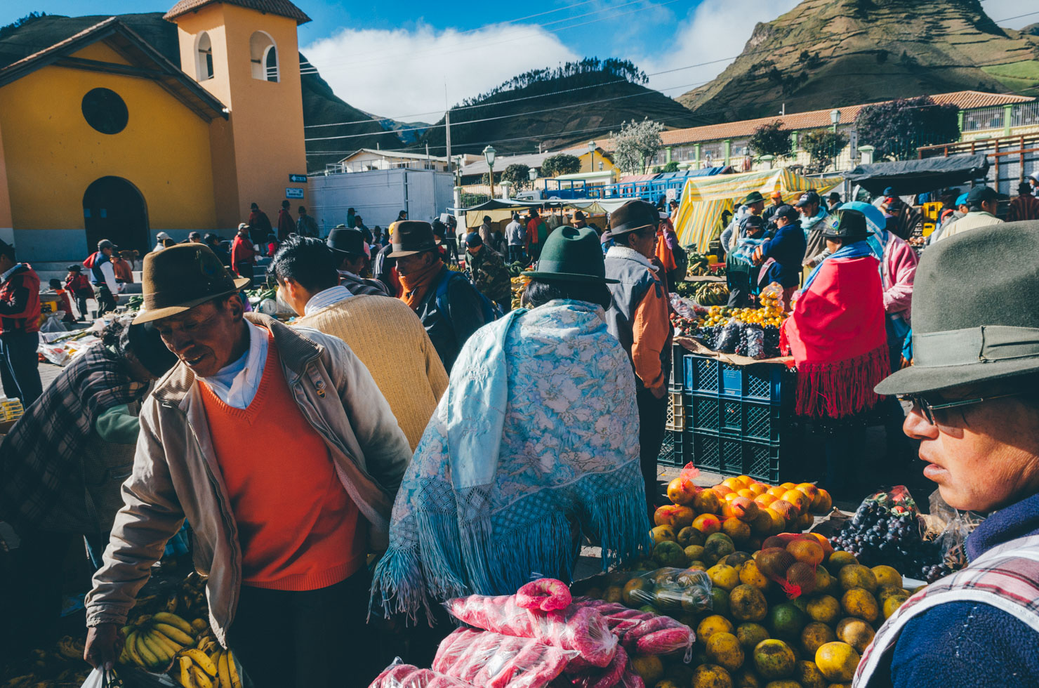
Market Life
Markets remain the lifeblood of Ecuador. They tend to occur on Thursday and at the weekend. Here are a few of the more colourful indigenous markets to bear in mind when planning your trip.
- Otovalo: Daily, largest on Saturday morning (touristy but well worth visiting for the vast array of textiles).
- Saquisili (off route): Thursday morning (touristy but still maintains local vibe)
- Zumbahua: Saturday morning (recommended).
- Simiatug: Wednesday morning (very local, few tourists).
- Guamote: Thursday morning (recommended, a true hubub of life).
For a 2017 gallery of the route and thoughts on bike setups, see Cass’ post here.
Stunning imagery from Mark Watson’s 2018 Ecuador posts; see his Highlux website.
Martijn Doolard’s lovely 2018 photoset of the route, including drone shots! See relevant posts on his site, Espiritu Libre.
Join the Trans Ecuador Mountain Bike Route Facebook Group to connect with other riders and report updates.


Terms of Use: As with each bikepacking route guide published on BIKEPACKING.com, should you choose to cycle this route, do so at your own risk. Prior to setting out check current local weather, conditions, and land/road closures. While riding, obey all public and private land use restrictions and rules, carry proper safety and navigational equipment, and of course, follow the #leavenotrace guidelines. The information found herein is simply a planning resource to be used as a point of inspiration in conjunction with your own due-diligence. In spite of the fact that this route, associated GPS track (GPX and maps), and all route guidelines were prepared under diligent research by the specified contributor and/or contributors, the accuracy of such and judgement of the author is not guaranteed. BIKEPACKING.com LLC, its partners, associates, and contributors are in no way liable for personal injury, damage to personal property, or any other such situation that might happen to individual riders cycling or following this route.
FILED IN (CATEGORIES & TAGS)
Ecuador
Please keep the conversation civil, constructive, and inclusive, or your comment will be removed.