


Eastern Divide Trail (S8): Cypress
Distance
1,144 Mi.
(1,841 KM)Days
19
% Unpaved
55%
% Singletrack
14%
% Rideable (time)
98%
Total Ascent
8,990'
(2,740 M)High Point
180'
(55 M)Difficulty (1-10)
6?
- 1Climbing Scale Easy8 FT/MI (1 M/KM)
- 5Technical Difficulty Moderate
- 7Physical Demand Difficult
- 5Resupply & Logistics Moderate
Contributed By

Karlos Bernart
Singletrack Samurai
NOTE: Lock 65a on the Kissimmee River is CLOSED until October 24, 2025. Riders will need to follow the High Water Alternative listed in the Trail Notes section until the gate reopens.
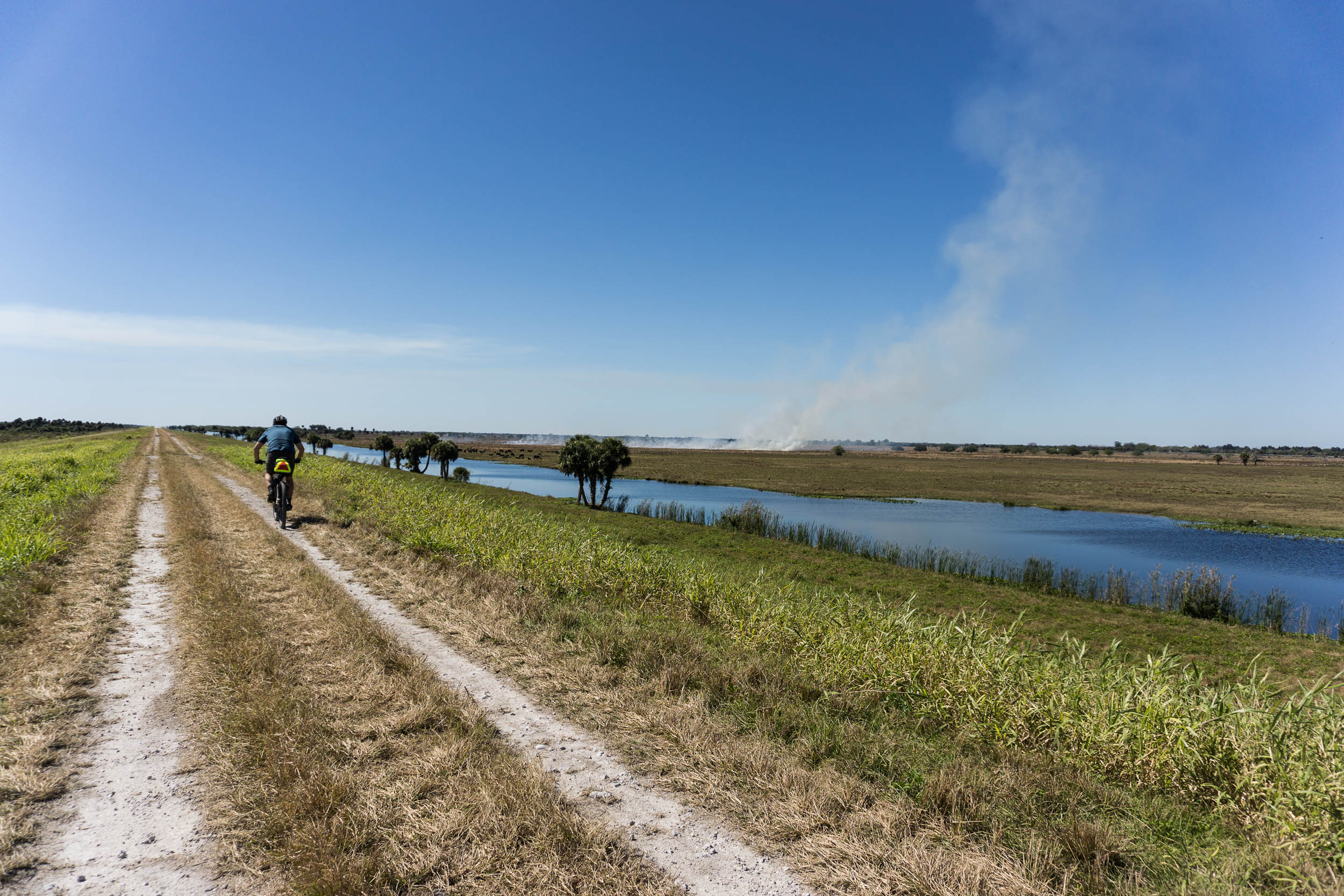
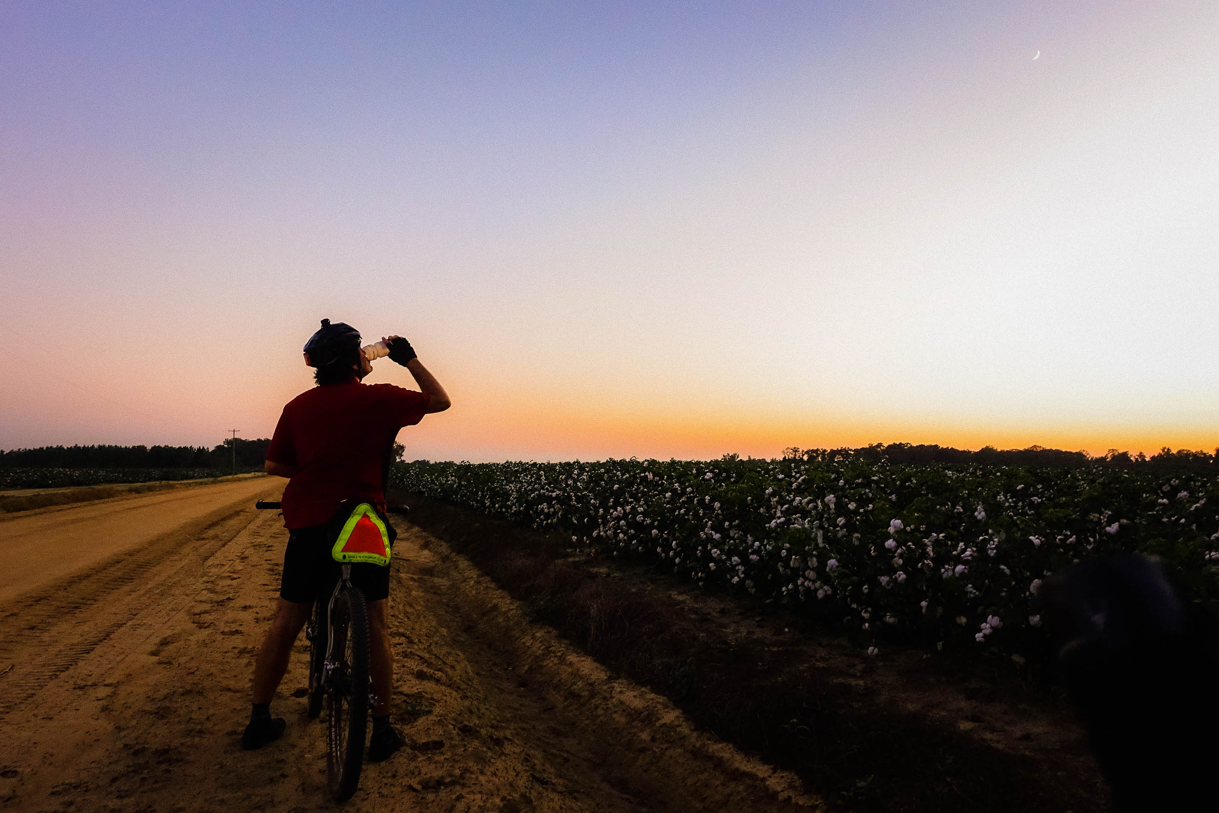
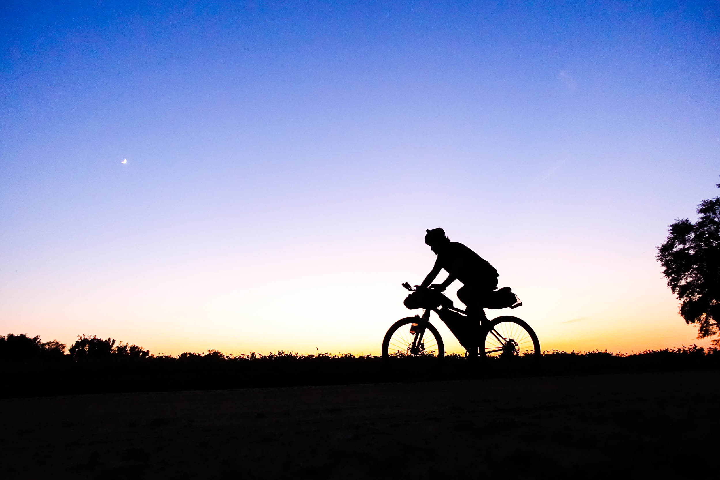
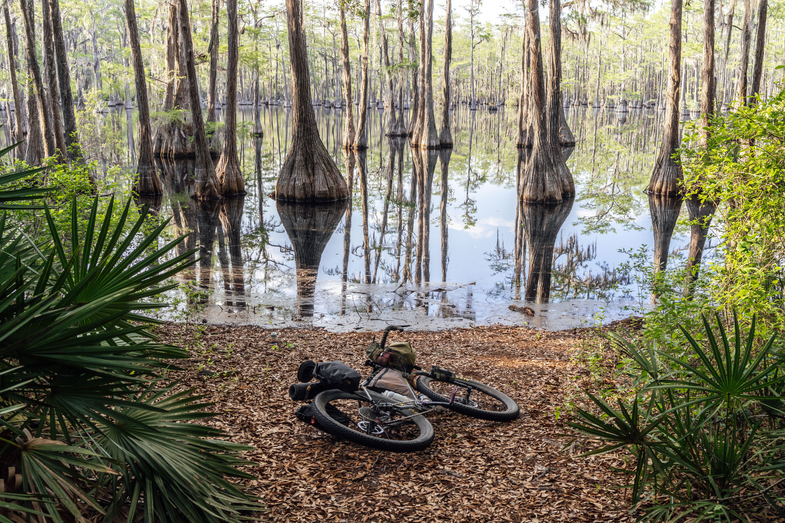
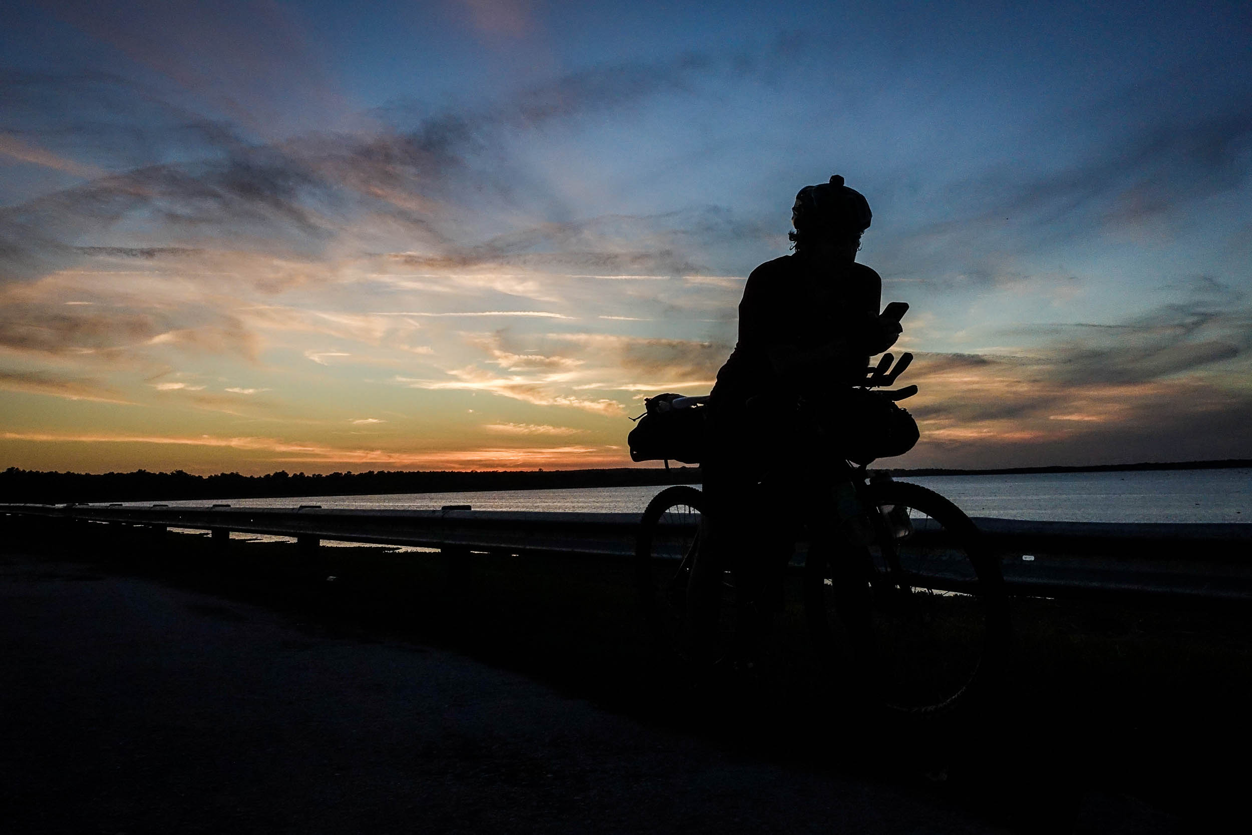
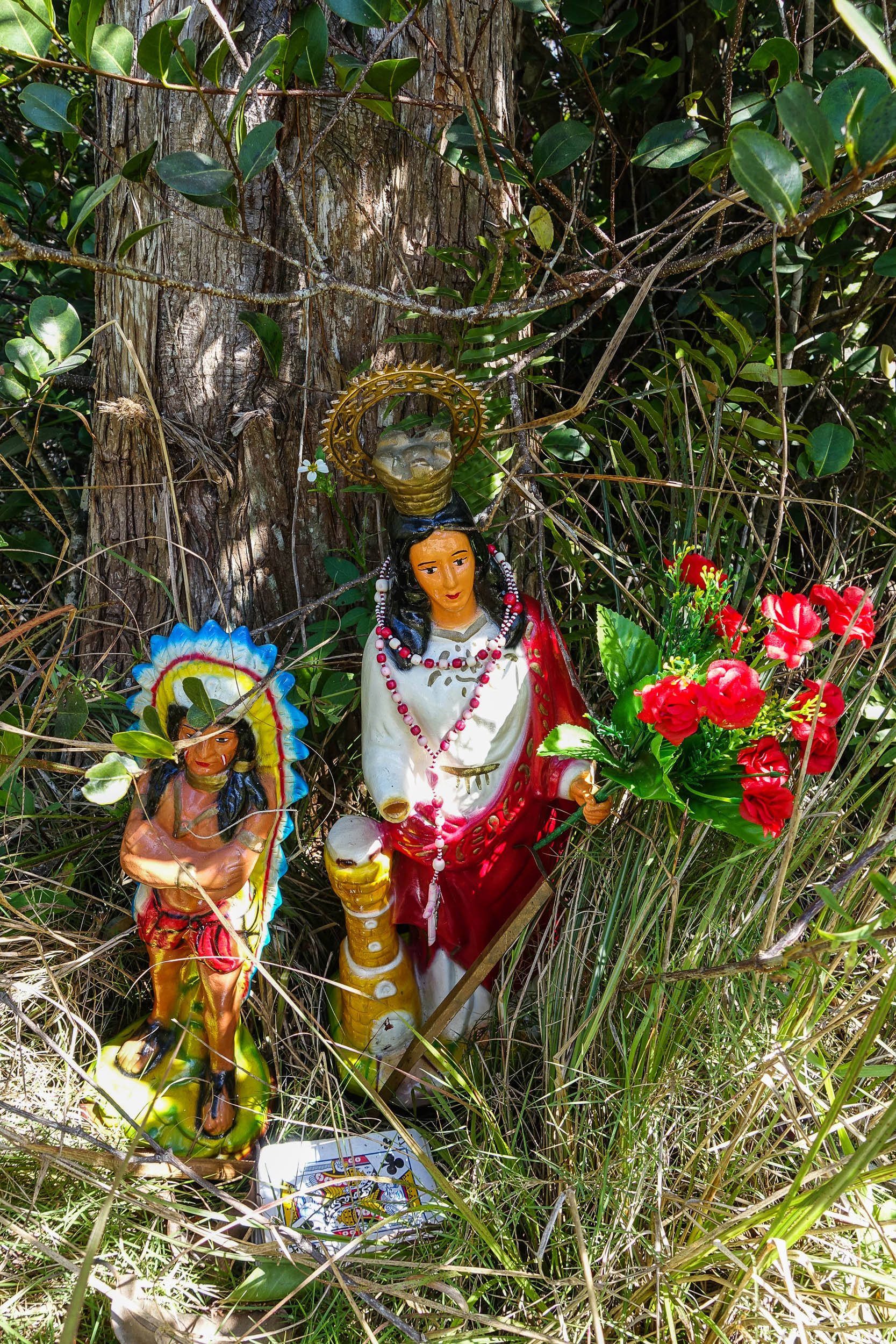
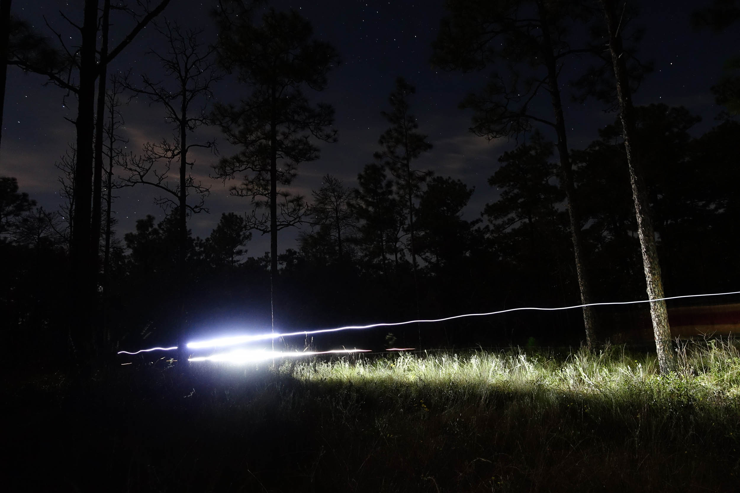
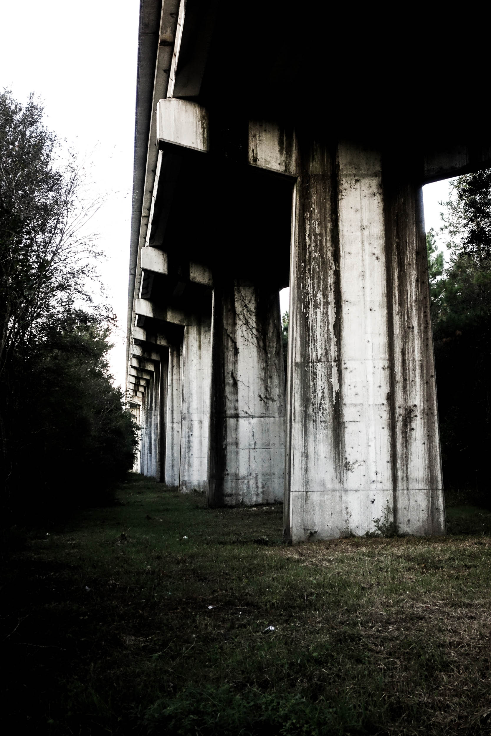
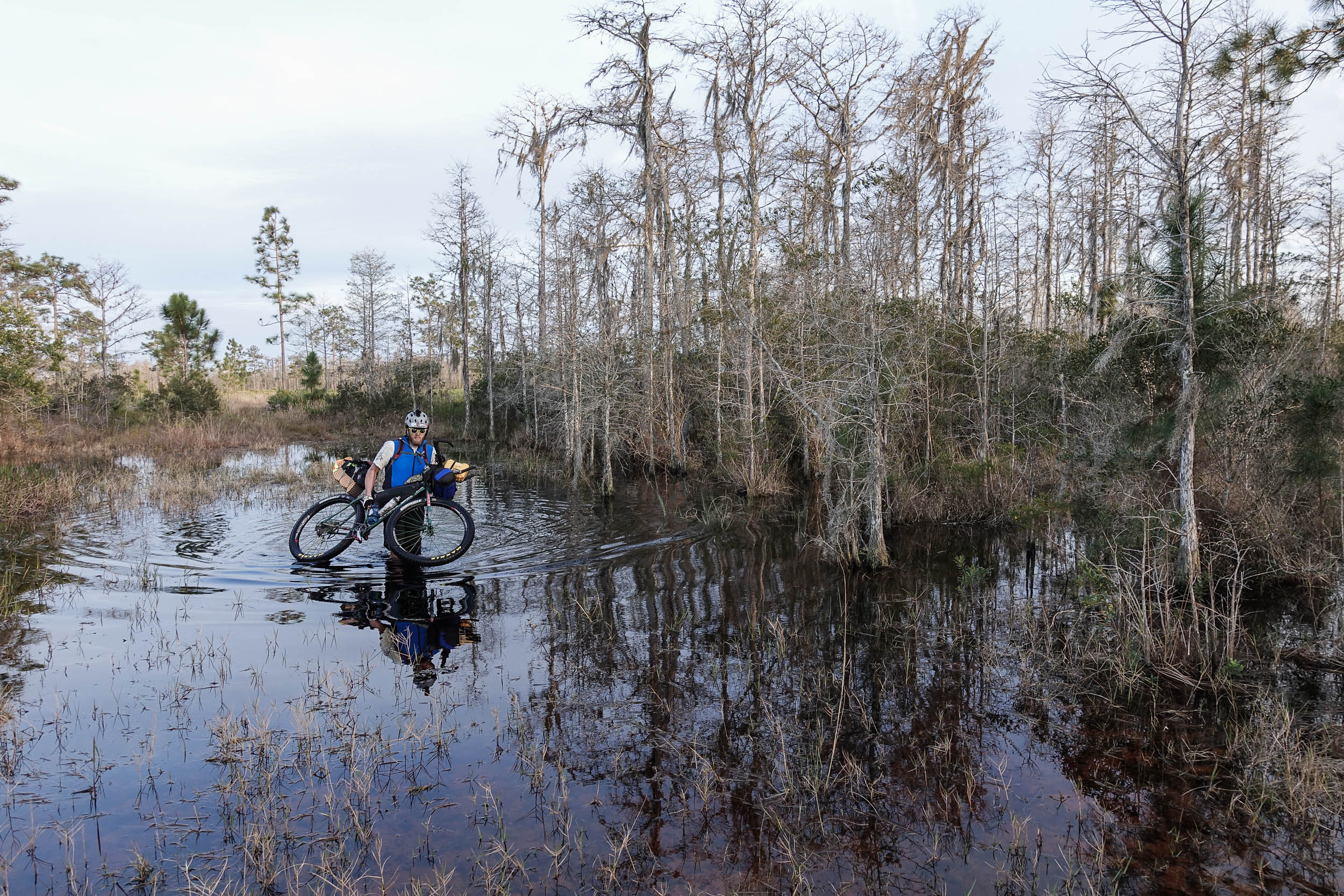
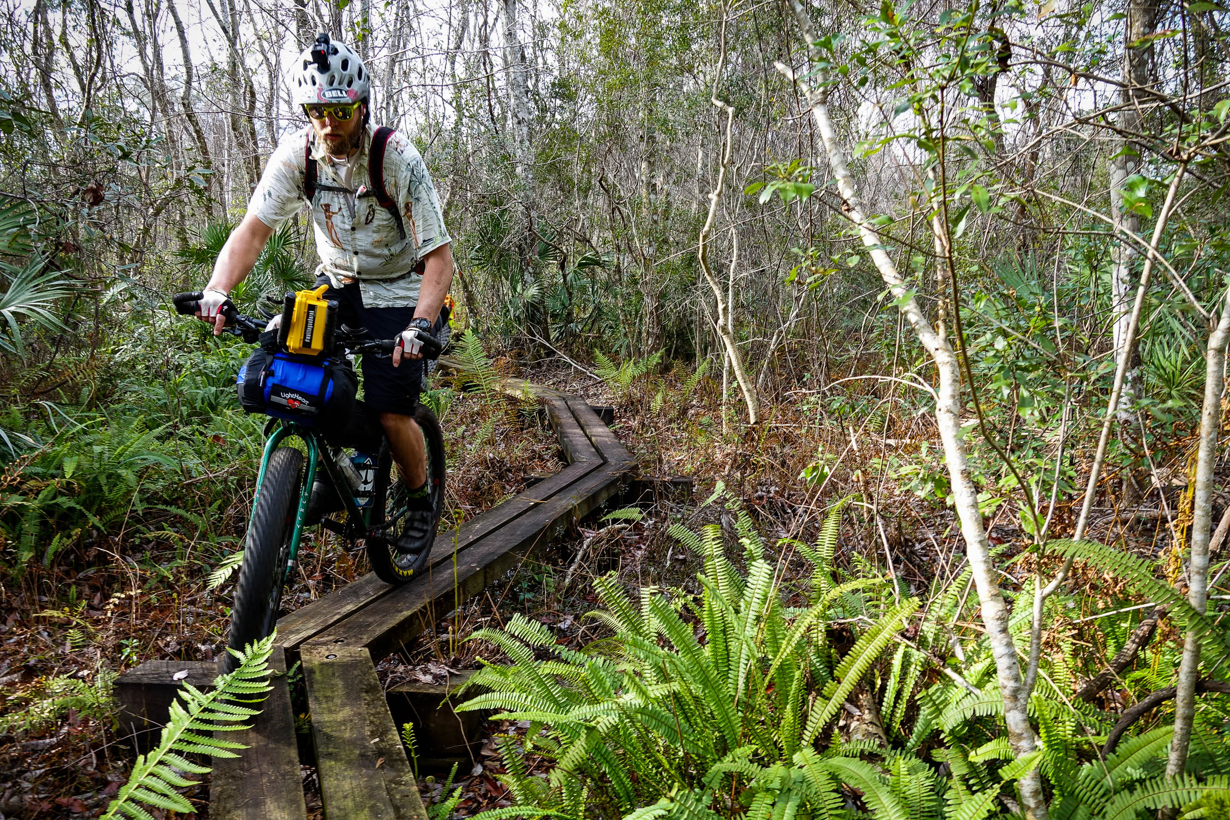
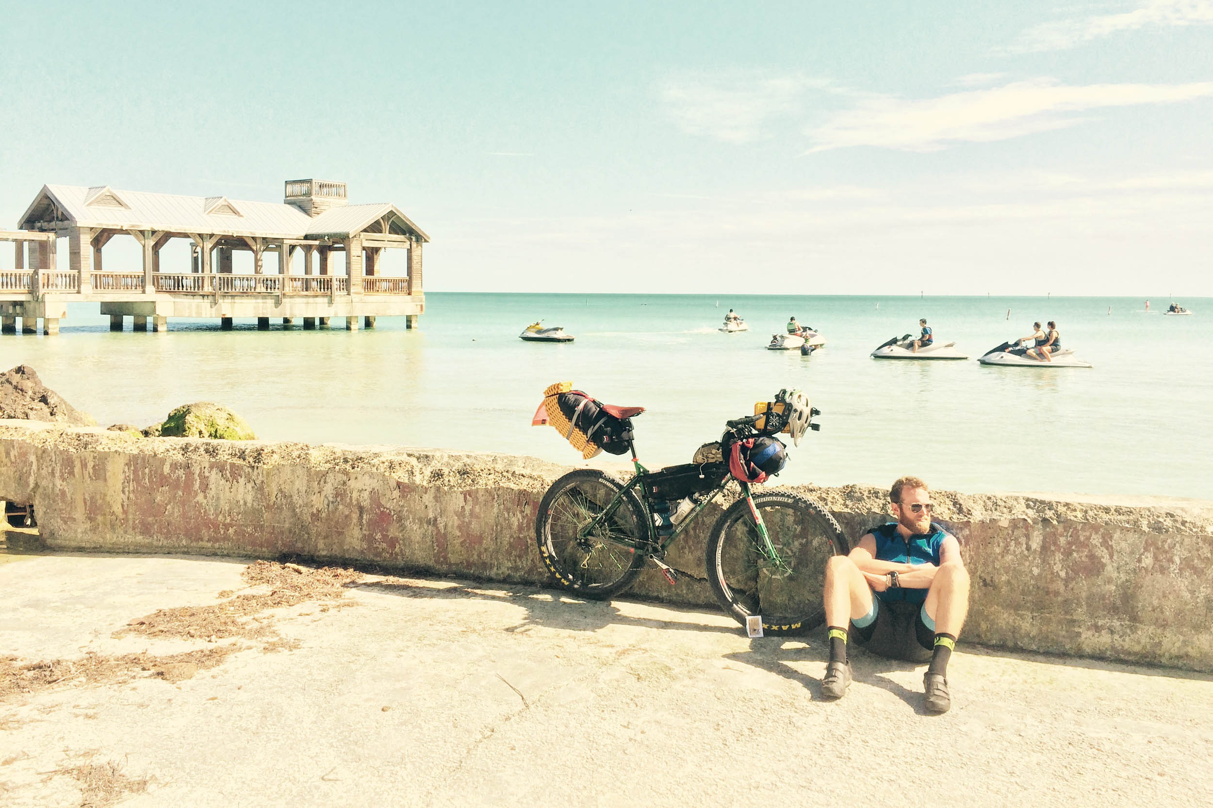
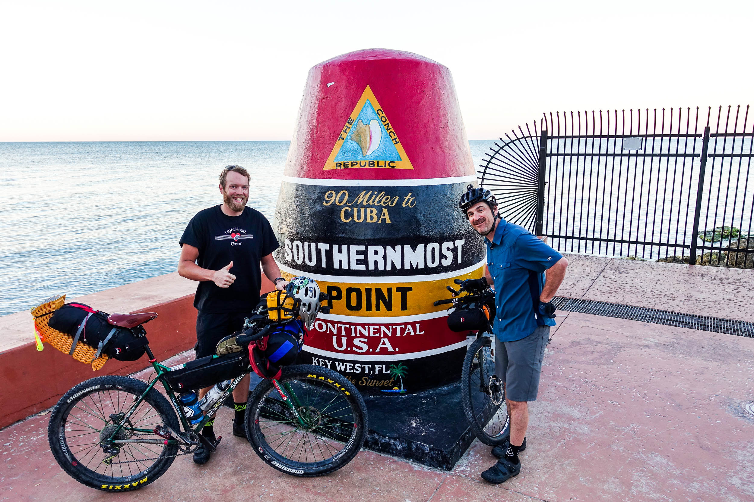
Photos in gallery by TJ Kearns
At one point in Florida’s ancient history, this land was covered by cypress forest. These majestic, enormous old trees could be seen from miles away, and early travelers frequently used them as landmarks. Florida is different from the other states that make up the EDT in many ways. Geologically, it was once part of Africa. The shelf the rest of the state is built upon is composed primarily of carbonate deposits from small dead coral and shellfish that created a layer of limestone. As the Appalachian mountains eroded, sand and quartz washed over and helped bolster this limestone layer. These geological changes that occurred over the millennium helped form the geography that makes up this land. Under the entire state of Florida lies the Floridan Aquifer. The rise and fall created by this underground river breathe life into the 900 springs that dot the land and help give contours to the landscape.
As you traverse the route, you begin noticing that the path goes from mostly flat to hilly when you’re near a river or a spring. Sure, there are no sustained climbs to note. In fact, it is the flattest of the states that make up the EDT. The long history of its geological development helped to foster many endemic animal and plant species. As you go down the state’s spine, you experience this variety and start to note the nuances in the terrain.
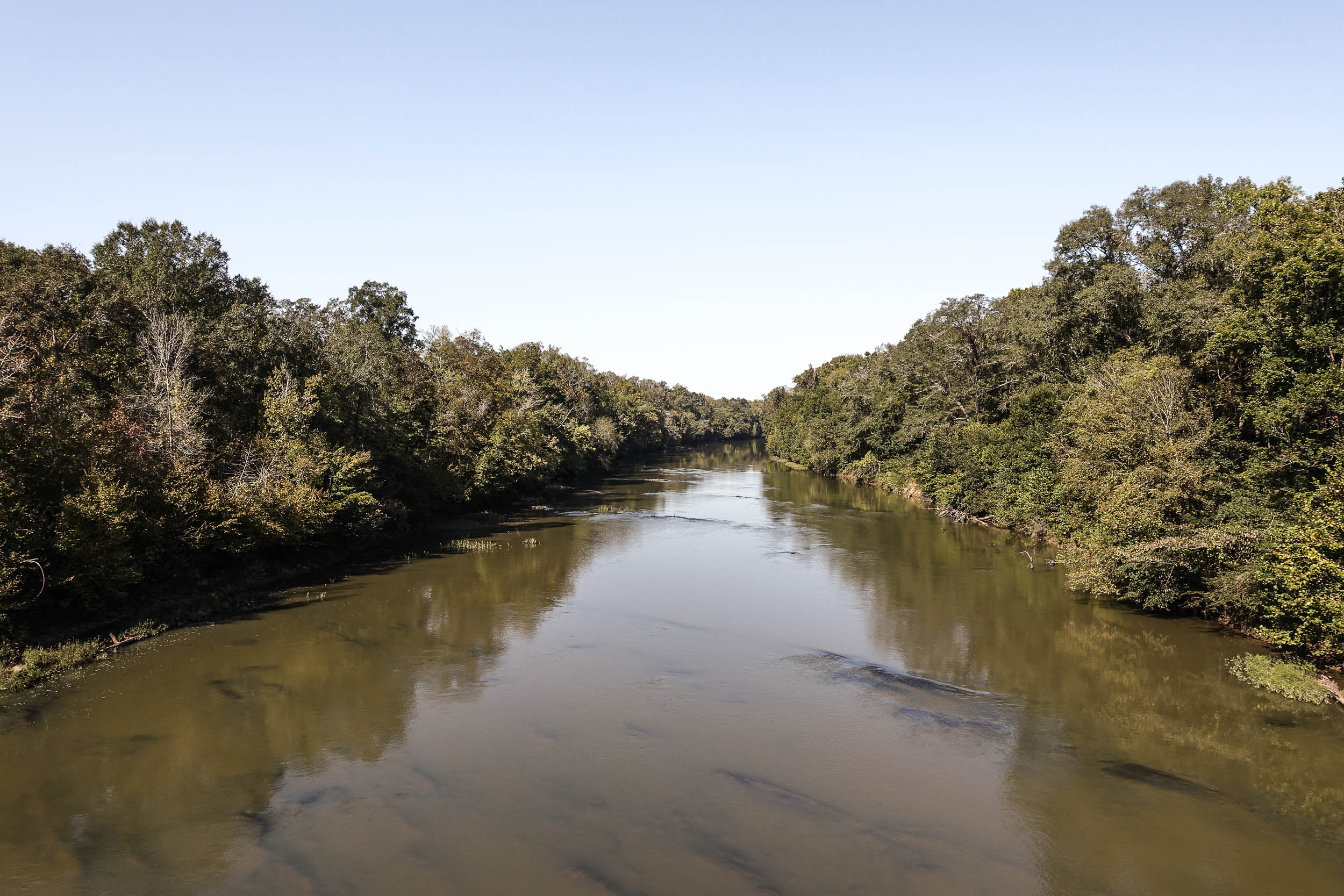
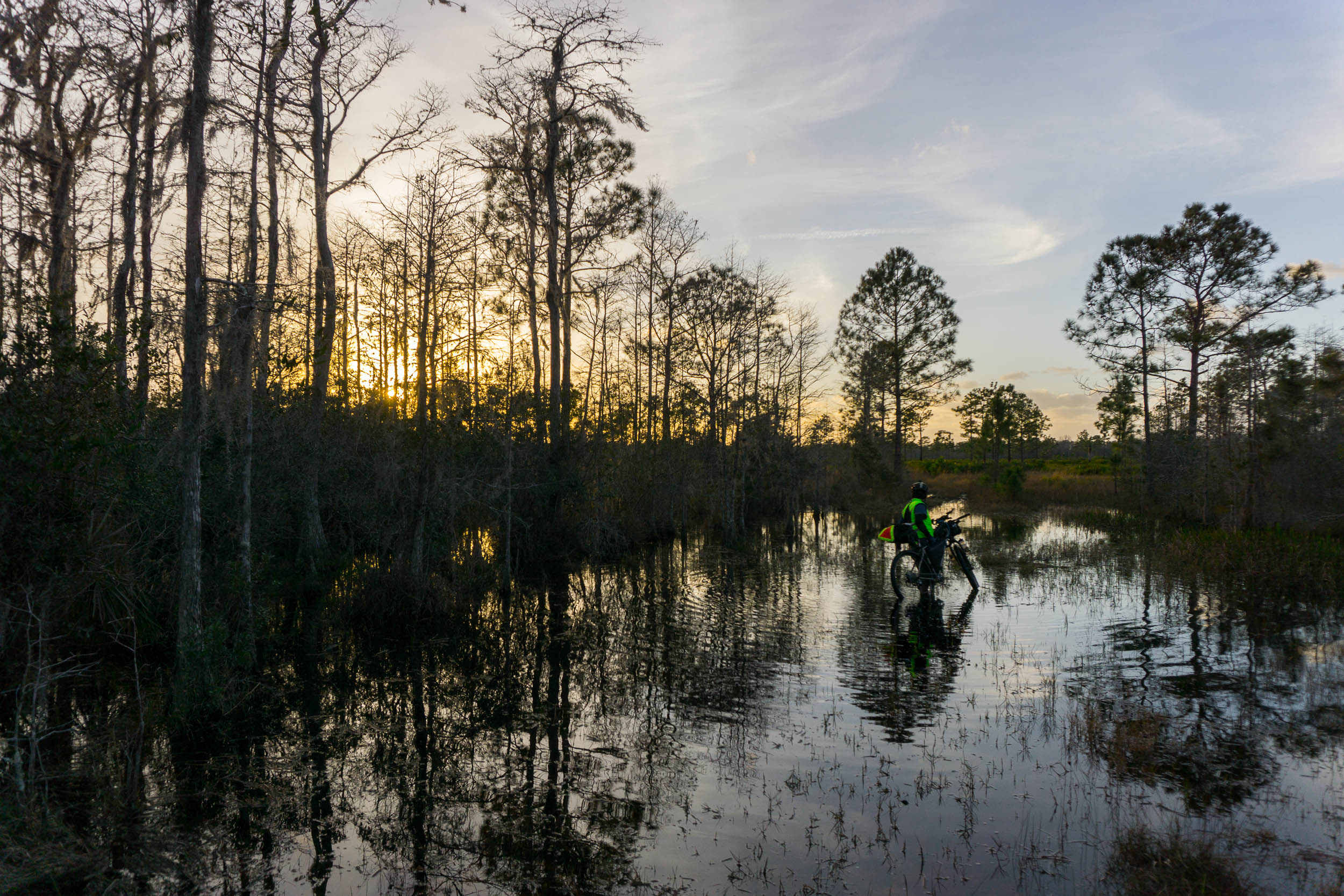
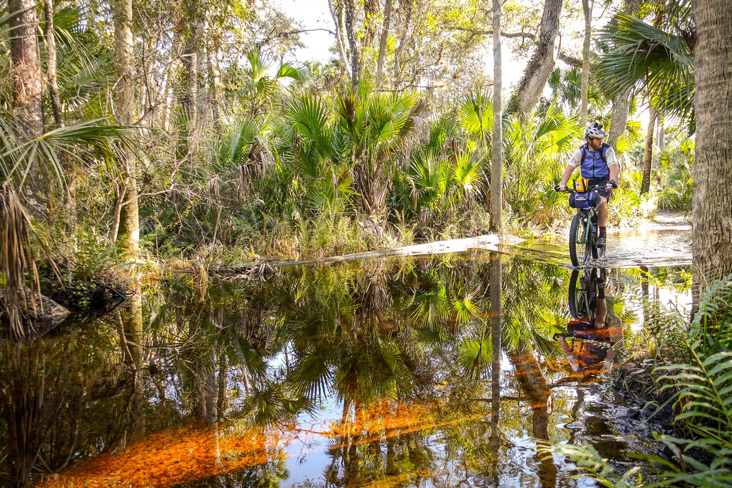
Like the Cypress tree, which typically lives near the water, the route frequently follows and crosses waterways. Except for the Saint Johns River, this route will allow you to commune with almost every major river and notable creek in the state.
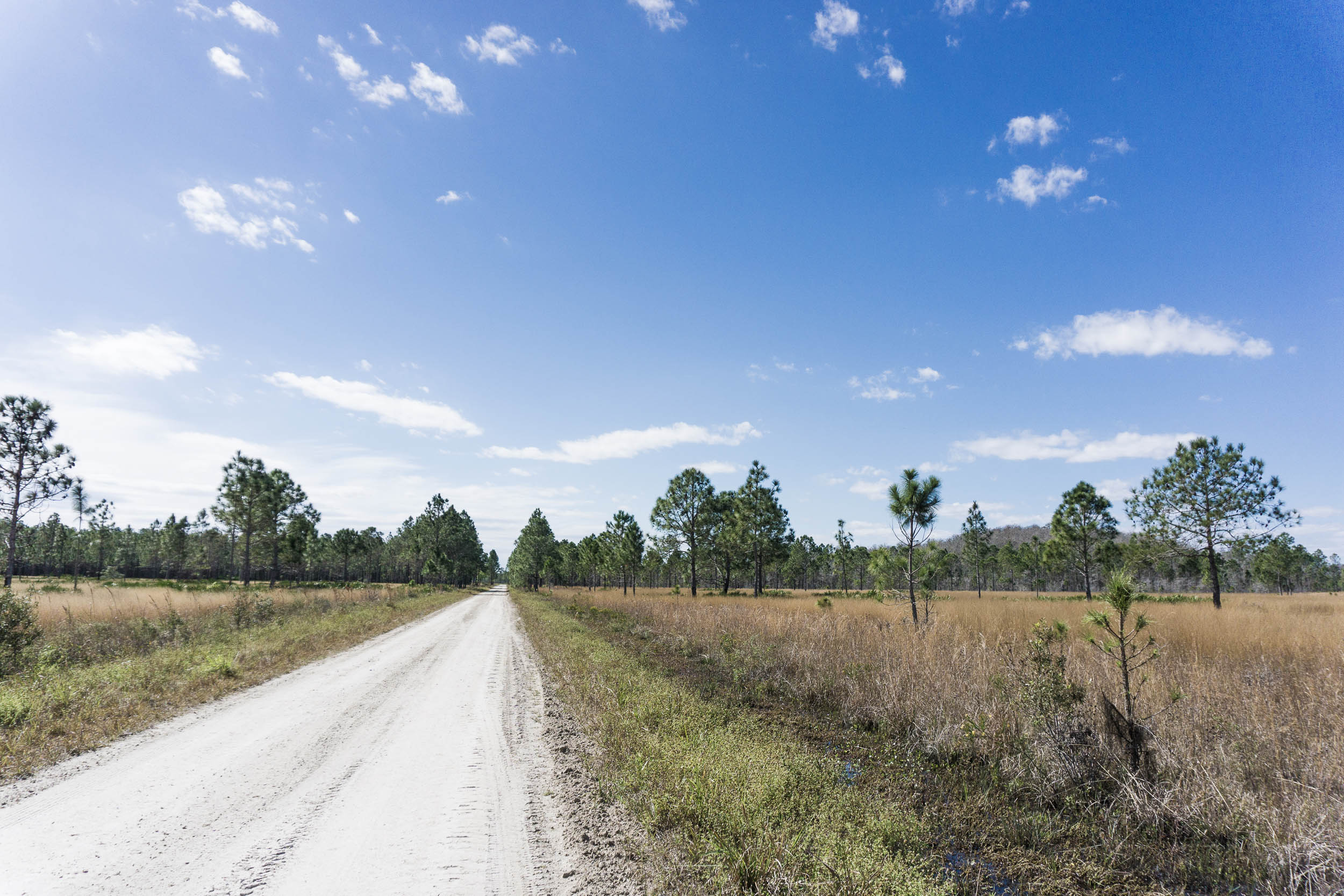
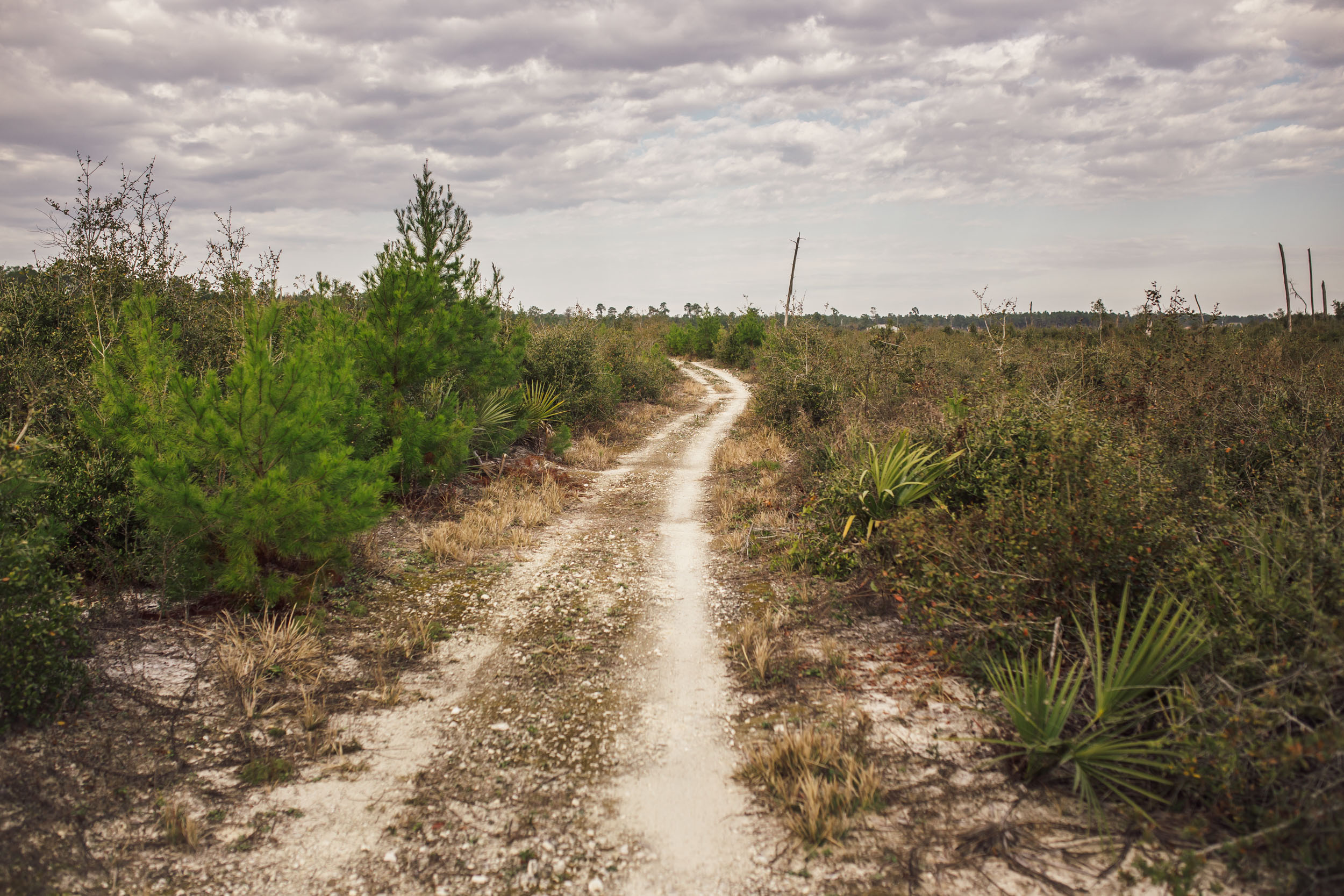
As you make your way south of the Kissimmee Basin along the River of Grass Corridor, you begin to notice the vast flatness of the land. The route goes from utilizing primitive paths and dirt roads to long gravel-based service levees. The influence and land shaping done by humans becomes obvious. The shade from the dense forests further north on the route is now gone. The area is seemingly barren, like an inland desert, easily influenced by wind and sun exposure. As you traverse the Devil’s Garden south of Lake Okeechobee, these conditions persist until you get a respite when you cross the lands of alligators, panthers, and boa constrictors, aka Big Cypress. In the distance, you can see the dome shapes changing the skyline, indicating where the bald cypress forests are located.
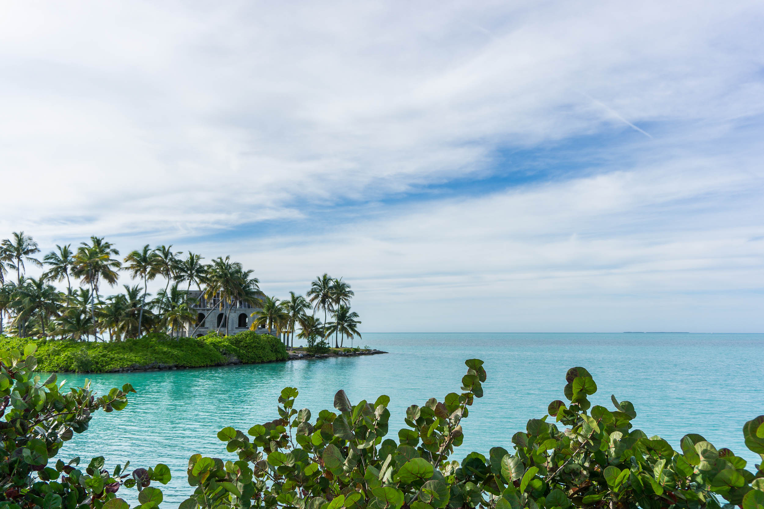
Beyond Big Cypress and Loop Road, the topography is vast and wide open as you make your way through the heart of the Everglades. Once in the Keys, the route is almost entirely on bike paths with a little dirt detour when you reach Pine Key that takes you through the local preserve with hopes of seeing the key deer, an animal that can only be found here. The Florida Divide can be used in conjunction with the vast network of local bikepacking routes to plan mostly off-road side trips to explore all the space coast, parks, springs, rivers, towns, and bioluminescent waters.
Lay of the Land
By Tsinnijinnie Russell (@tsinbean)
Florida has a long history of Indigenous populations, dating back 12,000 years. The Potano and Timucua were some of the original inhabitants of north Florida. Their first contact with Europeans led to huge numbers of people dying. European colonization began in the 16th century and quickly spread diseases that killed many Indigenous people. Settlers also used violent suppression to further batter the Indigenous populations of Florida, ultimately leading to the near extinction of the Potano and Timucua. Spanish missionaries settled in north Florida and forced conversion among the Potano and Timucua while also using them as slaves.
In 1656, the Potano joined the Timucuan in the Timucua rebellion. This led to eight months of fighting, during which the Spanish burned most Timucuan towns and missions. By 1650, there were an estimated 3,000 Potano remaining. By 1675, only 160 people had survived at the two missions. By 1685, the Potano were being raided by English settlers from Carolina and their villages were being burned and their territory turned into cattle ranches. Many were killed, and many were sold as slaves.
It is largely unknown what the surviving Potano did following the collapse of the Spanish mission system in 1704. Prior to European contact, the Timucuan population is estimated to have been over 200,000. By 1800, there were no Timucua left, with some survivors being taken to Cuba and others integrating into other Indigenous groups, such as the Seminole. The last recorded survivor of the Timucua, Juan Alonso Cabale, died in Cuba on November 14, 1767. It is unclear if there are any descendants of Timucua still in Cuba.
Southwest Florida was inhabited by the Calusa, who were people of the Caloosahatchee culture. Their culture was built around estuarine fisheries, and their territory reached from Charlotte Harbor to Cape Sable and inland to Lake Okeechobee. They were influential among other Southern Florida tribes, including the Mayaimi around Lake Okeechobee and the Tequesta and Jaega on the southeast coast. The Calusa resisted Spanish missionaries, but disease and war diminished their population and power in the region. Their villages were raided and sold into slavery. In 1711, there were potentially 1,700 Indigenous people left in southern Florida. In 1763, when Spain ceded Florida to Britain, Spain removed the last remnants of the tribes to Cuba, and some may have integrated with the Seminole.
The ecology of Florida was also vastly different from the drained, arable pastures and farmlands dotting the region today. Before drainage, Central Florida was swampland, scattered with pinewood and palmetto flat land prairies. The Florida Everglades’ headwaters were as far north as Lake Tohopekaliga. Prior to the Civil War, few white settlers had pushed further south than Orlando. The drainage projects of the late 19th century radically changed the area as cattlemen moved further south. Since colonization, the Indigenous populations of Florida have undergone genocide, and the natural landscapes have also undergone radical changes and degradation.
Route Difficulty
Physical Demand: 7 • Technical Challenge: 5 • Resupply/Logistics: 5
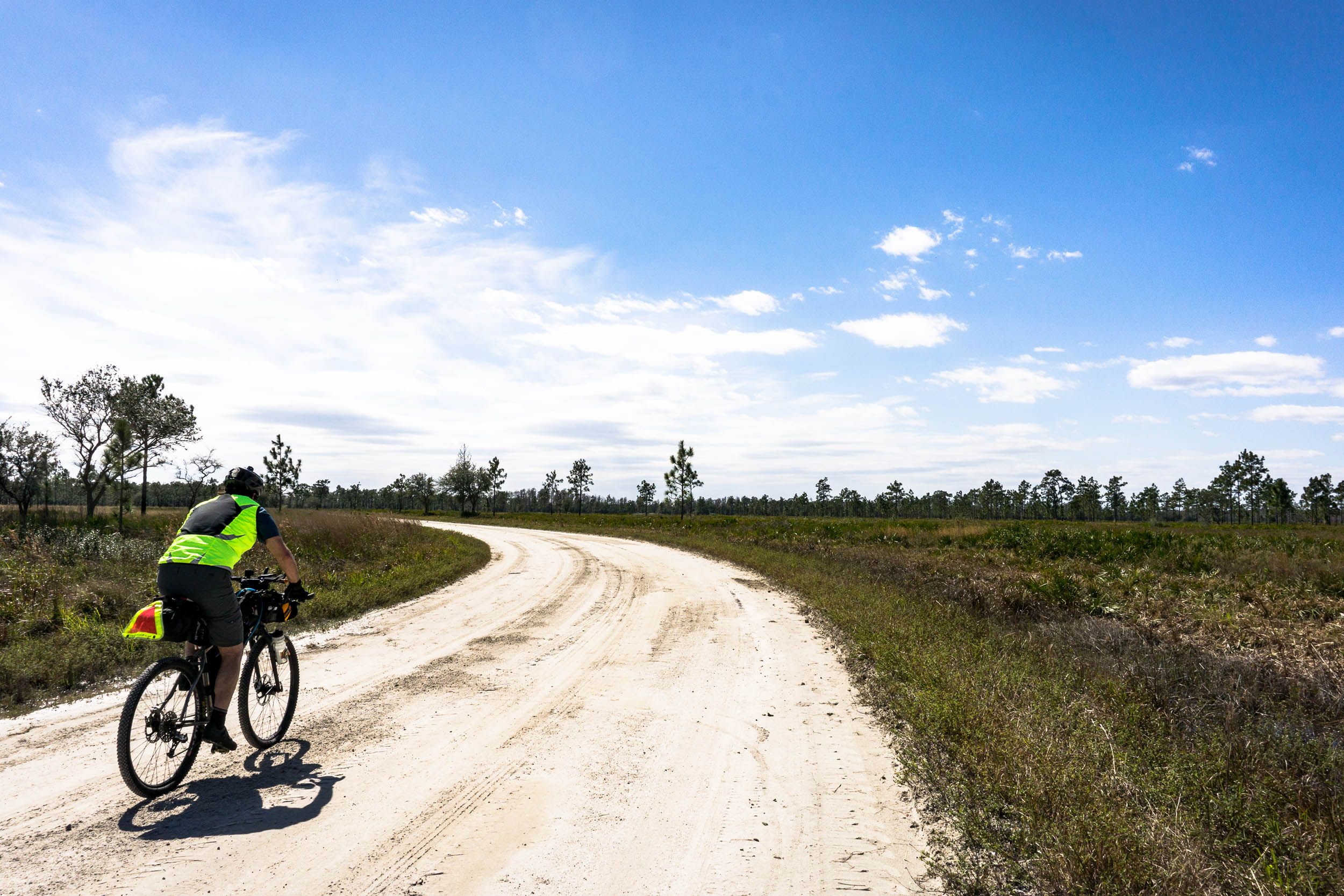
This being the longest and flattest segment that makes up the EDT pushed me to give it a physical demand rating of 7. Mountains are wonderful to ride, but generally, half the distance you cover is spent coasting and steering, not pedaling. Florida changes that paradigm. The further south along the route you get, the more influence the wind and sun have on your ride.
Most of S8 is technically tame and features many fun segments of well-maintained singletrack. Except on the more primitive tracks, you will spend most of your time on the bike. There will be some spots where deadfall and steep drops may require dismounting, particularly if you’re uncomfortable with chunky rooty trails. Further down the route, the grassy levees can feel taxing, and if conditions are dry, some roads can get sandy and may require the occasional bit of hike-a-bike.
Resupply is straightforward throughout. There are only a few stretches that require a little more attention and better planning or the carrying of extra water (more details in the Food/H2O tab). Tallahassee and Key West have airports, and with Miami not too far away, there is also the option of flying into that city and catching a shuttle to the southernmost point if you decide to start in the keys.
Route Development
EDT8 largely uses the Florida Divide, a longstanding route designed by Karlos Bernart as part of his extensive Florida network. Over the years, many individuals have contributed to improving the route. The success and development of this route benefited from this collaboration. Mat Bull was a huge contributor and provided valuable input in the panhandle. The work of the Suwannee Bicycle Association in gaining access to segments of the Florida Trail along the Suwannee River Valley was key in adding excellent singletrack through that area. Graham Partain offered valuable information on the finest dirt roads and connectors to improve the way leading to the Ocala National Forest and eliminate a bunch of busy roads. In central Florida, Brandon Rothenberg contributed a key re-route that added a lot of compelling tracks across Lil Econ, Charles Bronson, and Seminole Ranch. The work and input from the local gravel community in the homestead area helped refine the southern portion. Gary Mendenhall provided valuable input to help enhance the route in that area. Finally, Charlie Kemp aided in pushing for the addition of the Keys. As a long-time resident, he helped develop the connector and continues to be a valuable resource for updates and information in the area.


GPX download (link below) includes a detailed set of waypoints. Please keep personal copies set to private on RWGPS and other platforms. The Eastern Divide Trail was made possible by our Bikepacking Collective members. Consider joining to support the creation and free distribution of thoughtfully planned and documented bikepacking routes like this one.
Submit Route Alert
As the leading creator and publisher of bikepacking routes, BIKEPACKING.com endeavors to maintain, improve, and advocate for our growing network of bikepacking routes all over the world. As such, our editorial team, route creators, and Route Stewards serve as mediators for route improvements and opportunities for connectivity, conservation, and community growth around these routes. To facilitate these efforts, we rely on our Bikepacking Collective and the greater bikepacking community to call attention to critical issues and opportunities that are discovered while riding these routes. If you have a vital issue or opportunity regarding this route that pertains to one of the subjects below, please let us know:
Highlights
Whereabouts
Must Know
Camping
Food/H2O
Trail Notes
- Savor all the flavors of singletrack you will ride in this segment, from pristine mountain bike park trails to backcountry buff tracks. You will get to experience a wide variety of trails.
- Take an off-route visit to the Saint Marks Lighthouse, which has been in service since 1830 and was once an important feature of the old port town of St. Marks.
- Stop and take a swim at the Base of the Aucilla Rapids, one of few Class II rapids in the state.
- Marvel at the majestic Suwanee River, a 246-mile body of water that stretches from Georgia to the Gulf of Mexico and is also the site of the prehistoric Suwanee Straits that separated peninsular Florida from the panhandle.
- Spend time exploring the springs and parks along the Santa Fe River, home to Oleno River State Park and the famous Ginnie Springs.
- Take an off-route exploration in Gainesville to enjoy this historic college town’s good food and great brews.
- Visit the overlooks in Paynes Prairie and try to get a glimpse of the Bison or the wild horses that live there.
- Stop for a drink or maybe some karaoke at the world-famous 88 store, a bikepacker’s oasis in the middle of the Ocala National Forest.
- Take a swim in one of the many crisp, cool, clear water springs in Ocala National Forest, Salt Springs, Juniper, Silver Glenn, or Alexander. All beautiful, all unique. The temperature is always 72 degrees, which feels cold in the summer and wonderfully warm in the winter.
- Hunt for shark teeth in the Seminole forest at Shark tooth spring. Just grab a handful of dirt and you can see tons of tiny shark teeth.
- Venture off route to Melbourne and visit the Indian River Lagoon, the most biologically diverse estuary in North America and one of few places in the world to see bioluminescence.
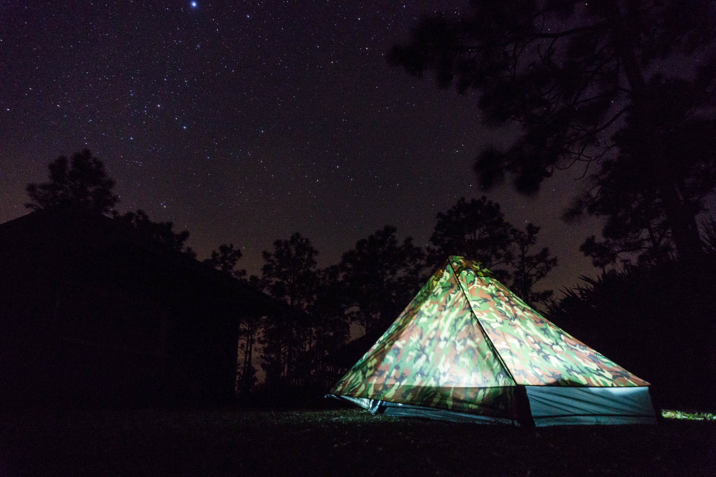
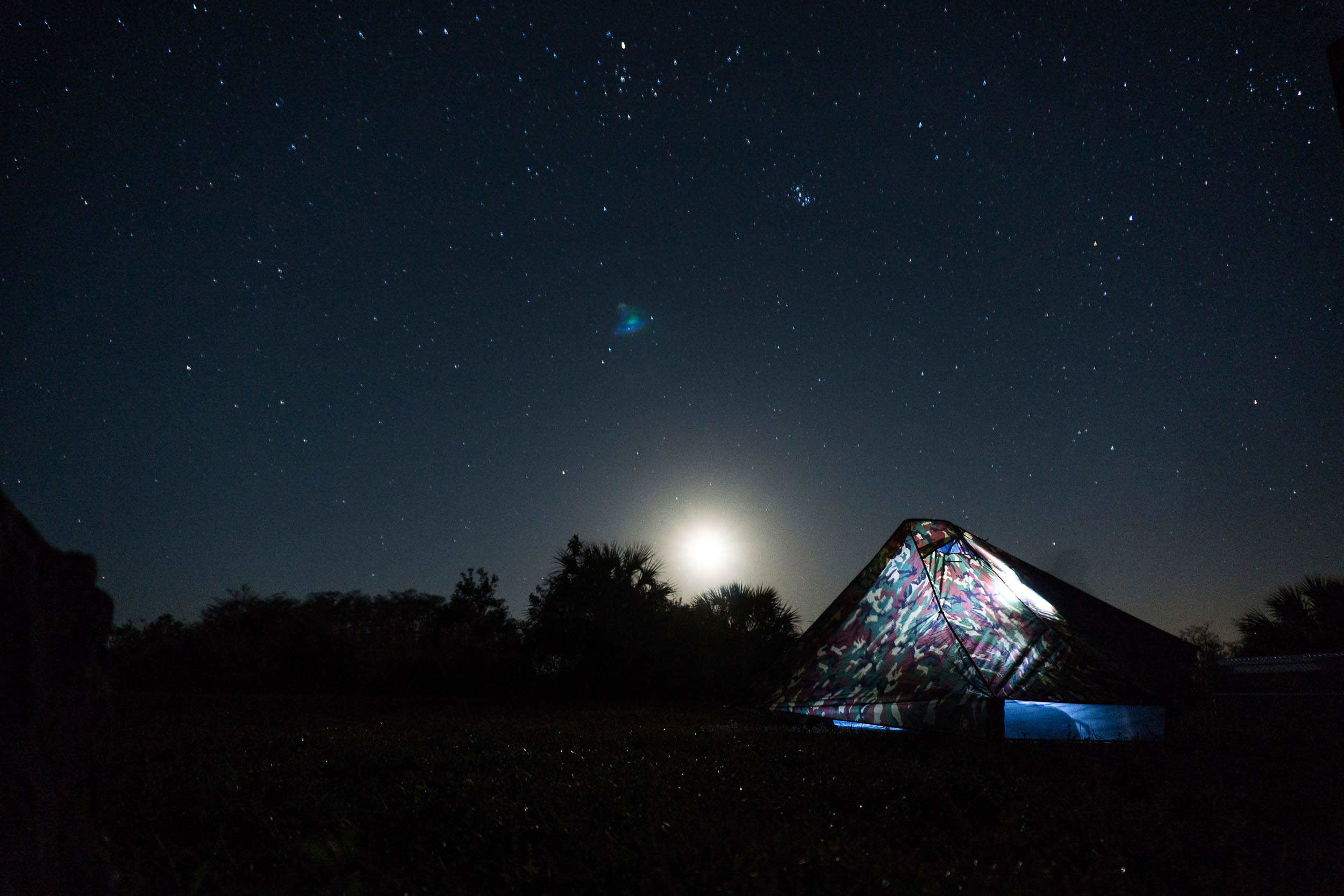
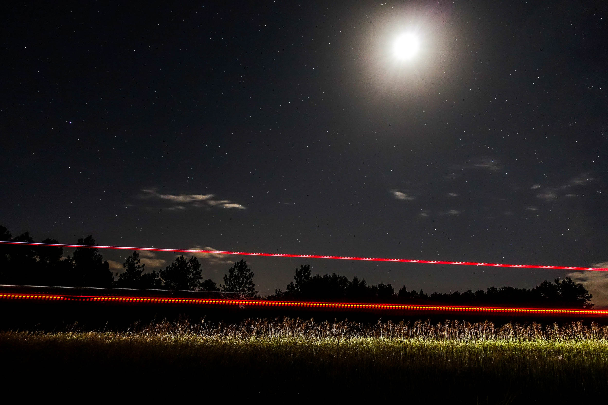
- Star Gaze at Kissimmee Preserve State Park, Florida’s first Dark Sky Park, and your opportunity to see the Milky Way.
- Take a side trip to Fakahatchee Strand to see the Ghost Orchid and maybe catch a glimpse of a Florida Panther.
- Visit the Skunk Ape Research Center, and talk with the owner, who can give you amazing advice about the Everglades. They offer an opportunity to camp, too.
- Visit Clyde Butcher’s world-famous Big Cypress Gallery. This photographer is known for his beautiful black and white landscape photos and his love of Florida. They even have a cottage for staying the night and offer swamp hiking tours.
- Go off route to visit Robert is here Fruit Stand, featuring a vast collection of locally grown rare and exotic fruits and vegetables.
- Take in the wonders of the handbuilt Coral Castle, which was constructed without large equipment. Edward Leeskalnin moved over 1,100 tons of coral to create this beautiful sculpture garden. To this day, scientists debate how he could have performed such a feat.
Whereabouts describes a list of places and things that are a part of this route as a means to understanding its history. With research and writing by Tsinnijinnie Russell (@tsinbean).
pin Mile 65
Bradwell Bay Wilderness
This wilderness area is a swamp thick with titi trees, which are identifiable by their leathery leaves and fragrant white flowers. It was established in 1975 by the Eastern Wilderness Act and contains a section of the Florida Trail notorious for being underwater. This is the second largest wilderness in Florida. The area is a swampland of hardwoods and small ponds that are either open or covered with aquatic plants. The area is in a subtropical climate and averages 55 inches of rain per year. White-tailed deer, black bears, and alligators are atop the food chain in the area. Low areas of the park are often submerged in up to 1 to 4 inches of standing water.
pin Mile 106
St. Marks Wildlife Refuge
Established in 1931 to provide winter habitat for migratory birds, this area encompasses 83,000 acres in three counties and includes 43 miles of North Florida’s Gulf Coast. This area was the first land set aside under the Migratory Bird Conservation Act. By 1960, the protected area was 67,000 acres, and in recent years, more land has been acquired through timer-for-land exchanges. These timber trade programs were slated for removal in forest prescriptions to improve wildlife habitat. Rather than selling the timber directly, the refuge traded it for land within the refuge acquisition boundary or adjacent to the refuge. The refuge is home to a wide variety of species including bald eagles, Monarch butterflies, the Florida black bear, osprey, and alligators, as well as wildflowers, waterfowl, and white-tailed deer.
pin Mile —
Blackwater Rivers
This is a type of river with a slow-moving channel that flows through forested swamps or wetlands. Tannins leach into the water as vegetation decays, creating a transparent, acidic water that is darkly stained and resembles black tea. Most major blackwater rivers are in the Amazon Basin and the Southern United States. These differ from other dark-water rivers because rivers in temperate regions often darken because of the color of their soil or by draining through areas of dark black loam, making them black mud rivers rather than blackwater rivers. Blackwater rivers are lower in nutrients and have higher ionic concentrations than rainwater. The unique conditions lead to unique flora and fauna.
pin Mile 208
Suwannee River
The etymology of the river’s name is unclear. The Shawanwaki (Shawnee) and Mvskoke (Sawanoke) who have historically lived in the area may be connected to the name of the river, with the word Suwannee being a mispronunciation or bad translation of either tribe. Albert S. Gatschet claims that the word Suwannee derives from a Creek word sawani meaning “echo” and others claim sawani means “muddy rivers.” Others suggest that the word Suwannee developed through “San Juan-ee,” referring to the Spanish mission of San Juan de Guacara located on the river.
The Suwannee River area has been inhabited by humans for thousands of years. The Weedon Island culture inhabited the area in the first millennium and the Suwannee River Valley culture began to form around 900. By the time the Spaniards arrived in the 16th century, the river was inhabited by two bands of Timucua-speaking peoples, the Yustaga and the Northern Utina. The river itself is a wild 246-mile blackwater. Its headwaters are in the Okefenokee Swamp in Georgia, and the river runs southwestward into the Florida Panhandle and drops elevation through limestone layers into a rare Florida whitewater rapid near White Springs, Florida. The river runs through Florida and eventually drains into the Gulf of Mexico near Suwannee, Florida. The song “Old Folks at Home” by Stephen Foster popularized the name of the Suwannee River, and the song was made Florida’s state song.
pin Mile 239
Suwannee Springs
This site is home to six natural sulfur springs, five of which flow directly into the south side of the Suwannee River. The main spring flows inside a manmade wall and flows from Oligocene-age limestone, and it discharges hard sulfuric water. The water maintains a year-round temperature of 70 to 76 degrees.
pin Mile 273
Osceola National Forest
This National Forest was established in 1931 with the aim of protecting 229,185 acres of wetlands and pine flatwoods. The park is named after Osceola, a Seminole warrior who led a group of warriors in resistance during the Second Seminole War. He was captured in 1837 after being deceived by a flag of truce when he entered Fort Peyton for peace talks. General Jesup used the truce flag in an act of treachery to capture Osceola. He was imprisoned at Fort Marion in St. Augustine and then transported to Fort Moultrie in Charleston, South Carolina, where he died of either internal infection or malaria.
The Forest itself is 200,000 acres of pine flatwoods and cypress-hardwood swamps. The park has one officially designated wilderness area, the Big Gum Swamp Wilderness, which has an area of 13,660 acres. The park provides a habitat for alligators, red-cockaded woodpeckers, Florida black bears, eastern indigo snakes, gopher tortoises, pileated woodpeckers, bobcats, fox squirrels, and many songbird species.
pin Mile —
Seminole Tribe of Florida
The Seminole towns in Florida moved about so frequently and altered their names so often that it’s next to impossible to follow their history in any connected manner. This means that many of the town names that existed in Florida also exist now in the present-day territory of the Seminole people in Oklahoma. The Seminole gathered from across Florida, Georgia, and Alabama because those borders did not define how the Seminole moved through their ancestral homelands. The Seminole were—like all tribes in the Southern U.S.—greatly impacted by Andrew Jackson signing the Indian Removal Act. The Seminole never signed a peace treaty and remained in Florida despite the Indian Removal Act moving many Indigenous people west. The Seminole were referred to by the Spanish as cimarrónes, the Spanish word for “runaways” or “wild ones.” Some Seminole saw the name as an insult, others as a badge of honor.
The Seminole fought for their home and cite Abiaka, Coacoochee, Micanopy, Osceola, Holatta Micco, and other great warriors as heroes who fought for their families and their way of life.
The Seminole Tribe of Florida followed Abiaka, known to Americans as Sam Jones, into the Florida swamps to remain free and unconquered. Their ways and traditions remained intact and as more people moved into Florida.
Today, the Seminole Tribe of Florida has grown from the 200 followers of Abiaki to more than 5,000 tribal members. They continue to fight in courtrooms to maintain the sovereignty of their schools, police, and courts. They still continue traditions of sewing, patchwork, chickee building, and alligator wrestling. They have also adapted to have one of the largest cattle operations in the U.S., and the tribe also owns Hard Rock Hotel & Casinos. They proudly maintain their ways, culture, and lives to remain the Unconquered Seminole Tribe of Florida.
pin Mile 352
San Felasco Hammock Preserve State Park
The park is named for the Spanish Mission San Francisco de Potano, which was the primary town of the Potano-Timucua at the time of first contact. Limestone outcrops in the park provide extreme elevation changes that make it an ideal habitat for hardwood trees, as well as bobcats, white-tailed deer, gray foxes, feral pigs, turkeys, and songbirds. This is one of the few mature forests that remain in Florida and is a prime example of climax mesic hammocks. Indigenous people have inhabited the area since at least 8,000 BCE. There are 56 archaeological sites within the park that represent eras potentially as far back as 12,000 years ago up to the 20th century. The Potano were the Indigenous population living in the area during Spanish colonization in the 16th century. San Felasco is a mispronunciation of “San Francisco.”
pin Mile 398
Gainesville
The Potano people were living in the Gainesville region at the time of European colonization. The de Soto expedition made the first mention of contacting the Potano in 1539. The tribe was politically, culturally, and linguistically tied to the Timucua. The Alachua tradition, evidence of which has been identified in the Gainesville area, is a precursor to the Potano people. The Potano were the main population of North Florida prior to colonization. The Potano and Timucua people were destroyed by European diseases and raids. Disease and suppression drastically reduced the Indigenous populations in the area. French and Spanish settlers supported wars on the Potano in the 16th century. Missionaries were sent, and missions were set up in the areas to baptize and assimilate the Indigenous people of the area.
pin Mile 413
Lochloosa Wildlife Conservation Area
Lochloosa Lake is within this wildlife conservation area. The area also provides a habitat for large populations of bald eagles, osprey, and wading birds. There are 18 listed species in the area, including Florida black bears, fox squirrels, eastern indigo snakes, wood storks, and sandhill cranes. The area is an environmentally sensitive watershed, and the preservation of the shoreline helps maintain hydrologic connections with the Orange Creek Basin. Lochloosa Lake is a 6,000-acre lake that can be up to 10 feet deep. The area surrounding the lake is 84% forests, wetlands, and other water bodies.
pin Mile 458-522
Ocala National Forest
The Ocala is the second-largest nationally protected forest in Florida, covering 607 square miles. Established in 1908, it is the oldest national forest east of the Mississippi River and the southernmost national forest in the continental U.S. The word Ocala is a derivative of a Timucuan term meaning “fair land” or “big hammock.” The forest contains several slow-moving rivers and wetlands. Blackwater rivers can be found inside the area and support the southern coastal plain blackwater river floodplain forests of bald cypress.
The southern coastal plain blackwater river floodplain forest is a forest system found in Alabama, Mississippi, Florida, and Georgia that occurs in the drainages of blackwater rivers and streams. The forests’ spring-fed rivers support hydric hammocks, evergreen, and hardwood tree hammocks. The prairies within the park are Floridian highlands freshwater marshes, and the southern coastal plain non-riverine basin swamps are large, seasonally flooded depressions and swamp tupelo. The Piencastle Bombing Range in Ocala National Forest is the only place on the East Coast where the US Navy performs live impact training, dropping 20,000 bombs a year at the site, hundreds of which are live.
pin Mile 600
St. Johns River / Tosohatchee Wildlife Management Area
The River had long been a fishing, hunting, and farming source for the Timucua, who occupied the region. In 1837, during the Second Seminole War, a Cherokee delegation met with Seminole leaders to persuade them to surrender. The Seminole name for the meeting place along the west bank of the St. Johns River was Totalousy Hatchy, a corruption of Tootoosahatchee. The wildlife management area along the river is 1,000 acres of old-growth floodplain swamp, with 20-40 acres of old-growth mesic flatwoods and an unknown amount of old-growth hydric hammock.
The St. Johns River is Florida’s longest river at 310 miles. The river flows north and drops less than 30 feet in elevation from headwaters to mouth. This results in a 0.3 mph flow rate. The widest point of the river is nearly three miles across, and its narrowest point at its headwaters is an unnavigable marsh. The river is one of 14 American Heritage Rivers and has been heavily polluted and redirected, heavily damaging its ecosystem. Seminole people called the river Welaka or Ylacco, which may derive from the Creek word wilako, meaning “big water.” It may also derive from the Seminole word walaka, from wi-alaka, “water” and “coming.” The American Rivers group listed the river as the sixth most endangered American river due to the number of proposals for large freshwater withdrawals for human use, the large amount of pollutants in the river, and the huge number of wetlands that were drained and paved over.
pin Mile 695
Three Lakes Wildlife Management Area
This is the second-largest remaining expanse of dry prairie in the U.S. The area is 62,000 acres and is home to a wide variety of Floridian wildlife. Indigenous people would use the area as a hunting and fishing area because its habitat is abundant with wildlife. This area was part of one of the last large open-range ranches in the U.S. until the Florida Legislature passed the Fence Law in 1949. Cattlemen would burn the prairie to kill pine saplings, oak, and palmetto in order for more grazing areas to grow. The area was also utilized for its lumber during the early 20th century. The area was known as the Three Lakes Ranch when it was purchased in 1974 under the Environmentally Endangered Lands Program. The three lakes are Lake Kissimmee, Lake Marian, and Lake Jackson.
pin Mile 757
Kissimmee River
The Kissimmee Valley region of Central Florida was inhabited by the Jororo, and the name of this river can be traced back to their language. The word means “long water.” Following the Indian Relocation Act, the Seminole and escaped slaves fled into the Kissimmee River Valley and settled in the swamplands of Central and South Florida because of their tactically defendable positions. The Kissimmee River still forms the north part of the Everglades wetland area and begins at Lake Tohopekaliga, flowing south through Lake Kissimmee into Lake Okeechobee.
Following the 1947 hurricane season, much of central and southern Florida faced heavy rainfall and flooding. In 1954, the United States Congress authorized the canalization of the Kissimmee river to help prevent future flooding. From 1962 to 1970, the Army Corps of Engineers dredged the C-38 Canal, shortening the river’s 103-mile distance from Lake Kissimmee to Lake Okeechobee to 56 miles. This project was devastating to the river, with 40,000 acres of floodplain below Lake Kissimmee drying out and reducing waterfowl habitat quality by 90%. Shortening the river created a faster flow, which led to major environmental problems in the Kissimmee Valley and in Lake Okeechobee. Restoration projects to repair sections of the river began in 1997 and are still underway.
pin Mile 782
Lake Okeechobee
This is the largest freshwater lake in Florida and the tenth-largest natural freshwater lake in the entire United States. It’s also the second-largest natural freshwater lake contained entirely within the contiguous 48 states. The lake covers 730 square miles and has an average depth of only nine feet. The Calusa are the lake’s earliest inhabitants. They called the lake Mayaimi, meaning “big water.” The name Okeechobee comes from the Hitchiti words oki (water) and chubi (big). The Calusa, who mostly lived in coastal towns and villages, had villages inland. They created canal systems that allowed them to travel between places such as Lake Okeechobee and Charlotte Harbor. This canal system would also allow them to haul seafood and bulk commodities between villages.
Today, the lake is undergoing environmental restoration, as elevated levels of arsenic and other pesticides have been found in mud removed from the lake floor. The lake has such high toxicity from human pollution that runoff must now be managed and water pumped out in order to avoid large volumes of polluted water releasing from the lake during heavy rains. The lake has also faced fires in dried-out portions of its lake bed, as well as algal blooms. The South Florida Water Management District was granted emergency permission to pump clean water back into the lake in an attempt to save wildlife and vegetation in the lake.
pin Mile 904
Big Cypress National Preserve
This vast 720,000-acre swamp is crucial to the health of the neighboring Everglades. The freshwaters of the swamp help support marine estuaries along Florida’s southwest coast. The area contains a mixture of tropical and temperate plant communities and is also home to diverse wildlife, including the endangered Florida panther. The archaeological Glades People moved into South Florida in 2500 BCE and would evolve into the Caloosahatchee culture, including the Calusa people. The Calusa were the original inhabitants of the area, as well as the Miccosukee and Seminole in later centuries.
pin Mile 960
Miccosukee Indian Villages
This is the contemporary home to the Miccosukee, where the tribe showcases tribal arts and culture with crafts, airboat rides, and alligators. The Miccosukee were originally a part of the Creek Nation but migrated to Florida prior to its statehood. After the Indian Removal Act forced many Miccosukee west, about 100 Mikasuki-speaking Creeks moved south into the Everglades. The tribe now has more than 600 members who are direct descendants of those people. In order to gain tribal recognition from the federal government, the tribe traveled to Cuba to ask Fidel Castro to sign an international recognition as a sovereign country within the United States. This led to the U.S. Secretary of the Interior approving the Miccosukee Constitution on January 11, 1962, and officially recognizing the Miccosukee Tribe of Indians of Florida. At the Miccosukee Indian Village, there is a museum that preserves their history and culture, a gift shop with crafts from Indigenous peoples from around the world, and alligator demonstrations that showcase centuries-old traditions and rituals.
pin Mile 1042-1150
Florida Keys
The Florida Keys were originally inhabited by the Calusa, Tequesta, and Matecumbe people, and Indigenous people from the Caribbean Islands may have also inhabited the area. The abundance of food and materials for making tools made the keys a great area for people to live. Shellfish was likely a large part of their diet, along with lobster, fish, and turtles, while supplementing with deer and raccoons. Sea grapes and coccolobas were also available to gather. Colonizers moved into the Keys, introducing disease to the Indigenous populations of the islands while also violently suppressing them, and many of the original inhabitants were victims of genocide or integrated with the Seminole who had moved south into Florida in the 18th Century.
WHEN TO GO
- The best time to ride Segment 8 is from December to March.
- That said, there is the threat of dangerous weather in the fall and spring. Hurricane season from August through November may impact travel plans, and it can sometimes cause serious flooding. Frequent afternoon thunderstorms also pose a threat in the spring and summer months.
- The route is rideable nearly all year with the right preparation. The ideal plan is to tackle the Florida portion when it’s cold in the northern parts so the southern regions won’t be as hot. Another favorable part of tackling the route during the colder months is the predominant wind direction will be from the north, which will help you out when you’re in the vast expanse of the River of Grass Corridor.
- Florida can get very hot, even in the fall and shoulder seasons.
LOGISTICS
- The segment starts in Tallahassee, a large city with full services and airport, lodging, and transportation services.
- The segment ends in Key West, which has an airport, lodging, and ferries that can take you to Fort Myers or buses to transport you to Miami.
- If you’re section-riding, there are several big cities you can fly into. Gainesville, Sanford, Orlando, and Miami are all close to the route and offer airports.
- It’s even possible to fly into Tampa and hop the Amtrak to Orlando to jump on the route or pedal into Fort Myers and take the Ferry to the Keys.
- Many local bicycle shops and city halls typically allow long-term parking for section riding; you just have to call and ask.
DANGERS & ANNOYANCES
- Many parts of this route are in black bear country, especially in the more remote sections in national forests. It’s best to get in the habit of tying up your food at night while camping. Find details on the PCT method here.
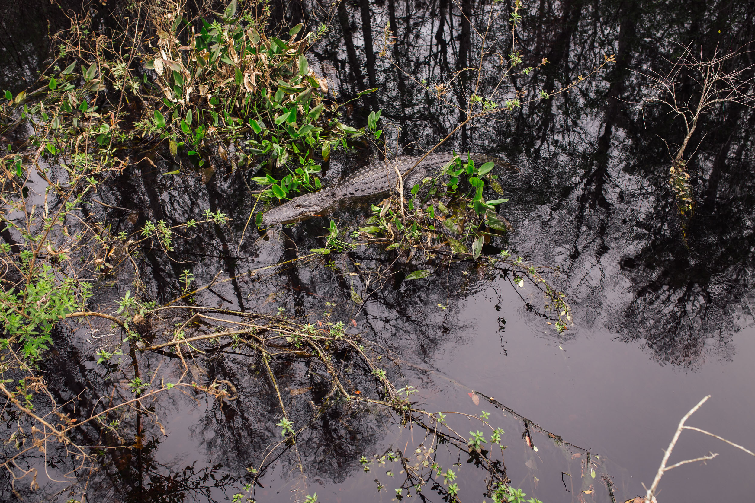
- It’s also not uncommon to see alligators, coyotes, and wild boars.
- There are rattlesnakes, copperheads, and mocassins in this zone too. Watch where you step and know how to deal with snake bites. Your chances of a dangerous encounter are low, but be aware.
- You cross two locks on this ride. Buckman Lock at the entry of Ocala National Forest is typically attended. There is a code you can use to cross after hours. Make sure the lock is right side up and the numbers 6691 line up correctly with the small hash marks.
- After entering the code, compress the lock and pull it out to open. Make sure to lock both gates and leave them as you found them after crossing. Lock 65a on the other side of Kicco is self-serve and does not require a code.
- Once in Big Cypress, remember that you’re in the panther’s home. Although no conflicts have been reported, it’s important to be aware.
- In this same area, you will encounter and be close to alligators. It is recommended you ride in the middle of the road when there is no traffic, especially on Loop Road and the levees, to avoid coming close to the animals. They like to sun on the shoulders during the day. Be especially cautious anytime you’re approaching an area with tall grass.
- As if that wasn’t enough, once you’re in Big Cypress and beyond, it’s possible to encounter pythons, an invasive species that officials are working hard to eradicate.
- Most of the route is within cell service, although several spots are without. You might consider bringing a satellite tracker or emergency beacon in case of injury or catastrophic failure.
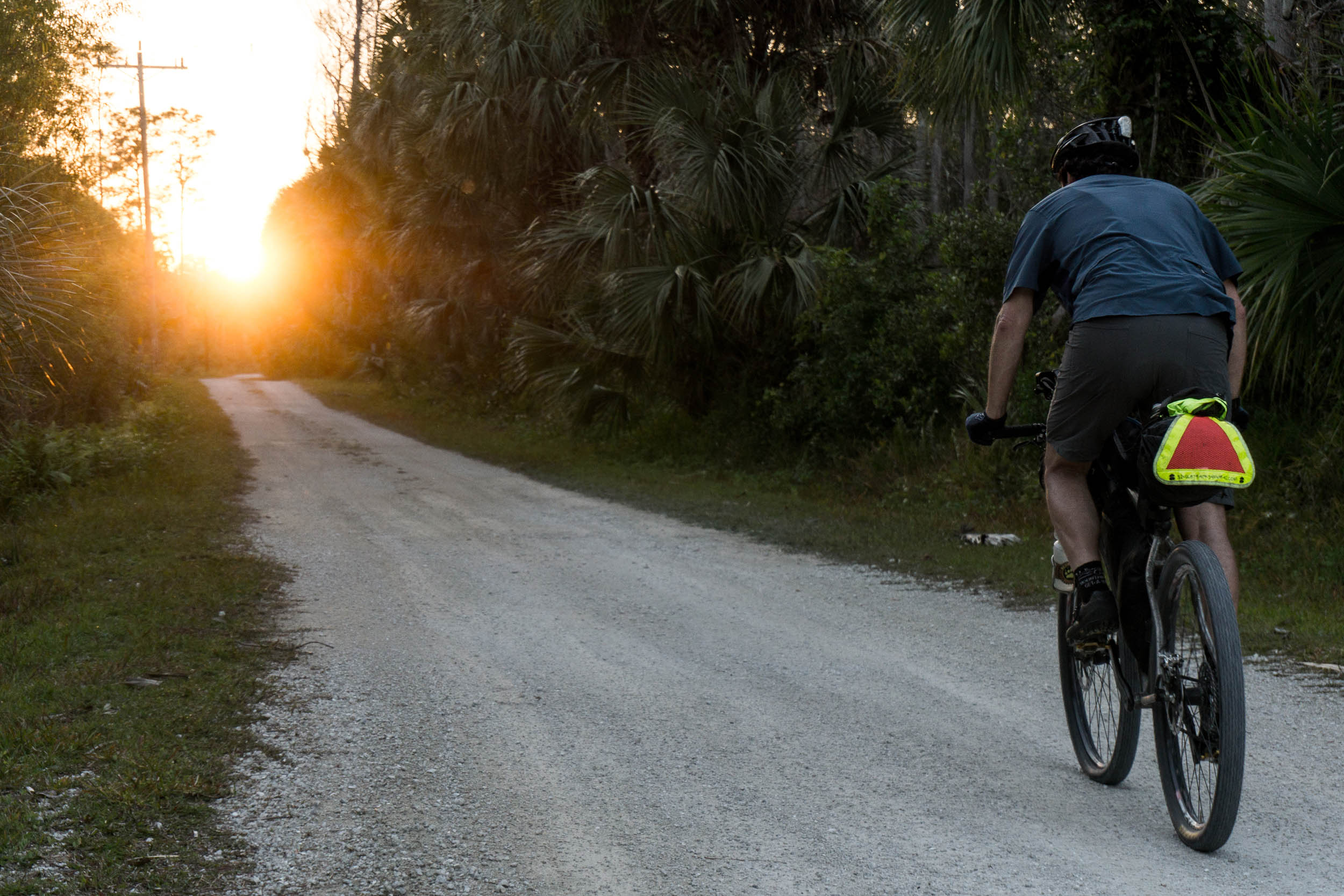
- While much of this route uses gravel and relatively low-traffic roads, a few spots are worthy of extra caution. Namely, on US1 as you approach Key Largo. As with any cycling outing, cars pose a threat. Wear bright colors and bring a rear blinker light.
- Additionally, there is hunting within national and state forests, wildlife management areas, and other public lands. Be sure to research hunting seasons in these areas before setting out. And wear a hi-viz orange vest if riding through any of them during hunting season.
WHAT BIKE?
- The best bike for this segment, as well as the entire Eastern Divide Trail, is an ATB or Tour Divide-style bike. For drop-bar aficionados, the Salsa Fargo and Cutthroat come to mind, or the Surly Ghost Grappler or Tumbleweed Stargazer. For those who prefer flat bars, any moderate hardtail or rigid 29er would be great, such as the Surly Ogre or Bridge Club, Salsa Timberjack, or Otso Fenrir.
- Considering the bullet point above, this segment is particularly variable, with plenty of sandy sections. Tires that are 2.4” or larger are highly recommended for sand roads that can be thick and soft in certain places. We like fast-rolling, ~2.4” XC rubber for this ride. Tires that folks like for the Tour Divide work well. The Maxxis Ikon or Rekon Race, Teravail Ehline, and Vittoria Mezcal are all tires we’ve used while scouting.
- There are several parts of the route that could be done on a gravel bike. Specifically, south of Kissimmee preserve to Key West.
- There are significant bike shops in Tallahassee, High Springs, Gainesville, Sanford, Lake Mary, Heathrow, Oviedo, Orlando, Melbourne, Sebring, Miami, Homestead, and The Keys.
- Segment 8 begins in Tallahassee, which has a robust bikepacking community and a hostel available at the Bicycle House. There are several trail angels in town. You can connect with these folks using the Warmshowers app or by joining the Florida Divide Riders or Tally Tango groups on Facebook.
- There are campgrounds and established campsites within national forest land throughout the route. Many prominent options are noted in the downloadable GPX file, but there are more.
- There are not many places on the route that don’t offer camping opportunities. With proper planning, you could do the entire route and stay outside. The challenging spots are south of Clewiston and in the Keys.
- If wild camping is a must, we recommend setting up after dusk and leaving at dawn. There are remote stretches of forest and options to camp out of sight within wooded areas. Churches, parks, and other public places are usually safe options, too, but use your judgment, and as always, leave no trace.
- There are hotels/motels/lodging in many of the major towns and cities. If you cannot locate an on-route option, off-route options are always available.
- White Springs has a bed and breakfast that is especially kind and generous to hikers and bikers. A stay at this spot is highly recommended. When you call for a reservation, just mention that you are riding your bicycle to the Keys to get the special rate.
- Segment 8 finishes at Key West, which is a huge tourist attraction. There are plenty of lodging options there. Camping is tough in the Keys. Other riders have succeeded with local businesses, churches, and fire stations that, when asked, have let folks camp.
- Study the Florida no-turn-away policy for added success on your journey.
- Surface water, creeks, and rivers to filter water from are abundant throughout the route.
- From south of Clewiston until you reach Big Cypress, filtering is not recommended due to possible pesticide contamination.
- You may also come across pitcher pumps in several areas. You will see a gallon of water right next to it. Use this water to pour into the top of the pump to prime it so you can dispense more water. In most cases, it’s still a good idea to clean this water after dispensing and always refill the priming gallon when done.
- Churches are a good source of drinking water as there are usually spigots available. If there is someone on-site, make sure to ask permission first.
- There are a fair number of resupply options on this route, as noted in the POIs of the downloadable GPX file. Florida bikepacking is rather stress-free and straightforward for resupply. There is almost always something in every town or city, either on or off the route. Plenty of cell coverage to search out spots.
- All the big cities on the route will provide almost all you need for travel, including food, restaurants, and bicycle shops. Most of the big towns will also have everything noted except bicycle shops. Make it a point to study the sections as you tackle them and know your resupply spots. Ensure you carry more water than you normally would as you get further south. Headwinds can enormously impact your forward progress and may double the expected travel time.
- Take special note of the slightly longer distance between restocks before leaving the towns of White Springs, Hawthorne, Christmas, Kenansville, Clewiston, and Sunniland.
Here is an example itinerary based on 50-75 mile days. This is a solid baseline that a fit and experienced thru-rider carrying a medium-light load might consider as a relatively challenging bikepacking itinerary. Less fit or experienced riders should factor in a longer schedule.
location Tallahassee to Sopchoppy
Day 1 (78 miles +1086)
You’ll be very happy if you like singletrack, because you’ll spend a huge chunk of your 78-mile day riding various trails. You start your ride on some local hometown chunk and then transition and drop into the Fern Trail, a beautiful little path along a canal. You weave in and out riding this course, which gets progressively more technical before crossing a road and entering Tom Brown at Weems Road. From there, you start to gain some elevation and get to play on some super fun clay-based tracks. Up and down, you go on the beautiful twisty path until you merge with a less technical trail and then make your way back to roads and bike paths until you reach Twilight and Munson, more pristine clay singletrack.
You end your odyssey with a traverse on the Forest Loop, a more rudimentary but fun area. From there, the ride flattens out, and you take a mix of sandier forest roads and hardpack gravel across the Apalachicola National Forest, eventually rejoining pavement and ending your day in Sopchoppy. If you like beer, check out Civic Brewing. There is a nice little city campground about a mile south of town that will make for good camping along the river.
location Sopchoppy to Aucilla Camp
Day 2 (63 miles +184ft)
Leaving Sopchoppy, the route starts with a mix of pavement and bike paths, but that doesn’t last long. You soon start your traverse over to Saint Marks. You will ride numerous sand roads and grassy tracks from here that eventually give way to hardpack and more gravel roads. A little bike path and road riding will drop you into Saint Marks, where the course is made up of grassy levees and spillways until you exit the park on primitive and potentially muddy roads. You rejoin the road at this point for a short stretch and a critical restock at JR’s Aucilla Store.
Leaving JR’s, you ride a mix of pavement and hardpack limestone road until the road narrows to a rough track at the entrance of Aucilla Sinks. This geologically wondrous place allows you to observe the river as it sinks and rises from underneath the earth. As you pedal along, you can see huge vast chasms in the limestone and the river underneath. Keep an eye out on your left for the little sign indicating the camp’s location and the end of your day. There is a bigger campground at the end of Goose Pasture Road if you prefer to save energy and complete the push across Aucilla Sinks Trail the next day.
location Aucilla Camp to Madison
Day 3 (48 miles +485ft)
Your time on the Aucilla Sinks Trail continues. Beautifully primitive, this trail is such a treat, and if you keep your ears open, you have a chance to take a swim and see one of the few rapids that exist in the state. Once you exit the trail, you start on two-track and quickly join a hardpack gravel road. From here to Madison, you will ride a mix of back roads, good dirt roads, and even a little bit of the Old Bellamy Highway before arriving in town. Once there, you have options for camping, hotels, restaurants, and convenience stores.
location Madison to Holton Creek
Day 4 (40 miles +574ft)
Stock up well on your departure from Madison. After a short stretch of tarmac, you will travel on rural dirt roads with huge views. Once you get closer to Twin Rivers Forest, you may hit a stretch or two of softer sand, but this is all generally good rolling terrain. After you rejoin pavement and before you start the Big Oak Trail, you have a chance to take a little side trip into Ellaville via the old Hillman Bridge. Most of your day will be spent riding along the Suwannee and Withlacoochee Rivers.
Aside from the beautiful twisty trail, one of this section’s many highlights is a chance to see an enormous old oak tree. Eventually, the trail ends, and you ride on good dirt roads with a little pavement before going into Holton Creek WMA. Once in the WMA, it’s mostly hardpack limestone roads under beautiful dense foliage before reaching the river camp. If you’re fortunate, you will get a chance to spend the night in one of several elevated shelters they provide at no charge. They have hot showers here, and every den has electricity, lights, and fans. Primitive camping is also available, but the real draw is the beautiful screened-in oasis.
location Holton Creek to Ocean pond
Day 5 (64 miles +525ft)
Your exit from Holton involves more primitive pathways that connect and intertwine to lead you out of the park and onto neighboring roads. From there, you will ride some sandier rural dirt roads and pavement until you drop into the backside of Stephen Foster State Park and its extensive singletrack system. Once on these trails, you will ride good, fun, twisty rooty singletrack into the center of town and then a few more tracks on your way out before the pavement stretch that connects you to Osceola National Forest. Most roads that take you to Ocean Pond are hardpacked and fast. On some narrower roads, you may encounter the occasional puddle if conditions have been wet. Ocean Pond has a big campground with electricity, hot showers, and even credit card-powered washers and dryers.
location Ocean Pond to Alachua/High Springs
Day 6 (58miles +731ft)
After a good rest at Ocean Pond, you will spend most of your time from here to the other side of Gainesville riding good rural dirt roads with the occasional stretch of pavement. No real surprises, just lots of good riding through scenic rural north Florida. At the end of the segment, you could go off route to High Springs or Alachua for camping, good food, or indoor lodging.
location Alachua/High Springs to Hawthorne
Day 7 (75 miles +668ft)
Departing from your previous night’s stay, you have more of the same beautiful, scenic oak-canopied dirt roads. Gainesville is just off route if you are craving a rest day or need some bicycle repair. There are lots of food options—too many to highlight. If you were missing the singletrack from the previous days, you will be happy as you drop into Sweet Water Preserve and ride some twisty trails to connect to the Gainesville-Hawthorne State Trail. This path borders Paynes Prairie on the northern end, and there are several overlooks you can take for an off-route viewing. This park is famous for its resident wild horses and bison. You ride on this undulating path before deeply exploring the unique service roads inside Longleaf and Grove Park.
More rudimentary and not as wide as the roads you have ridden, you may encounter the occasional stretch of soft sand. You rejoin the bike path just before you reach the town of Hawthorne. Camping options are limited in town. If you prefer to camp, take a shorter day and end in Longleaf (which has one campsite). You could also push into Ocala National Forest and camp at Rodman Dam.
location Hawthorne to 88 Store
Day 8 (51 miles +538ft)
Leaving Hawthorne, your ride starts on pavement and quickly gives way to rolling dirt roads that, when dry, can be soft. From Hunter Road, you enter even more rudimentary roads and some grassy tracks. This area can flood occasionally, but rarely is the water too deep to cross. You traverse a small bridge, eventually exiting this rather slow grassy segment, and cross into the Barge Canal Recreational Area. Here is a good chance for a break and to get water if you need it. If the attendant is available, he will help you cross the lock. If not, check for the code under the Dangers & Annoyances tab.
Once across, you travel on a raised grassy levee for several miles parallel to the barge canal. There is a huge campground with water and electricity on the route. This would be a good place to stop if you need a shower. If not, keep pushing on across Rodman Dam and down good clay roads until you reach the 88 Store. It’s a great little place for cheap beer, but resupply is limited. They will allow camping behind their store and have water and a laundry room.
location 88 store to Seminole Forest
Day 9 (75 miles +1266ft)
The rest of your trip across the Ocala National Forest will feature the most elevation change you have experienced so far. Big views and long rolling hills will be a nice change of pace. There are several unique springs in the forest and many opportunities for fun side trips. Stock up well on water before you depart, as the conditions on the forest roads are bright and exposed. There is a good store in Shockley Heights, and then you’re treated to the Paisley Woods Bicycle Trail and the rolling sand scrub singletrack.
At the end of the trail, you have a chance to shorten your day by staying at the Clearwater Lake campground. There is also good pizza and typical restock options in the town of Paisley. South of Paisley, you traverse Maggie Jones, a road that can be sandy at times but generally is fairly fast rolling. From there, it’s more dirt and rolling hilly pavement with the occasional deep sandy spots until you reach the interior of Seminole Forest. There’s a lot of camping options in this area and two sheltered sites. Study the map and choose a camp that suits your need. Stock up on water before leaving Paisley or plan to go off route in Pine Lakes, as most camps are dry.
location Seminole Forest to Tiger Branch Camp
Day 10 (63 miles +450ft)
Seminole Forest is a special place. It’s part of the Wekiva River Basin, and there are at least 20 springs littered all over the property. The roads are hardpack and fun to ride. Upon your exit, you have the option for an off-route foray to Wekiva Falls, another spring-fed magical place with food, camping, and lodging. Beyond that, a big chunk of your day will be spent on a bike path. The route starts with the Seminole Wekiva Trail and, after crossing over Interstate 4, joins the Cross Seminole Trail. If you need anything, this is the time. You’ll find good food and lodging all along the route.
The route also passes by Big Tree Park, home of Lady Liberty, one of the oldest cypress trees in the state. When you reach the outskirts of Ovideo and the Little Econ, your journey becomes more primitive as you navigate a combination of forest roads and horse trails. You take a small pavement break and then continue on to more of the same.
Before entering Seminole Ranch, you may encounter huge puddles or standing water. In the ranch, you’re greeted by high levee trails before following a bit of rudimentary singletrack and then crossing State Road 50. Plan an off-route trip to the store in Christmas as it will be a long trip until the next on-route store at Kenansville. Tossohatchee has really good firm gravel roads for you to enjoy. There are several camps in this area, so pick one that suits your needs and enjoy.
location Tiger Branch Camp to Three Forks Shelter
Day 11 (58 miles +57ft)
Leaving Tiger Branch, the hardpack road gives way to an area of the trail that is generally flooded. After exiting Tossohatchee, you’re on paved roads for a long time, probably the longest bit of your trip. Eventually, you reach the turn-off to Three Forks and begin your intense gravel levee journey south. If you need a room, bike repair, or hotel stay, continue on the paved road and head east into Melbourne. In Three Forks, you will find good roads with little to no surprises. Toward the end of the day, remember not to miss the turn-off to the shelter for your night’s stay.
location Three Forks Shelter to Kissimmee Preserve campground
Day 12 (75 miles +185ft)
Your day starts with more levee riding as you make your way out of Three Forks. Eventually, you join Fellsmere Grade, which starts as a levee road and eventually turns into a good dirt road. The store at Kenansville is a key restock and helps you avoid shopping at River Ranch, a really interesting place with disproportionally high prices. Lots of hardpack roads lead you on your way to your short road ride into River Ranch. The roads in Kicco are also well kept and fast. Expect to see cattle.
There are a couple of campsites in Kicco if you want to shorten your day. Once across Lock 65a, the ride will slow down quite a bit as the roads are composed entirely of grassy two-track. For the most part, your trip into Kissimmee Preserve State Park will be like this, but there is a great campground at the end, and if your timing is right, this is one of a few spots in Florida that rates as Dark Sky Park and allows you to view the Milky Way.
In the event of persistent rain, the path leading to KPC can flood and at times be dangerous to traverse. If you are curious about conditions, call the state park (863-462-5360) and ask them if the trail to lock 65a is flooded. If they say yes, we recommend using this high-water alternate.
location Kissimmee Preserve Campground to Indian Prairie Canal Camp
Day 13 (54 miles +36ft)
Unlike the path to get to KPC, the exiting route is hardpacked, fast dirt. You then ride on paved roads before rejoining levee roads on your approach to Lake Okeechobee. Once here, you will continue along the paved bike path and primitive levee road till you reach your planned stop for the night. This day was intentionally cut short to account for the added sun exposure and potential wind that can make things challenging. There are spots off route to stay inside if you desire.
location Indian Prairie Canal Camp to Clewiston
Day 14 (41 miles +28ft)
From the Indian Prairie site to Clewiston, it’s a mix of older levees, bike paths, and pavement until you reach Clewiston. Typically, most folks who tackle the Florida Divide stop at Clewiston. Here they rest up and restock for the hot, exposed, dry push across the Devils Garden.
location Clewiston to Everglades Farms
Day 15 (68 miles +28ft)
Stock up with extra water for your long sunny day. Expect winds to be the major hurdle to your forward progress. Most of the day is spent on hardpacked levees, but there may be some grassy connectors in between. Once you finish the levees, you are on rural paved roads for a long while. Outside the Devil’s Garden, the Azteca store is a famous stop for riders due to the authentic Mexican food. This segment ends at Everglades Farms. We stayed there recently and found the accommodations to be quite surprising. If you don’t want to stay here, push 20 more miles into Big Cypress, where they have several campsites available as soon as you enter. Make sure to stock up your food bags when leaving the Sunniland store, as there are no on-route food sources until you reach the other side of the Miccosukee Reservation.
location Sunniland/Hip Camp to Mitchell Landing Campground
Day 16 (65 miles +6ft)
After your Sunniland restock, you begin a long stretch without supplies. Most of the day is spent on limestone-based gravel roads, but there is a long stretch of pavement from Turner River Road to Loop. Here, there are unobstructed views and bountiful plant and animal diversity. The clear, crisp water you see when crossing the canals on Loop Road can be filtered. Just watch out for alligators, as the area is infested with them. Mitchell Landing is a primitive campground. If you prefer a camp with resources, take a shorter day and stay at Monument Lake.
location Mitchell Landing Campground to Everglades Trail Wild Camp
Day 17 (70 miles +15ft)
Your day starts on pavement, but once you get to the Valu Jet Memorial, you spend the rest of it on gravel levees. The Miccosukee Reservation is an interesting little area. You get an opportunity to view their traditional home construction style. You pass right through the middle of the reservation on the Tamiami. This is your chance for some on-route food and resupply. Beyond that, it’s just more levee roads as you travel south along the Everglades Trail. If you want to camp, pick a spot and set up before reaching the end of the levee south of Ingraham Highway. If you still feel like more miles, push on to Key Largo for a room or a high-dollar campsite.
location Everglades Trail Wild camp to Curry Hammock State Park
Day 18 (63 miles +102ft)
The road is very busy, but thankfully it is not long before you reach the Keys and start your journey on the bike path. Most of your ride will be on a bike path that weaves in and out and crosses the road here and there.
Resupply is a non-issue throughout. You can rush your experience in the Keys or just bask in the tropical climate and aqua-green waters.
location Curry Hammock State Park to Key West
Day 19 (55 miles +149ft)
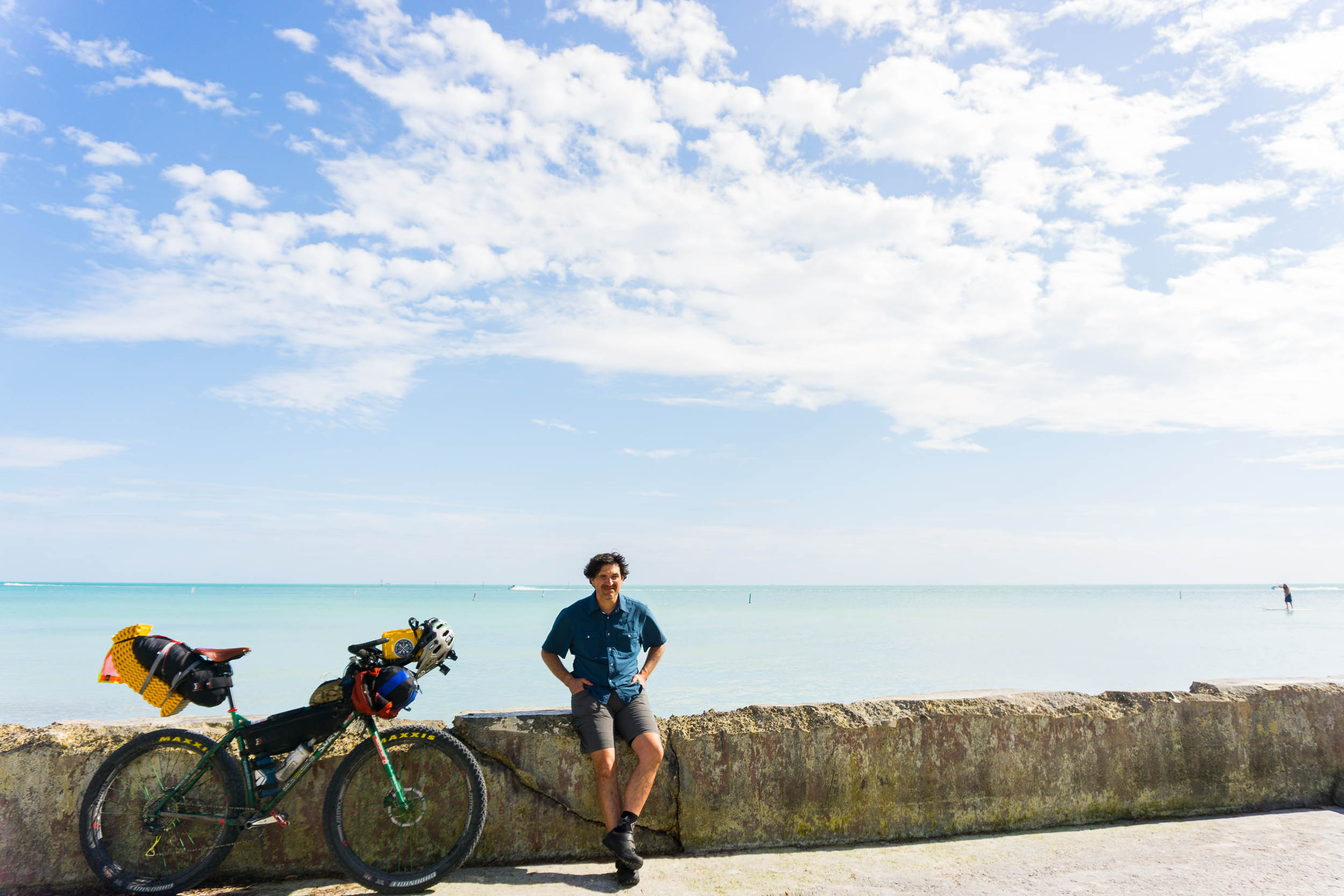
Your last day will start with more of the same until you reach Big Pine Key, where you go off the beaten path to ride a little bit of dirt with hopes of seeing a Key Deer. Once you reach the keys, watch for cars and the tourist traffic as you make your way to the southernmost point, Buoy, for that official finish picture! Bask in the glow of finishing the longest bikepacking route in the United States. You’re in luck, as you will have plenty of places to celebrate!
Ancestral Homelands
- Tallahassee, FL – Mvskoke (Muscogee), Apalachees
- White Springs, FL – Timucua, Mvskoke, Miccosukee
- Olustee, FL – Timucua, Miccosukee
- Lake Butler, FL – Seminole, Timucua, Miccosukee, Mascogo
- Palm Bay, FL – Seminole, Ais, Miccosukee, Mascogo
- Okeechobee, FL – Calusa, Seminole, Mayaimi, Miccosukee, Mascogo
- Hialeah, FL – Seminole, Taino, Tequesta, Miccosukee, Mascogo
- Key Largo, FL – Seminole, Taino, Matecumbe, Mascogo
- Big Pine Key, FL – Calusa, Seminole, Taino, Mascogo


Terms of Use: As with each bikepacking route guide published on BIKEPACKING.com, should you choose to cycle this route, do so at your own risk. Prior to setting out check current local weather, conditions, and land/road closures. While riding, obey all public and private land use restrictions and rules, carry proper safety and navigational equipment, and of course, follow the #leavenotrace guidelines. The information found herein is simply a planning resource to be used as a point of inspiration in conjunction with your own due-diligence. In spite of the fact that this route, associated GPS track (GPX and maps), and all route guidelines were prepared under diligent research by the specified contributor and/or contributors, the accuracy of such and judgement of the author is not guaranteed. BIKEPACKING.com LLC, its partners, associates, and contributors are in no way liable for personal injury, damage to personal property, or any other such situation that might happen to individual riders cycling or following this route.
Please keep the conversation civil, constructive, and inclusive, or your comment will be removed.