


Camino Del Puma: Peru and Bolivia
Distance
780 Mi.
(1,255 KM)Days
22
% Unpaved
70%
% Singletrack
0%
% Rideable (time)
99%
Total Ascent
57,569'
(17,547 M)High Point
16,371'
(4,990 M)Difficulty (1-10)
7?
- 5Climbing Scale Moderate74 FT/MI (14 M/KM)
- -Technical Difficulty
- -Physical Demand
- -Resupply & Logistics
Contributed By
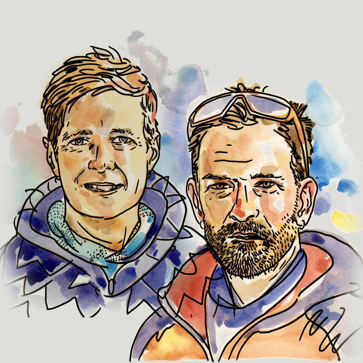
Mark and Hana
Highluxphoto / BeingHana
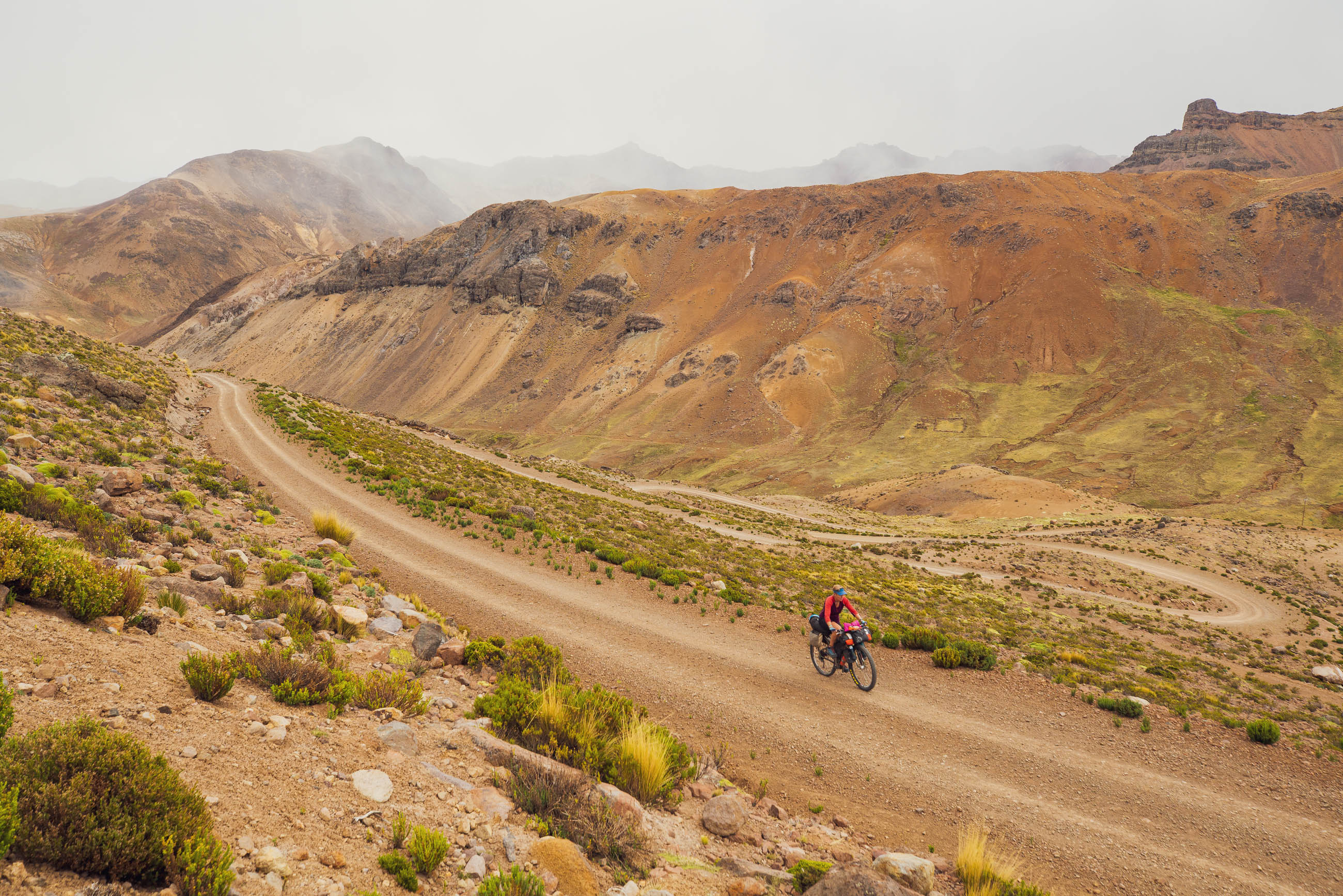
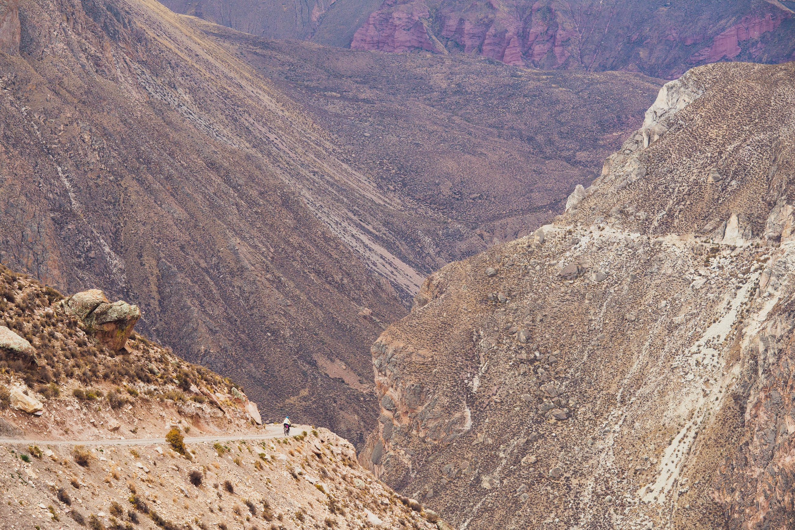
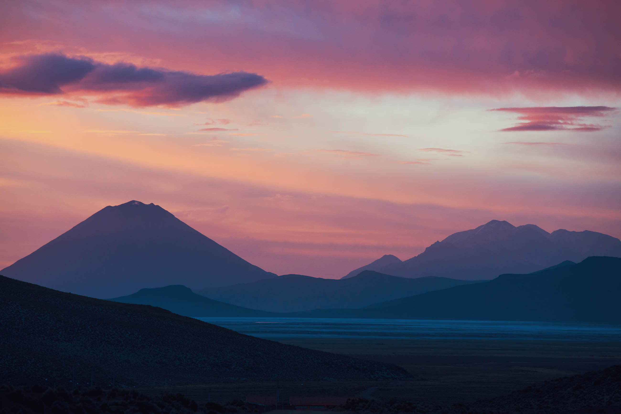
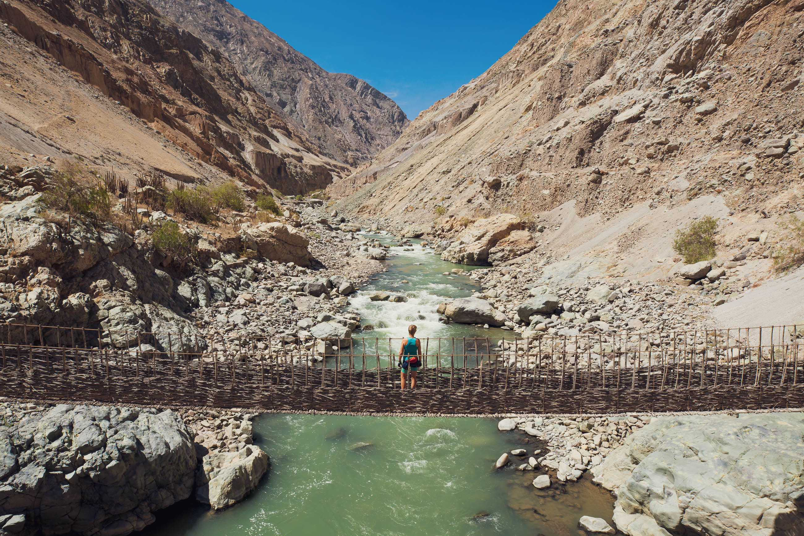
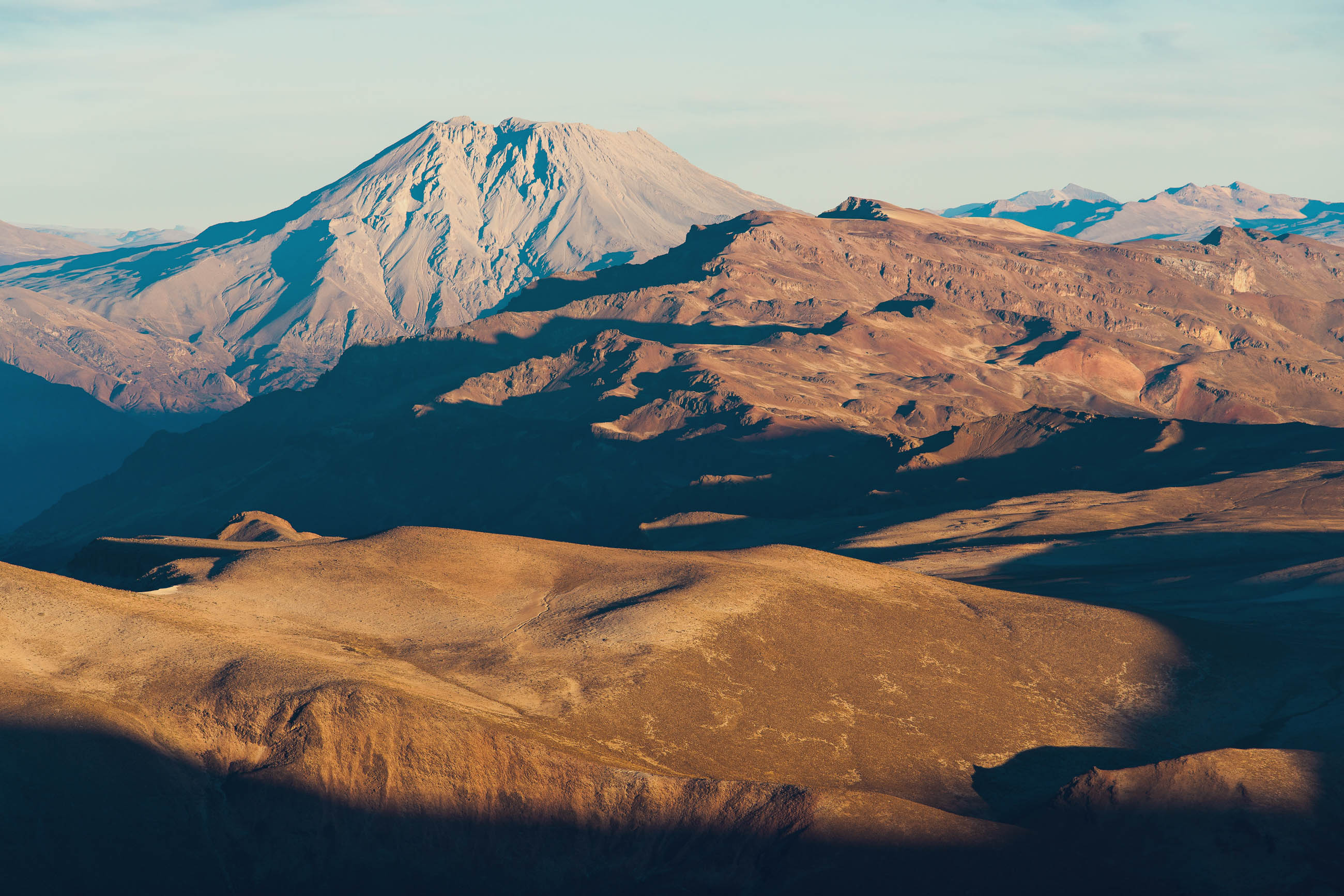
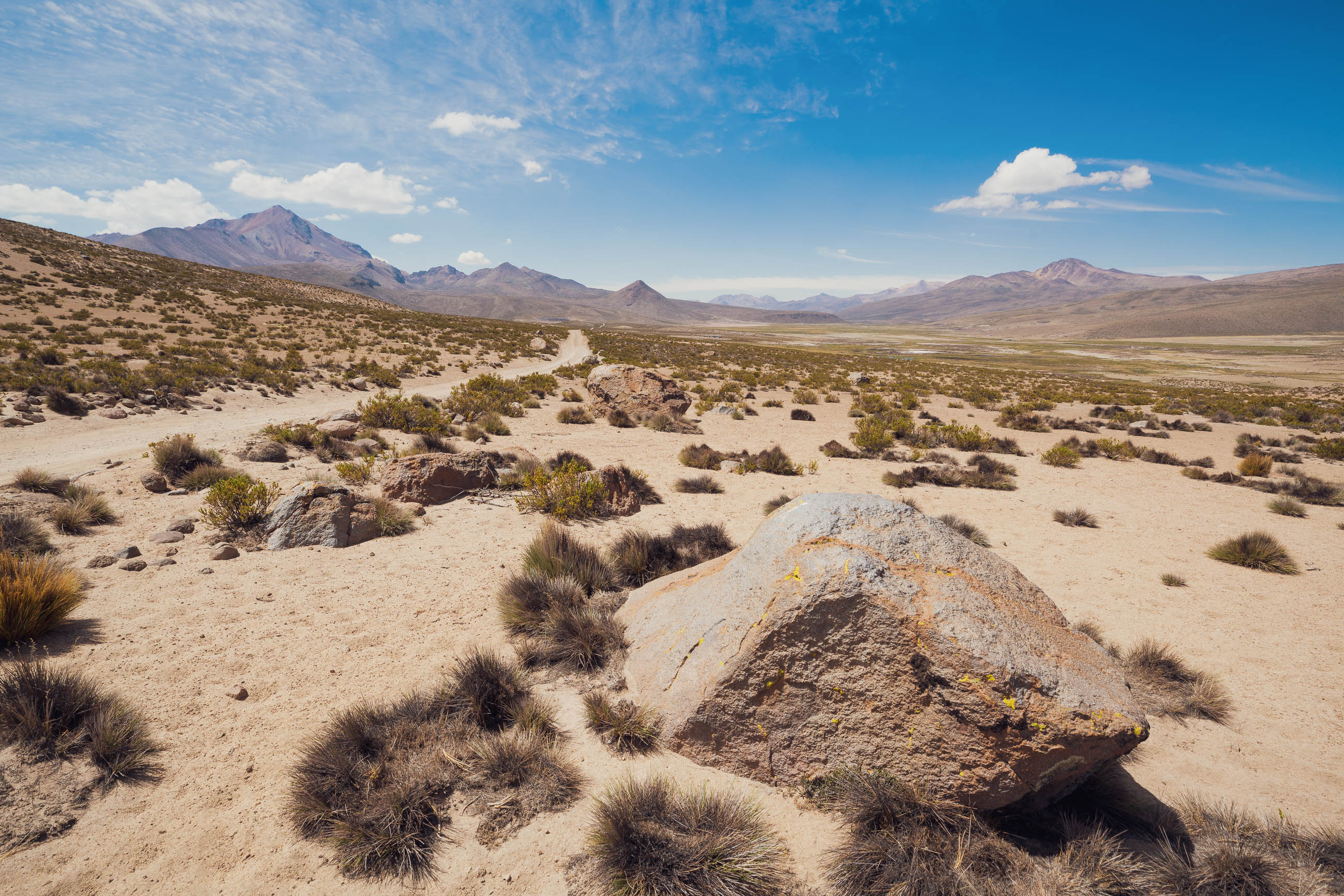
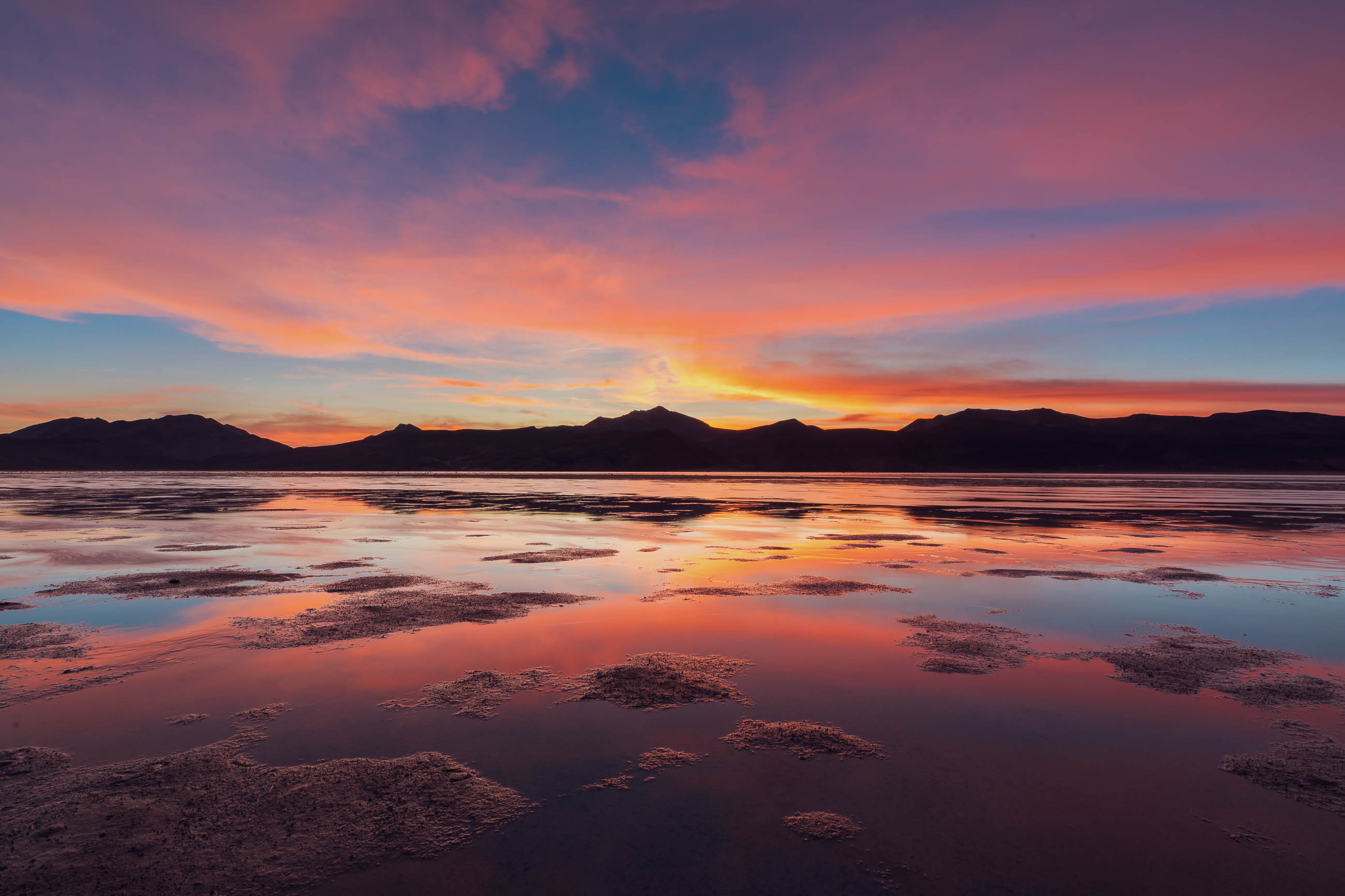
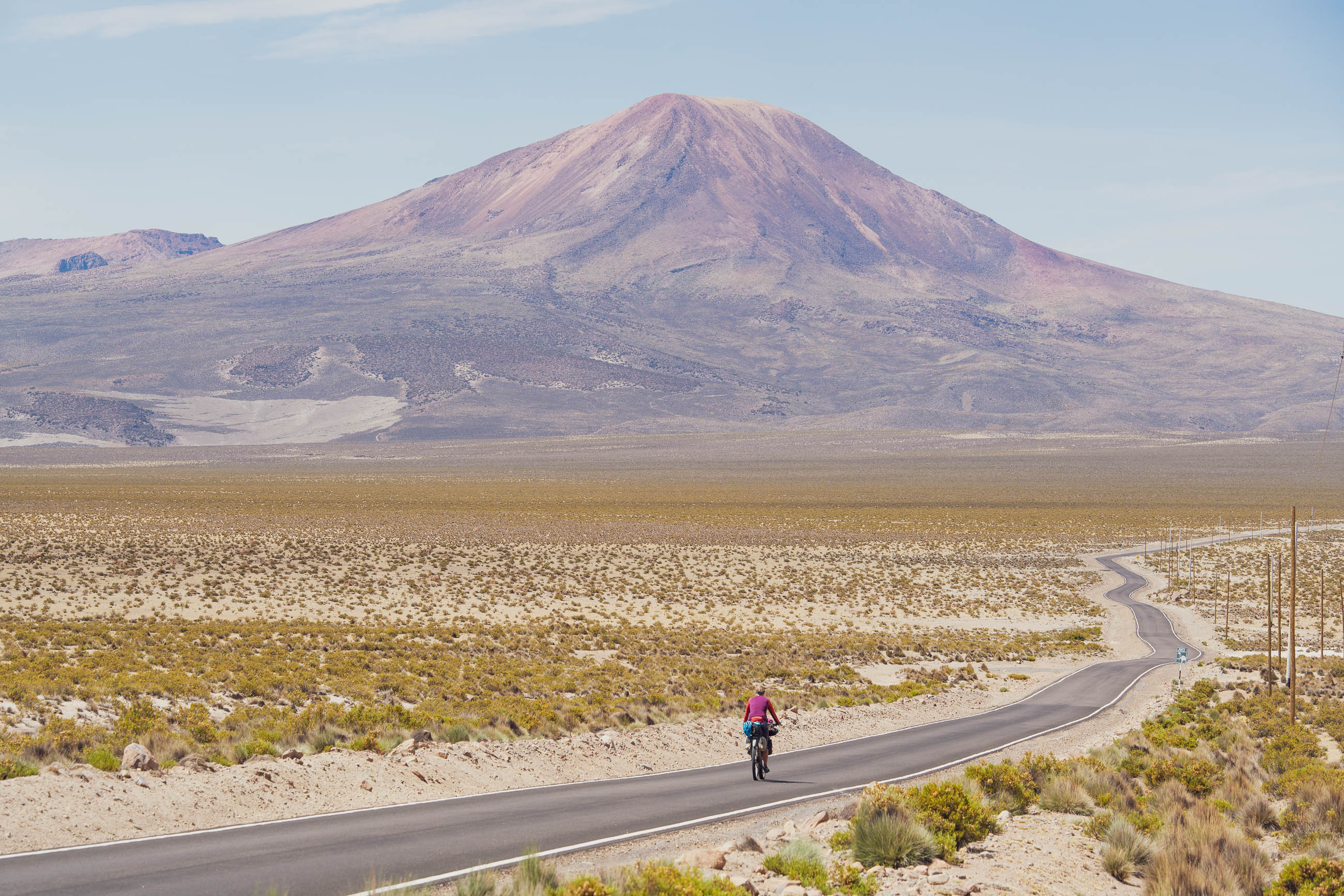
To follow this mountainous, high elevation route is to see the story of southwest Peru’s landscape unfold beneath your tyres. With the exception of the Tambo Canyon, much of the Camino Del Puma lies at an average elevation close to 4000m, and one of the passes is just a couple of bike lengths shy of 5000m. The land here is high; a product of the relentless action of plate tectonics and volcanism. Once you’ve left behind Arequipa and the sunshine of the Pacific slope you’ll be constantly reminded of the forces that created this dynamic landscape. As it crosses the high altitude puna, the route passes close by three active volcanoes and crosses ground zero of South America’s largest volcanic eruption in history, Huaynaputina. Add in the sparkling expanse of South America’s biggest lake, Titicaca, and the depths of the Rio Tambo Canyon, and you have the recipe for a memorable, and at times challenging, ride.
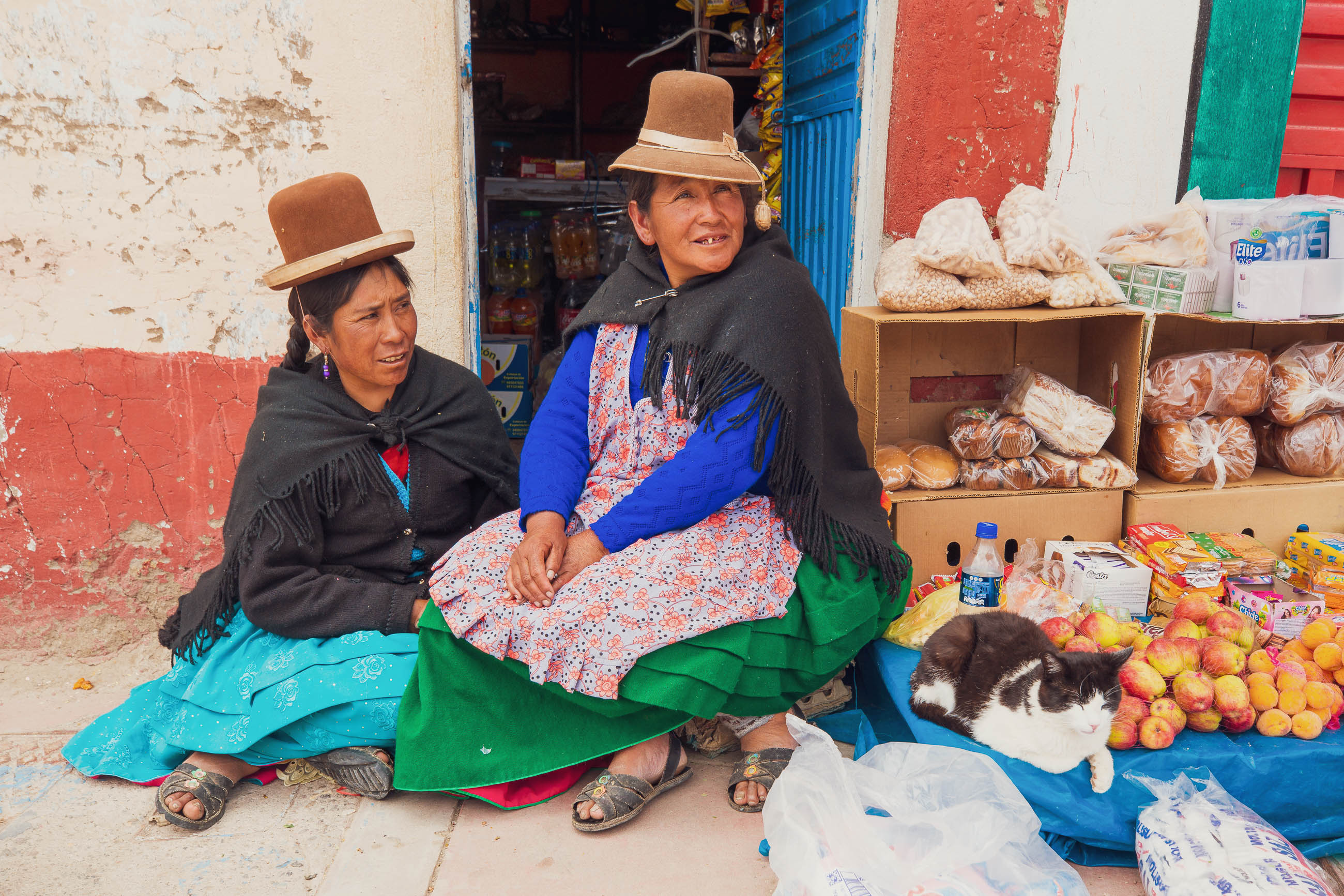
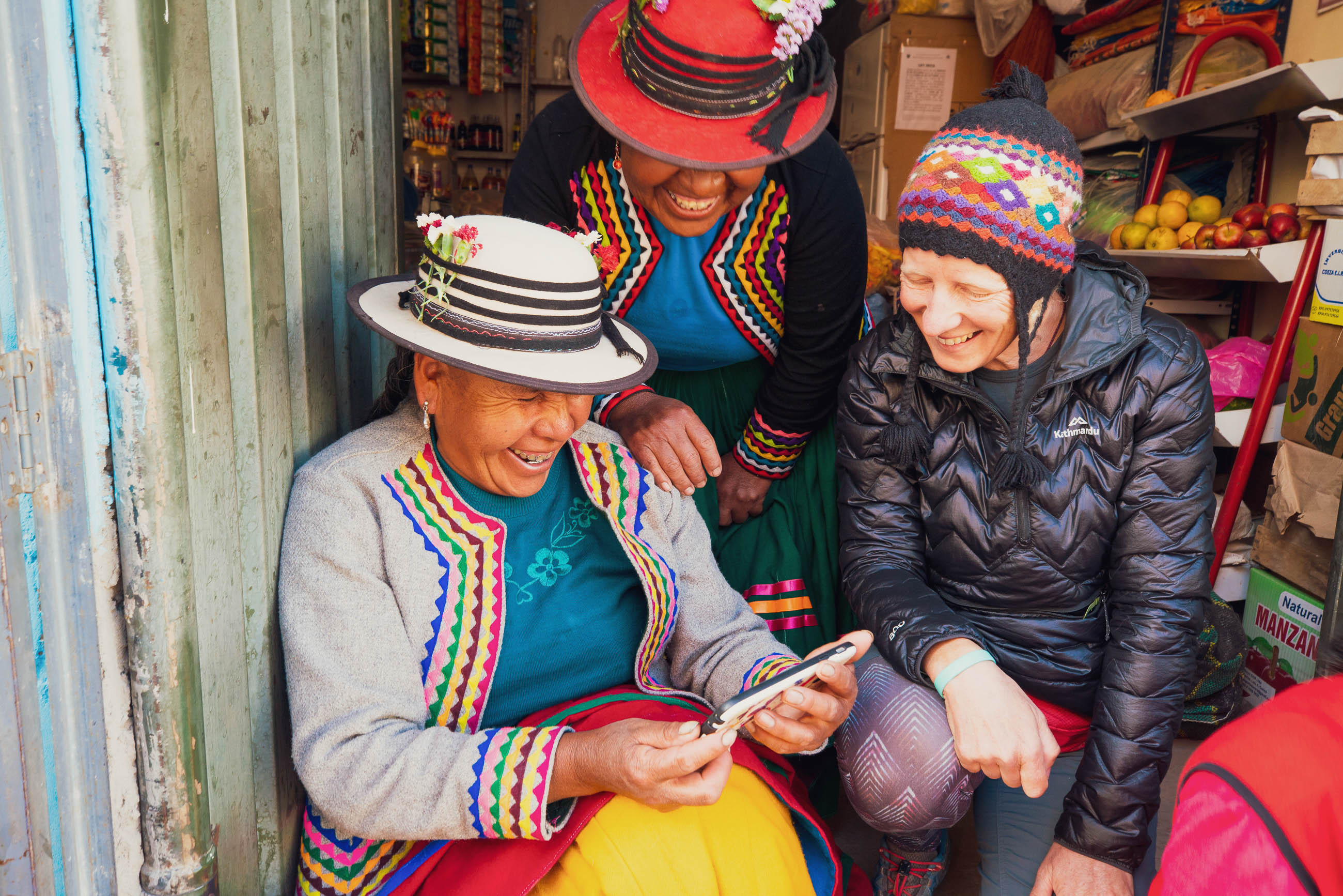
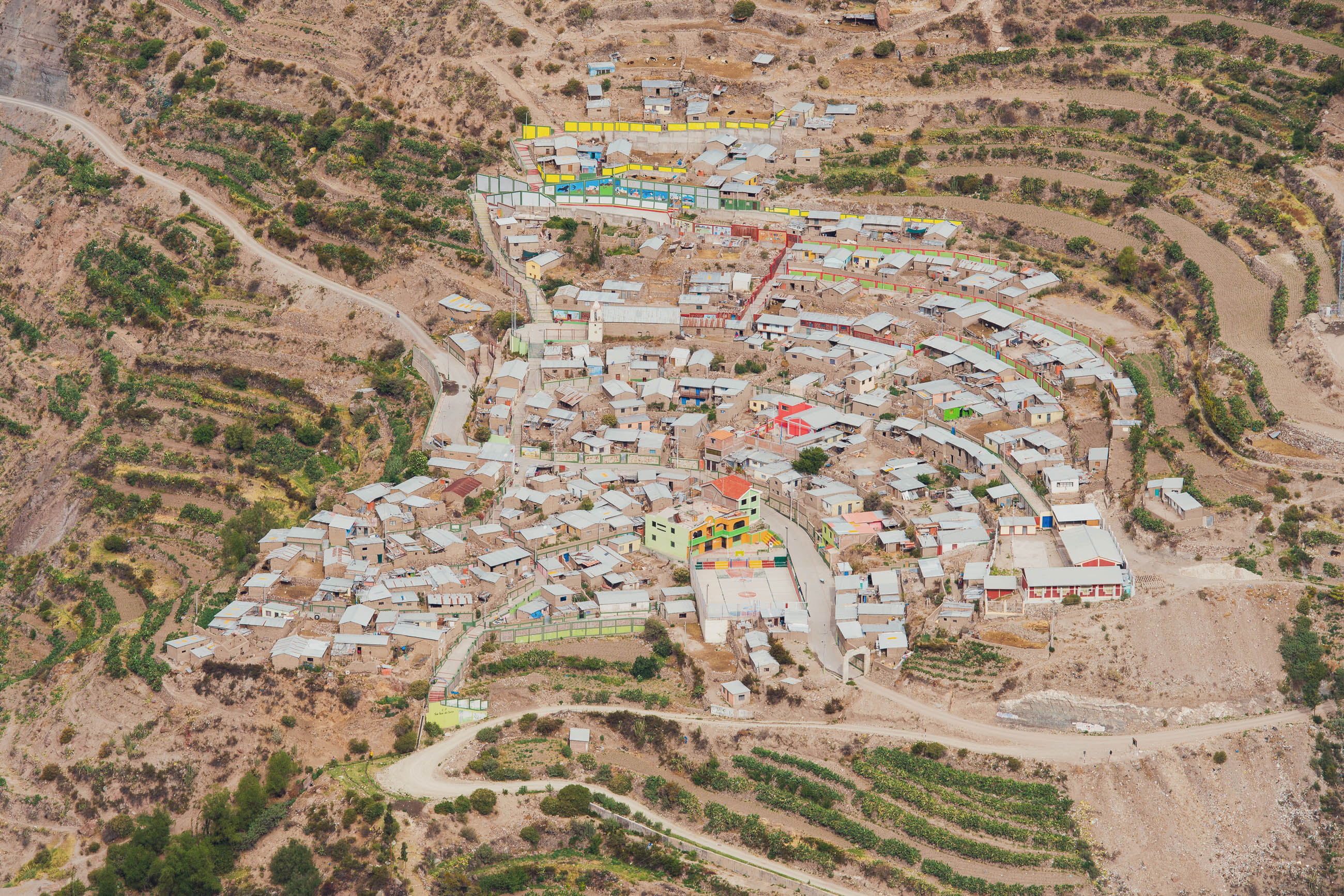
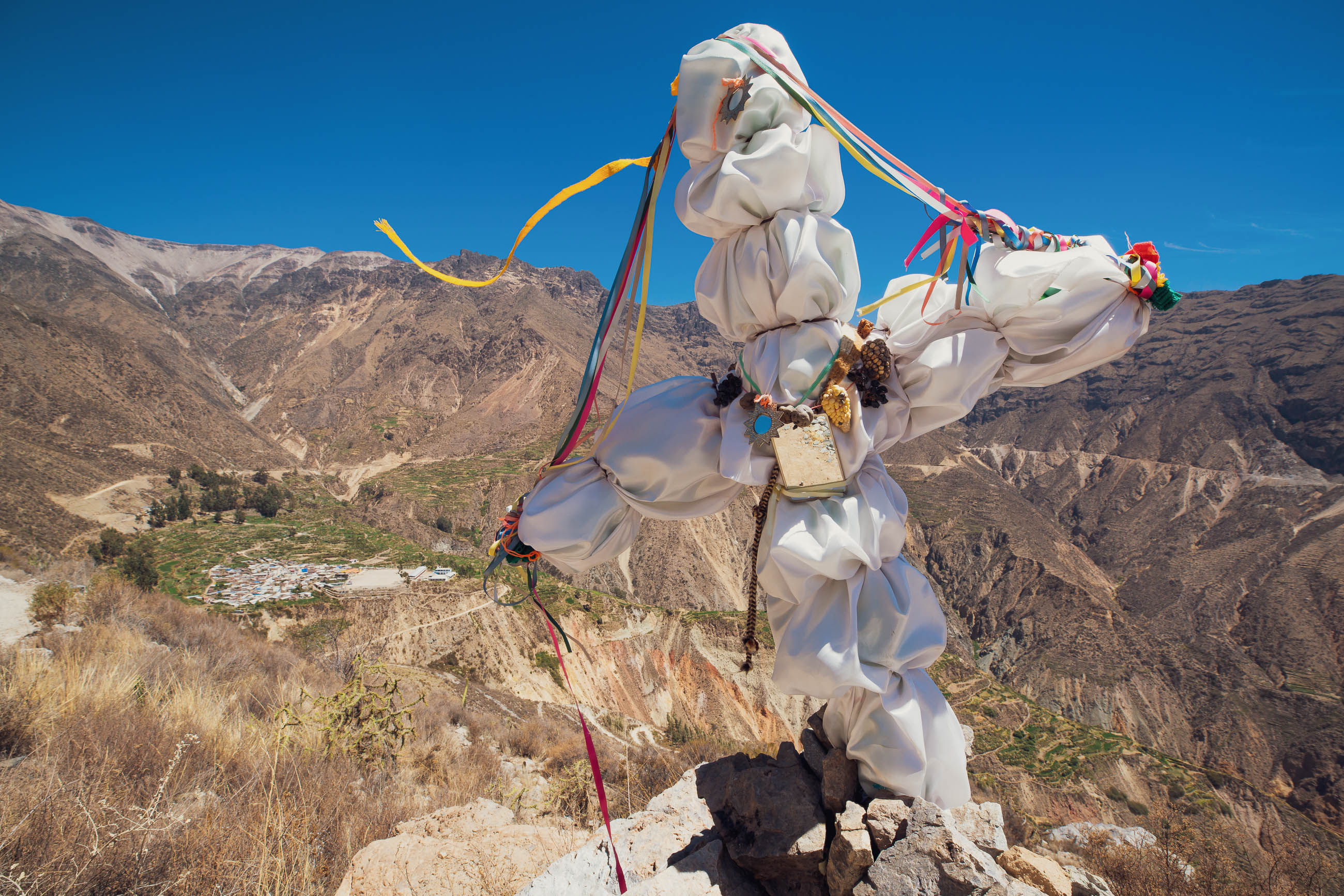
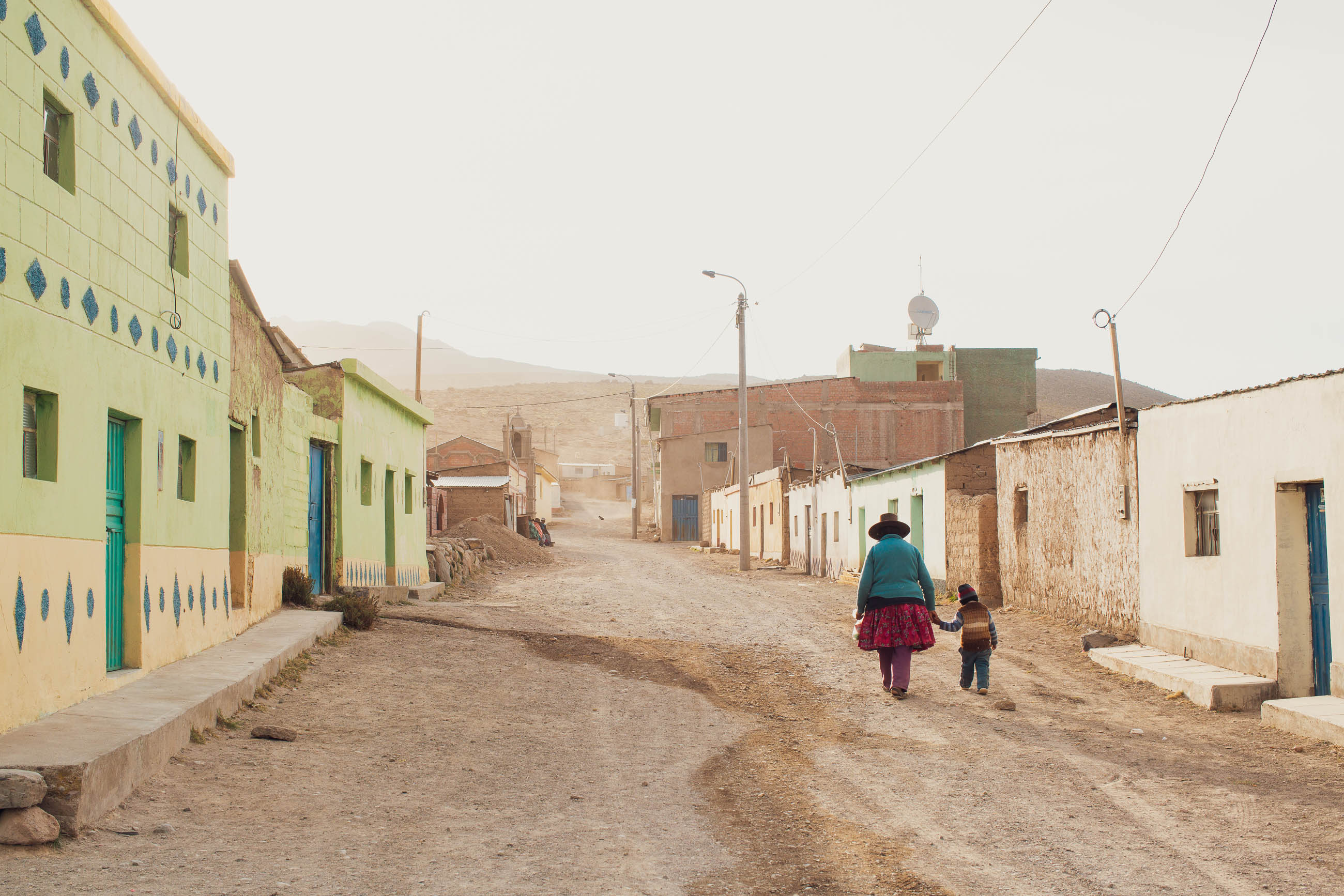
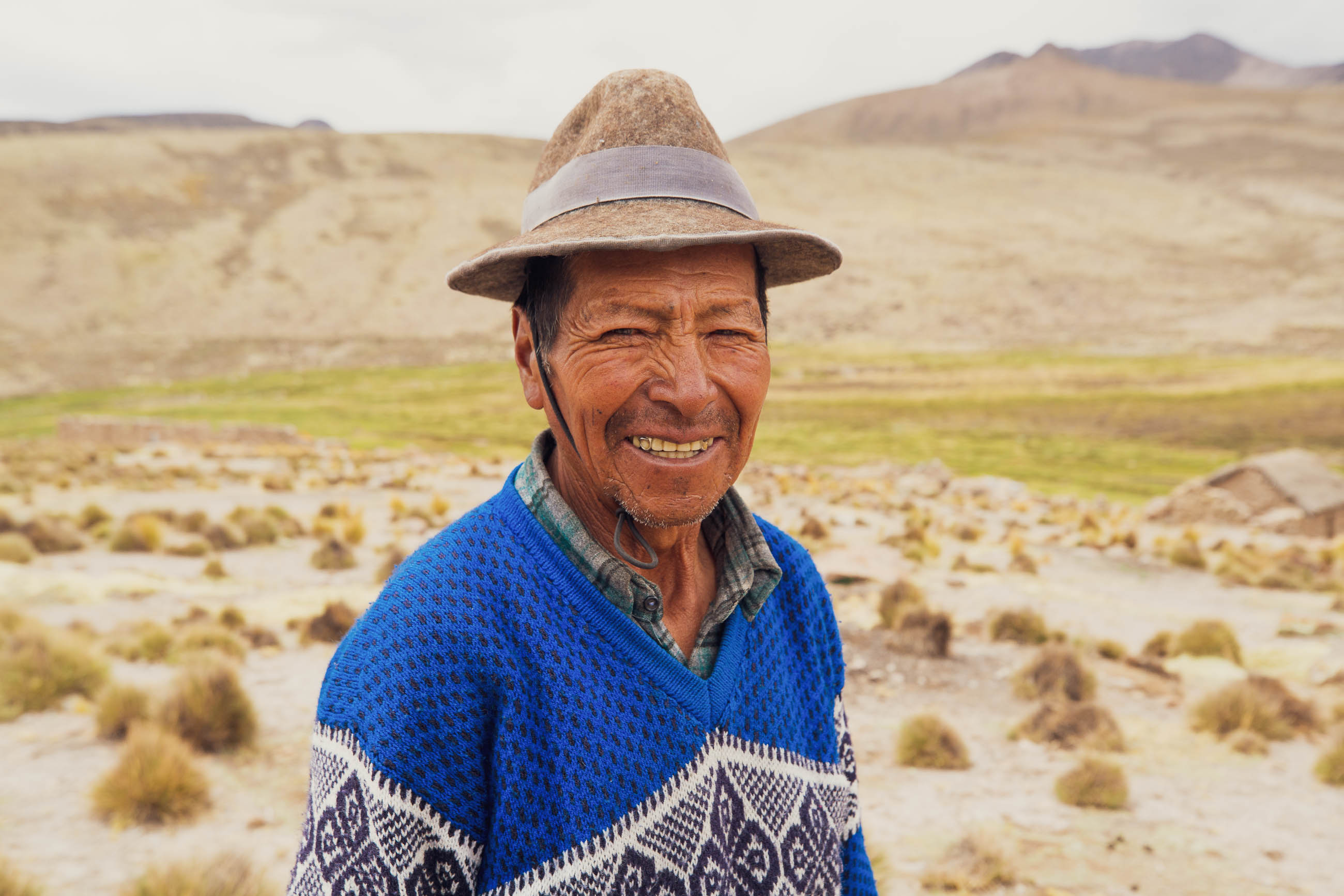
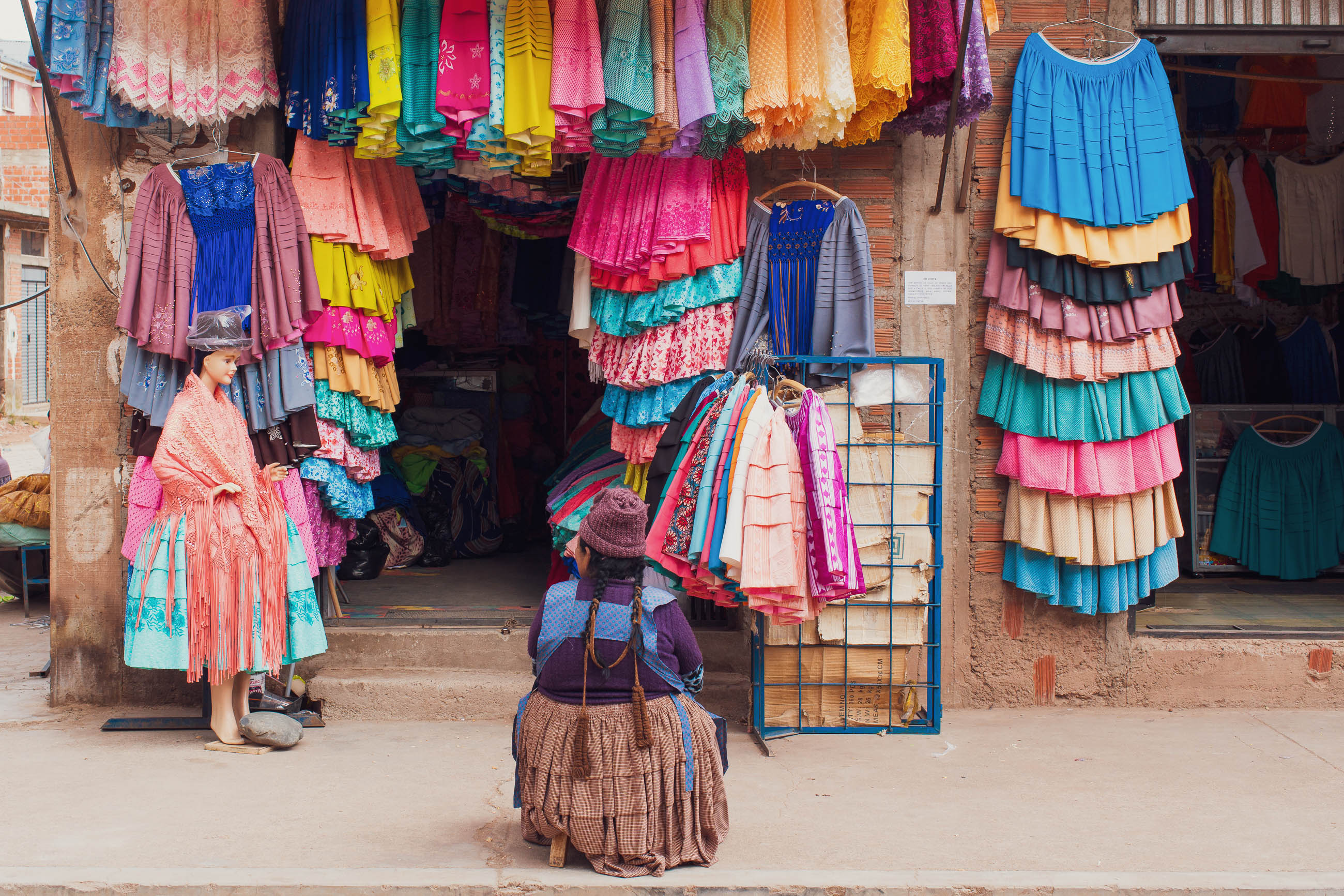
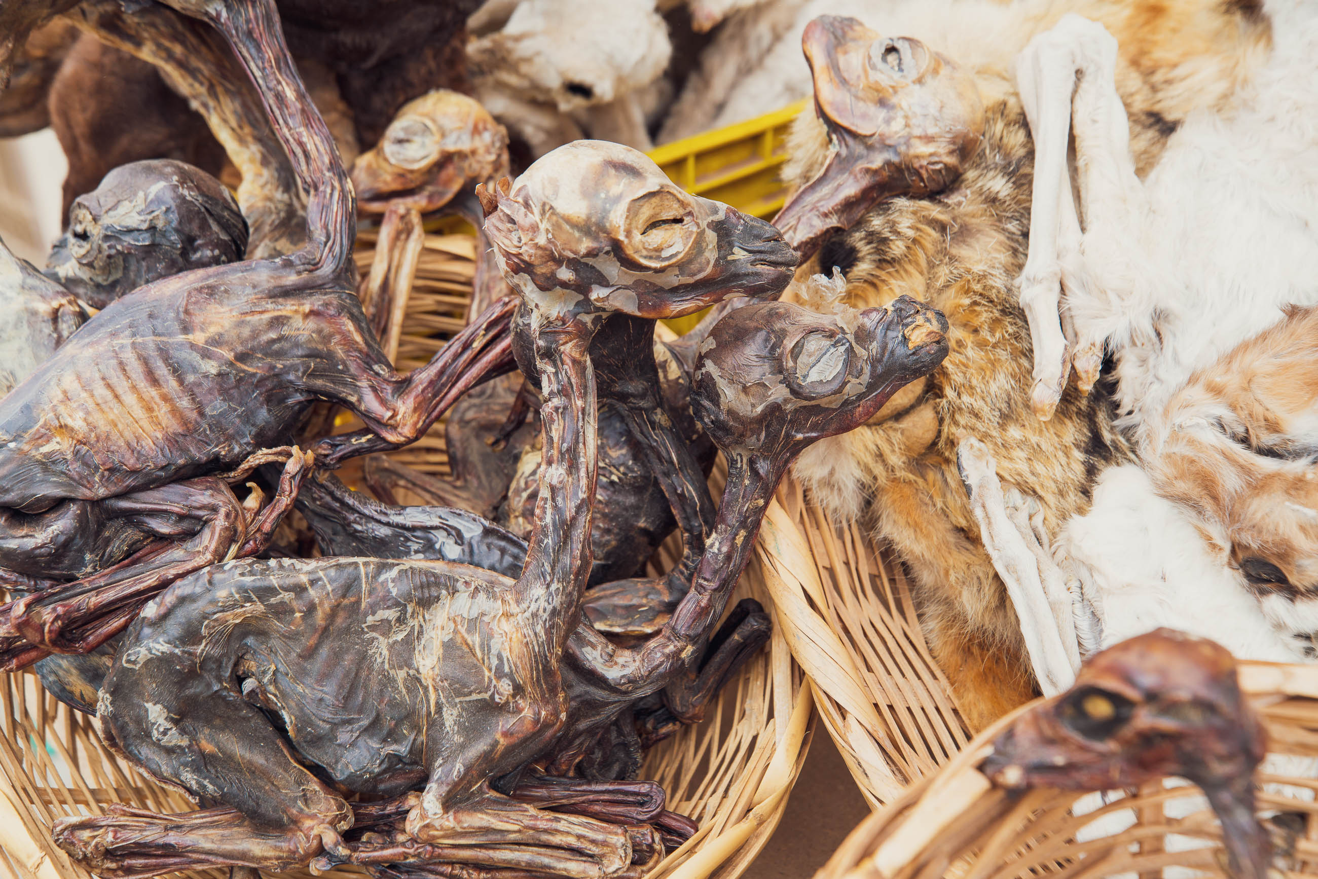
Not only is the landscape interesting, but cultural tradition is rich in this region, too. You’ll meet colourfully dressed Quechua and Aymara people, and you’ll also pass by several pre-Colombian archeological sites.
Camino Del Puma makes a classic standalone loop, ideal for a three-week tour. The southwest of Peru has low rainfall compared to the mountains to the north and east, making it a great area to ride in during the wet season. And, usefully, either the northern or southern ‘leg’ of this route makes a convenient connector from the Cones & Canyons bikepacking route to Bolivia’s Cordillera Real, or vice versa.
Make sure to read the full Trail Notes below for an overall itinerary.
Difficulty
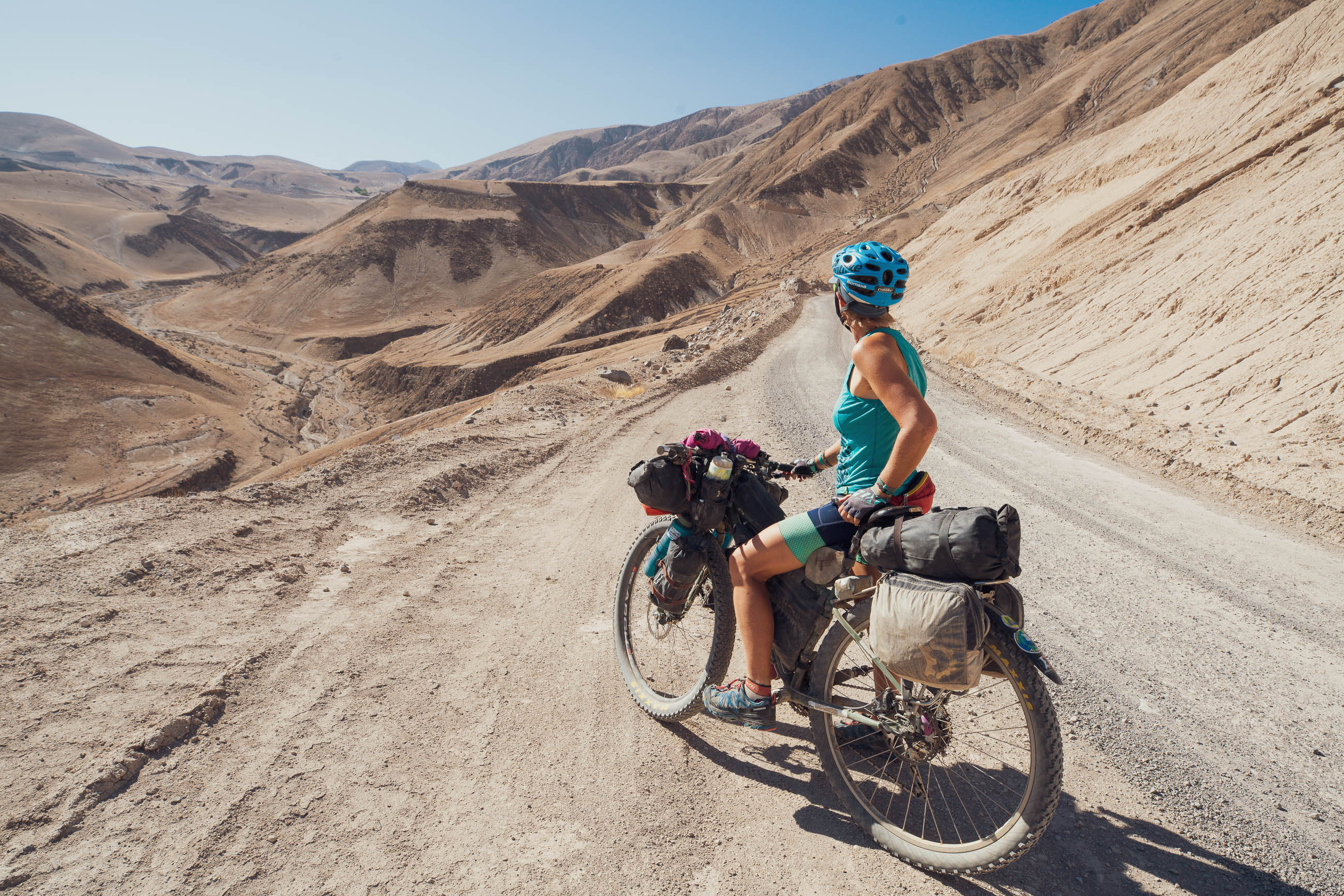
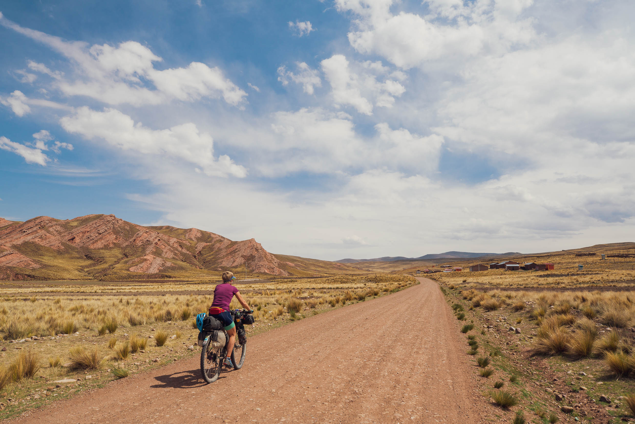
With an average elevation of close to 4000m (and many points reaching higher), the main challenge of this route for most people will be coping with cycling at altitude and the long, sustained climbs. Some acclimatisation before embarking on this route is essential. At 2300m, Arequipa is too low for your body to make the necessary adjustments, so a couple of days at a higher elevation would be advised, combined with a cautious approach to your elevation gain during the first couple of days. Sections of the route have sandy surfaces, but nothing particularly technical.


Submit Route Alert
As the leading creator and publisher of bikepacking routes, BIKEPACKING.com endeavors to maintain, improve, and advocate for our growing network of bikepacking routes all over the world. As such, our editorial team, route creators, and Route Stewards serve as mediators for route improvements and opportunities for connectivity, conservation, and community growth around these routes. To facilitate these efforts, we rely on our Bikepacking Collective and the greater bikepacking community to call attention to critical issues and opportunities that are discovered while riding these routes. If you have a vital issue or opportunity regarding this route that pertains to one of the subjects below, please let us know:
Highlights
Must Know
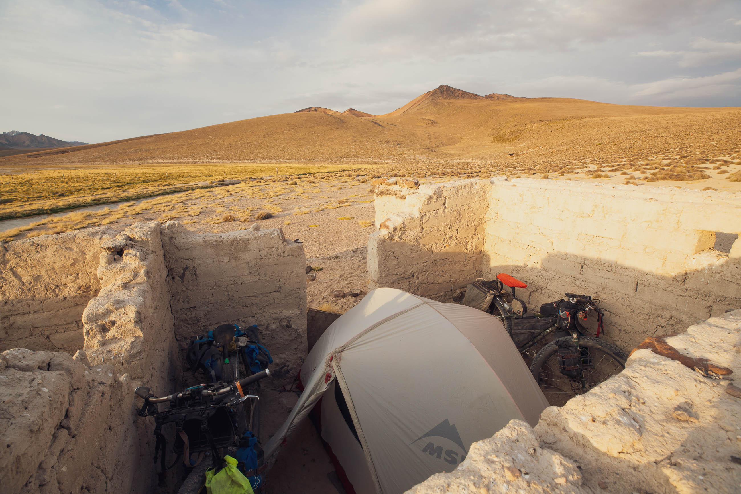
Camping
Food/H2O
Trail Notes
Resources
- Riding in a range of unique environments from the arid, volcano-dotted altiplano, stark and dramatic canyons with lush oases, and the rich agricultural landscape of the Lago Titicaca basin.
- Experiencing a rich mixture of Peruvian and Bolivian culture and encounters with local people in remote settlements in a region that sees few foreign visitors.
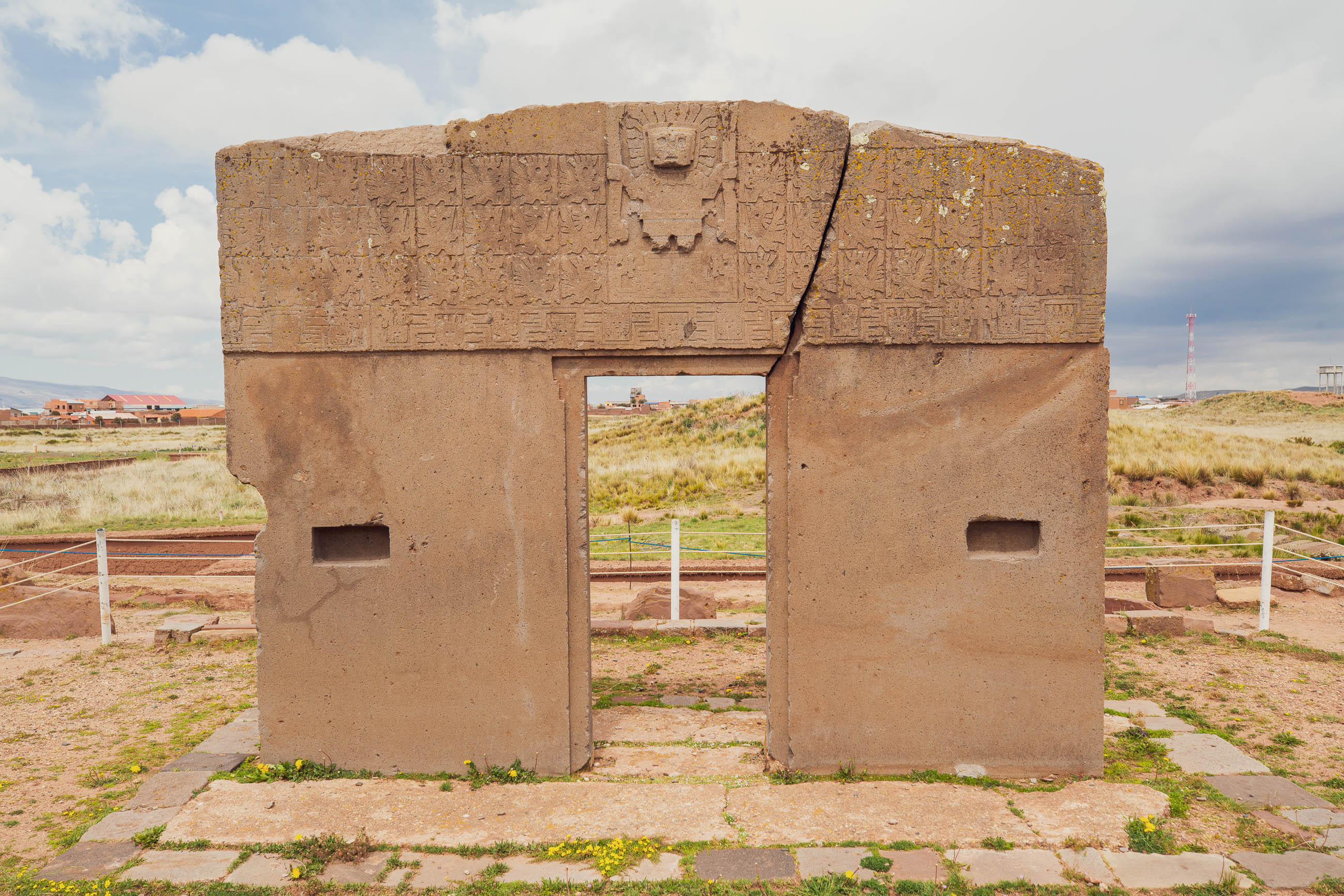
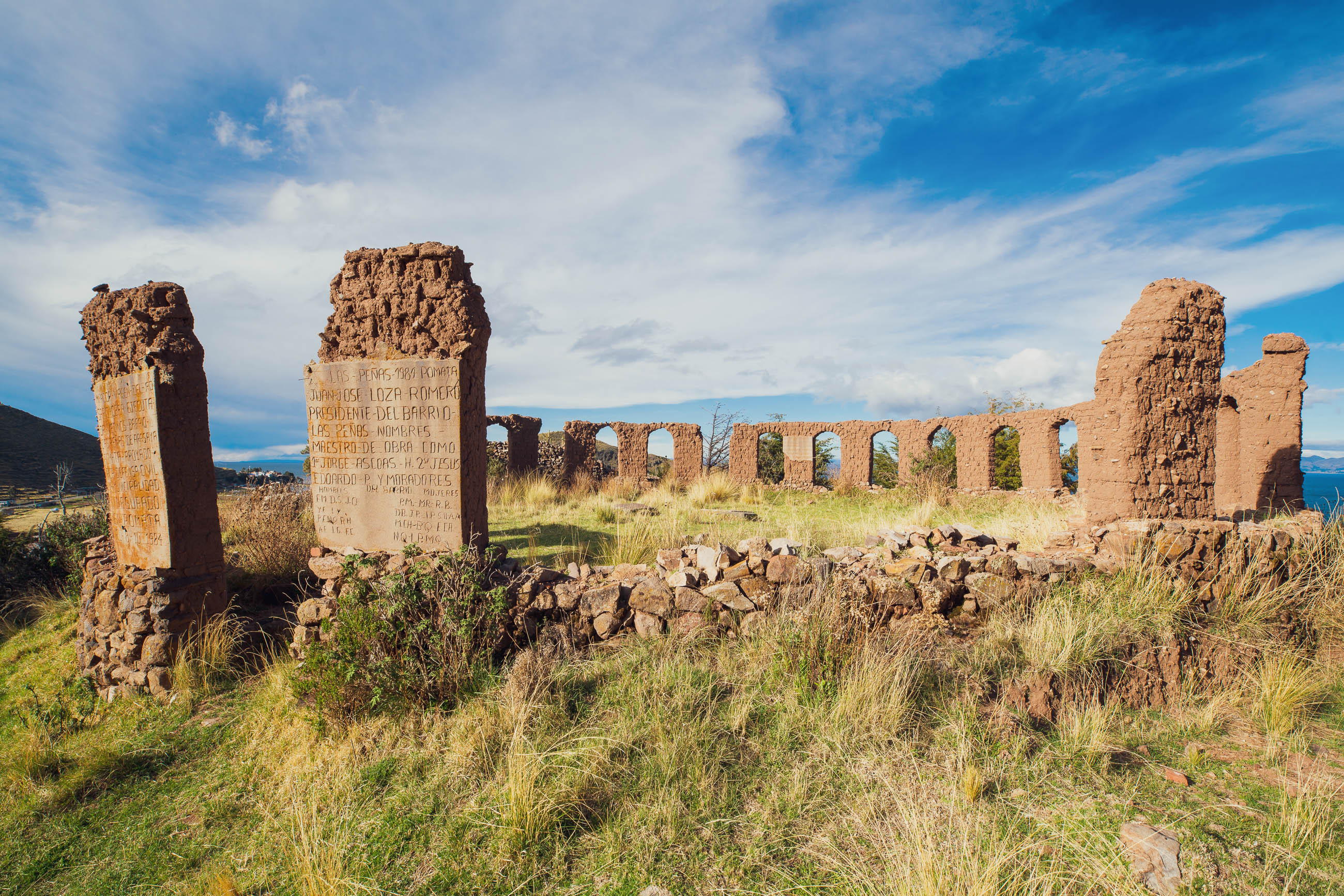
- Exploring the fascinating pre-Colombian archaeological sites of Cutimbo, Chucuito, and Tiwanaku (Bolivia) near Lake Titicaca.
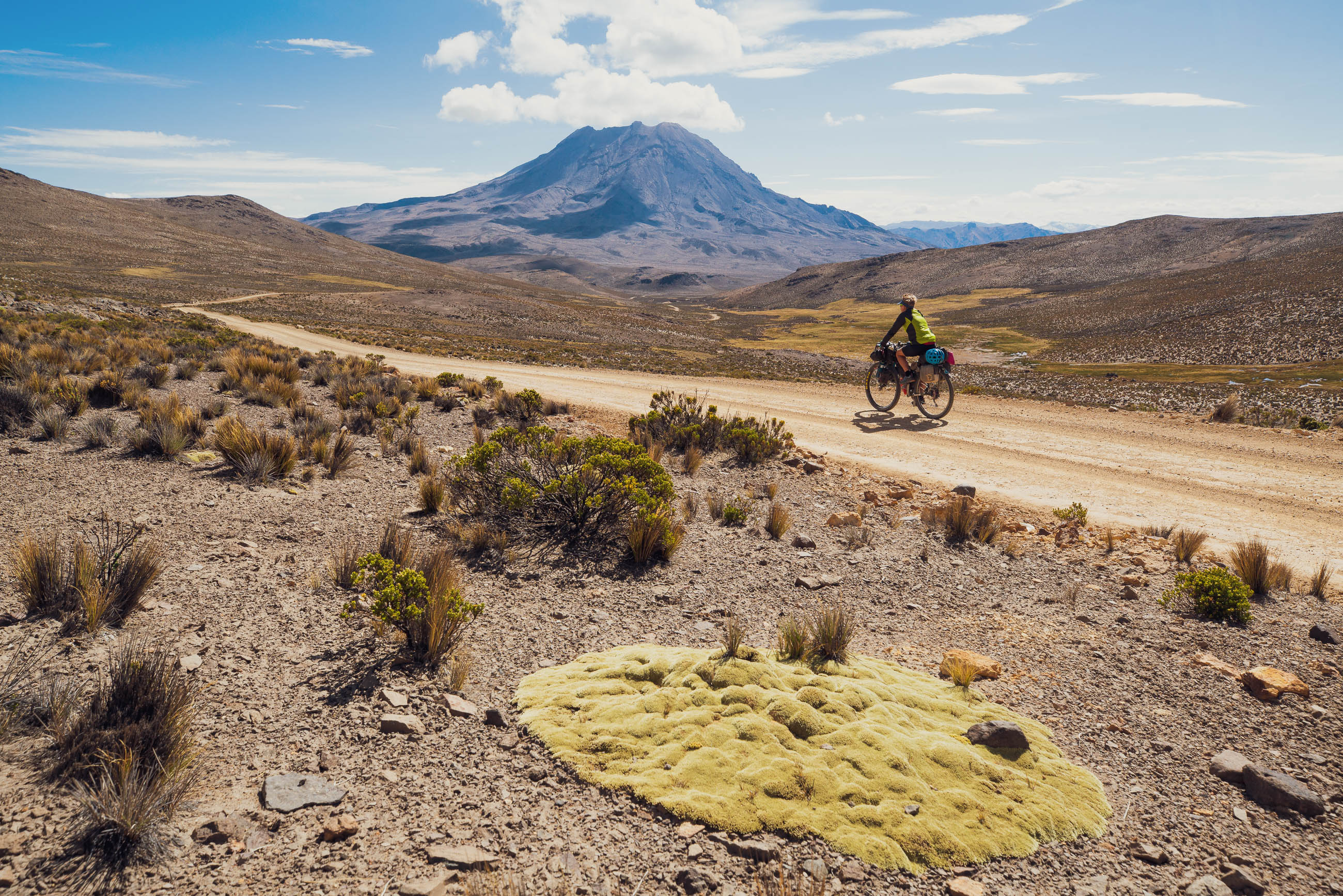
- Volcanoes; there’s frequently one on the skyline. Don’t miss the opportunity to climb one of the volcanoes around Arequipa, or the very accessible Volcan Ticsani.
- Relaxing on the southern shore of Lake Titicaca in chilled Copacabana (the halfway point of the route) with its abundant selection of comfortable hostels and restaurants serving excellent food.
- Being the only tourists in the spectacular and seldom visited Rio Tambo canyon – one of Peru’s best kept secrets.
- Long sections of this ride are spent at high altitude. Chivay and the Colca Canyon would be good options for an overnight acclimatisation trip from Arequipa. If not already acclimatised, be prepared to take your time on the climb up from Arequipa to Volcan Ubinas (or Ticsani if reversing the route). Be aware of the symptoms of acute mountain sickness (AMS) and how to manage them before you go.
- Very few people in this region speak English, and Spanish is a second language for many people. As such, some basic Spanish is essential to be able to arrange food and accommodation. Locals are friendly and helpful and will often approach you to chat. Being able to make even basic conversation will enrich your experience in this very traditional area.
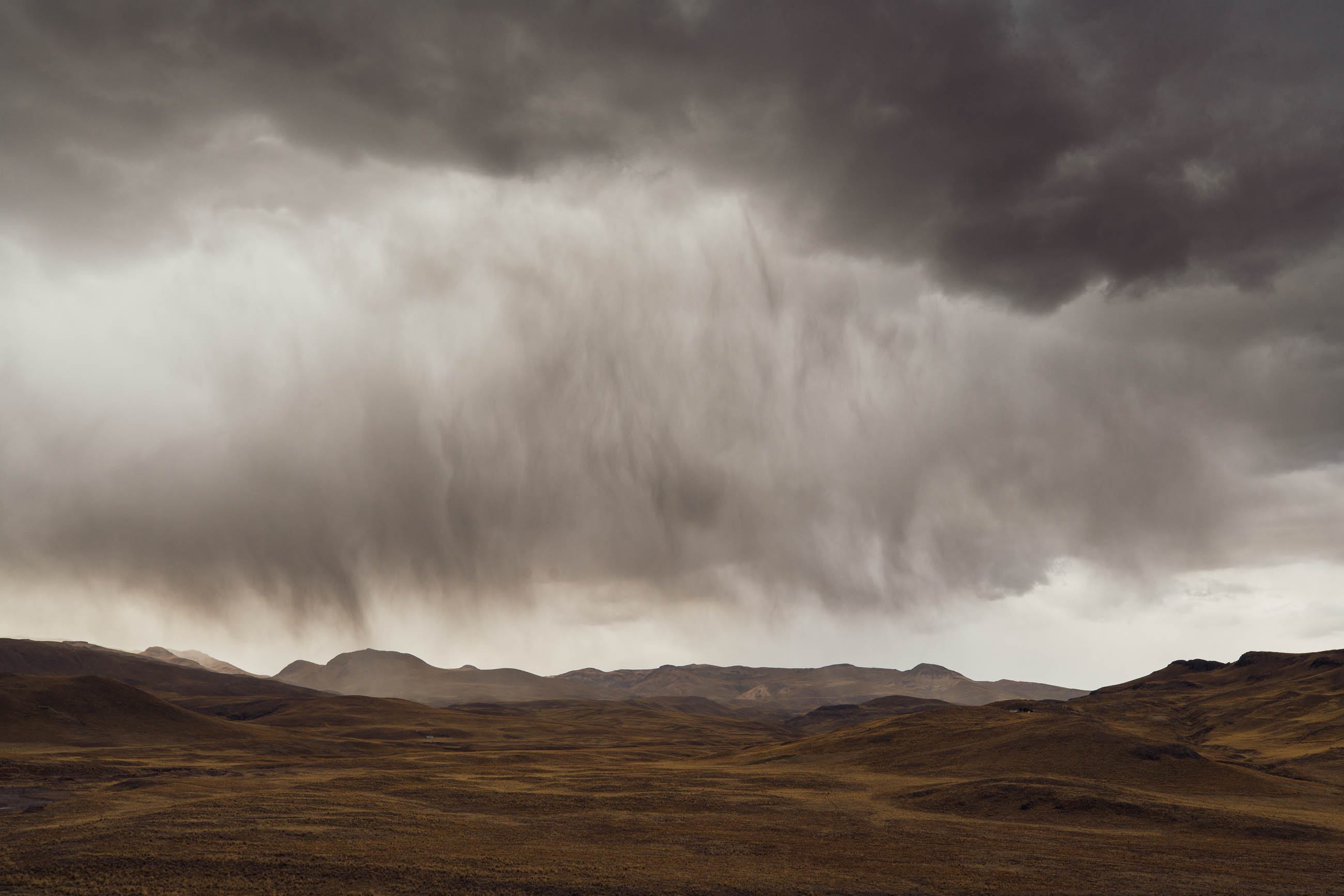
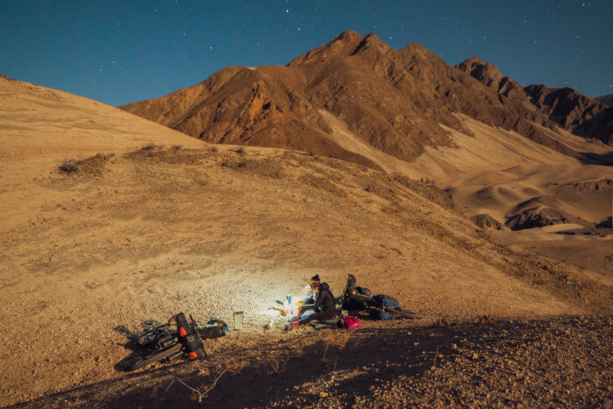
- Best time to ride: This region experiences a long dry season from April to December. Other parts of the Andes, especially on the divide and to the east, may already be getting afternoon storms by October, so this route is a good option in the latter part of the year. Outside of the dry season, be prepared for afternoon thunderstorms, and always be wary of electrical storms when up high. Conditions in November were mostly clear, calm and warm in the morning, with windy afternoons, so making early starts is a good idea. Make sure you are equipped for very cold (below freezing) nights on the higher sections of this ride. Good waterproofs, warm gloves and hats, and warm sleeping bags are recommended.
- The complete loop crosses into Bolivia for several days. This allows you to enjoy the pleasant lakeside town of Copacabana, a good place to take a few days off to rest and eat plentiful good food, and also to visit Tiwanaku. If short on time or traveling on a US passport (entry to Bolivia for US citizens costs US$160) you may want to skip this section. Crossing the border is otherwise very straightforward and took us no more than five minutes in either direction. There are several other route options from this area of northern Bolivia, including connecting to the Tres Cordilleras route and riding north to Cusco, or to Mama Coca and heading south. The route could also be done one way, or as a loop from La Paz. Both Arequipa and La Paz have international airports.
- We were surprised to see public transport on some of the more remote sections of this route. However, on other days we saw no more than a couple of motorbikes. Most locals don’t have vehicles but will always try to help if you have any major issues. And it’s always a good idea to carry an emergency locator beacon.
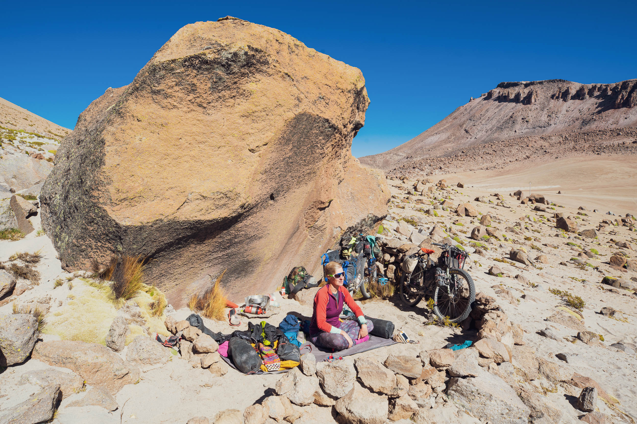
- While this route can be cycled on any touring setup capable of riding dirt roads, we recommend tyres of 2.35″ or bigger. Plus sizes are best to cope with the occasional rough or sandy section, the longest of which is 9km.
- There are plenty of opportunities to camp, but be prepared to ask permission if you’re within sight of houses or the road as land may be either community owned or privately farmed. When wild camping, be discrete and cautious of your property. It is not likely to be a problem, but remember people living in remote areas are not used to tourists, so you will be noticed.
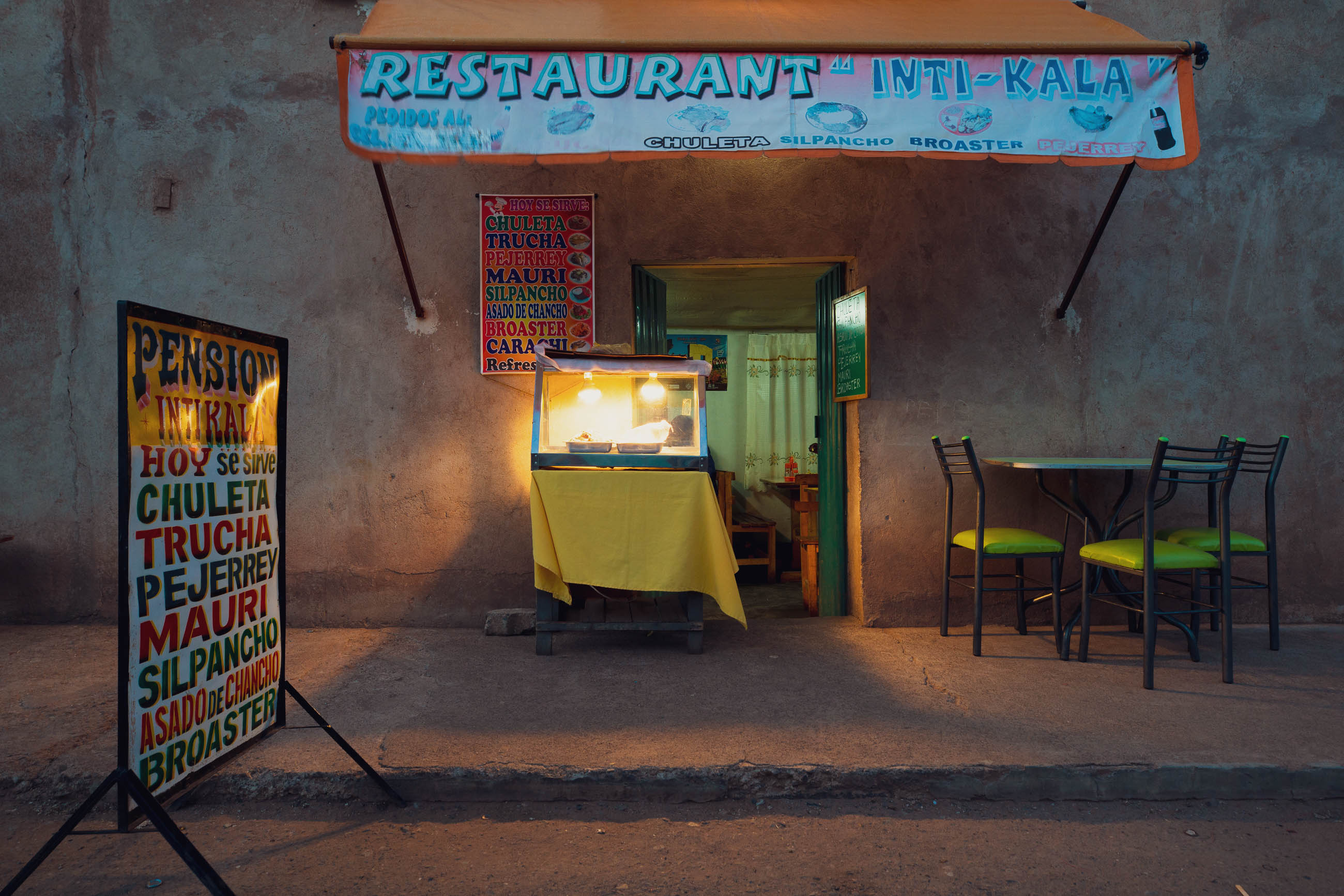
- Basic hospedajes/posadas, and meals, are available in many of the towns. Sometimes, these are owned by the municipality – don’t expect them to be clean. We usually paid between 10–20 soles each (US$3–6).
- Tiendas (small shops) selling food and drinks are usually found in or near the plaza of most towns. Supplies can be very limited; expect only basics such as rice, pasta, crackers, tuna, soup flavours, and snacks.
- Restaurants are more scarce away from Arequipa and the lakeside towns, and are not always obvious, so you may need to ask someone where you can eat, or if someone can prepare you a meal. Set meals or menu come with a soup, main, and drink, and are very cheap (US$2–3). People are usually happy to fill water bottles.
- In some places, we were told tap the water is treated. Despite being very arid country there are occasional streams to fill bottles if you have a Steripen or filter (check first for salinity or sulphur). We carried about two litres each most of the time, and had the capacity to carry six litres each when we suspected there may be no water, or for dry camps. Remote settlements and houses always have a water supply, and may be able to sell you potatoes and alpaca/llama meat if you get caught out.
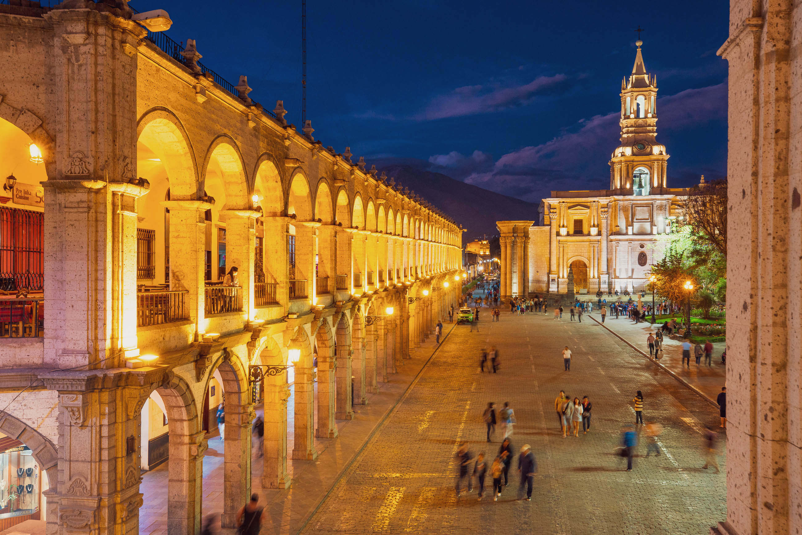
Arequipa – Chucuito (310km)
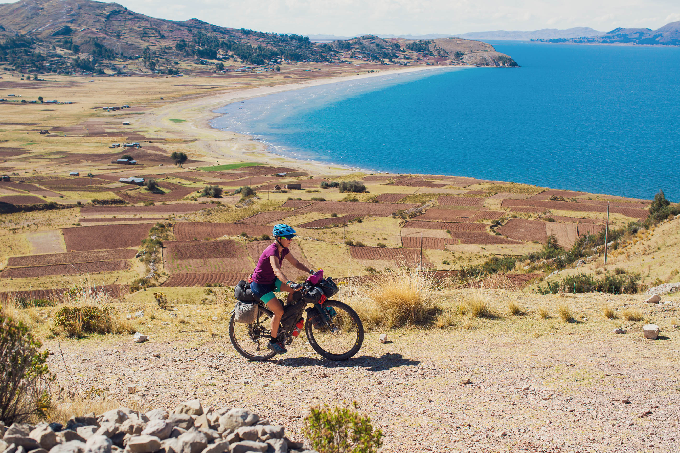
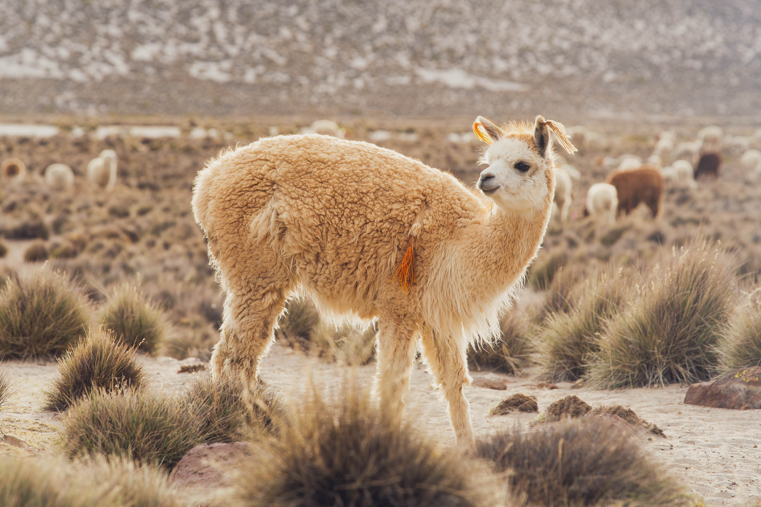
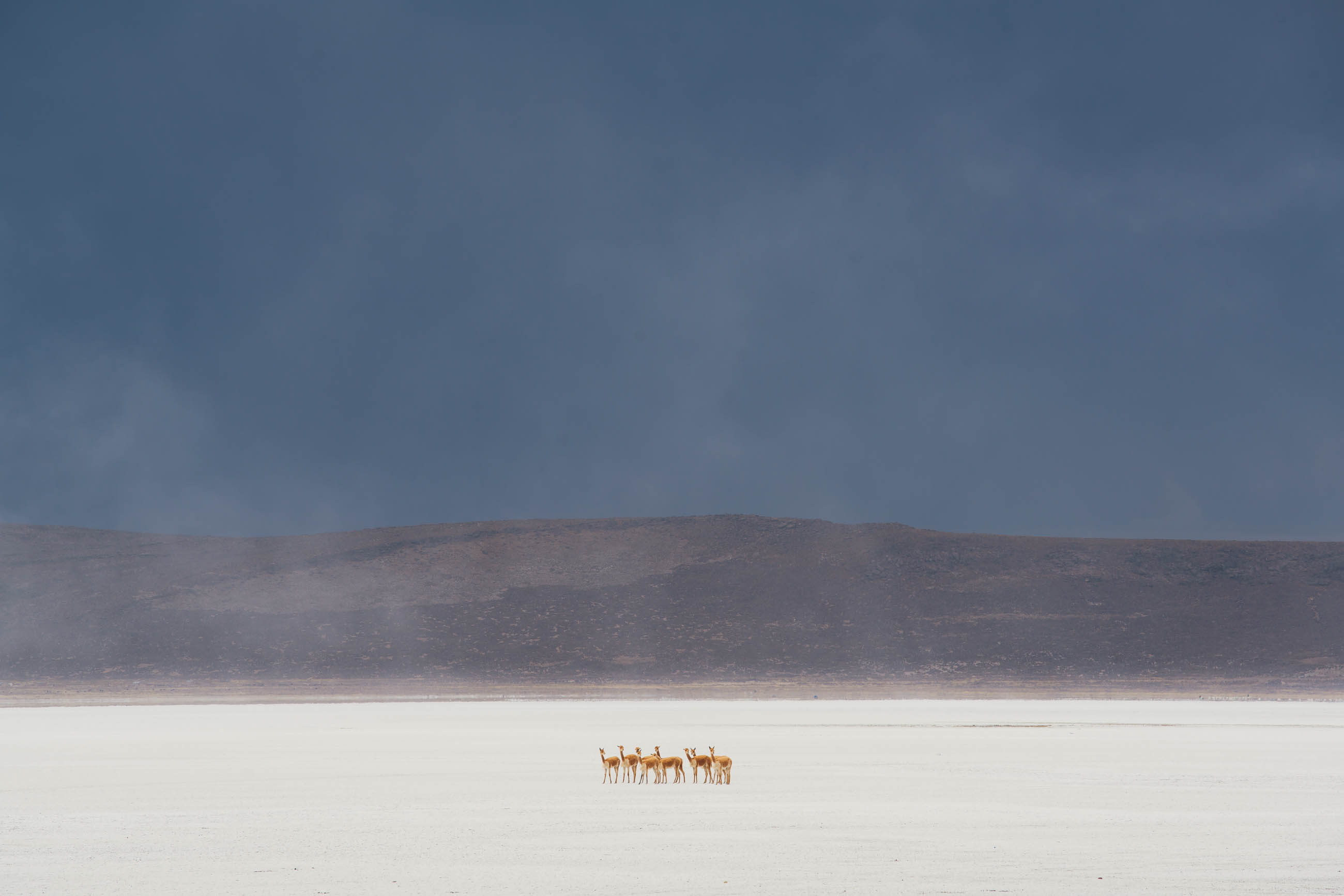
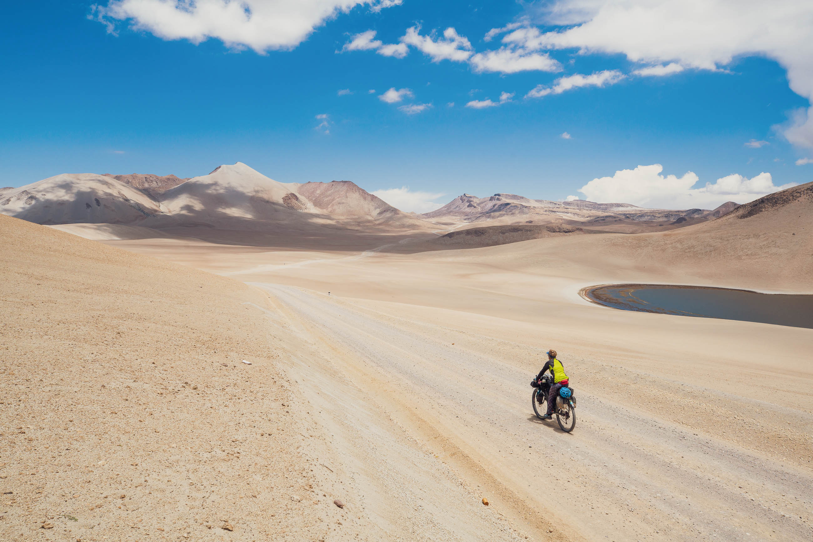
The route starts in the lovely colonial centre of Arequipa, Peru’s second city, climbing steadily to crest the Pacific slope of the Andes and then entering the altiplano at Laguna Salinas, where you’ll likely begin spotting alpacas, llamas, and their ancestors, the lithe vicuña. Because this section climbs steadily from 2300m to well over 4000m, you’ll need to plan your acclimatisation accordingly, if not already prepared for the heights. The first major highlight of the route comes as you cross a pass at 4638m and the symmetrical cone of Volcan Ubinas comes properly into view for the first time. After a fast descent, the route crosses sandy tracks on the mountain’s western flank, crosses two more high saddles, and then plunges towards the Rio Ichuña, a tributary of the Rio Tambo.
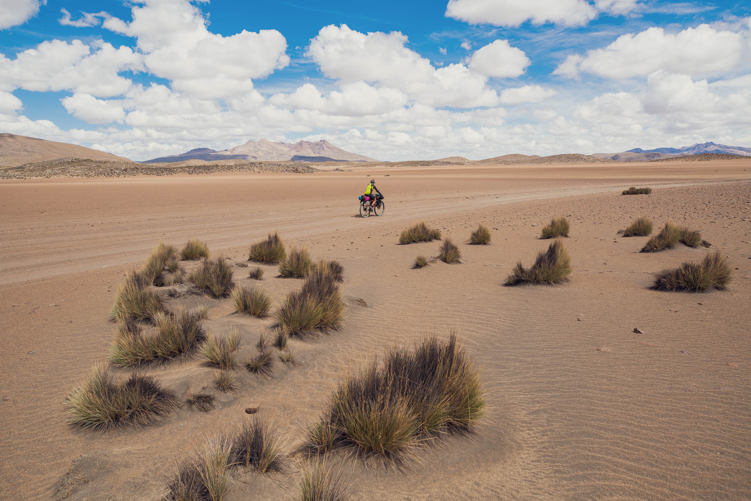
With the descent comes an increase in temperature, and you’ll enjoy warmer weather for a couple of days as the route gradually regains its elevation as it closes in on the high point of the route, a Continental Divide pass at 4990m. By the bottom of the ensuing descent you’ll find yourself in quite different surroundings: the wide plains and volcanic mesas of the Lago Titicaca Basin, which sits at an average elevation of around 3800m.
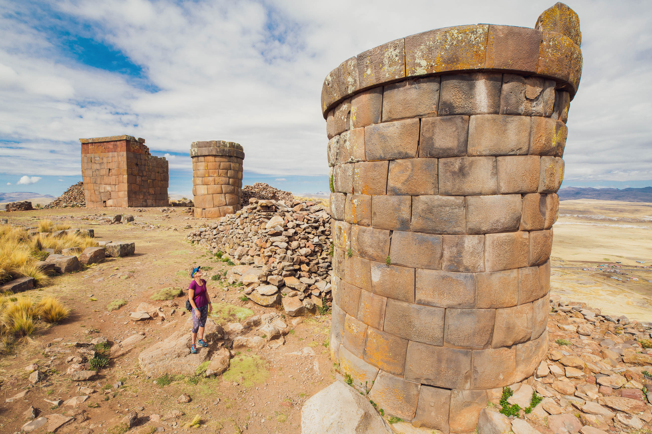
The route passes right by the pre-Inca site of Cutimbo and is well worth exploring to see the stonework mastery of its stunning chulpas, or funerary towers, as well as offering sweeping views of the plains and mountains of the divide.
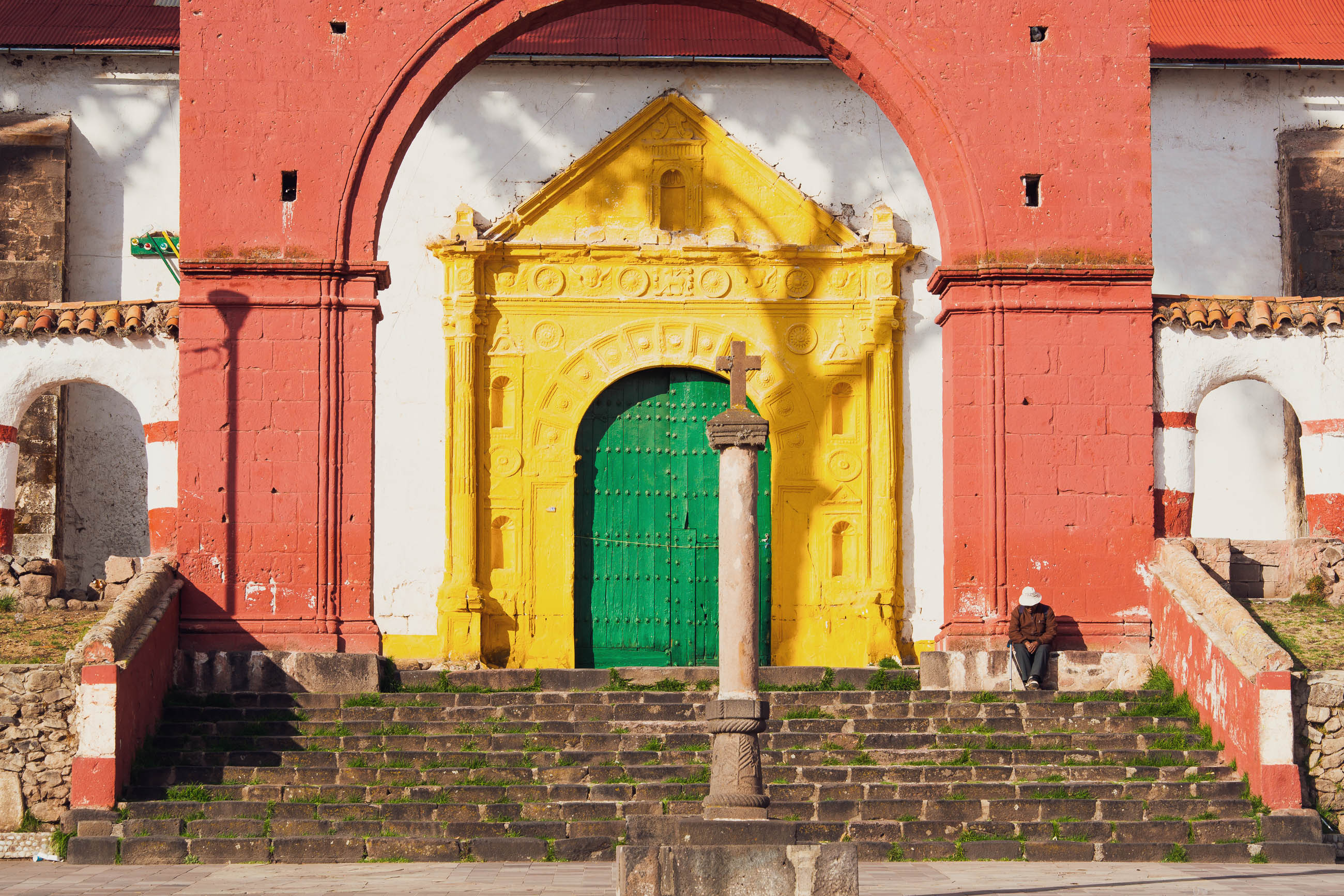
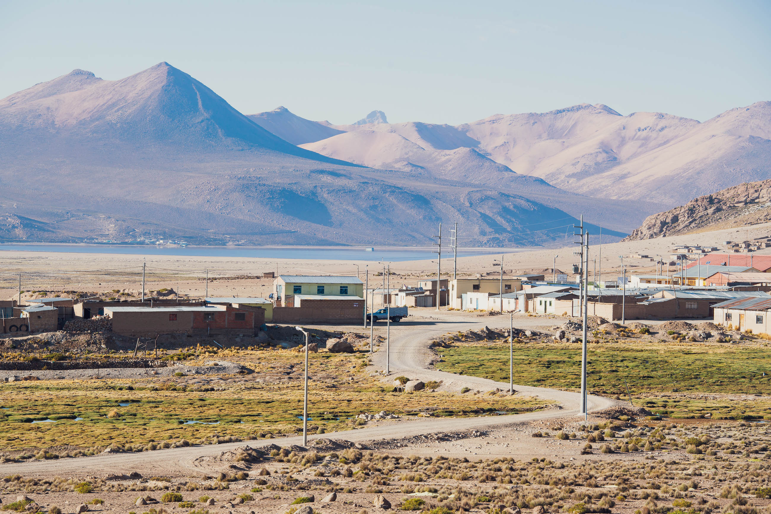
Several days out of Arequipa, the small town of Chucuito will be a welcome sight. There are guesthouses, restaurants, and a small but interesting archaeological site.
Chucuito – Desaguadero (396km)
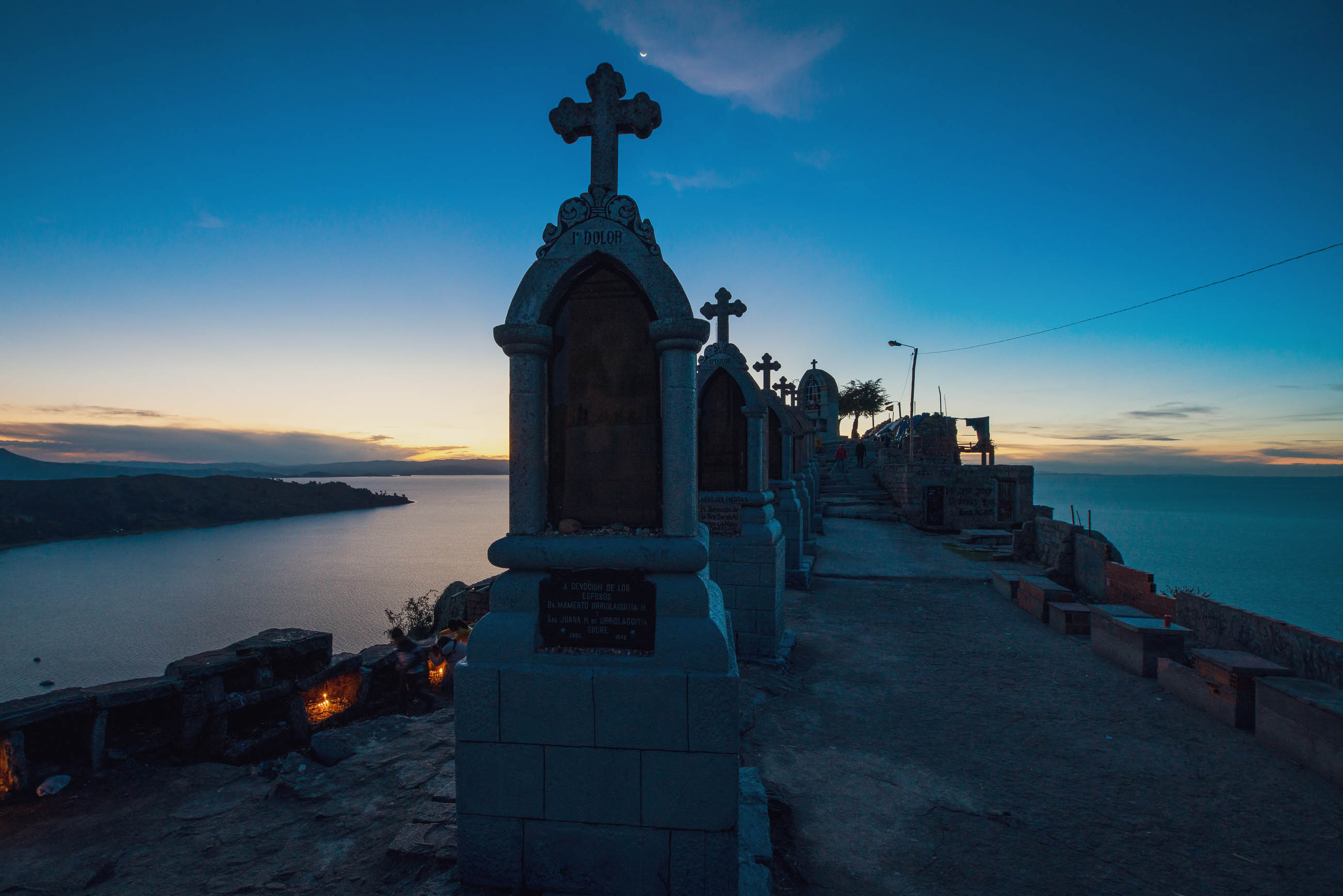
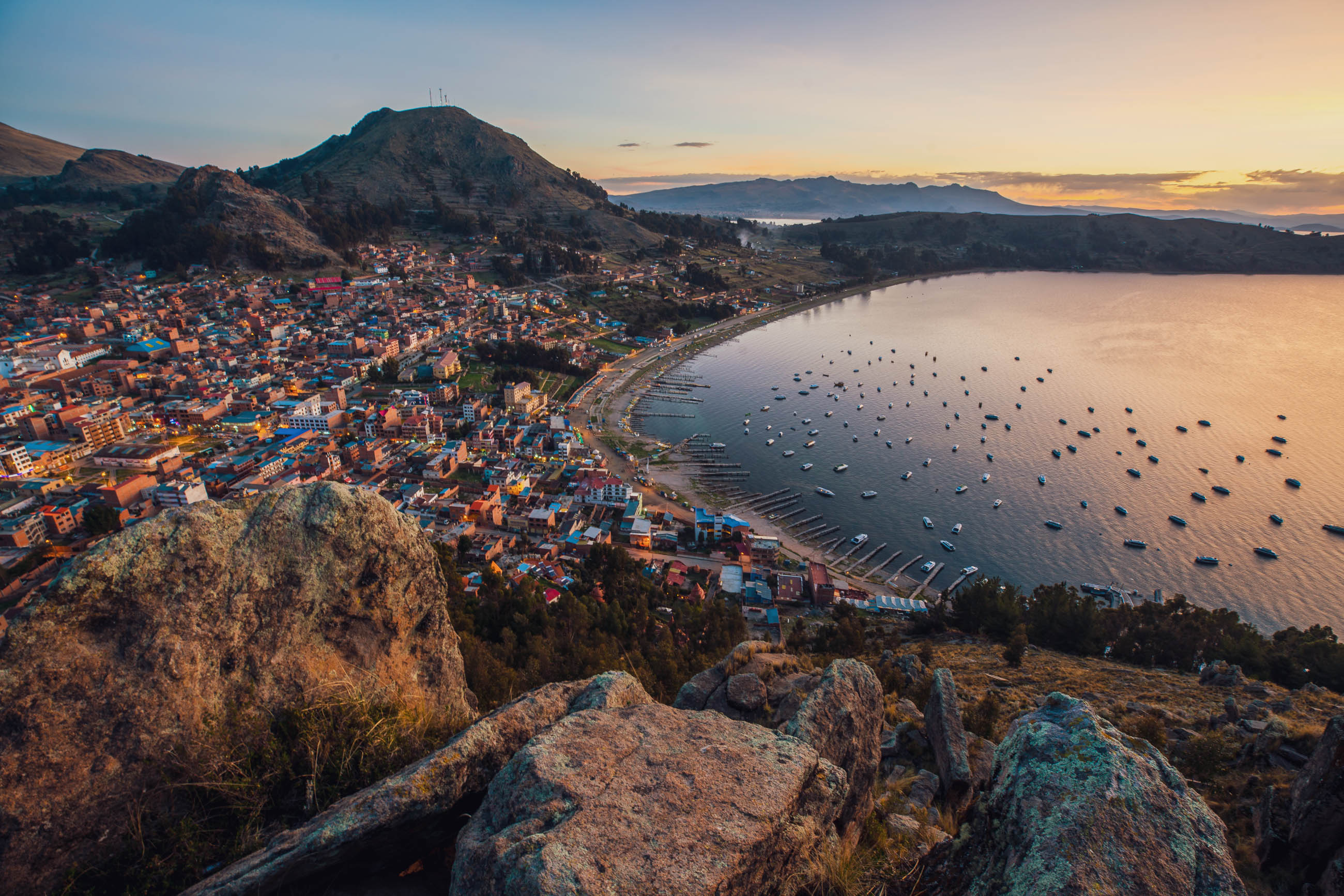
From Chucuito, the route hugs the shore, with the peninsula circuit being a particular highlight for its big views of the lake and the snowcapped Cordillera Real beyond. From here through to Desaguadero is the easiest section of this route, as it follows a mixture of good dirt roads and pavement, taking the odd small hill along the way. Soon after the border crossing into Bolivia comes Copacabana. At roughly the midway point of the ride, this tourist town makes for a great break with its abundant food and mild temps.
Tiwanaku is the next highlight. The small village here has a couple of hospedajes and hotels, but make sure you set aside some time to check out the archeological site: it’s Bolivia’s most important pre-Colombian city and was once the seat of power of the Tiwanaku civilisation. The two site museums should not be missed, one contains a seven-metre-tall statue, the Bennett Monolith.
Desaguadero – Arequipa (550km)
Make sure you leave Desaguadero well stocked with food, as although there are occasional tiendas along the route, they don’t tend to be widely stocked or reliably open. The next dependable shops – with a good range of food – are in Omate, 430 km away. That said, you should be able to buy quinoa, pasta, oats, potatoes, crackers, tuna, soft drinks, and snacks.
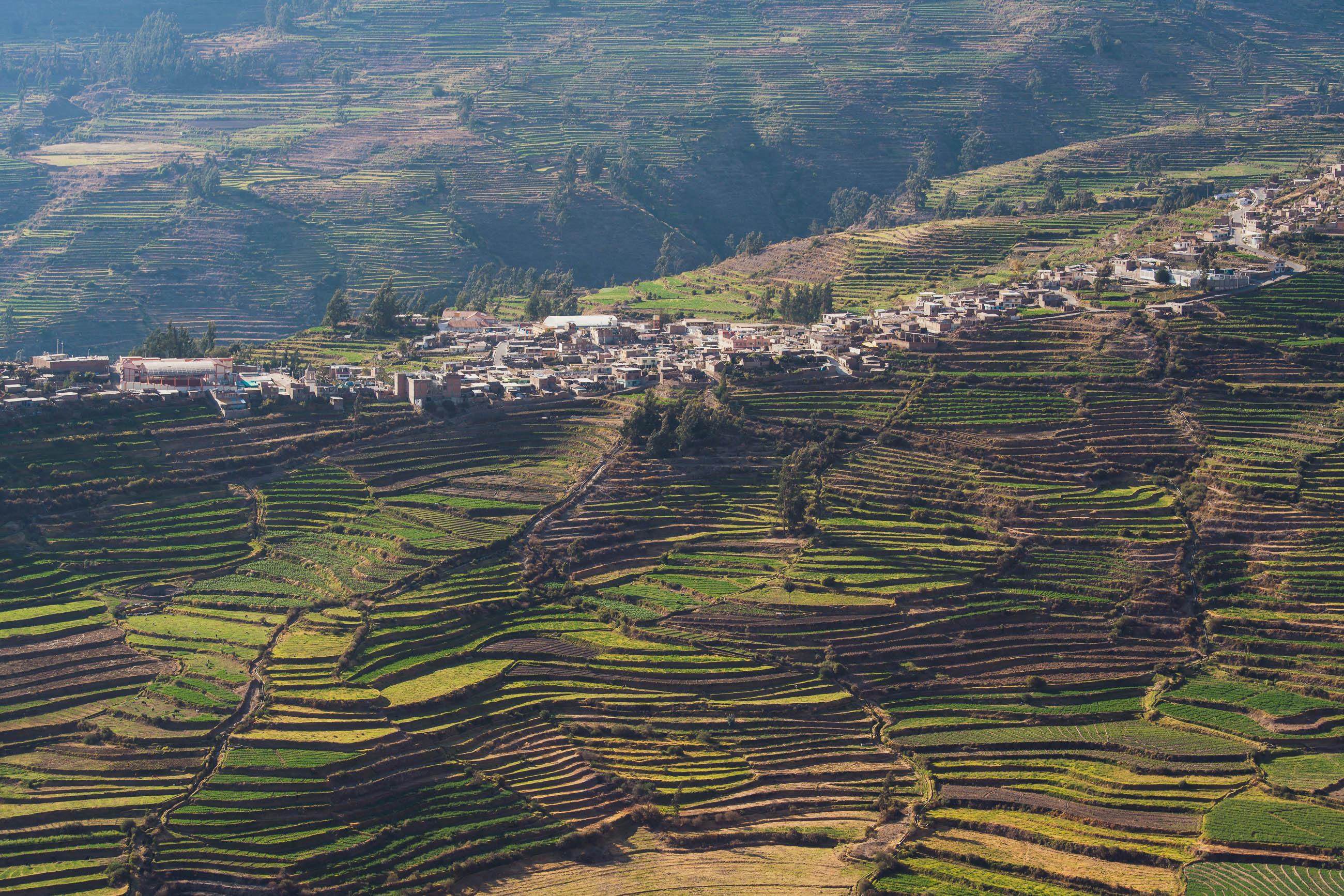
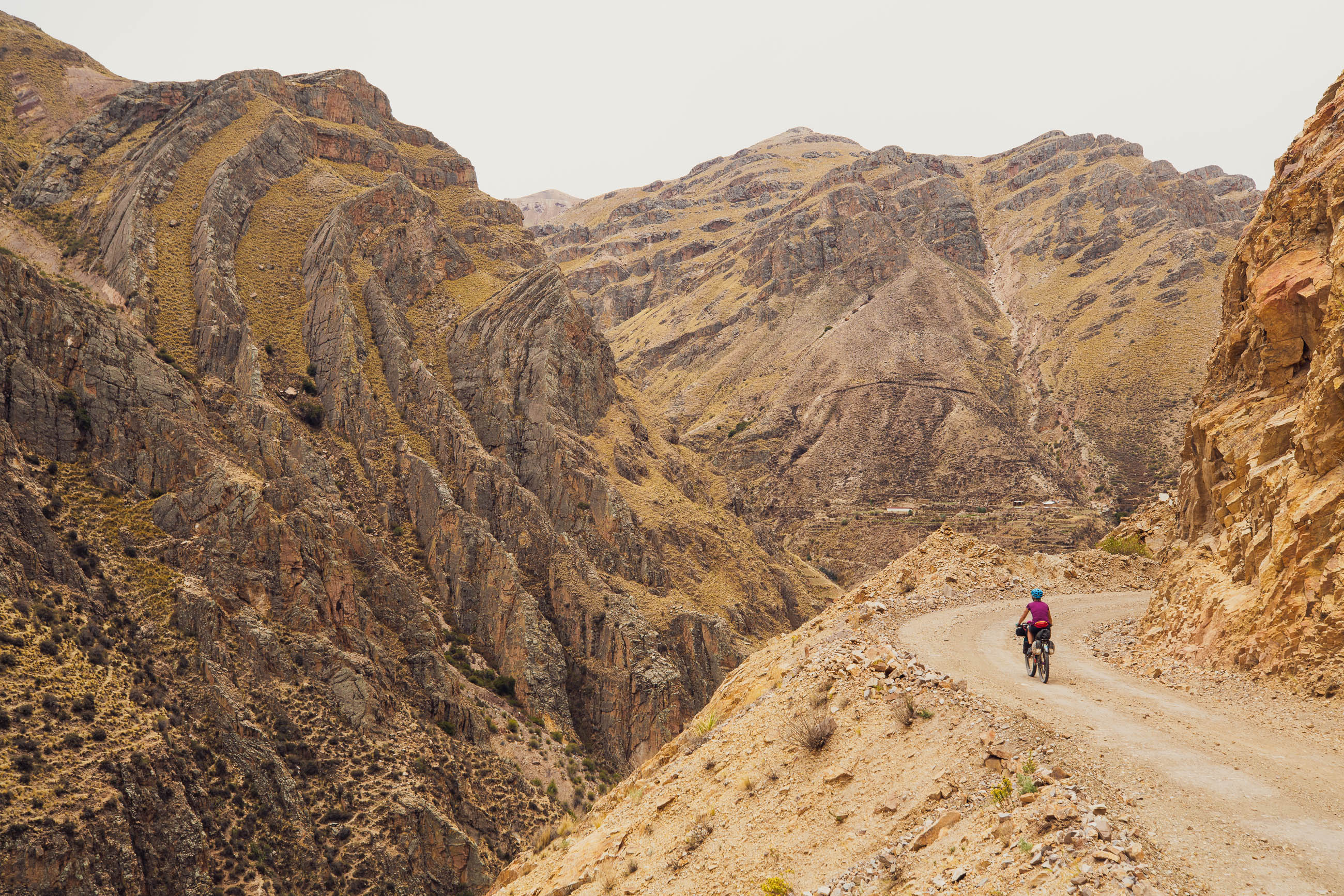
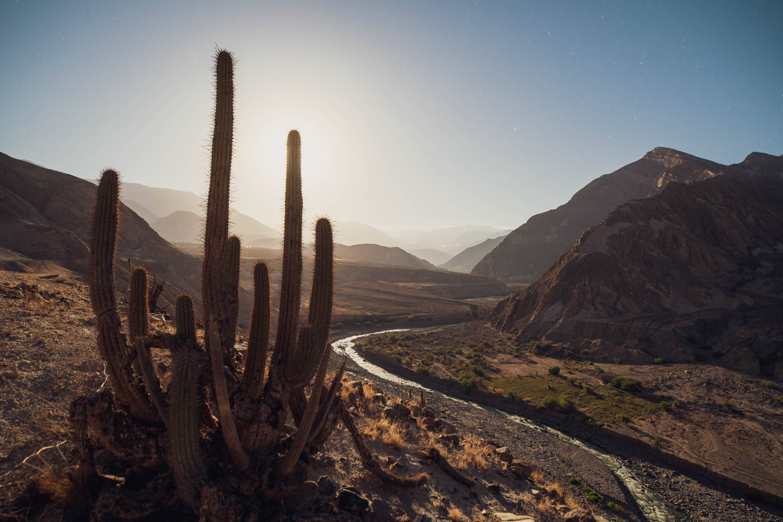
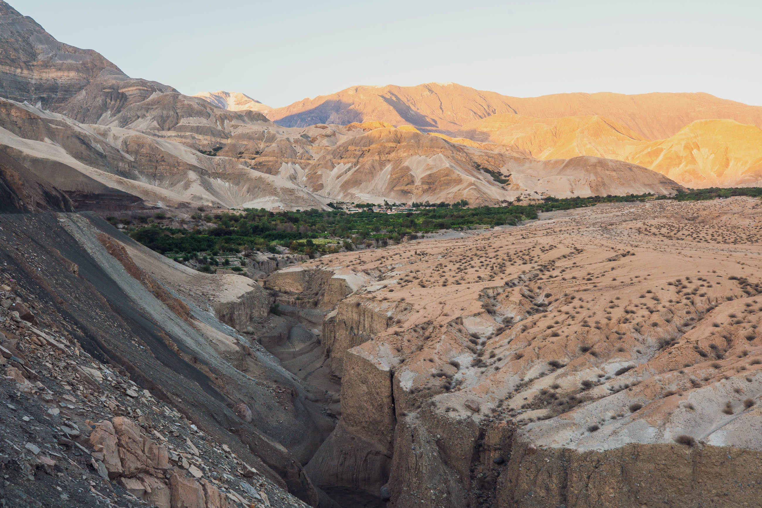
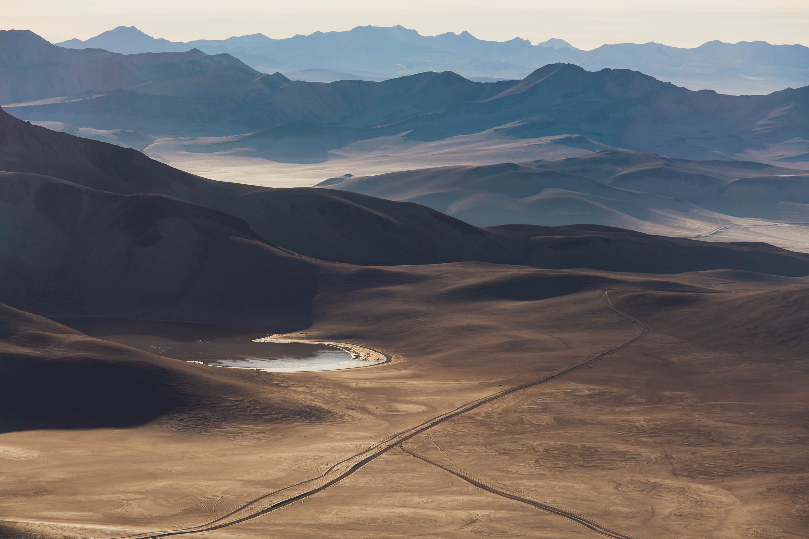
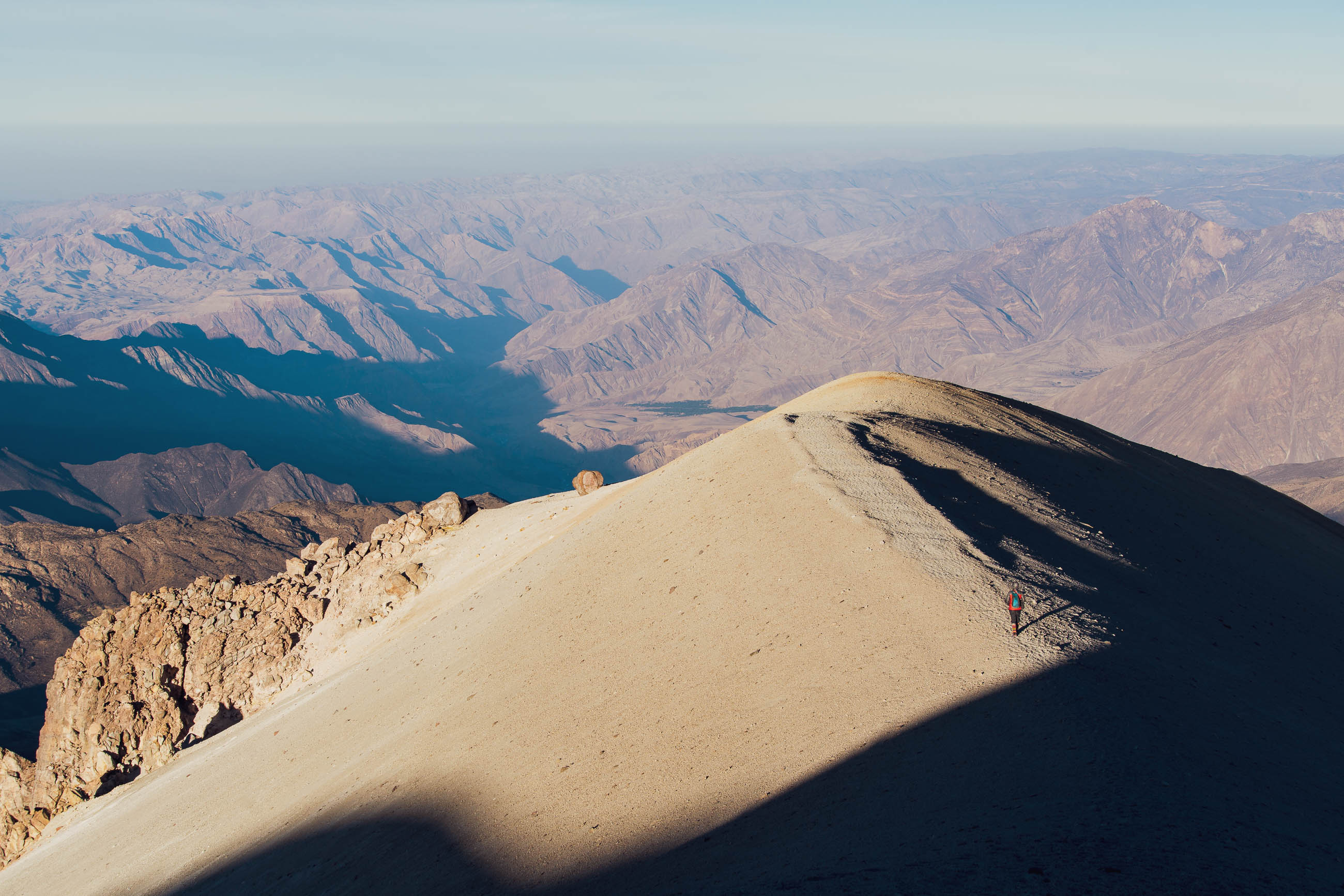
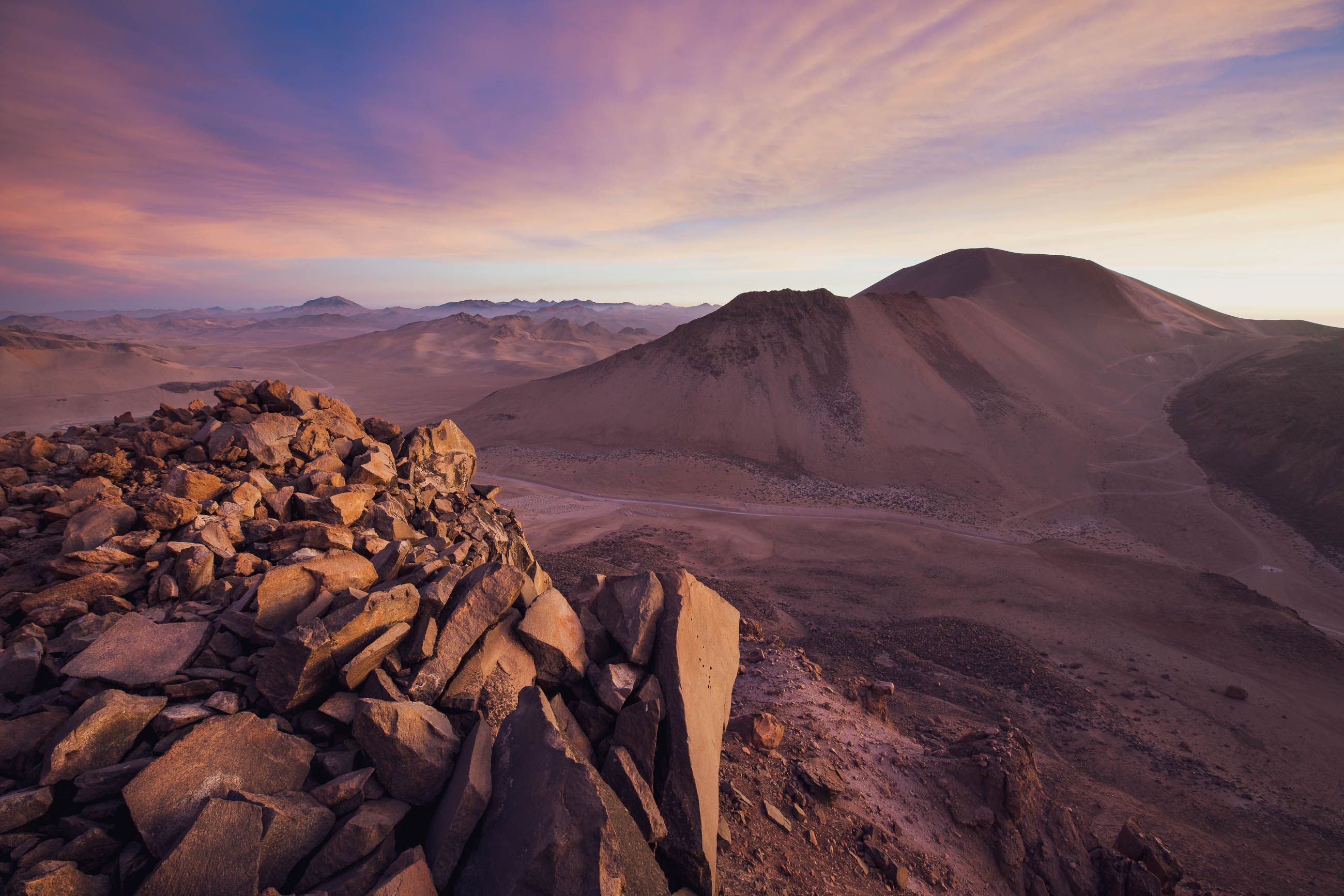
The route to Omate is the most sparsely populated section of the ride, crossing the arid northern margin of the Atacama Desert and passing tiny farming communities before turning northwest towards the flamingo-filled Laguna Vilacota. Volcanoes and other high peaks are a constant companion along this remote section of the ride. Stock up again in Huaytire before entering the starkly beautiful landscape of ash and pumice and lava flows surrounding Volcan Ticsani (close by the route and a relatively easy hike). Ticsani marks the edge of the altiplano and a dramatic change of scenery, as soon after the road plunges 3200m into the rift of the Rio Tambo Canyon. Two villages punctuate the descent to the river, where the road heads downstream through a landscape utterly transformed by the Volcan Huaynaputina eruption of 1600 AD, the biggest in recorded South American history. The landscape here, coated in a thick layer of ash, pumice, and lahar debris, still bears the scars.
The pleasant village of Omate will be welcome after the long, hot climb out of the east side of the canyon, and makes a great spot for a night or a day off, before the final couple of days’ ride out to the luxuries of Arequipa.
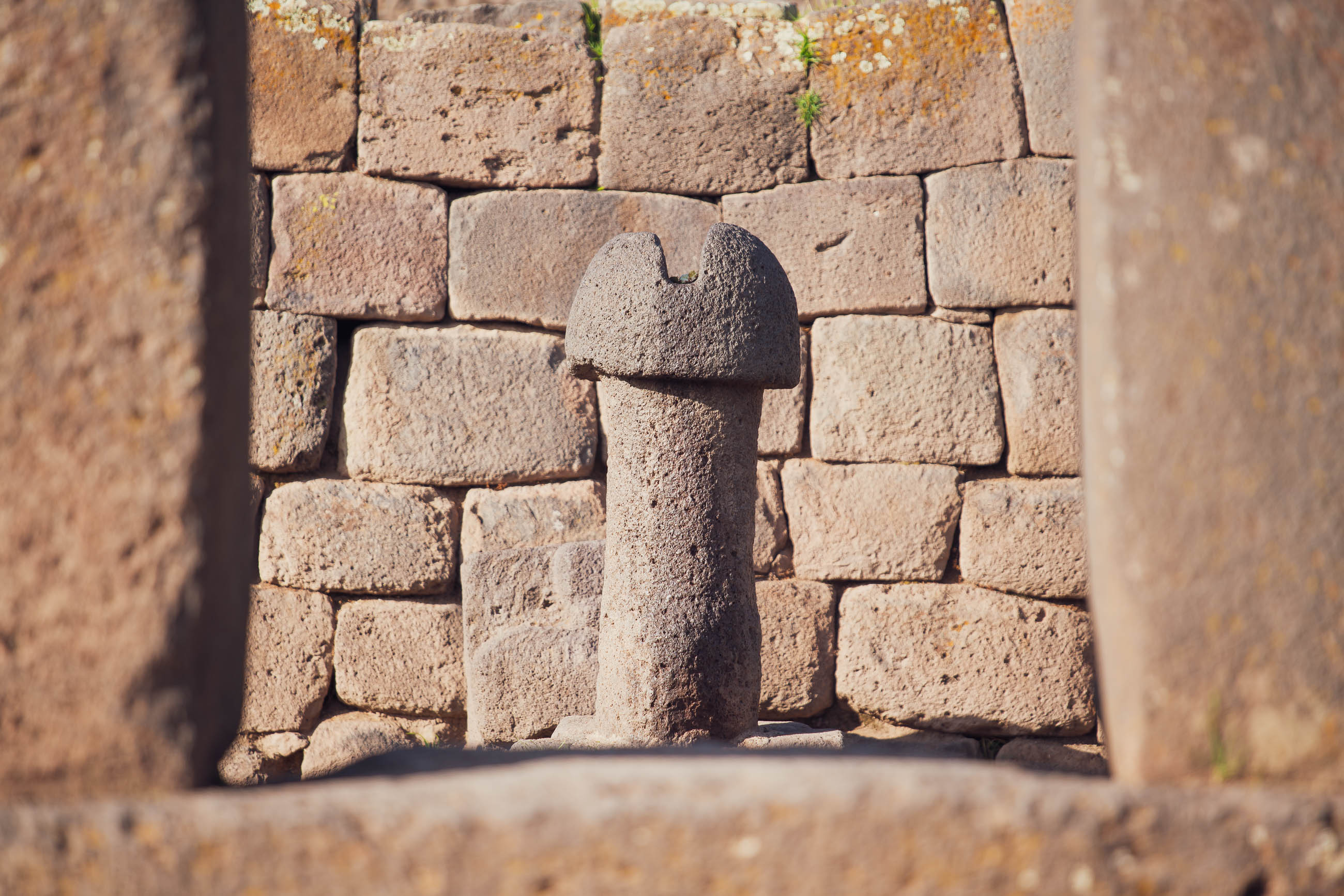
The Name: Although you probably won’t see one, the route crosses a lot of prime mountain lion habitat as it weaves its way across the pampa of southern Peru. The puma was a revered animal by pre-Colombian societies that flourished in the region, featuring strongly in mythology and legend. You’ll see place names, motifs, carvings, and the occasional statue – ancient and modern – celebrating these powerful animals; indeed, one of the possible translations of the name Titicaca is ‘gray puma’.
Additional Resources
Find detailed accounts and additional photos from this part of Mark and Hana’s trip on the following blog posts:


Terms of Use: As with each bikepacking route guide published on BIKEPACKING.com, should you choose to cycle this route, do so at your own risk. Prior to setting out check current local weather, conditions, and land/road closures. While riding, obey all public and private land use restrictions and rules, carry proper safety and navigational equipment, and of course, follow the #leavenotrace guidelines. The information found herein is simply a planning resource to be used as a point of inspiration in conjunction with your own due-diligence. In spite of the fact that this route, associated GPS track (GPX and maps), and all route guidelines were prepared under diligent research by the specified contributor and/or contributors, the accuracy of such and judgement of the author is not guaranteed. BIKEPACKING.com LLC, its partners, associates, and contributors are in no way liable for personal injury, damage to personal property, or any other such situation that might happen to individual riders cycling or following this route.
Please keep the conversation civil, constructive, and inclusive, or your comment will be removed.