


Elkhorn Crest Trail, Oregon
Distance
52 Mi.
(84 KM)Days
2
% Unpaved
75%
% Singletrack
50%
% Rideable (time)
93%
Total Ascent
4,750'
(1,448 M)High Point
8,230'
(2,509 M)Difficulty (1-10)
8.5?
- 6Climbing Scale Moderate91 FT/MI (17 M/KM)
- -Technical Difficulty
- -Physical Demand
- -Resupply & Logistics
Contributed By

Sarah Swallow
Contributing Editor
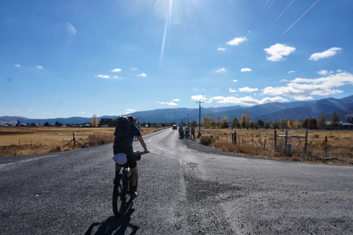
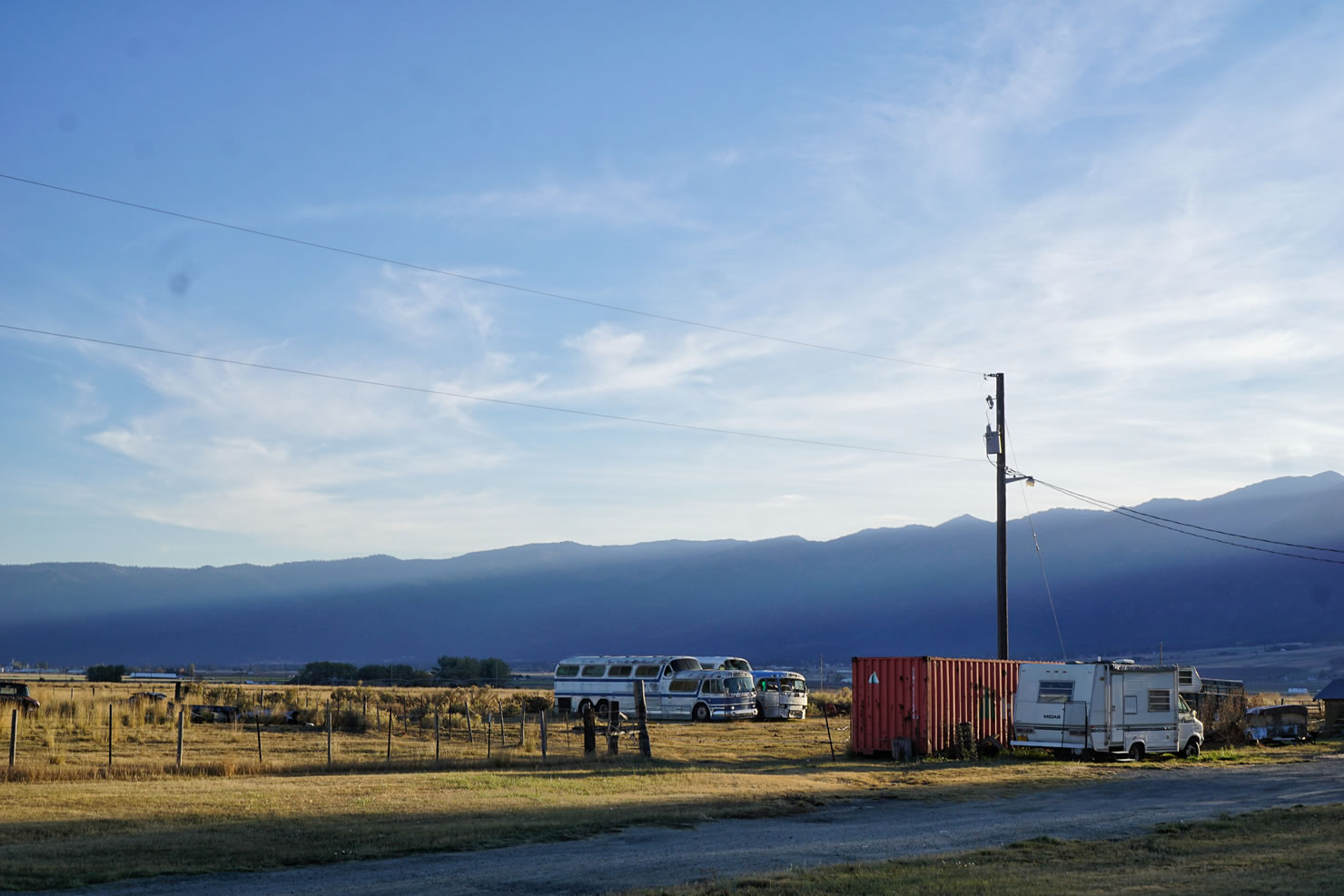
This ride begins in Haines, Oregon a very small town north of Baker City. We parked at a friendly residence for our ride but there is off street parking available on Front Street in town. I recommend checking in at the Haines City Office to let them know you will be leaving your vehicle for a couple days. You can also park in Baker City and connect with the route from there. This will add about 10 miles total to the route.
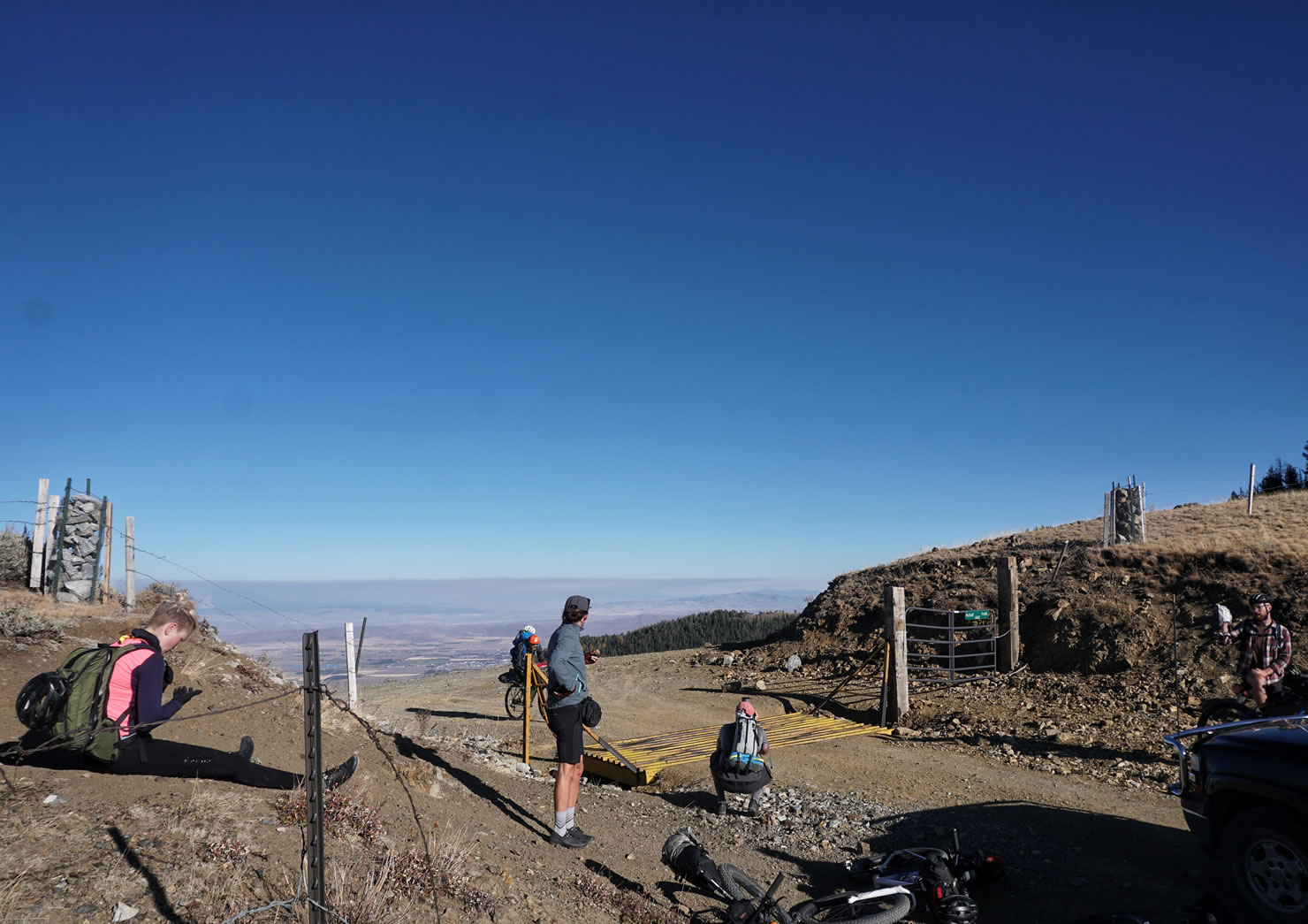
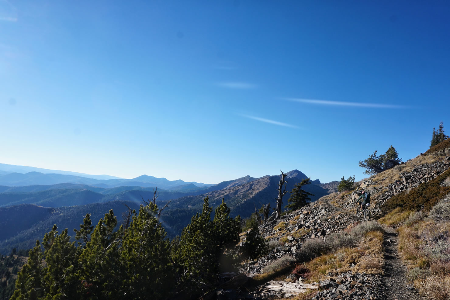
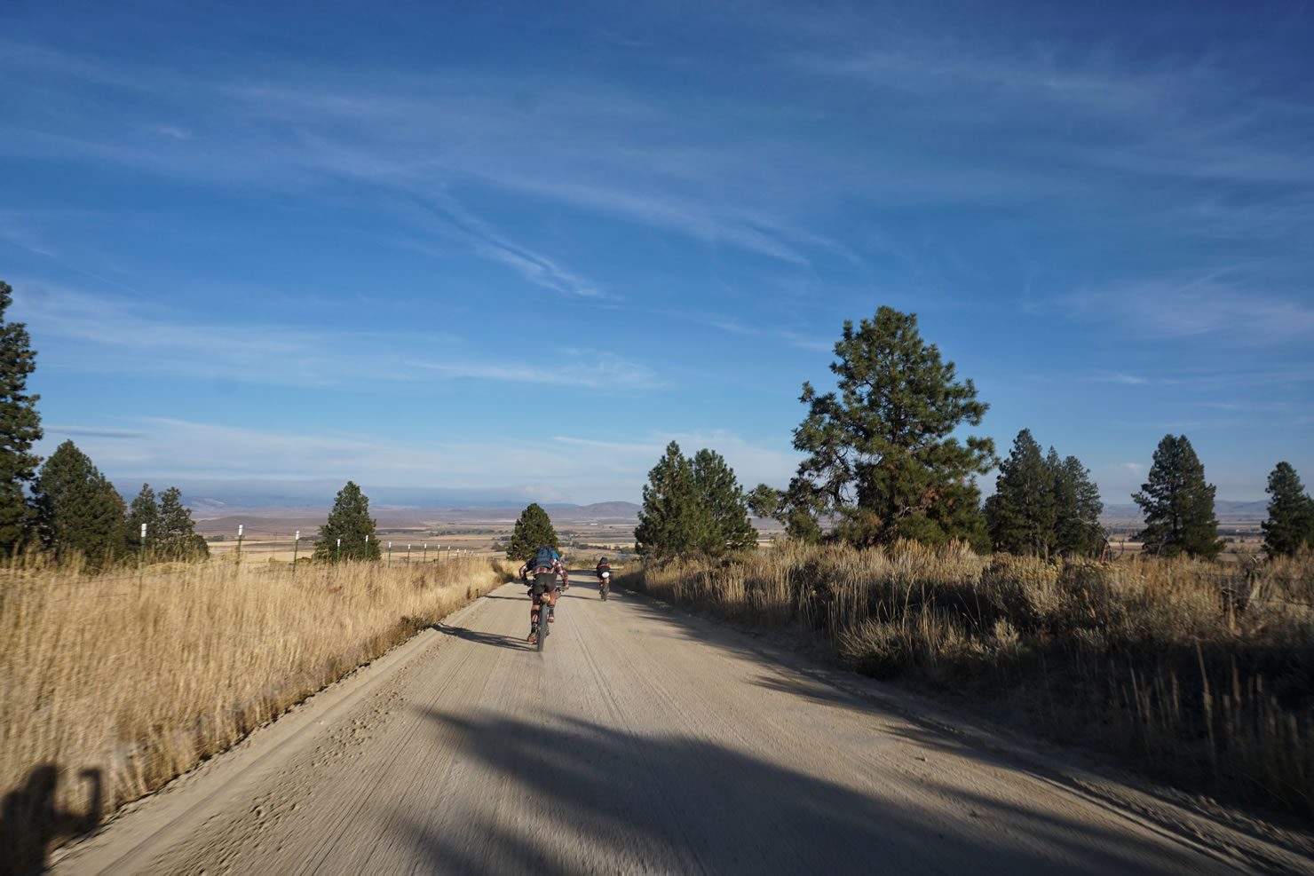
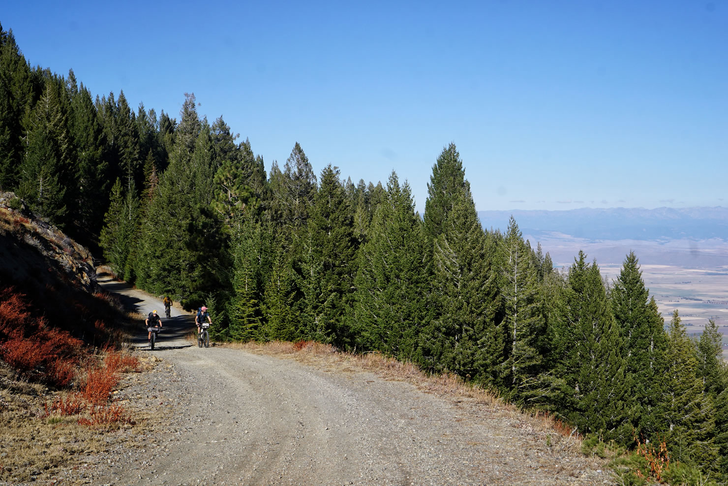
Begin your ride from Haines with a paved 8-mile false flat road through Baker Valley. When the road turns left, take the chunky gravel road to the right, Marble Creek Road. For the next 7.5 miles you will gain 3,873 ft at a grade that varies between 4-15%. A few sections of this road are very rocky. You will know when you reach the top when the road crosses the saddle of Elkhorn Mountain and you are greeted with 360-degree views of Baker Valley and the Wallowa Mountains to the East and the Blue Mountains to the West. This saddle is where you pick up the Elkhorn Crest Trail. The Marble Pass Trailhead sign designates the Elkhorn Crest Trail access.
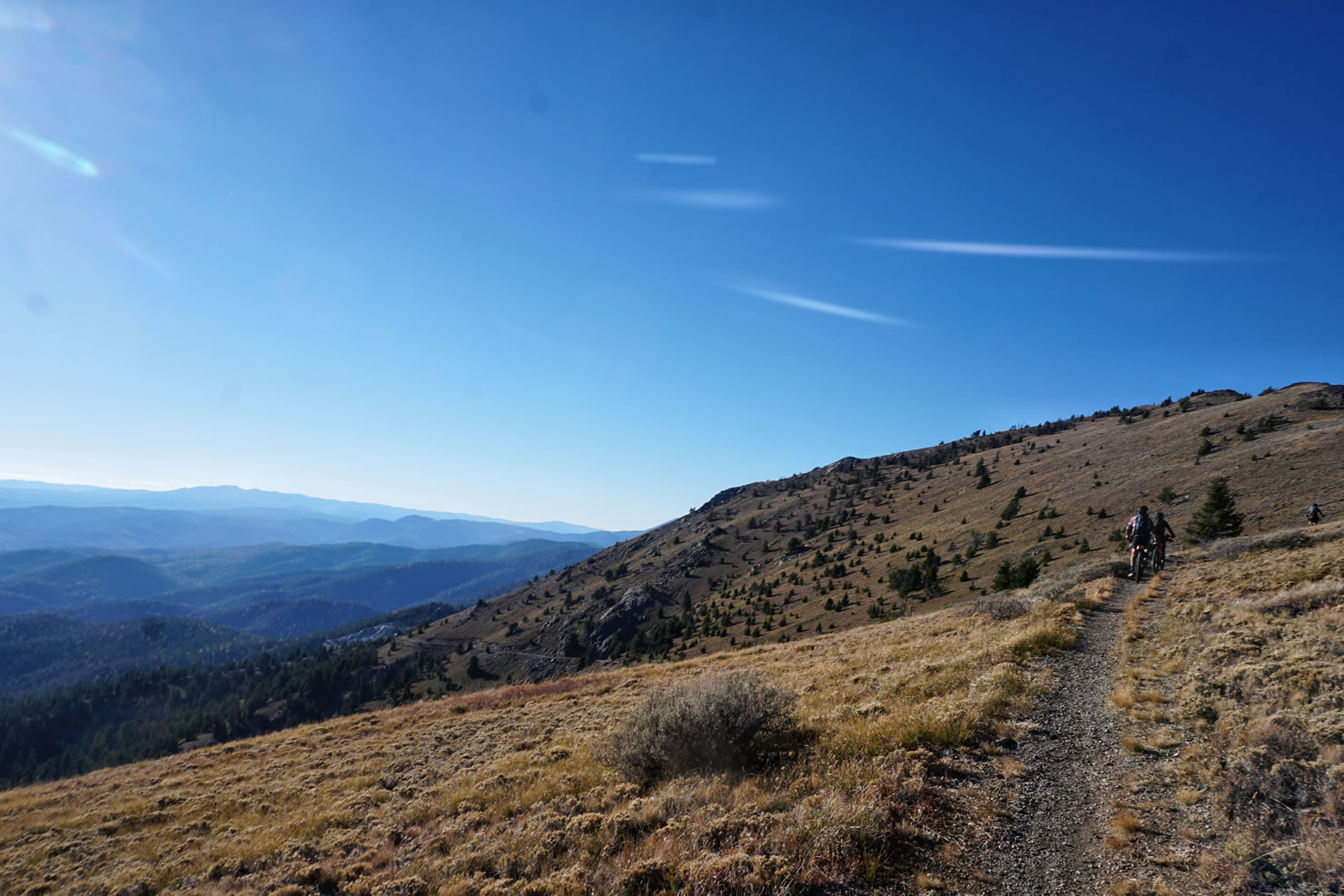
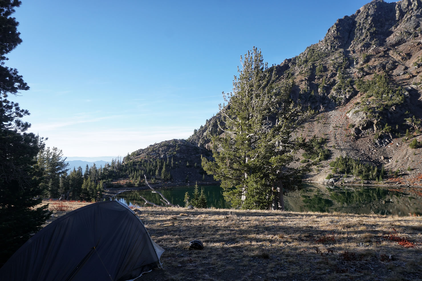
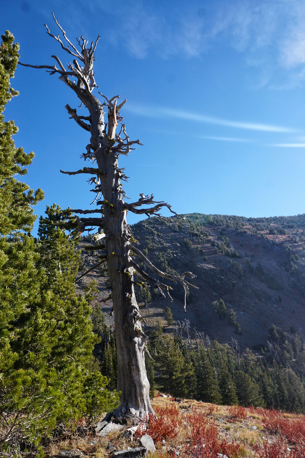
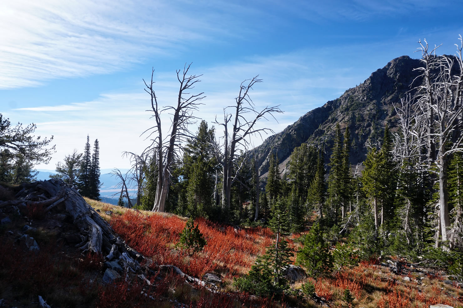
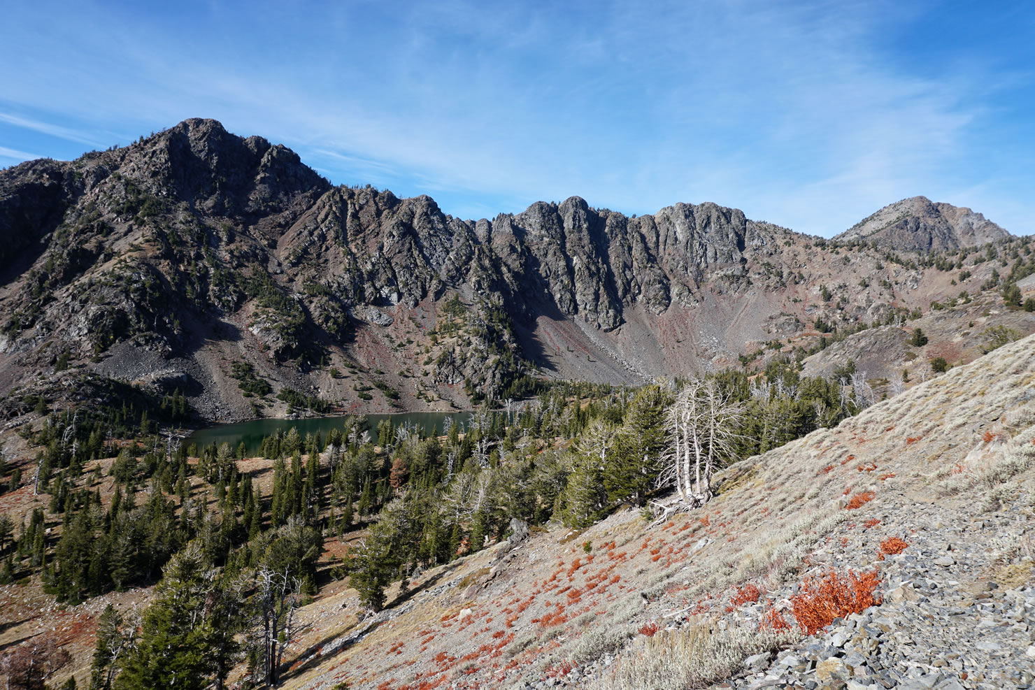
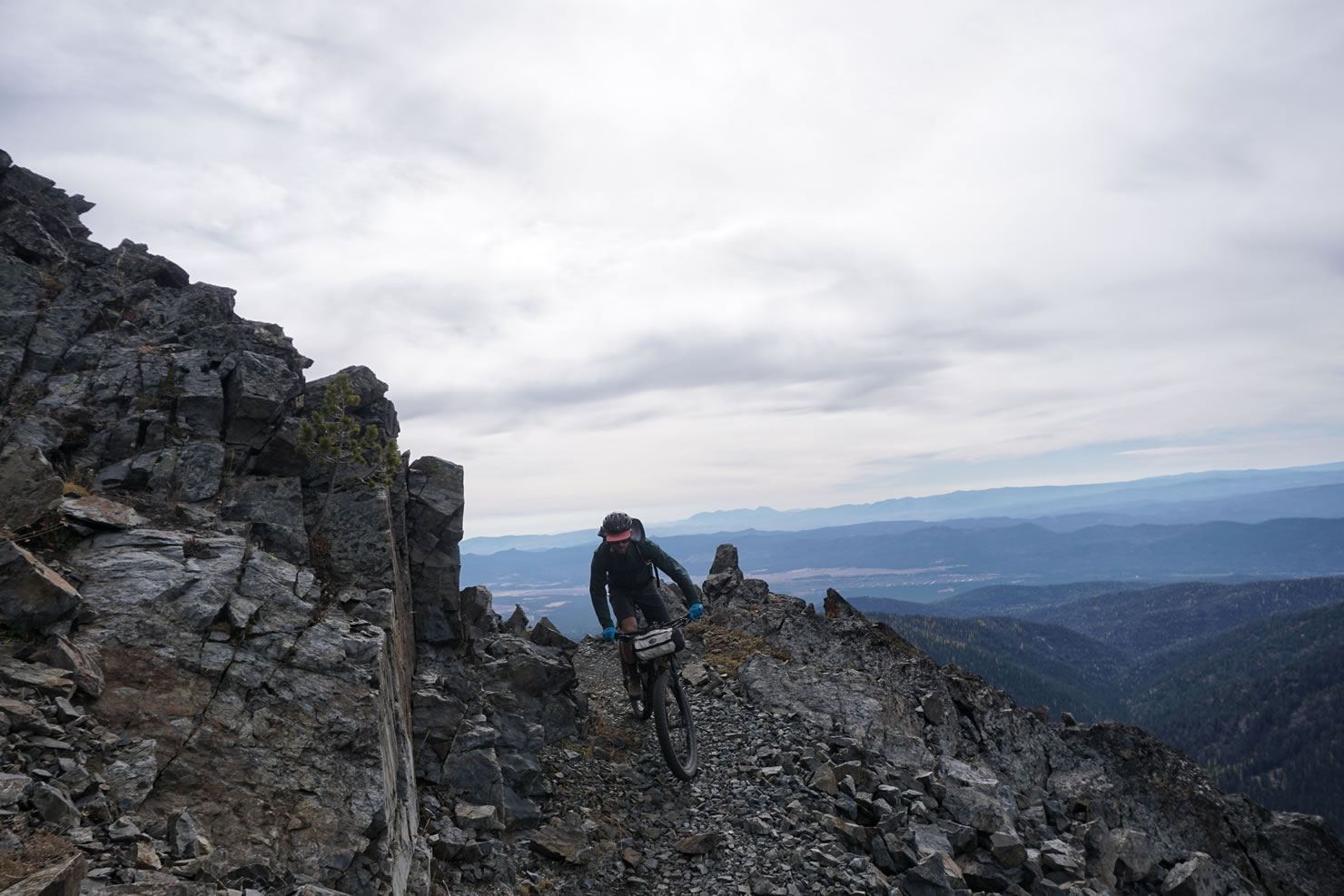
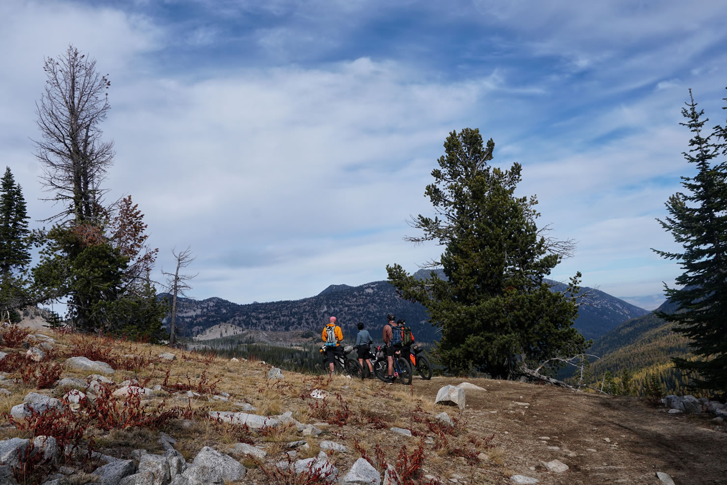
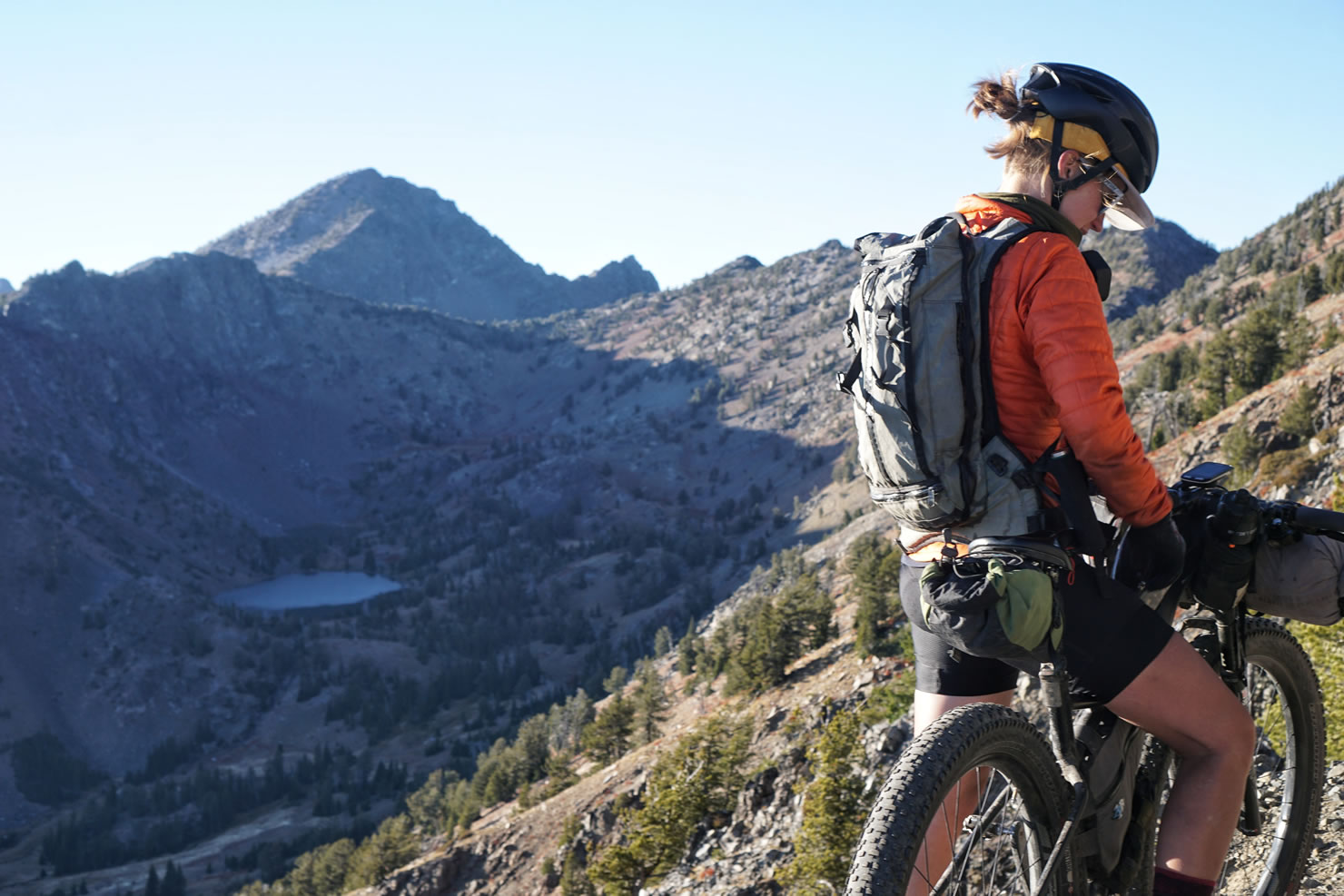
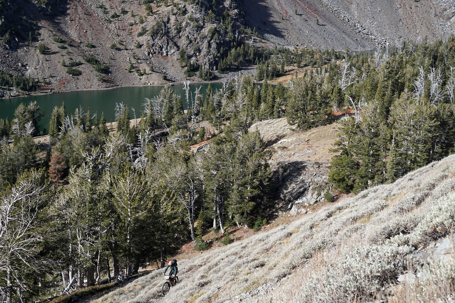
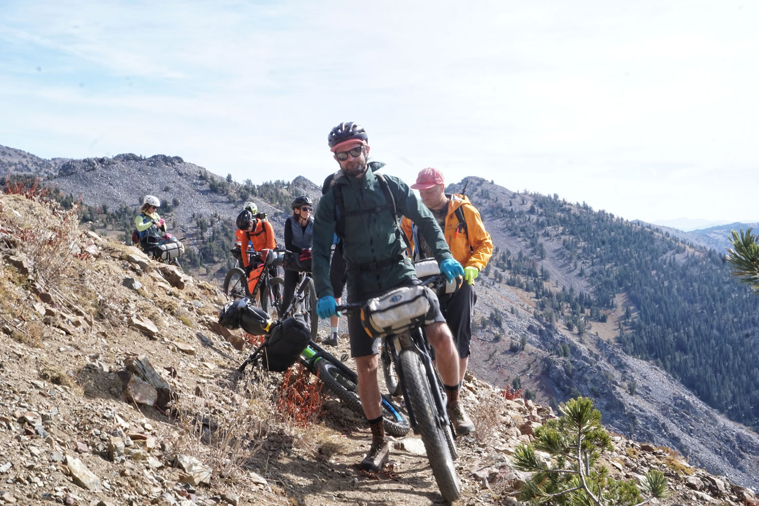
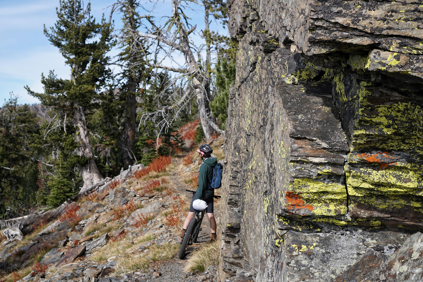
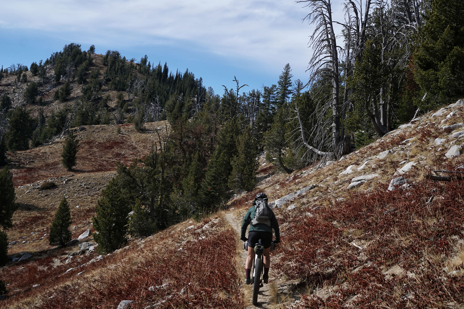
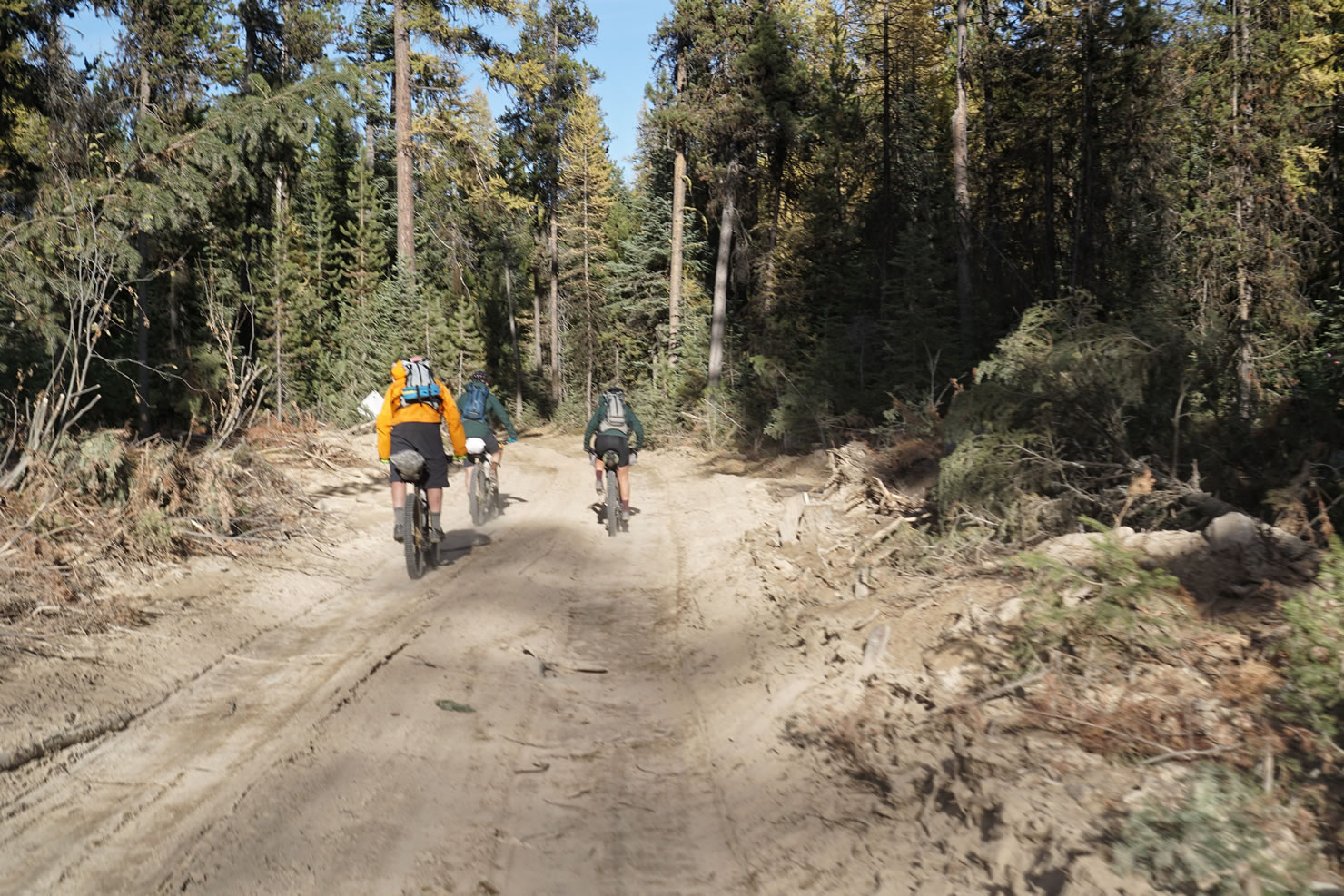
Follow the rocky ridgeline trail at a more manageable grade of 2-6%. The trail winds its way across the West face of Elkhorn Mountain, through alpine grasses and along some adrenaline spiking exposed cliffs. Soon, you will see the Twin Lakes in the distance. Twin Lakes is a beautiful place to camp with craggy mountain peek views and sightings of the resident mountain goats. The trailhead for Twin Lakes is approximately 4 miles from the Marble Creek Trailhead. The trail down to Twin Lakes is a bit more challenging than the Elkhorn Crest Trail and loses about 500 ft in 1 mile. This is a very scenic hike if you aren’t into riding steep and tight switchbacks.
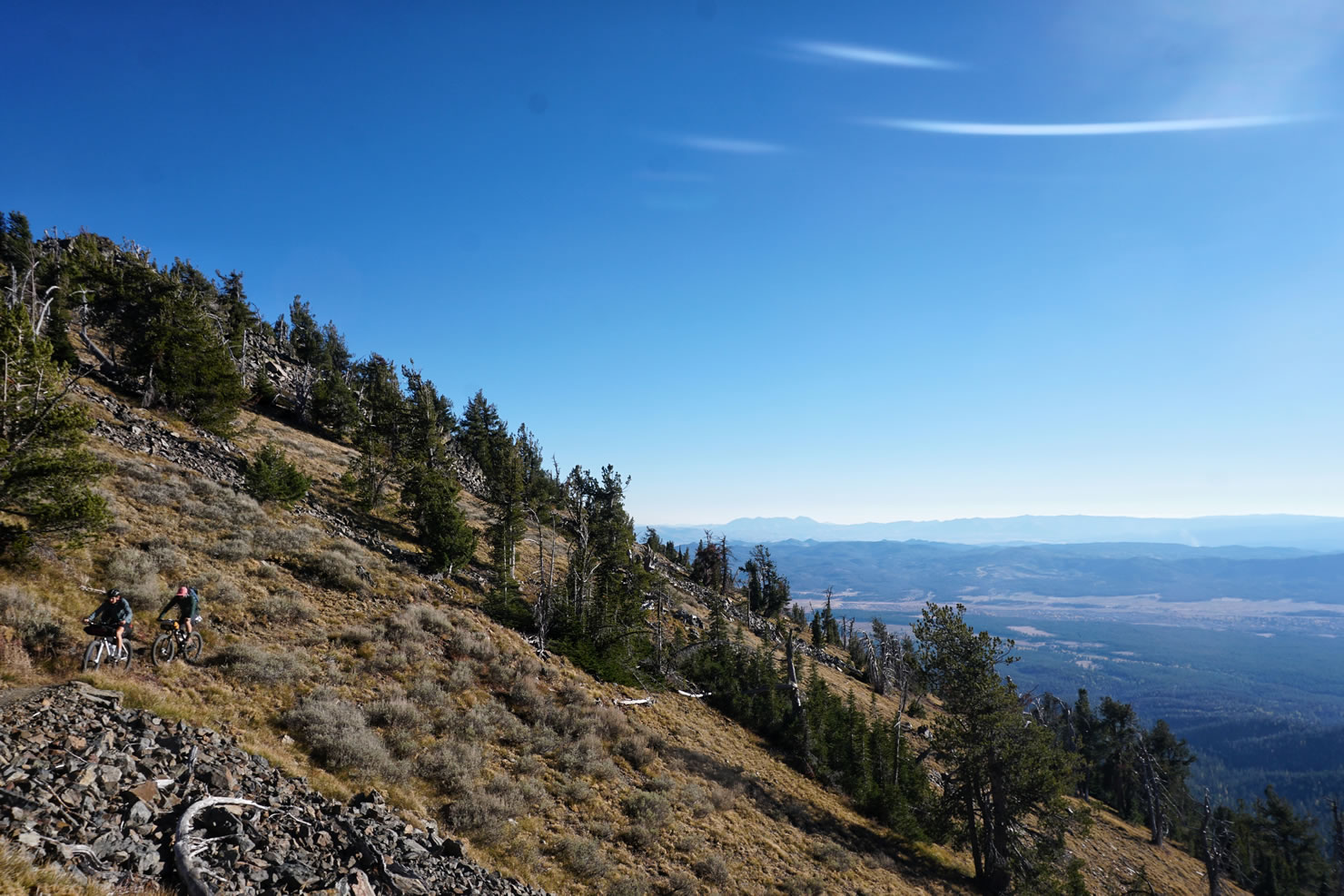
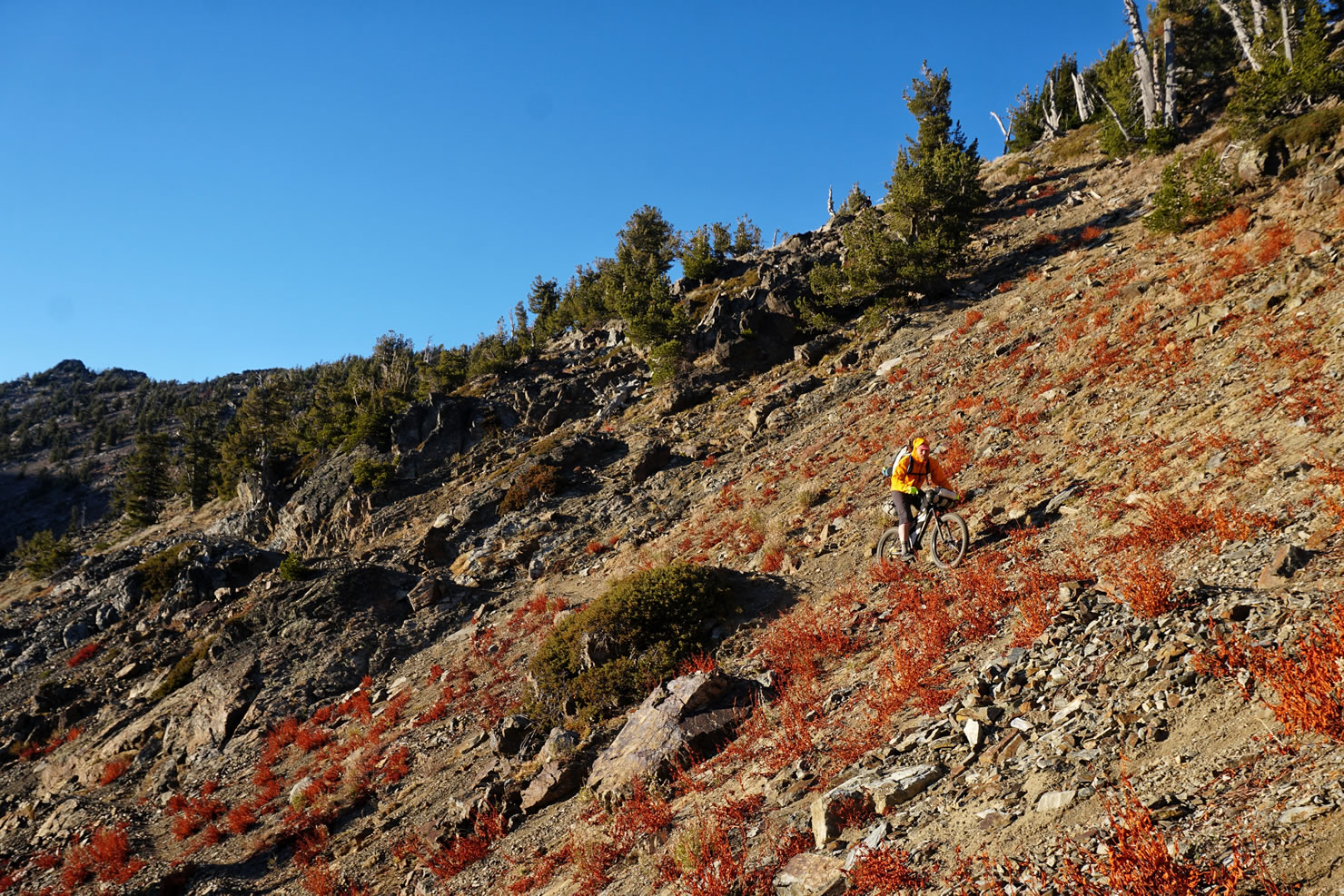
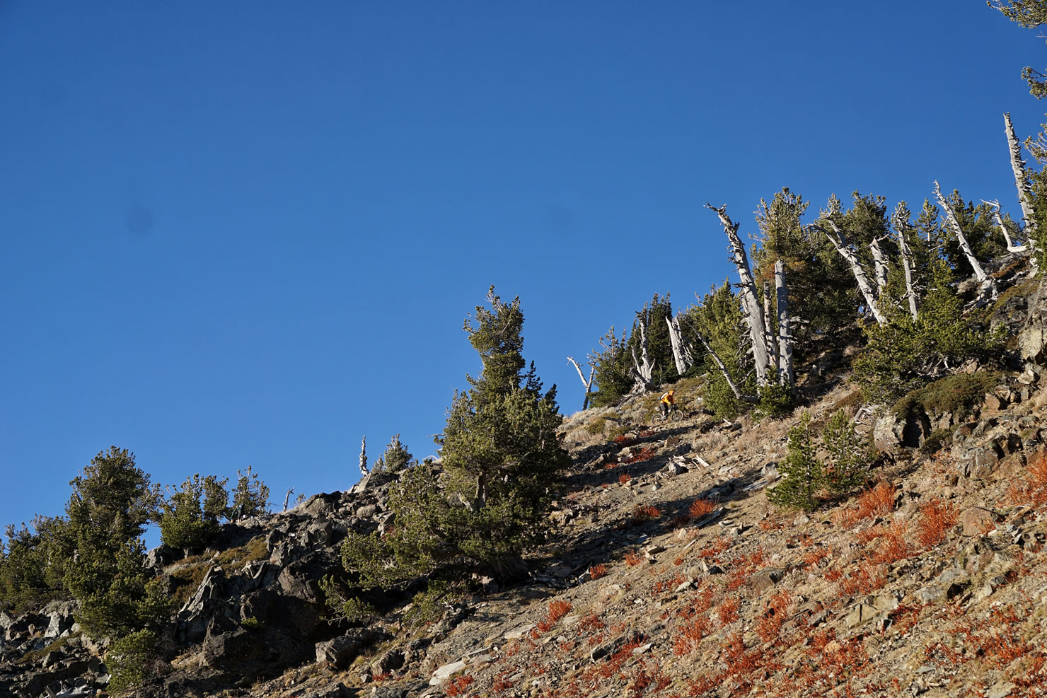
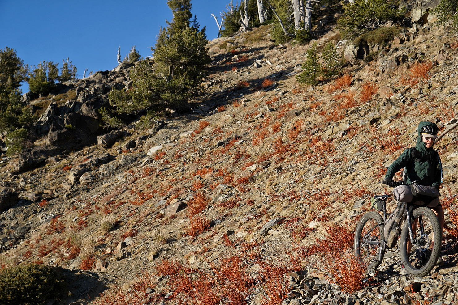
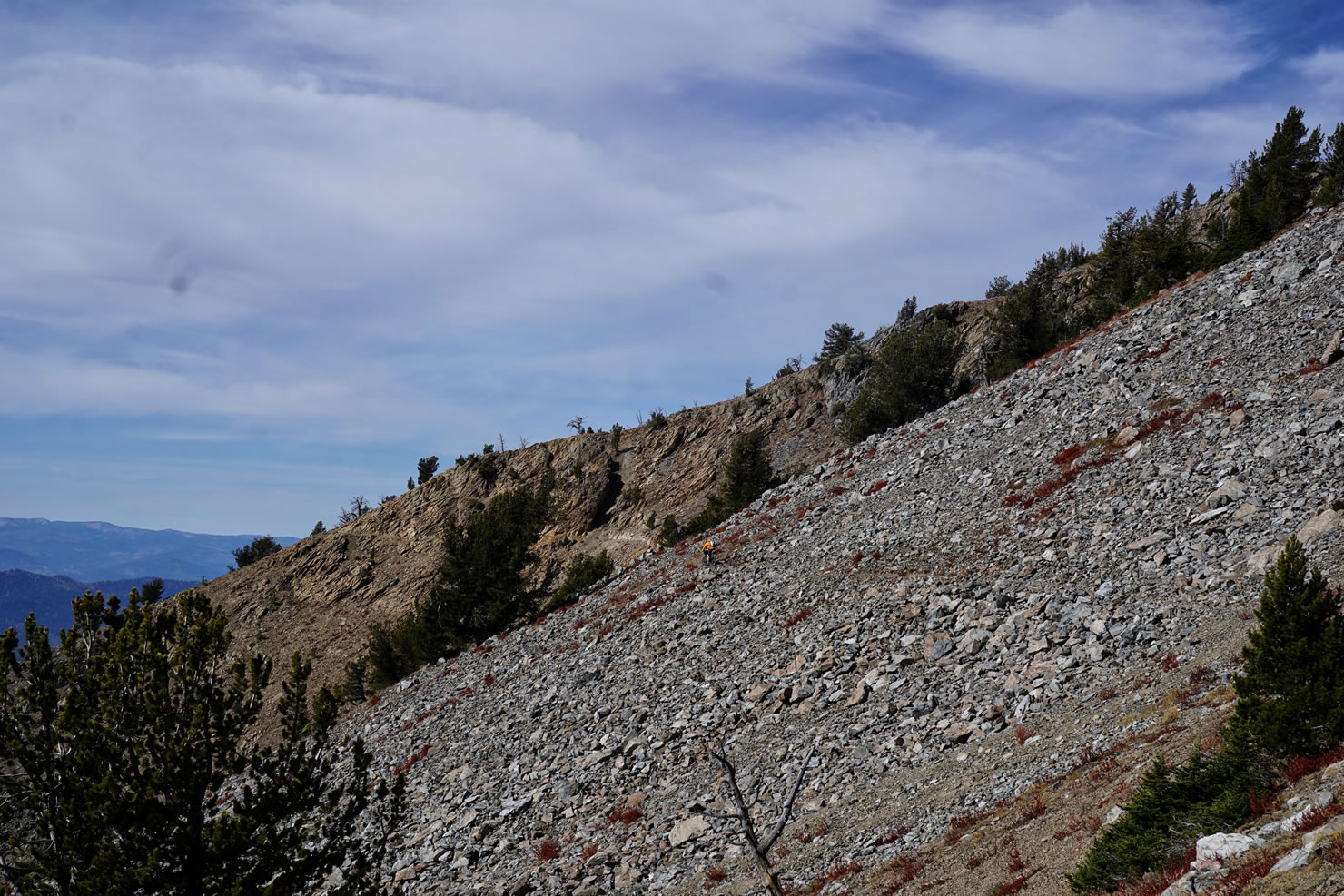
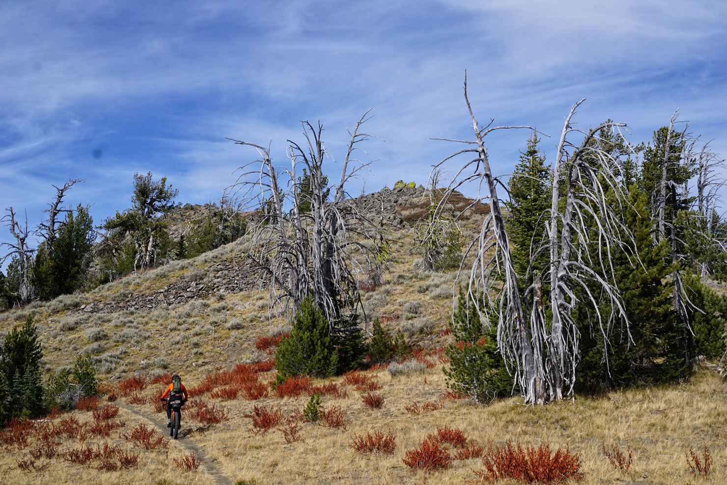
From Twin Lakes continue following the Elkhorn Crest Trail along more ridgelines, alpine grass fields, forest, and cliffs for about 11 miles. This portion of trail varies from loose gravel singletrack to rocky shale and loses 1,100 ft at a grade that varies from -1 to -6%. Don’t expect this to be a fast descent. It’s technical and gradual and will take some time.
If you’d like to split this ride up in three days, consider camping at an equally scenic campspot at Summit Lake, on the east face of Elkhorn Mountain. There will be signs for Summit Trail between mile 29 and 31.
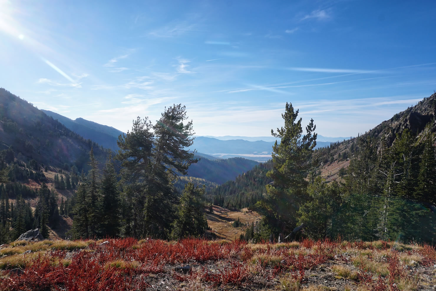
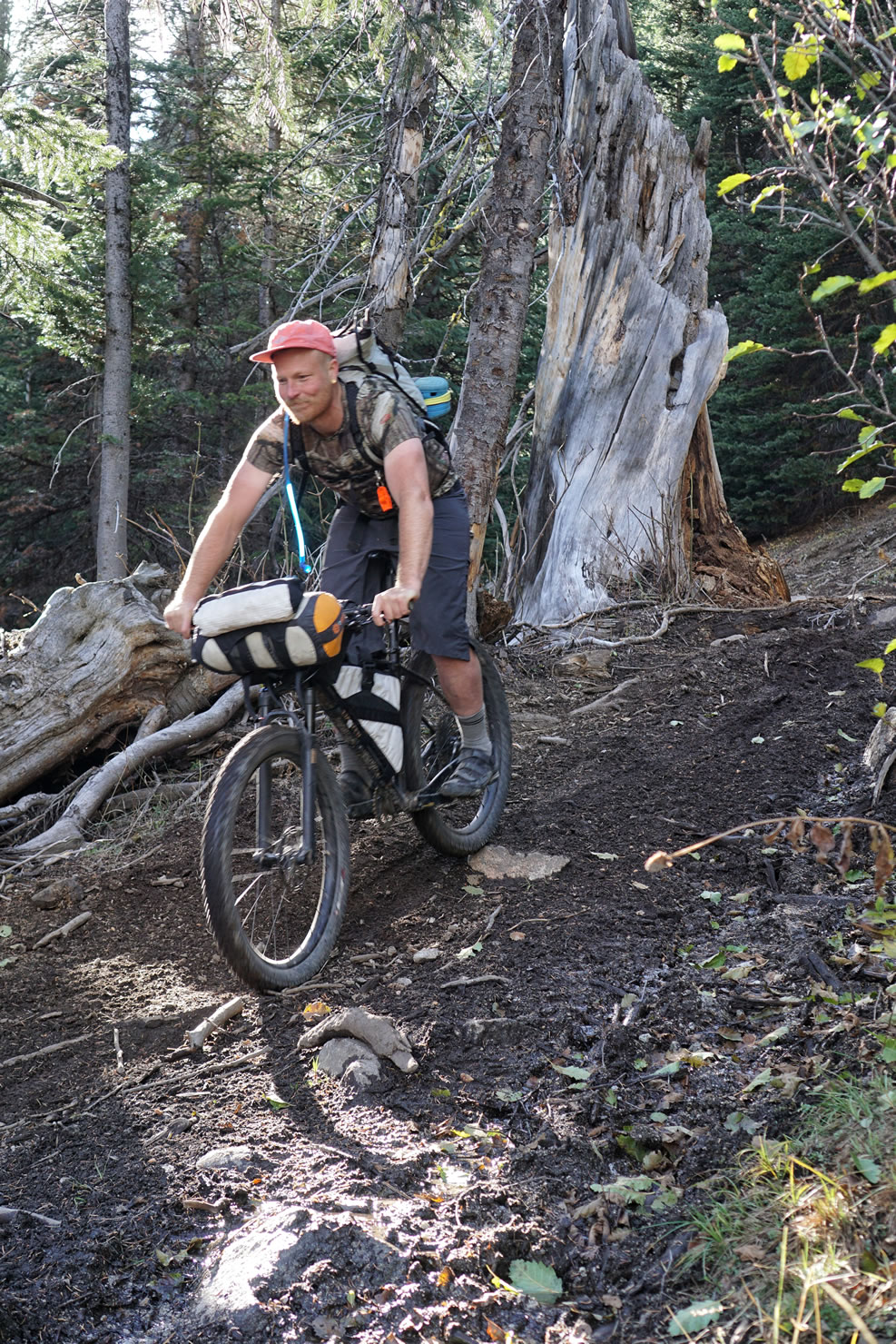
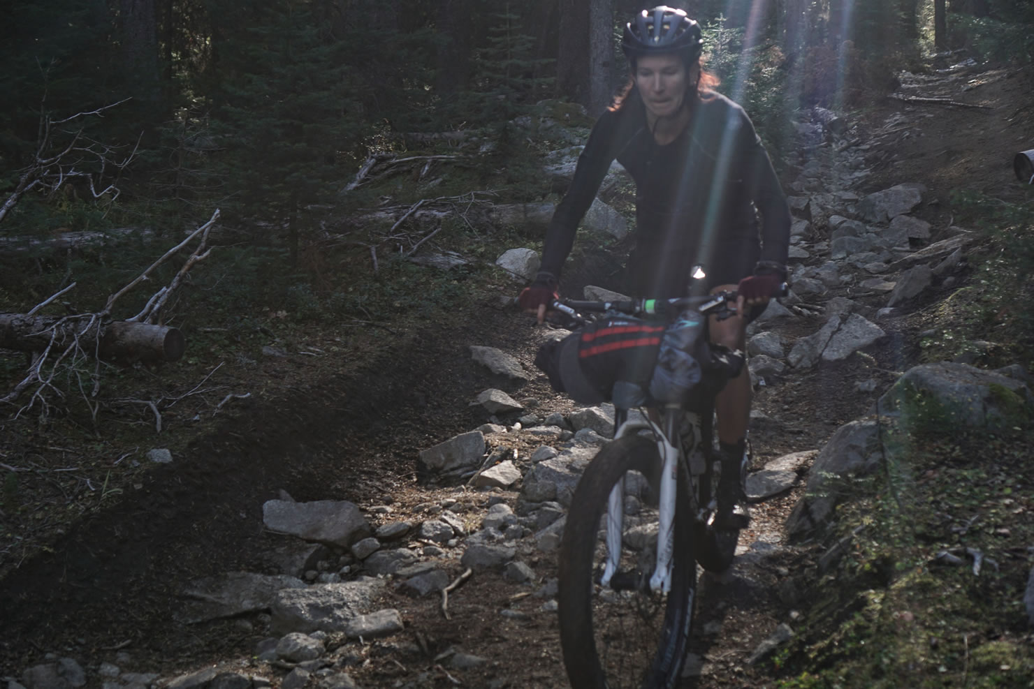
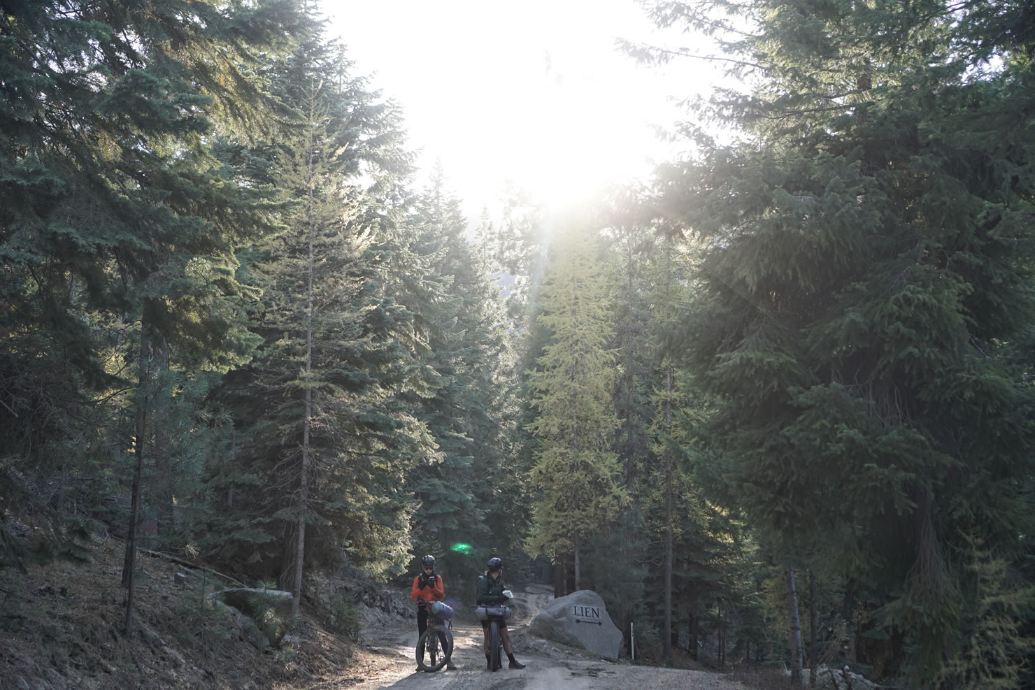
The non-wilderness portion of the Elkhorn Crest Trail ends around mile 31 where you come to an intersection of 4-wheel drive/jeep roads. Turn right to ride up a short steep hill before starting a 4,000 ft descent over the next 14 miles. These next 14 miles are very much jeep trail making for some really fun and wide double track technical riding. When we were there is mid-October, there was evidence of some serious potential for mud. At one point the road is covered in a deep pile of large boulders for about a mile. This can be a really fun technical ride for some and an awkward hike for others. Enjoy multiple fun lines throughout the rest of the descent before you reach Baker Valley. Enjoy the last 7 gradual-to-flat paved miles back into the town of Haines. Be sure to have some dinner at Haines Famous Steak House, they love birthdays, and the service is great!


Submit Route Alert
As the leading creator and publisher of bikepacking routes, BIKEPACKING.com endeavors to maintain, improve, and advocate for our growing network of bikepacking routes all over the world. As such, our editorial team, route creators, and Route Stewards serve as mediators for route improvements and opportunities for connectivity, conservation, and community growth around these routes. To facilitate these efforts, we rely on our Bikepacking Collective and the greater bikepacking community to call attention to critical issues and opportunities that are discovered while riding these routes. If you have a vital issue or opportunity regarding this route that pertains to one of the subjects below, please let us know:
Highlights
Must Know
Food/H2O
Trail Notes
Resources
- Elkhorn Crest Trail: A 16 mile single track trail that traverses the ridgeline of the Elkhorn Mountain, through sub-alpine prairies and forests, with 360 degree views of Baker Valley and the Wallowa Mountains to the East and the Blue Mountains to the West.
- Twin Lakes: A scenic place to camp with alpine lake and rocky mountain peak views.
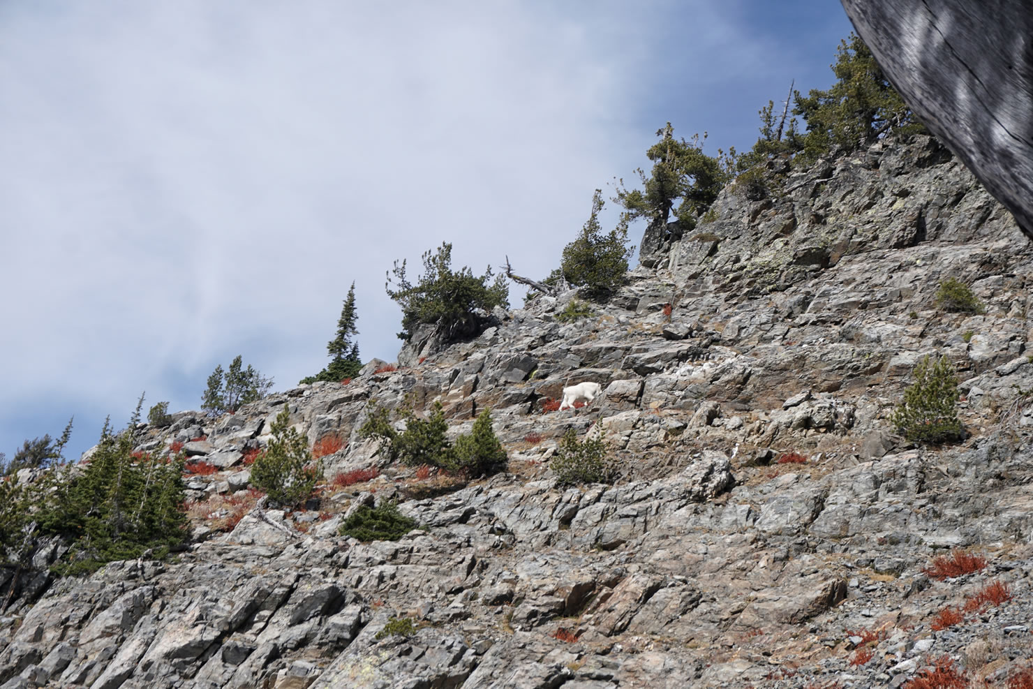
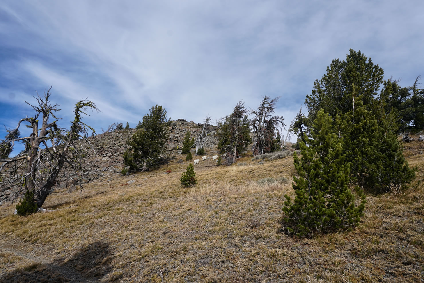
- Wildlife: There are herds of mountain goats that call Elkorn Mountain their home. You can see them often in the distance on the side of a rocky cliff, or around a corner on the single track. Elk sightings are possible as well.
- This route is bikepacking at its best in a 2-day ride.
- The highest elevation of this route is 8,300 ft. Making a visit during winter inadvisable due to snow accumulation. We recommend visiting anytime between late spring to mid-fall.
- You will be camping at 8,300 ft so be prepared for more extreme conditions higher up. This is an arid climate.
- The locals say that the mountain goats can get quite friendly by coming into camp and trying to steal food or packs. They like salt. Keep your food safely sealed and stored at camp.
- The Elkhorn Crest Trail continues north to Anthony Lakes. A portion of this section goes through wilderness land, which is why this route turns off of the Elkhorn Trail at mile 32 and follows Forest Road 7301 down into Haines.
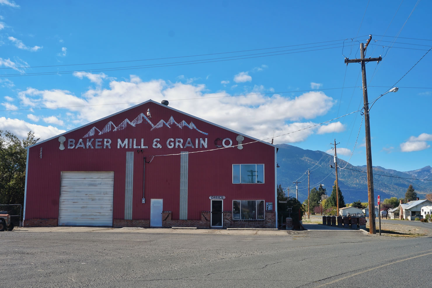
- The only food available is at the start and end of the route in Haines, which has a small mercantile and a steak house restaurant.
- Water is available at Twin Lakes, Summit Lake, and the North Powder River, which runs along the 4-wheel drive/jeep road, Forest Road 7301.
- Haines Steak House is an American steak and seafood restaurant with a rustic, wood-paneled atmosphere. They are your typical small town steak house but with a little sass if you get the right waitress. They serve buffet dinners and lunch and their salad bar is served out of a chuck wagon.
This is a great route that can easily be done in two full days. If the weather is really nice and you’d like some more time to explore the lakes and mountain peaks, camp at Twin Lakes the first night, ride a short day on day two and camp at Summit Lake, then descend the jeep trail to Haines the following morning.
This route is 75% unpaved with 50% of the total route being on single track. Due to the steepness of the climb up to Marble Creek Pass, the exposed technical ridgeline riding of Elkhorn Crest Trail, the change in elevation, and the technical sections of jeep road, we rate this route an 8.5 out of 10 on the difficulty scale and a 10 out of 10 on the fun scale.
Despite the difficulty rating, our large group that included people of all skill levels was able to ride this route at an all day pace in two full days. There was a bit more walking involved for the beginner riders but the trail is scenic and entertaining enough that waiting at a scenic vista to regroup is a delight.


Terms of Use: As with each bikepacking route guide published on BIKEPACKING.com, should you choose to cycle this route, do so at your own risk. Prior to setting out check current local weather, conditions, and land/road closures. While riding, obey all public and private land use restrictions and rules, carry proper safety and navigational equipment, and of course, follow the #leavenotrace guidelines. The information found herein is simply a planning resource to be used as a point of inspiration in conjunction with your own due-diligence. In spite of the fact that this route, associated GPS track (GPX and maps), and all route guidelines were prepared under diligent research by the specified contributor and/or contributors, the accuracy of such and judgement of the author is not guaranteed. BIKEPACKING.com LLC, its partners, associates, and contributors are in no way liable for personal injury, damage to personal property, or any other such situation that might happen to individual riders cycling or following this route.
Please keep the conversation civil, constructive, and inclusive, or your comment will be removed.