


Fish Forks Overnighter
Distance
30 Mi.
(48 KM)Days
1.5
% Unpaved
100%
% Singletrack
100%
% Rideable (time)
75%
Total Ascent
4,711'
(1,436 M)High Point
7,325'
(2,233 M)Difficulty (1-10)
6.5?
- 10Climbing Scale Very Strenuous157 FT/MI (30 M/KM)
- -Technical Difficulty
- -Physical Demand
- -Resupply & Logistics
Contributed By
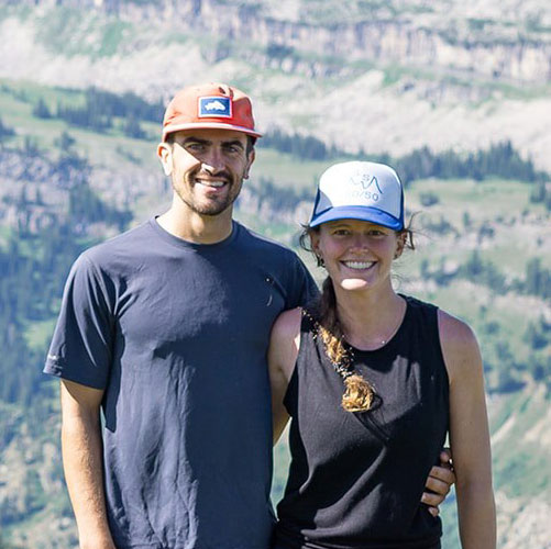
Conor Phelan
Guest Contributor
Originally hailing from the East Coast, Conor has spent his adult years bouncing around the mountain west. Newly transplanted to Reno, NV, Conor can likely be found far from the casinos on a pair of skis or wheels. See what he is up to on Instagram @cnphelan
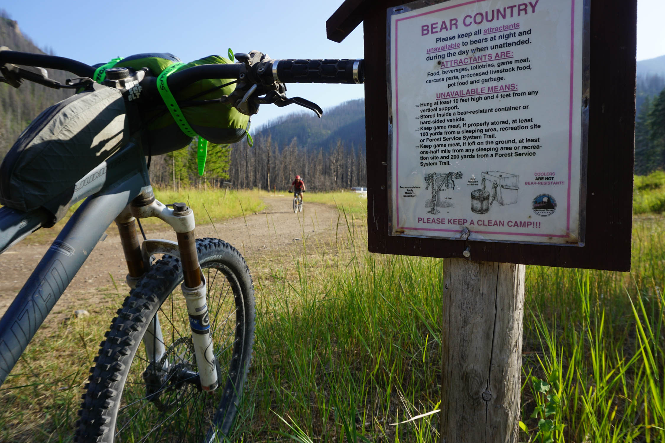
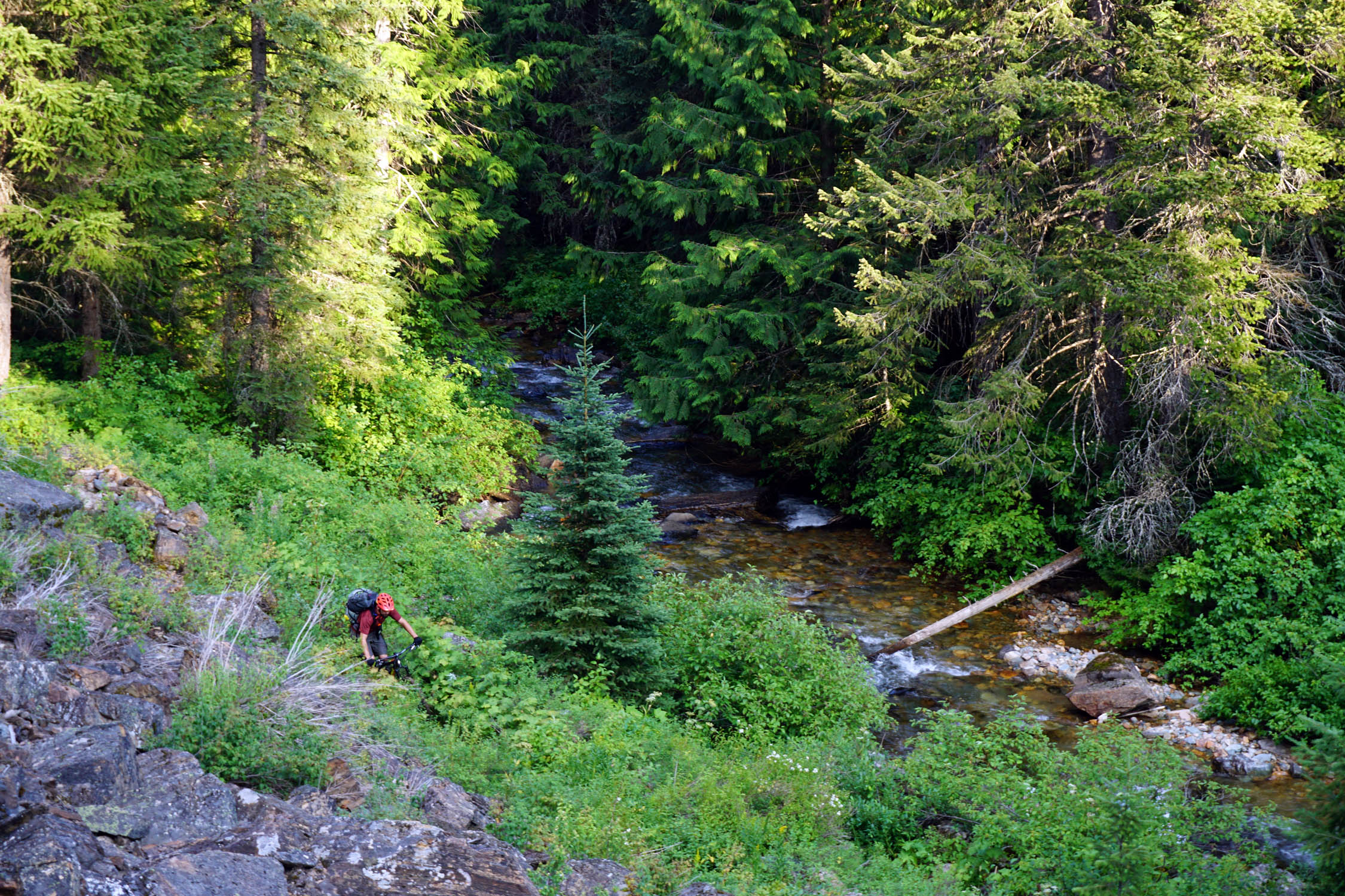
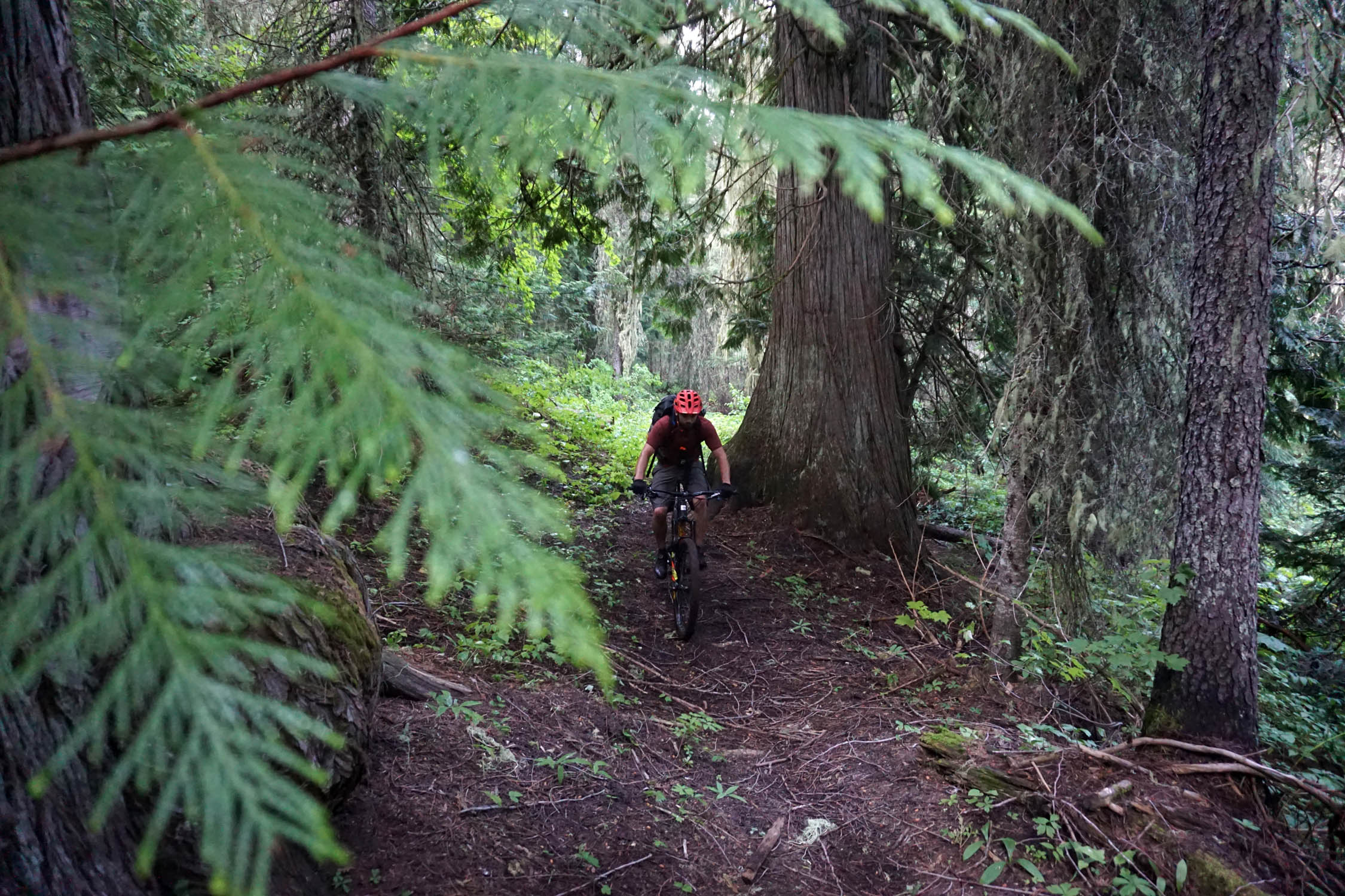
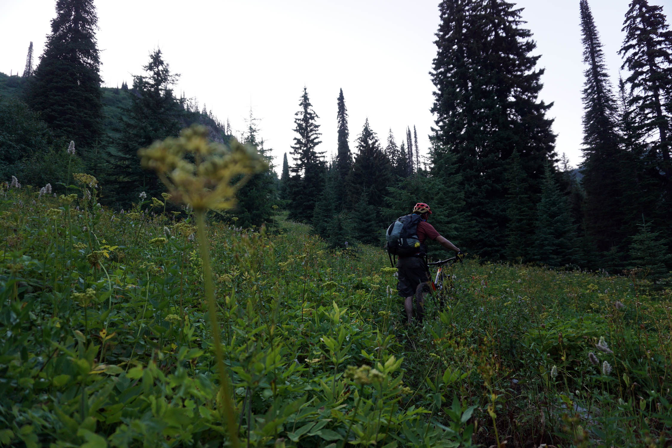
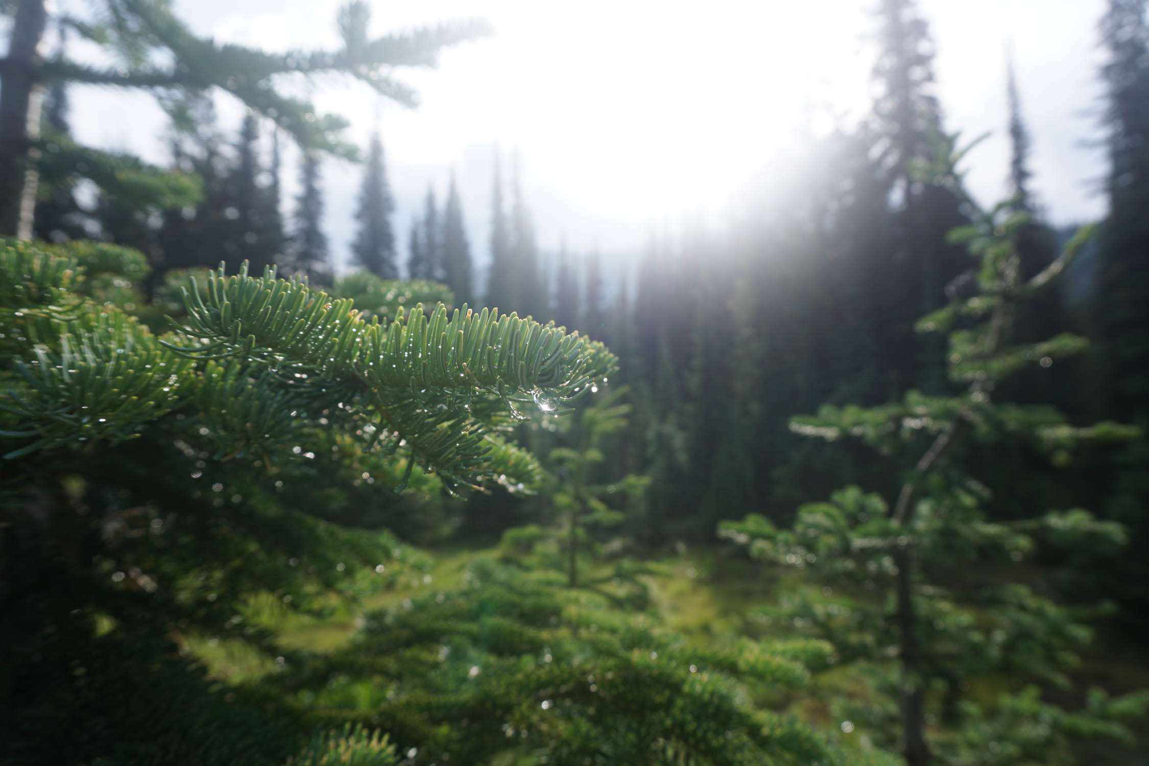
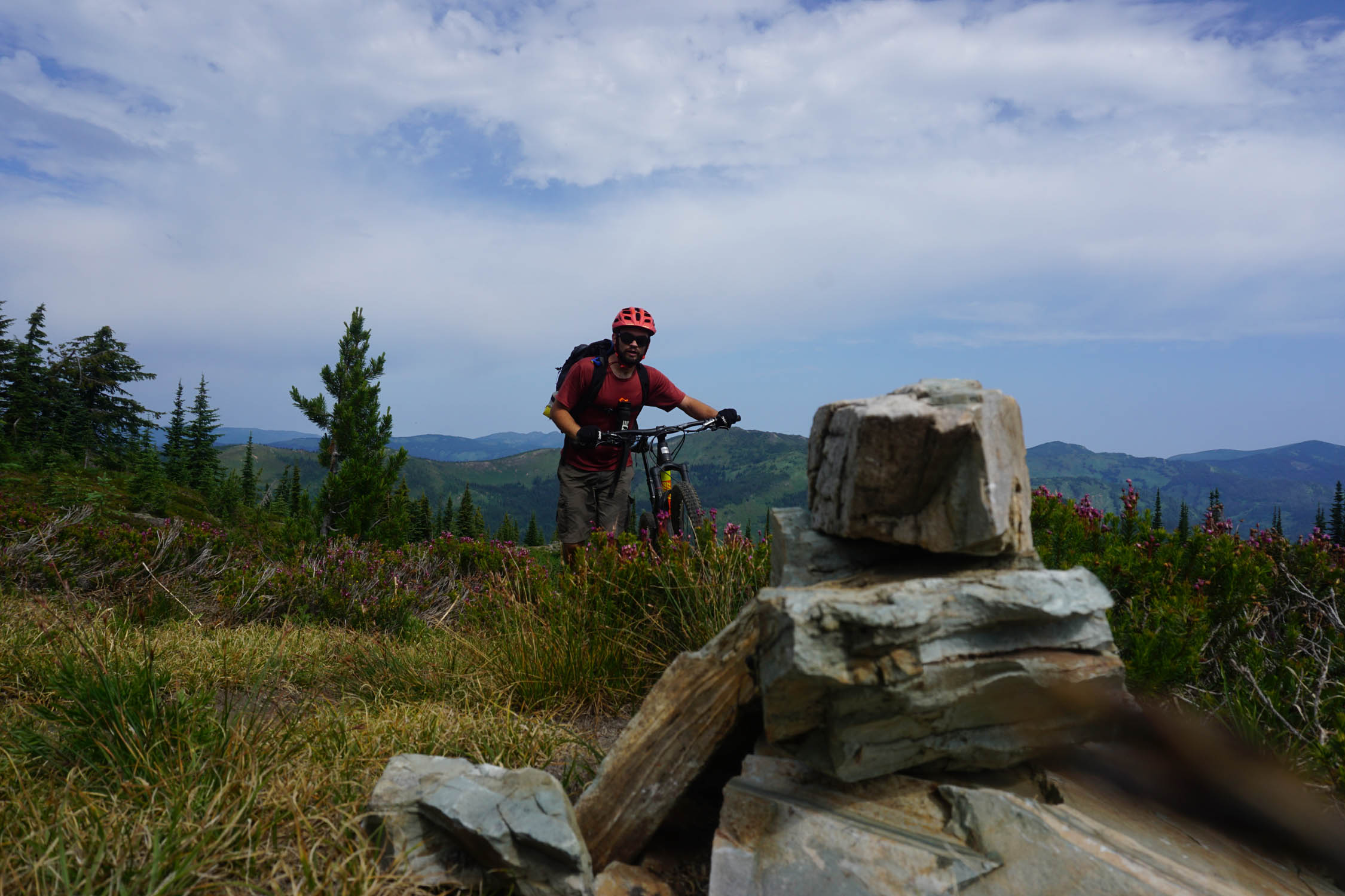
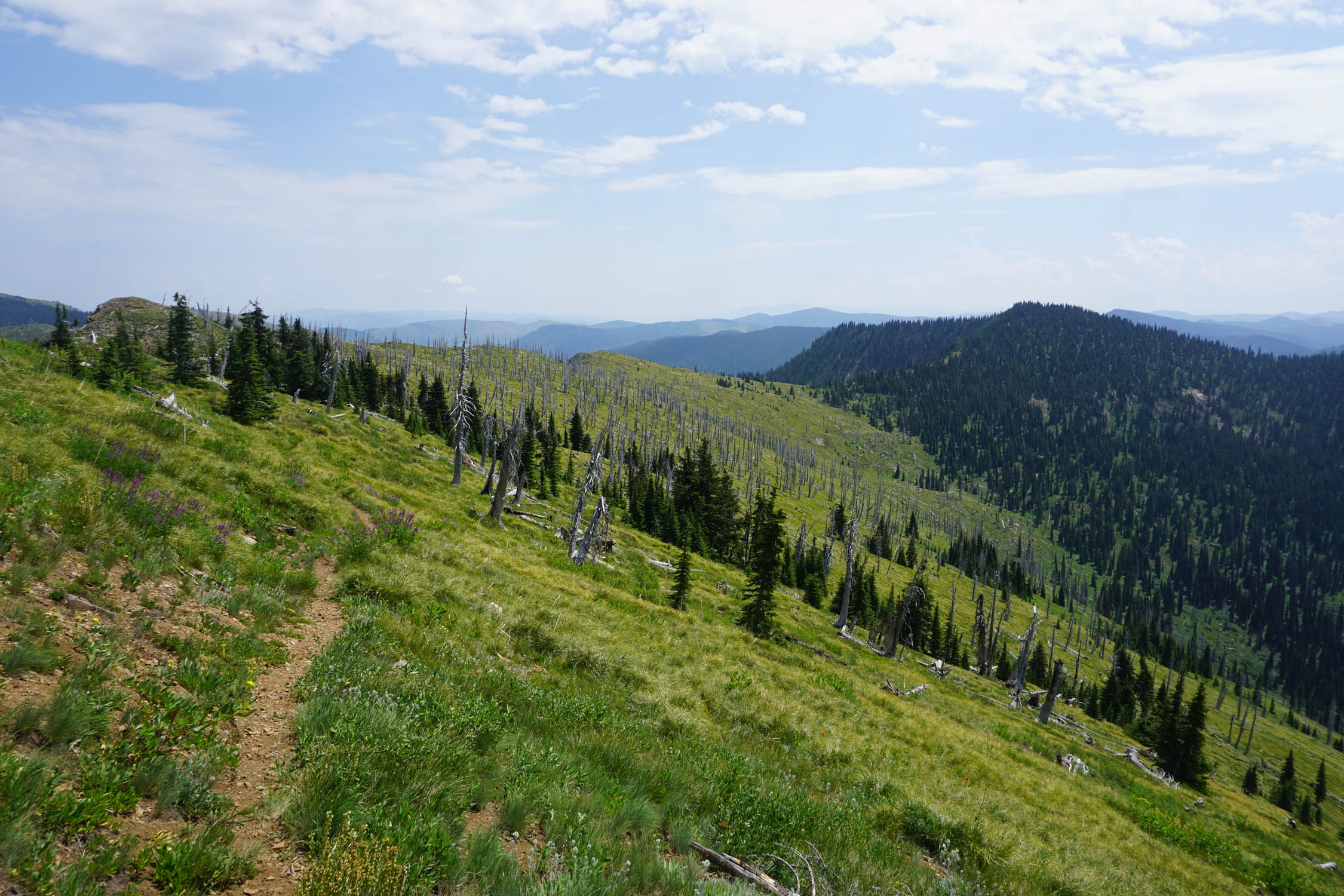
The bustling cultural center of Missoula, MT offers the perfect launchpad for this relatively short overnighter. Most visitors arriving here come to sightsee in Glacier National Park, fish one of the many local rivers, or simply relax in a town filled with breweries, good music, art, and a lively social scene. Just over an hour away, straddling the border between Montana and Idaho, the Northern Bitterroot mountains manage to escape much scrutiny. The trails in this area are likely busiest during hunting season when folks with ten-gallon hats and leather chaps can be found leading mule trains deep into the forest. Park your car at a popular staging area for horse packers, and begin the route with a tough climb up the North Fork of Fish Creek. As this trail sees more hoof traffic than tire traffic, you can expect rough technical sections, overgrown areas, and spots with a mix of both. As you work your way up the murmuring creek, keep an eye out for moose in the open meadows, and bears among the cedars.
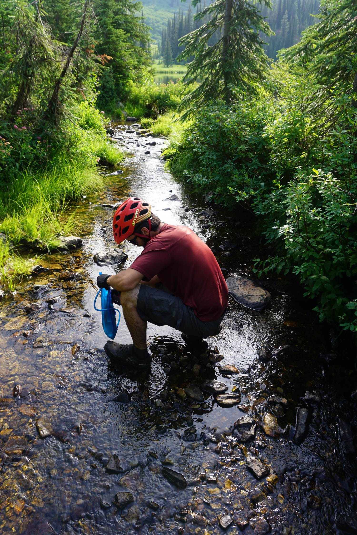
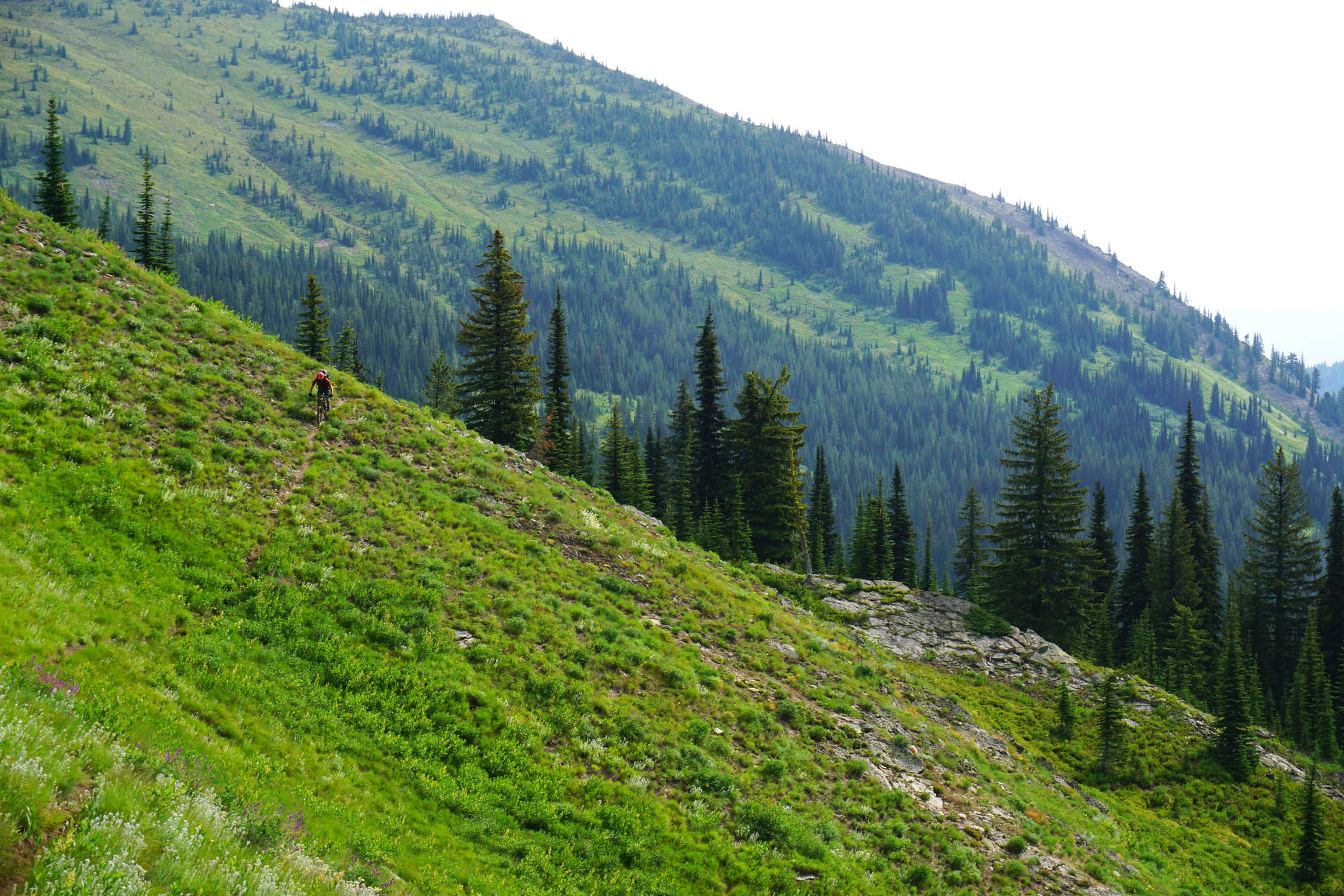
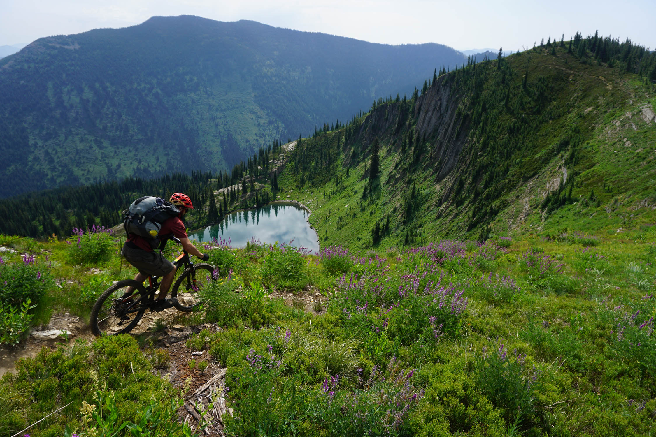
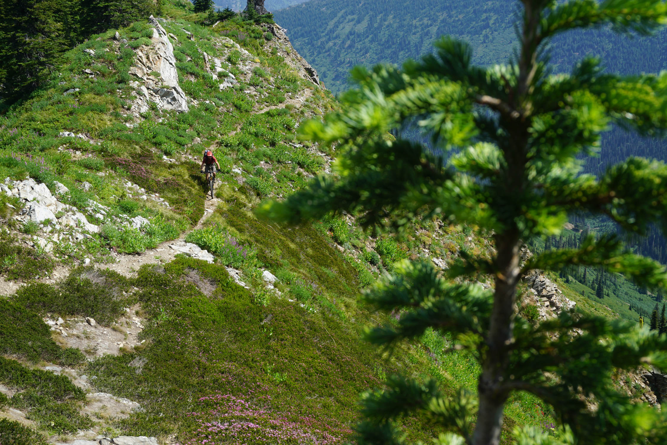
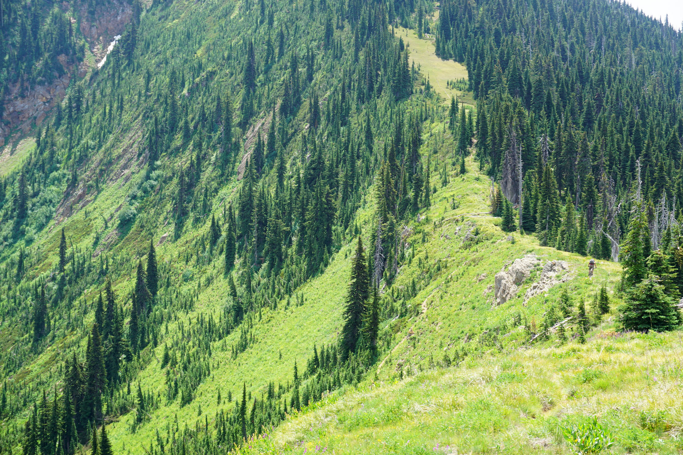
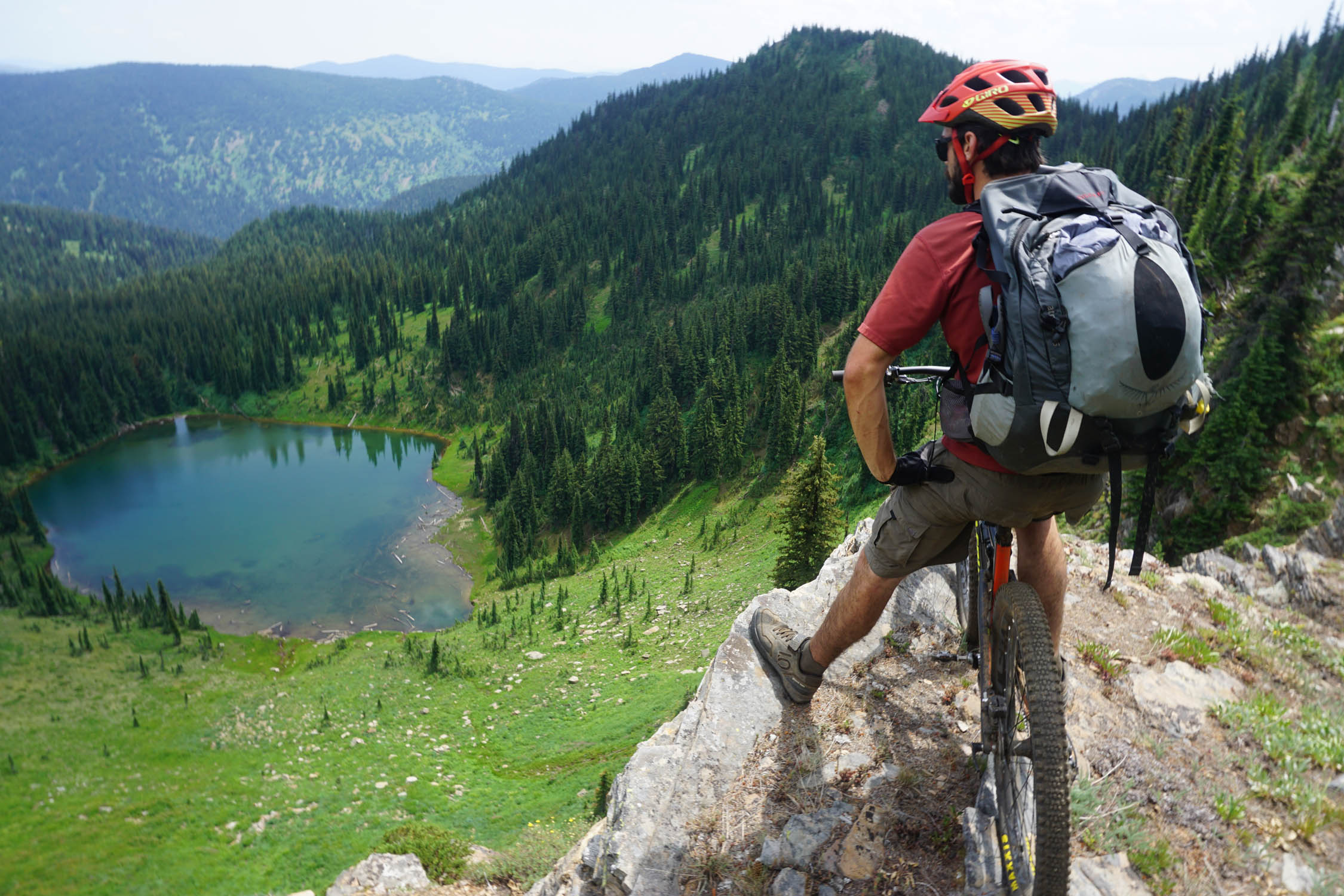
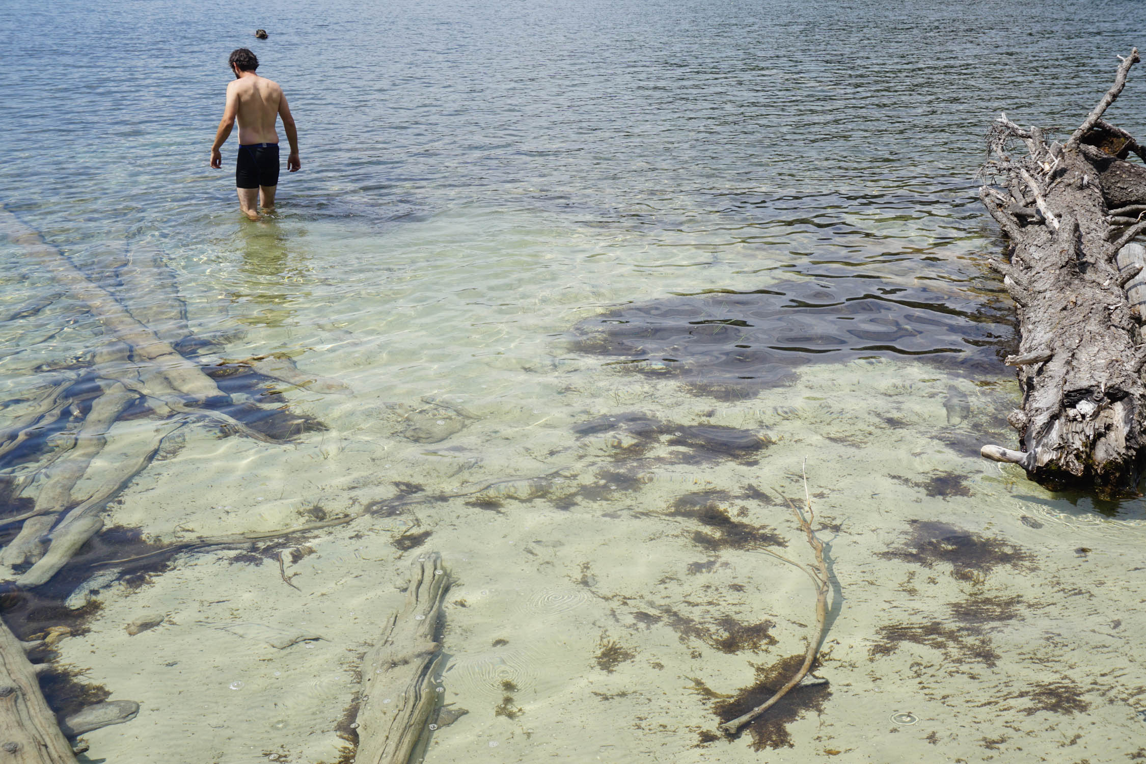
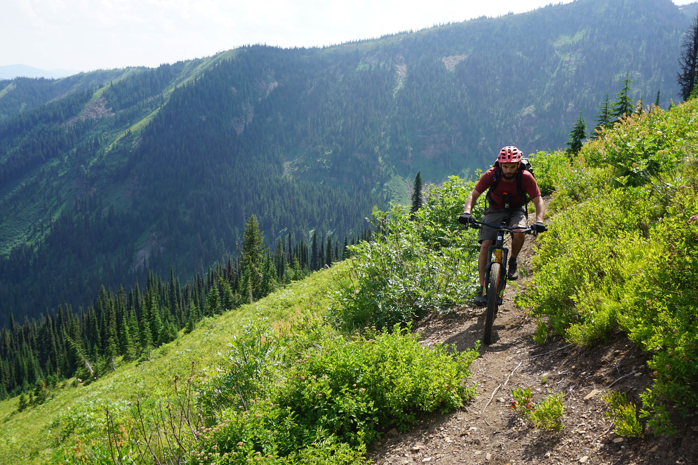
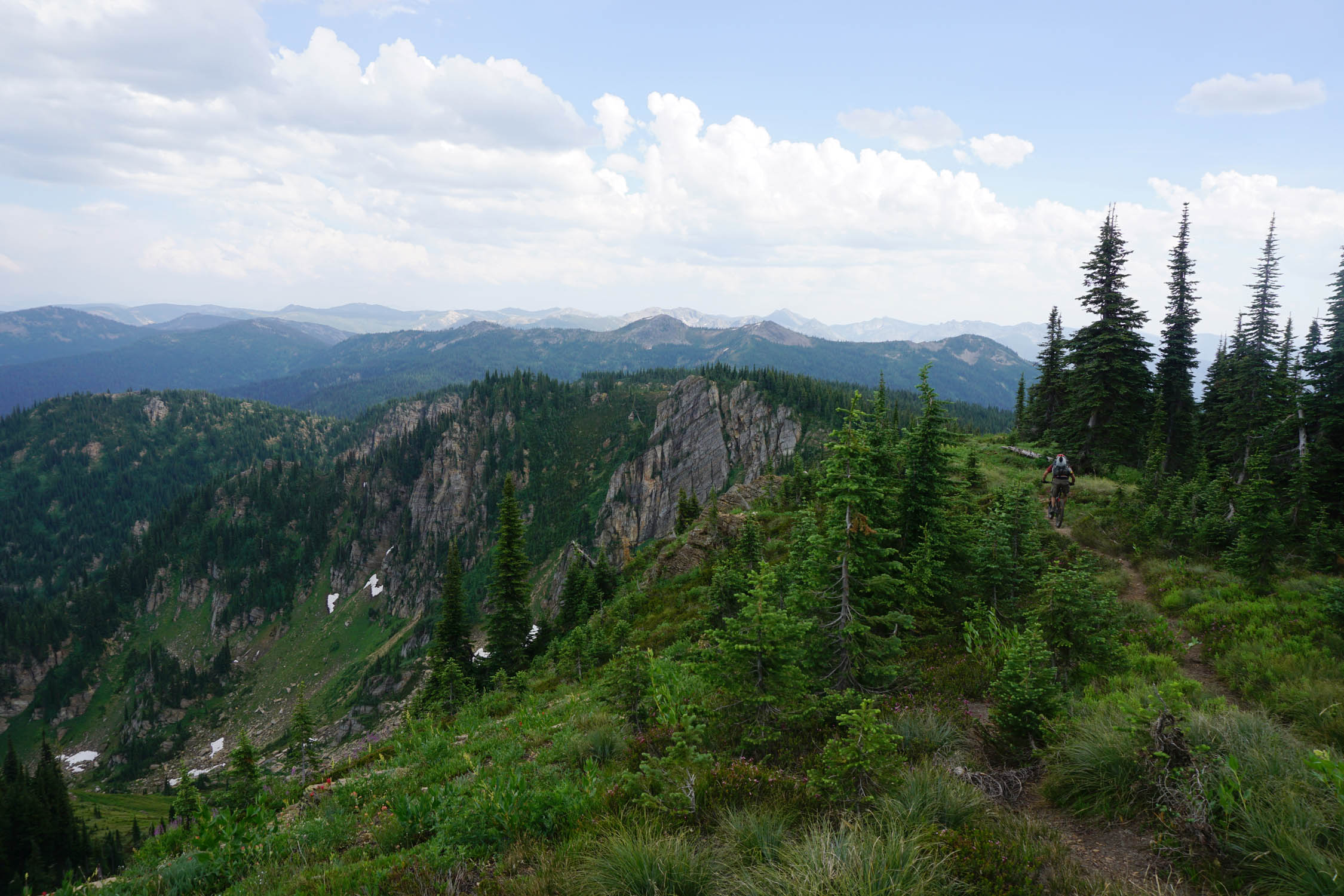
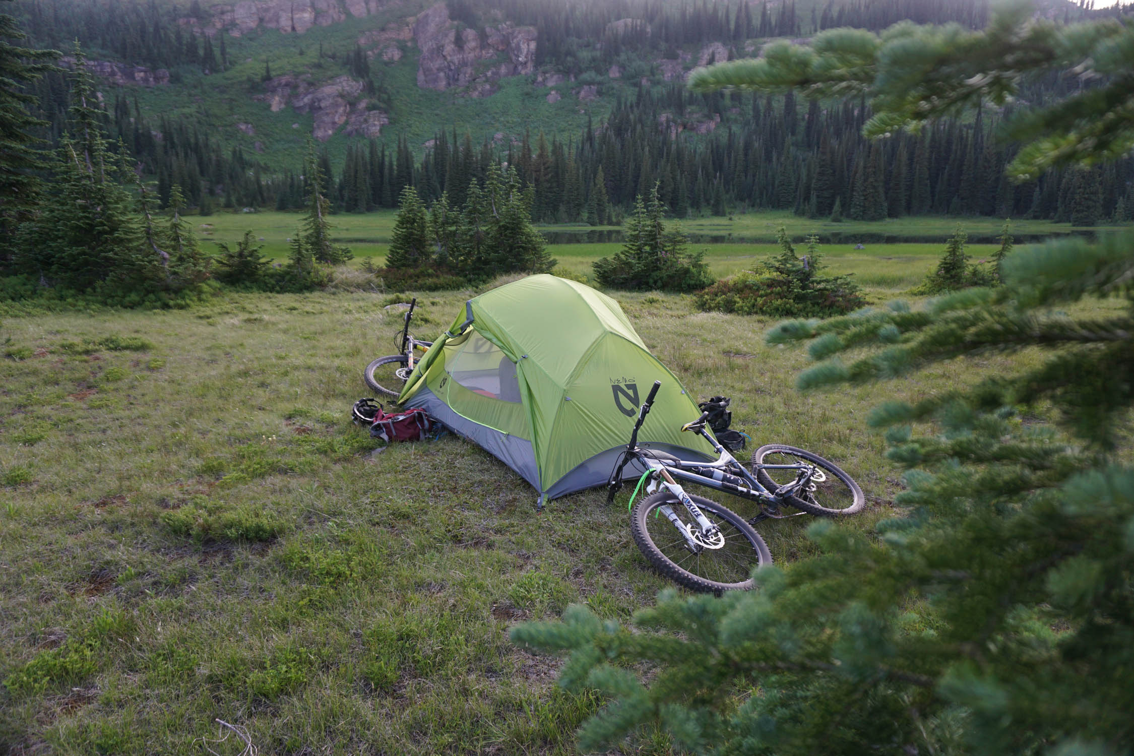
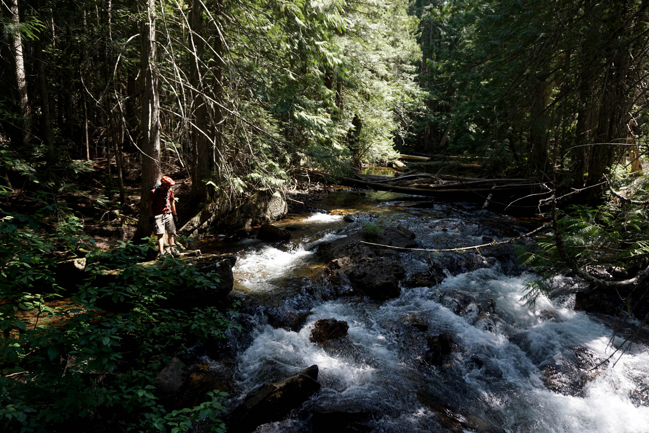
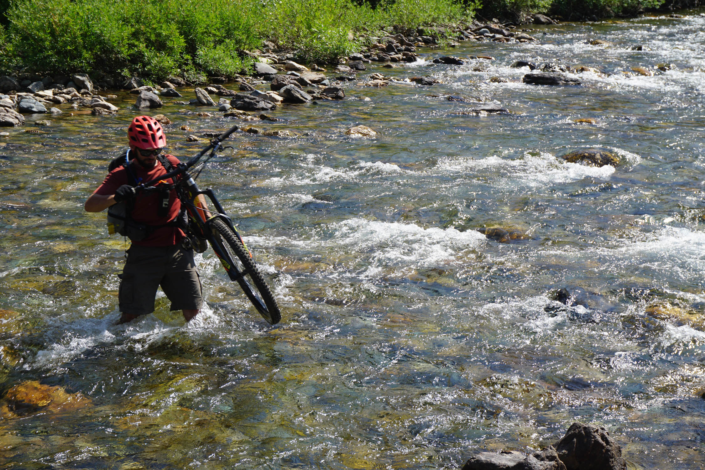
If you began your trip in the afternoon, the initial 2,500-feet of climbing opens up to the expansive clearing around Goose Lake, which makes for an enticing camp spot at the 10.5 mile mark. Otherwise, continue along the State Line Trail keeping an eye out for a picturesque tent site along the ridge. As its name implies, this trail sticks to the border between Montana and Idaho, offering incredible views in every direction. The route contours above numerous alpine lakes, some of which may be easier to access than others. Hike-a-bikes will be a reality in many sections along the divide, but the resulting fast, technical, and somewhat exposed descents make it all worth it. Shortly before reaching Fish Lake swing left onto the West Fork Fish Creek trail, and prepare for a rowdy backcountry downhill back to the car. This isn’t your local flow trail, and the down can prove as challenging as the up. Cap off the outing with a thigh deep stream crossing as the footbridge burned in a wildfire a few years back. Head back to town, and celebrate with a drink at one of more than a dozen local breweries.
Difficulty: Despite being low on mileage, the technical trail riding, remote setting, wayfinding challenges, possible wildlife danger, and vertical relief make for a rather stout loop. As a whole, it’s rated 6.5 out of 10. Front suspension (at least) and intermediate mountain biking skills are recommended. Packing light, but responsibly, will also increase enjoyment given the many short hike-a-bike sections. There are no resupply options along the way, but given the short distance, and plentiful water availability, this shouldn’t be an issue. Technical Difficulty: 4.5; Physical demand: 3.5; Resupply and Logistics: 3


Submit Route Alert
As the leading creator and publisher of bikepacking routes, BIKEPACKING.com endeavors to maintain, improve, and advocate for our growing network of bikepacking routes all over the world. As such, our editorial team, route creators, and Route Stewards serve as mediators for route improvements and opportunities for connectivity, conservation, and community growth around these routes. To facilitate these efforts, we rely on our Bikepacking Collective and the greater bikepacking community to call attention to critical issues and opportunities that are discovered while riding these routes. If you have a vital issue or opportunity regarding this route that pertains to one of the subjects below, please let us know:
Highlights
Must Know
Camping
Food/H2O
Resources
- Blissful solitude, don’t expect to see many other people!
- The challenging and stunning State Line Trail.
- Keep an eye out for abundant wildlife (grizzly bear, black bear, elk, wolves, moose, and more).
- Beautiful forest and mountain views the entire way.
- Soak in the remoteness of this steep, rugged country.
- Start your trip out right with a breakfast burrito and cup of joe from Market on Front.
- End your trip with a pint at Draughtworks, Great Burn, Kettlehouse, or one of many other local breweries.
- It is imperative that you call both the Clearwater National Forest (Idaho) and the Lolo National Forest (Montana) for express permission to mountain bike the State Line Trail. Due to ongoing wilderness designation discussions access can change year-to-year, and state-to-state. Please do your part to make sure your riding is legal. Clearwater National Forest: (208) 935-2513; Lolo National Forest: (406) 329-3750
- When to go: Rideable starting mid-summer, but recommended as a late-summer loop. Any earlier and the heat and bugs will be torturous, much later and the weather could be cold, wet, or both. After mid-October “crowds” of horse packers would also impact your experience and trail surface.
- Logistics: None apart from permission mentioned above. Dispersed camping (leave no trace) can be done almost anywhere along the route, although tent spots may be hard to find on steeper ridgelines. Let someone know you are going, as there is no service, and little traffic to the trailhead.
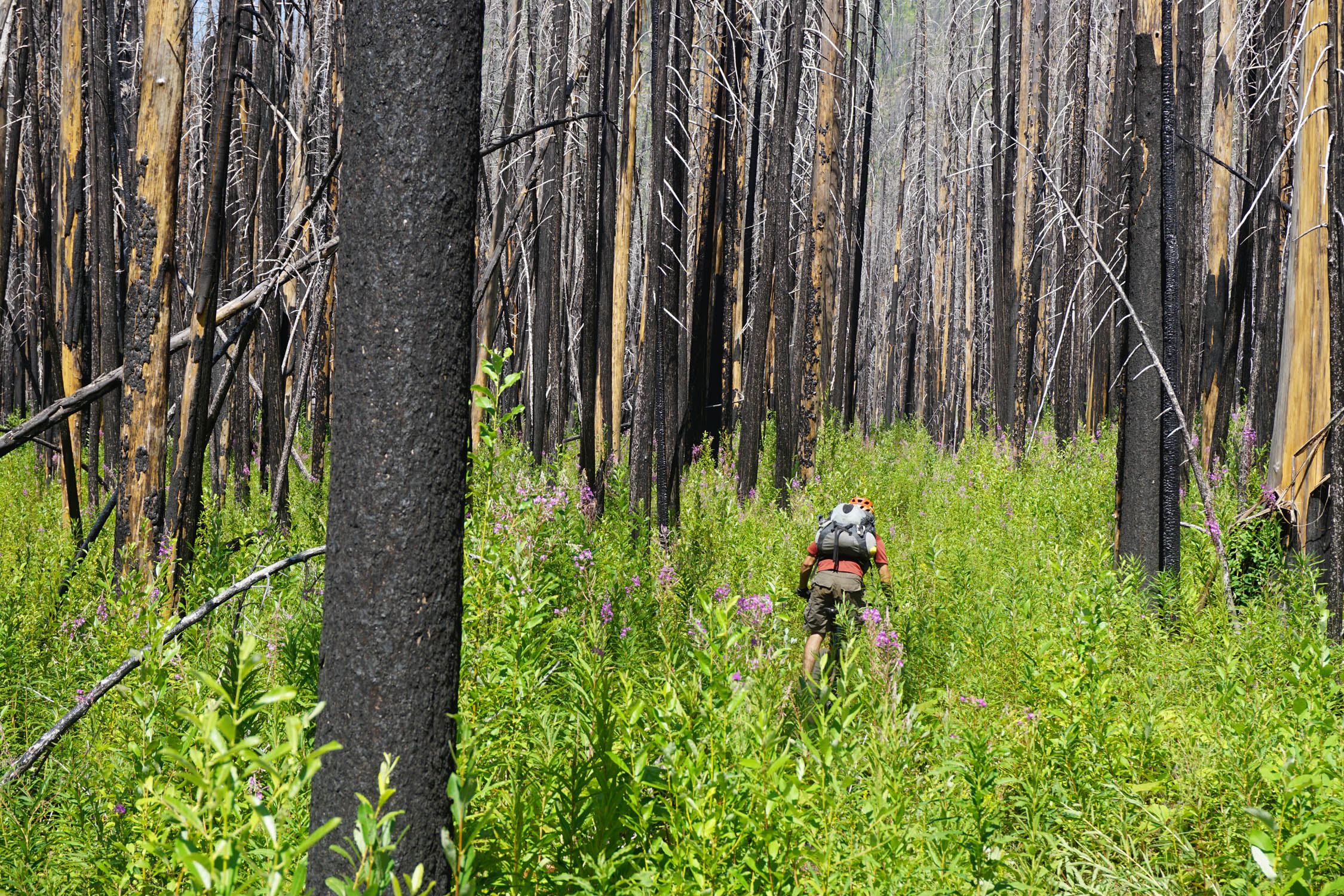
- Dangers and Annoyances: Avoid riding when wet, be aware of current wildfires in the area, and respect fire bans if in effect. This is bear country (and mountain lion, wolf, etc.) so remain vigilante, carry a deterrent, and practice safe food storage overnight.
- All USFS land, camping can be done almost anywhere you like.
- Respect buffer zones immediately around lakes and streams, and follow leave no trace guidelines.
- Be aware of any fire bans in effect.
- No resupply options for food, but shouldn’t be an issue given the length of the route.
- Apart from the State Line Trail, water is abundant. Recommended fill up at Goose Lake, with possibly hike-to water access at alpine lakes along the ridge if needed.
Additional Resources
- The Big Burn: Teddy Roosevelt and the Fire that Saved America by Timothy Egan
- Clearwater National Forest: (208) 935-2513
- Lolo National Forest: (406) 329-3750


Terms of Use: As with each bikepacking route guide published on BIKEPACKING.com, should you choose to cycle this route, do so at your own risk. Prior to setting out check current local weather, conditions, and land/road closures. While riding, obey all public and private land use restrictions and rules, carry proper safety and navigational equipment, and of course, follow the #leavenotrace guidelines. The information found herein is simply a planning resource to be used as a point of inspiration in conjunction with your own due-diligence. In spite of the fact that this route, associated GPS track (GPX and maps), and all route guidelines were prepared under diligent research by the specified contributor and/or contributors, the accuracy of such and judgement of the author is not guaranteed. BIKEPACKING.com LLC, its partners, associates, and contributors are in no way liable for personal injury, damage to personal property, or any other such situation that might happen to individual riders cycling or following this route.
Please keep the conversation civil, constructive, and inclusive, or your comment will be removed.