


GAWR Segment 1 (Columbia)
Distance
379 Mi.
(610 KM)Days
6
% Unpaved
70%
% Singletrack
1%
% Rideable (time)
100%
Total Ascent
15,377'
(4,687 M)High Point
3,207'
(977 M)Difficulty (1-10)
5?
- 3Climbing Scale Fair41 FT/MI (8 M/KM)
- 3Technical Difficulty Fair
- 5Physical Demand Moderate
- 4Resupply & Logistics Fair
Contributed By

Dana McKnight
Guest Contributor
Dana is retired and passionate about bikepacking and multi-day touring adventures. He spends much of his time developing and exploring routes in West Virginia, where he grew up, and Virginia, where he now lives. In 2024 and 2025, Dana completed the Great American Wheel Route, one of his bucket-list goals, over the course of two years. You can find more recaps of Dana’s adventures at Gravel Ride Recaps on Ohio Gravel Grinders.
B/W photos by Cody Johnson; Color photos by Cody Johnson, Dana McKnight, Mike Miller, Luke Kocher, Jen Kelly, Mike Miller, Evan Deutsch, and Evan Finton
The Columbia segment of the Great American Wheel Route starts at the Space Needle and snakes through Seattle’s urban and suburban areas on dedicated bike lanes and paths. Before leaving the city, take time to visit the historic Pike Place Market, where Starbucks opened its first store in 1971. Enjoy a Seattle original hand-crafted coffee before you start your adventure.
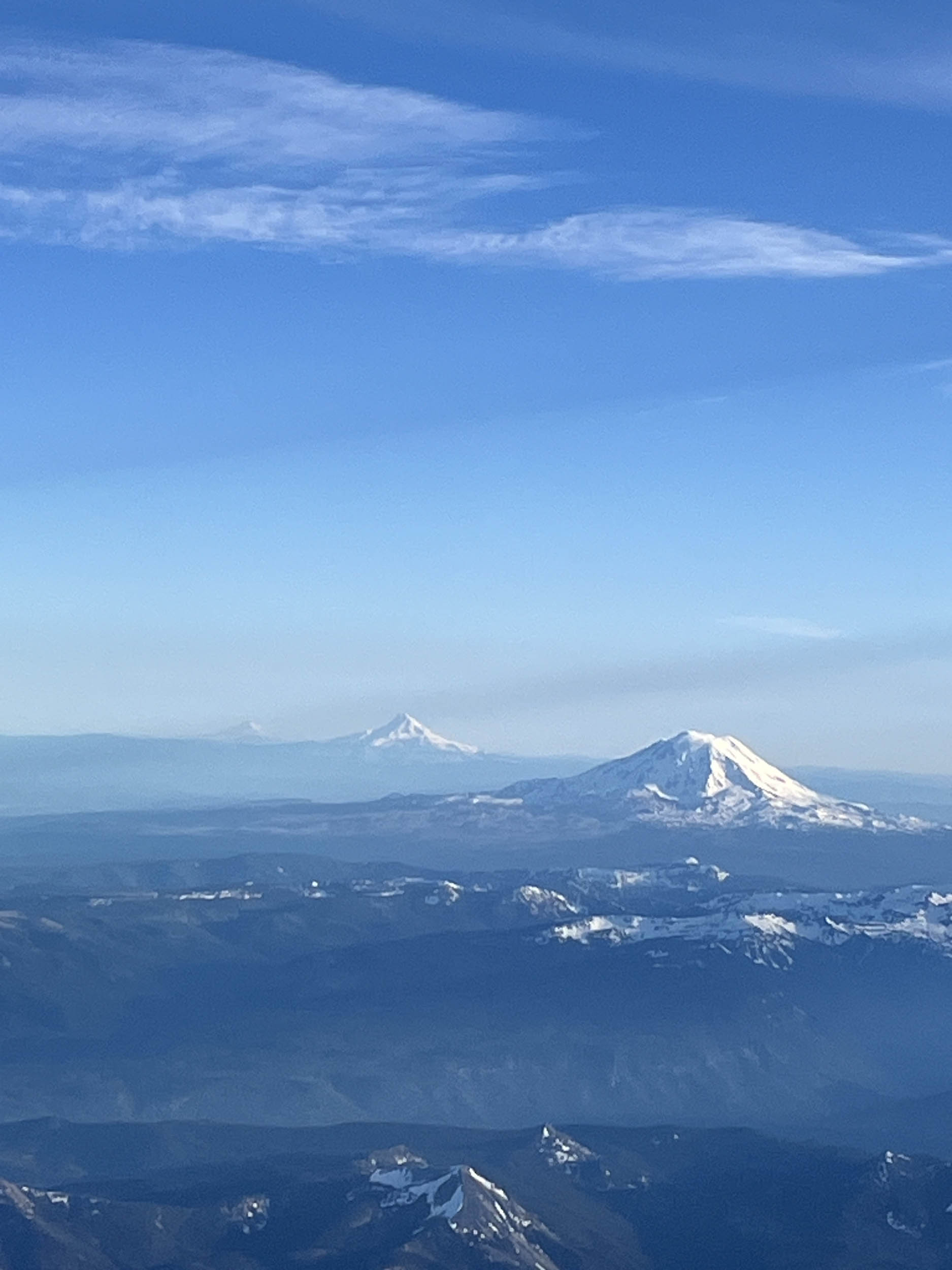
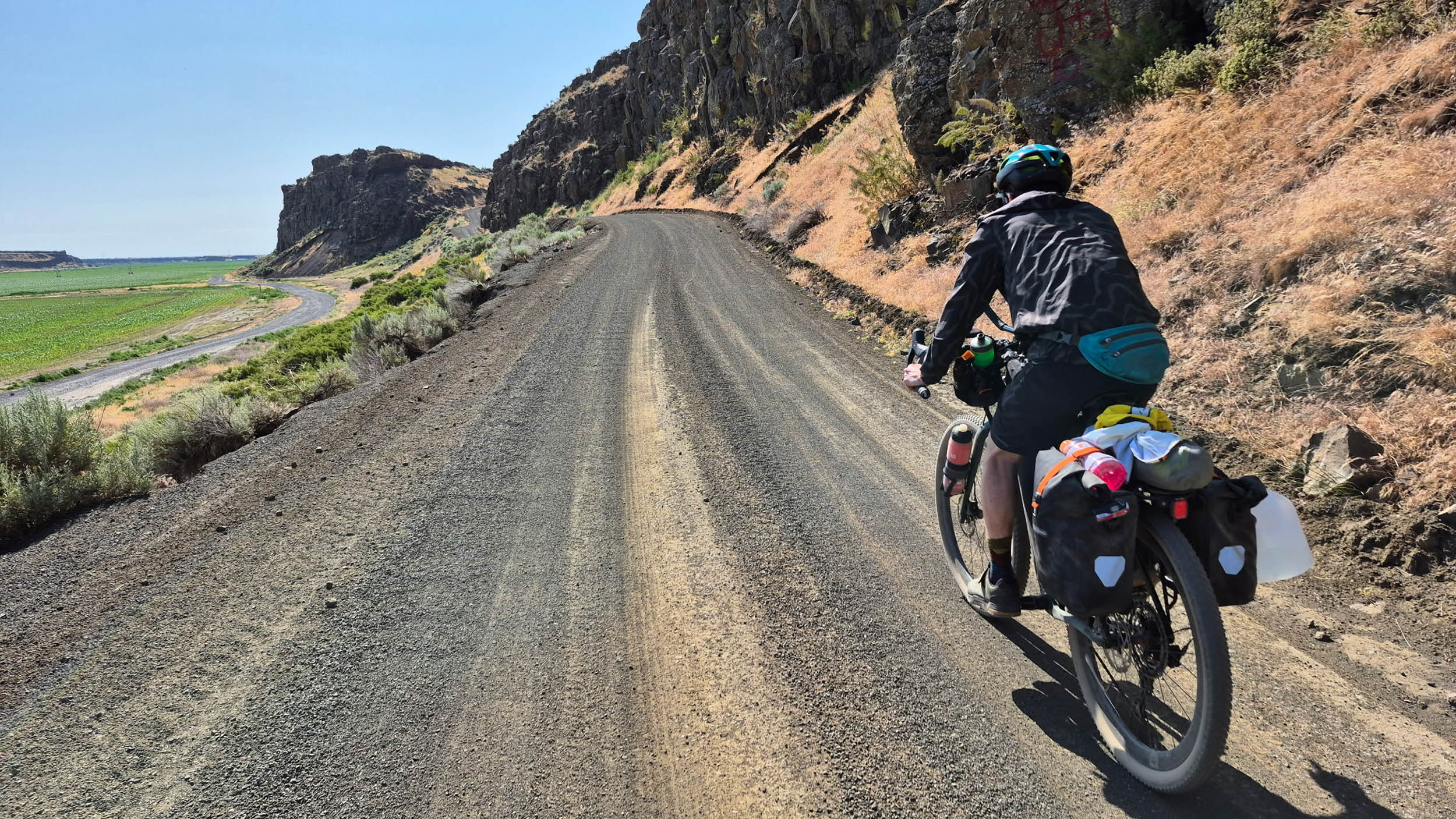
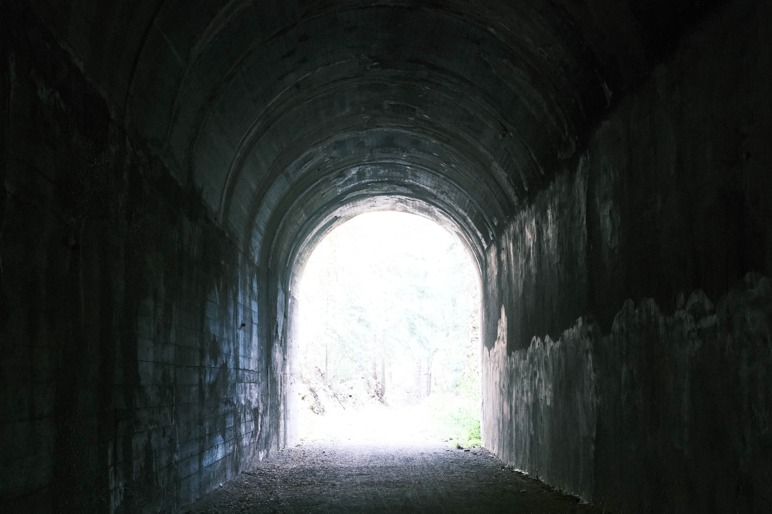
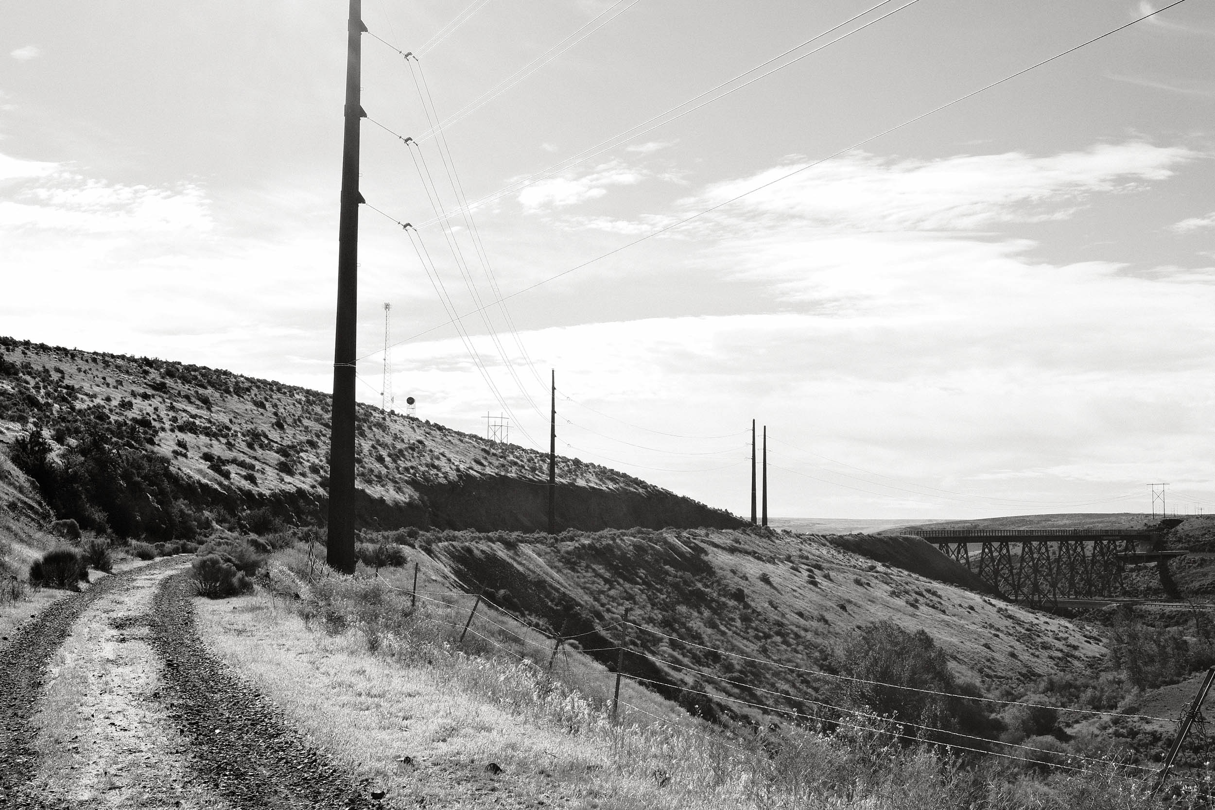
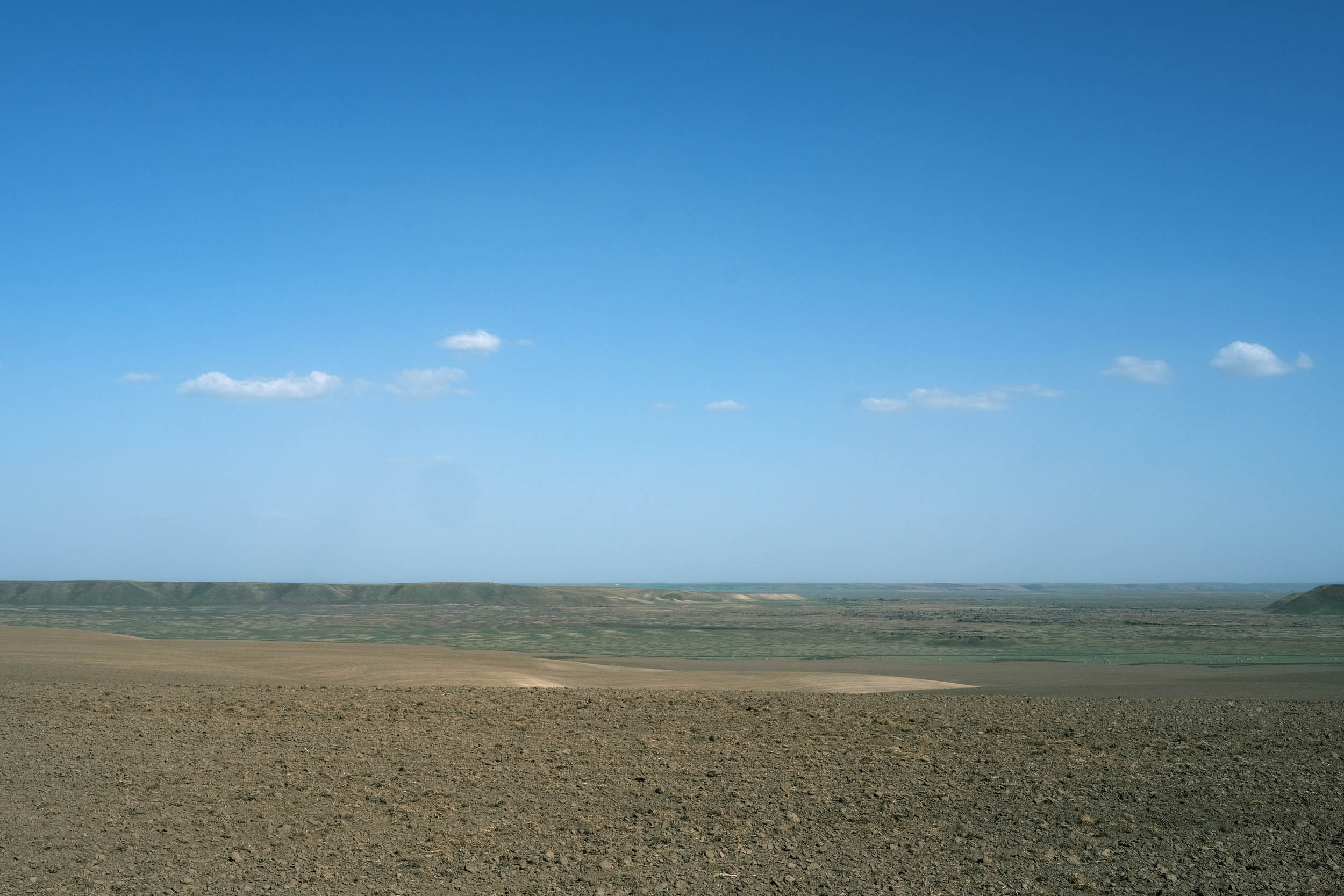
After leaving the Seattle metropolitan area, the route climbs the rugged and beautiful Cascade Mountains, which still have many active volcanoes, including Rainier, Adams, Baker, and St. Helens. The climb is gentle as it follows the Palouse to Cascade Rail Trail, peaking at the 2.3-mile, dark and damp Snoqualmie Tunnel. The eastern side of the Cascades slowly turns from a lush green landscape to a more arid one. Traversing the extremely remote Yakima Training Center is one of the hardest sections of the entire route, featuring challenging soft sand, large rocks, limited water, and endless views. The route crosses the Columbia River at Beverly, where large-scale farming dominates the landscape, relying on irrigation from the Columbia watershed to sustain the thirsty crops.


In the eastern portion of Washington, the land transforms once more into the Palouse, a region characterized by gentle rolling hills covered with grain fields. The hills were formed over tens of thousands of years from windblown dust and silt, called “loess”, from dry regions to the southwest. Eventually, the Palouse gives way to the foothills of the Rocky Mountains, where trees begin to grow, and elevation continues to increase.
Route Difficulty
We are assigning an overall difficulty of 5 to this segment due to its long distances between services in eastern Washington with the potential for dry, windy, and very hot conditions. Additionally, the remoteness, soft sand, and large rocks throughout the Yakima Proving Grounds are among the most demanding sections of the route. Water can be a challenge, so plan ahead and carry enough. Climbs are mostly on railroad grade trails with some short, higher-grade climbs on roads throughout the segment. Overall, the route is not extremely technical, but there are some sections with sand, rough gravel, and large rocks.
Resupply and logistics are mostly straightforward, as the route routinely goes through small towns and resupply points. There are sections in Eastern Washington where resupply stops can be more than 50 miles apart, so adequate planning is required. A spreadsheet with resupply, camping, and lodging locations is provided and has been very well received by previous riders. Transport to and from Seattle is easily provided by airlines with abundant bike lanes throughout the city. Mass transit is also available throughout the area. The closest major airport to the end of the segment in Plummer, Idaho, is Spokane, Washington.
The Great American Wheel Route (GAWR) is an expansive 3,700-mile mixed-terrain bicycle route traversing the United States. Beginning at the Space Needle in Seattle and concluding at the Washington Monument in Washington, D.C., the GAWR guides riders across the country via an elaborate network of gravel roads and paths, paved trails, and low-traffic backroads, prioritizing separation from motorized vehicles. Find the full GAWR route here.
Route Development: The GAWR was finalized in 2024, with many people contributing to its creation and maintenance. It was inspired by and incorporates multiple segments of Rails to Trails Conservancy’s Great American Rail Trail (GART) route, linking them with dirt to create a more gravel-focused experience across the country. Find details at the main route page here.


Submit Route Alert
As the leading creator and publisher of bikepacking routes, BIKEPACKING.com endeavors to maintain, improve, and advocate for our growing network of bikepacking routes all over the world. As such, our editorial team, route creators, and Route Stewards serve as mediators for route improvements and opportunities for connectivity, conservation, and community growth around these routes. To facilitate these efforts, we rely on our Bikepacking Collective and the greater bikepacking community to call attention to critical issues and opportunities that are discovered while riding these routes. If you have a vital issue or opportunity regarding this route that pertains to one of the subjects below, please let us know:
Highlights
Must Know
Camping
Food/H2O
Trail Notes
- Starting the GAWR adventure at the Space Needle in Seattle, the iconic 605-foot-tall observation tower built for the 1965 world’s fair.
- Riding across Lake Washington Bridge, the second-longest floating bridge in the world.
- Visiting the quaint small town of Snoqualmie Village, noted for the Northwest Railway Museum, the stunning Snoqualmie Falls, and the town’s role as a filming location for the TV series Twin Peaks.
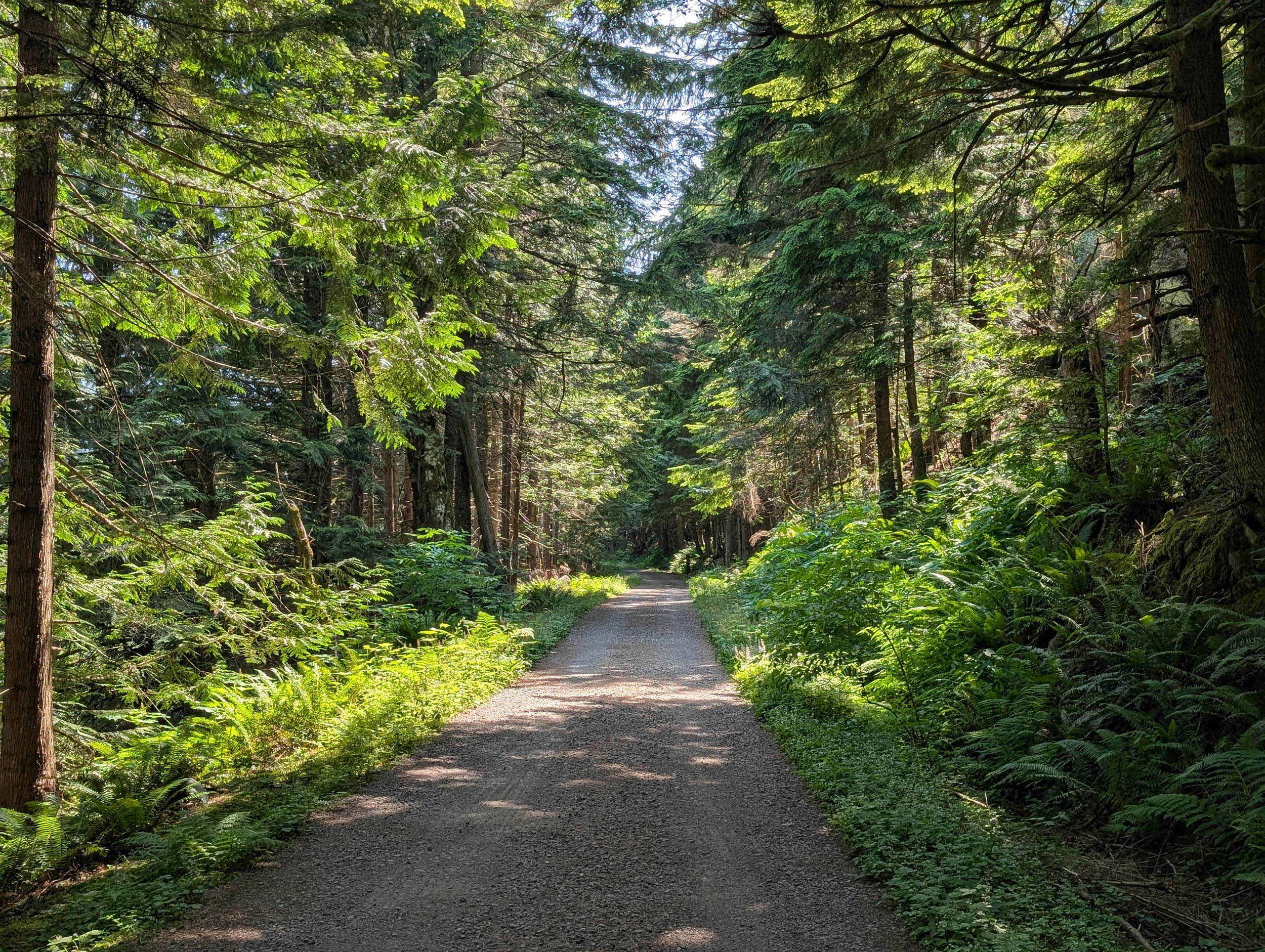
- Climbing over the Cascade Mountains on the Palouse to Cascades Trail, the former Milwaukee Road railroad that forms several portions of the GAWR all the way to the continental divide in Montana.
- Riding through the 2.3-mile and very dark Snoqualmie Tunnel, which was built between 1912 and 1914, providing the final passage between the eastern and western slopes of the Cascade Mountains.
- Riding over the Renslow Trestle, a historic railroad structure located over Interstate 90 in Washington State. Another Milwaukee Road structure built in 1908, the trestle spans approximately 680 feet and is 118 feet high.
- Riding through the U.S. Army’s Yakima Training Center, one of the most remote and challenging areas on the entire route. Loose sand and large rocks are common through this 20+ mile section, but the undulating terrain covered in sagebrush, bitterbrush, and bunch grass provides expansive views.
- Riding over the Beverly Railroad Bridge, a historic railroad bridge over the Columbia River near Beverly. It was constructed for the Milwaukee Railroad in 1909 during its Pacific Extension. The bridge was extensively renovated and reopened for trail use in April 2022.
- Visiting Lind, Washington. A small town with very friendly folks who try to bend over backwards to help riders. Check out the results of the annual very popular Combine Demolition Derber at the eastern side of town.
- Riding through the arid rolling landscape of Eastern Washington and realizing just how big and sparsely populated this portion of the United States is.
- Pausing in Malden, WA, to evaluate the impact and applaud the rebuilding effort associated with the September 7th, 2020, forest fire that destroyed approximately 80% of the town’s buildings.
- Visit the Coeur d’Alene Tribe Memorials at the trailhead in Plummer, ID. The memorials honor the tribe’s veterans.
When to go
- Summer to early fall – some of the passes in Montana and Idaho can still have snow in late May or early June.
Logistics
- Primary information about the Grand Depart and race can be found at The Unsupported Cycling.
- Palouse to Cascade Trail requires a fee. Once paid, you receive a code to unlock boundary gates along the trail.
Dangers and Annoyances
- Dogs – dogs may be encountered anywhere along the route, especially in rural areas where owners don’t properly contain them. Many riders have encountered multiple loose dogs in Beverly, Washington.
- Wind can be very strong and dangerous, particularly on the eastern slopes of the Cascades all the way across the Columbia River. Very high winds have blown riders over as they descend into the Columbia River valley heading into Beverly.
- Ensure to stay on the route through the Yakima Proving Ground. It is an active military base with live fire munitions.
- Ad-hoc route deviations – the ability and skill to reroute due to flooding, fires, weather, construction, etc., will enhance your ride and improve your odds of completing the adventure.
Travel basics
- Seattle-Tacoma International Airport airport in Seattle
- Spokane Airport, Spokane, Washington
- U.S. Visa requirements – U.S. Tourism & Visit Visa
What bike?
- Any comfortable endurance, gravel, adventure, touring type bike that can carry your gear and is durable. You will most likely experience mechanicals due to the route’s length and gravel conditions. Know basic skills and be able to find a bike shop when necessary. You may have to rig a solution until you get to the shop.
- Tire size – 40mm to 2.2 inches with durable compounds and less aggressive tread patterns are recommended.
- Gearing – at least a 1:1 gear ratio between the crank and cassette for the lowest gear. Lower is better.
- Suspension – many riders have completed the route without any suspension components. Stem and seat suspensions may provide additional comfort depending on riders’ preferences. Knowing when and how to adjust your tire pressure for different riding conditions is probably more important than having suspension.
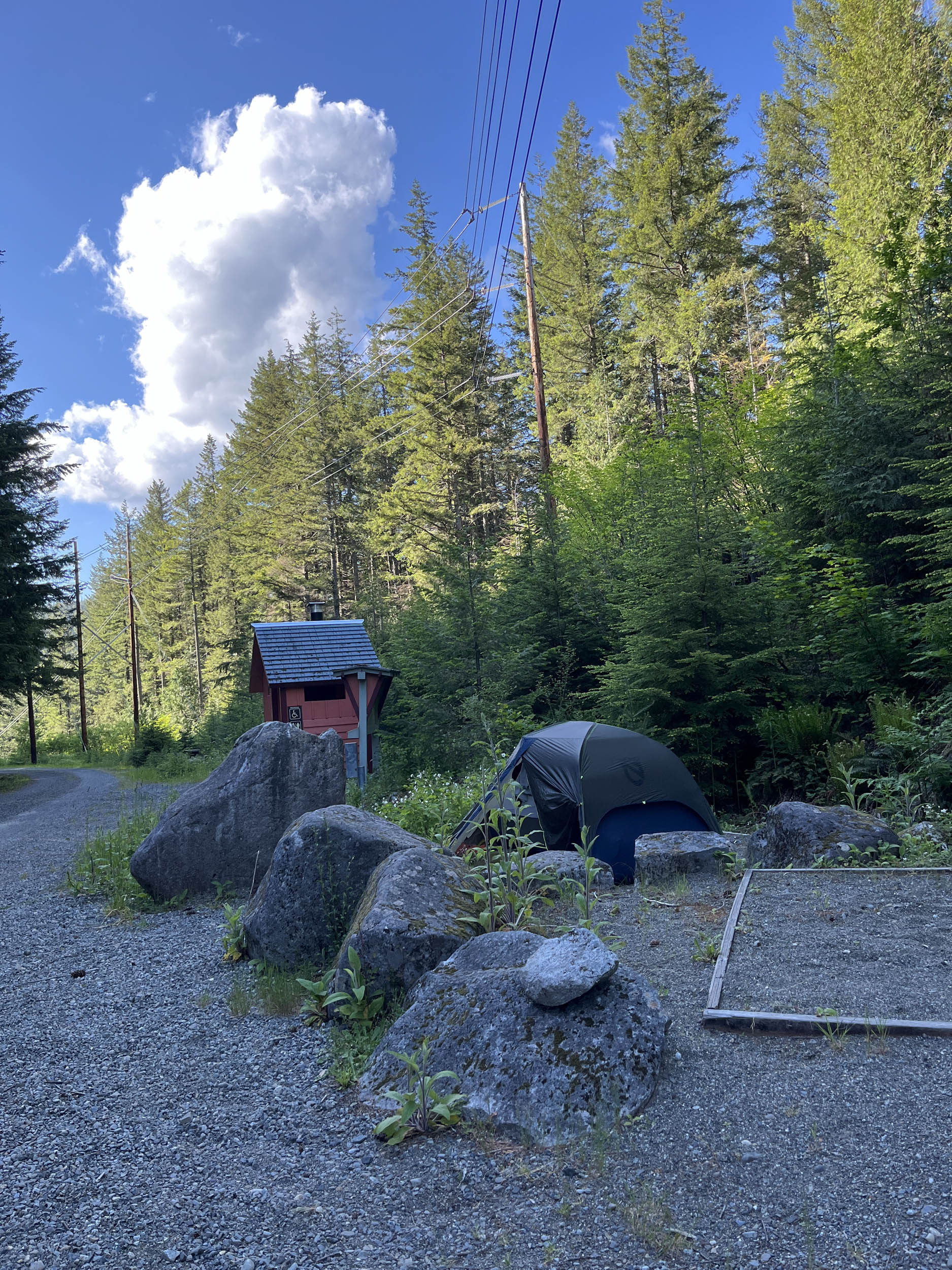
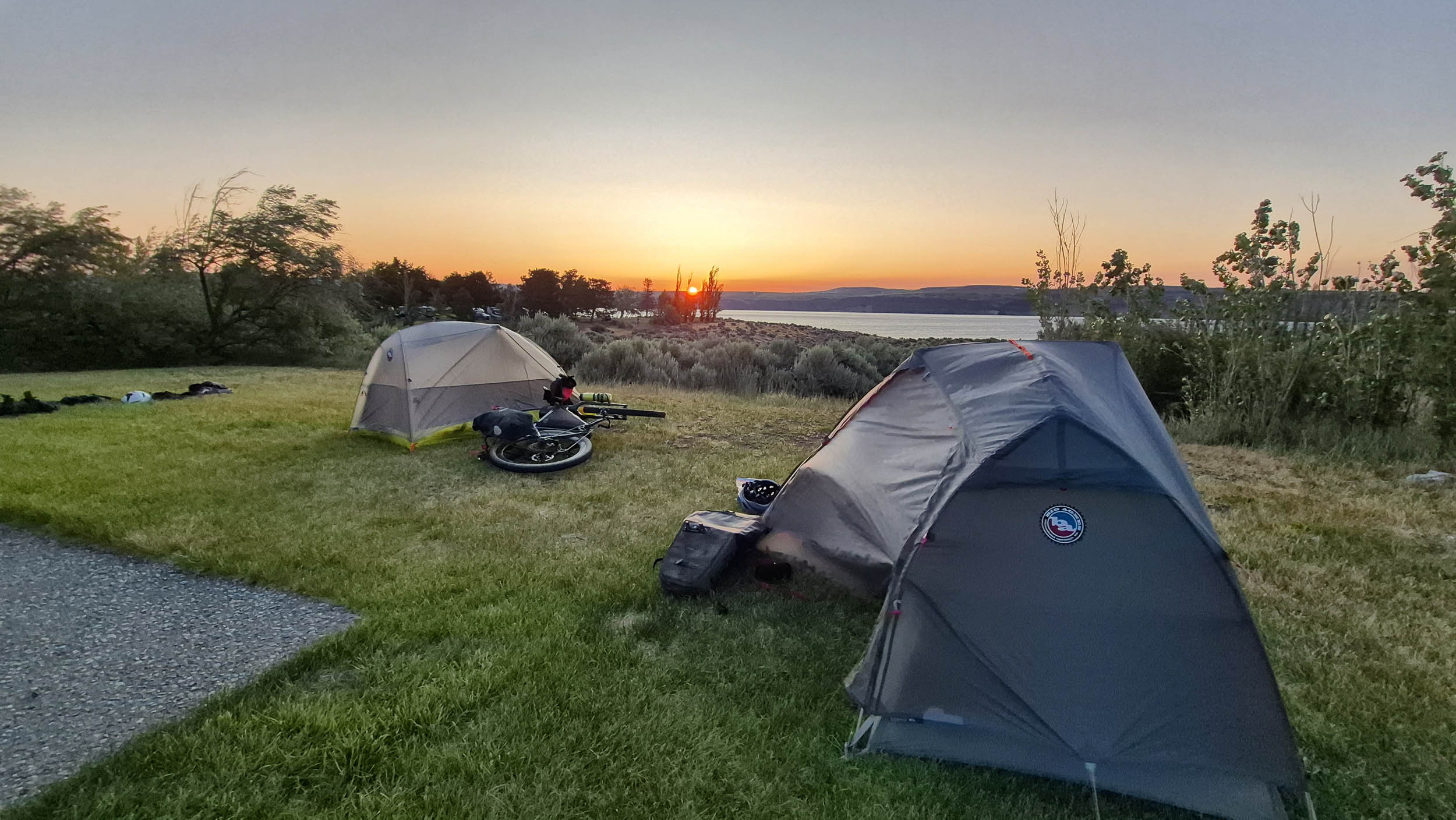
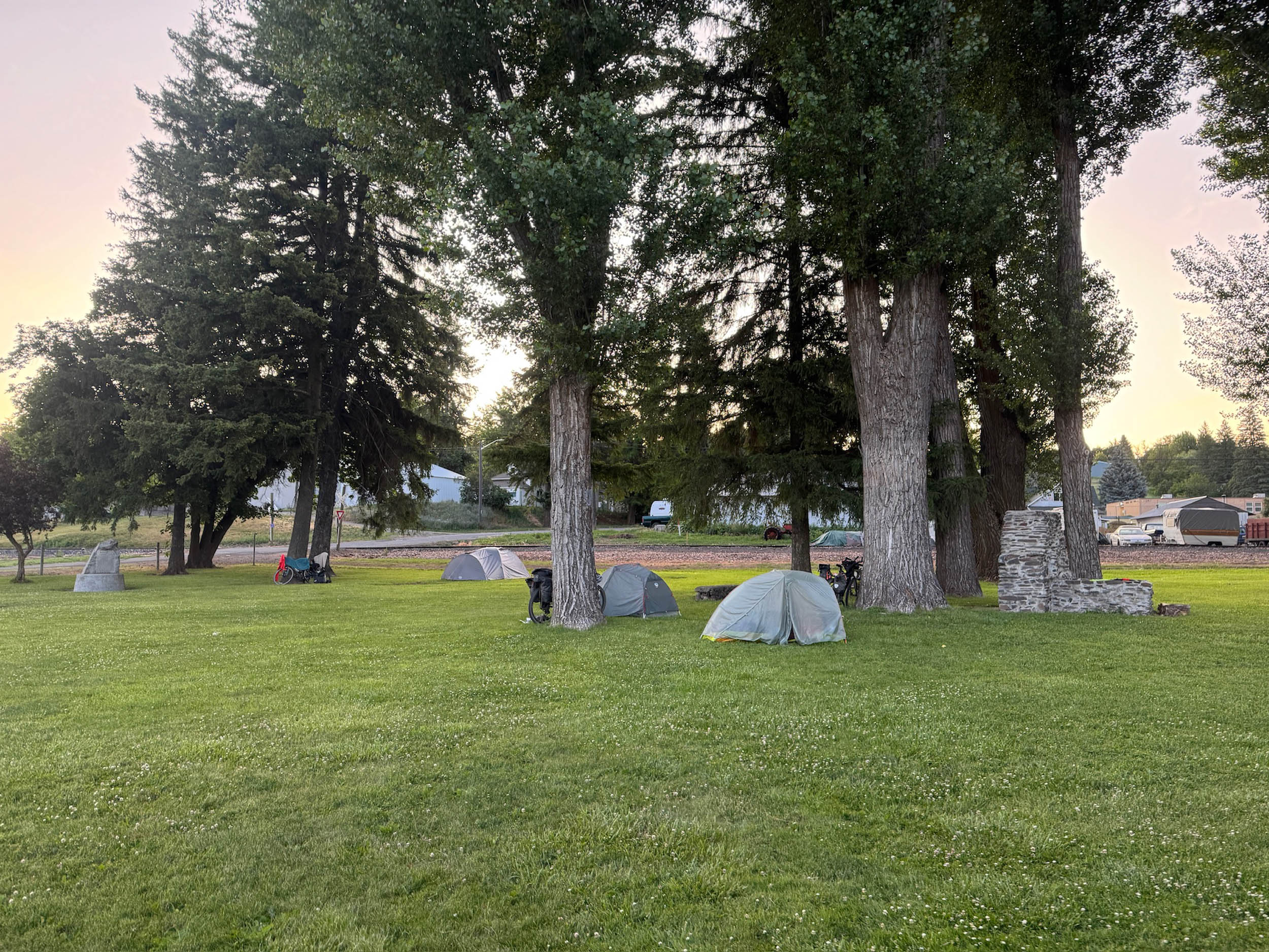
- There are campgrounds and established campsites along the route, especially after entering the Cascade Mountain Range and east of the range to the Idaho border. Many prominent options are noted in the downloadable GPX file and the available services spreadsheet, but there are more.
- There aren’t any sections where wild camping is absolutely necessary as long as you can keep a good pace. The most significant stretch without camping is between Cle Elum and Beverly, making sure you do not wild camp in the U.S. Army’s Yakima Training Center. If wild camping is a must, we recommend setting up after dusk and leaving at dawn. Churches, parks, and other public places are usually safe options, but use your own judgment, and leave no trace. Many small towns allow camping in their parks, but ask the locals before setting up.
- Especially out west, there are ample opportunities to camp on public lands that include National Forest, Bureau of Land Management (BLM), and National Grass Lands. You will also legally ride through private land areas on public accessible roads and paths. Understanding whether you are on public or private lands is imperative while camping. Private land ownership is taken very seriously in the United States, so it is of utmost importance that you understand when you will or won’t trespass on private land along the entire route.
- There are hotels/motels/lodging in North Bend, Cle Elum, Ellensburg, Othello, and Ritzville.
- Filterable water is available on most of the western part of the route through Ellensburg. Water becomes more scarce in the high arid eastern section of the route.
- Water is available in most towns along the route. Riders have also asked local residents for water, and most are more than happy to accommodate. Ask before using private water sources.
- Churches are a good source of drinking water as there are usually spigots available. Make sure to ask whether someone is on site.
- There are a fair number of resupply options on this route, as noted in the POIs of the downloadable GPX file and the available services spreadsheet. The longest stretch without resupply is between Ellensburg and Othello (miles 135 to 209). There is potable water around mile 165 at New Doris on the Yakima Training Center, but it is easily missed. Other stretches to consider are between Ritzville and Malden (miles 275-329).
- The main resupply points with significant options are Cle Elum, Ellensburg, Othello, Ritzville, Rosalia, Tekoa, and Plummer.
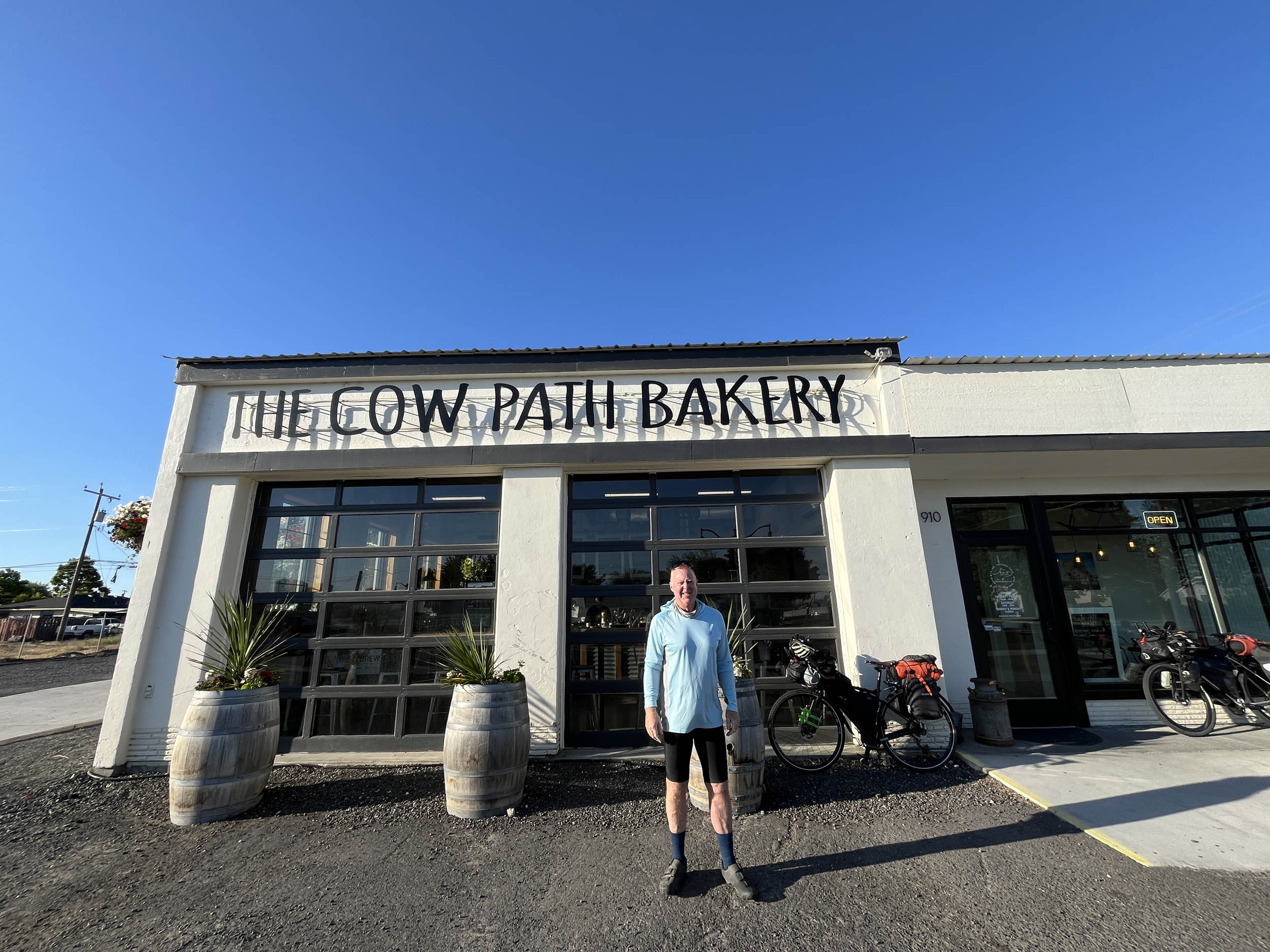
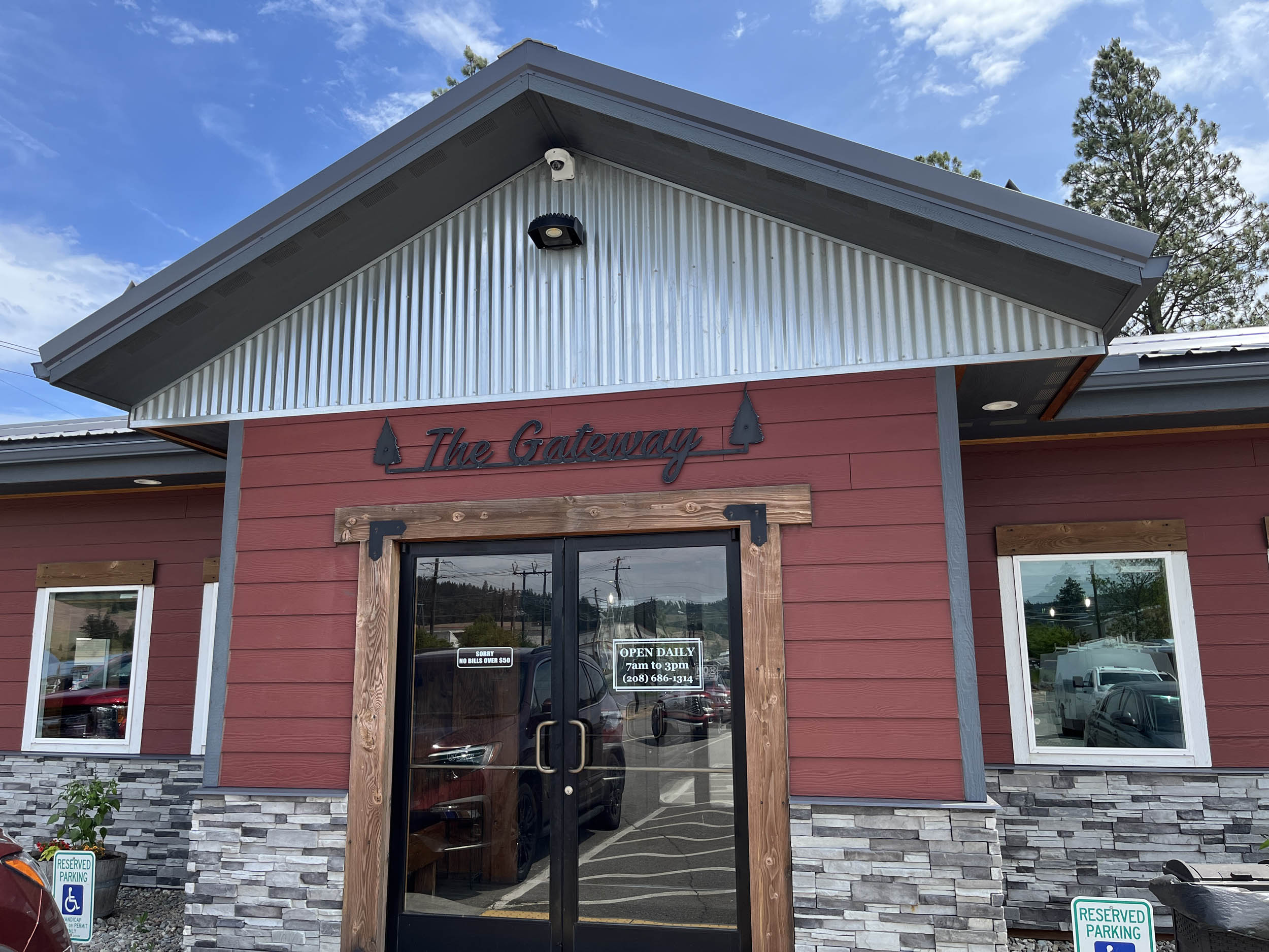
- There are a few recommended places for food and drink. Listed west to east, they include Mountain High Hamburgers in Cle Elum; Winegards Coffee and Creamery in Ellensburg; The Cow Path Bakery in Othello; Jakes Cafe in Ritzville; and the Gateway in Plummer, ID.
Here’s an example itinerary based on 60- to 80-mile days. Some riders might prefer shorter days, and others may average longer distances, but this provides a solid baseline for a reasonable through-ride itinerary. This assumes you’re a fairly seasoned rider carrying a medium load.
location Seattle, WA, to Alice Creek Campground, WA
Day 1 (69 mi +3,676 ft)
Leaving the Space Needle in Seattle, the route heads due east through the urban cityscape as it skirts Lake Union. Expansive water views follow as the route crosses Lake Washington, a well-known landmark in the Seattle area.
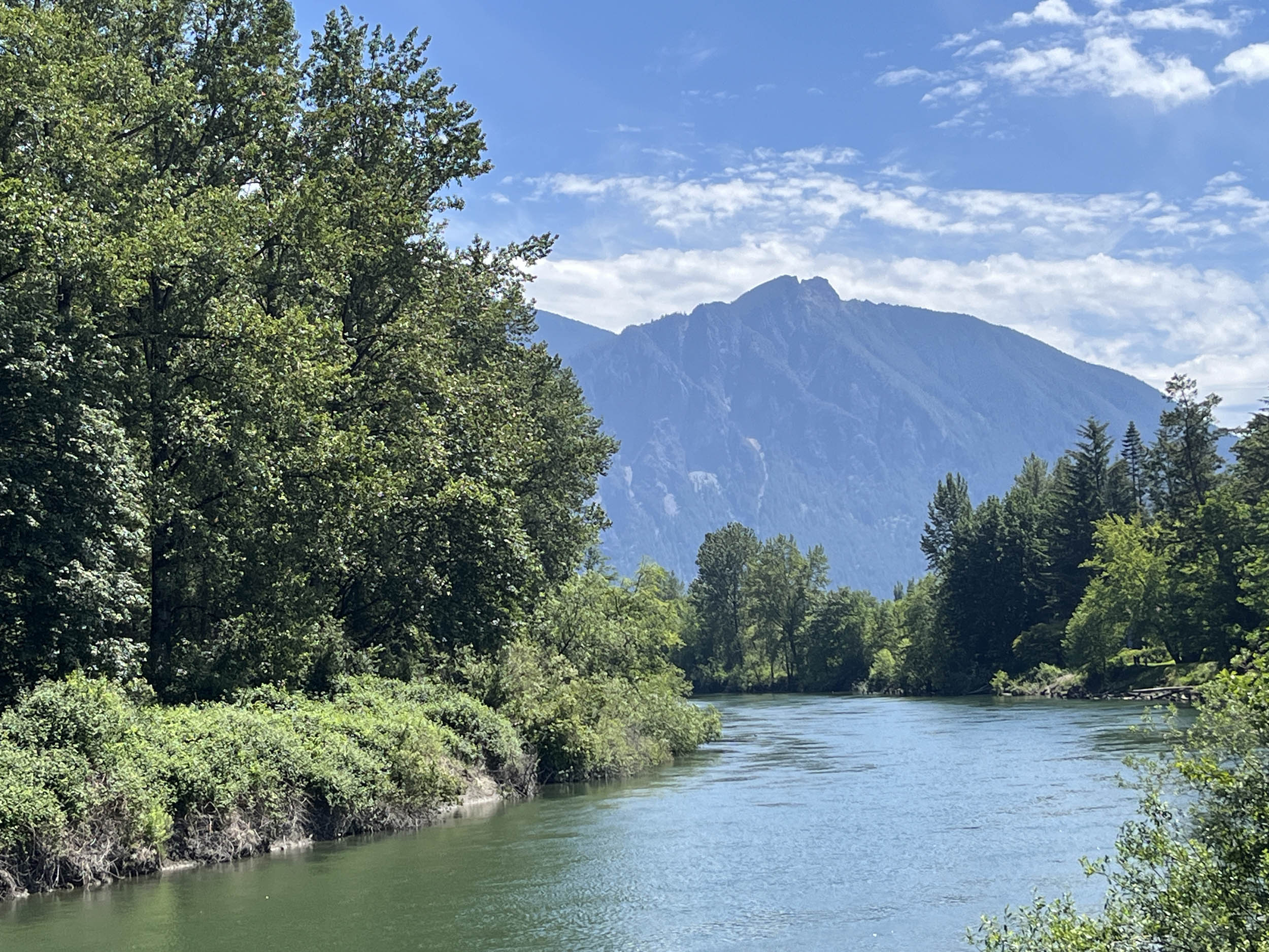
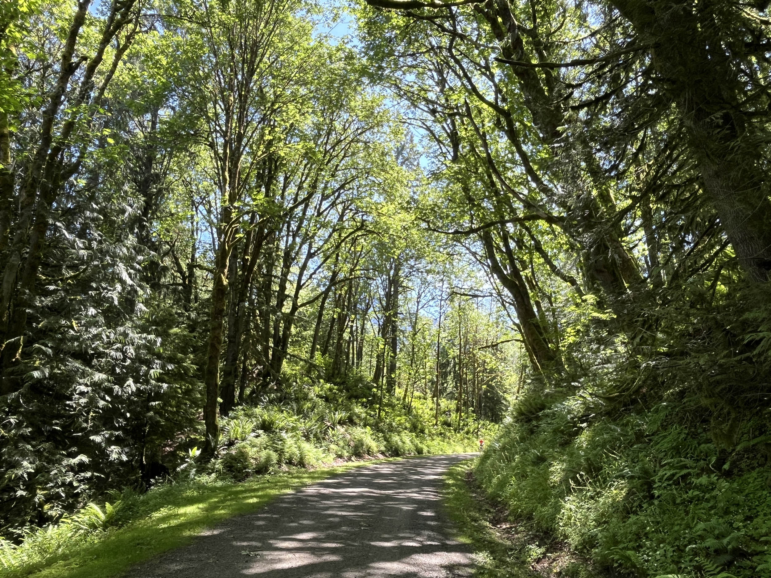
Much of the first day is spent on dedicated bike paths through the eastern suburbs before transitioning to quieter, more remote riding en route to the charming town of Snoqualmie. At Rattlesnake Lake Recreation Area, the route joins the Palouse to Cascades Trail and begins its gradual climb into the Cascade Mountains, which it follows for the next 289 miles to the Washington–Idaho border.
Several hiker/biker campsites sit directly on the trail, with Alice Creek Campground being the first.
location Alice Creek Campground, WA, to Ellensburg, WA
Day 2 (72 mi +1,300 ft)
From Alice Creek Campground, the Palouse to Cascades Trail continues climbing the western slopes of the Cascades, offering expansive views that, depending on the season, may include snowcapped peaks. After 10 miles, the Snoqualmie Tunnel appears, delivering a dark and damp 2.2-mile passage through the mountains—lights required.
The remainder of the day trends downhill as the route descends the eastern slopes of the Cascades, parallels the Yakima River, and enters the arid plains of eastern Washington. Temperatures can rise quickly here, and winds are often strong, though they sometimes provide a welcome tailwind.
The trail gradually flattens as it passes near several potential resupply towns before rolling directly through Central Washington University’s campus in Ellensburg. Camping is available at the KOA, and multiple lodging options are available in this city of roughly 20,000.
location Ellensburg, WA, to Othello, WA
Day 3 (75 mi +2,500 ft)
Leaving Ellensburg, the route climbs steadily before crossing the impressive Renslow Trestle, which towers 118 feet above I90. Beyond the trestle lies some of the most challenging riding of the entire route over the next 20 miles.
Trail conditions turn sandy for approximately five miles, potentially requiring hike-a-bike depending on surface conditions. Riders must remain on the trail while passing through the U.S. Army’s Yakima Training Center, where the sound of live-fire exercises may be heard.
At the former railroad stop of New Doris, potable water is available but easy to miss. Watch for large boulders in old railroad cuts, and use caution in high winds when descending toward the Columbia River and crossing the Beverly Bridge. Several camping options are available near Beverly.
With roughly 30 miles remaining to Othello, the expansive, arid hills of eastern Washington continue to dominate the landscape. Camping options in Othello are limited, so lodging is recommended.
location Othello, WA, to Ritzville, WA
Day 4 (62 mi +2,500 ft)
Start the day at Cow Path Bakery, where the baked goods are worth the stop. Leaving town, the route rolls into the wide-open farmland characteristic of central Washington.
A worthwhile break awaits in the small town of Lind at Jim’s Market. Ask locals about camping options—chances are they’ll point you in the right direction. If your timing aligns, the annual Lind Combine Derby is a memorable spectacle, featuring a parade, races, and the town’s signature Combine Demolition Derby hosted by the Lions Club. Results from past derbies are displayed at the eastern edge of town if you miss the event.
Camping is also available in the small community of Ralston before reaching Ritzville, where lodging options are plentiful.
location Ritzville, WA, to Rosalia, WA
Day 5 (67 mi +3,200 ft)
This day delivers more riding through the vast, remote reaches of eastern Washington, climbing rolling hills where cropland gives way to cattle pasture. The first 35 miles pass through sparsely populated country, where the likelihood of seeing another human is low.
Camping is available in both Malden’s and Rosalia’s town parks. Malden was heavily damaged by a wildfire in 2020, which destroyed approximately 80% of the town’s buildings. The community is actively rebuilding and continues to welcome bike travelers.
location Rosalia, WA, to Plummer, ID
Day 6 (30 mi +1,600 ft)
Leaving Rosalia, the route enters the foothills of the Rockies as the landscape shifts to pine forest, greener pasture, and mixed agriculture. Take a break in Tekoa, where resupply is available.
The route then crosses into Idaho and enters sections of the Coeur d’Alene Reservation near Plummer, ID, home to the Trail of the Coeur d’Alenes. The trailhead is located just outside town.
Finish the day with a stop at the Gateway Restaurant, rewarding yourself with a slice of homemade huckleberry and apple pie.

Terms of Use: As with each bikepacking route guide published on BIKEPACKING.com, should you choose to cycle this route, do so at your own risk. Prior to setting out check current local weather, conditions, and land/road closures. While riding, obey all public and private land use restrictions and rules, carry proper safety and navigational equipment, and of course, follow the #leavenotrace guidelines. The information found herein is simply a planning resource to be used as a point of inspiration in conjunction with your own due-diligence. In spite of the fact that this route, associated GPS track (GPX and maps), and all route guidelines were prepared under diligent research by the specified contributor and/or contributors, the accuracy of such and judgement of the author is not guaranteed. BIKEPACKING.com LLC, its partners, associates, and contributors are in no way liable for personal injury, damage to personal property, or any other such situation that might happen to individual riders cycling or following this route.
Please keep the conversation civil, constructive, and inclusive, or your comment will be removed.