


Henry Coe (Trial by Fire) Overnighter
Distance
36 Mi.
(58 KM)Days
2
% Unpaved
95%
% Singletrack
25%
% Rideable (time)
98%
Total Ascent
6,665'
(2,031 M)High Point
2,636'
(803 M)Difficulty (1-10)
6?
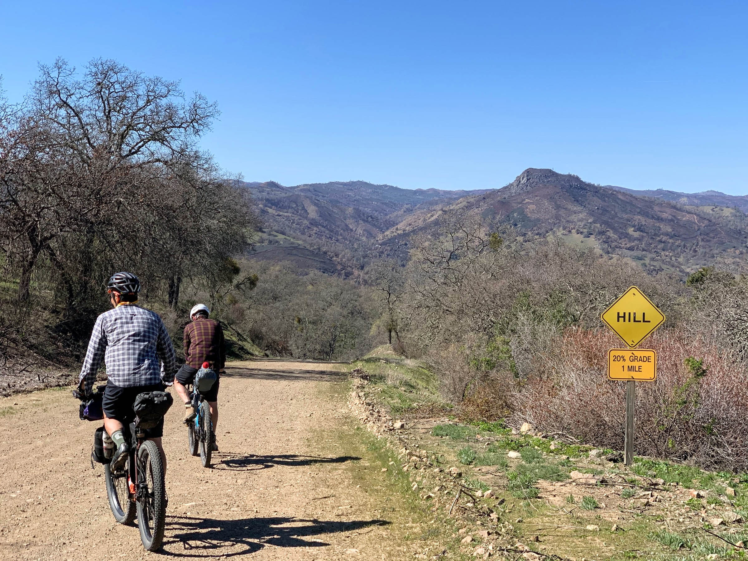
- 10Climbing Scale Very Strenuous185 FT/MI (35 M/KM)
- -Technical Difficulty
- -Physical Demand
- -Resupply & Logistics
Contributed By

Chris Pearson
Guest Contributor
Chris Pearson is a California native who enjoys exploring the outdoors by bike and by foot. Crazy enough, despite living within 50 miles of Henry Coe for most of his life, this year was the first time he ever visited. Nothing like COVID-19 to reset your focus on your own backyard.
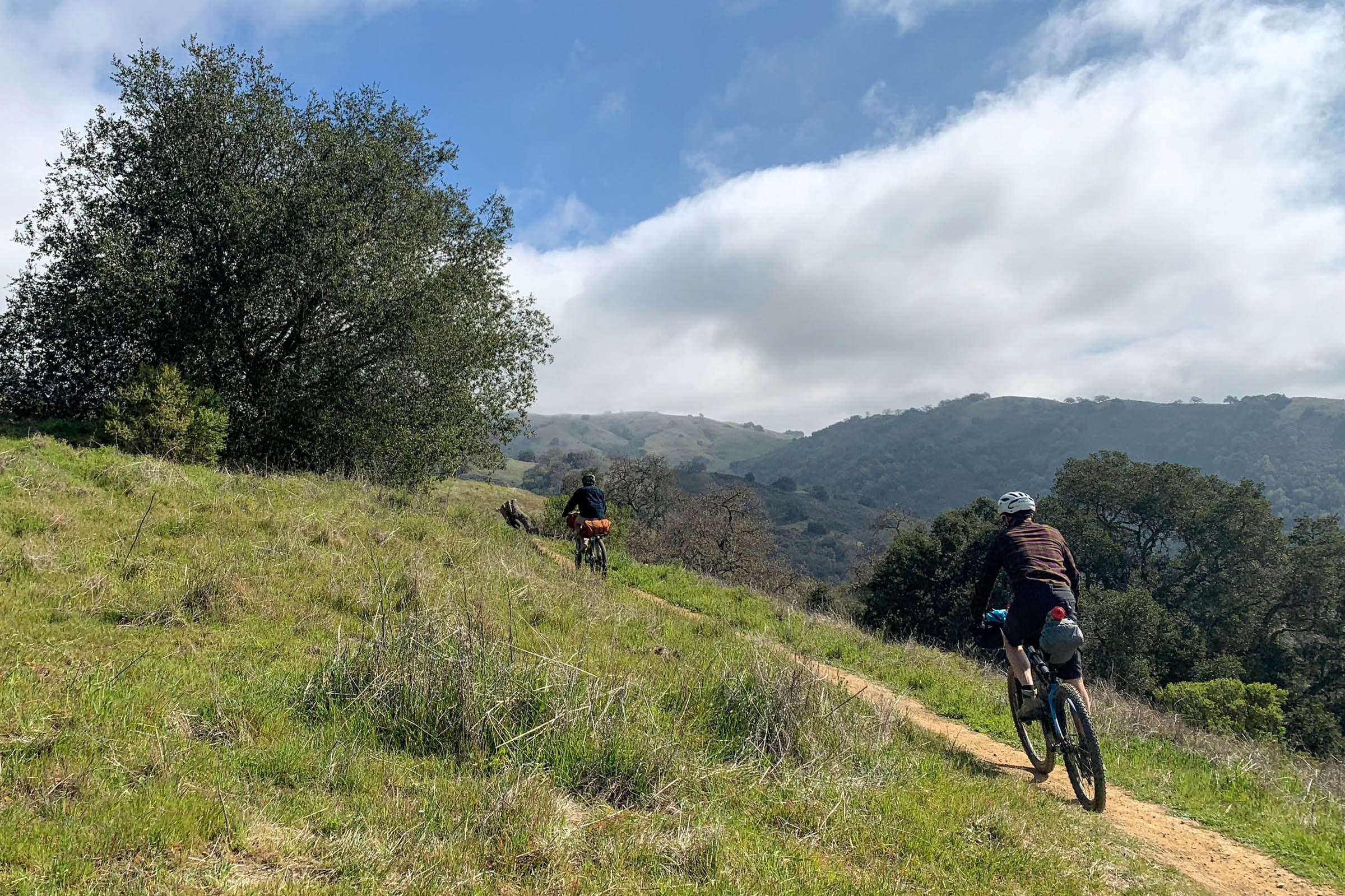
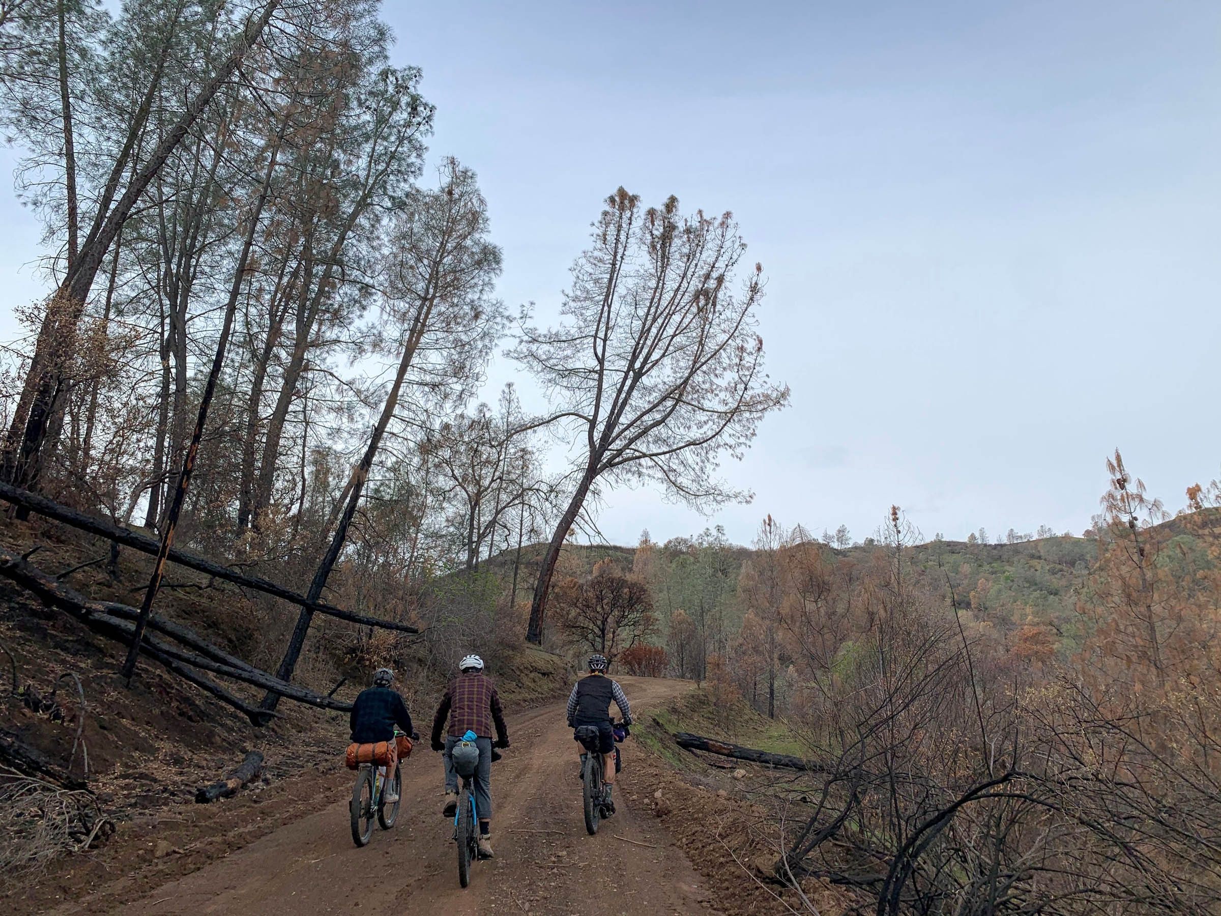
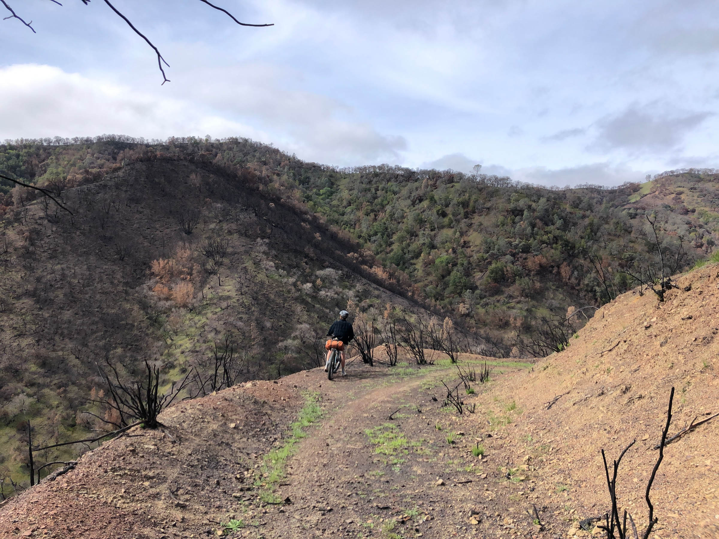
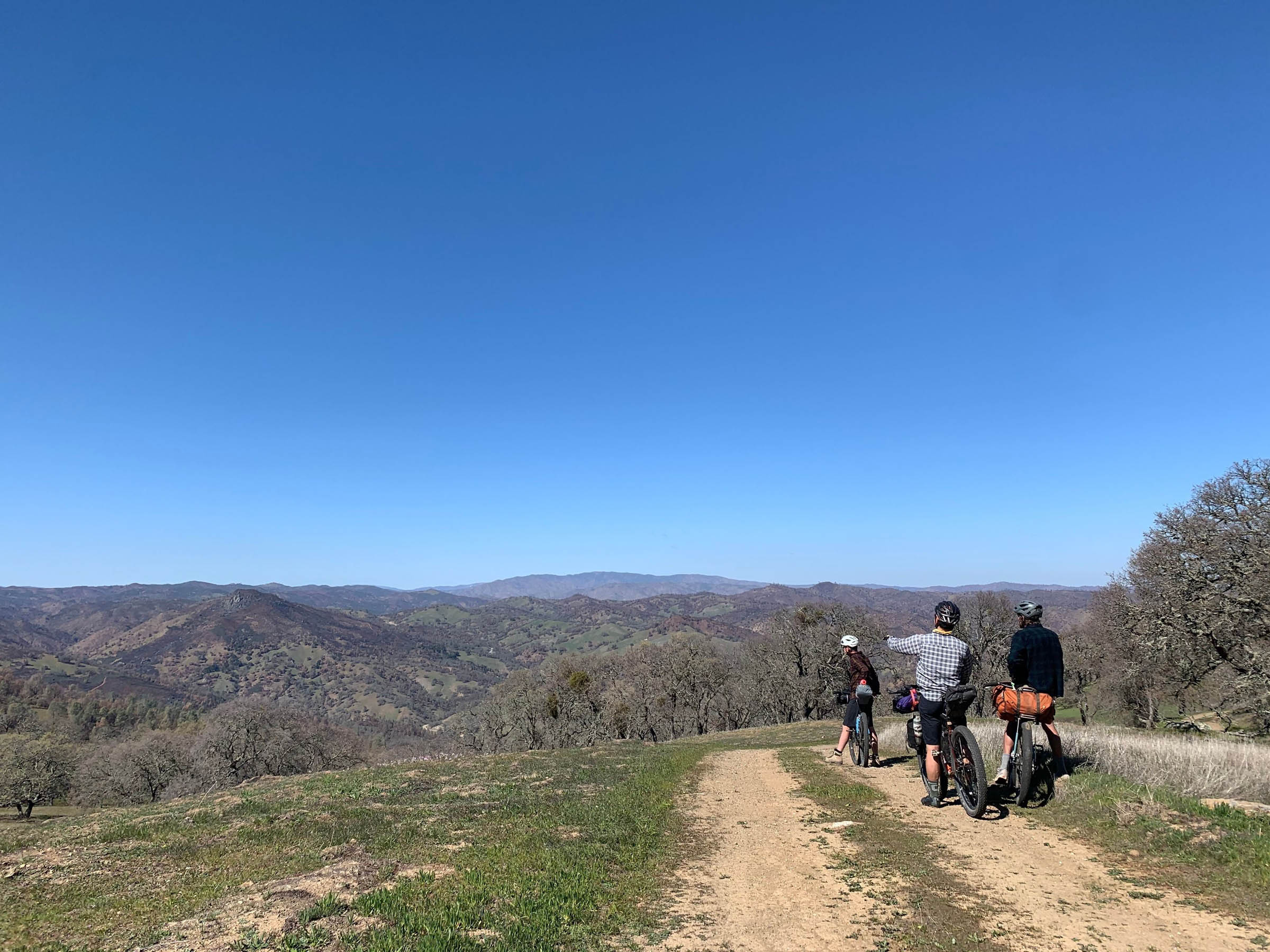
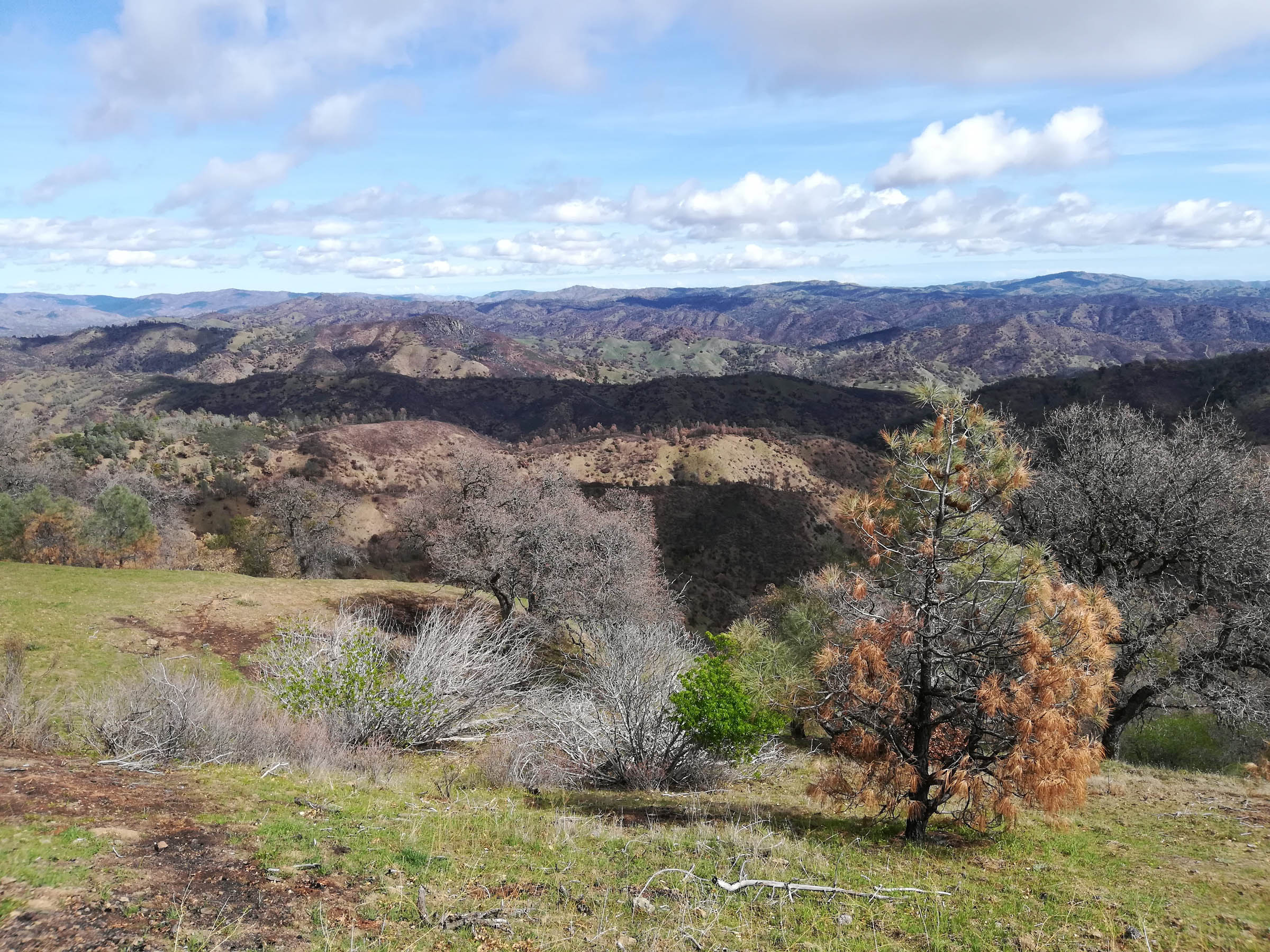
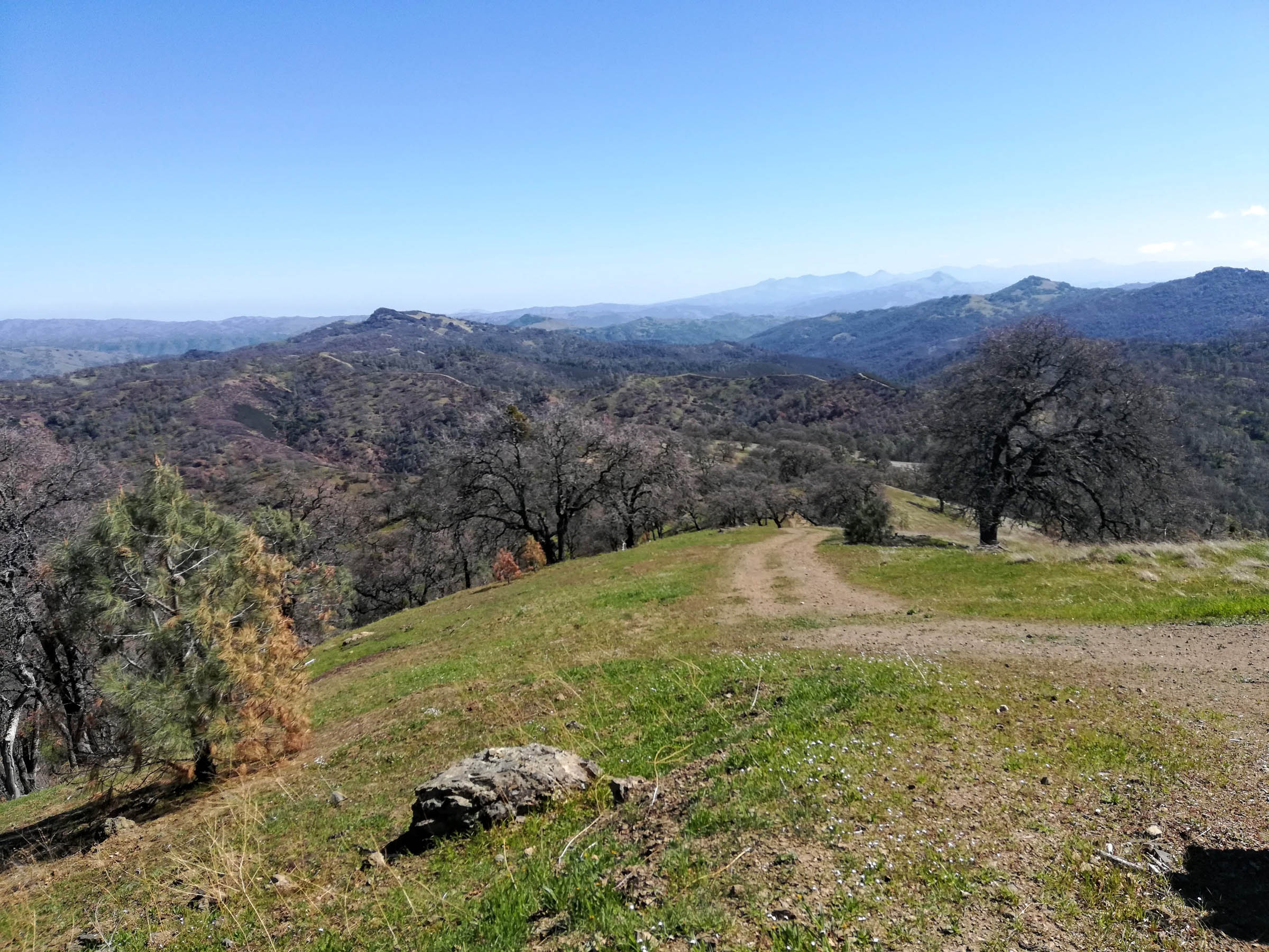
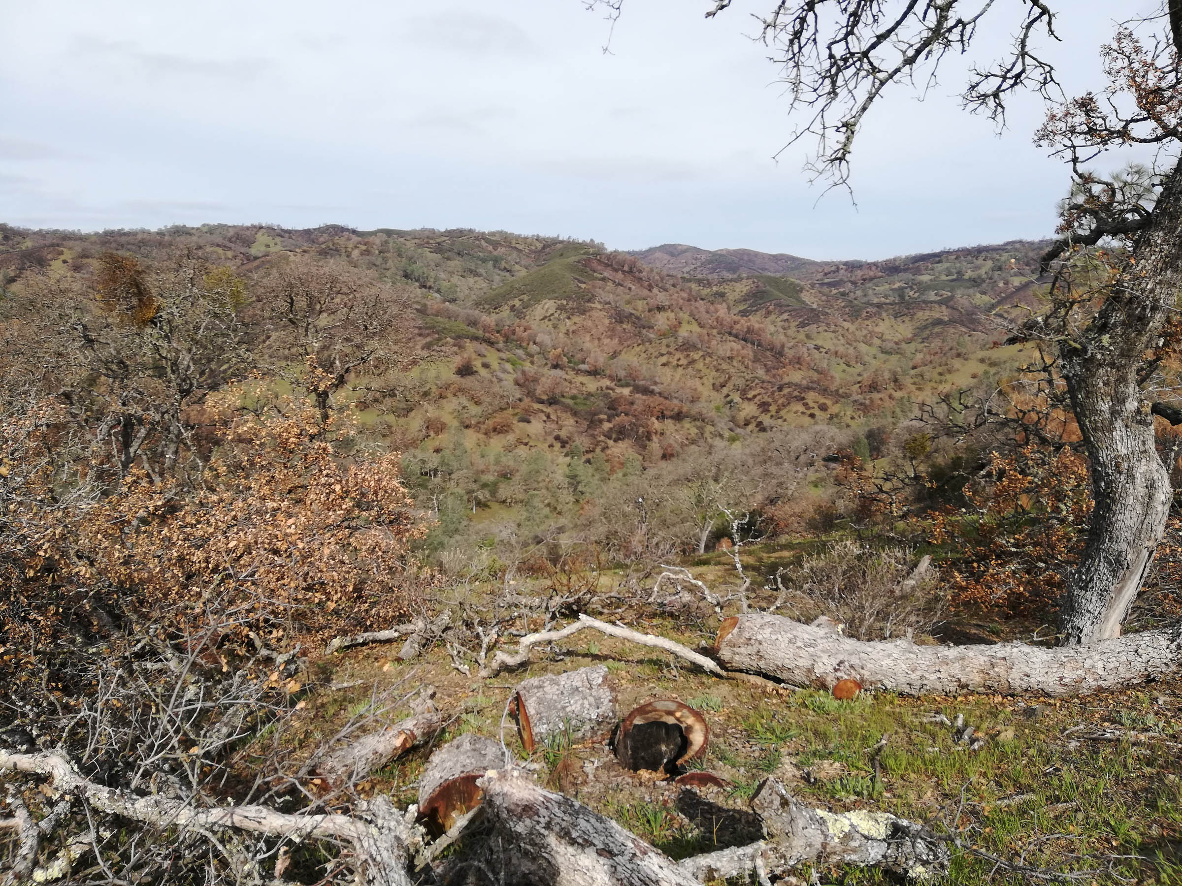
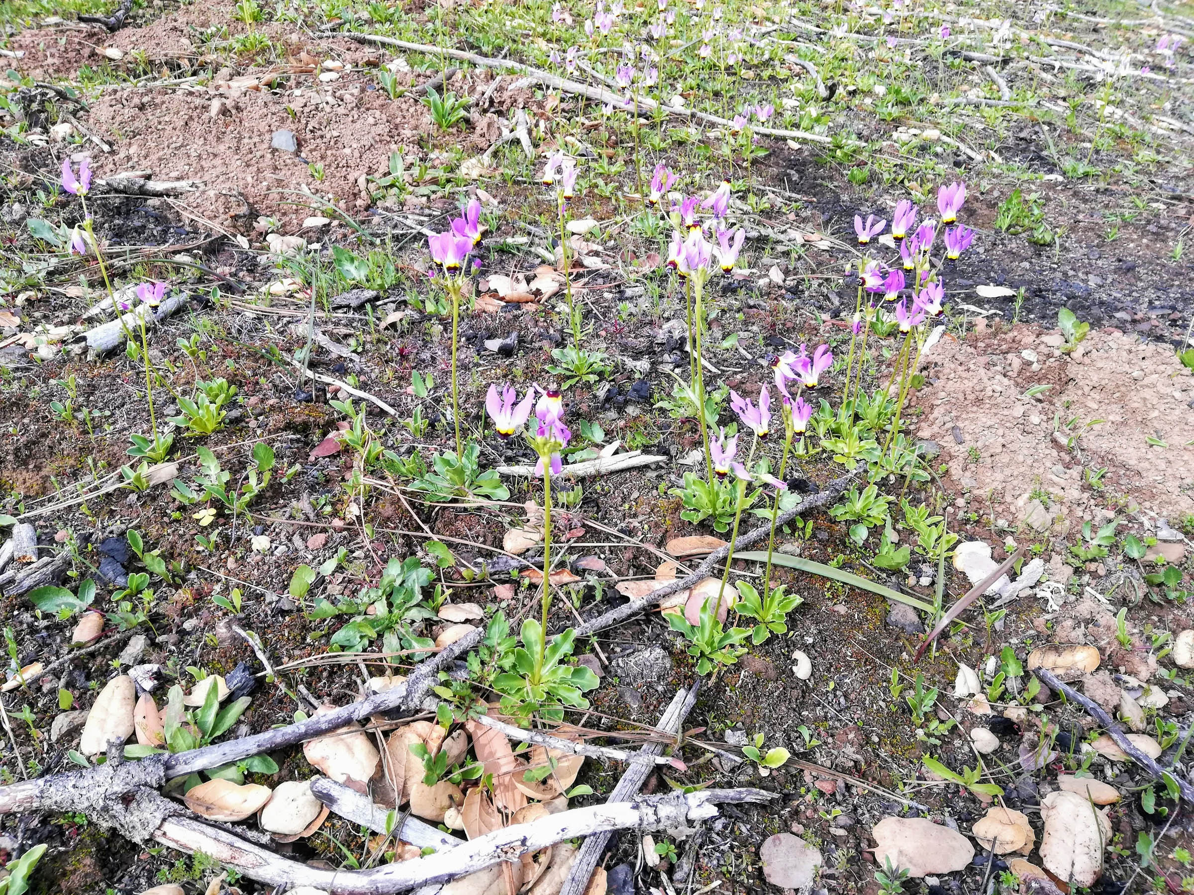
Henry Coe State Park is less than an hour away from San Jose and Silicon Valley but feels a thousand miles and years removed. With 88,000 acres of largely undeveloped hills and steep (and I do mean steep!) ridges, it’s California’s second-largest state park. While over 50% of the park was burned in the enormous SCU Lightning Complex Fires in August-September 2020, large parts remained unscathed, and already you can see Mother Nature renewing herself as wildflowers and grasses grow anew in the fire-impacted areas.
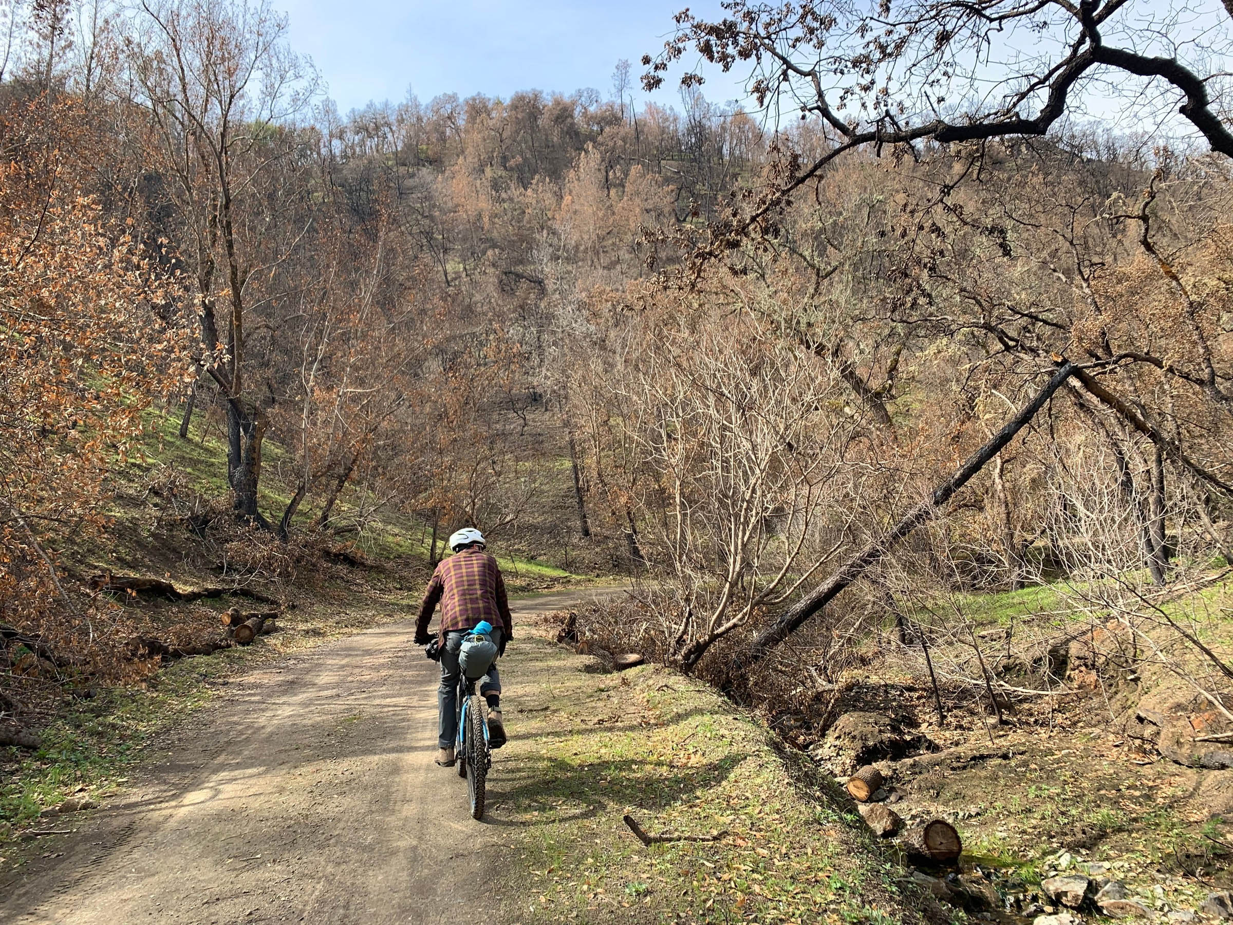
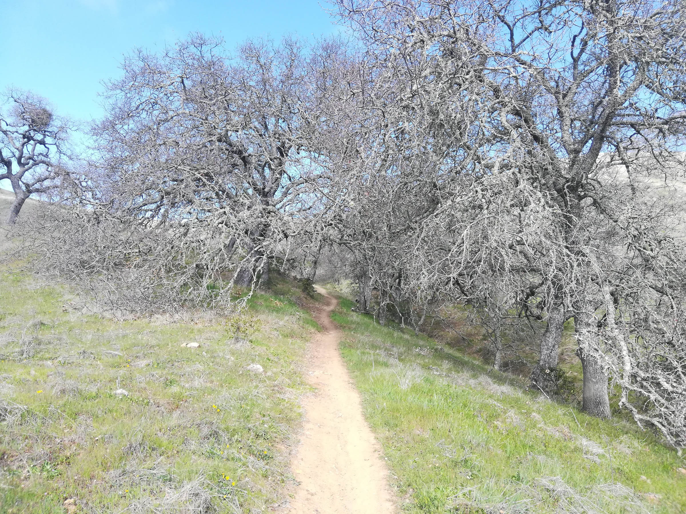
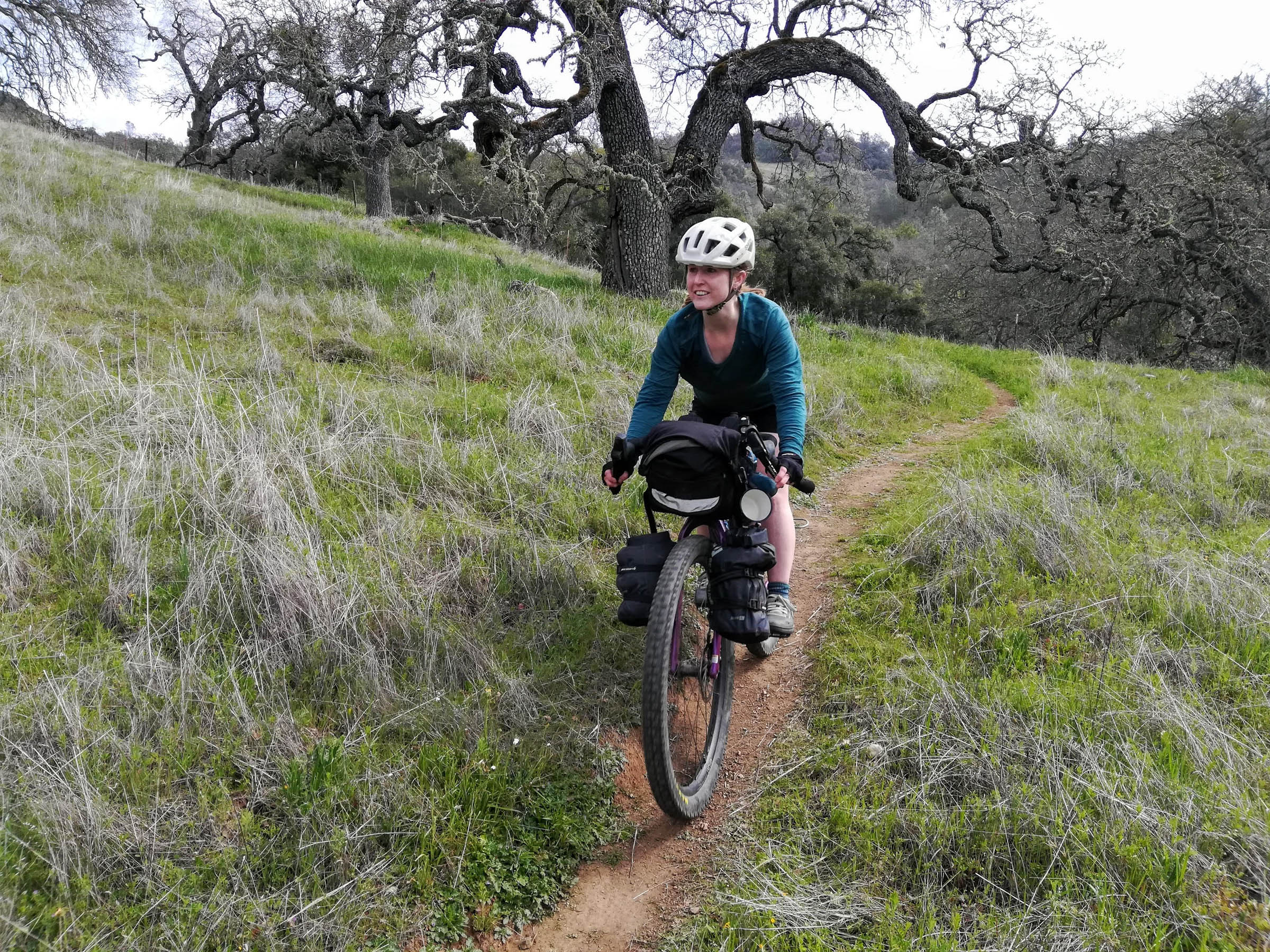
Previously inhabited by the Amah Mutsun and Northern Valley Yokuts peoples, the land that is now the park was used for cattle ranching by the Californios and Yankee settlers, leaving a 250-mile network of rough dirt roads (now fire roads) and cattle paths (now singletrack and hiking trails). The trip we took was approximately 70% fire road and 25% single or doubletrack, but you could easily modify the route to make it exclusively gravel roads or add in as much singletrack as you want.
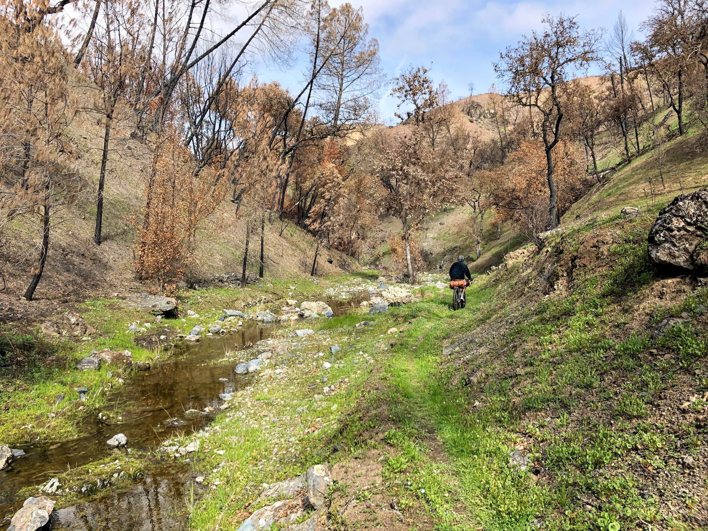
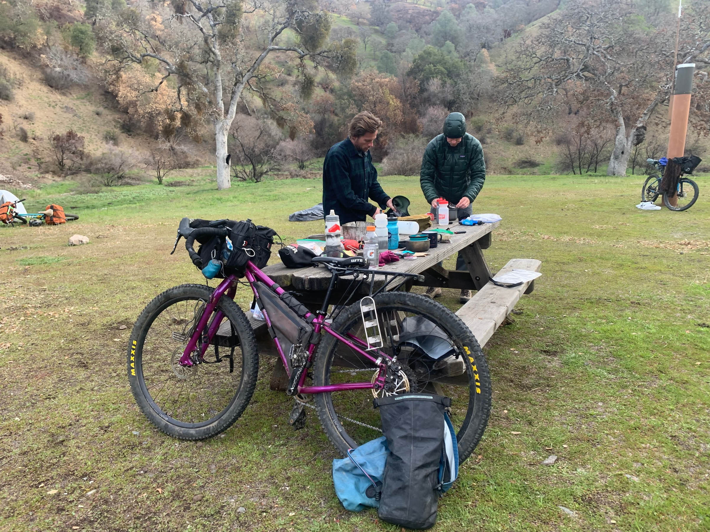
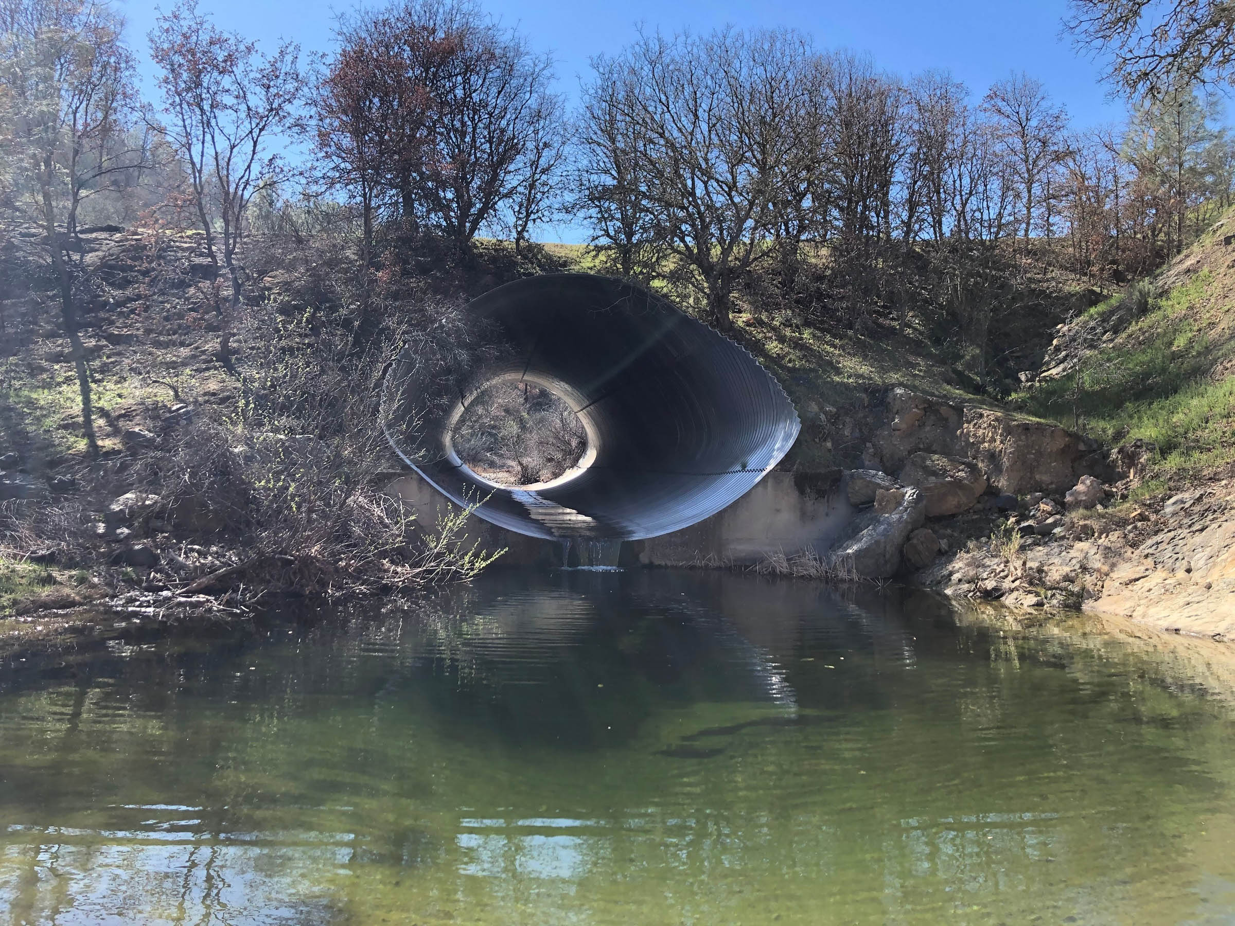
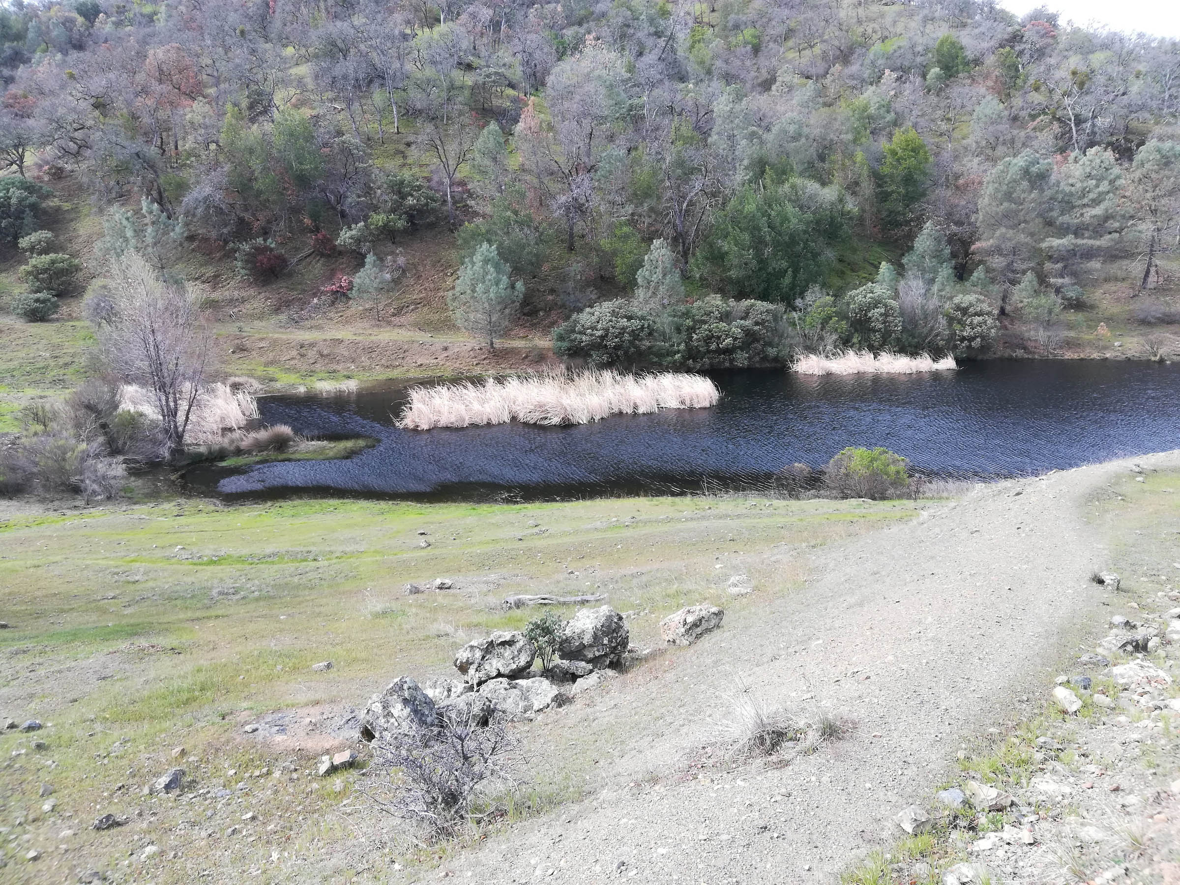
Coe has several established camps with primitive facilities (pit toilets & picnic tables), but dispersed camping is allowed just about anywhere. So, if you see a spot you like on your ride, go for it. There is no treated water here, so bringing water purification/filtration is mandatory. Ponds, streams, and springs are abundant in winter and spring but plan ahead to be self-sufficient. Campfires aren’t allowed, but gas stoves are okay for meal and coffee prep.
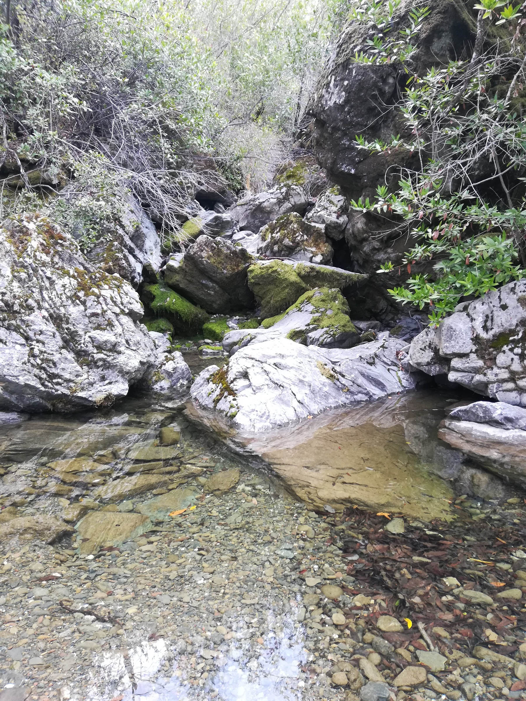
The timing of your visit will have a great impact on your experience. Summer and fall can get uncomfortably hot; winter and spring are probably the most enjoyable times to ride. The recent rains made the numerous stream crossings that much more fun. Plus, waterfalls! April is the best time for wildflowers.
Difficulty
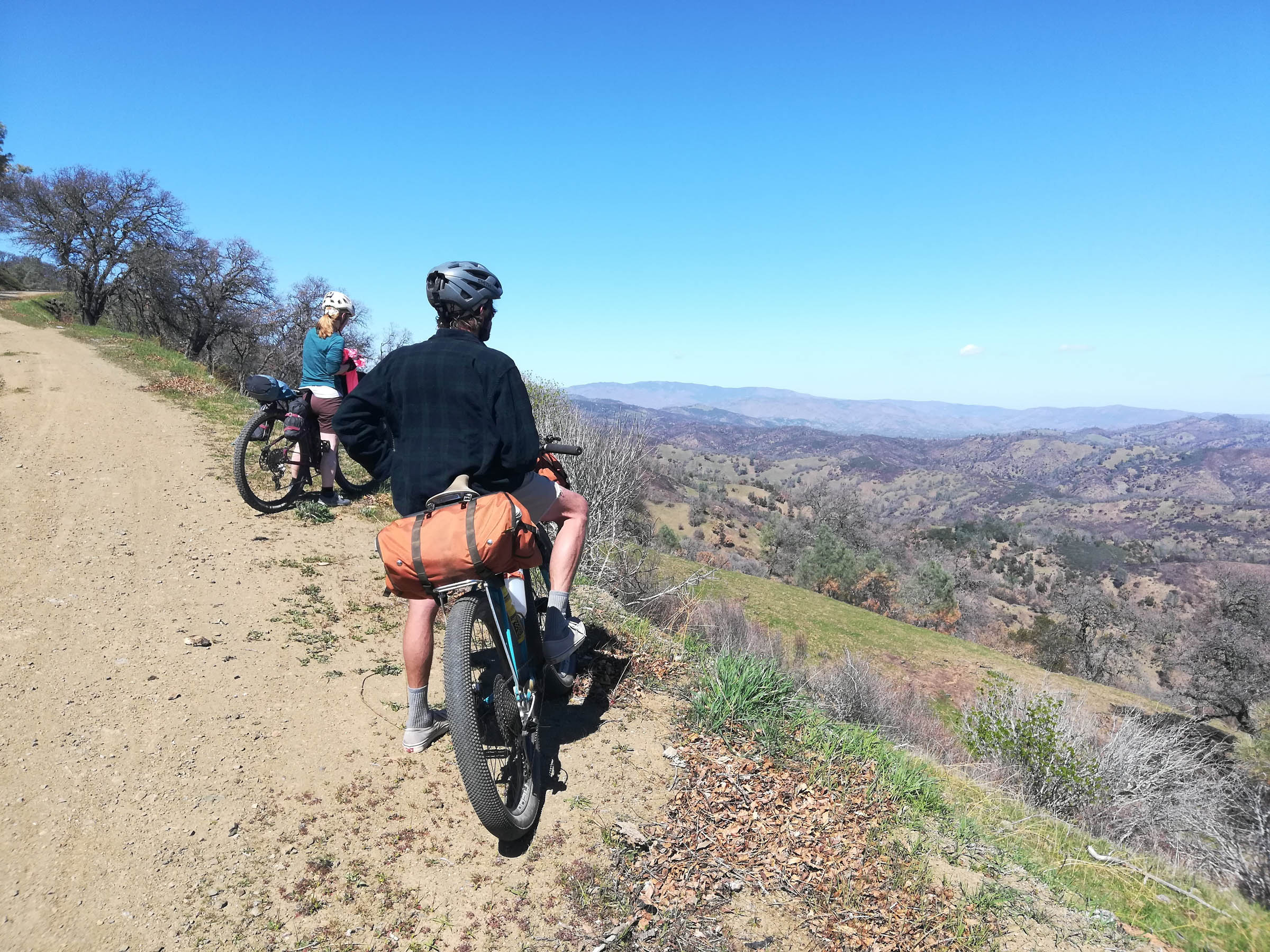
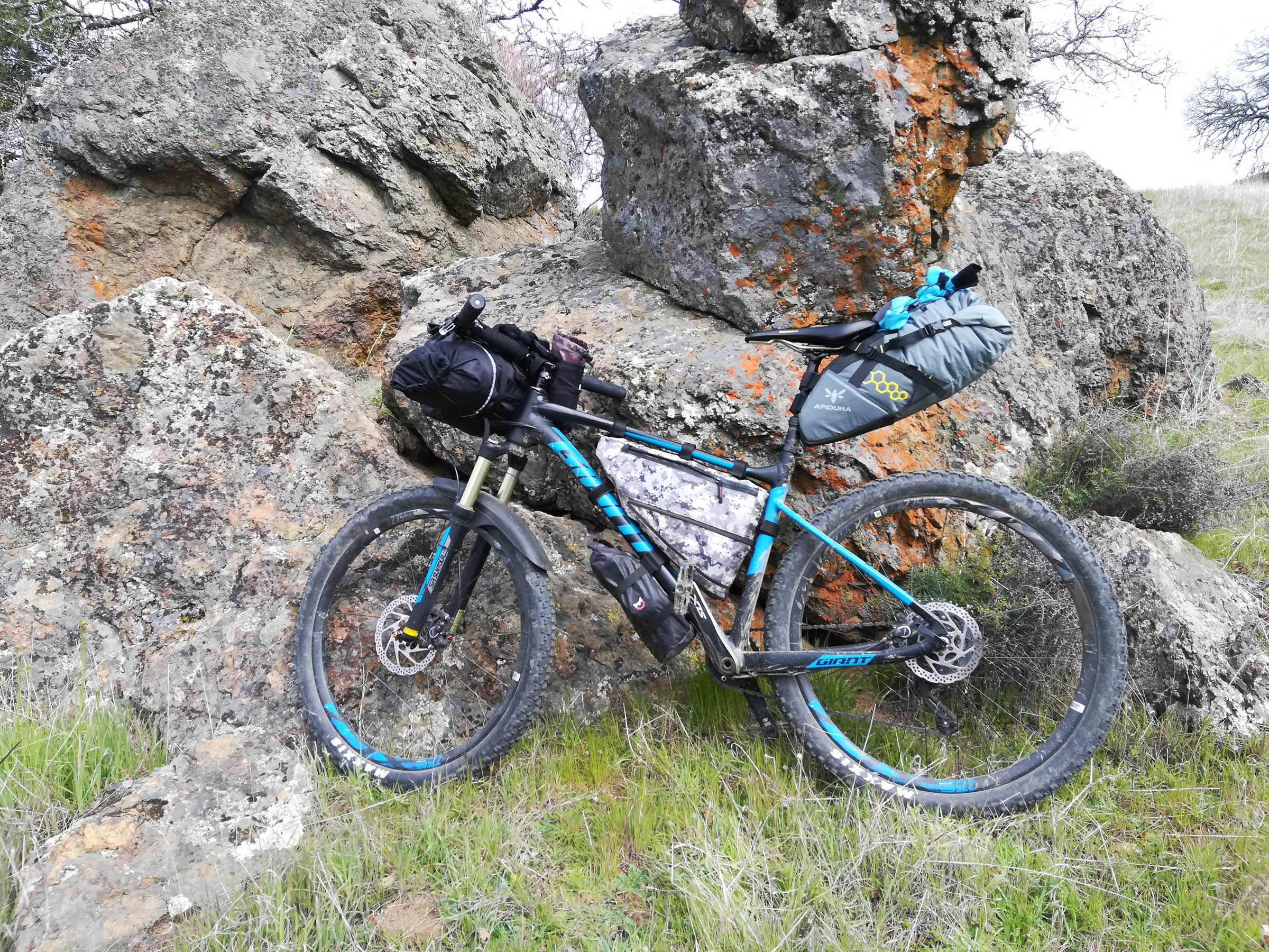
I’d rate this overnighter as a 6 overall. As mapped, the technical difficulty averages a 4 (fire roads = 2, some steep singletrack = 6+), but with dozens of trail options, you can generally reroute to avoid tricky singletrack if that’s not your thing. However, there’s no getting around the elevation here, so physical demand merits an 8. Our group rode a variety of rigs, from hardtail mountain to drop-bar gravel bikes. Whatever you bring, make sure it has a large granny gear as the climbing here is no joke. You will hike-a-bike at some point, probably several times. Resupply and logistics are a 6. While getting to Henry Coe is easy, there are no stores or treated water within the park, so you’ll have to bring what you need with you.
Route Development: Credit for this route goes to Stephen Chan of the NorCal Bicycle Touring Meetup group, who organized our recent trip. Kudos as well to The Pine Ridge Association, a non-profit volunteer group that helps build and maintain trails in the park and is doing heroic work in rebuilding from the wildfires.


Submit Route Alert
As the leading creator and publisher of bikepacking routes, BIKEPACKING.com endeavors to maintain, improve, and advocate for our growing network of bikepacking routes all over the world. As such, our editorial team, route creators, and Route Stewards serve as mediators for route improvements and opportunities for connectivity, conservation, and community growth around these routes. To facilitate these efforts, we rely on our Bikepacking Collective and the greater bikepacking community to call attention to critical issues and opportunities that are discovered while riding these routes. If you have a vital issue or opportunity regarding this route that pertains to one of the subjects below, please let us know:
Highlights
Must Know
Camping
Food/H2O
Trail Notes
- While you’ll curse the constant climbing, the panoramic vistas at the ridgetops are ample reward. The scale of this park is really epic
- Singletrack highlights include Serpentine, Coit Springs, and especially Grapevine Trails
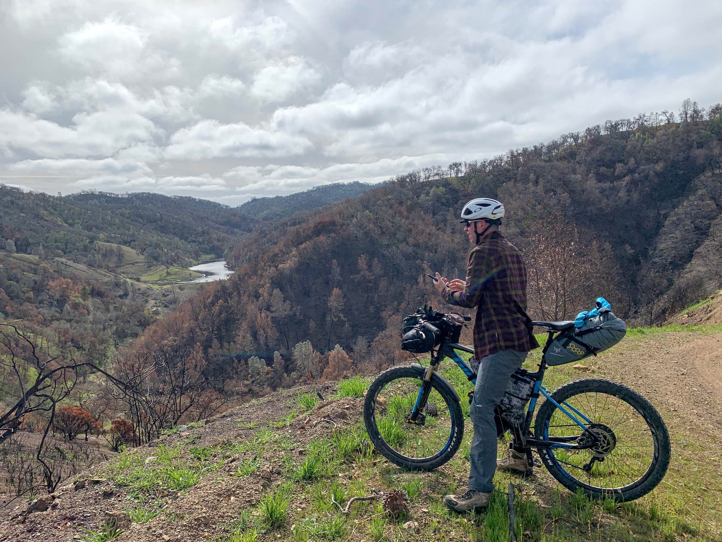
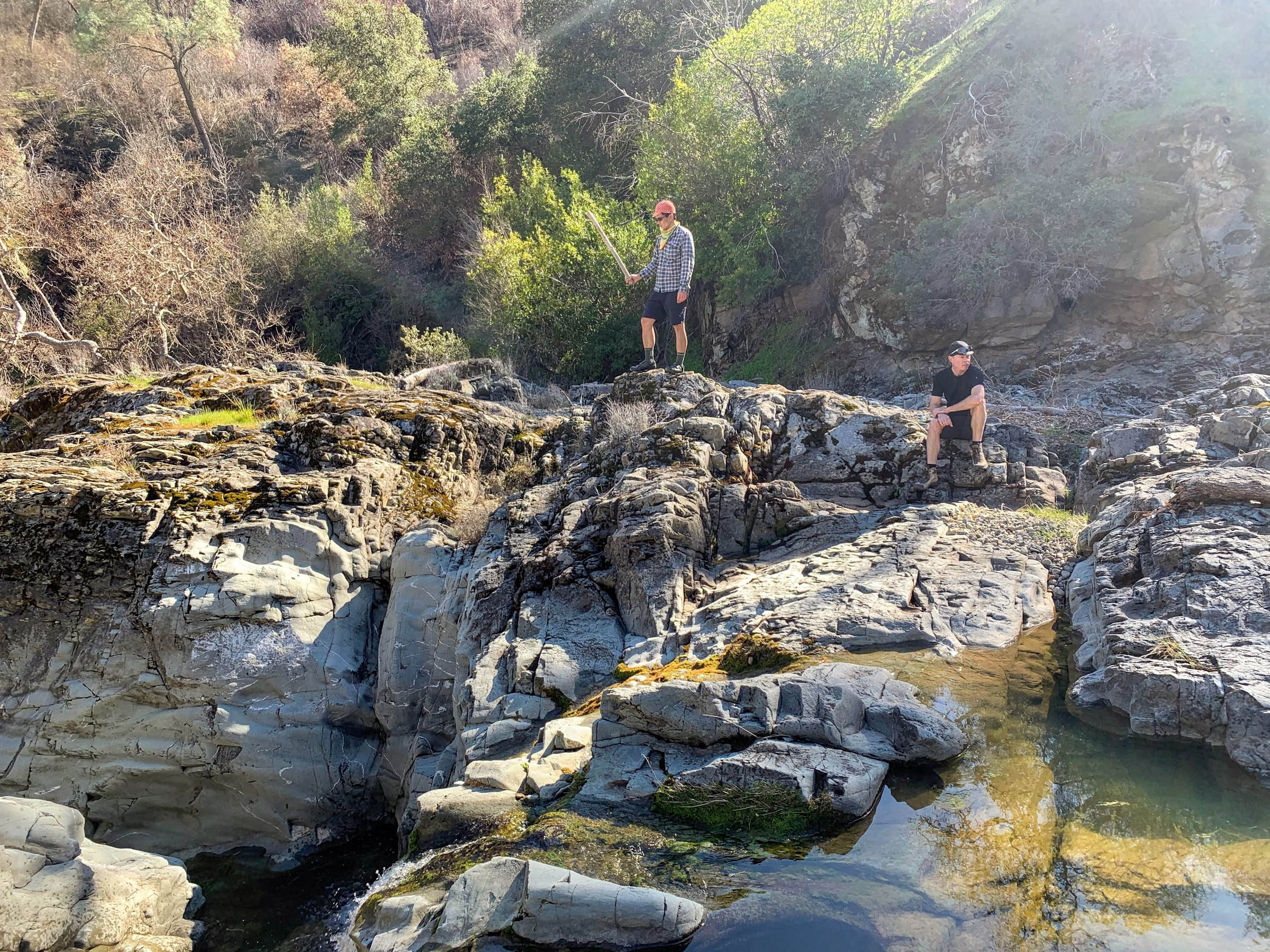
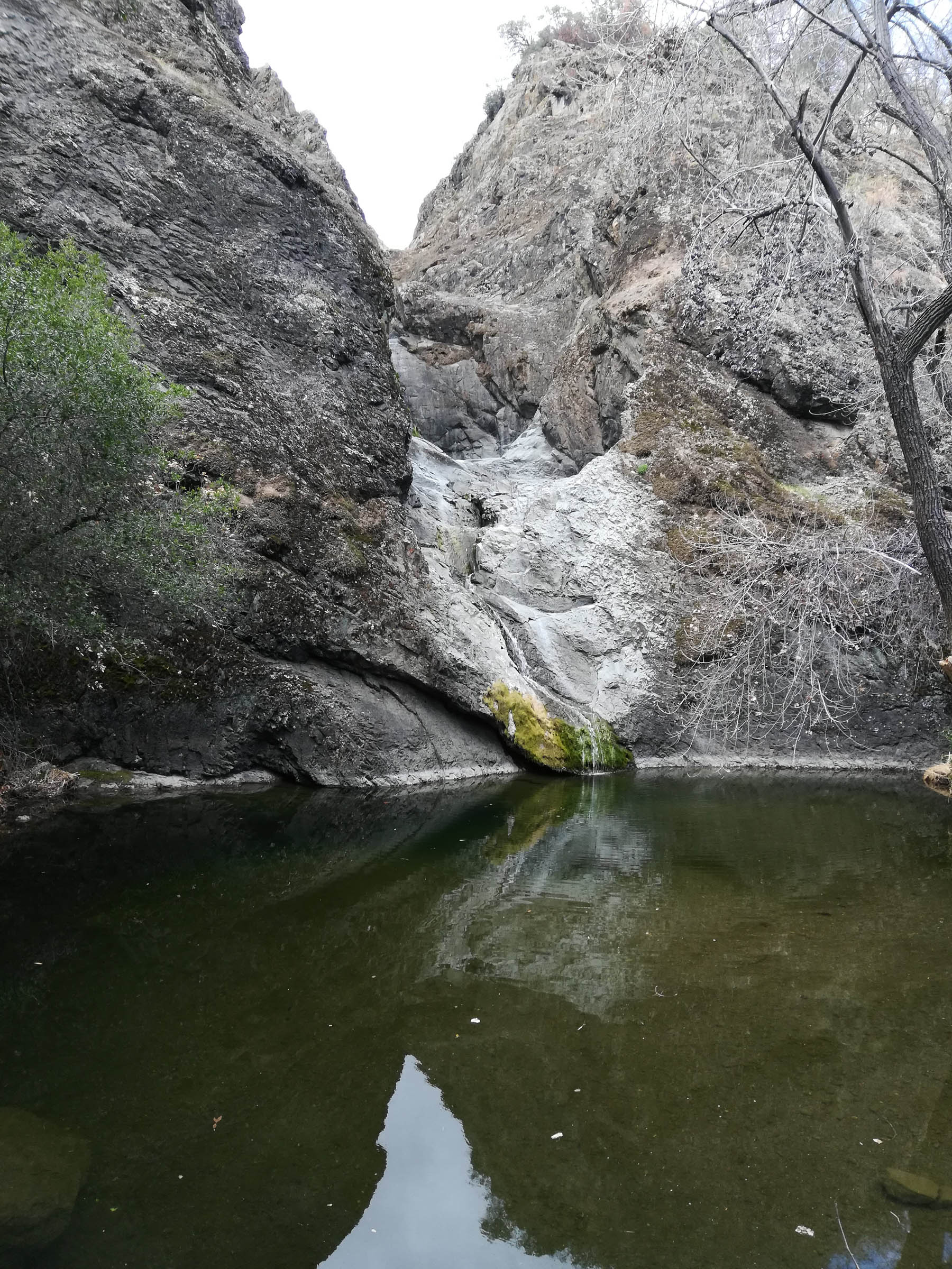
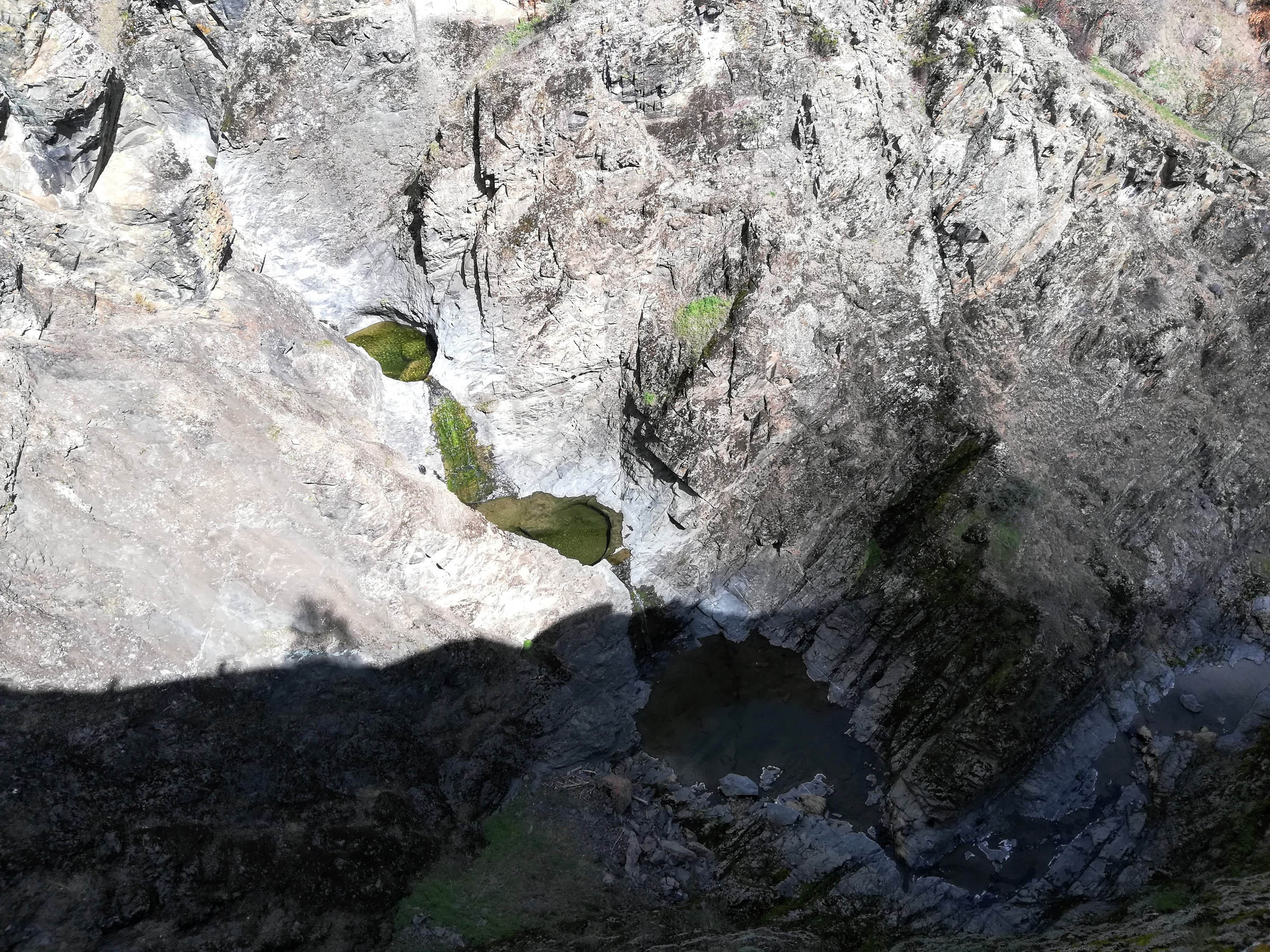
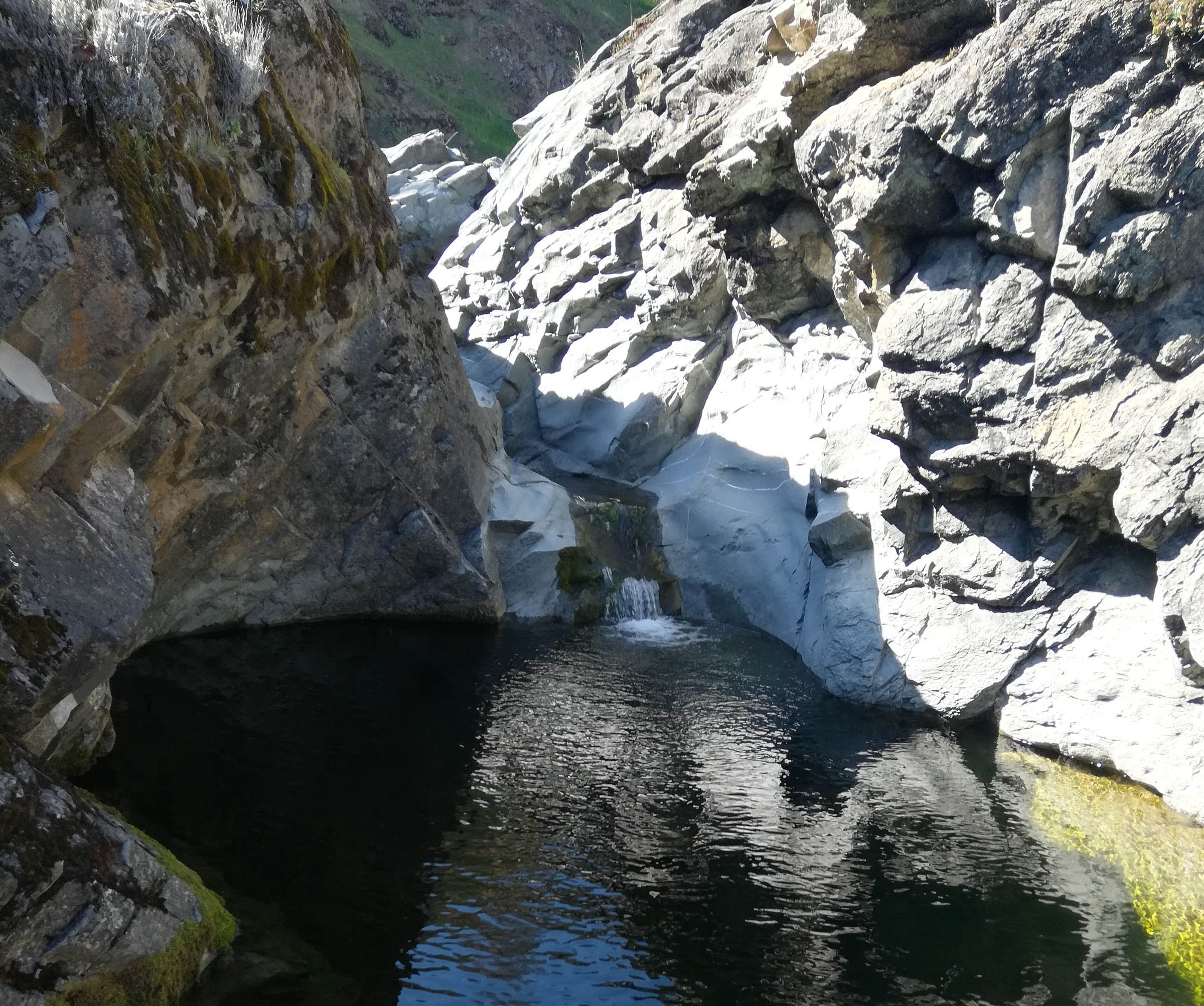
- Pacheco Falls is worth the steep descent and resulting climb out. Make sure to check out the top of the falls,
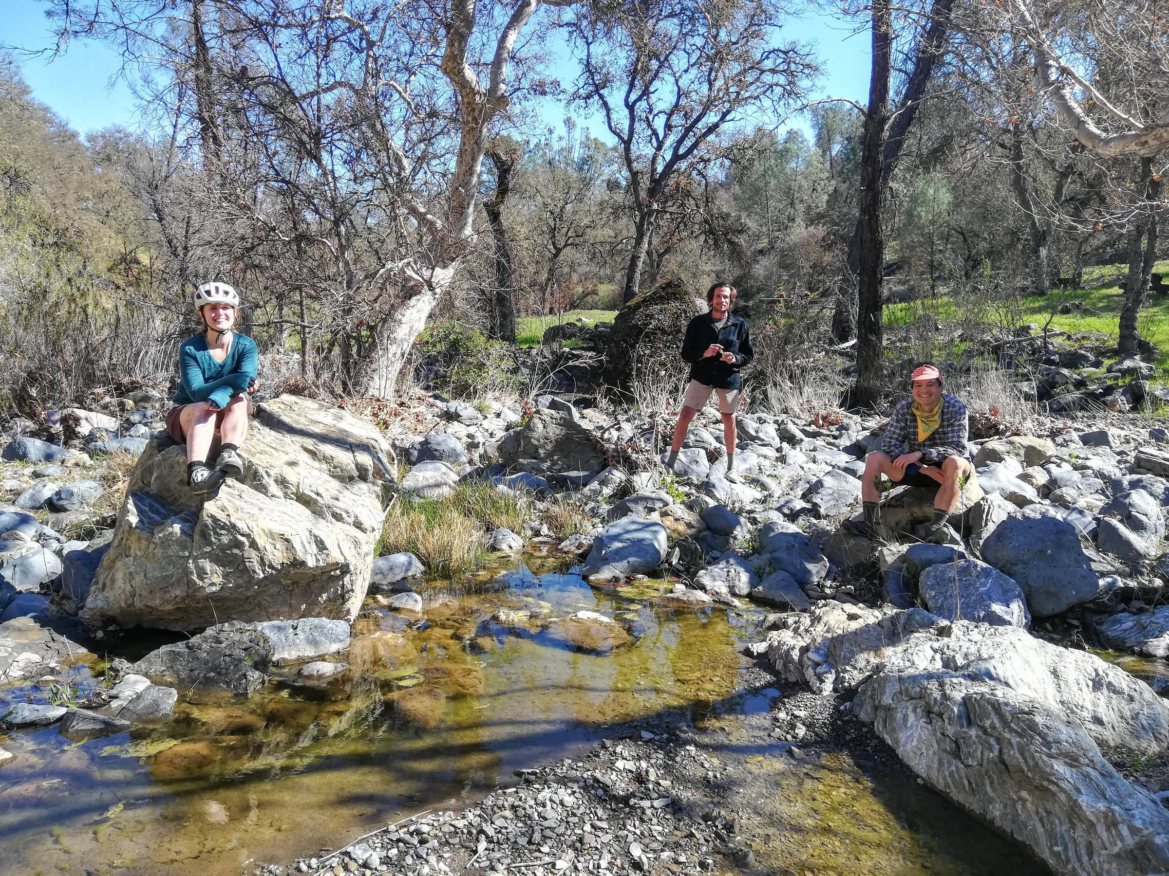
which sit below a knife-edge ridge that is best hiked to - The many ponds and streams (at least in winter/spring) are refreshing and pretty places to rest and snack
- Watching Mother Nature renew herself from the ravages of the wildfires
- You can ride Henry Coe just about year-round, but you’ll be most comfortable October-June. July-September can get extremely hot and water will be harder to come by, and certainly funkier
- Backcountry camping permits cost $5/night and parking is $6 daily. Bring exact change for the Iron Ranger (dropbox) in the Hunting Hollow entrance at the end of Gilroy Hot Springs Road
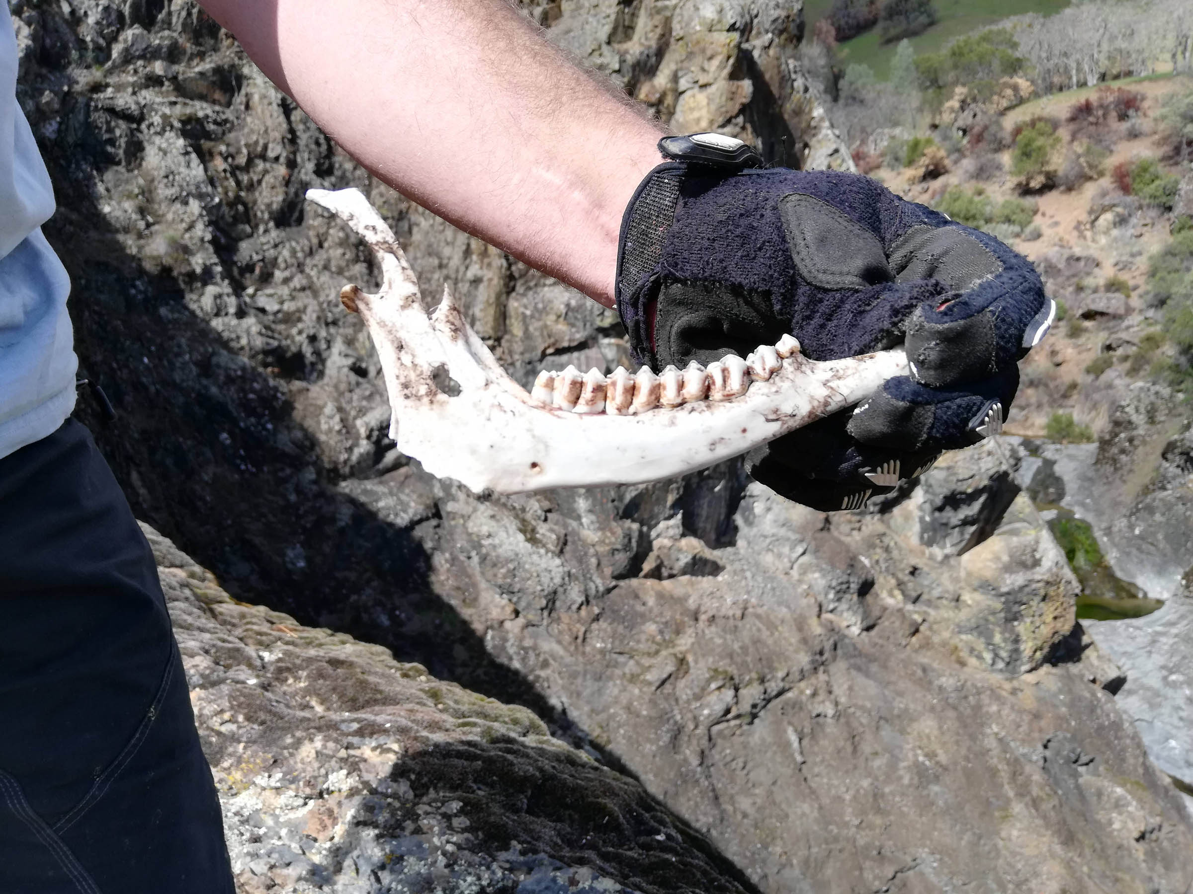
- Wildlife danger is pretty low, just watch out for rattlers in the hot months and check for ticks every so often
- While most people drive in and park at Hunting Hollow, we met several other bikepackers who took BART (Bay Area Rapid Transit) to the new Berryessa station in South San Jose and rode in (adds about 30 miles each way)
- Visit The Pine Ridge Association site and the CA State Park page for the latest developments and news about the park. Also, check out MTB Project for other trip ideas and map files of Henry Coe State Park.
- Dispersed camping is allowed just about anywhere except around the Hunting Hollow parking lot, so sleep where you like
- There are several established primitive camps with pit toilets (some of the cleanest and best I’ve seen in the California State Park System) and picnic tables
- We overnighted at Pacheco Camp, but an excellent alternative can be found on Kaiser-Aetna Road, where it crosses Pacheco Creek. It’s a peaceful site and close to Hole in the Rock waterfall
- Pack out your trash and leave the park in better condition than you found it
- Water filtration is mandatory, there is no treated water in the park
- There is plentiful surface water in winter/spring, and many springs that run even in summer
- Pick up a trail map in the Hunting Hollow entrance, which details the locations of springs and cattle troughs
- Bring more food than you think you’ll need as there are no stores in the park
- Groceries and supplies can be purchased beforehand in Gilroy or Morgan Hill, the closest communities
Day 1
- Make sure you pick up a paper trail map at Hunting Hollows entrance. It will help you identify the numerous
junctions and alternate routes from this one - Be prepared for a big day (4,900 feet of elevation) if your goal is Pacheco Camp. If you want to even out the route, set up camp where Kaiser Aetna crosses Pacheco Creek, which has a nice meadow and picnic tables. Spend the rest of the day exploring around Hole in the rock falls
- Pacheco Camp is a large open meadow with picnic tables, toilet, and a stream and springs for water. If you come on a weekend, you’ll probably have other bikepackers for company
Day 2
- Pacheco Falls is a long, often steep descent with several burned, downed trees to carry your bike over. The Falls viewed from the bottom are rather modest when water levels are low, but the view from the ridge above is spectacular. Leave your bikes for a short hike to the ridge – they’ll be safe as no bike thief would want to ride the grueling ascent out!
- Stop for water and/or lunch at Kelly or Coit Lakes before the long climb out on Coit Road
- If you like singletrack, I recommend the Coit Springs/Grapevine trails as mapped on RidewithGPS. There are several creek crossings and some pretty tight passages through trees and rock formations, but if not your cup of tea, stay on Coit Road. Both get you to the same road back to Hunting Hollow


Terms of Use: As with each bikepacking route guide published on BIKEPACKING.com, should you choose to cycle this route, do so at your own risk. Prior to setting out check current local weather, conditions, and land/road closures. While riding, obey all public and private land use restrictions and rules, carry proper safety and navigational equipment, and of course, follow the #leavenotrace guidelines. The information found herein is simply a planning resource to be used as a point of inspiration in conjunction with your own due-diligence. In spite of the fact that this route, associated GPS track (GPX and maps), and all route guidelines were prepared under diligent research by the specified contributor and/or contributors, the accuracy of such and judgement of the author is not guaranteed. BIKEPACKING.com LLC, its partners, associates, and contributors are in no way liable for personal injury, damage to personal property, or any other such situation that might happen to individual riders cycling or following this route.
Please keep the conversation civil, constructive, and inclusive, or your comment will be removed.