


Jeune Landing Loop
Distance
88 Mi.
(142 KM)Days
2
% Unpaved
95%
% Singletrack
0%
% Rideable (time)
100%
Total Ascent
5,922'
(1,805 M)High Point
904'
(276 M)Difficulty (1-10)
3?
- 4Climbing Scale Fair67 FT/MI (13 M/KM)
- 1Technical Difficulty Easy
- 5Physical Demand Moderate
- 2Resupply & Logistics Easy
Contributed By
Miles Arbour
Associate Editor & Events Manager
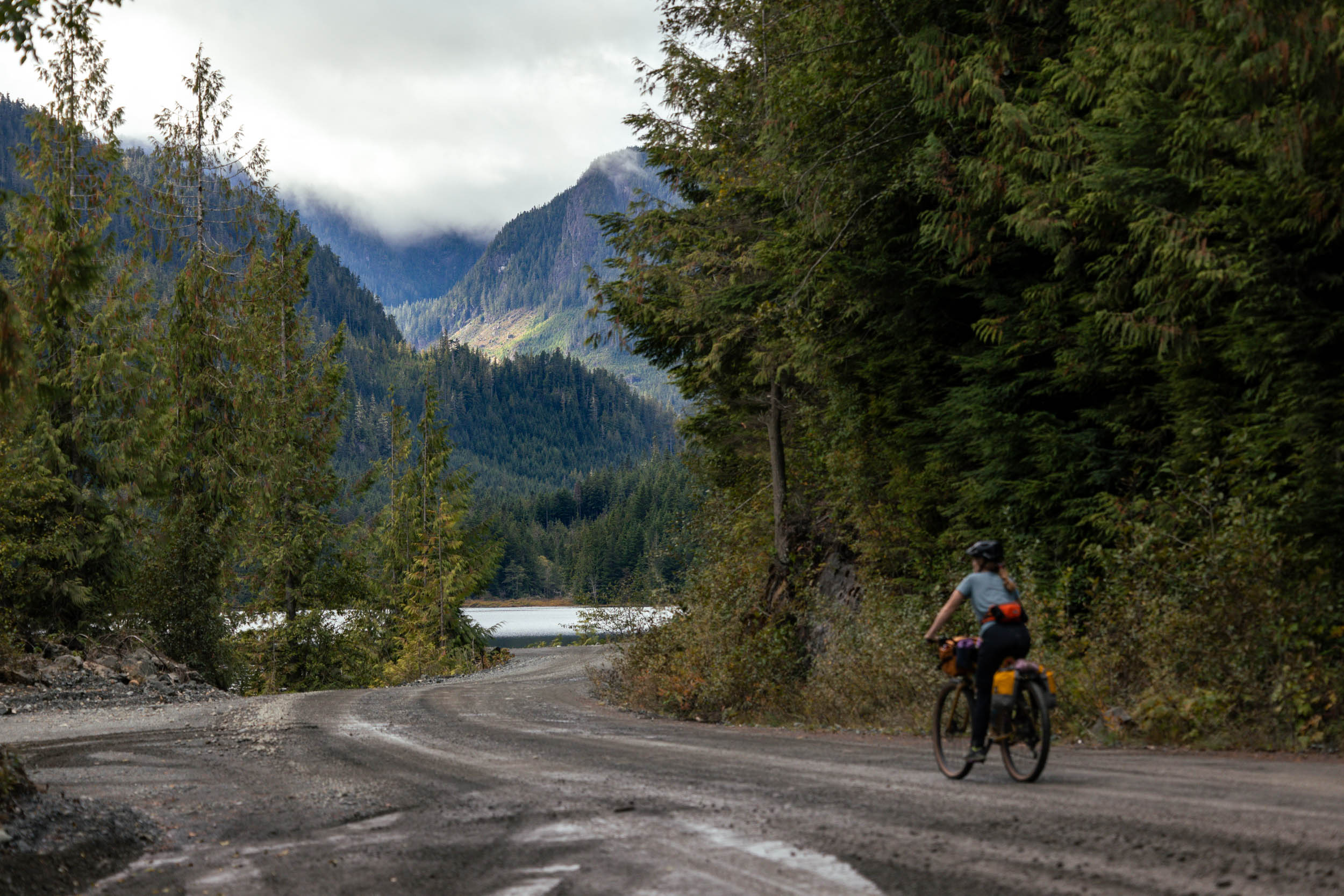
Unless you’ve ridden or researched the Tree to Sea Loop, the small coastal communities of Port McNeill and Port Alice likely haven’t been on your radar. Despite offering some of the mildest winters in the country, year-round access, diverse landscapes, and loads of bikepacking potential, the North Island region of Vancouver Island is far less visited compared to areas to the south. Five hours (by car) and nearly 500 kilometers north of Victoria is the town of Port McNeill. A logging town at heart, Port McNeill offers a proper North Island experience with just a few thousand permanent residents and is the next largest town north of Campbell River, some 200 kilometers south. To the west, on the opposite side of the island, located on an inlet off Quatsino Sound, is the even smaller community of Port Alice. The Jeune Landing Loop connects these two unsuspecting North Island towns via rolling gravel roads, providing an approachable introduction to bikepacking on Vancouver Island.
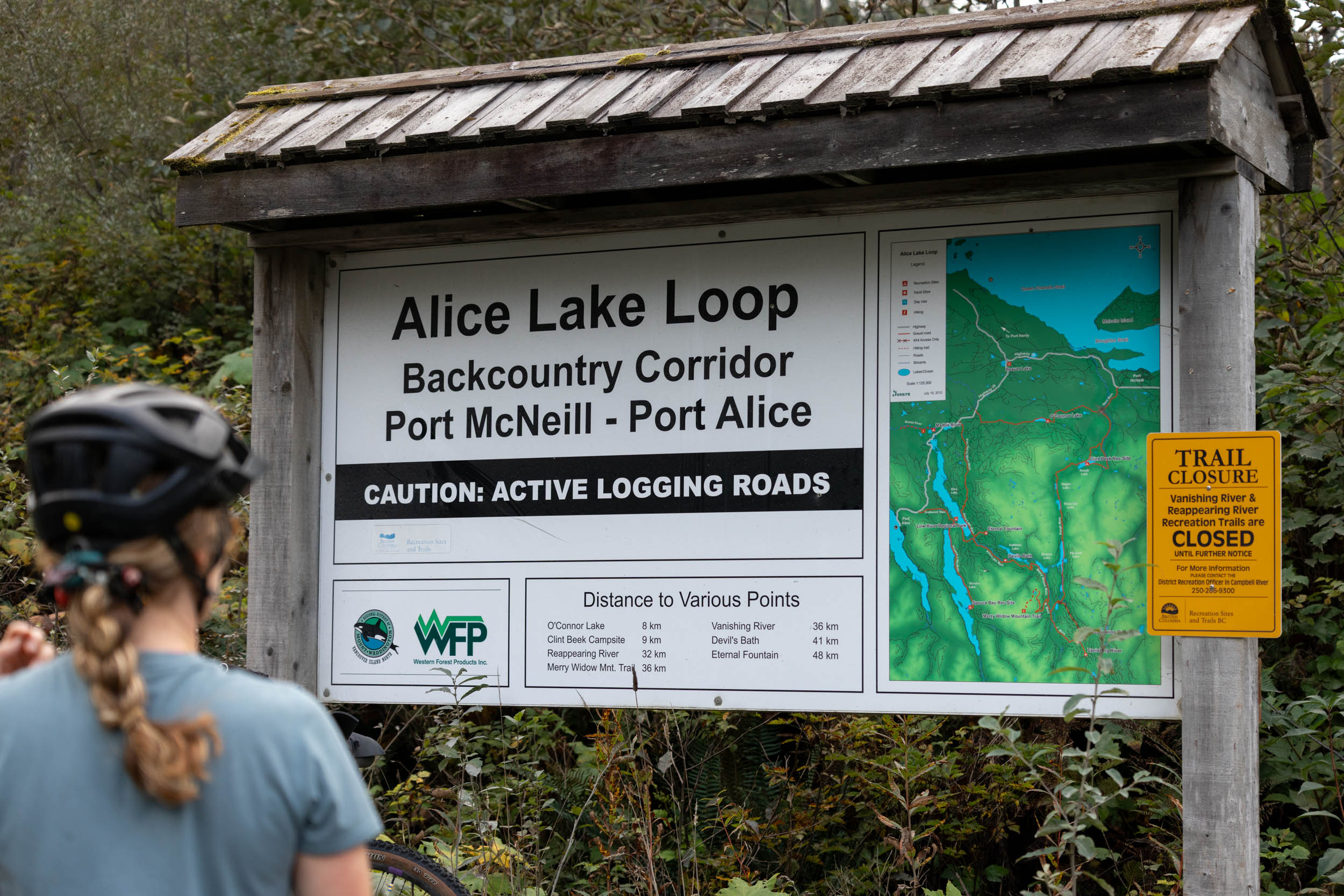
Jeune Landing Loop is named after a logging camp established in the mid-1940s to support logging operations in Quatsino Sound. The loop loosely follows the Alice Lake Loop Tour, a scenic driving route from Vancouver Island North Tourism, designed to offer the best opportunities in Canada to view the distinctive features of a fascinating landform known as karst. Roadside attractions, including the Eternal Fountain and the Devil’s Bath, provide a closer look at these formations. The Jeune Landing Loop follows this route south from Port McNeill, passing by several lakeside rec site campgrounds, before veering west toward Alice Lake. From here, you can either complete the loop and start the ride back to the east coast or head south along Victoria Lake and Neroutsos Inlet, taking the back door into the town of Port Alice. The route forms a charming 140-kilometer figure-eight that sets riders up for a resupply and cafe around the halfway point.


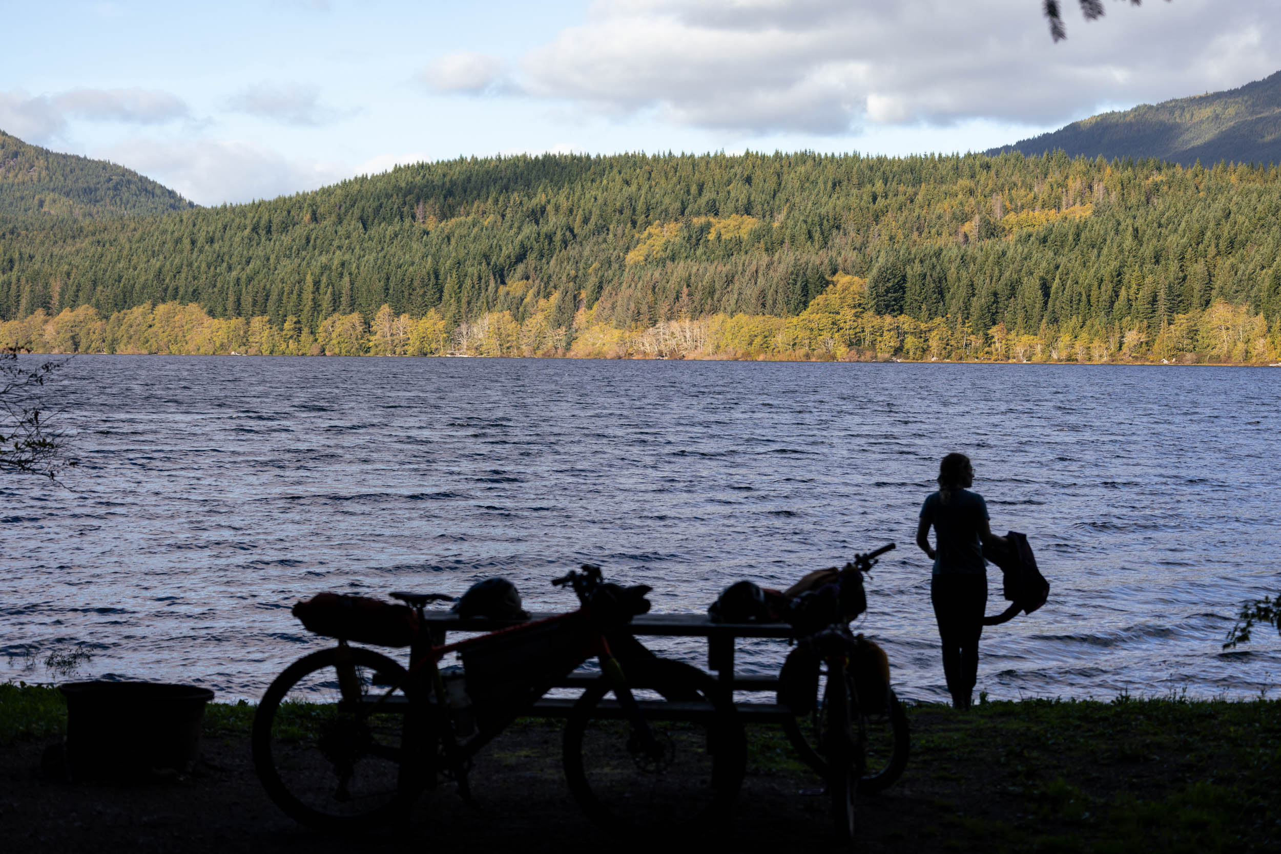
Depending on where you’re coming from, the Jeune Landing Loop can easily be ridden as an overnighter or spread out over three days with a slow first day and a short ride to camp. The abundance of BC Rec Site campgrounds makes planning the ride logistically simple, and the Link River Municipal Campground on Alice Lake is a great spot to aim for when riding the loop in two days. That way, you can treat yourself to a stop at Foggy Mountain Coffee in Port Alice for breakfast before continuing back to Port McNeill.
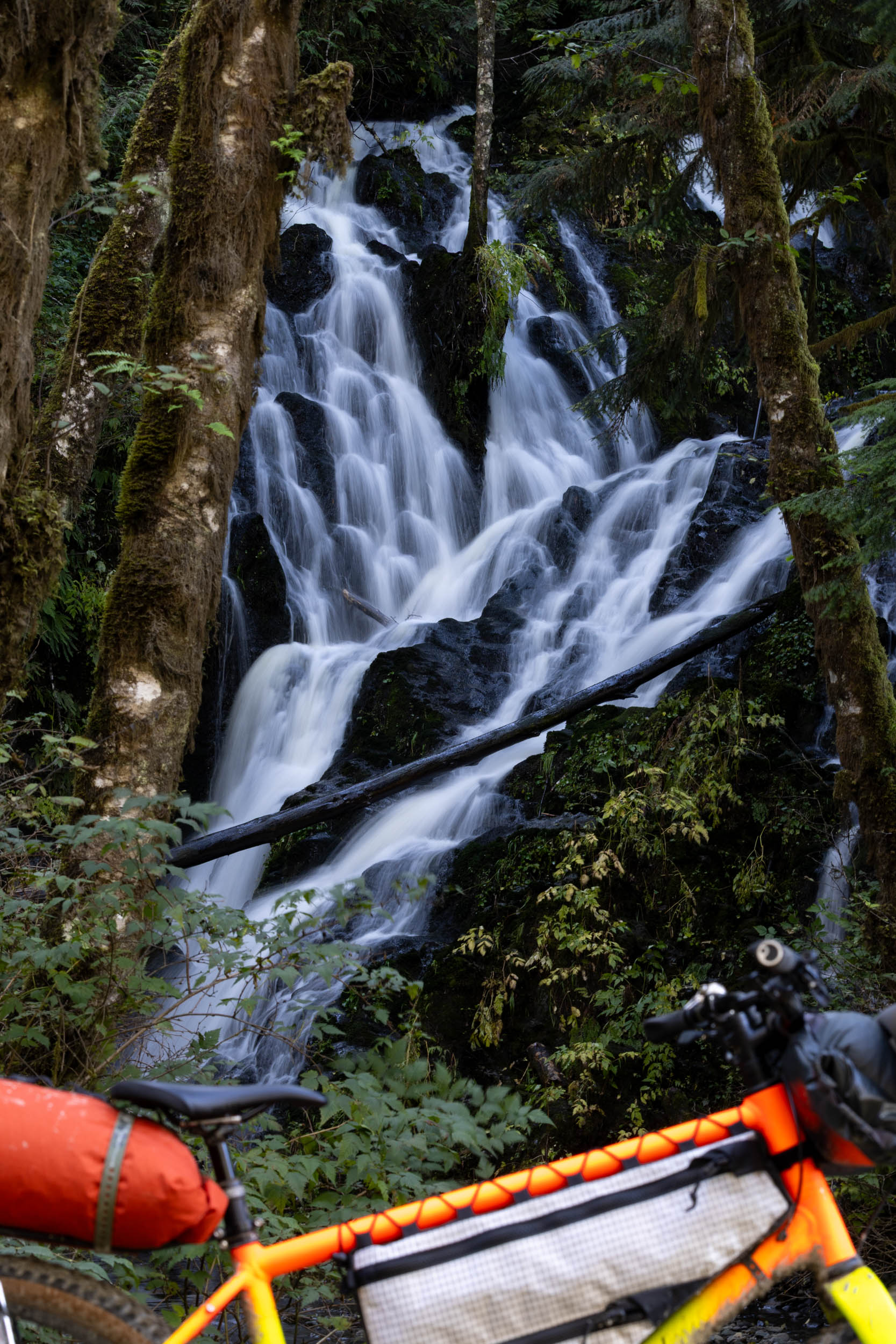
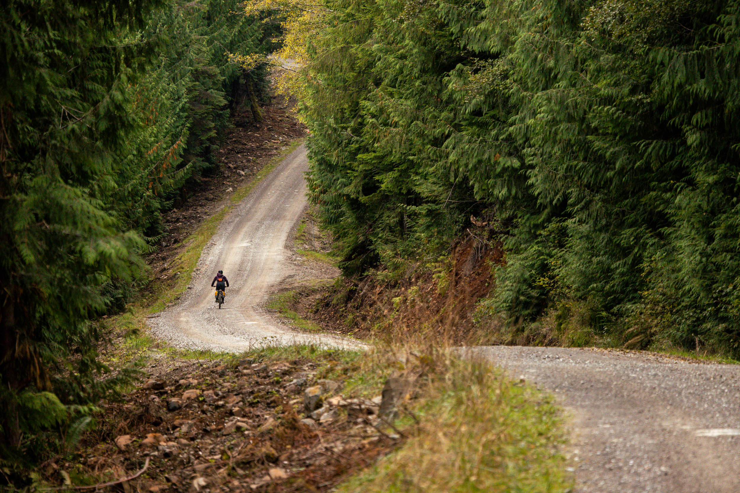
It’s not easy to make a 140-kilometer loop in British Columbia with so little elevation gain. The 1,805 meters of climbing is spread out evenly over the entire route, presented as short, meandering climbs on well-traveled logging roads. In the summer, there are ample opportunities for midday swims, and the route travels right by Devil’s Bath (one of Canada’s largest cenotes) and the Eternal Fountain, so there’s plenty to look forward to while riding. The route winds through towering North Island mountains, including the volcanic Twin Peaks. If you’re looking for a reason to explore the North Island further, the Jeune Landing Loop is a great place to start.
Difficulty
The Jeune Landing Loop is one of the easiest bikepacking routes on Vancouver Island due to the lack of singletrack, minimal elevation gain, and because it travels on established gravel/logging roads. It’s a great introductory route for folks looking to get a taste of longer routes, such as the Alberni Bam Bam or Tree to Sea offer, and it can be ridden in two or three days with minimal planning.
Route Development: Emily and I both fell in love with Port Alice while separately riding the Tree to Sea Loop. This quaint coastal community feels like night and day compared to the bustle of the mid-island, and the fact that it’s easily linked to Port McNeill using gravel roads makes for an enjoyable and approachable gravel overnighter. Both the Link River Campground host and the folks at Foggy Mountain Coffee Co. commented on how many bikepackers they’ve seen roll through since the Tree to Sea Loop was established, so the Jeune Landing Loop seeks to introduce people to the North Island without committing so much time. According to the Link River Campground, 20 to 30 percent of their customer base is now bikepackers!


Submit Route Alert
As the leading creator and publisher of bikepacking routes, BIKEPACKING.com endeavors to maintain, improve, and advocate for our growing network of bikepacking routes all over the world. As such, our editorial team, route creators, and Route Stewards serve as mediators for route improvements and opportunities for connectivity, conservation, and community growth around these routes. To facilitate these efforts, we rely on our Bikepacking Collective and the greater bikepacking community to call attention to critical issues and opportunities that are discovered while riding these routes. If you have a vital issue or opportunity regarding this route that pertains to one of the subjects below, please let us know:
Highlights
Must Know
Camping
Food/H2O
Trail Notes
Resources
- Start and end in Port McNeill, a proper North Island town with ferry access to Malcolm Island and Alert Bay.
- Grab a coffee and a bite to eat at Mugz before setting off, and finish at Devil’s Bath Brewing for a celebratory drink and meal.
- Rolling gravel roads with minimal elevation gain make the route perfect for newer riders or anyone searching for a relaxed overnighter.
- Plenty of roadside attractions, including loads of lakes, rec sites, Devil’s Bath, and the Eternal Fountain.
- A mid-way resupply and coffee shop stop in Port Alice. Make sure to visit Foggy Mountain Coffee Co. for a warm drink, sandwich, and some baked goods.
- Enter Port Alice from the south, passing through the original townsite that surrounded the operating pulp mill. In 1965, most of the residents moved a few kilometers up the road to escape the exhaust and smells from the mill.
- Ideal Bike: A gravel bike with at least 45mm tires is recommended, but a rigid mountain bike or hardtail wouldn’t be overkill. We first rode the route on rigid mountain bikes with fast rolling 29 x 2.4″ tires, and were happy to have them on some of the descents and mucky sections of logging roads.
- When to ride: The route can be ridden almost all year long, except any winter days with heavy snowfall. We recommend the summer months to enjoy the beautiful lakes and swimming along the way, but the fall is also a great time, as the campgrounds will be less busy and you’ll see fewer vehicles on the roads.
- Getting here: Port McNeill is a five-hour drive from Victoria, or a three-hour drive from Comox, if arriving from the Sunshine Coast. Pacific Coastal has flights from Vancouver to Port Hardy to the north, and Campbell River to the south, but they can get pricy.
- Parking: Overnight/long-term parking is available in Port McNeill. You can pay for parking using a machine in the small lot just north of the BC Ferries terminal. Lot C is designated for long-term parking. The main lot by the water has coin-operated showers and washrooms that are open year-round. These are a great resource to get cleaned up after the ride, before a meal.
- Route Direction: The route is designed to be ridden as a clockwise loop, but it can be ridden in either direction. A handlebar-mounted GPS device or cell phone is recommended for navigation, as there are quite a few other logging roads and small spurs.
- Land Acknowledgment: The Jeune Landing Loop route travels on the unceded traditional territory of the Kwakwaka’wakw and Quatsino First Nation. Take some time to learn about and respect their people. Head over to the British Columbia Assembly of First Nations website to learn more.
- Wildlife: There are bears, cougars, and other animals on this route. Make noise and carry bear spray to avoid startling any wildlife. Hang your food at night.
- There is active logging in the area and on some of the roads on the loop. For this reason, riding the route on the weekend is preferred, but not mandatory. Be prepared to make route adjustments on the fly, and get off the road when logging trucks pass.
- There are numerous free BC Recreation Campsites along the route, the majority of which offer no more than pit toilets and a few picnic tables. Explore the BC Rec Sit map here. These campgrounds can get busy in the summer months with car campers and RVs; plan accordingly.
- The Link River Municipal Campground, just before Port Alice, makes for a great halfway point camp spot. Online reservations can be made here, but the sites are free and first-come-first-served in the off-season (October to April). The current camp host said they will never turn away cyclists if you happen to show up on a busy weekend.
- The Port Alice Oceanfront RV + Campground is another option right in Port Alice proper, but it’s small, closed in the off-season, and not quite as scenic as the other options on the route. However, they do have showers and more amenities available.
- The only resupply is in Port Alice, which has a small grocery store, a few restaurants, and the Foggy Mountain Coffee Co. cafe. Stock up in Port McNeill before heading out, and triple-check that the coffee shop and grocery store will be open when you get there.
- There are lots of places to filter freshwater on the east side of the loop, but fewer on the west side. Expect to carry ~2L of water per person, and pack a water filter, purification tablets, or camp stove to purify any water.
- There is no potable water at any of the BC Rec Sites or Link River Campground. You’ll need a filter or will have to carry extra water for meals/drinks.
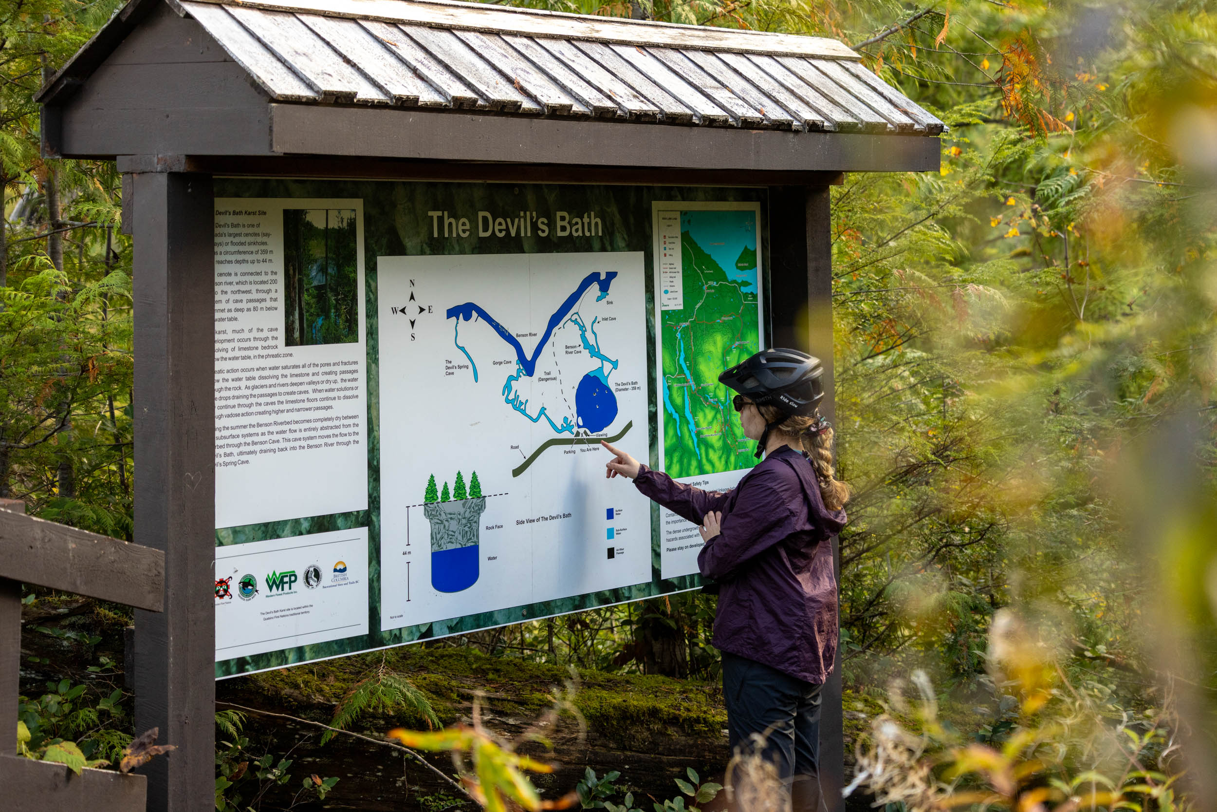
The Jeune Landing Loop starts in the coastal community of Port McNeill, backing onto the Queen Charlotte Strait. The route almost immediately leaves town on gravel, passing by the world’s largest burl (stop for a photo!), heading south on Keogh Main and the Cluxewe River. The first lake on the route is Koegh Lake, and there’s a reservable campground on the south side of the lake, accessed via Cluxewe Rd. The route continues south, passing by Three Isle Lake Rec Site, Maynard Lake Rec Site, and Kathleen Lake Rec Site, providing fantastic camping, snack stops, or a plus to filter water. Devil’s Bath, at around kilometer 47, is considered one of Canada’s largest cenotes (flooded sinkhole) measuring 359m around and 44m deep. It’s worth stopping in to check out the viewing platform. Link River Municipal Campground is under 10km from Devil’s Bath, and is the most realistic camping option for those riding the route over two days.
Day two starts with a steady, but gradual, climb along Victoria Lake, eventually descending down towards the end of Neroutsos Inlet. From there, the route heads north along the inlet through the original townsite and the Port Alice Heritage Golf Club. The only paved section of the route runs from this point to the far end of Port Alice. In town, there is a small grocery store, a local campground, a few restaurants, and Foggy Mountain Coffee Co. On the climb out of town, the route skirts off the pavement to rejoin the gravel up to Alice Lake. The last quarter of the route follows Alice Lake Main north, forming a figure-eight before passing by O’Connor Lake. Your ride ends with a leisurely descent back into Port McNeill. Head to Devil’s Bath Brewing Co. for a post-ride drink and meal!
Additional Resources


Terms of Use: As with each bikepacking route guide published on BIKEPACKING.com, should you choose to cycle this route, do so at your own risk. Prior to setting out check current local weather, conditions, and land/road closures. While riding, obey all public and private land use restrictions and rules, carry proper safety and navigational equipment, and of course, follow the #leavenotrace guidelines. The information found herein is simply a planning resource to be used as a point of inspiration in conjunction with your own due-diligence. In spite of the fact that this route, associated GPS track (GPX and maps), and all route guidelines were prepared under diligent research by the specified contributor and/or contributors, the accuracy of such and judgement of the author is not guaranteed. BIKEPACKING.com LLC, its partners, associates, and contributors are in no way liable for personal injury, damage to personal property, or any other such situation that might happen to individual riders cycling or following this route.
Please keep the conversation civil, constructive, and inclusive, or your comment will be removed.