


Mata Atlantica Bike Route (S1): Rio
Distance
242 Mi.
(389 KM)Days
10
% Unpaved
76%
% Singletrack
9%
% Rideable (time)
90%
Total Ascent
37,815'
(11,526 M)High Point
5,660'
(1,725 M)Difficulty (1-10)
9?
- 10Climbing Scale Very Strenuous156 FT/MI (30 M/KM)
- 8Technical Difficulty Difficult
- 9Physical Demand Very Difficult
- 5Resupply & Logistics Moderate
Contributed By
Alex Gauthier
Guest Contributor
Alex cycled exclusively for commuting in his hometown of Montreal until discovering bikepacking. To combine this new hobby with his lifelong passion for Latin America, he created the Mata Atlântica Bike Route in Brazil. He shares his travels on Instagram @alex.g.526.
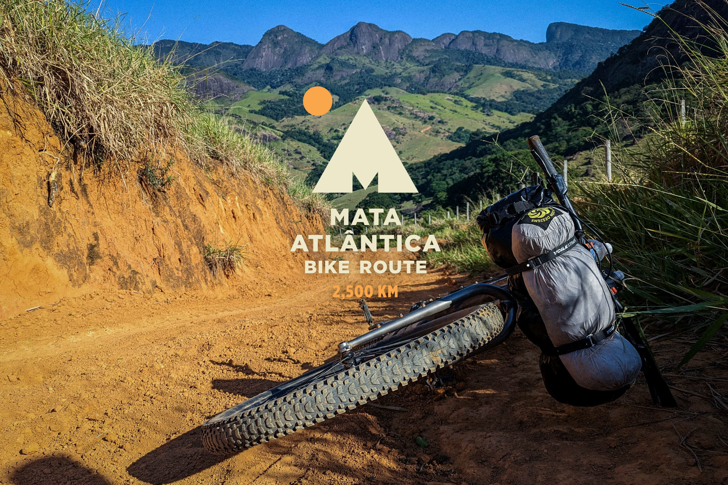
The Mata Atlântica Bike Route (MABR) stretches over 2,500 kilometers from Rio de Janeiro to Rio Grande do Sul, tracing mostly unpaved roads and paths through five Brazilian states. Inspired by the Caminho da Mata Atlântica long-distance trail, it follows the Serra do Mar mountains, connecting protected remnants of the Atlantic Forest—one of the world’s most biodiverse regions—while passing through landscapes of tropical forests, canyons, plateaus, and beaches. Along the way, riders encounter traditional communities, historic towns, and a mosaic of cultures, with opportunities to spot iconic wildlife and experience the region’s incredible natural beauty. Find all the segments here.
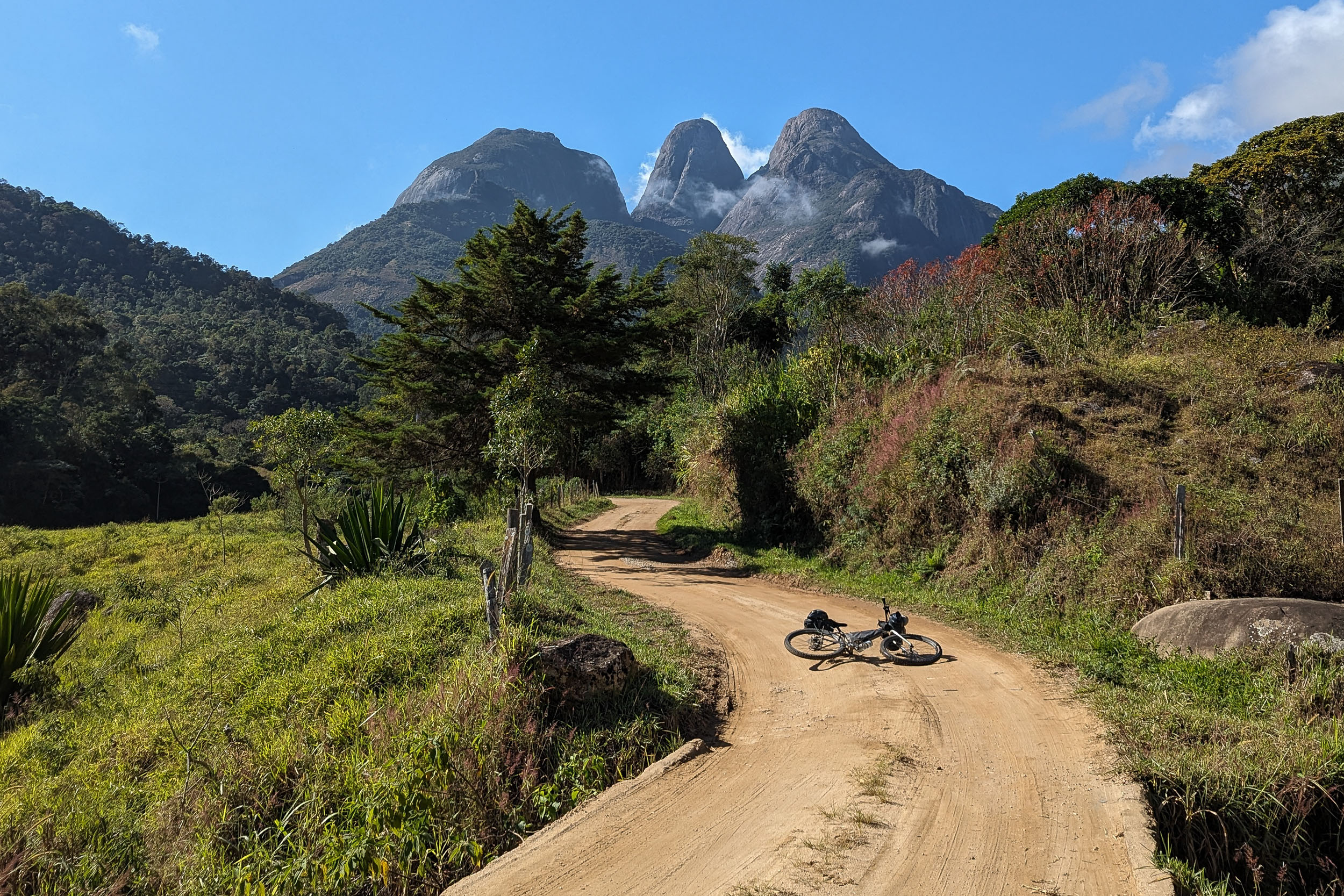
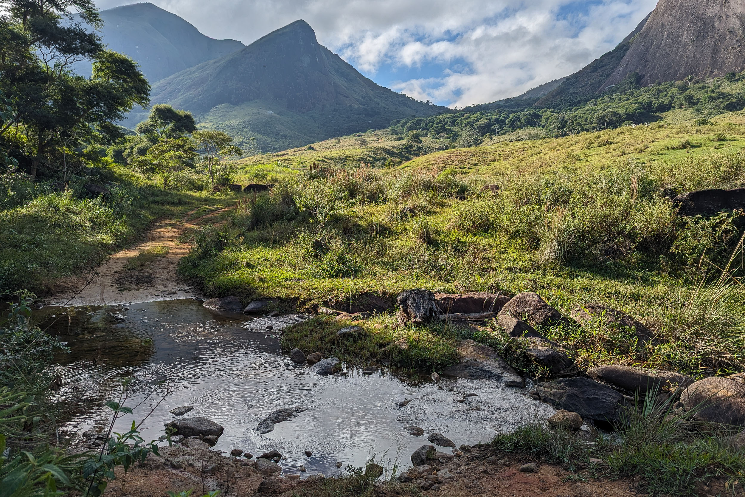
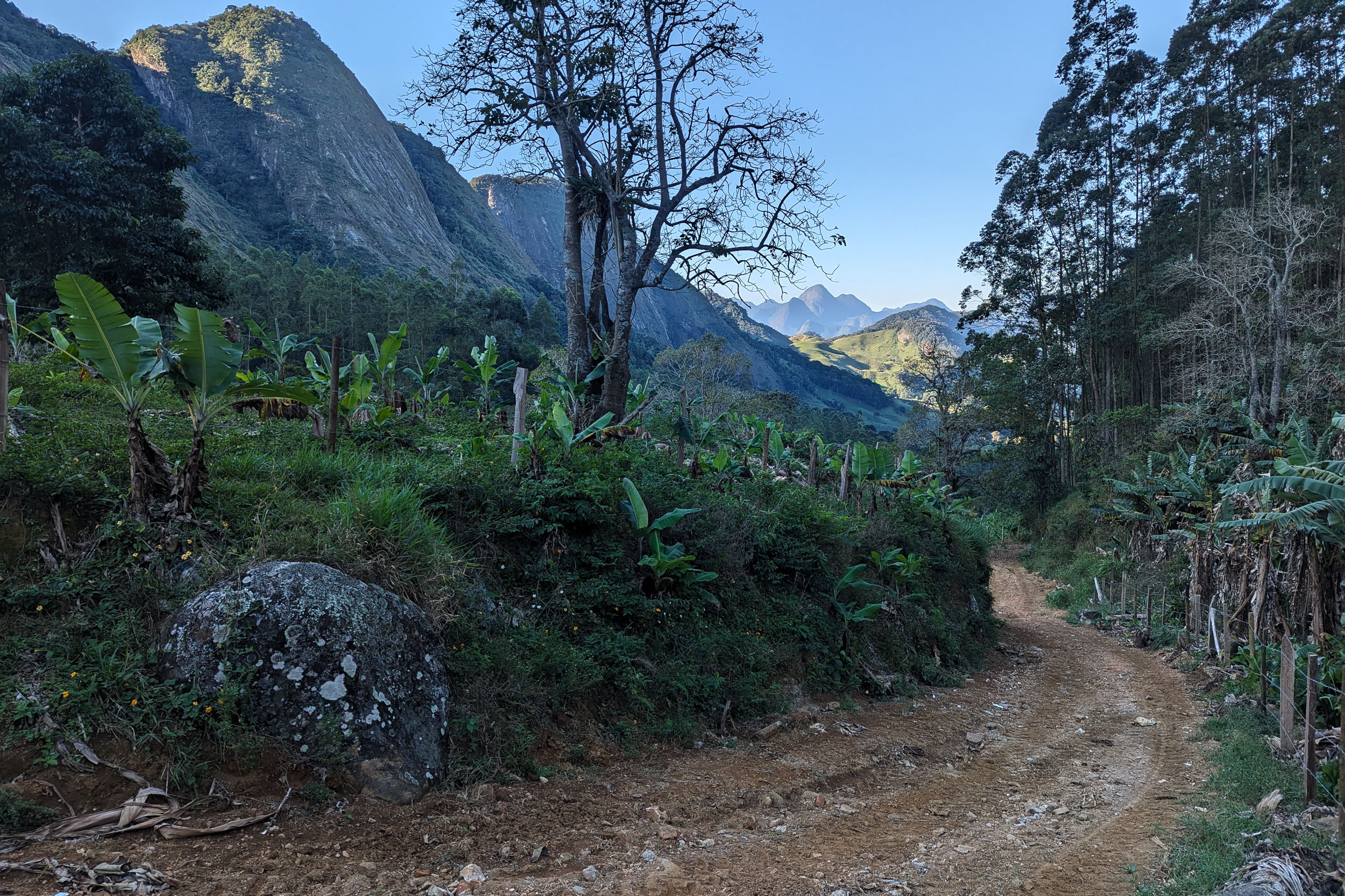
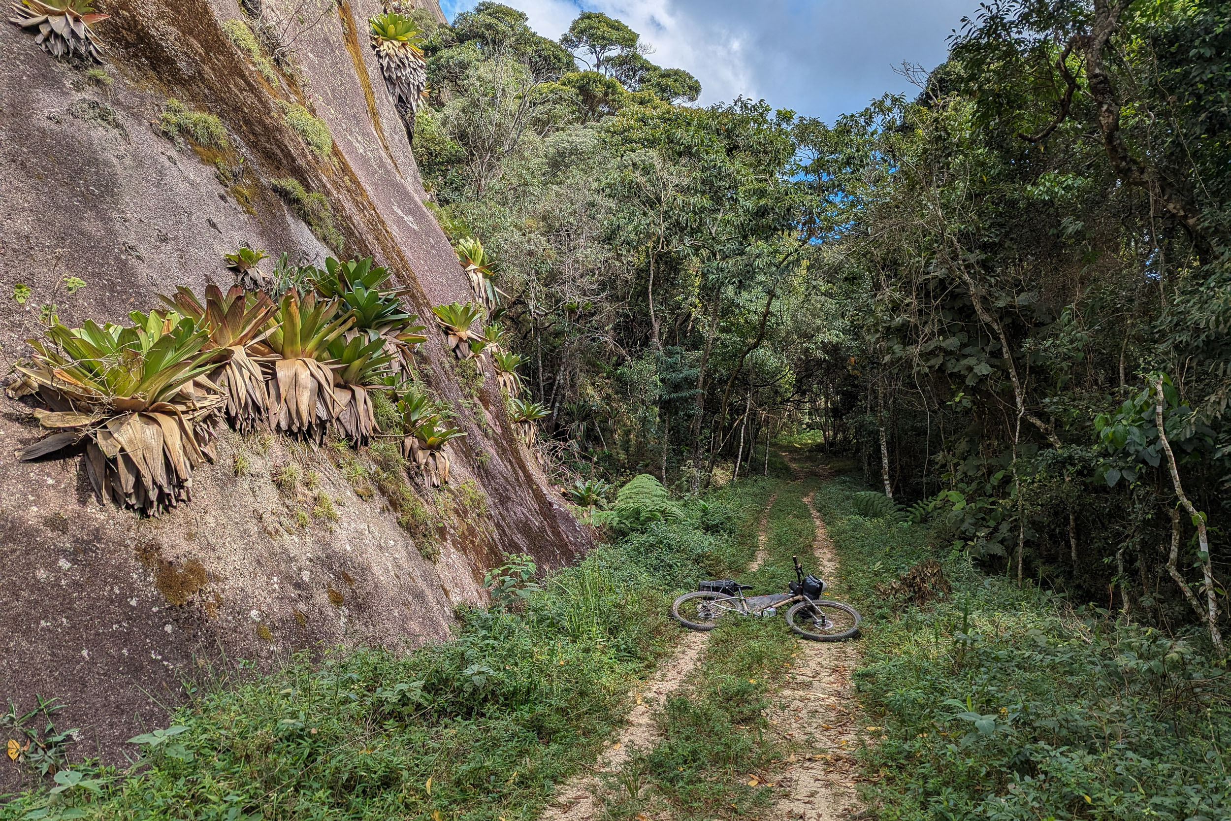
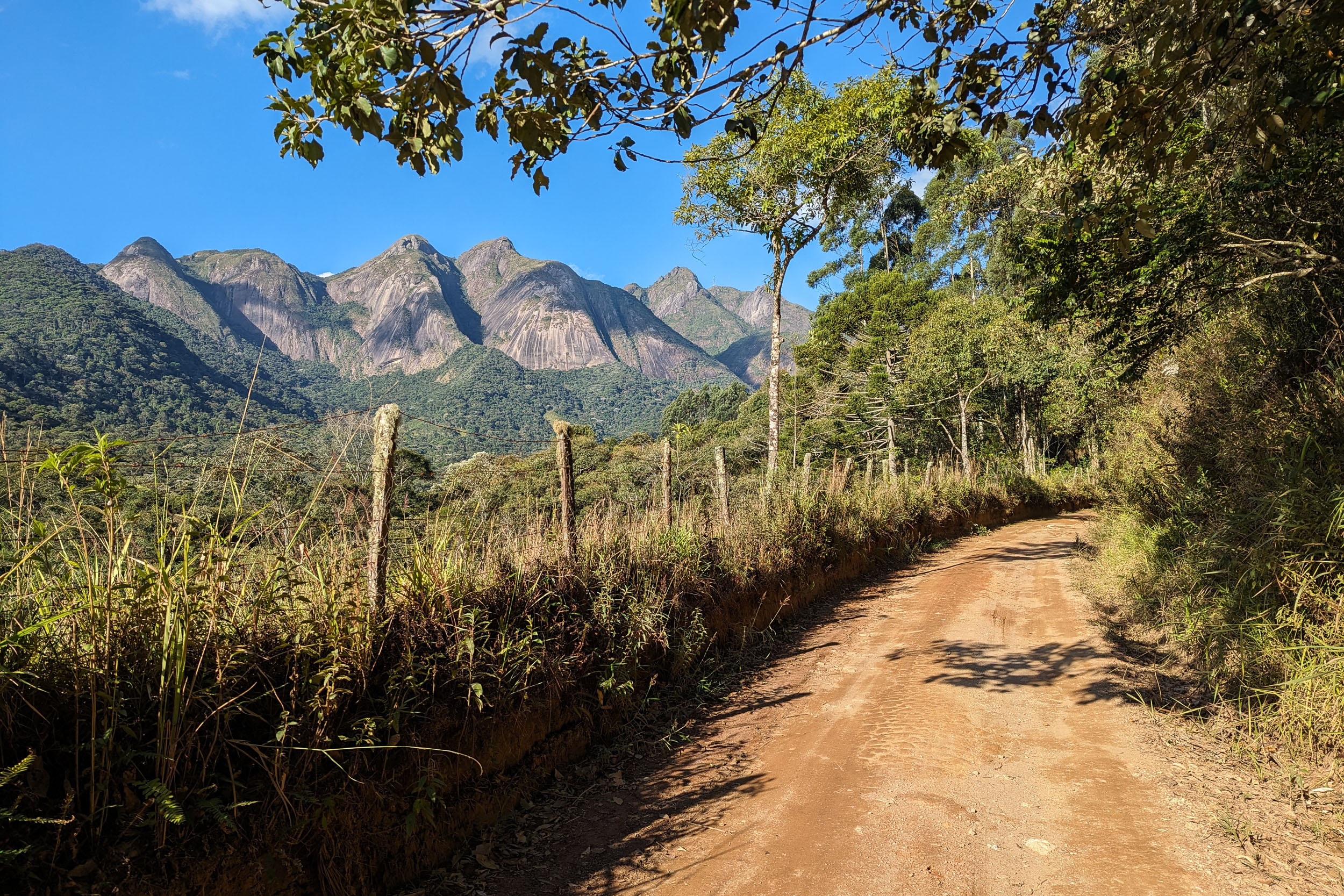
S1 starts in the vicinity of Campos dos Goytacazes and follows the Serra do Mar mountains to end in Petrópolis, the old imperial summer residence near Rio. The most striking features of the landscape are the numerous bornhardts, the tall dome-shaped rock outcrops characteristic of the region. While a lot of the land is now used for farming and grazing, the route repeatedly enters areas of lush forest on the steep flanks of the mountains. The forest at low altitude is tropical, but it changes significantly at higher elevation to look like what is usually seen further south, such as Araucaria trees. After all the climbing, multiple cachoeiras (waterfalls) with natural pools offer an opportunity to relax and cool off.
Protected areas crossed by this segment include a national park and two state parks. While the forest is quite fragmented in Rio de Janeiro, it still hosts a rich biodiversity. One iconic animal endemic to the region is the golden lion tamarin, a small monkey with a bright orange mane. But it is probably easier to spot larger ones like the black capuchin or brown howler monkey. Other emblematic animals that can be observed are multiple toucan species: the channel-billed, red-breasted and toco toucans, the spot-billed and saffron toucanets and the black-necked aracari.
At the time of European arrival, the region was inhabited by the Tupi and a few non-Tupi people, like the Puri and Goytacazes. The latter gave their name to the city near the start of the route. The native population was decimated by infectious diseases and armed conflict brought on by the colonists. But the Indigenous influence has not been limited only to toponyms. It can be seen in many aspects of Brazilian culture, including vocabulary and food. For example, manioc, a native crop, is still a staple of the country’s cuisine. The Portuguese first settled on the coast to exploit brazilwood, which gave the country its name. They then brought African slaves to work on sugar and later coffee plantations. Some escaped slavery and founded communities known as quilombos, such as the ones near the Desengano State Park and in the Rio metropolitan area.
The discovery of gold and diamonds in what is today Minas Gerais reoriented the economy in the late colonial era. The Caminho Novo was built to link the mines with the port of Rio de Janeiro. The bike route follows a short section of this historical path south of Petrópolis. Rio was made the colonial capital and later the home of the Portuguese royal court escaping Napoleon’s troops. Brazil became independent as an empire led by a branch of the Portuguese royal family. The imperial era saw the construction of Petrópolis as a summer residence with opulent palaces. During the late 19th century, the government started promoting large-scale immigration from Europe. A precursor to this policy was the founding of Nova Friburgo by Swiss settlers.
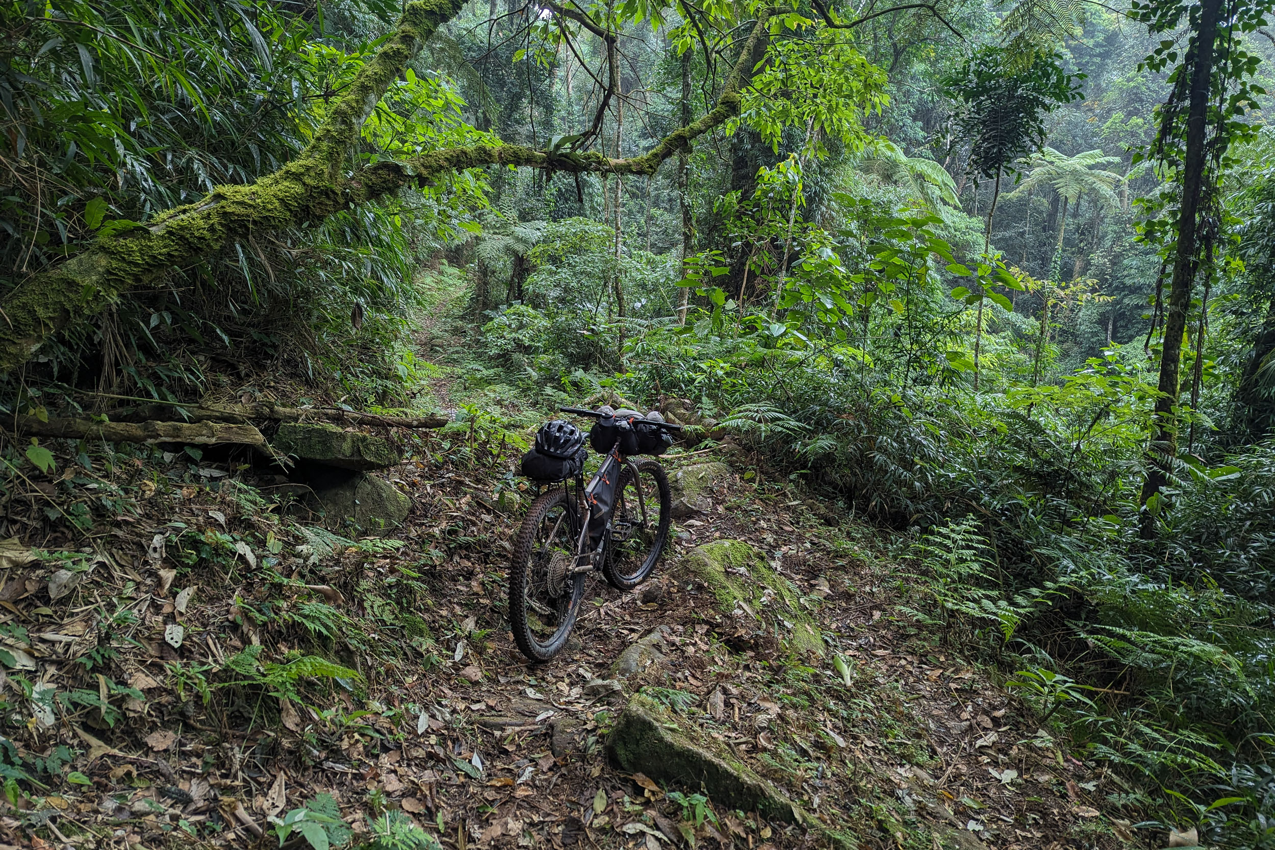
The segment has a few smooth dirt roads. But higher up in the mountains, it uses rough doubletrack and forest singletrack, or paths that blur the line between the two. Parts of the singletrack will require hike-a-bike. It is a nice opportunity to enjoy the surrounding nature at a slow pace, but be prepared for a challenge. There is some pavement, especially closer to Rio to connect with S2. This last section, between Teresópolis and Petrópolis, is optional. Skipping it would increase the unpaved surface percentage to 85%.
Route Difficulty
The elevation gain is extremely high, which makes the segment physically intense, especially combined with potentially hot and humid weather. The doubletrack and singletrack going up the mountains are often rough and steep. They both can be rocky, sandy or muddy. The singletrack can be overgrown or obstructed by fallen trees. In two sections, there are deep ruts that can make even pushing a bike difficult. While never very remote, there are sections of singletrack that see only rare traffic. This is a segment for people who enjoy some type 2 fun.
Logistically, the segment appears easy, with multiple options for resupply and sleeping. However, there are some challenges. While the route’s starting and ending cities are easily reached by buses, boarding those buses will likely require transiting through a larger Brazilian city with a bike (or bike box), which can be daunting. There is some peri-urban riding near Rio, which can be avoided if desired. Campgrounds and rural lodging establishments sometimes expect advanced reservation, which is difficult with sparse cell phone signal and the unpredictability of bike travel.
Route Development
The Mata Atlântica Bike route was inspired by the Caminho da Mata Atlântica, a long-distance trail currently being implemented to link protected remnants of the Atlantic Forest. While the bike route was mainly scouted solo, the team behind the Caminho provided a wealth of useful information, as did many local cyclists. The section of the Caminho northeast of Rio is one of the most well-established, so S1 follows most of it except for a few unbikeable trails. S1 also coincides partly with two preexisting bike routes: the Rota Serra Verde and the Estrada Real.


Submit Route Alert
As the leading creator and publisher of bikepacking routes, BIKEPACKING.com endeavors to maintain, improve, and advocate for our growing network of bikepacking routes all over the world. As such, our editorial team, route creators, and Route Stewards serve as mediators for route improvements and opportunities for connectivity, conservation, and community growth around these routes. To facilitate these efforts, we rely on our Bikepacking Collective and the greater bikepacking community to call attention to critical issues and opportunities that are discovered while riding these routes. If you have a vital issue or opportunity regarding this route that pertains to one of the subjects below, please let us know:
Highlights
Must Know
Camping
Food/H2O
Trail Notes
Resources
- The Desengano State Park‘s peaks and the singletrack in its lush forest
- Santa Maria Madalena and other charming mountain towns
- Stunning bornhardts, as seen from the dirt road north of Trajano de Moraes, for example
- Arraial do Sana‘s waterfalls and the thrilling singletrack descent to get there
- Macaé de Cima‘s quaint charm, its river and its forest trails
- The Cascatinha – São Lourenço traverse, with the tall Pico da Caledônia above and picturesque farmlands below
- The Vale dos Deuses high-altitude campground in the Três Picos State Park
- The Vale dos Frades and its beautiful views of the Três Picos de Friburgo
- Teresópolis, with its viewpoints toward the Serra Órgãos National Park, including the towering granite mountain known as Dedo de Deus (God’s Finger), and the city of Rio in the distance
- The Caminho do Ouro, a historic cobblestone path climbing to Petrópolis, the old imperial summer residence
- Cachoeiras, the numerous waterfalls that dot the route, often with natural pools to relax and cool off
- Tropical wildlife, such as multiple toucan and monkey species
When to go
- May to August is the best time to go (April and September are less optimal but can also work). This is the winter and dry season in the Southeast of Brazil, meaning mild temperatures and low precipitation. The weather is usually pleasant, but the lowlands can still be quite hot, and nighttime temperatures at high altitude can sometimes drop below 5 °C. The rest of the year, it can get uncomfortably hot, and heavy rain can make roads and trails muddy or even impassable. Considering that this segment is already challenging under perfect conditions, it is not recommended during the rainy season.
Logistics
- Traveling by bus with a bike in Brazil is generally easy. Most companies will accept bikes, boxed or not, as long as there is room in the luggage compartment. Some charge a fee, while others do not. However, a few companies do not accept bikes, and it can be hard to find the information online. To get to a bus station in large cities like Rio and São Paulo, it is probably safer and simpler to organize private transport to the station via taxi, shuttle or ridesharing app. For example, UberXL cars will usually fit a boxed bike.
- Near the starting point, Campos dos Goytacazes is connected by bus with Rio and São Paulo. There are multiple departures daily. Campos is a midsize city on a main highway. It has an airport, which only has flights to and from Campinas, not particularly useful for international tourists.
- The starting point at Lagoa de Cima can be reached by bike from Campos in about an hour. There are two options. The one with least traffic is the RJ-158 west and then, from Santa Cruz, the Estrada Lagoa de Cima southwest. If biking from the bus station or south of town, the busy BR-101 south and then the RJ-208 west is more direct. There are a few bike paths in the city, and the roads are flat, making it easy to bike out of town.
- An alternative starting point is São Fidélis further west, a town with bus connection to Rio de Janeiro. This shortens the first stretch of the route north of the Desengano State Park, the only one that has few formal camping and lodging options. For people wanting to extend the route to the north, São Fidélis is also a calmer and more charming place to cross the Paraíba do Sul River than Campos.
- An alternative ending point is Teresópolis, which shortens the route. It has bus connections with Rio de Janeiro and São Paulo. It is a midsize city next to the beautiful Serra dos Órgãos.
- The last section between Teresópolis and Petrópolis is optional. It has some pavement and arduous steep forest singletrack with hike-a-bike. It was chosen to be an adventurous way to link S1 and S2, while staying close to nature. However, this section does skirt the northern edge of the Rio de Janeiro metropolitan area. The region appears almost rural, but some people might prefer to avoid it. For people only riding S1, it is possible to simply end in Teresópolis. For people also wishing to ride S2, one alternative is to follow rural roads north of Teresópolis.
- The ending point, Petrópolis, also has bus connections with Rio de Janeiro and São Paulo. It is a midsize city with a significant heritage from the imperial period.
- Other cities reachable by bus on or near the route are: Santa Maria Madalena, Trajano de Moraes, Casimiro de Abreu and Nova Friburgo.
- The route can be ridden in either direction. It was mapped and scouted from Campos to Petrópolis because ending near the Serra dos Órgãos seemed more climactic, but it does involve more total climbing.
- Protected areas crossed in this segment are free to transit through.
- Maps using OpenStreetMap data are generally the most detailed and accurate. But there are occasional mistakes (such as overgrown trails mislabeled as roads) and omissions (for example, private gated roads not labeled as such). In a few regions, Google Maps is more detailed.
Dangers & Annoyances
- The physical demand of this segment is high. Riders should hydrate well and know their limits.
- Erosion can narrow the singletrack on the flank of mountains and present a risk of fall in a few spots. Keep an eye on the trail and proceed with care.
- Mosquitoes and ticks can transmit diseases. In the dry season, bug pressure is mild. Biting insects tend to be small and it is easy not to notice them even as they bite you. Bring a long-sleeve shirt and full pants. Yellow fever vaccination is recommended as tourists have died from the disease in the past.
- Snakes can be easy to miss in overgrown trails. Be careful where you step. Some species are venomous. Know what to do in case of snake bite.
- Free-ranging dogs are common in rural areas. They bark a lot and sometimes give chase when they see a cyclist. Do not try to outspeed them if it is risky. It is sometimes safer to dismount and put the bike between you and them. Be assertive and pretend to throw something at them, and they will usually let you go.
- Cattle can sometimes block the path. Give them space and do not startle them.
- Livestock gates are common, especially on the northern side of the Desengano State Park. Be careful when opening them as they are often secured with a loop of barbed wire. If found closed, make sure to close them back behind you.
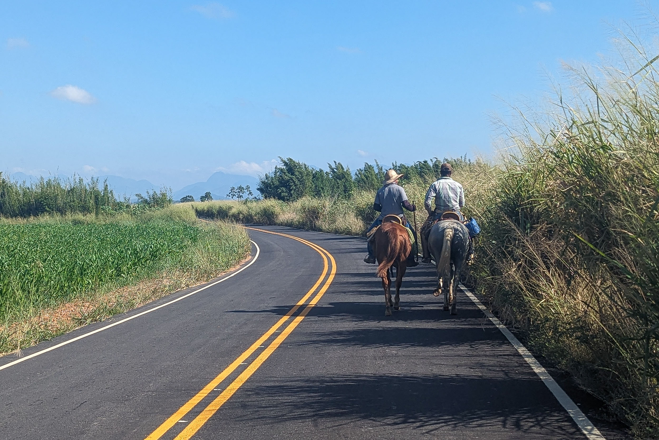
- Cars are rare on most of the route, but there is some unavoidable pavement, sometimes winding and without shoulder. Brazilian drivers often expect to see all kinds of things on rural roads (pedestrians, cyclists, horses, etc.), but as anywhere else, some are careless. Make sure to be visible and cautious.
- Crime is an issue in most large Brazilian cities, but rural areas are usually safer. The main risk for tourists in urban areas is theft and mugging. The route mostly avoids cities, except for a few exceptions. It is quick and easy to get out of Campos dos Goytacazes at the start. The route passes south of Nova Friburgo, but only through the upscale suburb of Cascatinha. If finishing in Teresópolis, it is easy to bike downhill straight to its center coming from the east. However, if heading the opposite way, it might be intimidating for some to have to bike uphill in a Brazilian city they do not know. Teresópolis and Petrópolis are safer than Rio, but the route between the two does skirt the northern edge of the Rio metropolitan area and passes through a tiny favela south of Petrópolis. This section can be omitted or bypassed. If you decide to ride it, stay on the route and make sure to give yourself ample time to finish before night.
What bike?
- A rigid mountain bike or hardtail with 2.2 to 2.6″ tires is the best bike to ride this segment because of all the singletrack and rough doubletrack. Very low gearing (18 gear inches or less) is recommended to minimize hike-a-bike on the steepest climbs. While touring bikes and gravel bikes with narrower tires might work for other segments, they are not appropriate for this one.
- A lightweight setup is needed because of all the climbing and hike-a-bike. This does not require a particularly light bike but rather a minimalist packing list. There is no reason to carry much, the weather is usually benign and resupply options are plentiful.
Language
- Portuguese, in its Brazilian variety (and multiple accents), is almost the only language you will encounter. Learning the basics will prove very useful.
- For Spanish speakers, it is quite easy to learn a lot of Portuguese quickly, considering the similarities. The same goes for other Romance language speakers to a lesser extent. Be careful about trying to speak Spanish to Brazilians. While they can often understand some simple spoken Spanish, it can be laborious and inefficient. There are a few common words that are radically different, and there are some key pronunciation differences. Putting in the work to learn them is highly valuable.
- English speakers are virtually nonexistent except in tourist hubs and large cities.
Money
- The Brazilian real (plural reais, sign $R, code BRL) is the official currency.
- ATMs to withdraw money are found in cities, but they often charge exorbitant fees.
- Credit cards are very commonly accepted by businesses, including some small rural ones. It is a convenient way to pay for things without carrying large amounts of cash.
- Pix, an instant payment platform, was created by the Central Bank of Brazil a few years ago. It became extremely popular, and now a few businesses refuse credit cards (and their high fees). Seamlessly using Pix requires a Brazilian bank account, but workarounds might be possible with apps.
- Money transfer apps can be used for payments that can wait, for example lodging. Owners will often accept to give you the necessary banking information for the transfer. One such app used by some businesses is Wise, but the apps usually work even if the receiver is not registered.
Cell phone
- Mobile phone service is dominated by three providers (Claro, Vivo and Tim).
- Network coverage varies according to the region. Most towns are now covered (sometimes by only one provider), but the signal generally disappears almost as soon as you exit them.
- SIM cards (physical and digital) from one of the three providers can usually only be obtained by people with a CPF, which is a taxpayer identifying number.
- A CPF can be obtained by foreigners through Brazilian embassies and consulates or once in Brazil. This might be worth it for people planning to spend extensive time there.
- International eSIM apps are the simplest but more expensive way to get network access.
- WhatsApp text messaging is usually the way to reach small businesses.
- Instagram is sometimes the only place to find important information about businesses such as campgrounds, as they often lack websites.
- Campgrounds are abundant in the second half of the route, between Arraial do Sana and Petrópolis. They usually have all the services you could want (water, bathrooms with hot showers, electricity, wifi, and often cooking areas). Some of them expect advanced reservation through WhatsApp, which can be difficult to organize with the lack of cell phone signal and the unpredictability of bike travel. They usually cost around R$40 per night per person, with some variation based on amenities. A more remote and rustic campground that is recommended is the free one high up in the Vale dos Deuses of the Três Picos State Park. It should be reserved online one week in advance.
- Wild camping is not common. It is usually forbidden in protected areas. Private land is often clearly delineated by fences. Stealth camping might be challenging, but it is possible for imaginative people, mainly further away from built-up areas. If looking for a place to sleep, you can ask around for recommendations. Owners of small rural businesses (such as bars and restaurants) are often resourceful and used to dealing with strangers. They might let you camp on their land or sleep in a room, for free or for a fee. Otherwise, they might direct you to a good spot. The only section that lacks formal camping or lodging is the northern side of the Desengano State Park. It might require to be creative one night. Another option would be to start in São Fidélis to mostly skip that part.
- Pousadas are small lodging establishments, generally family-run. They are present in almost every town, including crucially three in the first half of this segment, where camping options are rarer: Santa Maria Madalena, Trajano de Moraes and Maria Mendonça. Room prices vary between R$40 and 200 per night, with some in the lower range found in most towns. They usually let you bring your bike into your room. They often include all-you-can-eat breakfast. There are some lodging options in rural areas completely outside of towns, but they often cater to longer stays of groups with advanced reservation. This makes them more expensive and less convenient, especially for solo cyclists. With some planning and starting in São Fidélis, it would be possible to do the whole segment without camping.
- Water sources are common but will need to be treated. There is a lot of grazing, so the water is not always the most appealing.
- Bottled water can be bought from stores daily.
- 2.5 L of carrying capacity is recommended as a minimum. There are plenty of places to replenish, and you can often get away with carrying less. But it is easy to get dehydrated on the steepest most challenging sections, especially midday with the sun, heat and humidity.
- Supermarkets are found in every town. It is rarely needed to carry more than a day of food.
- Restaurants are common in towns but also near some tourist attractions. Along some dirt roads, there are rural bars, often serving snacks.
- Bakeries, such as the Casa do Pão in Santa Maria Madalena, are lively places offering traditional fare, such as pão de queijo (cassava flour cheese bread) or a simple pão na chapa (toasted bread with butter). Their early opening hours are convenient when staying in town. They also often serve sandwiches and other types of lunch. Desserts such as brigadeiros (balls of condensed milk, butter and chocolate) will satisfy sugar cravings.
- All-you-can-eat and pay-by-weight restaurants are common in cities. They are good for hungry cyclists and give the opportunity to try all kinds of new food. One such place for breakfast is the affordable Café Colonial Donna Leda in Arraial do Sana. An option for lunch is the popular Cantinho da Tia Lene on the road to Teresópolis.
- Fancier food options include a trout meal from on-site pisciculture at Arco Iris Trutas west of Nova Friburgo.
- Good snacks for people with a sweet tooth include fresh fruits and cold açaí na tigela. More packable options include bananada and paçoca (candies made from banana and peanut respectively).
- Meat is important in Brazilian cuisine, which might be challenging for vegetarians. However, rice and beans is the mainstay of the diet. It tends to be more flavorful than elsewhere in Latin America, but it is sometimes cooked with meat. It tastes even better when sprinkled with farofa, a toasted cassava flour, which unfortunately also often contains meat.
The time to complete the segment will depend on many factors. Ten days is recommended to enjoy both the riding and the attractions along the way, while sleeping in legal campsites and formal lodging. Someone focused on speed might complete it significantly faster. Another way to shorten the route is to start in São Fidélis and end in Teresópolis, which would remove a lot of pavement too. The route description that follows is subdivided in sections of about 50 km, which do not necessarily represent daily distance. Note that the alternatives proposed here were considered during planning, but they have not all been tested.
This segment contains a good amount of singletrack as it is the only way to spend much time in the Atlantic Forest in this region. It would be possible to avoid singletrack entirely, making the segment less steep, less technical and less difficult. However, it would end up skipping all the forest areas except the ones near the Macaé River.
(Campos dos Goytacazes) – Lagoa de Cima – Colégio River
This section is the only one where you might not find formal lodging or camping for a night, it can be shortened by starting the route in São Fidélis. To bike from Campos to Lagoa de Cima, the option with least traffic is the RJ-158 west and then, from Santa Cruz, the Estrada Lagoa de Cima southwest. If biking from the bus station or south of town, the busy BR-101 south and then the RJ-208 west is more direct. From Lagoa de Cima to Morangaba, the route is simple. The peaks of the Desengano state parks are stunning seen from below. Southwest of Morangaba, the route goes up a steep mountain, uses singletrack, crosses the Bela Joana River and then goes down to the Colégio River.
The last technical section can be avoided by instead heading northwest of Morangaba and then southwest to rejoin the route on the Colégio River south of São Fidélis.
Colégio River – Desengano State Park – Santa Maria Madalena
The route follows the Colégio River and then goes up toward the Desengano State Park. The north side of the park is beautiful, but the roads can be rough and steep. The park offers no formal lodging or camping option. However, Rony Nunes, who lives at one of the park entrances, works with tourists and can let you sleep or camp on his property if contacted in advance (+55 22 99933-3904). It is a detour uphill to get there, but it is worth it for the scenic surroundings, below a monolithic mountain and among fruit trees. The route then penetrates the lush forest, with some singletrack near the Estalagem Morumbeca. There are nice viewpoints and a few cachoeiras before descending to the charming mountain town of Santa Maria Madalena, with multiple lodging options.
The singletrack can be avoided and the climbing decreased by following the Colégio River west and then taking the RJ-146 south to rejoin the route past the Cachoeira do Escorrega.
Santa Maria Madalena – Trajano de Moraes – Maria Mendonça
The dirt road leaving Santa Maria Madalena is quite scenic with views of mountains and bornhardts. As the route approaches Trajano, it transforms into rough doubletrack and then overgrown forest singletrack. There are lodging options in Trajano. From there, the route passes through agricultural lands. It is straightforward and follows non-technical dirt roads. The Cachoeira de Sodrelândia makes for a possible short side trip. The route arrives in Maria Mendonça, an agricultural town with the affordable Pousada Knupp.
The singletrack north of Trajano can be avoided by taking the road through Doutor Loréti instead.
Maria Mendonça – Arraial do Sana – Galdinópolis
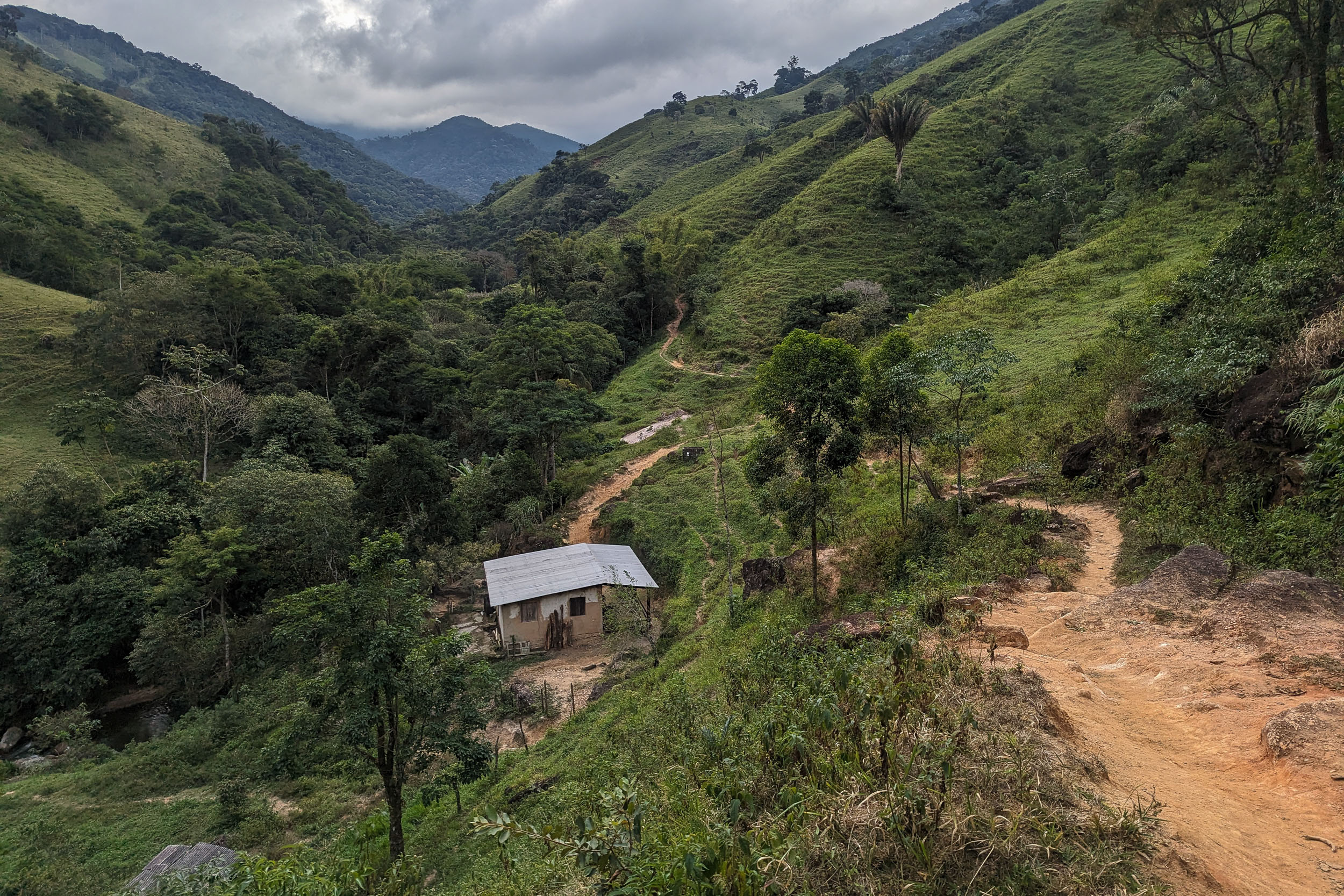
The route follows a dirt road from Maria Mendonça to Tirol. It climbs to reach the RPPN Shangri-lá, a private nature reserve in a nice setting where it is possible to spend the night. Afterward, there is a thrilling doubletrack and singletrack descent through the forest to Arraial do Sana. There are a few streams to cross on the way. Arraial do Sana is a low-key touristy town with access to many waterfalls and campgrounds. There is then a series of steep but non-technical dirt roads, and some unavoidable pavement. The Macaé River is crossed by bridge multiple times, including where it meets with the Bonito River. There are two campgrounds right before the rural area of Galdinópolis.
To avoid the singletrack near Sana, it is possible to skip the town completely and instead take the road from Tirol to Lumiar and then rejoin the route in Galdinópolis.
Galdinópolis – Macaé de Cima – Cascatinha (Nova Friburgo)
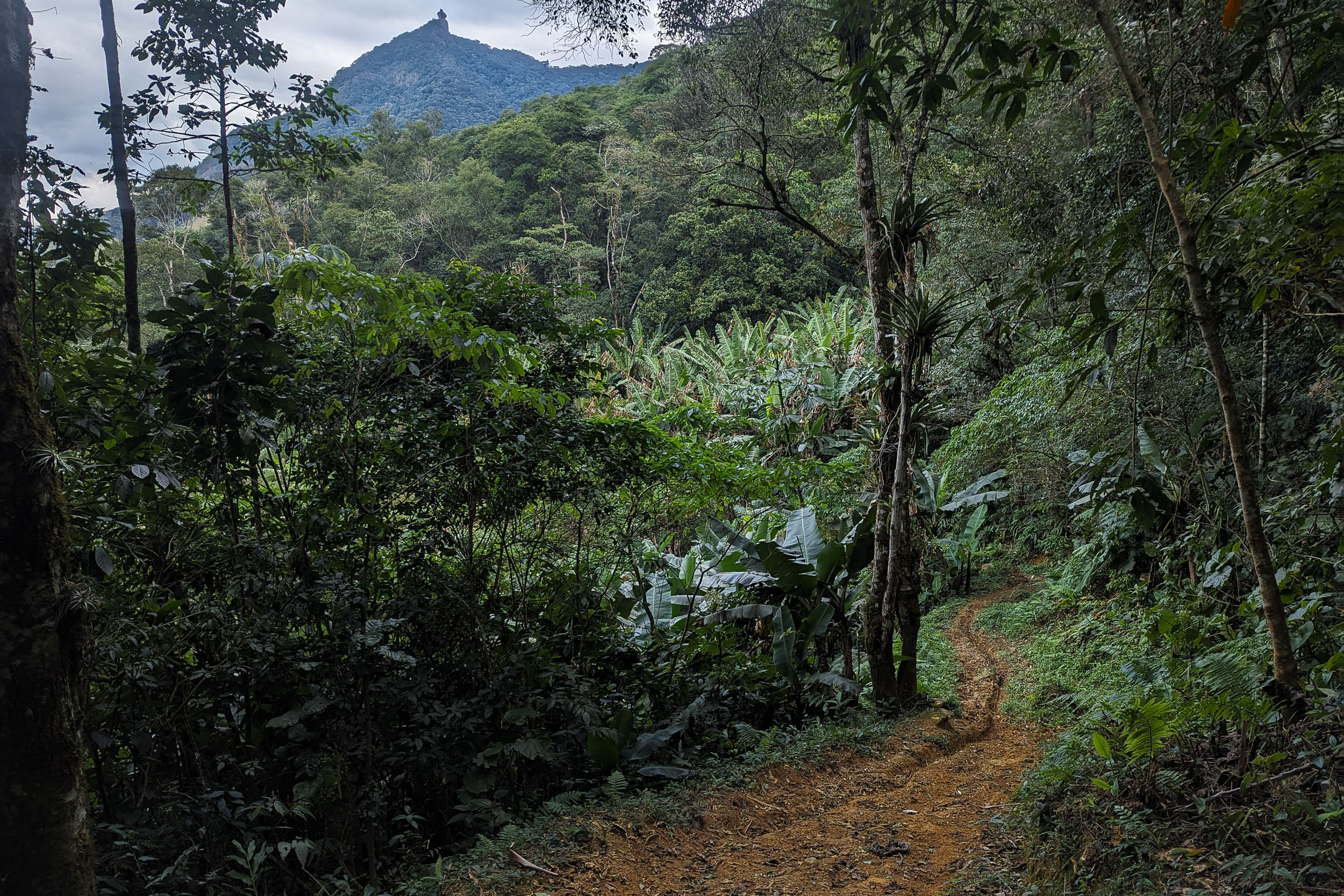
The region west of Galdinópolis around the Macaé River is one of the few in this segment where roads themselves go inside the forest (and not just the singletrack). The route veers southwest toward the quaint region of Macaé de Cima, with a few lodging options and river access with lush vegetation. Rough doubletrack then leads up a mountain, followed by an overgrown forest singletrack descent to Theodoro de Oliveira. Nearby Debossan, which has a campground, is the start of a 2-kilometer forest trail to the upscale suburb of Cascatinha. But despite being short, this singletrack is possibly the most grueling of the route. It is steep with narrow and deep ruts that make even pushing a bike very difficult, especially alone. The top is overgrown and requires some bushwhacking. Cascatinha has lodging options and two nearby campgrounds. The Camping Pico da Caledônia is known for its sunrise and as a base camp to hike up its eponymous mountain.
It is possible to skip all the singletrack by not veering southwest to Macaé de Cima (and Thedoro), and instead staying on the road west straight toward Debossan. One can then take the road north to the center of Nova Friburgo, before coming back south to Cascatinha. The detour in the city adds distance and pavement, but might end up being faster than the tough singletrack.
Cascatinha – São Lourenço – Vale dos Deuses (Três Picos State Park)
From Cascatinha, a trail descends west to São Lourenço. It used to be narrow and muddy, with a dangerously eroded edge at one spot. It has been considerably widened in 2024 and is much easier now. Breaks in vegetation give viewpoints of the picturesque farmlands below. Traversing the farmlands is fast as they are one of the few rare flat sections. This leads to the foot of the impressive Três Picos de Friburgo mountains, where there are numerous refuges, often offering food and camping. The route enters the Três Picos State Park via doubletrack to reach its highest altitude, more than 1,700 m. There is a campground here in the idyllic and aptly named Vale dos Deuses (Valley of the Gods), nested between the Três Picos and other photogenic mountains. There are also hiking trails and viewpoints nearby. The campground is free, but it should be reserved online one week in advance.
Vale dos Deuses – Vale dos Frades – Teresópolis
The route descends via a grassy path that blurs the line between doubletrack and singletrack. It eventually morphs into a dirt road, which offers beautiful views looking back at the Três Picos it comes from. The mountains, almost in every direction, appear like walls. The route follows the Rio dos Frades to the Cachoeira dos Frades and its picturesque surroundings. There is a campground nearby. The route then takes a bit of pavement and some easy singletrack in Jacarandá. There are some nice views of the Serra dos Órgãos. The trail ends in the city of Teresópolis, where there is lodging and a campground.
Teresópolis – Guapimirim – Petrópolis
This segment is optional and only for adventurous riders. A highway with a wide shoulder goes around Teresópolis to the Mirante do Soberbo. The lookout offers great views of the Dedo de Deus (God’s Finger), a towering granite mountain in the Serra dos Órgãos. The route uses forest singletrack to go down to the Cachoeira da Concórdia and then Guapimirim, where there are campgrounds and lodging. There is then a challenging singletrack section with narrow and deep ruts to Santo Aleixo. It will require significant hike-a-bike. Afterward, the route takes flat roads at the northern edge of the Rio de Janeiro metropolitan area, which appears almost rural. A detour to the Cachoeira Grande is possible. Finally, an 800-meter climb on a historic cobblestone path, the Caminho do Ouro, leads to Petrópolis, the old imperial summer residence. This will also require hike-a-bike.
One alternative to get to Petrópolis while avoiding the Rio metropolitan area is to take rural roads west of the Vale dos Frades that bypass Teresópolis and then go to Itaipava.
To get to S2 while avoiding urban areas completely, it is possible to bypass both Teresópolis and Petrópolis by staying north of them and then veering south to rejoin the route near the Vale das Videiras.
Loops
For people wishing to ride a short loop based on part of this segment, there are multiple options. A loop of the scenic dirt roads around the Desengano State Park would be a fun off-the-beaten-path adventure. Another option would be the Rota Serra Verde loop between Teresópolis and Nova Friburgo to take in some of this segment’s most impressive sights.
Additional Resources
- The Caminho da Mata Atlântica‘s official website and map can be useful, especially for this segment, which follows the Caminho closely. Reach out to them if you plan to hike or bike part of the route.
- Julieta Santamaria, from Argentina, is the first and only person to complete a thru-hike of the Caminho (2024-2025). She has documented her journey on Instagram and has shared maps of her hike on Wikiloc, which sometimes differed from the official map.
- The Rota Serra Verde is a bike touring loop between Teresópolis and Nova Friburgo (with a connector to Petrópolis), which coincides with part of S1. Their website has maps, and their Instagram provides updates on trail conditions.
- The Camping Vale dos Deuses in the Três Picos State Park is beautiful and free, but it requires reserving online one week in advance.
- The Serra dos Órgãos National Park has multiple campgrounds, including near Teresópolis and Guapimirim. Its website has information and a form to reserve a camp spot.
- The Estrada Real is a multimodal tourist route composed of different historic roads, linking the coast with Minas Gerais and its mineral riches. Part of its Caminho Novo coincides with S1 in Petrópolis.


Terms of Use: As with each bikepacking route guide published on BIKEPACKING.com, should you choose to cycle this route, do so at your own risk. Prior to setting out check current local weather, conditions, and land/road closures. While riding, obey all public and private land use restrictions and rules, carry proper safety and navigational equipment, and of course, follow the #leavenotrace guidelines. The information found herein is simply a planning resource to be used as a point of inspiration in conjunction with your own due-diligence. In spite of the fact that this route, associated GPS track (GPX and maps), and all route guidelines were prepared under diligent research by the specified contributor and/or contributors, the accuracy of such and judgement of the author is not guaranteed. BIKEPACKING.com LLC, its partners, associates, and contributors are in no way liable for personal injury, damage to personal property, or any other such situation that might happen to individual riders cycling or following this route.
Further Riding and Reading
Here are some connected/nearby routes and related reports...


Please keep the conversation civil, constructive, and inclusive, or your comment will be removed.