


Mata Atlantica Bike Route (S2): Bocaina
Distance
466 Mi.
(750 KM)Days
15
% Unpaved
73%
% Singletrack
2%
% Rideable (time)
98%
Total Ascent
55,160'
(16,813 M)High Point
5,591'
(1,704 M)Difficulty (1-10)
7?
- 8Climbing Scale Strenuous118 FT/MI (22 M/KM)
- 7Technical Difficulty Difficult
- 8Physical Demand Difficult
- 6Resupply & Logistics Moderate
Contributed By

Alex Gauthier
Guest Contributor
Alex cycled exclusively for commuting in his hometown of Montreal until discovering bikepacking. To combine this new hobby with his lifelong passion for Latin America, he created the Mata Atlântica Bike Route in Brazil. He shares his travels on Instagram @alex.g.526.
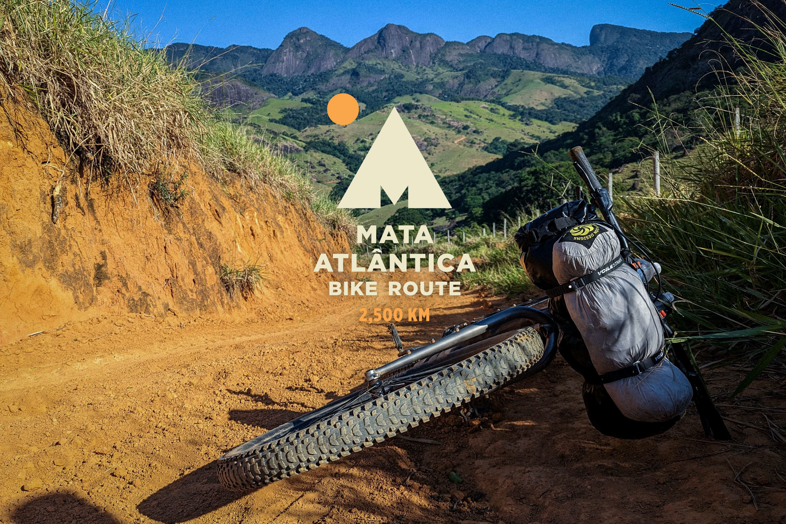
The Mata Atlântica Bike Route (MABR) stretches over 2,500 kilometers from Rio de Janeiro to Rio Grande do Sul, tracing mostly unpaved roads and paths through five Brazilian states. Inspired by the Caminho da Mata Atlântica long-distance trail, it follows the Serra do Mar mountains, connecting protected remnants of the Atlantic Forest—one of the world’s most biodiverse regions—while passing through landscapes of tropical forests, canyons, plateaus, and beaches. Along the way, riders encounter traditional communities, historic towns, and a mosaic of cultures, with opportunities to spot iconic wildlife and experience the region’s incredible natural beauty. Find all the segments here.
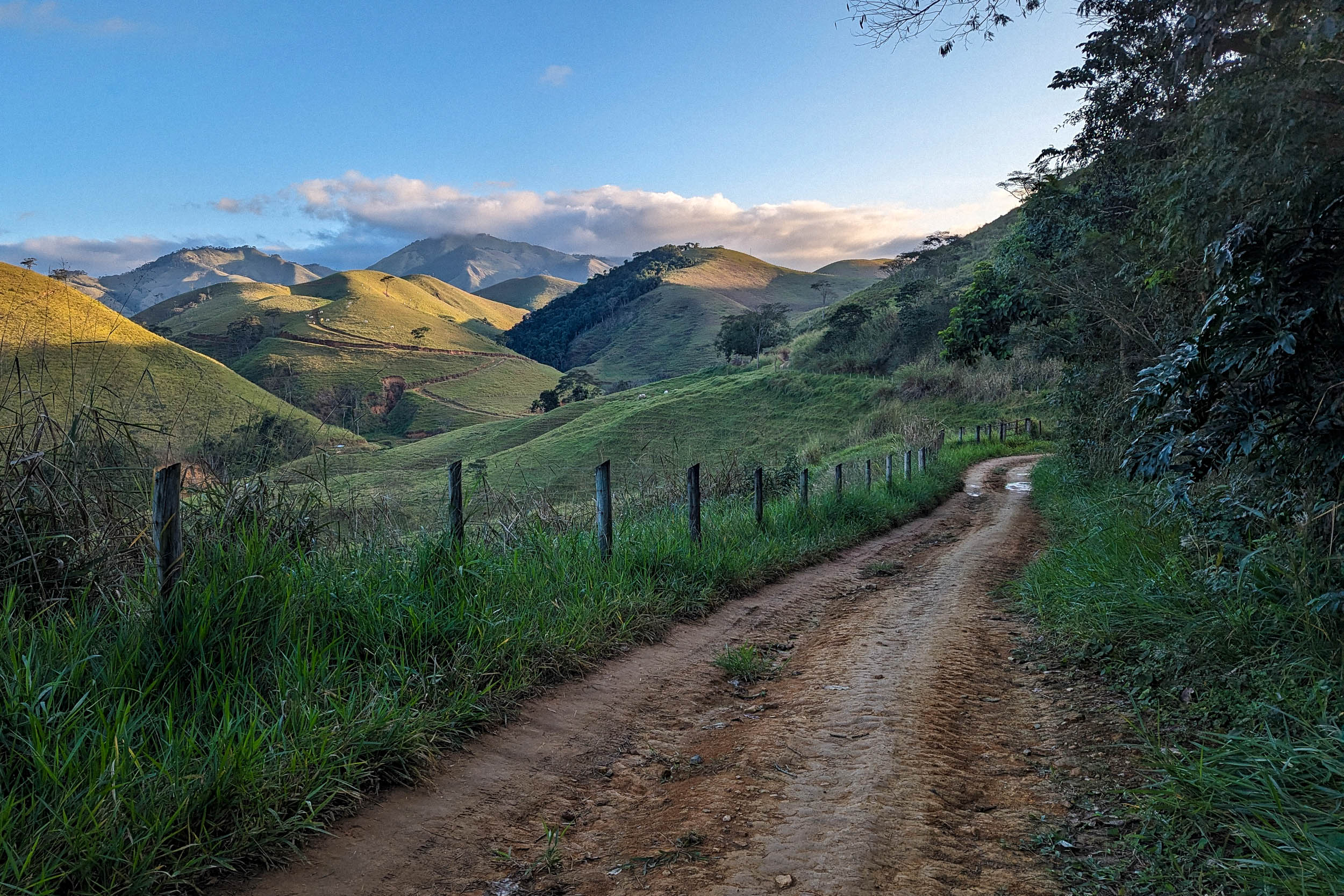
The segment starts in Petrópolis, the old imperial summer residence near Rio. It makes its way west through the mountainous rural hinterland. The landscape is initially marked by pastures and remnants of the Atlantic Forest, which grow larger as the route enters the remote Serra da Bocaina, notable for its impressive waterfalls. After reaching its highest altitude, the route plunges toward the sea to reach Paraty, a gorgeous historic town. It then follows the idyllic beaches of the Costa Verde, with the emerald mountains of the Serra do Mar as a backdrop. It climbs inland in the state of São Paulo, crossing logging areas and protected forests on the way to the capital. The landscapes vary according to altitude, from steamy tropical forest by the sea to grasslands with Araucaria trees in the mountains.
Protected areas crossed by this segment include a national park and a state park. Despite the proximity of big population centers, the rugged landscape of the Serra do Mar has shielded large expanses of forest from human encroachment between Rio and São Paulo. The region is still highly biodiverse, especially in terms of birds. Birdwatching lodges facilitate the observation of multiple species, including endemic ones: toucans, parrots, hummingbirds, and many more. Wildlife can also be spotted directly from the road, where you might race against a capybara, or spot a tapir if you’re lucky. Even in the streets of Paraty, the common marmoset, a diminutive monkey and invasive species, can be seen playing on the city’s power cables and replacing the local buffy-tufted marmoset.
When Europeans first arrived, the coast was inhabited by speakers of Tupi-Guarani languages, such as the Tupinambás and Tupiniquins, and non-Tupi people, such as the Guaianás. The Indigenous people became intertwined in conflicts between themselves, against the Portuguese newcomers, and against the French, who were briefly present in Rio de Janeiro. Some groups formed the Tamoio Confederation to resist the Portuguese. The combination of violence and infectious diseases dramatically reduced the native population. For a while, a Tupi creole known as lingua geral was widely spoken as a lingua franca in the colony.
Today, Guarani communities are found in the foothills of the Serra do Mar, including some near Paraty and São Paulo. While the latter remained a small city during the colonial era, it served as the base for settlers known as bandeirantes to launch expeditions deep inland in search of slaves and precious minerals. They often had children with Indigenous women, and many bandeirantes were themselves of mixed origins. The people living in the interior of São Paulo and neighboring regions came to be referred to as caipiras. The term caipira is used today to refer to the traditional culture that is still strong in rural areas like the ones around Cunha. African slaves were brought to work on sugar and later coffee plantations. Some escaped slavery and founded communities known as quilombos, such as the ones between Paraty and Ubatuba.
The bandeirantes eventually found gold and diamonds in what is today Minas Gerais. The Caminho Velho was built to link the mines with the port of Paraty. The bike route follows a section of this historical path. After independence, coffee became the main export and source of wealth. The government encouraged large-scale immigration from Europe and Asia to increase the rural workforce. The city of São Paulo became an industrial hub and magnet for immigrants, including those from less prosperous parts of the country, like the northeast. It grew to be the city with the largest population and economy in South America. Railroads were built, such as the one passing through Paranapiacaba to link São Paulo with the port of Santos and international markets. The region also started manufacturing goods, like the utilitarian Monark single-speed bikes still commonly seen in the countryside. However, Caloi mountain bikes made in the Amazon are more popular nowadays.
The segment mainly uses dirt roads, some smooth and wide, others rough and steep. There are a few singletrack sections, generally short and easy. There is also some pavement, mainly along the incredibly scenic coast. The coastal detour can be replaced by an inland alternative to shorten the route and increase the unpaved percentage to 83% (see Trail Notes tab).
Route Difficulty
The elevation gain is high, which makes the segment physically demanding, especially combined with potentially hot and humid weather. While some of the dirt roads are smooth, especially near São Paulo, others are challenging, mostly in the Serra da Bocaina, where the doubletrack can be steep, rocky, and sandy. There is also one infamous muddy section there. While usually short and easy, some of the singletrack can be a bit muddy and overgrown.
There are multiple options for resupply and sleeping along most of the route. However, the Serra da Bocaina roads are quite remote, with a long stretch without towns and only a few rural pousadas. While the route’s starting point, Petrópolis, is easily reached by bus, getting there will likely require transiting through a larger Brazilian city with a bike (or bike box), which can be daunting. From the ending point, it is possible to reach the center of São Paulo by bike or commuter train, but it is probably safer with private transport. Campgrounds and rural lodging establishments sometimes expect advanced reservations, which is difficult with sparse cell phone signal and the unpredictability of bike travel.
Route Development
The Mata Atlântica Bike route was inspired by the Caminho da Mata Atlântica, a long-distance trail currently being implemented to link protected remnants of the Atlantic Forest. While the bike route was mainly scouted solo, the team behind the Caminho provided a wealth of useful information, as did many local cyclists. The section of the Caminho between Rio and São Paulo contains quite a lot of unbikeable trails and some pavement, so S2 diverges from it significantly and ends up being shorter and more direct. Some highlights had to be excluded (Rio, Ilha Grande, Ilhabela), while others are still part of the route (Serra da Bocaina, Paraty, Costa Verde). S2 coincides partly with multiple preexisting bike routes: the Estrada Real, the Travessia Estrada do Rio Pardo Limeira, the The Caminho do Sal and the Rota Márcia Prado.


Submit Route Alert
As the leading creator and publisher of bikepacking routes, BIKEPACKING.com endeavors to maintain, improve, and advocate for our growing network of bikepacking routes all over the world. As such, our editorial team, route creators, and Route Stewards serve as mediators for route improvements and opportunities for connectivity, conservation, and community growth around these routes. To facilitate these efforts, we rely on our Bikepacking Collective and the greater bikepacking community to call attention to critical issues and opportunities that are discovered while riding these routes. If you have a vital issue or opportunity regarding this route that pertains to one of the subjects below, please let us know:
Highlights
Must Know
Camping
Food/H2O
Trail Notes
Resources
- The Caminho do Imperador, a road through the Atlantic Forest above Petrópolis, with views of Rio in the distance
- Dirt roads through pastures and bits of forest singletrack between Miguel Pereira and Lídice
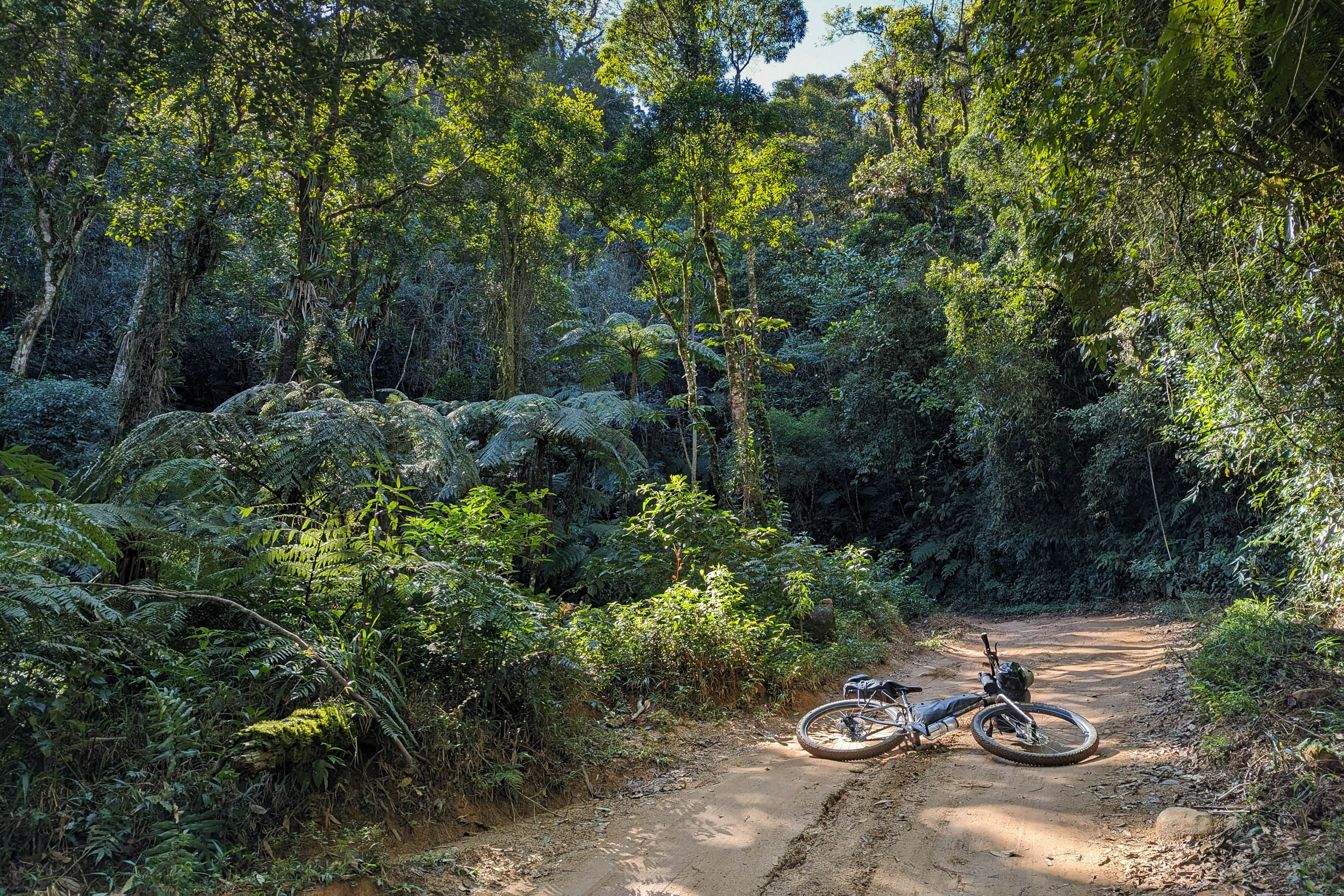
- The Estação Ecológica Bananal, with its cachoeiras, lush vegetation and mossy trails
- The Caminho de Mambucaba, also known as Trilha do Ouro, a rough doubletrack path surrounded by forest and impressive waterfalls
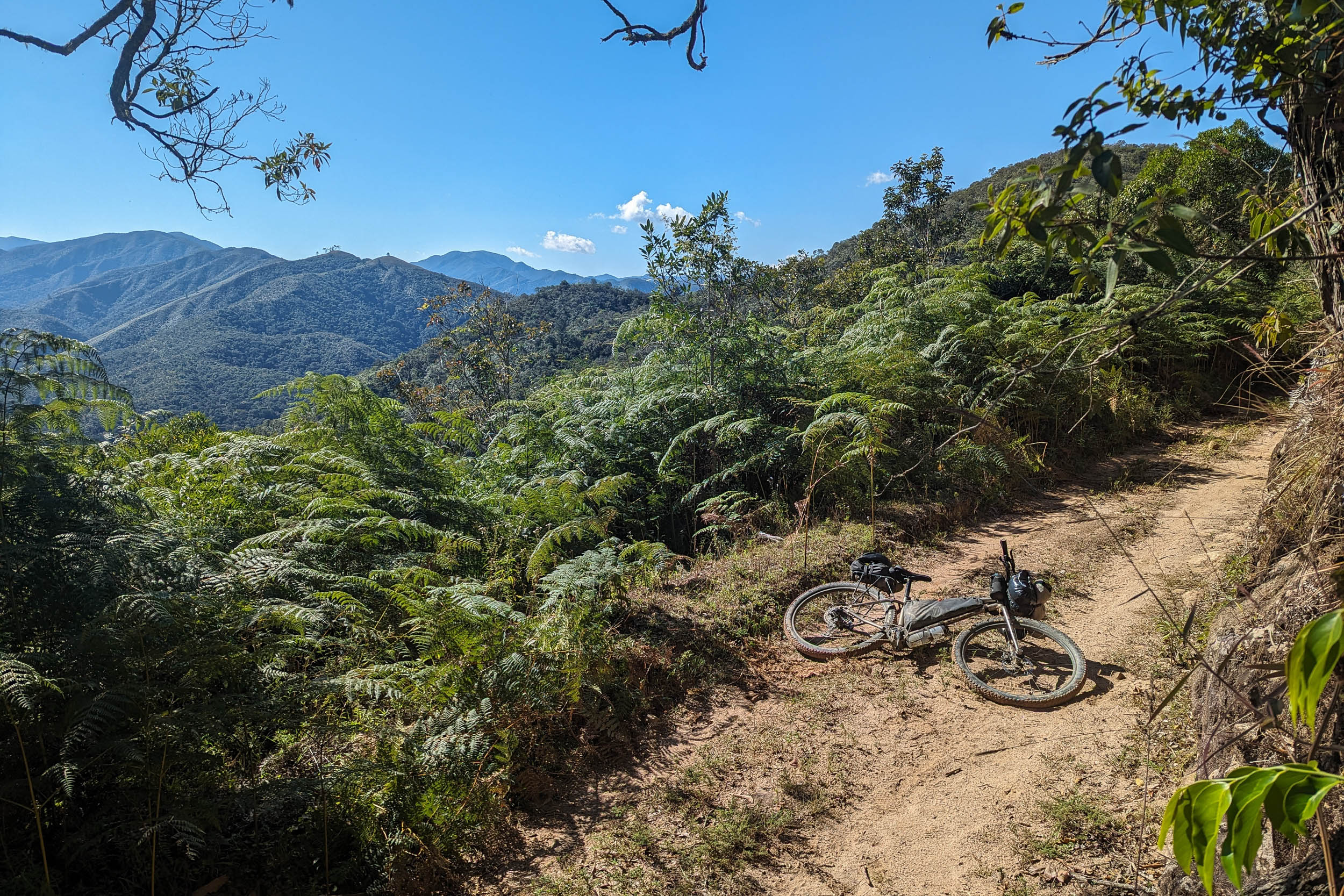
- The Serra da Bocaina‘s high-altitude grasslands with 360° views going as far north as the Serra da Mantiqueira
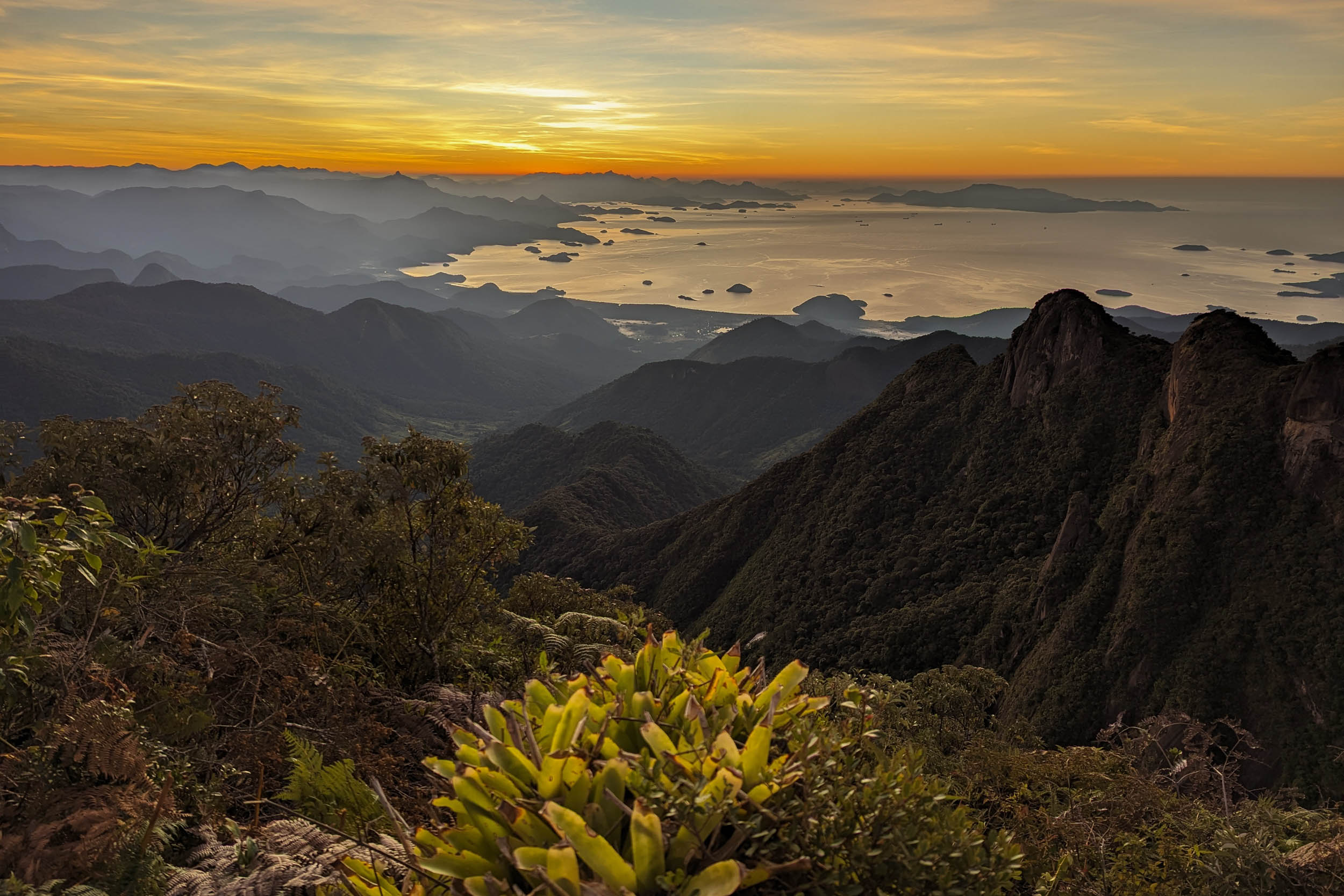
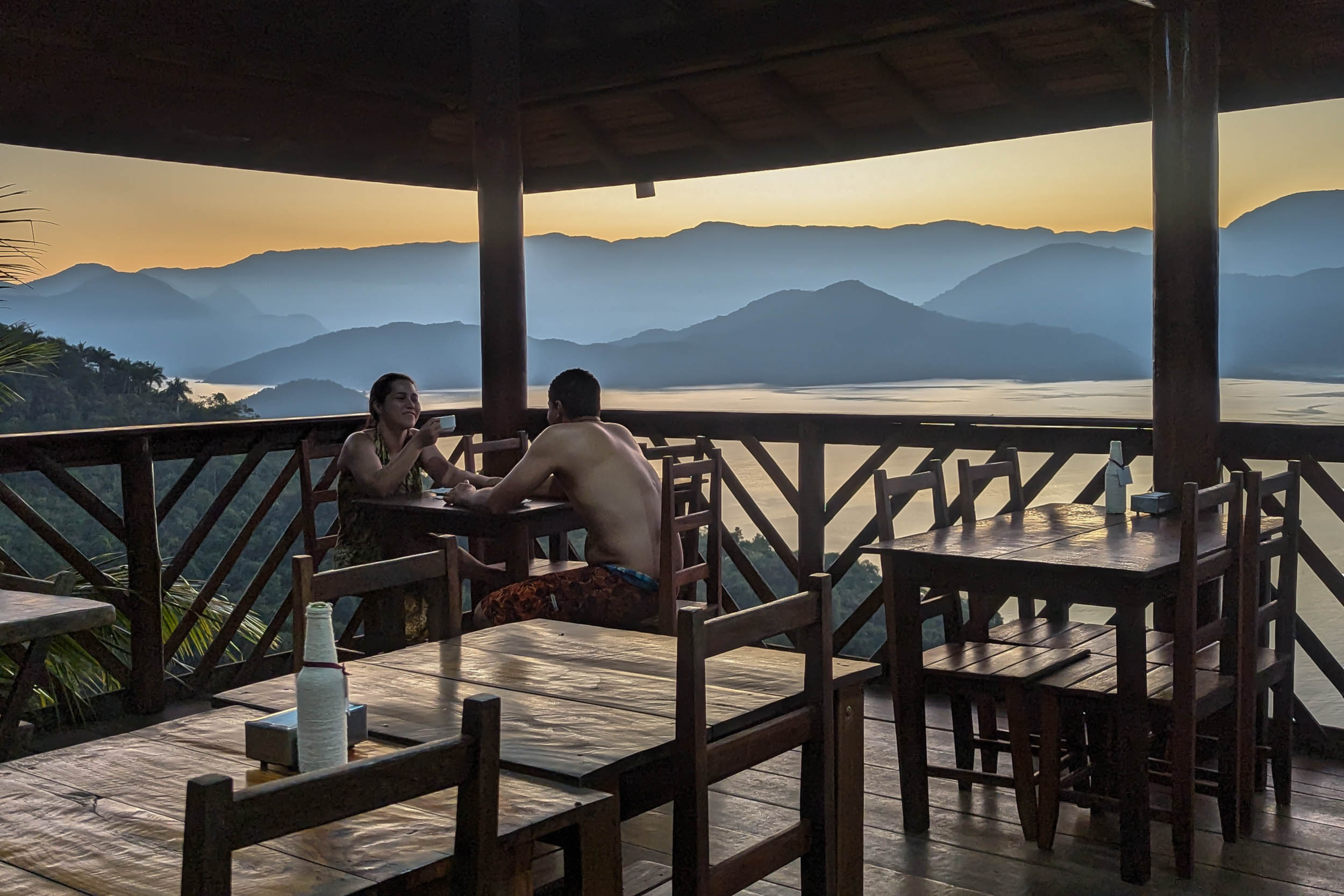
- The Pedra da Macela‘s campground to catch the sunrise over the bay of Paraty
- A thrilling 1500-meter descent to the sea through the Serra da Bocaina National Park
- Paraty‘s historic center, with its picturesque cobblestone streets and well-preserved architecture
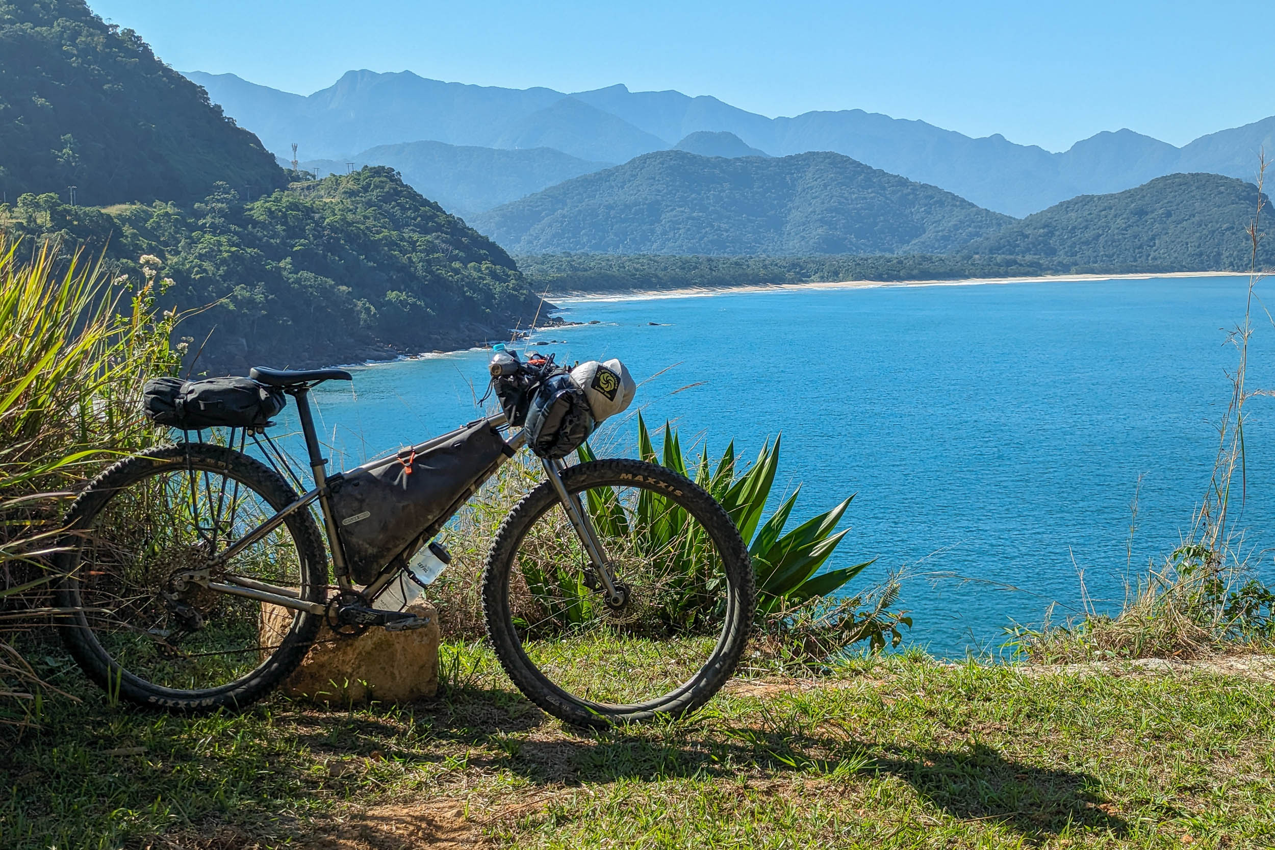
- The Costa Verde‘s beaches and their campgrounds, with the green mountains of the Serra do Mar as a backdrop
- The Serra do Mar‘s logging roads and protected areas east of São Paulo
- Paranapiacaba, a historic company town of the British São Paulo Railway, nested incongruously in the forest southeast of the city
- Wildlife that can be spotted in birdwatching lodges or on the road itself, where you can race against capybaras and, if lucky, spot a tapir
When to go
- May to August is the best time to go (April and September are less optimal but can also work). This is the winter and dry season in the Southeast of Brazil, meaning mild temperatures and low precipitation. The weather is usually pleasant, but the lowlands can still be quite hot, and nighttime temperatures at high altitude can sometimes drop below 5 °C. The rest of the year, it can get uncomfortably hot, and heavy rain can make roads and trails muddy or even impassable. Ubatuba, on the coast of São Paulo, is nicknamed Ubachuva for its abundant rainfall (chuva meaning rain). Touring in the rainy season is still possible, but it might be wiser to avoid the remote tracks of the Serra da Bocaina.
Logistics
- Traveling by bus with a bike in Brazil is generally easy. Most companies will accept bikes, boxed or not, as long as there is room in the luggage compartment. Some charge a fee, while others do not. However, a few companies do not accept bikes, and it can be hard to find the information online. To get to a bus station in large cities like Rio and São Paulo, it is probably safer and simpler to organize private transport to the station via taxi, shuttle or ridesharing app. For example, UberXL cars will usually fit a boxed bike.
- The starting point, Petrópolis, is connected by bus to Rio de Janeiro, São Paulo and other cities. It is quite simple to bike out of town, but it is uphill.
- The ending point near São Paulo is the Sítio Curucutu private reserve (+55 11 99971-3644). It was chosen as a nice place to spend the night in the forest between Segments 2 and 3. For people wishing to enter the city, the Márcia Prado bike route passes nearby and goes to the Zona Oeste via the Rio Pinheiros bike path. Another option to enter the city is to take the commuter train from Rio Grande da Serra near Paranapiacaba. It accepts bikes outside of rush hour. Mogi das Cruzes further east has a commuter train station too, but it also has intercity buses to Rio and São Paulo. To avoid cycling through São Paulo’s gigantic car-centric sprawl, it might be wiser to organize private transport instead. Bike do Polo (+55 11 99812-0497) is a bike tour operator offering this service. But if doing so, there is not much point in ending at the Sítio Curucutu. To avoid the urban cycling in Riacho Grande, it might be better instead to end the route in Paranapiacaba or the Caminhos do Mar park.
- Other cities reachable by bus on or near the route are: Miguel Pereira, Piraí, Lídice, Bananal, Cunha, Paraty and Ubatuba.
- The route can be ridden in either direction. It was mapped and scouted from Rio to São Paulo for two reasons. Visiting the beaches after the challenging Serra da Bocaina felt like a nice reward, and the massive 1500-meter elevation difference between the Serra and Paraty seemed more fun as a descent than as a climb.
- Protected areas crossed in this segment are free to transit through. But to spend the night legally at one of the two pousadas within the Serra da Bocaina National Park’s borders, it is necessary to send an email to the park three days in advance.
- Maps using OpenStreetMap data are generally the most detailed and accurate. But there are occasional mistakes (such as overgrown trails mislabeled as roads) and omissions (for example, private gated roads not labeled as such). In a few regions, Google Maps is more detailed. This is the case for the dirt roads around Campos de Cunha.
Dangers & Annoyances
- Mosquitoes and ticks can transmit diseases. In the dry season, bug pressure is mild. Biting insects tend to be small and it is easy not to notice them even as they bite you. Bring a long-sleeve shirt and full pants. Yellow fever vaccination is recommended as tourists have died from the disease in the past.
- Snakes can be easy to miss in overgrown trails. Be careful where you step. Some species are venomous. Know what to do in case of snake bite.
- Free-ranging dogs are common in rural areas. They bark a lot and sometimes give chase when they see a cyclist. Do not try to outspeed them if it is risky. It is sometimes safer to dismount and put the bike between you and them. Be assertive and pretend to throw something at them, and they will usually let you go.
- Cattle can sometimes block the path. Give them space and do not startle them.
- Livestock gates are common west of Rio and in the Serra da Bocaina. Be careful when opening them as they are often secured with a loop of barbed wire. If found closed, make sure to close them back behind you.
- Cars are rare on most of the route, but there is some unavoidable pavement, sometimes winding and without shoulder. Brazilian drivers often expect to see all kinds of things on rural roads (pedestrians, cyclists, horses, etc.), but as anywhere else, some are careless. Make sure to be visible and cautious. To avoid traffic on the paved roads along the touristy coast, it might be good to time your riding to occur on weekday mornings outside of holidays.
- Crime is an issue in most large Brazilian cities, but rural areas are usually safer. The main risk for tourists in urban areas is theft and mugging. The route mostly avoids cities, except for a few exceptions. Petrópolis is safer than Rio. Biking out of the city is straightforward but uphill. There is a small favela along the Fazenda Inglesa Road. It can be avoided by riding along the highway instead. Paraty is very touristy, but there have been crimes, including violent ones, against tourists there. Stay aware of your surroundings while enjoying the town. Ubatuba is supposedly safer, and it is bike-friendly, but still be on your guard. Biking into the city of São Paulo is not recommended except with a group.
What bike?
- A rigid mountain bike or all-terrain bike with 2.2 to 2.6″ tires is the best bike to ride this segment. Low gearing and wide tires are needed because of the steep and sometimes rough surfaces. Suspension is generally not needed, but a hardtail with fast-rolling tires could also work. Touring bikes and gravel bikes with narrower tires could work for a large percentage of the route, especially near São Paulo and on the coast, but would feel insufficient in the Serra da Bocaina between Lídice and Campos de Cunha.
- A lightweight setup is recommended because of all the climbing. This does not require a particularly light bike, but instead packing a minimal amount of gear. There is no reason to carry much, the weather is rather benign and resupply options are plentiful.
Travel basics
Language
- Portuguese, in its Brazilian variety (and multiple accents), is almost the only language you will encounter. Learning the basics will prove very useful.
- For Spanish speakers, it is quite easy to learn a lot of Portuguese quickly, considering the similarities. The same goes for other Romance language speakers to a lesser extent. Be careful about trying to speak Spanish to Brazilians. While they can often understand some simple spoken Spanish, it can be laborious and inefficient. There are a few common words that are radically different, and there are some key pronunciation differences. Putting in the work to learn them is highly valuable.
- English speakers are virtually nonexistent except in tourist hubs and large cities.
Money
- The Brazilian real (plural reais, sign $R, code BRL) is the official currency.
- ATMs to withdraw money are found in cities, but they often charge exorbitant fees.
- Credit cards are very commonly accepted by businesses, including some small rural ones. It is a convenient way to pay for things without carrying large amounts of cash.
- Pix, an instant payment platform, was created by the Central Bank of Brazil a few years ago. It became extremely popular, and now a few businesses refuse credit cards (and their high fees). Seamlessly using Pix requires a Brazilian bank account, but workarounds might be possible with apps.
- Money transfer apps can be used for payments that can wait, for example lodging. Owners will often accept to give you the necessary banking information for the transfer. One such app used by some businesses is Wise, but the apps usually work even if the receiver is not registered.
Cell phone
- Mobile phone service is dominated by three providers (Claro, Vivo and Tim).
- Network coverage varies according to the region. Most towns are now covered (sometimes by only one provider), but the signal generally disappears almost as soon as you exit them.
- SIM cards (physical and digital) from one of the three providers can usually only be obtained by people with a CPF, which is a taxpayer identifying number.
- A CPF can be obtained by foreigners through Brazilian embassies and consulates or once in Brazil. This might be worth it for people planning to spend extensive time there.
- International eSIM apps are the simplest but more expensive way to get network access.
- WhatsApp text messaging is usually the way to reach small businesses.
- Instagram is sometimes the only place to find important information about businesses such as campgrounds, as they often lack websites.
- Campgrounds are abundant in the Serra da Bocaina, on the coast and near São Paulo. Most have all the services you could want (water, bathrooms with hot showers, electricity, wifi, and often cooking areas). Some of them expect advanced reservation through WhatsApp, which can be difficult to organize with the lack of cell phone signal and the unpredictability of bike travel. They usually cost around R$40 per night per person, with some variation based on amenities. Some rural pousadas have camping areas, especially in the Serra da Bocaina. One recommended campground is at the Pedra da Macela. It is free, requires no reservations, and is a beautiful spot to watch the sunrise over the bay of Paraty. Spending a night camping on one of the beaches is also recommended.
- Wild camping is not common. It is usually forbidden in protected areas. Private land is often clearly delineated by fences. Stealth camping might be challenging, but it is possible for imaginative people, mainly further away from built-up areas. If looking for a place to sleep, you can ask around for recommendations. Owners of small rural businesses (such as bars and restaurants) are often resourceful and used to dealing with strangers. They might let you camp on their land or sleep in a room, for free or for a fee. Otherwise, they might direct you to a good spot. Between Ubatuba and Salesópolis, formal camping and lodging options are a bit limited. However, there is a lot of logging and it is not too hard to find a spot for stealth camping along a side path.
- Pousadas are small lodging establishments, generally family-run. They are present in almost every town, including many from Miguel Pereira to Lídice, where camping options are rarer. Room prices vary between R$40 and 200 per night, with some in the lower range found in most towns. They usually let you bring your bike into your room. They often include all-you-can-eat breakfast. There are some lodging options in rural areas completely outside of towns, but they often cater to longer stays of groups with advanced reservation. This makes them more expensive and less convenient, especially for solo cyclists. With some planning, it would be possible to do the whole segment without camping.
- Water sources are common but will need to be treated. There is a lot of grazing, so the water is not always the most appealing.
- Bottled water can be bought from stores almost daily.
- 2.5 L of carrying capacity is recommended. Even if there are plenty of places to replenish, it is easy to get dehydrated in the steepest most challenging sections, especially with the sun, heat and humidity.
- Supermarkets are found in every town. It is rarely needed to carry more than a day of food. The longest stretch without supermarket is the 140 km between Lídice and Campos de Cunha, but there are rural pousadas and restaurants where buying food might be possible.
- Restaurants are common in towns but also near some tourist attractions. Along some dirt roads, there are rural bars, often serving snacks. Rural pousadas can often serve traditional food of the roça (countryside), sometimes obtained from their own farm.
- Bakeries are lively places offering traditional fare and opening early, which is convenient when sleeping in town.
- All-you-can-eat and pay-by-weight restaurants are common in cities. They are good for hungry cyclists and give the opportunity to try all kinds of new food.
- Good snacks for people with a sweet tooth include fresh fruits and cold açaí na tigela. More packable options include bananada and paçoca (candies made from banana and peanut respectively).
- Meat is important in Brazilian cuisine, which might be challenging for vegetarians. However, rice and beans is the mainstay of the diet. It tends to be more flavorful than elsewhere in Latin America, but it is sometimes cooked with meat. It tastes even better when sprinkled with farofa, a toasted cassava flour, which unfortunately also often contains meat.
This is a proposed 15-day itinerary, which allows for time off the bike to enjoy Paraty, the Costa Verde’s beaches and other attractions along the way. Note that the alternatives proposed here were considered during planning, but they have not all been tested.
location Petrópolis – Sacra Família do Tinguá
Day 1 (63.3 km +1,259 m)
The route climbs out of Petrópolis via the Fazenda Inglesa Road and then takes the Caminho do Imperador dirt road west through the Atlantic Forest. Between the trees, the city of Rio and its famous landmarks can be seen in the distance. South of Miguel Pereira, the route follows an abandoned train track that transforms into easy singletrack, with nice views of the surrounding mountains. It then takes the paved RJ-121 for a few kilometers. There are pousadas in Miguel Pereira, Morro Azul and Sacra Família. There are two campgrounds past Sacra Família.
To decrease the pavement by 4 km, it is possible to do a detour south via Arcádia, which adds some climbing. Do not be tempted by the singletrack along the Santana River going to Arcádia, it is very overgrown.
location Sacra Família do Tinguá – Piraí
Day 2 (60.8 km +1,235 m)
The route follows dirt roads and easy singletrack west to join the paved RJ-127. There is a trail in the Curió Municipal Park to bypass that road, but it was closed as of 2024. In Paracambi, it is possible to check out the large brick building of the IFRJ in front of the park’s forest. Going further west, dirt roads lead to another section of singletrack, mostly easy. It transits through a private property that lets cyclists through. Past the singletrack, the route joins the paved RJ-145 for a few kilometers toward Piraí, where there is lodging.
If access to the singletrack near Paracambi is restricted in the future, it might be possible to do a detour south through Cacaria, which would require some cycling along the highway.
Near Piraí, there is a collapsed bridge to the north of the route and a submerged land bridge to the south that, if repaired, could provide alternatives to mostly avoid the RJ-145.
location Piraí – Lídice
Day 3 (58.8 km +1,318 m)
The route passes through pastures to reach Passa Três, on the old Rio – São Paulo road. It then passes next to the São João Marcos Archeological and Environmental Park, which contains the ruins of a town destroyed for the construction of a dam. The views of the nearby reservoir and surrounding mountains are great. Afterward, the route veers west to arrive in Lídice, where lodging is available.
location Lídice – Estação Ecológica Bananal
Day 4 (31.4 km +1,226 m)
From Lídice starts the most technically and physically challenging portion of this segment. It is also the most remote, with the next supermarket being 140 km away in Campos de Cunha, but some pousadas along the way can sell food. The route ascends toward the Serra da Bocaina. It enters the state of São Paulo over the Rio do Braço. The road transforms into rough doubletrack that turns very muddy for 6 km, a place nicknamed “Hotel Lameiro”. Hike-a-bike will be necessary to avoid the deepest mud. The route crosses a large secluded clearing where wild camping might be possible. It then enters the lush forest of the Estação Ecológica Bananal. The mossy trail to the Cachoeira Sete Quedas is recommended. It is possible to spend the night at the nearby Refúgio da Onça. One can also continue west, where a paved climb leads to a few pousadas and two campgrounds near the Bracuí River.
In the rainy season, it might be wiser to avoid the remote and sometimes technical roads of the Serra da Bocaina. One alternative would be to follow the coastal highway between Angra dos Reis and Paraty. Another would be to take the main roads to the north passing through Bananal and São José do Barreiro.
location Estação Ecológica Bananal – Serra da Bocaina National Park
Day 5 (65.7 km +2540 m)
A hiking side trip can be done to the Cachoeira do Bracuí, a series of waterfalls with a view of the ocean. The route goes west through the pastures of the Sertão da Onça to reach the Serra da Bocaina National Park. There are pousadas and camping options both outside and within the park.
location Serra da Bocaina National Park – Campos de Cunha
Day 6 (43.5 km +986 m)
The route follows the Caminho de Mambucaba. The doubletrack can be rough and steep, but the views of the forest and the surrounding mountains make it worth it. There are multiple waterfalls along the way that can be visited, including the Cachoeira das Posses, where wild camping is tolerated for now. A detour south to visit the impressive Cachoeira dos Veados is also possible. The route exits the park through its northern gate. There are two nearby campgrounds/pousadas. To the west, there are unfenced grasslands where wild camping might be possible. They offer 360° views of the surrounding mountains, going as far north as the Serra da Mantiqueira, especially beautiful at sunset. If it is still early, it is possible to continue to Campos de Cunha through steep and sometimes sandy dirt roads. The town has no formal lodging option, but there is a boteco run by Ivone, which sells pastéis until late at night and where it might be possible to rent an affordable room.
location Campos de Cunha – Pedra da Macela
Day 7 (48.8 km +1,618 m)
Rural roads, sometimes very steep, traverses the pastures south of Campos de Cunha. The Cachoeira do Pimenta is a possible spot for a break. Camping at the Pedra da Macela is recommended for a great view of the sunrise over the bay of Paraty. The campground is free and requires no reservation. During the week, it is possible to sleep at the base of the mountains and do a short hike to the summit at dawn. People are allowed to sleep on the summit itself on Friday and Saturday nights.
To shorten the route and avoid the pavement of the coast, one alternative is to stay inland, bike to Cunha, then Catuçaba, and finally rejoin the road north of Ubatuba.
location Pedra da Macela – Paraty
Day 8 (23.6 km +1,09 m)
Near the Pedra da Macela, the route crosses back into the state of Rio de Janeiro to begin its 1500-meter descent to the sea. The road on the way down is mostly paved with setts. Most of the descent is through protected forest within the Serra da Bocaina National Park. There are a few viewpoints along the way. Traffic is usually mild, but it is a touristy place, so it might be better to ride on a weekday outside of holidays. Toward the end, one can stop for a slide at the Cachoeira do Tobogã. It is worth spending some time exploring Paraty’s cobblestone streets and its architecture. There are campgrounds and multiple lodging options. The beach north of the center is a nice spot for sunrise.
location Paraty – Praia da Fazenda
Day 9 (37.5 km +561 m)
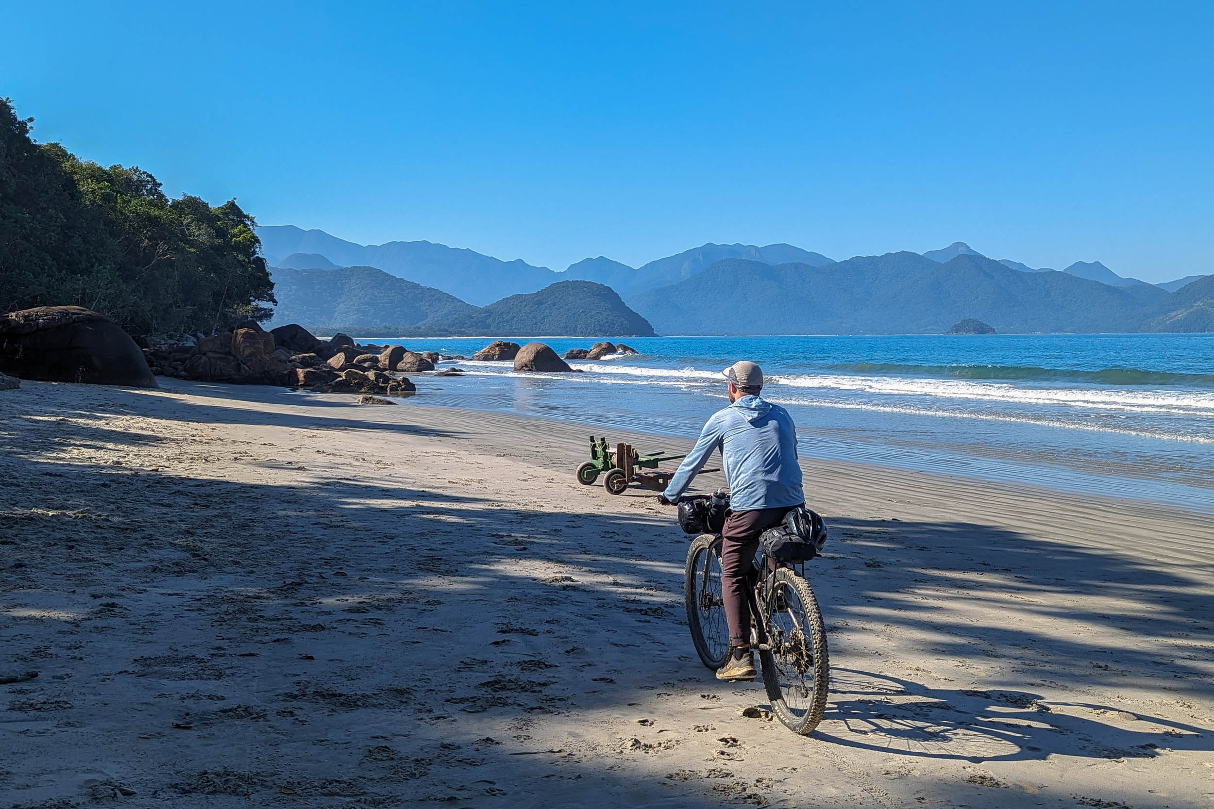
The route out of Paraty alternates between the main paved coastal road (with a good shoulder) and adjacent dirt roads. It passes close to the Guarani Parati-Mirim Indigenous Land and then through the Quilombo do Campinho, a community founded by freed slaves. Both offer community-based tourism. A detour to Trinidade, a famous beach with large boulders, can be done. The route then reenters the state of São Paulo. The laid-back beach of Camburi can be visited. It has restaurants and campgrounds. The route then passes on the Fazenda Beach, a long protected stretch of sand within the Serra do Mar State Park. At the end, there is a campground, the Camping Caracol. A bit after, there is a beautiful viewpoint for sunset at the Mirante da Chica restaurant. The next beach, Ubatumirim, also has a few campgrounds.
location Praia da Fazenda – Ubatuba
Day 10 (38.6 km +692 m)
Past Ubatumirim the route passes through two beaches, with optional detours to others. The views of the green Serra do Mar in the background are beautiful. After a short inland segment, the touristy city of Ubatuba is reached. It has campgrounds and multiple lodging options. There are many bike paths on its flat streets and cyclists are common.
location Ubatuba – Vargem Grande
Day 11 (44.4 km +1,572 m)
The Oswaldo Cruz paved road climbs the Serra do Mar above Ubatuba. It is an 800-meter climb with many hairpin turns. It is within the territory of the state park, so it is surrounded by greenery. Traffic is sometimes mild, but it can increase with tourist influx. Weekday mornings outside of holidays are probably the best time for cycling the road. At the top, a dirt road exits the park after passing one of its lodges. The nearby Pousada Oikos is popular for birdwatching. The route then heads west to cross the Paraibuna River and reach Vargem Grande, a small town with lodging and camping.
An alternative to climb the serra would be to do it from Caraguatatuba further west along the coast, where there is a dirt road through the Serra do Mar State Park called the Estrada Rio Pardo Limeira (or Petrobrás). Access is restricted and it needs to be reserved online. It is usually cycled in the opposite direction, downhill from west to east. Unfortunately, only groups of three or more are allowed. It would also add quite a bit of pavement to get there.
location Vargem Grande – Rodovia dos Tamoios
Day 12 (60.3 km +1,107 m)
Dirt roads lead to the town of Bairro Alto. There is a campground on the other side of the Paraibuna reservoir accessible by ferry. Further west, the route reaches the Tamoios Highway. Right before, there is a state park lodge and a pousada. After 7km of riding on the highway’s wide shoulder, the route takes dirt roads through logging areas. Stealth camping might be possible there.
location Rodovia dos Tamoios – Salesópolis
Day 13 (36.4 km +883 m)
The route takes some rough doubletrack north of the Núcleo Padre Dória in the Serra do Mar State Park. It then takes smooth dirt roads toward the small mountain city of Salesópolis. The nearby Macuquinho Lodge is popular for birdwatching. It is possible to do a detour to sleep in the city or to camp along the Ponta Nova Reservoir of the Tietê River.
location Salesópolis – Quatinga
Day 14 (63.5 km +989 m)
The route follows 500 meters of overgrown singletrack south of Salesópolis. Logging areas and farmlands are traversed to reach the town of Quatinga. There is a campground in the nearby Parque das Neblinas. There are a few other ones southwest toward Paranapiacaba.
The singletrack can be avoided by doing a detour along the reservoir, which is convenient for people sleeping there or in Salesópolis.
location Quatinga – São Paulo
Day 15 (68.6 km +1,055 m)
The route then traverses forested areas that still feel wild despite their proximity to São Paulo. It enters Paranapiacaba, a historic company town of the British São Paulo Railway, with well-preserved buildings. Then it reaches the large Billings Reservoir. It is possible to do a detour south to the Caminhos do Mar, a privately administered sector of the Serra do Mar State Park, with a campground and natural and historical attractions. After some urban cycling in Riacho Grande and a ferry ride, the segment ends at the RPPN Sítio Curucutu (+55 11 99971-3644) a private nature reserve with a lodge, within the municipal boundaries of São Paulo. The owners are partners of the Caminho da Mata Atlântica and can connect you with locals working in tourism.
Loops
For people wishing to ride a loop based on part of this segment, it is possible to combine the section between Lídice and the Serra da Bocaina National Park with rural roads further north passing through Bananal and São José do Barreiro. Another option is to combine the coastal section between Paraty and Ubatuba with inland unpaved roads, and even possibly with the Serra da Bocaina loop described above.
Additional Resources
- The Caminho da Mata Atlântica‘s official website and map can be useful, even if this segment only follows the Caminho partly. Reach out to them if you plan to hike or bike part of the route. They might be able to provide some support.
- Julieta Santamaria, from Argentina, is the first and only person to complete a thru-hike of the Caminho (2024-2025). She has documented her journey on Instagram and has shared maps of her hike on Wikiloc, which sometimes differed from the official map.
- The Estação Ecológica Bananal requires online registration to do any of its trails. It is free and can likely be done in person once there.
- The Serra da Bocaina National Park website has some information about the park and the Caminho de Mambucaba. To sleep legally at one of the two pousadas within the park’s borders, email the park three days in advance.
- The Estrada Real is a multimodal tourist route composed of different historic roads, linking the coast with Minas Gerais and its mineral riches. Part of its Caminho Velho coincides with S2 between Cunha and Paraty.
- The Serra do Mar State Park has two lodging options next to the route, the Hospedaria Santa Virgínia and Base Graví. They need to be reserved online in advance.
- The Parque das Neblinas is a private reserve that offers camping near the route. It needs to be reserved by email.
- The Caminho do Sal is a bike touring route that coincides with part of S2 between Quatinga and the Billings Reservoir. The official guidebook has information about attractions along the way.
- The Caminhos do Mar is a privately administered sector of the Serra do Mar State Park that offers camping near the route. It needs to be reserved online.
- The Rota Márcia Prado is a bike touring route connecting the Zona Oeste of São Paulo with Santos on the coast. It intersects S2 near its end. The website of Bike Zona Sul has a description of the route.
- The RPPN Sítio Curucutu is a private reserve in the southern outskirts of São Paulo where this segment ends. It offers lodging, which should be reserved in advance (+55 11 99971-3644).
- Bike do Polo (+55 11 99812-0497) is a bike tour operator based in the southern outskirts of São Paulo. They can organize transport for you and your bike between the end of this segment and the city. They also offer bike rentals and tours.


Terms of Use: As with each bikepacking route guide published on BIKEPACKING.com, should you choose to cycle this route, do so at your own risk. Prior to setting out check current local weather, conditions, and land/road closures. While riding, obey all public and private land use restrictions and rules, carry proper safety and navigational equipment, and of course, follow the #leavenotrace guidelines. The information found herein is simply a planning resource to be used as a point of inspiration in conjunction with your own due-diligence. In spite of the fact that this route, associated GPS track (GPX and maps), and all route guidelines were prepared under diligent research by the specified contributor and/or contributors, the accuracy of such and judgement of the author is not guaranteed. BIKEPACKING.com LLC, its partners, associates, and contributors are in no way liable for personal injury, damage to personal property, or any other such situation that might happen to individual riders cycling or following this route.
Further Riding and Reading
Here are some connected/nearby routes and related reports...


Please keep the conversation civil, constructive, and inclusive, or your comment will be removed.