


Mata Atlantica Bike Route (S4): Sul
Distance
483 Mi.
(777 KM)Days
14
% Unpaved
88%
% Singletrack
0%
% Rideable (time)
99%
Total Ascent
50,793'
(15,482 M)High Point
5,531'
(1,686 M)Difficulty (1-10)
6?
- 7Climbing Scale Strenuous105 FT/MI (20 M/KM)
- 6Technical Difficulty Moderate
- 7Physical Demand Difficult
- 4Resupply & Logistics Fair
Contributed By
Alex Gauthier
Guest Contributor
Alex cycled exclusively for commuting in his hometown of Montreal until discovering bikepacking. To combine this new hobby with his lifelong passion for Latin America, he created the Mata Atlântica Bike Route in Brazil. He shares his travels on his website.
The Mata Atlântica Bike Route stretches nearly 5,000 kilometers from Bahia to Rio Grande do Sul, tracing mostly unpaved roads and paths through eight Brazilian states. It follows the Chapada Diamantina, the coast of Bahia, the interior of Espírito Santo, and the Serra do Mar mountains. In doing so, it connects protected remnants of the Atlantic Forest—one of the world’s most biodiverse regions—while passing through landscapes of tropical forests, canyons, plateaus, and beaches. Along the way, riders encounter traditional communities, historic towns, and a mosaic of cultures, with opportunities to spot iconic wildlife and experience the region’s incredible natural beauty. Find all the segments here.
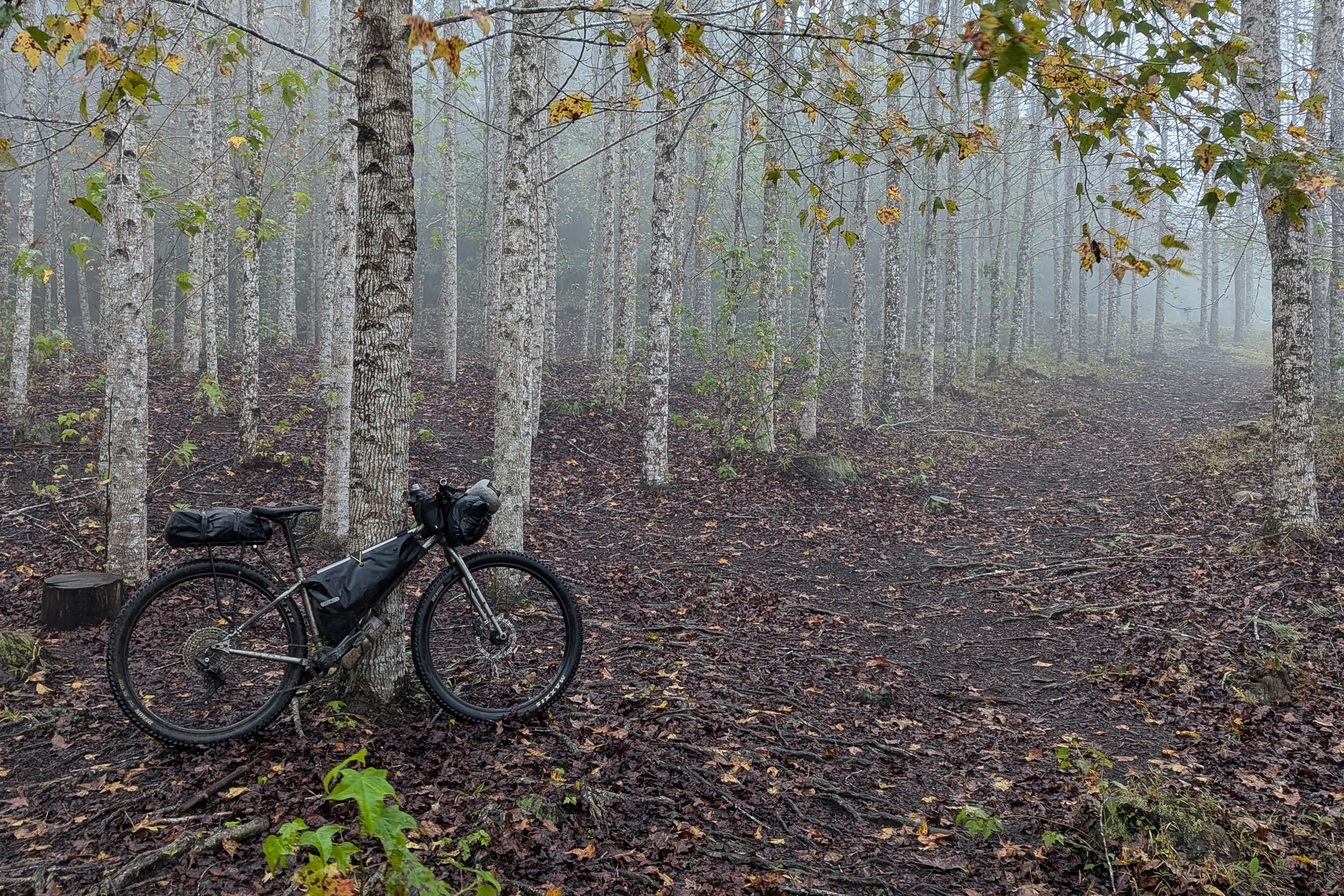
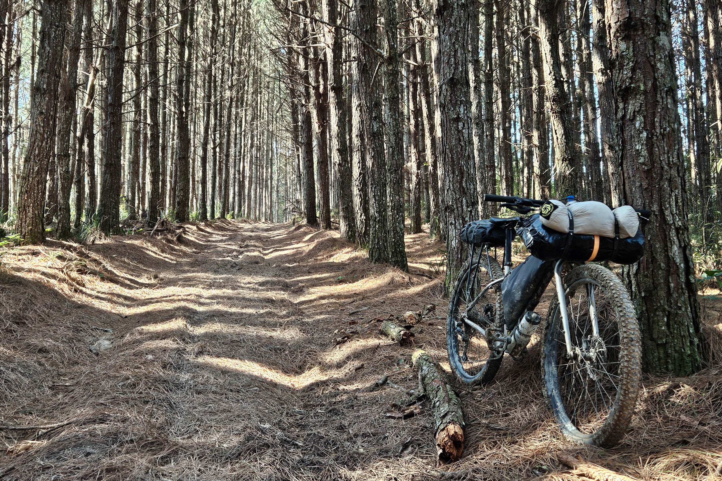
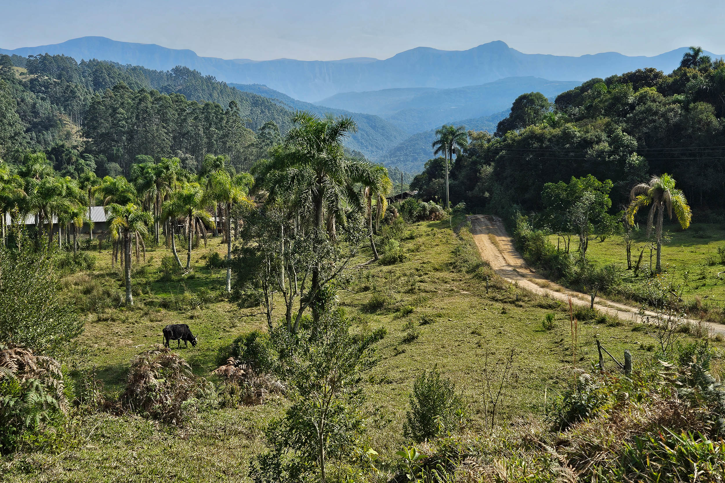
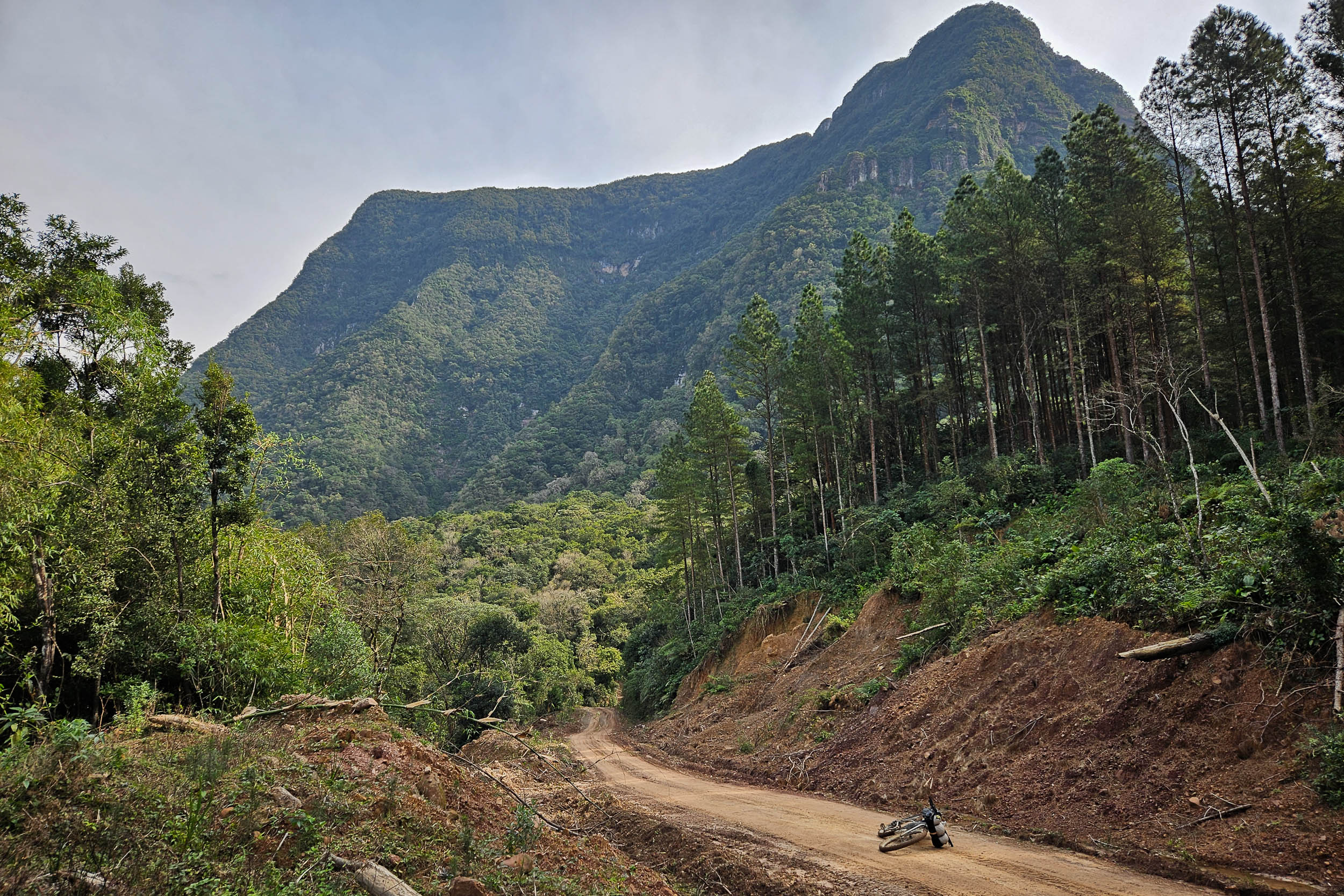
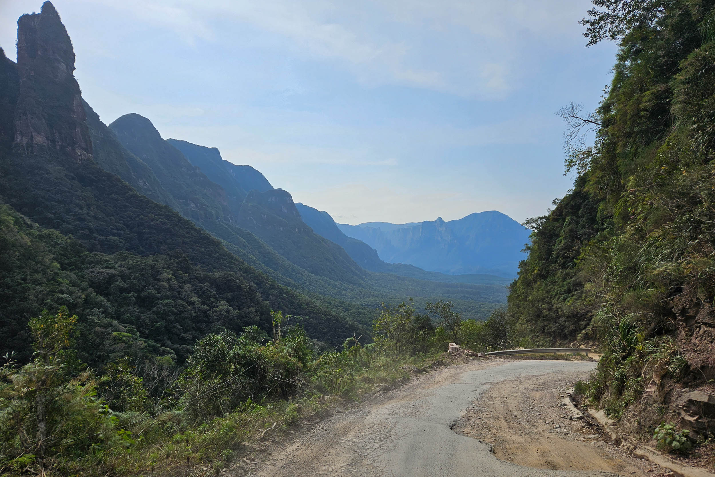
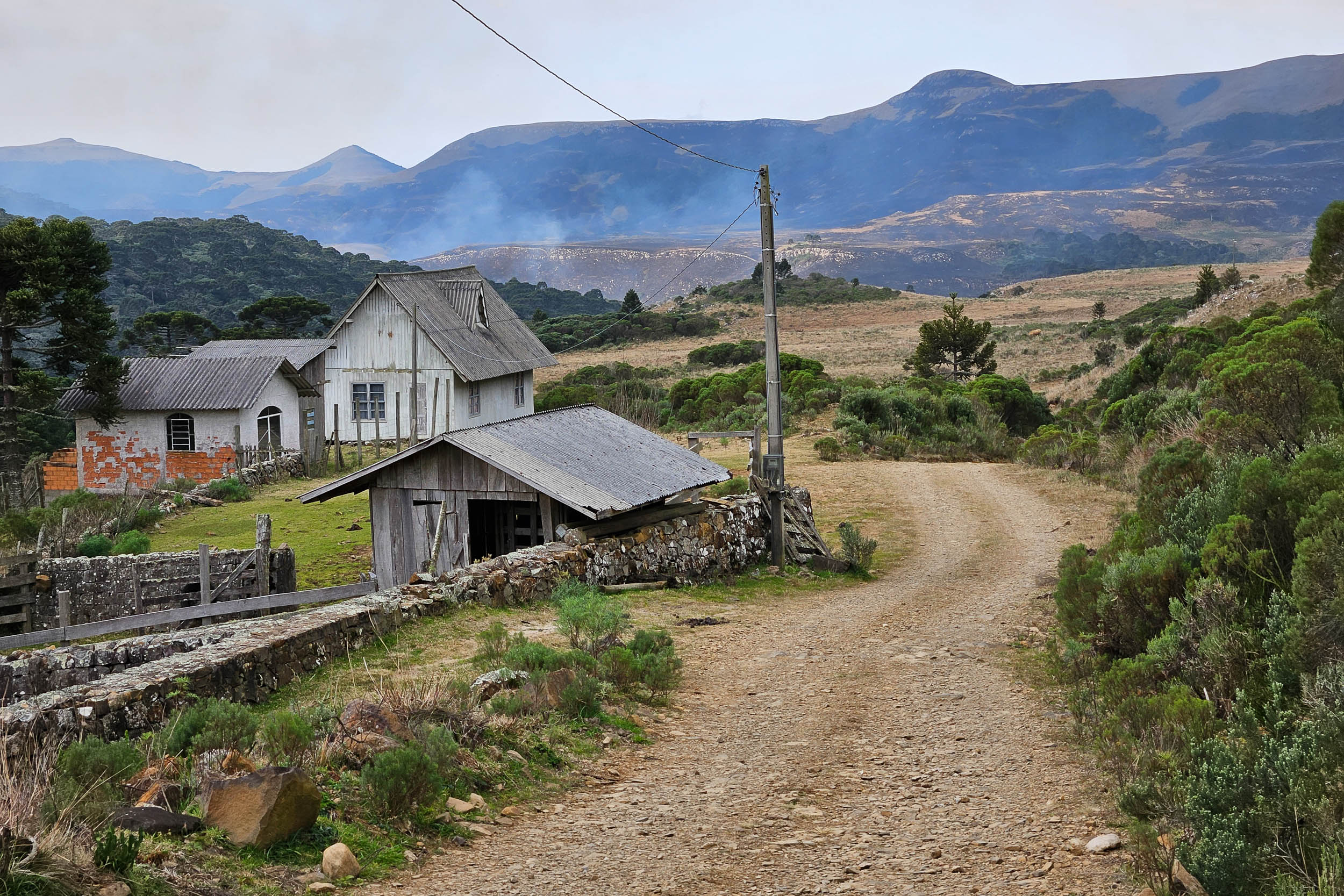
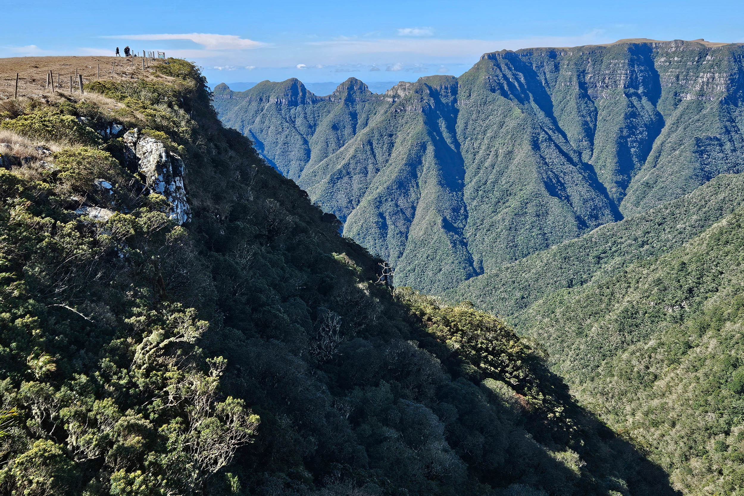
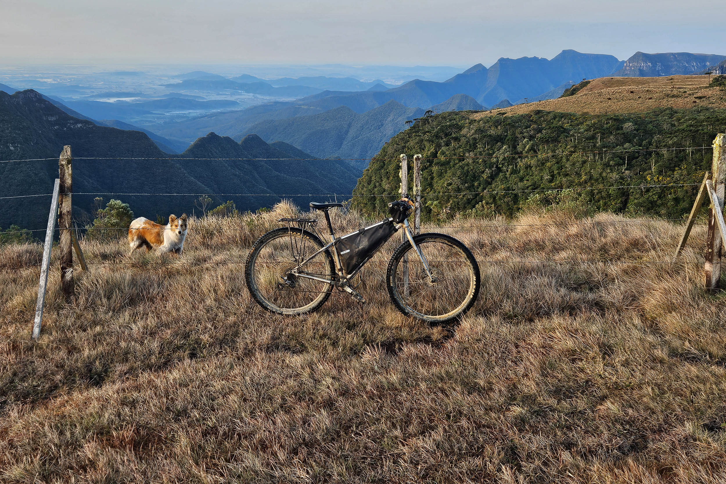
S4 starts near Joinville, the largest city in Santa Catarina. It makes its way west toward Jaraguá do Sul through flat agricultural lands. It then enters the Vale Europeu, a region popular for bike touring. The landscape becomes hilly and partly covered by forests, often used for logging. There are a few notable waterfalls. The route continues south along the green mountains of the Serra do Itajaí. Eventually, the Brazilian Great Escarpment becomes distinctly visible as it rises sharply to separate the coastal lowlands from the highlands to the west. Riders climb the Escarpment at the Serra do Corvo Branco. At the top lies a plateau with vast grasslands and patches of araucaria trees. Its edge is serrated by multiple impressive canyons. The route enters Rio Grande do Sul, the southernmost Brazilian state, and passes next to two of the most beautiful canyons in the country, Fortaleza and Itaimbezinho, before descending and ending by the sea in the city of Torres, with its beaches and coastal cliffs.
Protected areas connected by this segment include four national parks and two state parks. The forest is quite fragmented in the south of the country, but remnants survive on high plateaus and the slopes of the steepest mountains. In low-lying regions near the start of the segment, the fauna is sometimes similar to what is seen in tropical regions further north, such as multiple monkey and toucan species. But as the route moves to higher latitudes and altitudes, the ecosystems change drastically. The more open landscapes are home to mammals like the pampas fox and maned wolf, which meet at the northern and southern edges of their respective ranges. Endemic species include the red-spectacled amazon, a parrot that feeds on the seeds of the araucaria tree.
The interior of the south has been inhabited up to this day by the Kaingang and Xokleng, both speakers of Jê languages. Spanish Jesuits entered the region early via the Río de la Plata. They established missions to evangelize the local Guaranis deep inland near the great Paraná and Uruguay Rivers. The Portuguese later founded small settlements on the coast, where they encountered Guarani people whom they called the Carijós. As the borderland between two empires, the region was the site of conflicts that involved colonial troops, bandeirantes from São Paulo, Indigenous people, and the Jesuits. European presence in the hinterland remained minimal until the late colonial era. When gold and diamonds were found in Minas Gerais, the south of Brazil became a source of mules essential to the transport of minerals and other goods between the mining cities and the coast. Tropeiros established routes to lead mule trains from Rio Grande do Sul to São Paulo, which followed the same axis as the bike route. Portugal solidified its control over the region.
Cattle ranching developed in the large natural pastures. The horsemen tending the cattle were known as gauchos, which is still the name used to refer to the people of Rio Grande do Sul today. It highlights the state’s cultural similarities with neighboring Uruguay and Argentina. African slaves were brought to the region, and some escaped slavery to found communities known as quilombos, which can be found near Araquari and Praia Grande, among other places. After independence, the government encouraged large-scale immigration from Europe to colonize the interior. While many Azoreans had settled on the coast of Santa Catarina previously, most settlers were now of Italian or German origin. Rural isolation has allowed them to preserve their regional dialects for generations, but government suppression and then modern telecommunications have reduced the number of speakers significantly. Military expeditions and attacks by settlers decimated the Indigenous people and confined them to small, dispersed territories where they still live throughout the region.
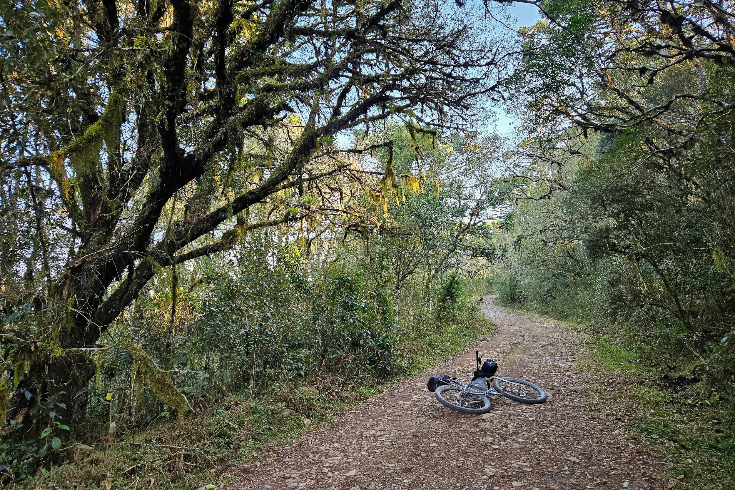
The segment mostly follows dirt roads that are in decent condition. However, a few of the most remote roads can be rough or muddy. Pavement is kept to a minimum. There is no singletrack.
Route Difficulty
The elevation gain is high, which makes the segment physically demanding. While summer can be quite hot, winter temperatures occasionally drop below freezing at high altitude. Heavy rain is possible during any month. The route does not have many technical difficulties. The dirt roads are generally in acceptable condition, but some of the most remote ones can be a bit rocky. There are two notoriously muddy sections, which can be bypassed if desired.
Logistically, this segment is quite straightforward. Resupply is possible daily. Formal camping and lodging options are abundant. While some establishments expect advanced reservations, this is less prevalent than elsewhere in the country, and many will accommodate bike tourists arriving unannounced. The route’s starting and ending points are reachable by bus.
Route Development
The Mata Atlântica Bike route was inspired by the Caminho da Mata Atlântica, a long-distance trail currently being implemented to link protected remnants of the Atlantic Forest. While the bike route was mainly scouted solo, the team behind the Caminho provided a wealth of useful information, as did many local cyclists. The section of the Caminho from Joinville to the southern terminus contains quite a lot of restricted or unbikeable trails and some pavement, so S4 diverges from it significantly and ends up being shorter and more direct. The detours northwest of Joinville and toward Florianópolis were excluded. Elsewhere, the bike route generally follows the Caminho at least in spirit, visiting some of the same attractions from nearby dirt roads. S4 coincides partly with two preexisting bike touring routes: the Circuito Vale dos Encantos and the Circuito do Vale Europeu.
S4 was updated in 2026. The main change was to extend the route to end by the sea in Torres, a city with nice beaches and frequent buses along the country’s main coastal highway. Otherwise, there were only minor changes to the route course, and POIs were updated.


Submit Route Alert
As the leading creator and publisher of bikepacking routes, BIKEPACKING.com endeavors to maintain, improve, and advocate for our growing network of bikepacking routes all over the world. As such, our editorial team, route creators, and Route Stewards serve as mediators for route improvements and opportunities for connectivity, conservation, and community growth around these routes. To facilitate these efforts, we rely on our Bikepacking Collective and the greater bikepacking community to call attention to critical issues and opportunities that are discovered while riding these routes. If you have a vital issue or opportunity regarding this route that pertains to one of the subjects below, please let us know:
Highlights
Must Know
Camping
Food/H2O
Trail Notes
Resources
- The Vale Europeu, a popular region for bike touring, with its farmlands and forested hills
- Waterfalls, such as the Cachoeira Paulista, which can be illuminated at night just for you if you camp there
- The Serra do Itajaí‘s green mountains
- The Parque Boa Vista’s campground, a good spot for sunrise and sunset with its 360° views
- The Great Escarpment‘s mountains rising sharply from the coastal lowlands, as seen from the roads around Anitápolis
- The Serra do Corvo Branco road, a steep climb up the Escarpment
- São Joaquim National Park, with its high-altitude grasslands and Araucaria groves
- The Serra do Rio do Rastro viewpoint of the SC-390 road snaking its way up (and also coatis!)
- The Boa Vista Canyon, with the opportunity to camp right at its edge
- The Fortaleza Canyon, in the Serra Geral National Park, a worthwhile detour with a spectacular trail along its rim
- The Itaimbezinho Canyon, in the Aparados da Serra National Park, with its steep walls and multiple waterfalls
- Torres, the southern terminus, with its beaches, coastal cliffs, sand dunes and restinga forest
When to go
- S4 can be done at any time because the weather in the highlands of the far south is quite different from the rest of the route. While winter is still the season with the least rain, precipitation is more equally spread throughout the year, and the difference with summer is smaller. Consecutive days of heavy rain or sun are possible during any month. Due to the region’s latitude, winter temperatures at high altitude occasionally drop below freezing, and it can even snow. Conversely, low-lying valleys can get very hot and humid in the summer.
Logistics
- Traveling by bus with a bike in Brazil is generally easy. Most companies will accept bikes, boxed or not, as long as there is room in the luggage compartment. Still, traveling with only one bike and having it in a box both increase your chances of it being accepted. Some companies charge a fee, while others do not. However, a few companies do not accept bikes, and it can be hard to find the information online, but this website has a partial list of bus companies and their bike policy.. To get to a bus station in large cities like Rio and São Paulo, it is probably safer and simpler to organize private transport to the station via taxi, shuttle or ridesharing app. For example, Uber Bag cars will usually fit a boxed bike. Larger taxis are also often available at airports and big bus stations.
- The starting point in Araquari can be reached by bike or by bus from nearby Joinville, the largest city in Santa Catarina. It was chosen as a convenient point to link S3 and S4, but the riding nearby is flat and rather unremarkable.
- An alternative starting point is Jaraguá do Sul. It is recommended for people only riding S4. This skips the flatlands near Araquari and the annoying crossing of the BR-101 highway. Jaraguá is a midsize city that is connected by bus to many other cities in the south of the country.
- The ending point, Torres,is a touristy city with nice beaches and cliffs. It is on the main coastal highway, with buses leaving to Joinville, Florianópolis, Porto Alegre and elsewhere.
- Other cities reachable by bus on or near the route are: Blumenau, Apiúna, Alfredo Wagner and Cambará do Sul.
- The route can be ridden in either direction. It was mapped and scouted from north to south because it felt more climactic to end with the impressive Fortaleza and Itaimbezinho Canyons.
- Protected areas crossed in this segment are generally free to transit through. The route passes through a private road at the Boa Vista Canyon, which costs R$20 to use. A detour is recommended to visit the Fortaleza Canyon (closed Tuesday) and Itambezinho Canyon (closed Monday). The entrance fee is R$107. If bought in person there, it includes access to the upper parts of both national parks (Serra Geral and Aparados da Serra) for seven days. If bought online, it can also include for the same price access to the Rio do Boi Trail in the lower sector of Aparados da Serra (access from Praia Grande, guide mandatory, which will cost additional money). Detours can be made to visit multiple other canyons along the route, often passing through private properties, which sometimes require an access fee and advanced reservation.
- Maps using OpenStreetMap data are generally the most detailed and accurate. But there are occasional mistakes (such as overgrown trails mislabeled as roads) and omissions (for example, private gated roads not labeled as such). In a few regions, Google Maps is more detailed. Private roads are common in this segment, which can be frustrating. They can appear on the map as more direct and potentially more scenic paths, but they are gated and often locked.
Dangers & Annoyances
- Mosquitoes and ticks can transmit diseases. In the winter, bug pressure is minimal. Biting insects tend to be small and it is easy not to notice them even as they bite you. Bring a long-sleeve shirt and full pants. Yellow fever vaccination is recommended as tourists have died from the disease in the past.
- Free-ranging dogs are common in rural areas. They bark a lot and sometimes give chase when they see a cyclist. Do not try to outspeed them if it is risky. It is sometimes safer to dismount and put the bike between you and them. Be assertive and pretend to throw something at them, and they will usually let you go. Larger guard dogs are more common in the South than elsewhere, but they are usually leashed or behind a fence.
- Cattle can sometimes block the path. Give them space and do not startle them.
- Livestock gates are present in a few places. Be careful when opening them as they are often secured with a loop of barbed wire. If found closed, make sure to close them back behind you.
- Cars are rare on most of the route. Brazilian drivers often expect to see all kinds of things on rural roads (pedestrians, cyclists, horses, etc.), but as anywhere else, some are careless. Make sure to be visible and cautious.
- Crime is an issue in most large Brazilian cities, but rural areas are usually safer. This segment completely avoids cities, except for small ones. The rural areas of the South are considered to be quite safe. Some of the rural communities of the region are insular and suspicious of outsiders. They sometimes have a rede de vizinhos (neighbors network) with whom they share information about any strangers they see. They might question you about your destination. Just answer with a smile, and there should be no issue.
What bike?
- A rigid mountain bike or all-terrain bike with 2.2 to 2.6″ tires is the best bike to ride all the segments combined. But for this particular segment, which is not very technical, a touring or gravel bike could also work. Still, using the largest tires that fit will be appreciated on the few rougher sections. Low gearing is needed to avoid having to hike-a-bike on the steepest roads.
Travel basics
Language
- Portuguese, in its Brazilian variety (and multiple accents), is almost the only language you will encounter. Learning the basics will prove very useful.
- For Spanish speakers, it is quite easy to learn a lot of Portuguese quickly, considering the similarities. The same goes for other Romance language speakers to a lesser extent. Be careful about trying to speak Spanish to Brazilians. While they can often understand some simple spoken Spanish, it can be laborious and inefficient. There are a few common words that are radically different, and there are some key pronunciation differences. Putting in the work to learn them is highly valuable.
- English speakers are virtually nonexistent except in tourist hubs and large cities.
Money
- The Brazilian real (plural reais, sign $R, code BRL) is the official currency.
- ATMs to withdraw money are found in cities, but they often charge exorbitant fees.
- Credit cards are very commonly accepted by businesses, including some small rural ones. It is a convenient way to pay for things without carrying large amounts of cash.
- Pix, an instant payment platform, was created by the Central Bank of Brazil a few years ago. It became extremely popular, and now a few businesses refuse credit cards (and their high fees). Seamlessly using Pix requires a Brazilian bank account, but workarounds might be possible with apps.
- Money transfer apps can be used for payments that can wait, for example lodging. Owners will often accept to give you the necessary banking information for the transfer. One such app used by some businesses is Wise, but the apps usually work even if the receiver is not registered.
Cell phone
- Mobile phone service is dominated by three providers (Claro, Vivo and Tim).
- Network coverage varies according to the region. Most towns are now covered (sometimes by only one provider), but the signal generally disappears almost as soon as you exit them.
- SIM cards (physical and digital) from one of the three providers can usually only be obtained by people with a CPF, which is a taxpayer identifying number.
- A CPF can be obtained by foreigners through Brazilian embassies and consulates or once in Brazil. This might be worth it for people planning to spend extensive time there.
- International eSIM apps are the simplest but more expensive way to get network access.
- WhatsApp text messaging is usually the way to reach small businesses.
- Instagram is sometimes the only place to find important information about businesses such as campgrounds, as they often lack websites.
- Campgrounds are abundant from the Serra do Corvo Branco to Torres. Most have all the services you could want (water, bathrooms with hot showers, electricity, wifi, and often cooking areas). Some of them expect advanced reservation through WhatsApp, which can be difficult to organize with the lack of cell phone signal and the unpredictability of bike travel. They usually cost around R$40 per night per person, with some variation based on amenities. Some rural pousadas have camping areas, especially in the highlands between Urubici and Cambará do Sul. Some campgrounds recommended for their viewpoints or nearby attractions are the ones at Cachoeira Paulista, Parque Boa Vista and Boa Vista Canyon. Some campgrounds indicated on the map have a discount for people hiking or cycling the Caminho da Mata Atlântica.
- Wild camping is not common in Brazil. It is usually forbidden in protected areas. Private land is often clearly delineated by fences. However, there are some spots where it is popular, the Serra da Rocinha for example. Stealth camping might be challenging, but it is possible for imaginative people, mainly further away from built-up areas. Owners of small rural businesses (such as bars and restaurants) are often resourceful and used to dealing with strangers. They might let you camp on their land or sleep in a room, for free or for a fee. Otherwise, they might direct you to a good spot. Camping next to rural churches might be an option too, but it is polite to ask locals for permission if possible.
- Pousadas are small lodging establishments, generally family-run, which are present in almost every town. In the South, it is also common to see lodging establishments labeled as hotels even in small towns. They are convenient when camping options are more limited, such as in Apiúna, Leoberto Leal and Anitápolis. Room prices vary between R$40 and 200 per night. They usually let you bring your bike into your room. They often include all-you-can-eat breakfast. There are some lodging options in rural areas completely outside of towns, but they often cater to longer stays of groups with advanced reservation. This makes them more expensive and less convenient, especially for solo cyclists. Some pousadas indicated on the map have a discount for people hiking or cycling the Caminho da Mata Atlântica. With some planning, it would be possible to do the whole segment without camping.
- Water sources are common but will need to be treated.
- Bottled water can be bought from stores daily.
- 2.5 L of carrying capacity is recommended, mainly for convenience.
- Supermarkets are found in every town. It is rarely needed to carry more than a day of food.
- Restaurants are common in towns but also near some tourist attractions. Pratos feitos (set meals) are good value.
- Bakeries are lively places offering traditional fare and opening early, which is convenient when sleeping in town.
- Snacks that are easy to pack include bananada and paçoca (candies made from banana and peanut respectively).
- Pinhão is the vernacular name given to the large edible seeds of the Araucaria angustifolia trees. The cooked seeds, eaten alone or as part of a recipe, are popular throughout the region.
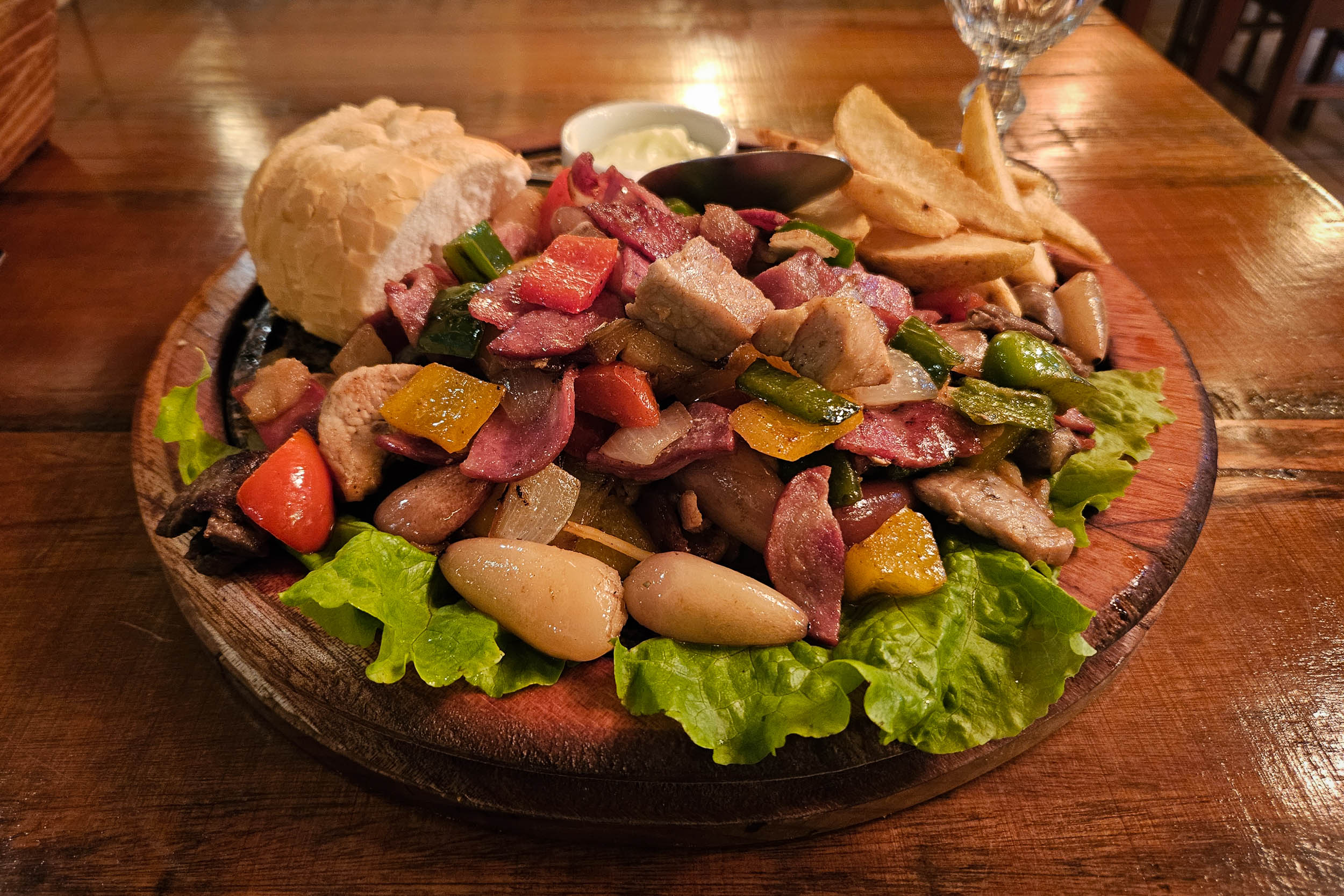
- Meat is important in Brazilian cuisine, which might be challenging for vegetarians. This is particularly true in the South of the country, famous for its churrasco. One typical plate, for example, is entrevero, a mix of grilled meats and vegetables, including pinhão. Rice and beans is also common, as it is elsewhere in the country. However, it is sometimes cooked with meat. It tastes even better when sprinkled with farofa, a toasted cassava flour, which unfortunately also often contains meat.
This is a proposed 14-day itinerary, which allows for small detours to a few canyons, including Fortaleza and Itaimbezinho. Note that the alternatives proposed here were considered during planning, but they have not all been tested.
location Araquari – Guaramirim
Day 1 (56.5 km +391 m)
From Araquari the route goes southwest through flat farmlands. A somewhat annoying crossing of the BR-101 is necessary. The Itapocu River is crossed by a hand-powered cable ferry. It is free, and there is an attendant present during daytime. South of Guaramirim, there is the Pousada Rural Quero Quero, which has a campground.
One alternative to avoid the crossing of the BR-101 is to do a detour 8 km to the south to Itapocu and take an underpass, which would require cycling along the highway and taking a user-operated hand-powered cable ferry over the Piraí River.
If the Itapocu River ferry is not working, it is possible to cross further west at the Guaramirim Suspension Bridge. This is also convenient for people heading the opposite way who might not want to risk having to backtrack if the ferry is not working.
If only riding S4, it is recommended to skip this first day and start in Jaraguá do Sul instead.
location Guaramirim – Rio Ada
Day 2 (49.8 km +918m)
To the west, the landscape starts to be hilly and forested. On top of the first significant climb, east of Rio Cerro II, there is a picnic table and orange trees for cyclists to relax and refuel. The route then reaches Rio Ada, where there are small chalets for rent and the option for cyclists to camp at Ada Verde.
location Rio Ada – Cachoeira Paulista
Day 3 (46.9 km +1,378 m)
Heading southwest, the route keeps alternating between forest and farmlands. The Benedito River is crossed at the Salto Donner waterfall. There is lodging and a campground nearby. The route passes close to the Cachoeira Nossa Senhora de Fátima and then next to the Cachoeira Paulista. The tourist infrastructure at the latter is a bit excessive, but there is a campground. If you sleep there, they can illuminate the large waterfall at night just for you.
location Cachoeira Paulista – Apiúna
Day 4 (56.6 km +854m)
The route veers southeast through logging areas. A detour to the Cachoeira do Zinco is possible if arranged beforehand with the owners of the land (R$20, +55 47 99170-8727). They also have a pousada and a camping area. Further east, a large wooden bike lies in front of the Fazenda Park Spiess, which has a restaurant and campground. The route then traverses the towns of Rodeio and Ascurra, which have lodging. There is a campground west of Ascurra (Camping Cascata Borboleta). Another option is to sleep in an affordable hotel in Apiúna, which is reached by crossing the Itajaí-Açu River via a suspension bridge.
location Apiúna – Fartura
Day 5 (52.5 km +1,607m)
The route follows the Neisse River south. It traverses a short forested section of the Serra do Itajaí National Park. It then crosses the Itajaí-Mirim River over a bridge. After a bit of climbing, there are some great views of the green mountains of the national park. Near the rural settlement of Fartura, there is a lodging option, the Sítio Stolfi, which rents cabins. If early, it is possible to continue to the agricultural town of Leoberto Leal, where there is an affordable hotel.
It would be possible to do a detour to traverse the Serra do Itajaí National Park via Faxinal do Bepe, and then visit the Botuverá Caves. However this would add a lot of climbing and a bit of pavement. It would also require an authorization from the park’s authorities, which can be obtained by sending them an email with the necessary information (name, CPF or passport number, date, schedule, reason of visit, mode of visit). Past the park, it would also be possible to continue east all the way to Florianópolis.
location Fartura – Boa Vista
Day 6 (61.5 km +1,456m)
After some farmlands south of Leoberto Leal, the route climbs the forested Serra dos Tropeiros. There is a nice view of the Brazilian Great Escarpment to the southwest, where it is particularly impressive as it rises sharply from the coastal lowlands. The route joins the paved BR-282 briefly to reach the Parque Boa Vista, which has viewpoints in all directions. It also has a simple campground, a good place to enjoy both the sunset and the sunrise. It is possible to camp a little further along the route at the Rancho Boa Vista, situated right before a muddy gated road through the forest.
To diminish the climbing and avoid the mud, it is possible to instead bike from Leoberto Leal to Alfredo Wagner, and then head southeast to rejoin the route on the way to Anitápolis. It would also be an alternative if the gated road at Rancho Boa Vista is locked in the future.
location Boa Vista – Anitápolis
Day 7 (50.5 km +993m)
After the muddy forest, the route traverses the farmlands of Rio Lessa. It then climbs logging roads going south. There are again nice views of the surrounding mountains. A detour to the Cachoeiras Salto do Perito is possible. There are two waterfalls and a campground there. Going southeast, the route reaches Anitápolis, a town with a nice square and a pousada.
There are more direct roads going south of the Parque Boa Vista toward Anitápolis, but they pass through private logging areas and are closed to the public.
location Anitápolis – Aiurê
Day 8 (49.4 km +1,512m)
Southwest of Anitápolis, there is another good viewpoint of the Escarpment at the Mirante da Bela Vista. After traversing more forest and farmlands, the route arrives in the town of Aiurê. There is no lodging directly inside of the town, but there are cabins for rent nearby to the north at the Pousada Doce Aconchego. There is also the more affordable Rota do Corvo pousada 8 km to the southeast via the paved SC-370 road.
location Aiurê – Urubici
Day 9 (52.2 km + 1,802m)
From Aiurê starts a 1,000-m climb up the Serra do Corvo Branco. The ascension begins via dirt roads south of the SC-370. There is one very muddy section there, which is popular with off-road vehicles. For this reason, the mud can be deep, and hike-a-bike will be required to avoid the deepest portions. The route then rejoins the SC-370, which is now mostly unpaved. It winds its way up mountains that appear almost vertical. There are viewpoints at the top, which are rather touristy. For this reason, it might be better to time yourself to visit on a weekday outside of holidays. There are multiple campgrounds around the top. The route passes near the Morro da Igreja. A side trip to the viewpoint on its summit is possible. It used to require a reservation with São Joaquim National Park, but it seems like now cyclists can just fill the paperwork at the gate there. Cyclist entrance is allowed only in the morning. See the park’s website for up-to-date information. The route then reaches Urubici, where there are multiple lodging options and campgrounds.
To skip the muddy road, you can simply stay on the paved SC-370 northwest of Aiurê.
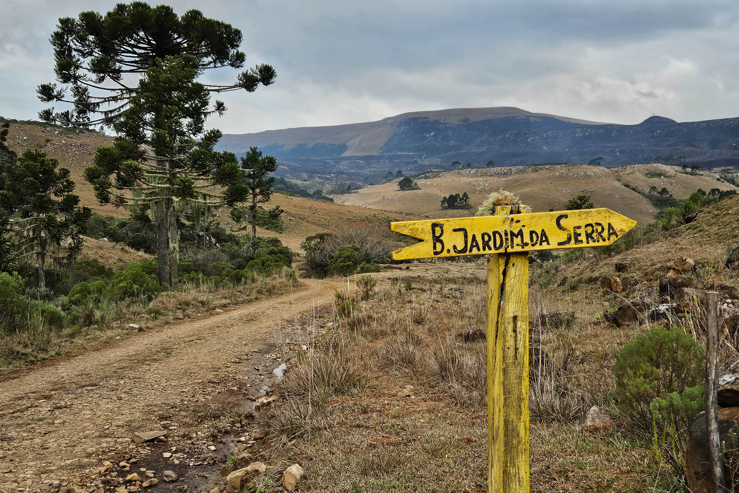
location Urubici – Bom Jardim da Serra
Day 10 (59 km +1,501m)
South of Urubici, the route traverses part of São Joaquim National Park. The landscapes are at times beautifully desolate. There are vast grasslands, with occasional groves of Araucaria trees. On this high-altitude plateau, the route reaches its highest point, almost 1,700 m. For a while, the segment follows the origin of the Pelotas River. One can make detours to visit the Laranjeiras Canyon’s north rim (R$50, reservation required, +55 48 99989-6510) and south rim (R$20, nearby campground). The route then reaches the town of Bom Jardim da Serra, where lodging is available. If still early, it is possible to continue further south to camp at the Camping da Ronda.
location Bom Jardim da Serra – Boa Vista Canyon
Day 11 (78.4 km +1,496m)
East of Bom Jardim da Serra, there is a popular viewpoint at the Serra do Rio do Rastro. The view of the SC-390 road snaking its way up the mountain is impressive. A bunch of coatis are usually chilling there and begging tourists for food. Further south, the Ronda Canyon (R$20) also has some nice views, with fewer people. The route then traverses the Bom Jardim da Serra Wind Farm. It is required to use the intercom to be let through. Say that you are going toward the Pousada Hélio Guedes. A bridge over the Rio das Contas is crossed to enter Rio Grande do Sul, the southernmost Brazilian state. There are more canyons there. The Monte Negro Canyon is a nice detour, as it is free and generally not busy. There is also a campground nearby at the Pousada e Camping Aparados da Serra. Further south, the route passes next to the Pousada Ecológica dos Cannyons. A transit fee of R$20 needs to be paid. The pousada has a campground, and it is possible to camp right at the edge of the Boa Vista Canyon.
location Boa Vista Canyon – Osvaldo Kroeff
Day 12 (75.1 km +1,067m)
The route passes next to the Encerra Canyon, also called Amola Faca, which can be visited for free by following a short trail. The route then passes through São José dos Ausentes, a town with two hotels. To the east, there is a viewpoint at the Serra da Rocinha, which is popular for wild camping. The route then reaches Osvaldo Kroeff, a town with an old paper mill and a few lodging options. It is possible to do a detour to Cambará do Sul, where there is a campground.
There is work underway to pave the road between São José dos Ausentes and Osvaldo Kroeff. To avoid the new pavement, the route could eventually be modified to take a dirt road to the west instead.
location Osvaldo Kroeff – Cambará do Sul
Day 13 (23.8km +406m)
South of Osvaldo Kroeff, the route traverses a few wooded areas. A detour is recommended to the Fortaleza Canyon in the Serra Geral National Park (closed Tuesday). The entrance fee is R$107. If bought in person there, it also includes access to the upper part of the Itaimbezinho Canyon for seven days. If bought online, it can also include for the same price access to the Rio do Boi Trail in the lower sector of the Itaimbezinho Canyon (access from Praia Grande, guide mandatory, which will cost additional money). While the main viewpoint of the Fortaleza Canyon can be quite busy, there is a nice bikeable train along the rim, which is much calmer. After backtracking a bit along the park road, the RS-427 road is reached. There is a campground at the Parador Pôr do Sol southeast of Cambará do Sul.
There are dirt roads through the park going from the Fortaleza Canyon to the Itaimbezinho Canyon. They could be an option to avoid backtracking, but they pass through private property and are closed to the public for now.
location Cambará do Sul – Praia Grande
Day 14 (64.7 km +495m)
Another recommended but shorter detour is the one to the Itaimbezinho Canyon in the Aparados da Serra National Park. The entrance fee is the same as explained above, and it can be paid online or at the gate right next to the route. The canyon is particularly impressive, with its steep walls and tall waterfalls. There is a nice bikeable path along its northern rim. The route then goes down the Serra do Faxinal to laid-back Praia Grande. The town is a popular destination for hot air balloon rides. There are multiple lodging options and campgrounds. The final stretch is through flatlands to reach the sea. The route ends in Torres, a touristy city with nice beaches and cliffs. There are multiple campgrounds and lodging options.
Loops
There are multiple options for loops in the region. One is to take the dirt roads around the Serra do Itajaí’s National Park. Another is to combine part of the plateau between Urubici and Cambará do Sul with part of the lowlands to its east. This would allow for some nice views of the mountains and canyons, both from above and below.
Additional Resources
- The Caminho da Mata Atlântica‘s official website and map can be useful, even if this segment rarely follows the official Caminho. Reach out to them if you plan to hike or bike part of the route. They might be able to provide some support.
- Julieta Santamaria, from Argentina, is the first and only person to complete a thru-hike of the Caminho (2024-2025). She has documented her journey on Instagram and has shared maps of her hike on Wikiloc, which sometimes differed from the official map.
- Olinto and Rafaela have a website where they share bike routes across Brazil, including one in the South that overlaps partly with this segment. They documented it extensively with a guide, maps, photos and videos.
- The Circuito Vale dos Encantos is a bike touring circuit around Jaraguá do Sul, which coincides with part of S4.
- The Circuito do Vale Europeu is a bike touring circuit west of Blumenau, which coincides with part of S4.
- The São Joaquim National Park‘s website has information about the rules to visit the Morro da Igreja.
- The Serra Geral and Aparados da Serra National Parks require visitors to pay for their entrance online or in person.
- Wikivoyage has a partial list of bus companies and their bike policy.


Terms of Use: As with each bikepacking route guide published on BIKEPACKING.com, should you choose to cycle this route, do so at your own risk. Prior to setting out check current local weather, conditions, and land/road closures. While riding, obey all public and private land use restrictions and rules, carry proper safety and navigational equipment, and of course, follow the #leavenotrace guidelines. The information found herein is simply a planning resource to be used as a point of inspiration in conjunction with your own due-diligence. In spite of the fact that this route, associated GPS track (GPX and maps), and all route guidelines were prepared under diligent research by the specified contributor and/or contributors, the accuracy of such and judgement of the author is not guaranteed. BIKEPACKING.com LLC, its partners, associates, and contributors are in no way liable for personal injury, damage to personal property, or any other such situation that might happen to individual riders cycling or following this route.
Further Riding and Reading
Here are some connected/nearby routes and related reports...


Please keep the conversation civil, constructive, and inclusive, or your comment will be removed.