


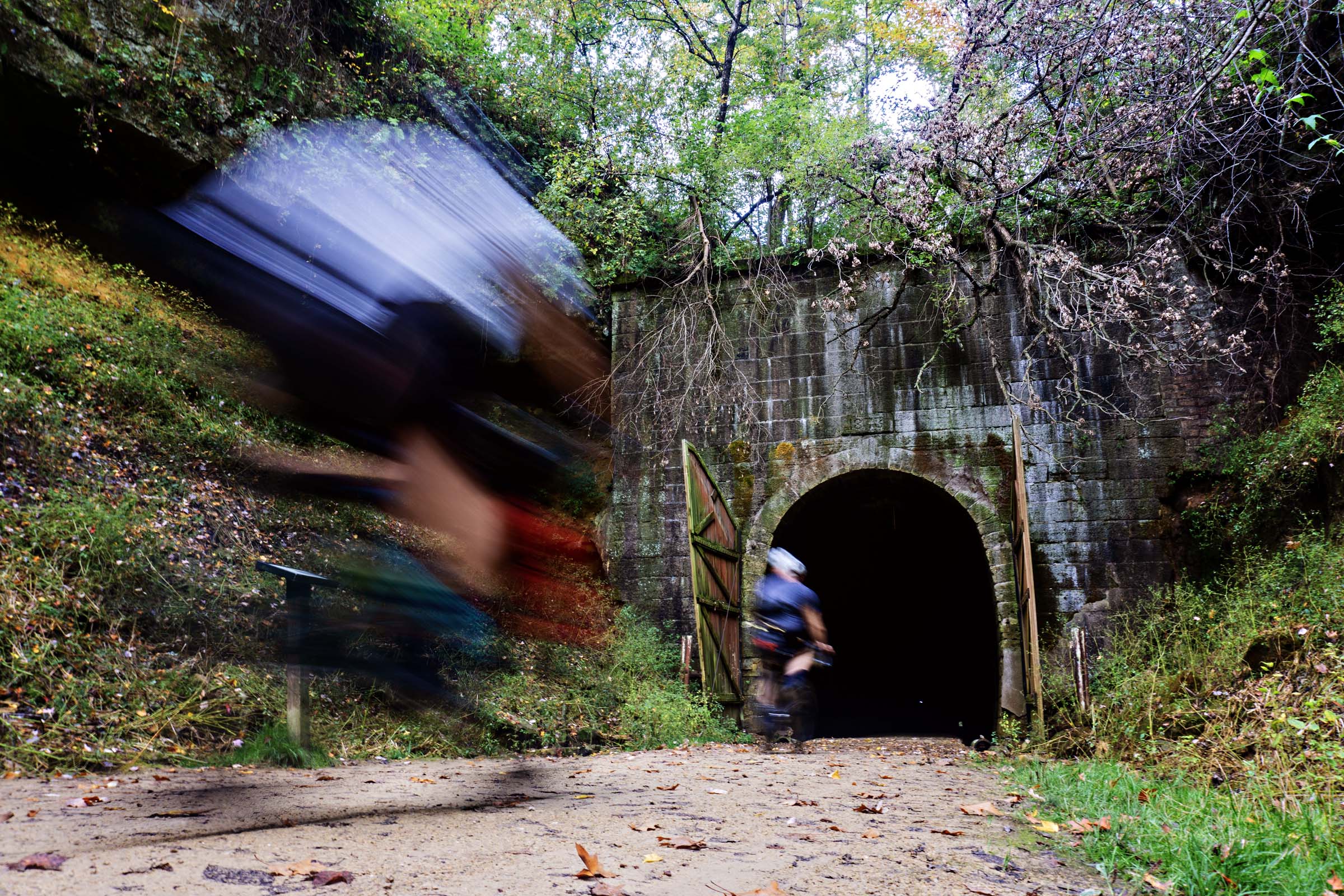
Old Stone House Loop
Distance
172 Mi.
(277 KM)Days
4
% Unpaved
79%
% Singletrack
2%
% Rideable (time)
99%
Total Ascent
8,916'
(2,718 M)High Point
1,248'
(380 M)Difficulty (1-10)
4?
- 3Climbing Scale Fair52 FT/MI (10 M/KM)
- 4Technical Difficulty Fair
- 4Physical Demand Fair
- 2Resupply & Logistics Easy
Contributed By

Scott Haraldson
When bikepacking, a route can settle into a rhythm—one where miles earned are balanced by miles gifted. The earned miles are the tough ones: steep climbs on loose gravel, headwinds howling, unrelenting sun, and stretches where you’re off the bike, pushing through tall grass or clambering over downed trees. Then there are the gifted miles—those stretches of hard-packed hero gravel and gentle rollers where the small downhills carry you to the top of the next rise, shaded canopies where your legs spin effortlessly, and long, winding descents that tease an ending at every bend, only to reward you another drop.
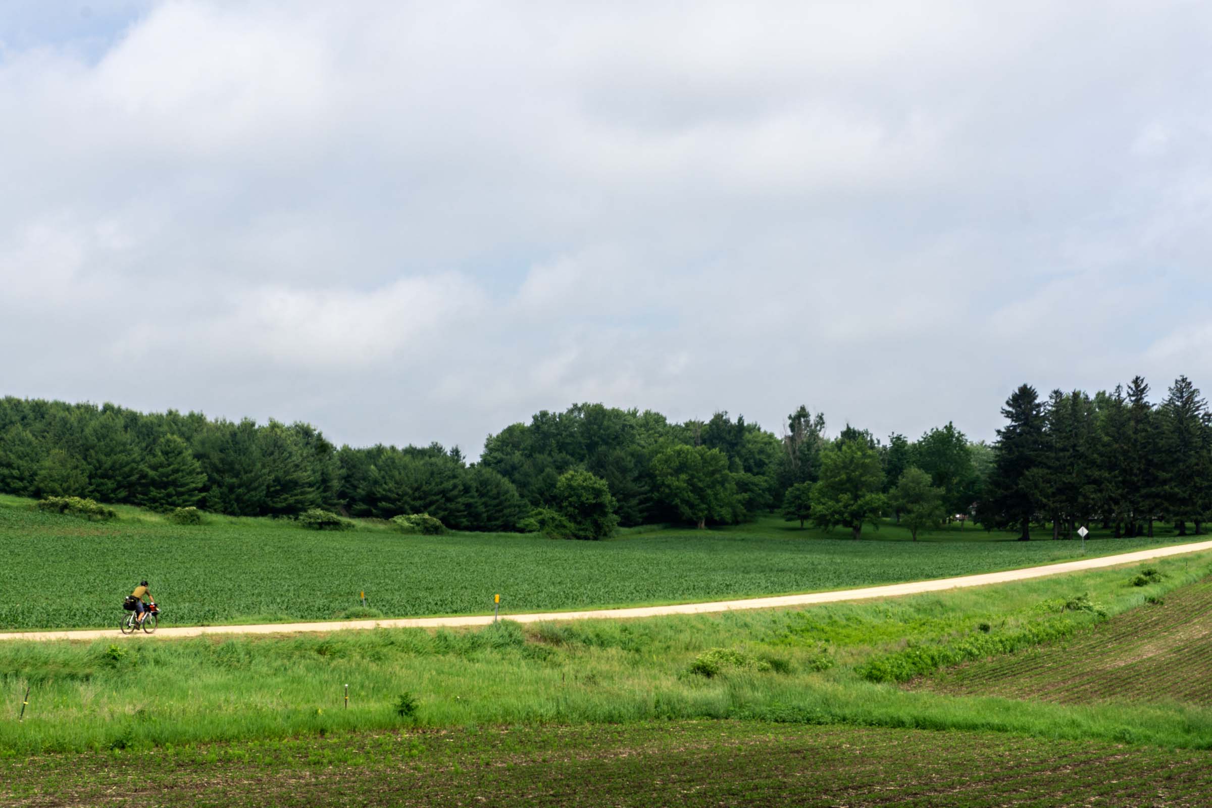
The Old Stone House Loop, located in Southeast Minnesota, delivers a well-balanced mix of both. Just a short drive from the Minneapolis–Saint Paul area, this 170-mile bikepacking route carves its way through the heart of the Driftless Region, a rare pocket of land left untouched by glaciers. Here, the terrain is wild and scenic. You’ll find yourself on the top of limestone bluffs, the landscape opening wide—endless rows of corn stretch out like green corduroy beneath the sky, each bluff divided by deep river valleys with crystal-clear spring-fed streams, making it one of the most beautiful and ecologically rich landscapes in the state.


Starting in Millville, the loop heads north with day one concluding at the route’s namesake: the Old Stone House, a historic limestone homestead built in 1875 by German immigrants Franz and Metta Cordes. Nestled in the peaceful Hay Creek Valley, within the R.J. Dorer Memorial Hardwood Forest, the remnants of the homestead offer a quiet, private place to pitch your tent and have a fire. It’s the perfect launchpad for the gravel climbs, downhills, minimum maintenance roads, sweeping vistas, and camping still to come.
Route Difficulty
What makes this route so rewarding is also what makes it physically demanding: the relentless climbs and fast, loose descents. If you’re accustomed to big mountain riding and knocking out 5,000 to 6,000 feet of vertical each day, this may feel like a warm-up. But if you’re coming from flatter terrain—where a 400-foot climb at a 15 percent grade sends you straight into the granny gear—be prepared for a real test.
That said, resupply and logistics are very manageable with a bit of planning. There are several restaurants and convenience stores spaced throughout the route. Water, however, is always a consideration, especially during hot days when the sun beats down on exposed sections. Plan accordingly and carry more than you think you’ll need.
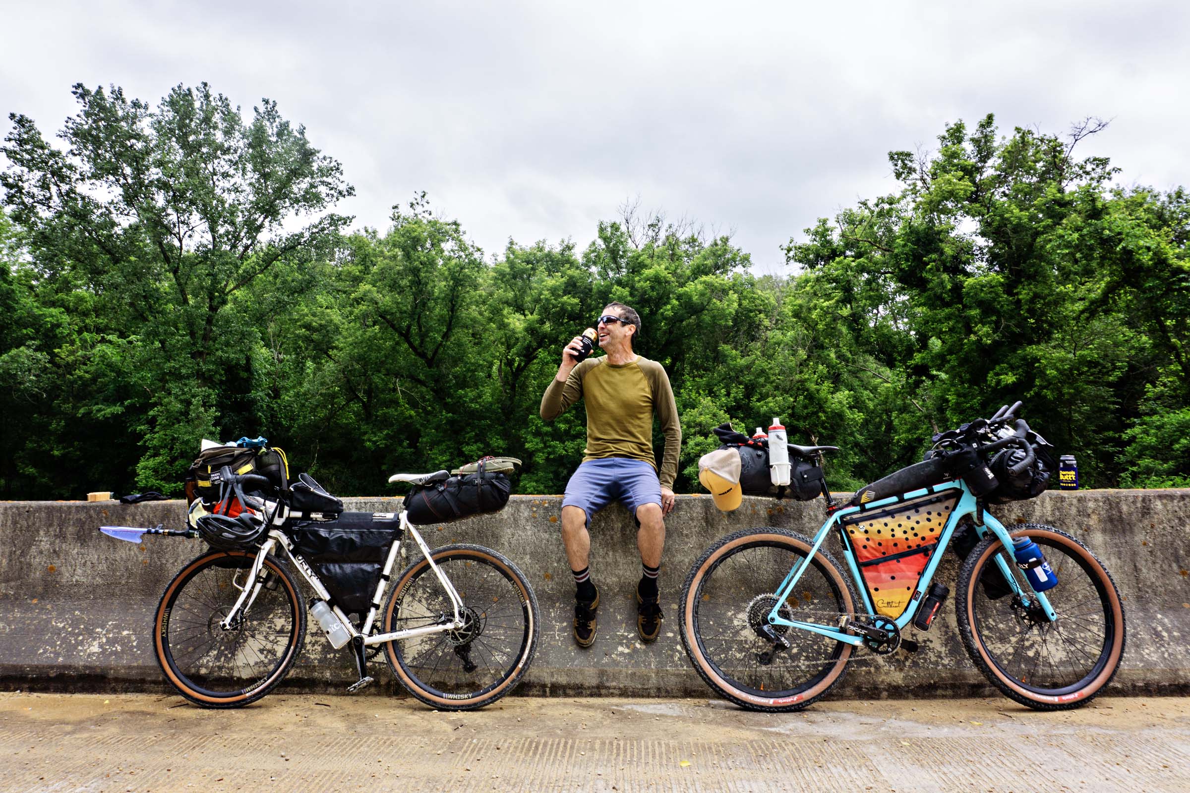
Nearly the entire route is rideable on a gravel bike. Our group rode a mix of setups: two Surly Midnight Specials with 650x48s, a Canyon Grizl on 700x50s, and a Salsa Cutthroat with 29×2.4s. Across the board, we’d all recommend wider tires. The descents may be short, but they come fast and rough, with loose gravel that can quickly get sketchy on narrower rubber.
The hike-a-bike section on day three adds an additional difficulty, but it can be avoided. See the Trail Notes tab for details on the reroute. Overall, I give the Old Stone House Loop a difficulty rating of 4 out of 10. For riders used to climbing, that number may dip lower.
Route Development
This route was born from a longstanding love of the Driftless Area, a connection that began during my college years in Southern Minnesota. My fascination with this particular landscape took root in 2009, when I lined up for my first gravel race, the Ragnarok 105. It was as grassroots as they come: self-supported, printed cue cards, a wired cycling computer for distance and hand-timed results. The race kicked my ass in all the right ways—but more importantly, it opened my eyes to the raw, untamed beauty of these valleys.
Still, it wasn’t until 2024 that the idea for a route took shape. Right at mile 235 of the Day Across Minnesota race, I was bombing down into Hay Creek, my legs completely spent but my heart full, knowing I was only five miles to the finish line. It was a semi-euphoric moment, and I couldn’t shake the feeling: this place deserved a route of its own. One that would stitch together its rugged climbs, winding bluffs, and quiet gravel backroads. So, I started planning and scouting.


Submit Route Alert
As the leading creator and publisher of bikepacking routes, BIKEPACKING.com endeavors to maintain, improve, and advocate for our growing network of bikepacking routes all over the world. As such, our editorial team, route creators, and Route Stewards serve as mediators for route improvements and opportunities for connectivity, conservation, and community growth around these routes. To facilitate these efforts, we rely on our Bikepacking Collective and the greater bikepacking community to call attention to critical issues and opportunities that are discovered while riding these routes. If you have a vital issue or opportunity regarding this route that pertains to one of the subjects below, please let us know:
Highlights
Must Know
Camping
Food/H2O
Trail Notes
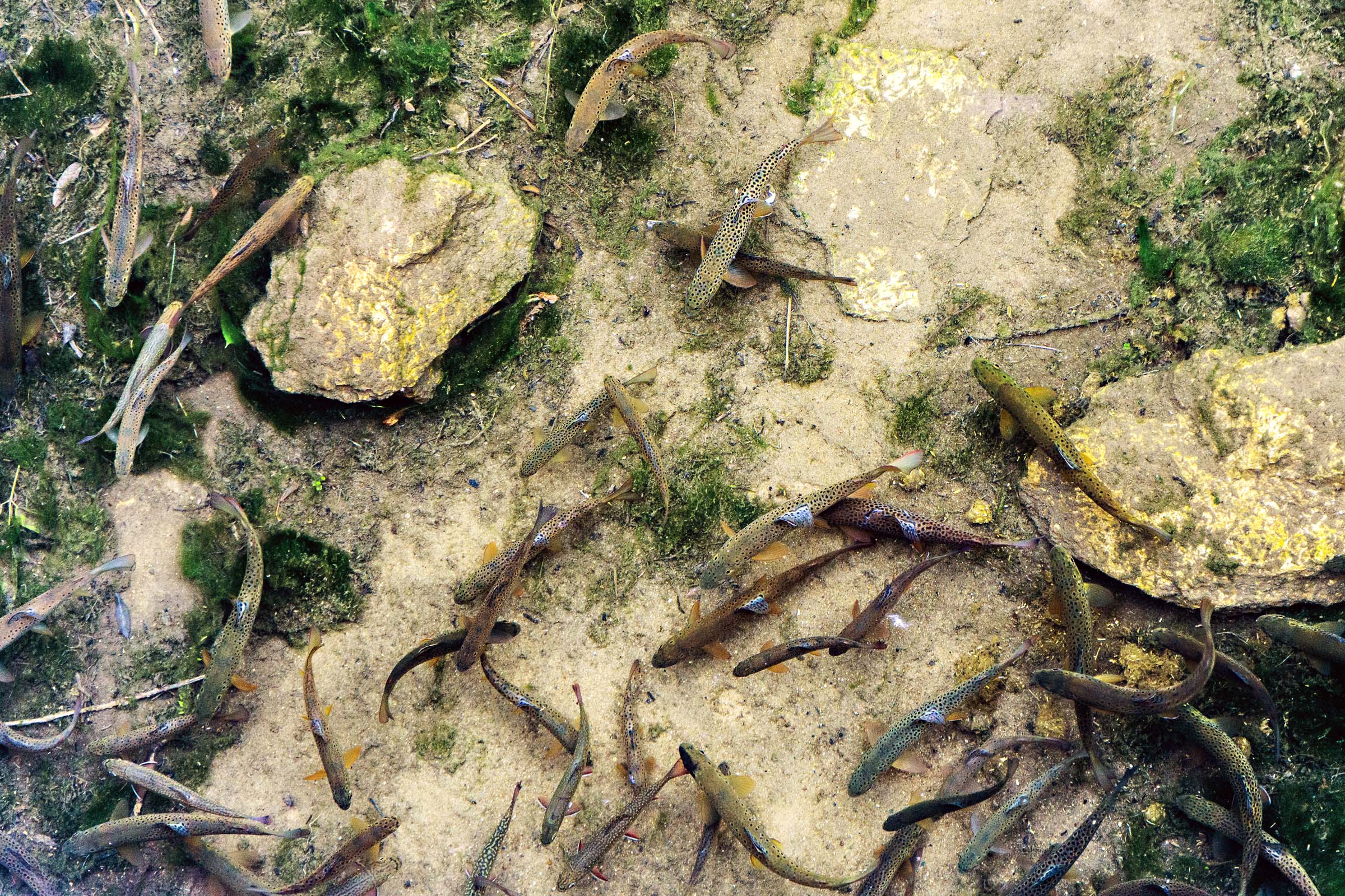
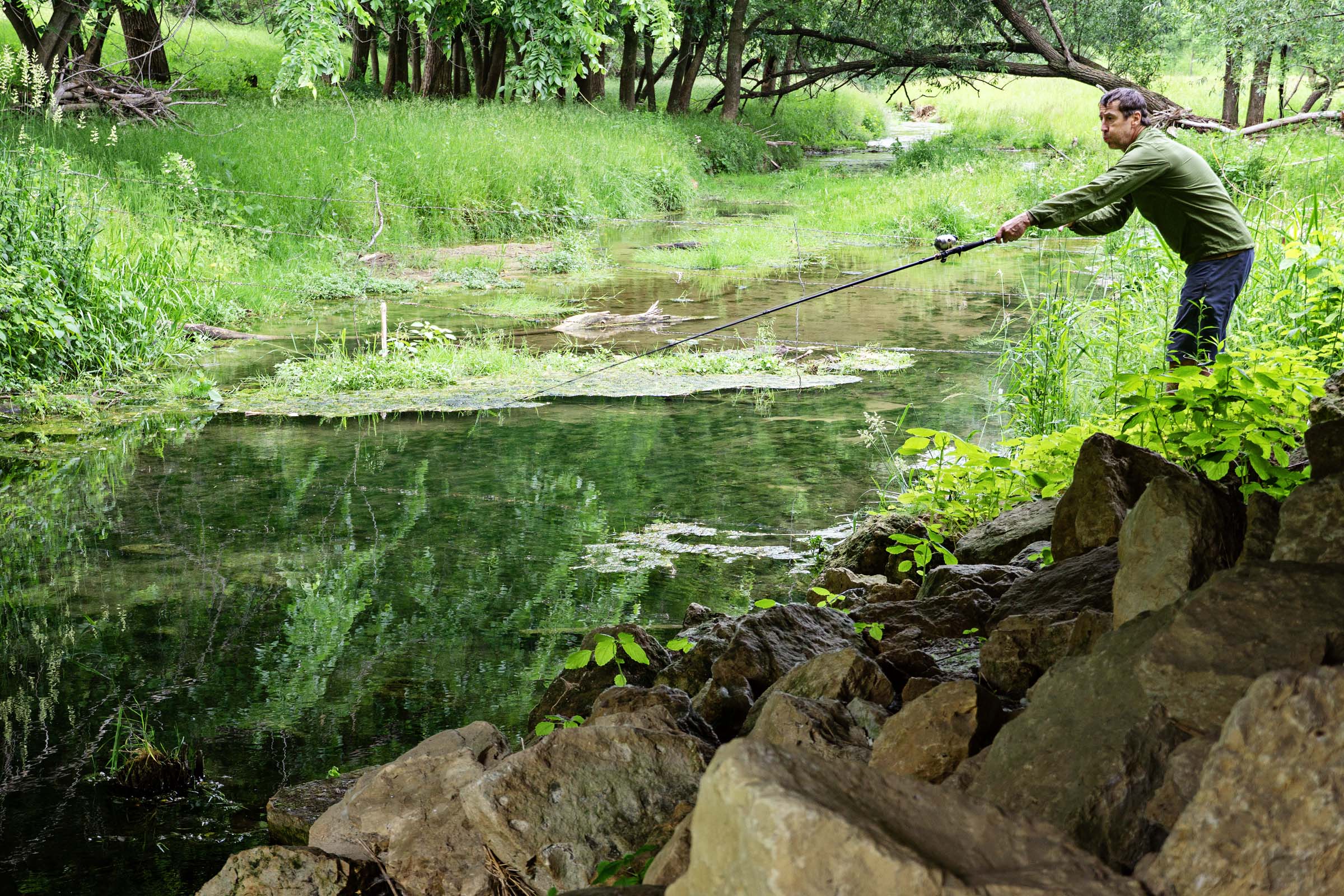
- Trout fishing. Southeast Minnesota is home to crystal-clear trout streams, where ancient river valleys and karst geology create ideal coldwater habitats. The region around Whitewater State Park is especially well known for its rivers stocked with brook, brown, and rainbow trout, so strap your pole to your bike and make time to fish.
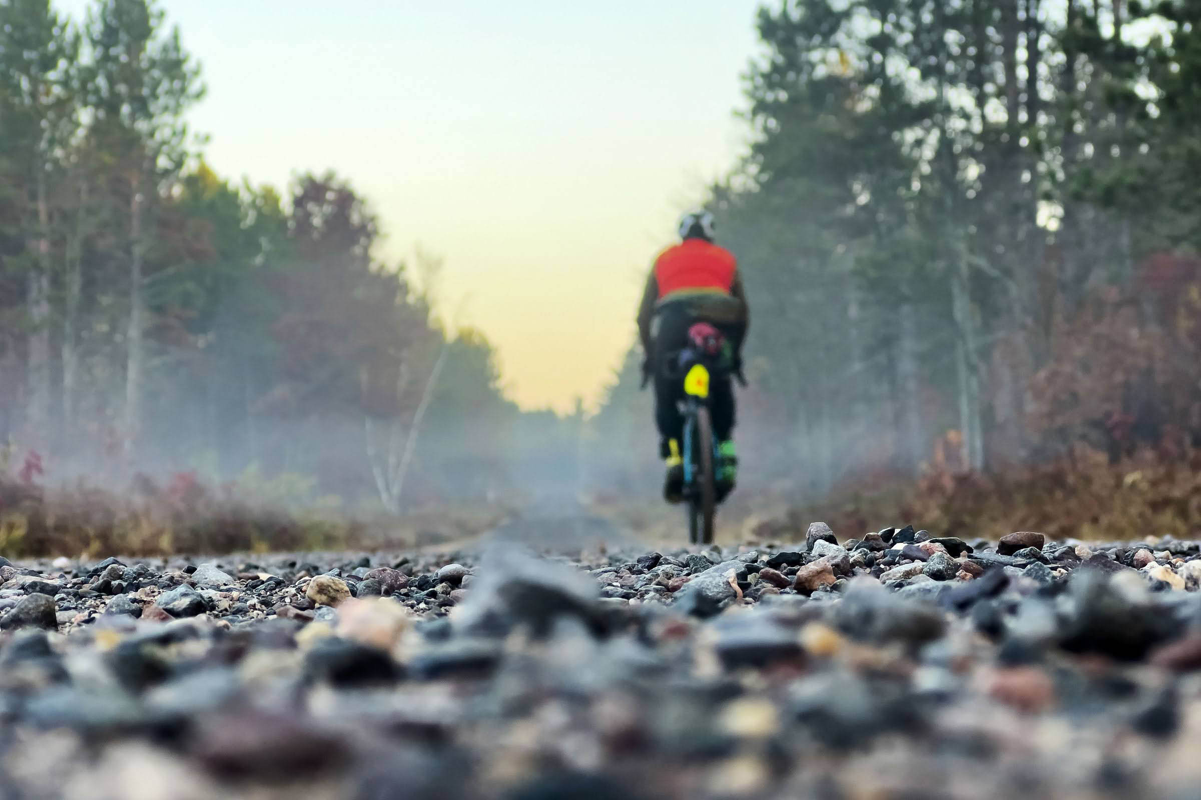
- Downhills: The region features some of the most exhilarating gravel downhills in the state. Steep, wooded ravines carve out long, fast descents on gravel roads that wind through dense, tunnel-like forest canopies. Turn after turn, you keep wondering when it will end.
- Lake Pepin is a naturally occurring lake on the Mississippi River. On its shore sits the town of Lake City, considered the birthplace of water skiing because it’s where the sport was first successfully invented and demonstrated in 1922 by a local teenager named Ralph Samuelson.
- After powering through a mile-long climb under the hot sun, you’ll spot the tree-lined entrance to Whitewater Winery. After your first sip of sangria, the climb will be forgotten. Perched atop a bluff, the winery feels like a hidden oasis where the reward is every bit as satisfying as the effort it took to get there.
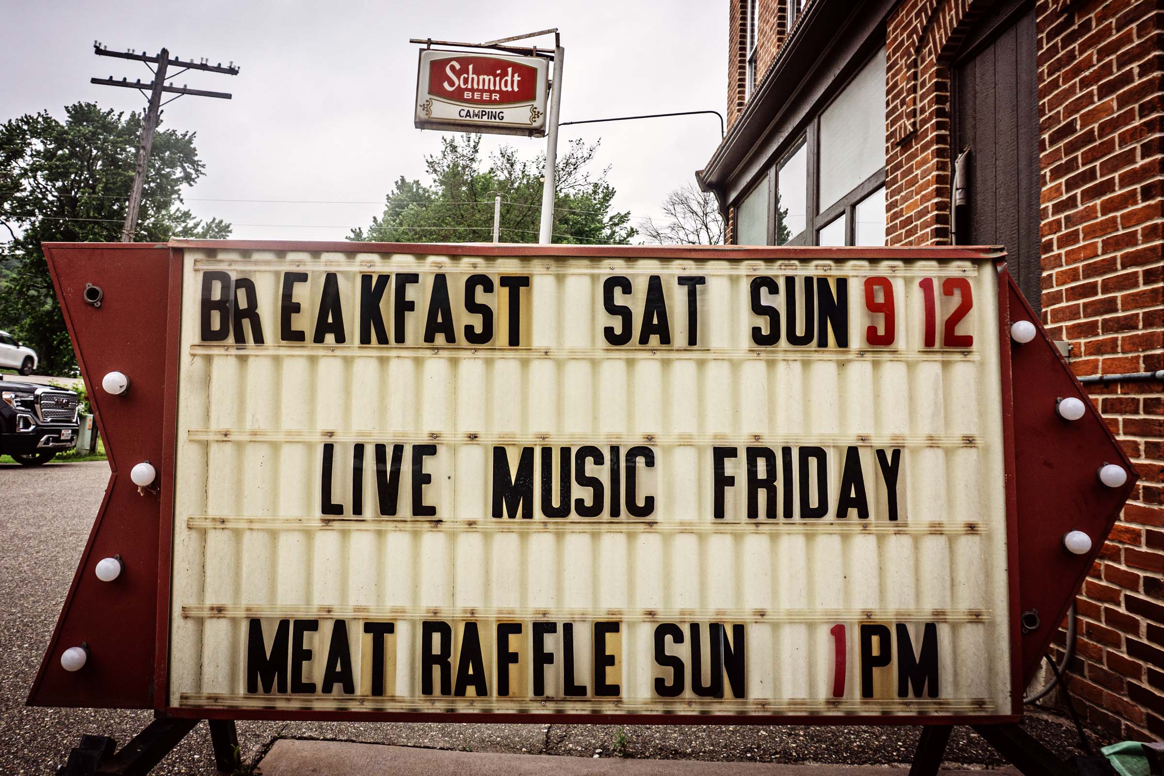
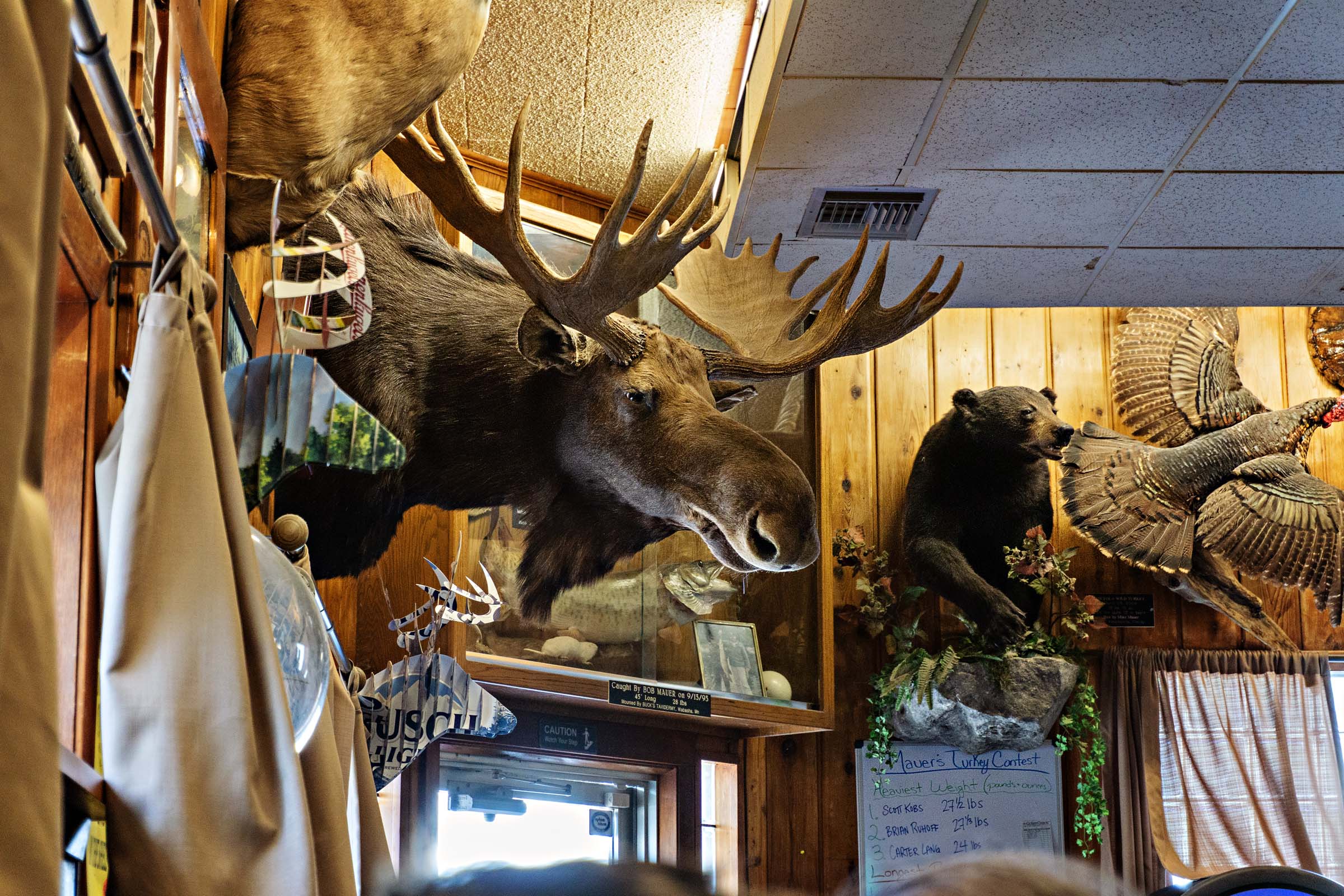
- Mauer Brothers Tavern and Grill has been a family-owned business for 135 years, spanning five generations. Now owned by April and Robert Mauer, the building reflects the family’s deep roots in the community with the walls lined with mounted deer, fish, and other game from local hunters and fishermen. Popular menu items include their never-frozen burgers and the house-made pickled eggs, both highly recommended by regulars.
- Chimney Rock in Whitewater State Park is one of six popular overlooks in the park. This dramatic natural sandstone formation sits high above the valley floor, offering sweeping views of the surrounding landscape. The hike to reach it is about three-fourths of a mile and only takes about 25 minutes. It is a steep climb with more than 100 stairs and roughly 300 feet of elevation gain. If staying in the park, it is worth hiking up to catch the last day’s light or rising early to get in a view before getting back on the bike.
- Best time to go: The ideal time to ride this route is between June and October. Waiting until June helps you avoid the wet spring months, when parts of the trail can be muddy or flooded. Finishing your ride before November is also recommended, as colder weather sets in and firearm deer hunting season begins on many of the public lands included in the route.
- Mosquitos and black flies are notoriously bad in Minnesota. We lucked out as they were nearly non-existent, but if riding in the summer, bring along plenty of bug spray.
- Singletrack and hike-a-bike: There are small sections of singletrack on day two and a hike-a-bike section on day three. See the Trail Notes section on how to avoid these if needed.
- Wild parsnip: If you choose to do the hike-a-bike section, be cautious of wild parsnip. The plant’s sap contains chemicals that can cause a skin reaction when exposed to sunlight. This can result in painful, burn-like blisters. The reaction is most likely to occur when the stalk is broken and the sap comes into contact with your skin, but even brushing against the plant can be risky. It can be easy to spot with its yellow, flat-topped clusters, and it’s best to avoid it.
- It is recommended to ride this route clockwise, starting in Millville, but you could also opt to start your ride in any number of locations.
- The Old Stone House is a dispersed camping location within the Richard J. Dorer Memorial Hardwood State Forest. Situated at the base of the historic limestone homestead built in 1875 by German immigrants Franz and Metta Cordes, the site offers a fire ring and picnic table. If the site is occupied, additional dispersed camping options are available along the singletrack trail leading away from the house, as well as spots along the river about two miles further along the route. Lastly, there are paid tent spots at the private Hey Creek Campground.
- Zumbro Bottoms, also located within the Richard J. Dorer State Forest, provides a semi-primitive camping experience with two campgrounds directly off the route. Primarily designed for equestrian use, these campgrounds are open to all on a first-come, first-served basis. Amenities include picnic tables, fire rings, vault toilet, and hand-pumped water. I recommend the first and smallest campground, located just before the Zumbro River crossing. Payment can be mailed in after your stay. Dispersed camping is also available, but bikes are not allowed on the horse trails.
- Whitewater State Park offers a unique camping experience at its Gooseberry Glen Cart-in Campground. This secluded area features six cart-in sites, providing a more private experience compared to traditional drive-in sites. Each campsite includes a fire ring and picnic table. I recommend campsites two through four for their locations adjacent to the Middle Fork Whitewater River and their privacy. Raccoons are known to visit campsites, so be sure to secure your food by placing something heavy on the provided food box or by elevating your bags. Sites may be reserved online up to 120 days in advance.
- There is water to be had, but always be filling up bottles. Three bottles or two bottles and an additional small bladder for times when you know you’ll be without resupply is my recommendation. Especially if using water for cooking/breakfast. A water filter may not be necessary, but it is nice to know it is there just in case.
- For our four-day trip (Friday to Monday), I brought dehydrated meals for Friday lunch, Saturday dinner, Sunday breakfast, Sunday lunch, and Monday breakfast. The remaining meals were enjoyed at local taverns and restaurants.
location Millville to Old Stone House
Day 1 (41 mi +2,669 ft)
Millville is about a 1.5-hour drive from Minneapolis. You can find on-street parking near the old Post Office, across from the veterans memorial. The route begins with a one-mile paved climb out of town before transitioning to gravel for the rest of the day.
Around mile 11, Zumbro Falls makes a great rest stop, with a gas station and two solid bar-and-grill options for lunch depending on how early or late you start. There are a handful of challenging climbs throughout the day, with the climb at mile 30 being one that stands out as you climb up alongside Wells Creek. The highlight of the ride comes near the end—a nearly two-mile downhill that’s fast, fun, and well-earned—followed by a final, steep, straight shot climb up to the Old Stone House site.
Before or after setting up camp, consider making the short trip to the Hay Creek Saloon for a cold drink, and if it’s Friday, go for the fish fry.
location Old Stone House to Zumbro Bottoms
Day 2 (41 mi +2,184 ft)
Begin your morning with 1.5 miles of twisting singletrack as you drop from the Old Stone House into the day’s first descent. If your timing is right and day two falls on a Saturday or Sunday, you can leave the stove packed and ride into the Hey Creek Saloon for their all-you-can-eat breakfast buffet. Don’t skip on the country fried steak!
The morning ride brings a few solid challenges, including Wiebusch Hill Road—a Category 4 climb familiar to anyone who has raced the Ragnarok gravel event.
Stop in Lake City for pizza at Papa Tronnios, then restock your snacks at Kwik Trip before getting back on the road. Not much further ahead lies the fourth and biggest climb of the day, a tough ascent out of the Mississippi River Valley. But your effort is rewarded with a thrilling two-mile descent to finish the day into Zumbro Bottoms, where the road winds through the valley and the trees and walls slowly close in, guiding you toward camp.
location Zumbro Bottoms to Whitewater State Park
Day 3 (52 mi +2,346 ft)
Day three covers the longest distance of the route—just over 51 miles—but it also includes two of my favorite gravel descents in the entire state.
I recommend breaking camp early and being on the bike by 9 a.m. You’ll be greeted almost immediately by a challenging 1.5-mile climb that gains over 400 feet of elevation as you leave Zumbro Bottoms behind. With your heart rate spiked, you’re then treated to a relatively easy—depending on the wind—15-mile stretch of blufftop gravel.
After one of those signature descents, you’ll reach an intersection at mile 21 that leads you down the Whitewater River valley toward the town of Weaver and the Mississippi River. Take your time on the way; several two-track offshoots snake between a series of man-made ponds. Explore these short in-and-out detours if you’re up for a little extra.
Optional Reroute or Hike-a-Bike Adventure
Just before mile 30, you’ll come to a decision point. If you go straight, you’ll enter a section of rugged two-track that winds back along the opposite side of the valley, passing the Young Cemetery before arriving at a half-mile hike-a-bike stretch. This marshy area is prone to spring flooding and tall summer grasses. Follow your GPS track closely, keep an eye out for wild parsnip, and with enough pushing, you’ll make it through.
The reward? More secluded two-track that opens into a striking, unexpected landscape—wide, wild, and almost savanna-like. It’s the kind of place where a giraffe or elephant wouldn’t seem out of place.
Prefer to avoid the hike-a-bike? Stay left at mile 30 and follow Wabasha County Road 29 for 4.5 miles. At the T-intersection, take a quick left, then an immediate right onto County Road 30. Continue for another 2.3 miles to rejoin the main route.
A few miles later—and up a substantial gravel climb—you’ll reach Whitewater Wines, perched atop the bluff. On a hot day, nothing hits the spot like a big glass of sangria or one of their signature wine slushies. Even if you’re not a wine person, it’s worth a quick stop for the view and atmosphere.
From there, it’s another screaming-fast descent into Elba, which makes a great spot for dinner at Mauer Brothers Tavern (get the pickled egg) or a quick resupply at the local convenience store. The final stretch to Whitewater State Park is flat and easy. Before you know it, you’ll be pitching your tent and settling in for the night.
location Whitewater State Park to Millville
Day 4 (38 mi +1,875 ft)
The final day of riding is the shortest on the route at just 38 miles, giving you time for a morning hike to Chimney Rock in Whitewater State Park.
After you exit the park, you head west and start to climb. Keep an eye out for an American flag perched atop a bluff, marking the start of the Old Glory Bluff climb. Once at the top, you’ll follow rolling gravel roads that rise and fall until you reach Plainview, a perfect spot to stop for lunch.
From there, the route heads north, tackling one last big climb before a thrilling descent into the Zumbro River Valley. The final stretch hugs the river, winding gently until you arrive back in Millville.
If it’s a hot day, take a right under the bridge and cool off with a swim in the river, a refreshing end to what hopefully has been a memorable journey.


Terms of Use: As with each bikepacking route guide published on BIKEPACKING.com, should you choose to cycle this route, do so at your own risk. Prior to setting out check current local weather, conditions, and land/road closures. While riding, obey all public and private land use restrictions and rules, carry proper safety and navigational equipment, and of course, follow the #leavenotrace guidelines. The information found herein is simply a planning resource to be used as a point of inspiration in conjunction with your own due-diligence. In spite of the fact that this route, associated GPS track (GPX and maps), and all route guidelines were prepared under diligent research by the specified contributor and/or contributors, the accuracy of such and judgement of the author is not guaranteed. BIKEPACKING.com LLC, its partners, associates, and contributors are in no way liable for personal injury, damage to personal property, or any other such situation that might happen to individual riders cycling or following this route.
Further Riding and Reading
Here are some connected/nearby routes and related reports...

Please keep the conversation civil, constructive, and inclusive, or your comment will be removed.