


Raki Roads
Distance
204 Mi.
(328 KM)Days
6
% Unpaved
75%
% Singletrack
1%
% Rideable (time)
99%
Total Ascent
24,956'
(7,607 M)High Point
4,180'
(1,274 M)Difficulty (1-10)
4?
- 8Climbing Scale Strenuous122 FT/MI (23 M/KM)
- 4Technical Difficulty Fair
- 6Physical Demand Moderate
- 2Resupply & Logistics Easy
Contributed By

Anna Haider
Guest Contributor
Anna lives in Lower Austria and teaches biology and English at a higher vocational school. With the purchase of a road bike in her early 20s, cycling became an essential part of her life. Together with her cousin Lisa and their partners, brothers Flo and Philipp, they embark on bikepacking adventures around the globe. Philipp is the one responsible for capturing perfect shots of their adventures. Find more of their photos on Instagram @an_na_hai and @pilsphiliipp.
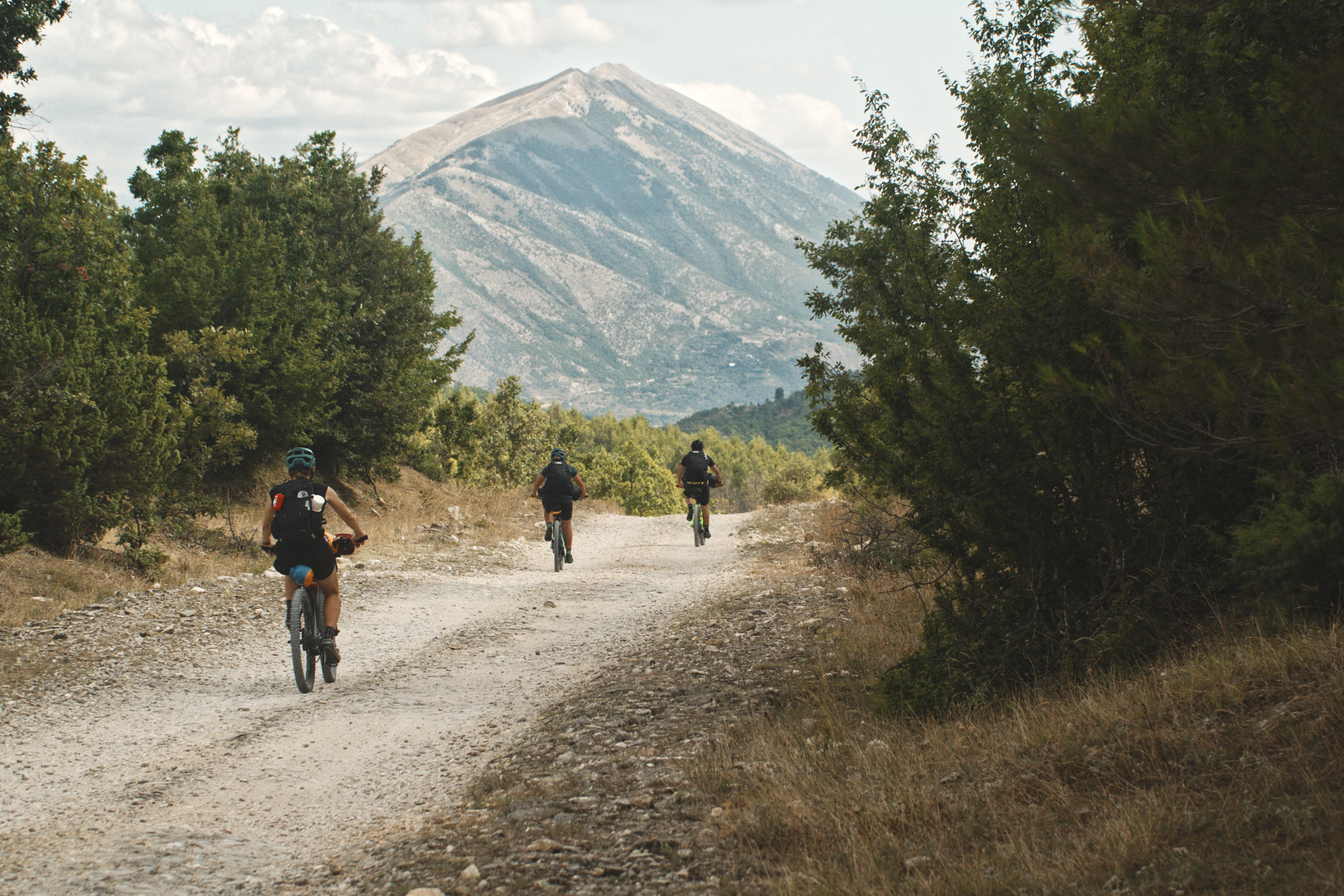
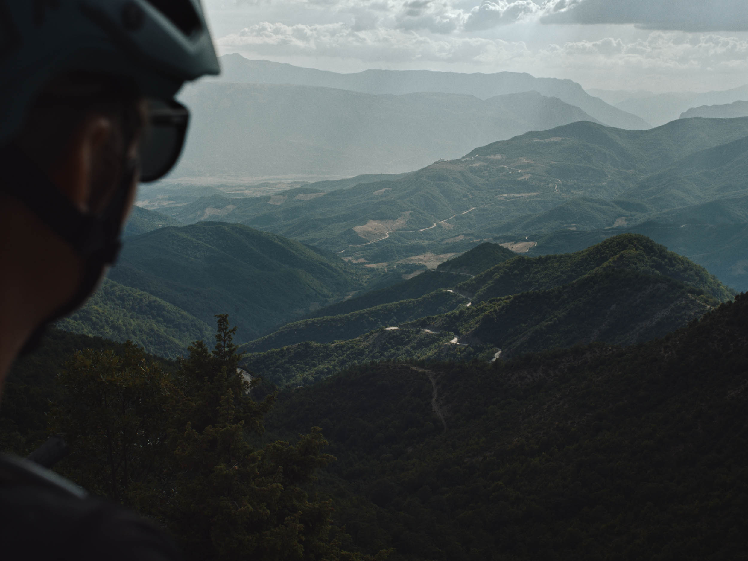
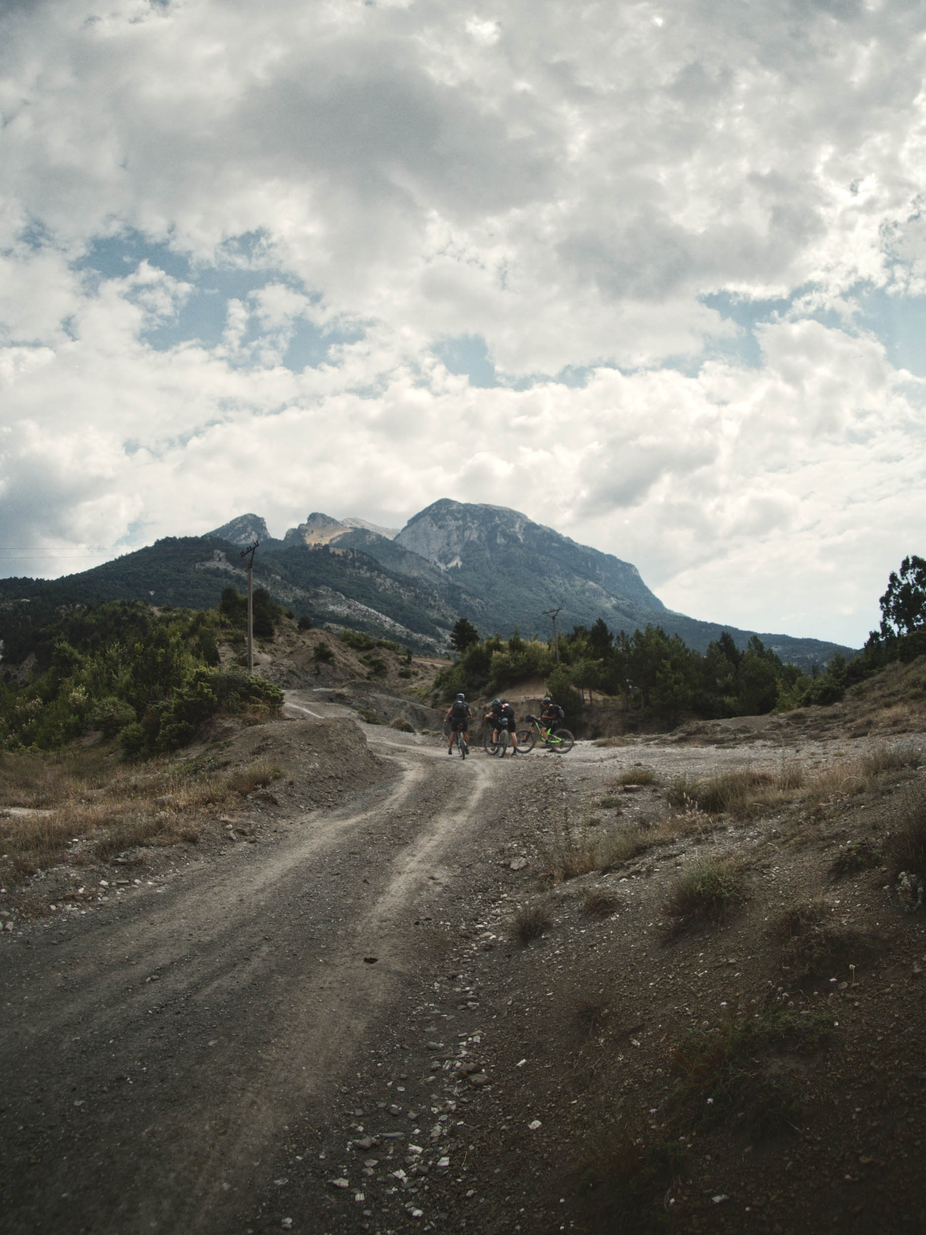
The starting point of the Raki Roads bikepacking route is Berat, often referred to as the “City of a Thousand Windows” and renowned for its well-preserved Ottoman architecture. Starting there doesn’t allow for an extensive warm-up since there’s a steep climb and some hike-a-bike at the beginning, but after about half a mile, the enjoyment of the ride begins and you can fully immerse in seemingly endless dirt roads.
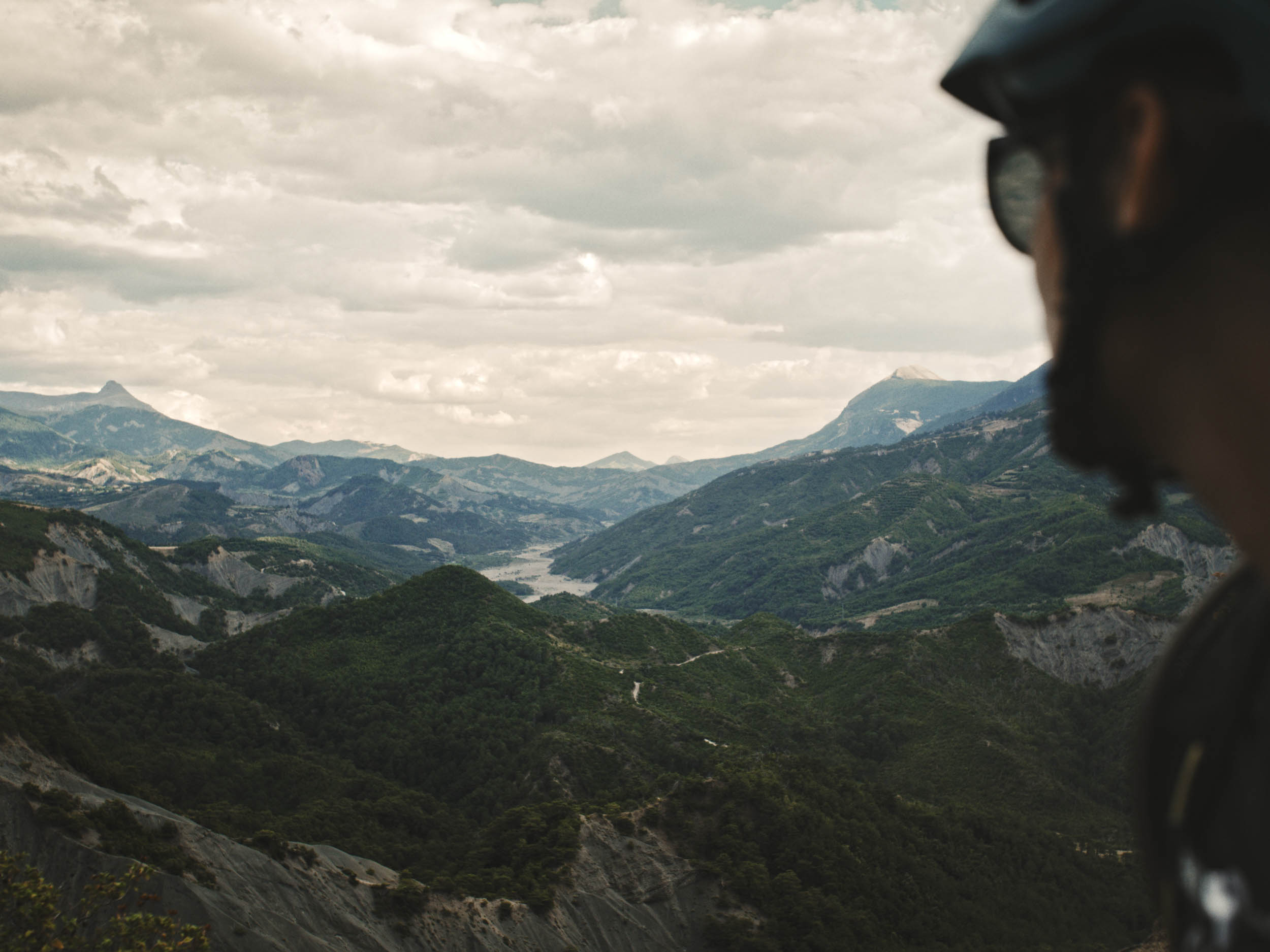
After the first mountain range, which provides a glimpse into what you can expect of the days to come, the route continues alongside Vjosa. The river is often referred to as the last remaining natural river in Europe, and with the assistance of the outdoor company Patagonia, it was turned into a national park. Despite ongoing efforts to protect the river, reoccurring plans for hydropower plants pose a threat to the fragile ecosystem, as does pollution, and plastic bags hang in the surrounding vegetation like ghosts.
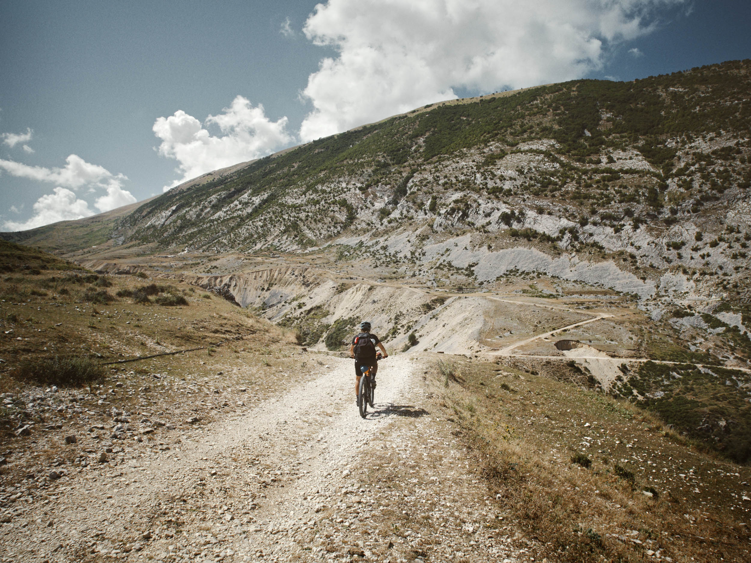
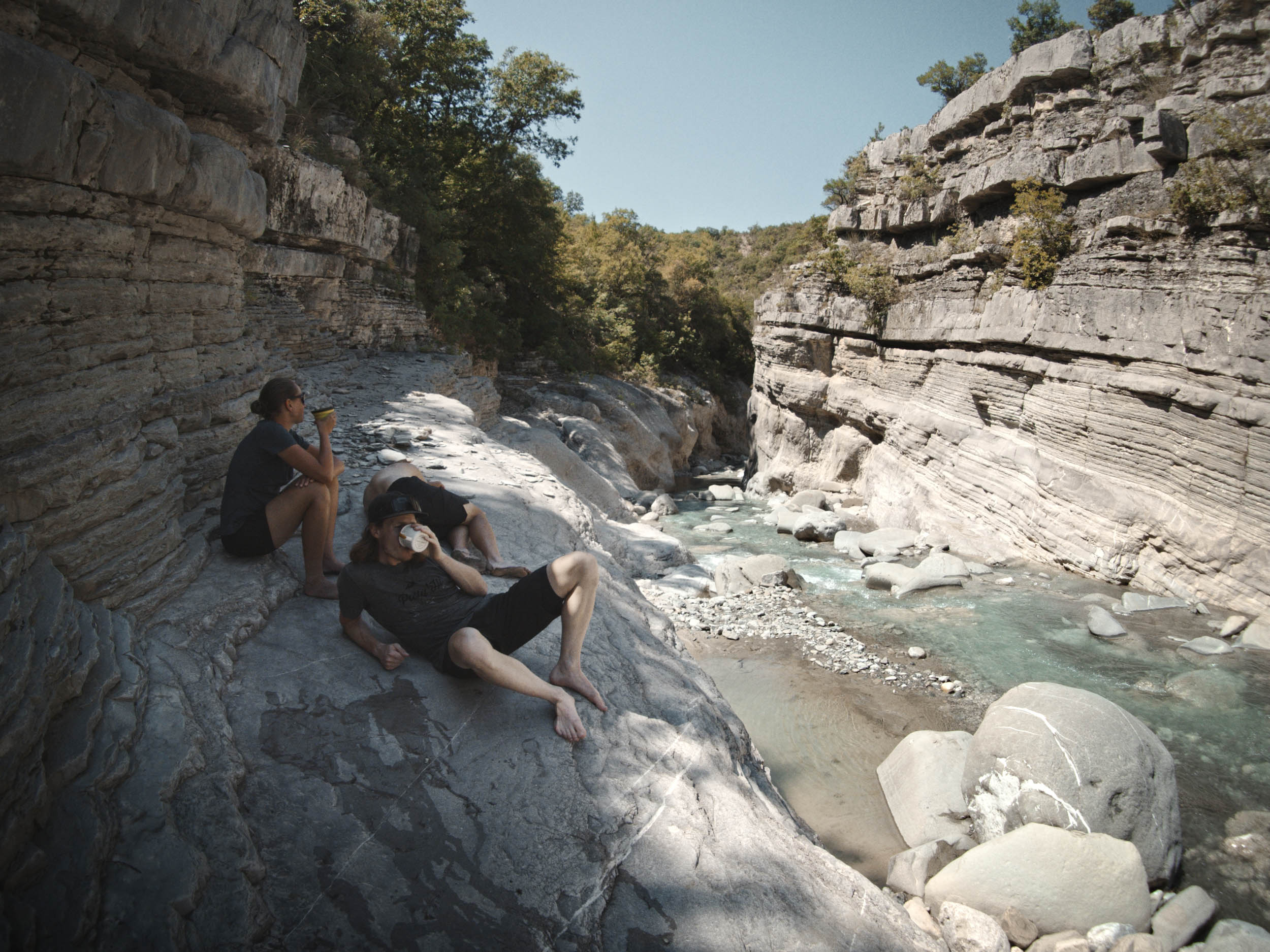
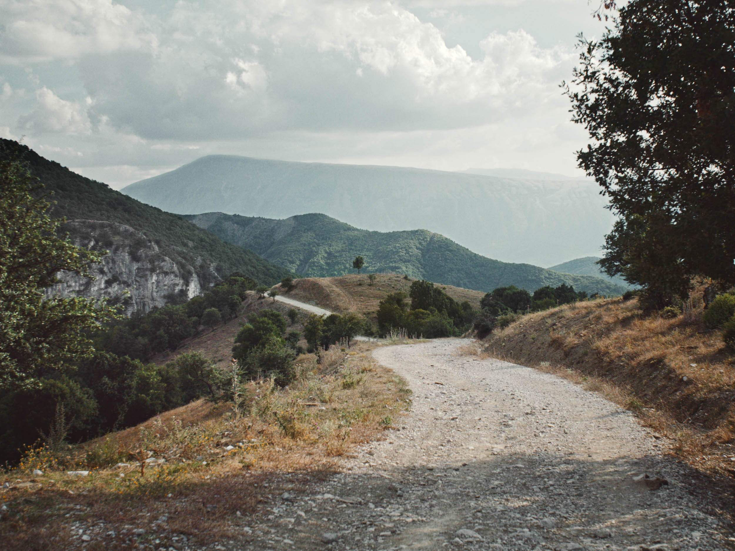
The ride through the valley is the only stretch of asphalt worth mentioning. Luckily, car drivers tend to be quite considerate of cyclists. Përmet is the last town to pass before heading towards Fir of Hotovë-Dangëlli National Park and the backcountry. Due to poor roads, not many people make it far into Lengarica Canyon, which was carved by the river to form a narrow and breathtaking gorge. The climb out of Lengarica Canyon follows a stunningly scenic winding road which offers spectacular views of the endless backcountry. Expect slow progress, as the bad road conditions have turned the road more or less into singletrack. There are some trickling streams, but water flow probably depends on previous rain, and the next reliable source is a river in Pagri. Hence, filling up water tanks at the hydropower plant before the climb is highly recommended.
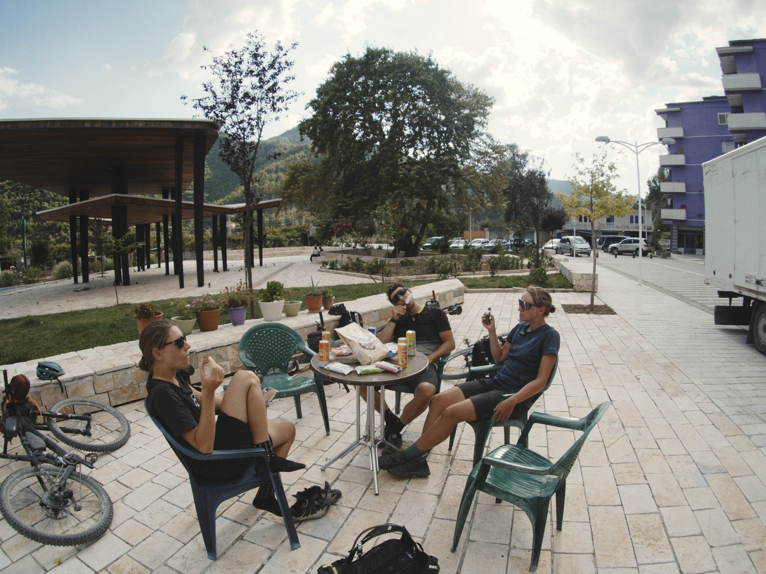
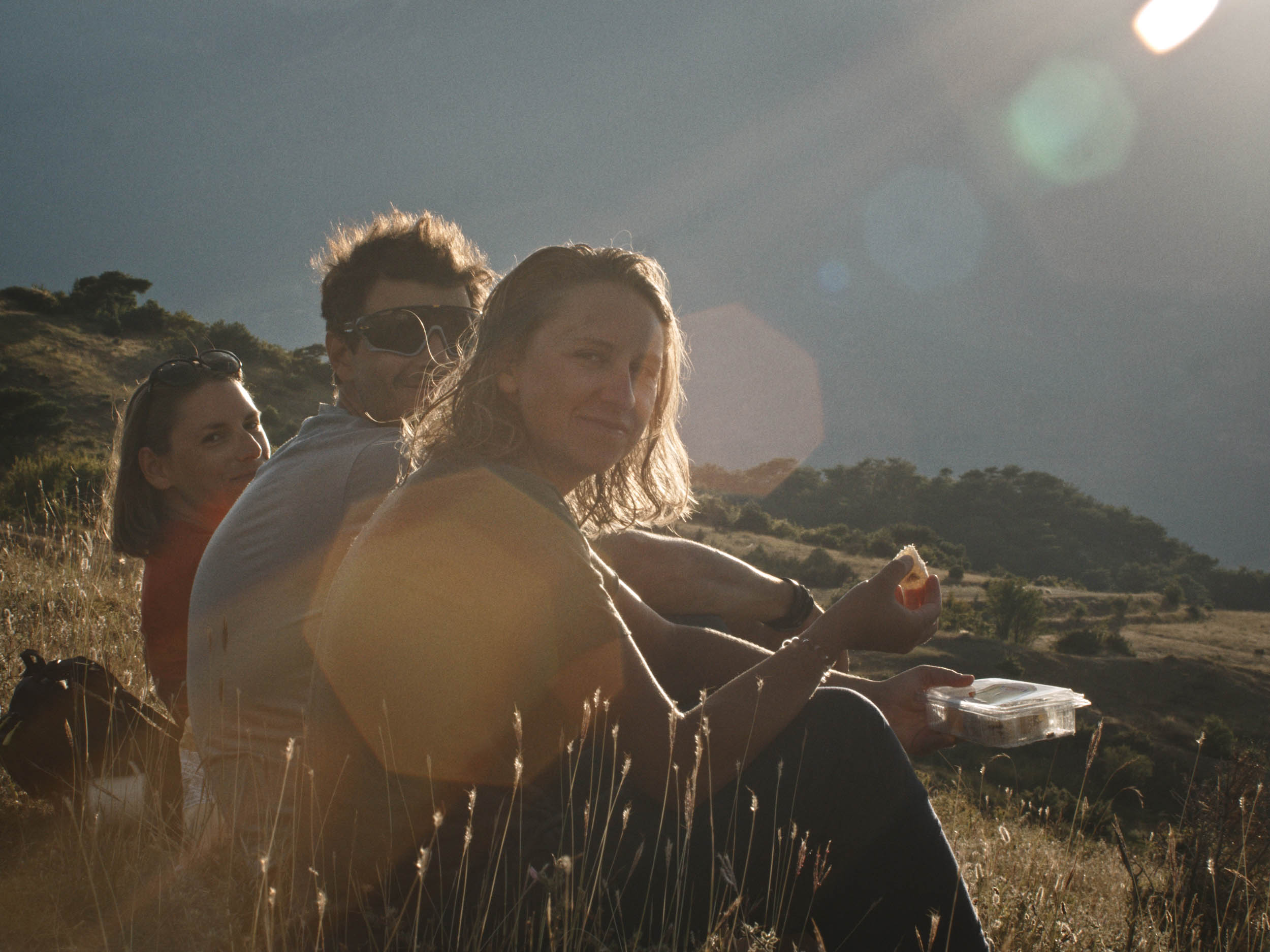
On Google Maps, I noticed a tiny cafe simply called “cafe” that had an astounding number of positive reviews and mouthwatering pictures. We had come to the unspoken agreement that we would not hesitate if the opportunity to indulge in Albanian delicacies presented itself. One particularly recommended is called Petulla, which is basically deep-fried dough that usually comes with honey. Petulla happened to be the specialty of the elderly lady who ran “cafe” while her aloof husband lingered around, a business strategy many Albanian culinary establishments seem to have adopted.
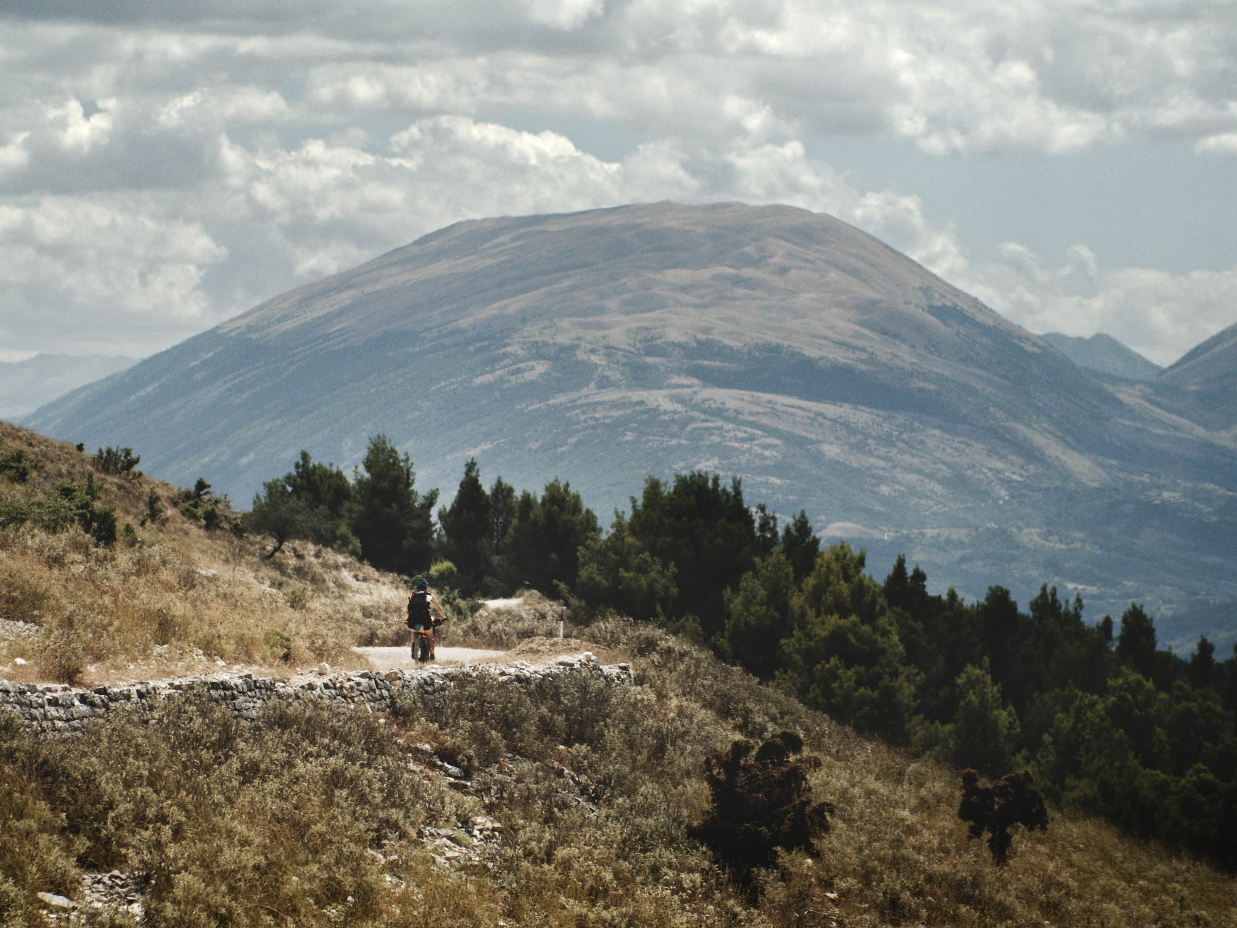
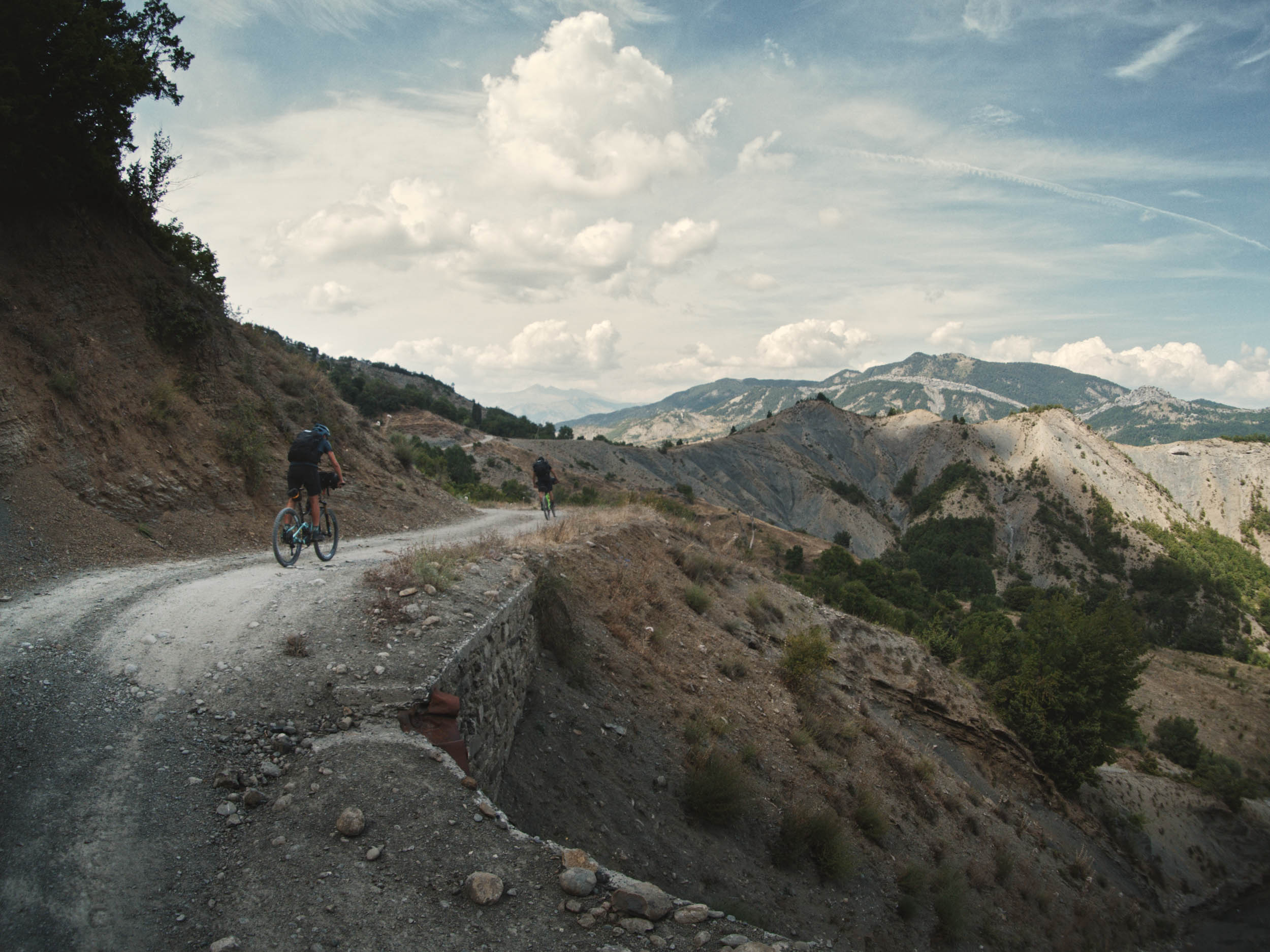
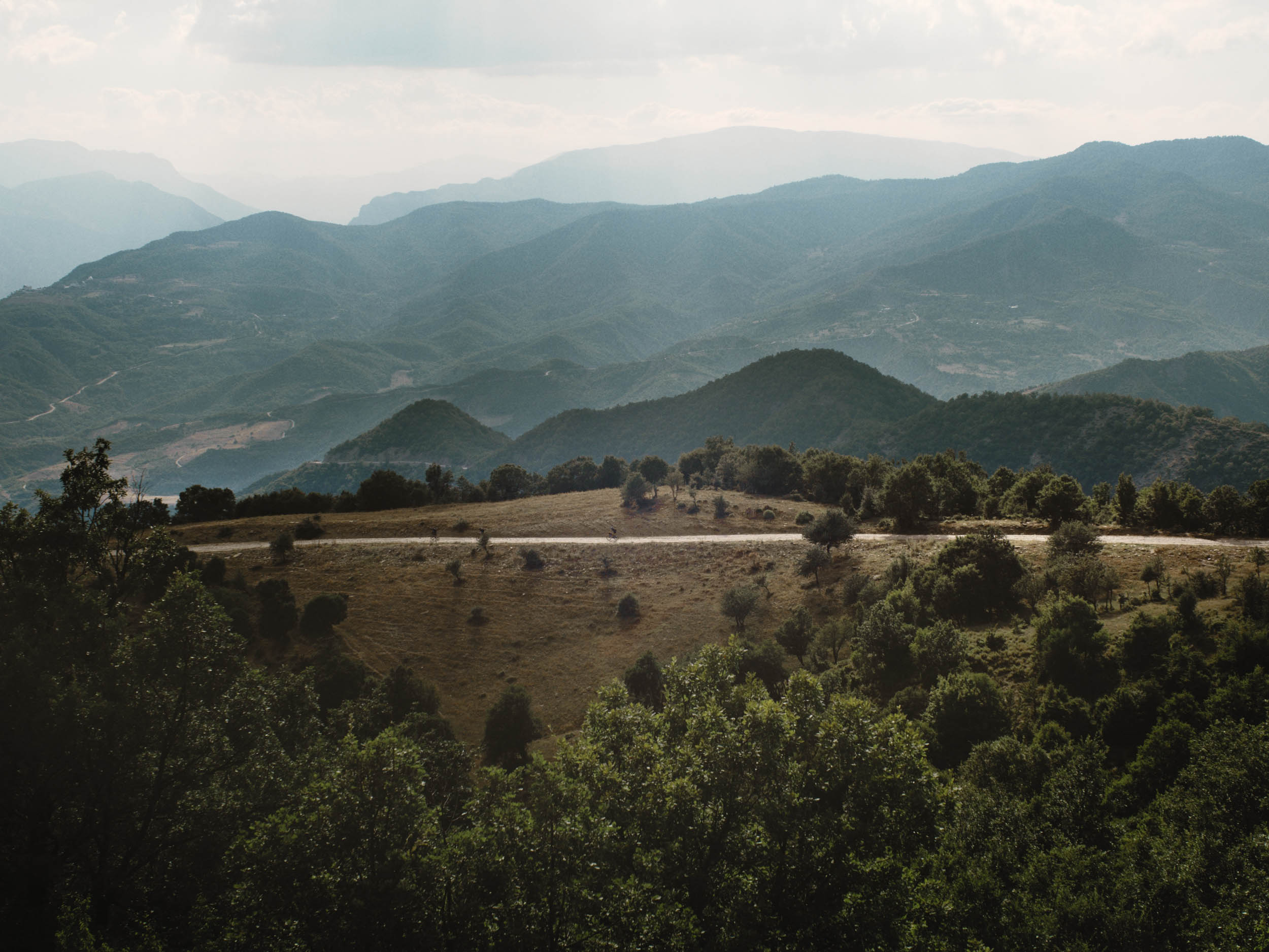
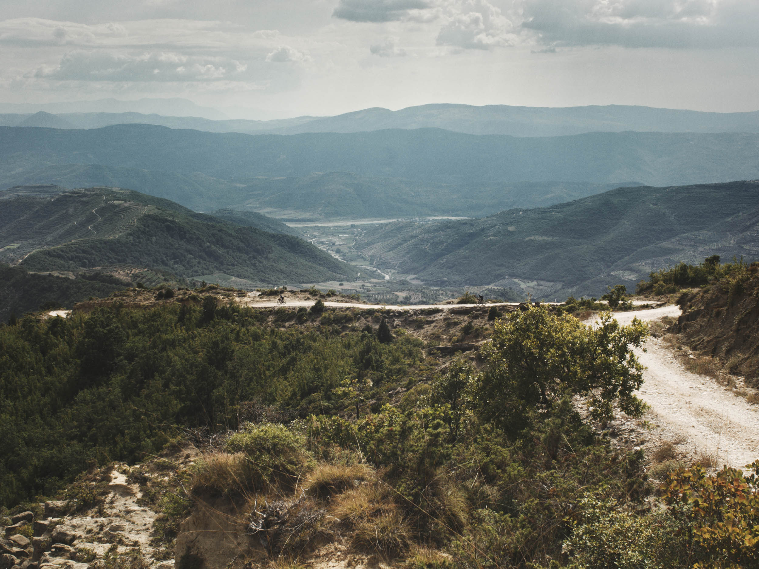
Breathtaking views into Osum Canyon provide the scenery for the ride to Çorovodë, a town that seemed to be made for tourists who never appeared. To climb out of Çorovodë, you’ll follow a smooth gravel road to one of the highest points of the tour. On the way down, the route passes a place called Gjerbës, essentially a village square surrounded by two restaurants and a convenience store. Sometimes, the previously mentioned elderly ladies spot you from afar and almost drag you into their establishments. One of the restaurants we couldn’t resist was called Restaurant Bar Gjerbës. Hospitality is an understatement when it comes to Albanians. We were treated to a three-course lunch and likely would have been offered any food we desired by the gracious host. This particular businesswoman even took it up a notch and runs an Instagram account, where she regularly posts pictures of her guests.
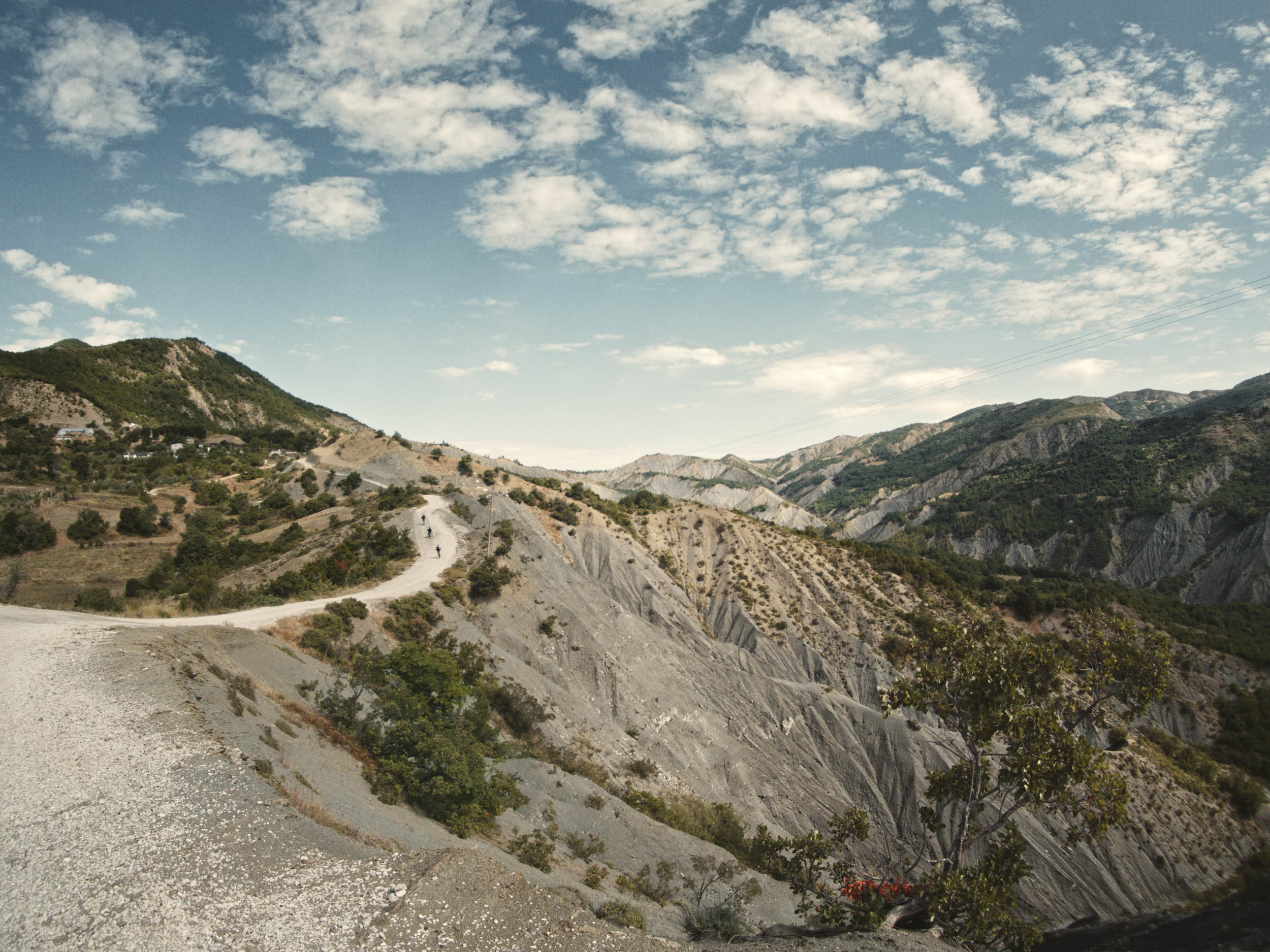
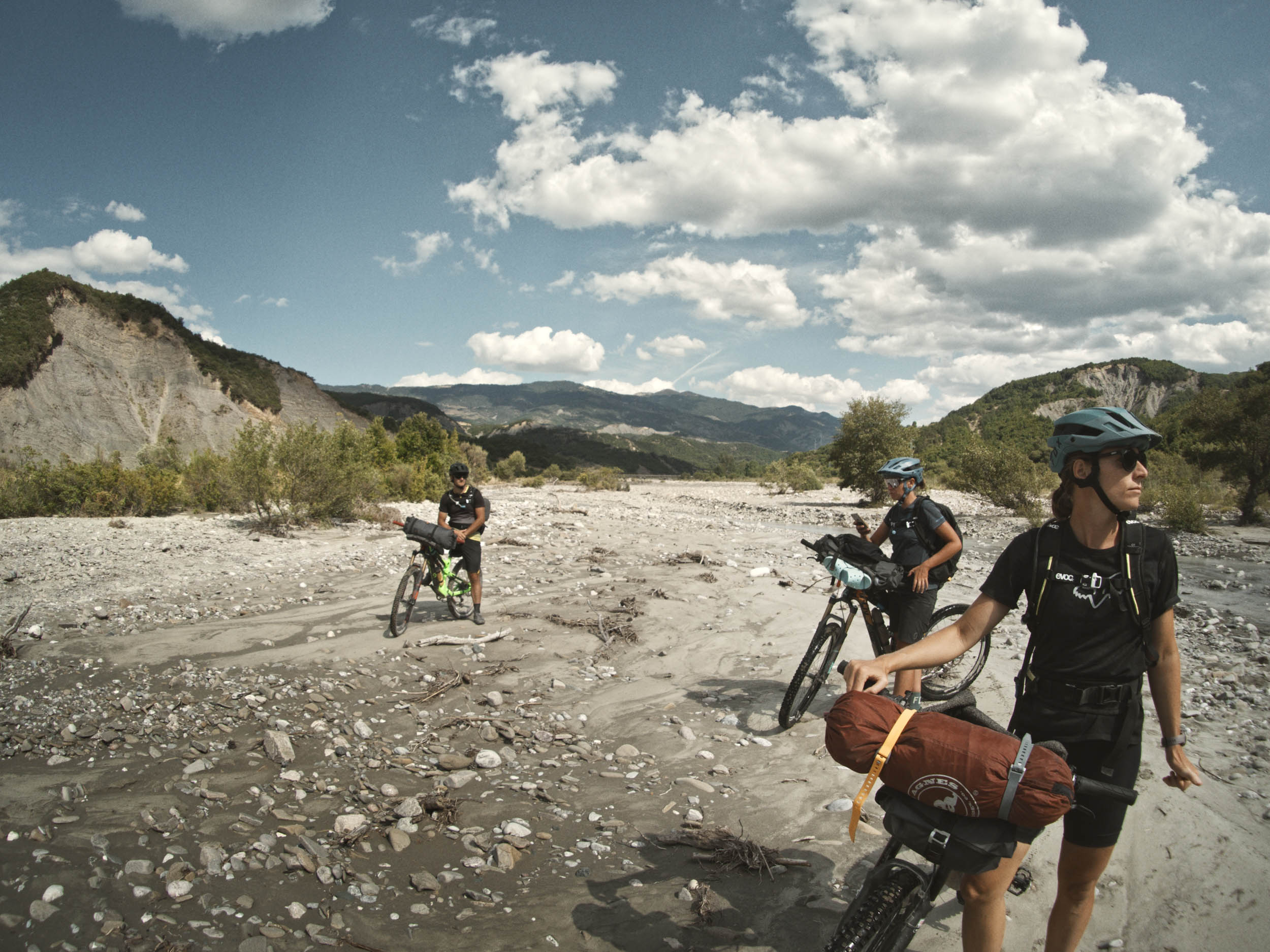
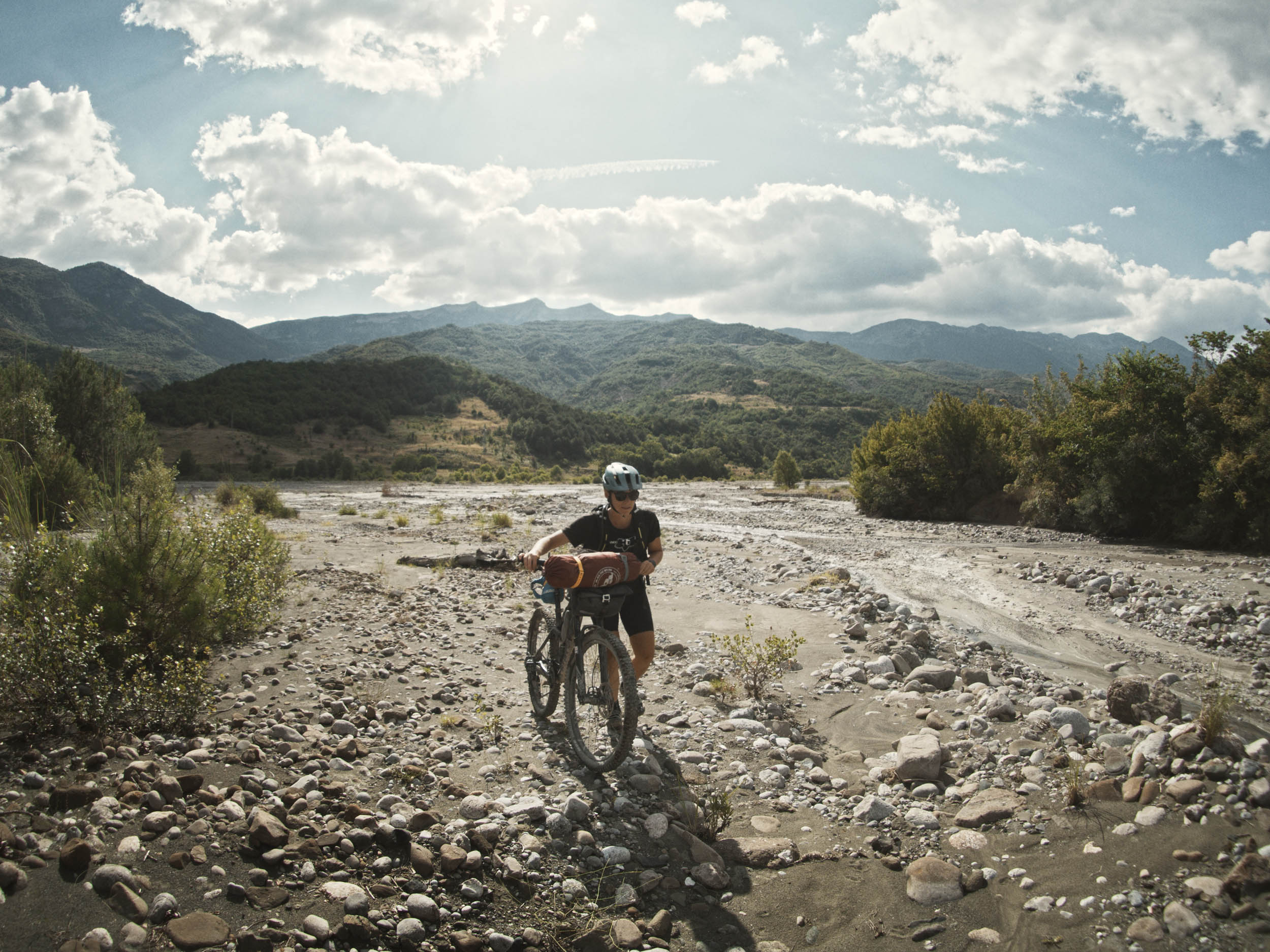
Navigation is straightforward except for one part where we were caught off guard as the gravel road we had been following ended in the bed of Tomorrica River. Be prepared to spend some time until you find the connection to the doubletrack on the other side. In summer, passing was easy; however, it might be more challenging after heavy rain or in spring.
For the last climb, you find yourself in Tomorr National Park. What starts as a straightforward climb develops into a steep and demanding one. The road is rideable, but be prepared for a strenuous finish. The descending road back to Berat is beautiful and provides the perfect opportunity to reflect on the ride.
Route Difficulty
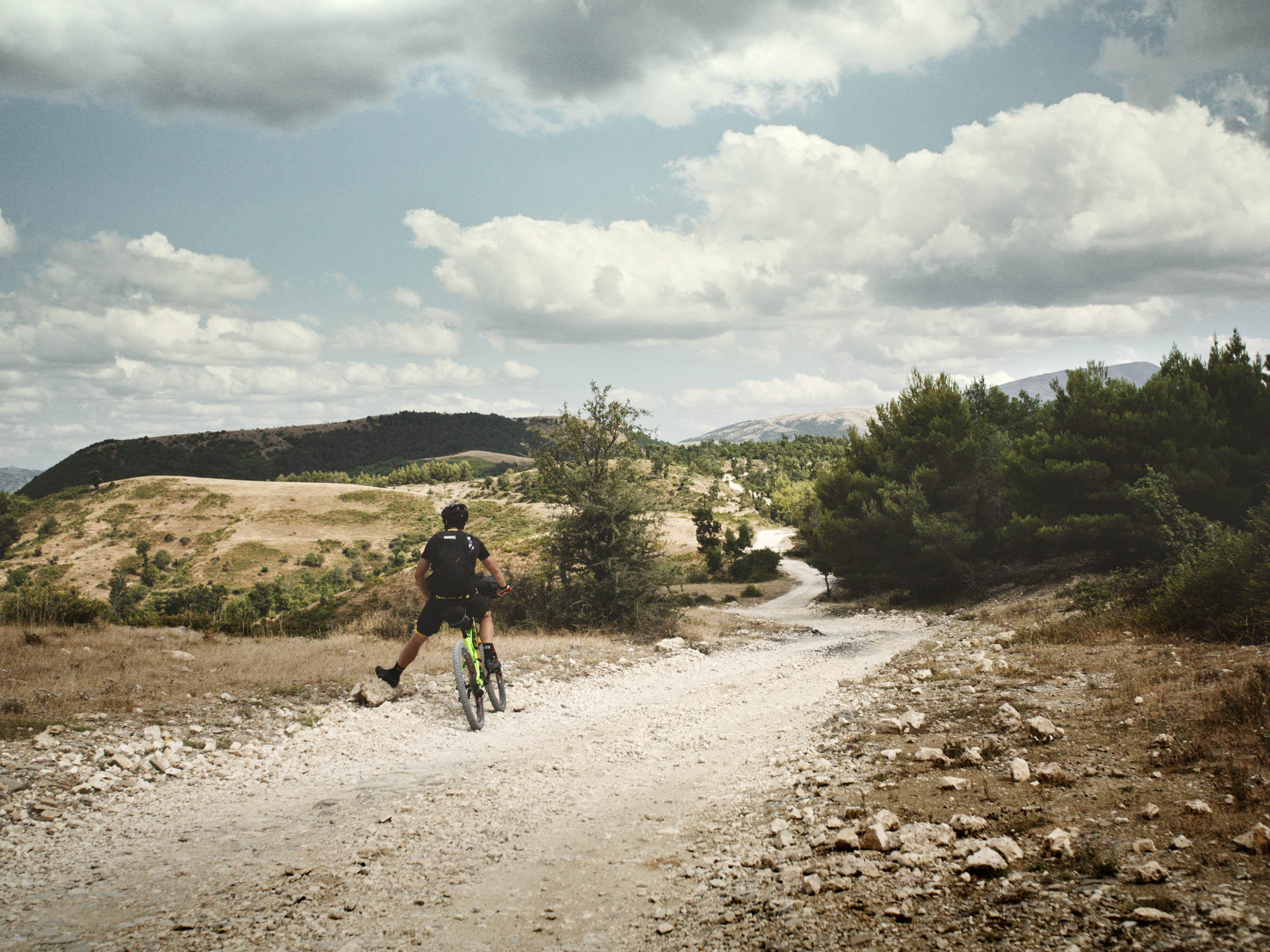
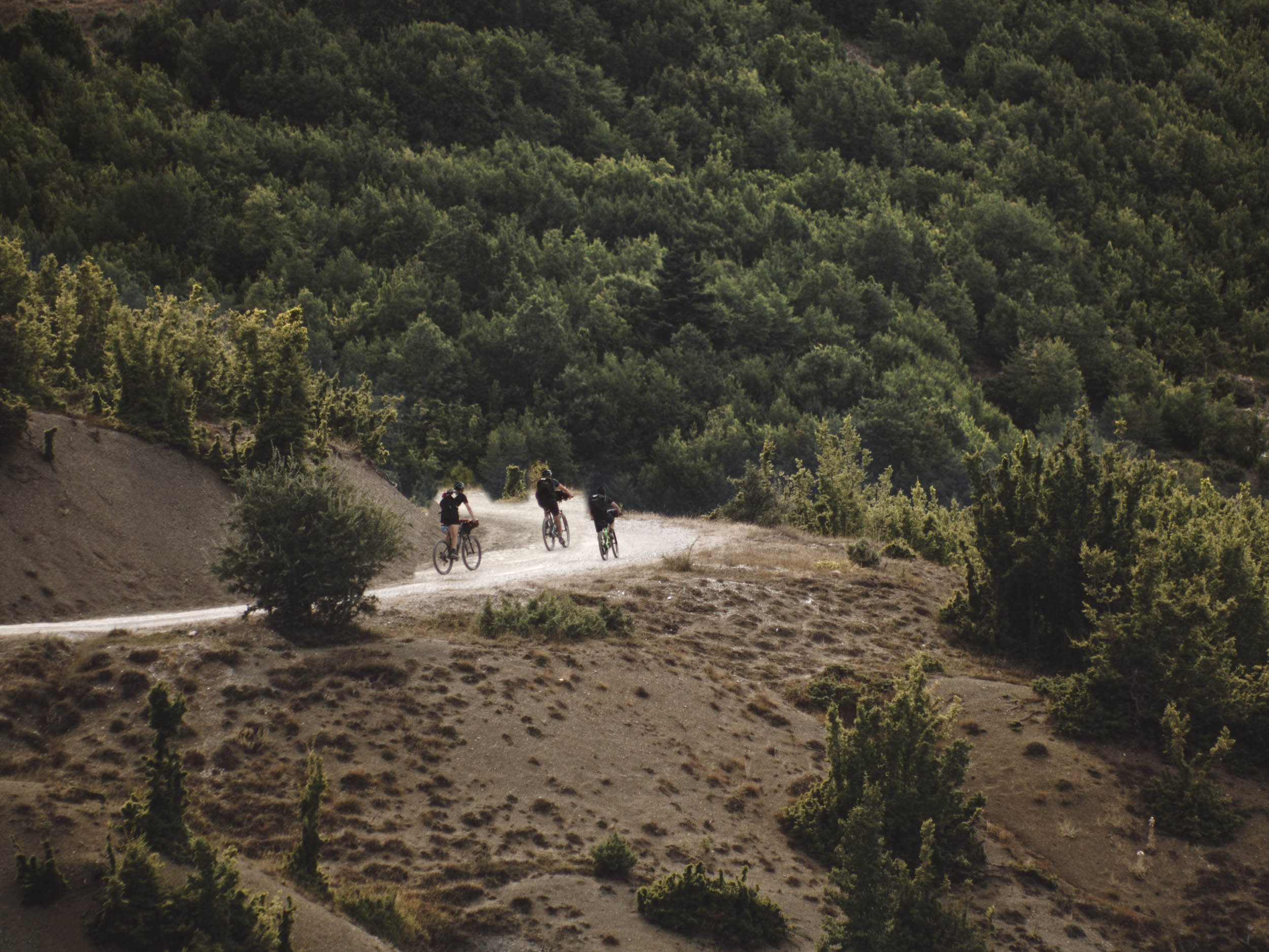
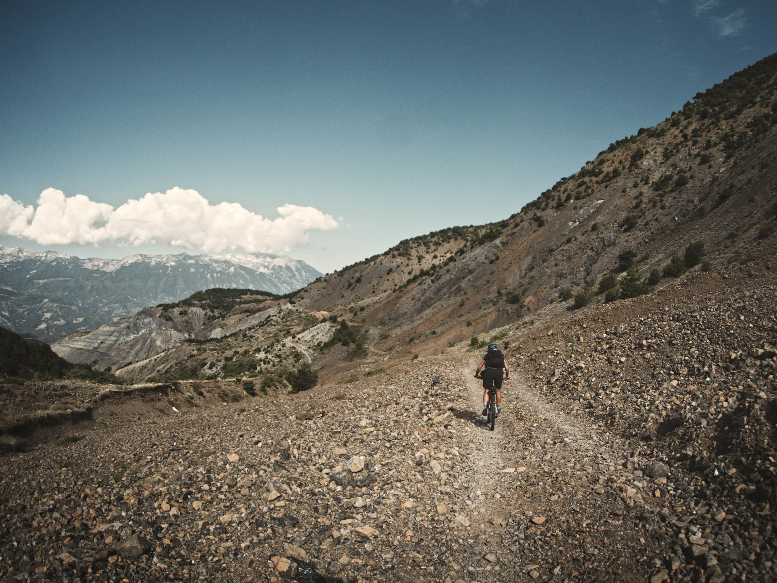
Apart from the short hike-a-bike section in Berat, every off-road part is a rideable doubletrack road, but the surface is often rugged or loose. There’s nothing too technical if you ride a mountain bike (technical difficulty 4/10). Tackling the tour on a gravel bike will lead to long pushing sections, uphill and downhill, and significantly less fun. The steepest part is the final section of the climb in Tomorr National Park, which experienced riders can manage without dismounting. There are a few extensive climbs, and if you’re aiming to complete the tour in six days, you’ll have to cover an average of 4,700 feet over 35 miles must be covered. Furthermore, roads are exposed to the sun, and shade is rare, which increases physical exertion (physical demand 6/10). There are several small towns and villages along the route where you can grab a bite. Supermarkets often resemble convenience stores and provide essentials. Bringing a water filter is recommended. As for equipment, ensure you have everything you might need because there is no option for purchasing spare bike parts or camping gear (resupply and Logistics 2/10). Considering all these aspects, the overall difficulty is 4/10.
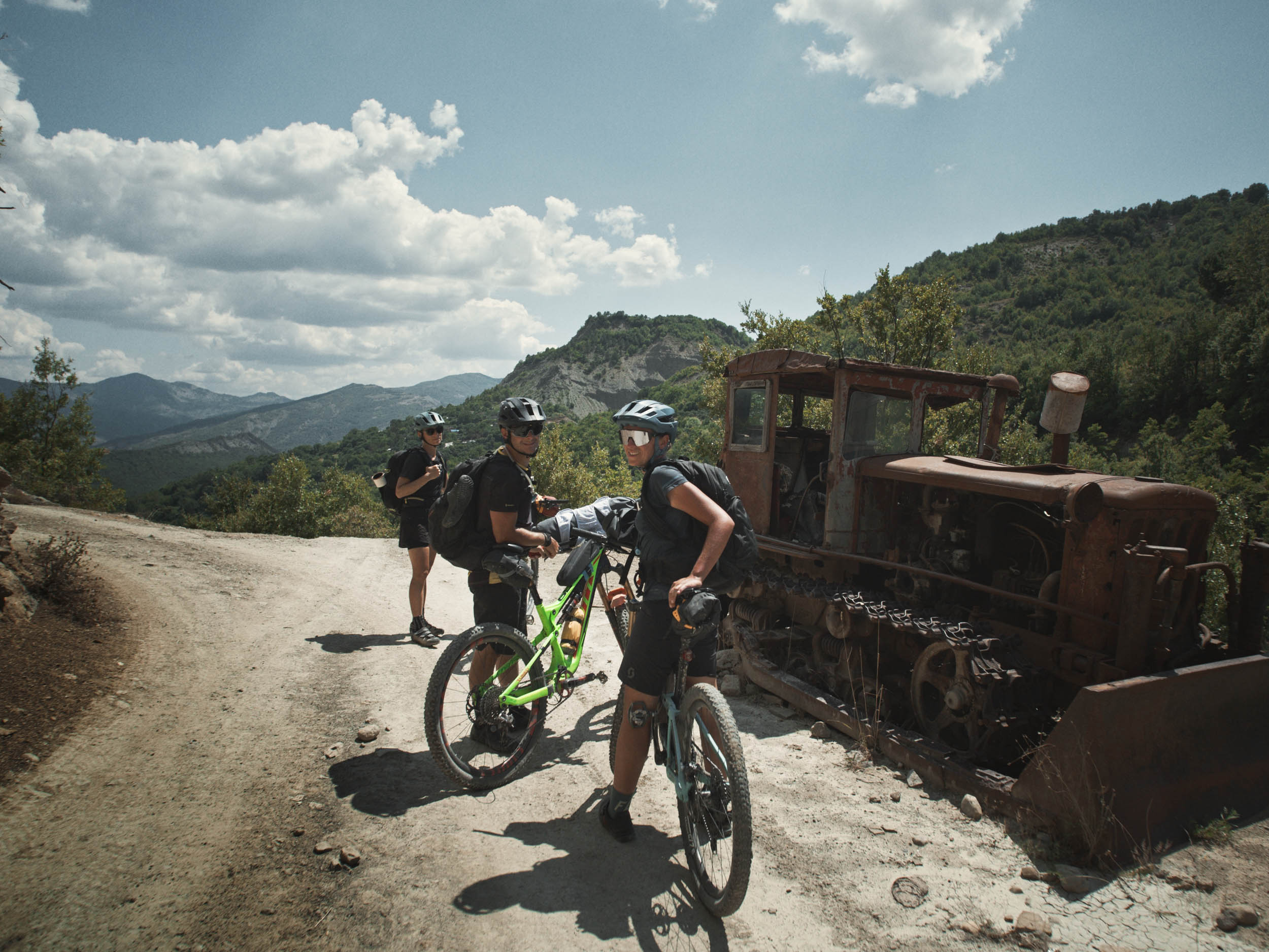
Route development: Even though people bikepack through Albania, we didn’t find any existing routes that met our demands. As such, we scoured Google Maps for a region with an extensive network of gravel roads and enough reliable water sources to allow for a trip in summer. We made some minor adjustments while riding, but the route turned out to be spectacular and also established enough to be rideable and sustainable, as the dirt road are often essential connections between mountain villages.
Submit Route Alert
As the leading creator and publisher of bikepacking routes, BIKEPACKING.com endeavors to maintain, improve, and advocate for our growing network of bikepacking routes all over the world. As such, our editorial team, route creators, and Route Stewards serve as mediators for route improvements and opportunities for connectivity, conservation, and community growth around these routes. To facilitate these efforts, we rely on our Bikepacking Collective and the greater bikepacking community to call attention to critical issues and opportunities that are discovered while riding these routes. If you have a vital issue or opportunity regarding this route that pertains to one of the subjects below, please let us know:
Highlights
Must Know
Camping
Food/H2O
Trail Notes
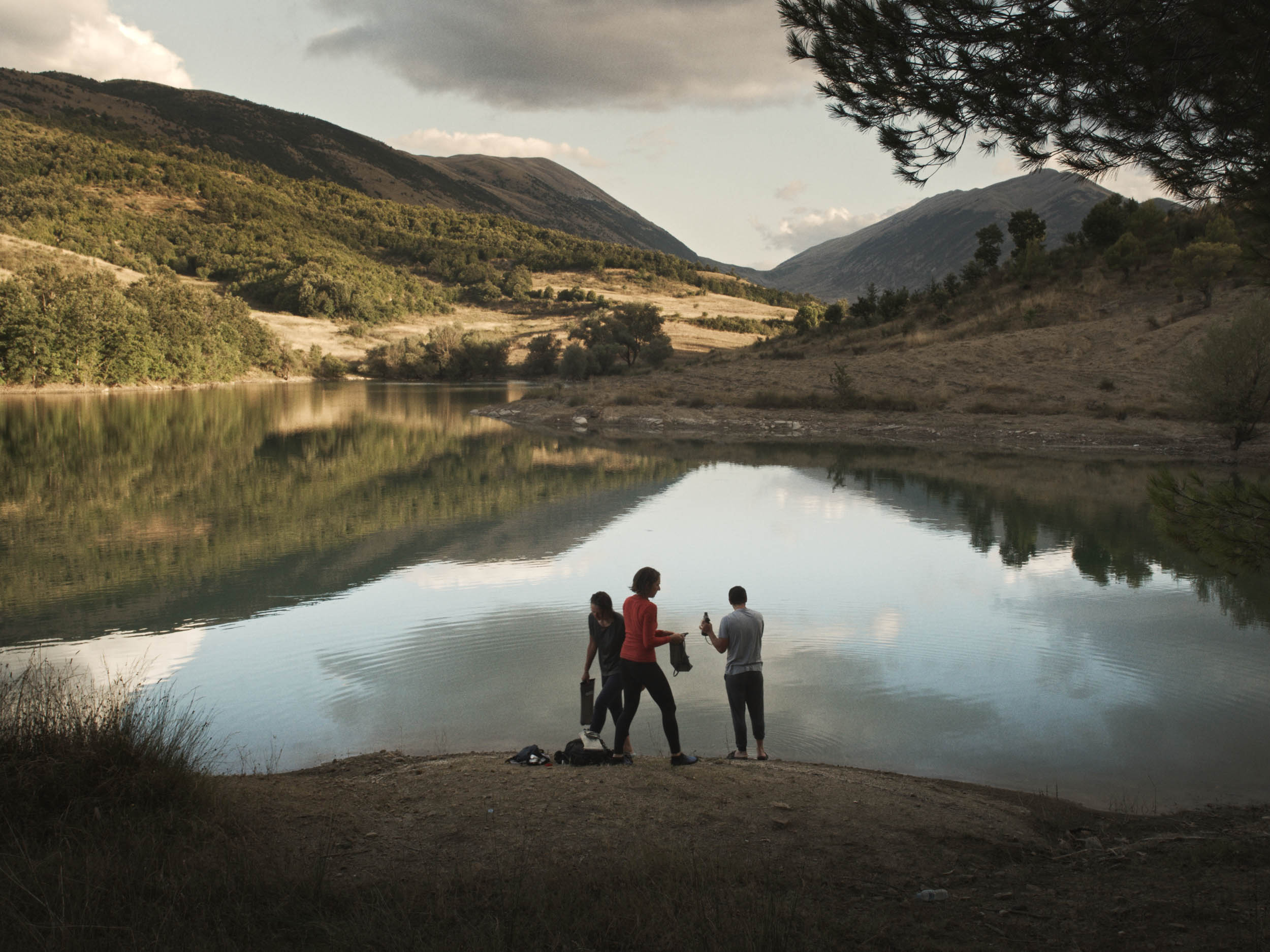
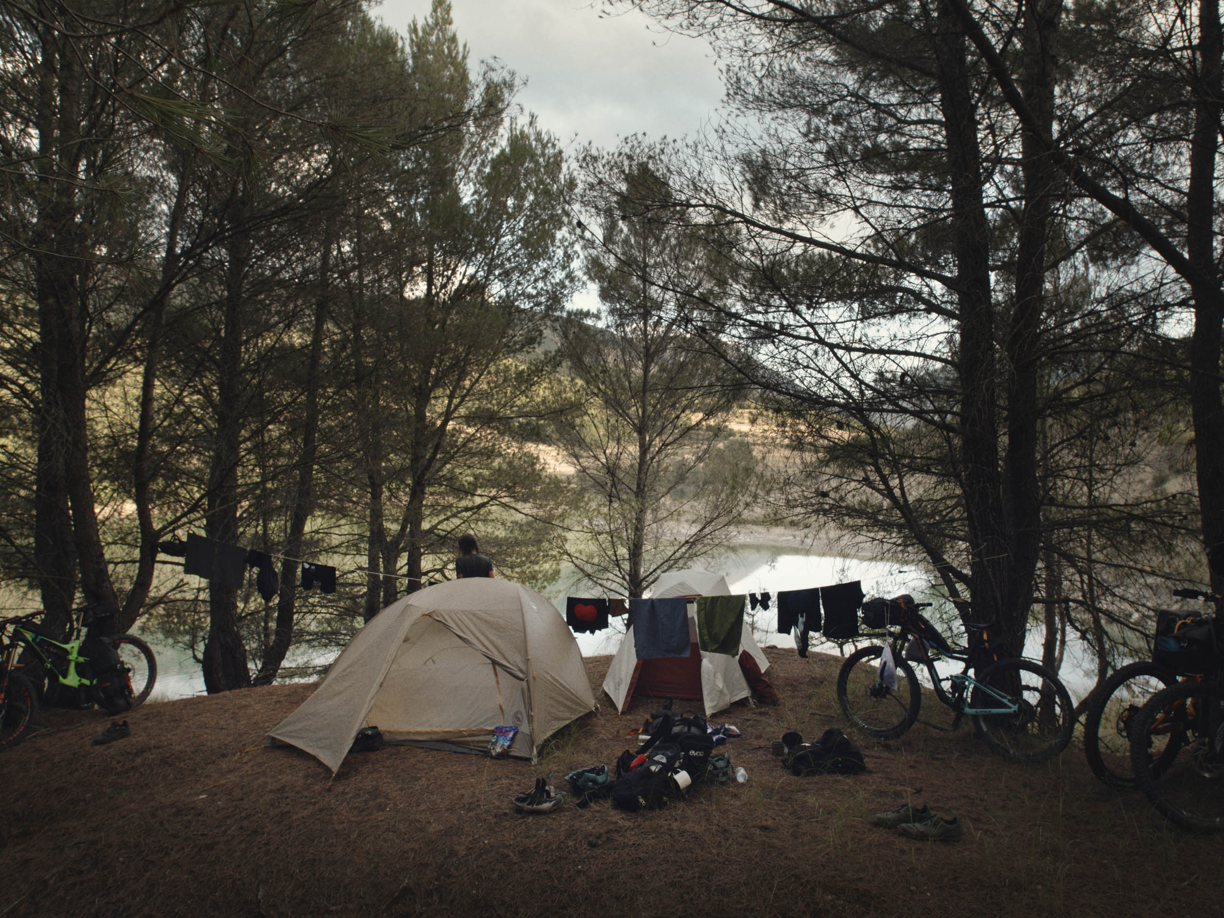
- The serene landscape and taking a swim in the water reservoir at our first camping spot.
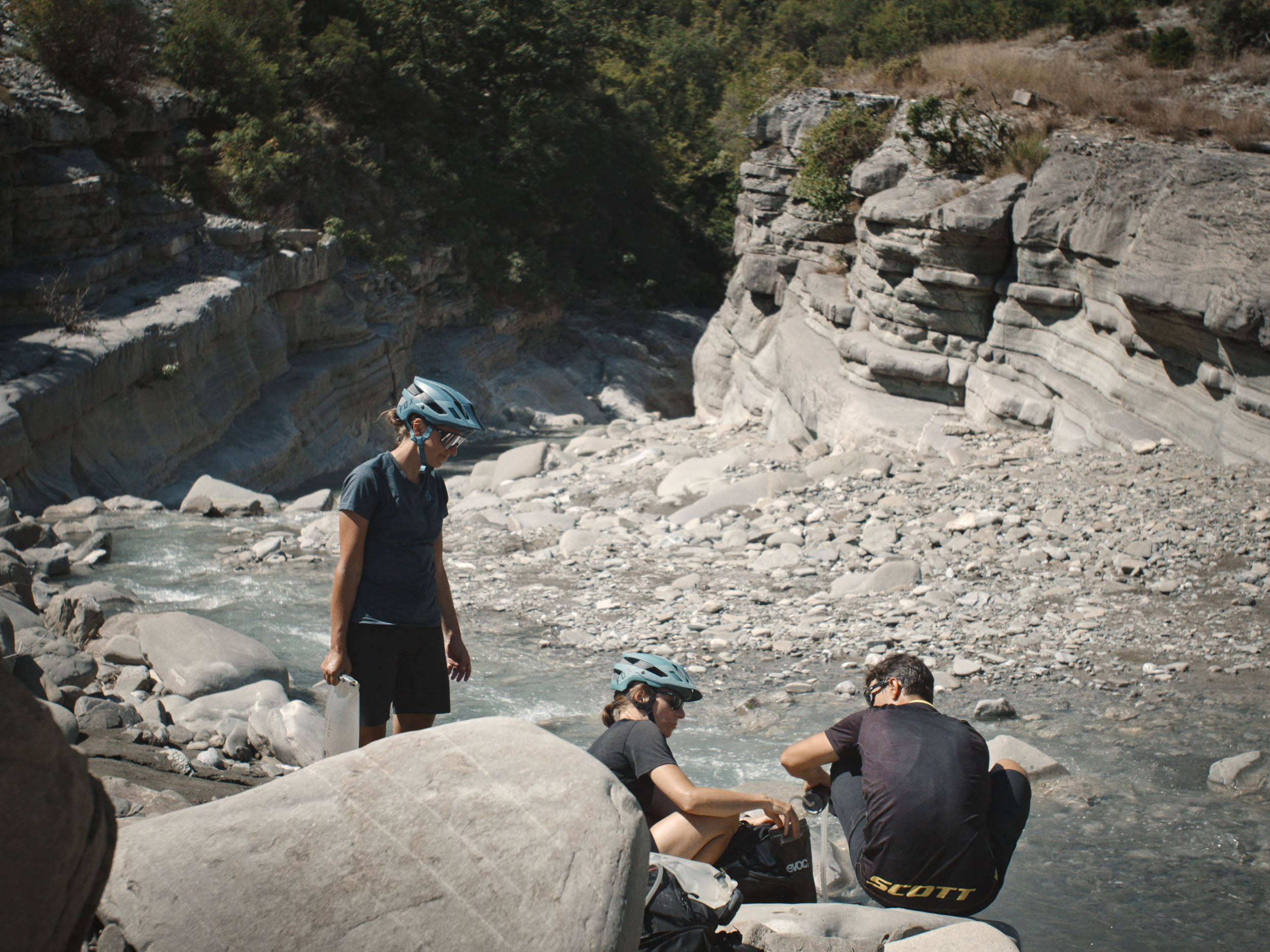
- Cooling off in Lengarice Canyon. The best spot to do so is at the hydropower station as there are no other people and it is just before a strenuous climb.
- Vjosa is said to be the last natural river in Europe, and seeing what a natural riverbed looks like is stunning and makes you realize that what we think of as wild rivers are more like human-tamed canals.
- Albanian hospitality and the delicious treats that come with it. You will not regret allowing time to have lunch at restaurants or cafes. Despite communication issues, hosts will make sure you don’t leave hungry.
- “Cafe” in Sevran I Madh offers the best Petulla we had, as well as self-made juices, raki, and honey.
- Restaurant Bar Gjerbës in Gjerbës provides you with delicious lunch and makes you feel more than welcome.
- When returning to Berat, you find a wide variety of restaurants. Ansel is the one we recommend for rewarding yourself.
- We did the tour in August and temperatures were above 90°F, which was tough but also resulted in warm nights. In general, the tour can be done from May to October, with the driest—but also hottest—months being July and August.
- In case you arrive at the Tirana Airport, you can get to Berat by bus, taxi, or renting a car. Fares are comparatively low, so the transportation mode of choice depends on your overall itinerary.
- We spent the night before we embarked on the tour at River Side Camping, and they were extremely kind and let us park the car on their property for the time of our absence.
- We used full-suspension bikes, but a hardtail mountain bike with at least 2.25-inch tires does the job equally well. Gravel bikes are insufficient.
- Many plants in this area have thorns. As there are no bike stores along the route, bring enough tubes or ride tubeless.
- Street dogs are reportedly an issue, but despite encountering many stray dogs, we never got into any dangerous situations. Use caution.
- Albanians are extremely eager to help, but communicating can be difficult. Downloading a dictionary or translation app might help.
- In rural areas, you can only pay cash. Some take Euros if there is no other option, but make sure you withdraw enough Lek for the whole tour.
- After Gjerbës, the road ends in a riverbed, and finding the road on the other side might be tricky if you have a bad navigation device. We used Komoot, which offers offline navigation, and it helped a lot. In early spring, crossing the river might be a bit challenging.
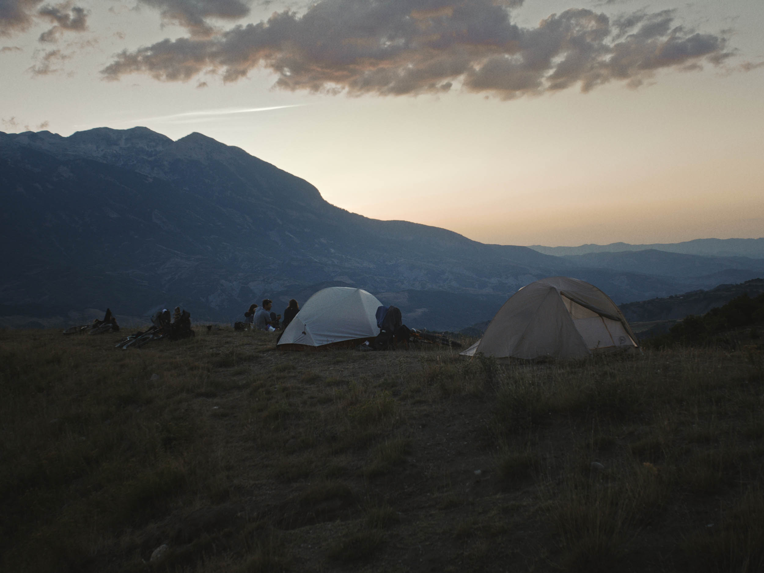
- Wild camping is legal in Albania.
- If planned accordingly, camping near water is always an option.
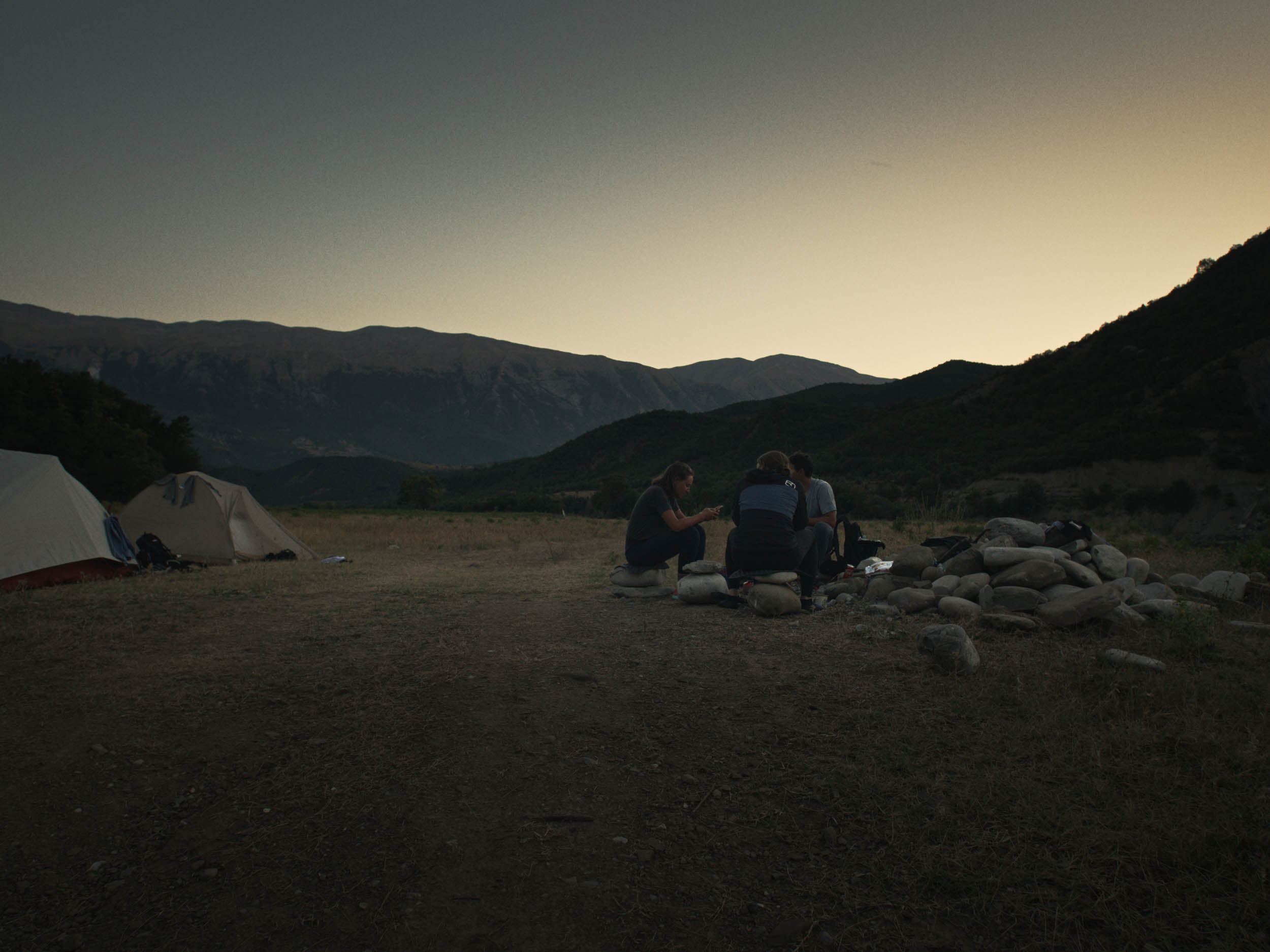
- All the spots we chose for spending the night were good, with the first one being extra special (see map).
- Convenience stores and restaurants can be found in all towns along the route (Berat, Tepelena, Këlcyrë, Përmet, Çorovodë).
- Longer stretches without any stores are from Përmet to Çorovodë and from Çorovodë to Gramsh.
- Reliable water sources, apart from restaurants and stores, can be found regularly. There are several rivers and sometimes water reservoirs in the mountains. Hence, bringing a water filter makes water supply straightforward.
- Where water and food are rather scarce, see map for POI.
- Local cuisine is highly recommended, and you can always have lunch somewhere with a little planning.
- Our favorites were “Cafe” in Sevran I Madh and the Petulla we had there, as well as Restaurant Bar Gjerbës in Gjerbës.
Below you will find a recommended six-day clockwise itinerary based on our ride. Find associated links to Strava maps for details.
location Berat-Liqeni I Golemajt (reservoir)
Day 1: 52 km +1,544 m (32 mi +5,060 ft)
location Liqeni I Golemajt-Langarica Canyon
Day 2: 79 km +1,308 m (48 mi +4,260 ft)
location Langarica Canyon-Pagri
Day 3: 57 km +1,657 m (37 mi +5,400 ft)
location Pagri-Ura e Kasabashit
Day 4: 40 km +1,091 m (25 mi +3,300 ft)
location Ura e Kasabashit-Çukat e Ferrës
Day 5: 38 km +1,380 m (23 mi +4,600 ft)
location Çukat e Ferrës-Berat
Day 6: 78 km +1,722 m (48 mi +5,580 ft)


Terms of Use: As with each bikepacking route guide published on BIKEPACKING.com, should you choose to cycle this route, do so at your own risk. Prior to setting out check current local weather, conditions, and land/road closures. While riding, obey all public and private land use restrictions and rules, carry proper safety and navigational equipment, and of course, follow the #leavenotrace guidelines. The information found herein is simply a planning resource to be used as a point of inspiration in conjunction with your own due-diligence. In spite of the fact that this route, associated GPS track (GPX and maps), and all route guidelines were prepared under diligent research by the specified contributor and/or contributors, the accuracy of such and judgement of the author is not guaranteed. BIKEPACKING.com LLC, its partners, associates, and contributors are in no way liable for personal injury, damage to personal property, or any other such situation that might happen to individual riders cycling or following this route.
Please keep the conversation civil, constructive, and inclusive, or your comment will be removed.