


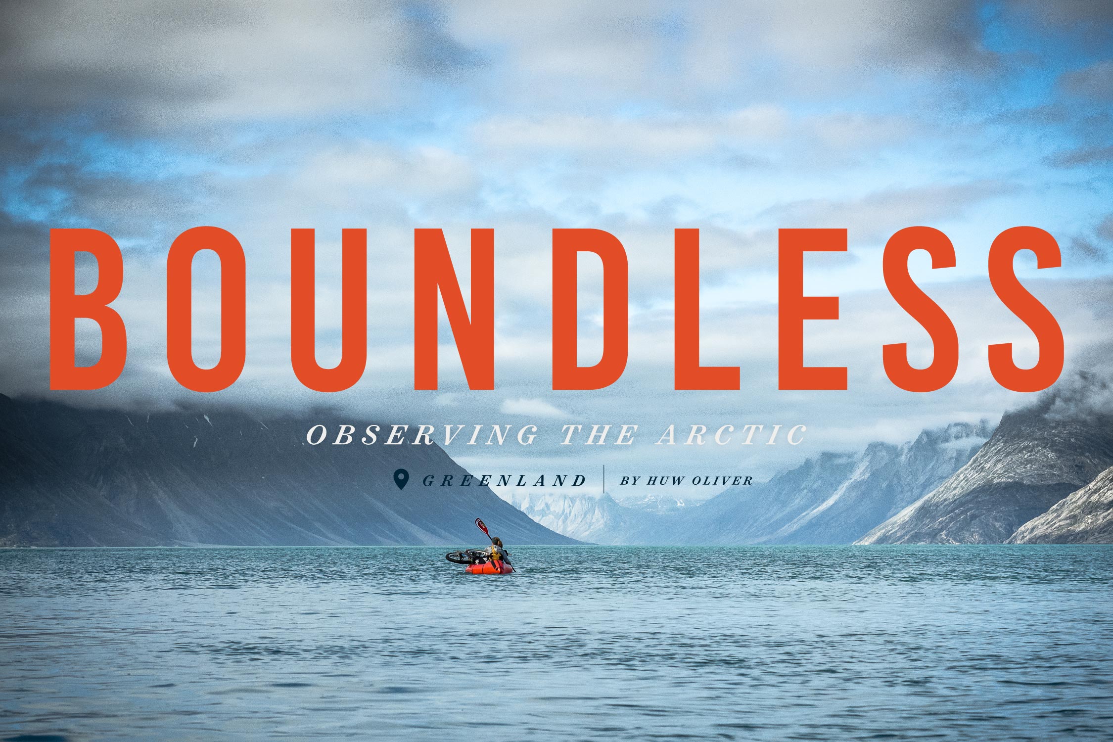
Ice to Coast: The Road to Freedom, Greenland
Distance
130 Mi.
(209 KM)Days
4-6
% Unpaved
90%
% Singletrack
0%
% Rideable (time)
90%
Total Ascent
14,904'
(4,543 M)High Point
1,707'
(520 M)Difficulty (1-10)
8?
- 8Climbing Scale Strenuous115 FT/MI (22 M/KM)
- 7Technical Difficulty Difficult
- 8Physical Demand Difficult
- 8Resupply & Logistics Strenuous
Contributed By

Thomas and Jorgen
Guest Contributor
Two Danes, an outdoor aficionado and an ex-pro cyclist meet up in a bar. The outdoor aficionado says, “I can set up camp faster than you can fix a flat tire,” to which the ex-pro cyclist replies, “I can fix both before you’ve downed that beer.” This is a true story, believe it or not, and now Thomas and Jørgen have taken countless of bikepacking trips together around the world.
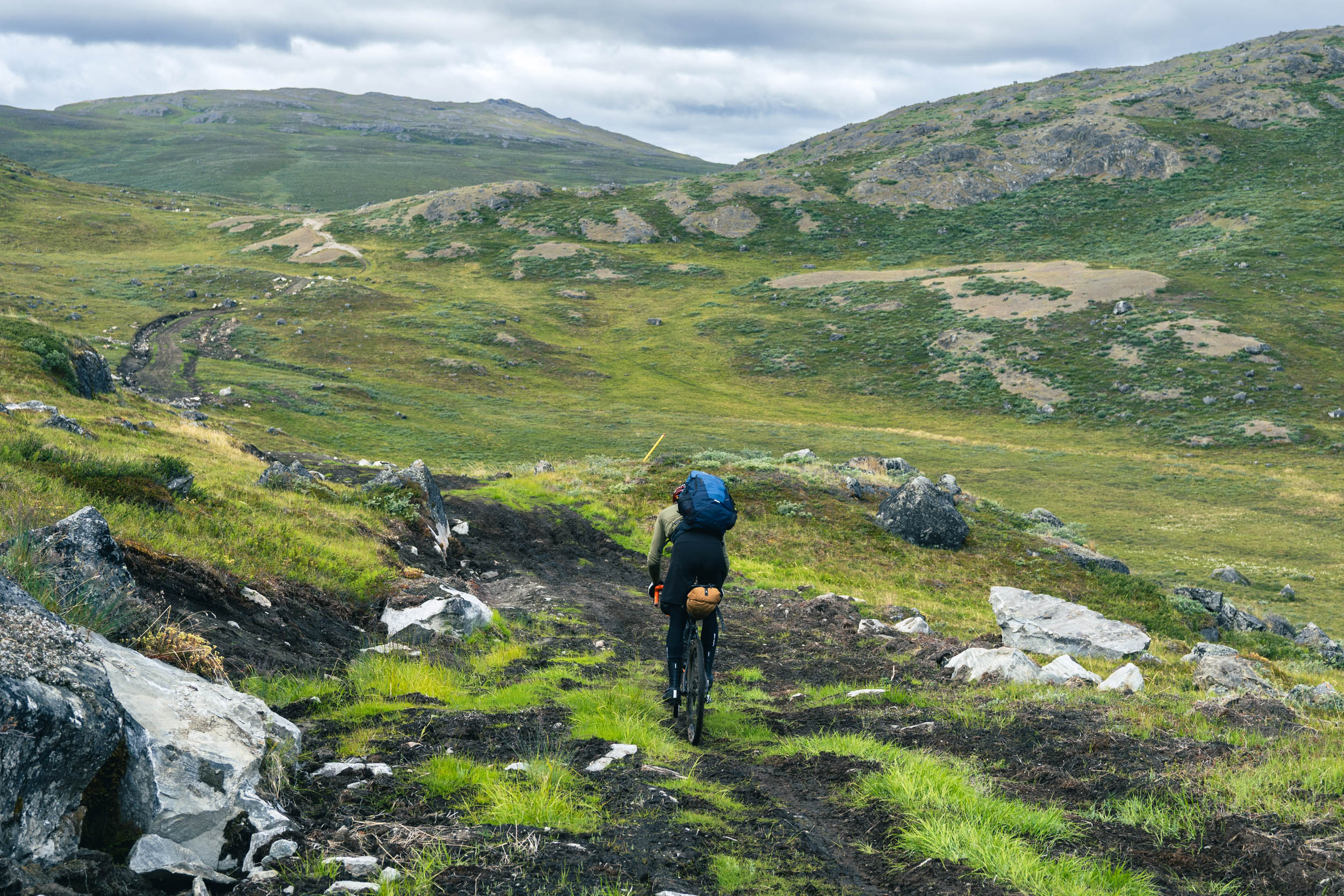
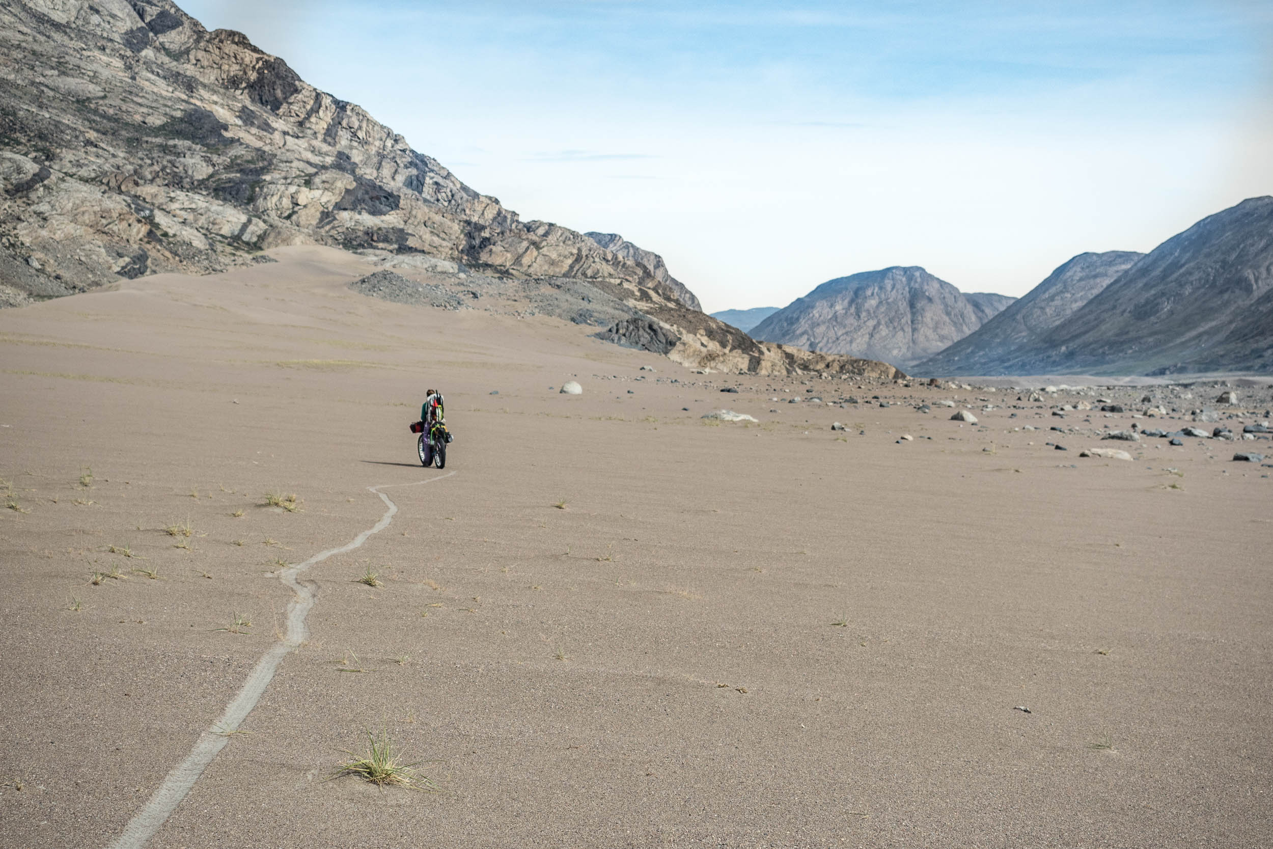
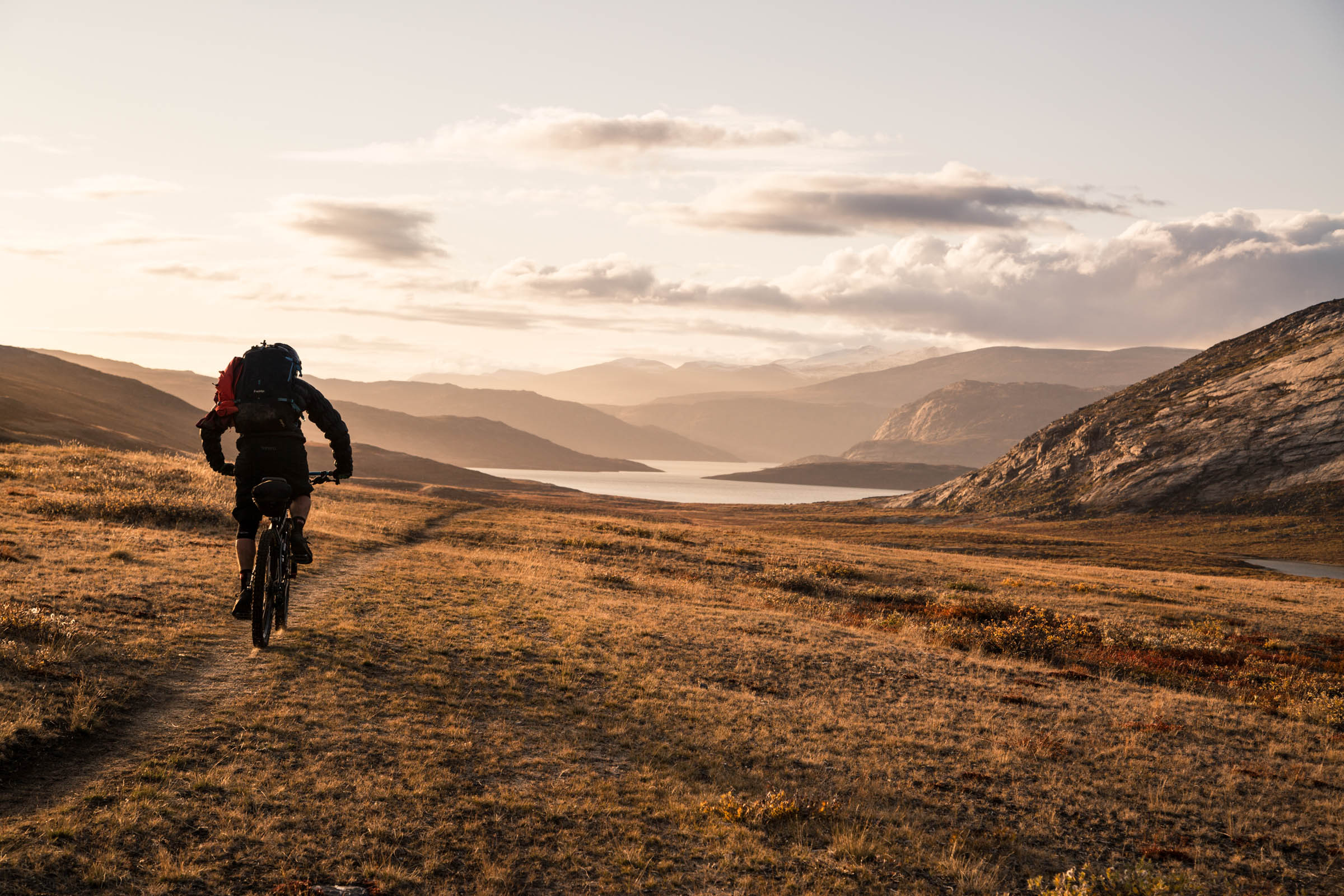
With a landmass of about a third the size of Australia, Greenland is mostly known for its ice cap, the second largest in the world after Antarctica. However, in a short window of just a few months each year, the Arctic summer transforms this part of the west coast into a blooming paradise for the arctic vegetation and the breeding wildlife. The landscape allows visitors to ride through incredible rock formations made by the moving ice cap and be greeted by the local musk oxen or perhaps awakened by the early grouse searching for food, and if the weather is nice, the thousands of mosquitoes Greenland is known for. The Arctic might occasionally show off its beauty, but nothing comes for free here.
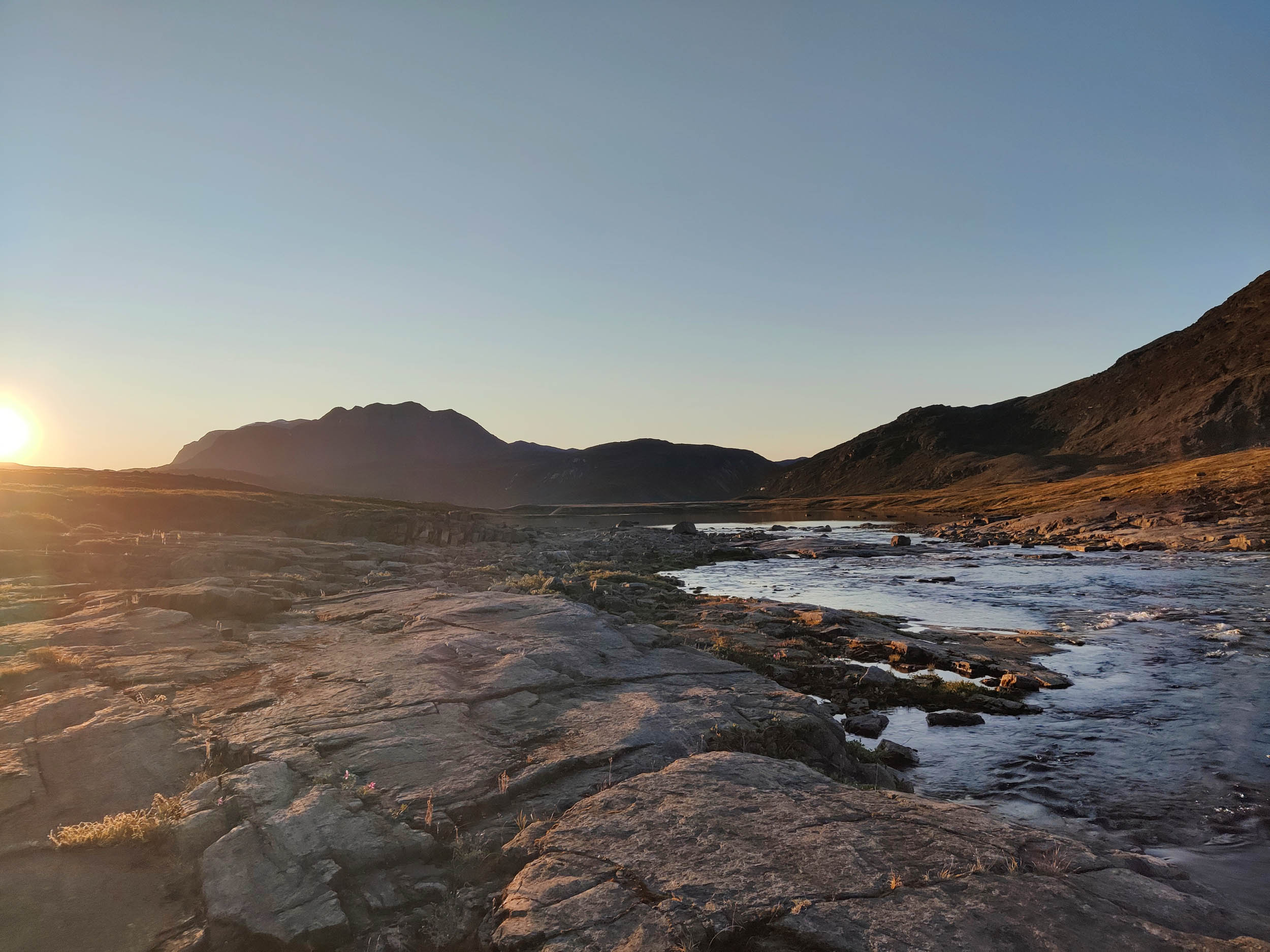
Greenland has experienced massive changes in the past years because of global greenhouse gas emissions, and this route takes the bikepacker as close to the changing climate as one can get. The route begins at Point 660, located right next to the ice cap, where the enormous rock formations showcase the rapid withdrawal of the ice cap—like a gigantic snail expelling dirt on its way back. Nearby, the calving Russel Glacier spits off huge chunks of ice, which occasionally end up in the Arctic Ocean.
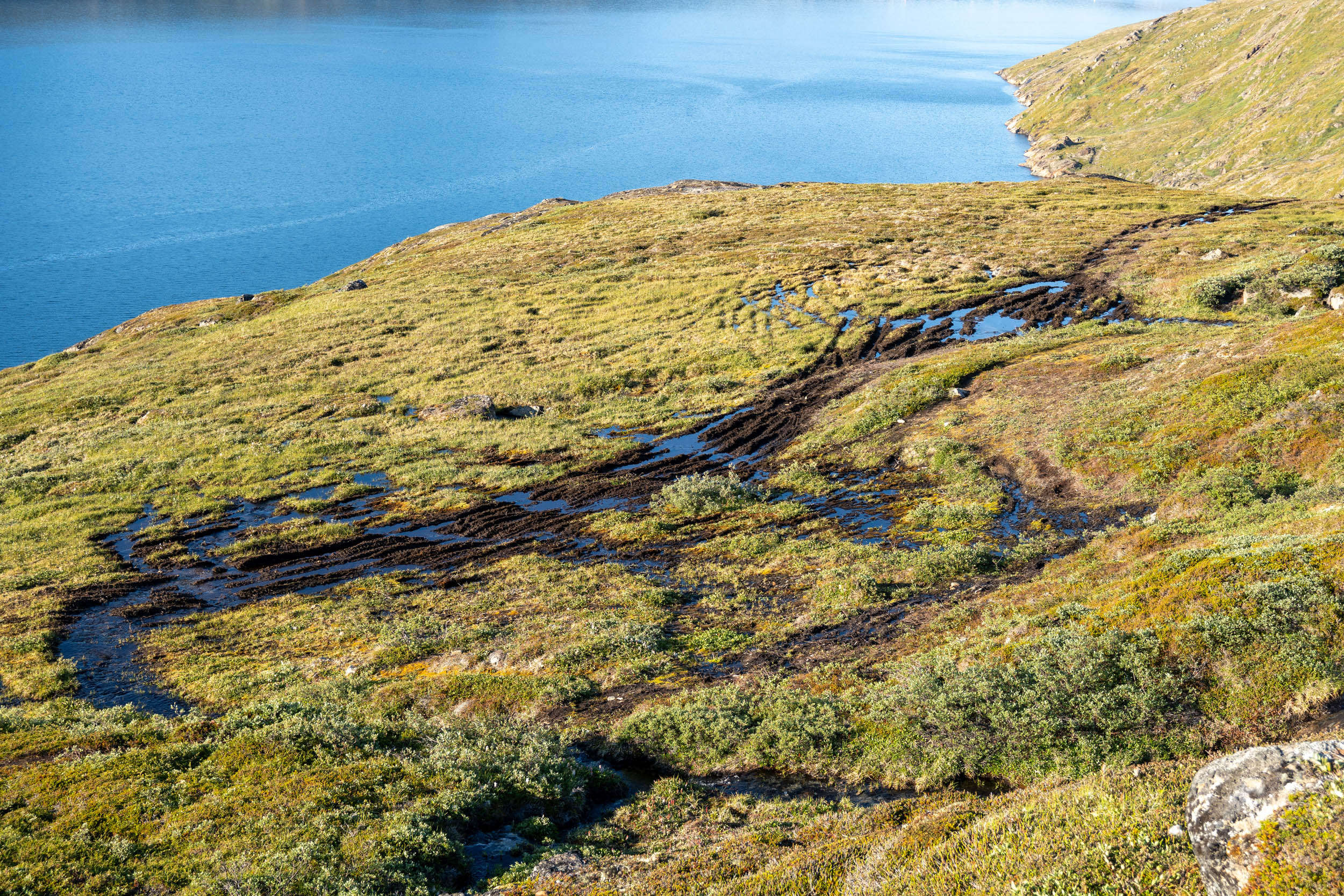
Traversing the alpine terrain, riders will also be met with sinkholes and hollows formed by the slow thawing of the permafrost, a perhaps even more serious phenomenon than the withdrawing ice cap. In 2017, a gigantic landslide further north killed eight people and destroyed several local towns. Unfortunately, this is not the only thing: Permafrost also contains toxic pollutants that are emitted into the atmosphere. Towards the end of the route, in the city of Sisimiut, locals in the area report how the seasons have shifted forward almost one and a half months within the last 10 years, impacting the local wildlife on land and in the sea.


Route development
This route is part of the local project, The Road to Freedom, which is meant to be the first real road between two larger cities in Greenland. At the beginning of October 2024, the first section of the road will be officially opened as an ATV track, but there remains a lot of work to be done before the road can eventually turn into a stable gravel road, especially taking the always-changing conditions in the area into account. The envisioned road is anticipated to significantly enhance accessibility for tourists and wildlife enthusiasts throughout the area, but the prospects for its realization remain uncertain.
Thanks are due to project director Laust Løgstrup and all the others involved in the local oversight of the project. If you ride this route and have any feedback, please let us know so we can contact those associated with the project.
In many ways, bikepacking represents an open and spontaneous way of meeting the world and its people, and this route offers a meditative opportunity to reflect on your own situation in the world and the impact you have. If you start by the glacier, you’ll end your trip in a city where the changing environment you experience en route directly affects the reality of Sisimiut’s inhabitants. Throughout 4-6 days, you’ll be isolated in the expansive natural world of the Arctic that, despite its ruggedness, is under immense pressure.
That said, this route is accessible to anyone looking to be immersed in an isolated and unique adventure. It is 250 kilometres of dirt, ice, gravel, bedrock, and potentially deep layers of mud between Point 660 and Sisimiut. While it might lack the cultural experience many other bikepacking routes offer, The Road to Freedom is a unique and immensely beautiful traverse with the distance and authenticity to create a true feeling of being one with nature. The ice cap, wildlife, remoteness, and rugged arctic landscape distinguish this route from most others and make it exceptional.
Route Difficulty
This route has been awarded a difficulty of 8, mainly due to the Arctic conditions it traverses. Situated a bit above the Arctic Circle, you must always be prepared for a radical shift in the weather, especially if riding towards the edges of the season (late May or early September), where snowstorms aren’t unusual. For this reason, we recommend always carrying a compass and maps of the route (which can be found on nunagis.gl) besides a GPS device with the offline GPX data.
Food can only be purchased in the small city of Kangerlussuaq, and you should carry at least enough for two more days than you expect to spend on the route. Note that groceries are expensive in Greenland.


Furthermore, all visitors in the area are obliged to carry an InReach or Spot satellite tracker since no mobile coverage is available in the area. Because of how isolated this region is, you should be aware that all SOS calls will result in a helicopter rescue, which can be expensive if you don’t have the proper insurance. On that note, be aware that the area is occasionally visited by stray polar bears—an increasing problem in the southern parts of Greenland. Note that most insurance companies do not cover an SOS call if a bear is simply spotted nearby!
In terms of water availability, you’ll always find yourself near a pristine stream or lake, all of which are purportedly safe to drink directly from. However, be aware that you should not drink melting water coming directly from the glacier, as it can contaminated with toxic fallout that has accumulated over several thousand years in the ice.
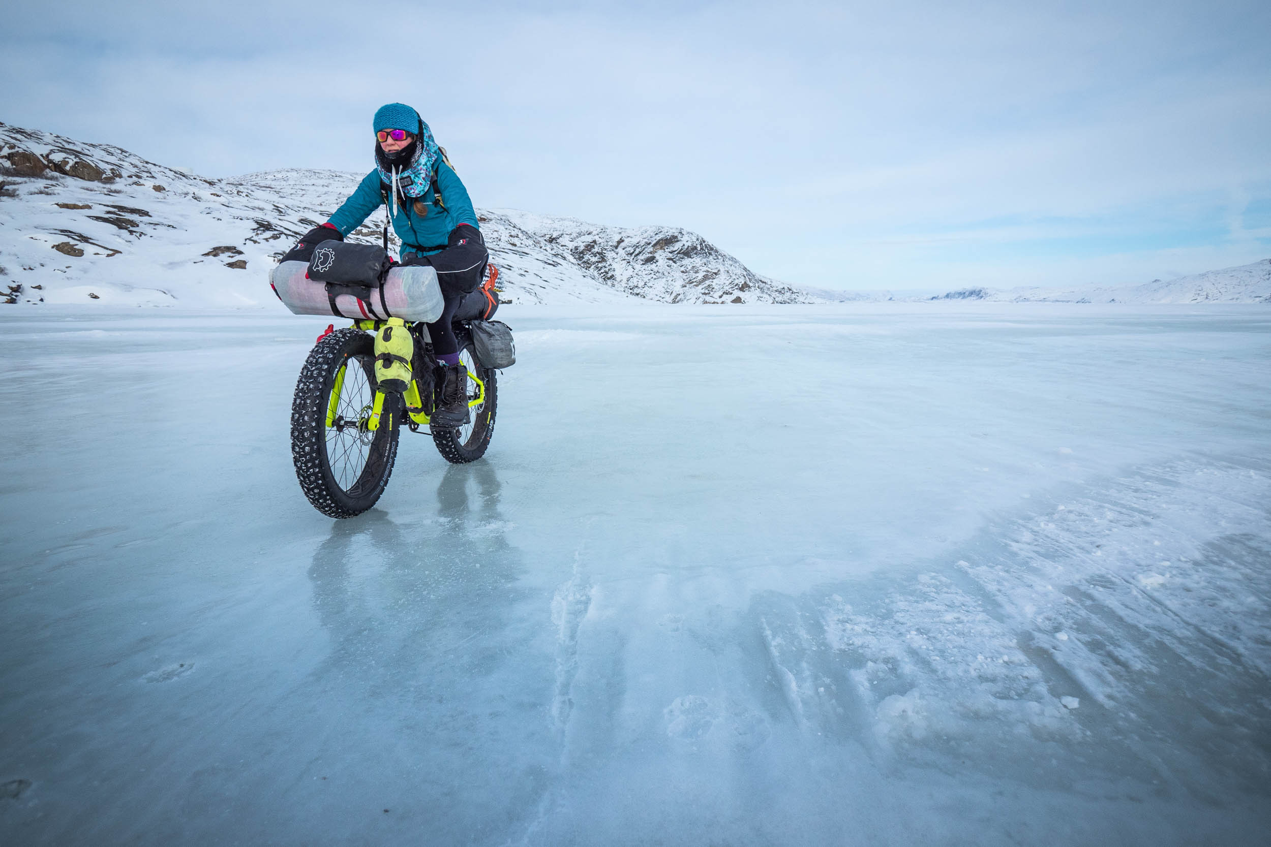
Finally, note that the conditions of the track vary enormously depending on the season. Local authorities are constantly working to enhance the quality of the track, but due to rainy weather, melting snow, and thawing permafrost, sections along the route might be extremely muddy. Bring your mountain bike, preferably with rear suspension. We rode the track on gravel bikes and regretted it several times. Follow the signs where local authorities attempt to guide you around the worst wetlands.


Submit Route Alert
As the leading creator and publisher of bikepacking routes, BIKEPACKING.com endeavors to maintain, improve, and advocate for our growing network of bikepacking routes all over the world. As such, our editorial team, route creators, and Route Stewards serve as mediators for route improvements and opportunities for connectivity, conservation, and community growth around these routes. To facilitate these efforts, we rely on our Bikepacking Collective and the greater bikepacking community to call attention to critical issues and opportunities that are discovered while riding these routes. If you have a vital issue or opportunity regarding this route that pertains to one of the subjects below, please let us know:
Highlights
Must Know
Camping
Food/H2O
Trail Notes
Resources
- Point 660: Gateway to the ice cap for most expeditions. If you are brave, you can crawl on the ice and pitch your tent there for a night.
- The calving Russel Glacier: Calving glaciers are always a spectacular view.
- Riding through the isolated wilderness of Aasivissuit-Nipisat.
- SØMA in Sisimiut: Find comfort in a warm bed and taste the local musk ox burger and other specialities on the old sea mens’ home in Sisimiut.
- Wildlife: Apart from the repeated accounts with reindeer, you might bump into the mighty musk ox, the shy polar fox, or hear grouse and ravens circle the sky.
- Getting in and out: From the beginning of 2025, the airport of Nuuk will take over from Kangerlussuaq as the main transit airport in Greenland. As with everything in Greenland, things change often, but there are plenty of domestic flights every day by Air Greenland. We landed in Kangerlussuaq, rode to Sisimiut, and flew the local plane back to Kangerlussuaq. Bringing the bike itself as check-in baggage in the small domestic planes is typically not an issue; you just need to turn the handlebar! Contact Air Greenland prior to your flight.
- Greenland has fast-changing weather: Be prepared that flights often are severely delayed. Don’t plan your trip too tight.
- The beginning of July to the end of August is the recommended window to do this track, but it might depend on the weather. Book flights with plenty of time to potentially wait for the worst weather to ride by. If you venture into the edges of the season, be prepared for an occasional snowstorm or several days of rain.
- Talk to the locals about the conditions, as there might be important things to know. Greenland changes fast. Make sure to find your way into the Facebook group “Arctic Circle Trail,” which is a forum for the hiking trail that runs parallel to the route.
- Mosquitoes: Greenland is most beautiful in good weather, but then you wonwon’t alone. Make sure to carry (and ride with) your mosquito net, have good routines for keeping the tent mosquito-free, and bring your most hardcore mosquito spray. By rising early in the morning (e.g., departing at 6 a.m.), you get several hours before they start showing up (remember that the sun is up almost 24/7).
- Carrying an InReach with a subscription is a must. The area is extremely isolated. It is also recommended that a compass and physical maps be carried (check out nunagis.gl). Check with your insurance that you are well covered.
- Best bike: To complete the route and ride most of the way, a mountain bike is needed. Both front and rear suspension are highly recommended. Also, consider a low gearing, as this area of Greenland does not have high peaks, but the ascents occasionally rise above 20 percent.
- There are no bike shops in Kangerlussuaq and only a few in Sisimiut. Expect to carry all spares yourself.
- Local currency is Danish Kroner, but most places take credit cards (as these are situated in the towns.)
- Wild camping is allowed everywhere in Greenland and extremely easy.
- As the track meets the ACT, a hiking track near Sisimiut, it is also possible to use one of the local hiker’s huts (see map).
- Hotels and accommodation in Greenland are generally very expensive, but the communities also rely heavily on tourism in the area. Consider if you want to support the local community by not simply wild camping outside the cities when being there.
- Recommended stays: SØMA in Sisimiut.
- Food is only available in Sisimiut and Kangerlussuaq in the local stores.
- Water is relatively clean everywhere and can be drunk straight from the streams.
- Don’t drink melting water directly from the glaciers.
- Make sure to taste all the local specialities when in town: Matdek, seal, musk ox, reindeer, grouse. There is a lot to try!
- Note that vegetables are generally not widely available in Greenland.
This route is designed to follow the local project The Road to Freedom from ice to coast. It is recommended to start from the ice cap, but the route can also be ridden in the other direction if the flights to and from are more suitable for that.
There is a fairly stable gravel road between Kangerlussuaq and Point 660. The distance is approximately 40 kilometres, and it can preferably be done the same day as arrival, as Kangerlussuaq is a very small town. Be aware that the weather next to the ice cap tends to be a bit rough, as the local climate has quite hectic contrasts.
Heading back towards Kangerlussuaq the coming day, you will pass the calving Russel Glacier, and the UNESCO site for the entire area, Aasivissuit-Nipisat, which has hosted some of the oldest hunter tribes in Greenland. Also, you will ride through Sandflugtsdalen, which hosts a yearly Formula E (electric Formula 1) event.
After Kangerlussuaq, you will be riding a few kilometers on the local asphalt road towards the harbour before taking a right turn on the ATV track itself. The beginning of the route itself is marked by a huge rock that is difficult for cars to pass. From here on, you only need to be aware of a single junction a few kilometers later, where the ACT (Arctic Circle Trail) hiking trail meets the ATV track. This is marked by a sign and is generally recognizable, as the ACT is only singletrail.
The ATV track is marked by yellow poles with kilometer marks, but note that many of them have fallen as a result of encounters with the musk oxen.
There are a few river crossings, but they are generally not too tough. We carried a rope in case the current was strong, but we didn’t use it. One crossing is aided by a bridge, as it can get a little deep. At approximately 140 km from the ice cap, the ATV track merges with the ACT (hiking trail), and the two tend to run in parallel. From here, you will find the hiker’s huts, which you can sleep in if vacant. As you approach Sisimiut, the road generally gets better as the local authorities have made an effort, and this area is also more frequented by local authorities.
Additional Resources
- nunagis.gl – the easiest approachable maps of Greenland
- adventours.gl – local renter of bikes in Kangerlussuaq. Involved with the ATV track.

Terms of Use: As with each bikepacking route guide published on BIKEPACKING.com, should you choose to cycle this route, do so at your own risk. Prior to setting out check current local weather, conditions, and land/road closures. While riding, obey all public and private land use restrictions and rules, carry proper safety and navigational equipment, and of course, follow the #leavenotrace guidelines. The information found herein is simply a planning resource to be used as a point of inspiration in conjunction with your own due-diligence. In spite of the fact that this route, associated GPS track (GPX and maps), and all route guidelines were prepared under diligent research by the specified contributor and/or contributors, the accuracy of such and judgement of the author is not guaranteed. BIKEPACKING.com LLC, its partners, associates, and contributors are in no way liable for personal injury, damage to personal property, or any other such situation that might happen to individual riders cycling or following this route.
Further Riding and Reading
Here are some connected/nearby routes and related reports...
Please keep the conversation civil, constructive, and inclusive, or your comment will be removed.