


Route of Caravans: Morocco Traverse (North)
Distance
520 Mi.
(837 KM)Days
14
% Unpaved
55%
% Singletrack
5%
% Rideable (time)
97%
Total Ascent
54,970'
(16,755 M)High Point
7,684'
(2,342 M)Difficulty (1-10)
6?
- 7Climbing Scale Strenuous106 FT/MI (20 M/KM)
- 5Technical Difficulty Moderate
- 5Physical Demand Moderate
- 3Resupply & Logistics Fair
Contributed By
Evan Christenson
Contributing Editor
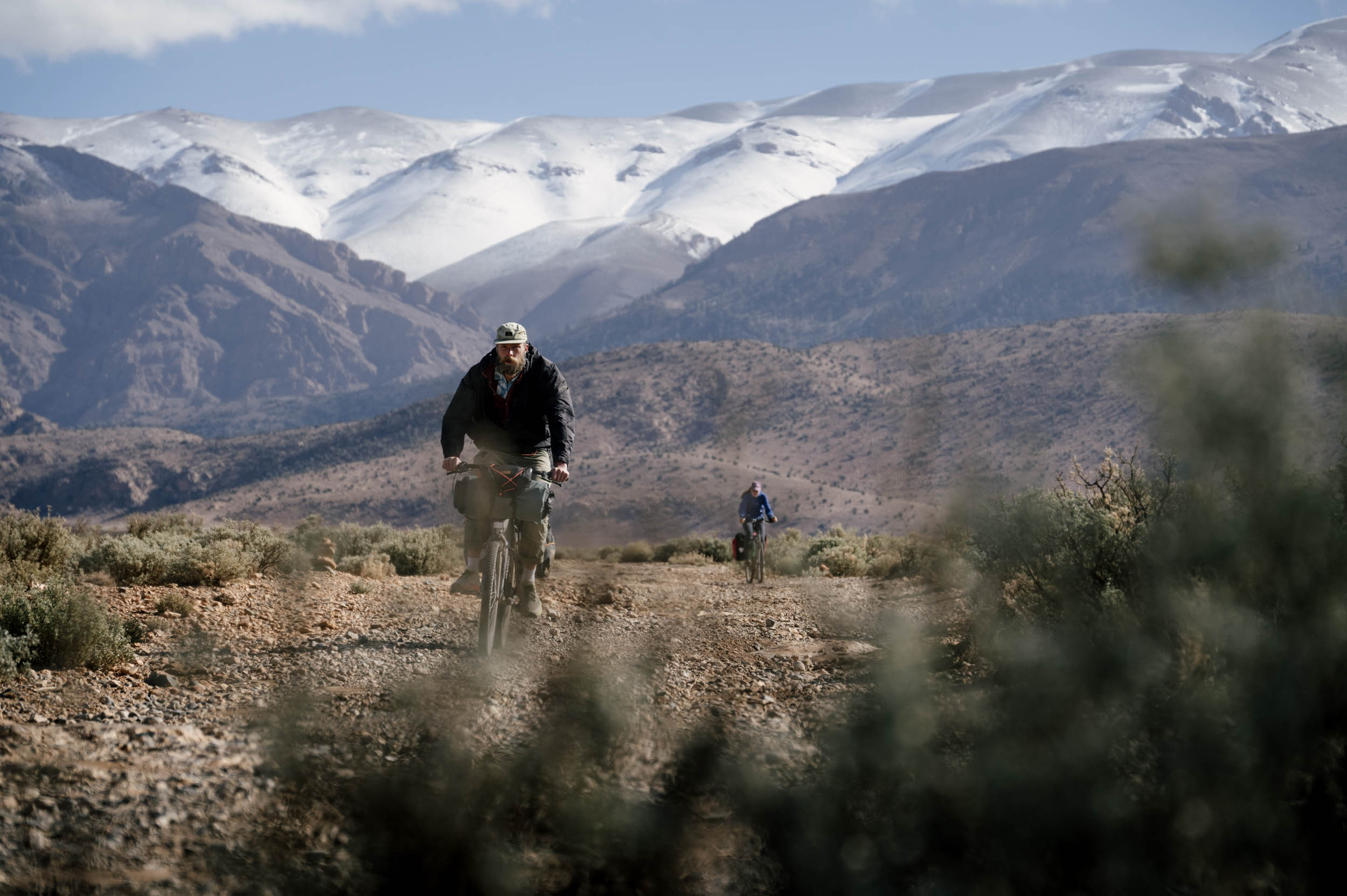
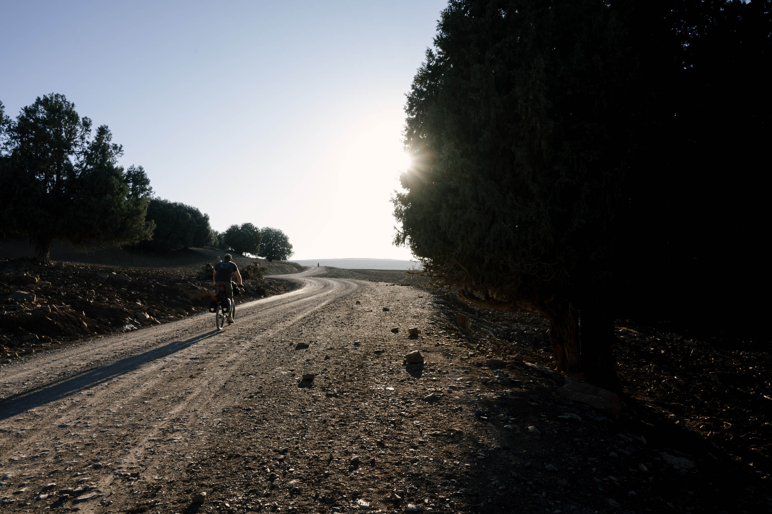
The highly anticipated Route of Caravans (RoC) is now finished, allowing riders to traverse the length of Morocco mostly on dirt, beginning with the southern tier that starts in the coastal town of Tiznit and runs along the Anti-Atlas Mountains, the Sahara Desert, and the High Atlas. Beginning in High Atlas village of Imilchil, where the southern tier leaves off, the northern tier of the RoC rides north through the remarkably diverse countryside. Many thanks to members of the Bikepacking Collective, whose generous support made this route (and extensive revisions the RoC South) possible through the Bikepacking Collective Routes fund.
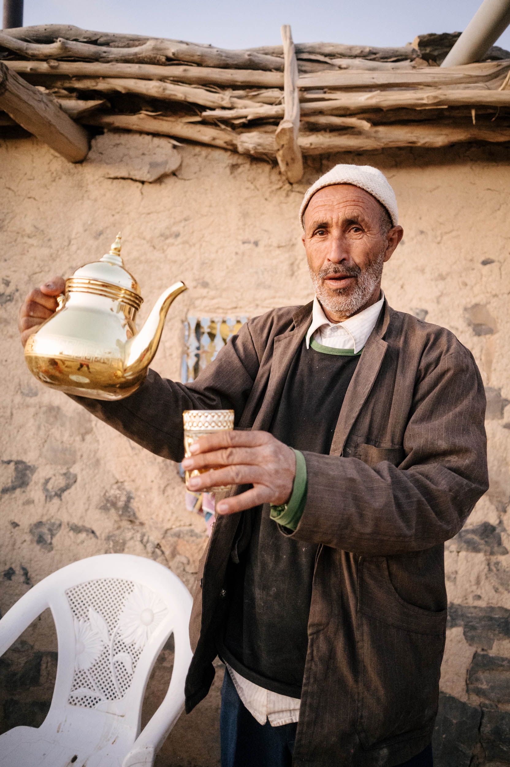
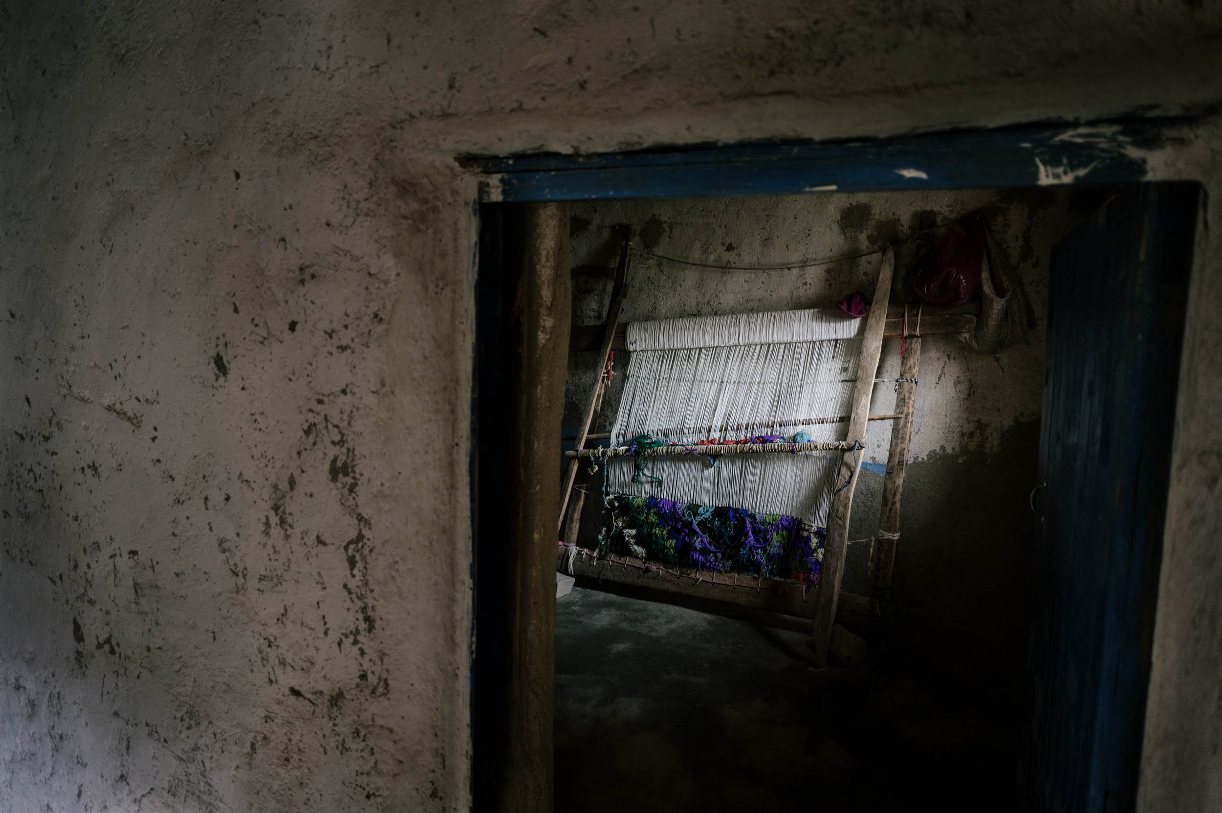
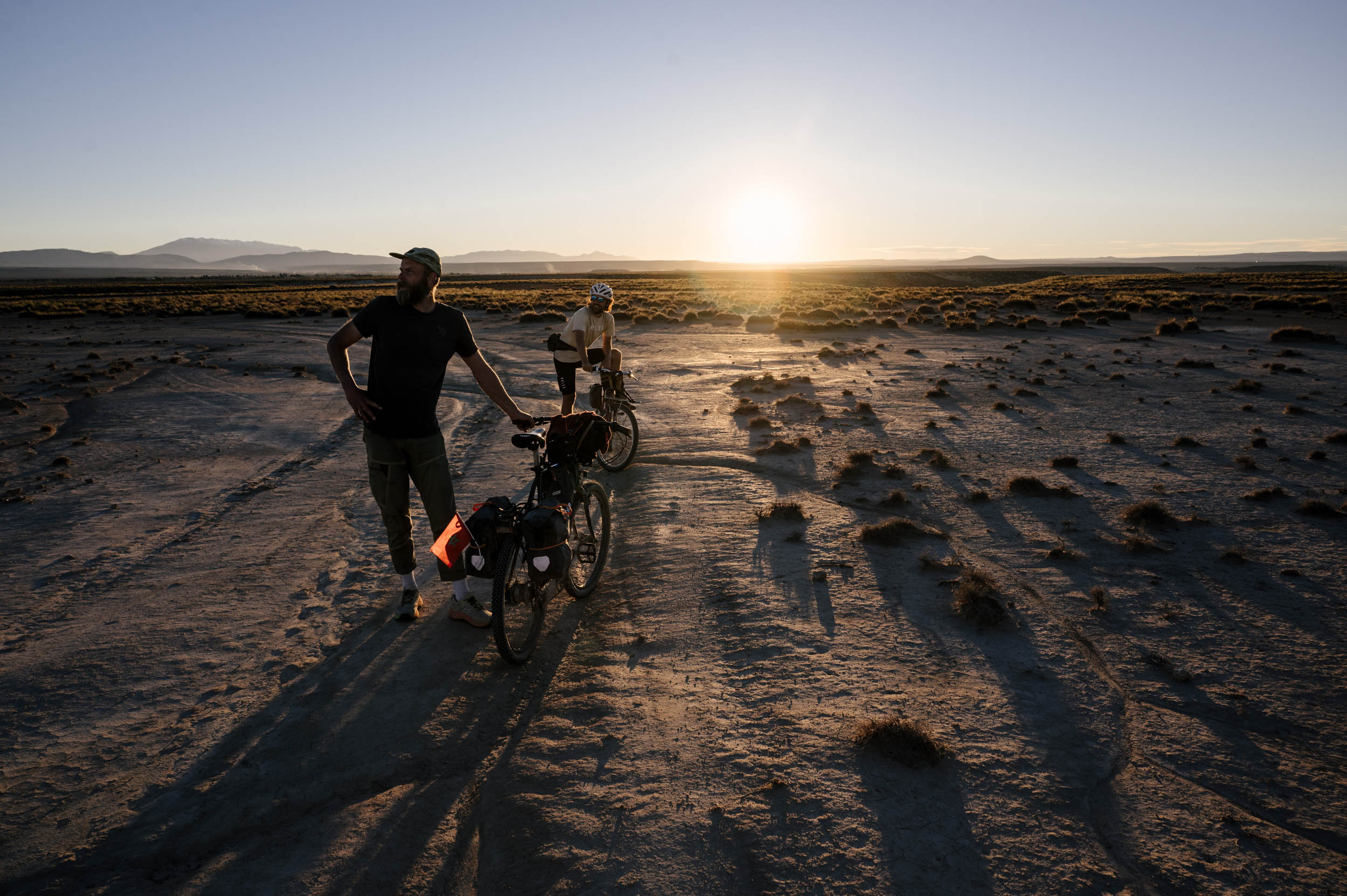
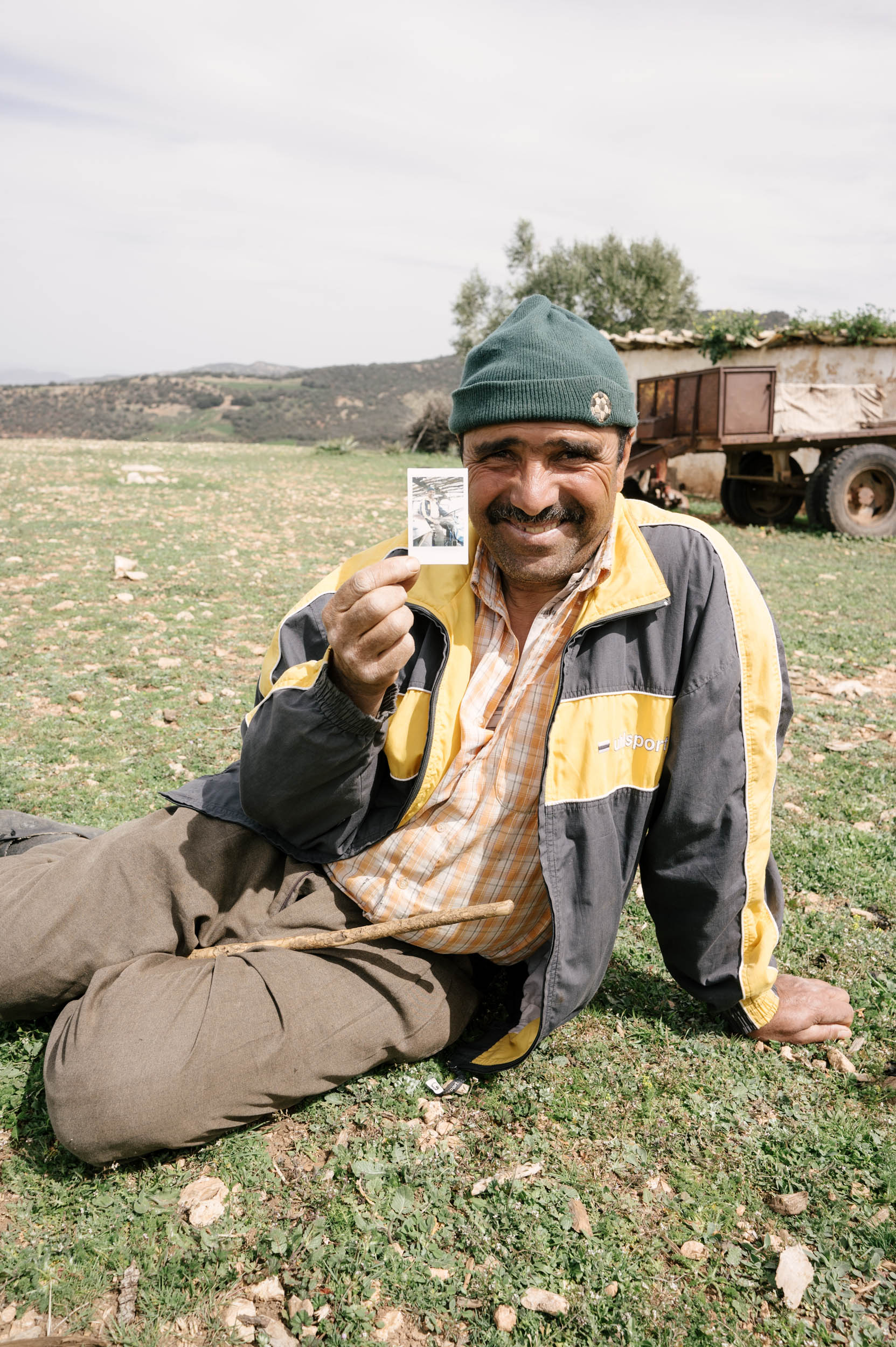
Wow. Where to even begin. Morocco is an incredible country. The Amazigh people are some of the nicest, friendliest, kindest people I have met. Their land is stunning. They take care of it. They build their homes with their earth and plow their fields with their donkeys and eat intimately with their families and neighbors and whoever is passing by. Amazigh culture is a fascinating example of the simple beauties of life, the importance of community, and the peace to be found in nature.
This route takes you right through the heart of the Amazigh landscape, through riverbeds and donkey trails and back roads and small villages. Please take the time to learn some of the language (read that under the Whereabouts tab below), let some kids ride your bike, hang out with a family if they invite you in, and always have a glass of tea. Like all of them, but especially here, this route is best ridden slowly.


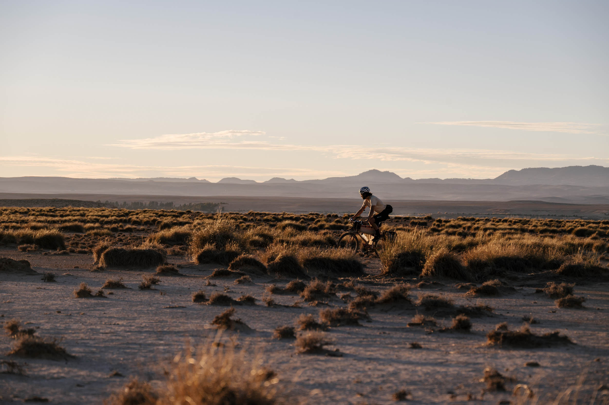
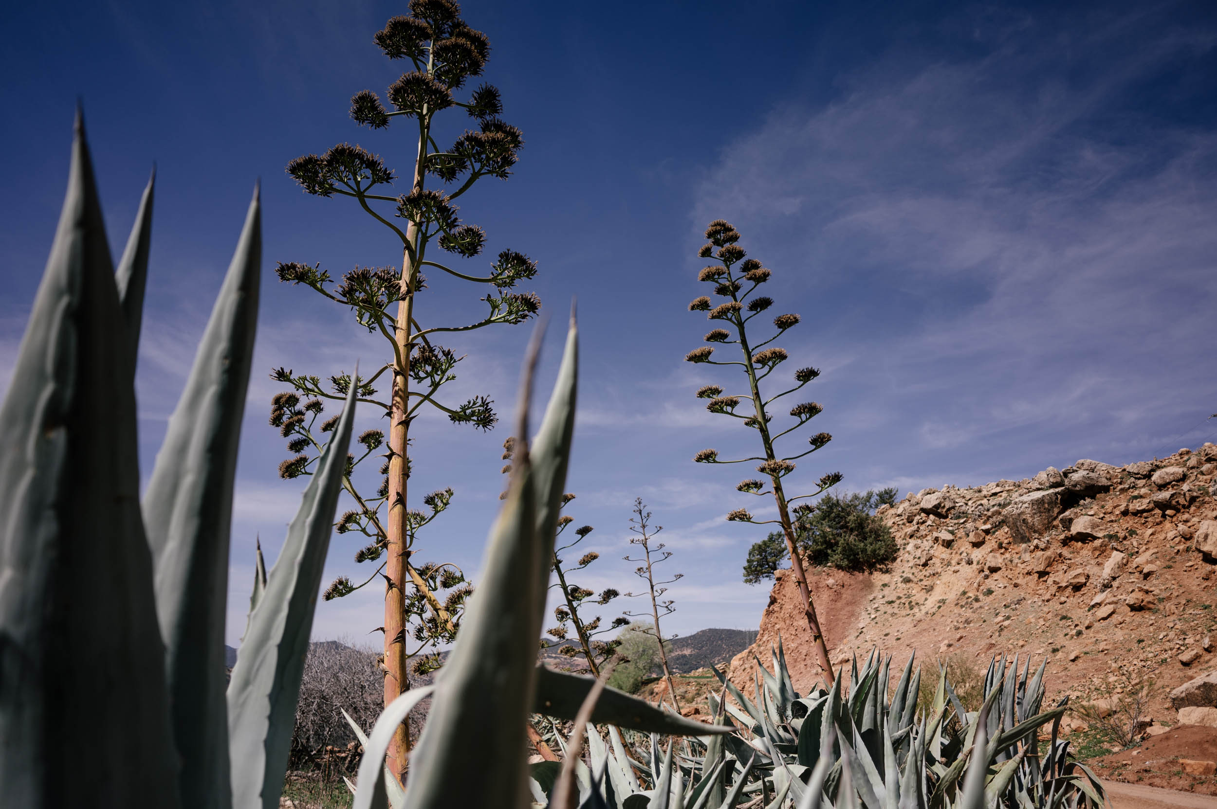
Morocco is a land of extremes, and the entire Route of the Caravans—traversing from the Atlantic Ocean, through the infamous Sahara desert, into the arid Anti-Atlas, the rugged High Atlas, and then descending into the fertile and populous Rift Mountains, finally down to the Mediterranean Sea, through rural villages and metropolitan cities, blending at least seven languages and centuries of bloody and peaceful history—really has it all. And on top of that, the clay kasbahs, the blue tiles, the tagines and the mosques and the dress, the beads and the jewels and the hats, Morocco has a rich and unique cultural aesthetic. There is no place like Morocco. And there is no route like the entire Route of the Caravans for you to get to know it.
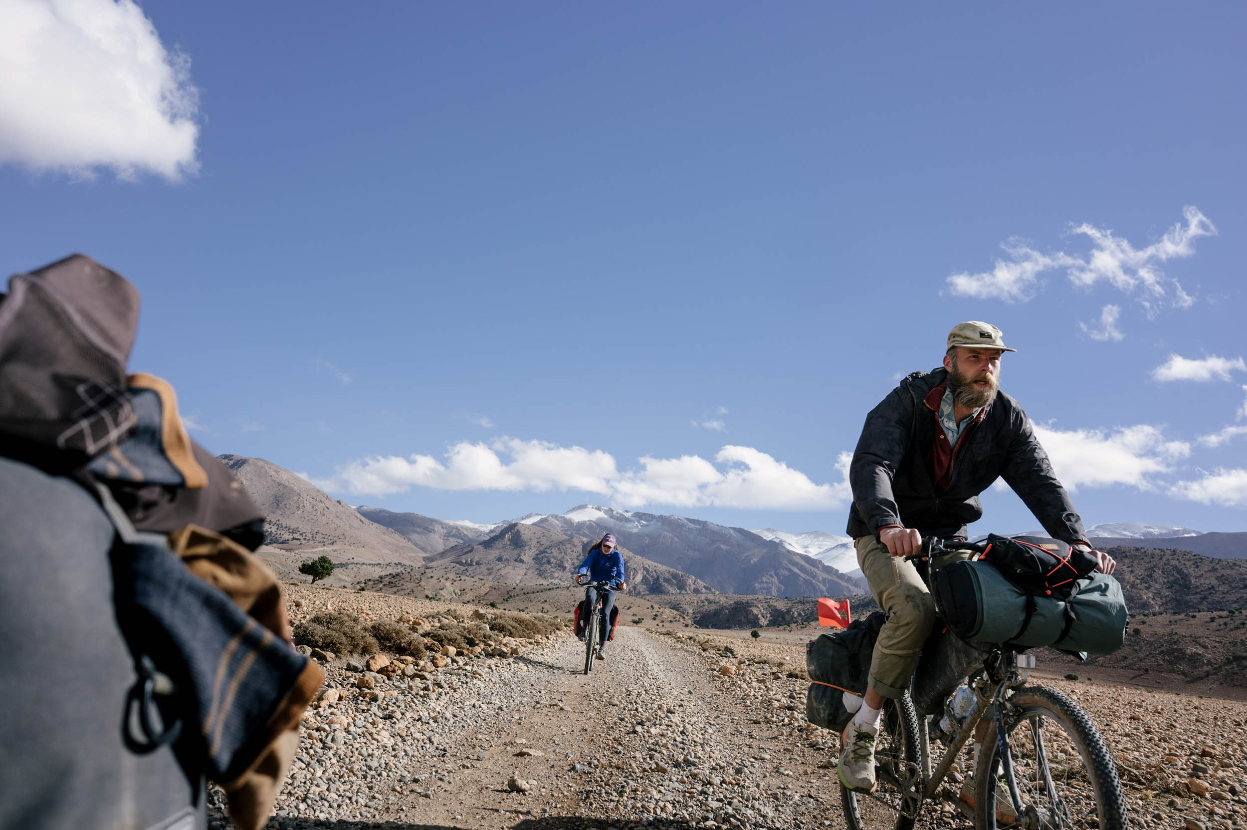
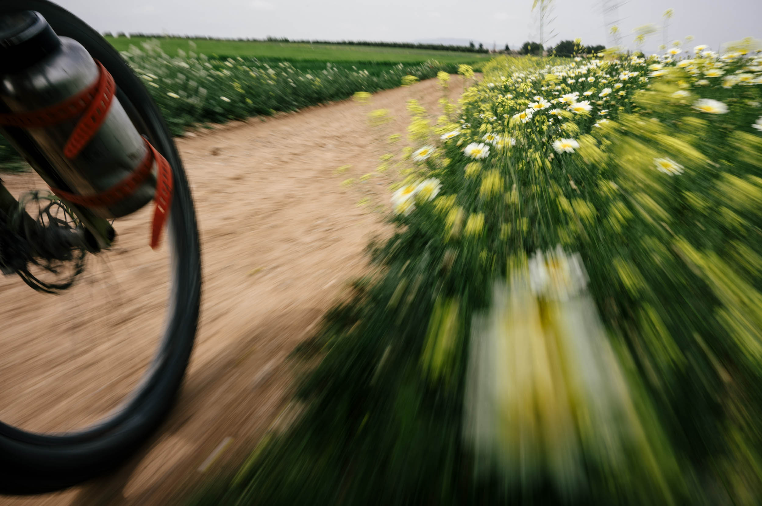
In general, all of the riding on this northern route is very pleasant. Save for two sections in the High Atlas, it can all be done on a gravel bike, and you never have to carry much food or water. The north of Morocco is very different from the south. Therefore, if you do the entire traverse from Tiznit to Tangier, you can expect some diverse experiences. Moroccans are wonderful people—friendly and excited and always down for a laugh. They are incredibly generous, their craftwork is stunning, they are all amazing at football, they are all intensely curious. Morocco is a beautiful country and extremely diverse in its landscapes, with no laws against wild camping, great food, amazing people, and endless dirt roads to explore. Morocco really has everything a bikepacker can dream of. It should not be missed.


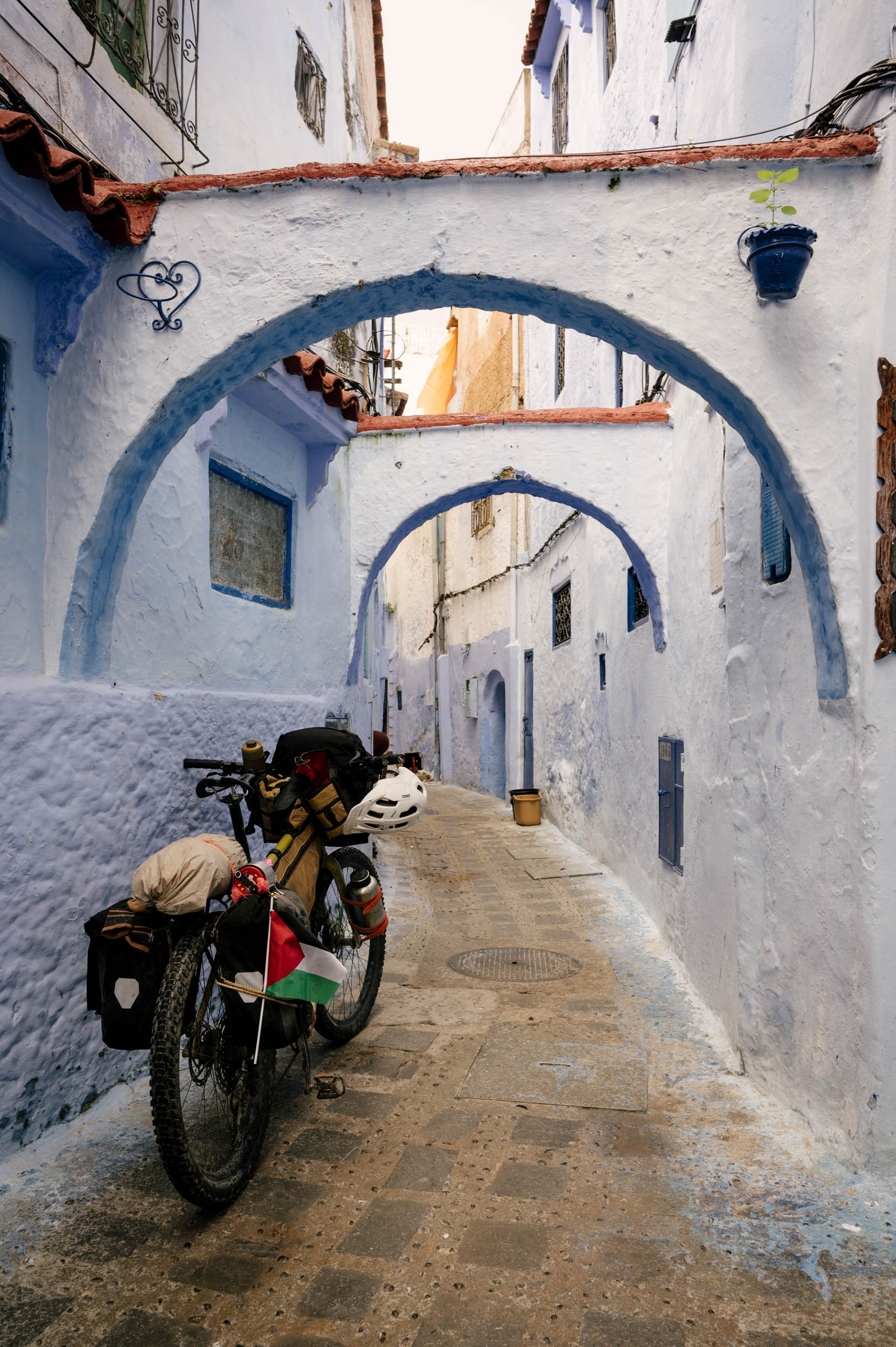
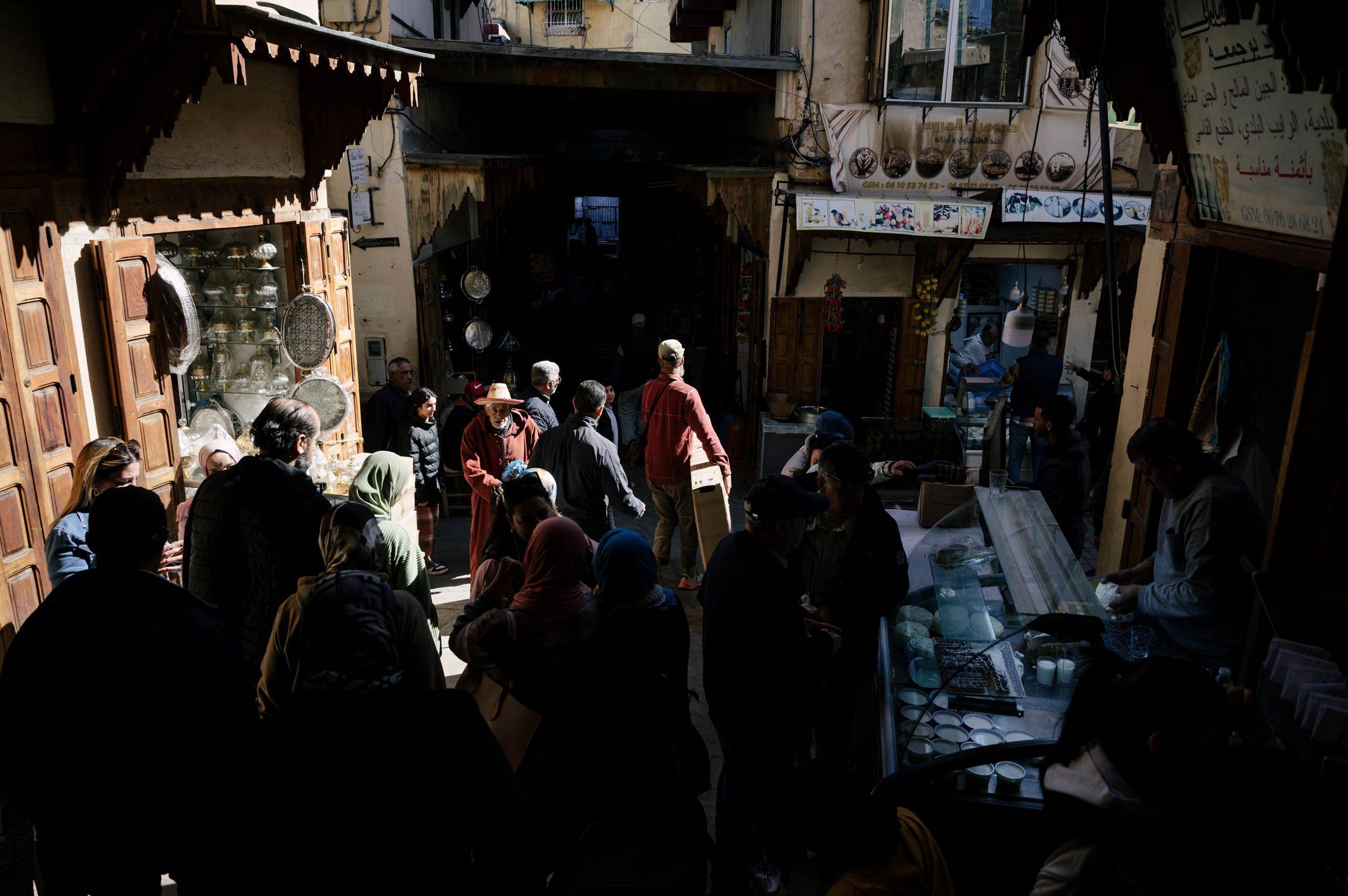
Morocco now get upwards of 12 million tourists a year, coming down mainly to stay in Marrakesh or on the beach. This route includes some of the more famous tourist destinations as well: Chefchaouen with its blue walls and little smokey cafes, Fes and the medina and the leather tannery, and Tangier and its sprawling metropolis all serve as unique and interesting places to drag mud through. But we also stop through smaller towns. Ifrane and its very distinct architecture, Bhalil and its small, much more genuine medina, Tetouan and its colonial heritage, and Imilchil with its high mountain, outdoor adventure audience, and rugged Amazigh culture. We travel across quiet back roads and donkey trails and logging roads and past mines and through dumps and over mountains and under highways. This route is very unique. Please enjoy.
Route Difficulty
This route is not exceptionally difficult. It is long, especially when combined with the southern RoC, but the riding is never that demanding. The northern section, other than the first big riverbed, can all be ridden on a gravel bike. There is water and food available most of the route, so you never have to ride that heavy. Most of the northern towns have solid tourism infrastructure that will aid in finding easy, comfortable, and cheap places to stay. In general, there is good food, solid resupply, and always a kind person willing to help if something goes sideways. Logistics are fairly straightforward, although if you begin in Imilchil, it isn’t the easiest to get there (unless you pay a bit for a private taxi in the mountains or just ride there as well).
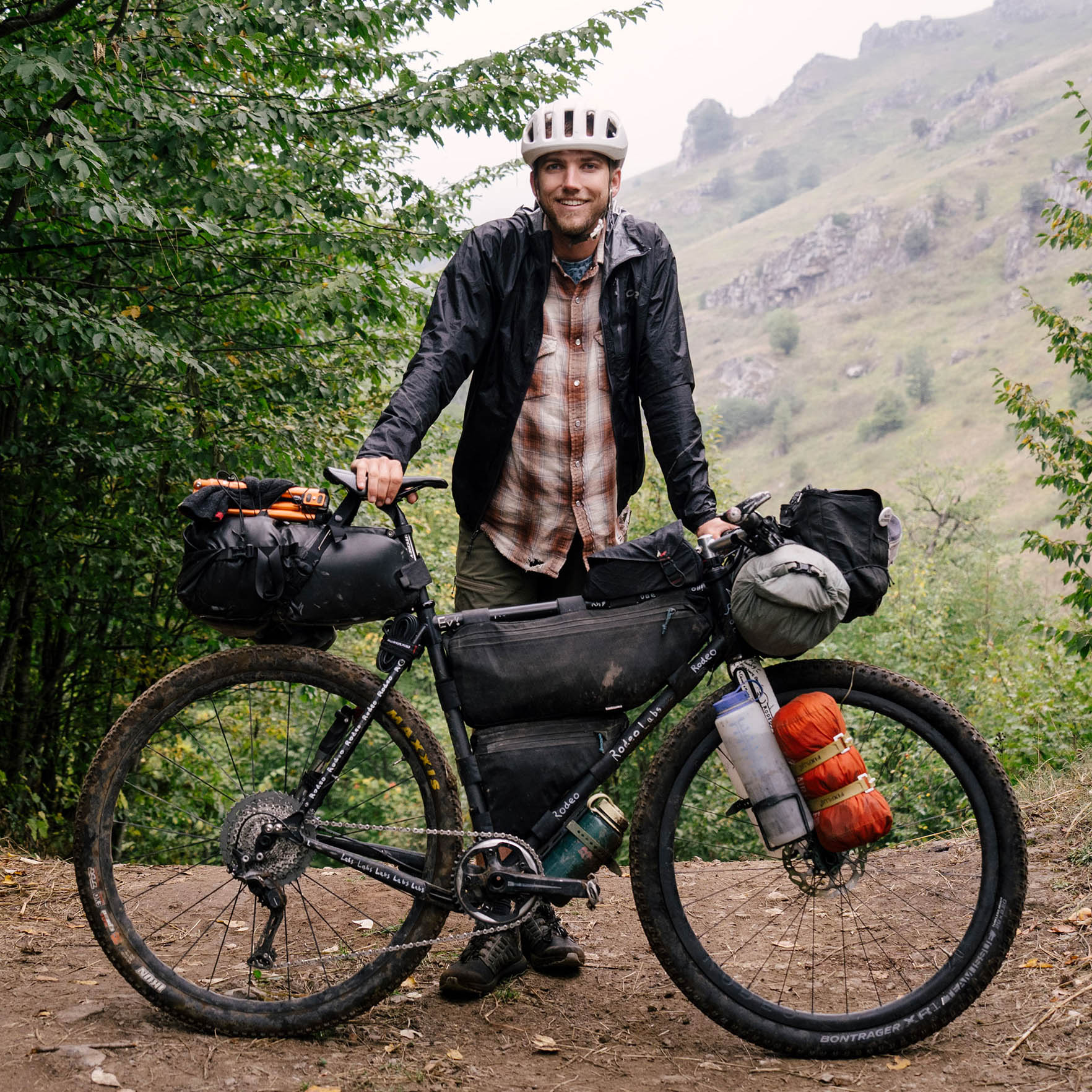
In my opinion, the tough part would be combining the two routes because of the various demands of the two. On the southern route, you need to carry a lot of water and have a big-tired bike. The north you do not. So, if you do both, you will have to make a compromise somewhere. That is up to you.
Route Development: This route has been in development for years, with the original concept designed by Logan Watts and preliminary scouting reports generously provided by Jonathan Kambskard-Bennett and Kevin Machtelinckx. In the spring of 2024, it was retraced and finalized by Evan Christenson during a several-month scouting ride, involving input from several local mountain bikers, off-road guides, and as many locals as he could find. This route was designed to connect the Route of the Caravans (South) to the Altravesur in Southern Spain and is designed to be ridden south to north. Of course, you can ride it north to south, but just keep that in mind when reading the info.
We acknowledge that many of these roads were originally cut in hundreds of years ago by slave trading caravans and a number were built by the French as a tool for colonization. We also acknowledge that this is Amazigh land. Please tread gently and be kind.


Submit Route Alert
As the leading creator and publisher of bikepacking routes, BIKEPACKING.com endeavors to maintain, improve, and advocate for our growing network of bikepacking routes all over the world. As such, our editorial team, route creators, and Route Stewards serve as mediators for route improvements and opportunities for connectivity, conservation, and community growth around these routes. To facilitate these efforts, we rely on our Bikepacking Collective and the greater bikepacking community to call attention to critical issues and opportunities that are discovered while riding these routes. If you have a vital issue or opportunity regarding this route that pertains to one of the subjects below, please let us know:
Highlights
Whereabouts
Must Know
Camping
Food/H2O
Trail Notes
- Hanging out, drinking tea, and playing cards with the Amazigh.
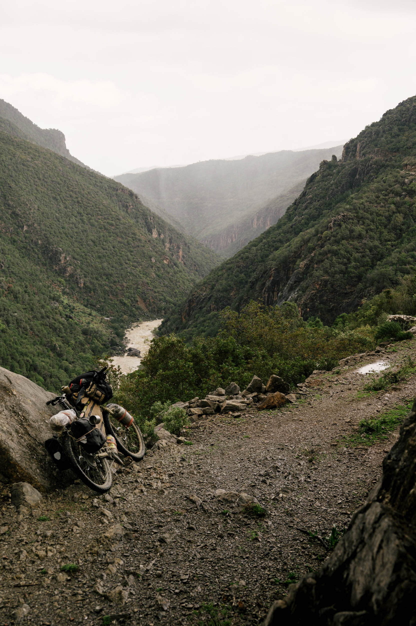
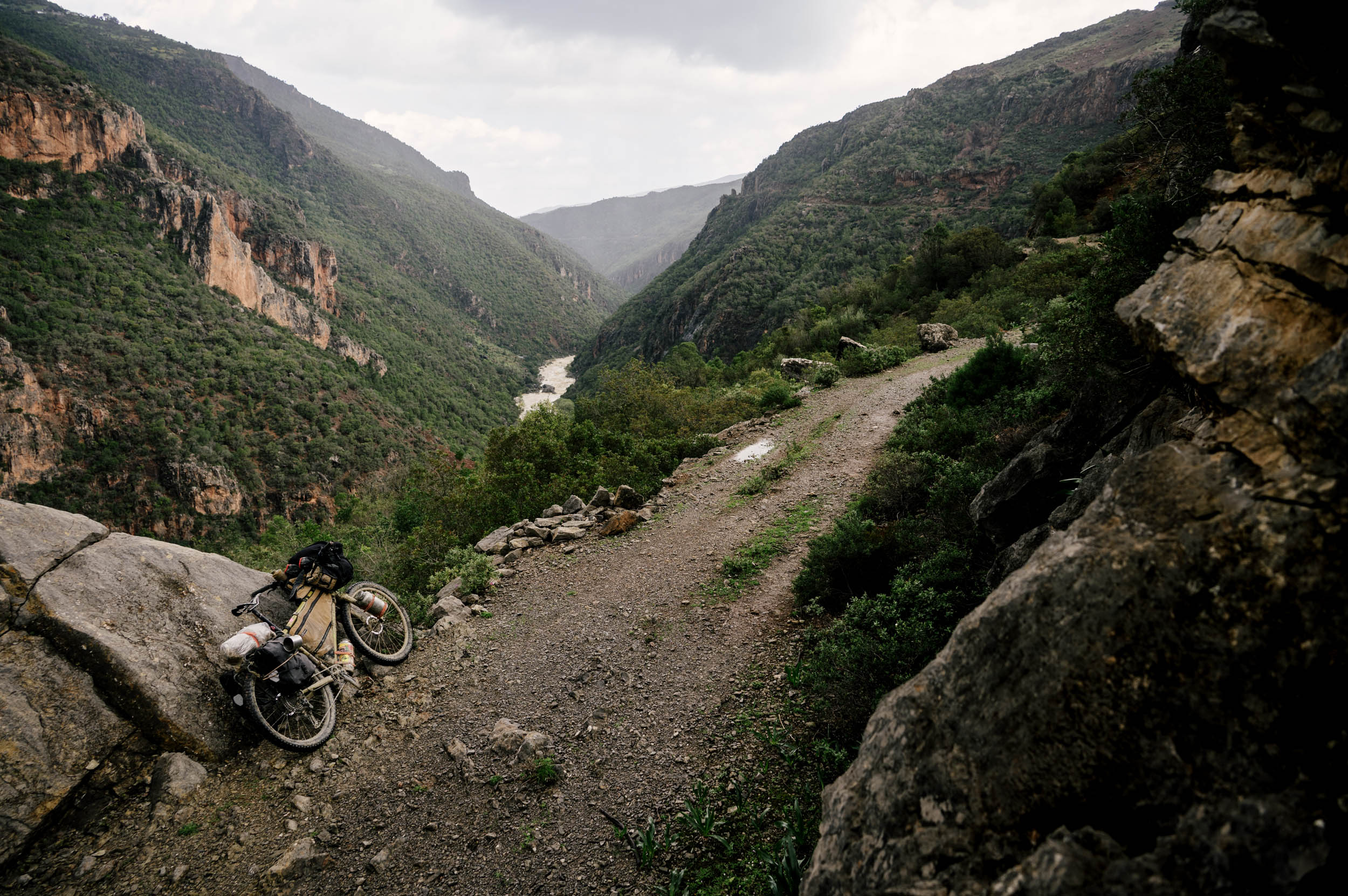
- Backcountry descending down donkey trails and through remote canyons.
- Dirt riding under the rim of the High Atlas through stunning gorges.
- A hearty tagine at the end of a long day of riding.
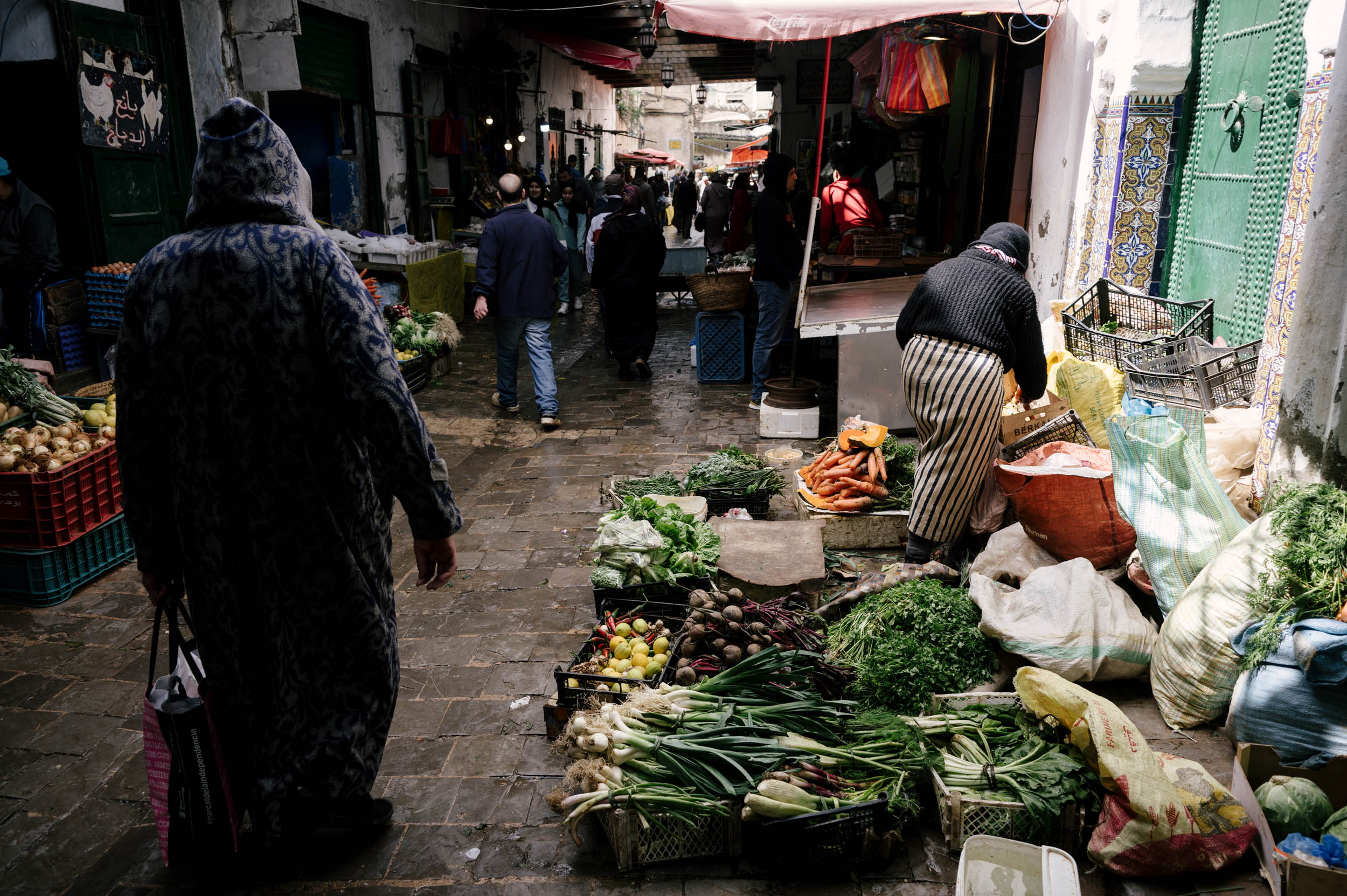
- The ancient medinas of Fez, Chefchaouen, Tétouan, and Tangier, with so many spices and chickens and fruits and pottery for sale you won’t believe it.
- Pedaling the canyon road above Oued Laou, some of the nicest riding I’ve ever done.
- Wild monkeys, tortoises, and birds of prey.
- Transitioning from wild camping in the High Atlas to a hammam in the city.
- Connecting to the RoC South and riding through the Sahara to traverse Morocco.
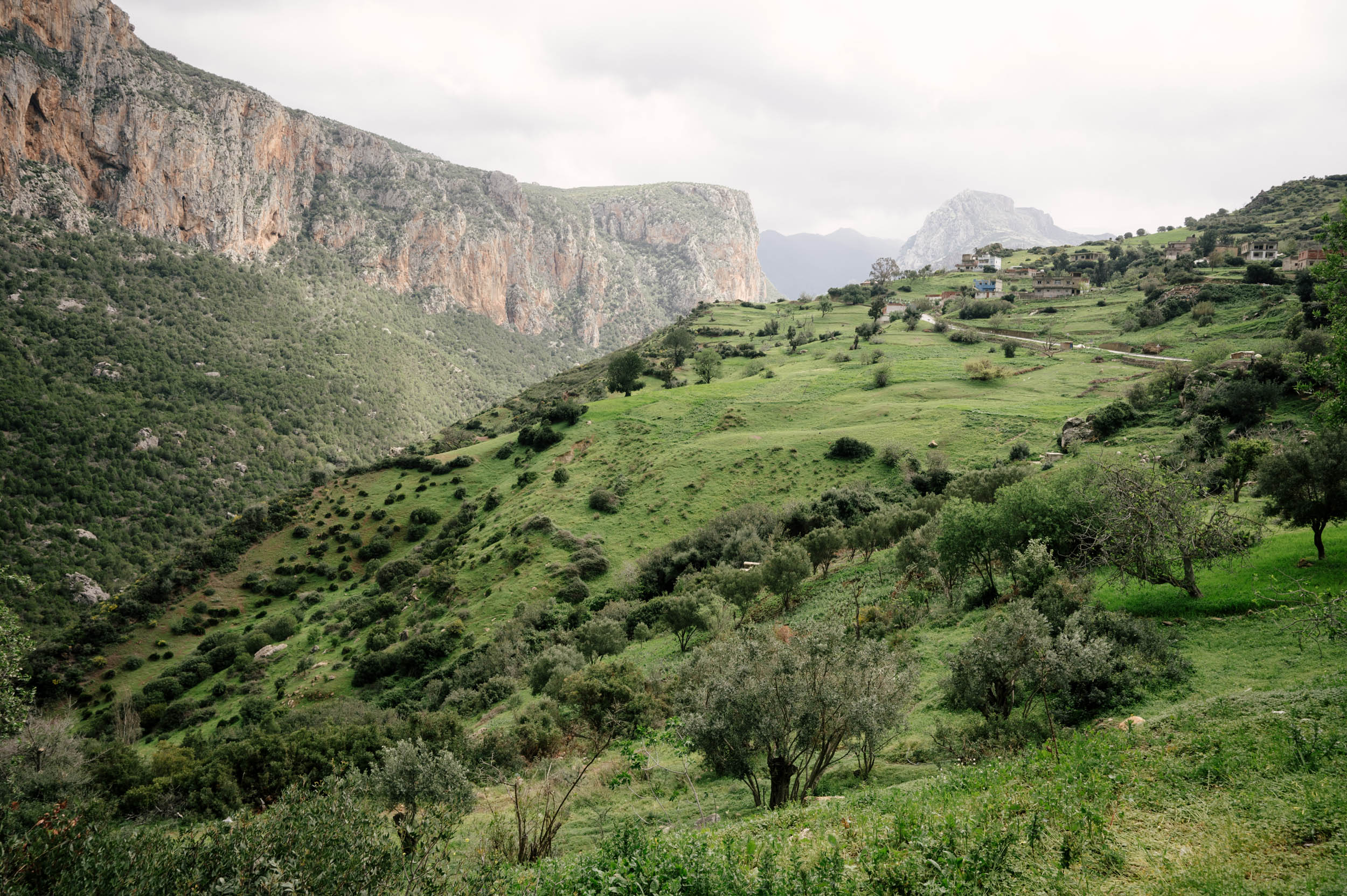
- The diversity of landscapes, from the high mountains to the rolling grassy hills to the Mediterranean.
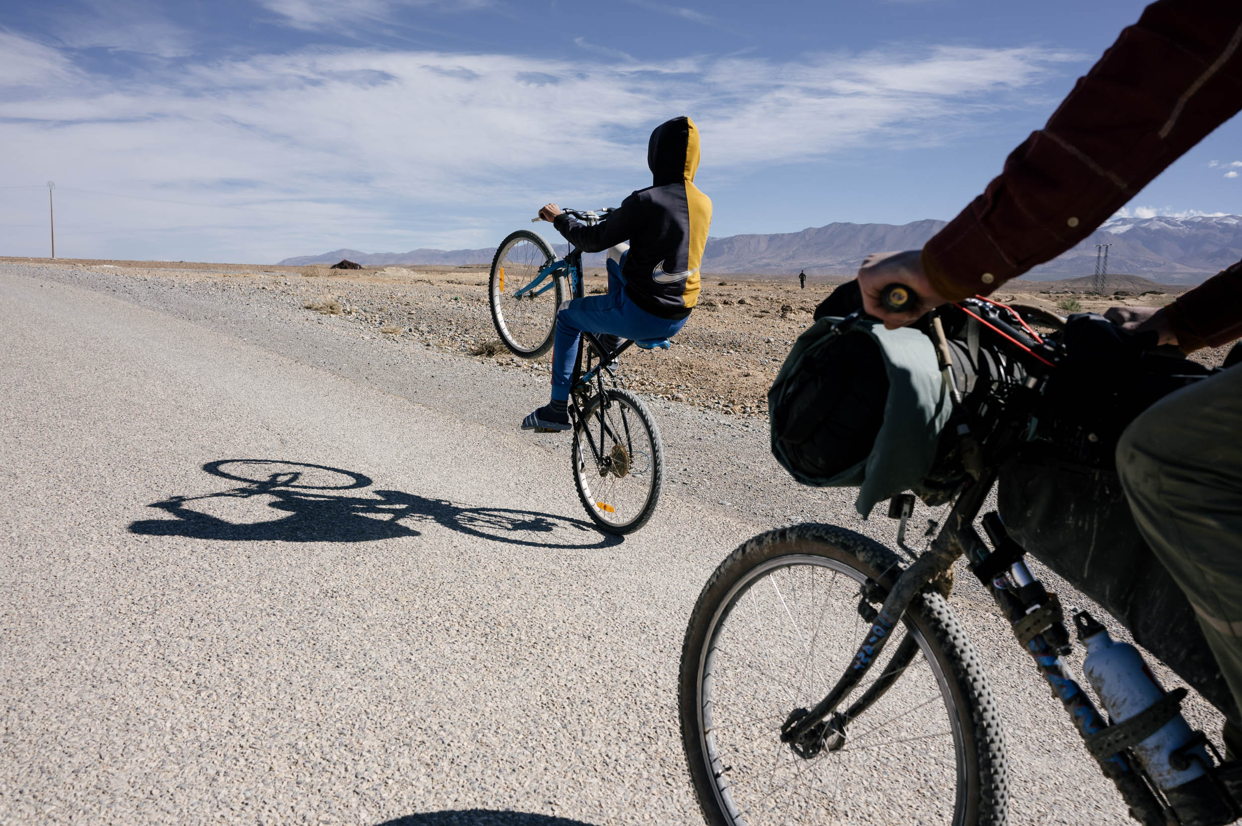
- Playing football in the villages, riding bikes with kids, and even staying the night with a family.
- Riding to (or from) the ferry terminal in Tangier and connecting to another continent by boat.
- Getting to intimately learn about this fascinating and beautiful part of the world one pedal stroke at a time.
Language Primer
by Evan Christenson
Paying attention and learning a bit of the local languages has been my most rewarding point of entry into the culture here in Morocco, so I wanted to write a few phrases down to help you begin your journey on bicycle and connect with the people you’re guaranteed to meet along the way. Learning someone else’s language is the easiest way to tell them you care and are interested in their perspective. It opens people up immediately. It is always worth the effort.
First, an explainer. There are several languages spoken in Morocco, but they’re broken into two categories.
The main language, what most government dialogue is done in, what most of the signs are in, what most people speak between themselves in Derijah. It is a regional dialect of Arabic, but is very derivative. A Moroccan person cannot go to Lebanon or Palestine and speak and understand the Arabic spoken there. Derijah uses a lot of slang, some French and Spanish influence, some Amazigh, and is very fast. Arabic languages have over 12 million words in them. The conjugations are incredibly difficult to understand.
Then there are the Indigenous languages. The indigenous people are called the Amazigh people. You may have heard the term “Berber” but as it’s derived from Barbarian, should be refrained from using. The Amazigh (pronounced ama-zeer) speak several dialects of Tamazight (pronounced Tamazeert). The most common one you’ll encounter is Tashelhaight. In the north, they speak Tarifeit, and in the desert, several other languages. We’ll focus on Tashelhaight.
In Morocco, 90% of people speak Derijah. A lot of people also speak a Tamazight language. Most people are Amazigh, but Derijah is more popular, especially after the previous king mandated it and shut down Tamazight education in schools (which has since been undone). In the mountains, the main language is Tamazight. In the valleys and cities, the main language is Derijah. Sometimes in the mountains, older people will not speak any Derijah. Most of the time in the cities you’ll only hear Derijah. Therefore, it’s important to know a little bit of both.
And re:French/English. French is the language of the colonizer and generally looked down on, but you will sometimes find it. Not always. English is now taught in schools, and the youth will speak it. Some are really plugged into internet culture and memes and that’s always funny to hear. In the north, you can find lots of Spanish speakers.
Confused yet? We’ll start with Derijah.
Derijah
The introduction is a very important part of Moroccan culture. If this is all you learn, you’re fine. It’s a really fun interaction to master. And it’s almost always the same.
- Salam Alaykum – hello (literally, peace be upon you)
- Alaykum Salam – hello (and unto you peace)
- Labas? – how are you
- Kulshi mezyan, Labas aleek? – everything is fine, how are you?
- Hambdullah – thanks be to god
These words can be changed around, but they’re almost always mentioned. Also, aanya is a fun reply/question which just means “normal.”
*the kh is a very gutteral sound. Similar to Dutch. Practice makes perfect.
- Wakha – ok
- Shokran – thank you
- Brit – I want
- Britti – you want
- Pikkala – bicycle
- Ana karkeb pikkala – I am riding the bike
- Piste – a dirt road
- Trek – a road
- Trek Salama – travel with peace / go well / goodbye
- Kima britti- whatever you want
- Kima brit- whatever I want
- Nemshi – to go
- Brit nemshi le – I want to go to ___
- Bzef – add onto anything to say a lot/too much
- Shweya- a little
- Afak – please
- Marhaba – you are welcome
- Zween – nice/beautiful
- Sbaah al kheyr – good morning
- Sbaah al nord – (the reply^) good morning to you
- Lmaa – water
- Atay – tea
- Khobz – bread
- Zeit – olive oil
- Halib – milk
- Kawha – coffee (kawa kala is black coffee)
- Makla – food
- Bneen – delicious
- Brit nakol- I want to eat
- Brit nkheless – I want to pay
- Ana – I
- Nta – you
- Uhndi- I have
- Uhnduk – do you have?
- Mneen nta – where are you from?
- Ana mneen – I am from ___
- Mushy mushkill – no problem
- Marakhra – next time
- Sahabi- my friend
- Khoya – brother
- Wahid, jeuj, tlata, arbauw, khemsa – 1,2,3,4,5
- Schohn – hot
- Brrrt – cold
- Shutuh – rain
- Rrih- wind
- Shnaw meesick – what is your name?
- Smiti – my name is
- Nhulus – to pay
- Aadi – easy
- Sela – difficult
- Baid – far
- Kribe – close
- Nkheiyem fiha – a camping place
- Siyam – Ramadan
- Kee doowidsee nahark – how was your day?
- Kalb kabir- big heart (but means I like this a lot)
There are many blessings in the name of Allah to be used as words.
- Bismallah – when you get your food (thanks be to god)
- Laaouhn – when you say goodbye (May god protect you)
- Laafduck – to say thank you (May god give you health)
- Laa arhem walidi – to really say thank you (May god protect your parents)
A very easy way to get a smile and a handshake is to say “Talafarask” when you say goodbye to someone. It means take care of yourself in a very sincere manner. Take care of your heart and your health and your family. People always get a kick out of this. The reply is “Talafarask tentuh” which means you too. If you say it to a group, you say “Talafaraskom.”
Tashelhaight
Now, to move on to Tashelhaight, the language spoken in the mountains by the Amazigh people. When you ride through the Atlas, this is what you’ll find mostly. The alphabet is derived from Greek and is very different looking. It is also very regional. If you travel 300 kilometers, the words are totally different and people may not understand the things you’re trying to say. Therefore, we’ll keep this short.
The introduction you use Salam alaykum as well, but instead of “labas” you say “metaneet?” And instead of replying with “mezyne” you reply “behayre.”
- Salam Alaykum – hello (peace be upon you)
- Alaykum Salam – hello (and unto you peace)
- Metaneet – how are you (can shorten to “Ten-uh”)
- Behayr – good
- Am dakal – my friend
- Ihula – nice/beautiful
- Asameed – cold
- Ohulugh – tired
- Teerrmt – food
- Aghrohm – bread
- Aman – water
- Mays minj – what is your name?
- Tsh – eat
- Reergh – I want
- Estreet – do you want?
- Estreet ek awounouk? – do you want help? (Masculine)
- Estreet ekem awounouk – do you want help? (Feminine)
- Dheer – to go
- Eesd waha – can I ___
- Adorholgh – I will return
- Tsoueira – picture
- Daysa – a shepherd
- Keef keef – the same as
- Timinseween tesadayeen – good night
- Mate skardt – what are you doing?
- Menka stsdreet wasanuuk – how was your day?
Enjoy your ride and your journey into these fascinating languages. The pronunciations are very hard, and have very different sounds than we’re used to with the Romantic/Germanic languages, but with practice, you can get there. I hope you have a nice ride in Morocco. I hope you make someone smile.
Talafarask Sahabi ✌️
- Please read this entire guide, including the language primer under the Whereabouts tab. I worked very hard on it. You should care about the people whose land you are riding through. Show them that. Learn some of their language. Don’t just pass through and take pictures. Interact. Make friends. Give something back. You can also find a printable version here.
- Please heed this warning. If you are: not a confident rider, not on a mountain bike, riding southbound, or if there is a decent riverflow, DO NOT ride the first canyon out of Imilchil. There is a pin on the route. Stay on the highway to Imilchil if heading southbound. If you’re heading northbound and you’re not a confident rider on a mountain bike, take the highway to Anefgou. The road is quiet and nice anyway. This canyon is very rugged.
- This route can be ridden most of the year. Spring is probably the nicest, but then you could have high river crossings if there was a lot of snow fall. The southern section needs to be ridden in winter, so if you connect, plan accordingly. This route can be ridden in the winter, but be prepared for snow/rain/cold. Summer would be fine, just hot in the center. Fall would be really nice, just hot in the Sahara.
- Check what time of the year Ramadan is (it changes every year). Riding during Ramadan is not impossible, but certainly much more difficult. After having ridden in Morocco both in Ramadan and not, I did not prefer riding during Ramadan. It is harder to find food, people are more on edge, it feels a bit awkward to eat when you’re hungry, and the whole country is asleep. You can ride this route during Ramadan, just know that it is different and a bit more difficult.
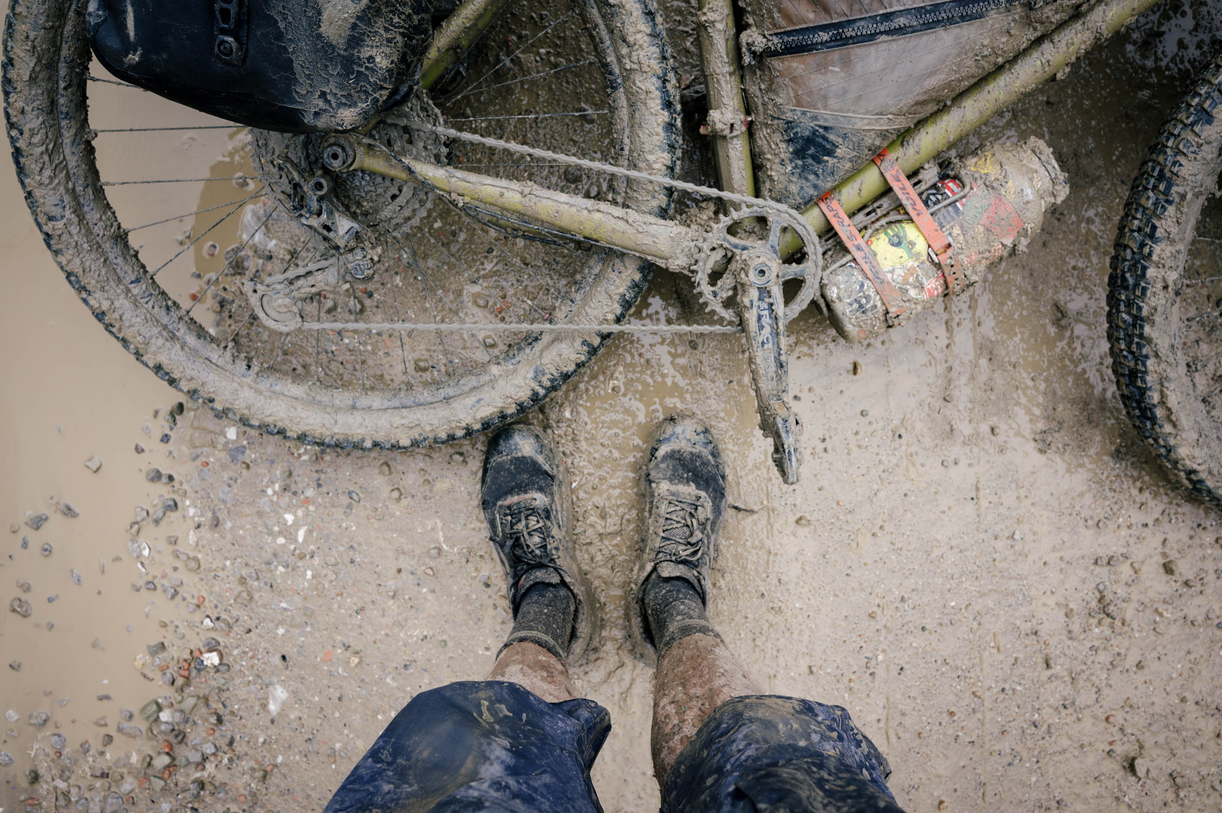
- There is really nasty peanut butter mud in the northern half. If it is really wet, keep this in mind. Stay on roads if you can.
- To get to Imilchil, you can go from Marrakech and then bus to Beni-Mellal. From Beni-Mellal, you can take a grand taxi or a private taxi to Imilchil. These can be a little pricey ($40-60) for a private ride. The bike ride from Béni-Mellal to Imilchil is also really nice.
- There is a high-speed train from Tangier to Marrakech.
- I took an FRS ferry from Algeciras to Tangiers a few years ago. It was cheap, fast, and easy. I paid nothing for the bike.
- There are no dangerous animals in Morocco. The monkeys are very timid. Nothing can really hurt you there. Drivers are for the most part very cautious. People are very friendly. It is a safe country, especially outside of the cities. The cities are a little different, a bit more hostile and just really hustly. But I never worried traveling alone there (spoken as a white male with privilege).
- Most Western countries are granted an automatic three-month tourist visa on entry. If you need more time, you can do a border run, and on re-entry are granted another three months.
- Fes, Marrakech, Tangier, Casablanca, and Rabat all have big international airports serving most of the world.
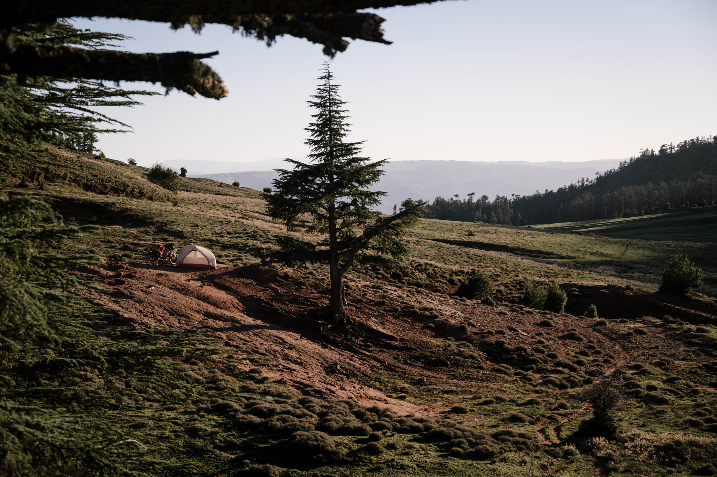
- There is plenty of wild camping in the southern half of this route. I pinned some places on the map, but do know there are other places to go. Once you get north of Fes, it becomes more difficult, as the population density is higher and there are so many shepherds wandering around with their flocks. I have noted some gites (hotels) you can stay in that might be wise. The center is definitely the most difficult section to camp.
- Morocco does not have much “private” land. You will not once see a sign this entire route that says “do not pass.” But do be mindful that this is not your land to make a mess of. Please leave no trace and be mindful of where you are camping.
- If you stay with a family, try to have something special and exchange gifts. If they ask for money, you should pay.
- There is plenty of fresh water in the northern half. I didn’t even pin it all down because there was so much. You can ride 50 kilometers and pass 10 water spickets in the Rift.
- In the High Atlas, you ride through many river beds, typically with small streams that you can filter water from. Therefore, you never really need to carry more that 4-6 liters of water for camping/cooking that night and a few hours of riding the next day.
- There are small markets all along this route, typically with cans of tuna and couscous and tomato paste and cookies and water and Coca-Cola. Bigger markets can be found in the slightly bigger towns. But every small village has a small market in case you need some essentials. See my language document to learn how to ask for a market.
- Get ready to eat a lot of tagine, bread, olive oil, tea, and couscous.
- Moroccans typically eat a really big dinner late at night (9-10 p.m.). If you’re staying with a family, expect to wait around.
- Friday is the holy day in Islam, and Moroccan families typically have a big family lunch Friday afternoon with couscous. These are always fun to join.
- If you are riding during Ramadan, carry extra food and try to eat/prepare it away from people.
- In general, I was very impressed by Moroccan produce.
Section 1: From Imilchil to Boumia
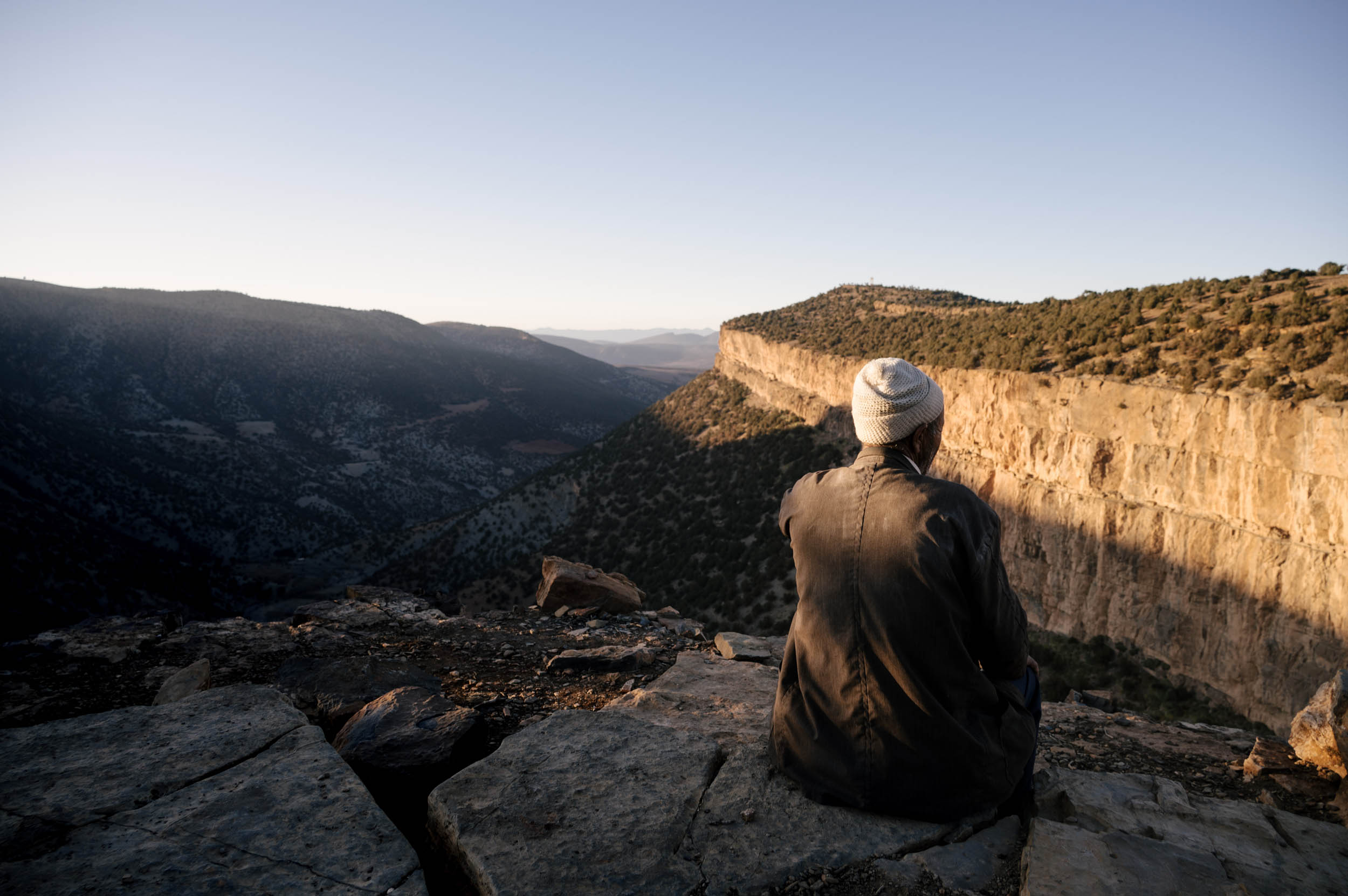
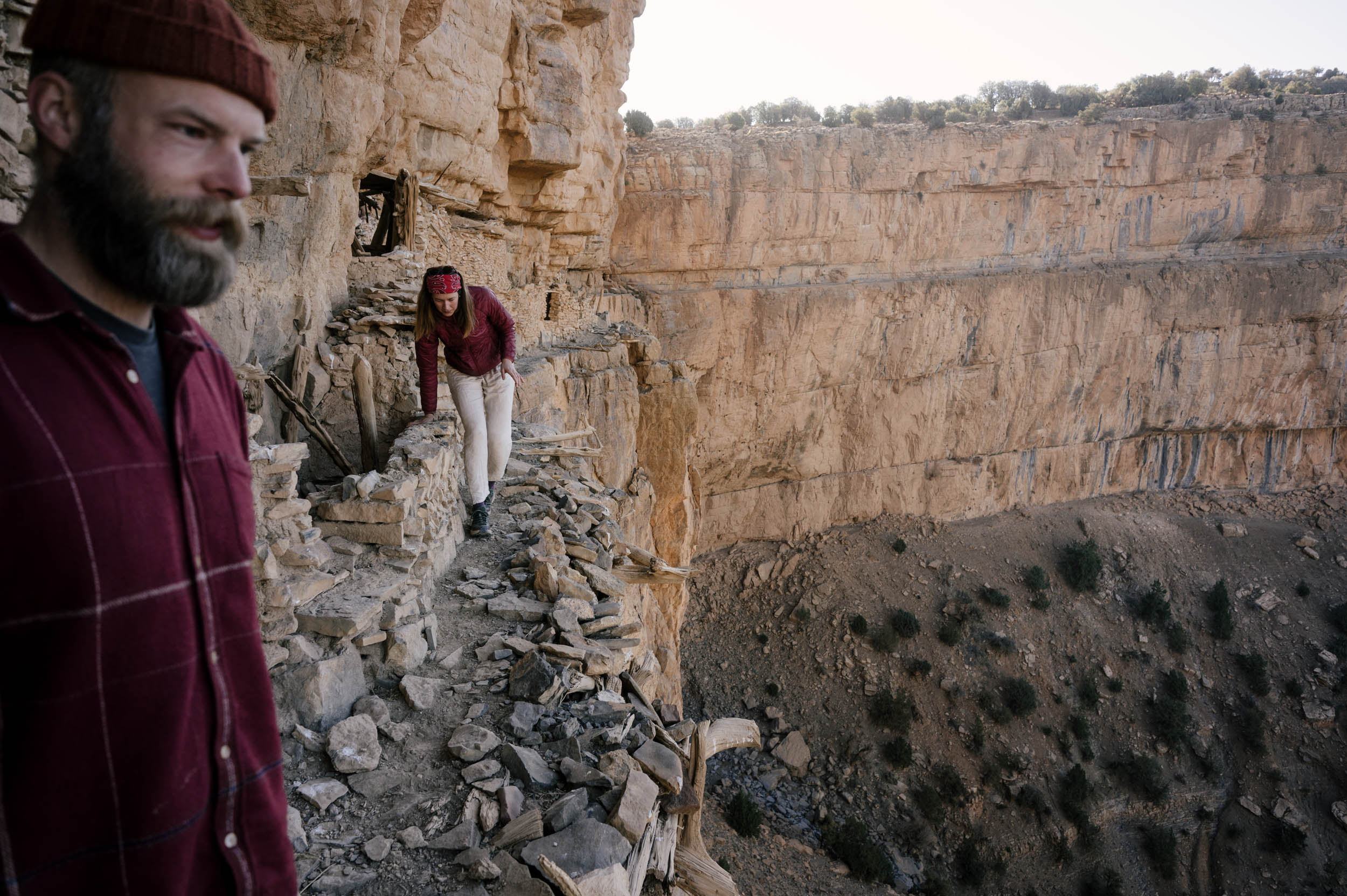
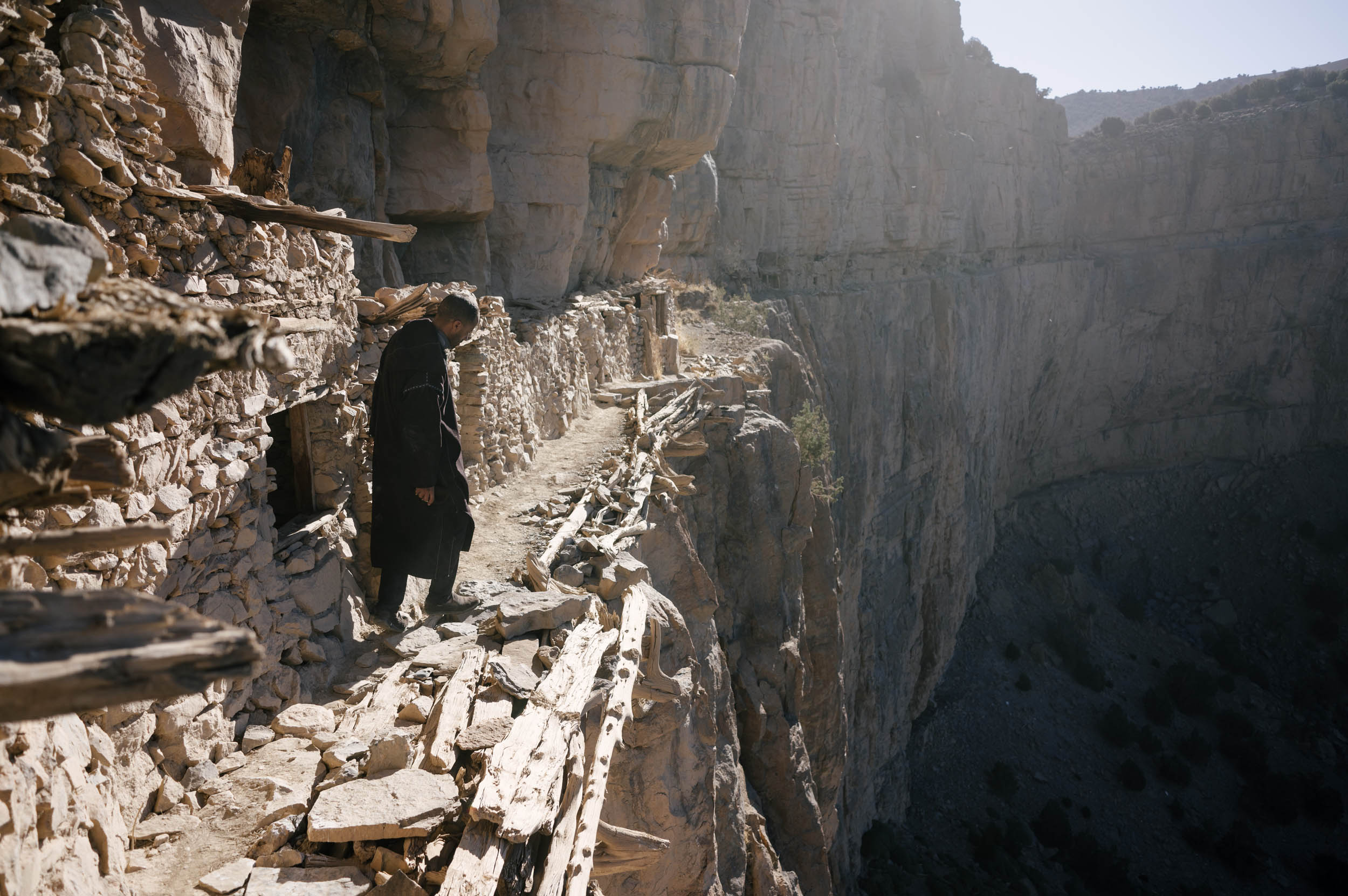
The route officially begins in the High Atlas village of Imilchil, where the southern Route of the Caravans ends. If you want a nice two-day ride from Imilchil, ride down to the Oujgal granaries, a stunning example of the beginnings of Amazigh banking and defenses built into a remote cliffside. Then load up on groceries, take a rest, go to Hammam, and get ready, because right out of Imilchil the hard riding begins.
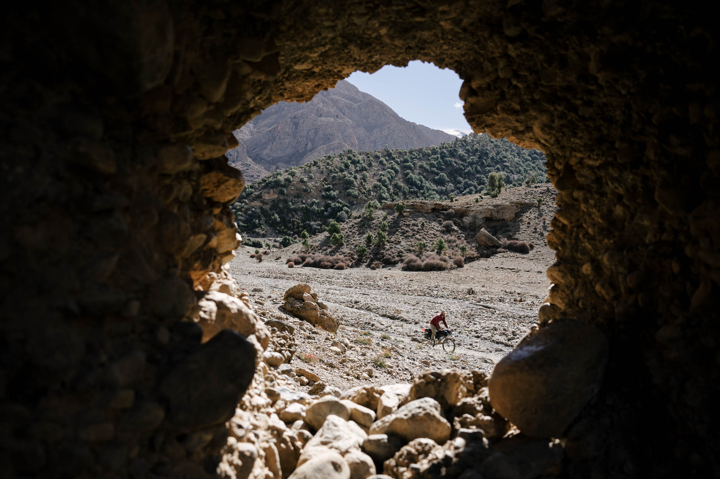
The route begins riding by the twin high alpine lakes, Isli and Tilsit, before connecting to one of the highlights of the entire route, the donkey trail singletrack descent. Warning, it is steep and technical, and the riverbed riding after this is very demanding. It is a stunning and immersive backcountry ride that you will share with locals going to the market on horseback and pass by children playing in the riverbed. You will pass juniper trees and granite peaks, and there’s even some really flowy bits of singletrack you can properly ride. This section is only recommended for confident riders on mountain bikes going northbound, and only while there is not much snowmelt.
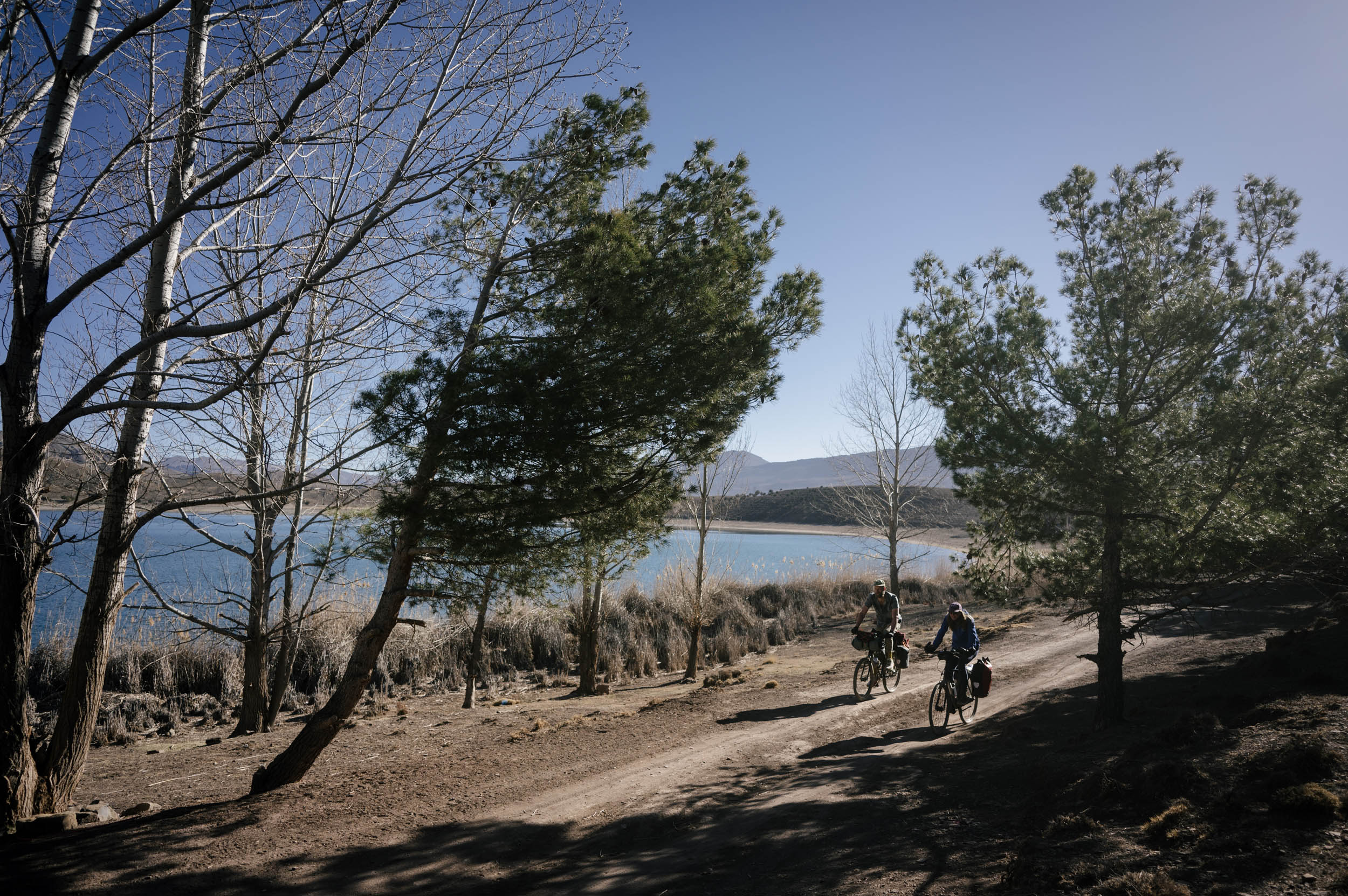
After this section, you ride through more riverbeds on small dirt roads and singletrack paths and broken down and abandoned roads. The riding is quiet, empty, stunning, and really lovely. Expect a lot of river crossings and some nice wild camping here, too. Stop in town for a game of cards and a smoke at the cafe. Even a nice hotel every couple days if you’re inclined.
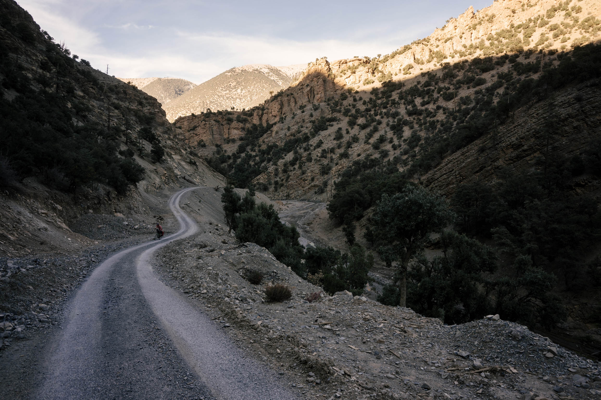
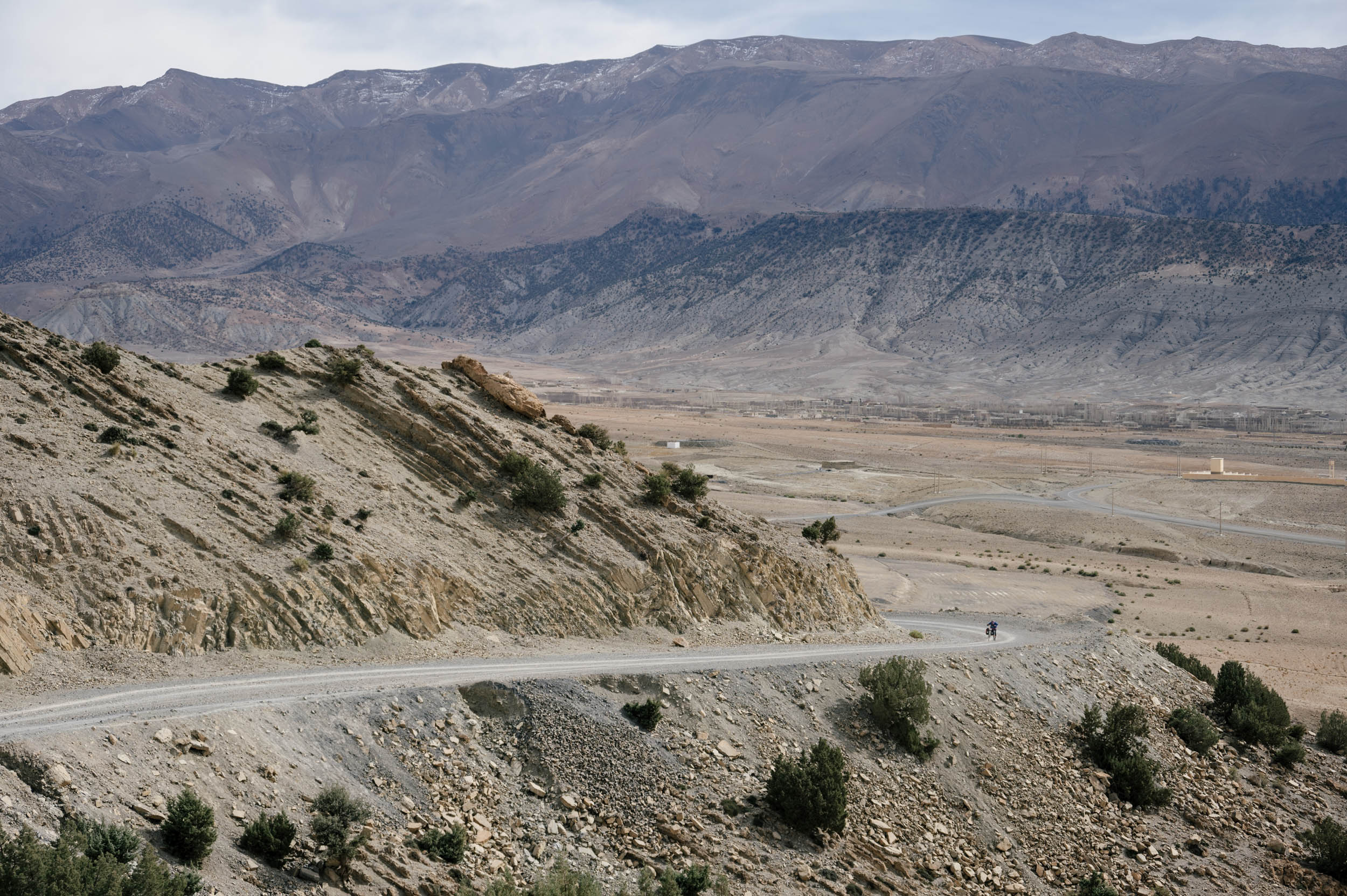
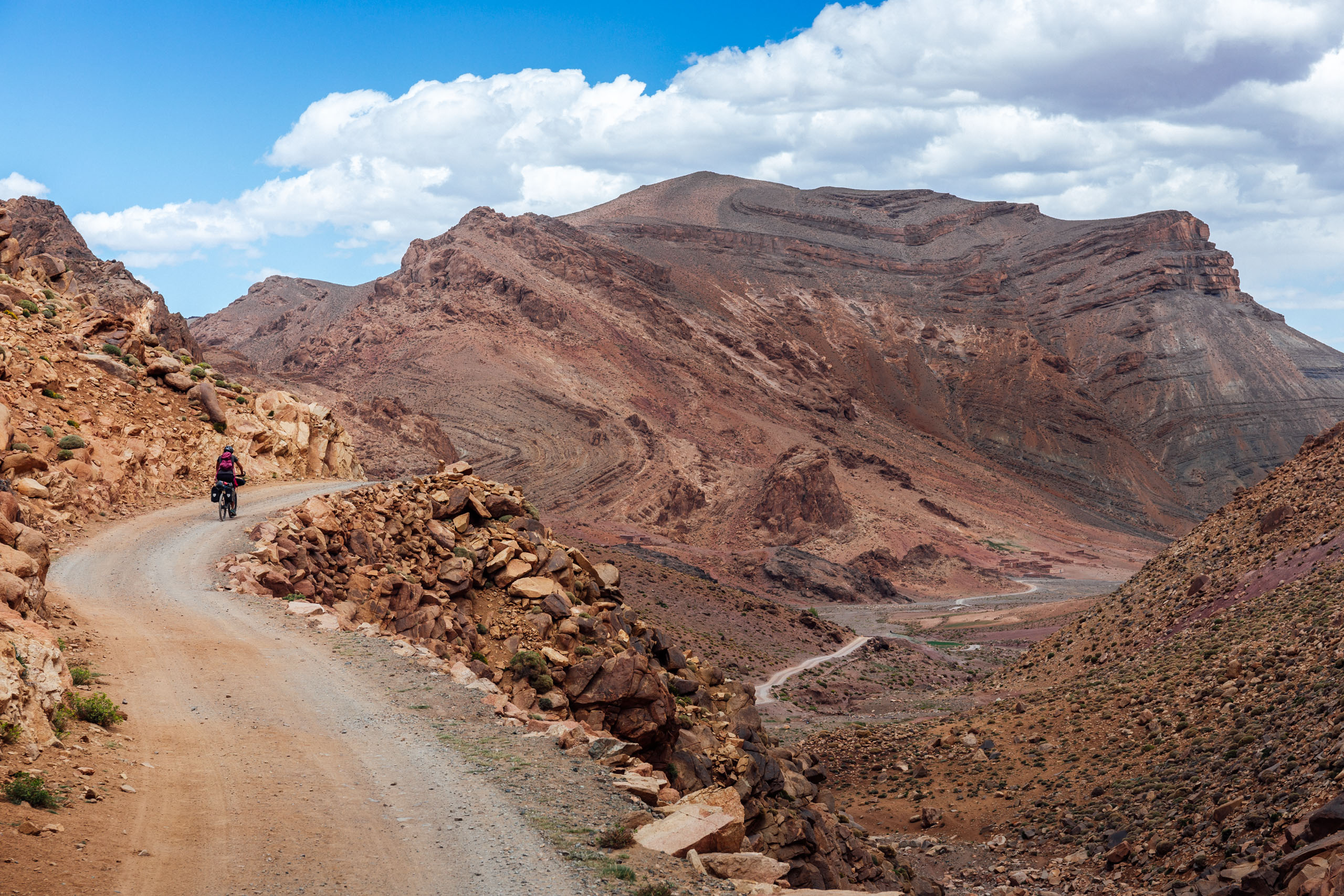
The route then pushes on for the Cirque de Jaffar, an unmissable stretch of dirt riding under the brim of the High Atlas through oak trees and pines,with snow-capped mountains and red tail hawks soaring overhead. Then, you descend through the Jaffar Gorge, another stunning gorge you can ride straight down the heart of. You then ride across the plains to Boumia, where you can resupply and shower. Wave goodbye to the High Atlas. It’s all lesser from here.
Section 2:Boumia to Fes
Now, you begin the long traverse north. Out of the High Atlas, Morocco becomes much more populated, and you connect from small city to village constantly. There’s always a market or two and someone to talk to and a soccer game to jump in if you still have the energy. The riding is very nice for this stretch, and is much less dramatic, arid, and difficult.
You ride through rolling dirt roads in Khenifra, on logging roads, tracing singletrack in Ifrane, and past two very significant waterfalls, Oum Rabia and Zaouiat Ifrane. There is still nice wild camping, pines and junipers, incredibly warm and kind Amazigh people, and here you can expect tribes of macaque monkeys to scramble through the trees as your tires crunch gravel.
As you ride north, towns become more and more developed. More services are available, and a distinctly more European feeling comes with every day. You pass through “Little Switzerland,” the weirdly European ski town of Ifrane, and then connect through countryside dirt roads and descend into Fez, the ancient city full of history, leather tanneries, a very hectic Medina, and the oldest still active university in the world.
Section 3: Fes to Tangier
From Fez onward, we struggle to stay on dirt, to be frank. Morocco is paving roads incredibly quickly. Things that were dirt five years ago are now nice fresh pavement. Please don’t be sad, but this section has some pavement. But I do promise you this: it is all really nice riding and also still very quiet. Don’t let this turn you off on this route. The paved riding is still spectacular.
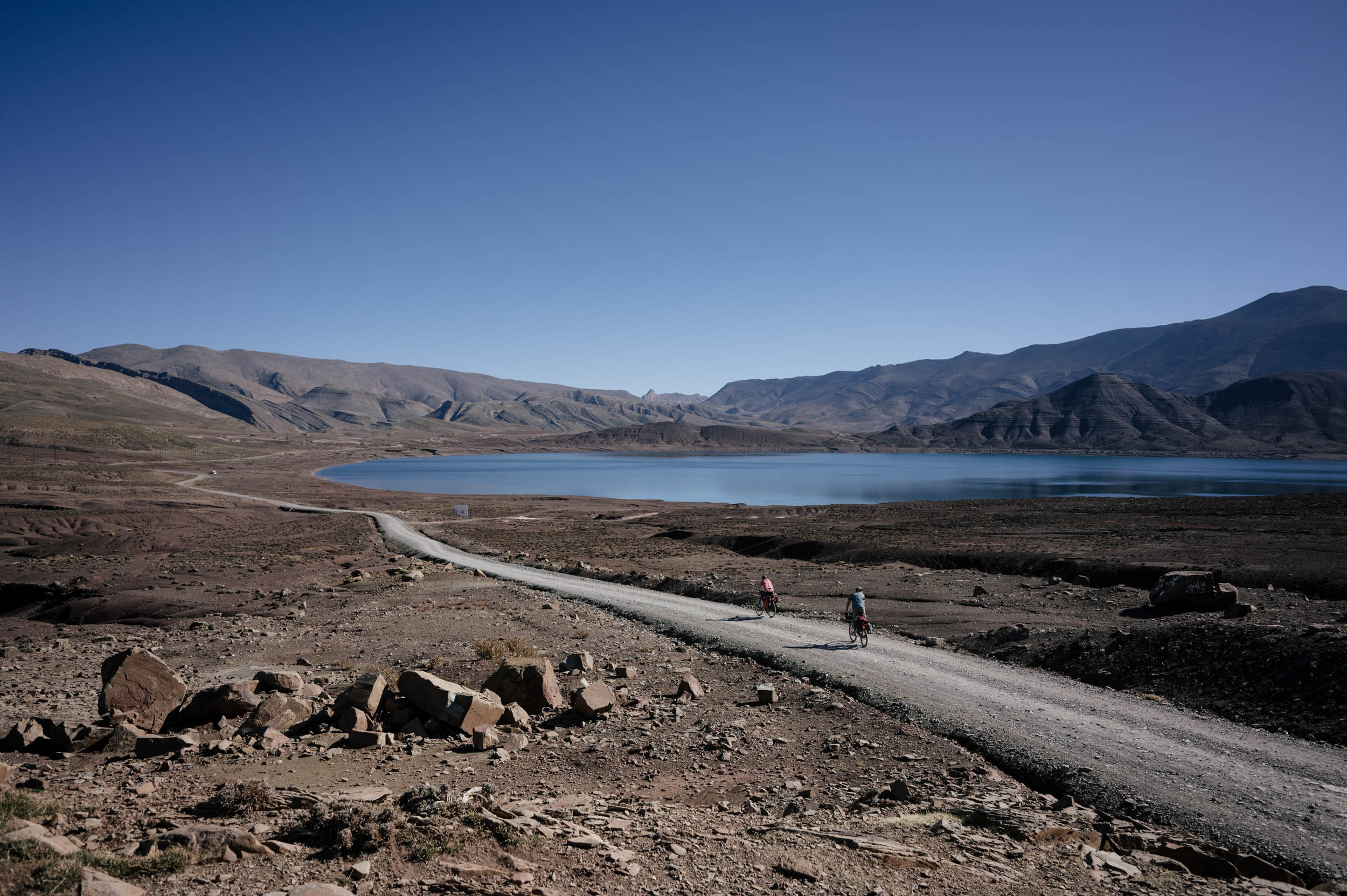
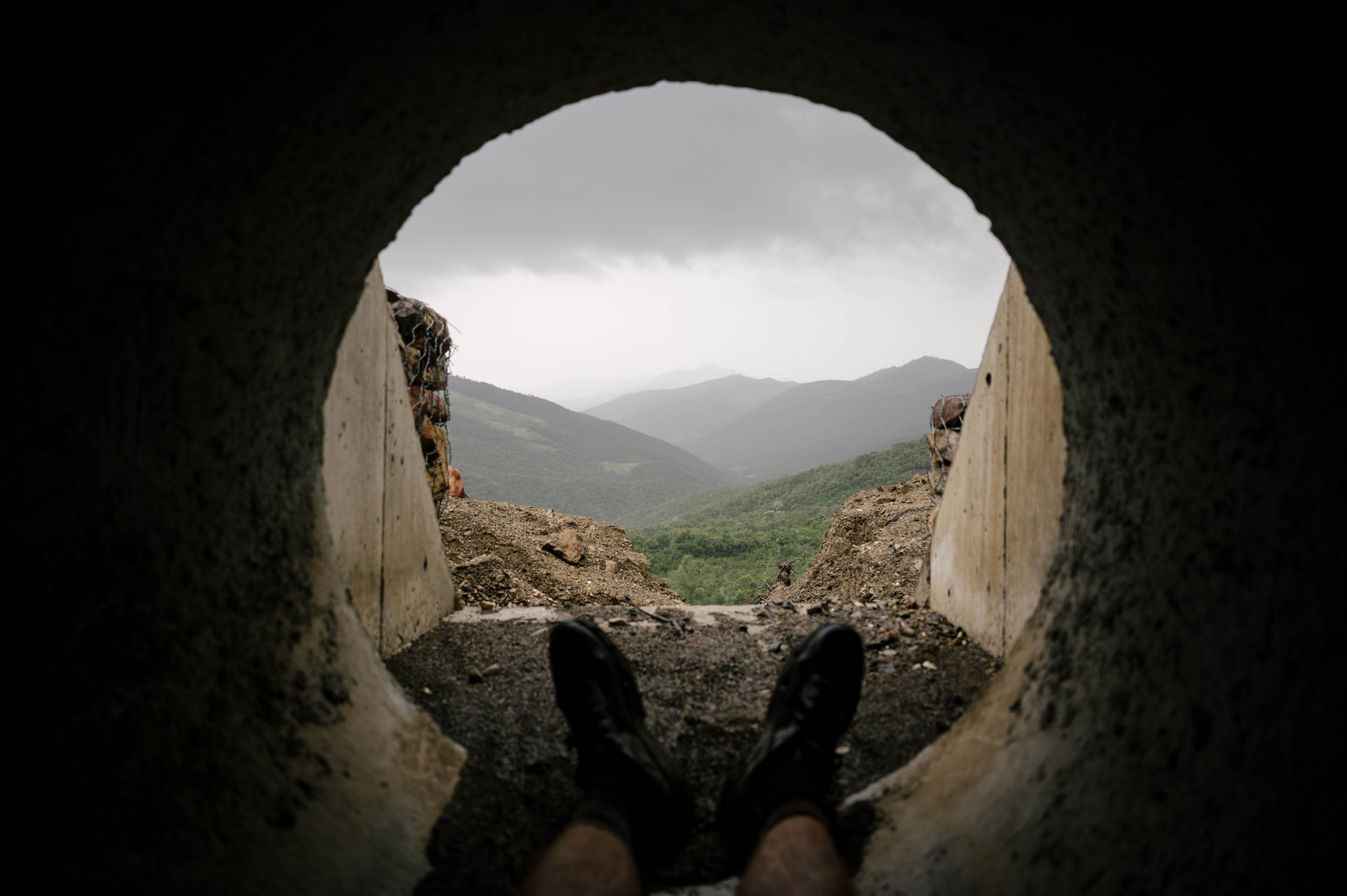
You pass the Barrage Al Wahda and ride into the Rift mountains after climbing out of Fez and snaking through the green hills growing to the north. It is an incredible contrast from just a week prior, whereas just days before, you were riding in a dry and remote, high alpine Martian-like landscape, now you ride through rolling green hills, with little villages on the hillsides and rivers flowing everywhere. Note that while riding around Barrage Al Wahda, lodging is difficult to find. Wild camping in this region is difficult as well.
You then enter the Rift mountains, with big mountain riding around the peak of Jebel Lakraa and a screaming dirt descent into Chefchaouen, the ancient blue city and tourist destination. Grab a hotel for 10 euros, buy a trinket, take a photo of some cats sleeping on a blue doorway, definitely get offered some hashish, and then ride the best section of this whole route.
The section from Chefchaouen to Tétouan is superb. It is some of the best riding I’ve ever done in my entire life. You ride these beautiful dirt roads through a gorge next to a massive river, completely alone. It is stunning. It is unbelievable. It cannot be missed. Tétouan is a nice town as well, with my favorite Medina of all the cities. The ride to Tangier is also very nice through more rolling hills. You enter through the dump, which always makes for an interesting day.
You descend on dirt into the city of Tangier. Then you ride through the metropolis and can make whatever next moves you prefer, including taking the ferry over and connecting to the Altravesur, or to the European Divide, or wherever else is next. Congrats!


Terms of Use: As with each bikepacking route guide published on BIKEPACKING.com, should you choose to cycle this route, do so at your own risk. Prior to setting out check current local weather, conditions, and land/road closures. While riding, obey all public and private land use restrictions and rules, carry proper safety and navigational equipment, and of course, follow the #leavenotrace guidelines. The information found herein is simply a planning resource to be used as a point of inspiration in conjunction with your own due-diligence. In spite of the fact that this route, associated GPS track (GPX and maps), and all route guidelines were prepared under diligent research by the specified contributor and/or contributors, the accuracy of such and judgement of the author is not guaranteed. BIKEPACKING.com LLC, its partners, associates, and contributors are in no way liable for personal injury, damage to personal property, or any other such situation that might happen to individual riders cycling or following this route.
Further Riding and Reading
Here are some connected/nearby routes and related reports...
Please keep the conversation civil, constructive, and inclusive, or your comment will be removed.