Santa Rosa Valleys and Vistas
Distance
130 Mi.
(209 KM)Days
4
% Unpaved
95%
% Singletrack
16%
% Rideable (time)
95%
Total Ascent
13,949'
(4,252 M)High Point
5,288'
(1,612 M)Difficulty (1-10)
7?
- 7Climbing Scale Strenuous107 FT/MI (20 M/KM)
- 6Technical Difficulty Moderate
- 7Physical Demand Difficult
- 6Resupply & Logistics Moderate

Contributed By

Moe and Harry
Guest Contributor
Moe (she/her) and Harry (he/him) are partners who live in Nelson, BC. They’ve traveled by bike both collectively and solo for many years, finding joy in dead-end roads, hike-a-bikes, and meaningful connections with new people. They are passionate bikepackers and mountain bikers, using both as a tool to build deep relationships with the land. Always on the hunt for the next sweet treat, you can often find them on the trails or in the nearest cafe.
Photos by Dustin Lalik
In 2021, Harry and I set out to explore our own backyard, scouting a loop from our front door that we could never have anticipated would become one of our favorite bikepacking adventures. With the pandemic limiting travel and being relatively new to Nelson, we didn’t have many options but to ride together and close to home. After completing the BC Epic 1000, which follows a portion of the BC Trail and is BC’s largest self-supported bikepacking race, we were searching for a route that forced us to slow down. Being avid mountain bikers, we thought there was no better way to ride fewer kilometers than by adding singletrack whenever we could along the route. As we drafted up ideas, this route quickly became a perfect blend of everything we love about biking in the West Kootenays.
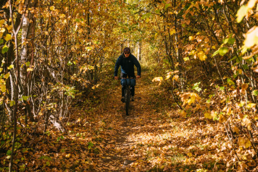
Re-scouting it in 2024 only deepened my appreciation for the route. After four years of living here, we’ve found a beautiful community of folks who are just as interested in outdoor adventure. Every day I’m reminded of how lucky we are to live on this land and experience it with our pals. We rode the route in October, and although my hands were wrapped in ski mitts to keep warm during the freezing morning temperatures, I continued to sing, laugh, and make jokes the entire way. If that’s not the mark of a good ride, I don’t know what is.
The route loops around the Rossland Range and brings together some of the most exciting rides in the area. After some warm-up singletrack and a brief stint of road riding, the route cruises along the Columbia Western Rail Trail, originally built in the late 1800s and early 1900s as the Gold Fever, reached Rossland. This rail grade is now a popular cycling route and part of the Trans-Canada Trail. After a pit stop in Christina Lake, you begin the Santa Rosa gravel climb, which takes you to a lovely valley we jokingly dubbed “Good Vibe Valley” during our 2024 scouting mission. As you ascend the long climb, it’s hard not to reflect on the beauty and simplicity bikepacking brings. After two long climbs, it’s time to ride the Dewdney Trail singletrack. A historic route established in 1864 by Edgar Dewdney to connect settler communities, this trail now serves as a fast and flowy downhill with small hits and berms that are guaranteed to have you hooting and hollering. The history embedded in this trail offers a poignant reminder of how the region has been shaped over time.
Another standout section of the route is the Doukhobor (doo-koh-bawr) singletrack. As you ride (or push) up the trail, take a moment to reflect on the rich history of the Doukhobors, a group of Russian pacifist settlers who came to the West Kootenays in the early 1900s. While they contributed significantly to the area’s agricultural development, their community also endured trauma due to forced assimilation policies, including residential schools. The province issued an apology and compensation in 2024, but many survivors still seek adequate recognition and healing. If interested in learning more, take a pitstop on the final section at the Doukhobor Discovery Centre. The route ends with a singletrack finale on the Columbia River Trail. This narrow, sometimes exposed path hugs the side of the river, offering incredible views of the Columbia.
What makes Santa Rosa Valleys and Vistas special is the way it combines everything I love about bikepacking—the history, challenging terrain, sense of connection to the land, and communities along the way. Whether you’re pushing through a tough climb or coasting down a flowy singletrack, you’re constantly reminded of how much this area has to offer.
 With four routes and more to come, the West Kootenay Bikepacking Route Network provides riders of all levels an opportunity to explore the history, landscape, and vibrant culture of the West Kootenays. Routes range from overnighters to the largest flagship route, the nine-day Kootenay Confluence. Learn more about the area and find a growing map of routes at the West Kootenay Bikepacking Route Network.
Difficulty
Santa Rosa Valleys and Vistas is rated as a 7/10. It’s logistically straightforward, but as is expected in the Kootenays, it includes a significant amount of climbing, with guaranteed hike-a-bike and singletrack. There are a few long, steady climbs that can be pretty hot in the summer. Food resupply options are plentiful, but water is somewhat limited, so plan accordingly.
Route Development: Santa Rosa Valleys and Vistas was a collaborative project developed by Moe Nadeau and Harry Tudor, partners living in Nelson. Initially scouted in 2021, it was a loop from their front door, encouraging the pair to explore more of their backyard amidst the pandemic. The route blends varied terrain because Moe and Harry are always on the hunt to find more singletrack on their adventures. Official route development was made possible thanks to the support of the Qube Charitable Foundation and fellow bikepacker Ian Quigley. A special thanks to the friends who joined our scouting mission, including Dustin Lalik, Raphael Leblanc-Cyr, and Kevin De Souza.
Submit Route Alert
As the leading creator and publisher of bikepacking routes, BIKEPACKING.com endeavors to maintain, improve, and advocate for our growing network of bikepacking routes all over the world. As such, our editorial team, route creators, and Route Stewards serve as mediators for route improvements and opportunities for connectivity, conservation, and community growth around these routes. To facilitate these efforts, we rely on our Bikepacking Collective and the greater bikepacking community to call attention to critical issues and opportunities that are discovered while riding these routes. If you have a vital issue or opportunity regarding this route that pertains to one of the subjects below, please let us know:
Highlights
Must Know
Camping
Food/H2O
Trail Notes
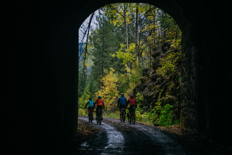
- Cycling through the 912-meter-long Bulldog Tunnel is a unique and very dark experience. Constructed between 1898-1900 for the former Canadian Pacific Railway southern main line under Bulldog Mountain, the Tunnel provided much easier access for trains compared to its previous multi-switchback route up the tunnel.
- The Dewdney Trail is an awesome singletrack that marks the end of the Epic Seven Summits Trail. The trail is part of the historic Dewdney Trail, established in 1864 by Edgar Dewdney. It was 700 kilometers long, linking Hope to Fort Steele. Various sections of the historic trail remain, serving as routes for backcountry adventures, logging, and farming. The singletrack is a fast and flowy downhill track with small hits and berms. Prepare to hoot and holler as you make your way down.
- The Old Cascade Highway between Christina Lake and Rossland provides beautiful scenery and a rewarding climb. Known by many names, including the Santa Rosa Road and Old Cascade-Rossland Highway, it switchbacks through the Monashee Mountain Range. It is a historic transportation route that is now primarily used to provide access for activities including hiking, dirt biking, horseback riding, and mountain biking. You can also find small acreages along this road.
- The Columbia River Trail is the perfect singletrack to end the trip. Situated on the east side of the Columbia River, the trail can be narrow and exposed in sections, with small creek crossings. It is ridden in both directions and serves as part of the Trans-Canada Trail. The Trail is maintained by the Kootenay Columbia Trail Society and the Castlegar Parks and Trails Society. Don’t forget to donate to the trail societies that make these routes possible.
- The Doukhobor Discovery Centre provides a glimpse into the rich history and culture of the Doukhobors, who began settling in the West Kootenays in 1908. Roughly 5000 Doukhobors, a sect of Russian dissenters, came at this time and purchased land to farm and partake in forestry. Between 1953 and 1959, the province of BC forcibly removed Doukhobor children from their families and placed them into residential schools aimed at assimilation because their parents opposed government rules and did not send them to public schools.
For many years, the community has asked for an apology from the provincial government for the trauma and stigma they’ve experienced as a result of attempted assimilation. In 2024, the provincial government offered an apology and a $10-million compensation package, with specifics on how the money was to be allocated. This offer faced a great deal of backlash as it, once again, placed control in the hands of the province. Only a small portion of the funds have been allocated directly to residential school survivors. The community continues to ask for adequate compensation after facing such horrific acts of assimilation.
When to go
- Early summer and early fall are the optimal times, as they have lower daytime highs, and the route is less likely to be covered in snow. However, forest fire season is unpredictable, making it challenging to predict the perfect time.
- BC’s Interior is highly susceptible to forest fires starting as early as July. Make sure to check on the BC forest fire map for current conditions and be prepared to adjust your plans quickly. If you see a forest fire, you can report it by calling *5555.
Logistics
- There is free overnight parking available at the Columbia and Western Rail Trail trailhead, where the route begins.
- Castlegar has a regional airport with daily flights to and from Vancouver.
- There is also an airport in Trail, about a half hour’s drive from Castlegar, with flights from Vancouver via Pacific Coastal.
- Both airports offer paid long-term parking. The Trail Airport currently costs $3/day and $15/week CAD. Visa, Mastercard, and cash are accepted. The West Kootenay Regional Airport in Castlegar costs $10/day and $55/week CAD. Multiple payment methods are accepted.
- The Kootenays are home to a variety of wildlife. Expect to see deer, elk, black bears, and grizzlies. On both route scouting missions, larger carnivore sightings were had on the rail trail between Castlegar and Christina Lake. To avoid unwanted encounters, bring a rope and drybag to store your food in a tree at night, cook away from your tent, and #LeaveNoTrace. If in the backcountry, pack out what you bring in, and dispose of waste properly when you get to town.
- Cell phone coverage is spotty but reasonably reliable. However, carrying a satellite communication device is recommended for emergencies outside of cellular reception.
What Bike
- The route is technical, with a section of hike-a-bike and a good amount of blue-rated, sometimes technical, singletrack. We recommend riding a bike with at least 56mm (2.2”) tires, but anything up to 2.8” wide will make some of the descents more enjoyable.
- A hardtail mountain bike is likely your best choice for the route. It offers the comfort needed for the singletrack sections while providing efficiency on the rail grade portion of the route.
- A rigid hardtail or drop-bar 29er will also get the job done. We rode a mix of suspension and rigid forks, with wide (2.6-2.8”) tires to counteract the chunder.
- If riding this route on a gravel bike, skip the Dewdney Trail singletrack and follow the Old Cascade Highway to Rossland. You can find an updated version of the route sans singletrack here.
Route Direction
- Santa Rosa Valleys and Vistas can be ridden in either direction, although we chose to ride it counter-clockwise to take advantage of the singletrack and avoid some awkward climbs that are easier to descend. It also starts with an easy Rail Trail to prepare your legs for the singletrack sections. If ridden Clockwise, we recommend diverting at Rossland, avoiding the Dewdney Trail, and reconnecting with the route along the Old Cascade Highway. The Dewdney Trail would be a pretty miserable hike-a-bike and could be dangerous as mountain bikers descend.
- There are two established campgrounds in Christina Lake. Skands Campground is lakefront, with plenty of tent sites and hot showers. Walking distance to the water, Christina Pines Campground offers tent sites, free wifi, a heated swimming pool, mini golf, and laundry facilities. The mini golf is free, and it is a riot. The campground also has on-site RV rentals and one small cabin. However, they have a minimum of 3 and 2-night stays, respectively. Christina Pines has made a commitment to “never turn away a bikepacker”.
- The Santa Rosa Creek Recreation Site is a modest option, located in a shady, cool cedar grove adjacent to Santa Rosa Creek. It has picnic tables and nearby water.
- For those detouring to Rossland, the Rossland Lions Campground is a great option. It is close to town and has picnic tables, a covered area with a BBQ, and warm showers.
- Be prepared to wild camp. You will likely spend at least one night wild camping. There are plenty of options along most of the route, but be sure you are on public land before setting up camp for the night. The rail trail has multiple shelters along the route that make for a great place to camp. However, water can be limited, so plan accordingly.
- Christina Lake is full of little restaurants and a grocery store called Huckleberry Mountain Market. New food stands are popping up every summer, be sure to check them out. Portly Penguin Pizza is a local favorite.
- The Ice Creamery in Christina Lake is a must-stop. Decorated in old-style parlor decor, it is a classic stop for cyclists and vehicle travelers alike. Home of the infamous four-flavor-two-scoop cone, this detour will not disappoint you. It is open seasonally, from the May long weekend to the September Labour Day weekend.
- Founded in 1943, Ferraro Foods is a family-owned business highlighting the Kootenay’s incredible community. Anyone passing through Trail or Rossland takes the time to stop into either location. Ferraro’s is open in Trail Monday to Friday: 6 AM – 7 PM and Saturday and Sunday: 8 AM – 6 PM. Be sure to try their cinnamon buns.
- Castlegar boasts many restaurants, gas stations, and grocery stores. You can find anything you’d need pre-trip. Crumbs Bakery Cafe, open Wednesday to Saturday, 7 AM to 5 PM, is an artisan bakery with delicious options. It’s a great place to start or end your trip.
- There are a number of streams and small creeks on the route that flow for most of the year. We’ve completed this route multiple times between June and October, and finding natural water sources wasn’t an issue. We carried about 2L per person at all times. We recommend filling up on water before the rail trail climb and Santa Rosa road climb.
Sample Four-Day Itinerary
On both scouting missions, we completed the route in three days. However, this was largely due to time constraints. As a team, we’ve decided the best way to experience this route is to give yourself four days (and even more if you want to check out the Seven Summits Epic Trail). See below for a detailed description of our proposed four-day itinerary.
locationCastlegar-Bulldog Tunnel
Day 1 (39 KM +929 M / 24 MI +3,047 FT)
Start your trip on the Columbia-Western Rail Trail trailhead. Cars can be parked overnight for free here. The rail trail is approximately 90 kilometers long and connects Castlegar to Christina Lake. Riders will enjoy beautiful views over Lower Arrow Lake, scenic trestles, and long, slightly spooky riding through abandoned railway tunnels. Notably, the route passes through Bulldog Tunnel, measuring almost a kilometer long! There are plenty of covered picnic table areas along the way that make for perfect camp spots. Many of them also have pit toilets. Feel free to camp anywhere along this route, although if you decide to camp on the ascent, the Bulldog Tunnel has a few drips of water that make for an excellent overnight location.
locationBulldog Tunnel-Santa Rosa Creek Recreation Site
Day 2 (84 KM +1,793 M / 52 MI +5,882 FT)
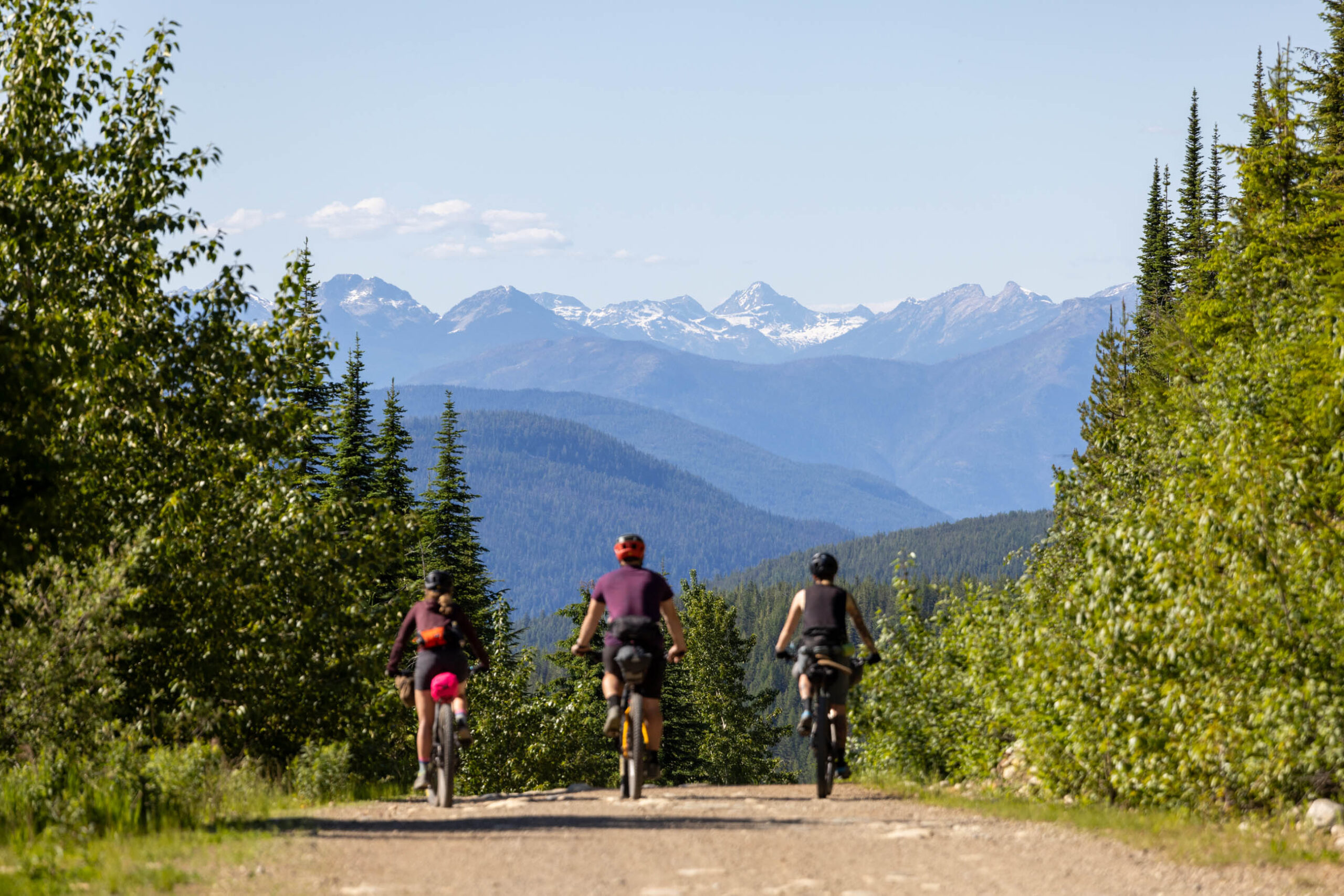
The route starts with a brief climb and a lovely descent into Christina Lake, Canada’s warmest tree-lined lake— a very niche designation. It is a popular tourist destination in the summer, with sandy beaches and a big water sports scene. Grab a cone at the Ice Creamery, a legendary ice cream spot that is open seasonally. Ask for the four-flavor-two-scoop; it’s exactly what it sounds like and is well-known for making dreams come true. Take a swim, grab some supplies at the local Market, and make your way up the roughly 1100-meter climb on the Old Cascade Highway. This is the largest climb of the trip; however, it is well-graded and not too strenuous, with lovely views most of the way. When route scouting, we termed this area “Good Vibe Valley.” The descent on the other side will have you hooting and hollering as you make your way to Santa Rosa Creek Recreation Site for the evening.
locationSanta Rosa Creek Recreation Site-Rossland
Day 3 (36 KM +1,214 M / 22 MI +3,982 FT)
Start your morning with a roughly 700-meter climb to the top of the route’s first (and arguably best) section of singletrack. This section of the Dewdney Trail is most commonly used as the finale of the Seven Summits, a highly praised IMBA Epic Trail. This is the most technical section of the route, and while it can be done on a rigid bike, some suspension will allow the rider to take advantage of the trail’s giggle-inducing berms, jumps, and swoops. Shake your fist at the sky and curse the route developers as you push your bike up Doukhobor, an old-school mountain bike descent now more commonly used as a climb trail in the Rossland trail network. Arrive in Rossland tired and hungry, and treat yourself to a dinner at the Flying Steamshovel, a classic Rossland pub, before camping at the Rossland Lions Campground.
If time permits, it is worth extending your trip by a day or two to explore the mountain town of Rossland and the Seven Summits Epic Trail. We recommend grabbing a coffee at the Alpine Grind and walking the main street. Various companies in town offer shuttle services if you decide your legs have enough gusto for the roughly 30-kilometer black diamond singletrack of the Seven Summits.
locationRossland-Castlegar
Day 4 (53 KM +532 M / 32 MI +1,745 FT)
Pack up camp and grab a coffee and a baked good from the Alpine Grind or Seven Summits Coffee Roastery. If you are gluten-friendly, seriously consider grabbing some cinnamon buns from Ferraro Foods (locations in Rossland and Trail), as they are magnificent. Descend to Trail via singletrack and backroads before following the Columbia River Trail to end in Castlegar. This trail winds along the shore of the Columbia River, providing views and pleasant singletrack riding as a lovely denouement to the trip. Celebrate your accomplishments with a trip to Crumbs Bakery in Castlegar, where the coffee is great, and the cheese pretzels are even better.
You will finish up the route with lovely singletrack, taking you to the Brilliant Suspension Bridge, a national historic site built in 1913 by the Doukhobors to connect their settlements on both sides of the Kootenay River. After a short section of more singletrack, you will ride roughly 8 kilometers on the road to the Columbia-Western Rail Trail.
Terms of Use: As with each bikepacking route guide published on BIKEPACKING.com, should you choose to cycle this route, do so at your own risk. Prior to setting out check current local weather, conditions, and land/road closures. While riding, obey all public and private land use restrictions and rules, carry proper safety and navigational equipment, and of course, follow the #leavenotrace guidelines. The information found herein is simply a planning resource to be used as a point of inspiration in conjunction with your own due-diligence. In spite of the fact that this route, associated GPS track (GPX and maps), and all route guidelines were prepared under diligent research by the specified contributor and/or contributors, the accuracy of such and judgement of the author is not guaranteed. BIKEPACKING.com LLC, its partners, associates, and contributors are in no way liable for personal injury, damage to personal property, or any other such situation that might happen to individual riders cycling or following this route.
Further Riding and Reading
Here are some connected/nearby routes and related reports...
Please keep the conversation civil, constructive, and inclusive, or your comment will be removed.


