


Silver Siouxon
Distance
75 Mi.
(121 KM)Days
3
% Unpaved
74%
% Singletrack
46%
% Rideable (time)
95%
Total Ascent
9,868'
(3,008 M)High Point
4,207'
(1,282 M)Difficulty (1-10)
6?
- 9Climbing Scale Very Strenuous132 FT/MI (25 M/KM)
- -Technical Difficulty
- -Physical Demand
- -Resupply & Logistics
Contributed By
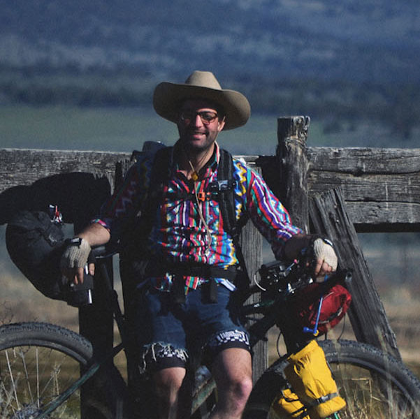
Gabriel Amadeus
Limberlost
One of the most frequent questions I hear is: “What can I bikepack on a long weekend that’s close to town?”
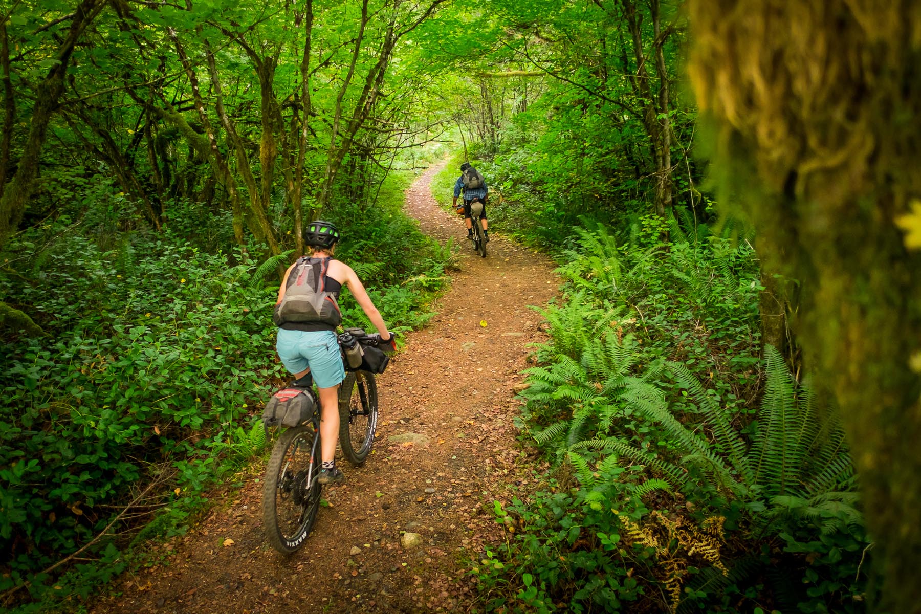
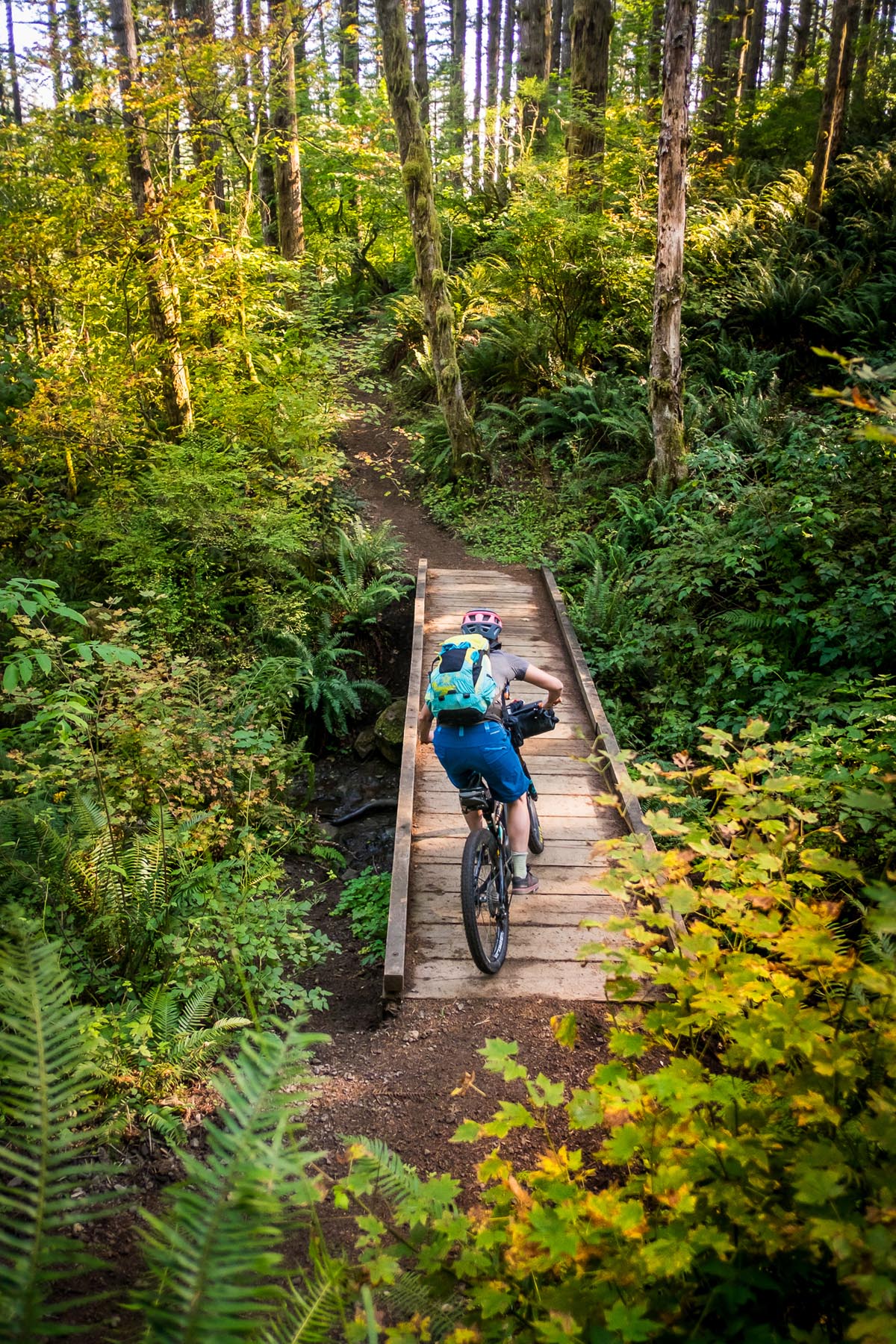
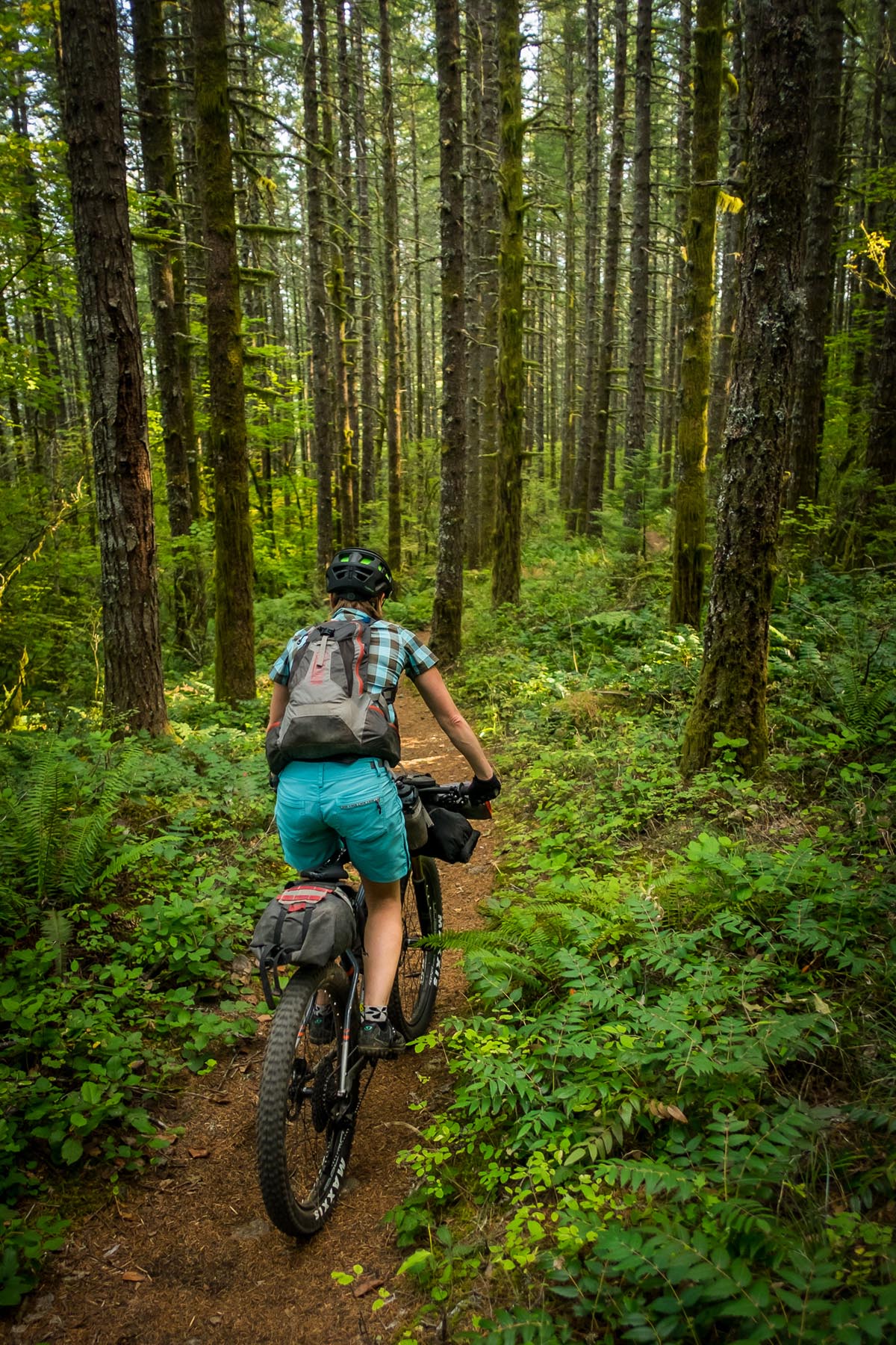
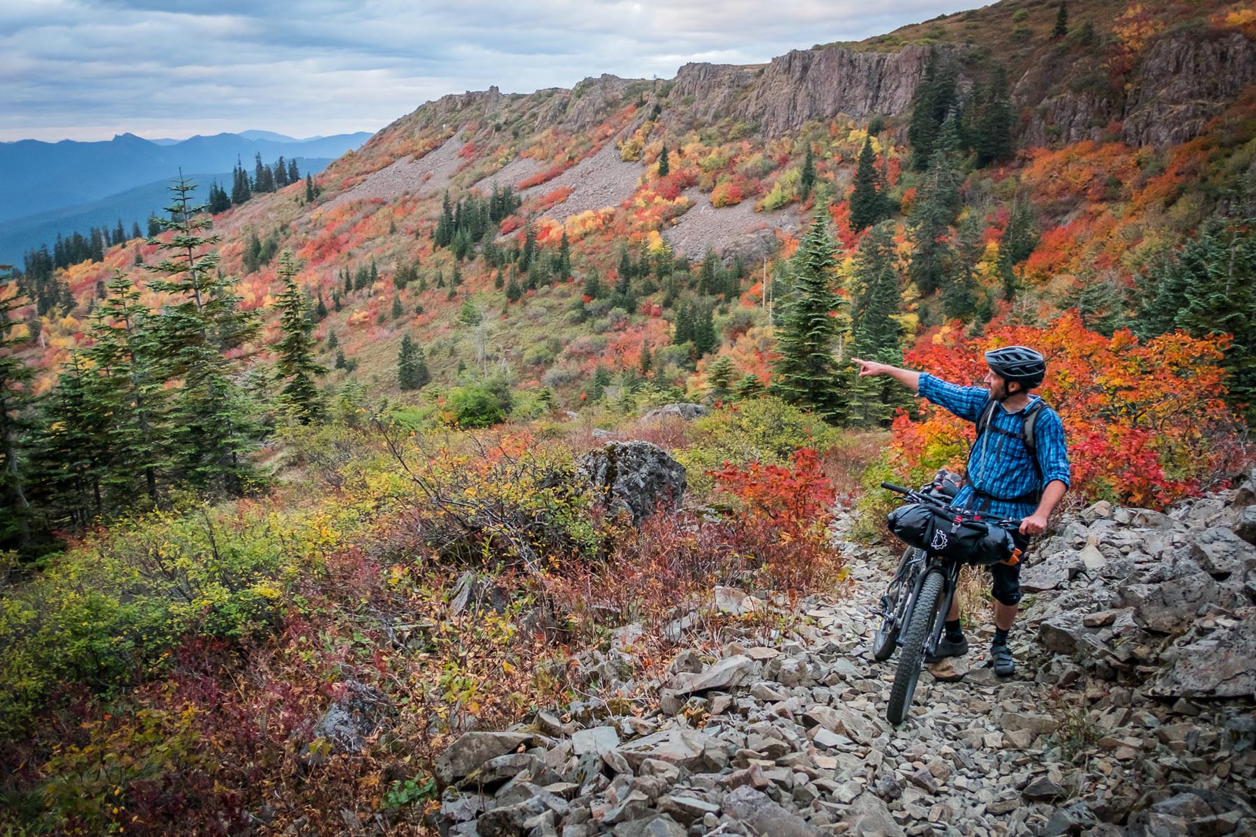
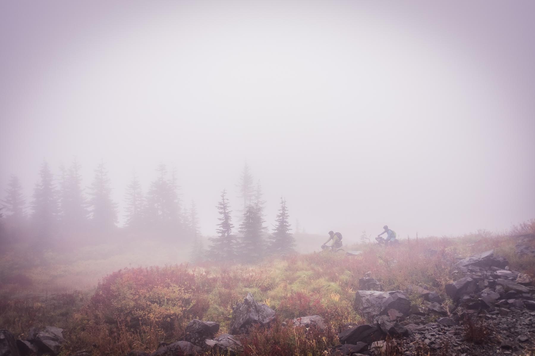
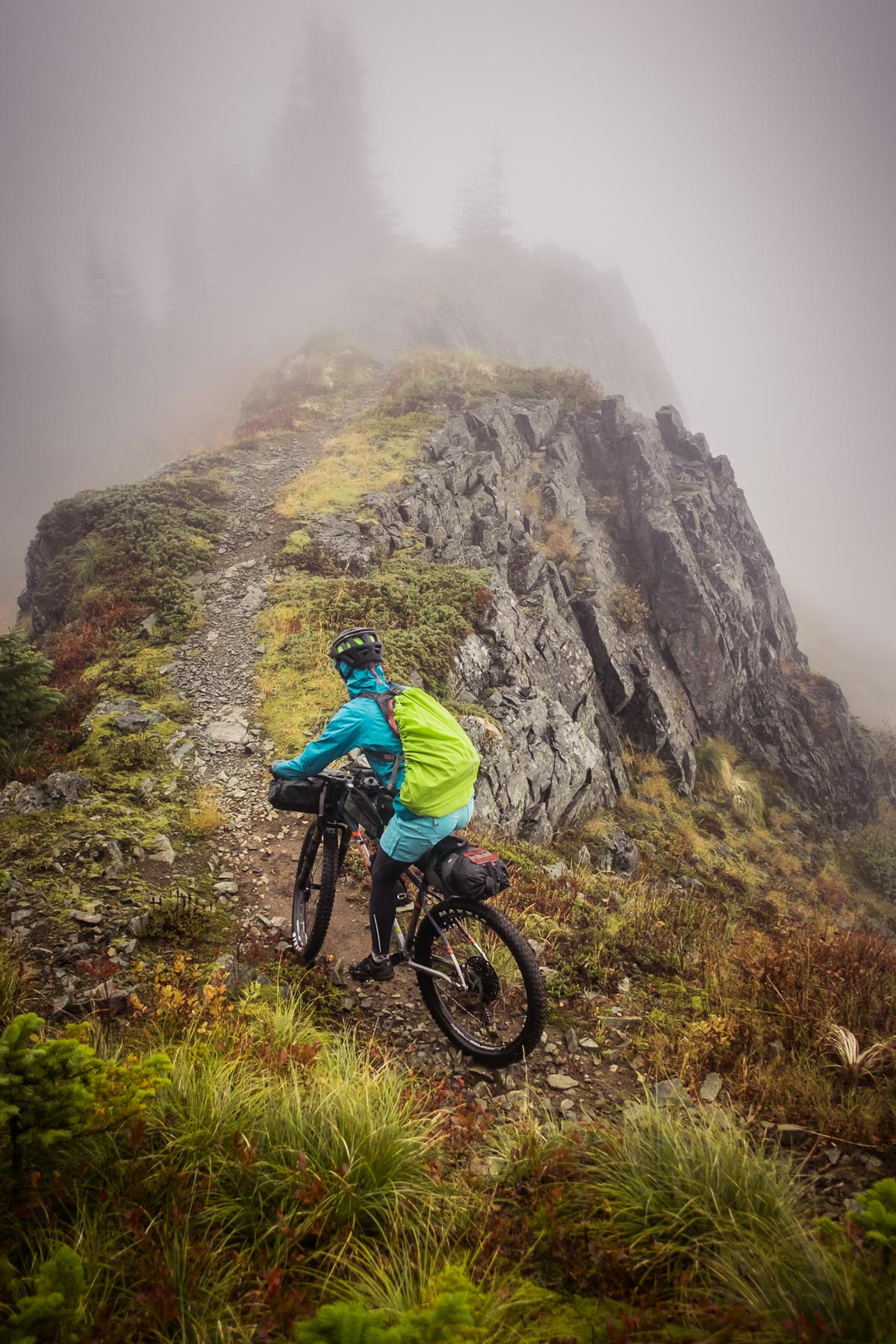
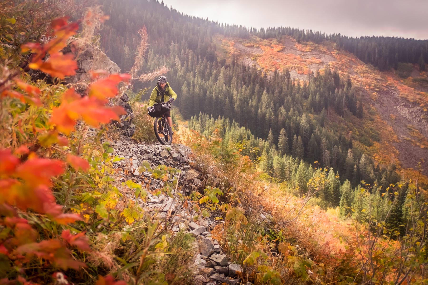
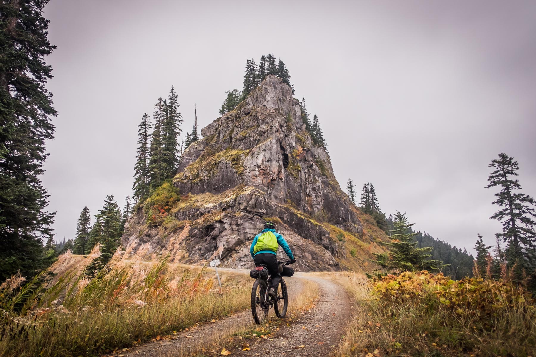
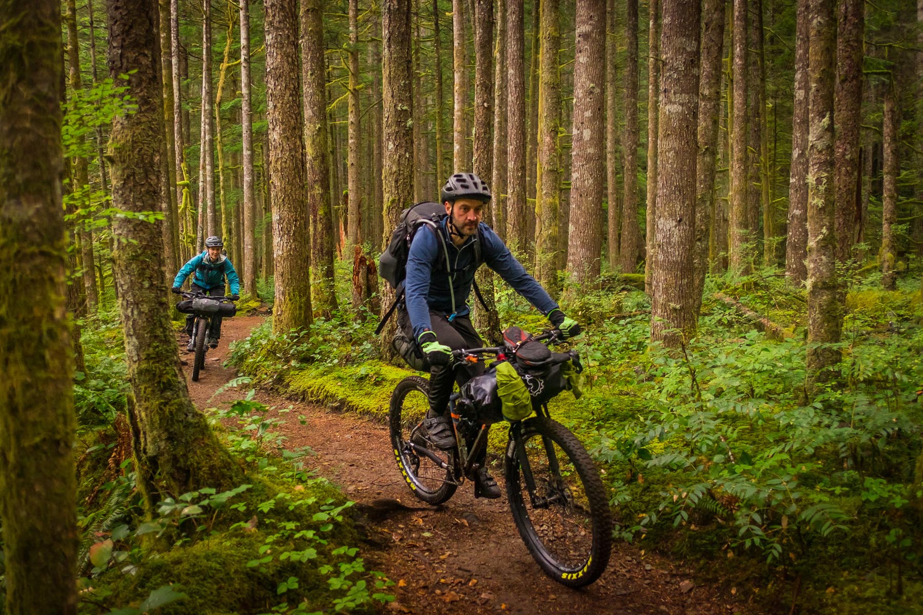
The Silver Siouxon route is the answer to that question. You get incredible backcountry singletrack and a remoteness that seems much, much farther than an hour’s drive from Portland. You’ll climb (errr, push) to above 4,000′, and traverse rocky ridgelines before descending through one of the most stunning old growth stands in the area.
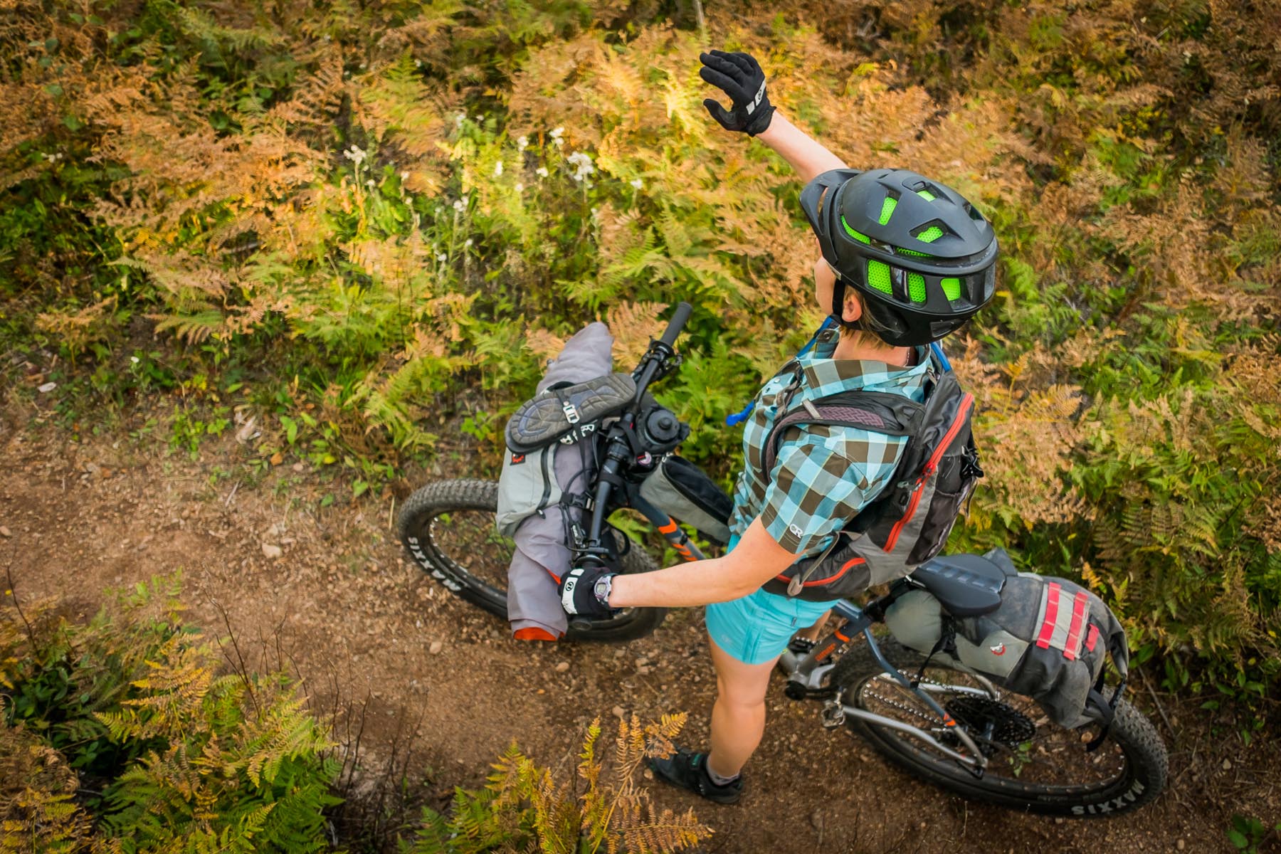
Each day is approximately 25 miles, but don’t let that fool you — the steep pitches are unforgiving. There is plenty of water along the route, and a delicious hot meal waiting in Yacolt at the finish. The trails are steep and breathtaking, but only moderately technical. It’s close enough that with an extra day you could even pedal there from Portland’s city limits.
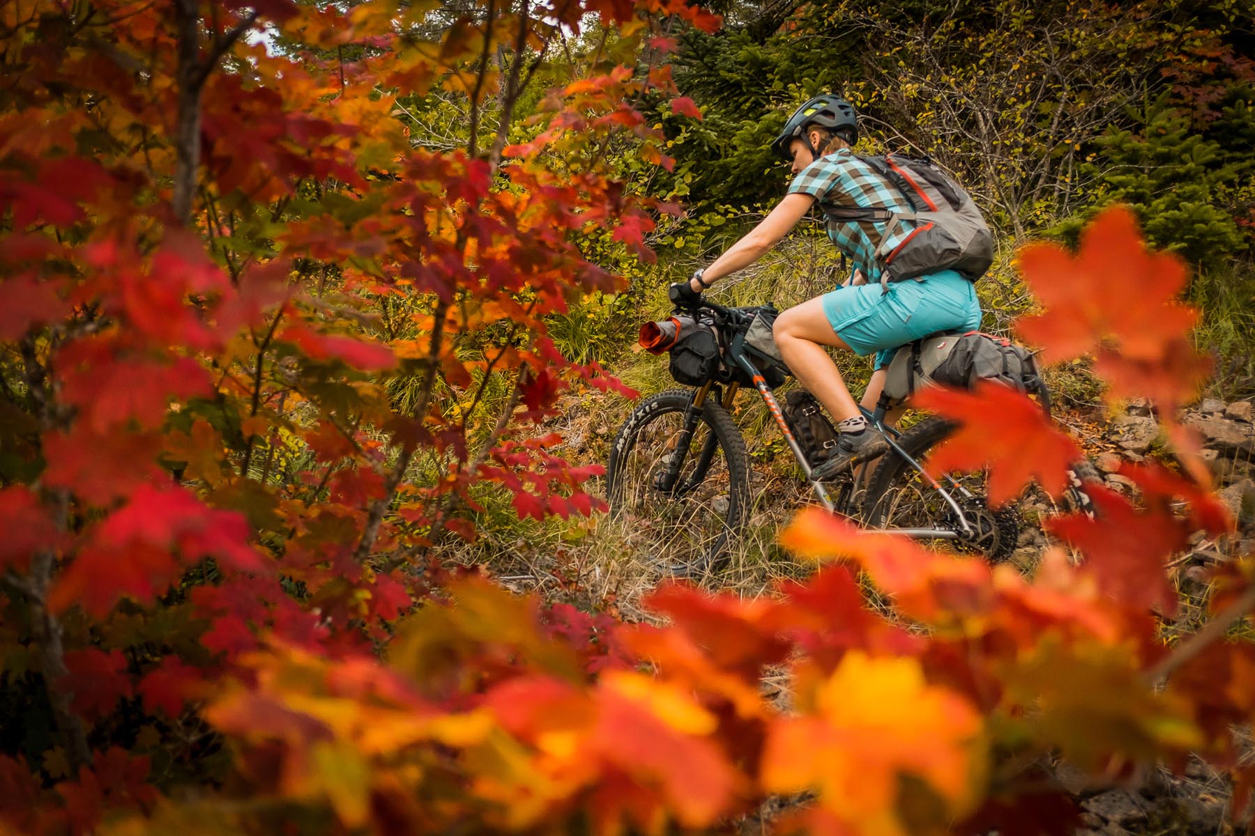
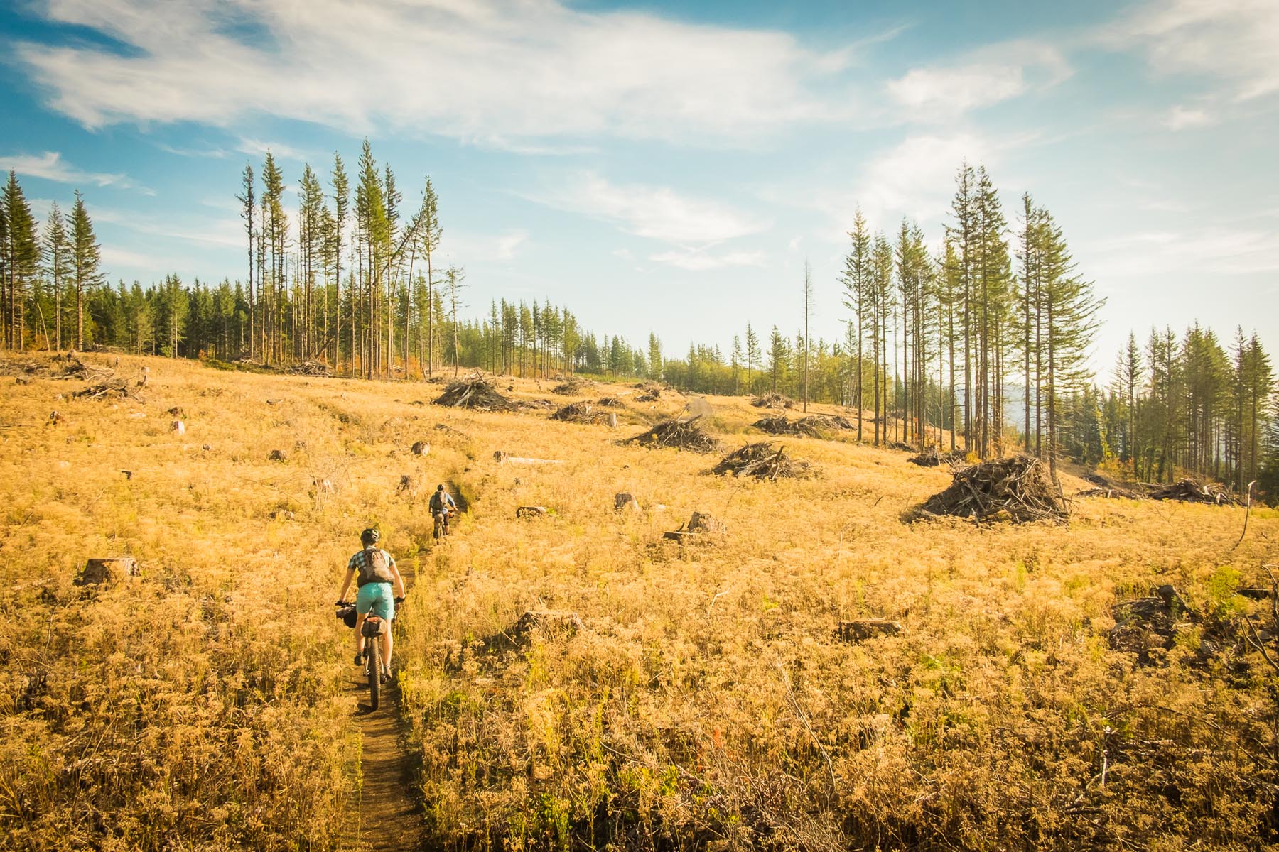
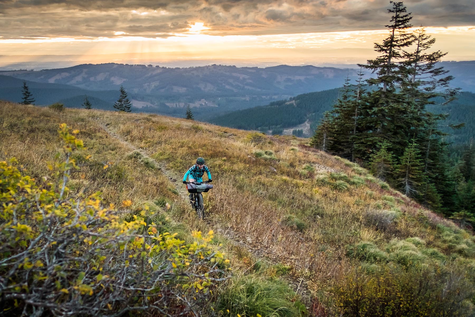
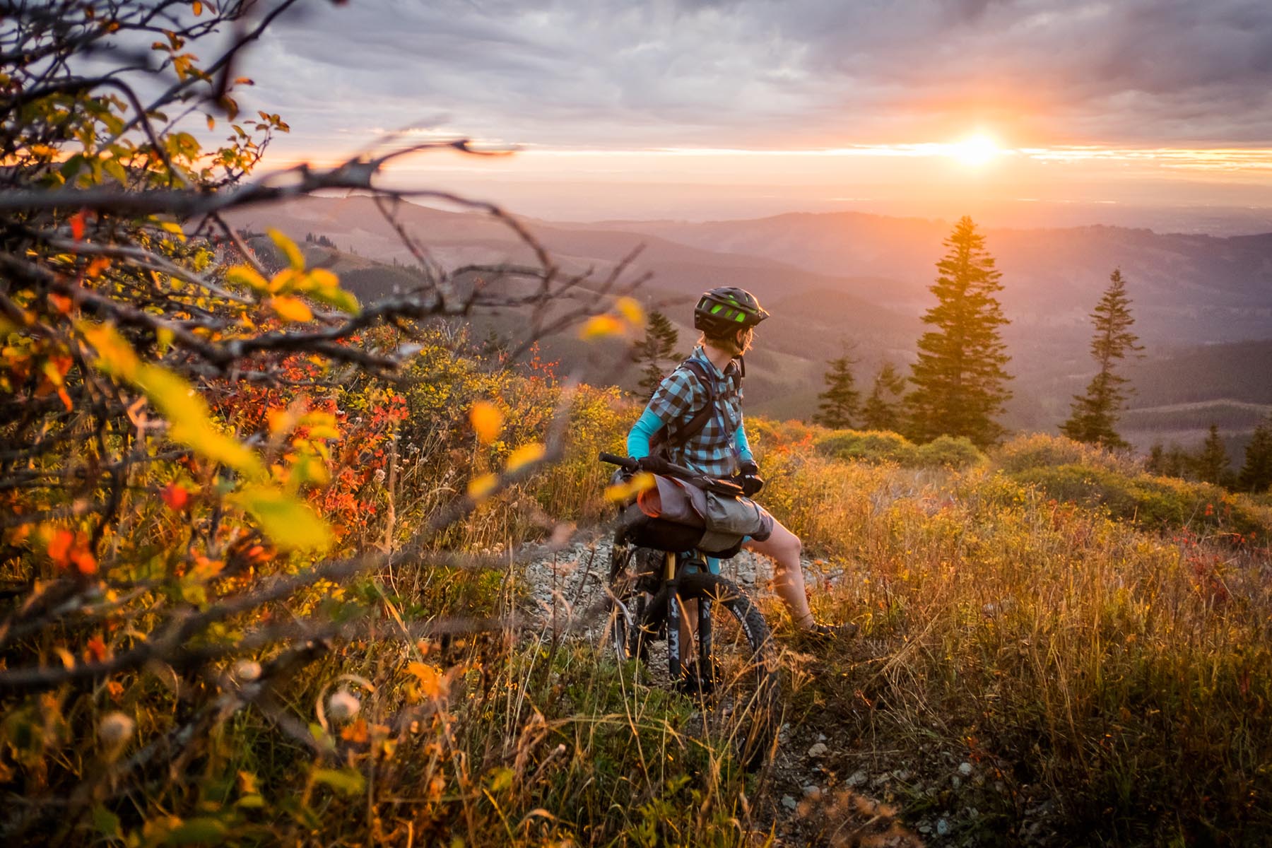
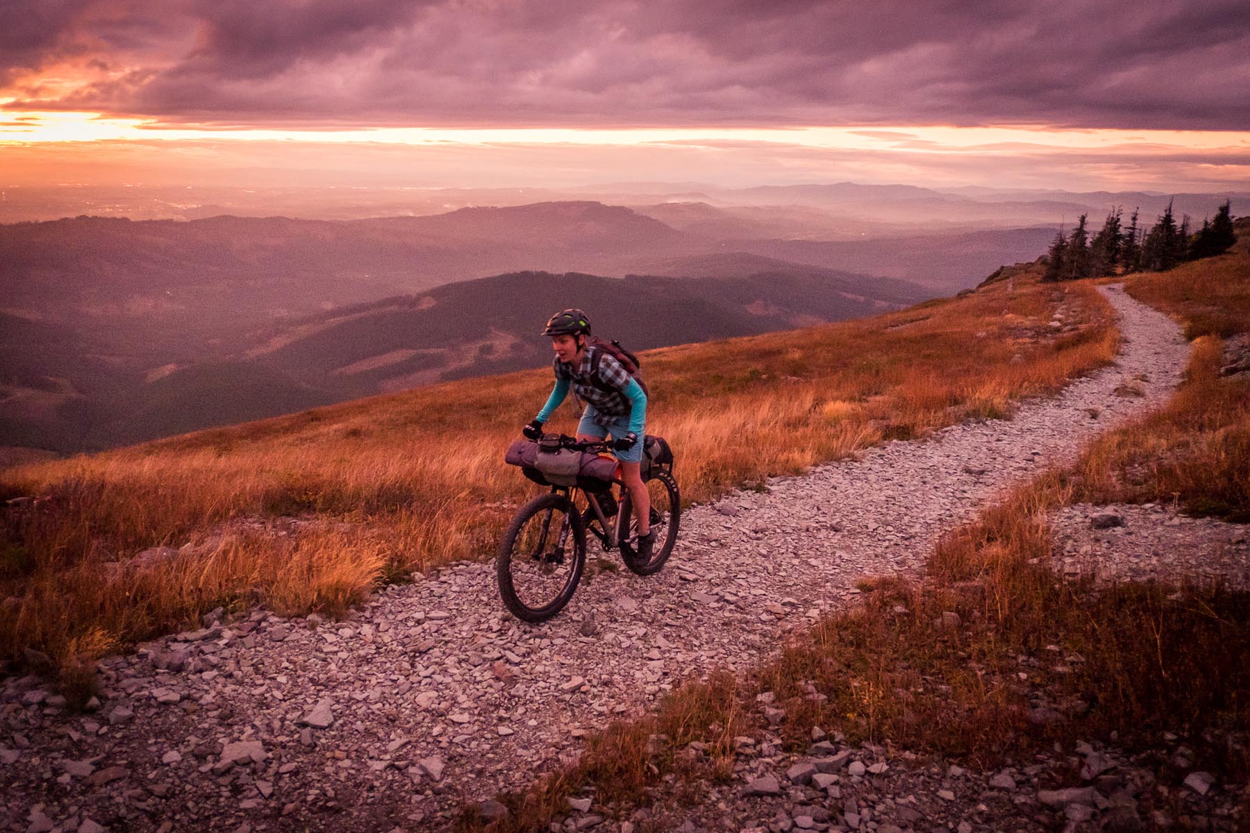
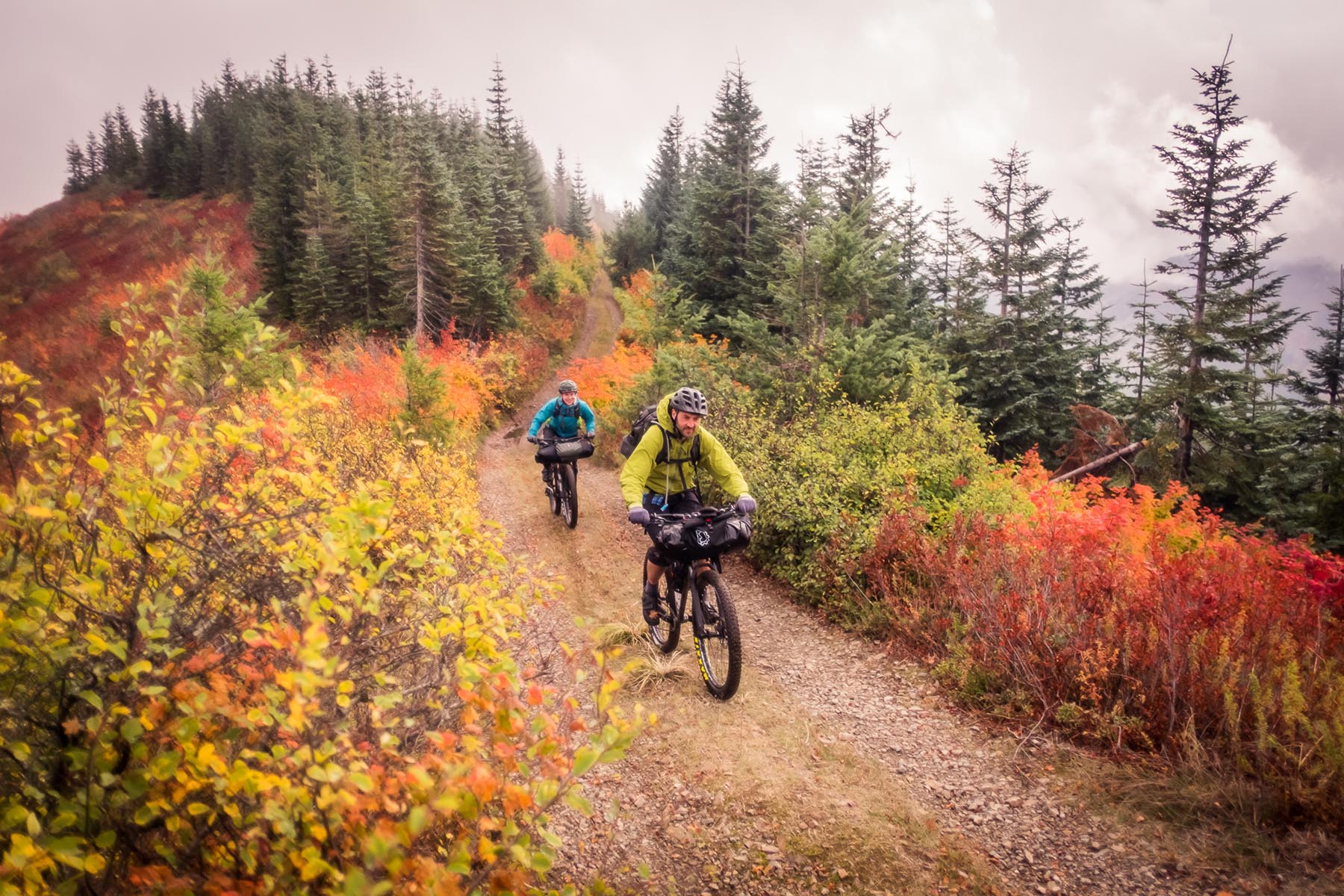
We rode it in October with stunning fall colors, but late spring and early summer sport an equally beautiful wildflower bloom. The variety of terrain you pass through is unique. Countless waterfalls, working timber forests, the faux-alpine terrain of Silver Star (a byproduct of the Yacolt Burn), the giant scree fields of Bluff Mountain, imposing Cougar Rock, and the verdant green tunnel of Siouxon Creek.
Route Development: The Tarbell Loop and Siouxon Creek trail have long been local destination days rides, and I’ve long explored the vast network of anonymous Gifford Pinchot forest roads for many years but on one of these adventures I noticed a faint shelf carved through a scree field in the distance off Silver Star and knew they all had to be connected.

Submit Route Alert
As the leading creator and publisher of bikepacking routes, BIKEPACKING.com endeavors to maintain, improve, and advocate for our growing network of bikepacking routes all over the world. As such, our editorial team, route creators, and Route Stewards serve as mediators for route improvements and opportunities for connectivity, conservation, and community growth around these routes. To facilitate these efforts, we rely on our Bikepacking Collective and the greater bikepacking community to call attention to critical issues and opportunities that are discovered while riding these routes. If you have a vital issue or opportunity regarding this route that pertains to one of the subjects below, please let us know:
Highlights
Must Know
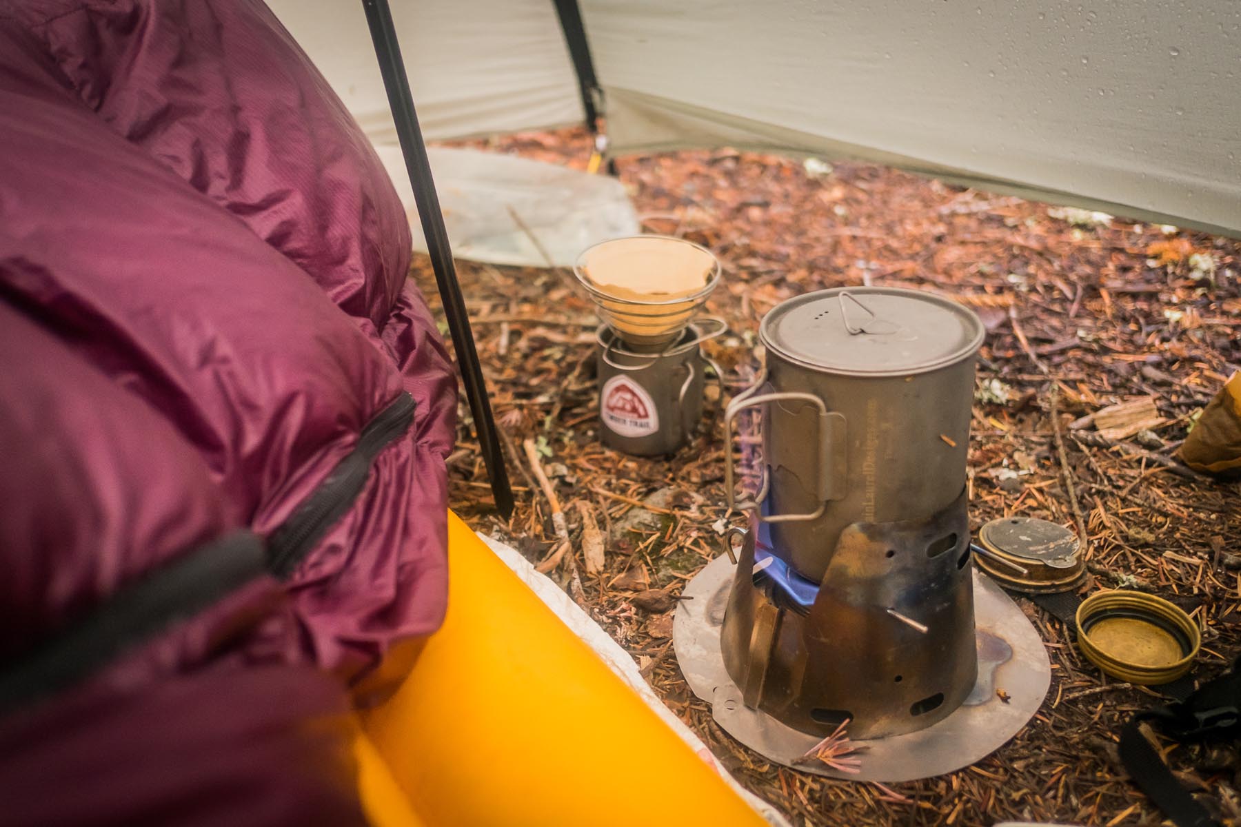
Camping
Food/H2O
Trail Notes
Resources
- Yacolt Falls is quaint and a perfect first stop
- Moulton Falls offers some fantastic swimming holes
- Bells Mountain trail is rarely ridden but a fun gem
- The scenery from the Silver Star climb is stunningly beautiful and don’t miss the 360º summit
- Bluff Mountain Trail is overgrown and rough, but easily my favorite bit of riding
- Descending down the little-seen upper Siouxon Creek Trail
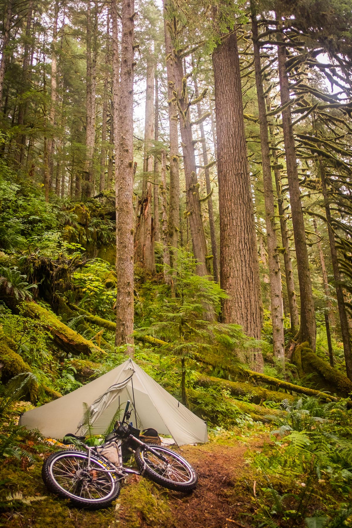
- Siouxon’s majestic old growth and creekside campsites
- Huffman Peak trail provides an optional challenge on day three
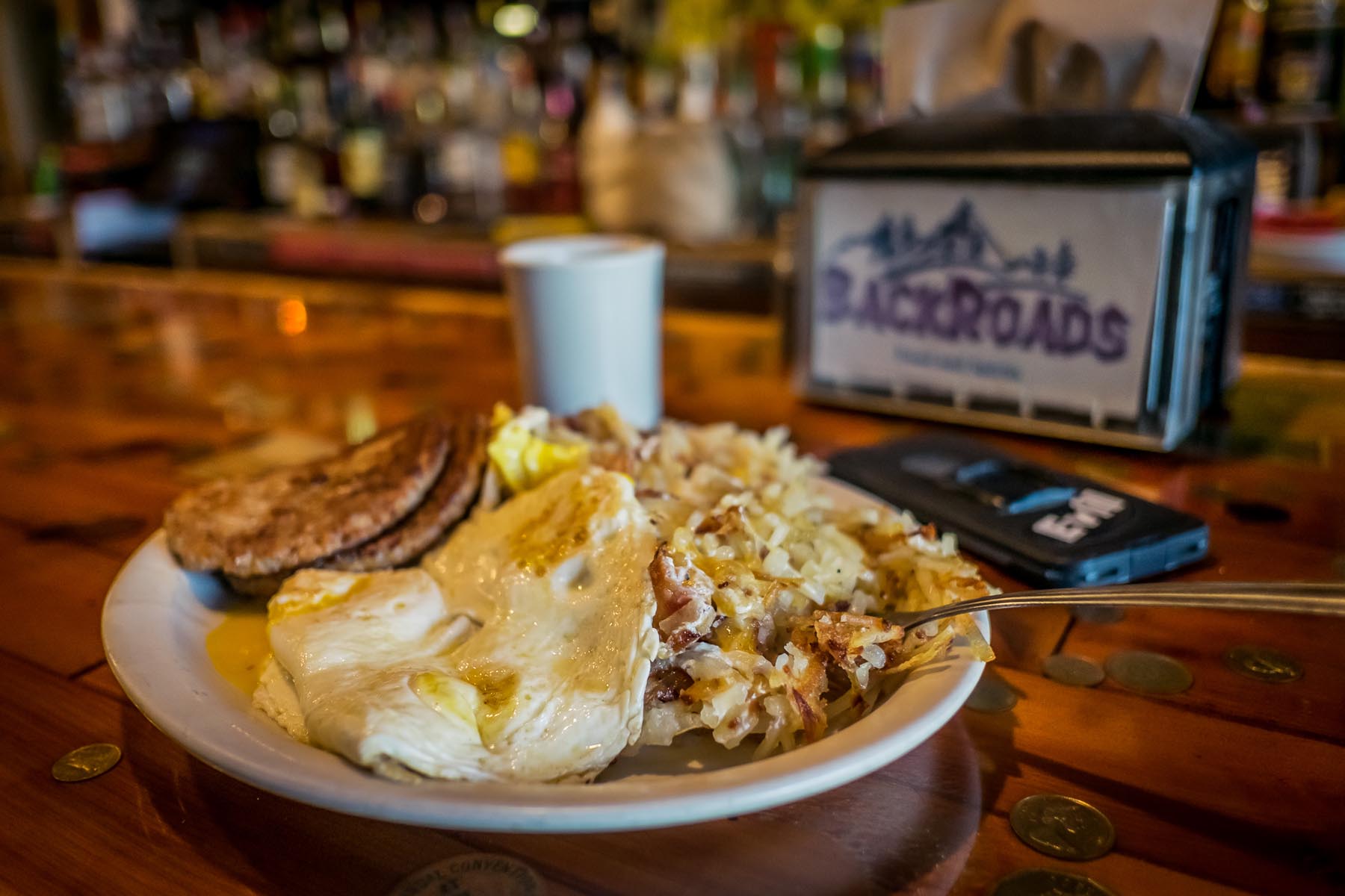
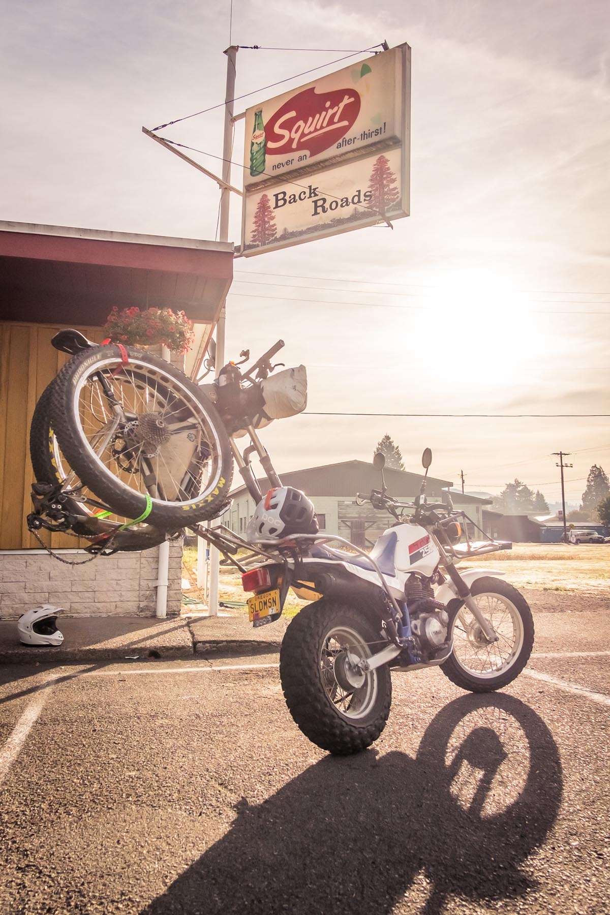
- BackRoads bar offers great food and drink before and after the ride
- June-October is the best time to ride Silver Siouxon.
- Silver Star is the high point and fairly easy to get snow reports on.
- Yacolt is pretty laid back, park on the street or ask where a good overnight spot is
- Siouxon Creek is a popular hike, be aware of other trail users
- There are several campgrounds and established sites along the route.
- Dispersed camping is abundant in the Gifford Pinchot National Forest.
- There are no food resupplies available until Chelatchie at mile 69.
- Water should be abundant most of the year, during high summer it may be scarce from mile 27-47.
DAY ONE
Load up on Backwoods Diner’s loaded hashbrowns. You’ll need the calories. Then it’s a flat paved pedal, a few beautiful creeks, and a steep push up Bells Mountain before a fun, rolling trail to Tarbell Trail at Rock Creek Campground. Tarbell is a stiff climb for a few miles but then branching off on the Chinook Trail switchbacks you’re forced to a crawl. It’s soon worth it, though, as a picture perfect campsite rests on top of Silver Star with a hidden fresh water spring nearby.
DAY TWO
You’ll probably wake to ambitious hikers huffing by for the summit, but you leave the throngs behind almost immediatly as you head east on Bluff Mountain trail. The exposure is gripping and the riding the most technical of the route as you traverse scree slopes with 360º views. Eventually you’ll connect with a series of little-used doubletrack roads that maintain elevation linking you north to Siouxon Creek. Siouxon is another popular trail but the upper trail is rarely accessed—which you drop into wrapping the day up in a glorious descent.
DAY THREE
Your final day on the trail is a mellow one. A mostly flat cruise along Siouxon Creek brings you to a narrow paved road descent and another few miles back to your car… and those loaded hashbrowns.
Additional Resources
- Silver Star on Outdoor Project: outdoorproject.com
- Siouxon Creek on MTB Project: mtbproject.com
- Tarbell Trail Map: dnr.wa.gov (pdf)


Terms of Use: As with each bikepacking route guide published on BIKEPACKING.com, should you choose to cycle this route, do so at your own risk. Prior to setting out check current local weather, conditions, and land/road closures. While riding, obey all public and private land use restrictions and rules, carry proper safety and navigational equipment, and of course, follow the #leavenotrace guidelines. The information found herein is simply a planning resource to be used as a point of inspiration in conjunction with your own due-diligence. In spite of the fact that this route, associated GPS track (GPX and maps), and all route guidelines were prepared under diligent research by the specified contributor and/or contributors, the accuracy of such and judgement of the author is not guaranteed. BIKEPACKING.com LLC, its partners, associates, and contributors are in no way liable for personal injury, damage to personal property, or any other such situation that might happen to individual riders cycling or following this route.
Please keep the conversation civil, constructive, and inclusive, or your comment will be removed.