


Vedauwoo Rendezvous
Distance
42 Mi.
(68 KM)Days
2
% Unpaved
95%
% Singletrack
45%
% Rideable (time)
99%
Total Ascent
3,405'
(1,038 M)High Point
8,798'
(2,682 M)Difficulty (1-10)
6?
- 5Climbing Scale Moderate81 FT/MI (15 M/KM)
- 7Technical Difficulty Difficult
- 7Physical Demand Difficult
- 4Resupply & Logistics Fair
Contributed By
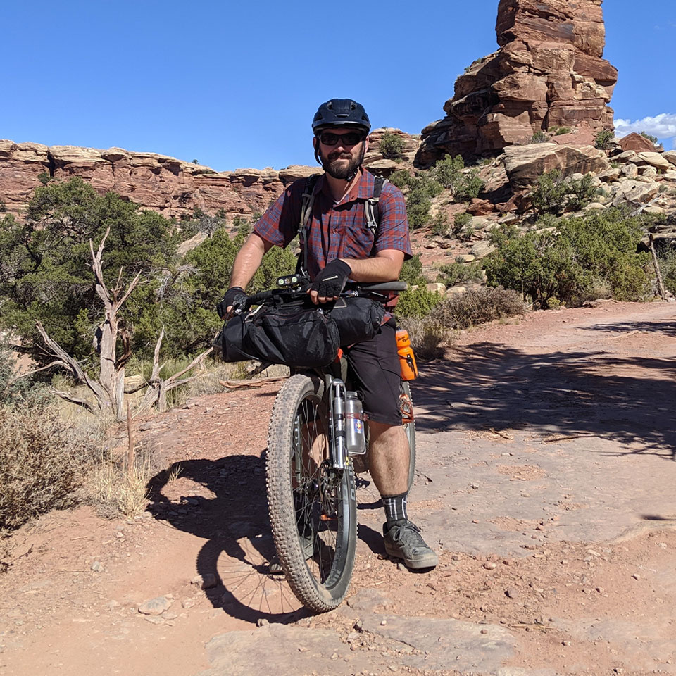
Seth Kruckenberg
Guest Contributor
Raised in Wyoming, Seth has been exploring the landscapes of the West for the majority of his life. Riding throughout the Rocky Mountains from an early age, he gained an appreciation for public lands, outdoor recreation, and geology. Now based in Massachusetts, Seth is a geologist, educator, and general cycling enthusiast who posts on Instagram as @tipsyrider.
Vedauwoo (pronounced “vee-dah-voo”) is a unique geological area located in southeastern Wyoming. Part of the Medicine Bow-Routt National Forest, Vedauwoo is the local shorthand name for a much larger region of the Sherman Mountains that extends from Pole Mountain to Curt Gowdy State Park north of Interstate I-80, approximately 15 miles east of Laramie and 35 miles west of Cheyenne.
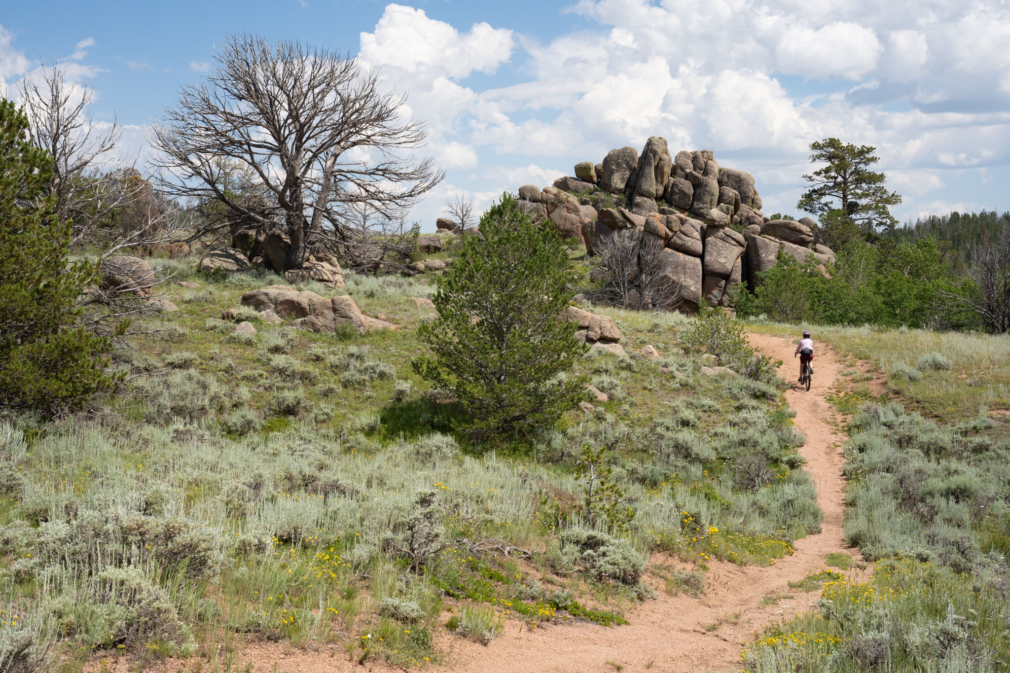
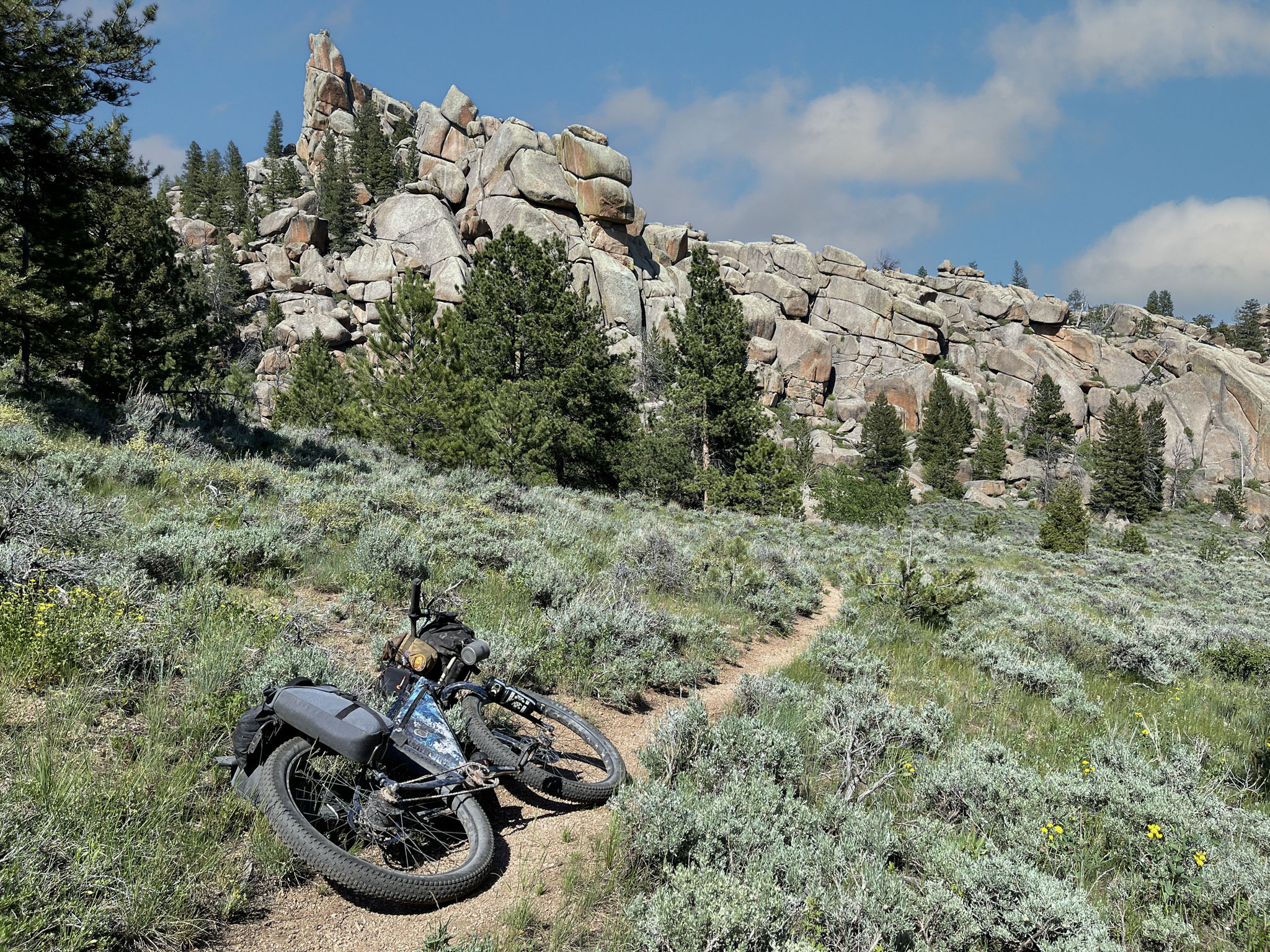
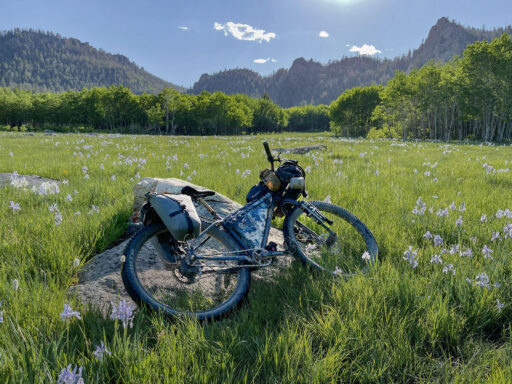
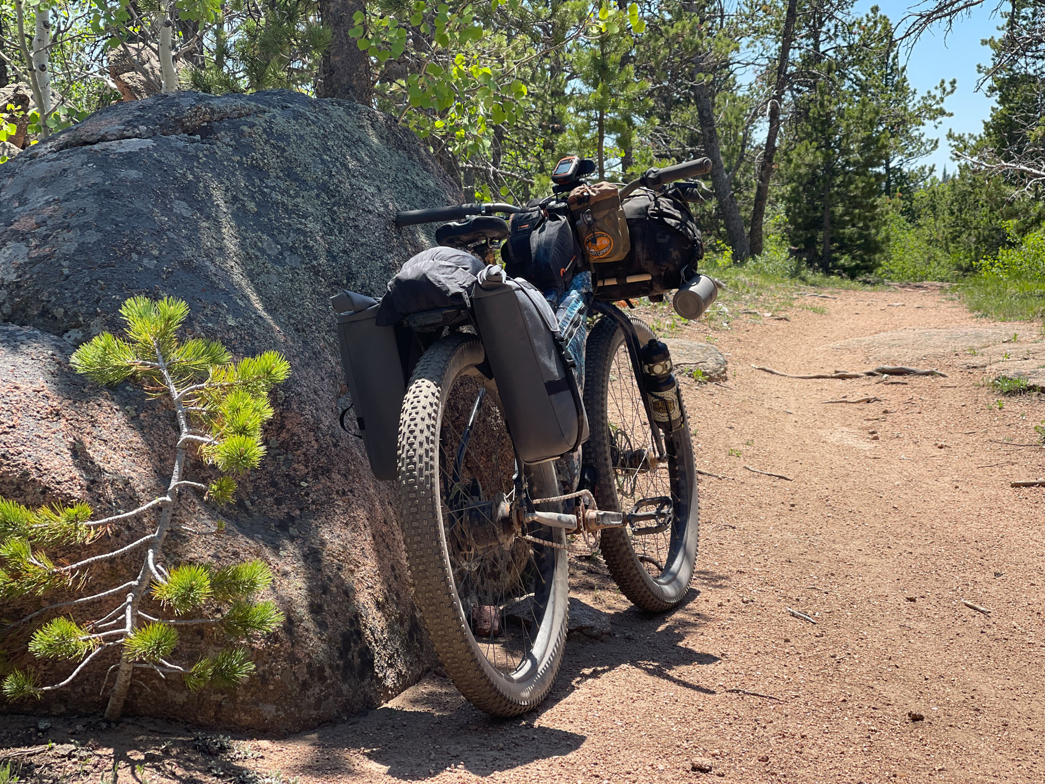
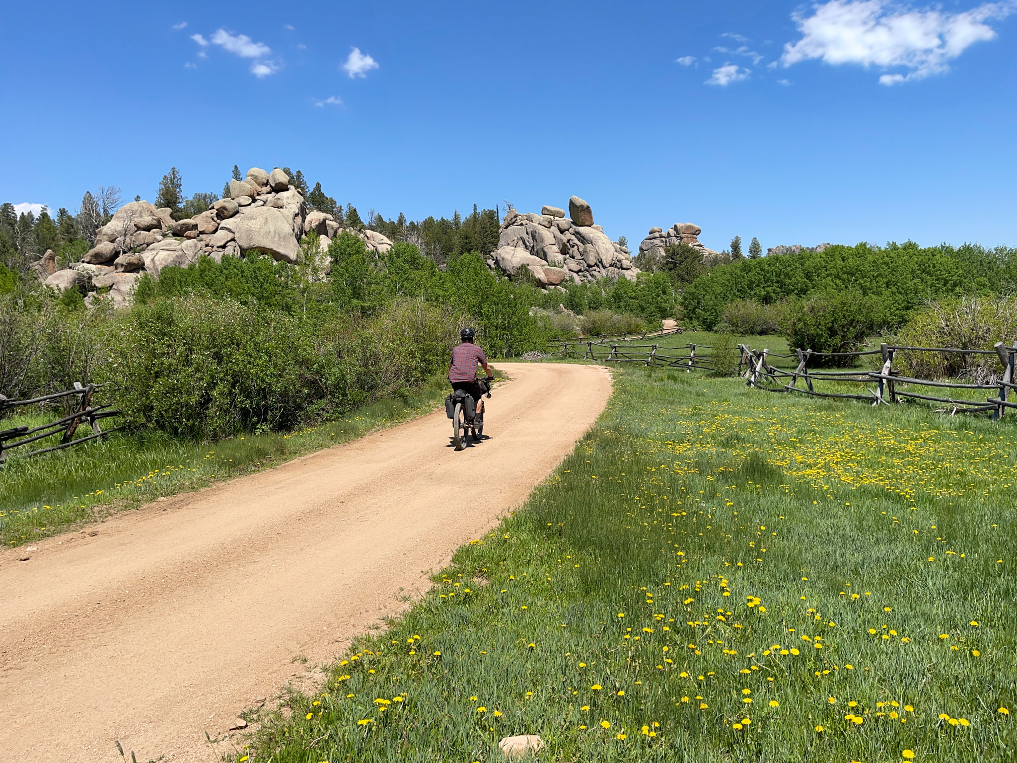
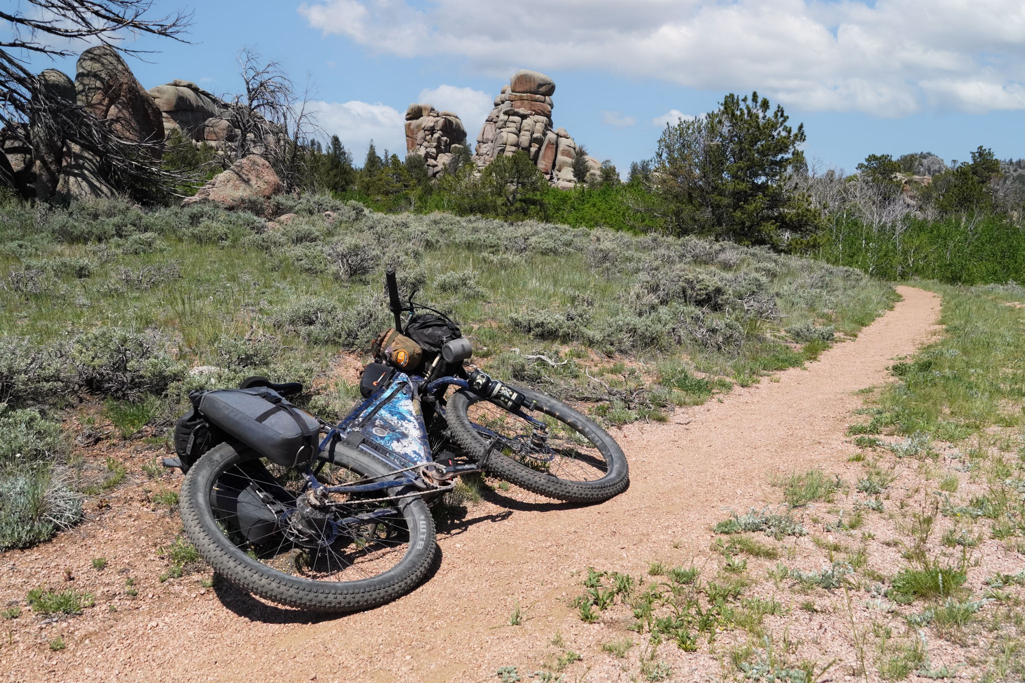
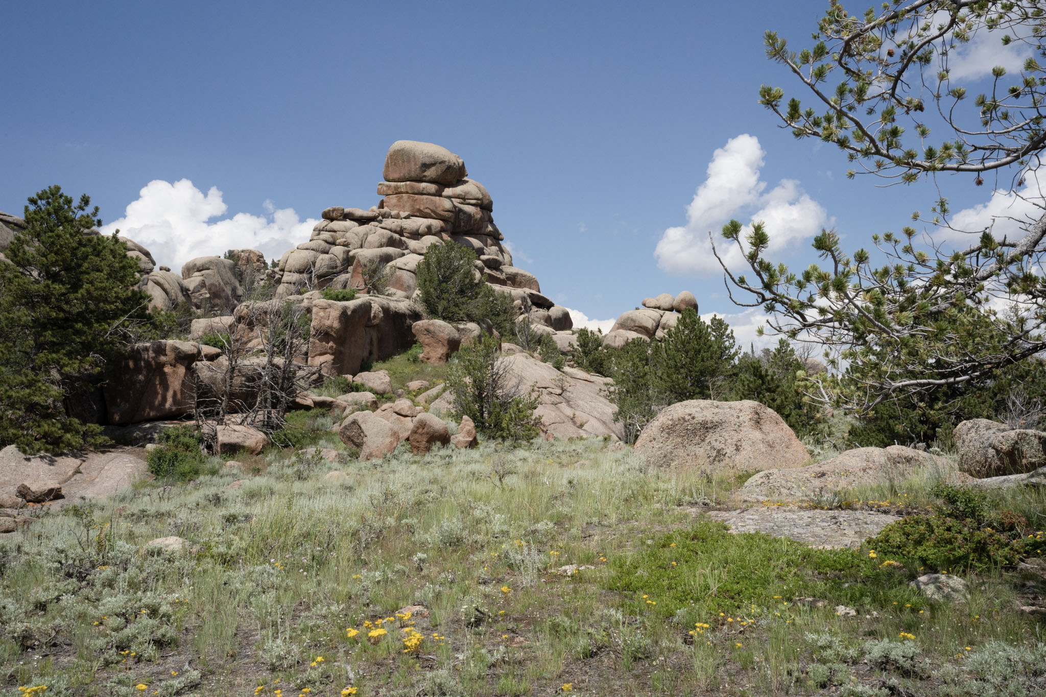
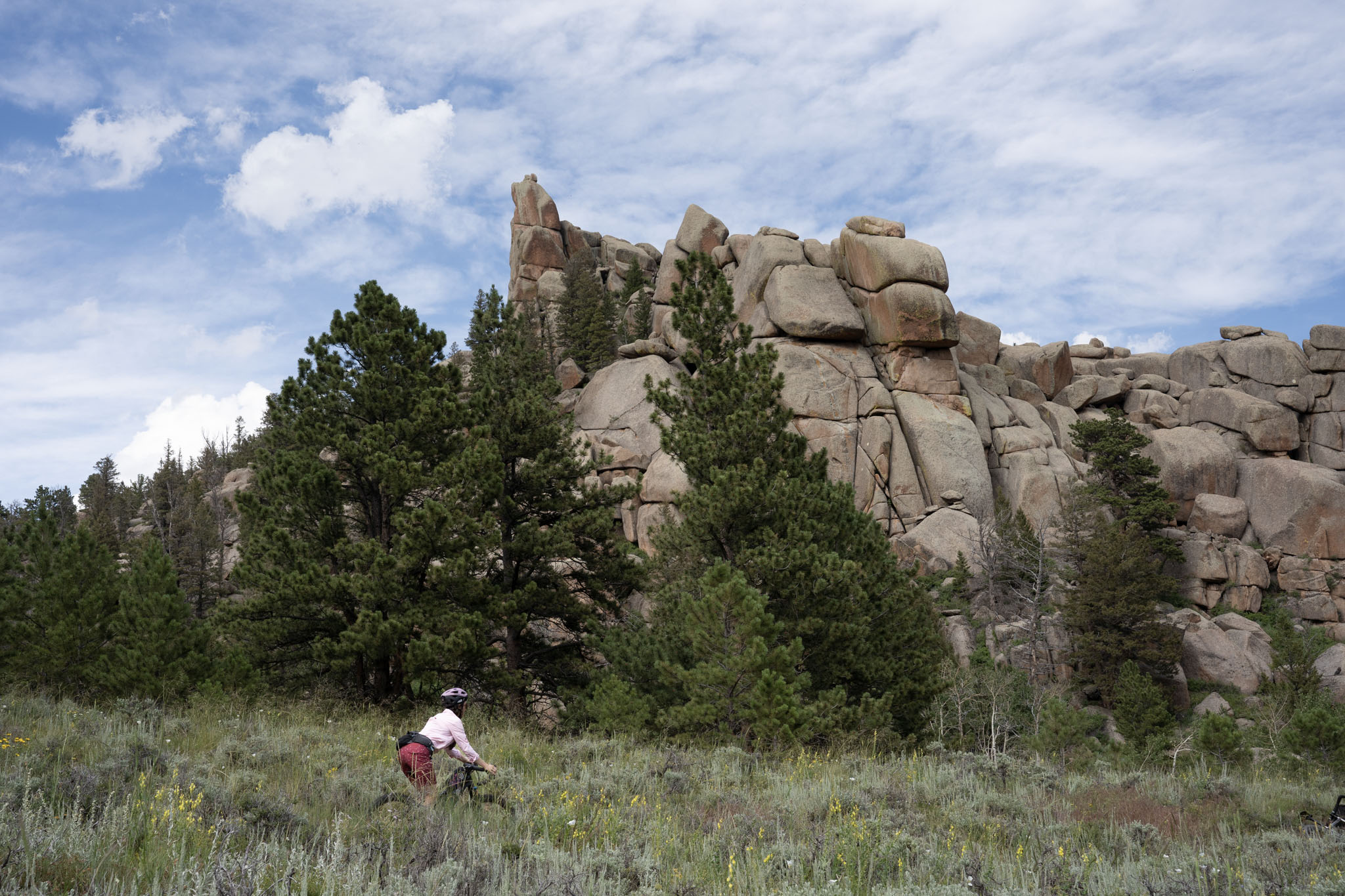
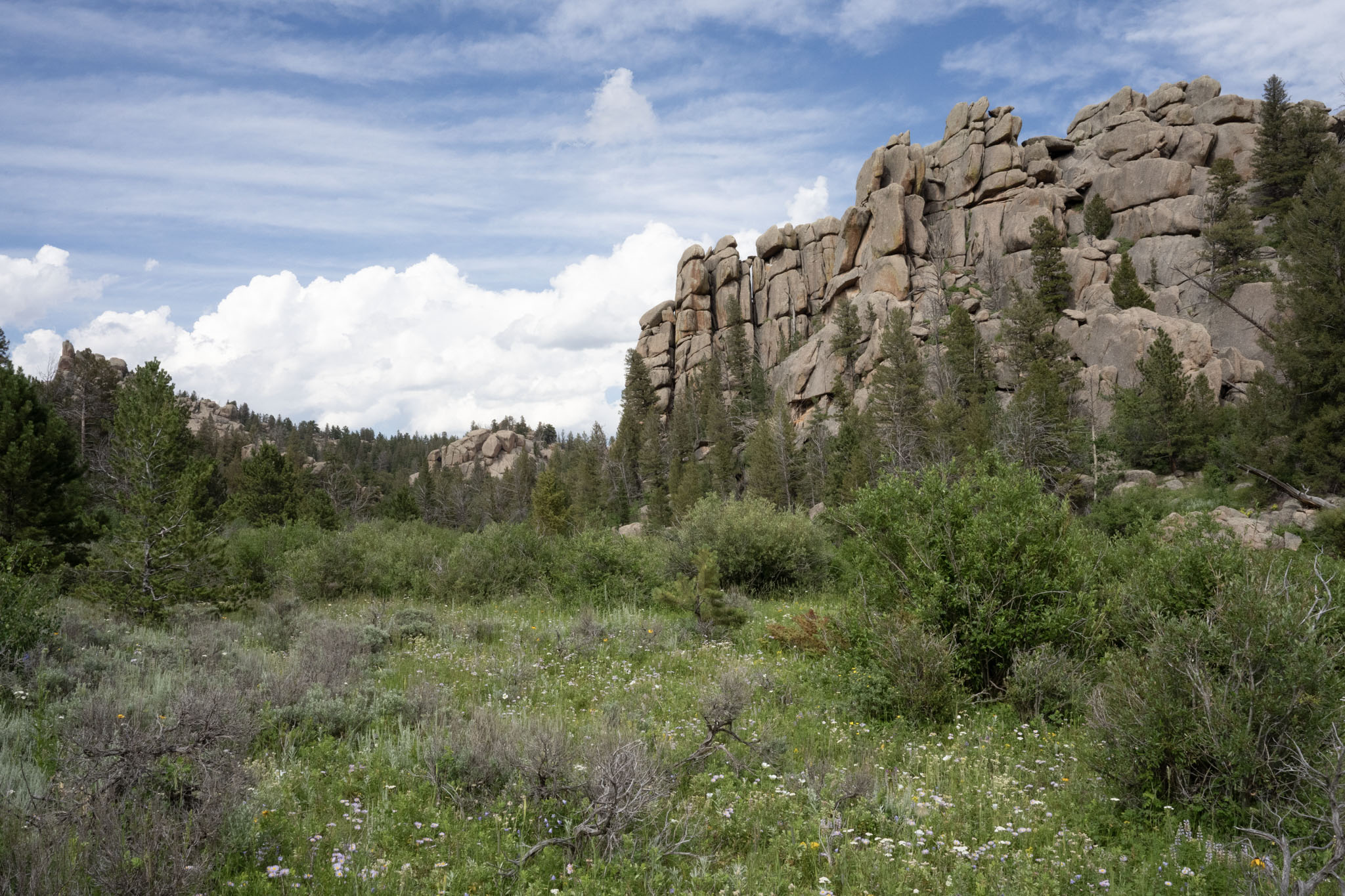
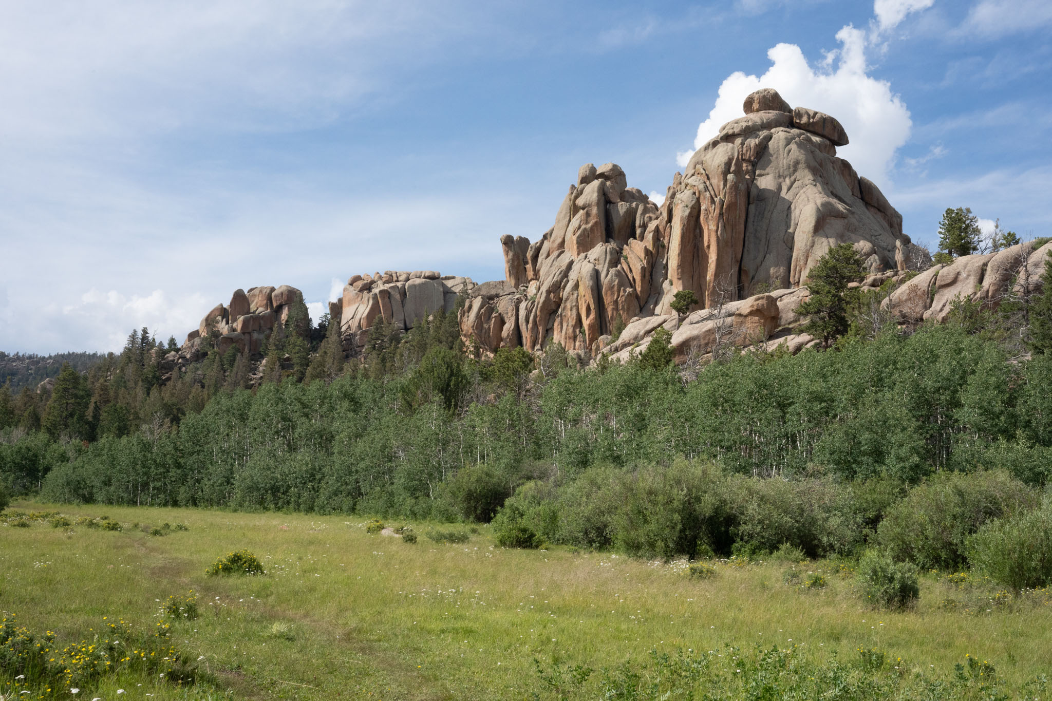
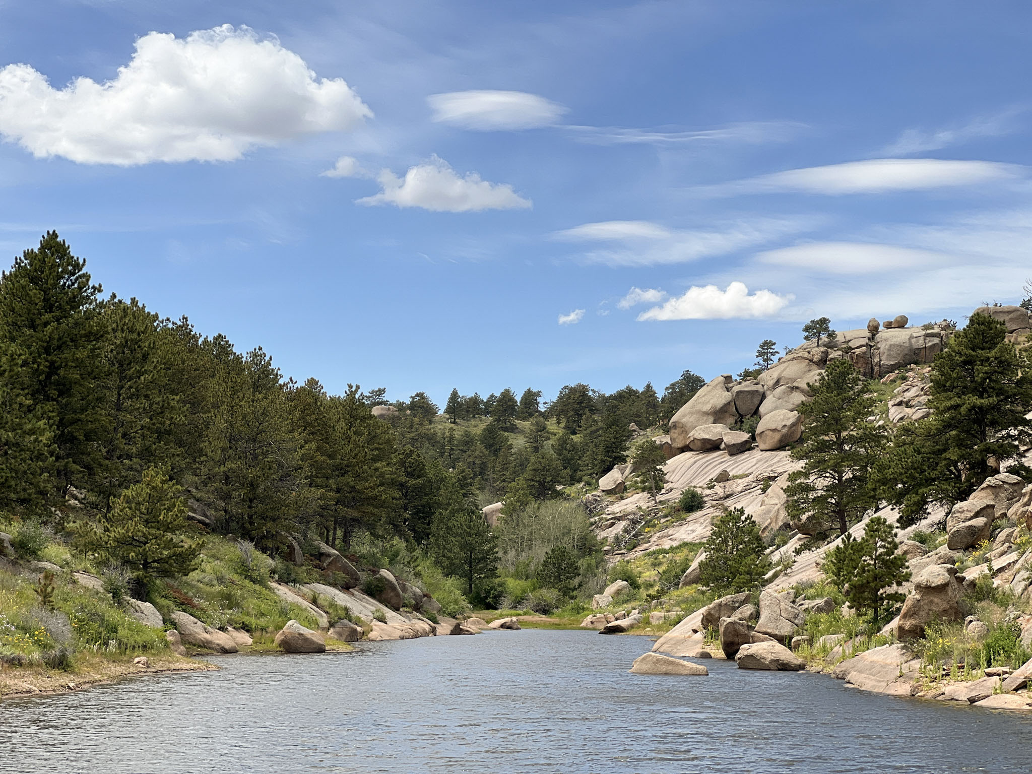
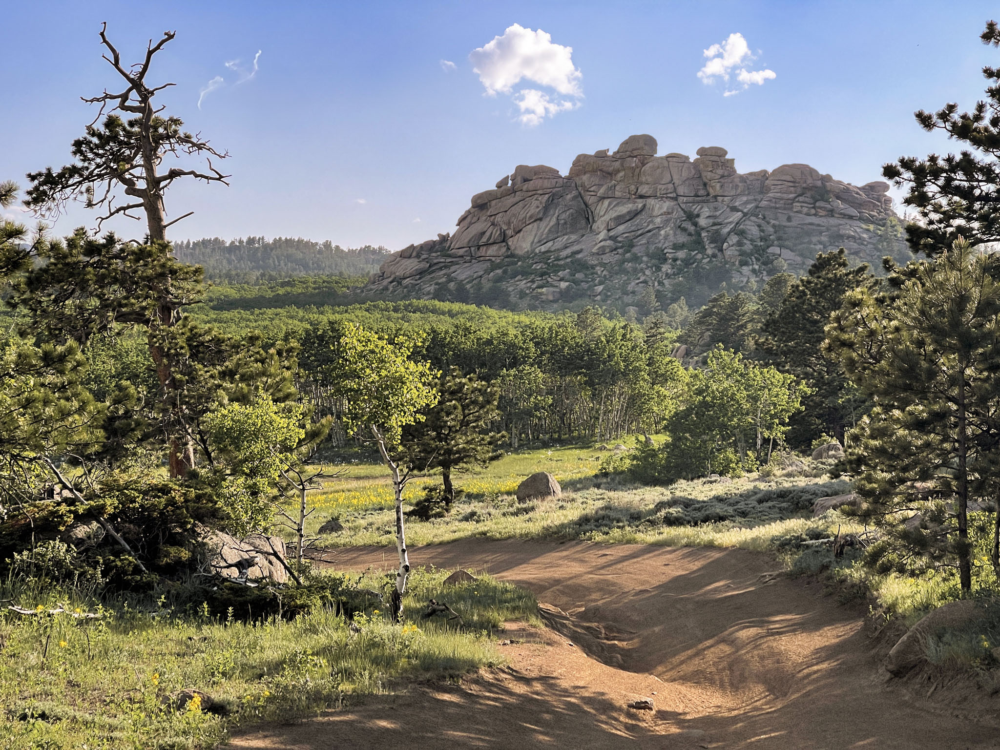
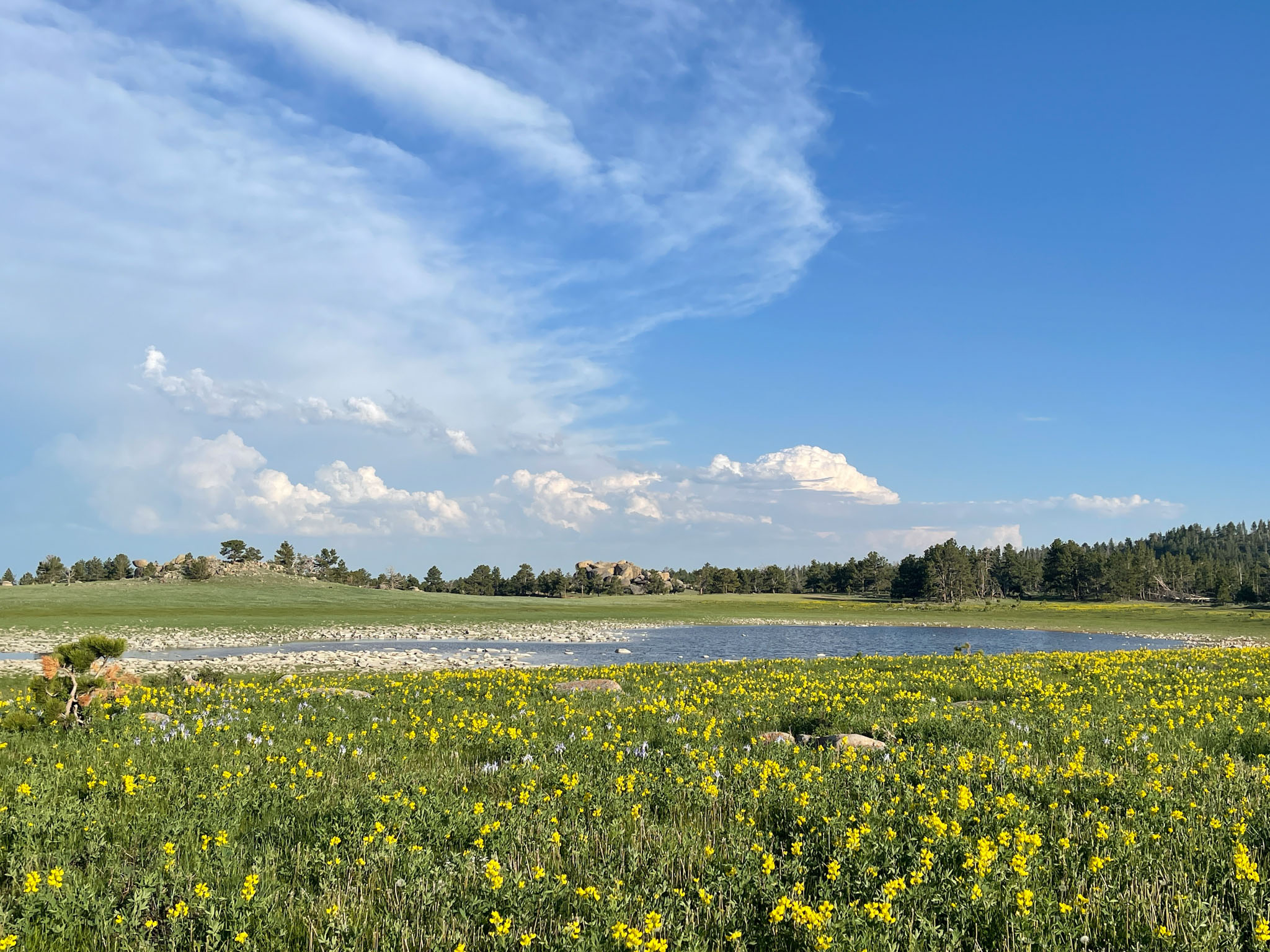
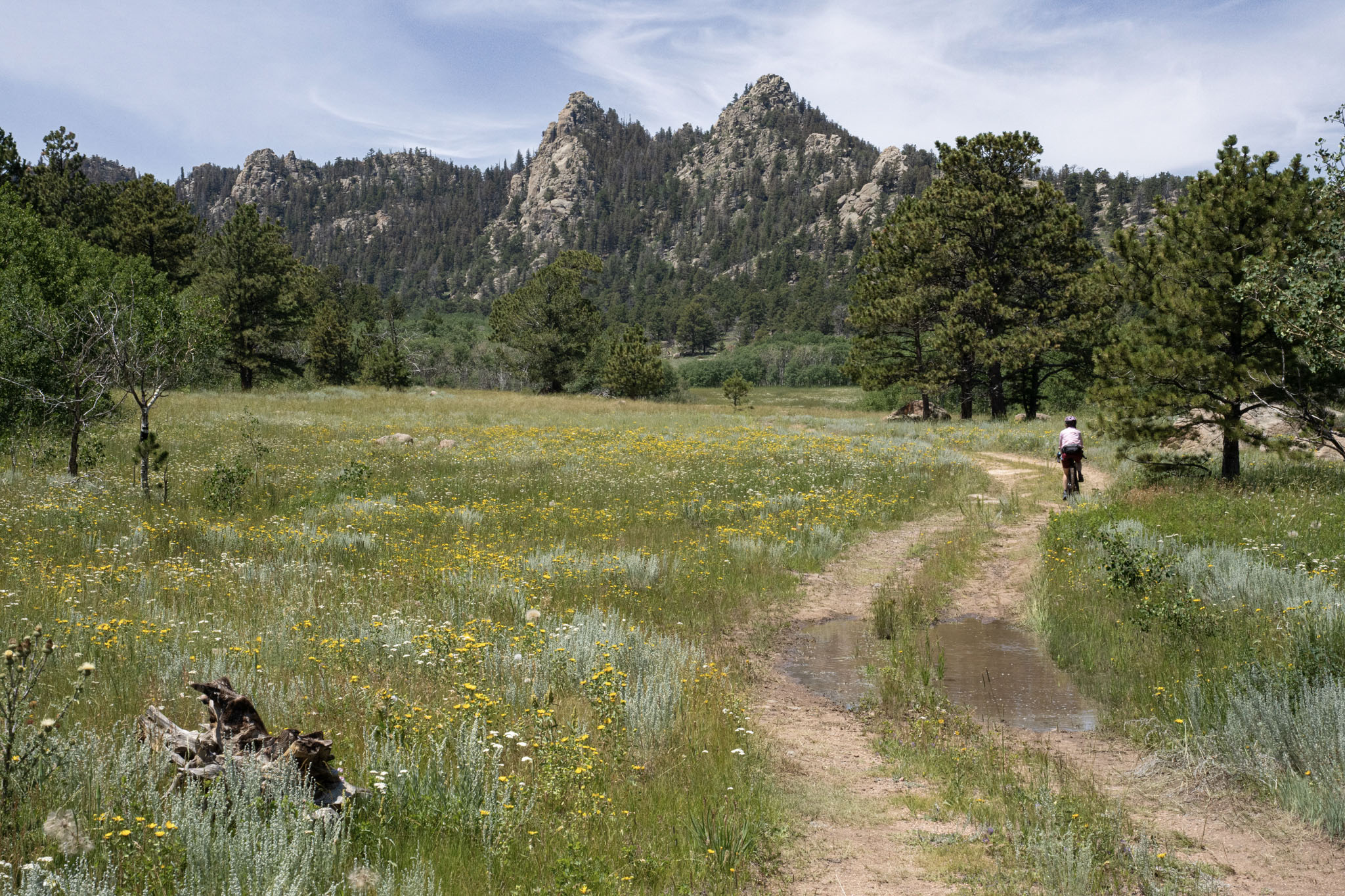
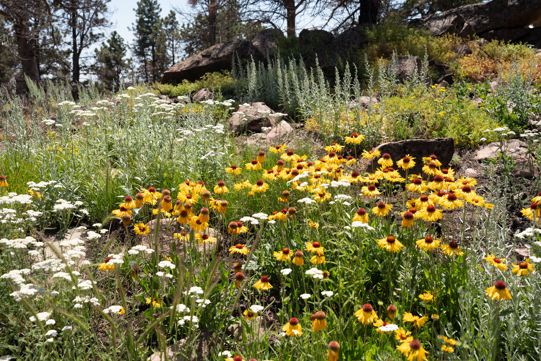
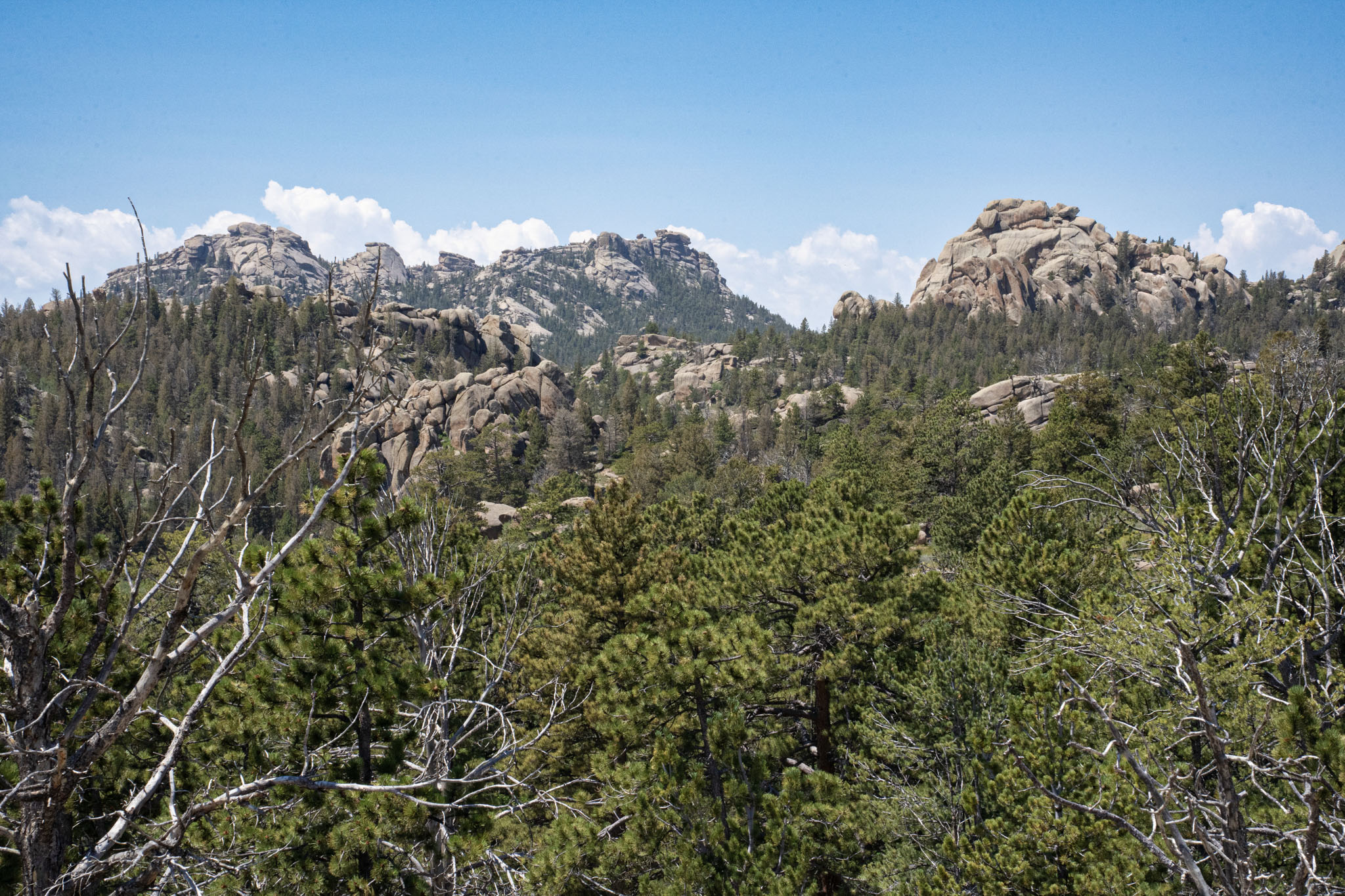
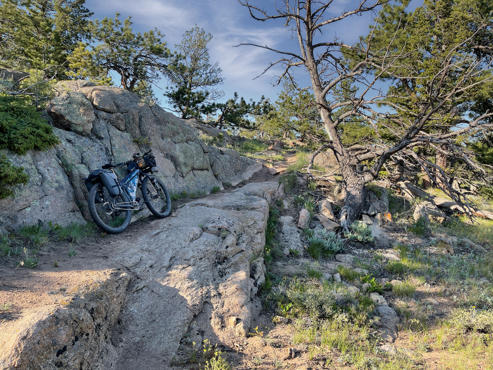
Known for its towering granite spires, hoodoos, massive boulders, and peculiar outcrops, the region is a popular destination for rock climbers, hikers, campers, and mountain bikers. Its open public lands and network of picturesque trails that wind through the surrounding variable landscape are unlike other regions of the Rocky Mountains at similar elevations. Whereas 7,000 to 8,000-foot elevations are likely to yield alpine cirques and valleys along the Colorado Front Range to the south, this is a high-elevation plateau formed atop a wedge of sedimentary rocks known as “The Gangplank,” a geological oddity that played an important role in the history of the Western United States, including the establishment of the Union Pacific Railroad over the Rocky Mountains. Slow erosion and the long passage of time—beginning over 70 million years ago during uplift associated with the Laramide Orogeny—have exhumed and eroded this wedge of sedimentary rocks and the underlying 1.4-billion-year-old Sherman Granite from the surrounding plains. The result is a Daliesque landscape that conjures images of sleeping giants, animals, and other exotic forms in the rocky outcrops, boulders, and spires that comprise the region as we see it today.
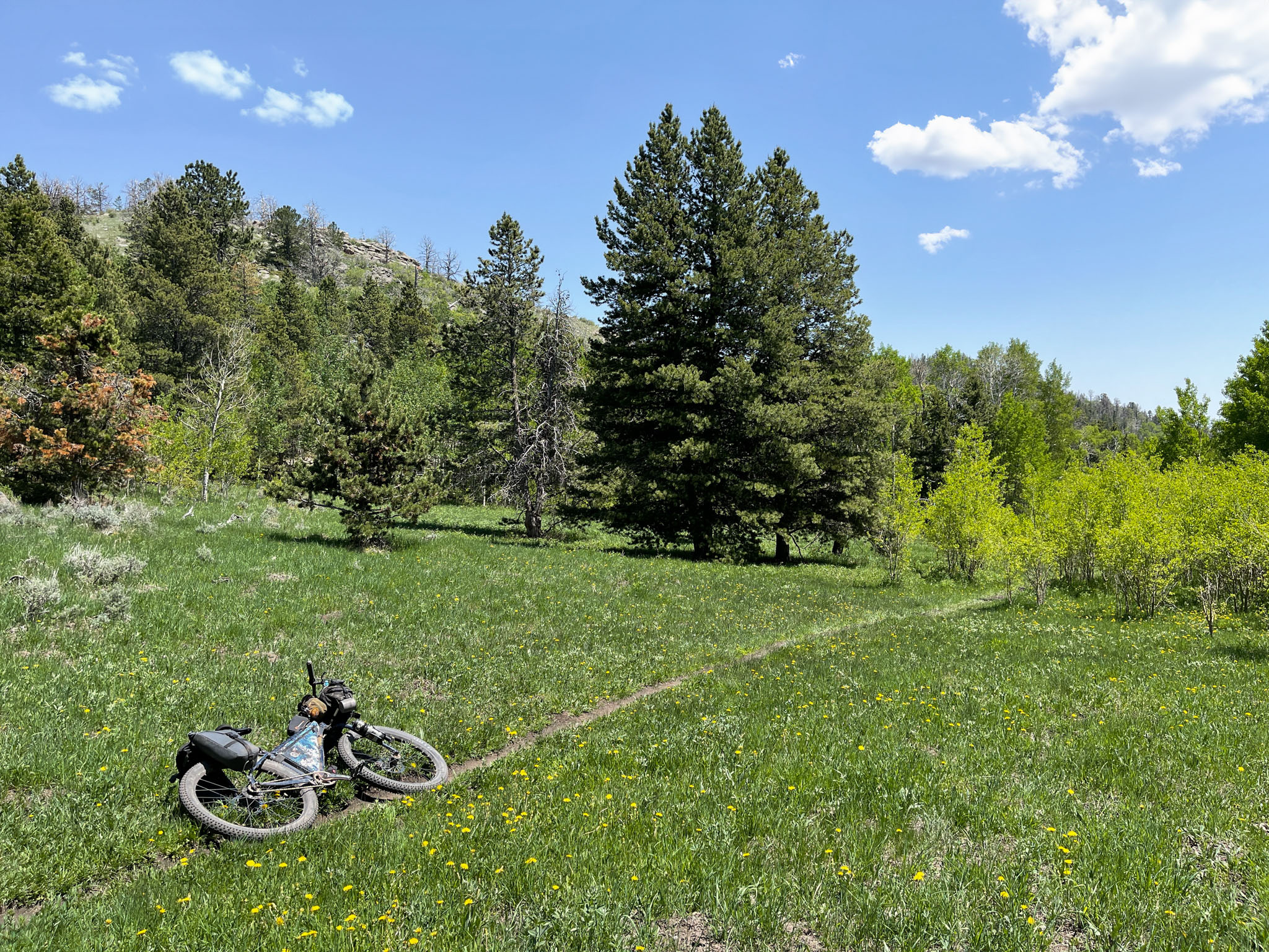
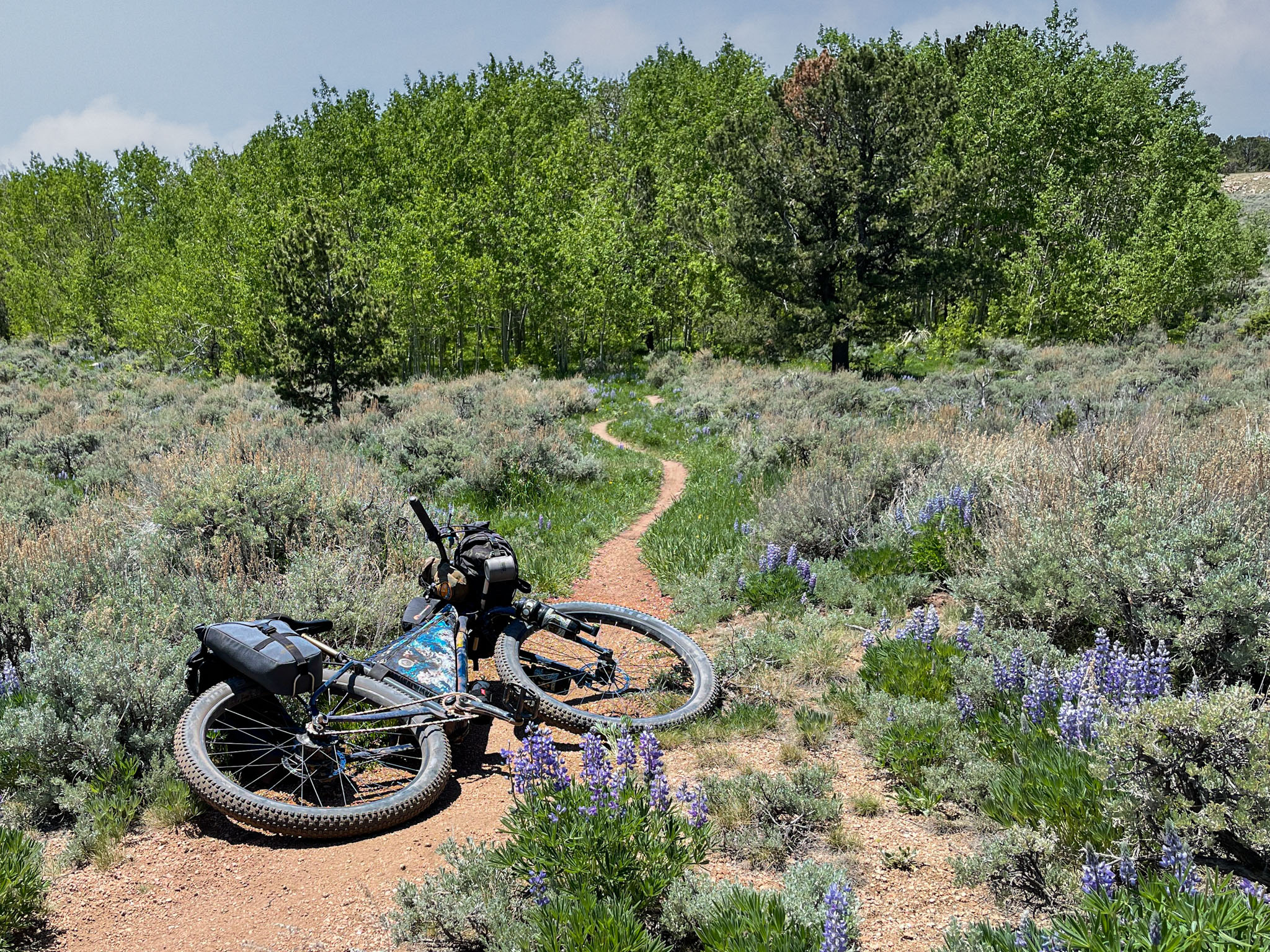
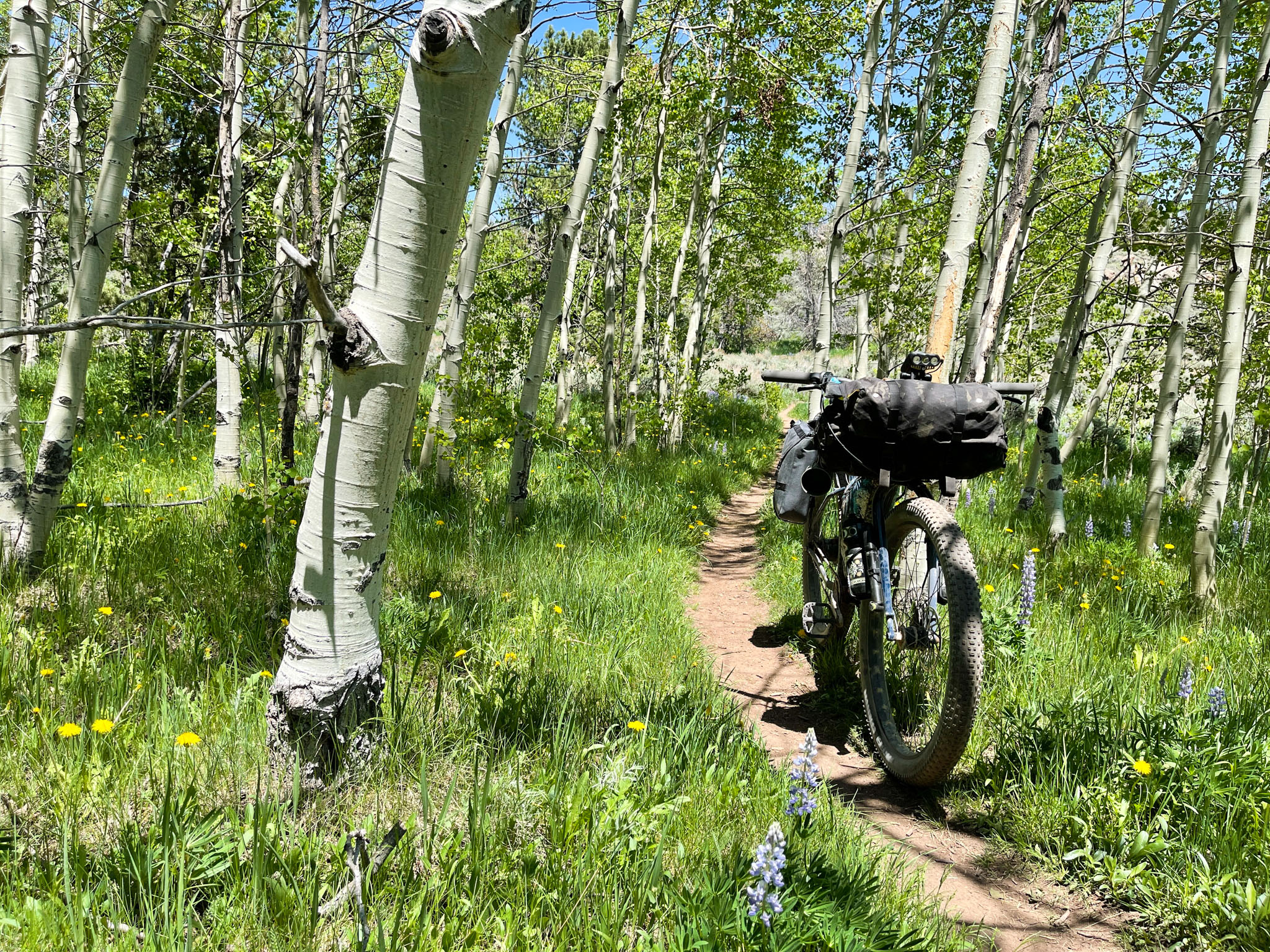
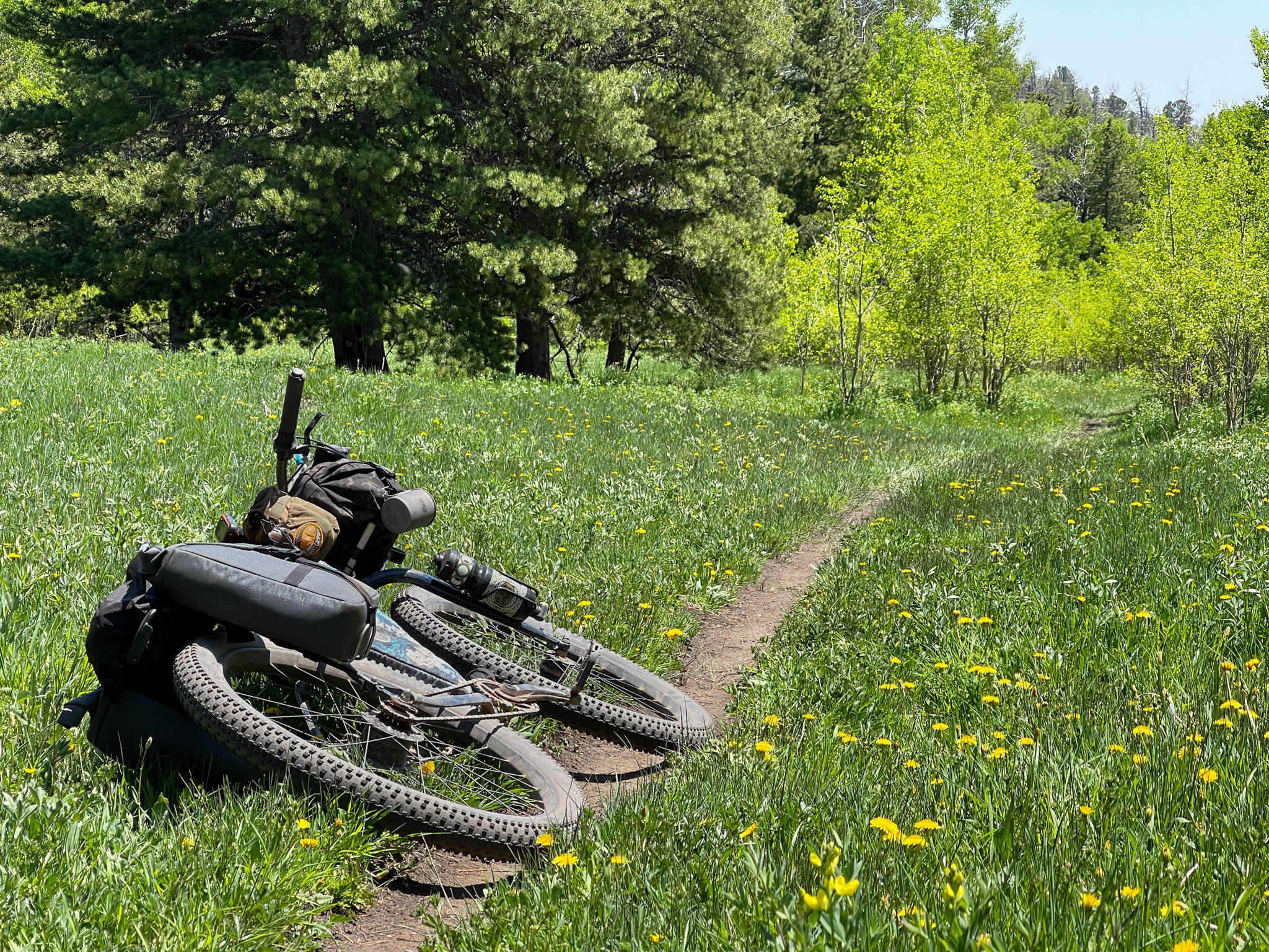
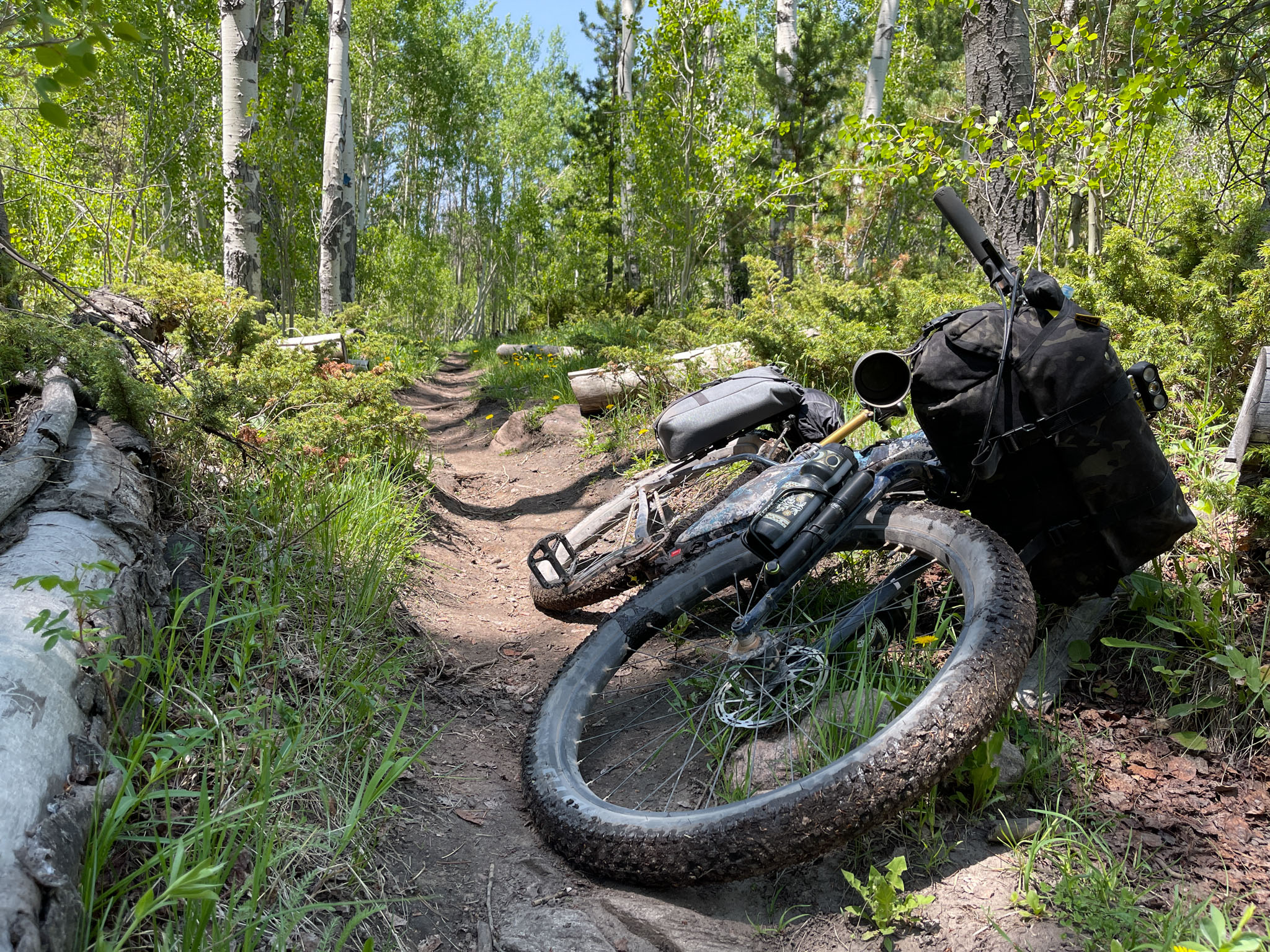
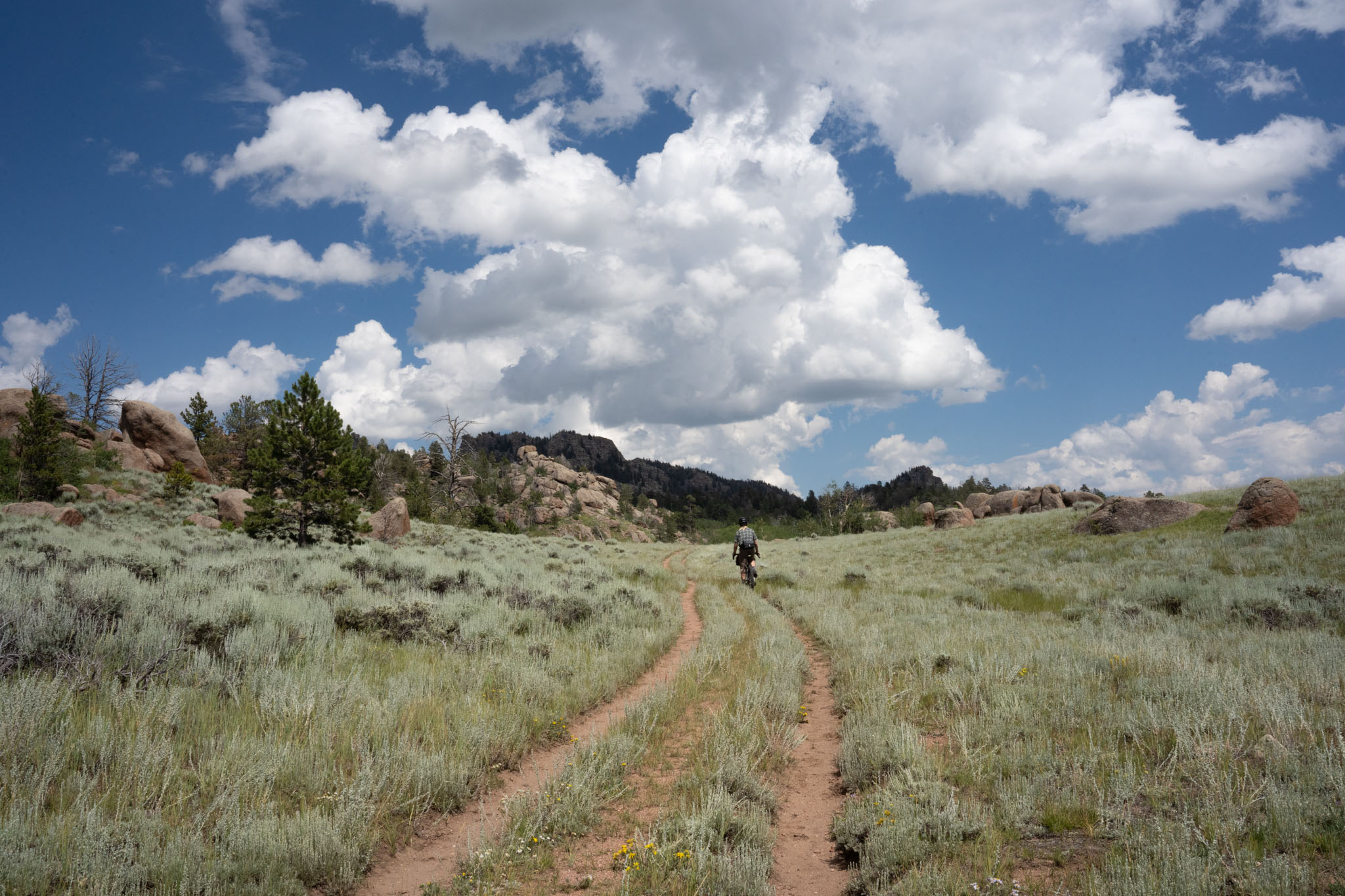
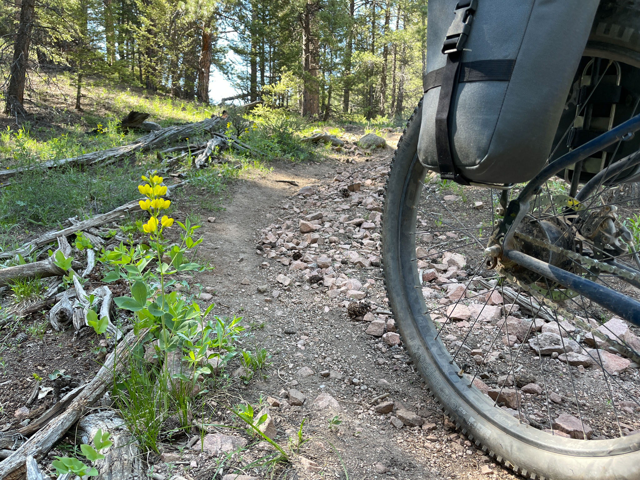
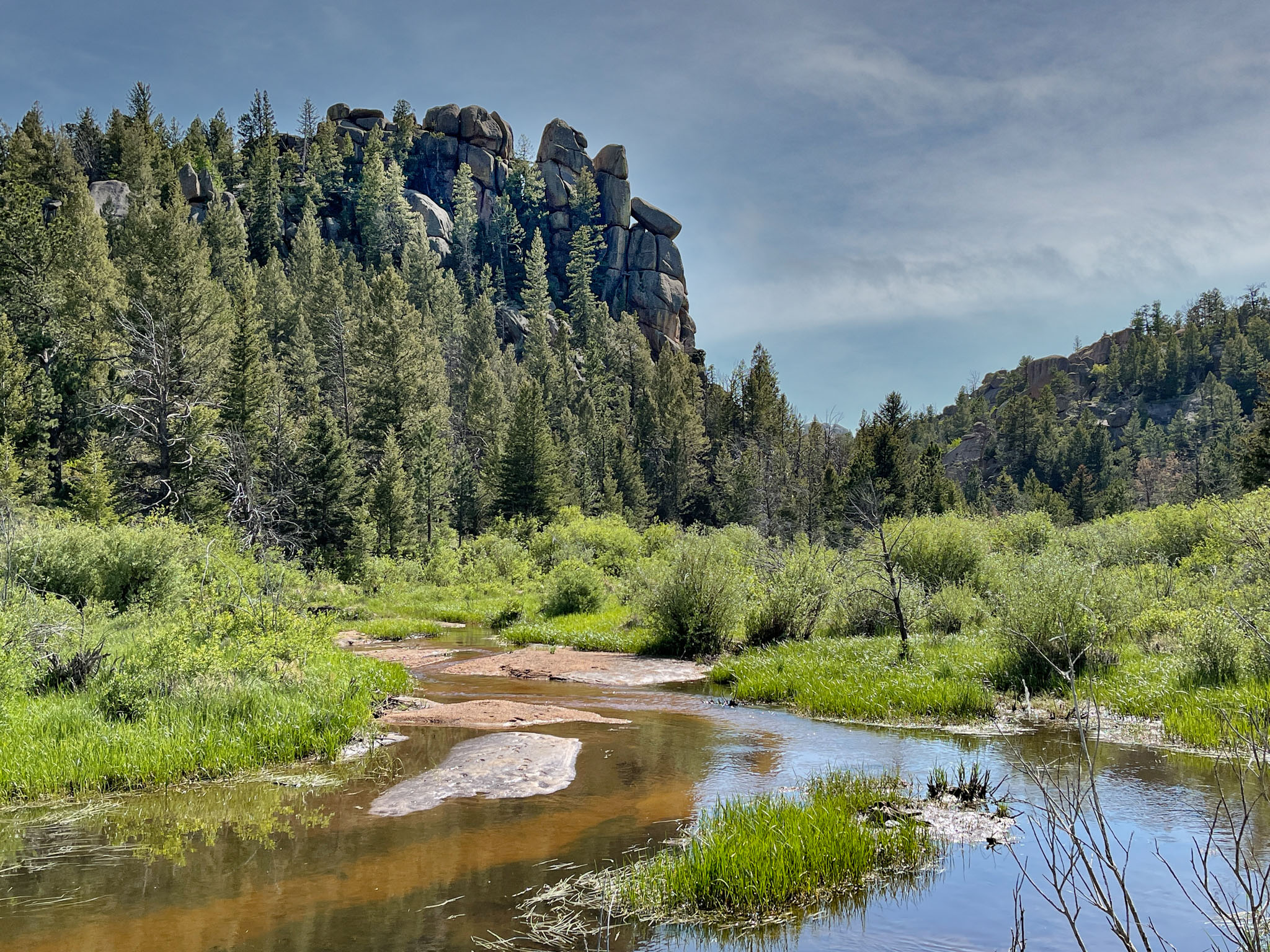
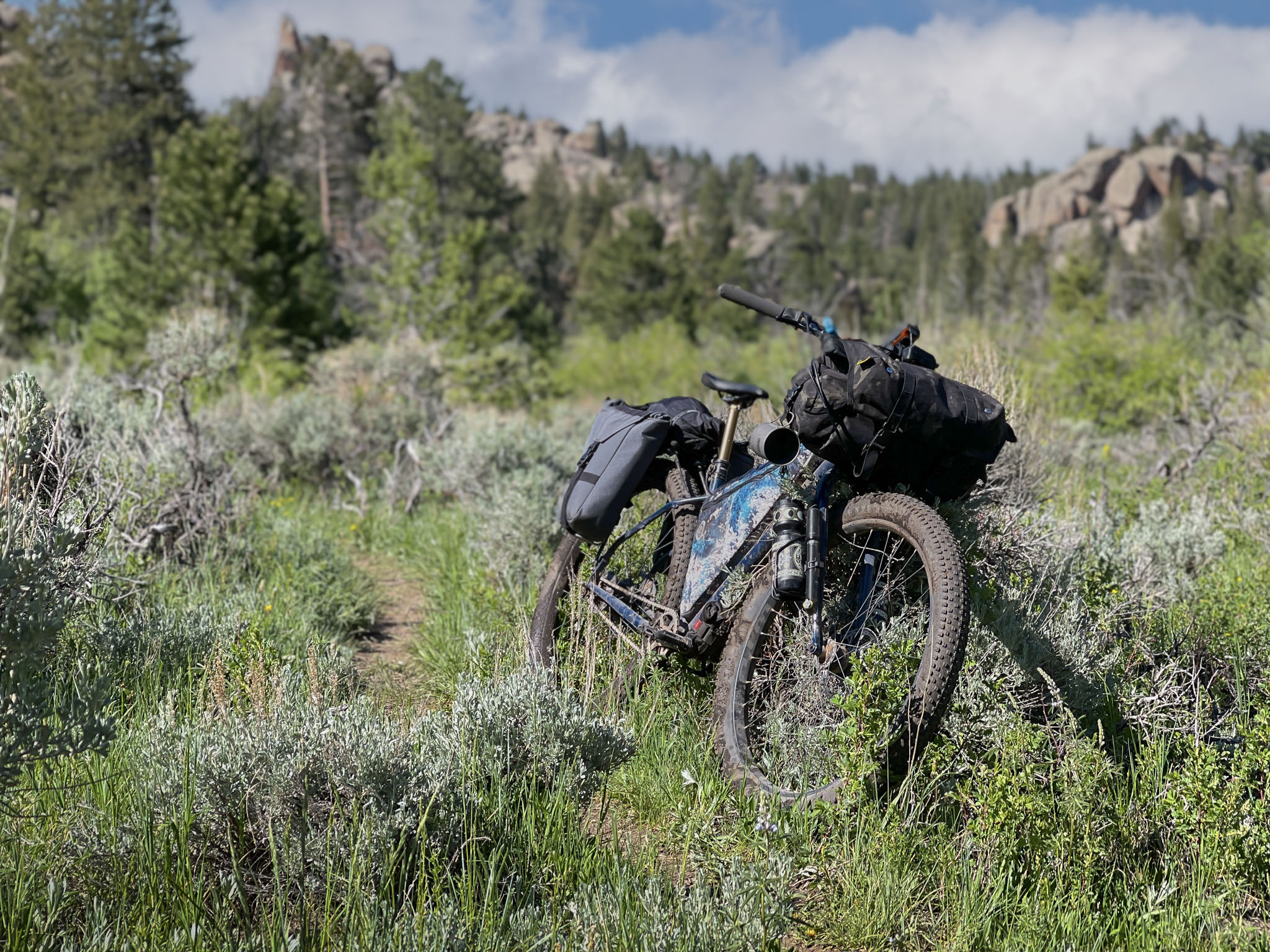
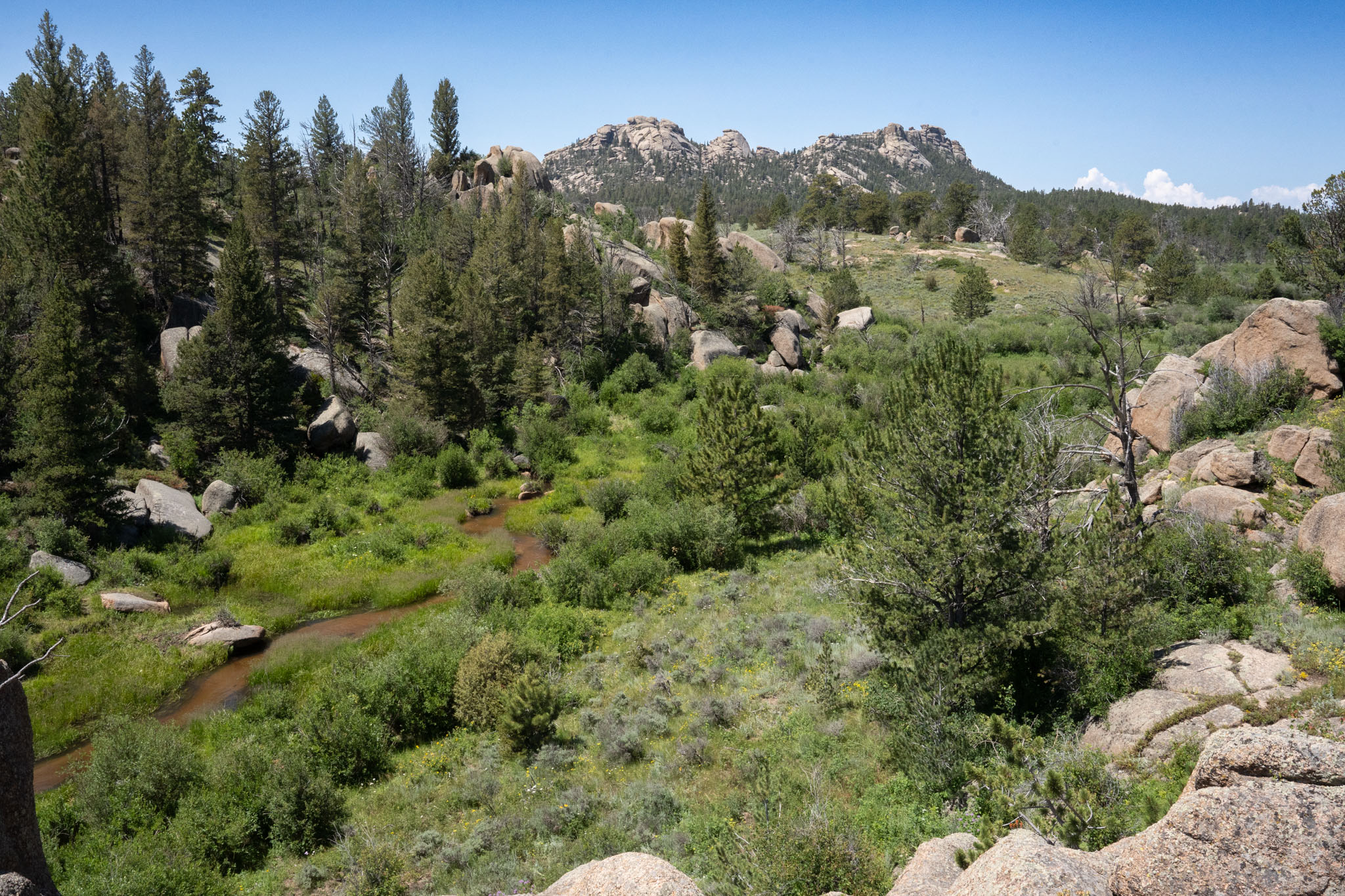
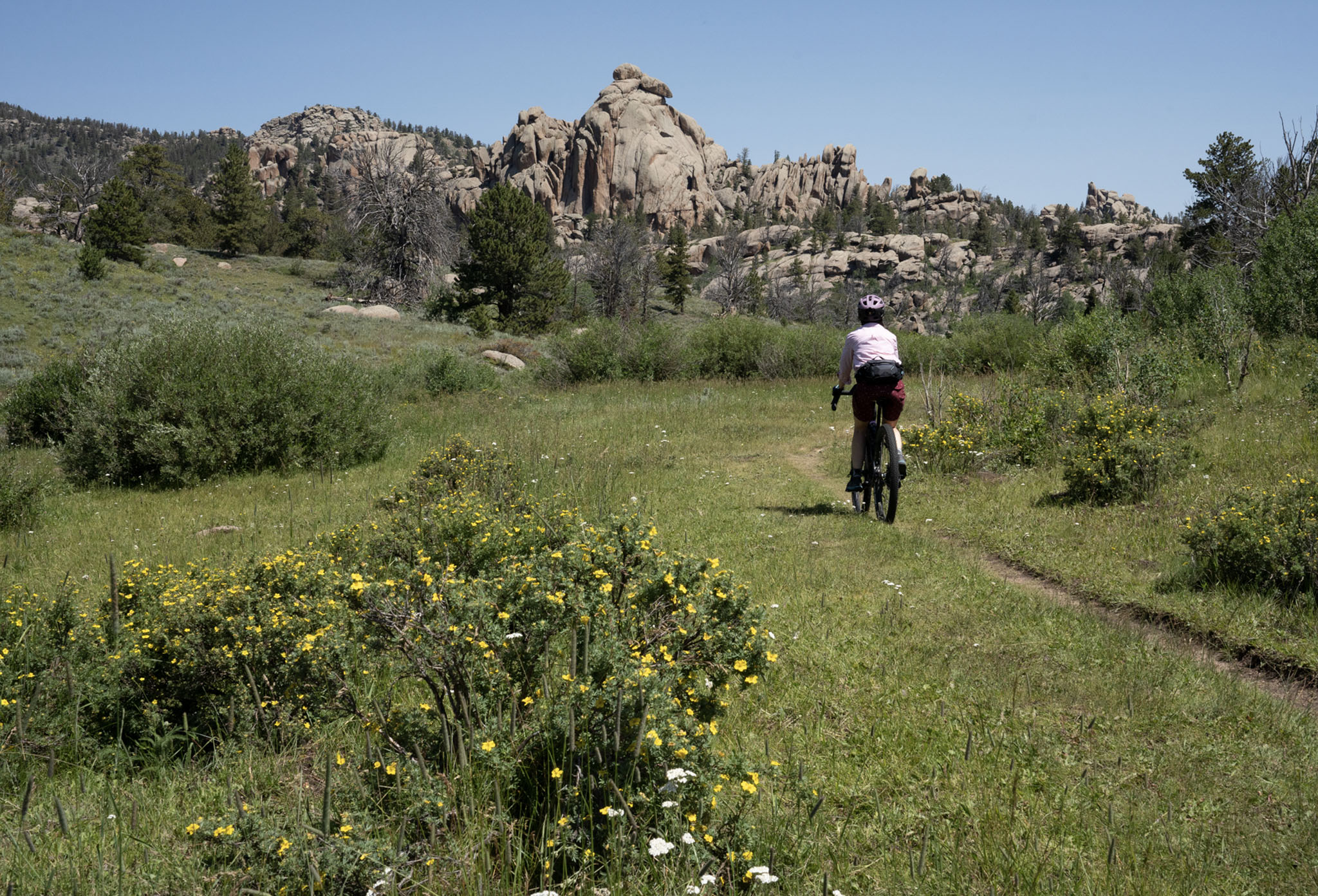
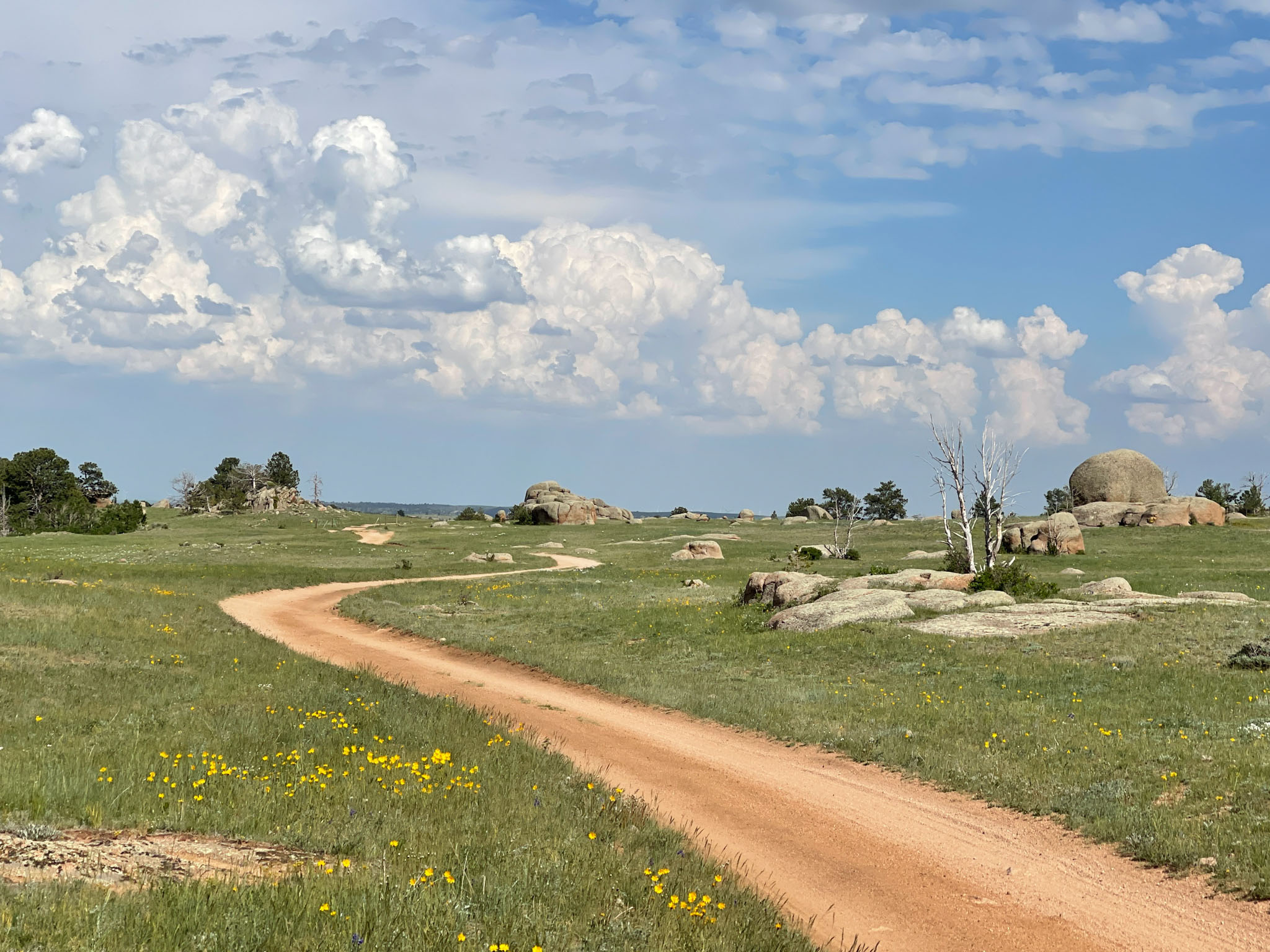
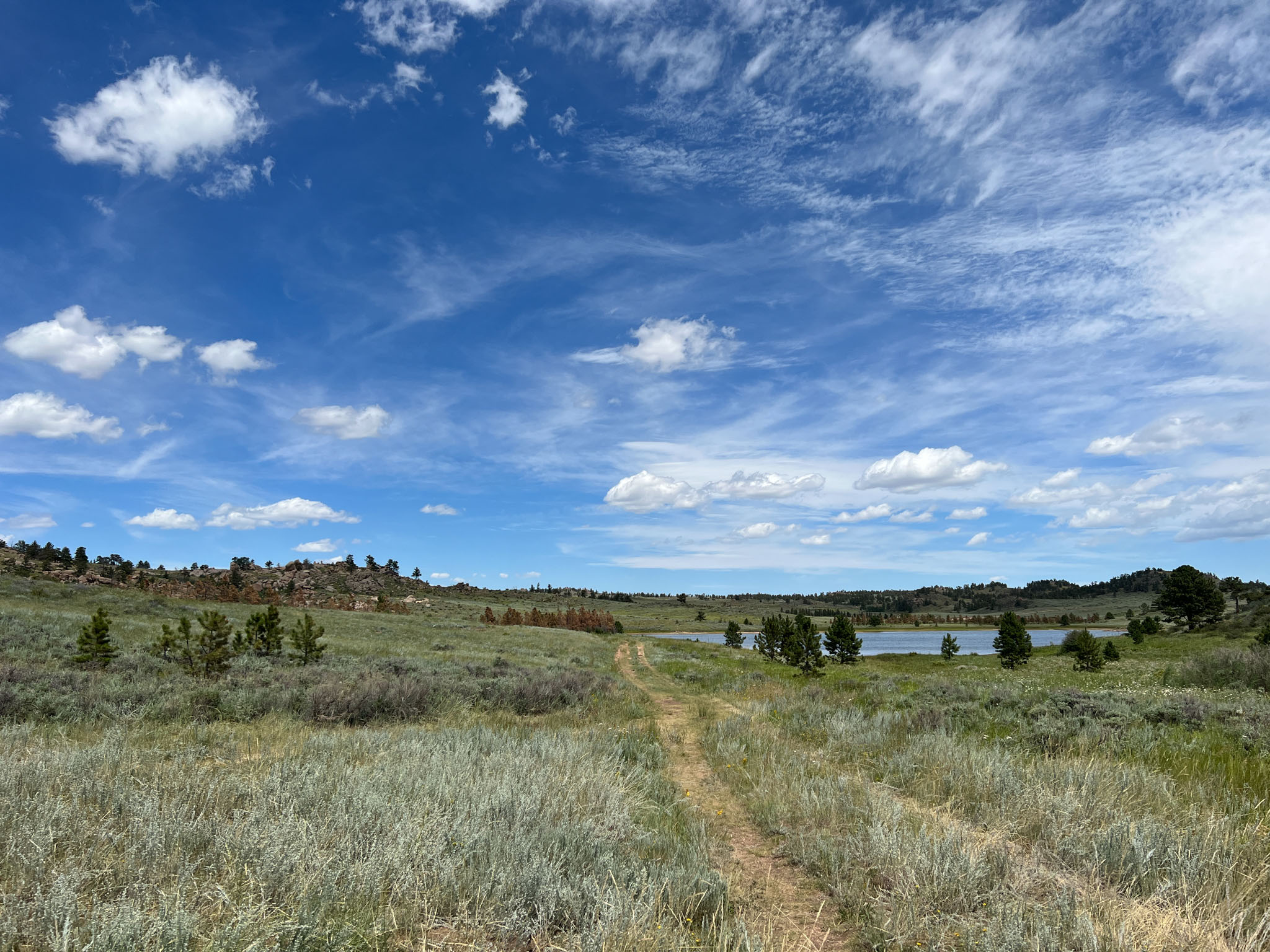
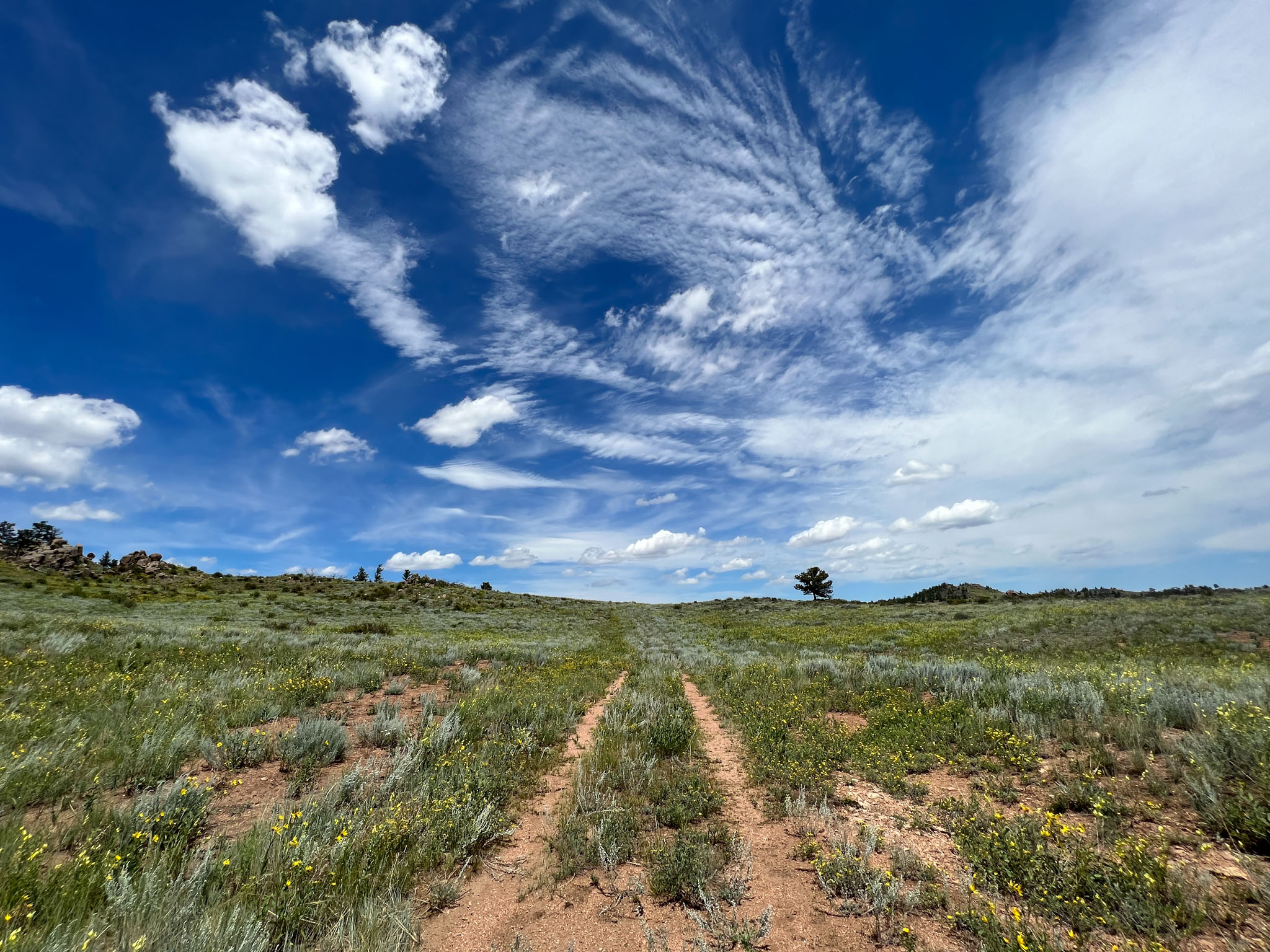
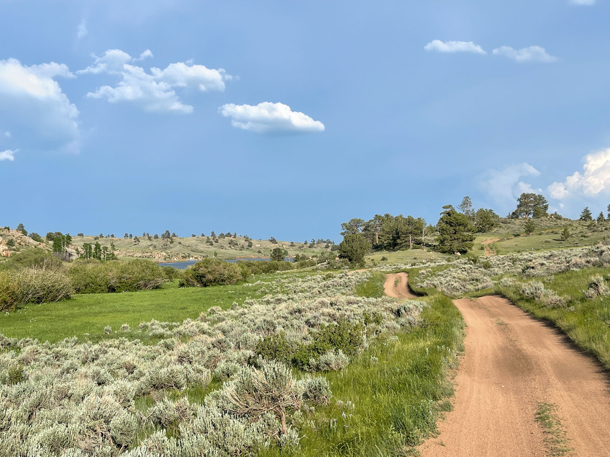
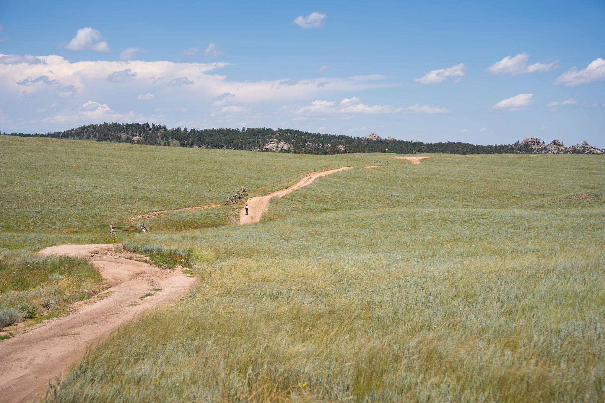
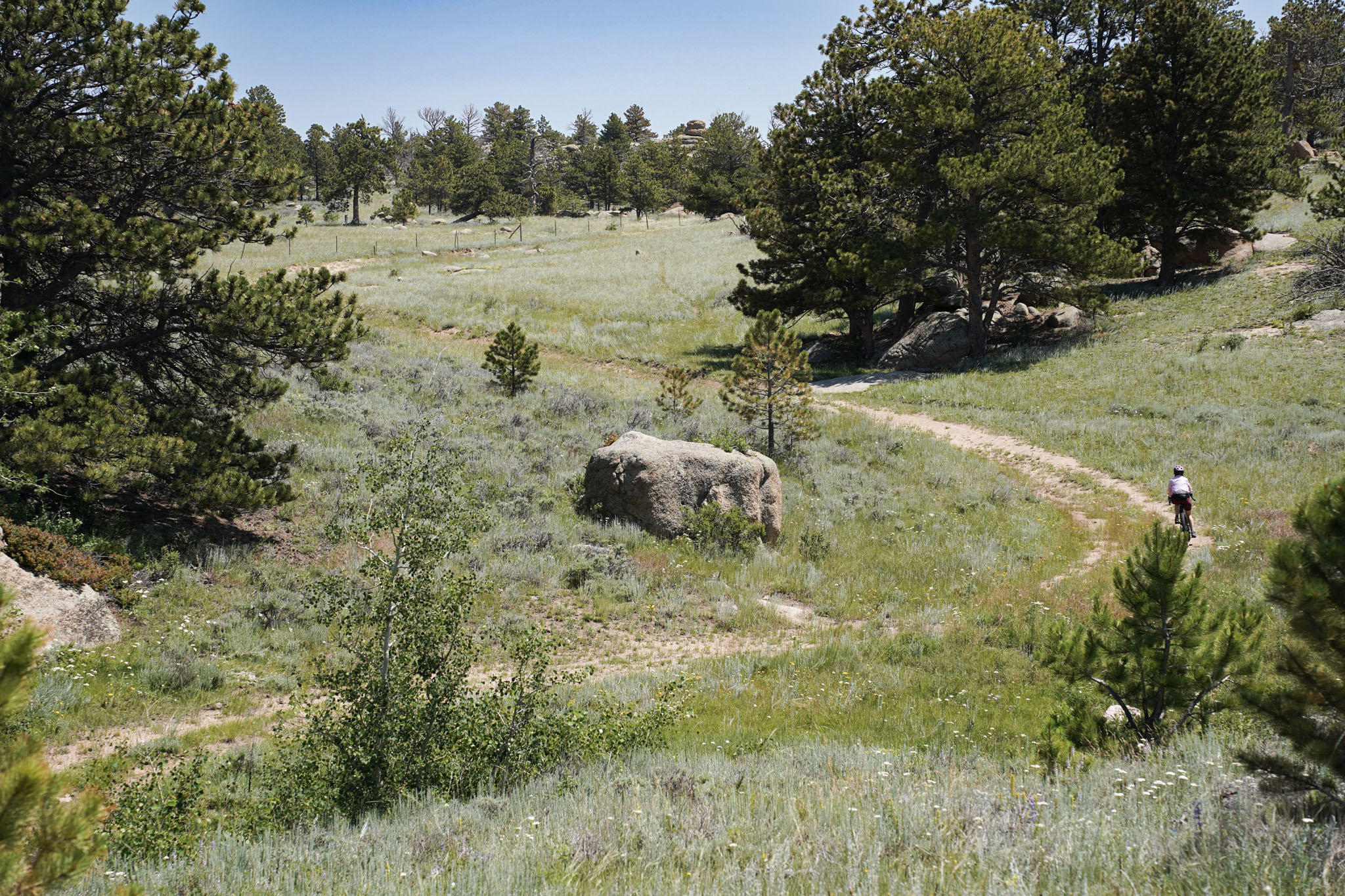
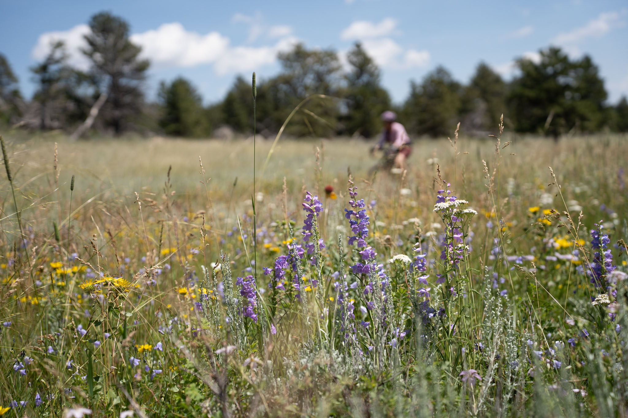
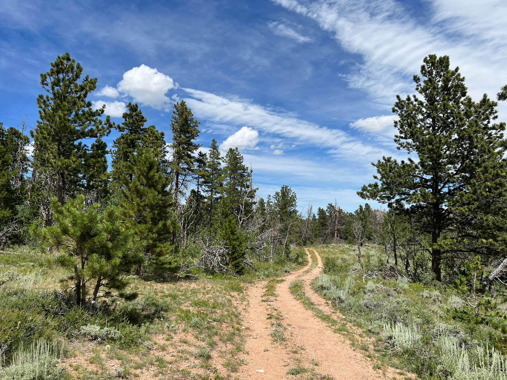
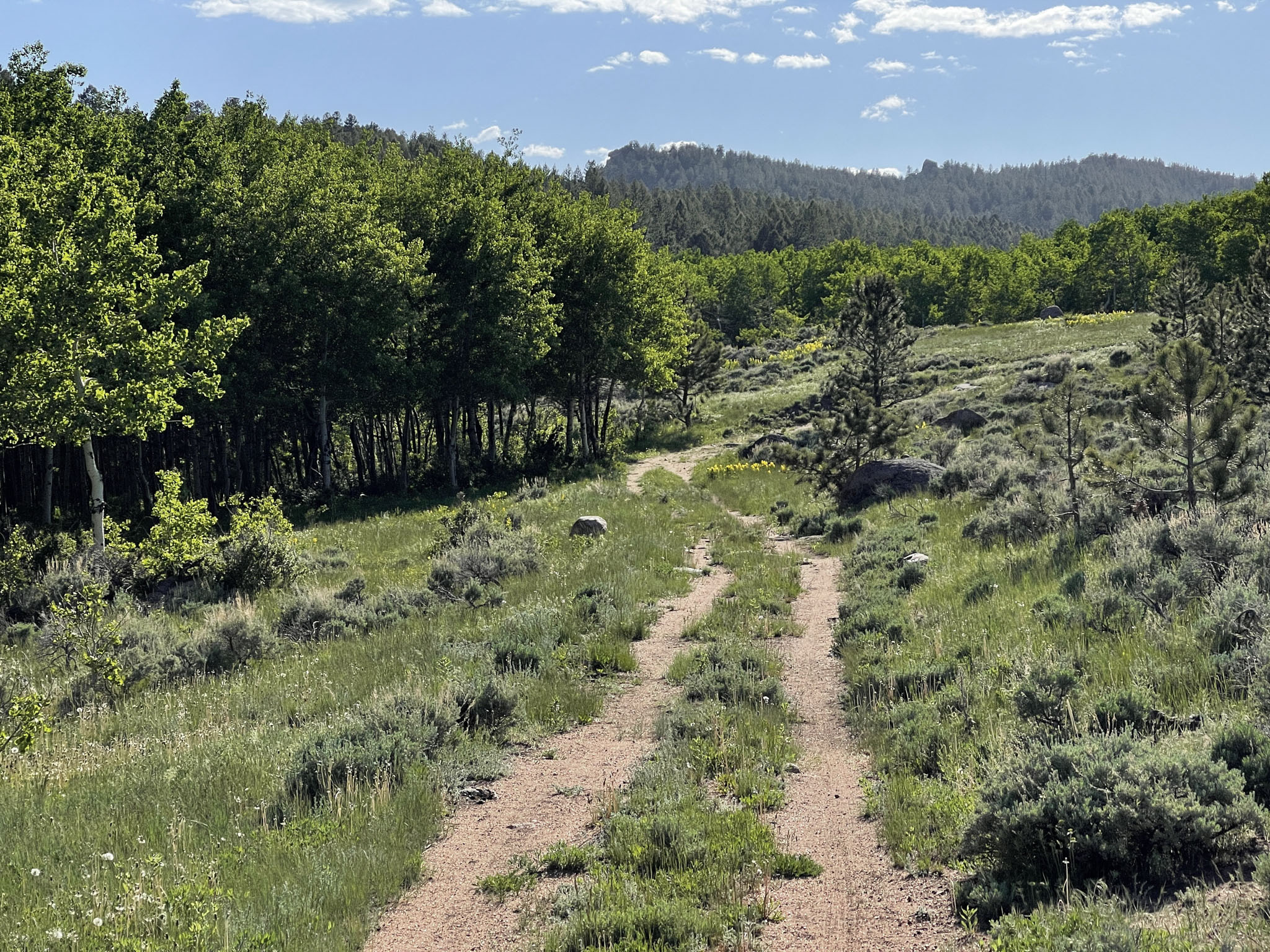
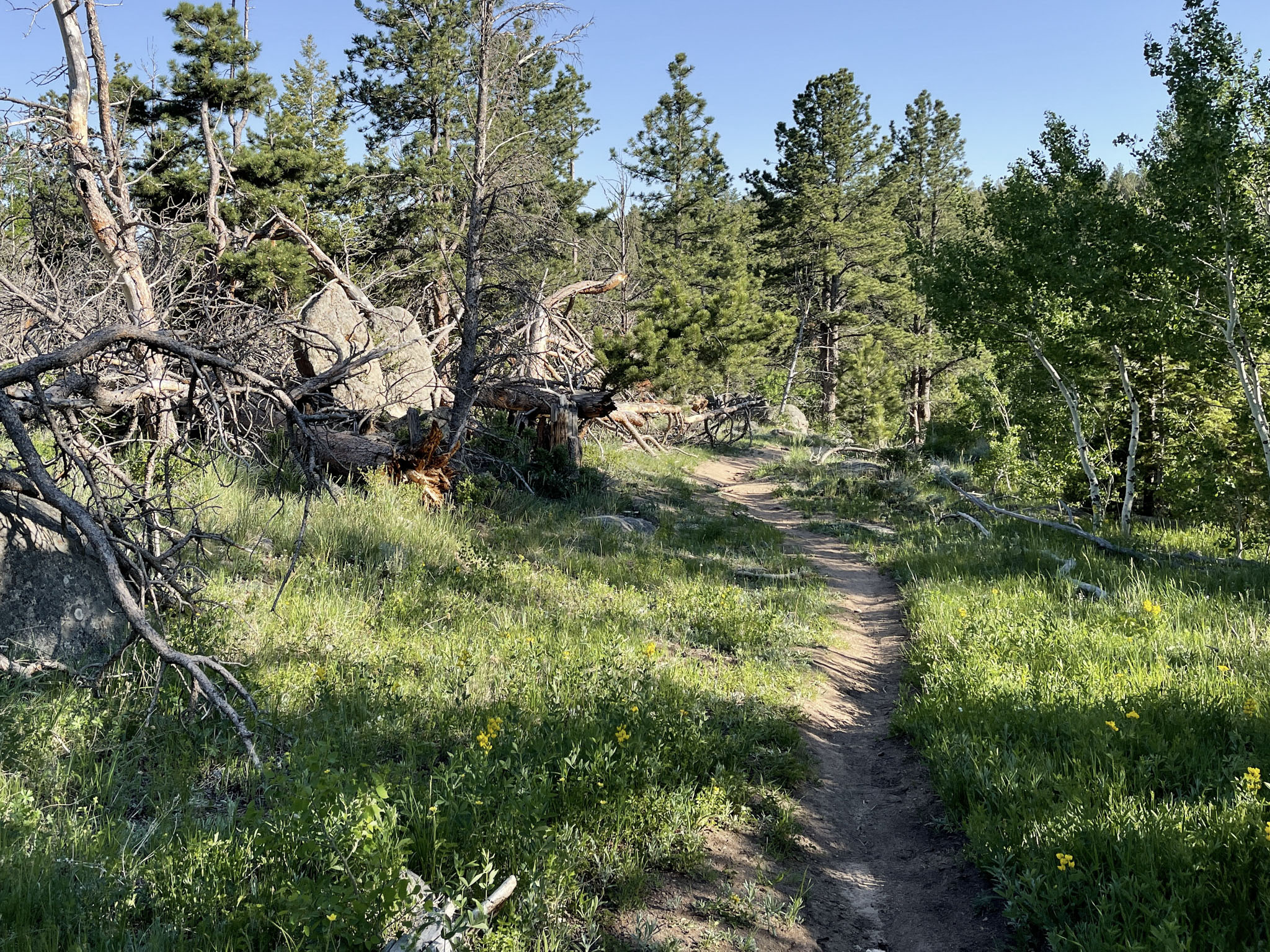
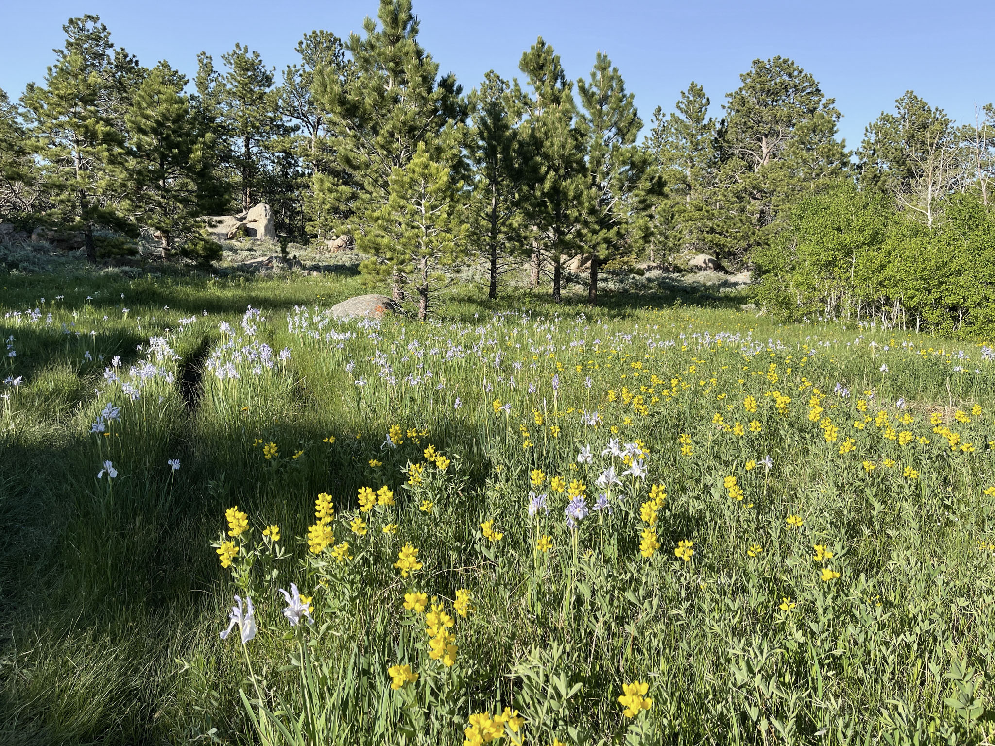
A logical starting point for the Vedauwoo Rendezvous has riders departing from the Happy Jack Recreation Area Trailhead (a few miles off of exit 323 on Interstate I-80) and going counterclockwise. You begin by climbing along singletrack trails in a high alpine pine forest to the high point of the route at ~8,800 feet elevation. From here, riders follow the downward contours of the landscape, descending through pine forest, aspen groves, and grassy prairies. Rocky climbs on singletrack trails stitch their way through abstract granite rock formations that emerge from the surrounding hills and plains to give a unique character to the time on trail. Riders will encounter giant walls of granite, picturesque mountain valleys, streams, and ponds, and—if timed right—abundant wildflowers throughout! The second half of the route is characterized by a mixture of gravel roads and rocky doubletracks that work their way upward through open prairies and sections of singletrack set at the foot of the mountains as riders return to the starting trailhead.


The Vedauwoo Rendezvous is also conveniently situated between two mountain biking hotspots: the Happy Jack Recreation Area Trails in the west and Curt Gowdy State Park to the east. The latter of these has exploded in popularity in recent years, owing to the establishment of over 35 miles of new trails for riders of various skill levels, including an IMBA Epic. Given the plethora of recreation opportunities in the region, this route was designed to be the perfect canvas for riders interested in integrating their bikepacking forays with other multi-sport activities (e.g. rock climbing) while serving up a stunning introduction to the unique beauty of southeastern Wyoming.
Route Difficulty
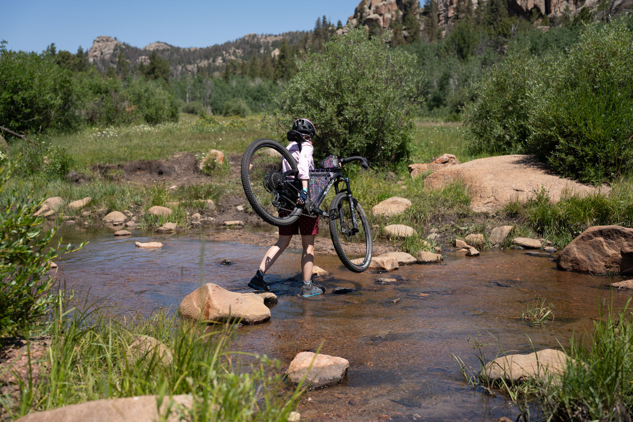
Over 95% of this route is on rocky singletrack and doubletrack trails and gravel roads. Numerous sections, particularly in the first half of the route, have off-camber sections and good mountain biking skills are necessary to safely ride. The high-elevation of this route, abundance of singletrack, and loose rocky climbs on with off-camber sections add to the physical exertion required. Technical mountain bike skills are required in some regions with occasional hike-a-bike sections to carry your loaded bike over rocky obstacles and some stream crossings. Water is abundant on the route but requires filtering from streams, ponds, and lakes. There are no services on route, so there is no chance for resupply beyond caches placed beforehand. However, as an overnighter, this is likely not needed!
Route Development: Route designed, scouted, photographed, and contributed by Seth Kruckenberg. At just over 42 miles long, this route is not big on miles, but that was never the intent. The loop was designed to be a perfect place for a solo outing or a rendezvous with friends. This region is a recreation wonderland that includes numerous mountain bike trail networks, world-class rock climbing, and abundant hiking and fishing opportunities, making this overnighter the perfect lattice on which to build your own weekend adventure in the region. Please see the trail notes and links provided in the additional resources for more information on activities that can be integrated with your bikepacking forays in the region.

Submit Route Alert
As the leading creator and publisher of bikepacking routes, BIKEPACKING.com endeavors to maintain, improve, and advocate for our growing network of bikepacking routes all over the world. As such, our editorial team, route creators, and Route Stewards serve as mediators for route improvements and opportunities for connectivity, conservation, and community growth around these routes. To facilitate these efforts, we rely on our Bikepacking Collective and the greater bikepacking community to call attention to critical issues and opportunities that are discovered while riding these routes. If you have a vital issue or opportunity regarding this route that pertains to one of the subjects below, please let us know:
Highlights
Must Know
Camping
Food/H2O
Trail Notes
Resources
- Riding through a Daliesque landscape of exotic granite rock formations made by the slow erosion and weathering of the 1.4-billion-year-old Sherman Granite.
- Miles of high-altitude singletrack and doubletrack trails that wend their way through pine forests and quaint aspen groves.
- Discovering secluded mountain prairies, streams, and ponds nestled between and at the foot of towering granite spires, hoodoos, and massive outcrops.
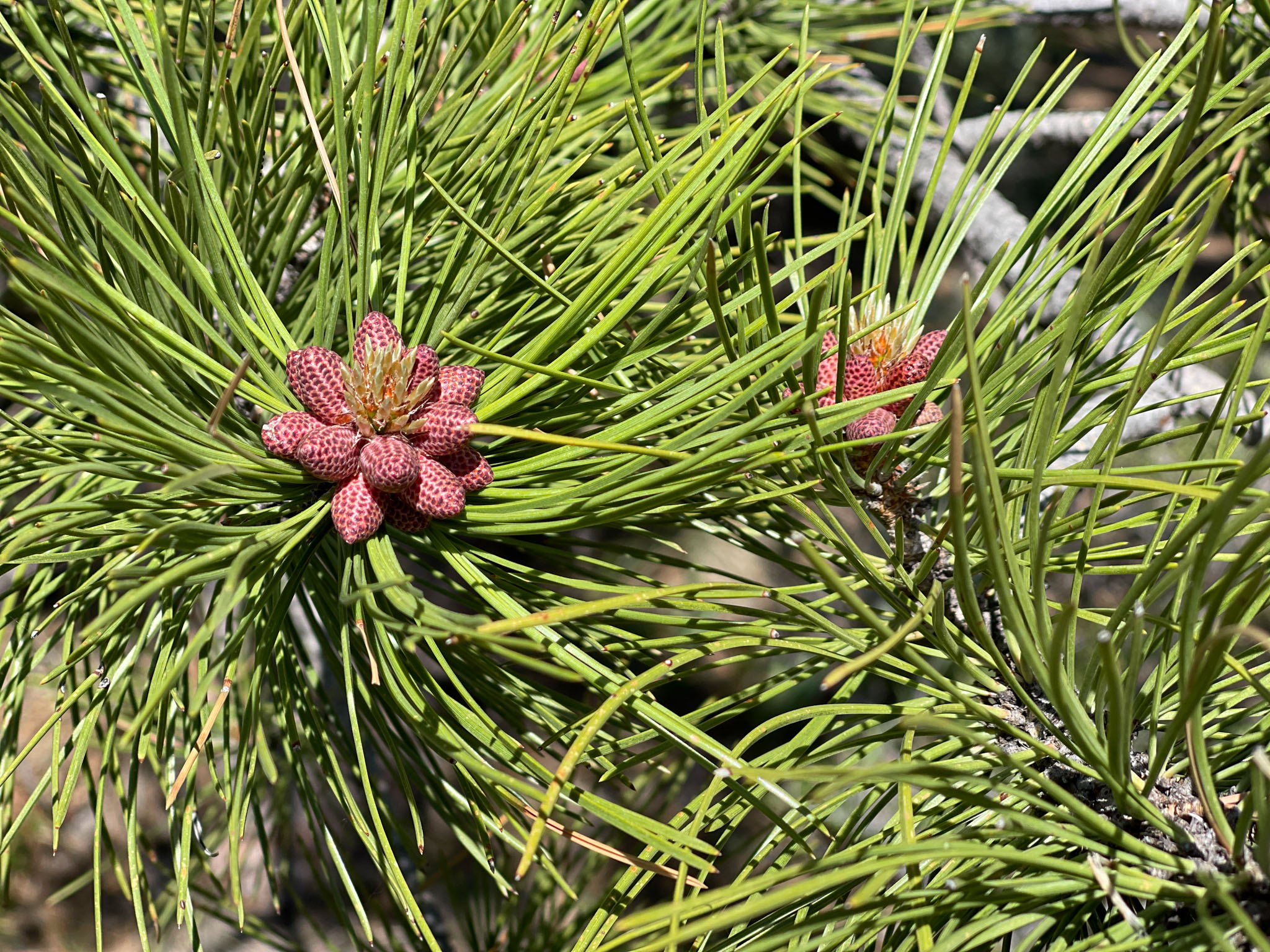
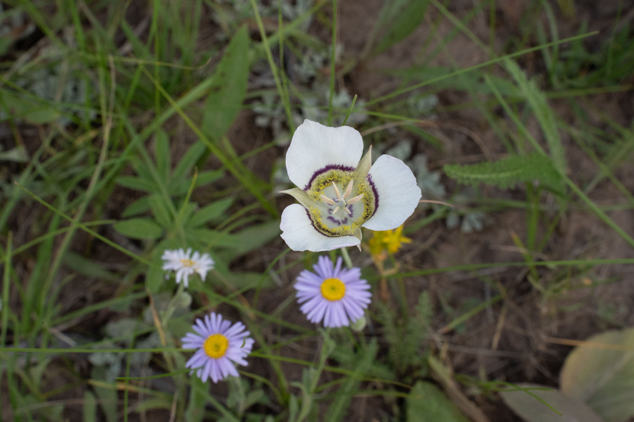
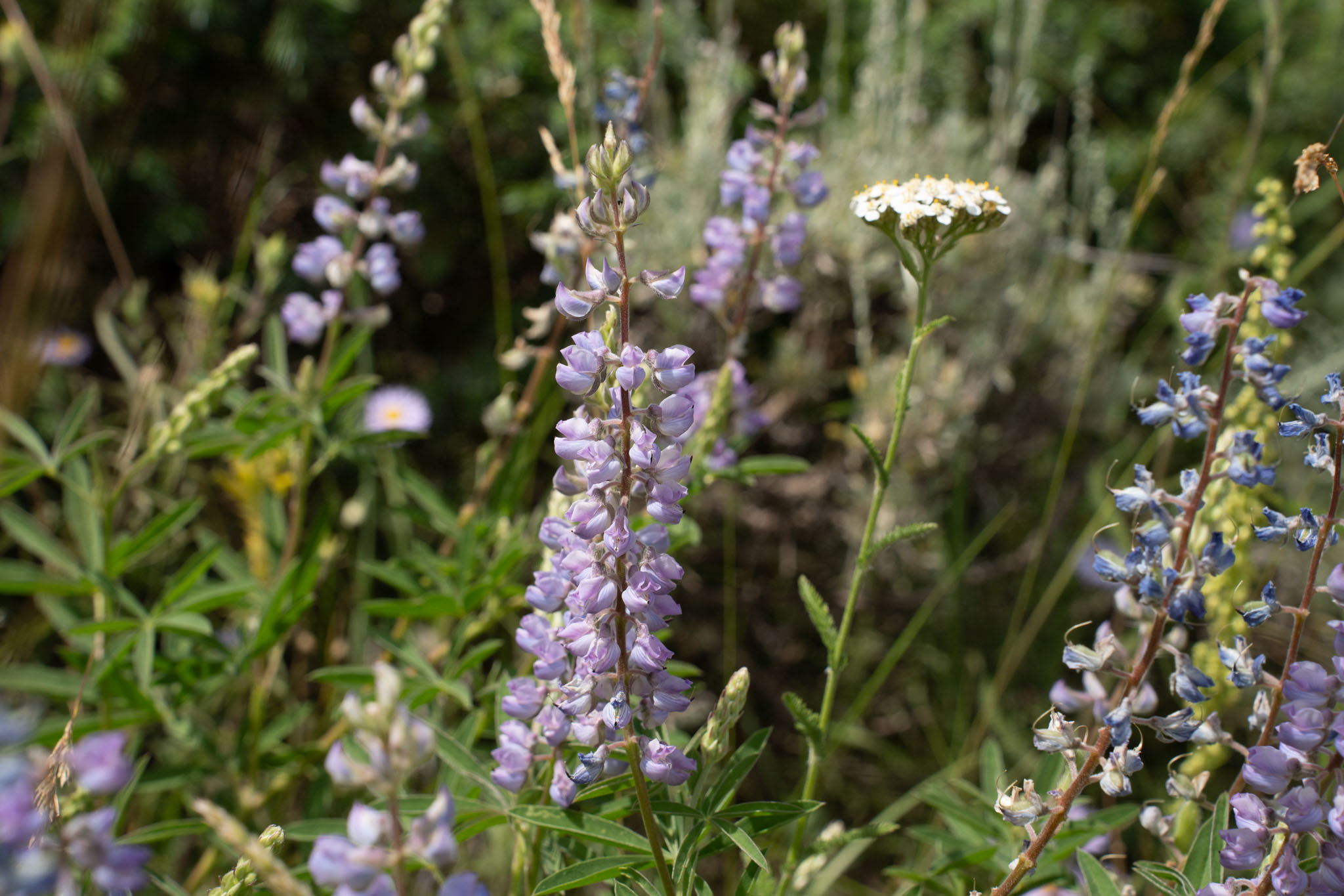
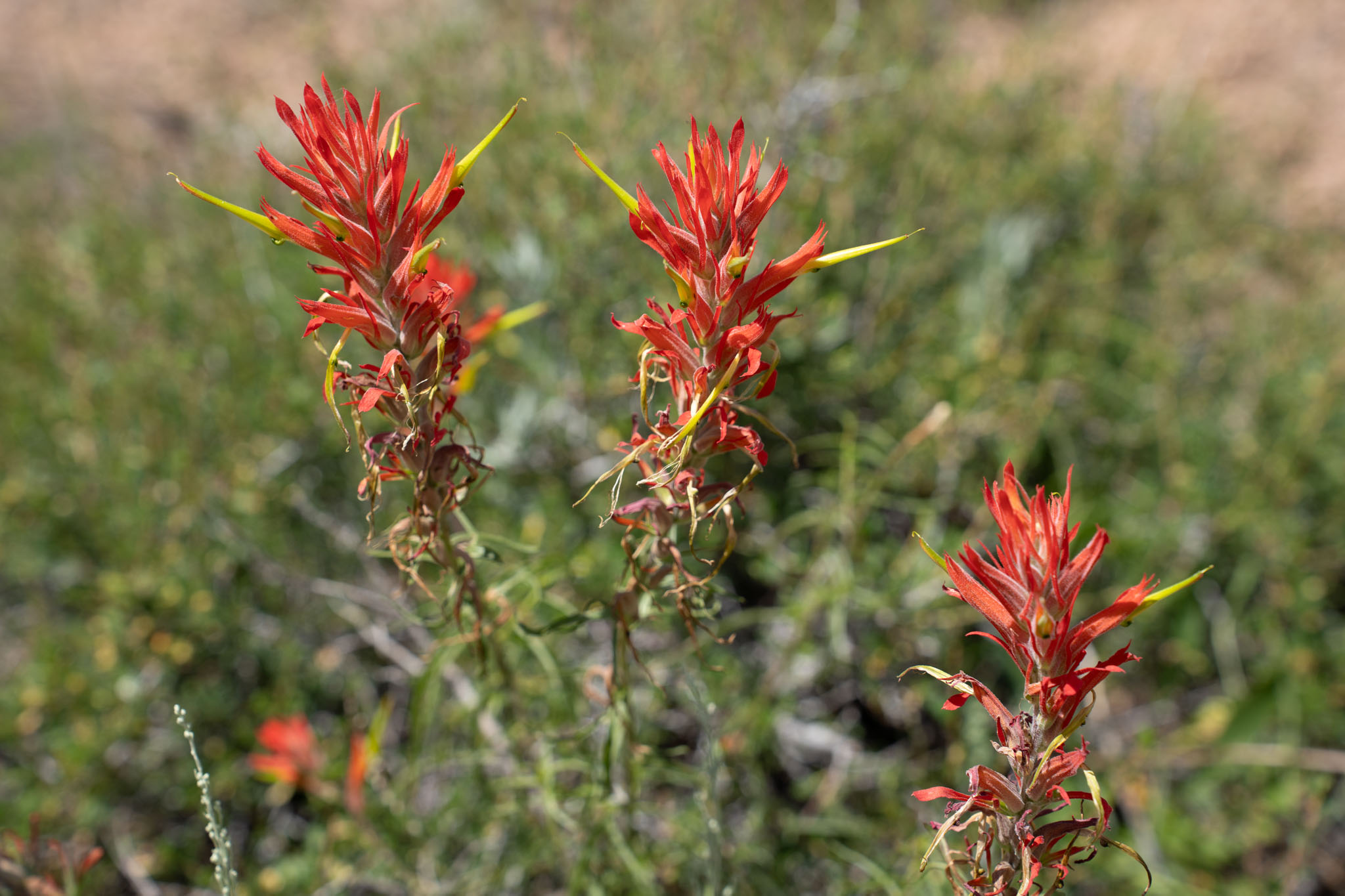
- Colorful wildflowers that paint the rocky trails and plains throughout the route in the spring and early summer.
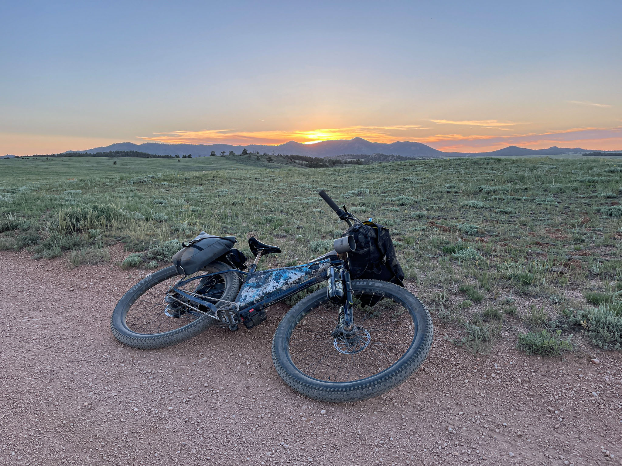
- Incredible night skies full of stars.
- A diversity of riding surfaces and locations that take riders from trails tucked into the Sherman Mountains to open plains with sweeping vistas.
- Due to its location in the Rocky Mountains, with elevations ranging from 7,500 to 8,800 feet, this route is best ridden in the spring through late fall months when the trails are free of snow. Depending on seasonal conditions, the spring and early summer months (May to June) are likely to present riders with a dazzling array of wildflowers. Given its high elevation, summer riding conditions are similarly excellent, and the fall months bring a second nature show with the changing fall foliage.
- The route is logistically very straightforward. As mentioned in the route description, abundant parking is available at the start of the GPX track at the Happy Jack Recreation Area Trailhead. This trailhead can be accessed from Exit 323 off of Interstate I-80 by driving approximately 2 miles along Happy Jack Road eastbound to a right hand turn that takes you another 0.5 miles down a gravel road to a large parking lot.
- Use of the Happy Jack Recreation Area requires payment of a modest daily use fee, and it is possible to leave your vehicle overnight without issue. Be sure to obey all posted signs should policies or permitting requirements change.
- Bears and other wild animals are in the region, so please take standard precautions, particularly when in more secluded environments and when camping.
- A short section of the route at miles 20-21 passes through the Upper North Crow Reservoir day use area, which has a day use fee for those parking or staying at the reservoir.
- The entirety of the route is on public land, and most of the route is entirely within the Medicine Bow-Routt National Forest. As such, there are abundant camping locations en route, but remote camping is not allowed in all regions.
- There is paid camping near the start of the route at the Yellow Pine Campground. There are also paid sites at the Vedauwoo Campground (near the main climbing area), located slightly off of the southern end of the route and accessed via I-80 exit 329.
- Remote camping is not allowed in the first dozen miles of the route, but there are 73 campsites available for use in the designated Pole Mountain dispersed camping zone between miles 12-16 of the route GPX track.
- No camping is allowed in the Upper North Crow Reservoir day use area (miles 20-21; approximately the halfway point of the route) but a number of free distributed camping locations can be found in the Medicine Bow-Routt National Forest between miles 22-36.
- The route is located approximately 15 miles east of Laramie and 35 miles west of Cheyenne, Wyoming. These towns are the nearest (and only) locations in either direction for food supplies.
- A number of good water sources are available en route, but filtration will be required. Sources that are seasonally consistent include the Middle Crow Creek (miles 10-11; mile 14), Upper North Crow Reservoir (mile 20-21), and a mountain pond at mile 24. After mile 24, mountain brooks and streams are variable. These sources may not have sufficient flow depending on the season, so riders are advised to top off at the larger sources nearer the halfway point as mentioned above.
- For those wanting some fantastic vegetarian food (+/- libations) either pre- or post-ride, it is definitely worth the short drive into downtown Laramie to hit up Sweet Melissa’s Cafe. While the entire menu is incredible, the cauliflower wings, sweet potato & black bean burrito, and lentil loaf are personal favorites!
- Riders interested in departing from the nearby town of Laramie can connect to the Vedauwoo Rendezvous loop via the Pilot Hill Recreation Area trails, which connect downtown Laramie to the Happy Jack Recreation area trails. There are a number of possible paths through that trail network, but this GPX track follows the bi-directional trails from the Pilot Hill Recreation Area trailhead in Laramie to extend the route into an approximately 70-mile lollipop.
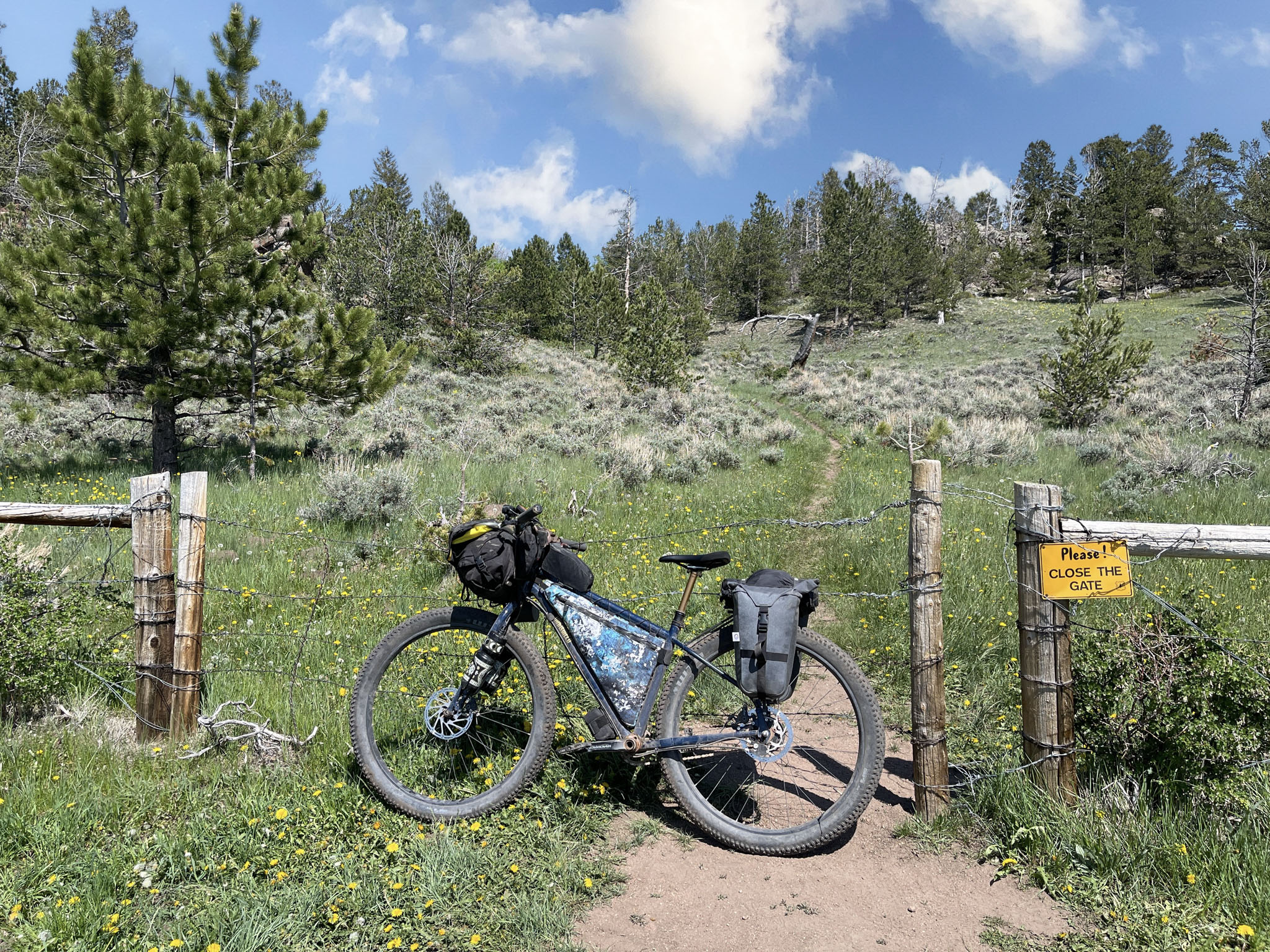
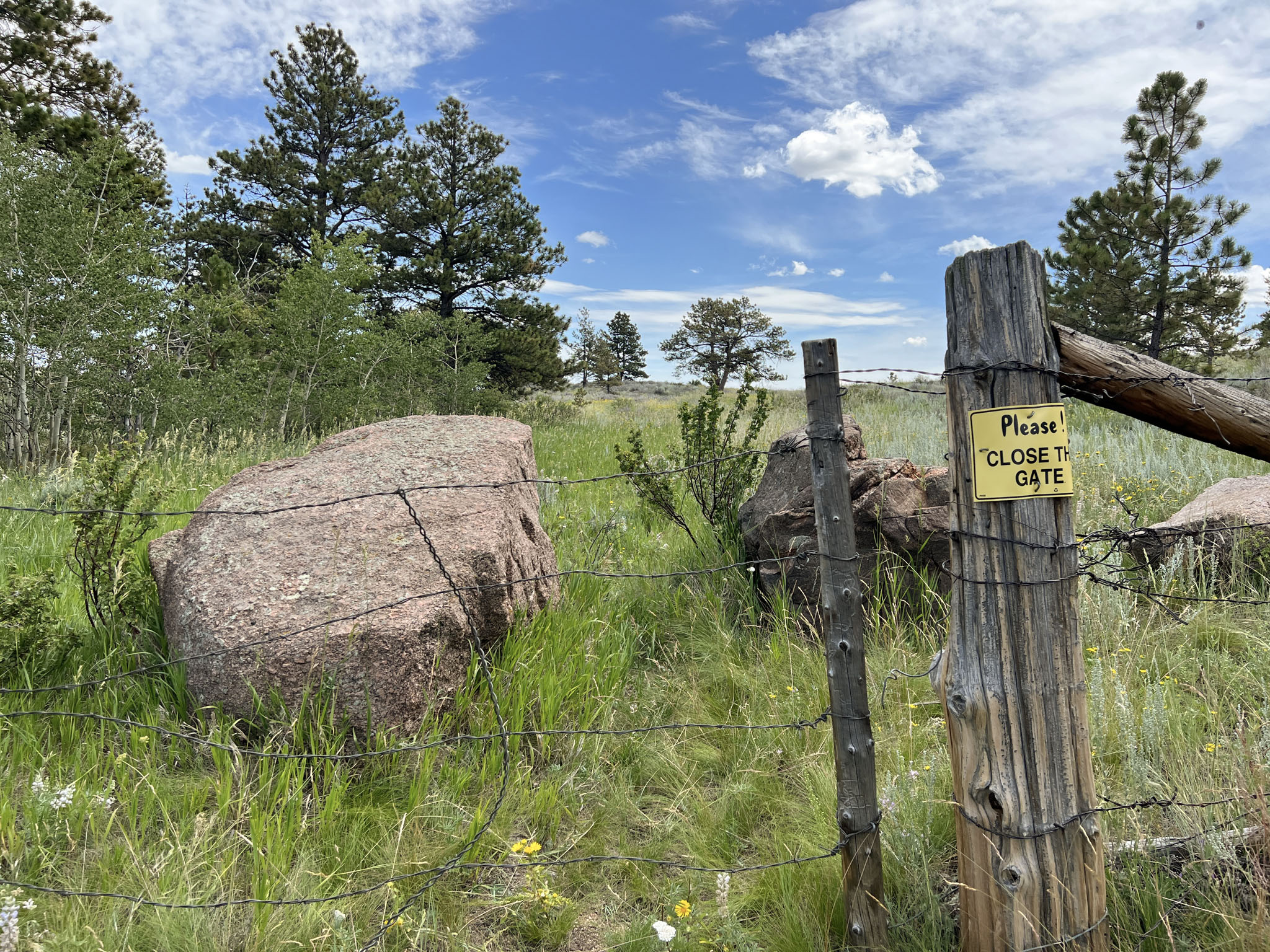
- The exit from Upper North Crow Reservoir follows an old doubletrack away from the reservoir at mile 21.1 to a gate in the fence at mile 21.3. Portions of this trail are heavily overgrown and may require some hike-a-bike and keen scouting, but the GPX track accurately follows the best line out of the day use area as of 2023.
- Since livestock may be present in some regions, please be sure to close all gates in accordance with posted signs.
Additional Resources
- As mentioned in the description, this route is conveniently situated between two mountain biking hotspots: the Happy Jack Recreation Area Trails to the west and Curt Gowdy State Park to the east. Up-to-date information on the trail networks and conditions can be found on popular sites like Trailforks, MTB Project, All Trails, etc.
- For those interested in sampling some of the region’s world-class rock climbing opportunities, check out Vedauwoo.org and The Mountain Project to learn more.


Terms of Use: As with each bikepacking route guide published on BIKEPACKING.com, should you choose to cycle this route, do so at your own risk. Prior to setting out check current local weather, conditions, and land/road closures. While riding, obey all public and private land use restrictions and rules, carry proper safety and navigational equipment, and of course, follow the #leavenotrace guidelines. The information found herein is simply a planning resource to be used as a point of inspiration in conjunction with your own due-diligence. In spite of the fact that this route, associated GPS track (GPX and maps), and all route guidelines were prepared under diligent research by the specified contributor and/or contributors, the accuracy of such and judgement of the author is not guaranteed. BIKEPACKING.com LLC, its partners, associates, and contributors are in no way liable for personal injury, damage to personal property, or any other such situation that might happen to individual riders cycling or following this route.
Please keep the conversation civil, constructive, and inclusive, or your comment will be removed.