


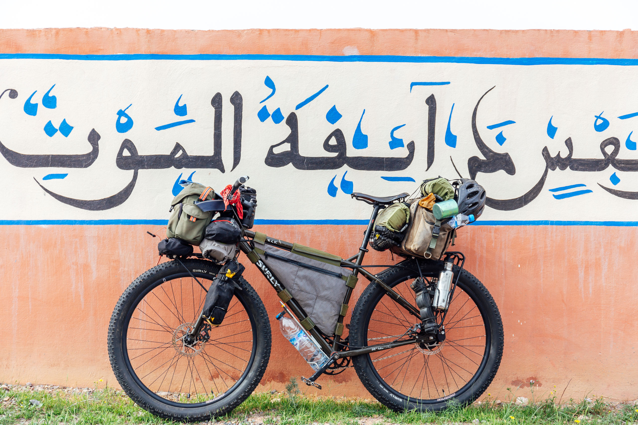
Route of Caravans: Morocco Traverse (South)
Distance
768 Mi.
(1,236 KM)Days
21
% Unpaved
70%
% Singletrack
3%
% Rideable (time)
97%
Total Ascent
58,509'
(17,834 M)High Point
9,523'
(2,903 M)Difficulty (1-10)
7?
- 5Climbing Scale Moderate76 FT/MI (14 M/KM)
- 5Technical Difficulty Moderate
- 7Physical Demand Difficult
- 8Resupply & Logistics Strenuous
Contributed By

Logan Watts
Founding Editor
The highly anticipated Route of Caravans (RoC) is now finished, allowing riders to traverse the length of Morocco mostly on dirt, beginning with the southern tier that starts in the coastal town of Tiznit and runs along the Anti-Atlas Mountains, the Sahara Desert, and the High Atlas. The RoC North is also published and starts where this one leaves off, in High Atlas village of Imilchil, and rides north through a remarkably diverse countryside. Read on for details. Many thanks to members of the Bikepacking Collective, whose generous support made both of these routes possible through the Bikepacking Collective Routes fund.
After discussing extensively with both police and military, we were advised to remove the section along the border with Algeria due to unrest and safety concerns. We have since moved the route north through the stunning Tizi n’Tlite gorge and over to the infamous French Colonial Road, which is also used in the Atlas Mountain Race. After searching for other alternatives, we can confidently say that the riding is amazing and that this is the best way to traverse the country from west to east through the stunning Anti-Atlas. We think you’ll really enjoy this section. Other highlights/changes include a traverse through the end of Dades Gorge to the Valley de Rose—a beautiful section that affords a stunning ride. We also shifted the route through N’Kob and down through Tizi n’Tanekfoult, which is an impressive canyon with quiet, breathtaking dirt riding. We also include an optional reroute around Dades Gorge past the Cathedral rock; find that under Trail Notes > Scouts Wanted.
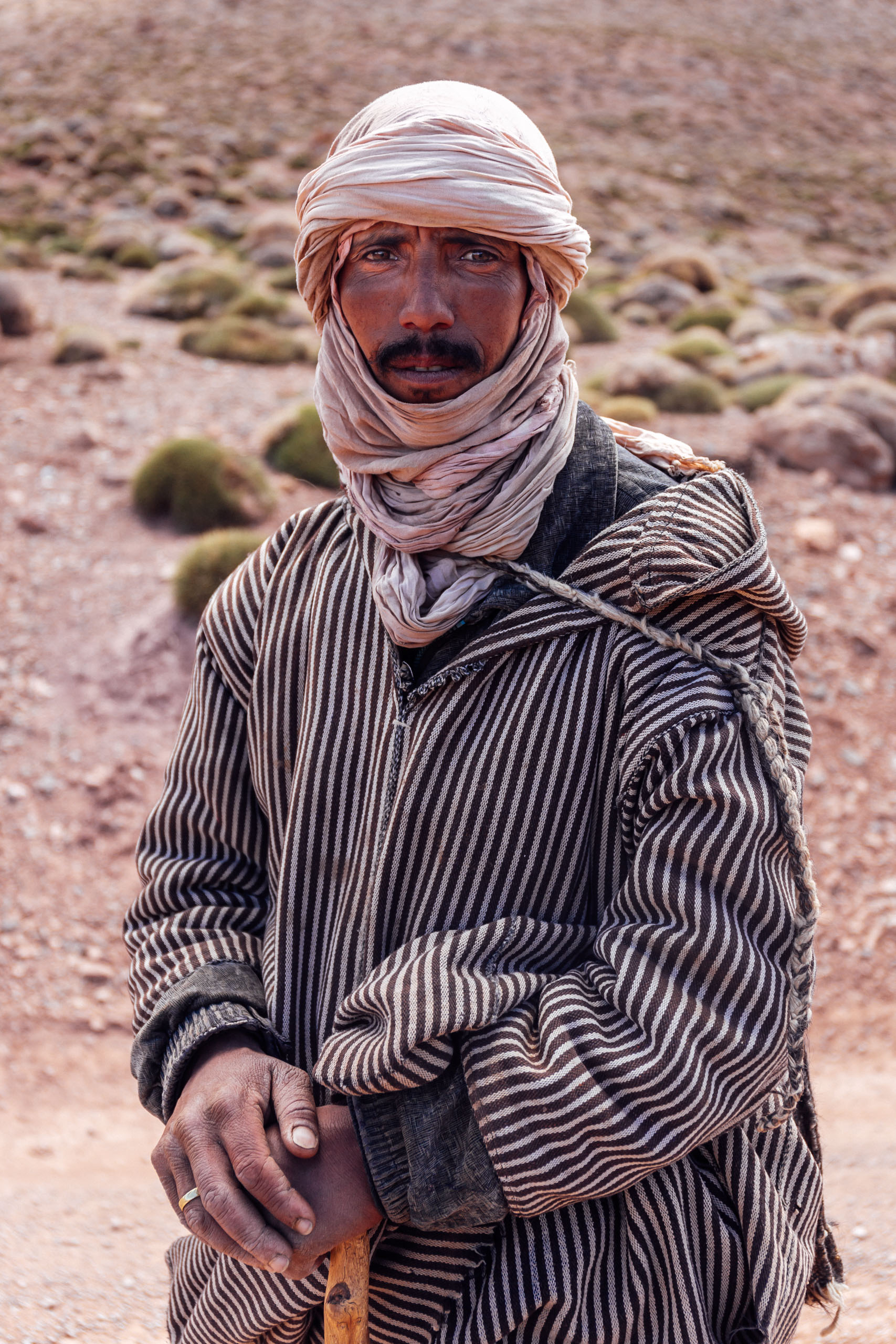
We acknowledge that many of these roads were originally cut in hundreds of years ago by slave trading caravans and a number were built by the French as a tool for colonization. We also acknowledge that this is Amazigh land. Please tread lightly and be kind.
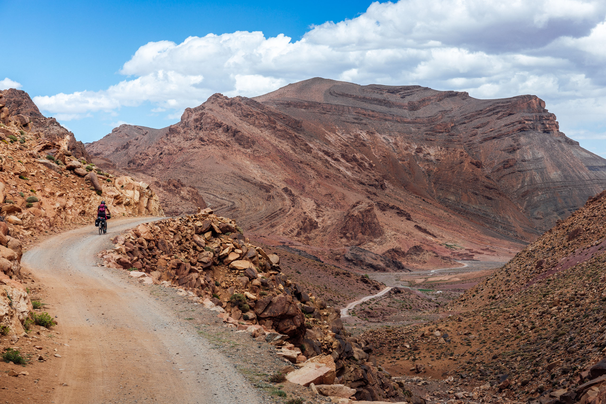
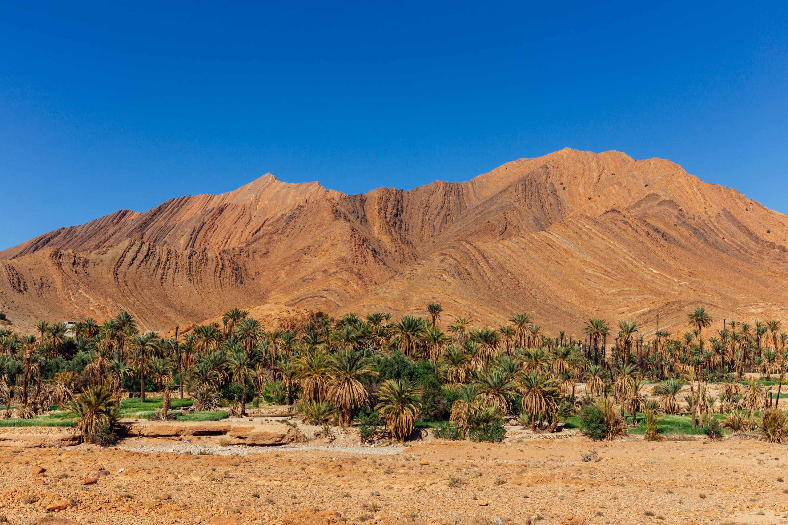
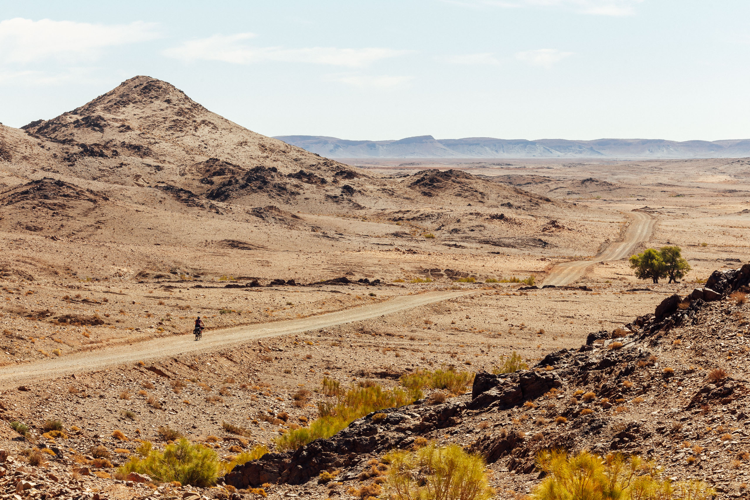
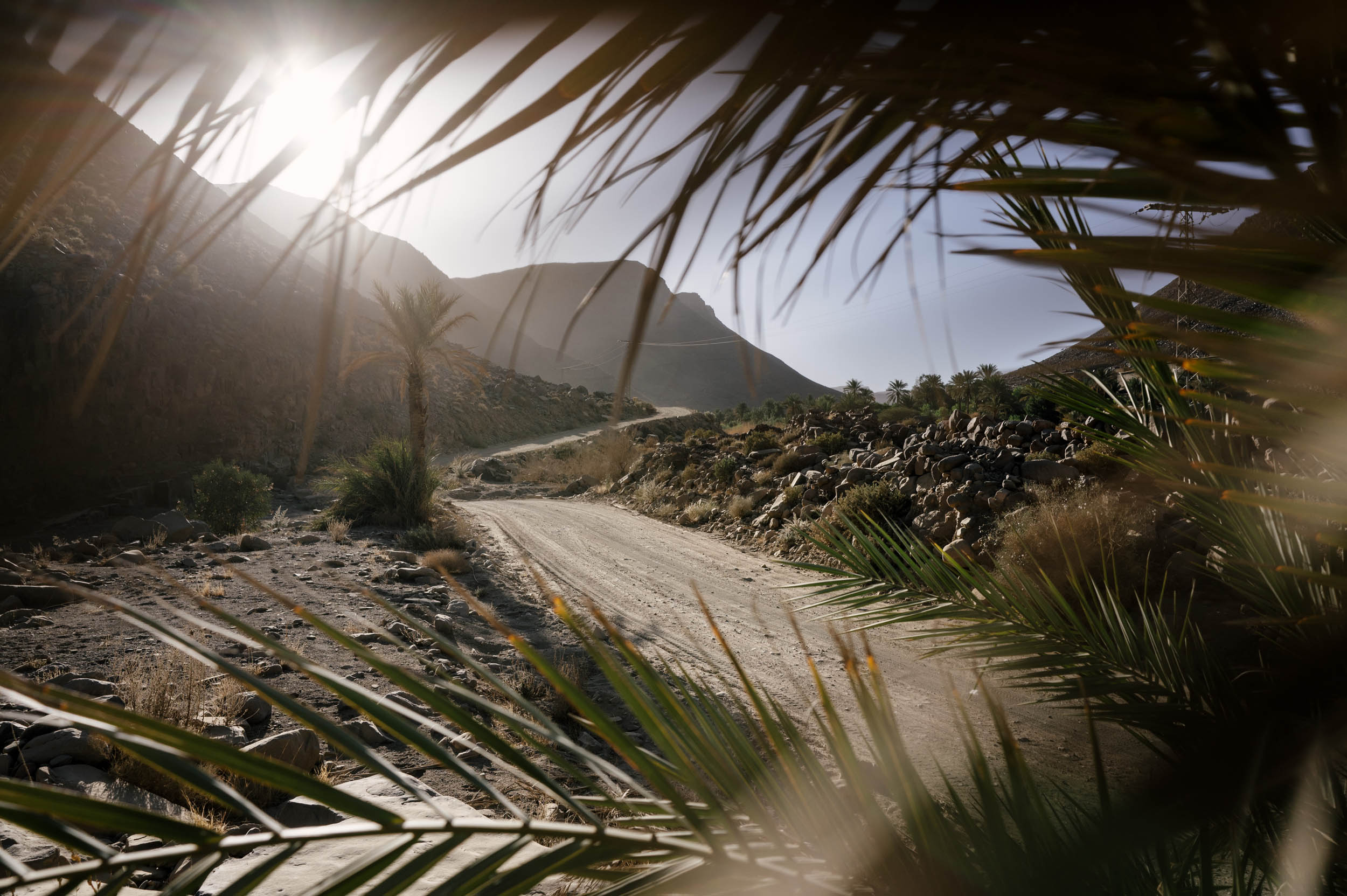
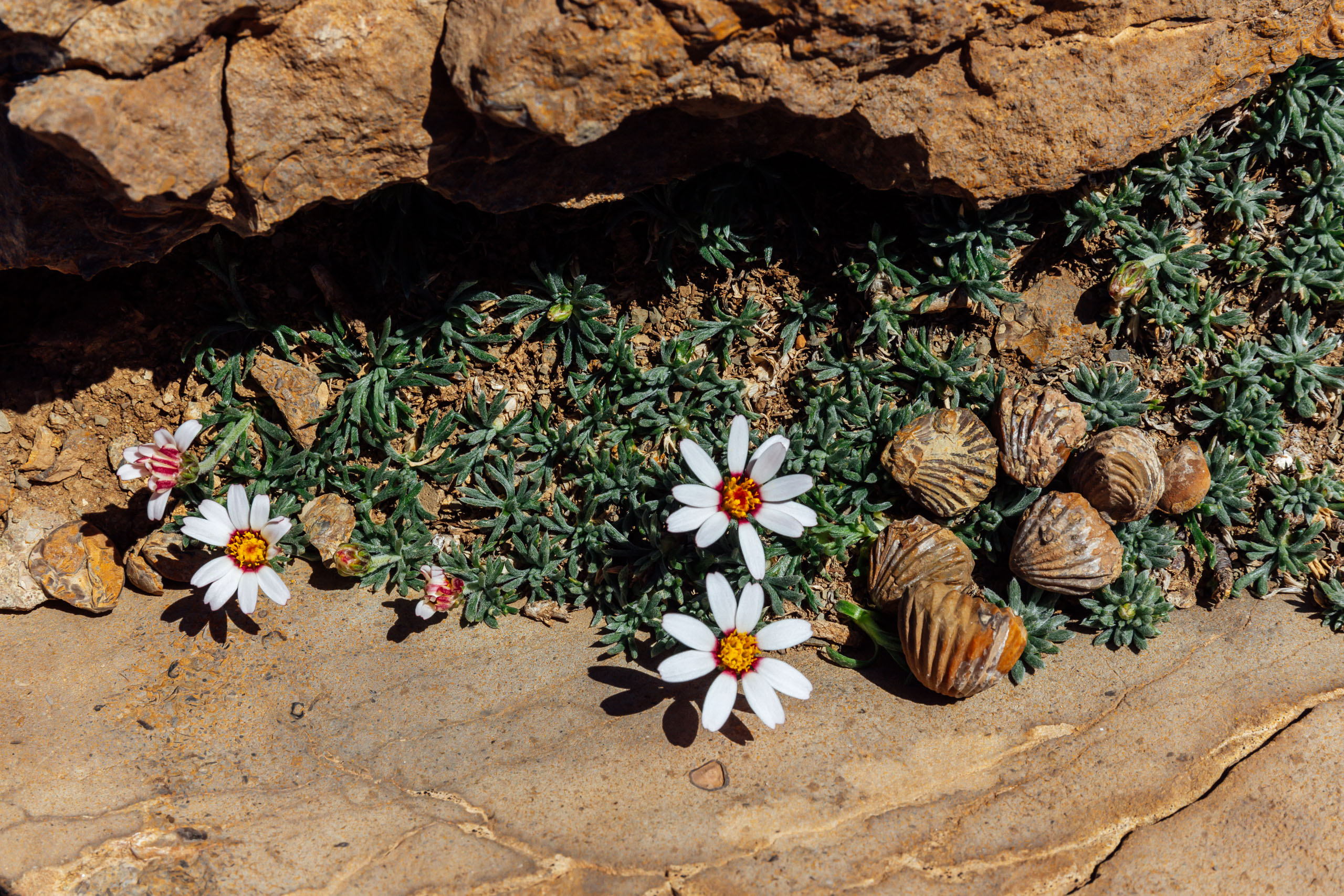
To preface, this route formerly existed as three disconnected segments—some of the first routes created on this website—which have been joined and reworked to make up the larger Morocco Traverse. The Route of Caravans (South) is a monumental bikepacking route that explores three distinct regions in southern Morocco, the first of which is the incredibly vivid Anti-Atlas Mountain range. It is one of the least visited areas in Morocco and a region of stark contrasts. High aromatic wildflower meadows at its red-granite peaks collide with the harsh expanse of the Sahara Desert to the south. From the heights of these mountains, ancient caravan routes—trading thoroughfares first established in the third century—funnel through mineral rich red cliff gorges with palm-filled oases and mud-brick villages at their floors. It is a spectacular place.
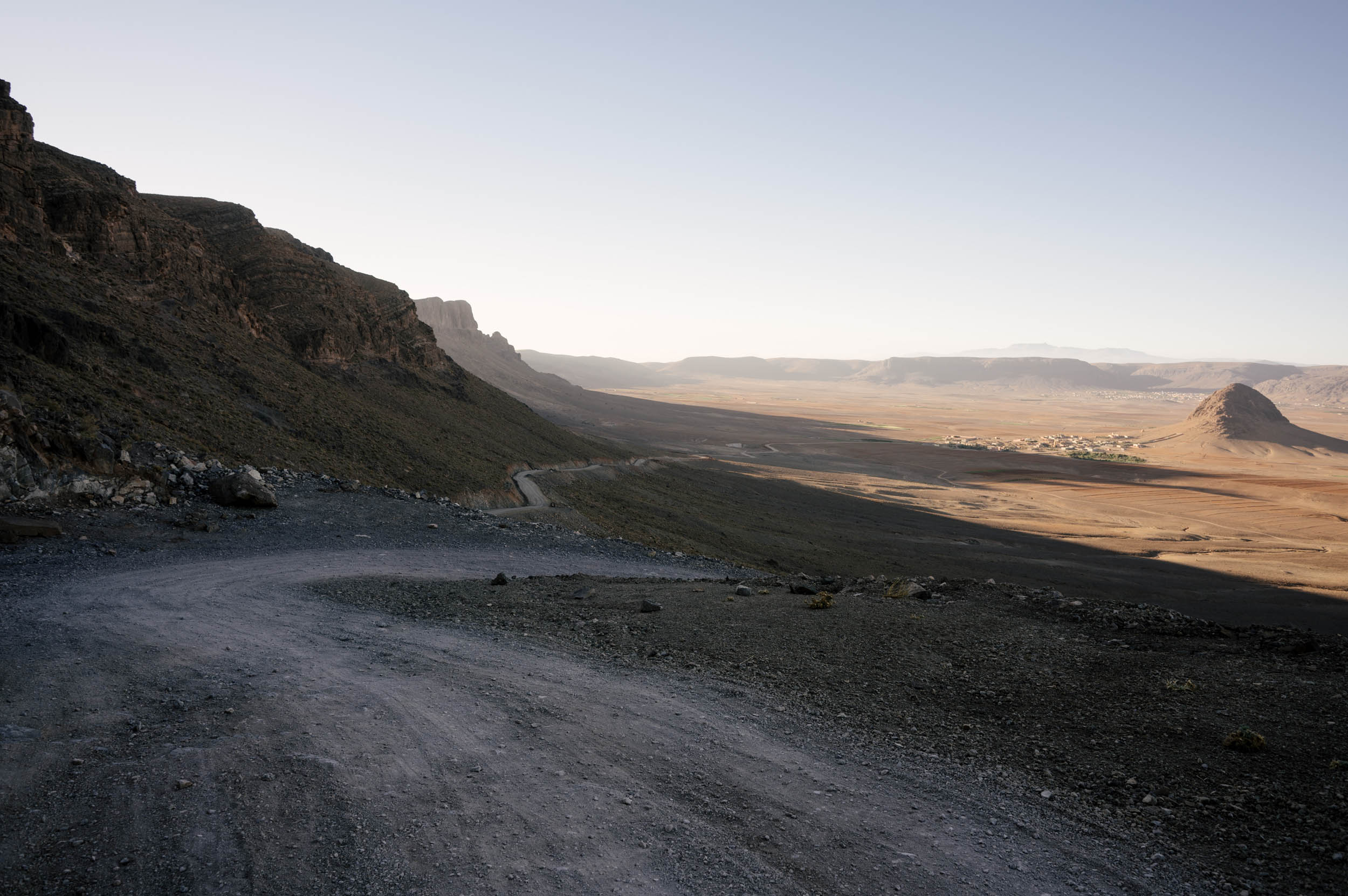
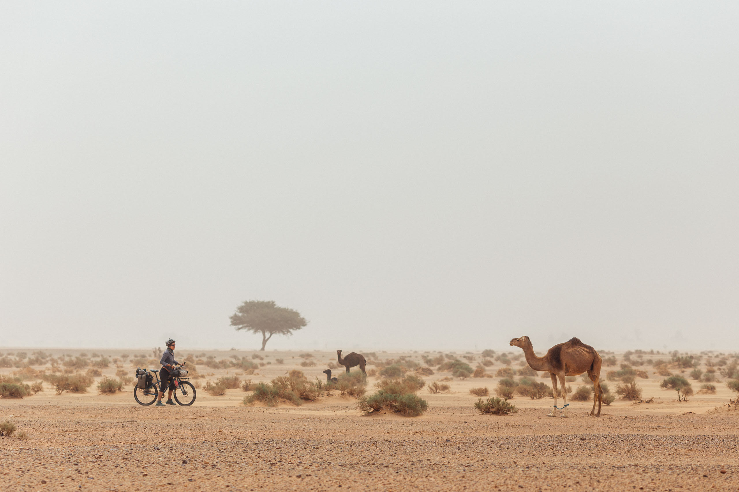
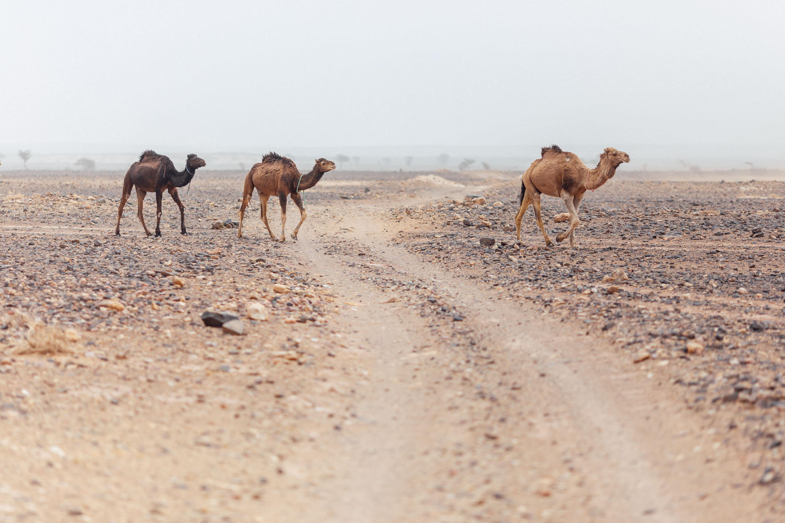
From the Anti-Atlas escarpment, the route drops to the edge of the Sahara. This section guarantees riders will find sand and camels with a slight chance of dust storms and flat tires. Despite its hazards, it’s also quite enchanting, with a sublime emptiness like nowhere else on Earth. Along the way, there are plenty of opportunities to experience geologic marvels, palmeraies, authentic and remote oasis villages, Amazigh culture, and incredible sand dunes. However, be warned, due to the heat and lack of water, this also makes for some challenging riding.
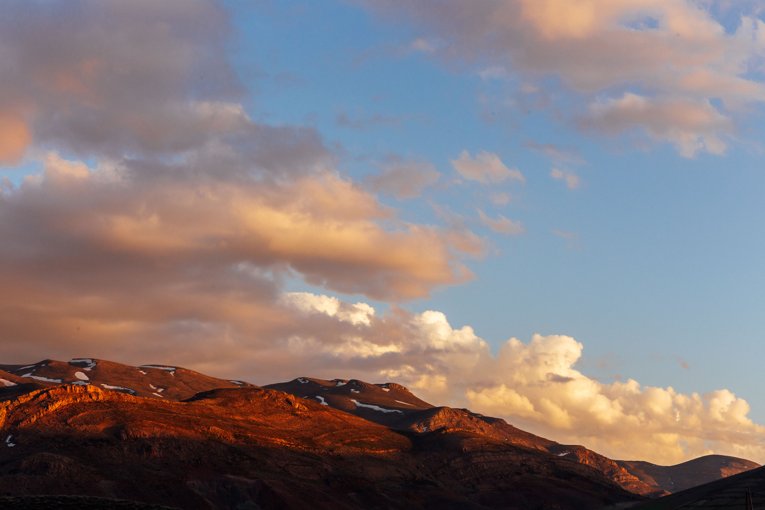
Once through the Sahara, the Route of Caravans takes riders on a slow climb north through the Draa Valley, a magical river valley lined with palm oases and ancient mud-brick kasbahs. It then begins its ascent back over the eastern Anti-Atlas Mountains, where the High Atlas range suddenly dominates the skyline with its 4,000+ meter snow-capped peaks.
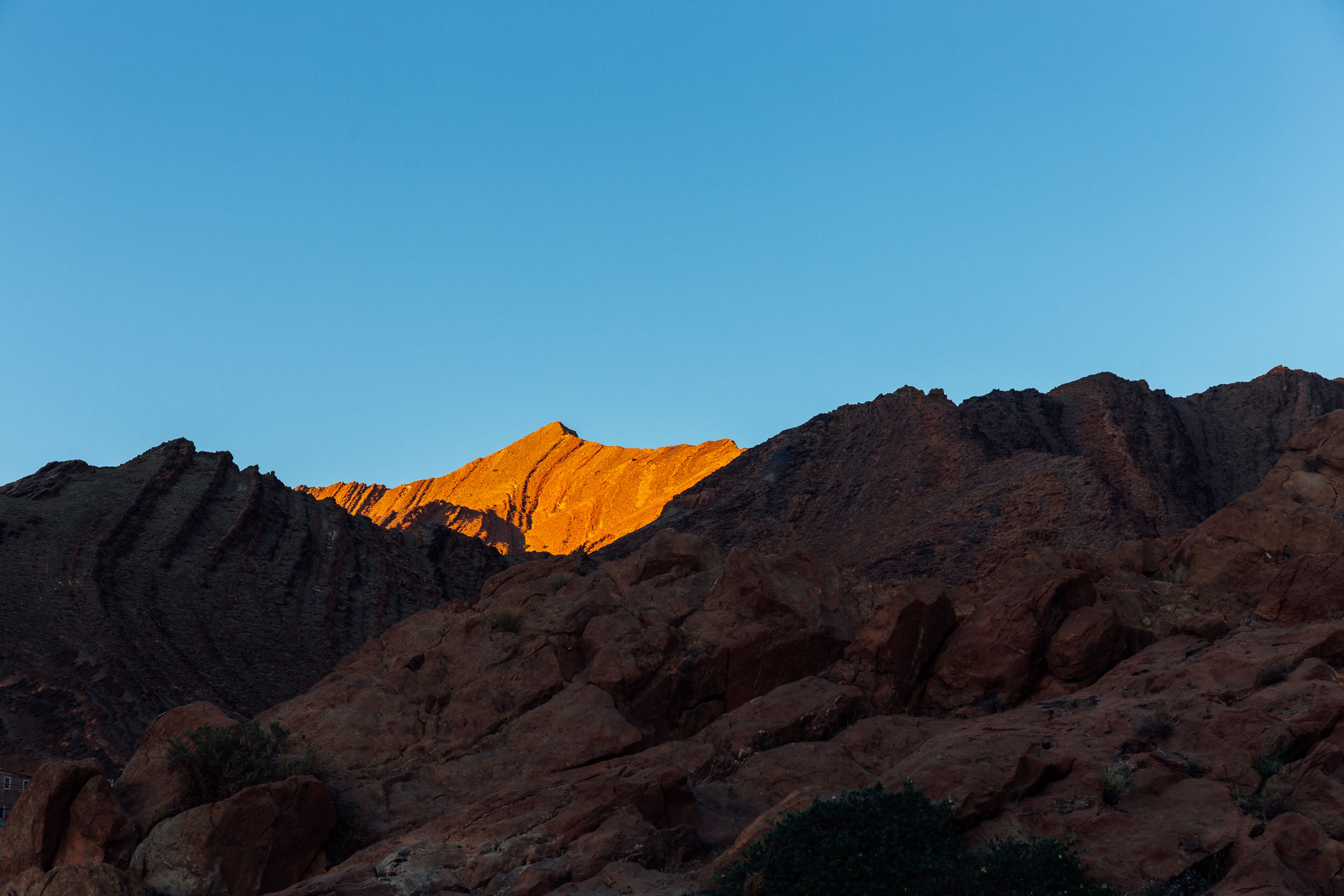
The Route of Caravans is designed to be ridden from south to north, in the spring, when the sky is a deep sea of cobalt, creating a tack sharp contrast with the reddish brown rock that zigzags across the horizon. The streams are swollen as the last traces of snow in the High Atlas are melted by the quickly warming air. The perfect time of year, when mountains beckon.
Ultimately, the Morocco Traverse will continue north to Tangier with a second segment of similar length. The southern section of the Route of Caravans segment ends in the small town of Imilchil, deep within the High Atlas Mountains. This actually makes a pretty good stop as there is a fairly easy exit point there. There are several ways this route can be ridden on its own or even in parts. See options in the Trail Notes below as well as a more detailed itinerary through each of the main segments.

Route Development
This route was originally designed and scouted by Logan Watts and Virginia Krabill in 2014 and was made to be a part of a larger, more complete (and coming soon) full Moroccan traverse. After several years of being heavily ridden and discussed, we have made some major changes over the years with a complete revision in 2024. We’d like to thank everyone who left notes and recommendations, especially Robin Thwaites, Alissa Bell, Humbert Campins, and the many others who contributed to the conversation. After scouting several options, we’ve also decided to overlap with a small portion of the Atlas Mountain Race route developed by Nelson Trees. We recently finished phase one of the northern tier from Imilchil to Tangier (via Fes) that connects with another one of our favorite routes, the Altravesur. Find that here.
Scouts wanted! Note that we have an option to reroute out of the Dades gorge and the Valle de Rose, and instead spend more time in the High Atlas taking in the famous Cathedral rock and a lot more dirt. Find details in the Trail Notes tab.
Route Difficulty: This route crosses a diverse collection of terrain, so there are varying degrees of difficulty at different stages. While there are a few spots with steep and rocky climbs, the overall route is more or less non-technical in nature. However, be advised that there are sandy stretches and very rugged tracks peppered throughout. The biggest challenge on route is having enough drinking water, especially during the section from Foum Zguid to Mhamid. This is the Sahara Desert, and it should not be underestimated. Sand storms occur frequently, and extreme dehydration is an ever-present possibility. Be well prepared, and check with locals before setting out. Also, make sure to read the Trail Notes below.
Submit Route Alert
As the leading creator and publisher of bikepacking routes, BIKEPACKING.com endeavors to maintain, improve, and advocate for our growing network of bikepacking routes all over the world. As such, our editorial team, route creators, and Route Stewards serve as mediators for route improvements and opportunities for connectivity, conservation, and community growth around these routes. To facilitate these efforts, we rely on our Bikepacking Collective and the greater bikepacking community to call attention to critical issues and opportunities that are discovered while riding these routes. If you have a vital issue or opportunity regarding this route that pertains to one of the subjects below, please let us know:
Highlights
Whereabouts
Must Know
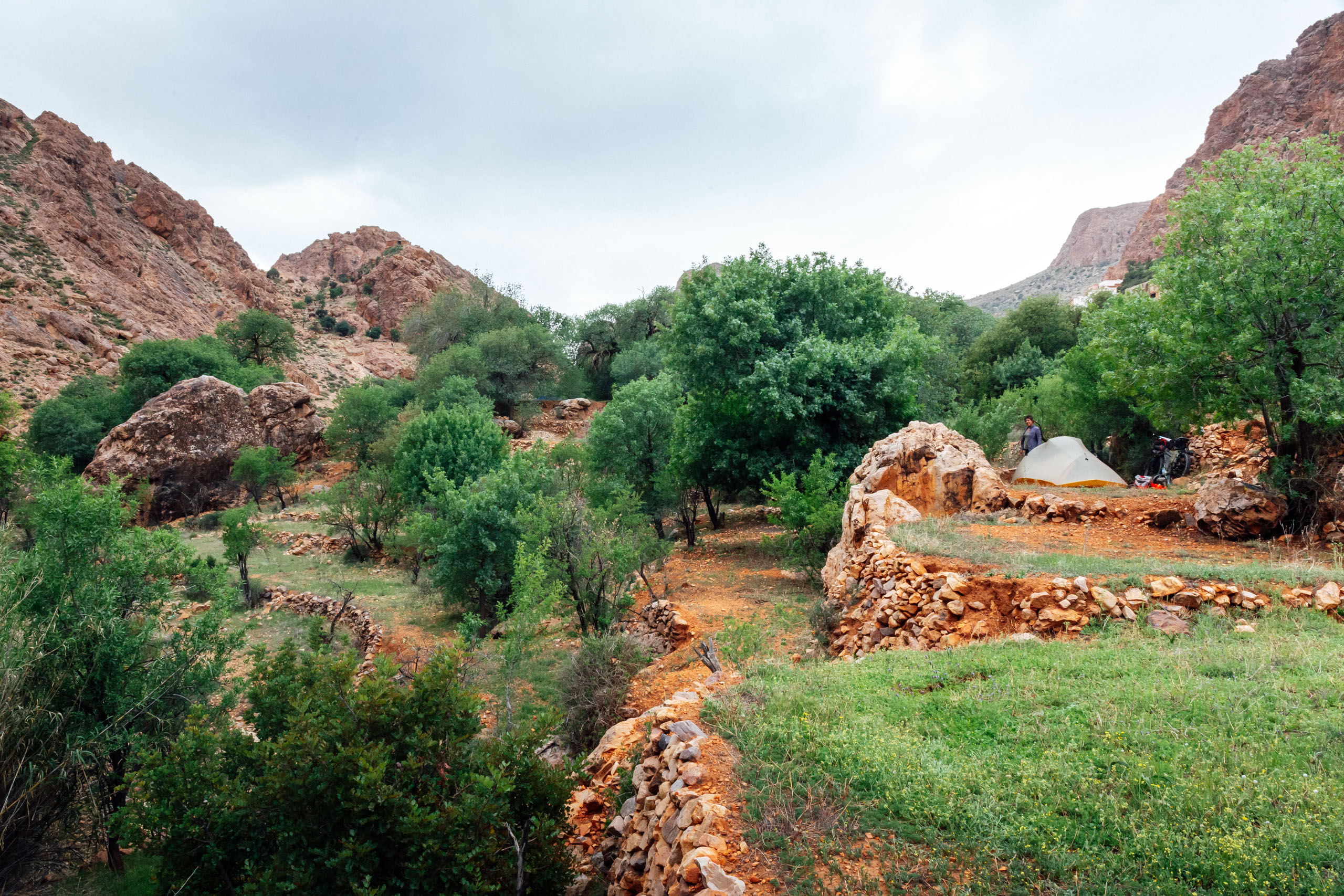
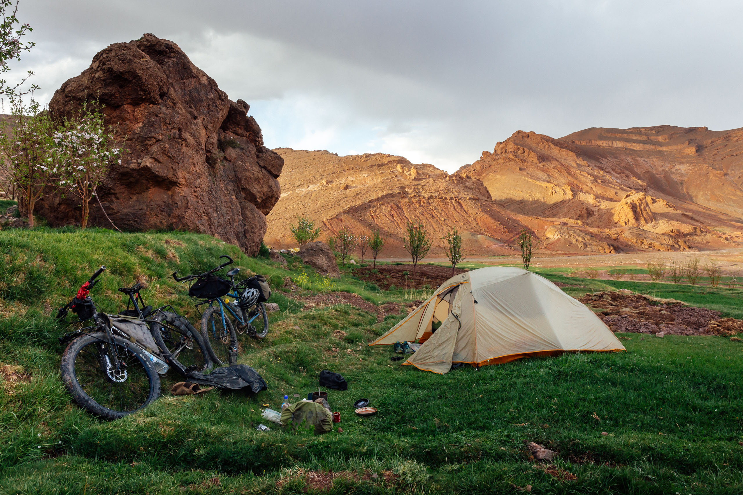
Camping
Food/H2O
Trail Notes
- The mesmerizing folds and peaks of the Anti-Atlas as they descend through oases into the Sahara.
- The crunching of piste in the empty silence of the Sahara.
- Foum Zguid and other interesting desert towns.
- Erg Chigaga and its amazing sand dunes.
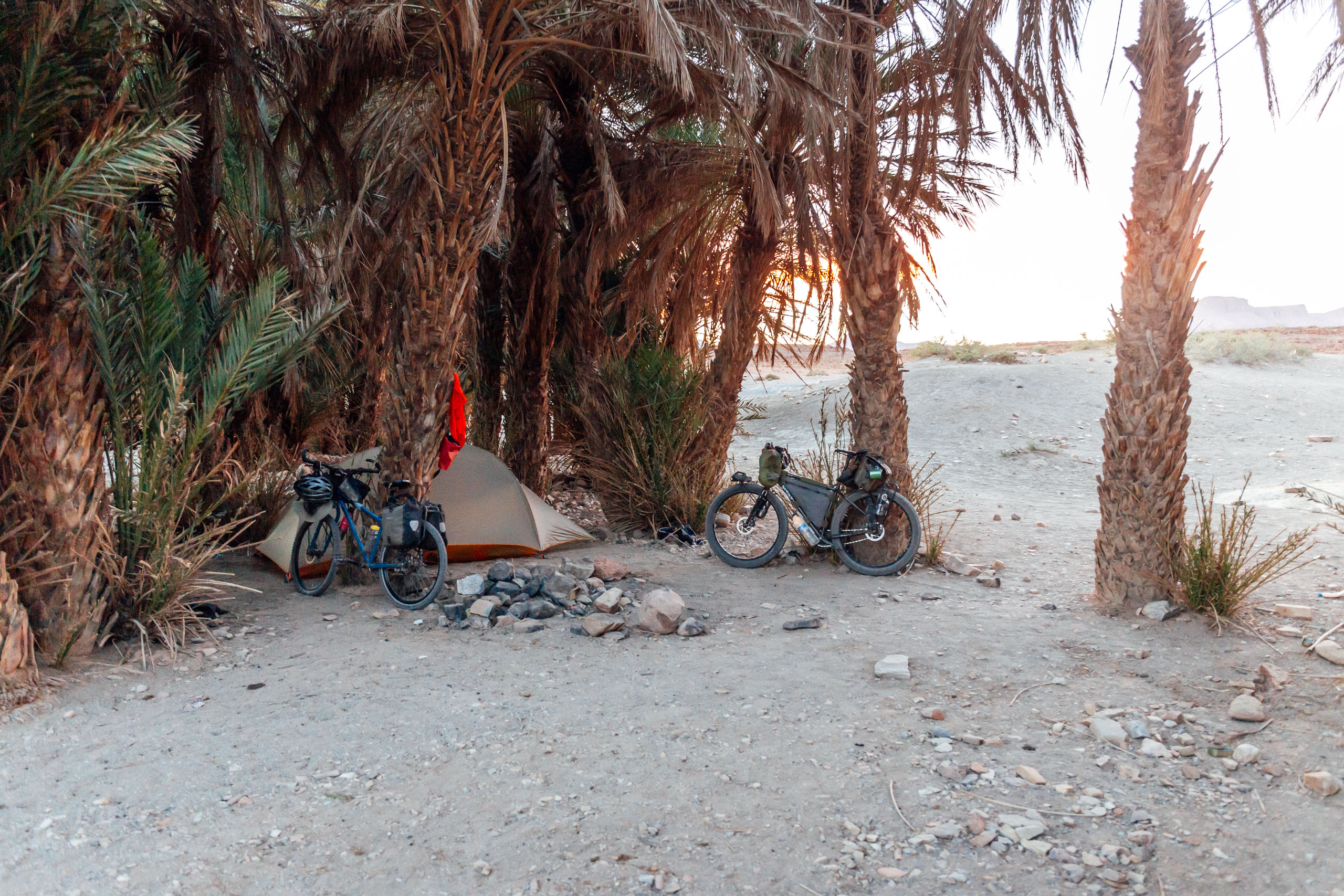
- Camping among oases, palmeraies, and ruins.
- Cycling through small villages and being greeted by countless locals.
- Invitation to Friday meals from friendly families across Morocco.
- Amazing mud-brick kasbahs along the route, such as Zagora.
- Passing camels and nomads.
- Beautiful roads that traverse the ever-scenic High Atlas with views of snow-capped peaks and endless wild flowers.
- Finding fossilized seashells at 8,000 feet above sea level.
Language Primer
by Evan Christenson
Paying attention and learning a bit of the local languages has been my most rewarding point of entry into the culture here in Morocco, so I wanted to write a few phrases down to help you begin your journey on bicycle and connect with the people you’re guaranteed to meet along the way. Learning someone else’s language is the easiest way to tell them you care and are interested in their perspective. It opens people up immediately. It is always worth the effort.
First, an explainer. There are several languages spoken in Morocco, but they’re broken into two categories.
The main language, what most government dialogue is done in, what most of the signs are in, what most people speak between themselves in Derijah. It is a regional dialect of Arabic, but is very derivative. A Moroccan person cannot go to Lebanon or Palestine and speak and understand the Arabic spoken there. Derijah uses a lot of slang, some French and Spanish influence, some Amazigh, and is very fast. Arabic languages have over 12 million words in them. The conjugations are incredibly difficult to understand.
Then there are the Indigenous languages. The indigenous people are called the Amazigh people. You may have heard the term “Berber” but as it’s derived from Barbarian, should be refrained from using. The Amazigh (pronounced ama-zeer) speak several dialects of Tamazight (pronounced Tamazeert). The most common one you’ll encounter is Tashelhaight. In the north, they speak Tarifeit, and in the desert, several other languages. We’ll focus on Tashelhaight.
In Morocco, 90% of people speak Derijah. A lot of people also speak a Tamazight language. Most people are Amazigh, but Derijah is more popular, especially after the previous king mandated it and shut down Tamazight education in schools (which has since been undone). In the mountains, the main language is Tamazight. In the valleys and cities, the main language is Derijah. Sometimes in the mountains, older people will not speak any Derijah. Most of the time in the cities you’ll only hear Derijah. Therefore, it’s important to know a little bit of both.
And re:French/English. French is the language of the colonizer and generally looked down on, but you will sometimes find it. Not always. English is now taught in schools, and the youth will speak it. Some are really plugged into internet culture and memes and that’s always funny to hear. In the north, you can find lots of Spanish speakers.
Confused yet? We’ll start with Derijah
Derijah
The introduction is a very important part of Moroccan culture. If this is all you learn, you’re fine. It’s a really fun interaction to master. And it’s almost always the same.
- Salam Alaykum – hello (literally, peace be upon you)
- Alaykum Salam – hello (and unto you peace)
- Labas? – how are you
- Kulshi mezyan, Labas aleek? – everything is fine, how are you?
- Hambdullah – thanks be to god
These words can be changed around, but they’re almost always mentioned. Also, aanya is a fun reply/question which just means “normal.”
*the kh is a very gutteral sound. Similar to Dutch. Practice makes perfect.
- Wakha – ok
- Shokran – thank you
- Brit – I want
- Britti – you want
- Pikkala – bicycle
- Ana karkeb pikkala – I am riding the bike
- Piste – a dirt road
- Trek – a road
- Trek Salama – travel with peace / go well / goodbye
- Kima britti- whatever you want
- Kima brit- whatever I want
- Nemshi – to go
- Brit nemshi le – I want to go to ___
- Bzef – add onto anything to say a lot/too much
- Shweya- a little
- Afak – please
- Marhaba – you are welcome
- Zween – nice/beautiful
- Sbaah al kheyr – good morning
- Sbaah al nord – (the reply^) good morning to you
- Lmaa – water
- Atay – tea
- Khobz – bread
- Zeit – olive oil
- Halib – milk
- Kawha – coffee (kawa kala is black coffee)
- Makla – food
- Bneen – delicious
- Brit nakol- I want to eat
- Brit nkheless – I want to pay
- Ana – I
- Nta – you
- Uhndi- I have
- Uhnduk – do you have?
- Mneen nta – where are you from?
- Ana mneen – I am from ___
- Mushy mushkill – no problem
- Marakhra – next time
- Sahabi- my friend
- Khoya – brother
- Wahid, jeuj, tlata, arbauw, khemsa – 1,2,3,4,5
- Schohn – hot
- Brrrt – cold
- Shutuh – rain
- Rrih- wind
- Shnaw meesick – what is your name?
- Smiti – my name is
- Nhulus – to pay
- Aadi – easy
- Sela – difficult
- Baid – far
- Kribe – close
- Nkheiyem fiha – a camping place
- Siyam – Ramadan
- Kee doowidsee nahark – how was your day?
- Kalb kabir- big heart (but means I like this a lot)
There are many blessings in the name of Allah to be used as words.
- Bismallah – when you get your food (thanks be to god)
- Laaouhn – when you say goodbye (May god protect you)
- Laafduck – to say thank you (May god give you health)
- Laa arhem walidi – to really say thank you (May god protect your parents)
A very easy way to get a smile and a handshake is to say “Talafarask” when you say goodbye to someone. It means take care of yourself in a very sincere manner. Take care of your heart and your health and your family. People always get a kick out of this. The reply is “Talafarask tentuh” which means you too. If you say it to a group, you say “Talafaraskom.”
Tashelhaight
Now, to move on to Tashelhaight, the language spoken in the mountains by the Amazigh people. When you ride through the Atlas, this is what you’ll find mostly. The alphabet is derived from Greek and is very different looking. It is also very regional. If you travel 300 kilometers, the words are totally different and people may not understand the things you’re trying to say. Therefore, we’ll keep this short.
The introduction you use Salam alaykum as well, but instead of “labas” you say “metaneet?” And instead of replying with “mezyne” you reply “behayre.”
- Salam Alaykum – hello (peace be upon you)
- Alaykum Salam – hello (and unto you peace)
- Metaneet – how are you (can shorten to “Ten-uh”)
- Behayr – good
- Am dakal – my friend
- Ihula – nice/beautiful
- Asameed – cold
- Ohulugh – tired
- Teerrmt – food
- Aghrohm – bread
- Aman – water
- Mays minj – what is your name?
- Tsh – eat
- Reergh – I want
- Estreet – do you want?
- Estreet ek awounouk? – do you want help? (Masculine)
- Estreet ekem awounouk – do you want help? (Feminine)
- Dheer – to go
- Eesd waha – can I ___
- Adorholgh – I will return
- Tsoueira – picture
- Daysa – a shepherd
- Keef keef – the same as
- Timinseween tesadayeen – good night
- Mate skardt – what are you doing?
- Menka stsdreet wasanuuk – how was your day?
Enjoy your ride, and your journey into these fascinating languages. The pronunciations are very hard, and have very different sounds than we’re used to with the Romantic/Germanic languages, but with practice, you can get there. I hope you have a nice ride in Morocco. I hope you make someone smile.
Talafarask Sahabi ✌️
- Getting to the route start: There are regular bus lines that run the eastern corridor of Morocco. The 10-hour bus ride from Casablanca to Tiznit will cost you about 240 dirham (65USD) via CTM, the largest bus line in Morocco (at the time of this writing). Busses will carry bikes on the roof or in the cargo hold. CTM charges 10dh per bike and up. Ours were still in boxes, so they were stored underneath. Before booking, check with CTM to make sure that your bikes will be accommodated.
- Route changes: We started our route in Agadir, but our course was slightly botched. We mapped this version from Tiznit based on a goal to evolve this route. We used simple dirt, gravel, and B roads for the first workaround, so it should be fairly straightforward. However, we are also open to suggestions. There are two other changed connectors, so make sure to read the Route Development section above and see the green arrow icons on the map.
- When to ride: The best time to ride this route is in the early spring (late February/March/April) or in the fall. Southern Morocco gets very hot, but there is also snow cover in the Atlas. It was designed to be timed with the cooler late winter/early spring in the south and allow time for snow to melt in the mountains. We started at the beginning of April, which seemed almost perfect for spring in the very high mountains. Starting in March would be ideal.
- Direction to ride: As mentioned, the route was designed to be ridden from south to north and ultimately connect with the Altravesur in Spain to form a larger route. The ROC could be ridden in from north to south as well. This would likely require an autumn start in the Atlas, however, which would make it slightly difficult to get to the start.
- Mechanicals: There aren’t many modern bike shops in Morocco outside the bigger cities, so be prepared. There are many thorns and spines in the desert; we had eight flats in 24 hours (some were due to faulty tubes); make sure you run tubeless and bring plenty of spares and patches.
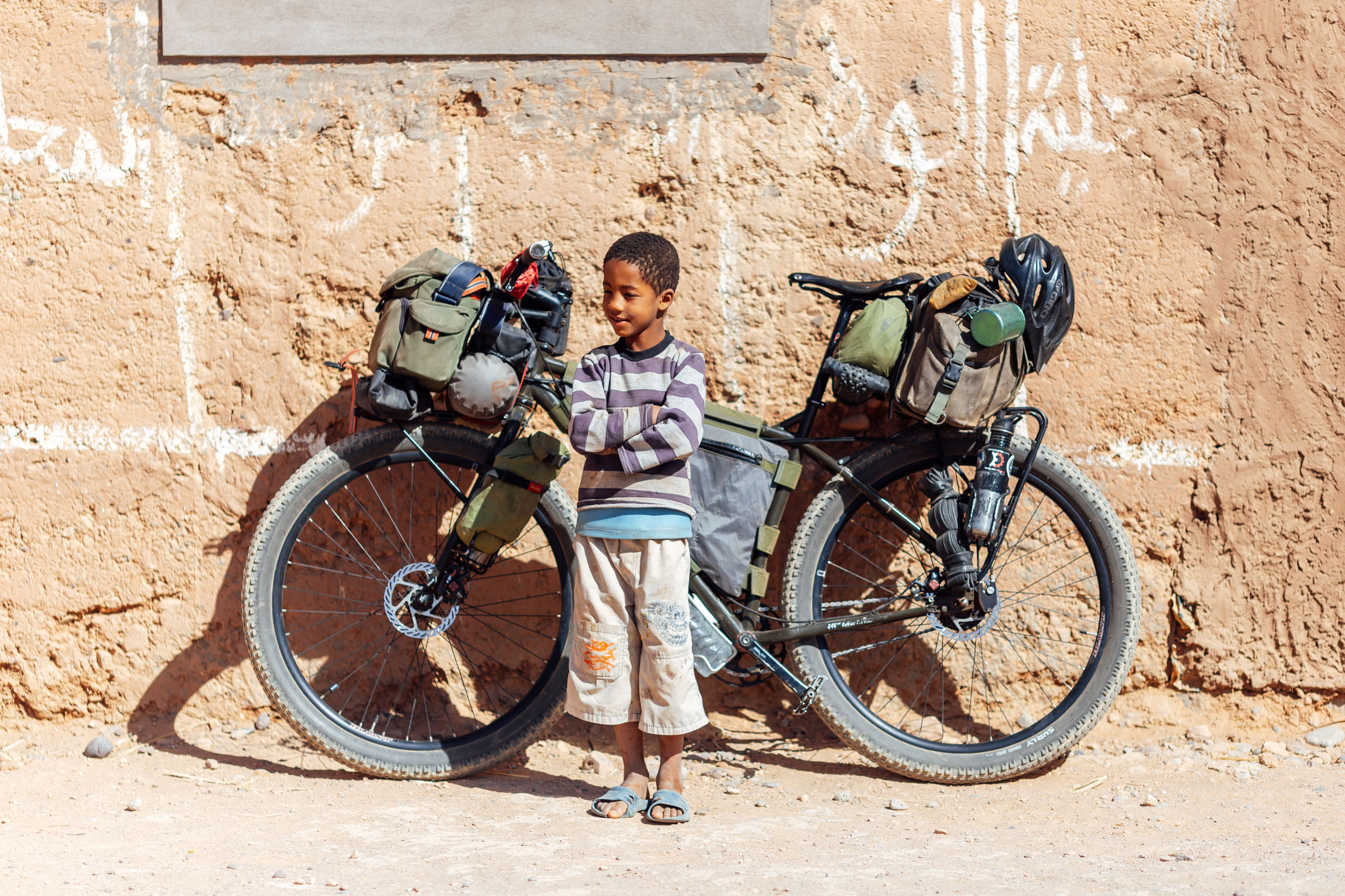
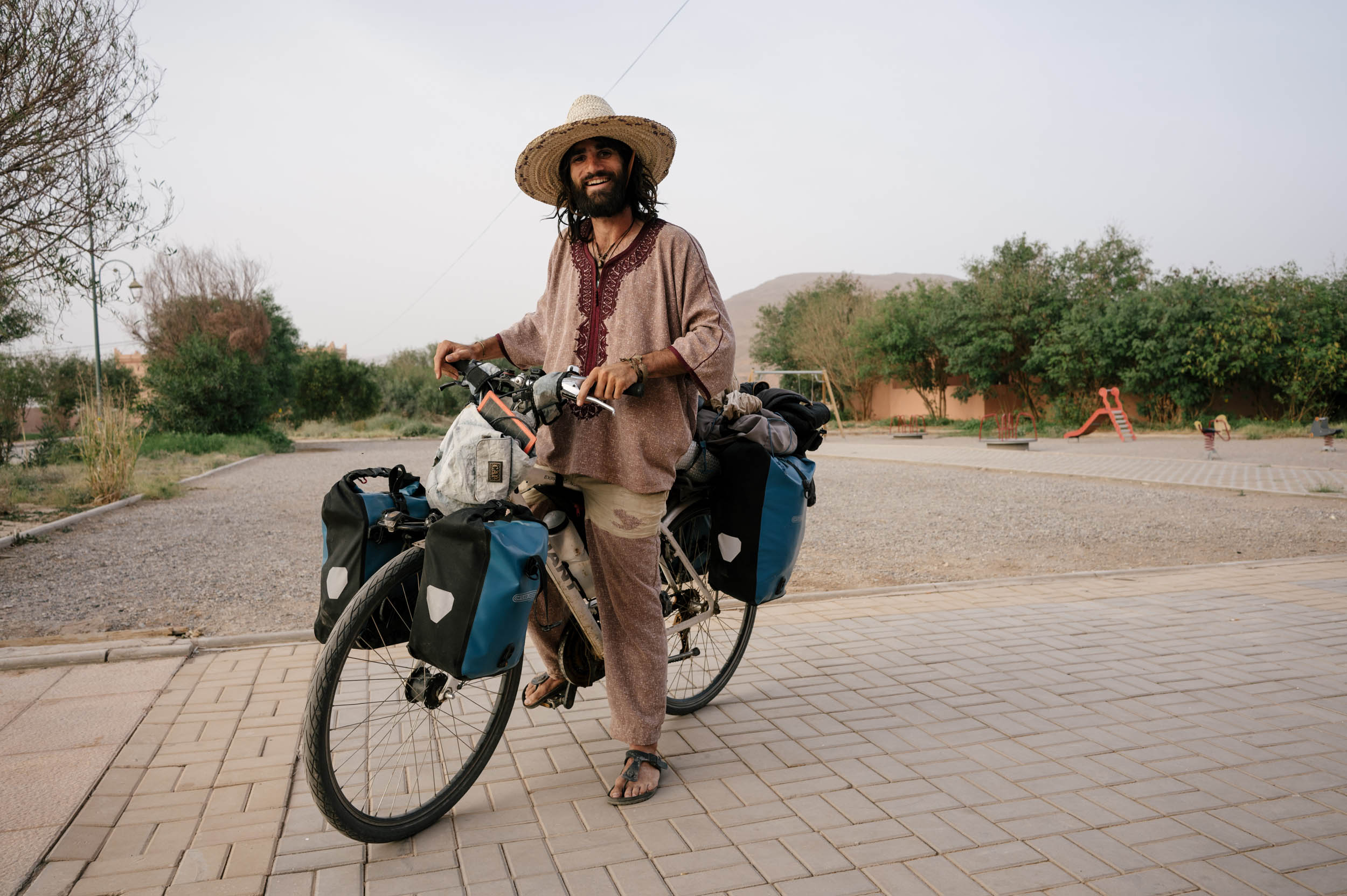
- Hassles: The children in villages can be aggressive on occasion. They are notorious for grabbing the bike as you are moving, chasing you down, and occasionally throwing rocks. In my opinion, irresponsible tourists are at least partially responsible for this type of behavior. Handing out gifts to children promotes begging, discourages education, and ultimately hinders tourism and the local economy.
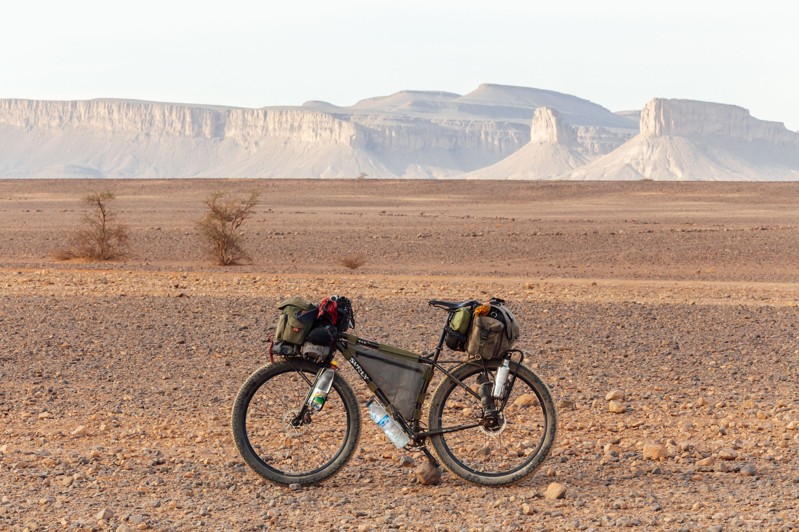
- Tire size: It is highly advisable to use plus-size tires on this route. You could get away with standard 2.1″ mountain bike tires, but you will likely be pushing in sand on several occasions. There are a lot of rough and chunky dirt roads as well as sand along the ROC. No, this route is not doable on a cross bike.
- Don’t forget: A Buff. It can get very dusty in the desert. Also, make sure to have plenty of water storage capacity. We carried over eight liters each through the Saharan section.
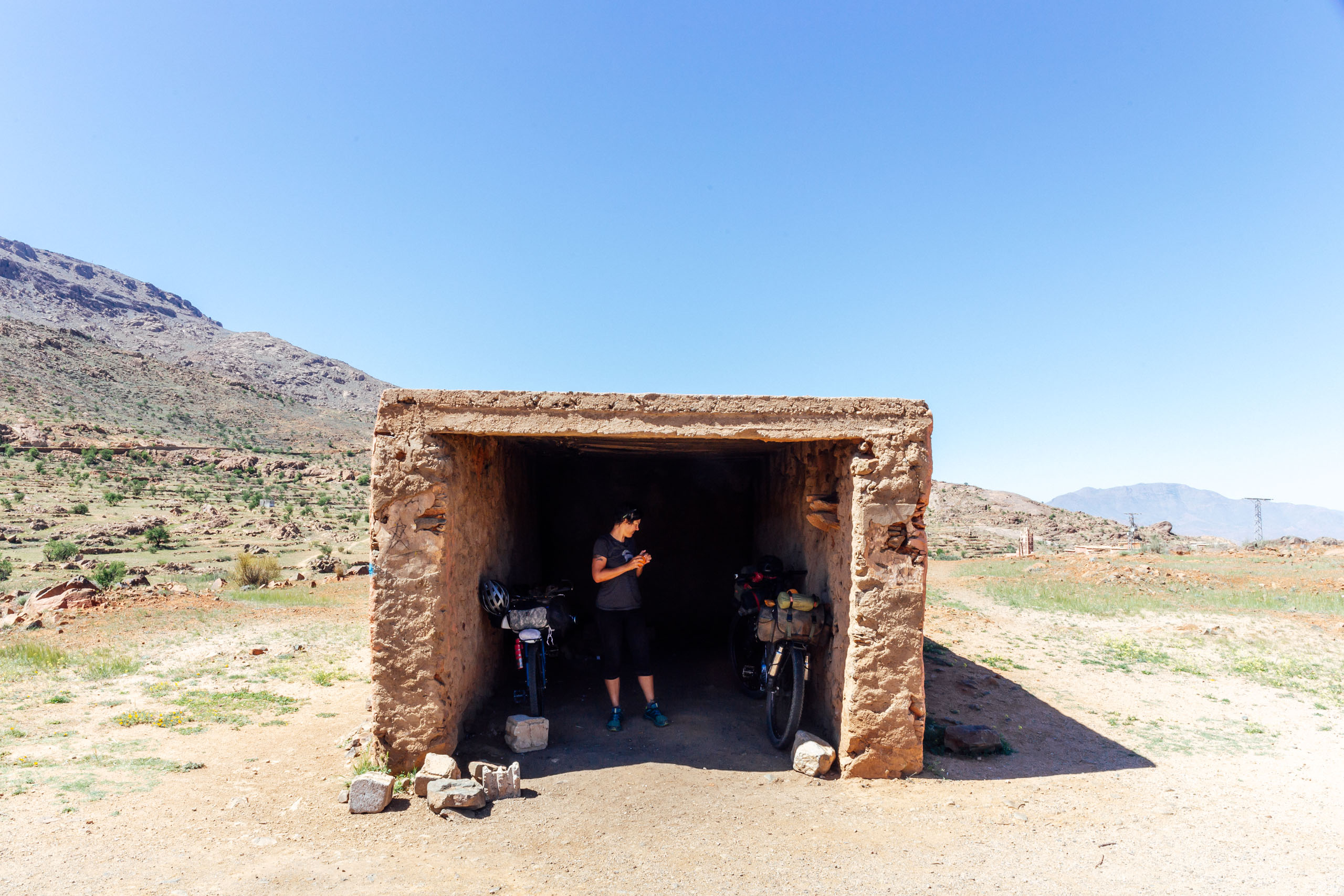
- There are guesthouses and auberges in Tiznit, Tafroute, Monsour, Zaouia Timguidcht, Tata, Foum Zguid, the flats of Iriki, Mhamid, in both Zagora and Agdz, Imilchil, as well as other small towns along the way.
- Expect to pay anywhere from $15-60, and up, depending on the location and your desired level of comfort.
- In the desert, we were told it is okay to camp anywhere.
- There is an oasis near Tata with free camping; it’s marked on the map.
- There are also plenty of wild camping options. If you camp in an oasis, ask someone if it’s okay (if you happen to see anyone).
- There are plenty of lodging options around the Dades Gorge that are fairly inexpensive.
- In the Atlas, wild camping is available in the more remote sections, but it’s often tricky as much of the land is very arid and desolate.
- Wild camping is harder to come by near civilization as much of the land is farmed. We found a couple of places by asking local farmers. Most of the time, they have no problem with it.
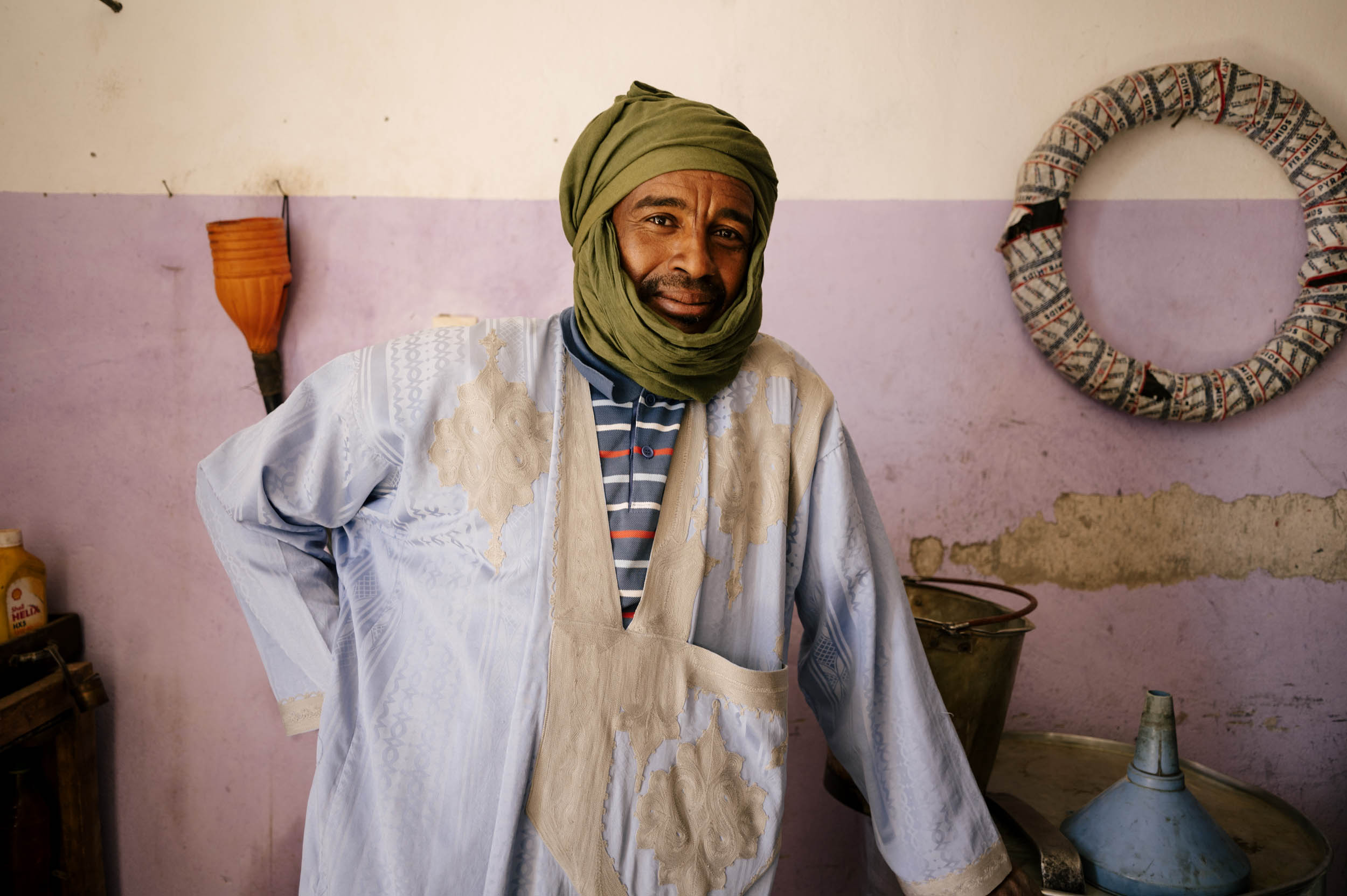
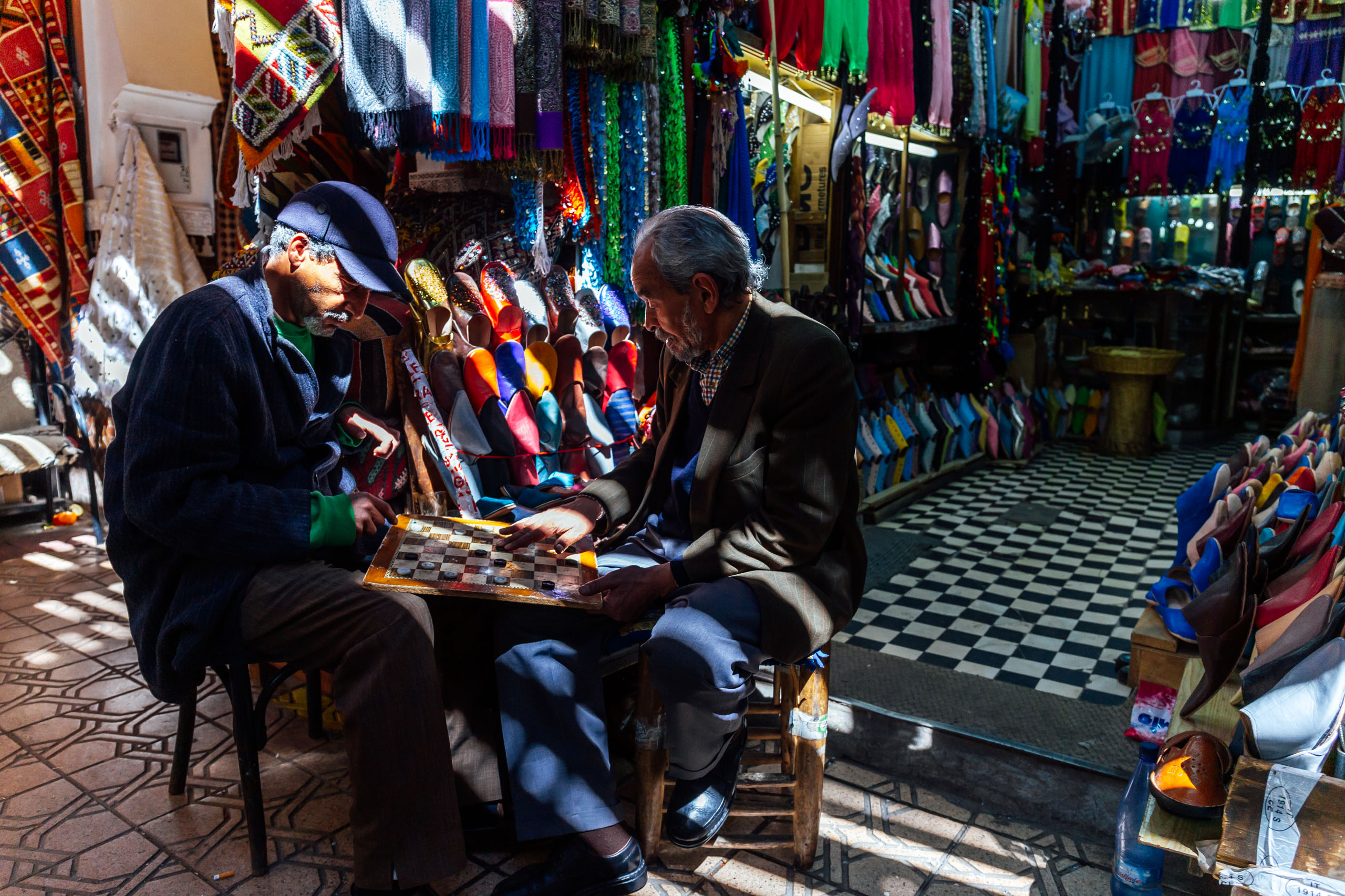
- The Moroccan people are incredibly hospitable. You will most likely be invited to a family meal at some point during your travels. Graciously accept the offers, as these experiences are likely to be the most rewarding of your entire trip.
- The three places where food and water are scarce are from Tiouadou and Imitek (40ish rugged miles), the desert section between Foum Zguid and Mhamid, and the massive climb from the Draa valley at Afra to the Oued Dades.
- We carried about 7-8 liters each in the Sahara. I would advise more if possible; consult the map and analyze the terrain based on your personal water needs.
- There is a small village in the hills below the escarpment around Lake Iriki that has water, but you will need to carry all of your food and water on that stretch.
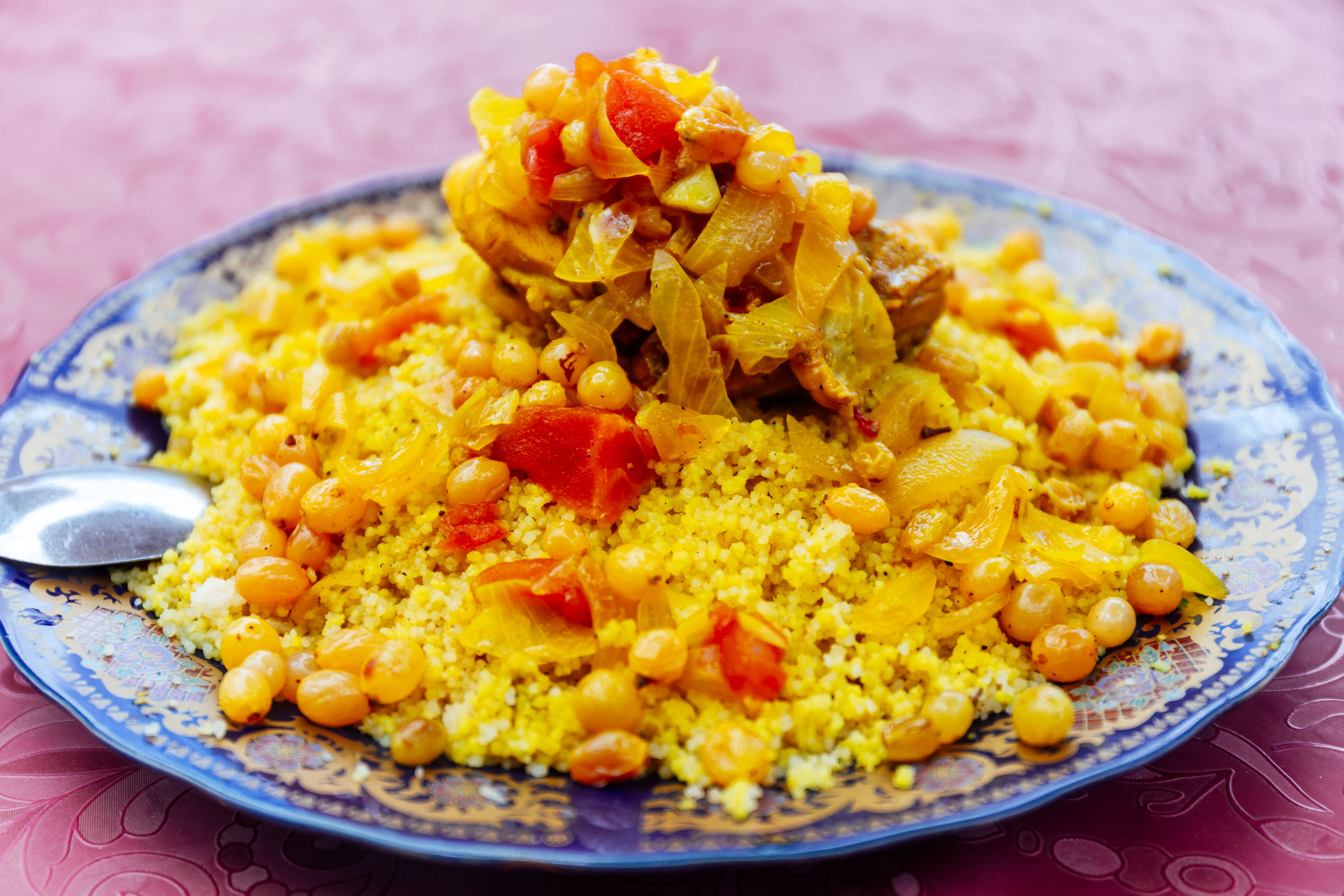
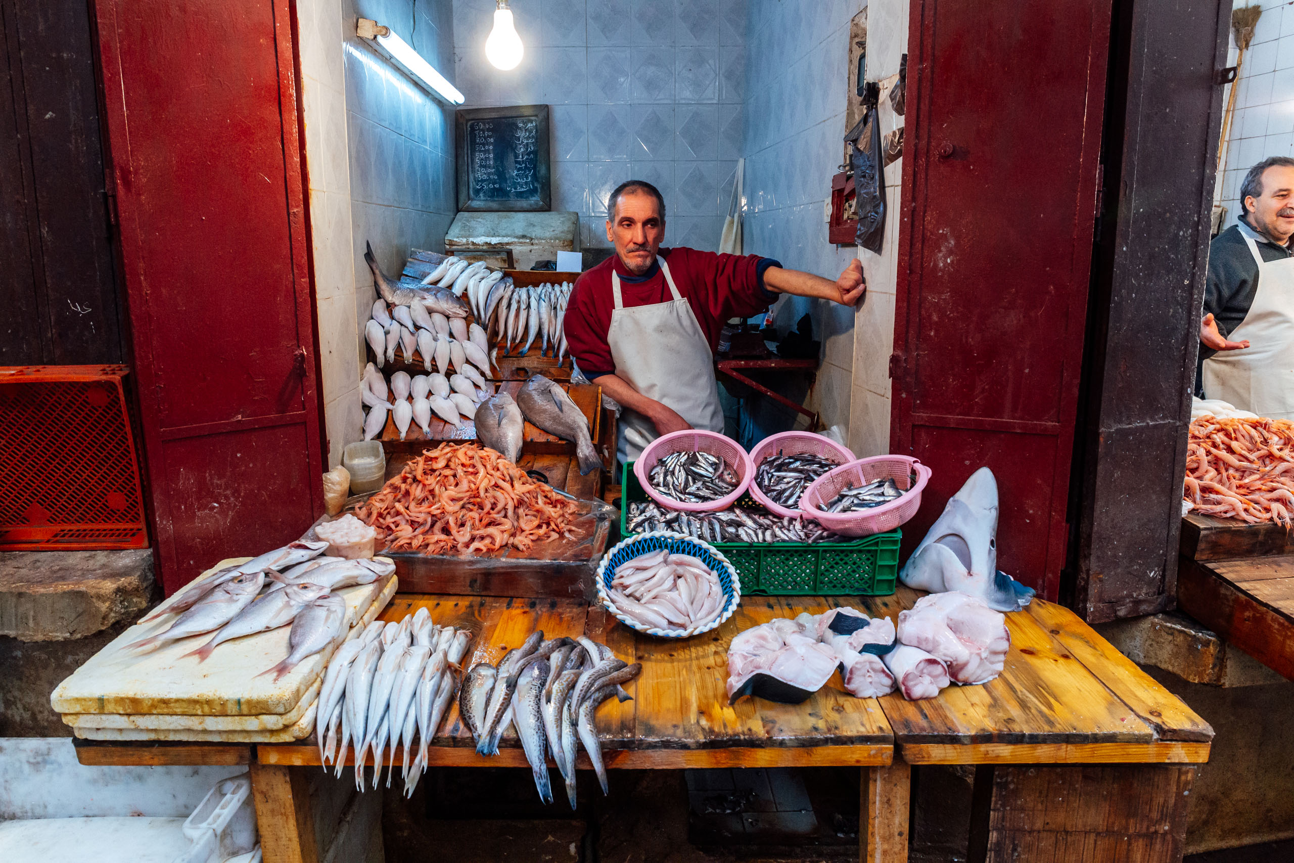
- There are food options and shops in the larger cities and small shops in many areas between. Lentils and rice can be found in even the smallest of shops. Guests and non-guests alike can purchase inexpensive and hearty meals at auberges.
- Along the Oued Draa, water is ever-present in the river, and there are plenty of wells all along the way too.
- There is very little food available from the end of Dades Gorge until Imilchil. There are a couple of small villages with shops, and even a campground along the way, but in our experience, they tend to be closed when you need them most.
- Alcool à brûler (for alcohol stoves) is best found in open markets; look for the guy selling gasoline. It can also be found at hardware stores. It’s best to bring your stove with you to show them what it’s for.
While the Route of Caravans can be ridden in either direction—and may even be a little more fun from north to south, where it would be trending downhill—it was designed to be ridden in the spring, from south to north, allowing the snow to melt in the High Atlas Mountains. This would also make for a smooth transition to the Northern section.
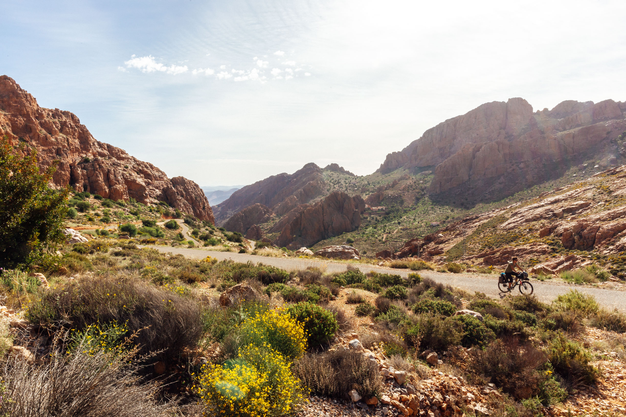
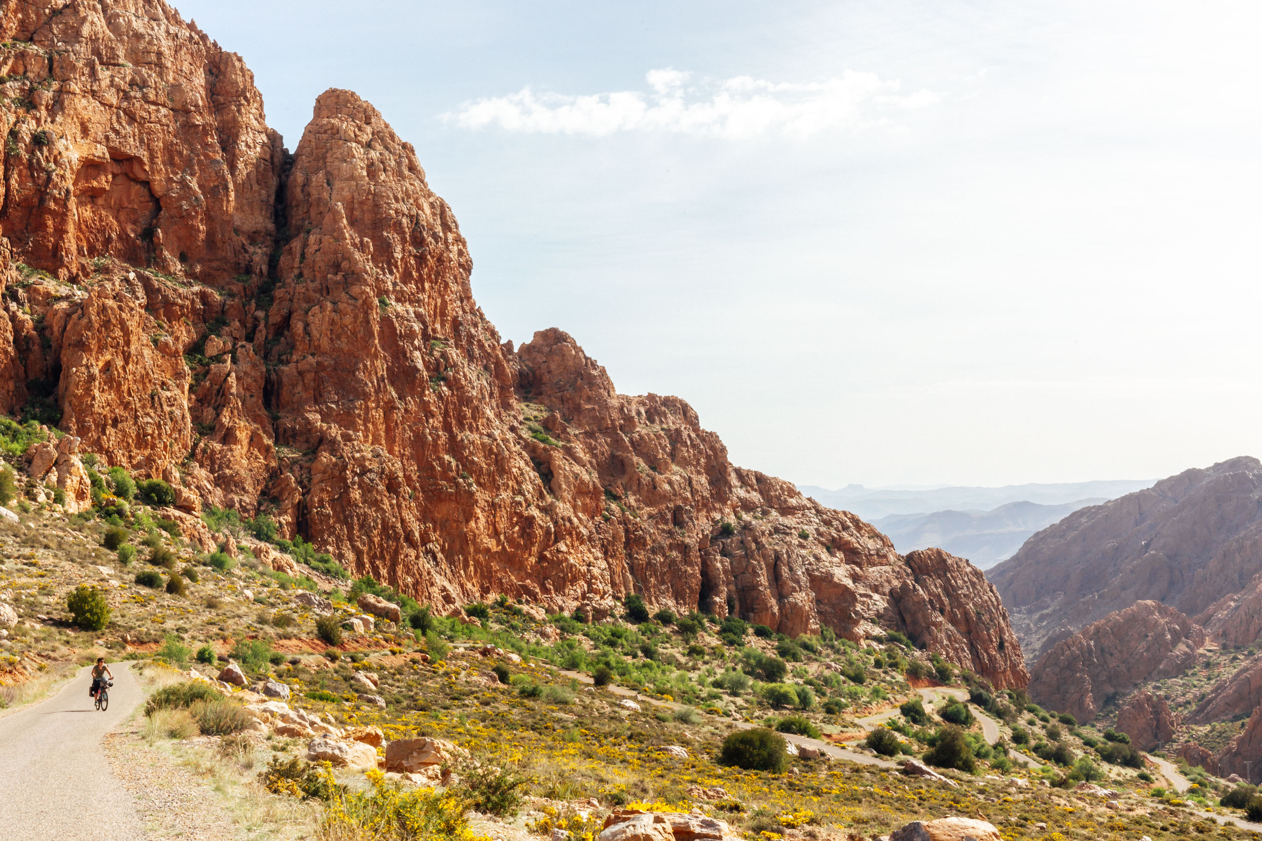
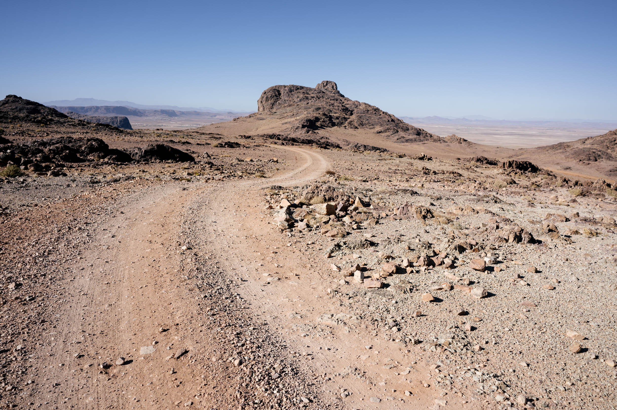
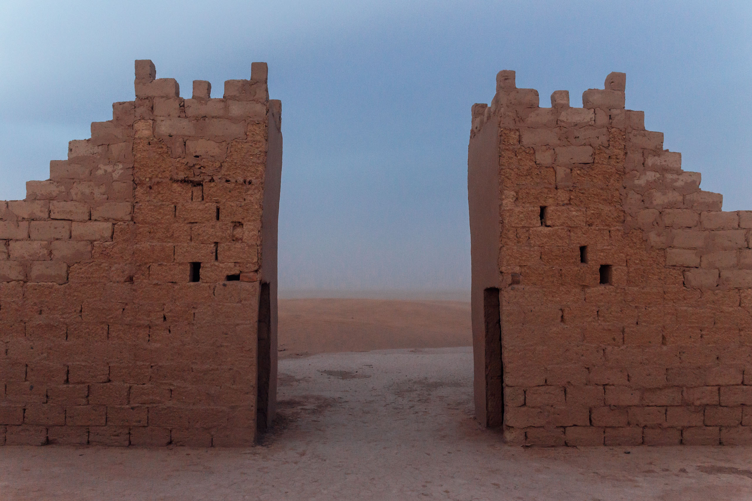
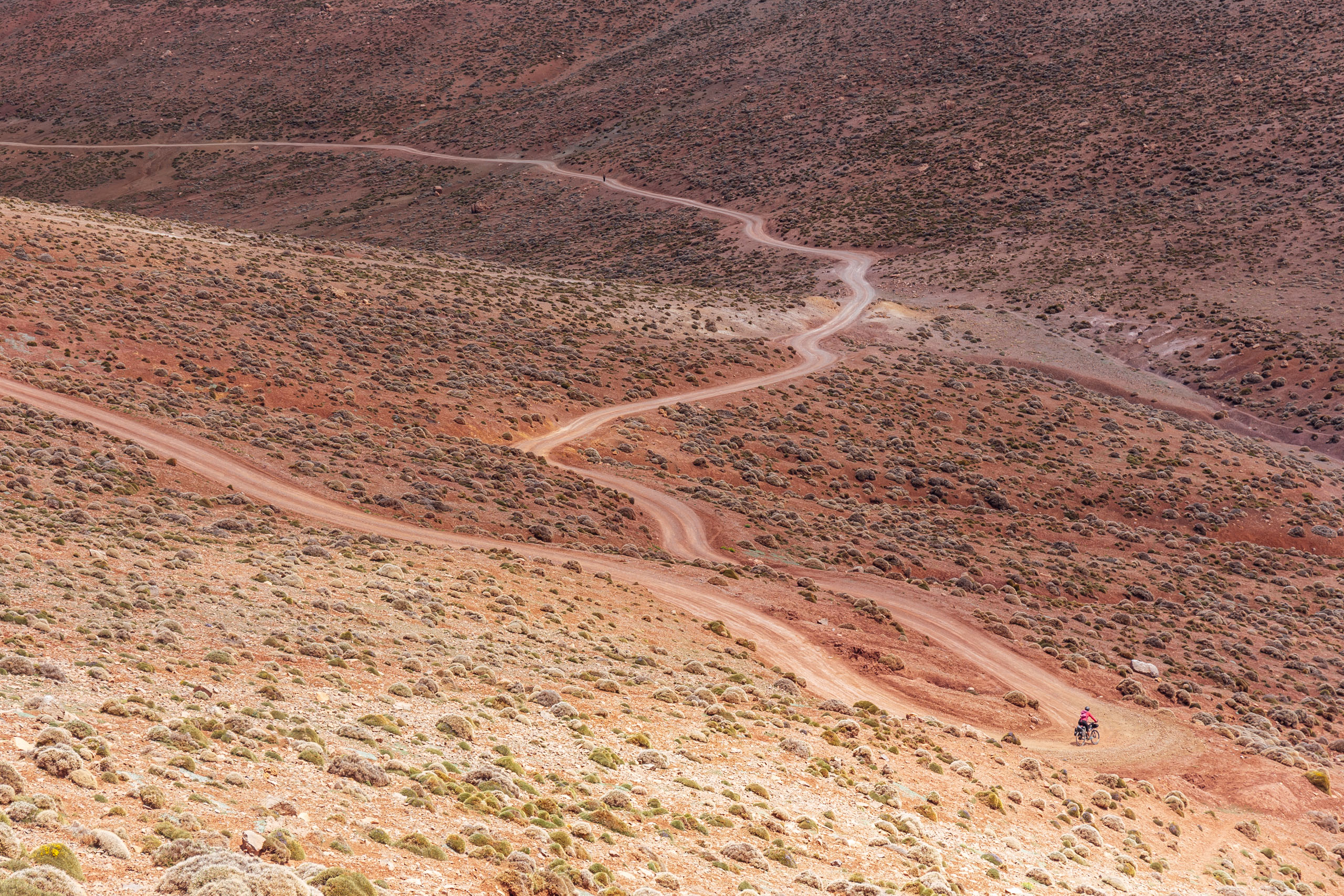
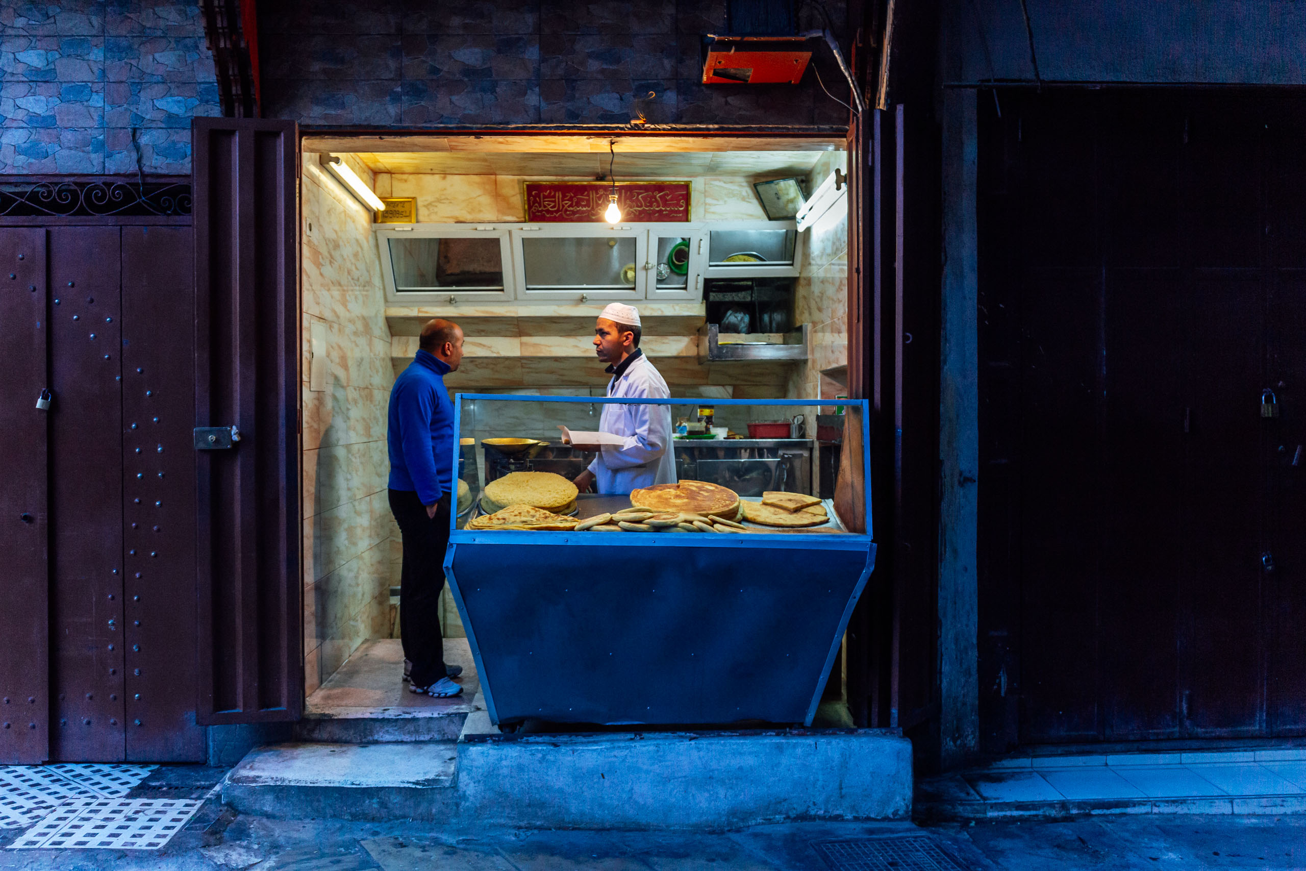
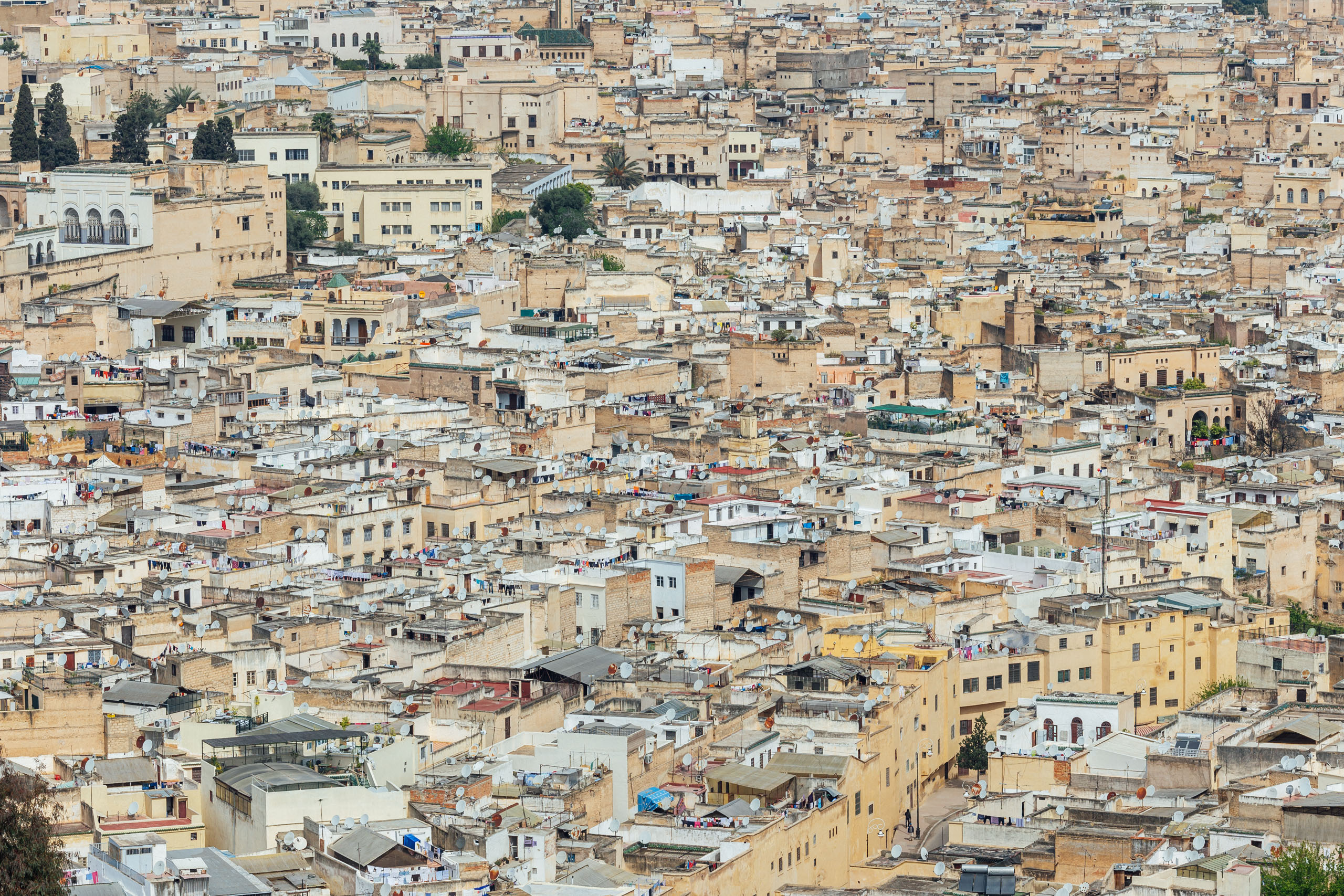
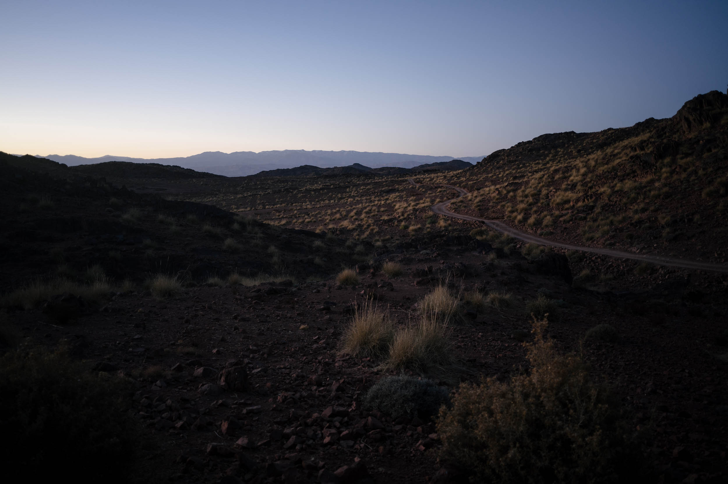
THE ANTI-ATLAS (FROM TIZNIT TO THE SAHARA)
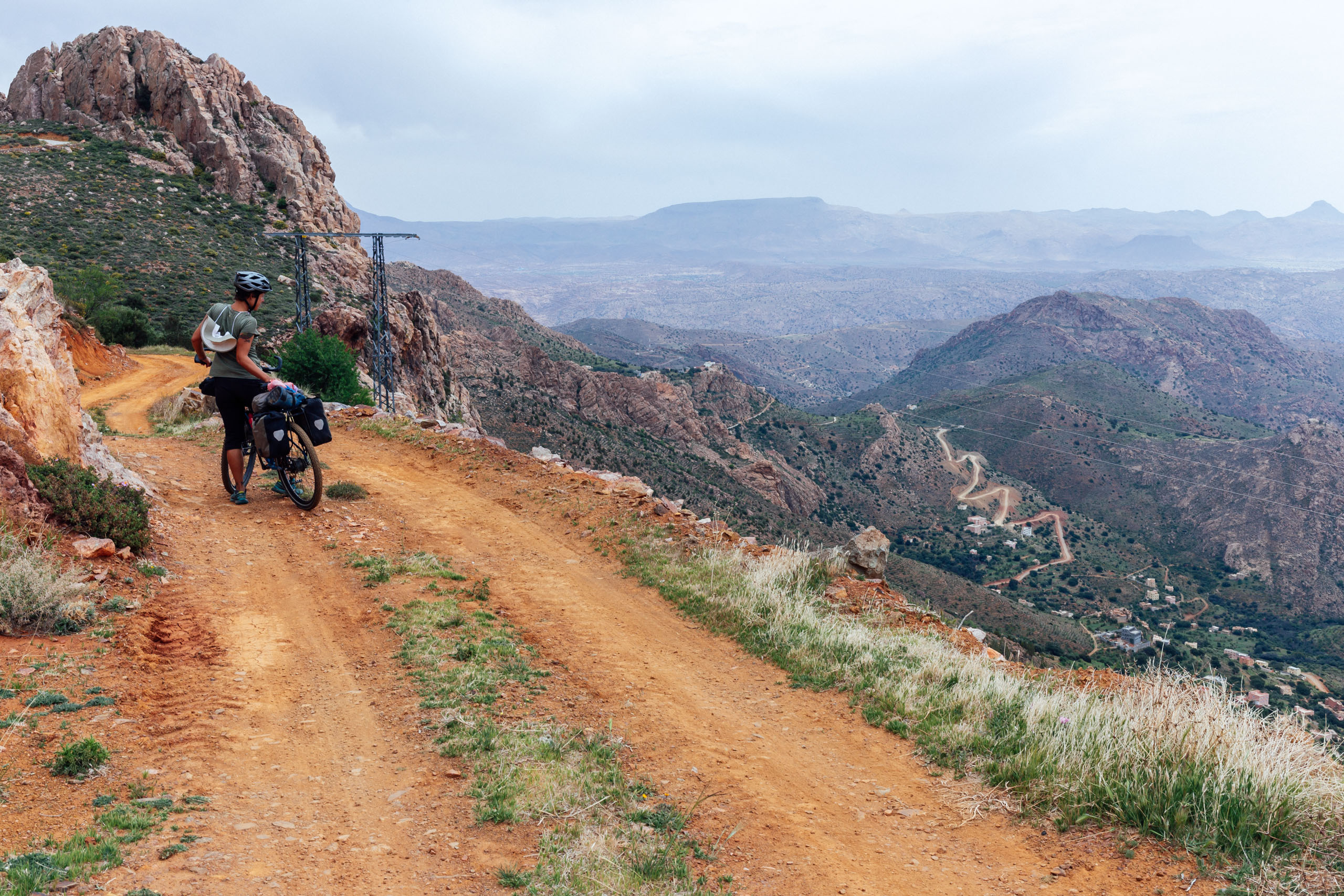
The Route of Caravans starts at La Source Bleu, a historic fountain in the old medina of Tiznit, a town of about 75,000 known for its historic charm and Amazigh jewelry. From there, the route leaves the city and quickly finds its way into the country via tertiary roads and dirt tracks. As with many bikepacking trips, the first day will likely be among the most difficult. Those words ring especially true on the Route of Caravans, as it quickly ascends from the coastal plain into the Anti-Atlas Mountains. On day one, if you are very strong, you can get to the first marked campsite (wild camping). However, this would be a huge day of climbing. If you aren’t quite up to it, there are additional wild camping options several miles after a resupply in Anzi.
Note that once the route turns to dirt after Anzi, a particularly steep ascent and descent goes over a lovely pass. However, if you are on a heavily laden bike and not interested in the scenery, you may choose to take the road around. See map for details.
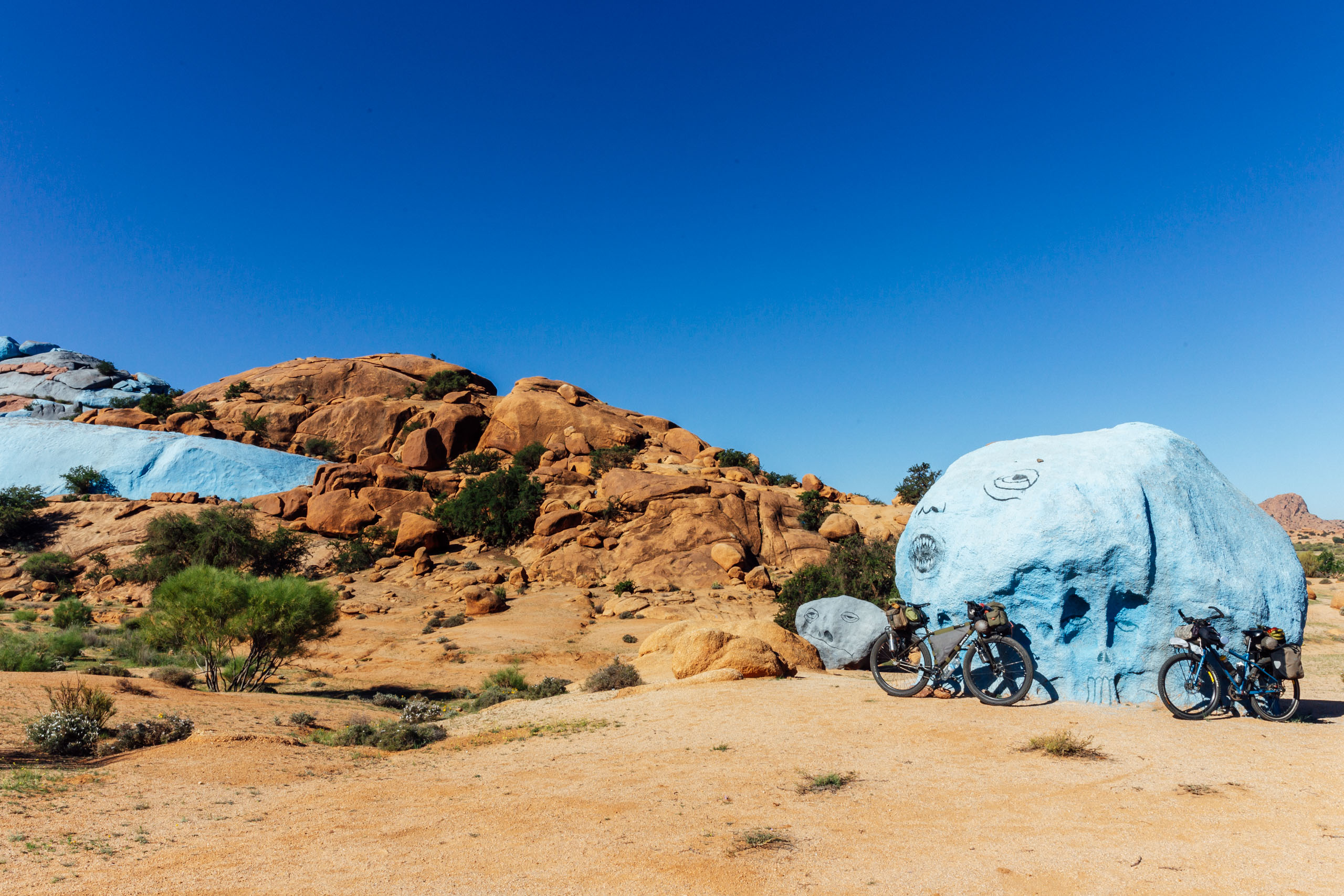
After dropping down from the higher Anti-Atlas, the route meanders into the bustling town of Tafroute, the center of the southern Anti-Atlas. You may stay in town or find a camping spot just outside town, where it joins a dirt road. This leads to the Painted Rocks, an art installation on the edge of town comprised of giant boulders covered in light blue paint. It’s well worth a look.
The next 15 miles dish out a hearty 3,000-foot climb that eventually gives way to a freewheel down the escarpment. There are two options you can take here. The ROC follows a lesser road that gives way to dirt and gravel, leading through Taghaout and continuing to Tizerkine. We later learned about this passage from other cyclists and opted to add it to this route. However, during our trip, we unknowingly took the alternate paved road through Vallee d’Ait Mansour, a beautiful oasis surrounded by dramatic red cliffs. However, this way is paved, more touristed, and requires a little jog north to rejoin the route and a final resupply, so we recommend staying on route. From there, the road ebbs and flows before dropping the final escarpment to the edge of the Sahara.
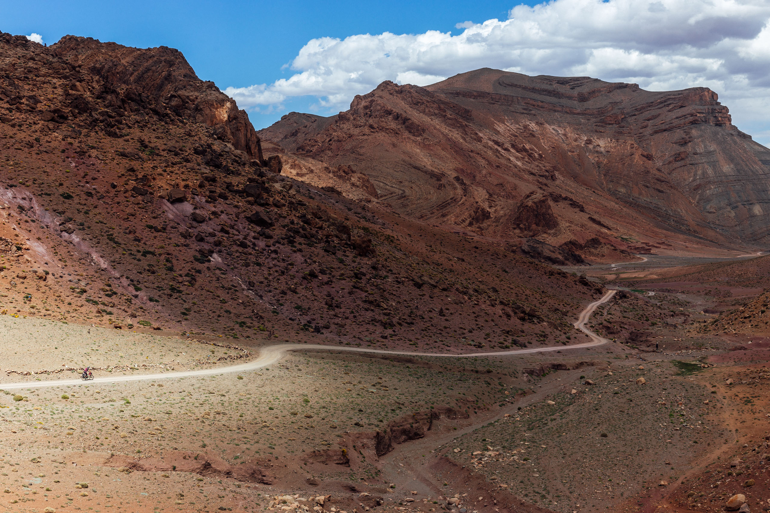
THE COLONIAL ROAD (ESCARPMENT TO TAGOUNITE)
We have rerouted the southern section of the route further north into the Anti-Atlas along the infamous Colonial Road. We believe this to be a better way to traverse east, as the old route was shut down by military activity. Note that if you want an easier ride, the highway from Tata to Tissint is still nice to ride, but it is just a bit busy at times. We have elected to take the more difficult way.
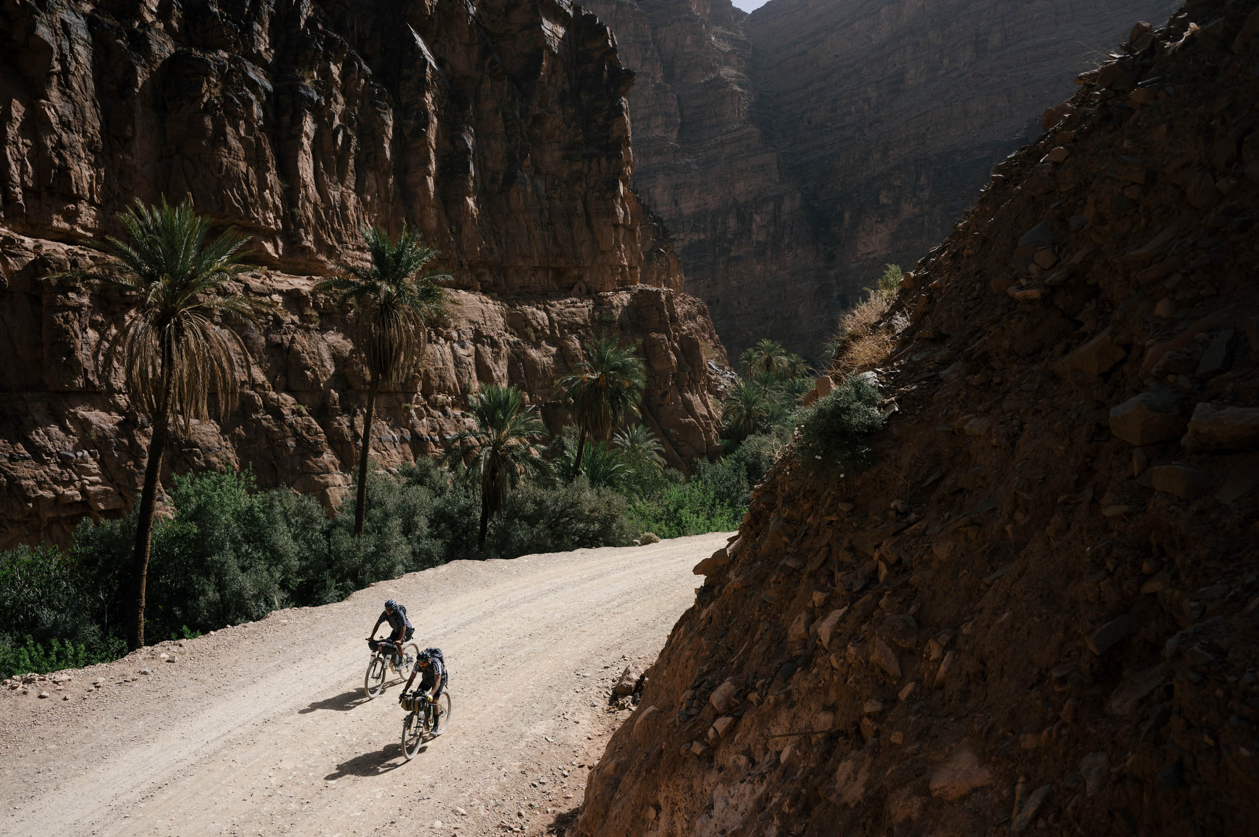
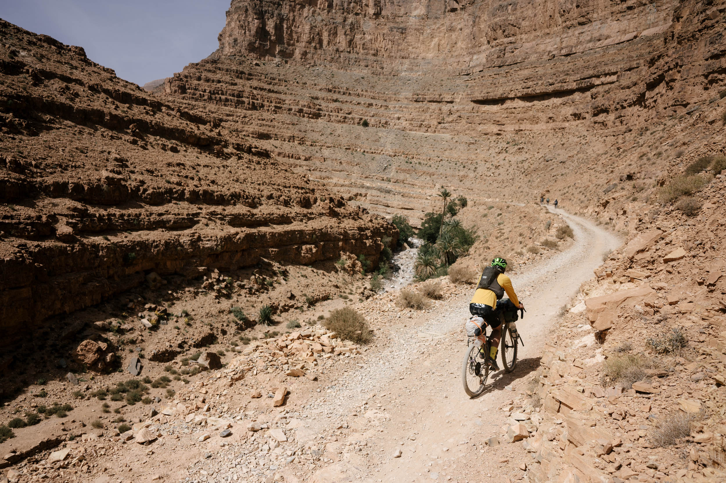
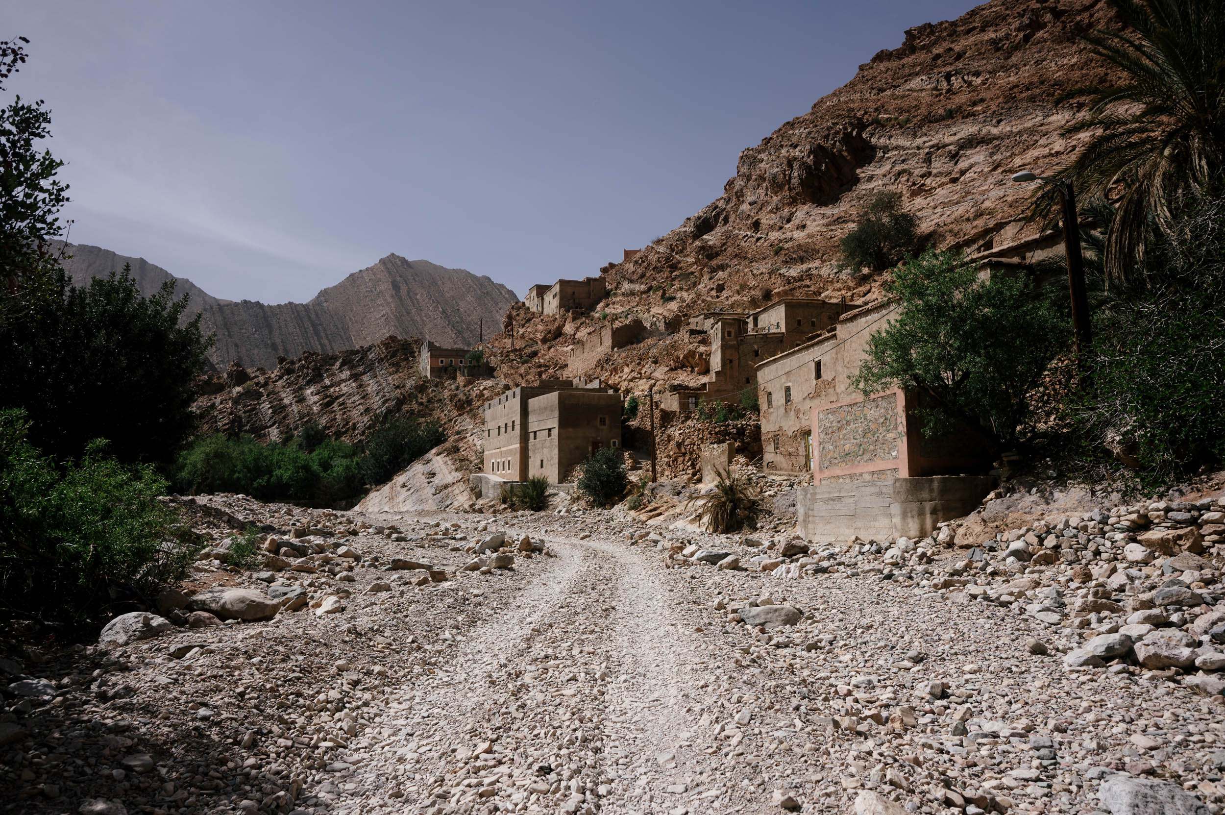
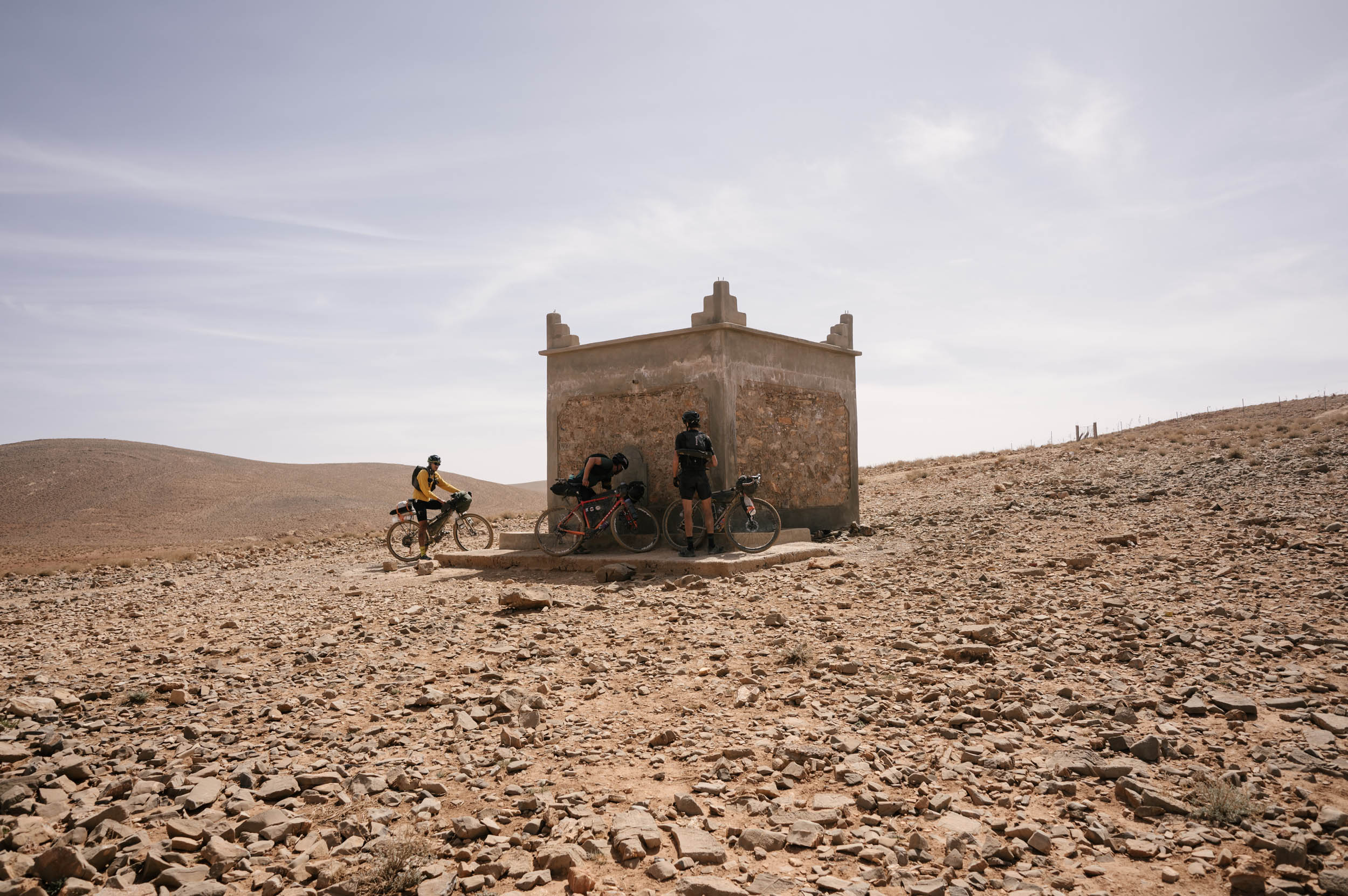
Before the Colonial Road, you ride through another canyon/oasis through Tazegazout. This is all on dirt, at times a bit rough, but stunning and quiet riding through tranquil countryside. Do take note of resupply, though, on the backside. Do not leave the highway without full bags of food and water!
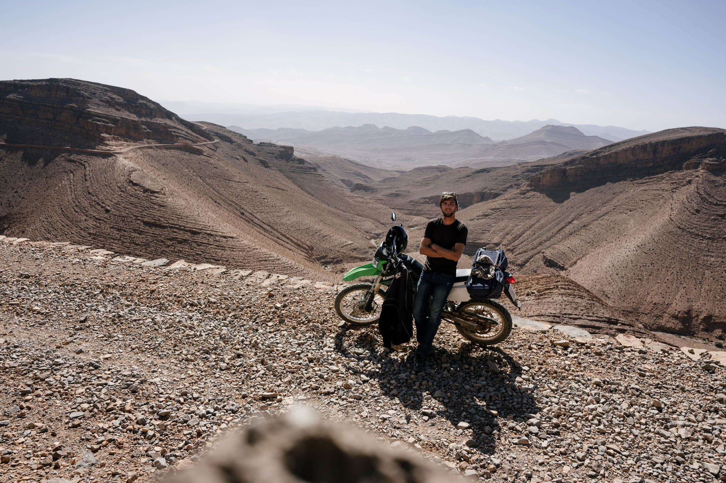
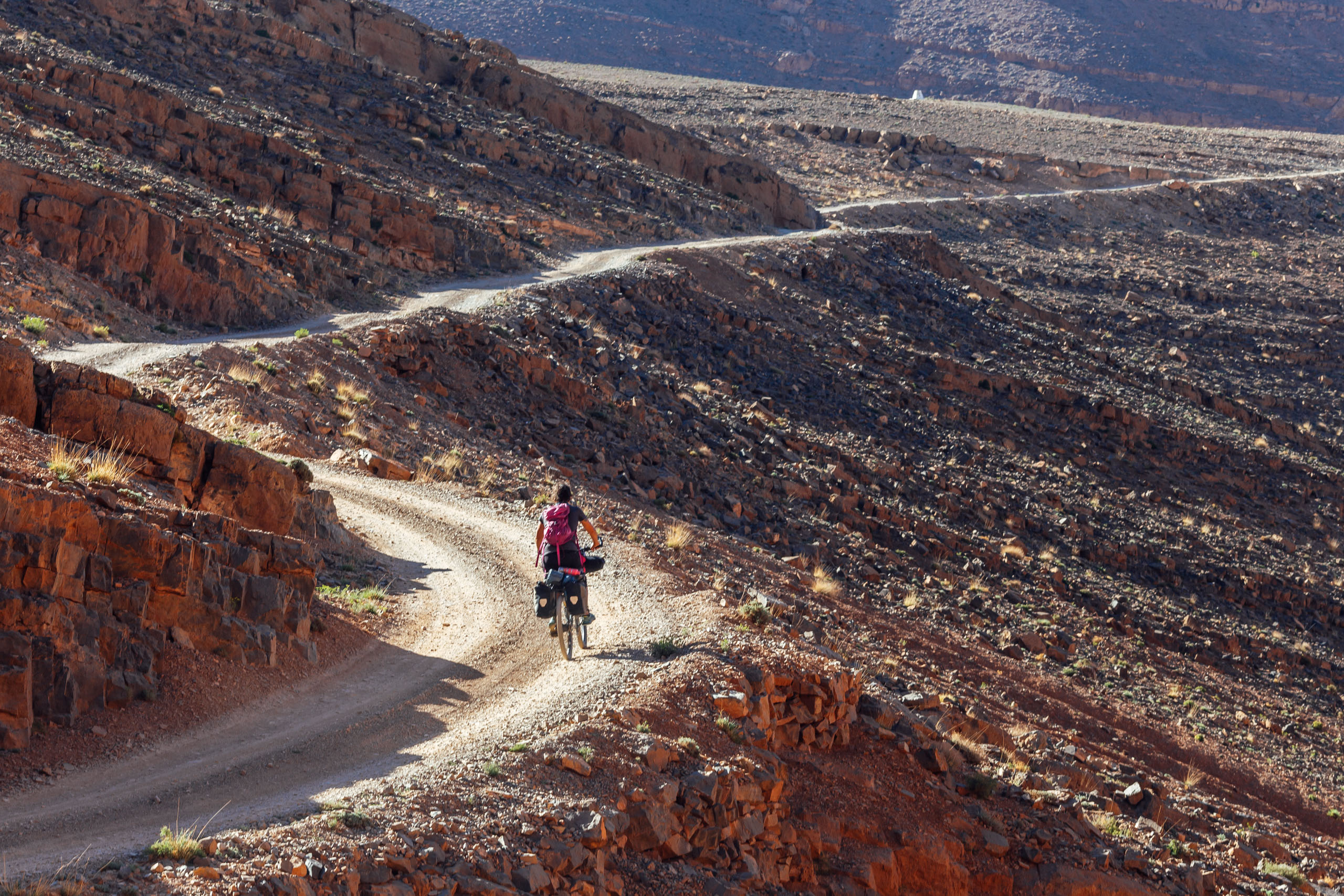
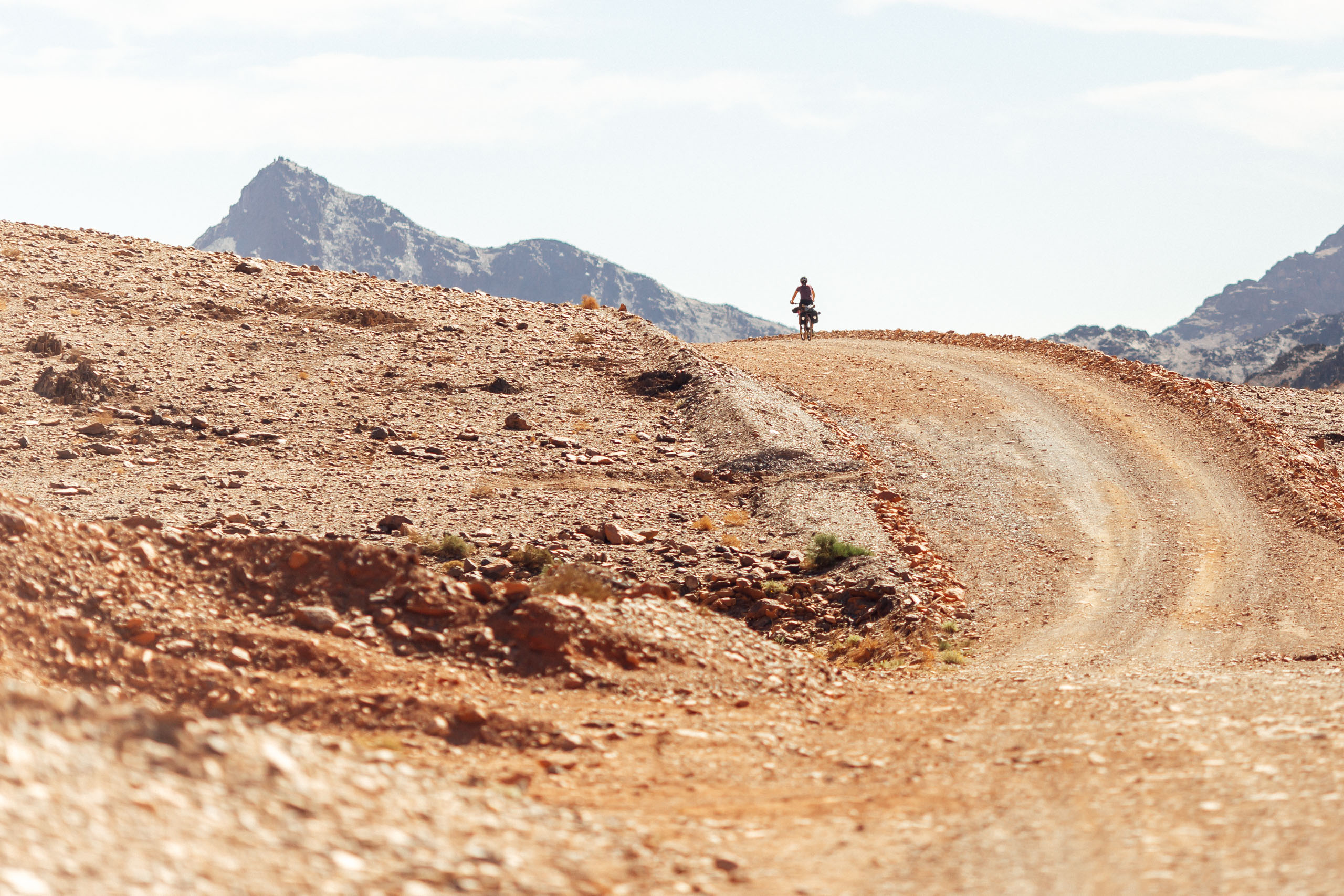
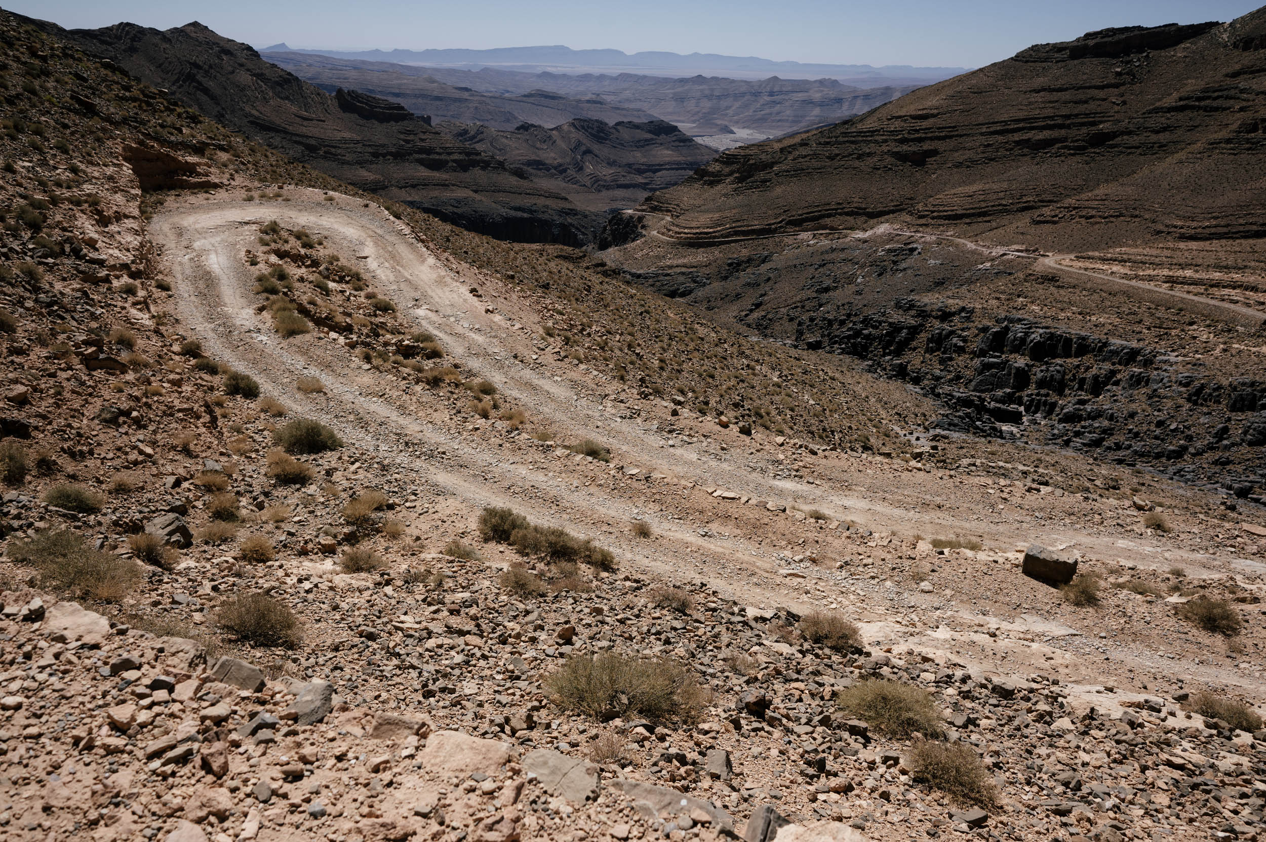
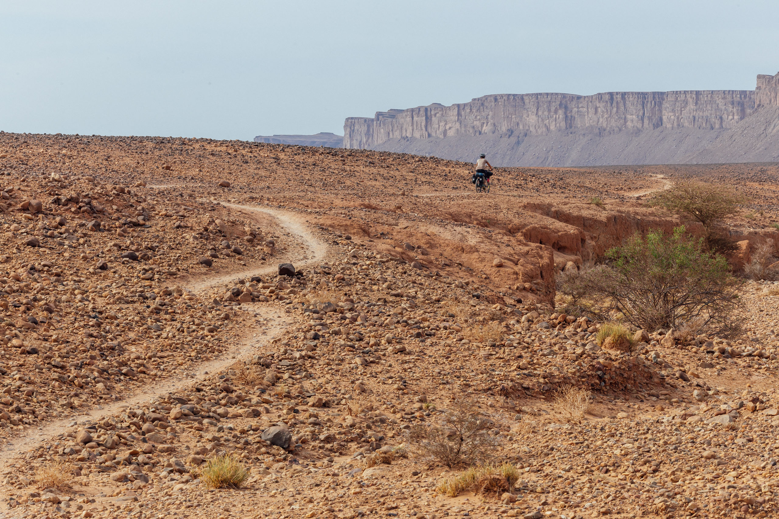
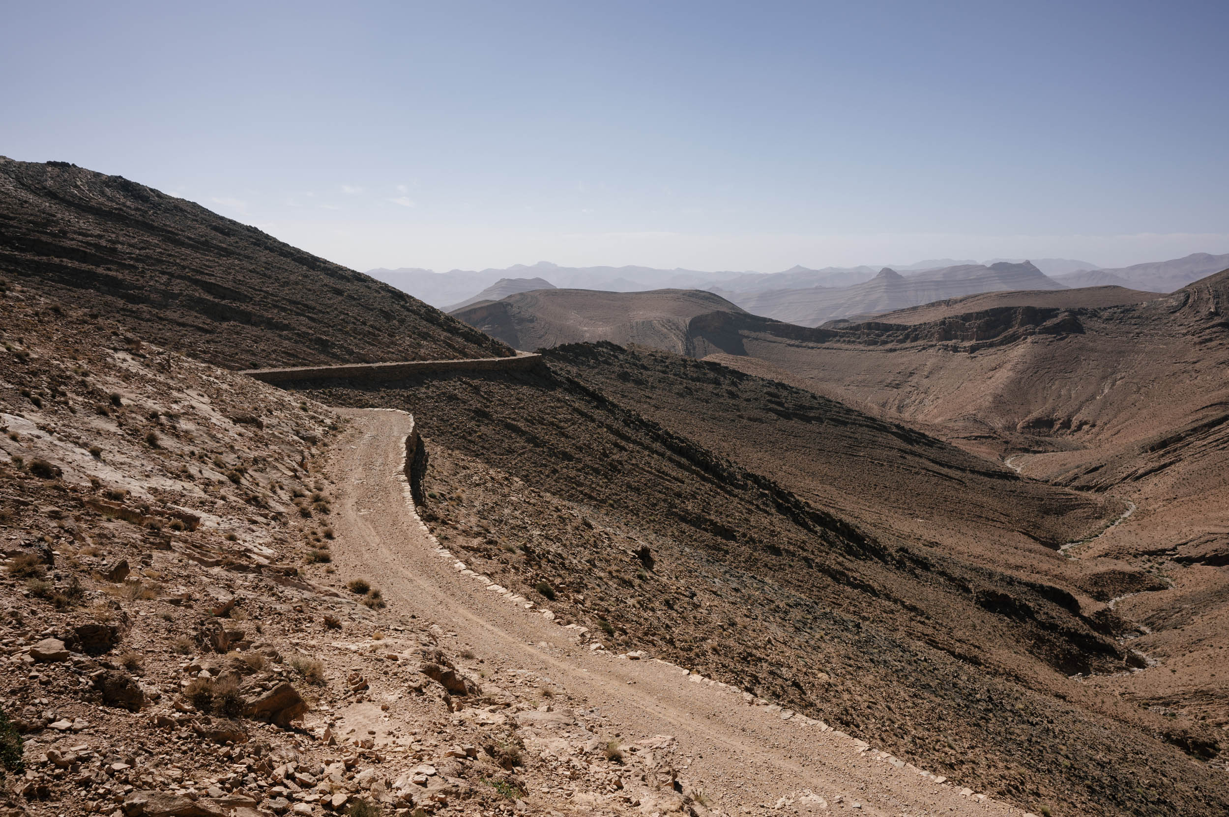
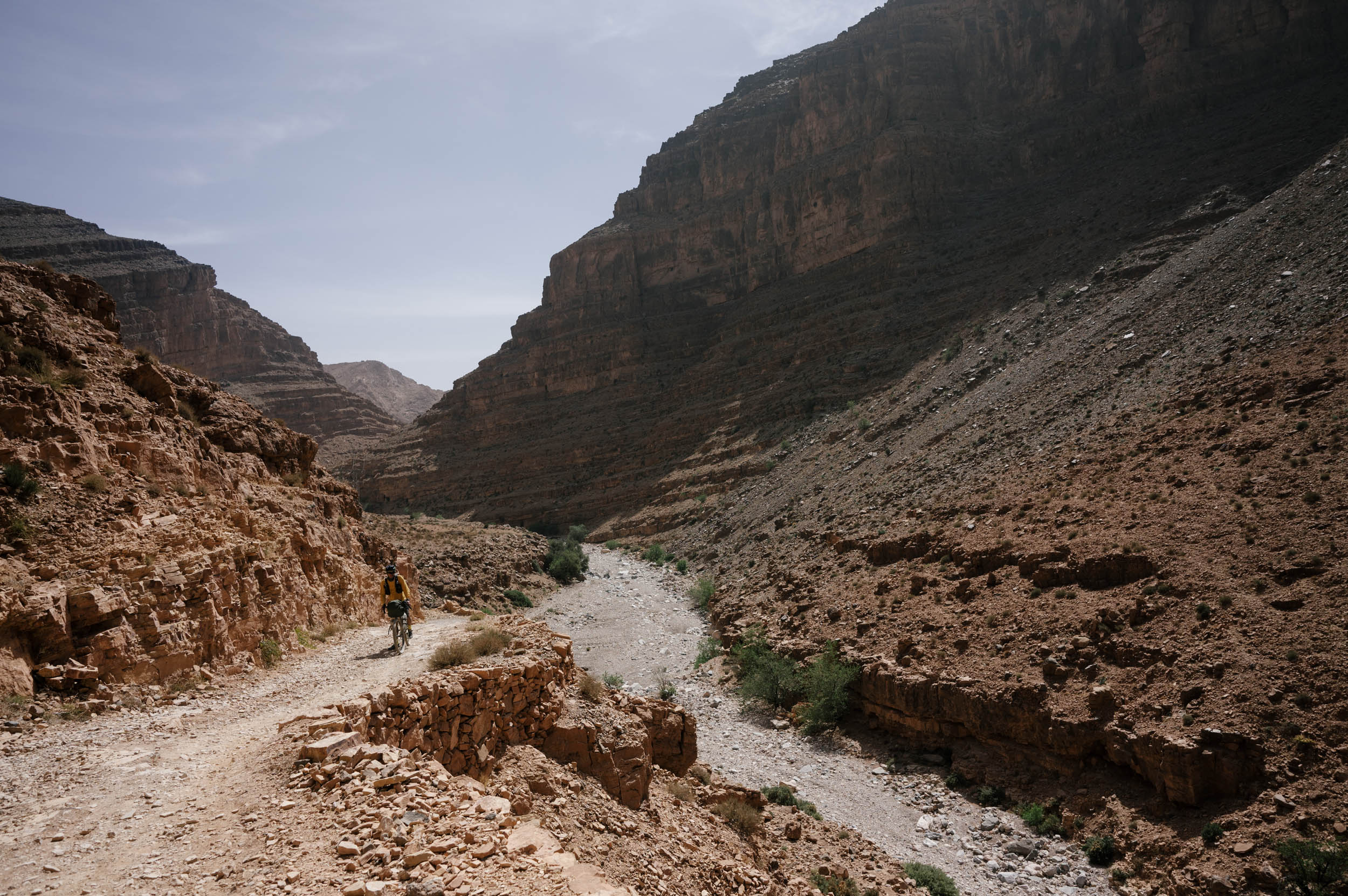
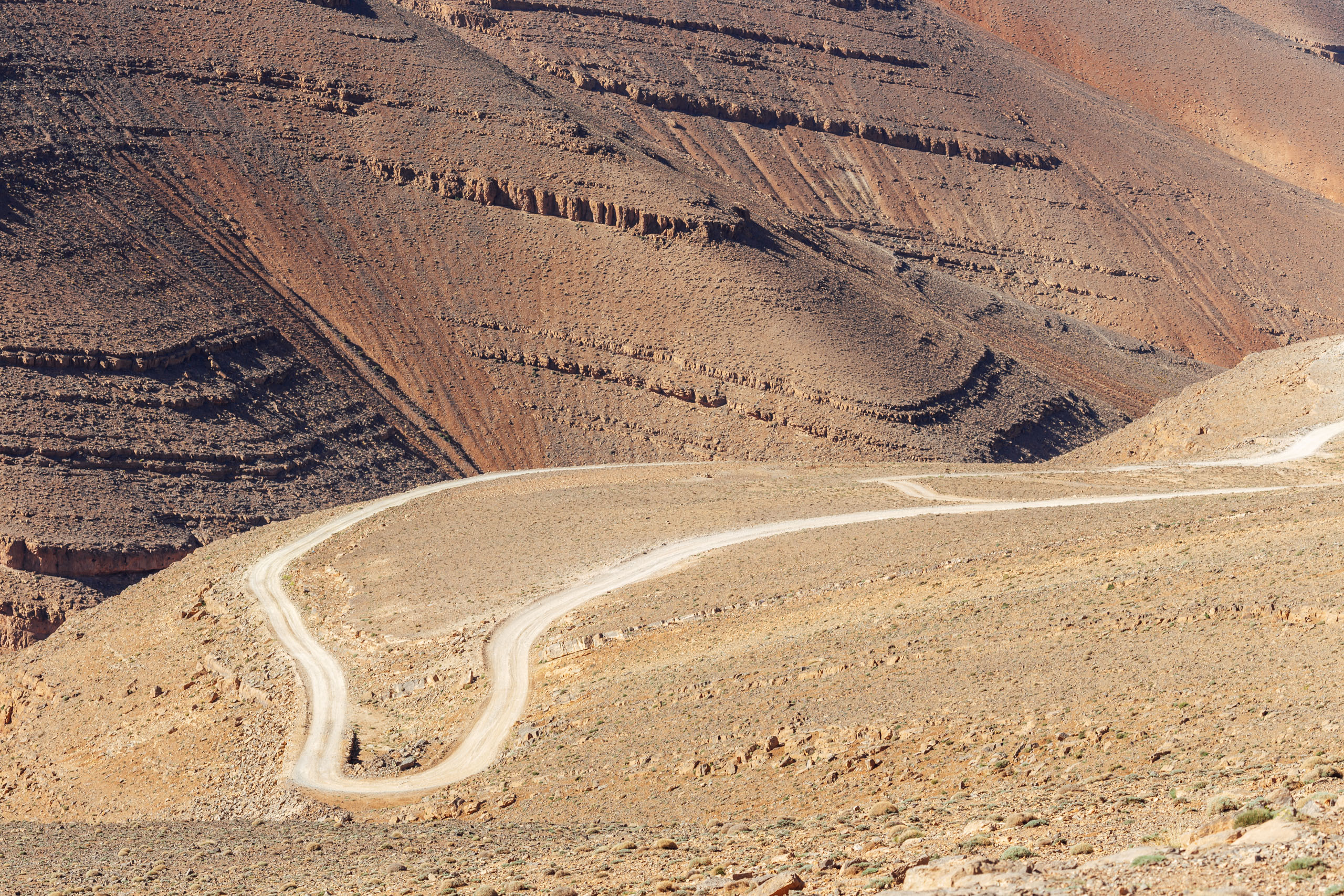
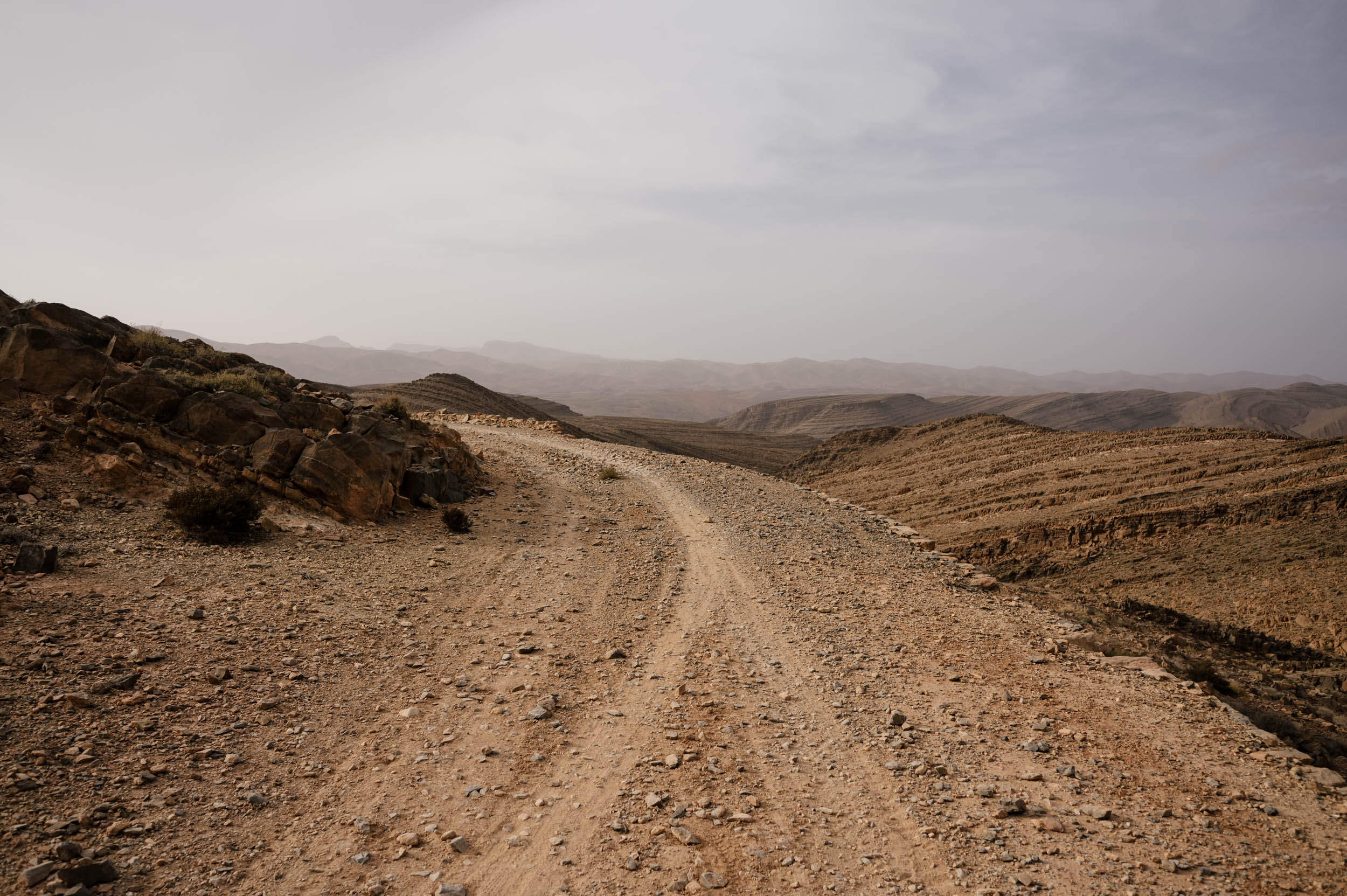
The Colonial Road is an impressive feat of engineering. Drawn up by the French during the days of colonialism, this road has certainly seen better (and worse) days. It is now essentially a singletrack along the mountain ridges, with beautiful panoramas of the desert below and the High Atlas above. It is rocky and dry, but there are several places to refill on water. Make sure to have a sufficient tire for this section. It is incredibly beautiful but also tough. Also note there are several places where the road has either partially or fully collapsed, and you now have to hike your bike through a short and steep ravine to the other side. This is possible but can be difficult.
Then, there is a bit of pavement riding after Ibn Yacoub, which is very quiet, and then there are more oases and canyon riding through Taourirte. It is similarly rugged and rocky and should be prepared for with a big tire and plenty of food, but it is, once again, stunning and quiet riding. Palm oases and big red cliffs and jagged faces and blue sky and kind and remote communities. The Anti-Atlas is, in many ways, some of the best riding you could ever ask for. You could, of course, take the highway down to Tissint as a bailout, though, if it is proving too rocky or dry.
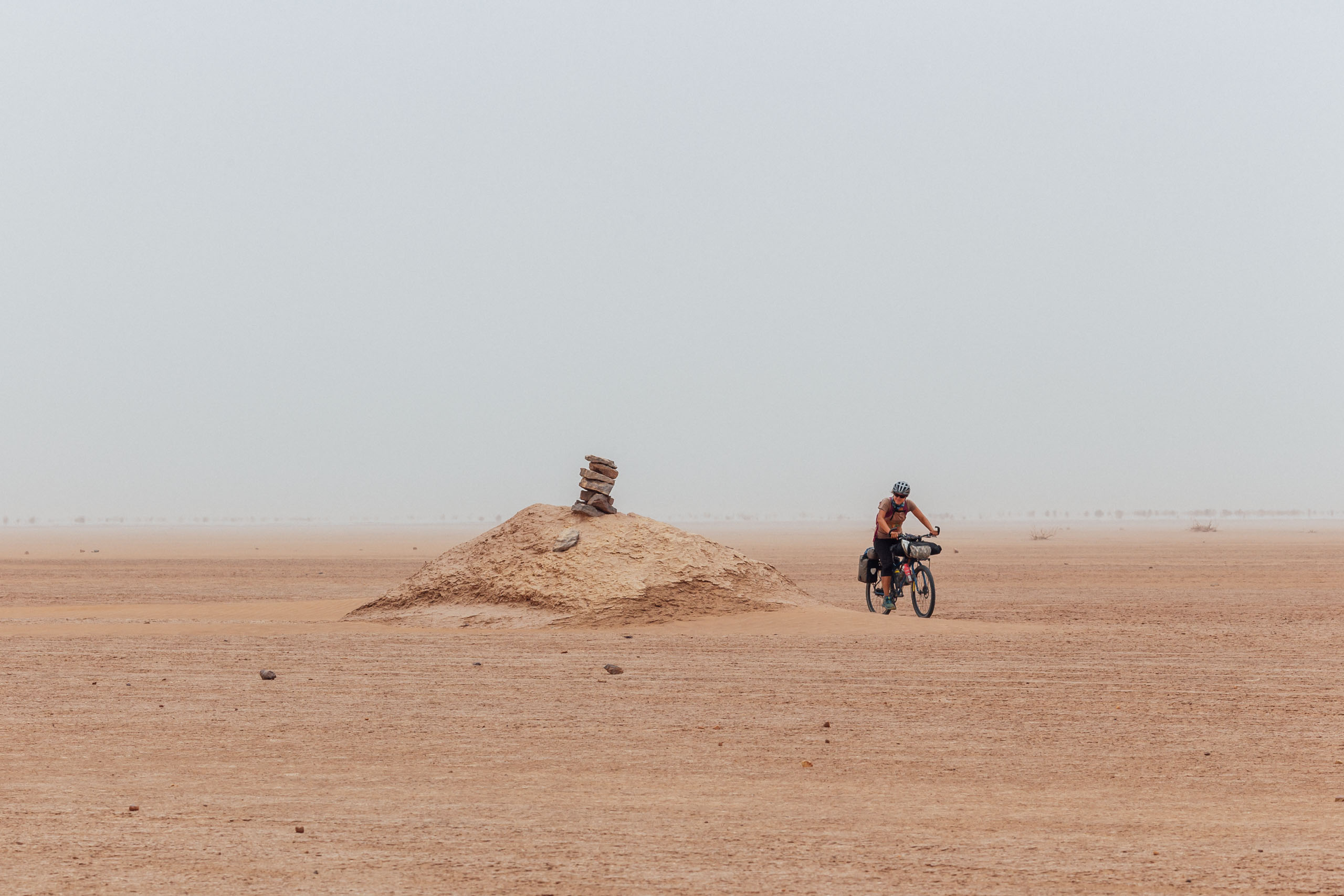
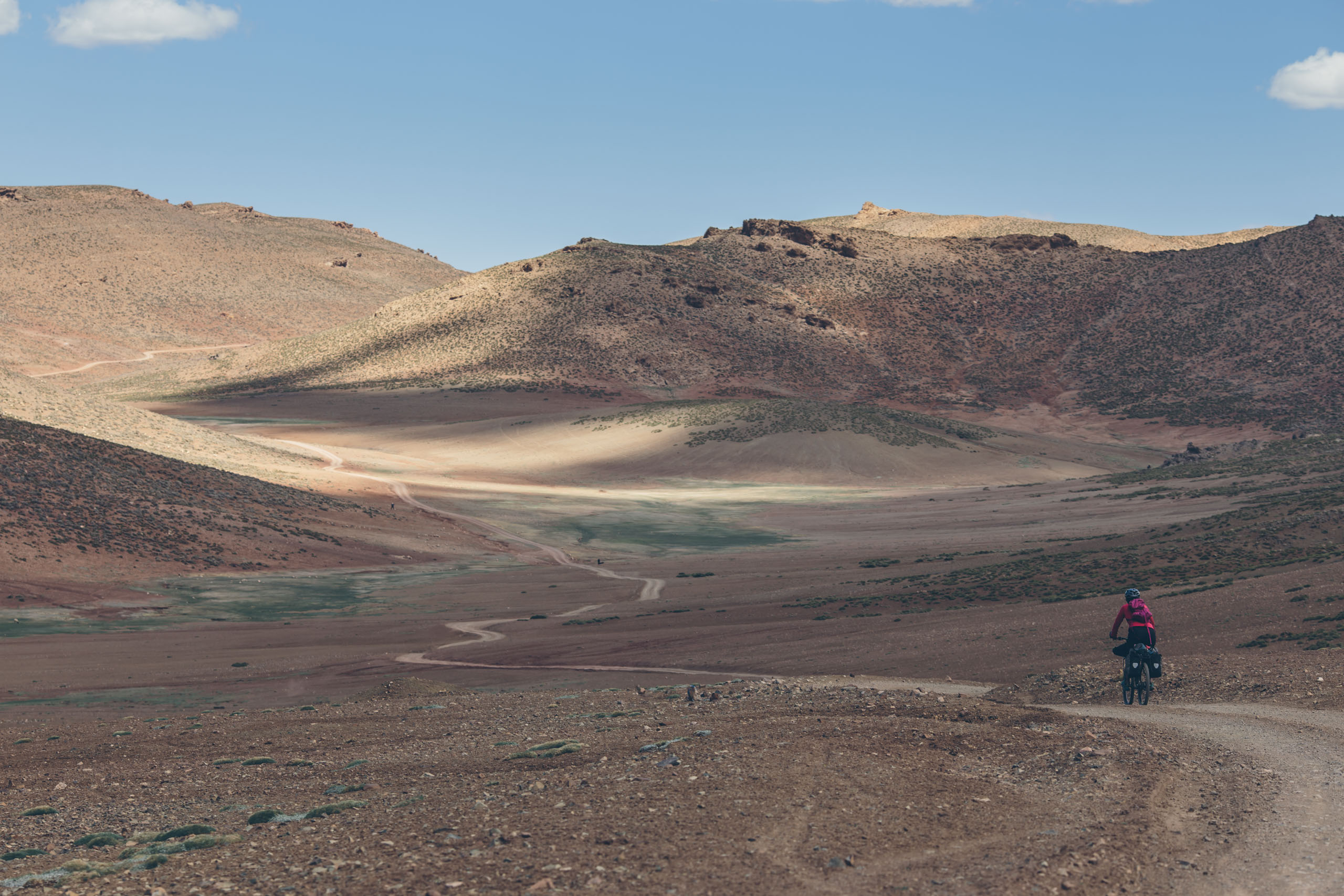
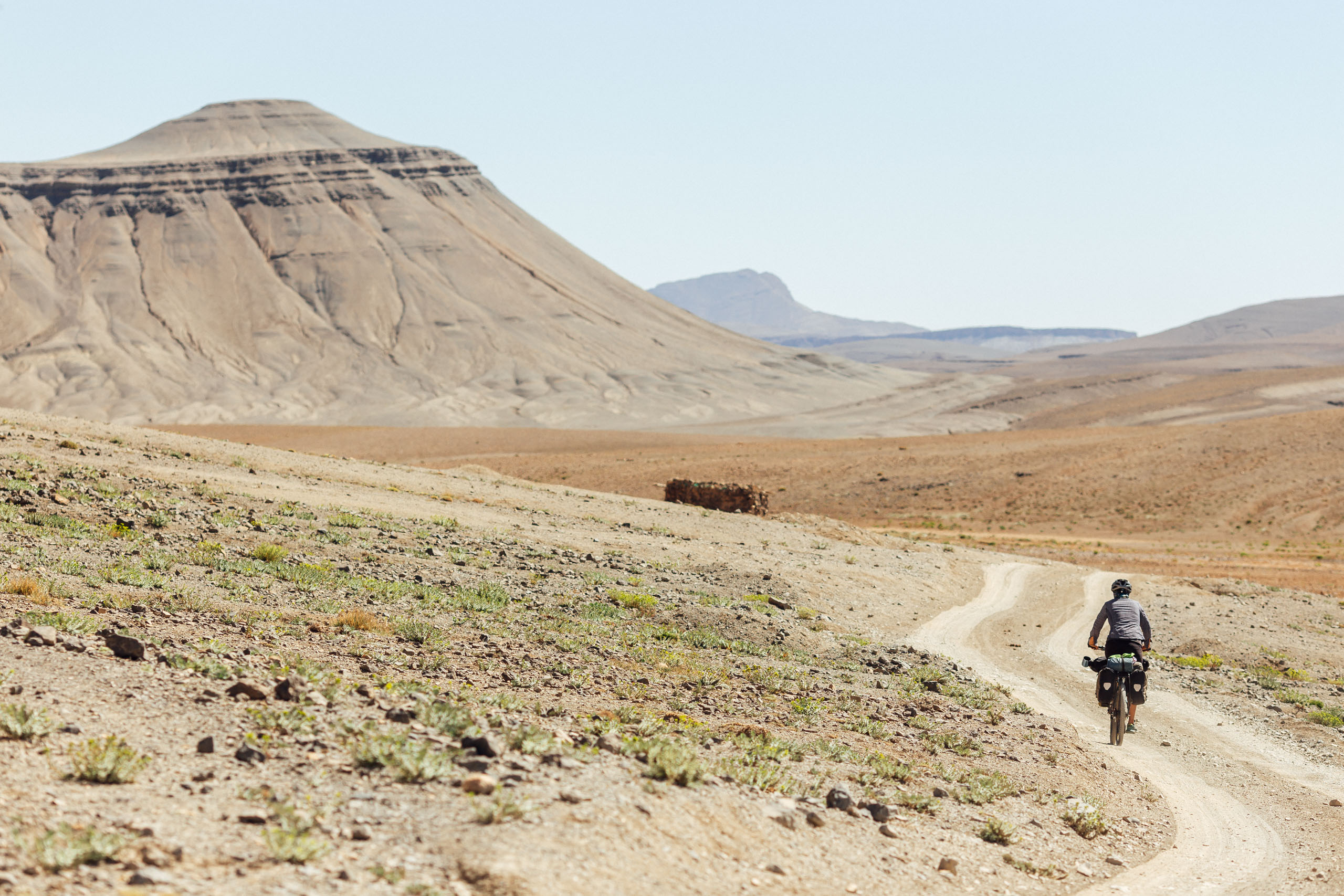
The 90-mile section from Foum Zguid to Mhamid is real-deal desert riding. It starts as an unbelievably rough track full of embedded stones that shake you to your core. Luckily, the terrain changes continuously. There are a few places where you can actually stumble onto nice singletrack carved out by camels and the occasional motorcycle. The smooth and serpentine gashes through the Martian-like surface are nice reprieves from the rocky doubletrack.
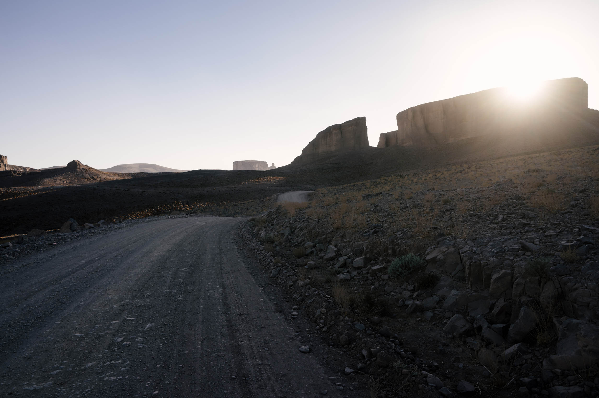
Eventually, the road turns to sand, and it’s easier to stay on the northerly track that turns into the flats of Lake Iriki. There, the track continues across the ancient salt lake and is marked only by the occasional cairn.
About 20 miles prior to the road split to Mhamid, the track skirts the edge of the main attraction, Erg Chigaga. Unfortunately, we missed it due to a massive dust storm that clouded visibility. Otherwise, it’s advisable to plan a night on the dunes.
THE DRAA VALLEY (TAGOUNITE TO AGDZ)
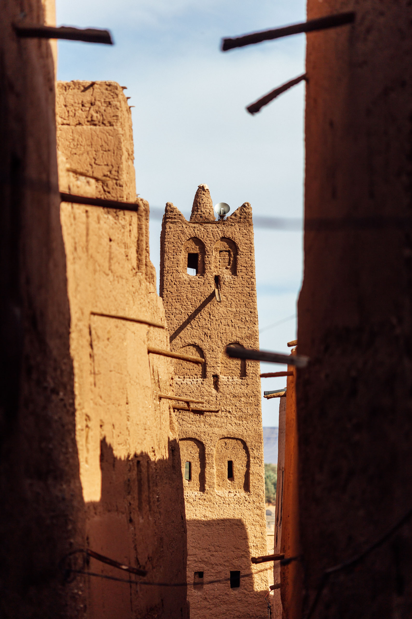
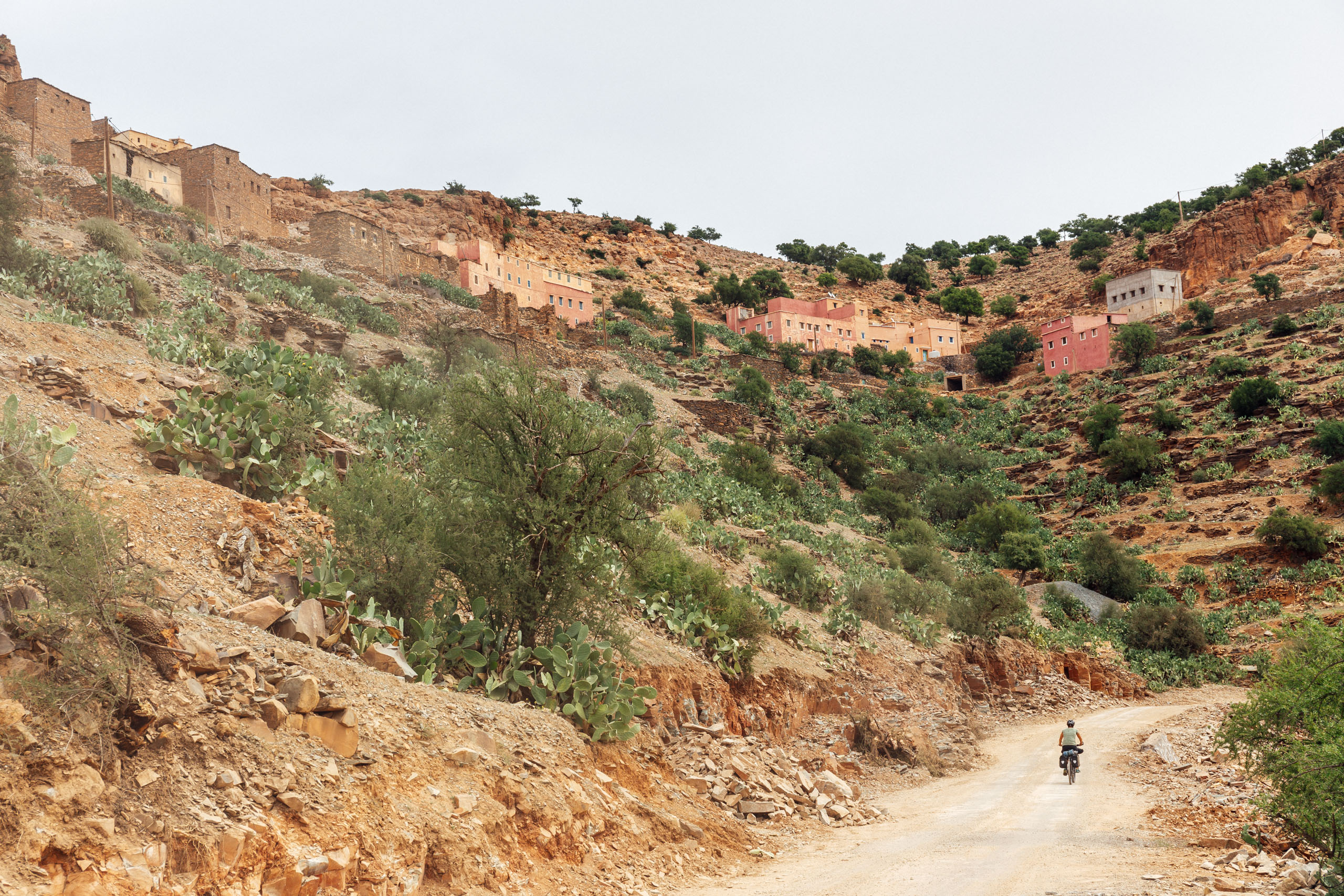
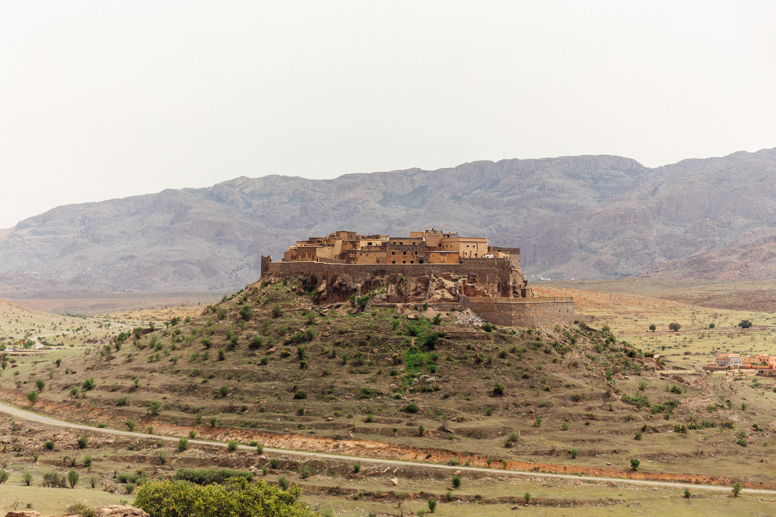
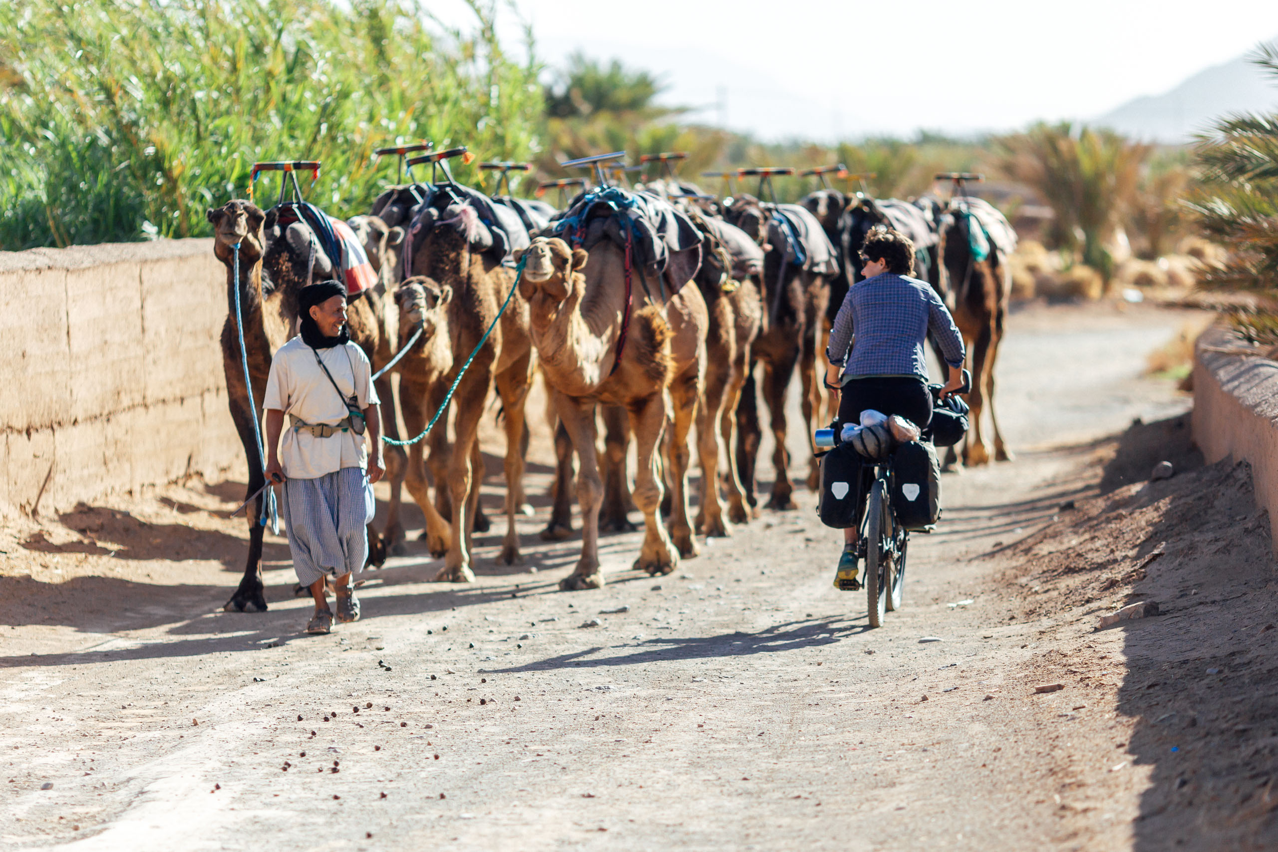
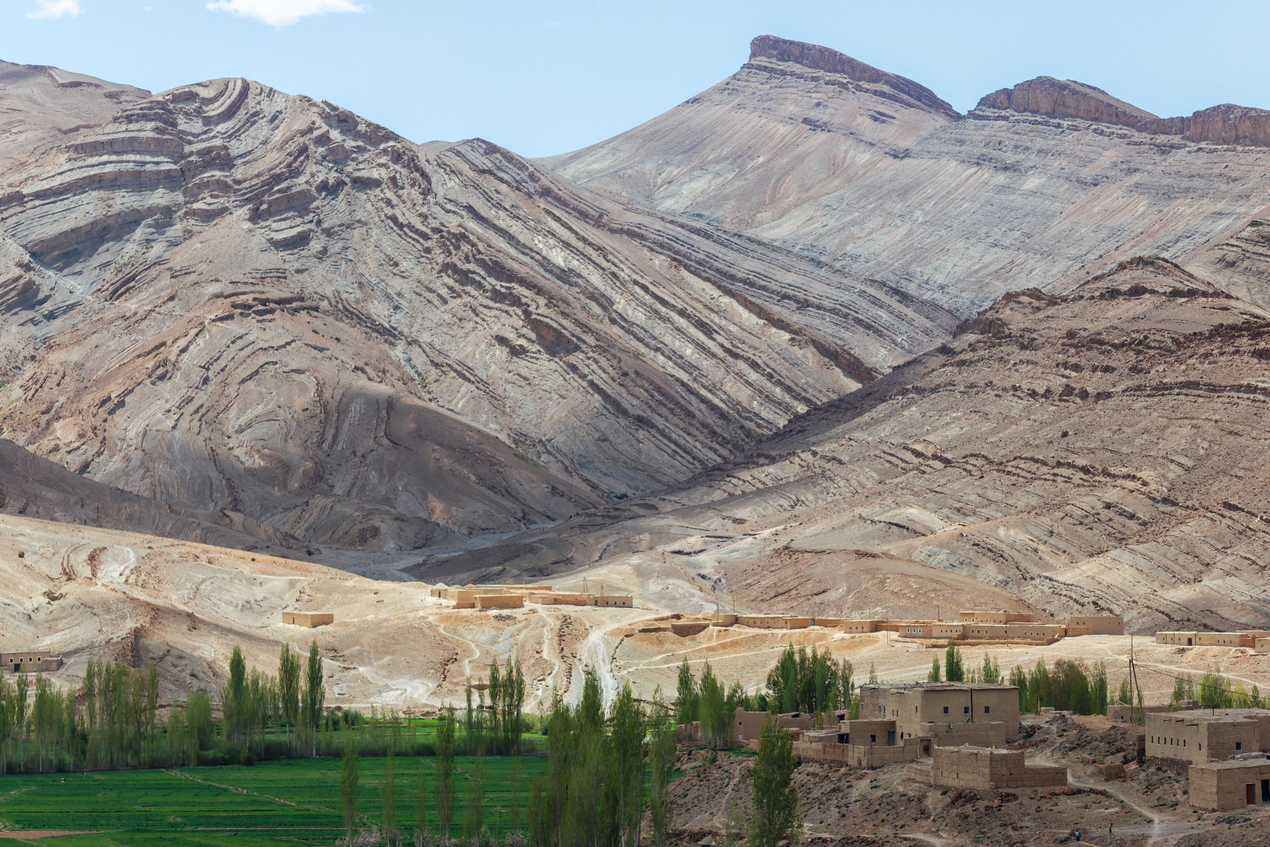
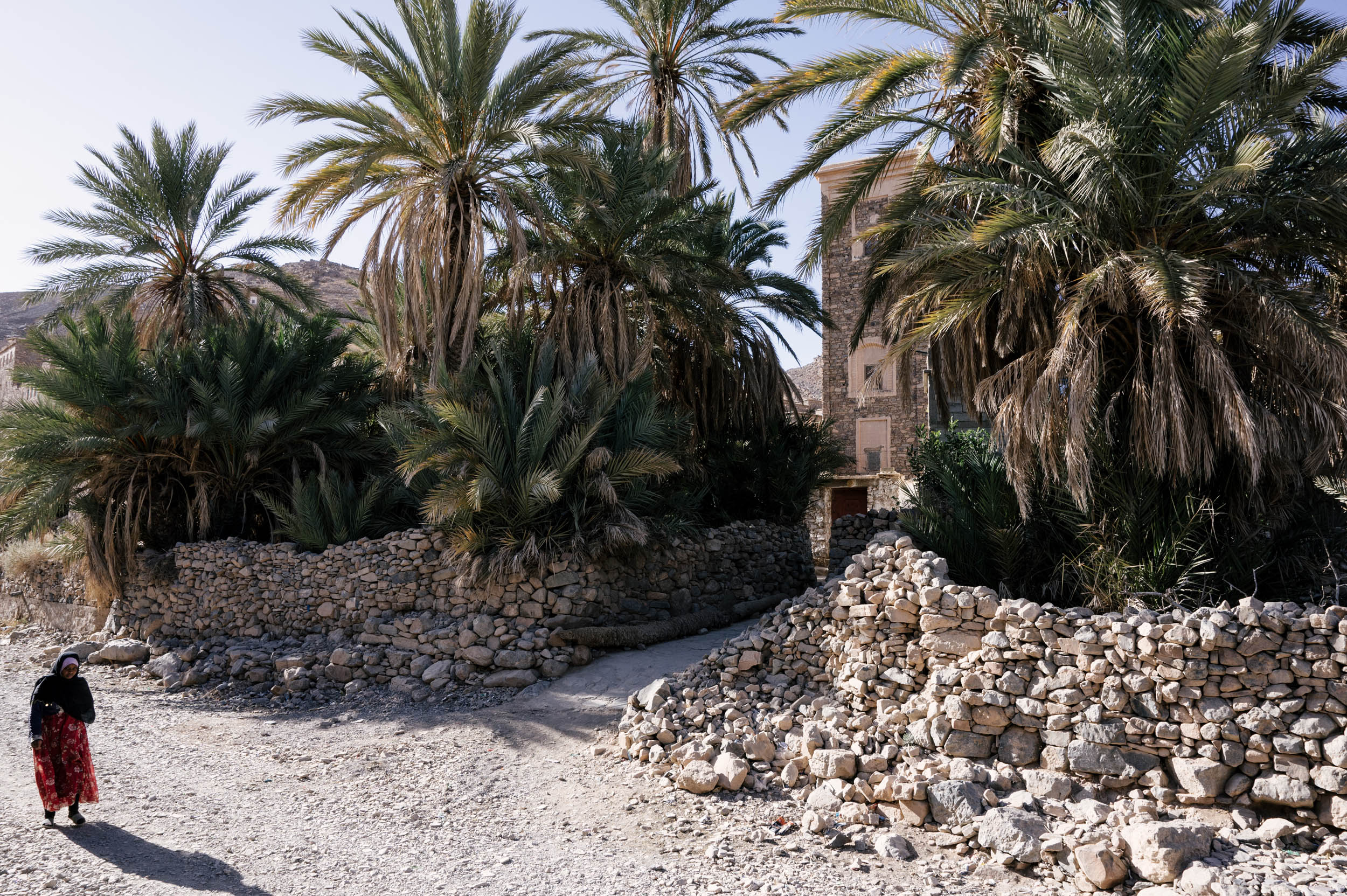
The Oued Draa (river) flows from the High Atlas and erupts in a series of lush oases as it inches toward the desert, particularly between Zagora and Agdz. This segment follows a long dirt track that flows upriver through the Draa Valley and meanders through a continuous wave of green palmeraies and oasis towns. It’s also known as the Kasbah Trail, named for the many mud-brick cities en route. This same route has been trodden for centuries by caravans from the Sahara.
This dirt road parallels a main road that is sometimes far out of sight and, at other times, visible. This is an excellent way to reach more untapped villages, people, and landscapes in an otherwise touristed area. Make sure to allow time to visit a few of the kasbahs along the way, such as Zagora.
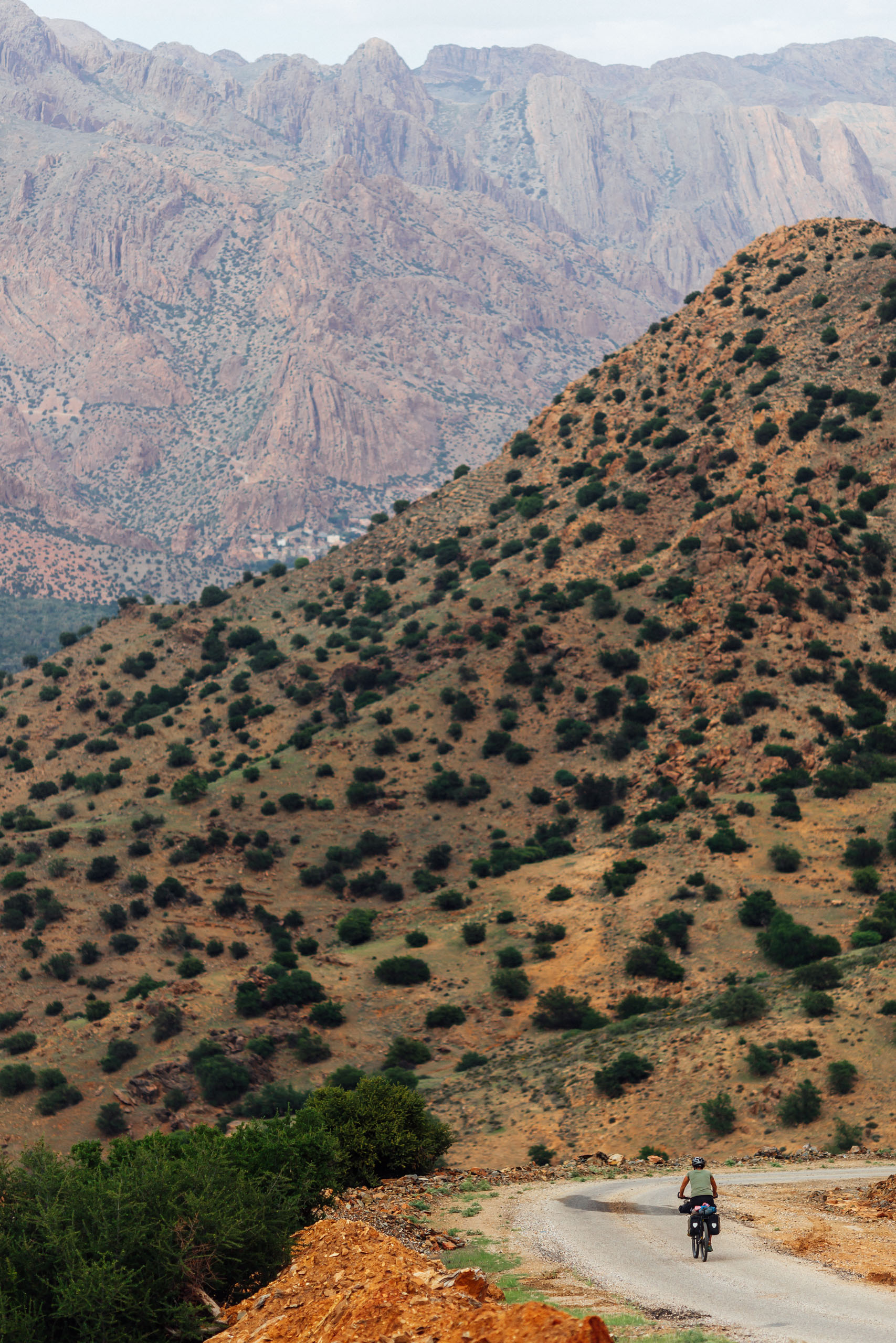
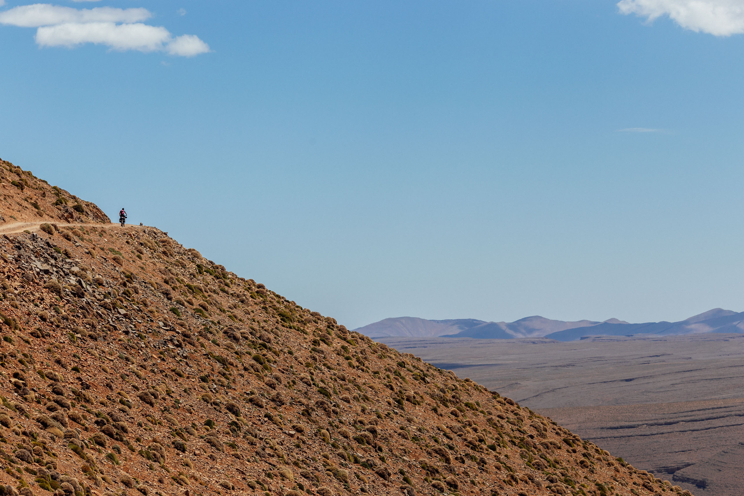
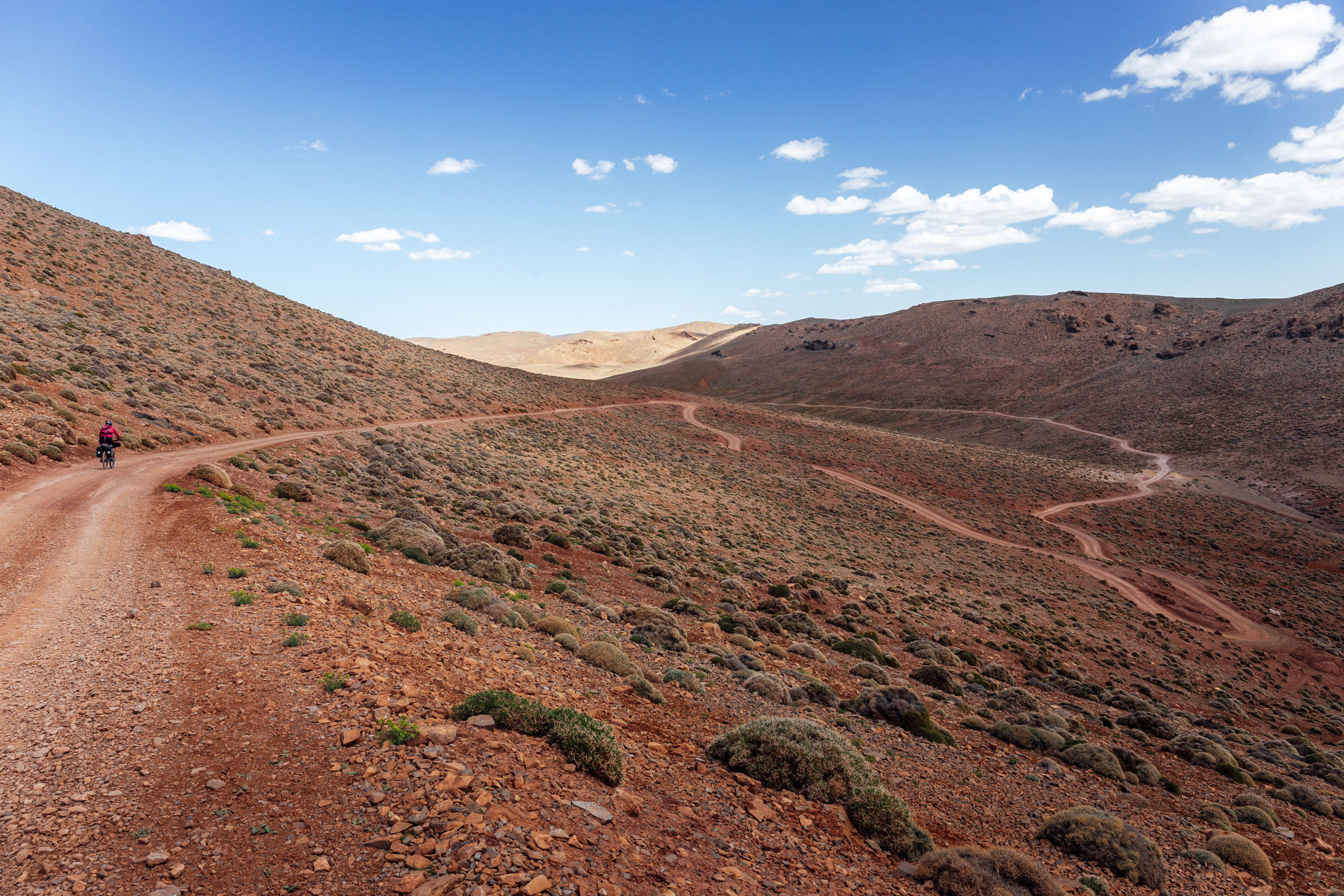
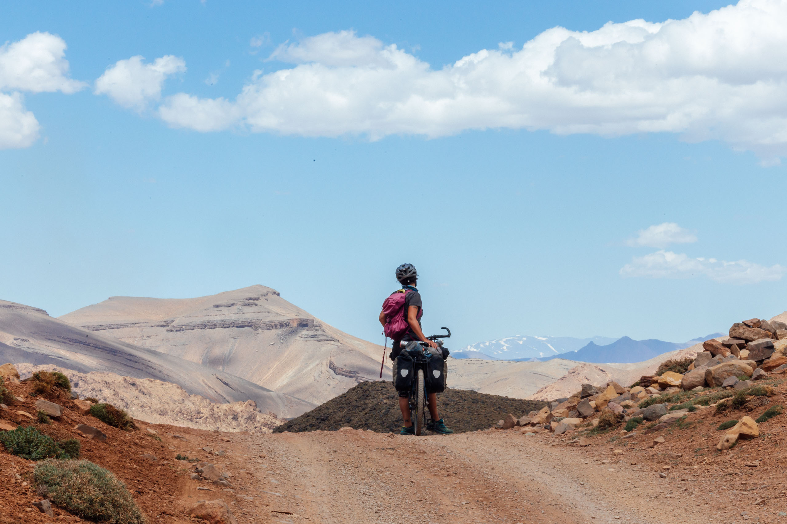
THE ATLAS MOUNTAINS (THE DRAA TO IMILCHIL)
From Zagora, we have shifted the route east, making it both more direct and also dirtier. This includes more dirt through the stunning Tizi n’Tanekfoult and up to N’Kob, and through the northern canyons around Tizi n’Terhrout. These areas are incredibly remote, shockingly quiet, and offer yet more massive canyon views and little oases dotting the intermediary. Then, you begin the final climb into the High Atlas. This is where the Southern part ends, and the amazing views just keep on coming.
Scouts Wanted
Note that we have an option to reroute out of the Dades Gorge and the Valle de Rose and instead spend more time in the High Atlas, taking in the famous Cathedral Rock and a lot more dirt. This route is only partially scouted and adds a few days into the grand scheme of things. We know it connects, as the majority of it is a common and popular motorcycle route, but we’re unsure of the road conditions and details. If you are interested in scouting this portion, here is the map, but realize you are doing so at your own risk. Do your research before setting out. We are looking for a full report including where pavement on this stretch starts and stops, POIs for water and food, and other such notes. If you are interested in tackling this project, you can report back using the Route Alerts form under the map.
ROUTE OPTIONS
If you are taking on the Route of Caravans on its own, Beni Mellal is a good place for an exit. There are plenty of interesting ways to get there, but the most obvious choice is about a 1-2 day ride from Imilchil—80 miles and 8,000 feet of climbing (129 kilometers/2,400 meters). From Beni Mellal, you can get busses to Marrakesh, Fes, or Rabat.
Interested in a shortened desert version of the ROC? Zagora features plenty of tourism infrastructure and makes for another easy exit point. There are direct busses to Ouarzazate and Marrakesh.


Terms of Use: As with each bikepacking route guide published on BIKEPACKING.com, should you choose to cycle this route, do so at your own risk. Prior to setting out check current local weather, conditions, and land/road closures. While riding, obey all public and private land use restrictions and rules, carry proper safety and navigational equipment, and of course, follow the #leavenotrace guidelines. The information found herein is simply a planning resource to be used as a point of inspiration in conjunction with your own due-diligence. In spite of the fact that this route, associated GPS track (GPX and maps), and all route guidelines were prepared under diligent research by the specified contributor and/or contributors, the accuracy of such and judgement of the author is not guaranteed. BIKEPACKING.com LLC, its partners, associates, and contributors are in no way liable for personal injury, damage to personal property, or any other such situation that might happen to individual riders cycling or following this route.
Please keep the conversation civil, constructive, and inclusive, or your comment will be removed.